The Helvellyn Walk from Thirlmere Avoiding Swirral Edge and Striding Edge
Embark on this Helvellyn walk from Thirlmere, an amazing trail that avoids Swirral Edge and Striding Edge. Kick off your 7-mile journey at Swirls Car Park, located on the A591 adjacent to Thirlmere’s western banks. Alternatively, consider the sizeable roadside lay-by on the A591 just north of Swirls, a short stroll away.
The walk commences with a brisk south-east climb from Swirls. Though steep, this straightforward trail first guides you to Browncove Crags. From here, continue upwards to Lower Man. Your steady ascent culminates at the Helvellyn summit, rewarding you with sweeping views of the Lake District.
From the Helvellyn summit, follow the trail south towards Nethermost Pike. Just before reaching the Nethermost Pike summit, veer south-west, treading above High Crags, then prepare for your descent. Birk Side and Comb Crags mark the halfway point of your descent, which will lead you into a lush woodland.
Finally, head north along a forestry track nestled beneath Helvellyn’s imposing slopes. This path ushers you back to your starting point, wrapping up your Helvellyn walk from Thirlmere. This is an appealing alternative to the often-crowded eastern ascent, usually from Glenridding on the Ullswater side, which includes Swirral Edge and Striding Edge.
Helvellyn Walk from Thirlmere: Maps and Tools
Visit either the OS Maps website or the Outdooractive website to view this walking route in greater detail. Both platforms offer a range of features, including the ability to print the route, download it to your device, and export the route as a GPX file. You can also watch a 3D fly-over and share the route on social media.
Helvellyn Walk from Thirlmere: Distance, Duration, Statistics
Distance: 7 miles
Distance: 11½ kilometres
Duration: 4¼ hours
Ascent: 2956 feet
Ascent: 901 metres
Type: Circular walk
About Helvellyn
Helvellyn, possibly meaning ‘pale yellow moorland’, is a renowned mountain in the English Lake District. It proudly stands as the highest point of the Helvellyn mountain range, a north to south sequence of mountains situated just north of Ambleside. This range acts as a barrier between the waters of Thirlmere and Ullswater.
As the third-highest point in both England and the Lake District, Helvellyn attracts many explorers due to its comparatively easier accessibility than the two taller peaks, Scafell Pike and Scafell. Indeed, the Helvellyn walk from Thirlmere is a popular route for many avid walkers.
Helvellyn is not merely a walk, but a journey through time. Its distinct landforms were carved from volcanic rocks during violent eruptions approximately 450 million years ago, in the Ordovician period. These rocks, formed in the caldera of an ancient volcano, were further shaped by glaciers during the last ice age.
The mountain’s topography is truly remarkable. The peak of Helvellyn unfolds into a broad plateau, extending from north-west to south-east for about a kilometre. From Lower Man to the commencement of the renowned Striding Edge, the plateau maintains a height of over 900 metres (3000 feet).
To the west, the ground slopes gently, before plunging steeply down towards Thirlmere. The eastern side, on the other hand, showcases deep glacial coves, their looming cliffs sheltering the gem of Red Tarn. Separating these coves are two sharp ridges, Striding Edge and Swirral Edge, adding an edge of drama to the scene.
Helvellyn has long been a favourite of walkers and explorers, including this Helvellyn walk from Thirlmere, with its popularity dating back to the late 18th century. Among its famous early visitors were poets Samuel Taylor Coleridge and William Wordsworth, who both resided in the vicinity.
With its height of 950 metres (3116 feet), Helvellyn ranks third on the list of Wainwrights by height. Its grid reference is NY 342 151, appearing on Explorer map OL5 and Landranger map 90, and it’s featured in the Eastern Fells Wainwright Book.
Recommended Ordnance Survey Map
The best map to use on this walk is the Ordnance Survey map of the Lake District North-Eastern Area, reference OS Explorer OL5, scale 1:25,000. It clearly displays footpaths, rights of way, open access land and vegetation on the ground, making it ideal for walking, running and hiking. The map can be purchased from Amazon in either a standard, paper version or a weatherproof, laminated version, as shown below.
Standard Version
Helvellyn Walk from Thirlmere: My Photos
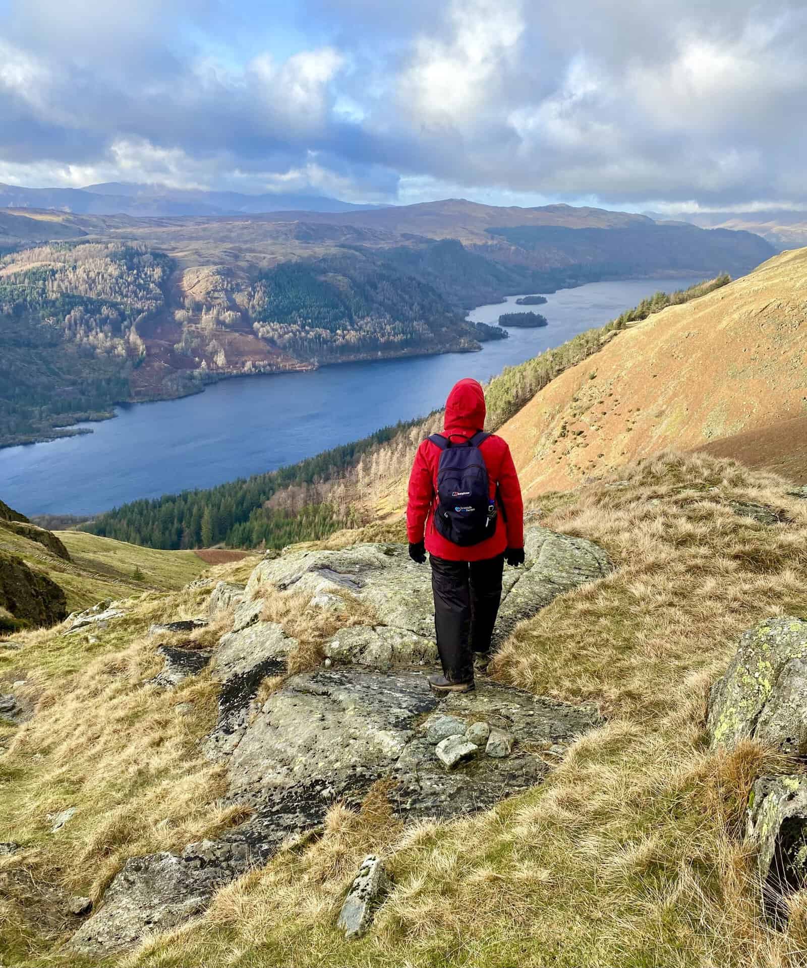
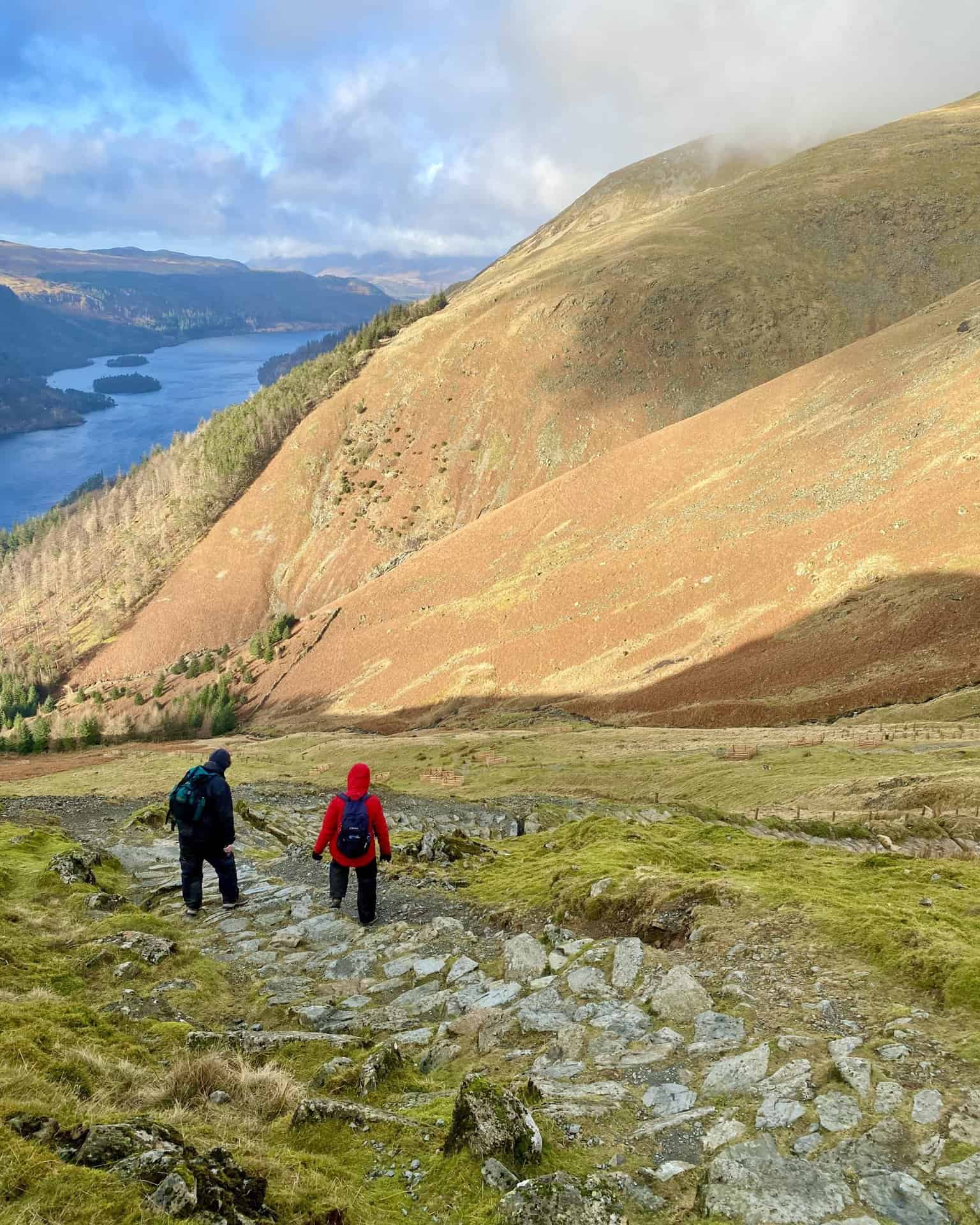
The view of Thirlmere (Reservoir) from the Browncove Crags area. Bassenthwaite Lake is visible in the distance from this point in our Helvellyn walk from Thirlmere.
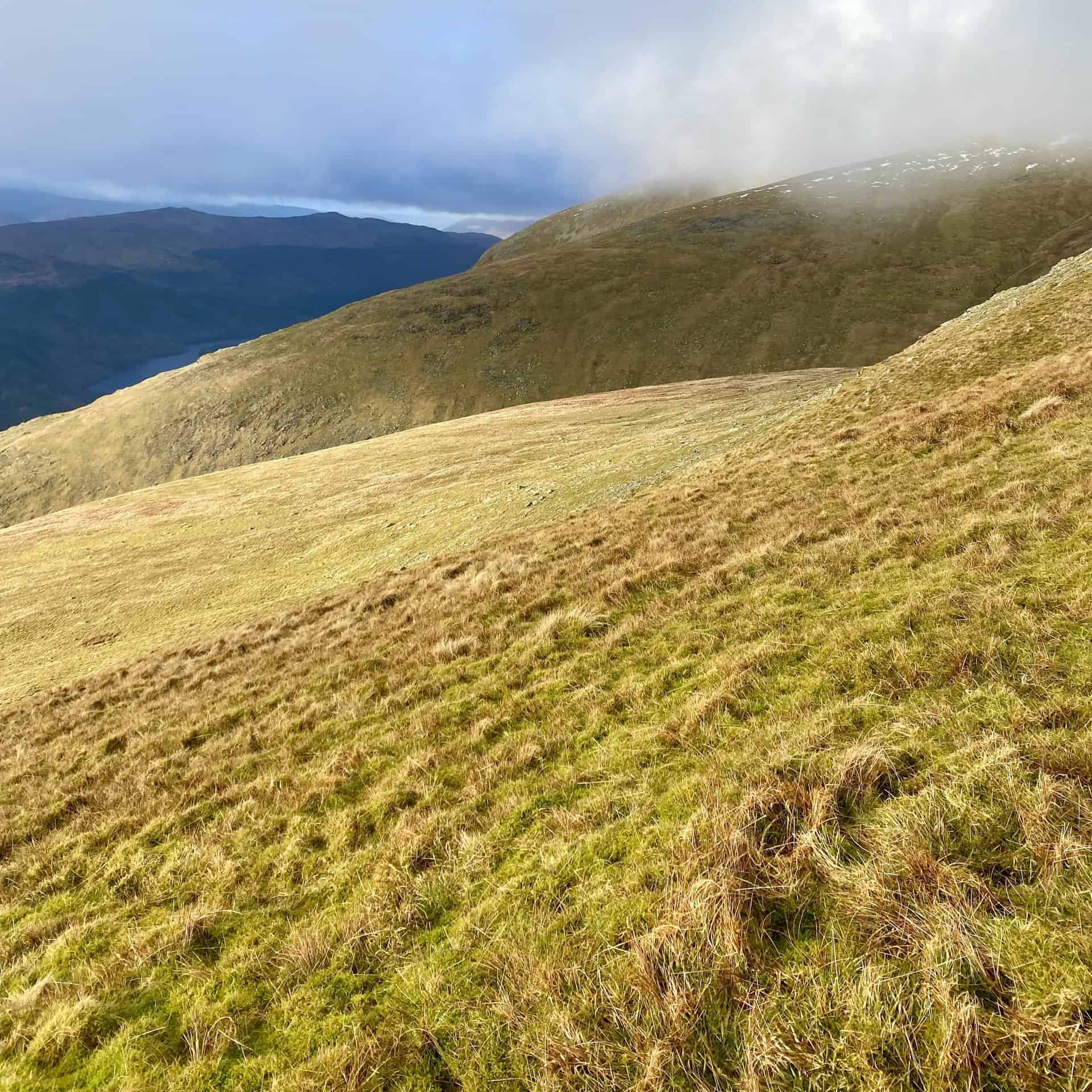
The grassy slopes of Middle Tongue and Whelp Side on the western flanks of Nethermost Pike and Helvellyn.
As we descend, Harrop Tarn can be seen on the far side of Thirlmere. The tarn is situated within a corrie (a bowl-shaped valley) above the south-west side of the reservoir. It is a classic example of a glacial tarn formed as a result of glacial erosion during the last ice age.
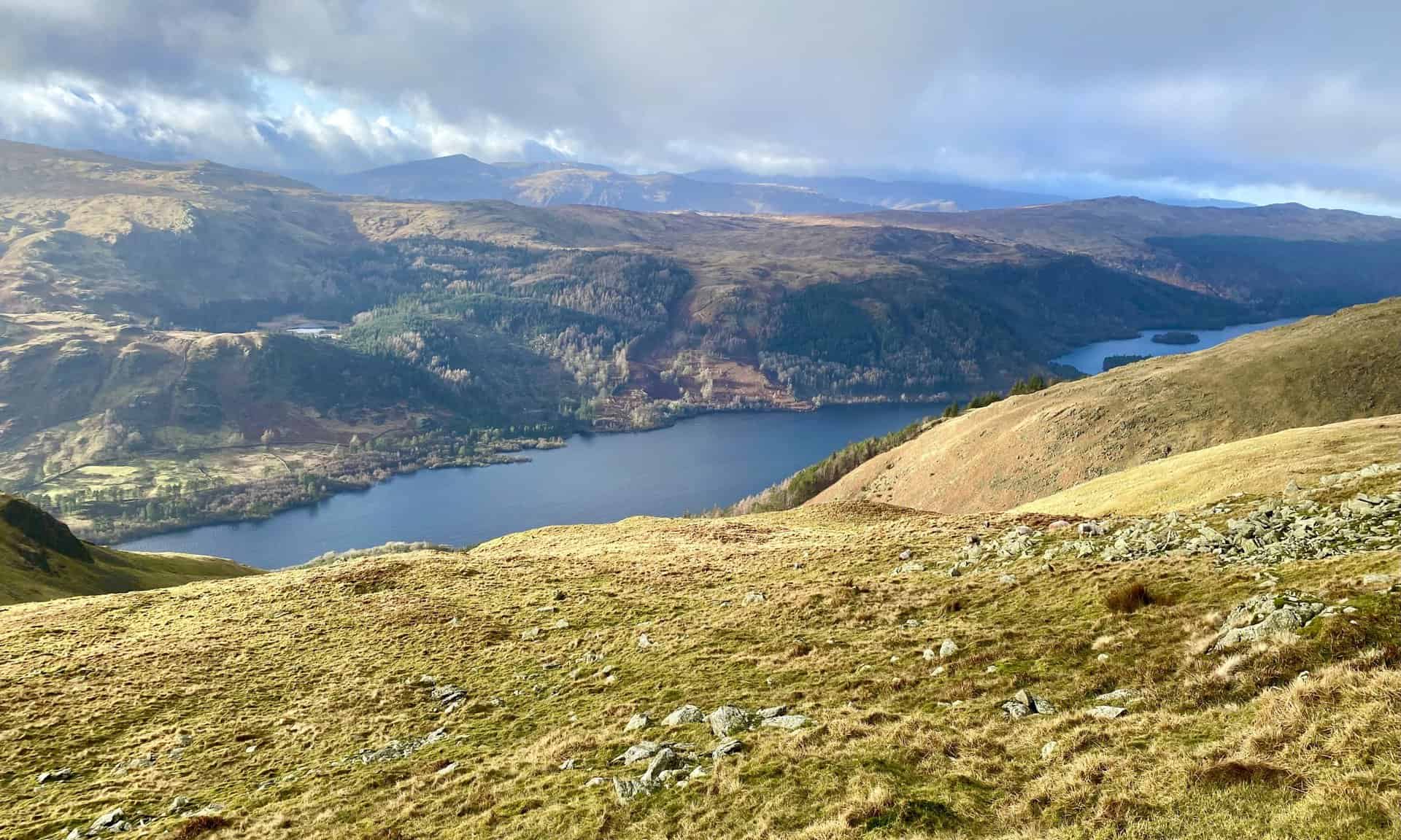
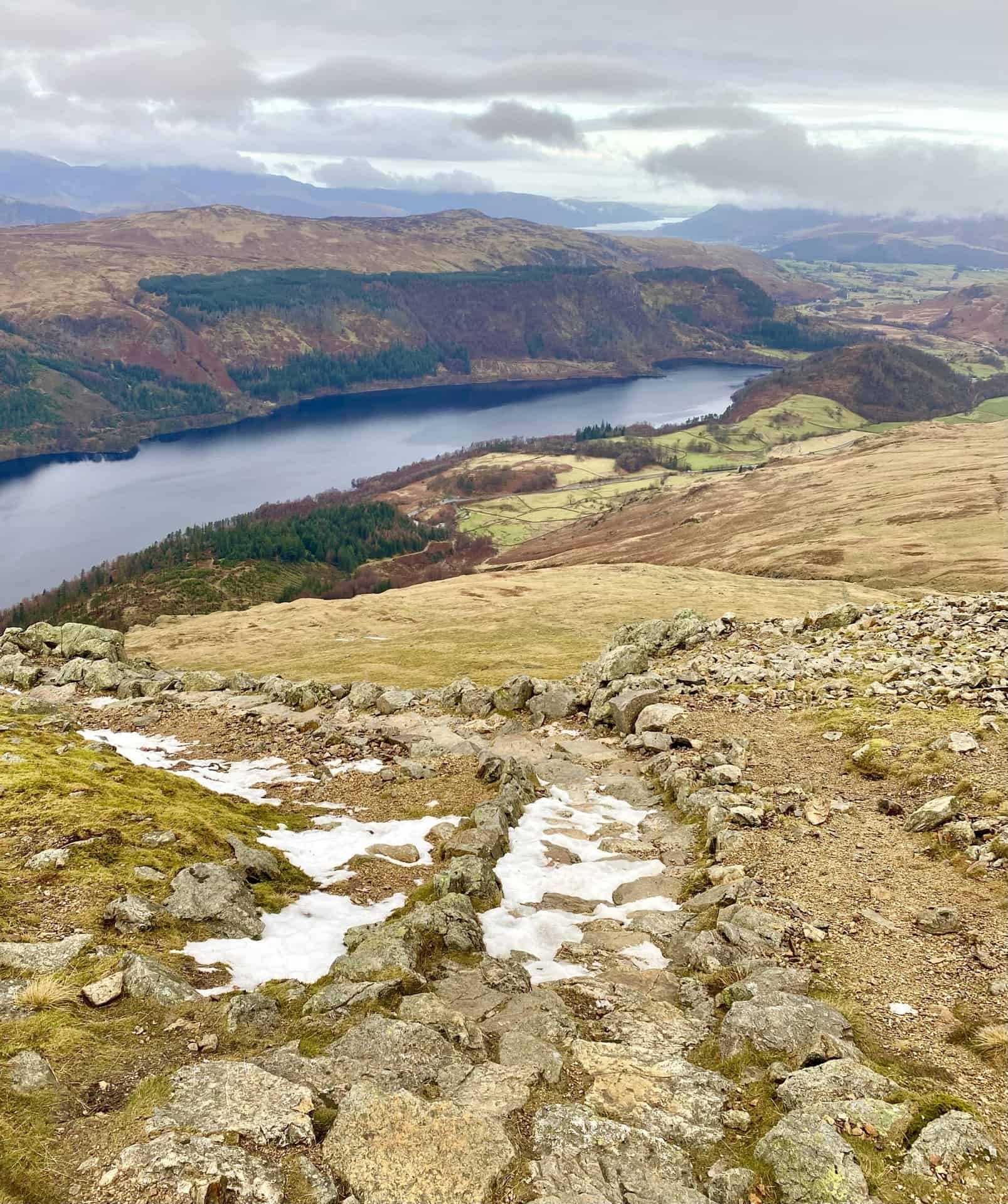
Looking north-west across Thirlmere from Comb Crags. The Helvellyn walk from Thirlmere provides one of the best views in the Lake District. The two islands in the reservoir are Hawes How Island and Deergarth How Island.
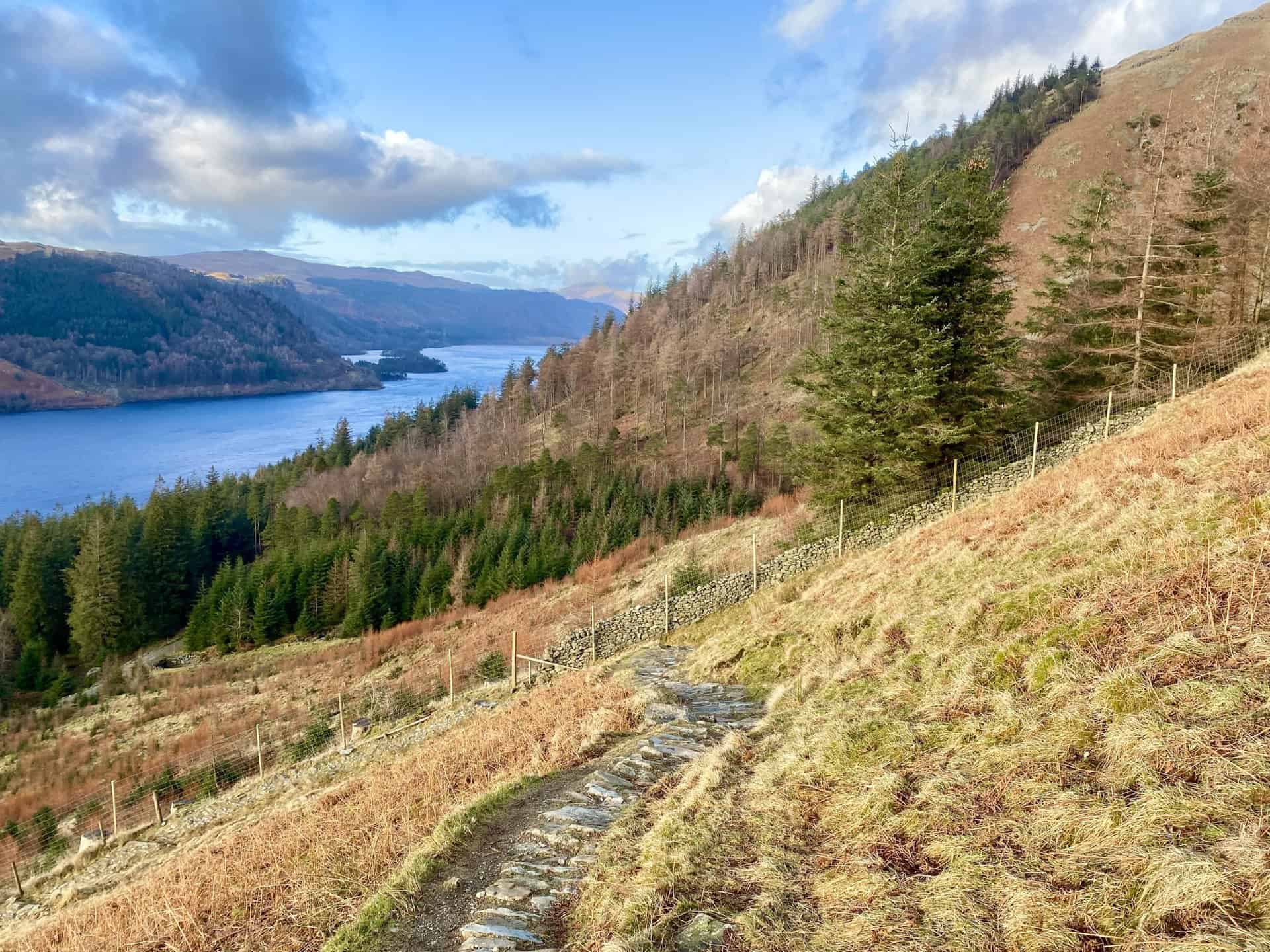
The steep, rocky path near Comb Crags.
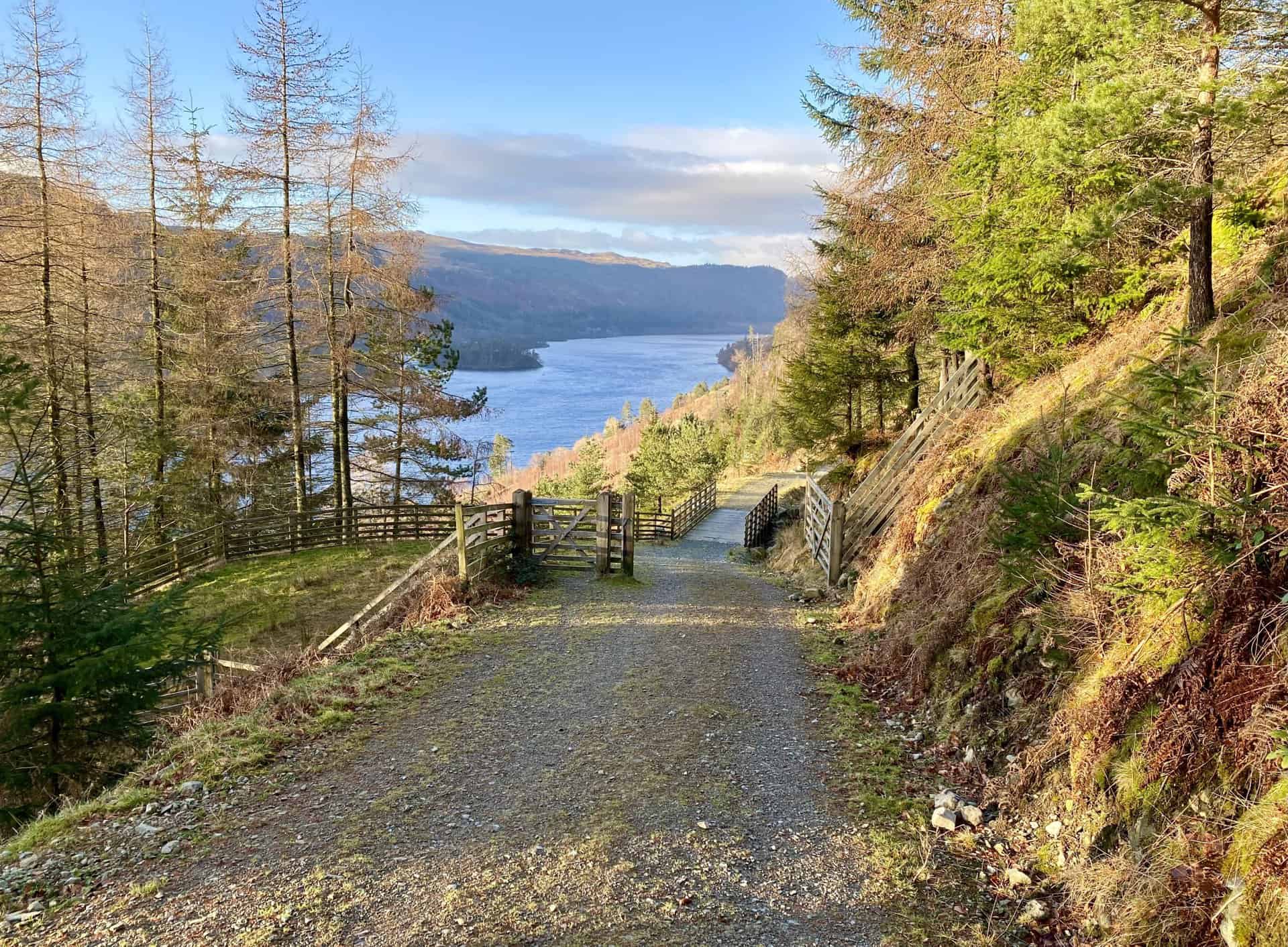
The last part of the descent from Comb Crags into the woodland near Wythburn, about two-thirds of the way round the Helvellyn walk from Thirlmere.
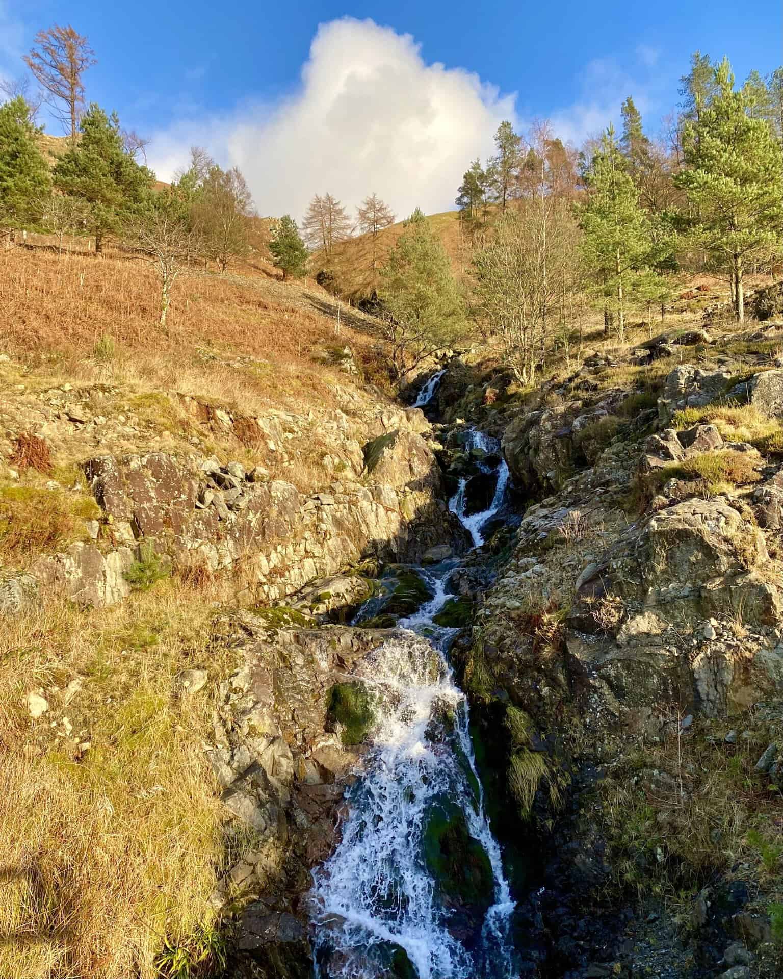
Comb Gill. The stream originates from above Comb Crags on the western side of Nethermost Pike and cascades down the mountainside before flowing into Thirlmere.
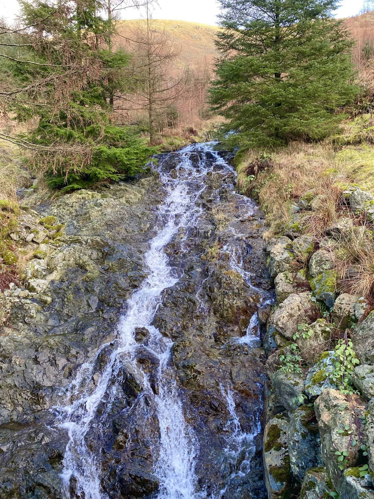
Whelpside Gill, just a few metres north of Comb Gill. This stream descends through the valley between Whelp Side and Middle Tongue and continues its flow into Thirlmere.
Heading north on the forestry track beneath the western slopes of Helvellyn, with great views of Thirlmere from a lower level.
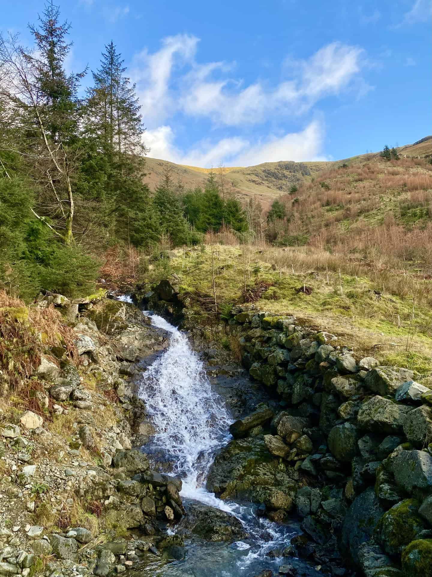
Another waterfall seen from the forestry track. This stream originates from Brownrigg Well about 80 metres below the Helvellyn summit. It cuts a channel between Helvellyn Screes and Whelp Side and empties into Thirlmere. This is about three-quarters of the way round our Helvellyn walk from Thirlmere.
Amazon’s Top Walking Boots: Four Standout Choices for Men and Women
For walking and hiking, the right boots are essential for both comfort and safety. While Amazon boasts a wide range, certain boots emerge as top-sellers. From those, here are four I personally favour. As an Amazon affiliate, I may earn a small commission from any purchases made through the links provided. This helps support the upkeep of this website. Rest assured, you won’t pay a penny extra, but your purchase will contribute to keeping my site running smoothly. Happy walking!

Berghaus Men’s Hillmaster II Gore-Tex Walking Boots
These fully waterproof leather walking boots feature a Gore-Tex lining, ensuring no water enters whilst allowing feet to breathe and stay cool. Made from full-grain leather, they promise unmatched durability and comfort. The boots come with memory foam tongues and cuffs that mould to your feet for a tailored fit, and the Vibram Hillmaster outsoles offer confidence on challenging terrains.

Salewa Men’s Mountain Trainer Mid Gore-Tex Walking Boots
Made from durable suede and abrasion-resistant textile, these men’s hiking boots are both lightweight and sturdy. The upper material is enhanced by a 360° full rubber sheath. Their dual-layer midsole with Bilight technology ensures ergonomic cushioning and grip, especially on extended hikes. The Vibram Wrapping Thread Combi outsoles allow a natural walking feel, and the Gore-Tex lining provides waterproofing, breathability, and optimal weather protection. Furthermore, the patented Salewa 3F system ensures flexibility, a secure heel grip, and a blister-free fit.

Berghaus Women’s Supalite II Gore-Tex Walking Boots
Specially designed for women, these hiking boots offer waterproofing and breathability, thanks to their Gore-Tex lining. Crafted from full-grain abrasion-resistant leather, they’re durable enough for the toughest hikes. The Supalite soles ensure stability and traction, and the EVA midsoles add comfort for extended walks.

Merrell Women’s Moab 3 Mid Gore-Tex Walking Boots
These hiking boots incorporate a Gore-Tex waterproof membrane, blending breathability with superior waterproof performance. The combination of pigskin leather and mesh on the uppers, along with the suede outer material, ensure durability and style. Enhancements include 100% recycled laces, webbing, and mesh lining. Additionally, bellows tongues, protective toe caps, and Vibram TC5+ rubber soles ensure protection and ease on any terrain.