Enjoy Breathtaking Ullswater Views on Your Gowbarrow Fell Walk to Aira Force Waterfall
Start your Gowbarrow Fell walk from the compact car park on the south side of Dockray, situated right over the road bridge by the A5091. After parking, head back over the bridge towards the village.
Next, head eastwards from Dockray, crossing the picturesque countryside. Follow the footpath as it gently ascends to the summit of Gowbarrow Fell. This climb, scaling just over 400 metres, is both pleasant and achievable for all walkers.
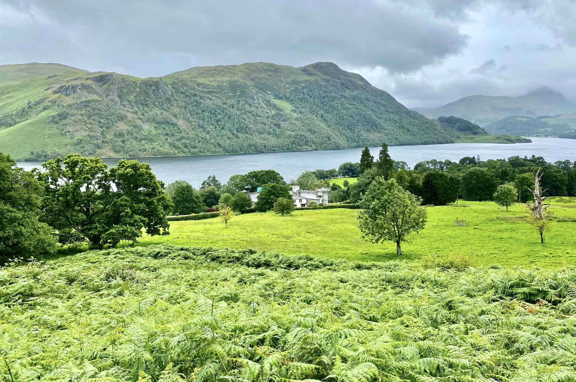
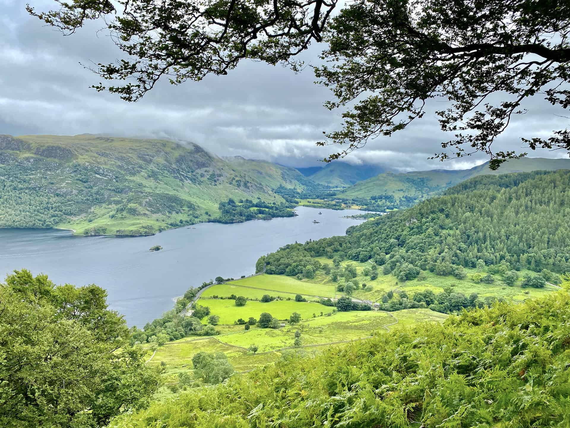
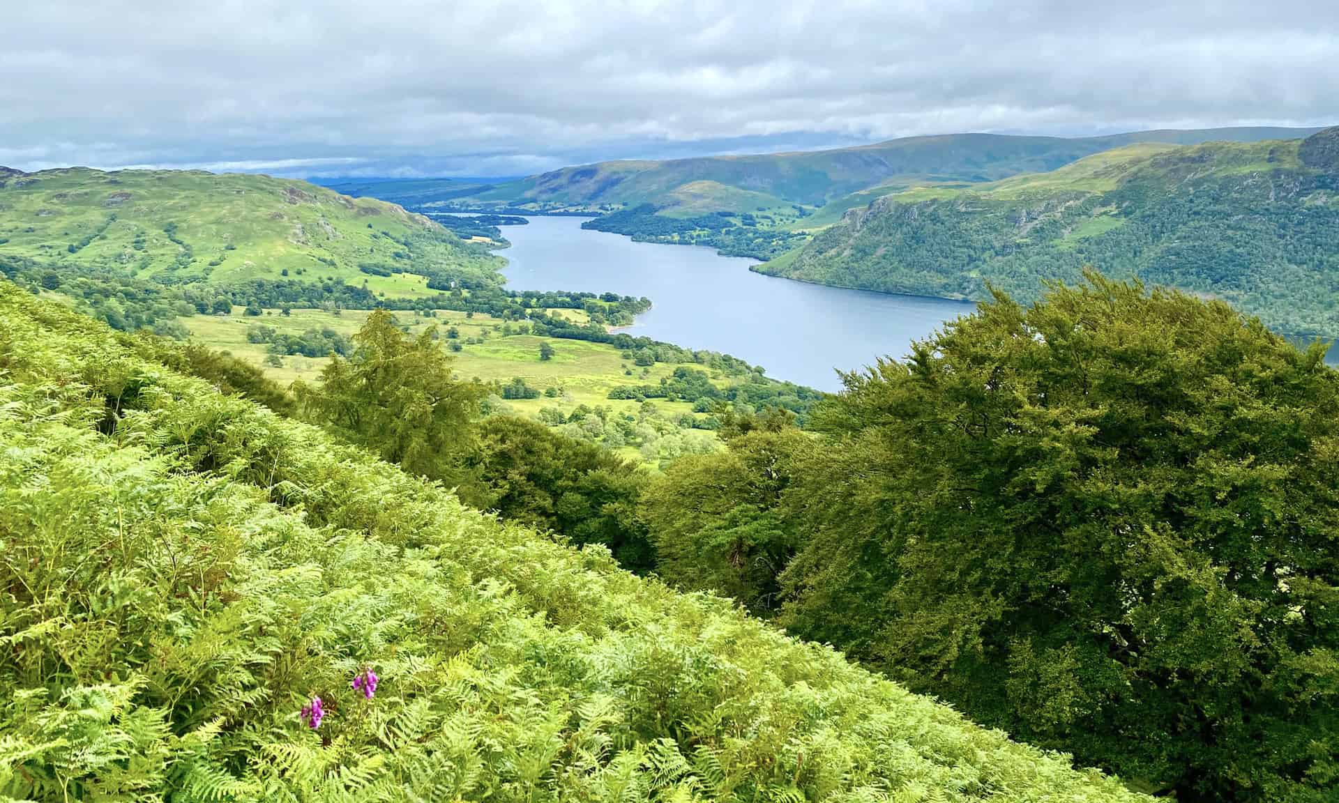
Your route now veers around the eastern slopes of Gowbarrow Park, leading you to Memorial Seat. Here, savour unparalleled views of Ullswater, a stunning highlight of the Gowbarrow Fell walk. Continue your journey along Gowbarrow Park’s southern slopes, passing just below Bernard Pike.
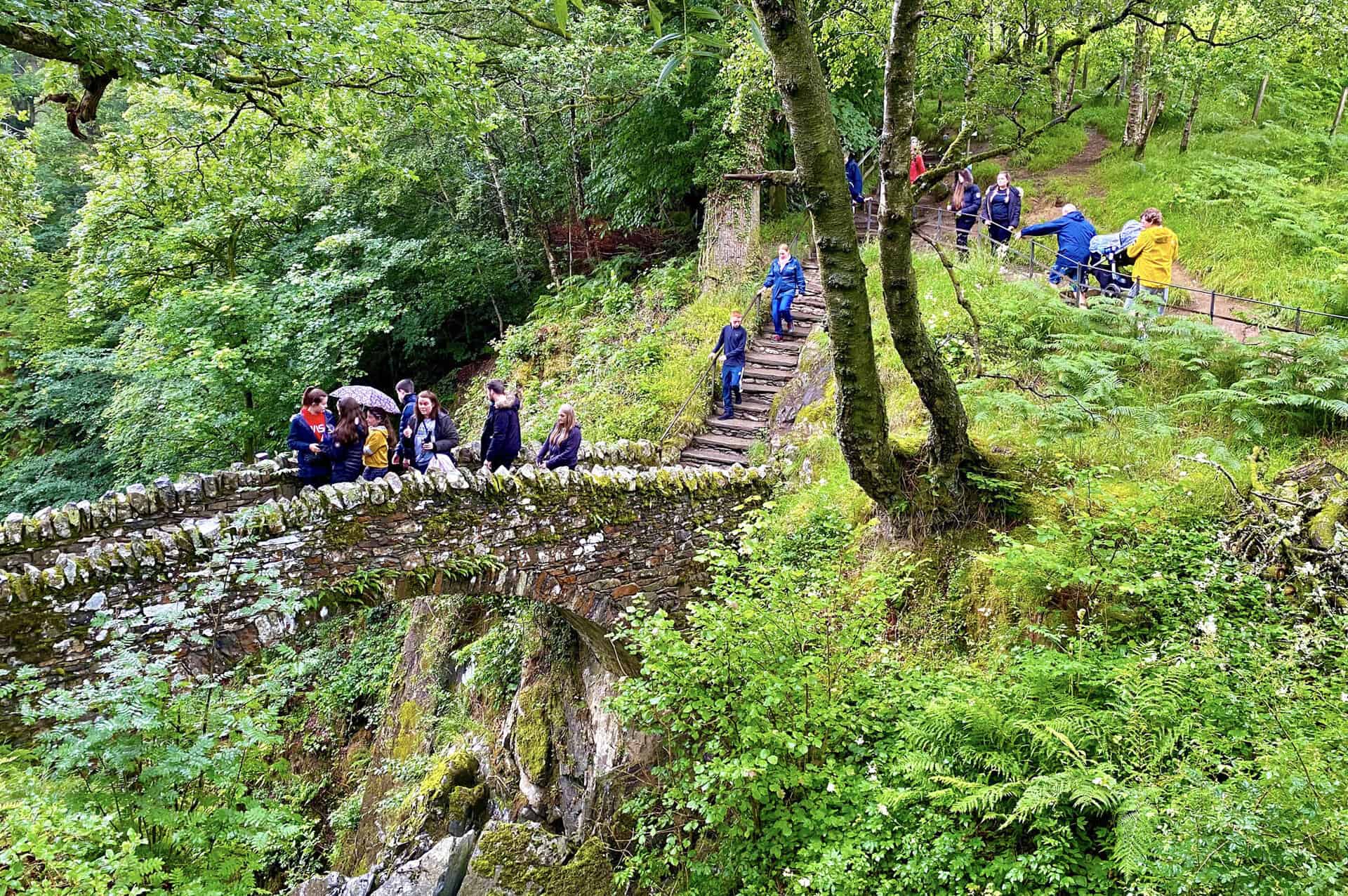
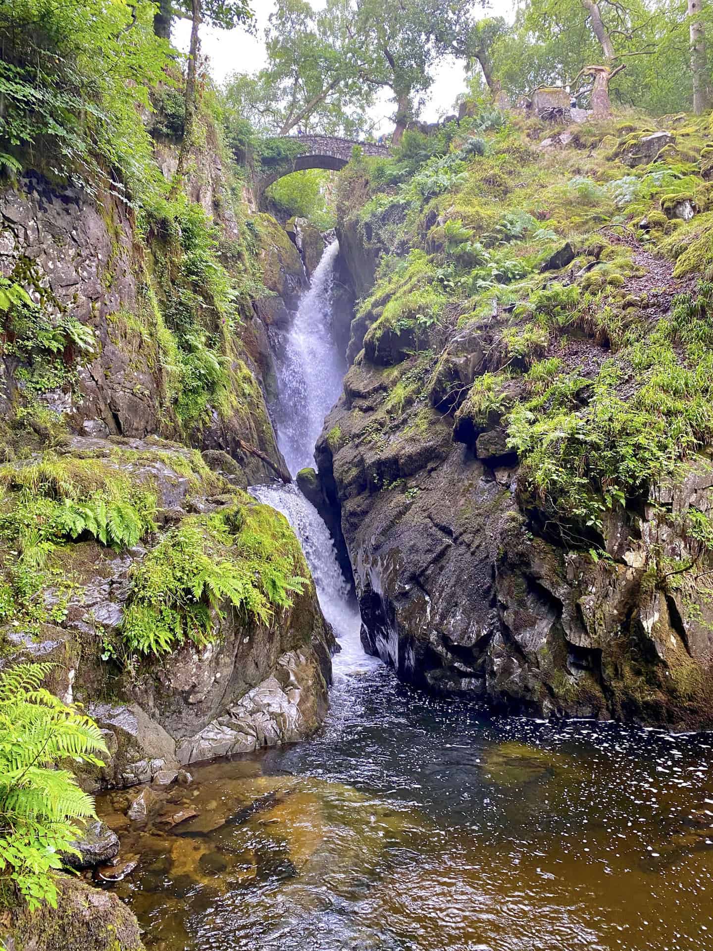
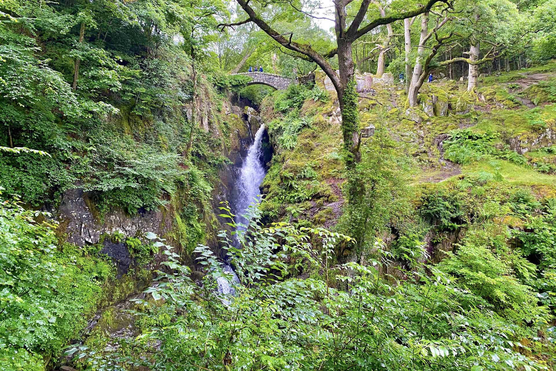
Your next stop is Aira Force, a captivating waterfall. Take some time to explore the surrounding woodland before proceeding south-west. Ascend the south-eastern slopes of Common Fell and Watermillock Common until you reach the top of Glencoyne Brow.
At Brown Hills, make a U-turn and proceed northwards to Swineside Knot. A little further on, you’ll reach the peak of Watermillock Common. Continue your hike in a north-easterly direction, crossing Watermillock Common and scaling the summit of Common Fell.
Finally, continue further north-east, descending back to Dockray. This circular route of the Gowbarrow Fell walk spans 7 miles, perfectly showcasing the charm of the Lake District.
Gowbarrow Fell Walk: Maps and Tools
Visit either the OS Maps website or the Outdooractive website to view this walking route in greater detail. Both platforms offer a range of features, including the ability to print the route, download it to your device, and export the route as a GPX file. You can also watch a 3D fly-over and share the route on social media.
Gowbarrow Fell Walk: Distance, Duration, Statistics
Distance: 7½ miles
Distance: 11¾ kilometres
Duration: 4 hours
Ascent: 2235 feet
Ascent: 681 metres
Type: Circular walk
About Gowbarrow Fell
Gowbarrow Fell, also known as Windy Hill, is a low fell located north of Ullswater in the Lake District. It is defined by the stunning Aira Beck on one side, home to the enchanting waterfall, Aira Force, a major attraction for travellers exploring the area.
Historically, Gowbarrow Fell was part of a medieval hunting park named Gowbarrow Park, owned by the lords of Greystoke. In 1906, the National Trust purchased the fell and 750 acres of the park, preserving its natural beauty for future generations.
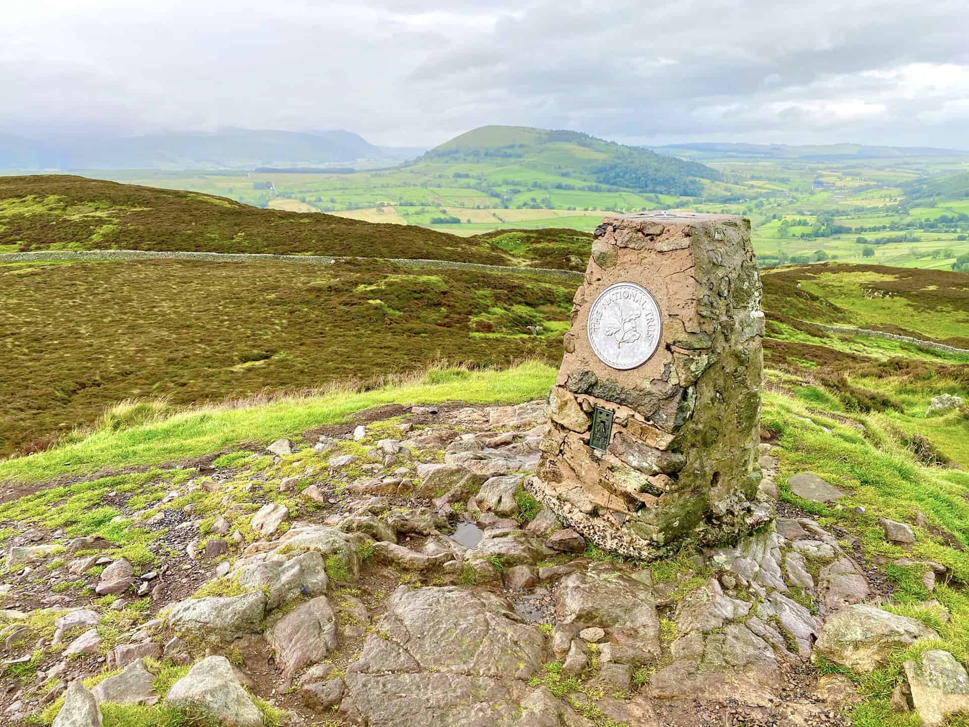
At the top of Gowbarrow Fell, you’ll find a broad plateau dotted with small rocky knolls rising above areas of heather and bog. The highest point, the rocky Airy Crag, hosts an Ordnance Survey triangulation pillar, adorned with a National Trust plaque marking the land’s stewardship.
The Gowbarrow Fell walk offers an extraordinary panorama from the summit. You can see the two Mell Fells, Blencathra, and the northern fells of the Lake District, as well as the northern regions of the Helvellyn range, including the Dodds. Geologically, the rocks of Gowbarrow Fell date back to the Ordovician period, roughly 460 million years ago.
In Alfred Wainwright’s list of 214 Lake District fells, Gowbarrow Fell ranks 181st in terms of height, reaching 481 metres (1579 feet). You can find it using the grid reference NY 407 218, and it is featured on the OL5 Explorer map and the 90 Landranger map. It is also featured in the Eastern Fells book of Wainwright’s Pictorial Guide to the Lakeland Fells.
So, if you’re in the Lake District, why not take the Gowbarrow Fell walk? It’s an incredible journey through time and landscape, offering spectacular views and a touch of history.
Recommended Ordnance Survey Map
The best map to use on this walk is the Ordnance Survey map of the Lake District North-Eastern Area, reference OS Explorer OL5, scale 1:25,000. It clearly displays footpaths, rights of way, open access land and vegetation on the ground, making it ideal for walking, running and hiking. The map can be purchased from Amazon in either a standard, paper version or a weatherproof, laminated version, as shown below.
Standard Version
Gowbarrow Fell Walk: My Photos
Triangulation pillar on Gowbarrow Fell summit, height 481 metres (1578 feet).
The view of Ullswater, with Hallin Fell on the right and Barton Fell in the background.
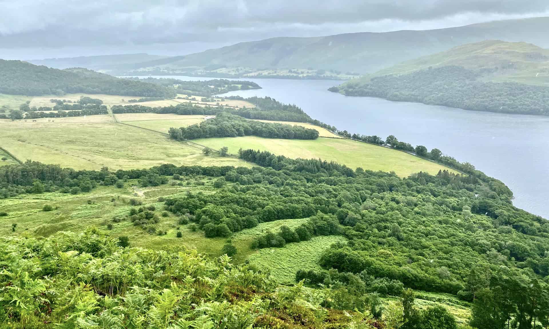
Looking across Ullswater towards Bleaberry Knot and Place Fell.
Ullswater backed by Low Birk Fell and Birk Fell. The views during this Gowbarrow Fell walk are stunning.
One of two small arched bridges which span Aira Beck at the popular Aira Force waterfall.
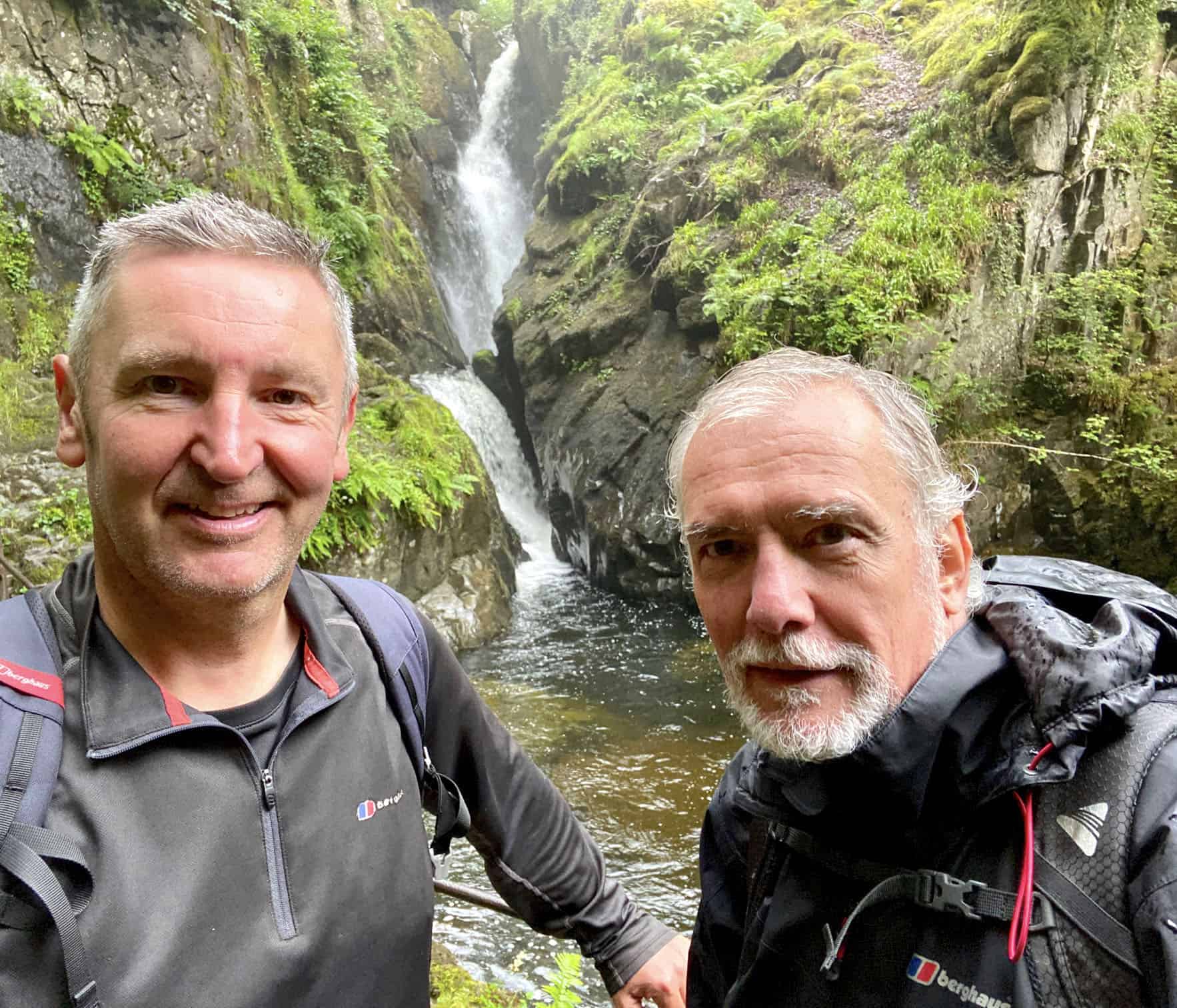
Mike and I at Aira Force, about halfway around our Gowbarrow Fell walk.
Aira Beck drops approximately 20 metres down a steep-sided ravine into a rocky plunge pool before continuing its journey to Ullswater.
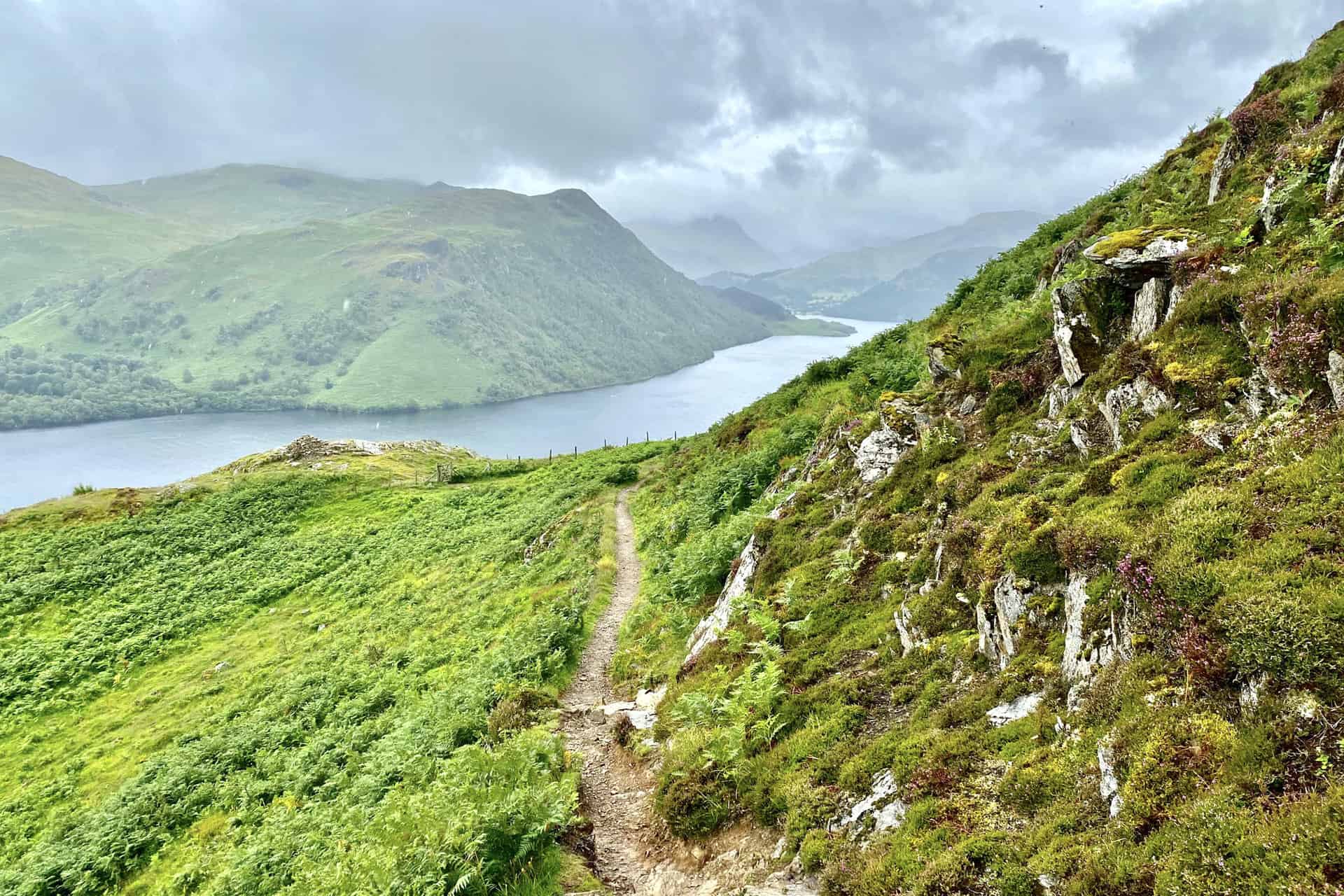
Looking down into the Glencoyne valley from the steep slopes of Glencoyne Brow. In the distance Ullswater reaches its southernmost extent at Patterdale.
The view east from Glencoyne Brow across Ullswater towards Hallin Fell.
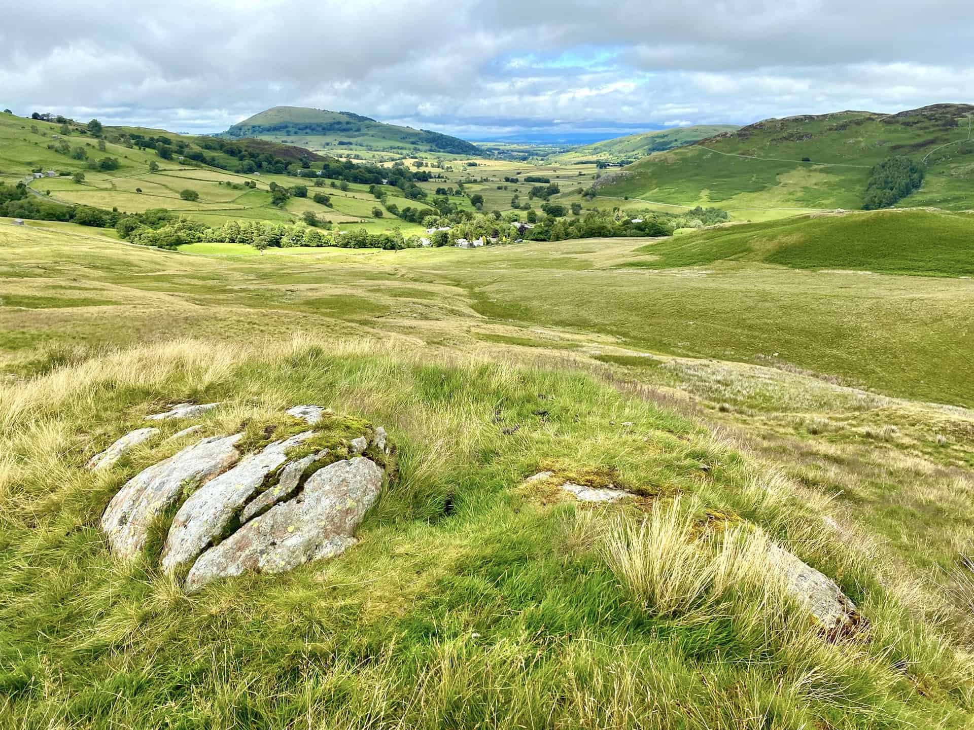
The view down to Dockray village, with Gowbarrow Fell on the right and Great Mell Fell in the distance left of centre. Nearing the end of our amazing Gowbarrow Fell walk.
Amazon’s Top Walking Boots: Four Standout Choices for Men and Women
For walking and hiking, the right boots are essential for both comfort and safety. While Amazon boasts a wide range, certain boots emerge as top-sellers. From those, here are four I personally favour. As an Amazon affiliate, I may earn a small commission from any purchases made through the links provided. This helps support the upkeep of this website. Rest assured, you won’t pay a penny extra, but your purchase will contribute to keeping my site running smoothly. Happy walking!

Berghaus Men’s Hillmaster II Gore-Tex Walking Boots
These fully waterproof leather walking boots feature a Gore-Tex lining, ensuring no water enters whilst allowing feet to breathe and stay cool. Made from full-grain leather, they promise unmatched durability and comfort. The boots come with memory foam tongues and cuffs that mould to your feet for a tailored fit, and the Vibram Hillmaster outsoles offer confidence on challenging terrains.

Salewa Men’s Mountain Trainer Mid Gore-Tex Walking Boots
Made from durable suede and abrasion-resistant textile, these men’s hiking boots are both lightweight and sturdy. The upper material is enhanced by a 360° full rubber sheath. Their dual-layer midsole with Bilight technology ensures ergonomic cushioning and grip, especially on extended hikes. The Vibram Wrapping Thread Combi outsoles allow a natural walking feel, and the Gore-Tex lining provides waterproofing, breathability, and optimal weather protection. Furthermore, the patented Salewa 3F system ensures flexibility, a secure heel grip, and a blister-free fit.

Berghaus Women’s Supalite II Gore-Tex Walking Boots
Specially designed for women, these hiking boots offer waterproofing and breathability, thanks to their Gore-Tex lining. Crafted from full-grain abrasion-resistant leather, they’re durable enough for the toughest hikes. The Supalite soles ensure stability and traction, and the EVA midsoles add comfort for extended walks.

Merrell Women’s Moab 3 Mid Gore-Tex Walking Boots
These hiking boots incorporate a Gore-Tex waterproof membrane, blending breathability with superior waterproof performance. The combination of pigskin leather and mesh on the uppers, along with the suede outer material, ensure durability and style. Enhancements include 100% recycled laces, webbing, and mesh lining. Additionally, bellows tongues, protective toe caps, and Vibram TC5+ rubber soles ensure protection and ease on any terrain.