Explore Rugged Fells and Tranquil Valleys on the Grisedale Pike Walk
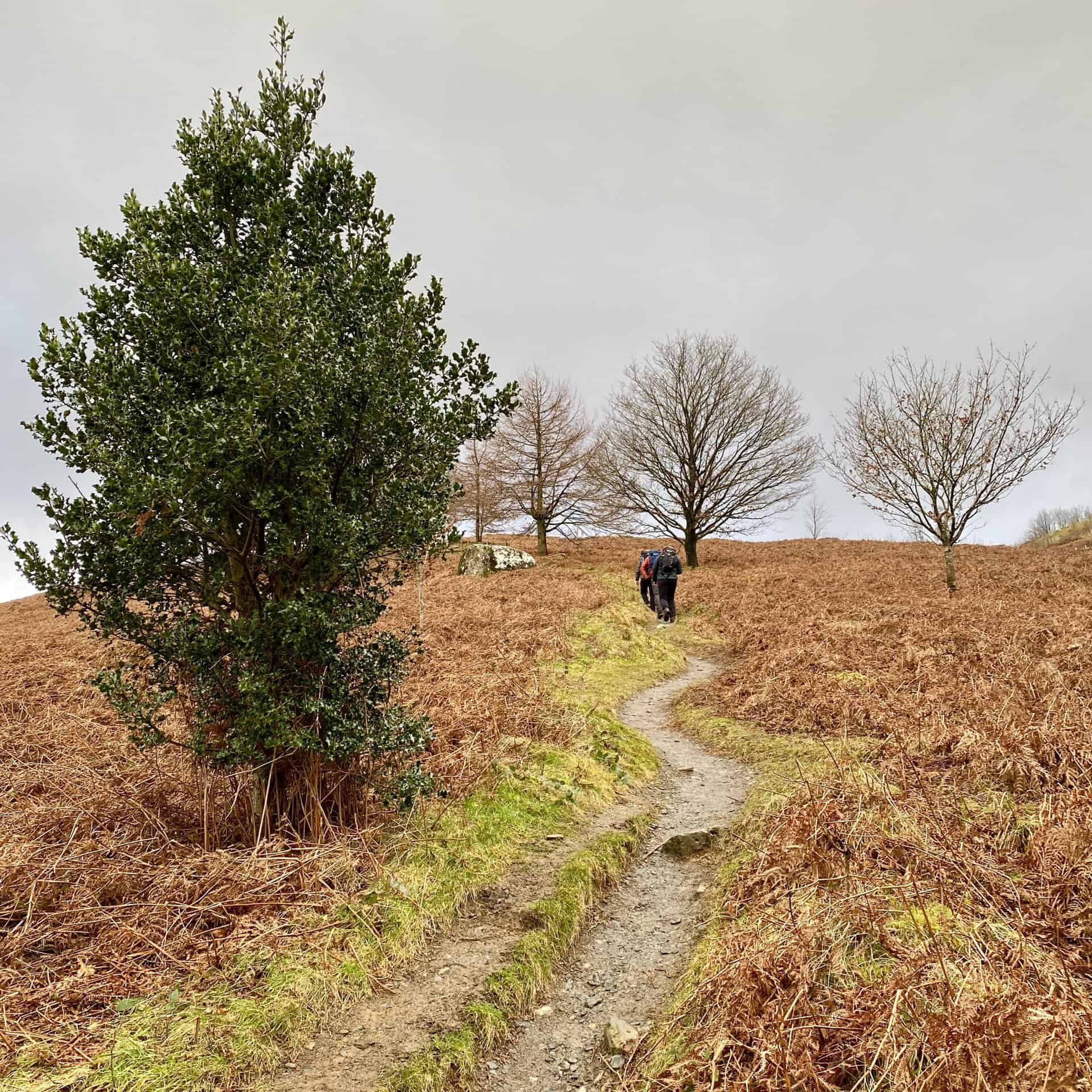
Set off on the Grisedale Pike walk, a classic ‘fell and dale’ journey through the Lake District’s dramatic ascents and tranquil descents. Your adventure begins just outside the picturesque village of Braithwaite, with convenient parking available alongside the B5292 Whinlatter Pass. From the car park, you’ll ascend the steps directly into the inviting woods. Continue uphill, following the well-marked path south-west to reach the summit of Grisedale Pike.
Once you’ve enjoyed the views from Grisedale Pike, continue on your south-west course, then head west to skirt the upper edge of Hobcarton Crag on your way to the summit of Hopegill Head. For those seeking extra adventure, a detour north to the summit of Ladyside Pike is an option. Although it’s not a Wainwright, the ascent provides its own set of rewarding panoramas. After Ladyside Pike, retrace your steps, head south to conquer Sandhill, and then descend to the junction at Coledale Hause.
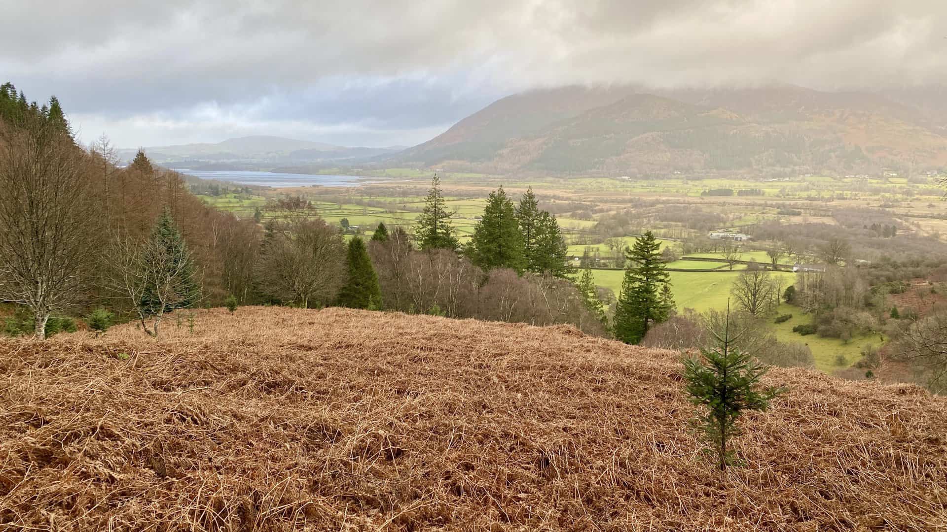
The next part of your Grisedale Pike walk is a descent to the east towards the fascinating Force Crag Mine. Allow yourself time to explore this historic site before proceeding. The final stretch offers a leisurely north-east path through the scenic Coledale Beck valley, leading back to the car park.
The entire Grisedale Pike walk, spanning an estimated 8½ miles, can typically be completed in around five hours. This engaging route, equally divided between the rugged fell terrain and the tranquil valley paths, offers walkers a splendid sampling of the Lake District’s diverse landscapes.
Grisedale Pike Walk: Maps and Tools
Visit either the OS Maps website or the Outdooractive website to view this walking route in greater detail. Both platforms offer a range of features, including the ability to print the route, download it to your device, and export the route as a GPX file. You can also watch a 3D fly-over and share the route on social media.
Grisedale Pike Walk: Distance, Duration, Statistics
Distance: 8½ miles
Distance: 13½ kilometres
Duration: 5 hours
Ascent: 3163 feet
Ascent: 964 metres
Type: Circular walk
About Grisedale Pike
Grisedale Pike is a prominent fell in Cumbria’s Lake District, approximately 4½ miles west of Keswick. This substantial fell radiates three lengthy ridges down to the valley floors, with two shorter spurs connecting to Hopegill Head and the vital Coledale Hause, which joins Grisedale Pike with the broader Coledale fells network. To its south lies the Coledale valley, spanning 2½ miles, and to its north, the B5292 road traverses the Whinlatter Pass. Braithwaite village nestles at the base of its eastern ridge. The northern slopes are notably forested by the Forestry Commission, including the extensive Hospital Plantation in the Grisedale Gill valley. The ridge’s geology features the laminated mudstone and siltstone of the Kirkstile Formation, characteristic of the Skiddaw group.
The Coledale region of the fell has seen significant mining activity, with Force Crag Mine being the district’s last operational lead mine until its closure in 1990; it also extracted zinc and barite. Ownership of the mine changed hands numerous times, and it was frequently shut and reopened since the early 1800s. The mine experienced a severe collapse in 1990, prompting the New Coledale Mining Company to cease operations. The Grisedale Pike walk typically commences in Braithwaite, ascending the eastern ridge along a distinct path. An alternate route to Grisedale Pike starts from the car park in Hospital Plantation by Whinlatter Pass, ascending the northern ridge via Hobcarton End en route to the summit.
The Grisedale Pike walk is commonly included in the Coledale Horseshoe, a popular circular route. In the list of Wainwrights, Grisedale Pike ranks as the 40th highest fell, with a grid reference of NY 198 225, included in Alfred Wainwright’s North Western Fells category.
Recommended Ordnance Survey Map
The best map to use on this walk is the Ordnance Survey map of the Lake District North-Western Area, reference OS Explorer OL4, scale 1:25,000. It clearly displays footpaths, rights of way, open access land and vegetation on the ground, making it ideal for walking, running and hiking. The map can be purchased from Amazon in either a standard, paper version or a weatherproof, laminated version, as shown below.
Standard Version
Grisedale Pike Walk: My Photos
The view north towards Bassenthwaite Lake shortly after leaving the car park.
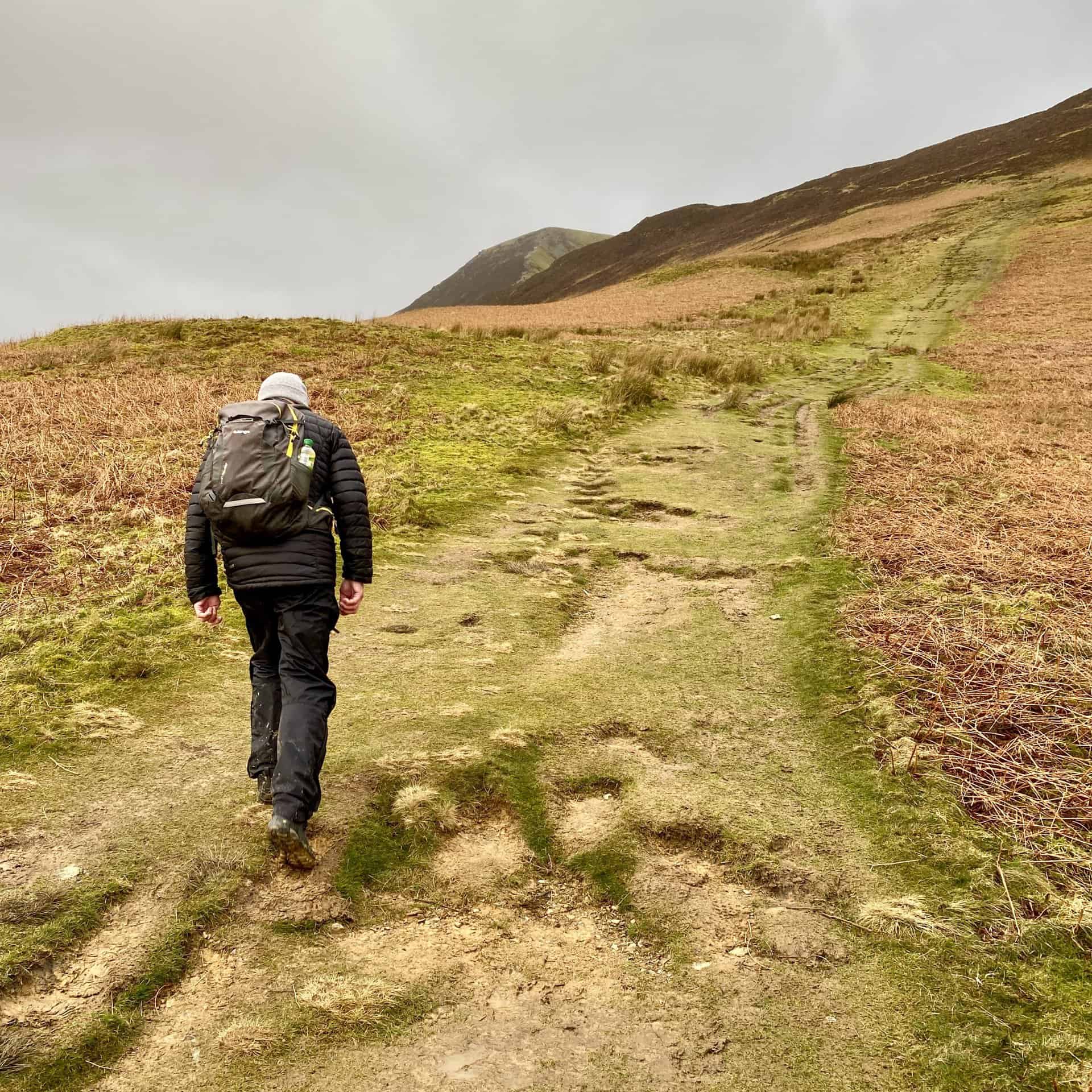
The start of the climb to the summit of Grisedale Pike.
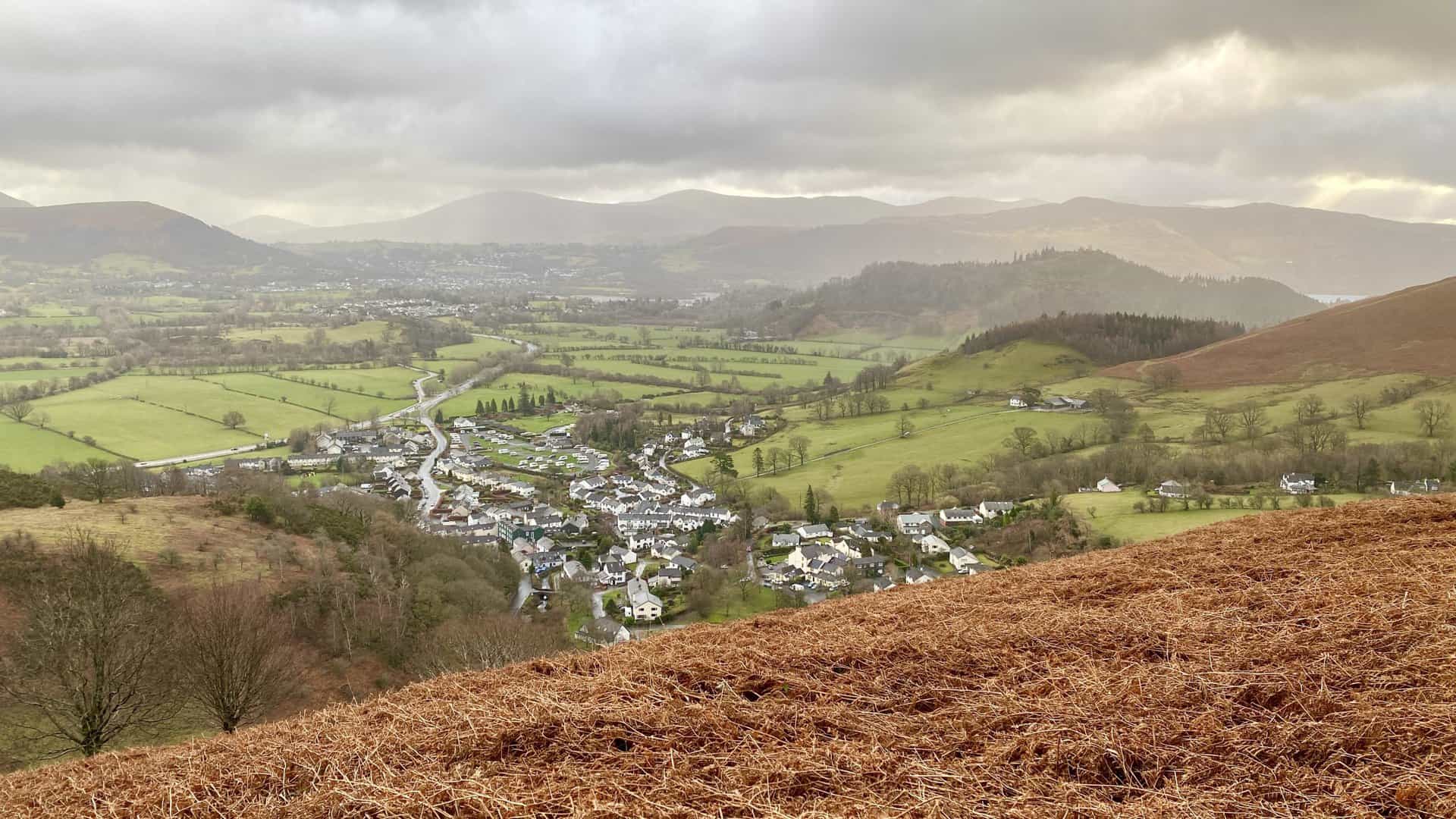
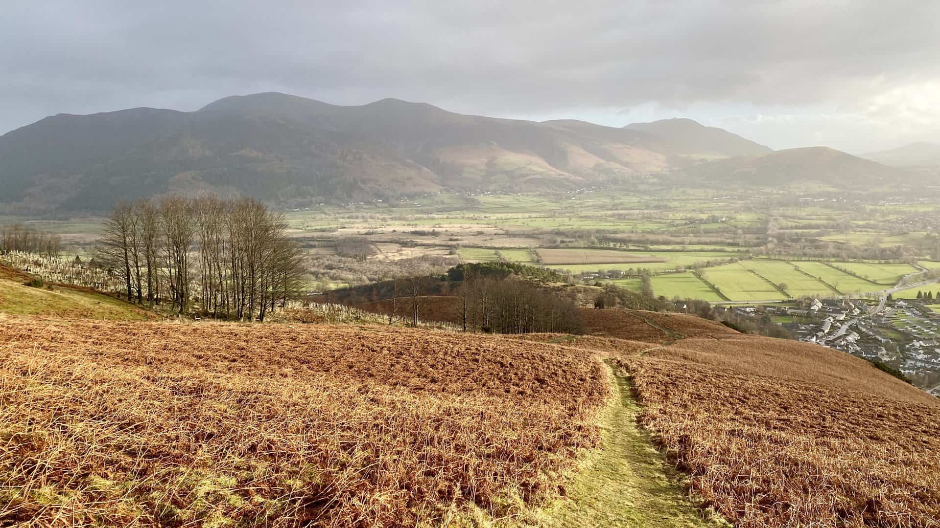
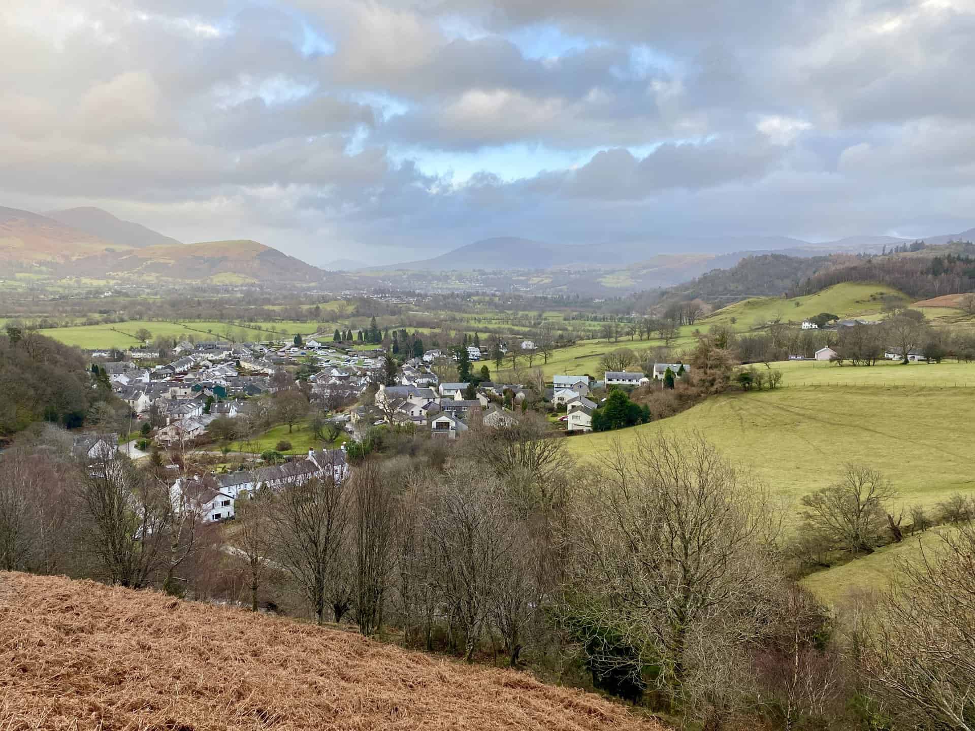
Looking down upon the village of Braithwaite. Even at a height of only 240 metres the views are magnificent.
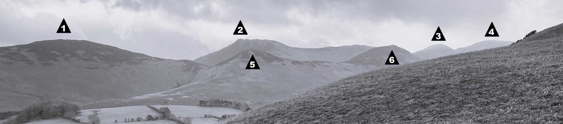
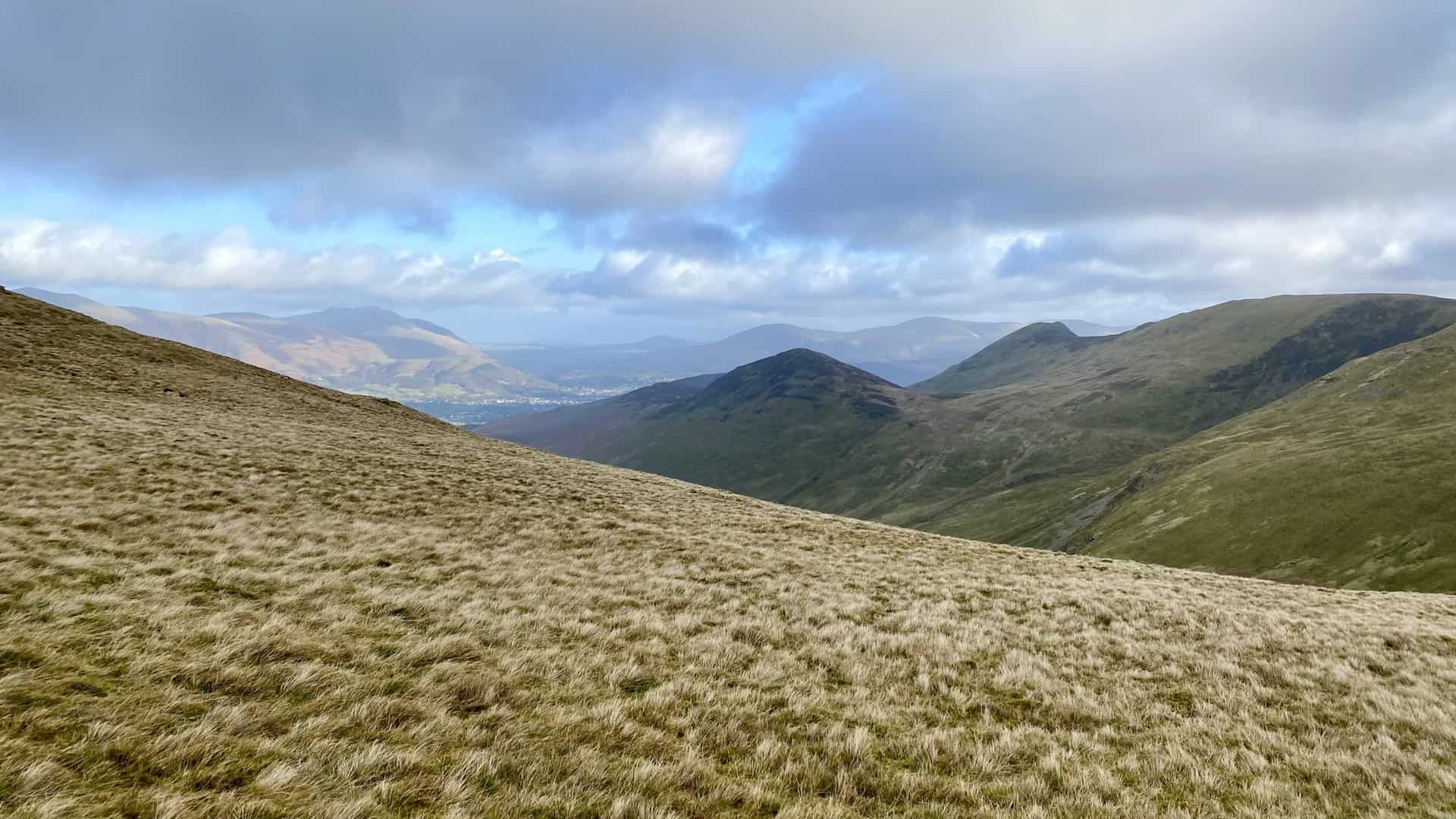
The fells on the southern side of the Coledale Beck valley. See the key below for their names.
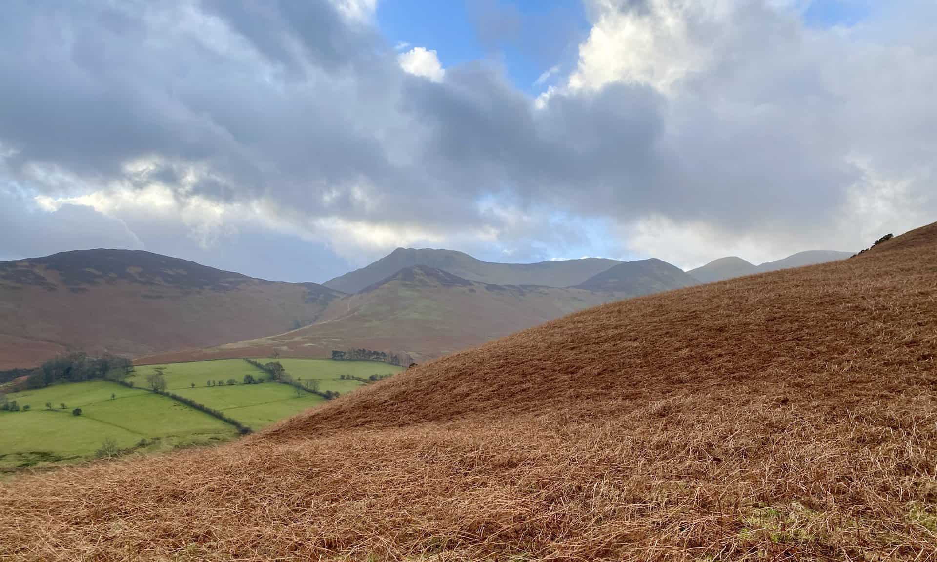
Key: 1 Barrow; 2 Causey Pike; 3 Sail; 4 Crag Hill; 5 Stile End; 6 Outerside.
The path to Grisedale Pike is easy to follow.
Looking back at the Skiddaw range of mountains to the north-east. The smaller hill on the far right is Latrigg which overlooks Keswick.
At the 400 metre mark the path steepens. Grisedale Pike can be clearly seen in the distance.
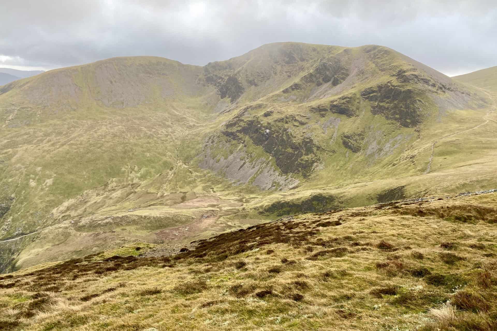
The north-facing slopes of Outerside with Causey Pike just behind.
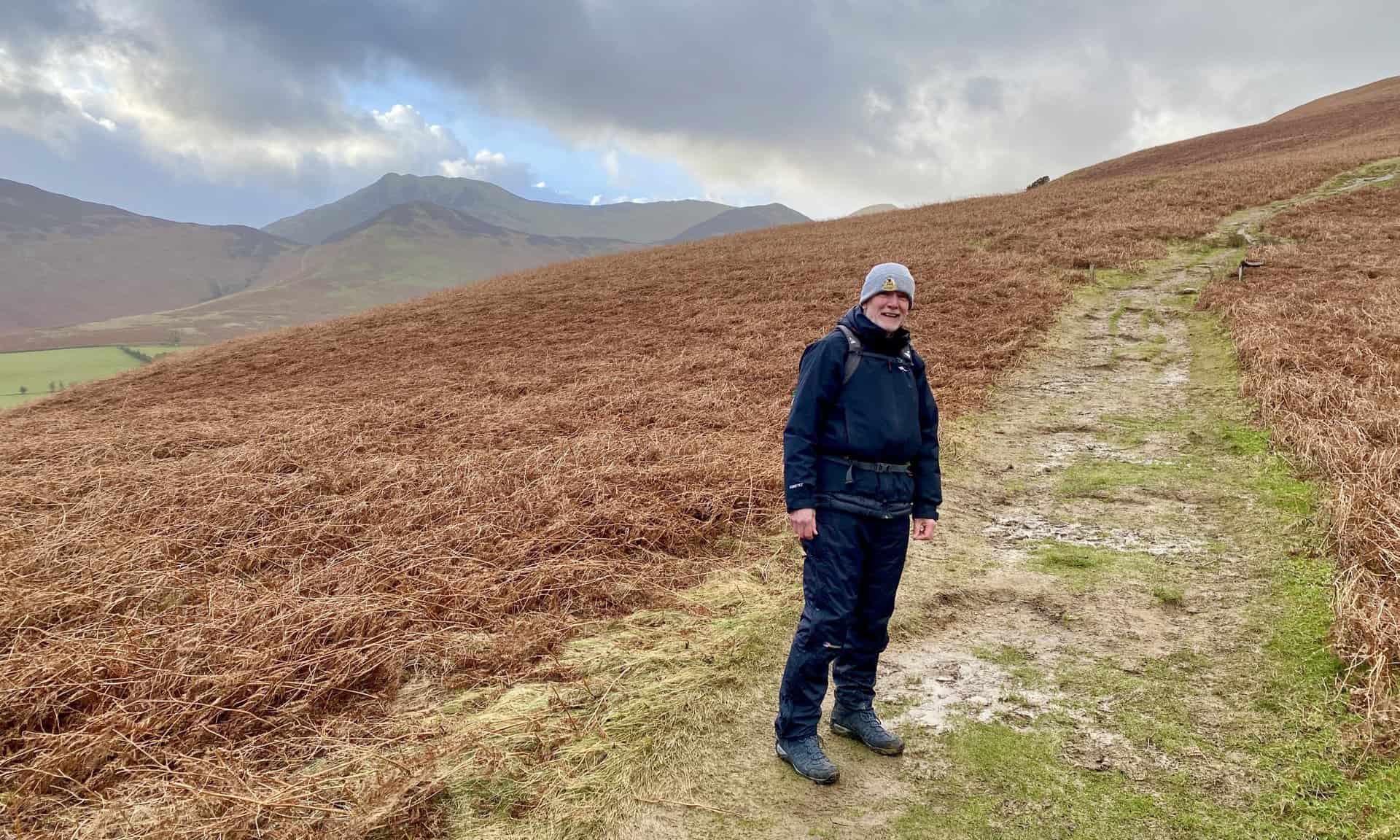
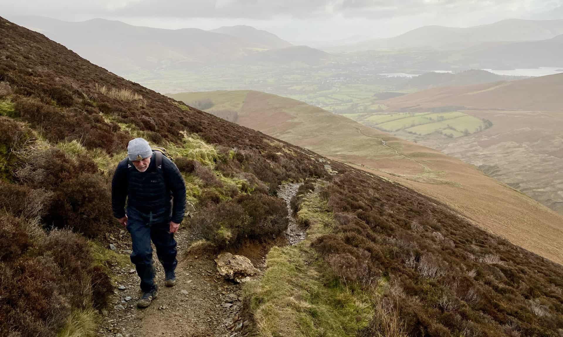
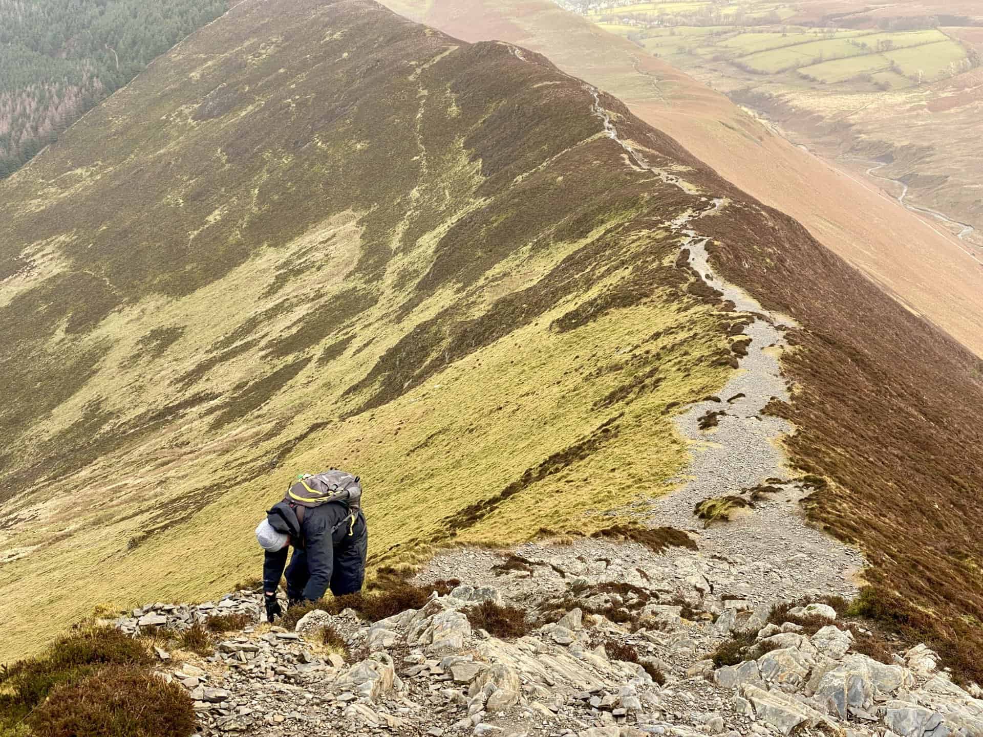
Mike tackles the path on Sleet How in strong winds.
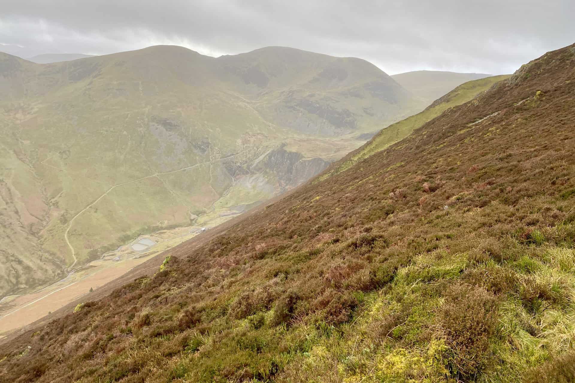
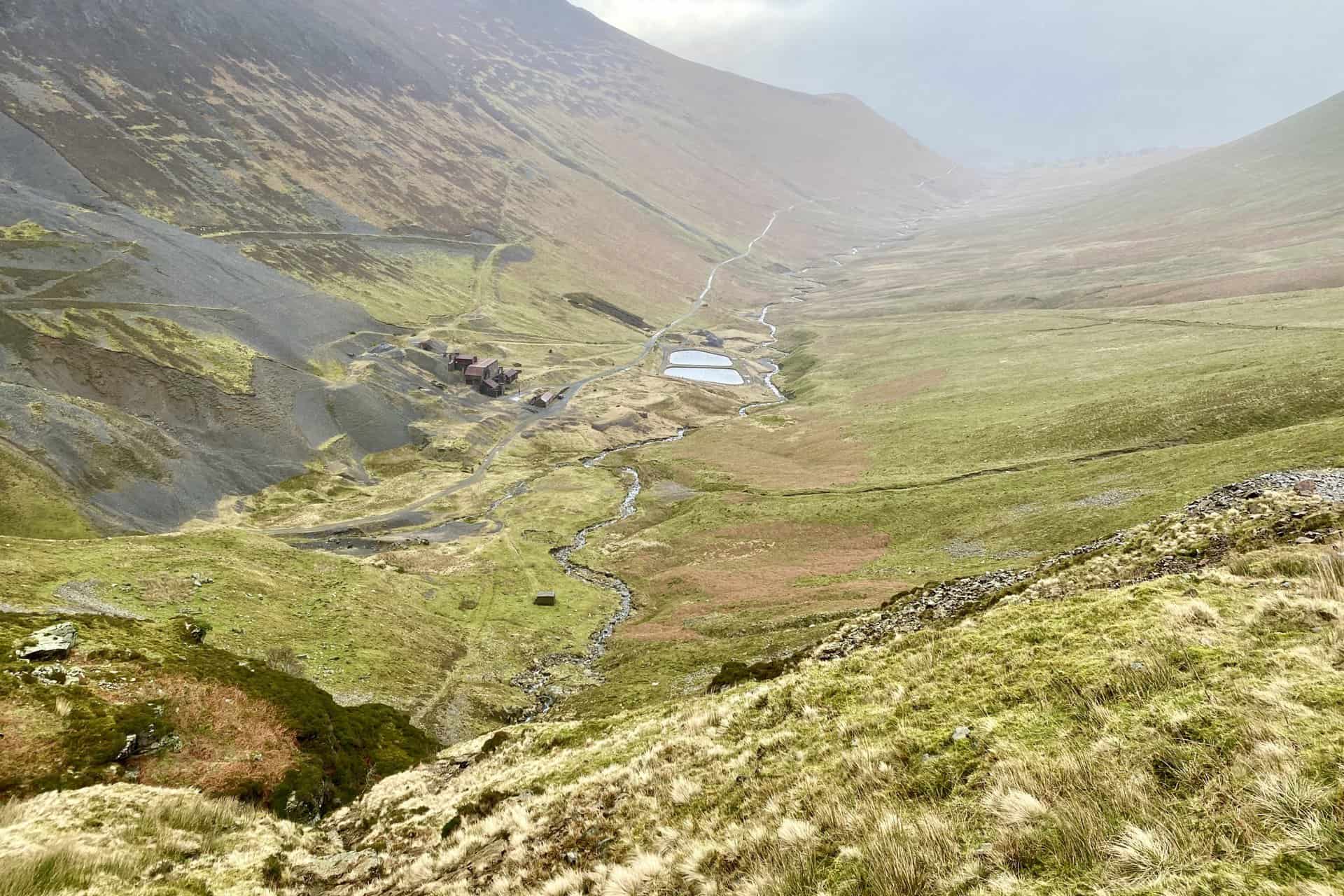
The view down to Force Crag Mine. At the head of the valley is the mighty Crag Hill.
A look back at the path across Sleet How as we get close to the top of Grisedale Pike.
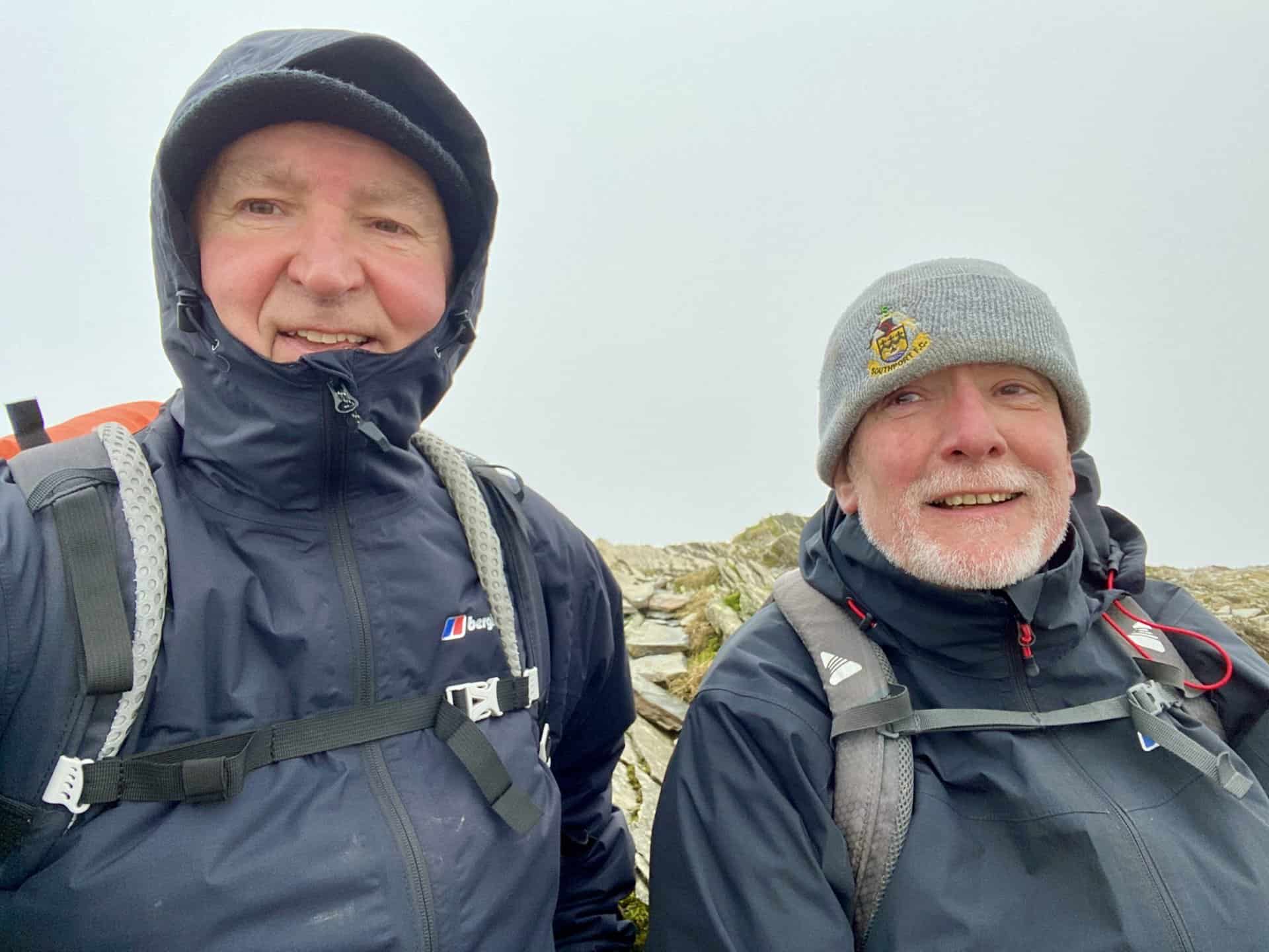
Mike and I on the summit of Grisedale Pike, height 791 metres (2593 feet). We’re only about a quarter of the way round our Grisedale Pike walk and it’s extremely windy.
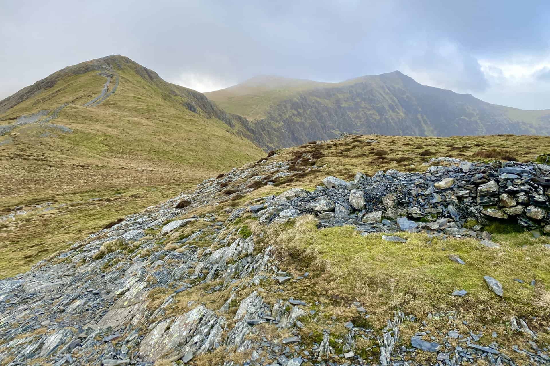
Hobcarton Crag and Hopegill Head as seen from a shelter just below Grisedale Pike.
The sun briefly lights up the fells on the eastern side of Derwent Water. The Helvellyn mountain range is just visible on the horizon.
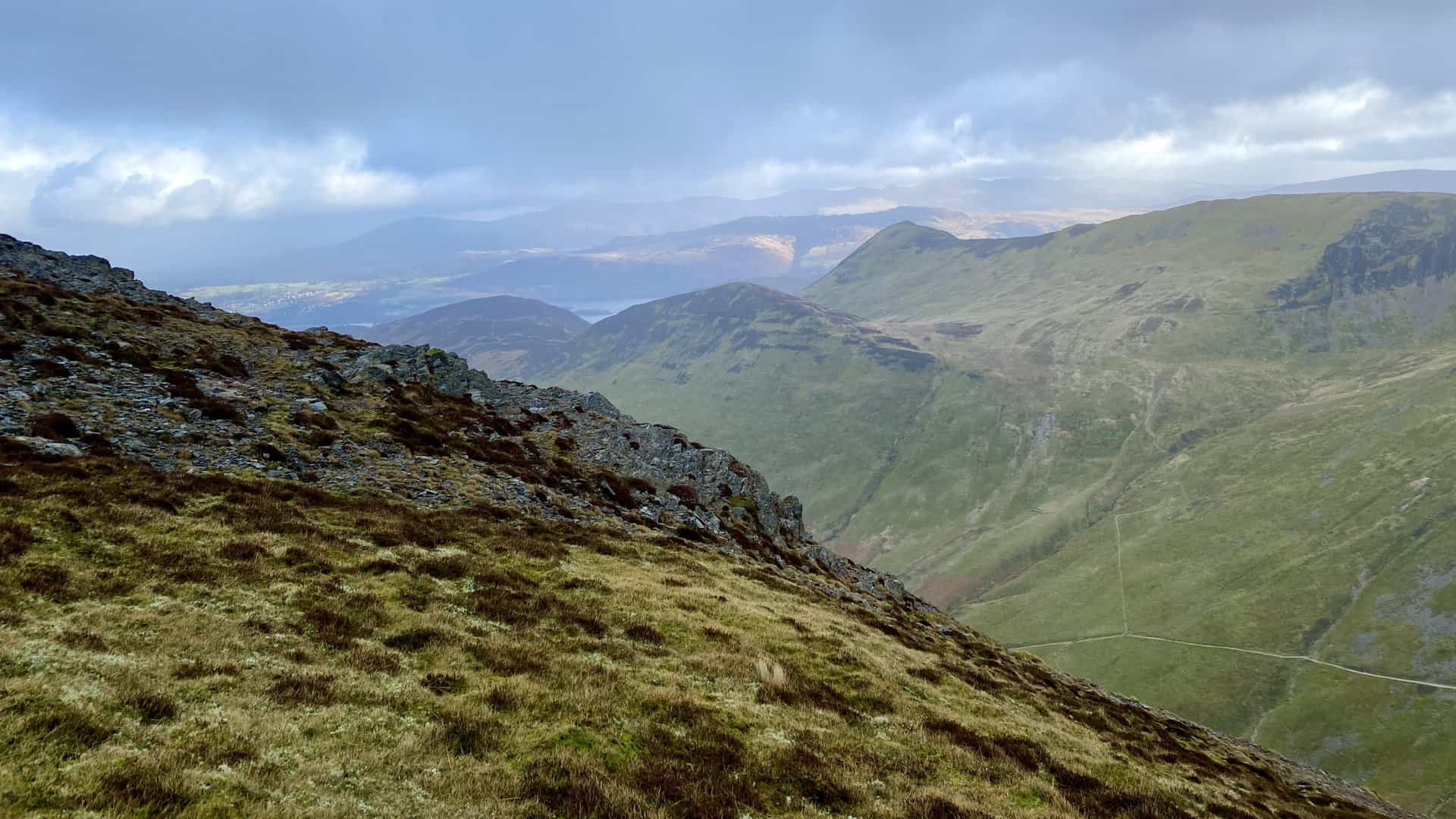
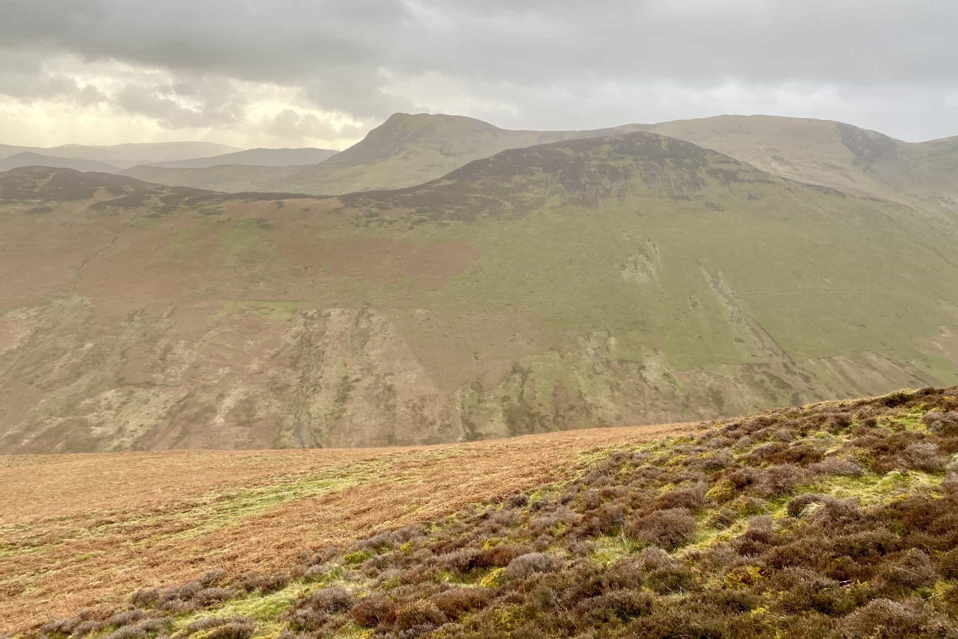
Crag Hill (right) and Sail (left).
The view from Sand Hill, about halfway around this Grisedale Pike walk. The sun shines down on Keswick and the Blencathra range of mountains.
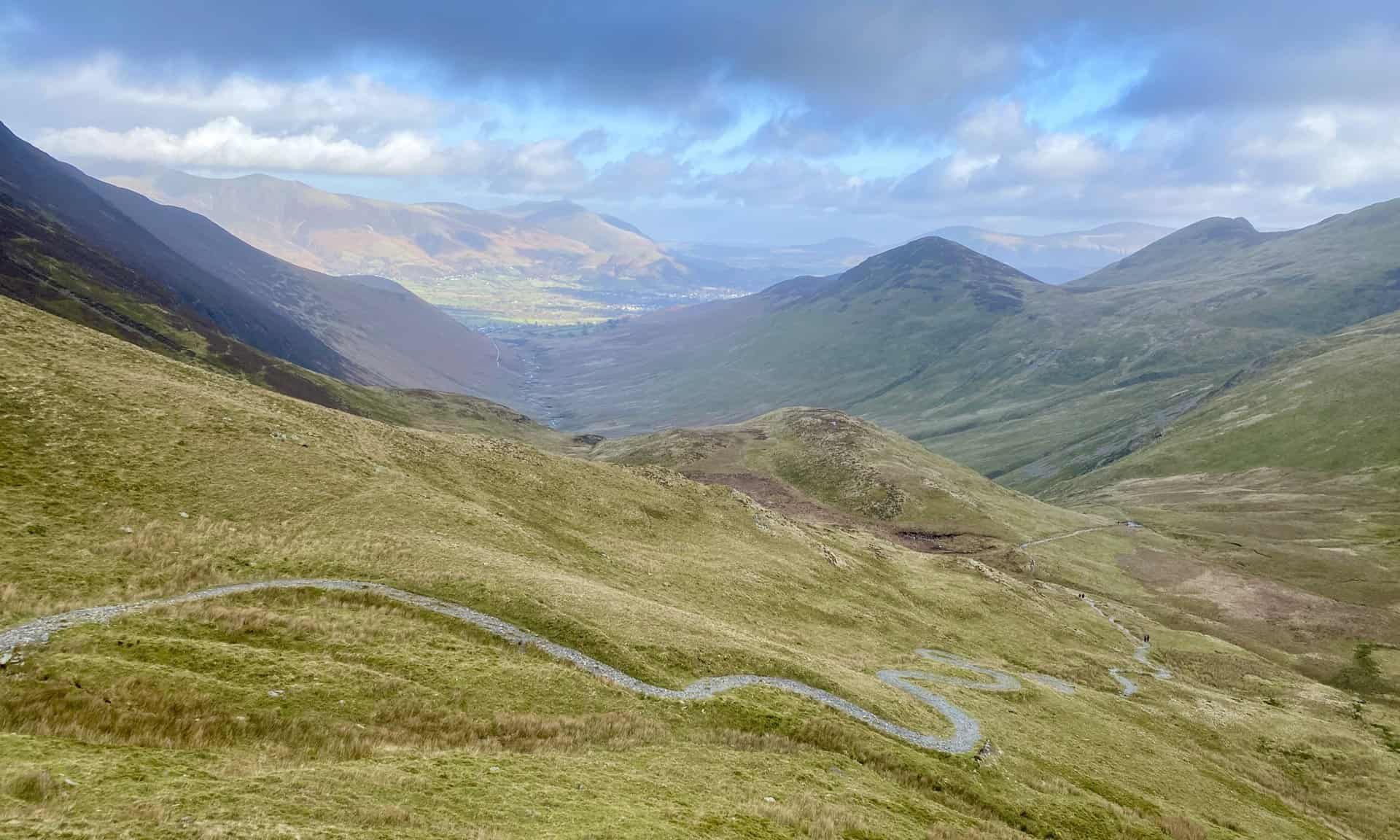
The winding path from Coledale Hause (the col or saddle between Sand Hill and Eel Crag) down to Force Crag Mine.
The Coledale Beck valley.
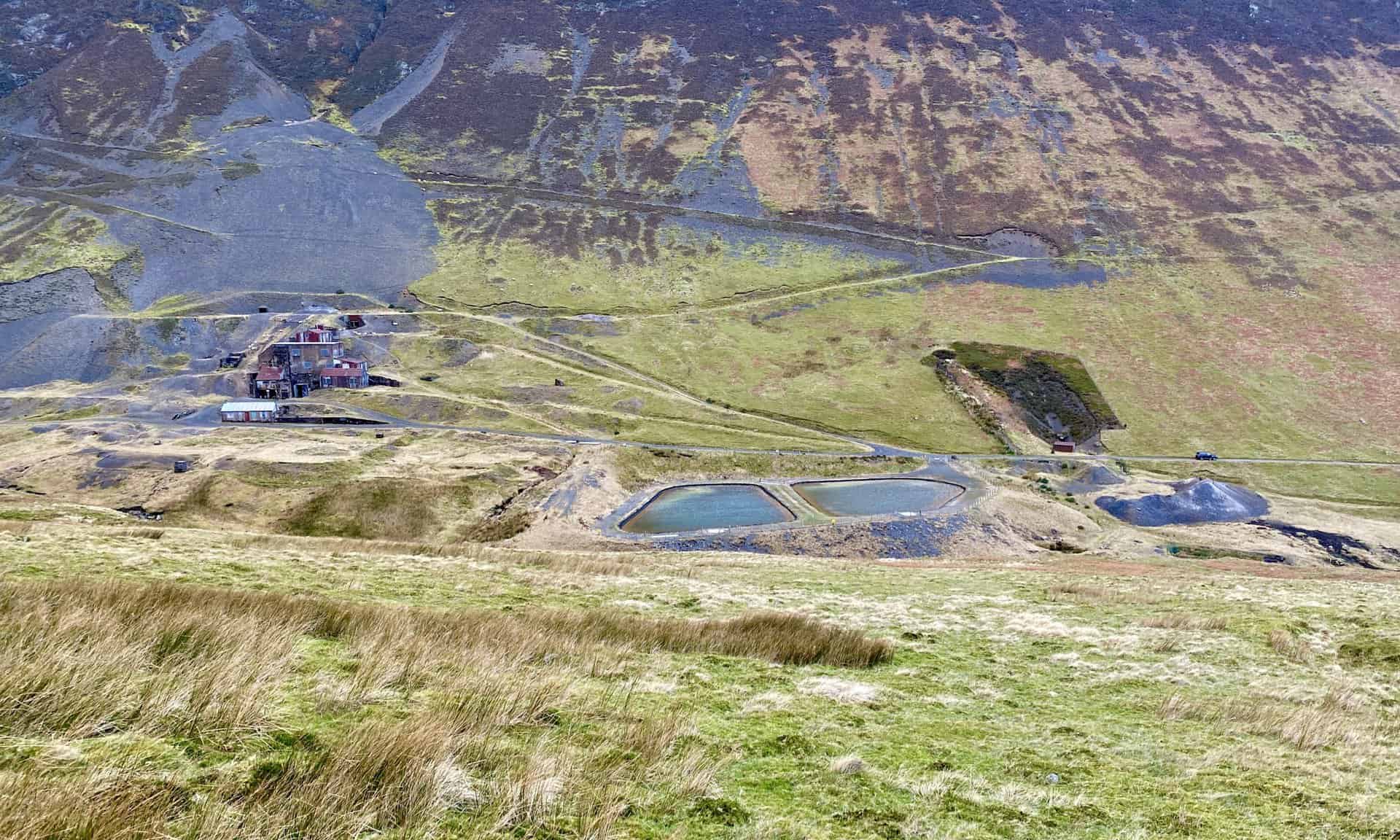
Force Crag Mine
Force Crag Mine is the last working mineral mine in the Lake District. Lead, zinc and barytes have been mined at the site for over 130 years. This particular mill was built in 1908-1909 and modified in 1940.
The National Trust acquired the mine and mineral rights in 1979. The mine ceased working in 1991 and was finally declared abandoned in 1992. The mill building was restored in 2004 and is now open for guided tours.
In 2001 Force Crag Mine was recognised as being of national importance and designated a Scheduled Monument by English Heritage.
As the last working mineral mine in the Lake District, Force Crag is a unique site. Scheduling has ensured the protection of the mill buildings and machinery, spoil heaps and remaining workings. The unusual variety of minerals found at Force Crag has led to the site being registered as a Site of Special Scientific Interest (SSSI).
The mine is a highlight of this Grisedale Pike walk, about three-quarters of the way round.
The village of Braithwaite, with Portinscale and Keswick in the background.
Amazon’s Top Walking Boots: Four Standout Choices for Men and Women
For walking and hiking, the right boots are essential for both comfort and safety. While Amazon boasts a wide range, certain boots emerge as top-sellers. From those, here are four I personally favour. As an Amazon affiliate, I may earn a small commission from any purchases made through the links provided. This helps support the upkeep of this website. Rest assured, you won’t pay a penny extra, but your purchase will contribute to keeping my site running smoothly. Happy walking!

Berghaus Men’s Hillmaster II Gore-Tex Walking Boots
These fully waterproof leather walking boots feature a Gore-Tex lining, ensuring no water enters whilst allowing feet to breathe and stay cool. Made from full-grain leather, they promise unmatched durability and comfort. The boots come with memory foam tongues and cuffs that mould to your feet for a tailored fit, and the Vibram Hillmaster outsoles offer confidence on challenging terrains.

Salewa Men’s Mountain Trainer Mid Gore-Tex Walking Boots
Made from durable suede and abrasion-resistant textile, these men’s hiking boots are both lightweight and sturdy. The upper material is enhanced by a 360° full rubber sheath. Their dual-layer midsole with Bilight technology ensures ergonomic cushioning and grip, especially on extended hikes. The Vibram Wrapping Thread Combi outsoles allow a natural walking feel, and the Gore-Tex lining provides waterproofing, breathability, and optimal weather protection. Furthermore, the patented Salewa 3F system ensures flexibility, a secure heel grip, and a blister-free fit.

Berghaus Women’s Supalite II Gore-Tex Walking Boots
Specially designed for women, these hiking boots offer waterproofing and breathability, thanks to their Gore-Tex lining. Crafted from full-grain abrasion-resistant leather, they’re durable enough for the toughest hikes. The Supalite soles ensure stability and traction, and the EVA midsoles add comfort for extended walks.

Merrell Women’s Moab 3 Mid Gore-Tex Walking Boots
These hiking boots incorporate a Gore-Tex waterproof membrane, blending breathability with superior waterproof performance. The combination of pigskin leather and mesh on the uppers, along with the suede outer material, ensure durability and style. Enhancements include 100% recycled laces, webbing, and mesh lining. Additionally, bellows tongues, protective toe caps, and Vibram TC5+ rubber soles ensure protection and ease on any terrain.