Five Wainwright Peaks to Conquer on this Newlands Horseshoe Walk
Begin your Newlands Horseshoe walk with roadside parking near Gutherscale, just north-east of Skelgill. Start by ascending south up and across the Skelgill Bank ridge. Continue south to Cat Bells, the first Wainwright summit. Enjoy stunning Derwent Water views from the outset. Proceed along the ridge to Maiden Moor, your second Wainwright. This popular Lake District walk boasts clear, well-defined paths.
Continue your journey south to High Spy, the third Wainwright fell of the day. Then, head south from High Spy to Dalehead Tarn. This area, lower down and sheltered, is ideal for a lunch break. The next challenge is ascending to Dale Head’s summit, the fourth Wainwright fell and highest point of the Newlands Horseshoe walk. Revel in spectacular views north down the Newlands Beck valley.
Next, journey west from Dale Head, crossing Hindscarth Edge. Here, enjoy breathtaking vistas towards Buttermere and Crummock Water. Then, head north to Hindscarth, the fifth and final Wainwright fell. After Hindscarth, continue along the ridge north-east and descend via Scope End. This descent includes tricky sections that may require scrambling.
After descending Scope End, head north to Little Town. Then continue north-east across the countryside back to Skelgill and the car park. This remarkable 10½ mile high-level Lake District walk encapsulates the essence of a horseshoe-style trek.
Newlands Horseshoe Walk: Maps and Tools
Visit either the OS Maps website or the Outdooractive website to view this walking route in greater detail. Both platforms offer a range of features, including the ability to print the route, download it to your device, and export the route as a GPX file. You can also watch a 3D fly-over and share the route on social media.
Newlands Horseshoe Walk: Distance, Duration, Statistics
Distance: 10½ miles
Distance: 16½ kilometres
Duration: 6 hours
Ascent: 3459 feet
Ascent: 1054 metres
Type: Circular walk
About the Newlands Horseshoe
The Newlands Horseshoe walk in the Lake District is an exceptional and popular circular trail, renowned for embracing the main peaks around the Newlands Beck valley. This trek is a high point for those seeking a high-level ridge walking experience, offering breathtaking views and a challenging adventure. As one of the Lake District’s classic horseshoe circuits, it stands alongside other notable routes like the Coledale Horseshoe and Kentmere Horseshoe.
Encompassing six Wainwright peaks, the walk includes Catbells, Maiden Moor, High Spy, Dale Head, Hindscarth, and Robinson. Dale Head, the highest peak at 753 meters, towers at the head of the Newlands Beck valley, adding a majestic backdrop to the south of the trail. Commonly embarked from either Littletown or Gutherscale, enthusiasts often prefer to tackle this route in a clockwise direction.
Unique to the Newlands Horseshoe walk is the flexibility it offers. Walkers can either extend or shorten their journey. A popular variation, favoured by the esteemed British fellwalker and guidebook author Alfred Wainwright, excludes Robinson, opting for a descent via Hindscarth and Scope End. This alternative route, highlighted on this page, rewards hikers with unparalleled views of the Newlands Beck valley, making it a truly memorable experience.
Whether you’re a seasoned walker or a curious explorer, the Newlands Horseshoe walk promises a remarkable journey through some of the most stunning landscapes the Lake District has to offer. It’s not just a walk; it’s an adventure that encapsulates the essence of the majestic Lake District.
Recommended Ordnance Survey Map
The best map to use on this walk is the Ordnance Survey map of the Lake District North-Western Area, reference OS Explorer OL4, scale 1:25,000. It clearly displays footpaths, rights of way, open access land and vegetation on the ground, making it ideal for walking, running and hiking. The map can be purchased from Amazon in either a standard, paper version or a weatherproof, laminated version, as shown below.
Standard Version
Newlands Horseshoe Walk: My Photos
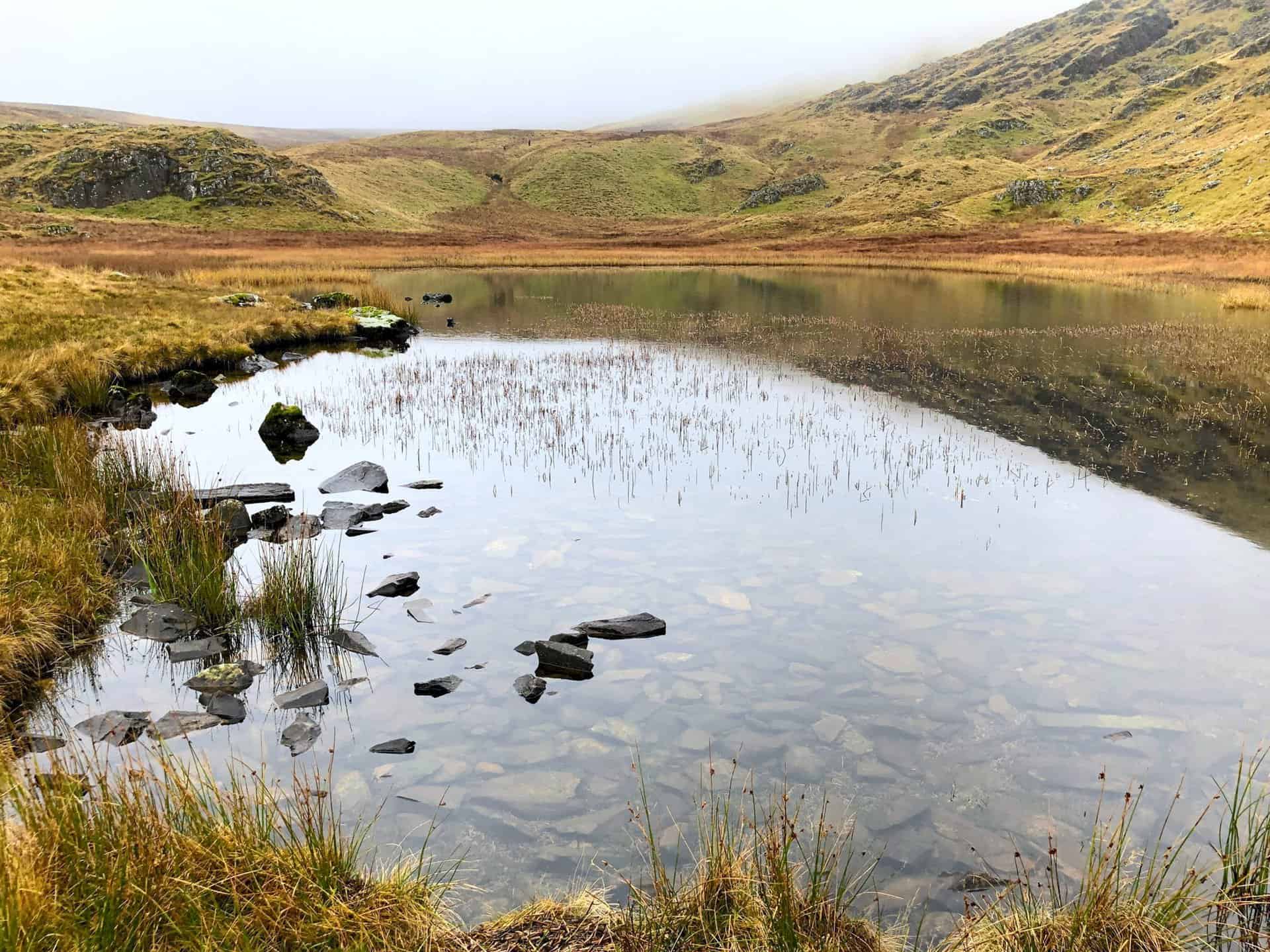
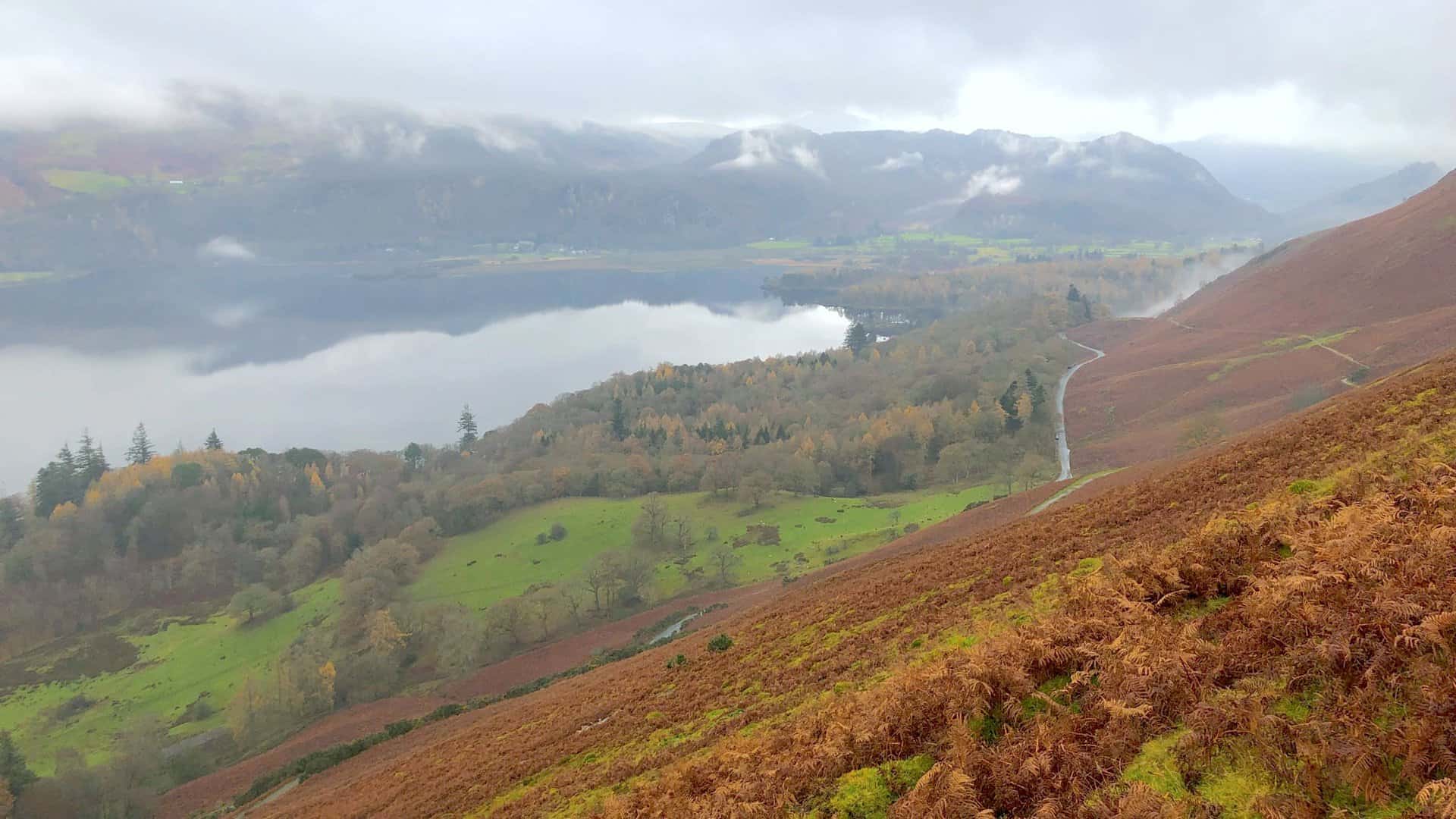
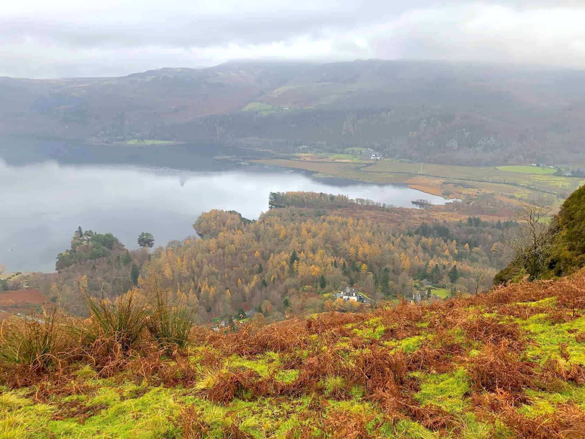
The view over Derwent Water from Skelgill Bank on a misty but very atmospheric morning.
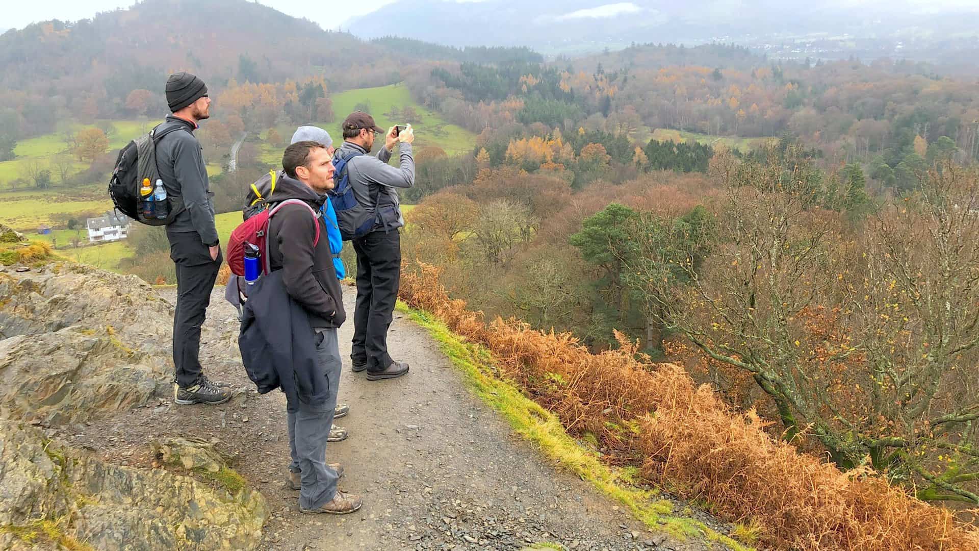
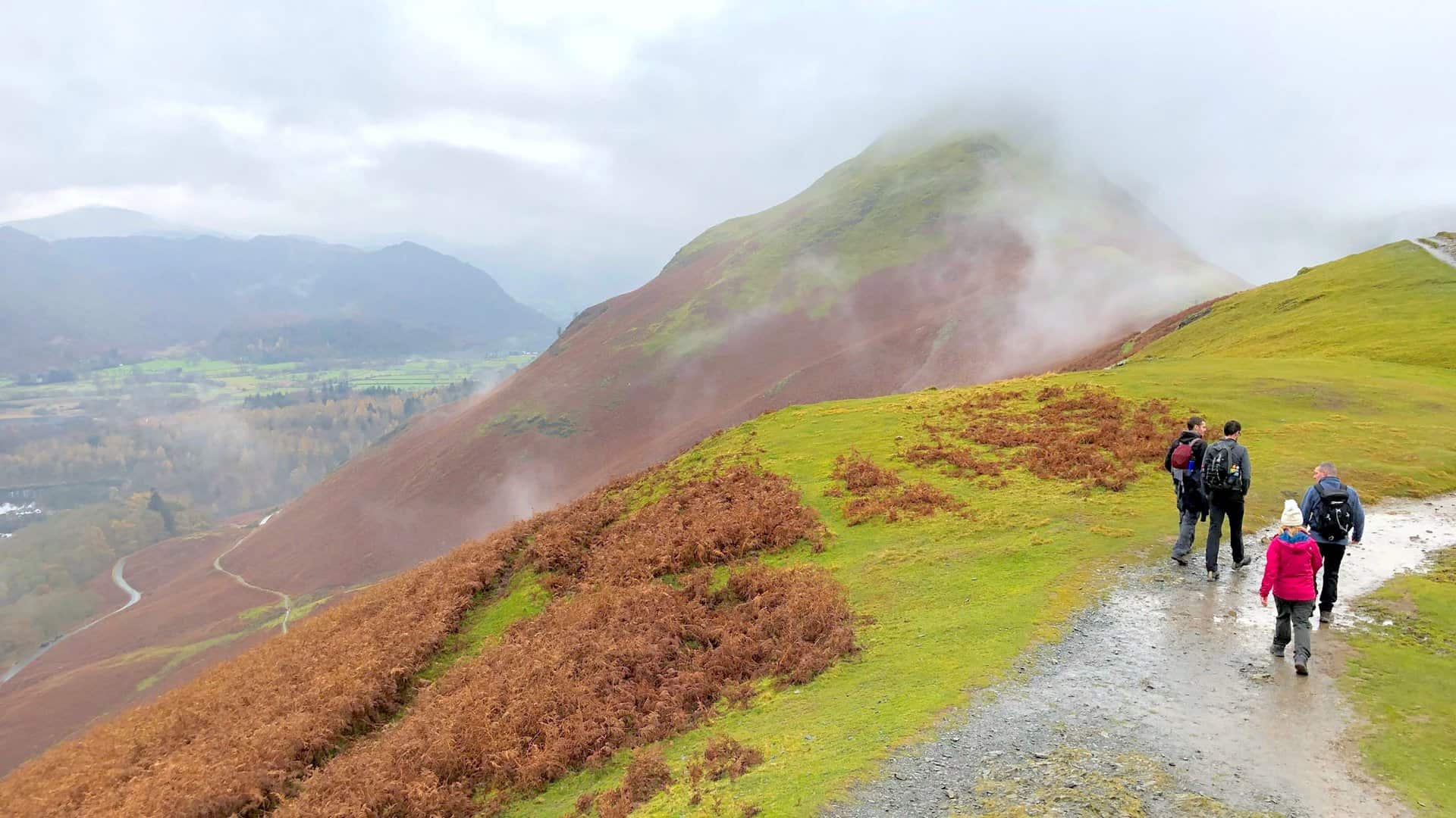
Enjoying the views soon after the start of the Newlands Horseshoe walk.
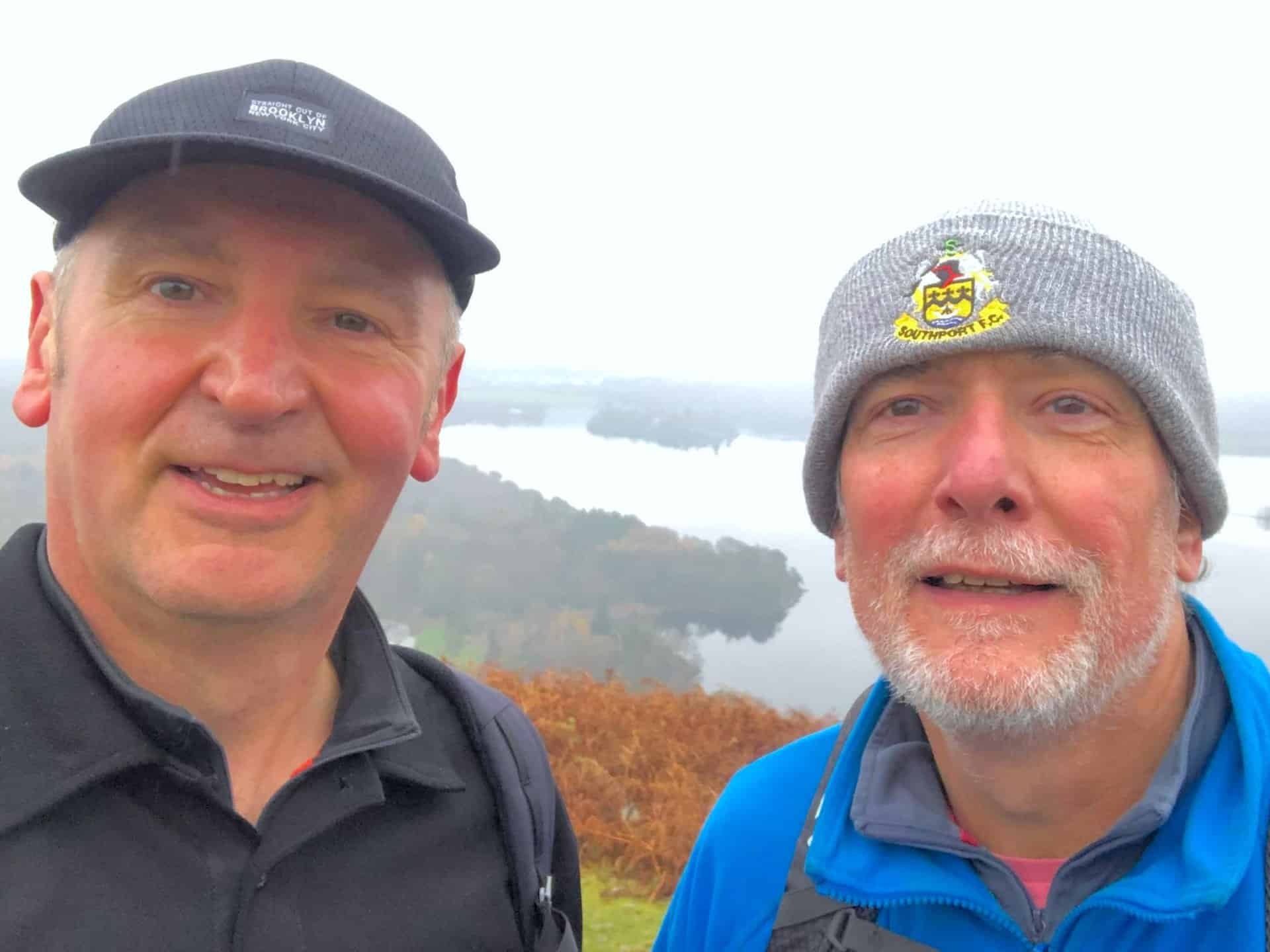
Mike and I, with Derwent Water in the background.
Looking towards the southern end of Derwent Water from Skelgill Bank.
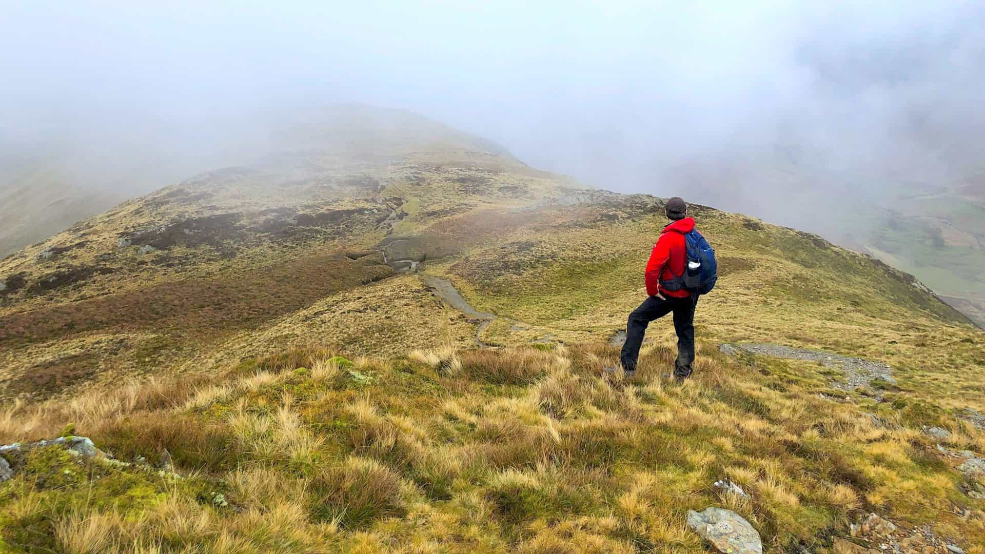
The top of Cat Bells comes into view. The fog would hang over higher ground for the rest of the day.
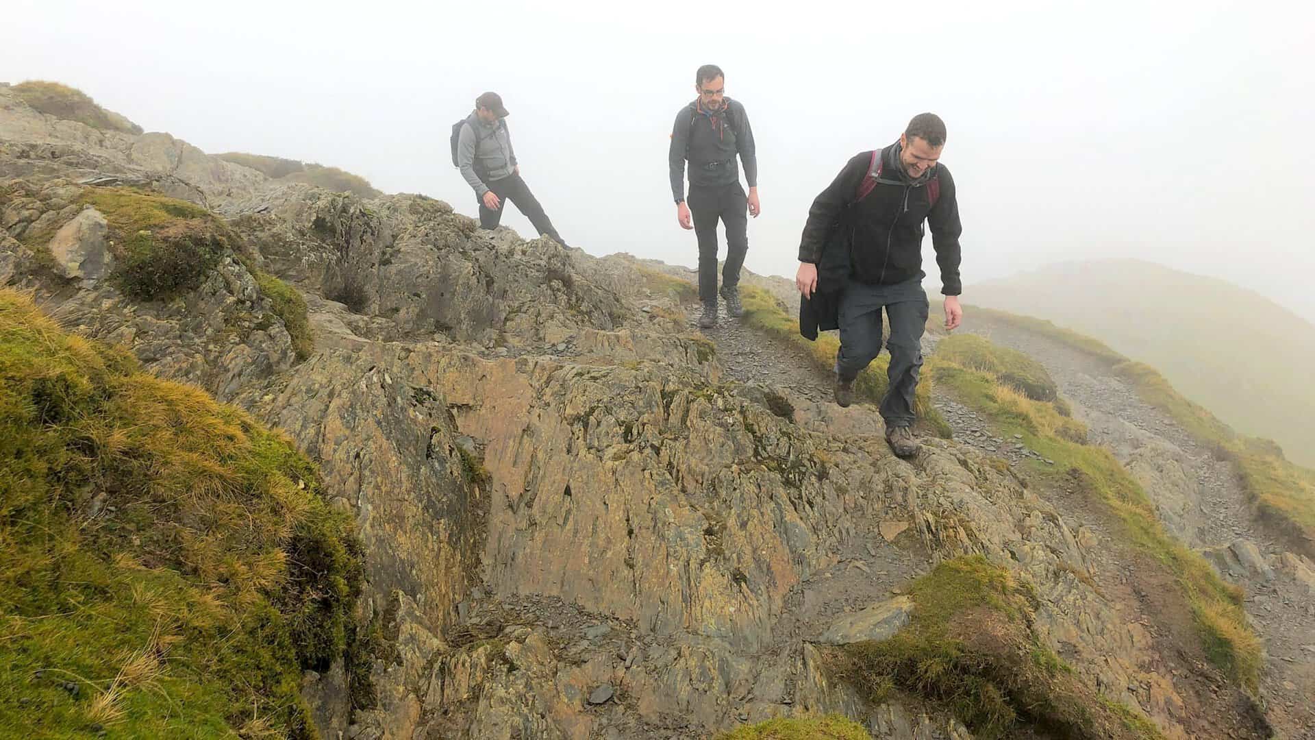
One of a few instances where extra care was needed on the wet slippery rocks.
The Cat Bells summit, height 451 metres (1480 feet).
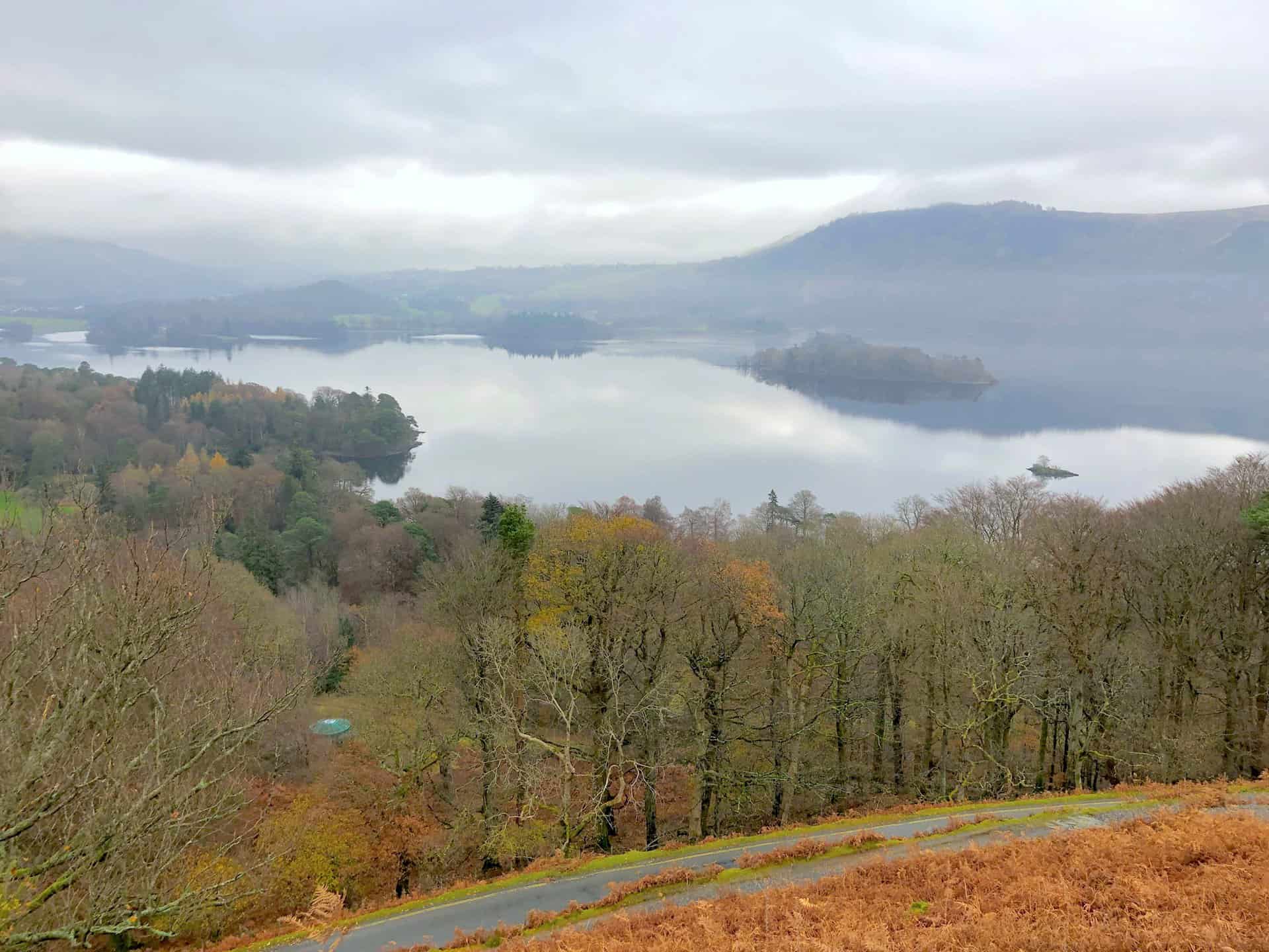
The view east towards the Lodore Falls Hotel nestled below Ashness Fell.
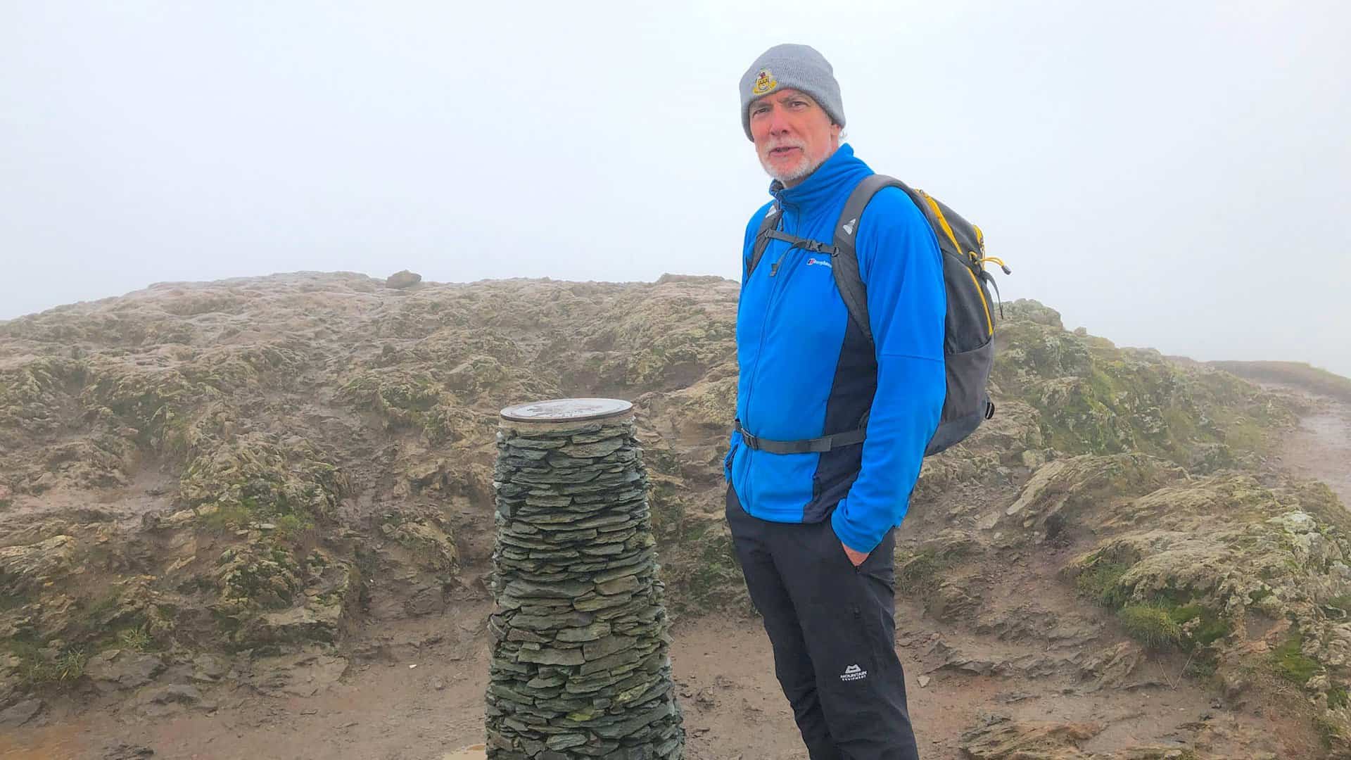
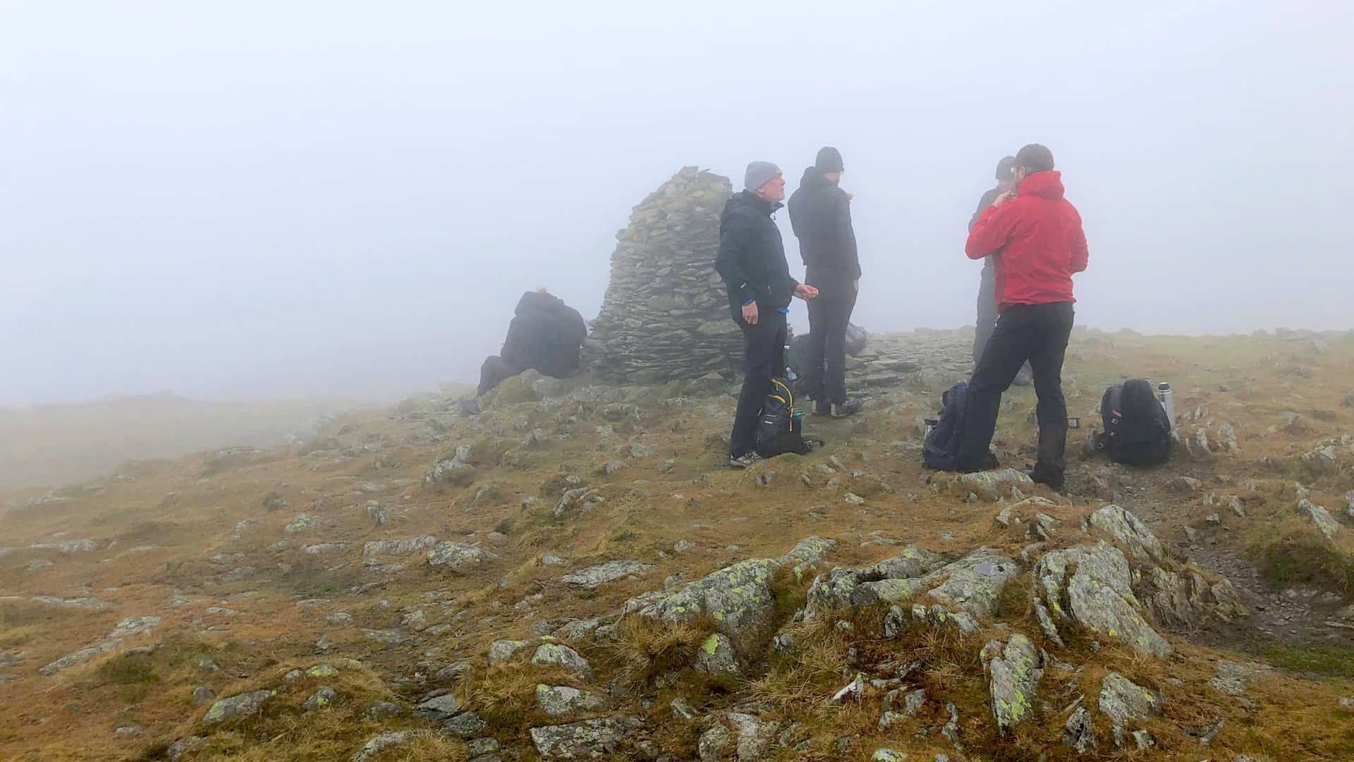
The summit of High Spy, height 653 metres, 2142 feet. We’re about one-third of the way round our Newlands Horseshoe walk.
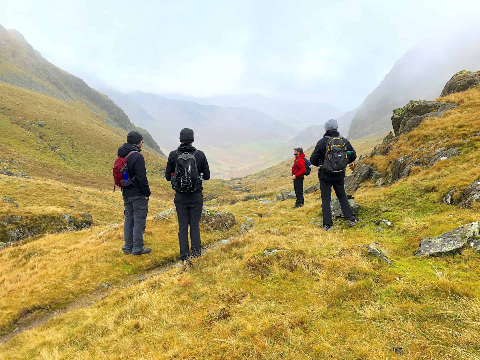
Mike, Jamie and Mick look north down into the Newlands Beck valley, whilst Nick contemplates our impending climb to the top of Dale Head.
Dalehead Tarn. A fantastic spot for a coffee break or lunch on the Newlands Horseshoe walk.
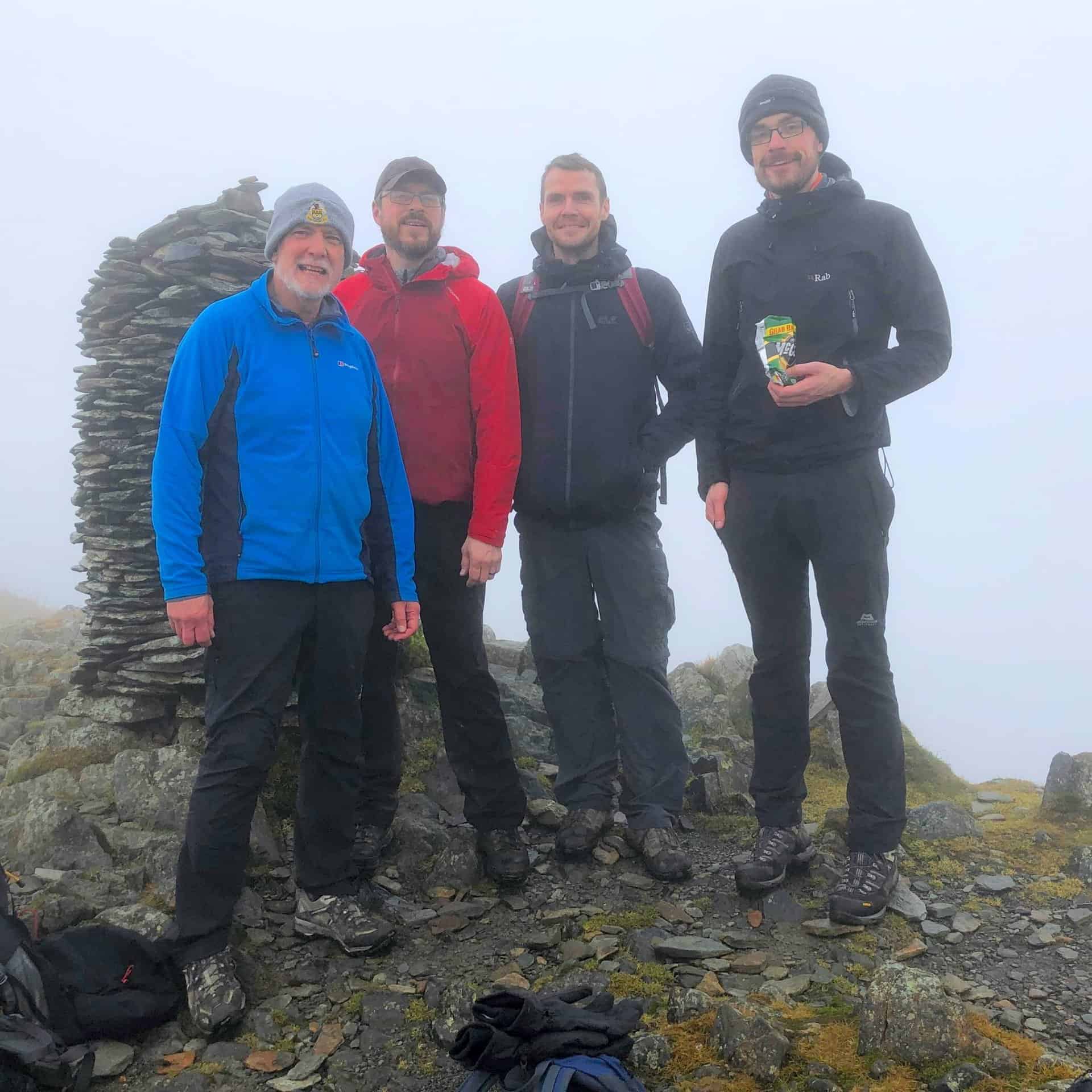
The summit of Dale Head, height 753 metres, 2470 feet. This is roughly halfway around the Newlands Horseshoe walk.
The descent from Hindscarth to Little Town via High Craggs and Scope End.
Amazon’s Top Walking Boots: Four Standout Choices for Men and Women
For walking and hiking, the right boots are essential for both comfort and safety. While Amazon boasts a wide range, certain boots emerge as top-sellers. From those, here are four I personally favour. As an Amazon affiliate, I may earn a small commission from any purchases made through the links provided. This helps support the upkeep of this website. Rest assured, you won’t pay a penny extra, but your purchase will contribute to keeping my site running smoothly. Happy walking!

Berghaus Men’s Hillmaster II Gore-Tex Walking Boots
These fully waterproof leather walking boots feature a Gore-Tex lining, ensuring no water enters whilst allowing feet to breathe and stay cool. Made from full-grain leather, they promise unmatched durability and comfort. The boots come with memory foam tongues and cuffs that mould to your feet for a tailored fit, and the Vibram Hillmaster outsoles offer confidence on challenging terrains.

Salewa Men’s Mountain Trainer Mid Gore-Tex Walking Boots
Made from durable suede and abrasion-resistant textile, these men’s hiking boots are both lightweight and sturdy. The upper material is enhanced by a 360° full rubber sheath. Their dual-layer midsole with Bilight technology ensures ergonomic cushioning and grip, especially on extended hikes. The Vibram Wrapping Thread Combi outsoles allow a natural walking feel, and the Gore-Tex lining provides waterproofing, breathability, and optimal weather protection. Furthermore, the patented Salewa 3F system ensures flexibility, a secure heel grip, and a blister-free fit.

Berghaus Women’s Supalite II Gore-Tex Walking Boots
Specially designed for women, these hiking boots offer waterproofing and breathability, thanks to their Gore-Tex lining. Crafted from full-grain abrasion-resistant leather, they’re durable enough for the toughest hikes. The Supalite soles ensure stability and traction, and the EVA midsoles add comfort for extended walks.

Merrell Women’s Moab 3 Mid Gore-Tex Walking Boots
These hiking boots incorporate a Gore-Tex waterproof membrane, blending breathability with superior waterproof performance. The combination of pigskin leather and mesh on the uppers, along with the suede outer material, ensure durability and style. Enhancements include 100% recycled laces, webbing, and mesh lining. Additionally, bellows tongues, protective toe caps, and Vibram TC5+ rubber soles ensure protection and ease on any terrain.