A Guide to Completing Five Wainwright Fells on the Newlands Horseshoe Walk
Begin your Newlands Horseshoe walk at Little Town, nestled in the Newlands Beck valley of the Lake District. Locate the car park adjacent to Chapel Bridge, on the hamlet’s south-west side. From here, cross the bridge and proceed west towards Newlands Church. Continue briefly along the road before heading south-east across the fields on a public footpath towards Low Snab, marking the start of your ascent.
Ascend towards Scope End, climbing further to reach High Crags. Traverse the ridge, continuing your upward journey to the summit of Hindscarth. Next, head south to find the path leading east along Hindscarth Edge, guiding you to Dale Head, the pinnacle of the Newlands Horseshoe.
Begin your descent on Dale Head’s steep eastern slopes, making your way to Dalehead Tarn. Cross Newlands Beck, then navigate north, ascending to High Spy’s summit. Proceed northward across Maiden Moor, sticking to the well-marked ridge path before descending to Cat Bells’ peak.
Advance a bit further north along the path towards Skelgill Bank. Here, look westward down the grassy slopes to spot unmarked but visible paths. Choose one to descend into the valley, eventually joining the track that veers south and then west, skirting the steep slopes back to Little Town.
This splendid Lake District horseshoe walk spans approximately 9½ miles and guarantees an unforgettable experience. The panoramic views encountered throughout this trek are truly spectacular, making for a rewarding exploration of the Newlands Horseshoe.
The Newlands Horseshoe can be navigated in either a clockwise or anti-clockwise direction. The route detailed on this page follows the anti-clockwise path, commencing from Little Town. My website features another Newlands Horseshoe walk, which takes a clockwise approach, is about a mile longer, and starts from Gutherscale, located just north-east of Skelgill.
The Newlands Horseshoe: Maps and Tools
Visit either the OS Maps website or the Outdooractive website to view this walking route in greater detail. Both platforms offer a range of features, including the ability to print the route, download it to your device, and export the route as a GPX file. You can also watch a 3D fly-over and share the route on social media.
The Newlands Horseshoe: Distance, Duration, Statistics
Distance: 9½ miles
Distance: 15¼ kilometres
Duration: 5½ hours
Ascent: 3381 feet
Ascent: 1031 metres
Type: Circular walk
About the Newlands Horseshoe
The Newlands Horseshoe walk in the Lake District is a celebrated circular trail, acclaimed for its comprehensive route around the principal peaks of the Newlands Beck valley. Specifically designed for those seeking a rewarding ridge-walking experience, it showcases stunning views and offers a spirited challenge. Recognised as an iconic among the Lake District’s horseshoe circuits, it ranks alongside distinguished paths like the Coledale Horseshoe and the Kentmere Horseshoe.
Walkers have the flexibility to traverse the Newlands Horseshoe in either a clockwise or anti-clockwise direction. The journey described here adopts the anti-clockwise route starting at Little Town. Opting for a clockwise path, conversely, adds approximately a mile, beginning from Gutherscale. The walk’s adaptability is further highlighted by the option to extend the adventure with the inclusion of Robinson’s summit.
Ideally suited for both seasoned trekkers and those new to exploring, the Newlands Horseshoe promises a memorable expedition through some of the most captivating landscapes the Lake District has to offer, truly embodying the area’s majestic allure.
Recommended Ordnance Survey Map
The best map to use on this walk is the Ordnance Survey map of the Lake District North-Western Area, reference OS Explorer OL4, scale 1:25,000. It clearly displays footpaths, rights of way, open access land and vegetation on the ground, making it ideal for walking, running and hiking. The map can be purchased from Amazon in either a standard, paper version or a weatherproof, laminated version, as shown below.
Standard Version
The Newlands Horseshoe: My Photos
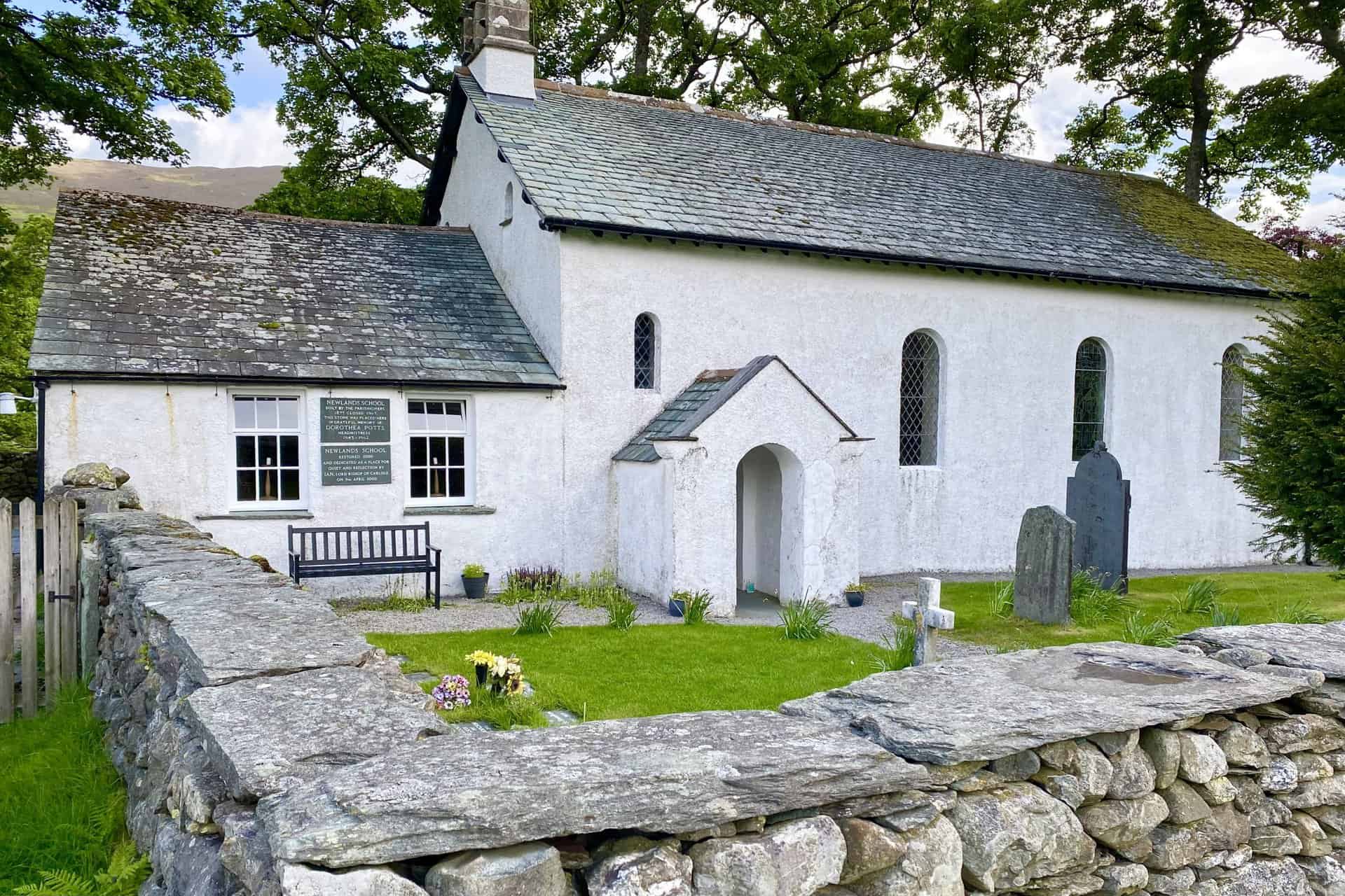
Grade 2 listed, 16th-century Newlands Church just outside the hamlet of Little Town. Attached to the church is a former school. The plaques on the wall read as follows:
NEWLANDS SCHOOL
BUILT BY THE PARISHIONERS
1877, CLOSED 1967
THIS STONE WAS PLACED HERE
IN GRATEFUL MEMORY OF
DOROTHEA POTTS
HEADMISTRESS
1943-1962
NEWLANDS SCHOOL
RESTORED 2000
AND DEDICATED AS A PLACE FOR
QUIET AND REFLECTION BY
IAN, LORD BISHOP OF CARLISLE
ON 9TH APRIL 2000
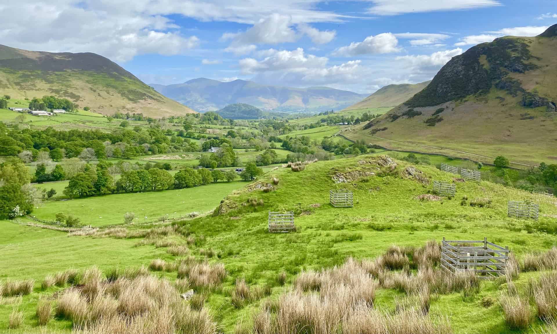
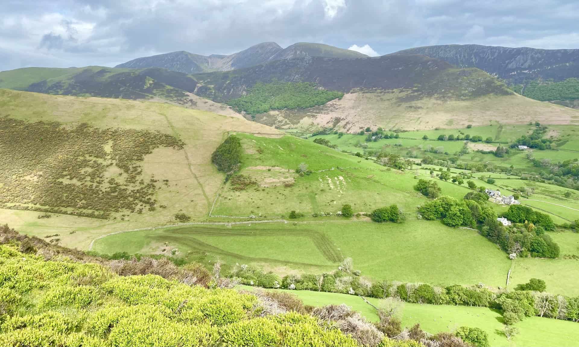
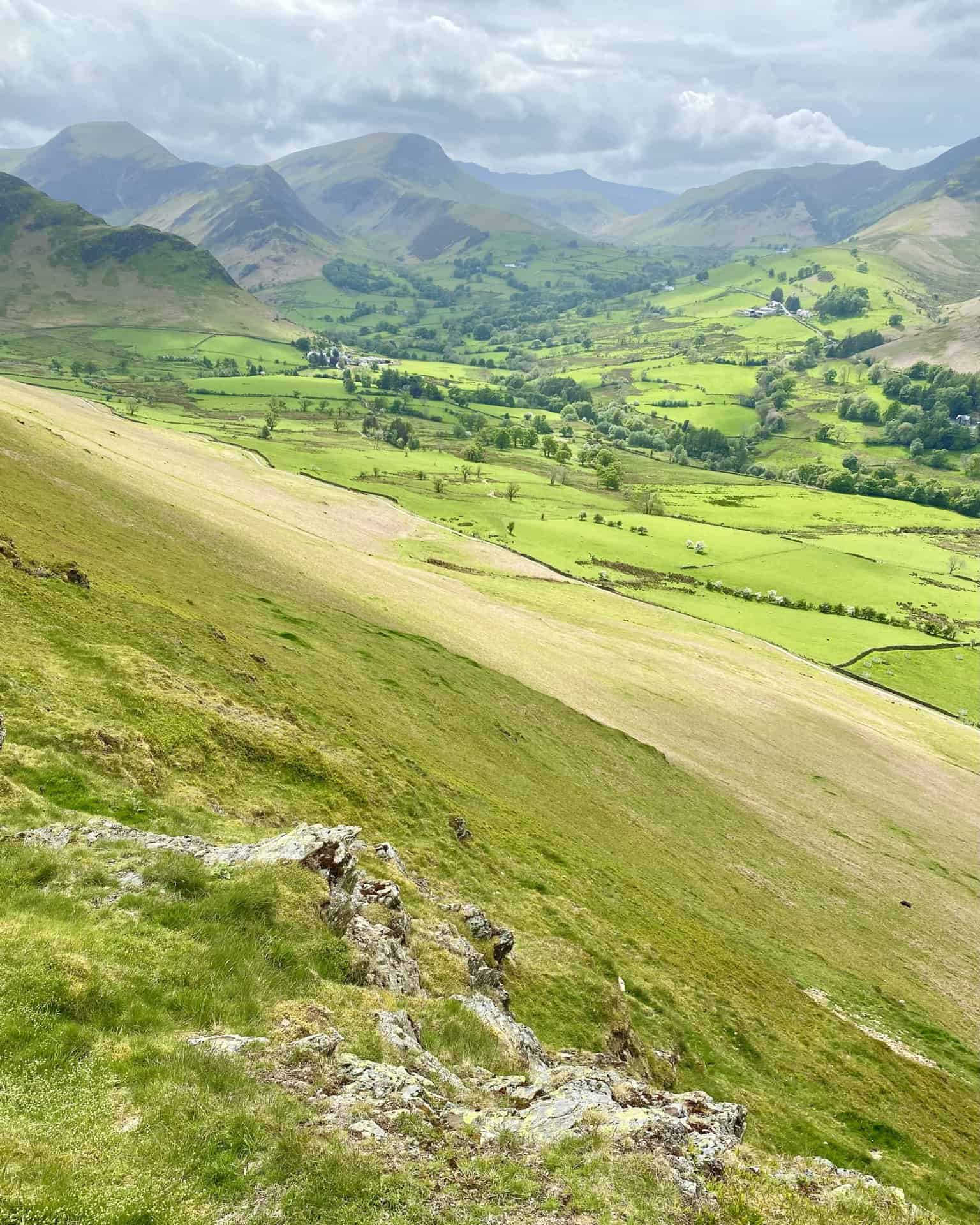
The view from Low Snab north through the Newlands valley towards the Skiddaw mountain range.
Causey Pike with its distinctive cone-shaped top as seen during the ascent of Scope End.
Looking west towards Sail, Crag Hill and Wandope, the three high points on the horizon, centre of picture.
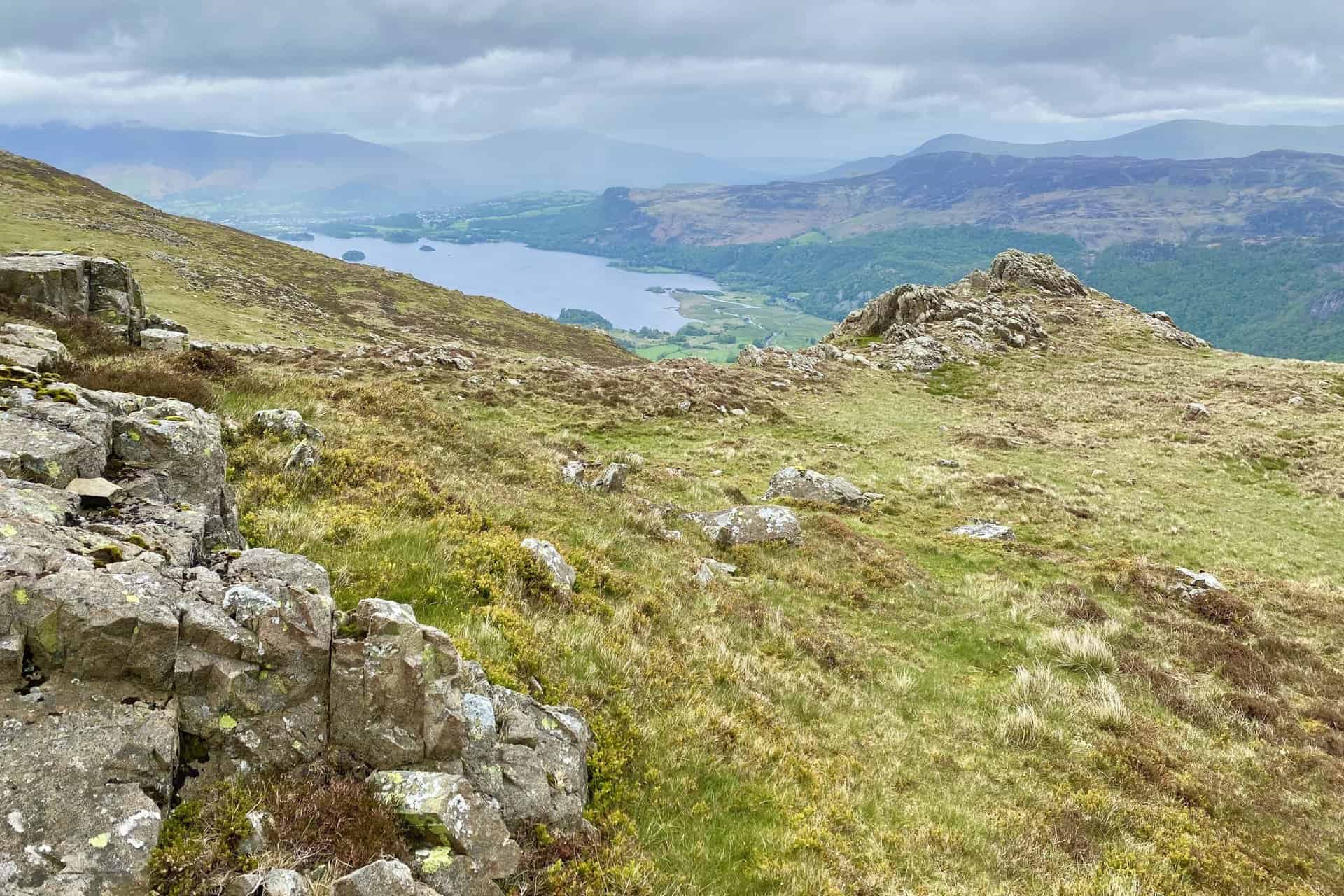
The view of Hindscarth (centre) and Dale Head (left) from Scope End.

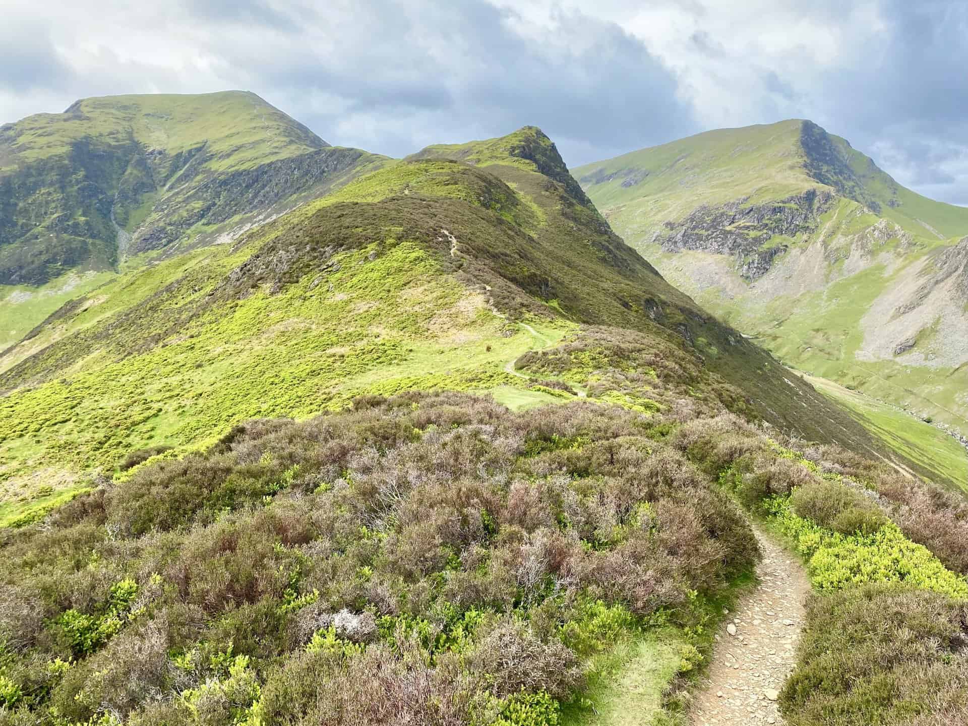
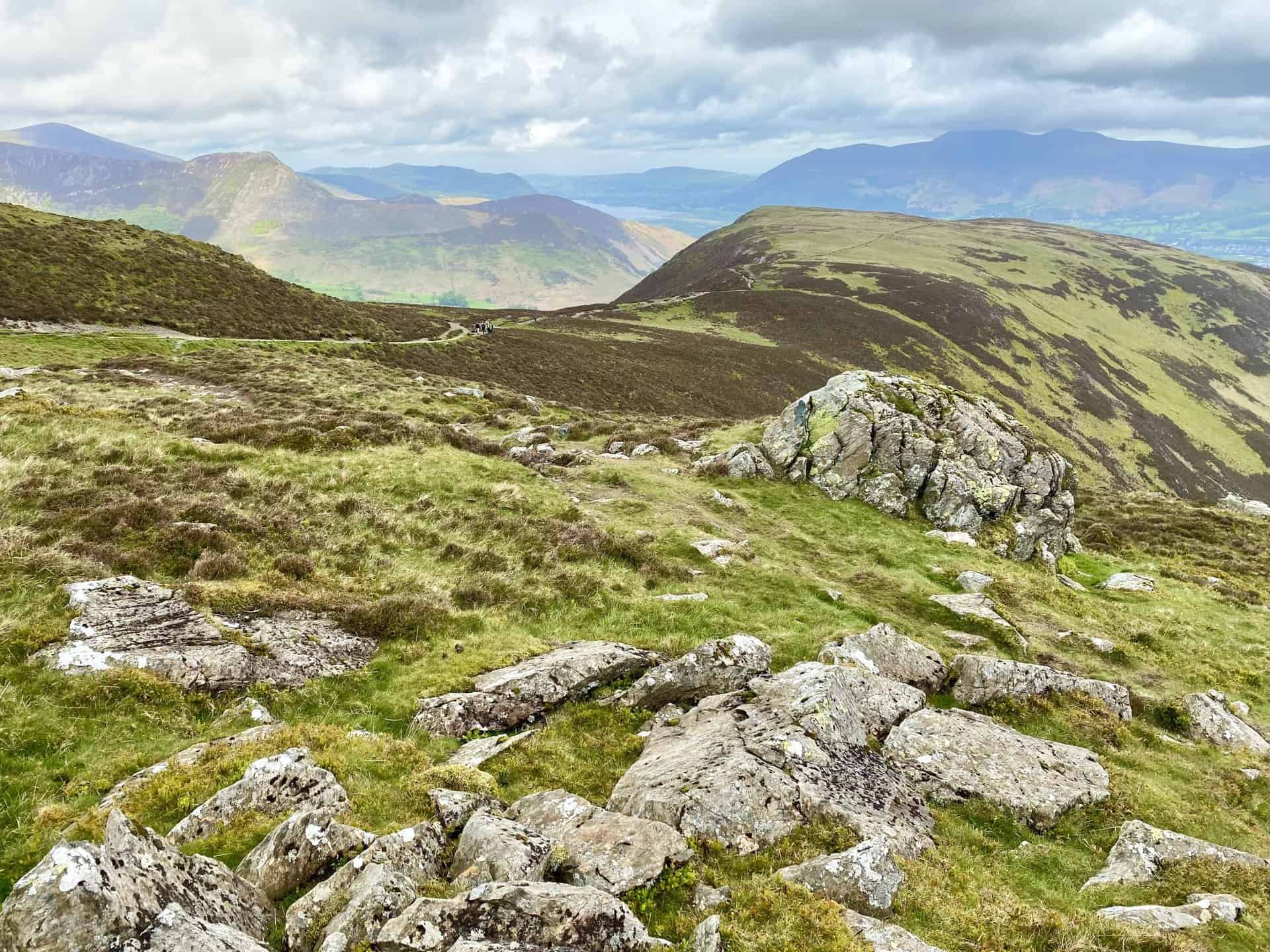
Heading towards High Crags, with Robinson on the right and Hindscarth on the left.
The steep, craggy, west-facing slopes of the High Spy / Maiden Moor ridge.
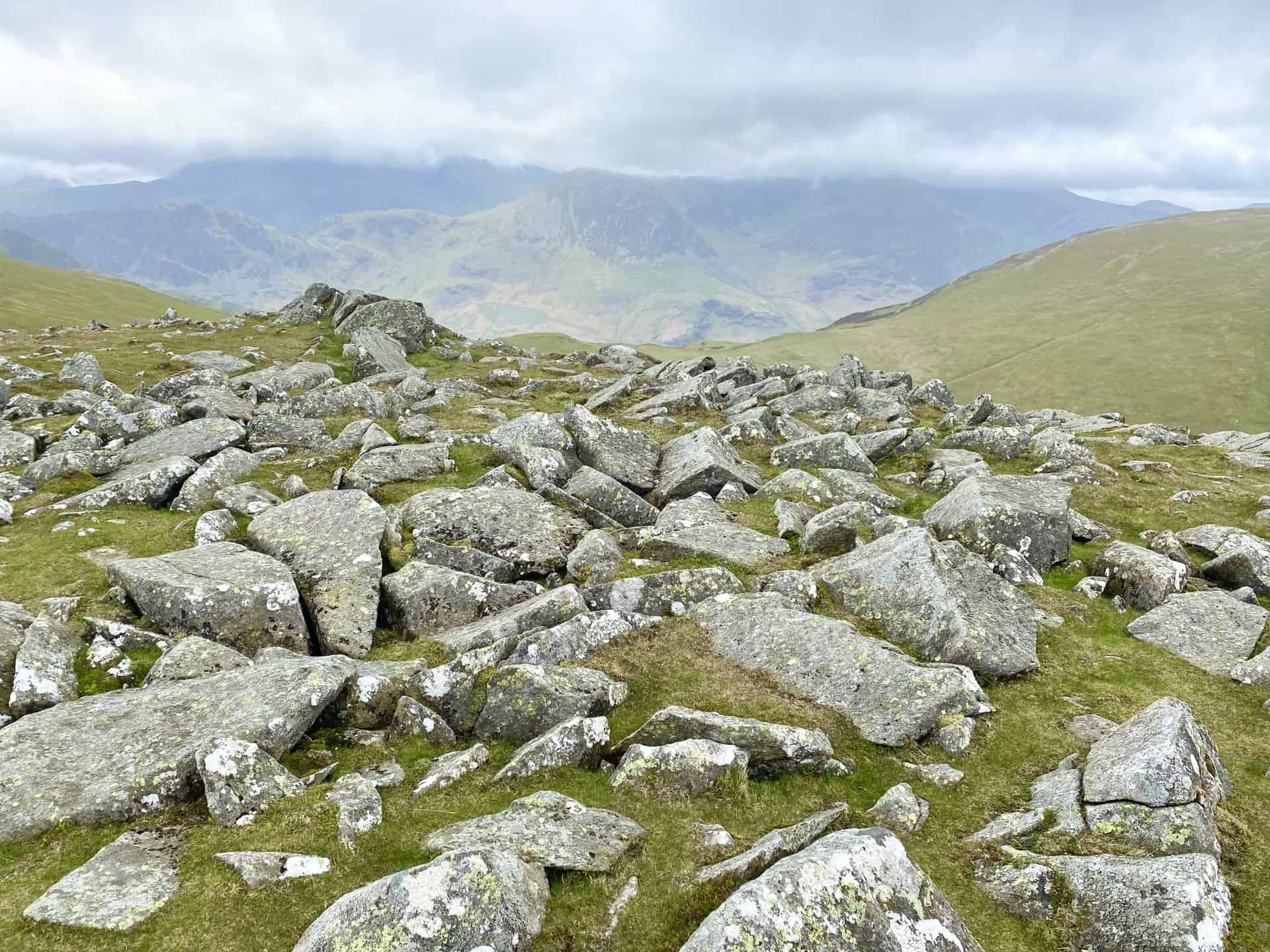
Looking back at High Crags and Scope End, with the Skiddaw and Blencathra mountain ranges in the distance.
The summit of Hindscarth, height 727 metres (2385 feet). This is roughly one-third of the way round the Newlands Horseshoe.
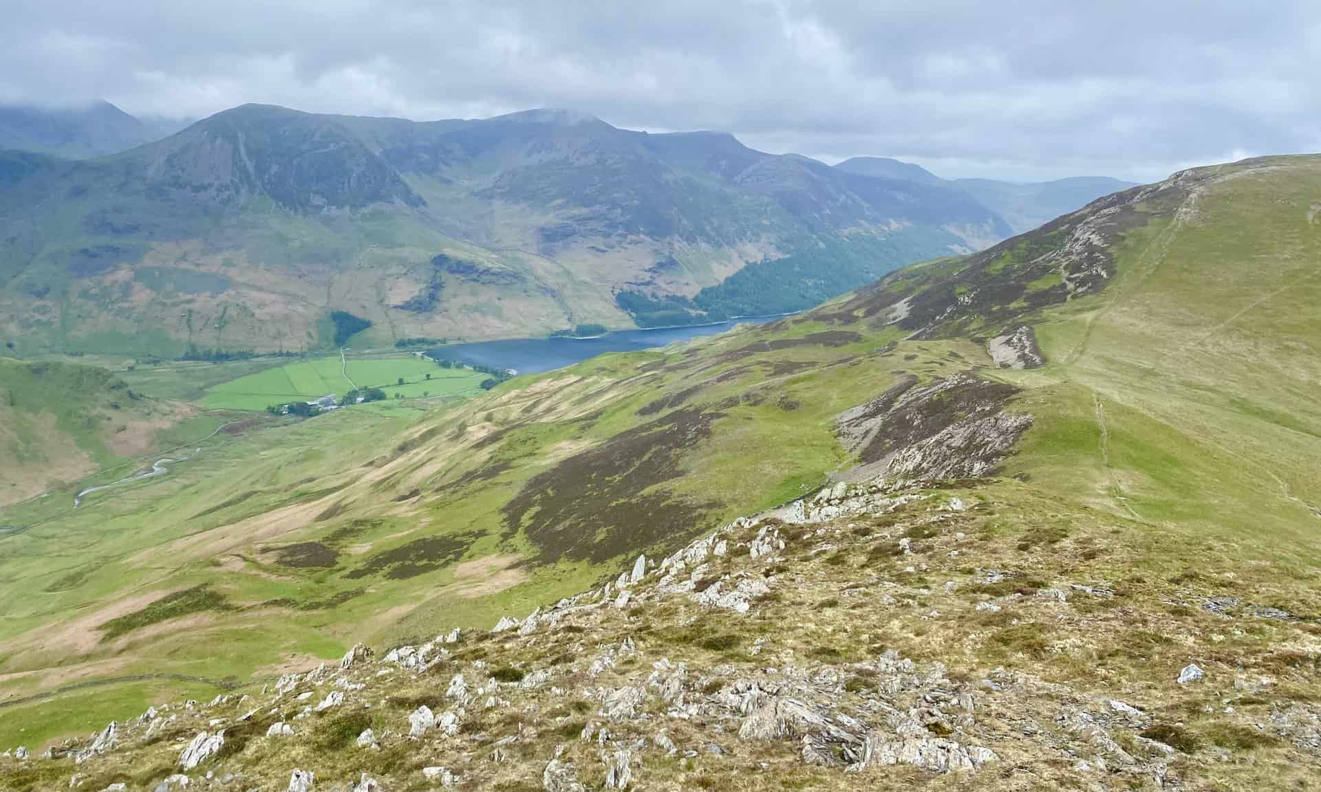
Buttermere comes into view as I join the Littledale Edge / Hindscarth Edge footpath. The lake is backed by the three high points of Red Pike, High Stile and High Crag.
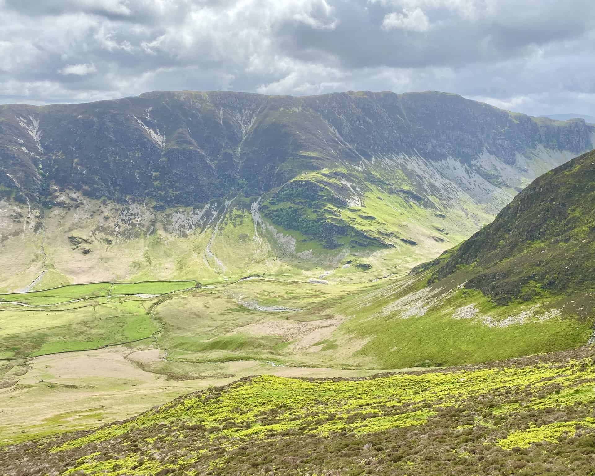
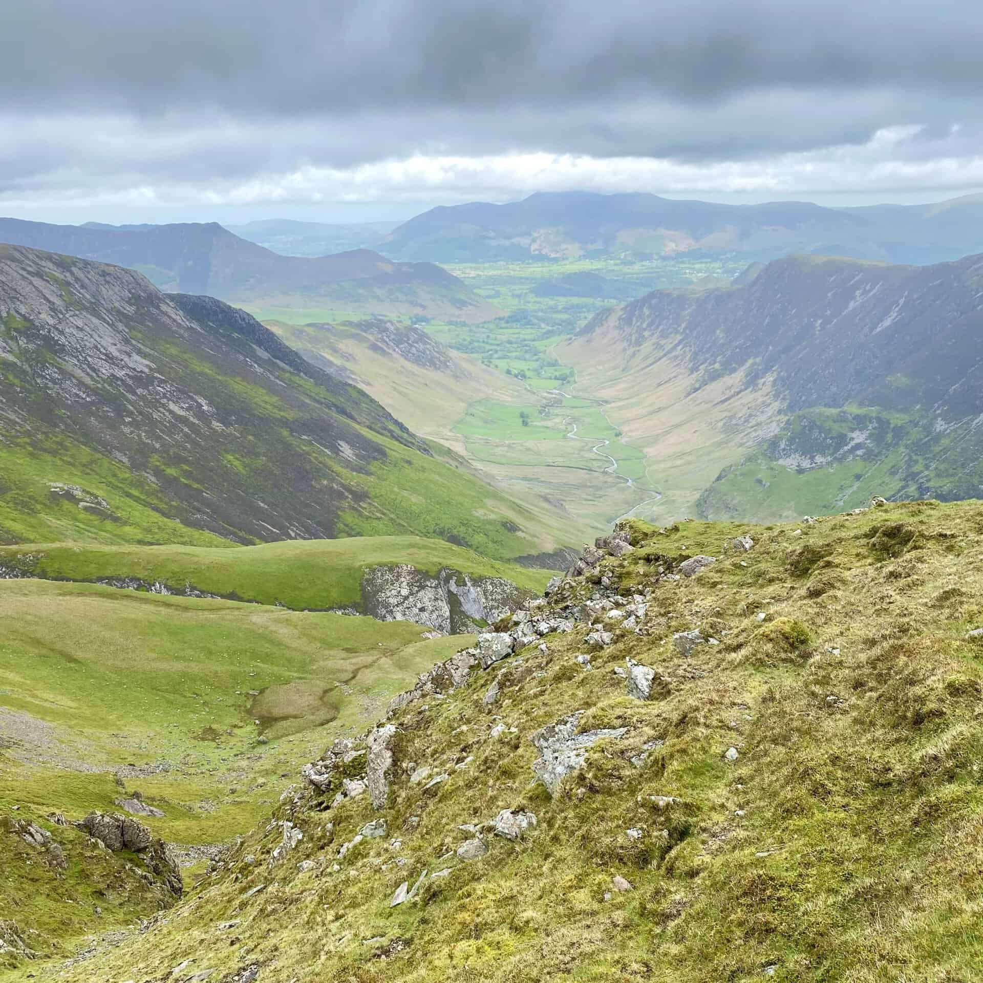
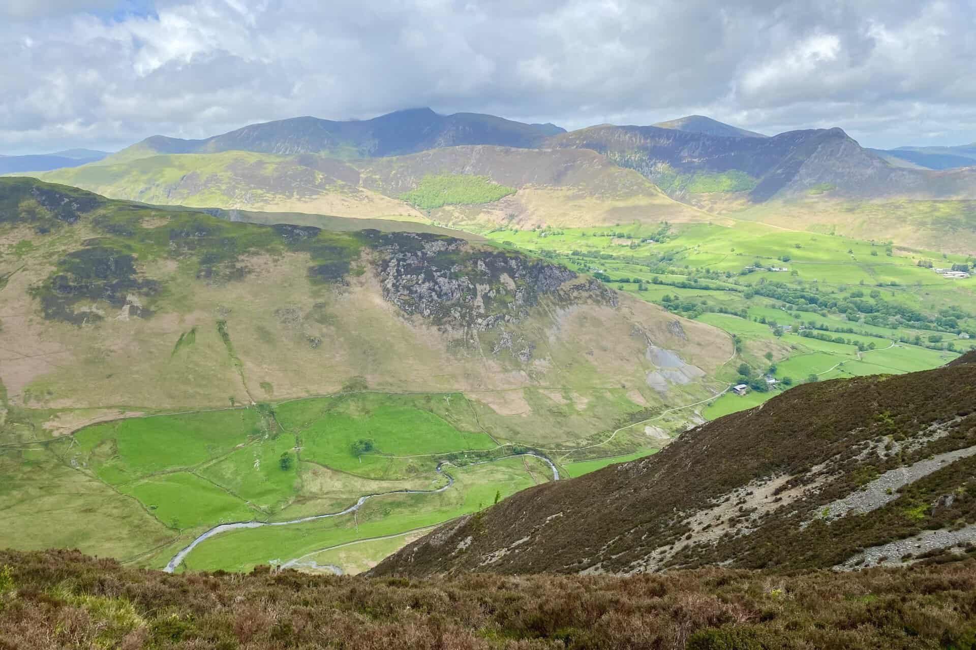
The Newlands valley as seen from Dale Head.
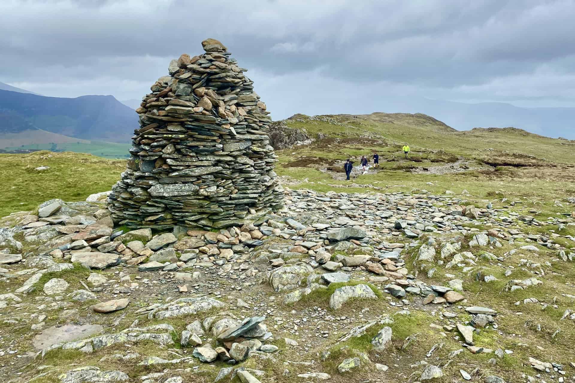
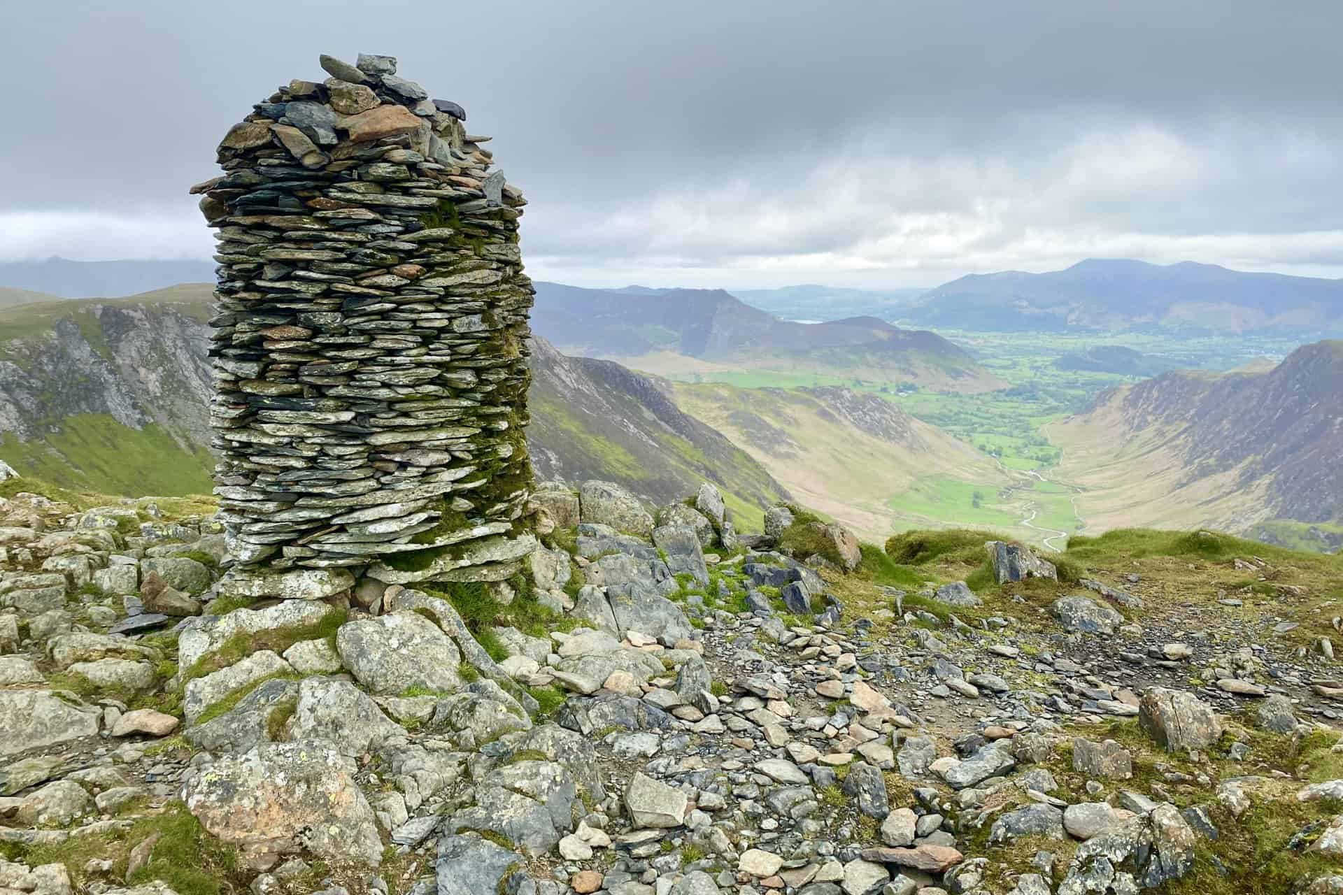
The summit cairn of Dale Head, height 753 metres (2470 feet).
Dalehead Tarn. The tarn is the halfway point of this Newlands Horseshoe walk.
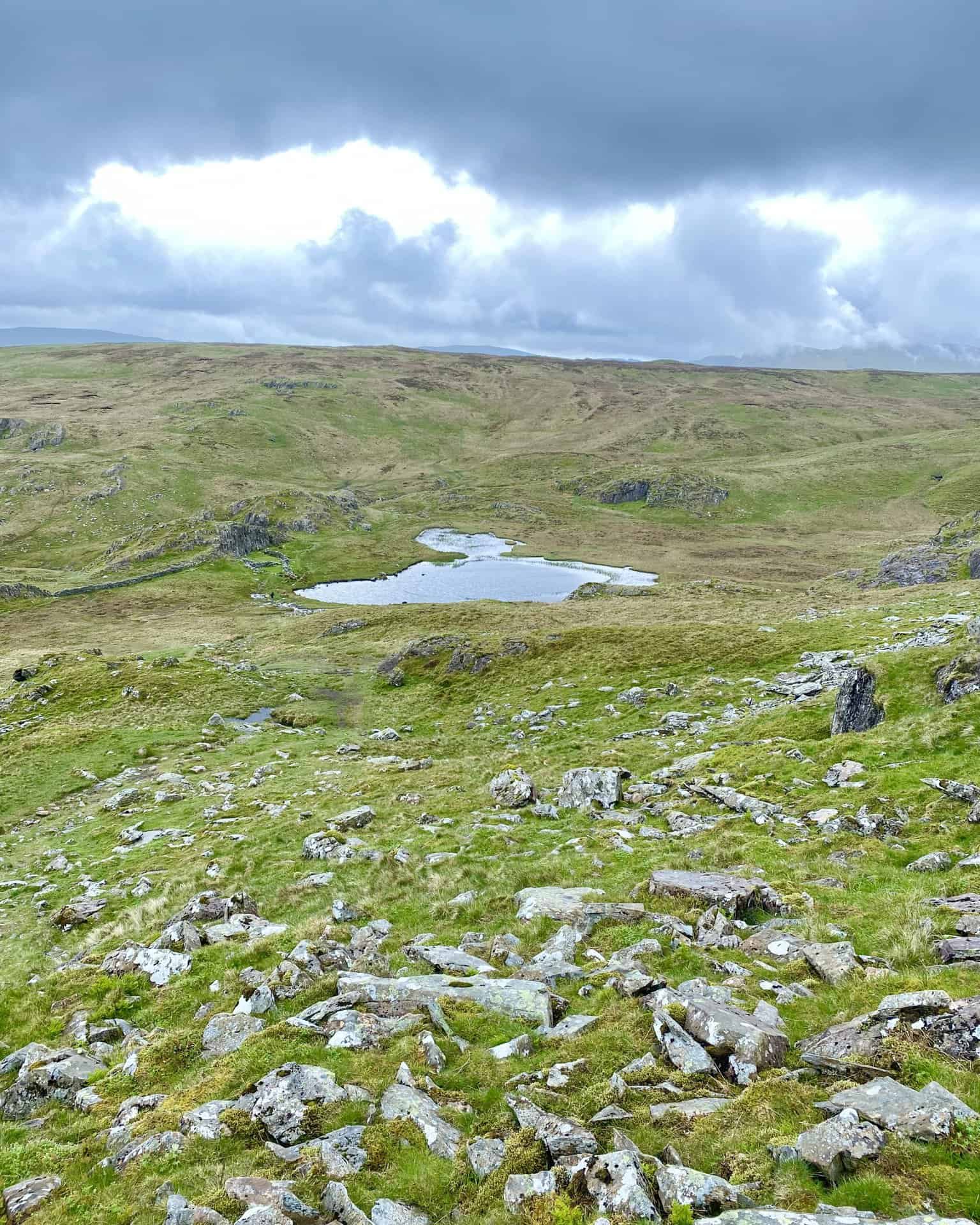
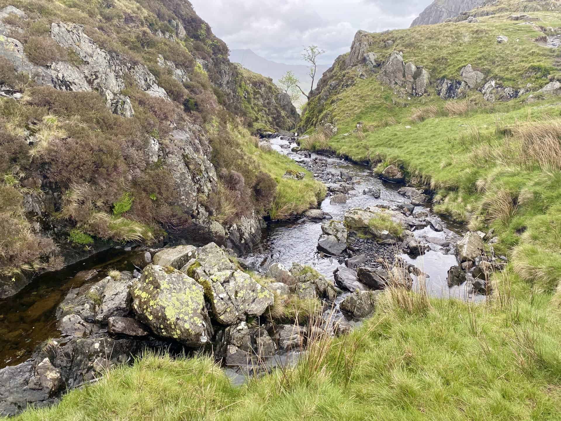
The upper course of Newlands Beck near Dalehead Tarn.
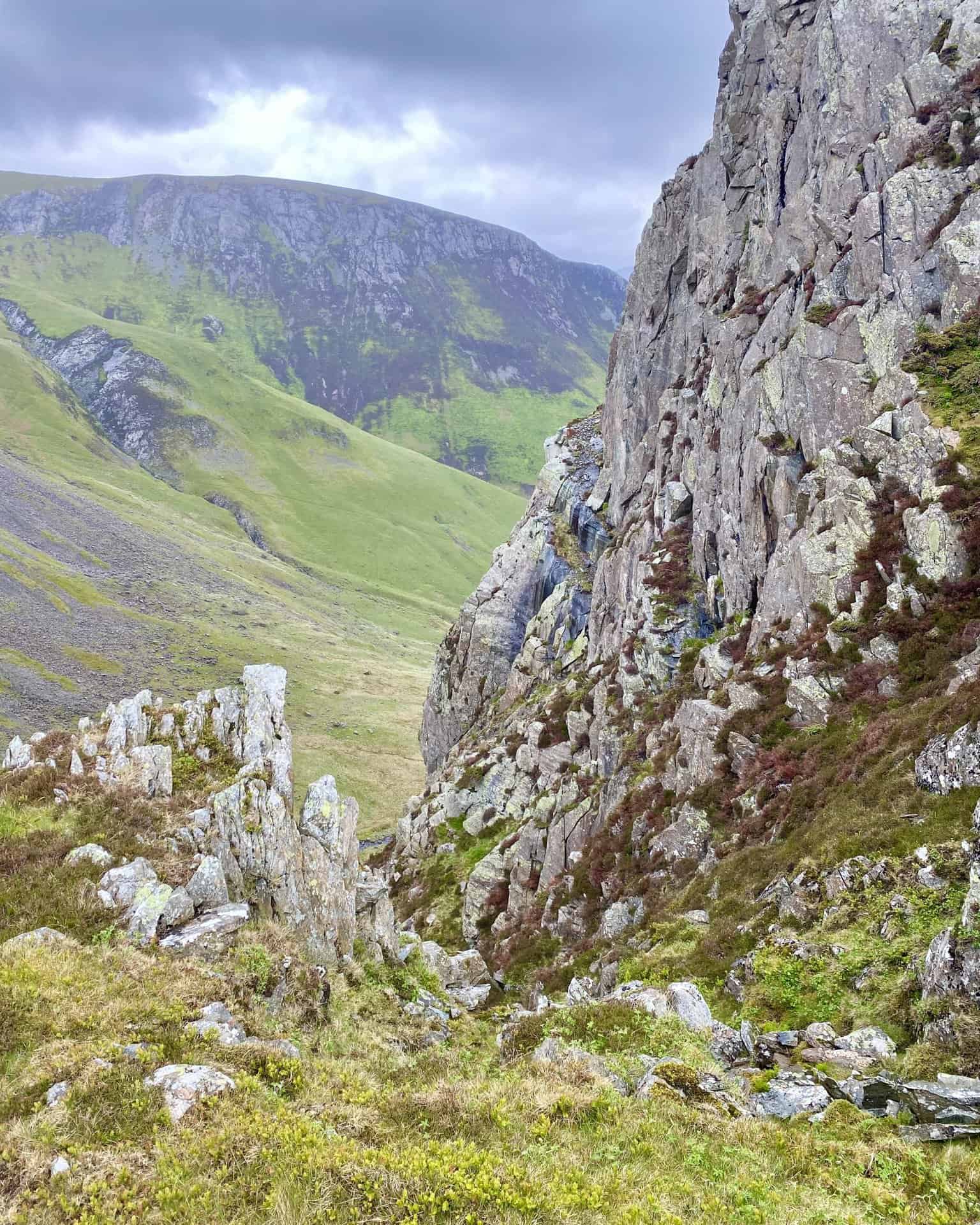
The view of Hindscarth Crags from the southern flanks of High Spy. The deep cut in the rocky landscape (on the left in both pictures) has been created by Far Tongue Gill, a tributary of Newlands Beck.
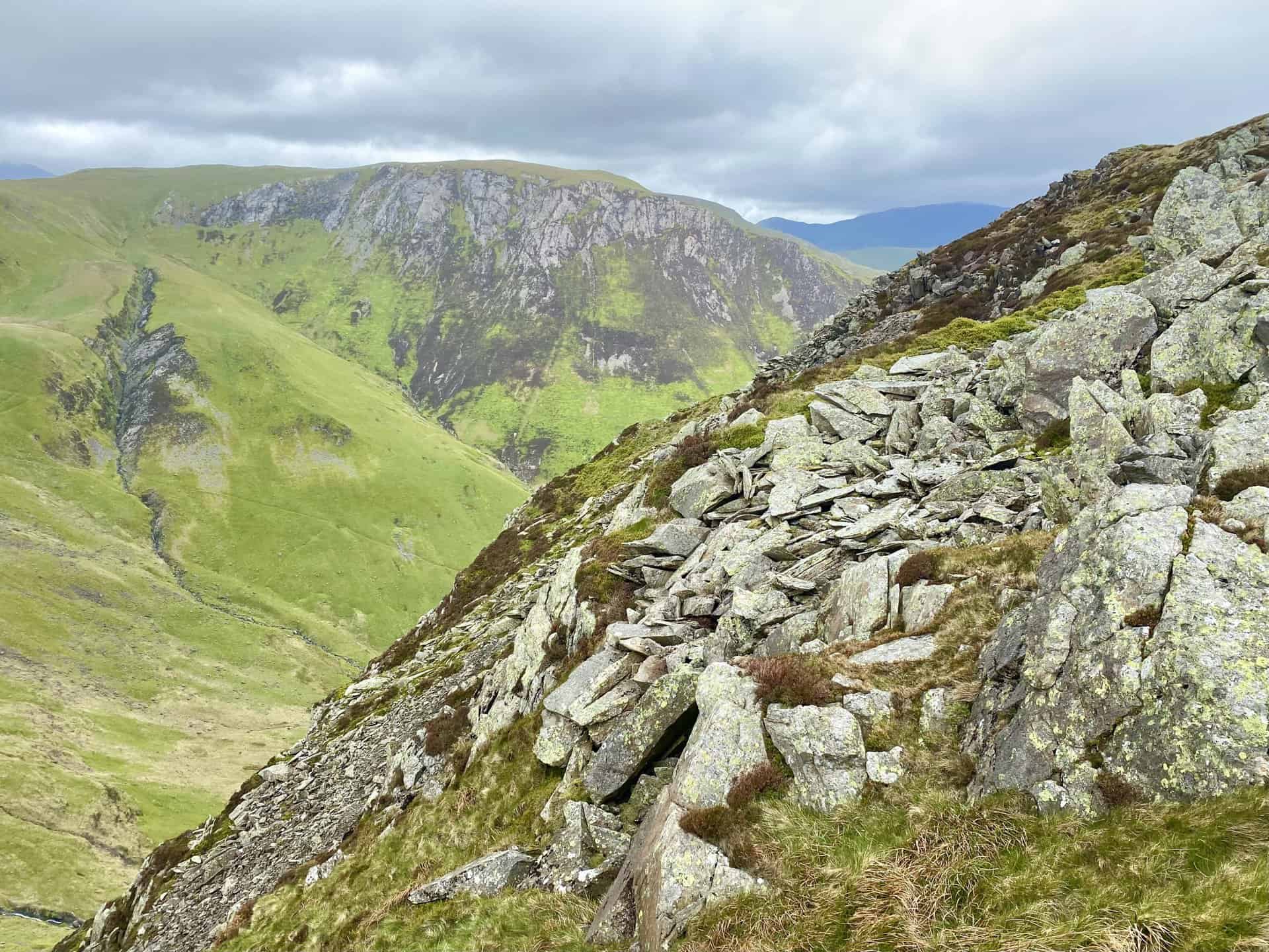
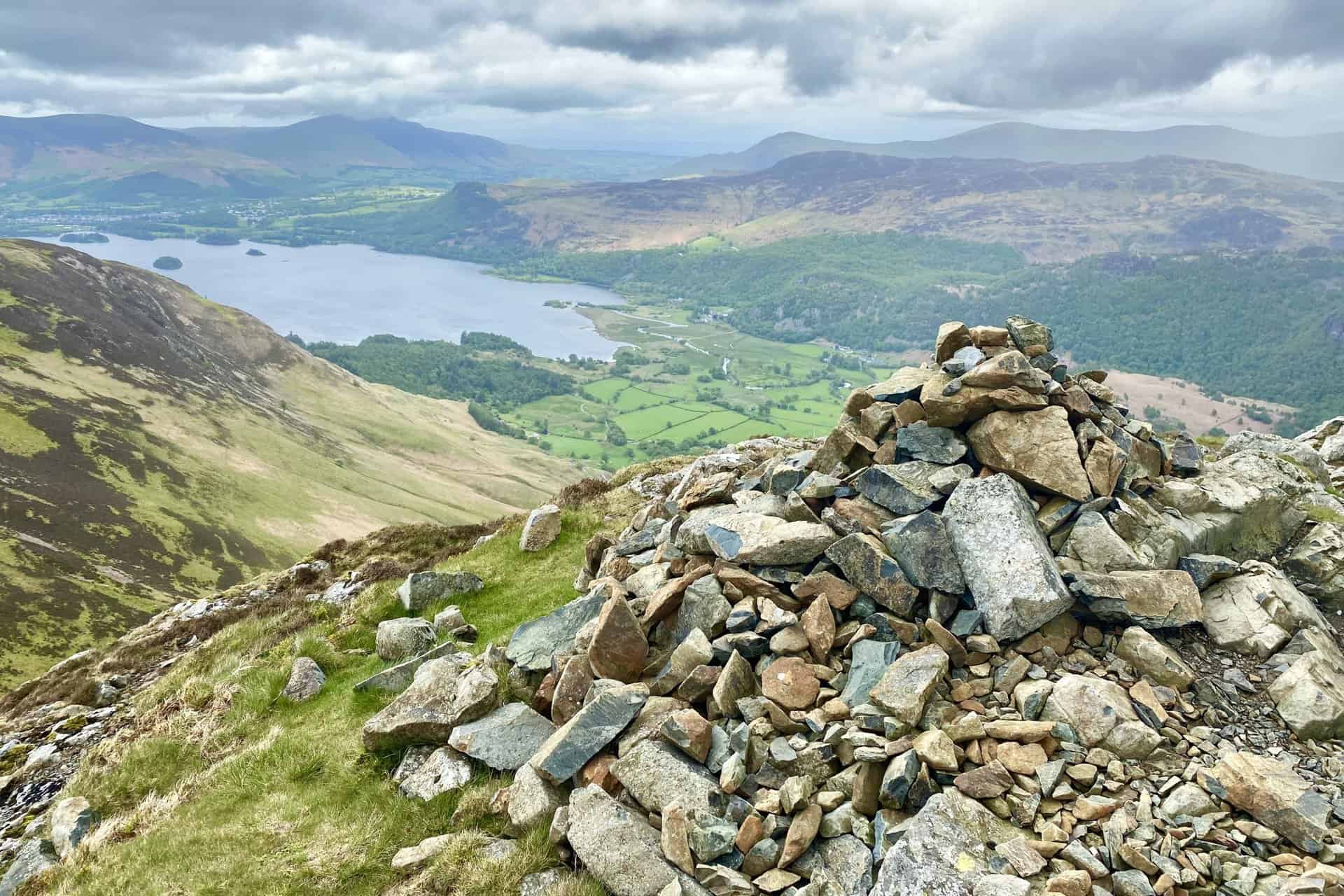
The summit cairn of High Spy, height 653 metres (2142 feet). High Spy is approximately two-thirds of the way round this Newlands Horseshoe walk.
Derwent Water is visible from the footpath across High Spy, but it’s worth briefly leaving the path as there are better views from Minum Crag on the eastern slopes of the mountain.
The view east from Minum Crag towards the Helvellyn mountain range in the distance on the horizon.
Cairn between High Spy and Maiden Moor, about 150 metres to the east of the main path.
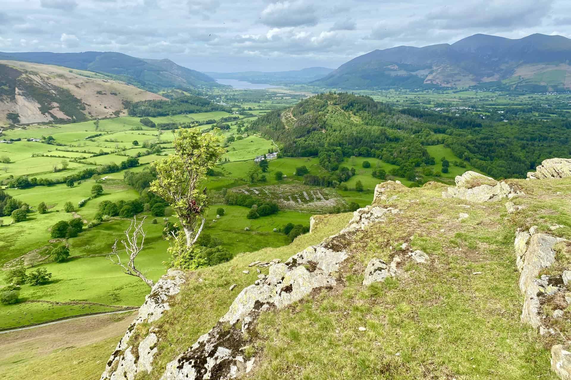
The well-used route across Maiden Moor, and the first view of Bassenthwaite Lake.
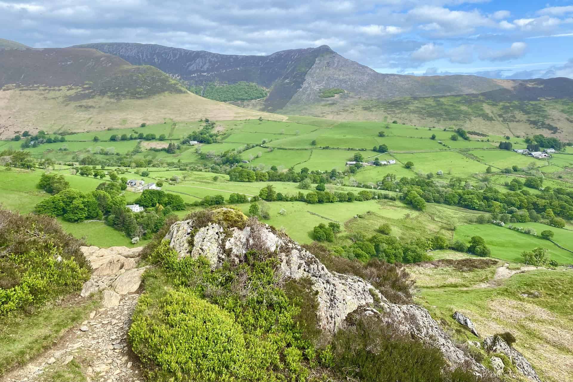
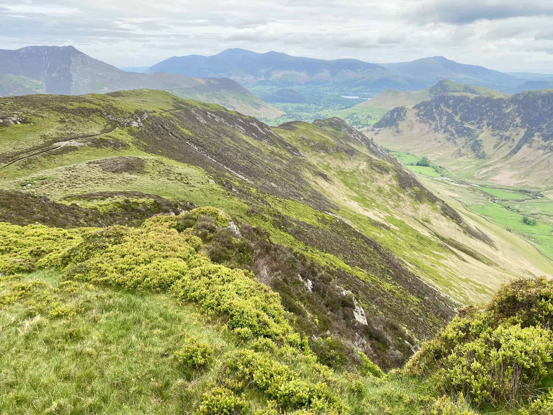
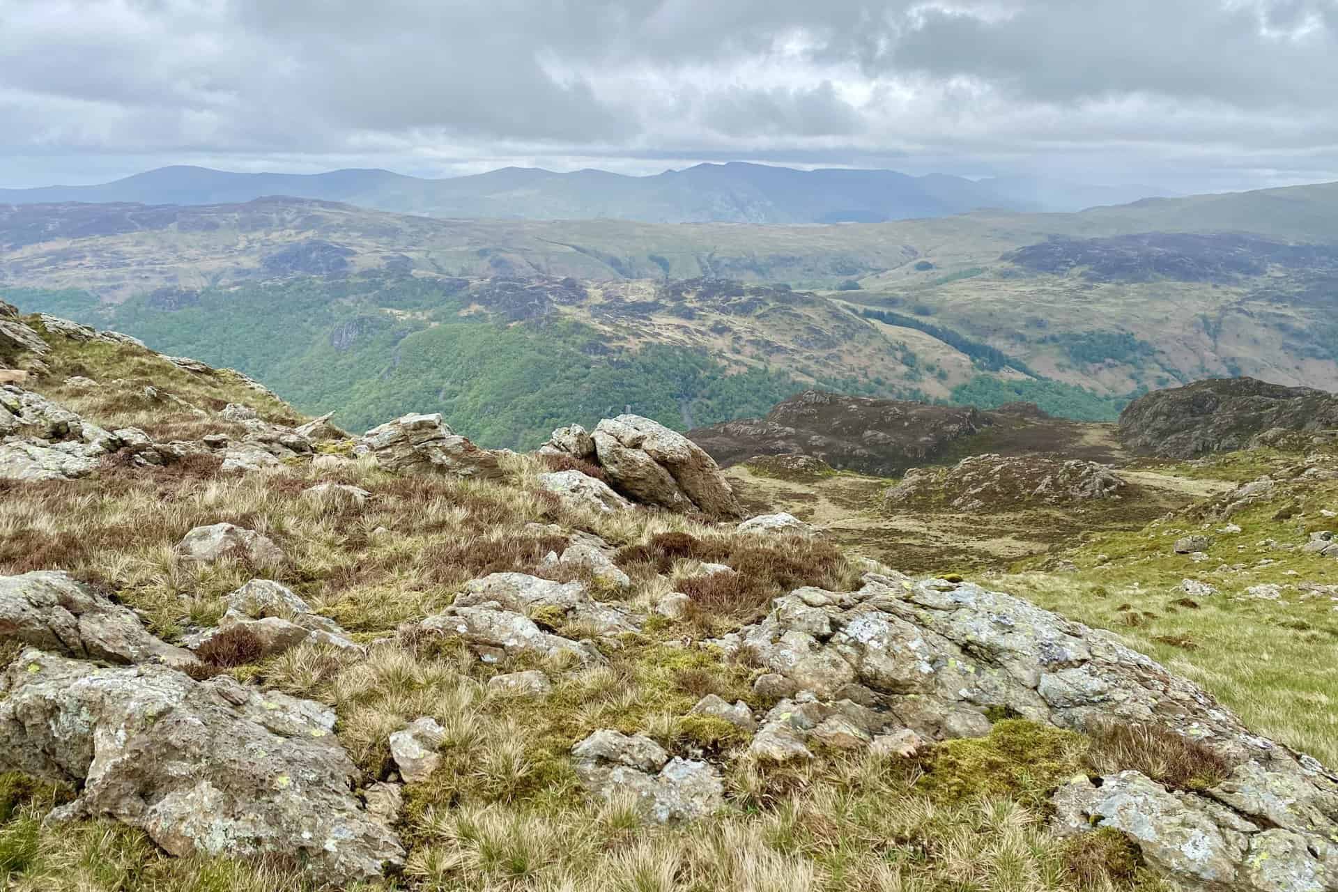
The Newlands valley and many of the Lake District north-western fells, including Whiteless Pike, Wandope, Crag Hill, Sail, Causey Pike, Ard Crags and Knott Rigg.
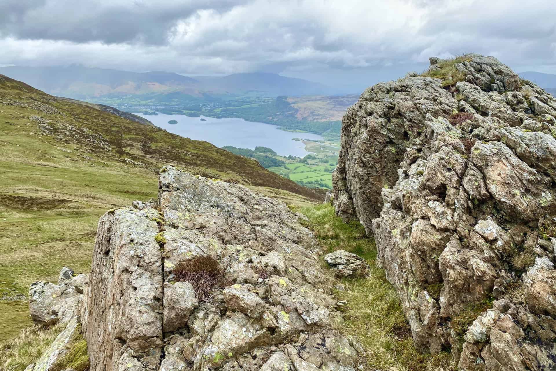
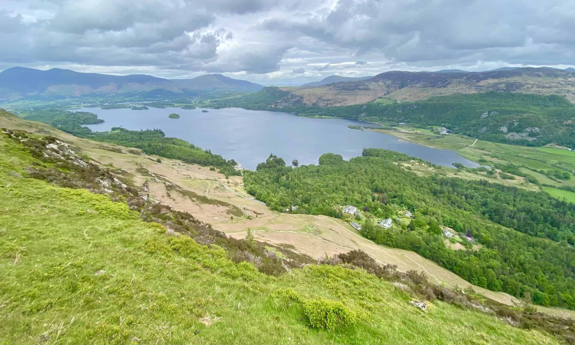
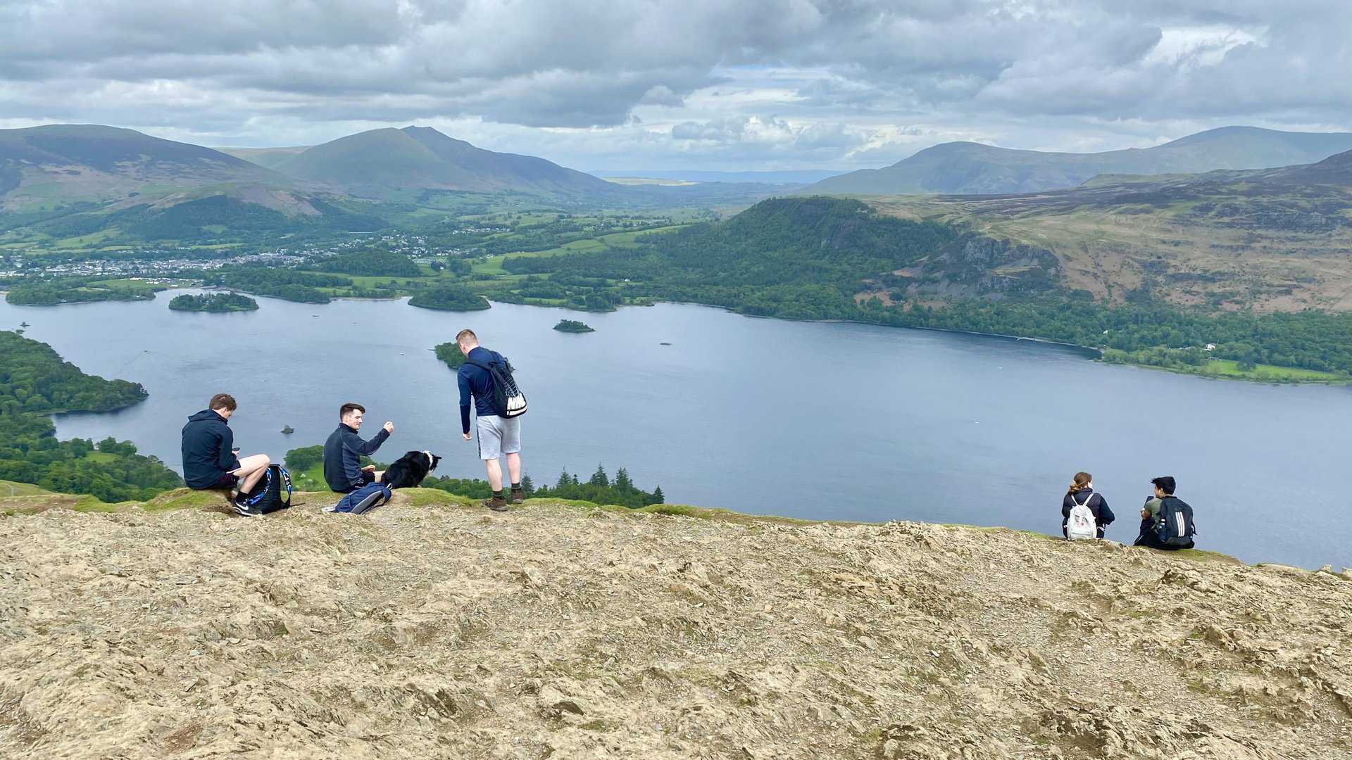
Derwent Water (right) and Bassenthwaite Lake (left) in one view.
The full extent of Derwent Water. Keswick is situated on its northern shores with Skiddaw and Blencathra in the background.
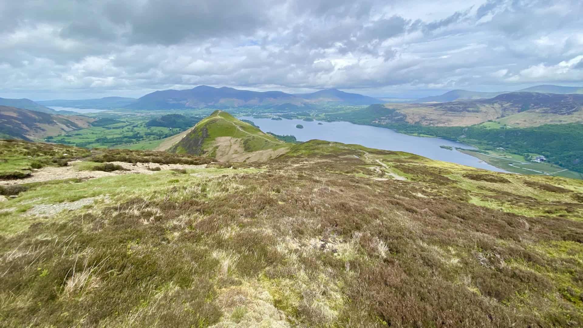
The summit of Cat Bells, height 451 metres (1480 feet).
Looking north from Skelgill Bank towards Swinside (the tree-covered hill) and Bassenthwaite Lake.
The Newlands valley viewed from Skelgill Bank. Descend these grassy slopes and head back to Little Town to complete the Newlands Horseshoe.
Highly Rated Osprey Hiking Backpacks for Outdoor Enthusiasts
Osprey’s reputation for crafting high-quality hiking backpacks is well-established, offering a range of options that cater to both men and women. The following four backpacks stand out for their excellent sales and customer ratings on Amazon, making them a top choice for outdoor enthusiasts seeking reliability and comfort. As an Amazon affiliate, I may earn a small commission from any purchases made through the links provided. This helps support the upkeep of this website. Rest assured, you won’t pay a penny extra, but your purchase will contribute to keeping my site running smoothly. Happy walking!

Osprey Tempest 20 Women’s Hiking Backpack
The Tempest 20 stands out as the ideal solution for day-hiking, biking, or peak-bagging, tailored specifically for women. It features a panel-loading design for ease of access, complemented by an internal zippered mesh pocket with a key clip for secure storage. Unique to this model are the Stow-on-the-Go trekking pole and LidLock bike helmet attachments, enhancing its versatility. Side stretch mesh pockets, along with an easy-access, expandable stretch mesh harness pocket, offer ample storage. Additionally, it includes a blinker light attachment (light not included) and a large stretch mesh front panel pocket for extra carrying capacity.

Osprey Talon 22 Men’s Hiking Backpack
Designed for the active adventurer, the Talon 22 provides an optimal panel-loading design suitable for day-hiking, biking, or peak-bagging. Key features include dual-zippered panel access to the main compartment and a tuck-away ice ax attachment with a bungee tie-off. It boasts a top panel zippered slash pocket for quick access items and lower side compression straps for load management. An external hydration reservoir sleeve and dual-zippered fabric hipbelt pockets enhance hydration and storage, while a large stretch mesh front panel pocket increases its utility for various activities.

Osprey Tempest 30 Women’s Hiking Backpack
The Tempest 30, designed with a women’s-specific fit, is a streamlined top-loader ideal for both extensive day trips and light-and-fast overnight adventures. It includes a fixed top lid with an external zippered slash pocket and an under-lid zippered mesh pocket with a key clip for organised storage. The pack features a tuck-away ice ax attachment with a bungee tie-off, dual upper and lower side compression straps for load adjustment, and an external hydration reservoir sleeve. For added convenience, it offers an easy-access, expandable stretch mesh harness pocket and dual-zippered fabric hip-belt pockets.

Osprey Talon 33 Men’s Hiking Backpack
The Talon 33 is engineered for dynamic movement, making it the perfect streamlined top-loader for committed day trips or light-and-fast overnight excursions. It features top load access to the main compartment for easy packing and retrieval. The backpack is equipped with a large stretch mesh front panel pocket, Stow-on-the-Go trekking pole attachment, and stretch mesh side pockets for versatile storage options. Additionally, an easy-access, expandable stretch mesh harness pocket and dual-zippered fabric hip-belt pockets offer convenient storage solutions for essential gear.