Experience Magnificent Views of the Lake District on the Great Gable Walk
Embark on an unforgettable Great Gable walk, starting at Honister Slate Mine. Located on the B5289 Honister Pass road, between Rosthwaite and Buttermere in the Lake District, this starting point offers ample parking facilities. The route encompasses an exhilarating journey across four Wainwrights: Grey Knotts, Brandreth, Green Gable, and Great Gable, each offering its unique challenges and vistas.
The adventure kicks off with a challenging yet achievable steep ascent south from the Honister Slate Mine, leading you directly to the summit of Grey Knotts, the first Wainwright. After conquering Grey Knotts, the path directs you south-west towards Brandreth, marking the second Wainwright on your journey.
Continuing south, the walk takes you across the grassy expanse, descending to cross Gillercomb Head and then ascending to reach Green Gable, the third Wainwright. The route then dips into the col known as Windy Gap before tackling the south-westward climb up the rocky slopes of Great Gable to reach the summit, the fourth Wainwright.
Upon reaching the summit of Great Gable, take time to explore. Walk towards Westmorland Cairn and White Napes to discover captivating geological features and extraordinary views down to Wast Water, rewarding your efforts with unparalleled vistas.
The descent from Great Gable involves navigating the north-west slopes, carefully traversing rocky terrain and loose, slippery scree. Continue downwards to a path that veers east, skirting the impressive Gable Crag. The route then heads north, below Greengable Crag, and along Mosesʼ Trod, guiding you across the fells.
Concluding this 6-mile trek, the path gently slopes across the countryside, leading past Fleetwith and down a stone track past Bell Crags, returning to Honister Slate Mine. This Great Gable walk, though challenging, promises a memorable experience and a profound sense of achievement.
Great Gable Walk: Maps and Tools
Visit either the OS Maps website or the Outdooractive website to view this walking route in greater detail. Both platforms offer a range of features, including the ability to print the route, download it to your device, and export the route as a GPX file. You can also watch a 3D fly-over and share the route on social media.
Great Gable Walk: Distance, Duration, Statistics
Distance: 6 miles
Distance: 9¾ kilometres
Duration: 4 hours
Ascent: 2820 feet
Ascent: 860 metres
Type: Circular walk
About Great Gable
Great Gable is a mountain located in the Lake District, United Kingdom. Its name reflects its pyramid shape from Wasdale. However, from most other directions, it appears dome-shaped. It ranks among the most favoured of Alfred Wainwright’s Lake District Fells for walking. There are numerous paths leading to its summit. A high pass called Windy Gap connects Great Gable to its smaller counterpart, Green Gable. The lower pass of Beck Head links it to Kirk Fell to the west.
The Geographical Setting
Situated at Ennerdale’s head, Great Gable and Green Gable have the Sty Head pass behind them. This pass links Borrowdale with Wasdale, placing Great Gable at the heart of both valleys. Although the connection to Borrowdale is less direct, Great Gable’s prominence is undeniable from nearly any viewpoint along Ennerdale. The mountain’s upper reaches form a near-square shape, with sides about half a mile long. These sides align with the compass’s cardinal directions, with connecting fells and ridges at the square’s corners.
Great Gable Walk Landscape
Gable Crag creates the northern face, standing out in views from Haystacks and nearby fells. It presents the longest continuous crag on Great Gable, extending close to the summit. Scree slopes from here lead down to the River Liza’s source in Ennerdale. The eastern slopes, less craggy, descend steeply to Styhead Tarn. This tarn, around 30 feet deep, nestles in a hollow and is known for its trout population. It’s also a favoured spot for wild camping. The southern face drops sharply, 2300 feet down to Lingmell Beck. Below the summit, Westmorland Crags appear, followed by Kern Knotts, Raven Crag, and Great Napes, each ending in vast scree slopes. On the west, rough terrains lead down to White Napes and into the slender Gable Beck valley.
Ridge Connections and Features
A ridge extends to Kirk Fell from the north-west, crossing the Beck Head col. A small tarn, sometimes joined by another after rain, sits in this depression. Gable Beck flows south from Beck Head, while an unnamed stream heads north. The main western fells ridge stretches to Green Gable, then dips to Windy Gap near Gable Crag’s end. This ridge, eroded by countless Great Gable walkers, features Stone Cove and Aaron Slack gully. The south-eastern ridge, heading to the southern fells, passes Sty Head, a key crossroads for walkers. Opposite this, Great End sits within the Scafells, with Kern Knotts and Dry Tarn along the ridge. The south-western ridge descends via Gavel Neese, positioned between Lingmell and Gable Becks.
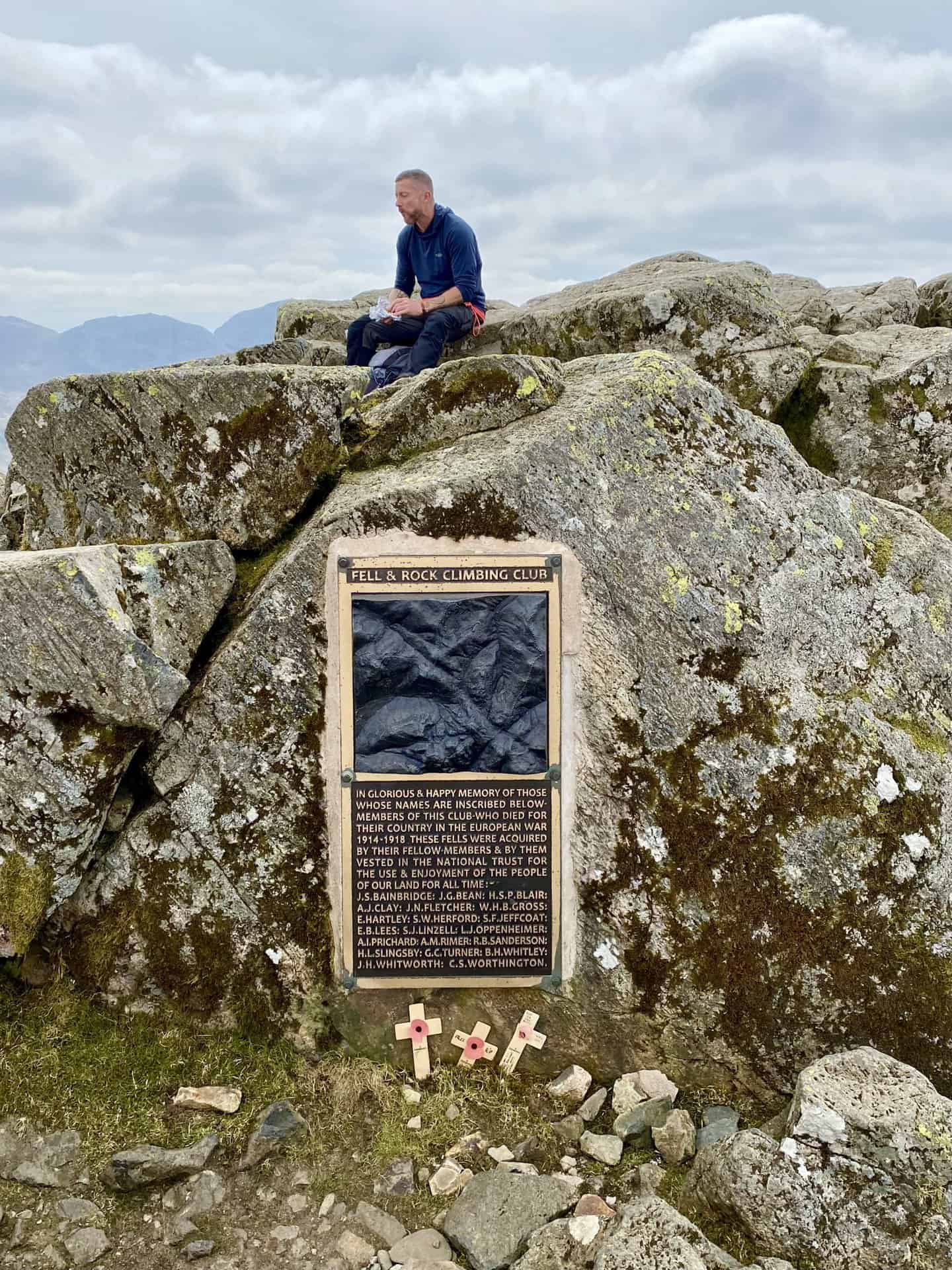
Great Gable Walk Summit
The summit features a rock outcrop and cairn marking the highest point. A plaque commemorates the Fell & Rock Climbing Club members lost in World War I. An annual Remembrance Sunday service honours them. The club donated 3000 acres, including Great Gable, to the National Trust in their memory. In 2013, the original bronze memorial was replaced, correcting spelling mistakes. The summit’s central location offers panoramic views across the Lake District. Wast Water and Windermere are visible lakes. Near the summit, the Westmorland Cairn highlights what some deem the Lake District’s best view. Additional cairns top Gable Crag. The summit has also become a chosen site for scattering ashes after cremation.
Recommended Ordnance Survey Map
The best map to use on this walk is the Ordnance Survey map of the Lake District North-Western Area, reference OS Explorer OL4, scale 1:25,000. It clearly displays footpaths, rights of way, open access land and vegetation on the ground, making it ideal for walking, running and hiking. The map can be purchased from Amazon in either a standard, paper version or a weatherproof, laminated version, as shown below.
Standard Version
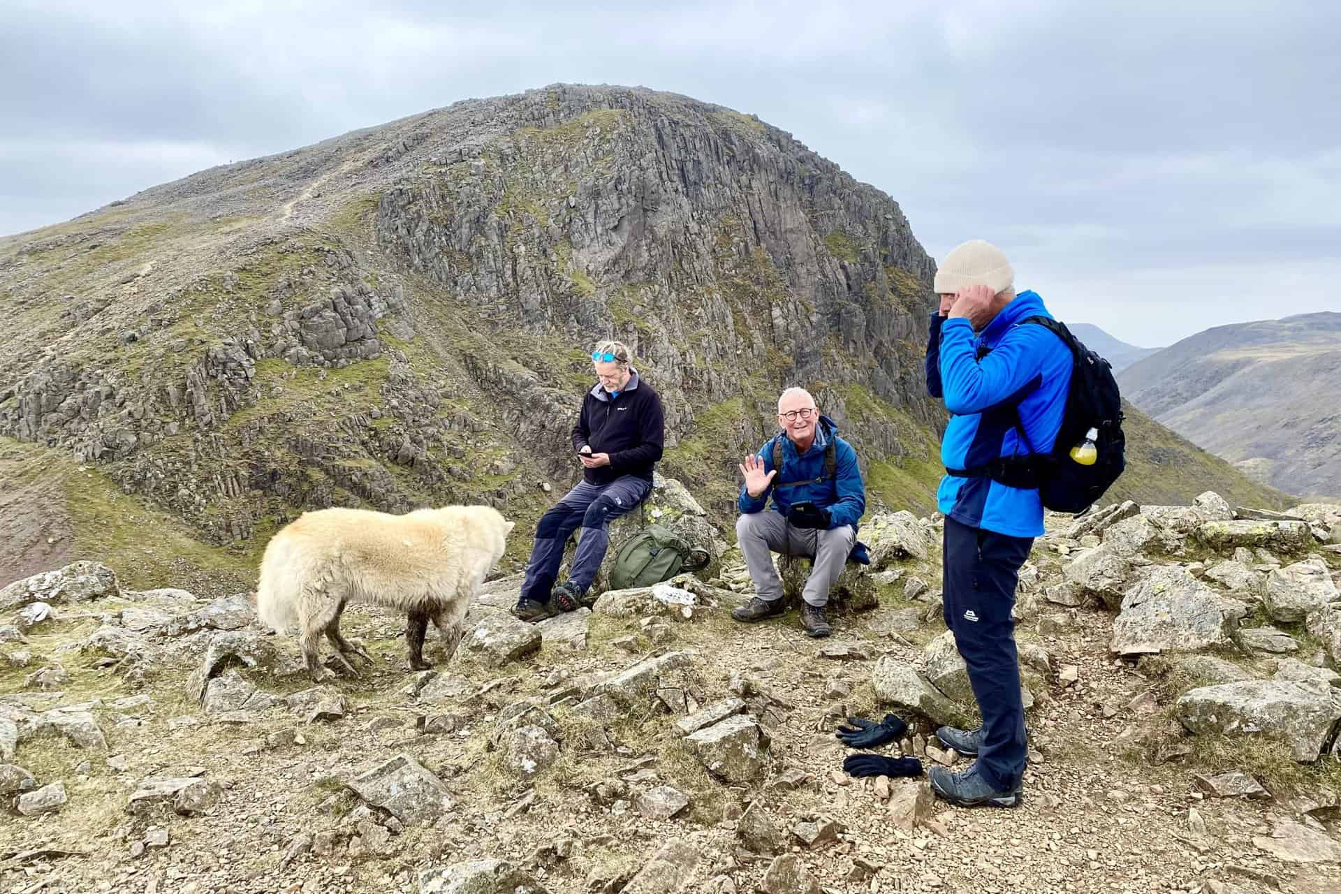
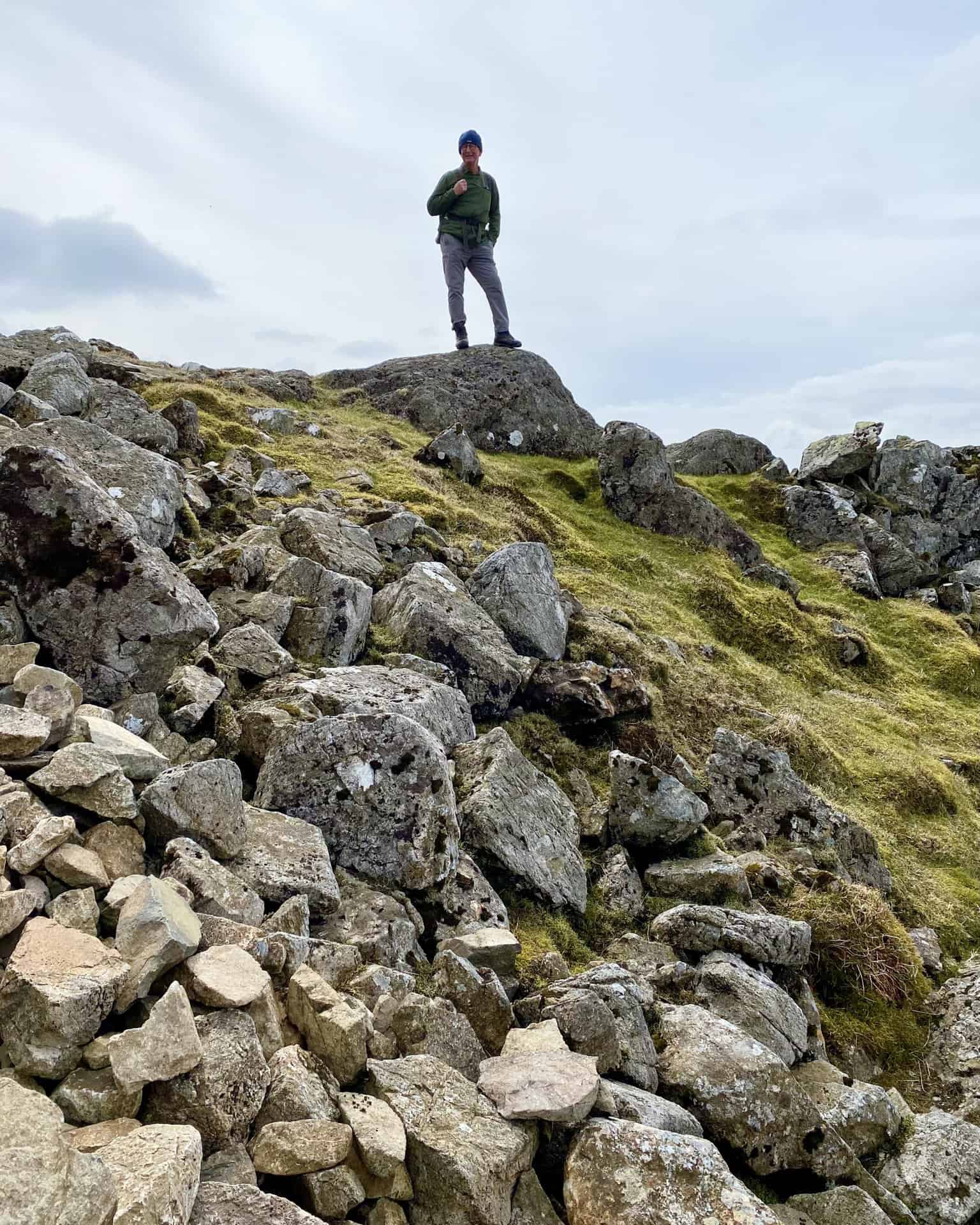
Great Gable Walk: My Photos
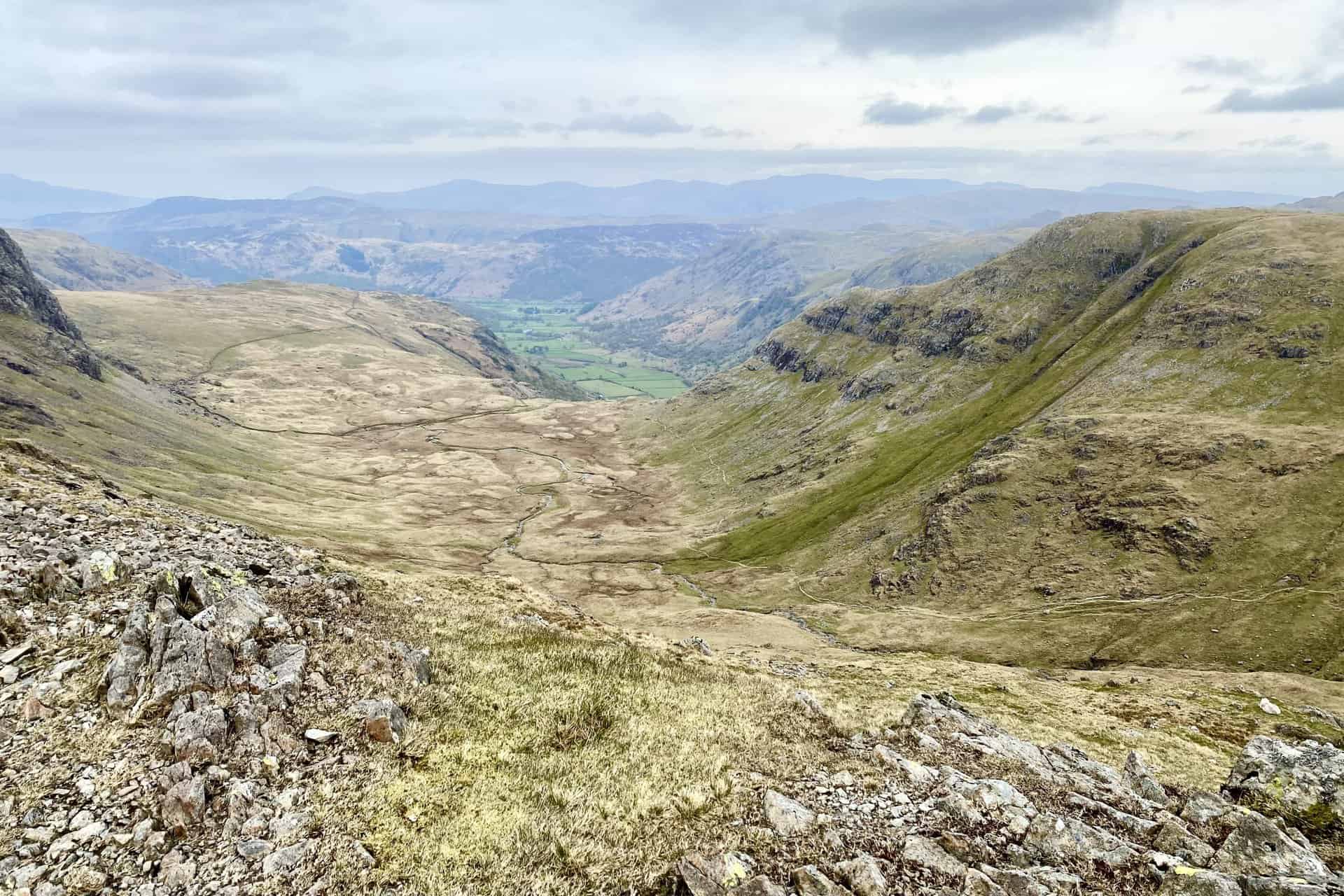
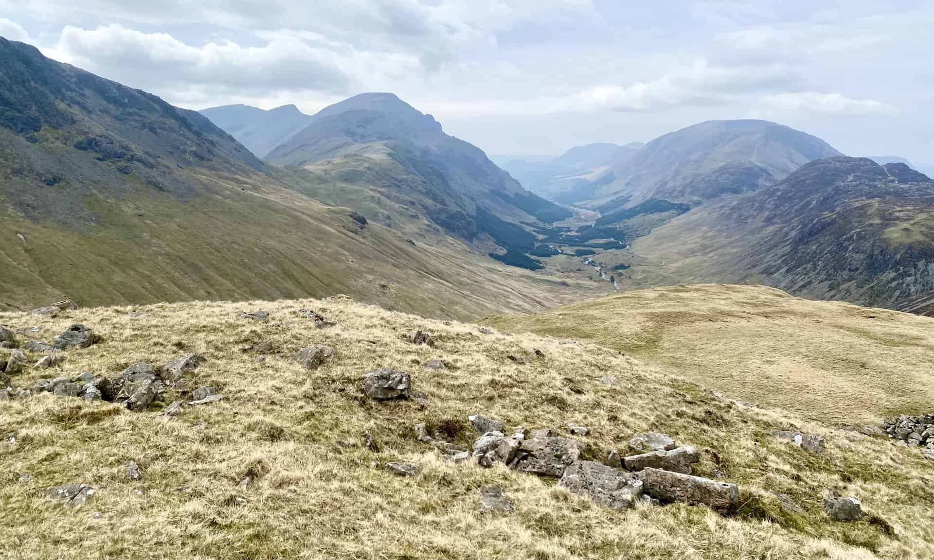
The view north-east from Gillercomb Head down into the valley between Base Brown (right) and Brandreth.
Gillercomb Head between Brandreth and Green Gable, about one-quarter of the way round the Great Gable walk. Great Gable is in the background on the right.
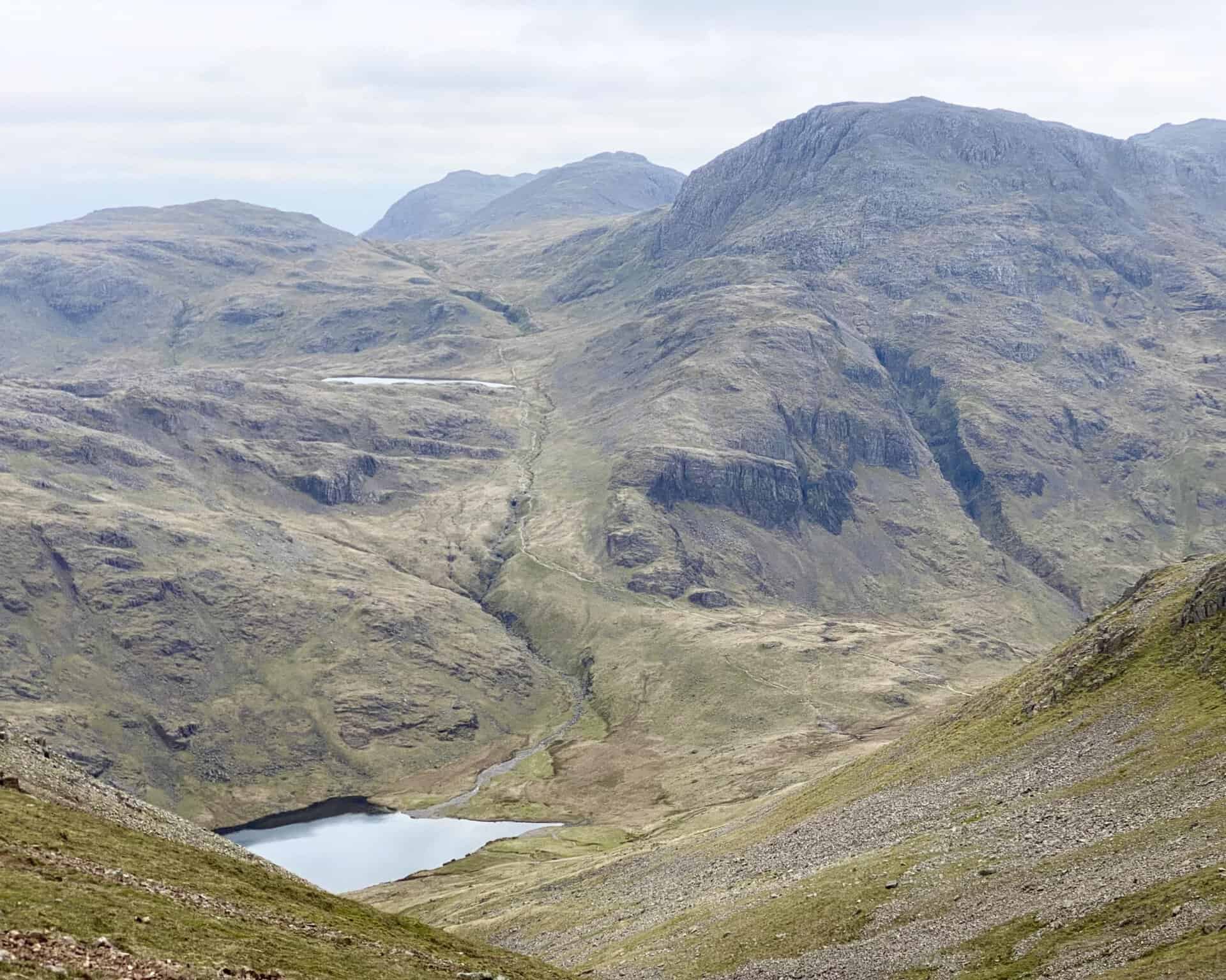
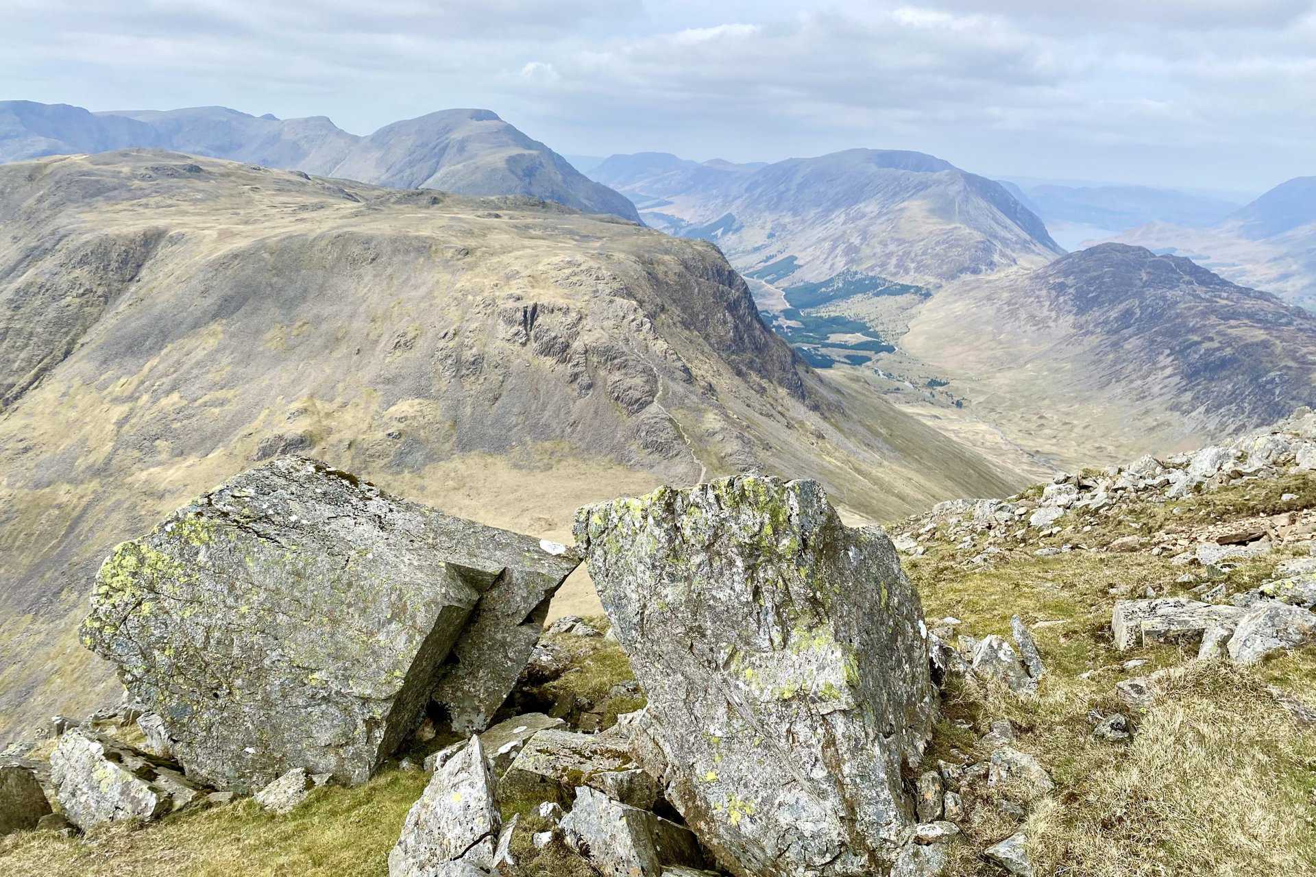
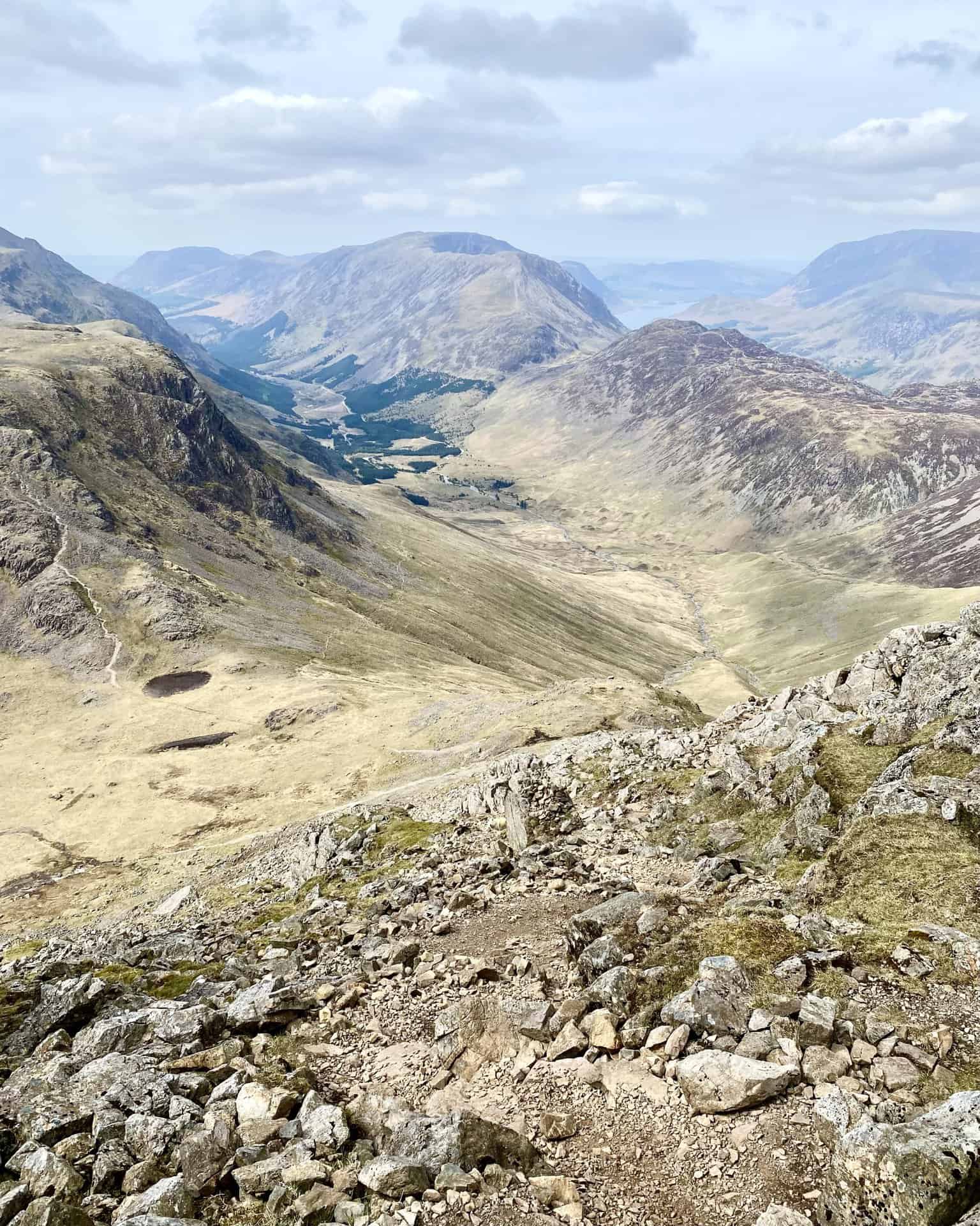
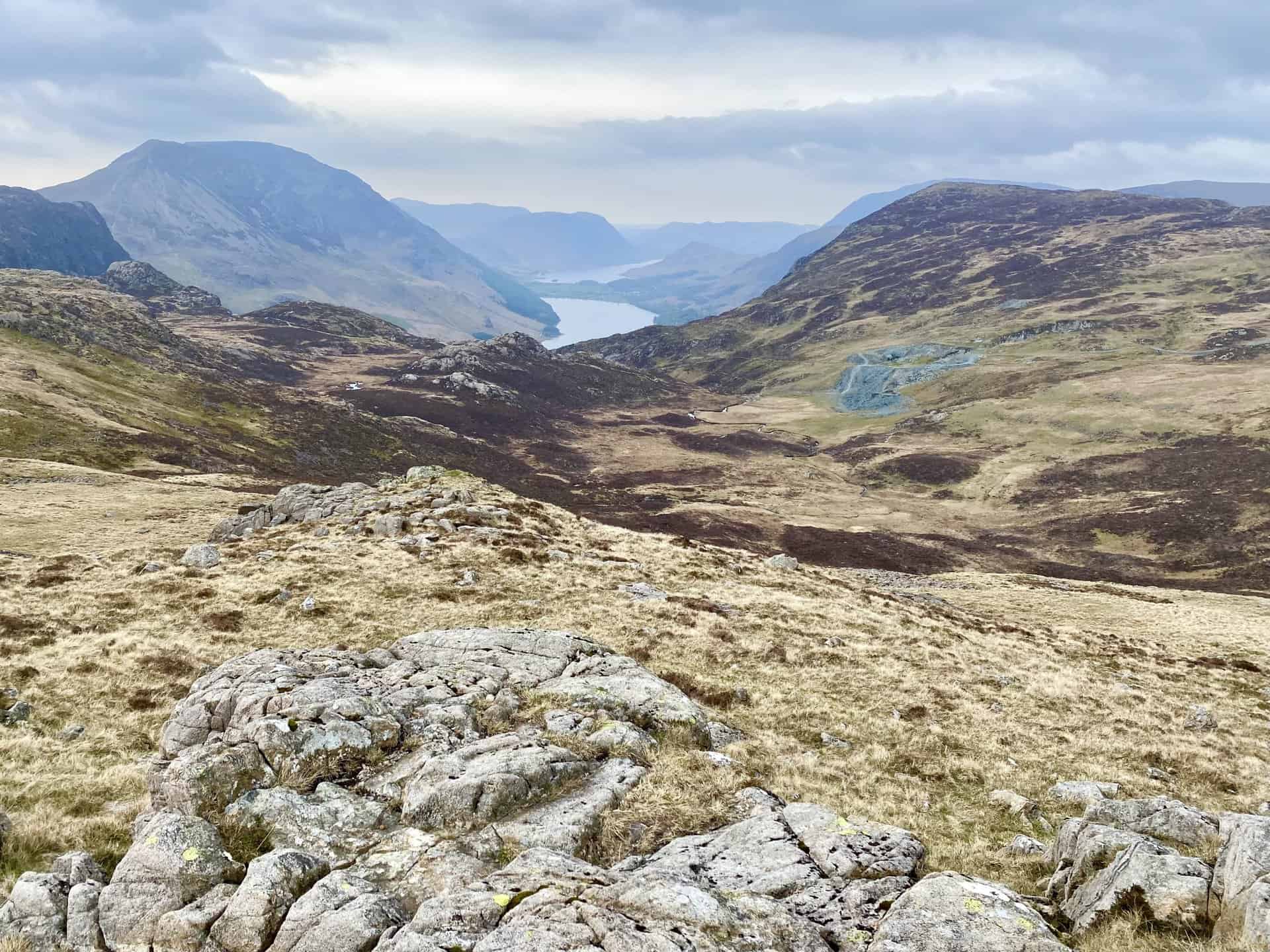
Looking north-west towards the Ennerdale valley. The River Liza flows through the valley to reach Ennerdale Water which can just be seen in the distance.
The summit of Green Gable, height 801 metres (2628 feet), backed by Great Gable.
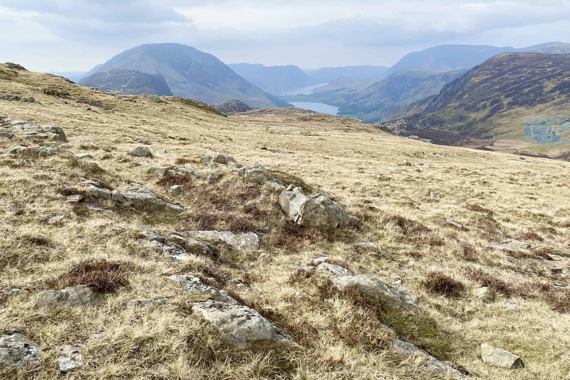
The Ennerdale valley as seen from Green Gable. Buttermere and Crummock Water are also visible on the right.
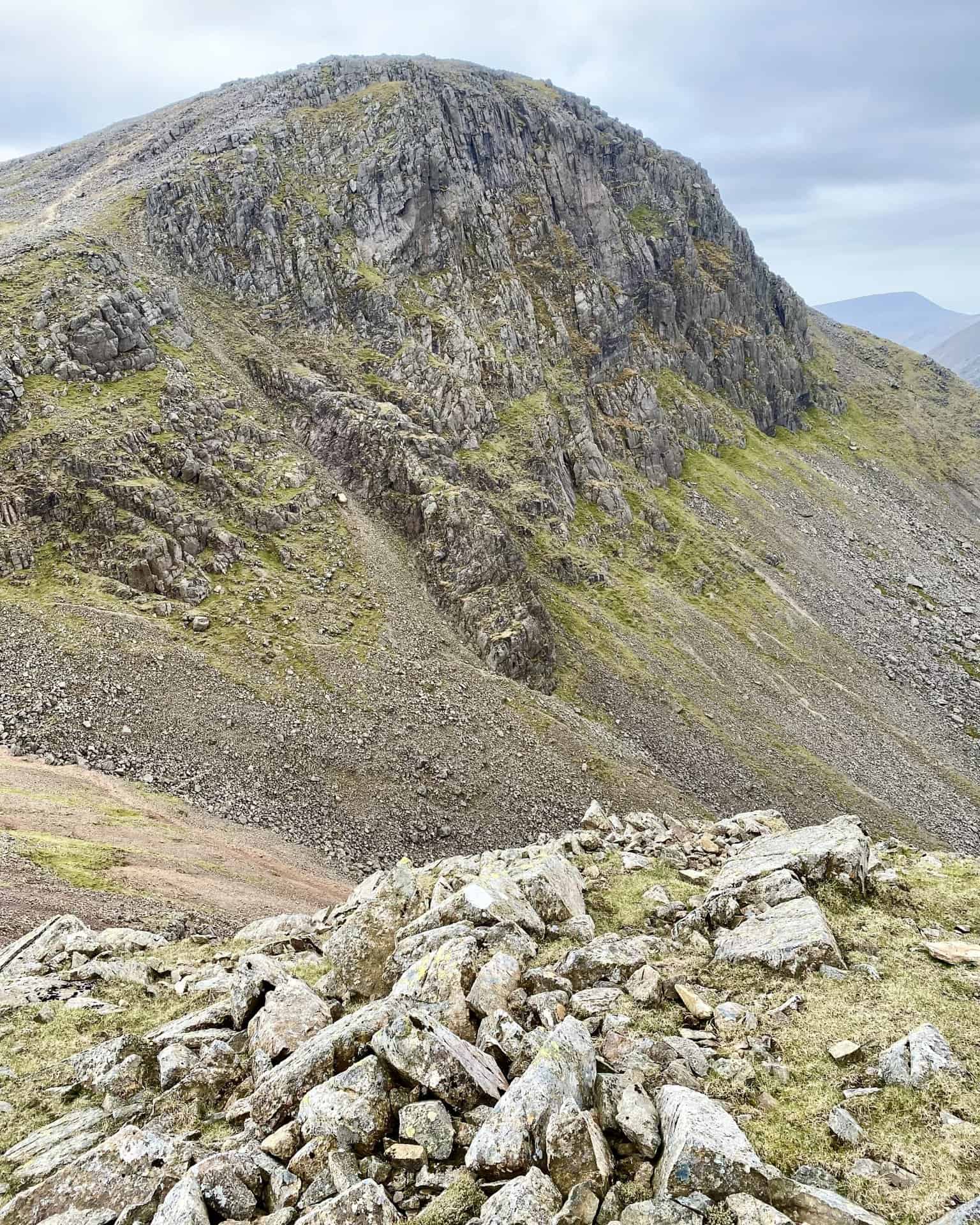
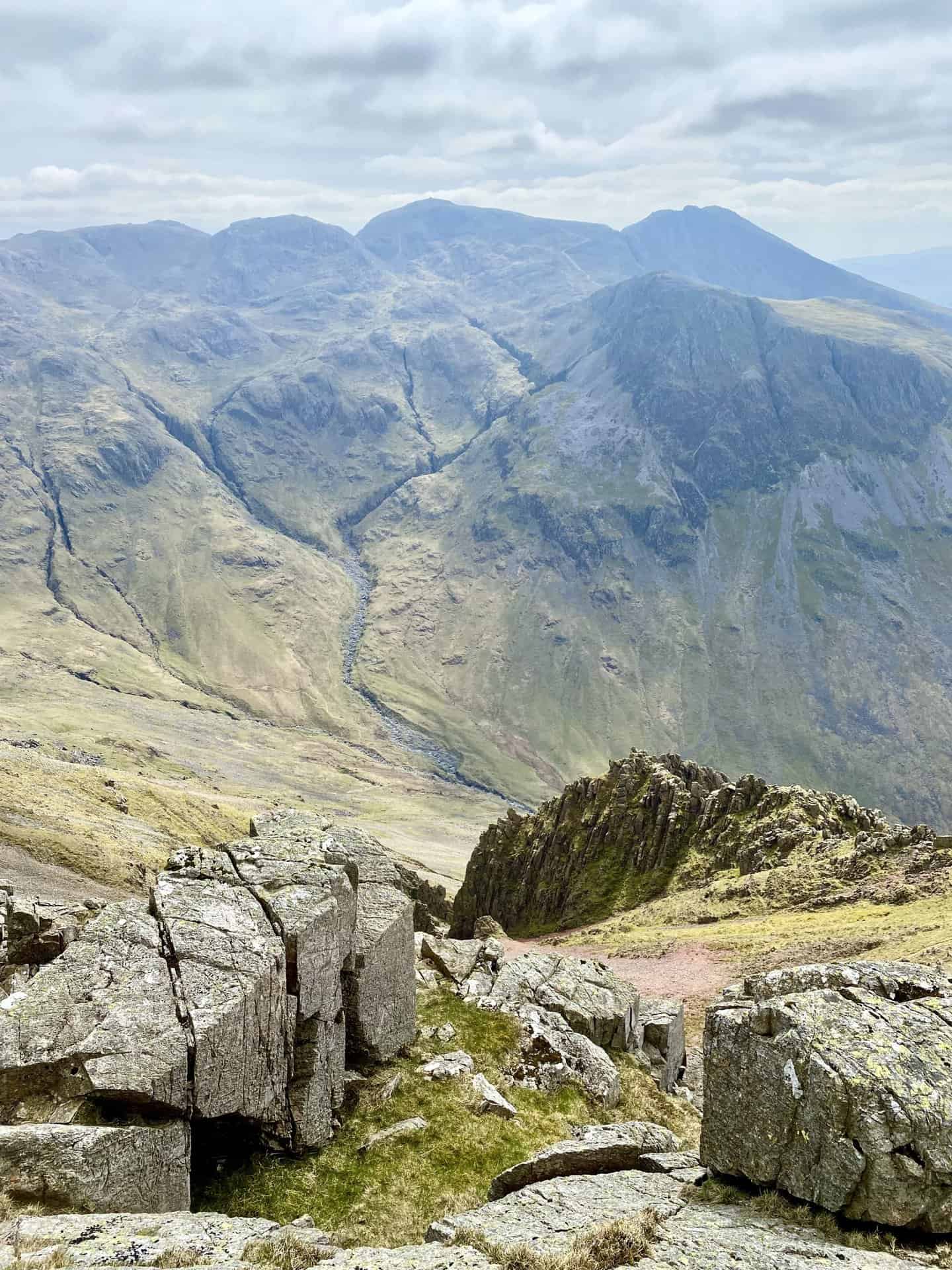
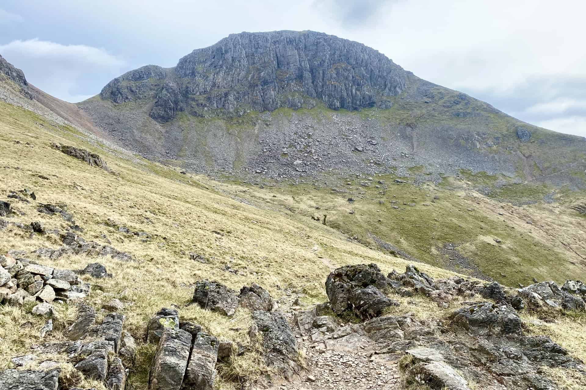
Gable Crag on the north face of Great Gable.
The view south-east from Windy Gap down to Styhead Tarn and over to the higher Sprinkling Tarn.
Windy Gap, the col or saddle between Green Gable and Great Gable.
The mountain range which divides the Ennerdale valley and the Buttermere / Crummock Water valley includes, from front to back, Hay Stacks, High Crag, High Stile, Red Pike, Starling Dodd and Great Borne.
Another view of Styhead Tarn and Sprinkling Tarn. To the far left of the picture on the horizon are the knobbly peaks of Pike of Stickle and Harrison Stickle in the Langdale Fells.
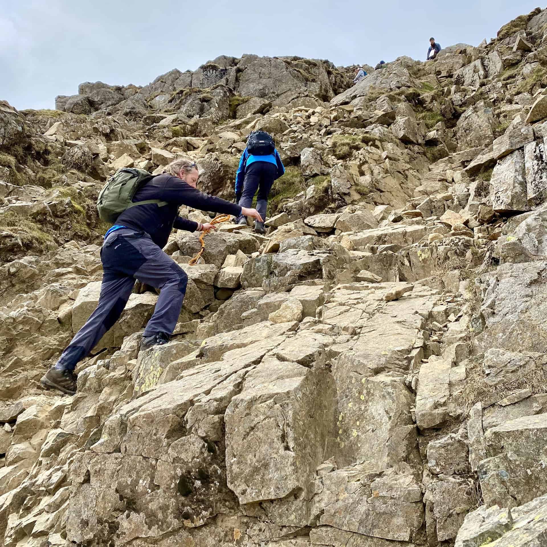
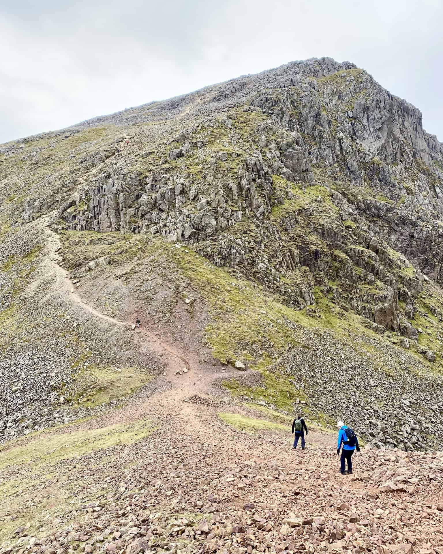
The climb to the top of Great Gable.
The summit of Great Gable, height 899 metres (2949 feet). The plaque attached to the rock reads as follows:
FELL & ROCK CLIMBING CLUB
IN GLORIOUS & HAPPY MEMORY OF THOSE
WHOSE NAMES ARE INSCRIBED BELOW-
MEMBERS OF THIS CLUB-WHO DIED FOR
THEIR COUNTRY IN THE EUROPEAN WAR
1914-1918 THESE FELLS WERE ACQUIRED
BY THEIR FELLOW-MEMBERS & BY THEM
VESTED IN THE NATIONAL TRUST FOR
THE USE & ENJOYMENT OF THE PEOPLE
OF OUR LAND FOR ALL TIME:
J.S.BAINBRIDGE: J.G.BEAN: H.S.P.BLAIR:
A.J.CLAY: J.N.FLETCHER: W.H.B.GROSS:
E.HARTLEY: S.W.HERFORD: S.F.JEFFCOAT:
E.B.LEES: S.J.LINZELL: L.J.OPPENHEIMER:
A.I.PRICHARD: A.M.RIMER: R.B.SANDERSON:
H.L.SLINGSBY: G.C.TURNER: B.H.WHITLEY:
J.H.WHITWORTH: C.S.WORTHINGTON.
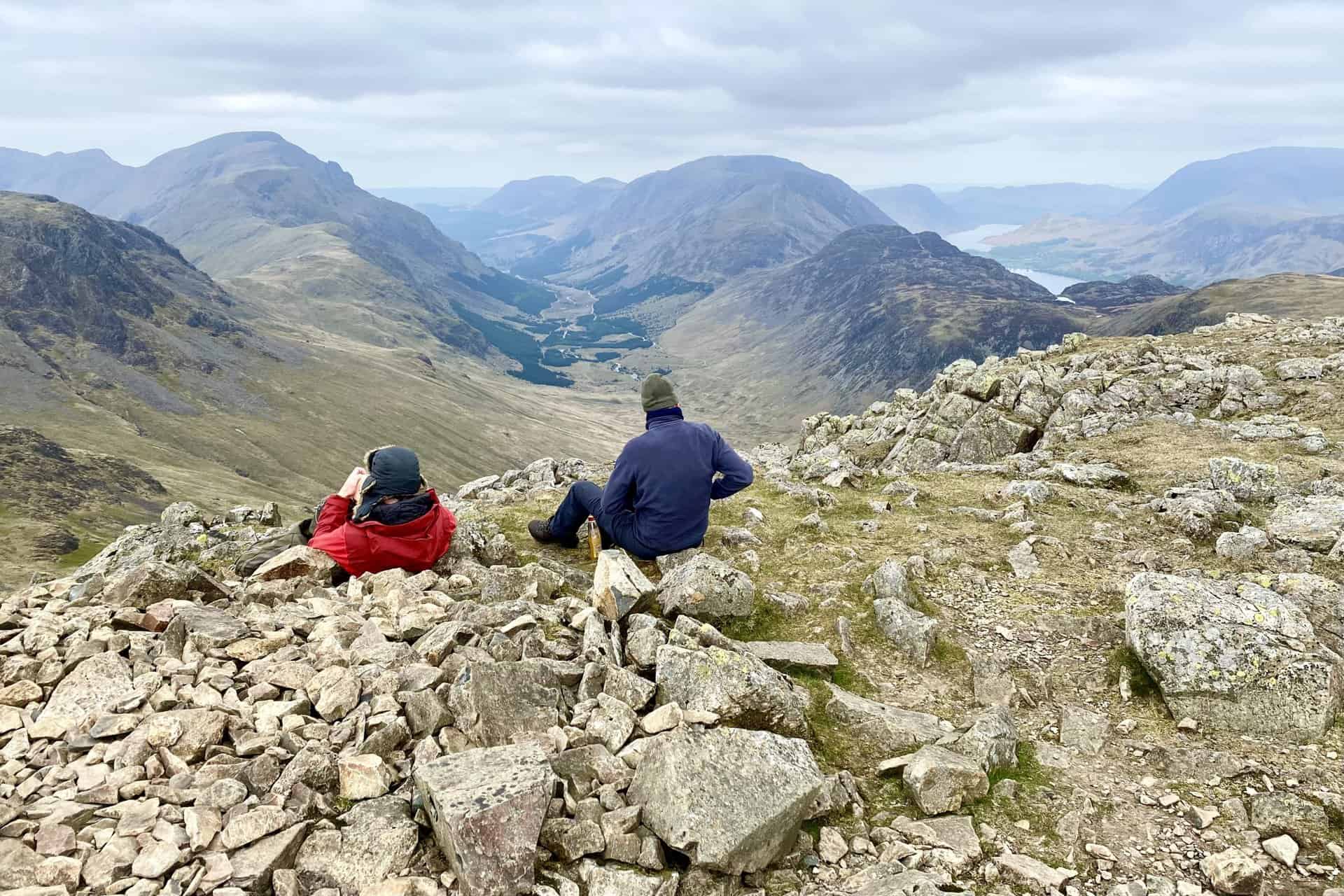
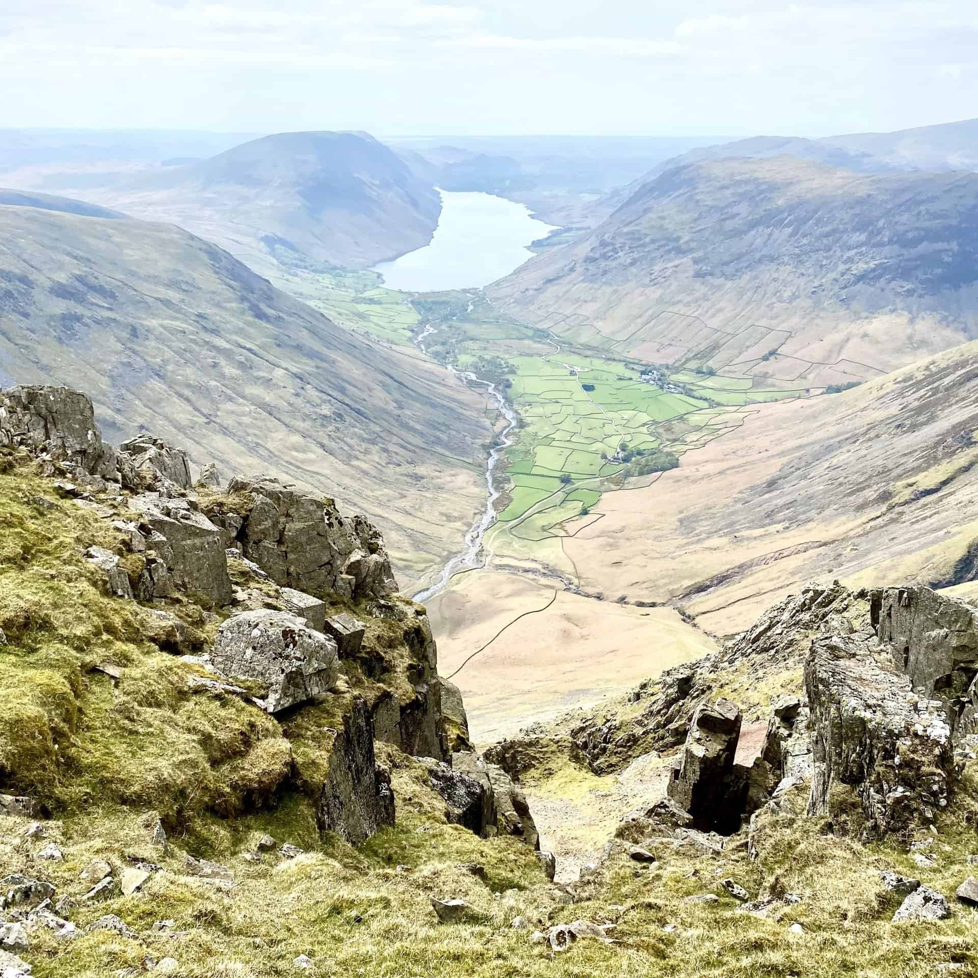
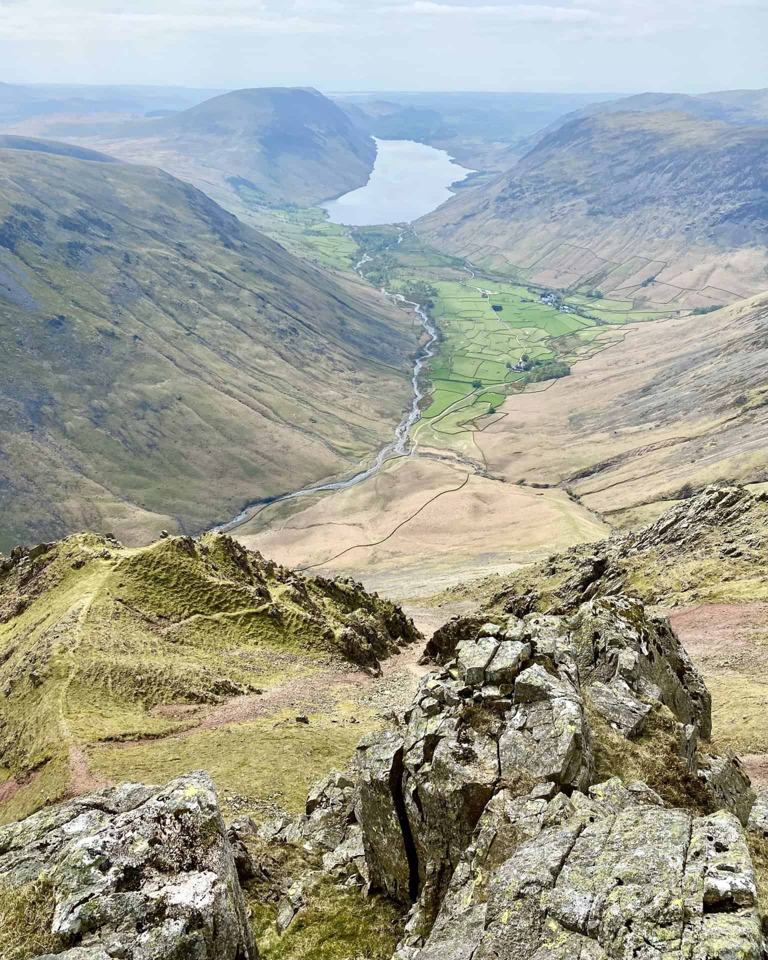
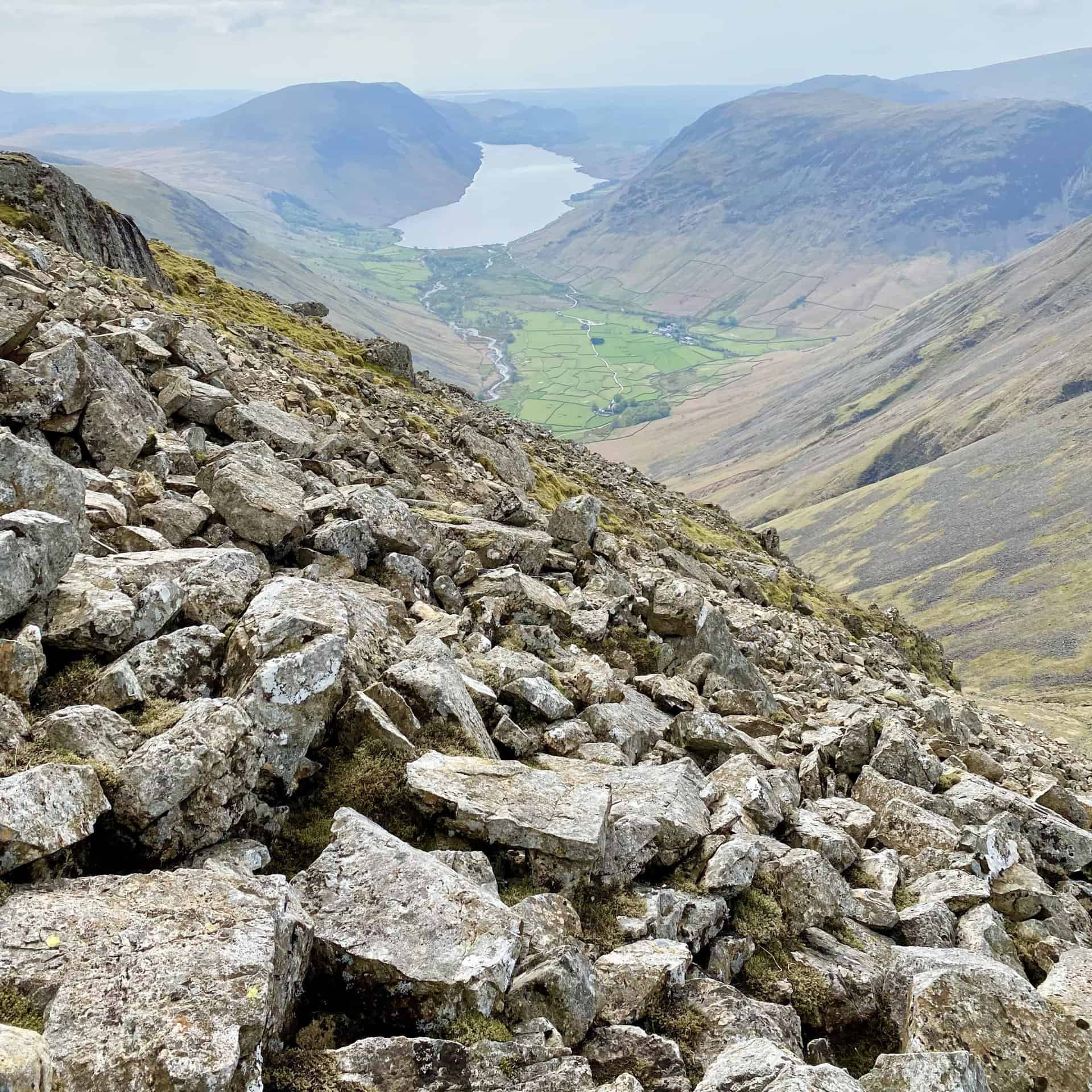
Wast Water as seen from Westmorland Cairn, one of the many highlights on this Great Gable walk.
The view south from Westmorland Cairn towards Scafell Pike (centre, horizon). To the right of Scafell Pike is Sca Fell and to the left is Broad Crag and Ill Crag. Lingmell sits in front of Sca Fell.
Looking west from Westmorland Cairn over to Kirk Fell, backed by Pillar.
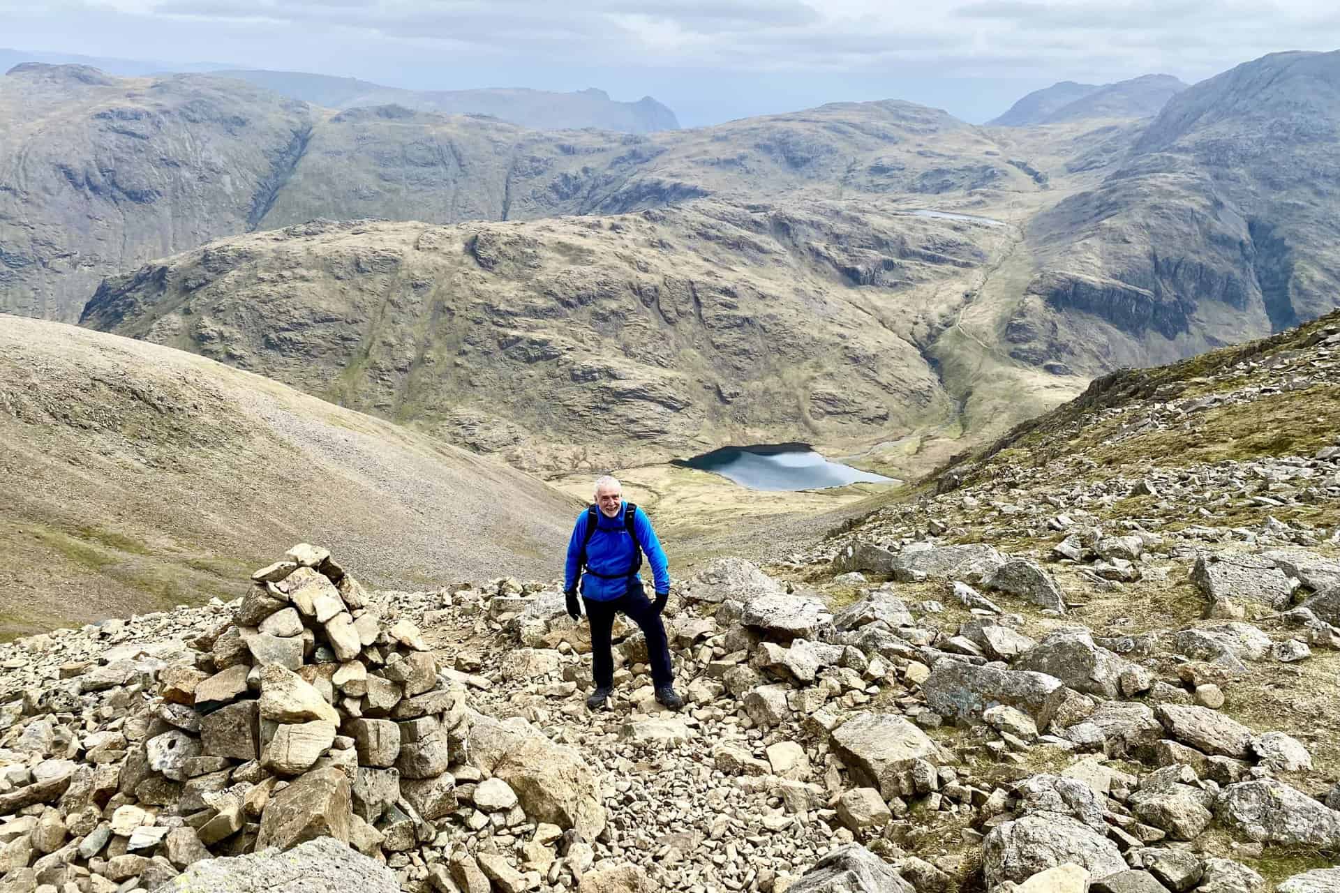
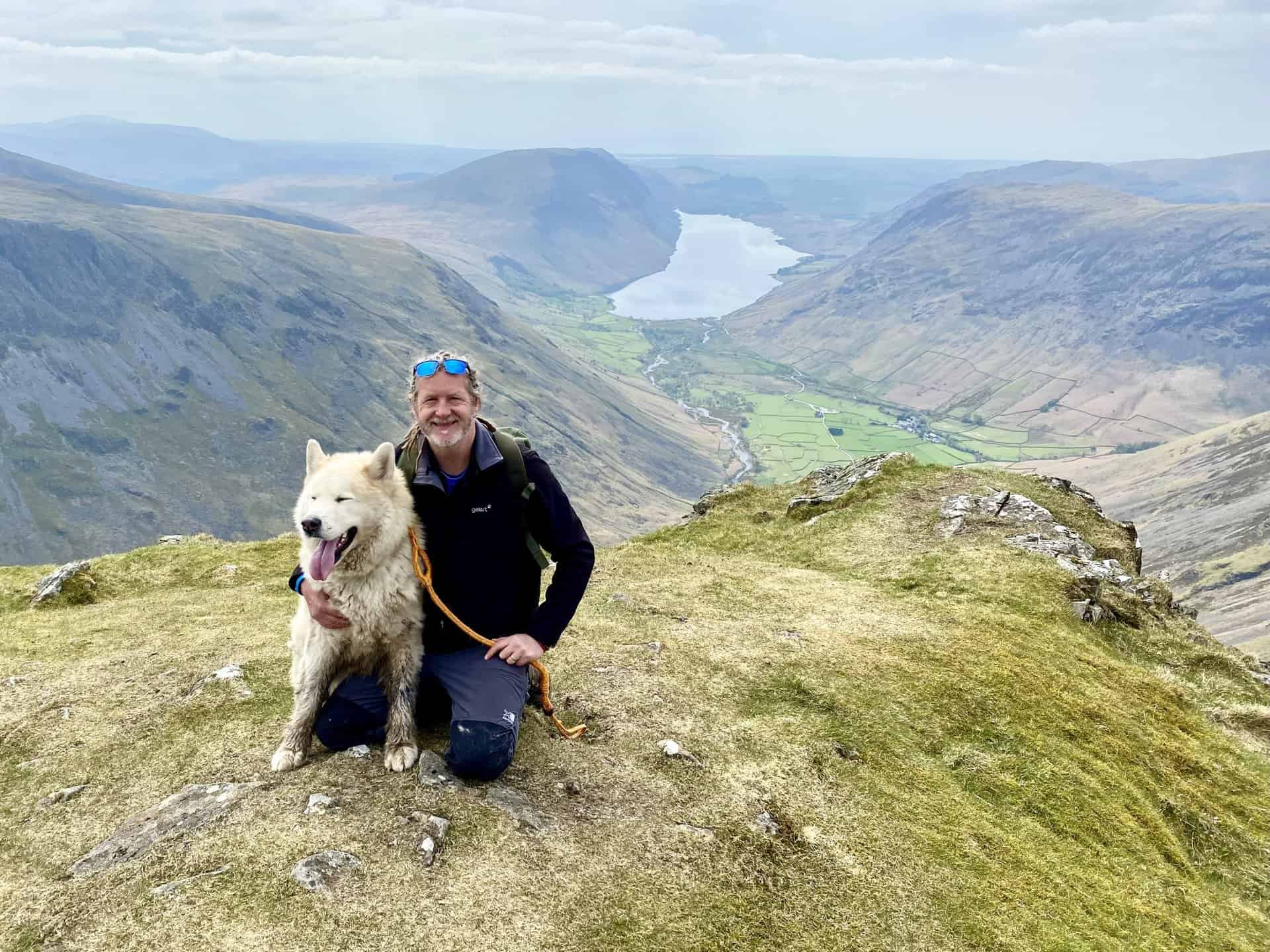
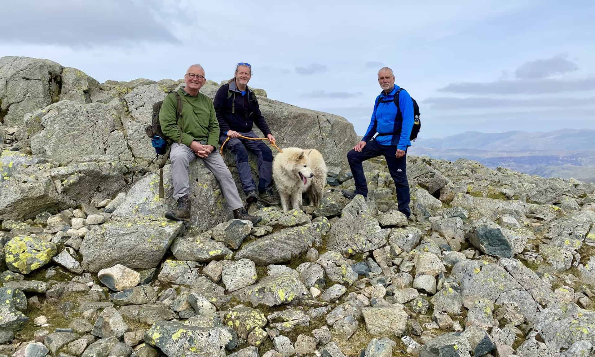
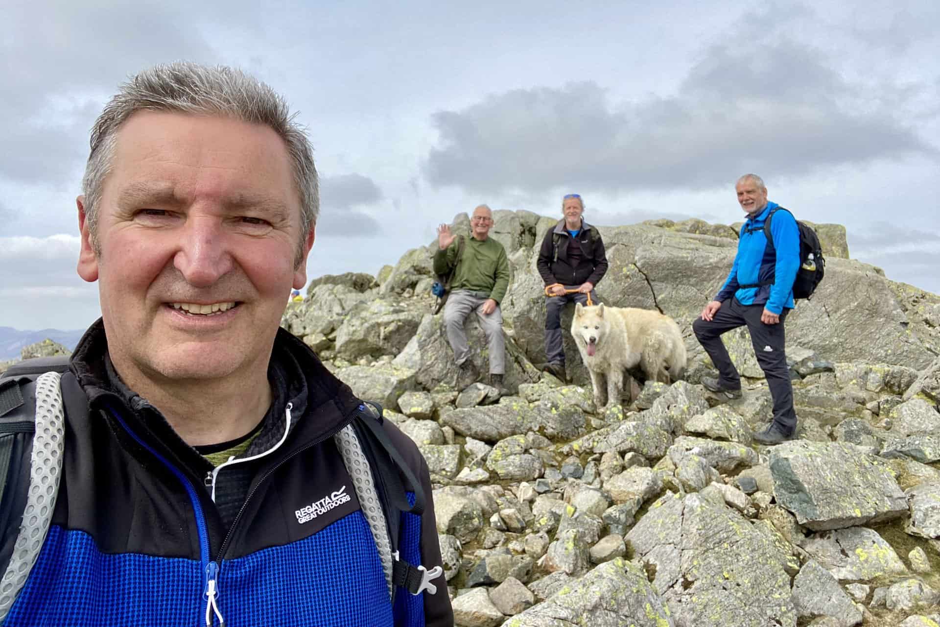
Back on the top of Great Gable after our detour to Westmorland Cairn.
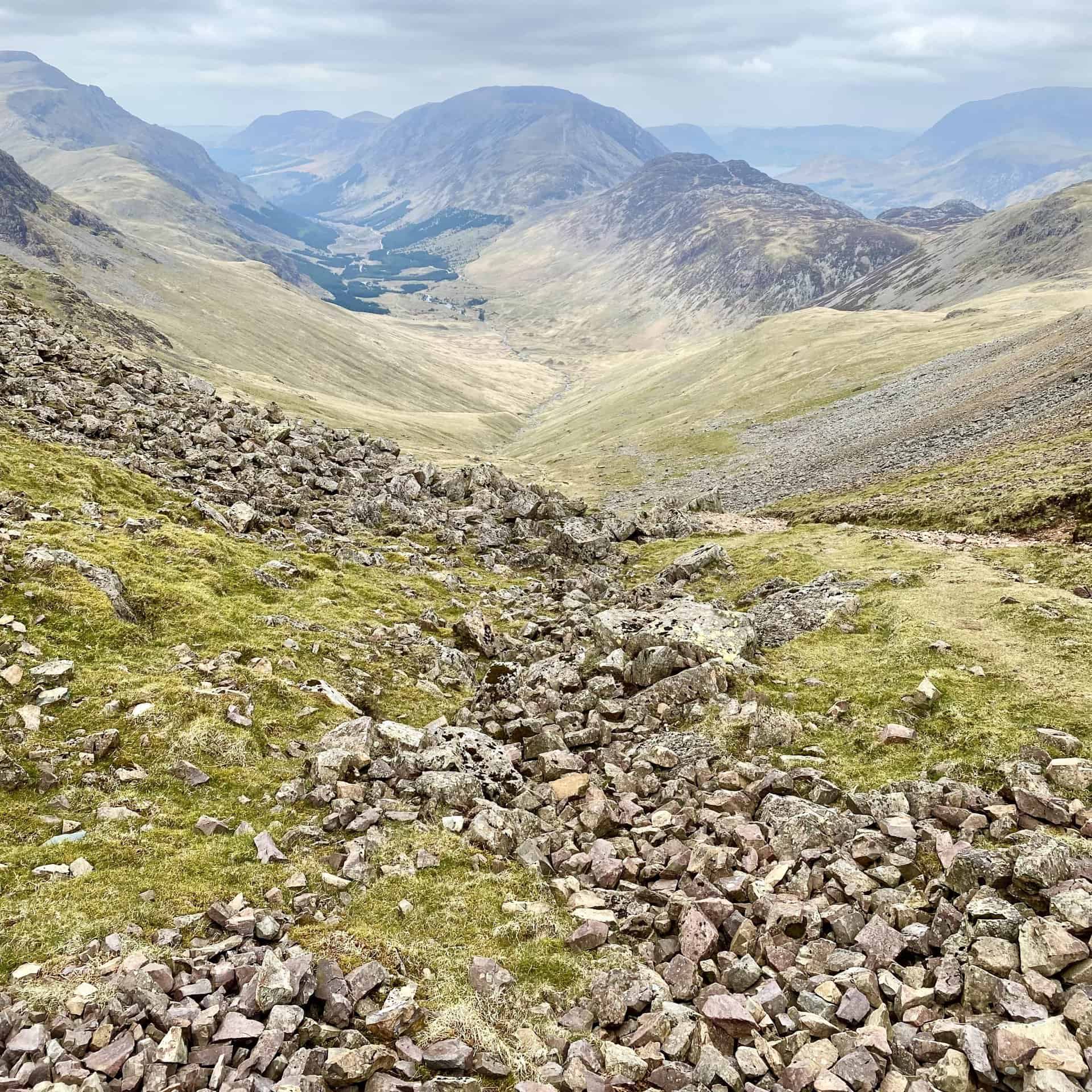
Amazing views during the north-west descent of Great Gable, but care is needed as the steep mountainside is covered with loose, slippery scree. This is roughly the halfway point of the Great Gable walk.
Looking back at Gable Crag from Moses’ Trod.
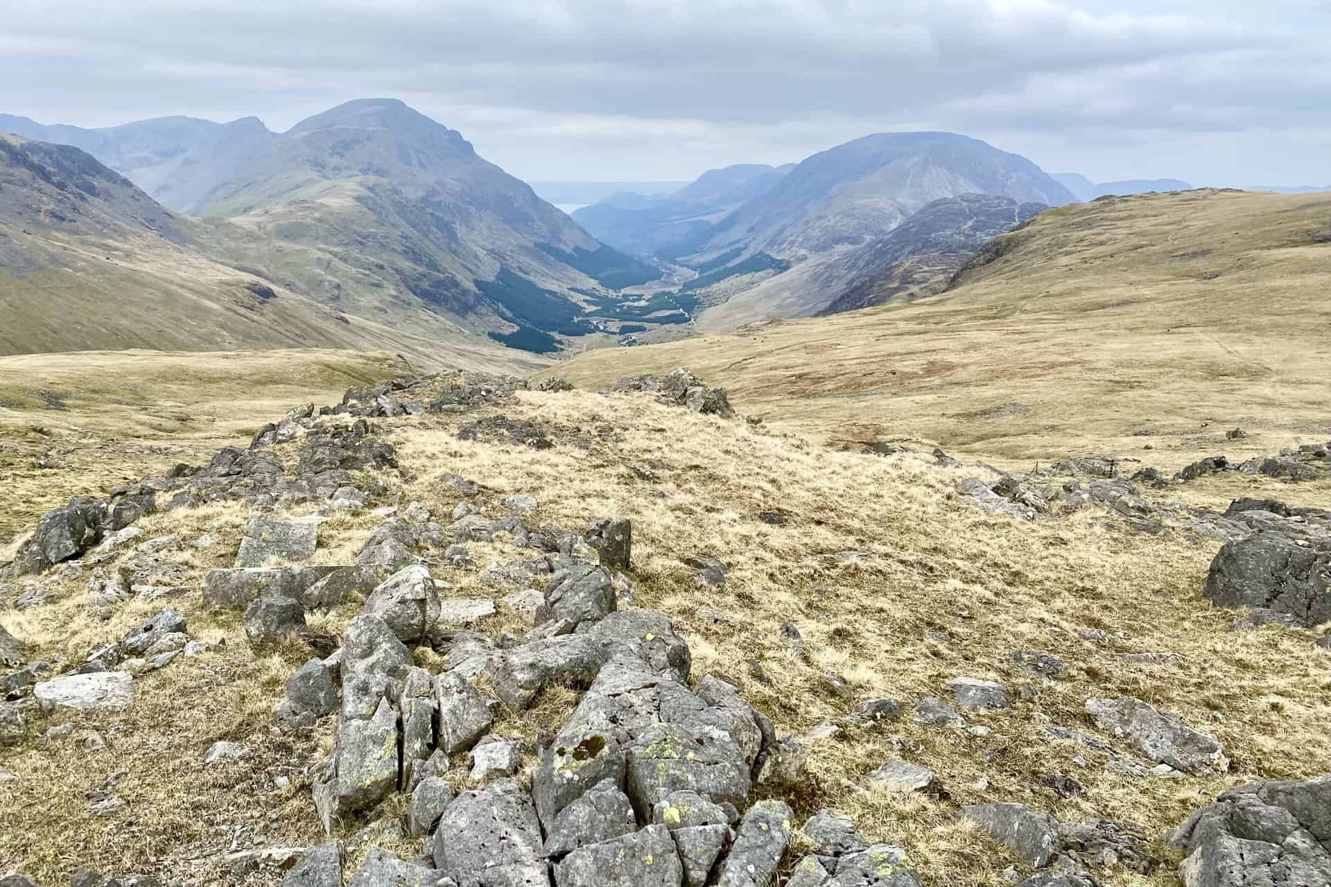
The mountain range on the southern (left) side of the Ennerdale valley includes, from front to back, Pillar, Black Crag and Scoat Fell.
Buttermere and Crummock Water come back into view as we make our way over to Fleetwith. At this point we’re about three-quarters of the way round our Great Gable walk.
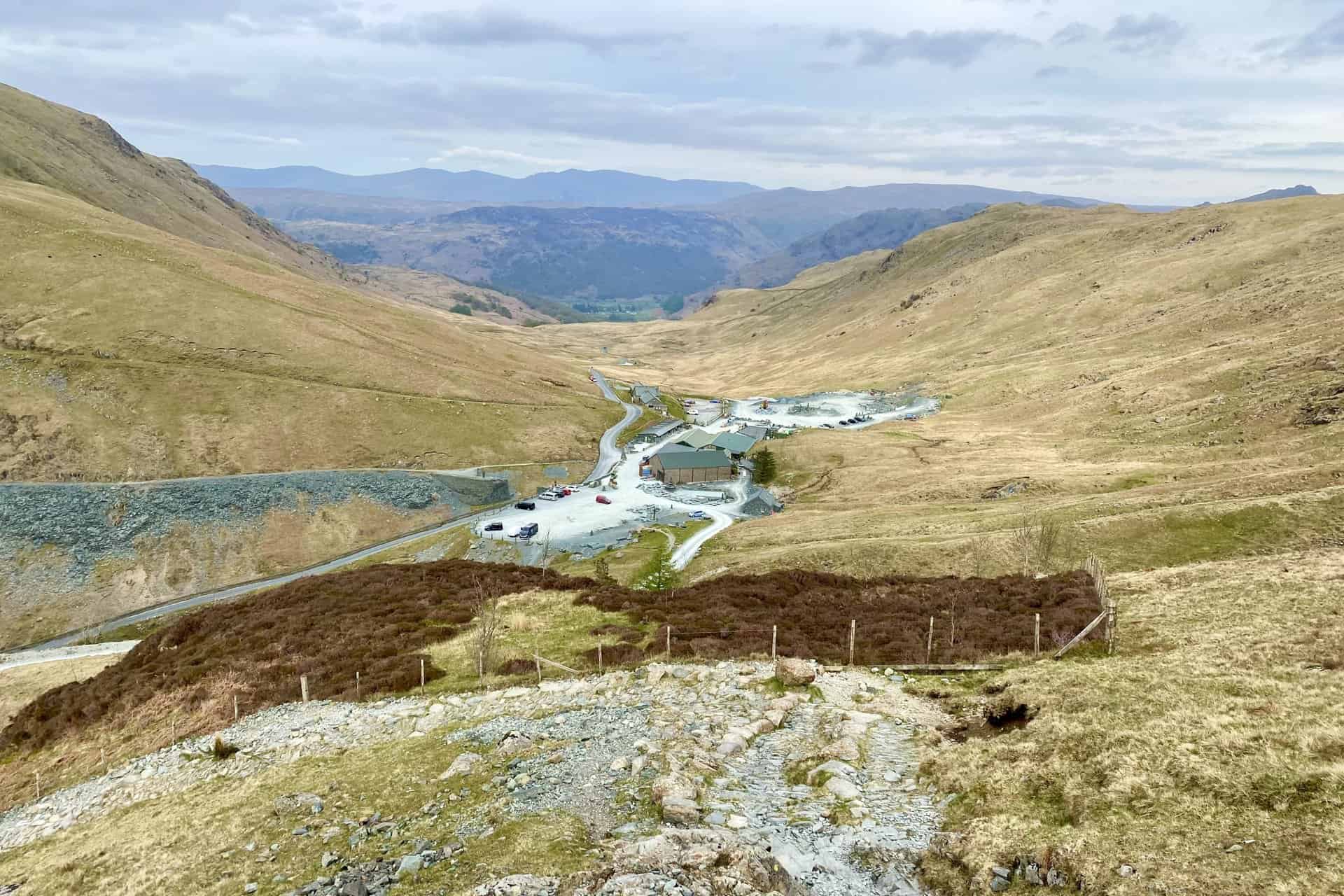
Honister Slate Mine, the last working slate mine in England. Quarrying for Westmorland green slate has been taking place in the area since 1728. Apart from the mining it is also a very popular tourist attraction in the Lake District.
Highly Rated Osprey Hiking Backpacks for Outdoor Enthusiasts
Osprey’s reputation for crafting high-quality hiking backpacks is well-established, offering a range of options that cater to both men and women. The following four backpacks stand out for their excellent sales and customer ratings on Amazon, making them a top choice for outdoor enthusiasts seeking reliability and comfort. As an Amazon affiliate, I may earn a small commission from any purchases made through the links provided. This helps support the upkeep of this website. Rest assured, you won’t pay a penny extra, but your purchase will contribute to keeping my site running smoothly. Happy walking!

Osprey Tempest 20 Women’s Hiking Backpack
The Tempest 20 stands out as the ideal solution for day-hiking, biking, or peak-bagging, tailored specifically for women. It features a panel-loading design for ease of access, complemented by an internal zippered mesh pocket with a key clip for secure storage. Unique to this model are the Stow-on-the-Go trekking pole and LidLock bike helmet attachments, enhancing its versatility. Side stretch mesh pockets, along with an easy-access, expandable stretch mesh harness pocket, offer ample storage. Additionally, it includes a blinker light attachment (light not included) and a large stretch mesh front panel pocket for extra carrying capacity.

Osprey Talon 22 Men’s Hiking Backpack
Designed for the active adventurer, the Talon 22 provides an optimal panel-loading design suitable for day-hiking, biking, or peak-bagging. Key features include dual-zippered panel access to the main compartment and a tuck-away ice ax attachment with a bungee tie-off. It boasts a top panel zippered slash pocket for quick access items and lower side compression straps for load management. An external hydration reservoir sleeve and dual-zippered fabric hipbelt pockets enhance hydration and storage, while a large stretch mesh front panel pocket increases its utility for various activities.

Osprey Tempest 30 Women’s Hiking Backpack
The Tempest 30, designed with a women’s-specific fit, is a streamlined top-loader ideal for both extensive day trips and light-and-fast overnight adventures. It includes a fixed top lid with an external zippered slash pocket and an under-lid zippered mesh pocket with a key clip for organised storage. The pack features a tuck-away ice ax attachment with a bungee tie-off, dual upper and lower side compression straps for load adjustment, and an external hydration reservoir sleeve. For added convenience, it offers an easy-access, expandable stretch mesh harness pocket and dual-zippered fabric hip-belt pockets.

Osprey Talon 33 Men’s Hiking Backpack
The Talon 33 is engineered for dynamic movement, making it the perfect streamlined top-loader for committed day trips or light-and-fast overnight excursions. It features top load access to the main compartment for easy packing and retrieval. The backpack is equipped with a large stretch mesh front panel pocket, Stow-on-the-Go trekking pole attachment, and stretch mesh side pockets for versatile storage options. Additionally, an easy-access, expandable stretch mesh harness pocket and dual-zippered fabric hip-belt pockets offer convenient storage solutions for essential gear.