Plan Your Outdoor Escape with a Bannerdale Crags Walk in the Lake District
Embark on a scenic journey through the Lake District with this Bannerdale Crags walk, beginning in the charming village of Mungrisdale. Reach this starting point by driving north for about two miles along the Mungrisdale and Caldbeck road, which branches off from the A66. Conveniently park your vehicle by the side of the road opposite Mungrisdale Village Hall. Kick off your adventure by crossing the footbridge over the River Glenderamackin to the Mill Inn, and then take the small tarmac road south for about 500 metres.
At the end of this stretch, turn right onto a public footpath. Stride uphill along the eastern flanks of Souther Fell until you reach its summit. From here, proceed south-west, descending to the col between Souther Fell and Scales Fell. Then, commence your ascent westward up Scales Fell to reach Hallsfell Top, the summit of Blencathra, where you will be rewarded with spectacular panoramic views.
Continue your hike by heading north to Atkinson Pike, where you might encounter other hikers who have climbed the challenging Sharp Edge. Next, head north, descending into the valley before veering east to ascend to the summit of Bannerdale Crags. Stroll along the top of the crags’ steep western slopes, savouring the breathtaking vistas over the Bannerdale valley.
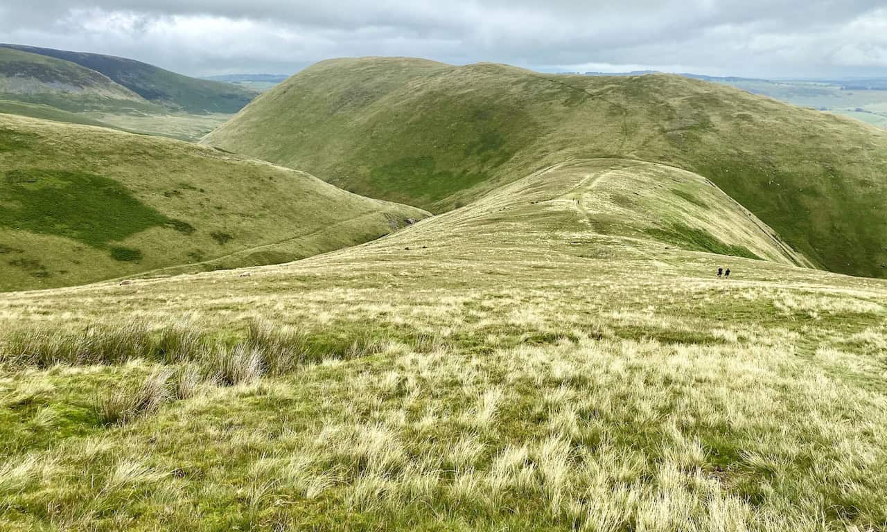
Afterwards, keep heading north across Bowscale Fell until you arrive at Tarn Crags, offering a splendid view of Bowscale Tarn below. Navigate around the top of the Bowscale Tarn cirque, a natural amphitheatre, and then descend the slopes to cross the River Caldew via a footbridge at Roundhouse.
From Roundhouse, follow the gentle track east through the valley beneath the steep southern slopes of Carrock Fell towards Mosedale. Turn south, cross Mosedale Bridge, and continue your stroll back to Mungrisdale on the minor road. This delightful 11-mile Bannerdale Crags walk covers four of Alfred Wainwright’s famed Lake District fells – Souther Fell, Blencathra, Bannerdale Crags, and Bowscale Fell.
Bannerdale Crags Walk: Maps and Tools
Visit either the OS Maps website or the Outdooractive website to view this walking route in greater detail. Both platforms offer a range of features, including the ability to print the route, download it to your device, and export the route as a GPX file. You can also watch a 3D fly-over and share the route on social media.
Bannerdale Crags Walk: Distance, Duration, Statistics
Distance: 10½ miles
Distance: 17 kilometres
Duration: 5¾ hours
Ascent: 3070 feet
Ascent: 936 metres
Type: Circular walk
About Bannerdale Crags
Bannerdale Crags is a fell located in the Lake District, nestled between Blencathra and Bowscale Fell in the northern fells. It ranks 97th in the list of Wainwrights by height. The fell stands at 684 metres (2244 feet) and is marked on maps with the grid reference NY 335 290. It appears on the Ordnance Survey Explorer Map OL5 and Landranger Map 90, and is featured in Alfred Wainwright’s ‘Northern Fells’ book.
Bannerdale Crags Topography
The topography of Bannerdale Crags includes a ridge extending from north-west to south-east. Originally, the name referred only to the steep north-eastern flank. Now, it applies to the entire fell. The northward slope from Blencathra’s Atkinson Pike top is broadly convex, dividing into two ridges. The western arm leads to Mungrisdale Common, while the north-eastern arm descends sharply to a col at 620 metres (2020 feet). Here, Blackhazel Beck flows north-west to join the River Caldew. The opposite slope is the source of the River Glenderamackin. South-west of the col, smooth slopes ascend the other side of the ridge, hiding the craggy wall facing north-east.
Eastern Ridge and River Systems
The eastern ridge side overlooks the Bannerdale Beck valley, a River Glenderamackin tributary. Here, crags stretch almost continuously for a mile, with the highest sections dropping 180 metres (600 feet) to the valley. A significant spur provides an ascent route just below the summit. Northwards, the summit ridge crosses a grassy saddle to Bowscale Fell, with crags extending slightly into the neighbouring fell. In contrast, to the south-east, the ridge sharply descends to White Horse Bent, leading to the River Glenderamackin. This river winds intricately around the south and east of Bannerdale Crags, encircles Souther Fell, and flows west towards Keswick and the River Derwent.
Summit and Views
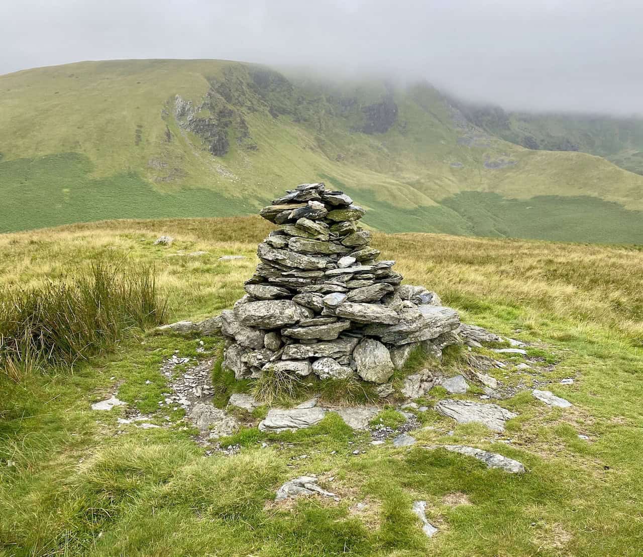
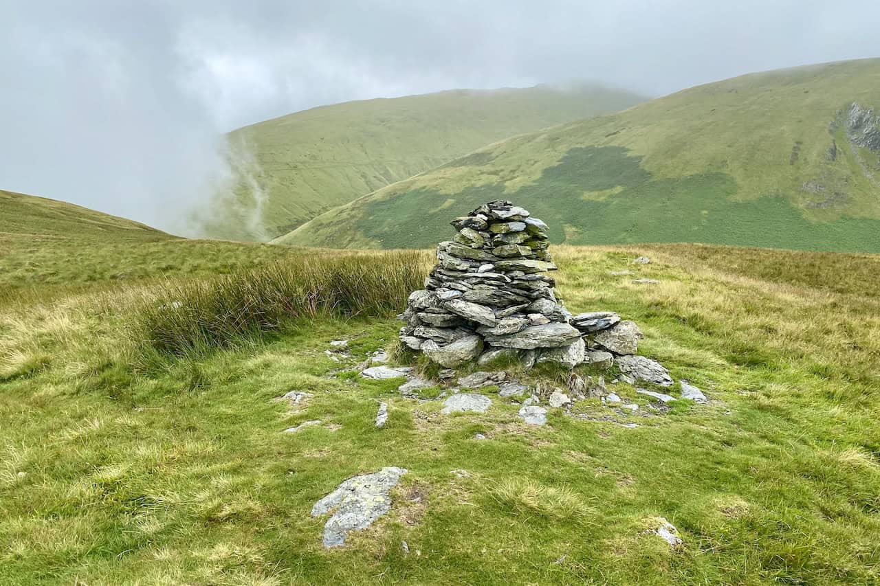
The summit itself is smooth and grassy. The highest point is set back from the crags and marked by a small cairn of flat stones. Closer to the face, another cairn, previously referred to as a currick on older maps, acts as a stone shelter. From here, the view extends significantly.
Bannerdale Crags Geology
Geologically, Bannerdale Crags is predominantly made up of the Kirk Stile Formation from the Skiddaw Group. This formation consists of laminated mudstone and siltstone, interspersed with greywacke sandstone and dates back to the Ordovician period.
Recommended Ordnance Survey Map
The best map to use on this walk is the Ordnance Survey map of the Lake District North-Eastern Area, reference OS Explorer OL5, scale 1:25,000. It clearly displays footpaths, rights of way, open access land and vegetation on the ground, making it ideal for walking, running and hiking. The map can be purchased from Amazon in either a standard, paper version or a weatherproof, laminated version, as shown below.
Standard Version
Bannerdale Crags Walk: My Photos
The summit of Souther Fell, height 522 metres (1713 feet).
Looking back towards Souther Fell from the slopes of Scales Fell, about one-quarter of the way round our Bannerdale Crags walk.
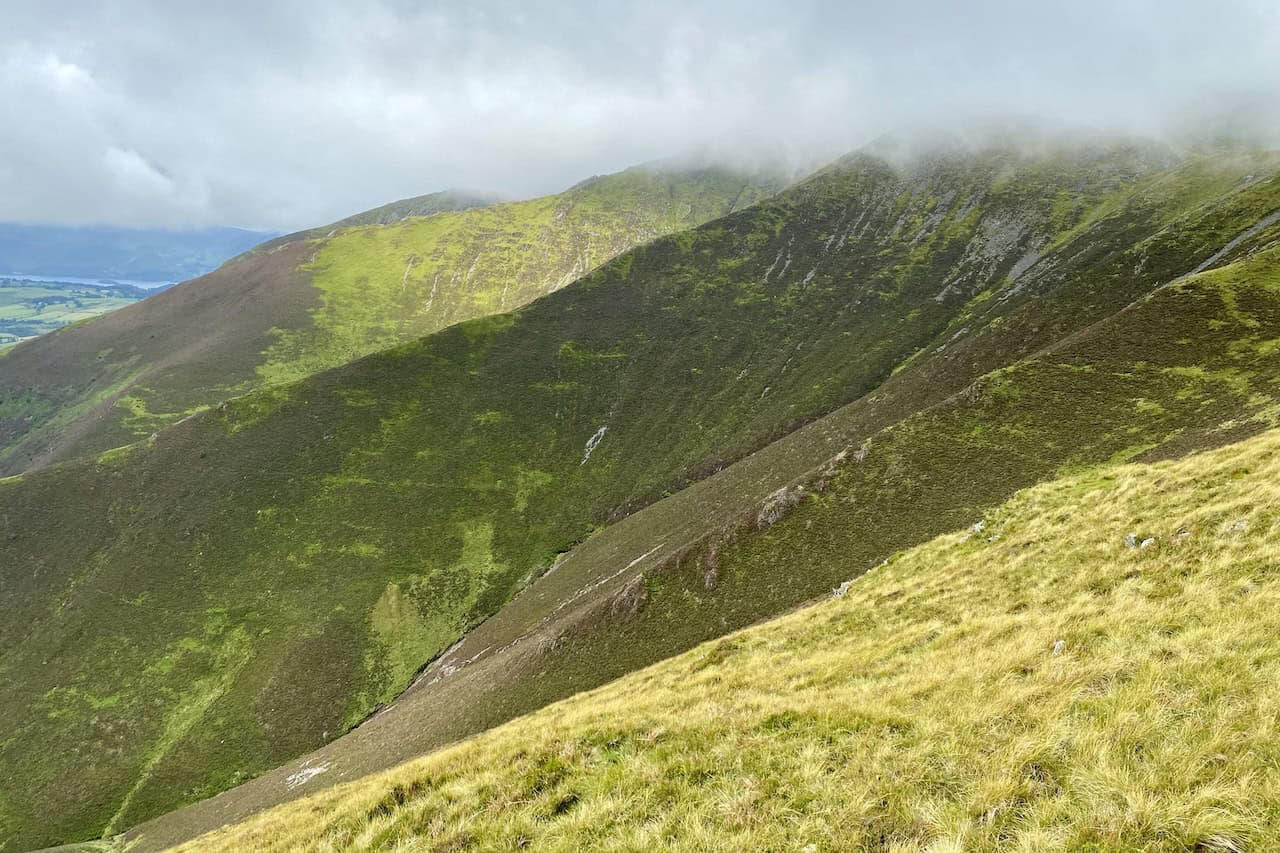
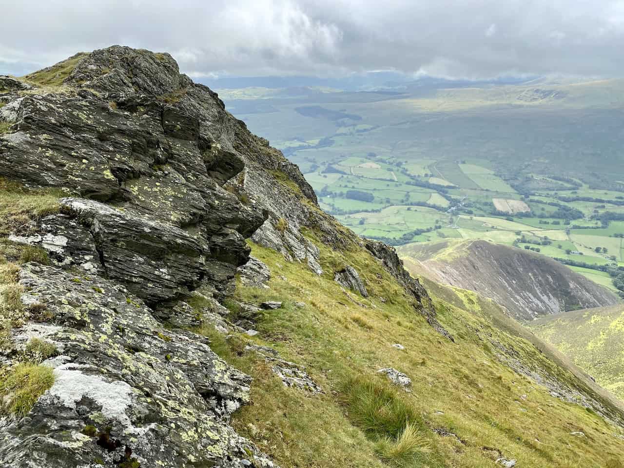
The rocky spurs and scree slopes on Blencathra’s southern flank.
Amazing views to the south and south-west from Scales Fell.
Looking across to Sharp Edge, probably Blencathra’s most popular and well-known approach.
The valley cut by Scaley Beck between Doddick Fell (right) and Scales Fell (left).
Our first sighting of Scales Tarn.
Blencathra’s rocky crags between Doddick Fell and Hallsfell Top.
Scales Tarn.
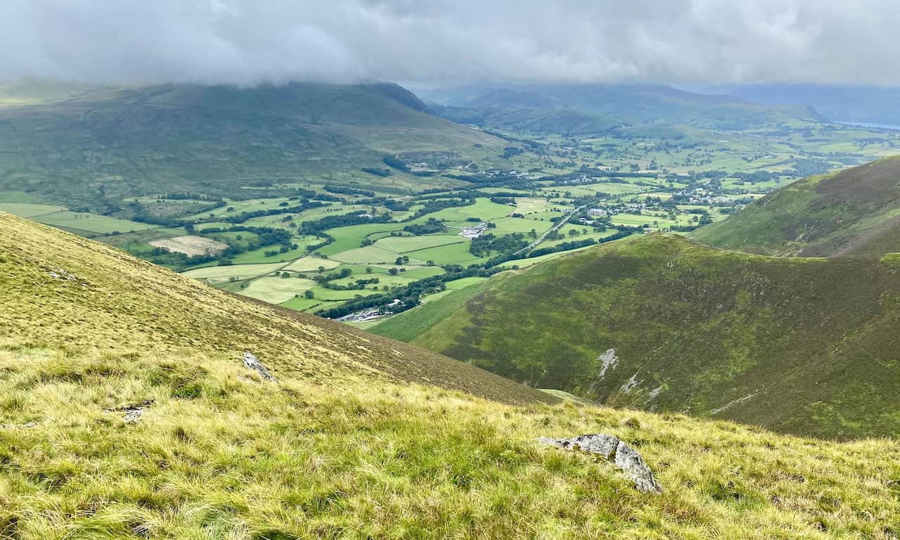
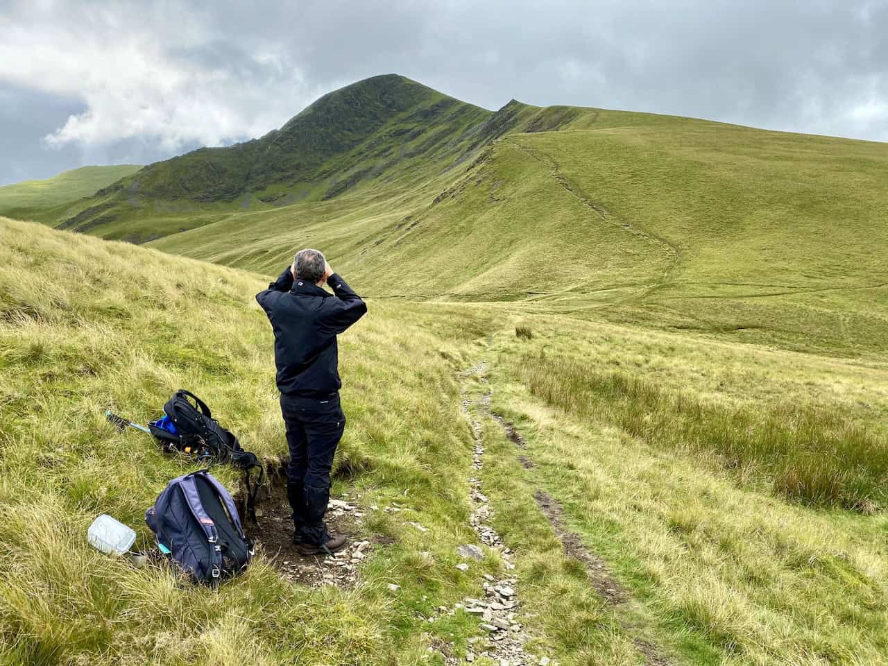
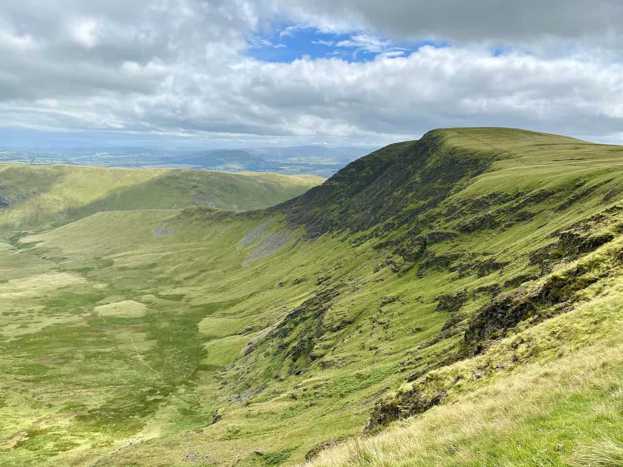
Mark looks back towards Blencathra as we make our way over to Bannerdale Crags.
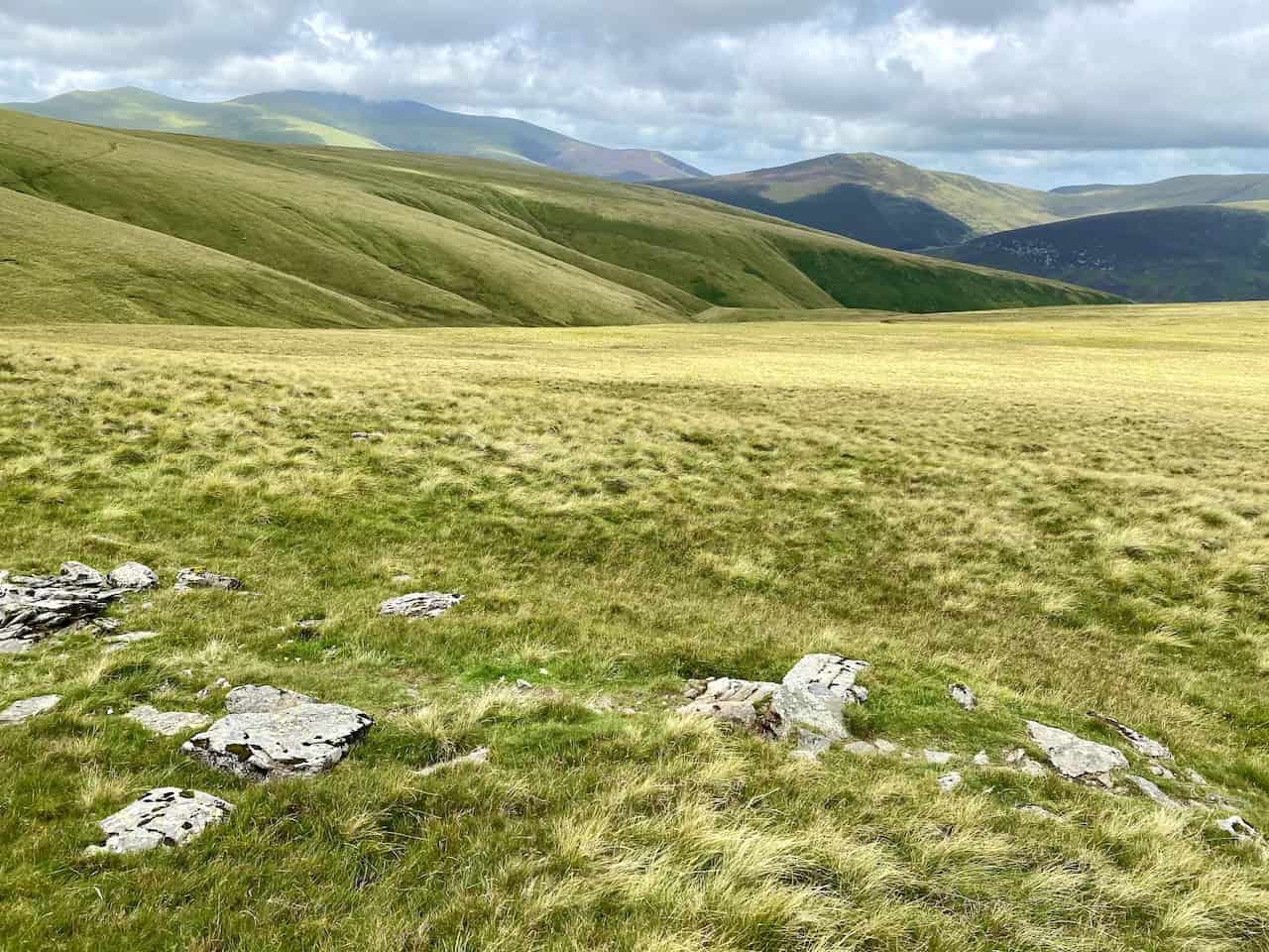
The view west over Mungrisdale Common towards the Skiddaw range of mountains in the far distance.
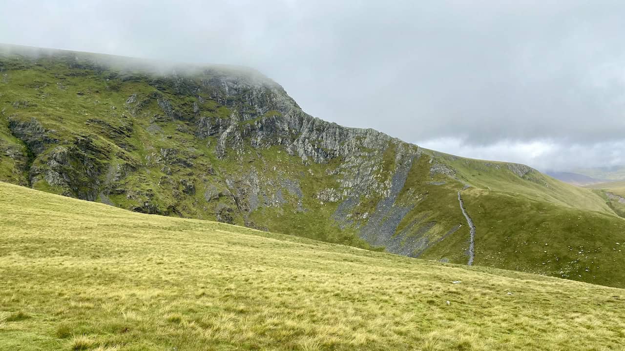
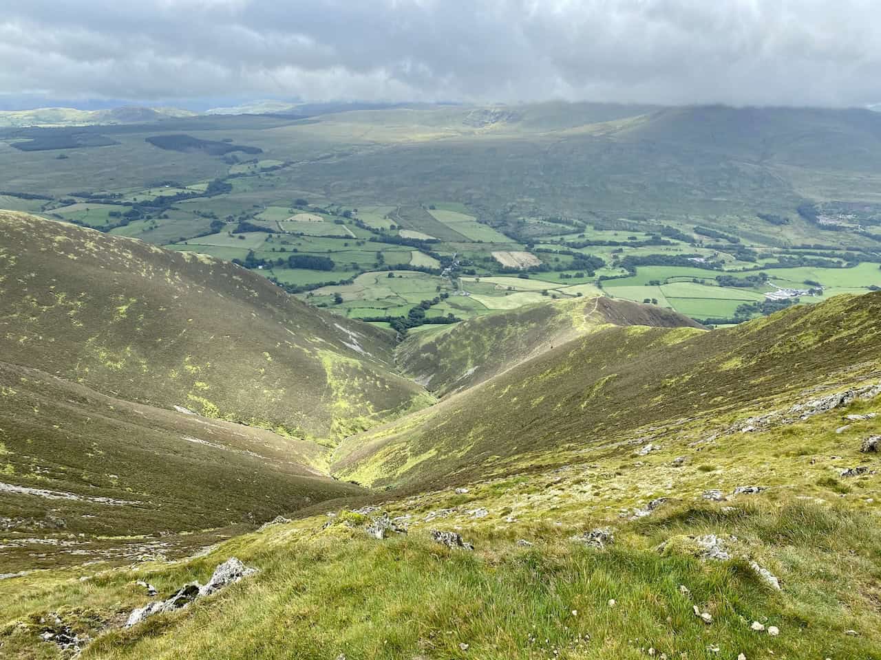
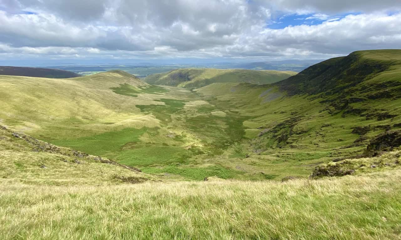
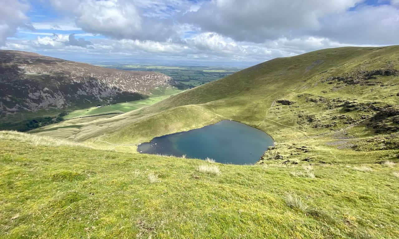
Bannerdale and Bannerdale Crags.
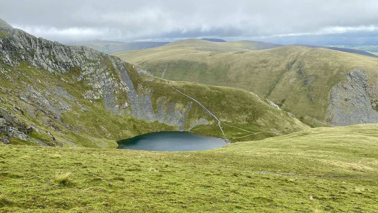
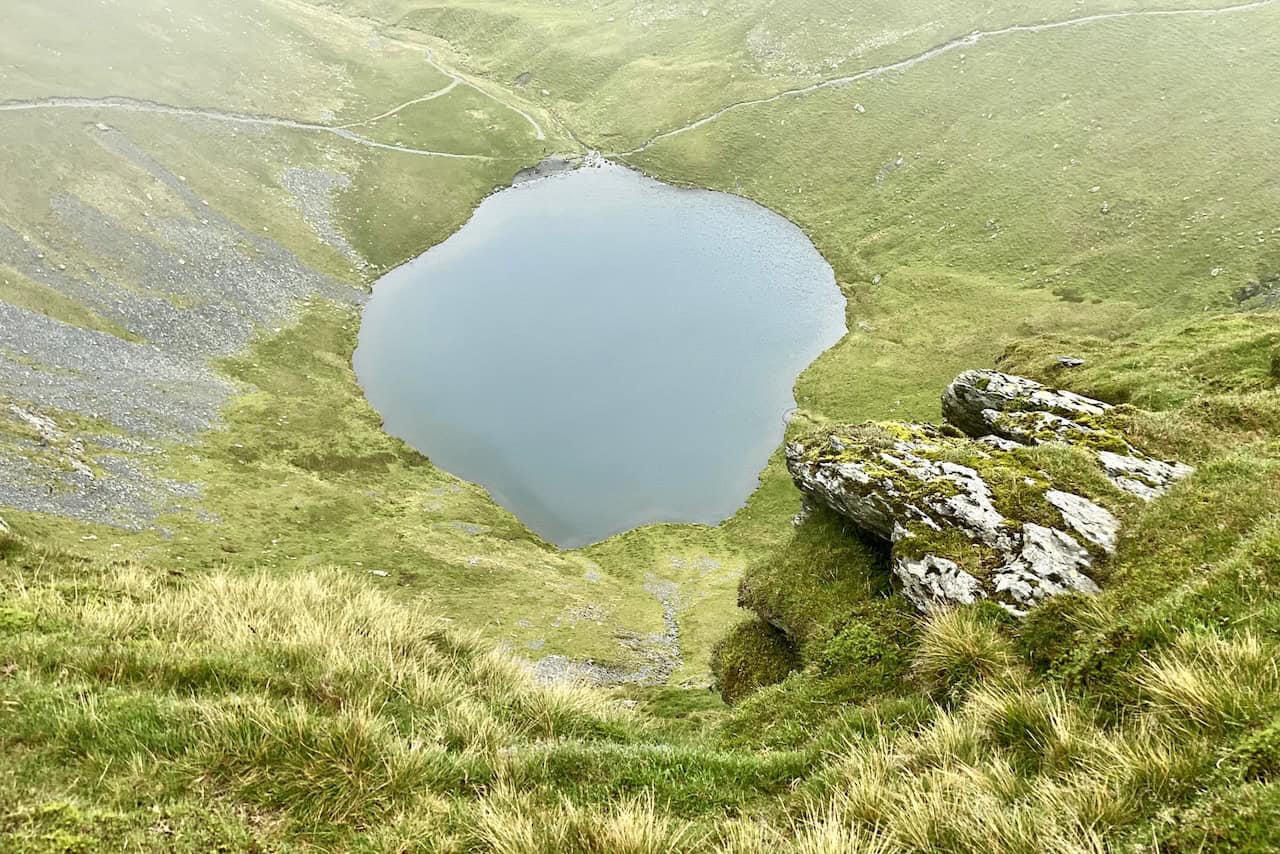
Bowscale Tarn with Carrock Fell in the background.
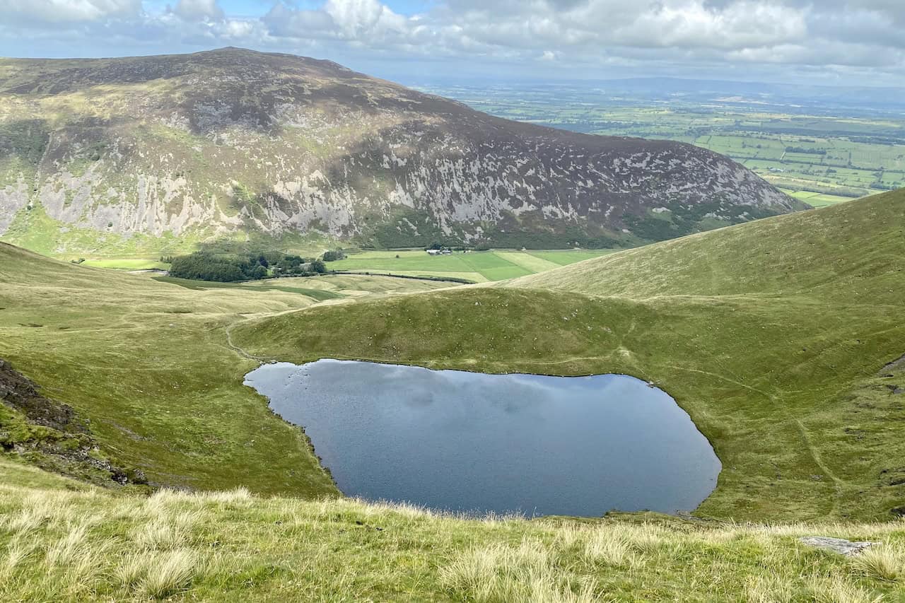
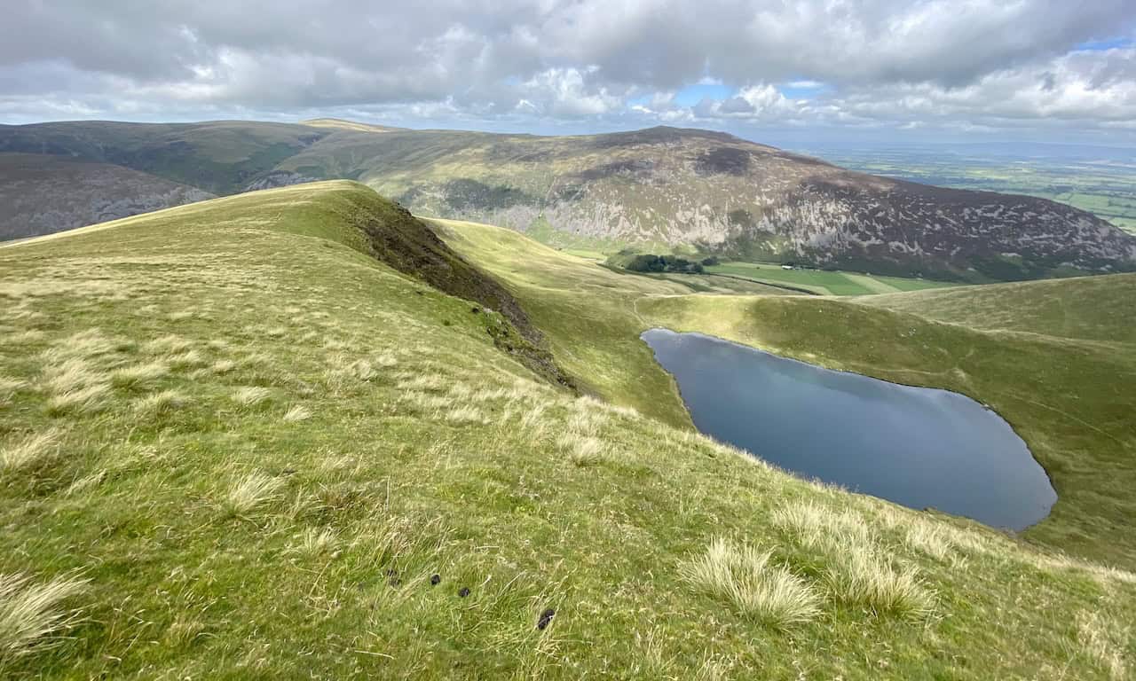
Bowscale Tarn in a classic glacial corrie, held in place by a humped moraine.
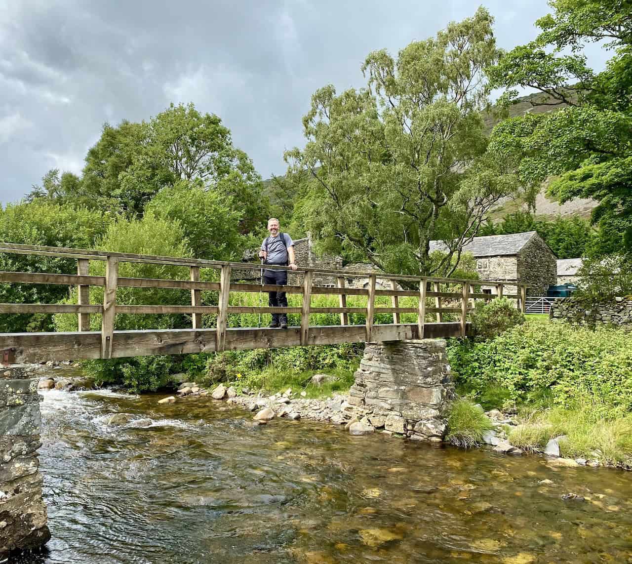
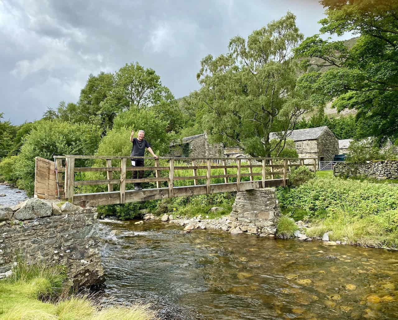
Footbridge over the River Caldew at Roundhouse, about three-quarters of the way round our Bannerdale Crags walk.
Highly Rated Osprey Hiking Backpacks for Outdoor Enthusiasts
Osprey’s reputation for crafting high-quality hiking backpacks is well-established, offering a range of options that cater to both men and women. The following four backpacks stand out for their excellent sales and customer ratings on Amazon, making them a top choice for outdoor enthusiasts seeking reliability and comfort. As an Amazon affiliate, I may earn a small commission from any purchases made through the links provided. This helps support the upkeep of this website. Rest assured, you won’t pay a penny extra, but your purchase will contribute to keeping my site running smoothly. Happy walking!

Osprey Tempest 20 Women’s Hiking Backpack
The Tempest 20 stands out as the ideal solution for day-hiking, biking, or peak-bagging, tailored specifically for women. It features a panel-loading design for ease of access, complemented by an internal zippered mesh pocket with a key clip for secure storage. Unique to this model are the Stow-on-the-Go trekking pole and LidLock bike helmet attachments, enhancing its versatility. Side stretch mesh pockets, along with an easy-access, expandable stretch mesh harness pocket, offer ample storage. Additionally, it includes a blinker light attachment (light not included) and a large stretch mesh front panel pocket for extra carrying capacity.

Osprey Talon 22 Men’s Hiking Backpack
Designed for the active adventurer, the Talon 22 provides an optimal panel-loading design suitable for day-hiking, biking, or peak-bagging. Key features include dual-zippered panel access to the main compartment and a tuck-away ice ax attachment with a bungee tie-off. It boasts a top panel zippered slash pocket for quick access items and lower side compression straps for load management. An external hydration reservoir sleeve and dual-zippered fabric hipbelt pockets enhance hydration and storage, while a large stretch mesh front panel pocket increases its utility for various activities.

Osprey Tempest 30 Women’s Hiking Backpack
The Tempest 30, designed with a women’s-specific fit, is a streamlined top-loader ideal for both extensive day trips and light-and-fast overnight adventures. It includes a fixed top lid with an external zippered slash pocket and an under-lid zippered mesh pocket with a key clip for organised storage. The pack features a tuck-away ice ax attachment with a bungee tie-off, dual upper and lower side compression straps for load adjustment, and an external hydration reservoir sleeve. For added convenience, it offers an easy-access, expandable stretch mesh harness pocket and dual-zippered fabric hip-belt pockets.

Osprey Talon 33 Men’s Hiking Backpack
The Talon 33 is engineered for dynamic movement, making it the perfect streamlined top-loader for committed day trips or light-and-fast overnight excursions. It features top load access to the main compartment for easy packing and retrieval. The backpack is equipped with a large stretch mesh front panel pocket, Stow-on-the-Go trekking pole attachment, and stretch mesh side pockets for versatile storage options. Additionally, an easy-access, expandable stretch mesh harness pocket and dual-zippered fabric hip-belt pockets offer convenient storage solutions for essential gear.