Experience the Beauty of the Nidderdale Way Walk from Lofthouse Village Centre
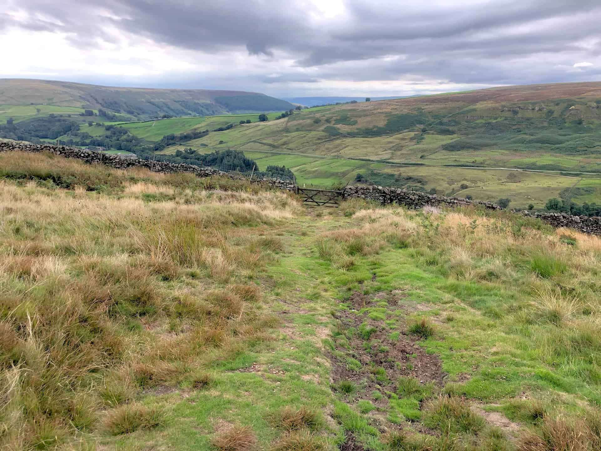
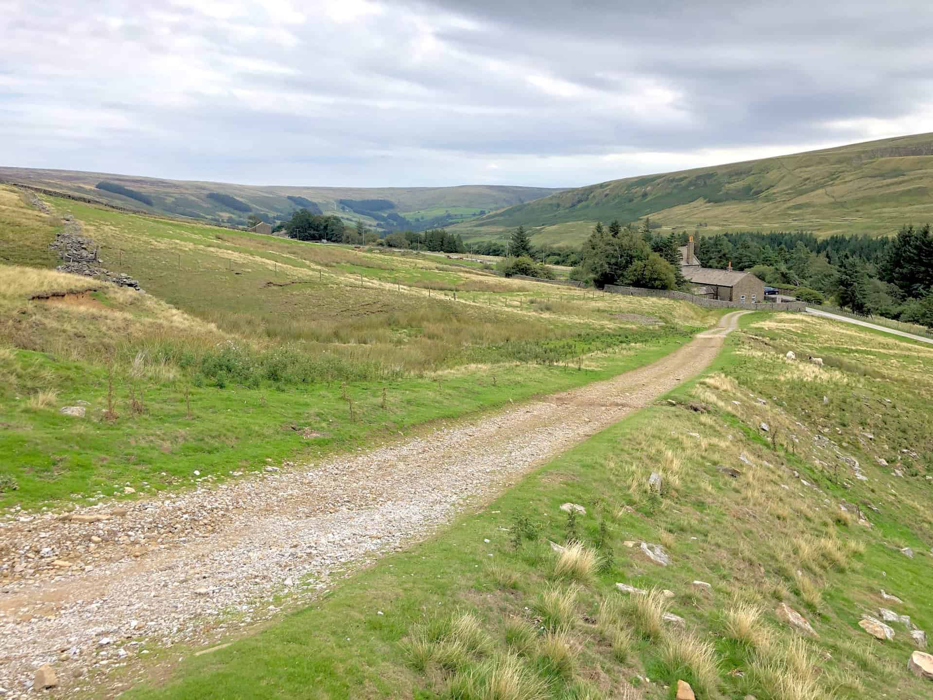
Begin your Nidderdale Way walk by parking in Lofthouse village centre. From there, head north on the Nidderdale Way for approximately 2½ miles towards Bracken Ridge. As you progress, you’ll pass notable landmarks such as Limley Farm and Thwaite House. It’s worth noting that the Nidderdale Way on this stretch of the walk generally traces the path of the River Nidd in an upstream direction.
Continue your journey on the Nidderdale Way, turning west and walking roughly another three miles. This will lead you to the north-eastern tip of Scar House Reservoir. Pursue the path further west, following a track named Carle Fell Road. This track runs above the northern side of the reservoir, eventually guiding you south-west towards the Angram Reservoir dam.
Cross the Angram Reservoir dam and follow the path alongside the southern banks of Scar House Reservoir. Continue until you reach a point just before the southern end of the Scar House Reservoir dam. From this point, shift your direction south-eastwards, venturing over In Moor towards Middlesmoor using the designated Nidderdale Way.
Continuing south-east will bring you back to your starting point in Lofthouse. Altogether, this walk covers a distance of approximately 12 miles, representing just a section of the Nidderdale Way. It’s important to note that this is not the full 54-mile Nidderdale Way Long Distance Path (LDP), which you can read about further down the page.
Nidderdale Way Walk: Maps and Tools
Visit either the OS Maps website or the Outdooractive website to view this walking route in greater detail. Both platforms offer a range of features, including the ability to print the route, download it to your device, and export the route as a GPX file. You can also watch a 3D fly-over and share the route on social media.
Nidderdale Way Walk: Distance, Duration, Statistics
Distance: 12 miles
Distance: 19½ kilometres
Duration: 5¾ hours
Ascent: 1919 feet
Ascent: 585 metres
Type: Circular walk
About the Nidderdale Way Long Distance Path (LDP)
Exploring the Nidderdale Way LDP
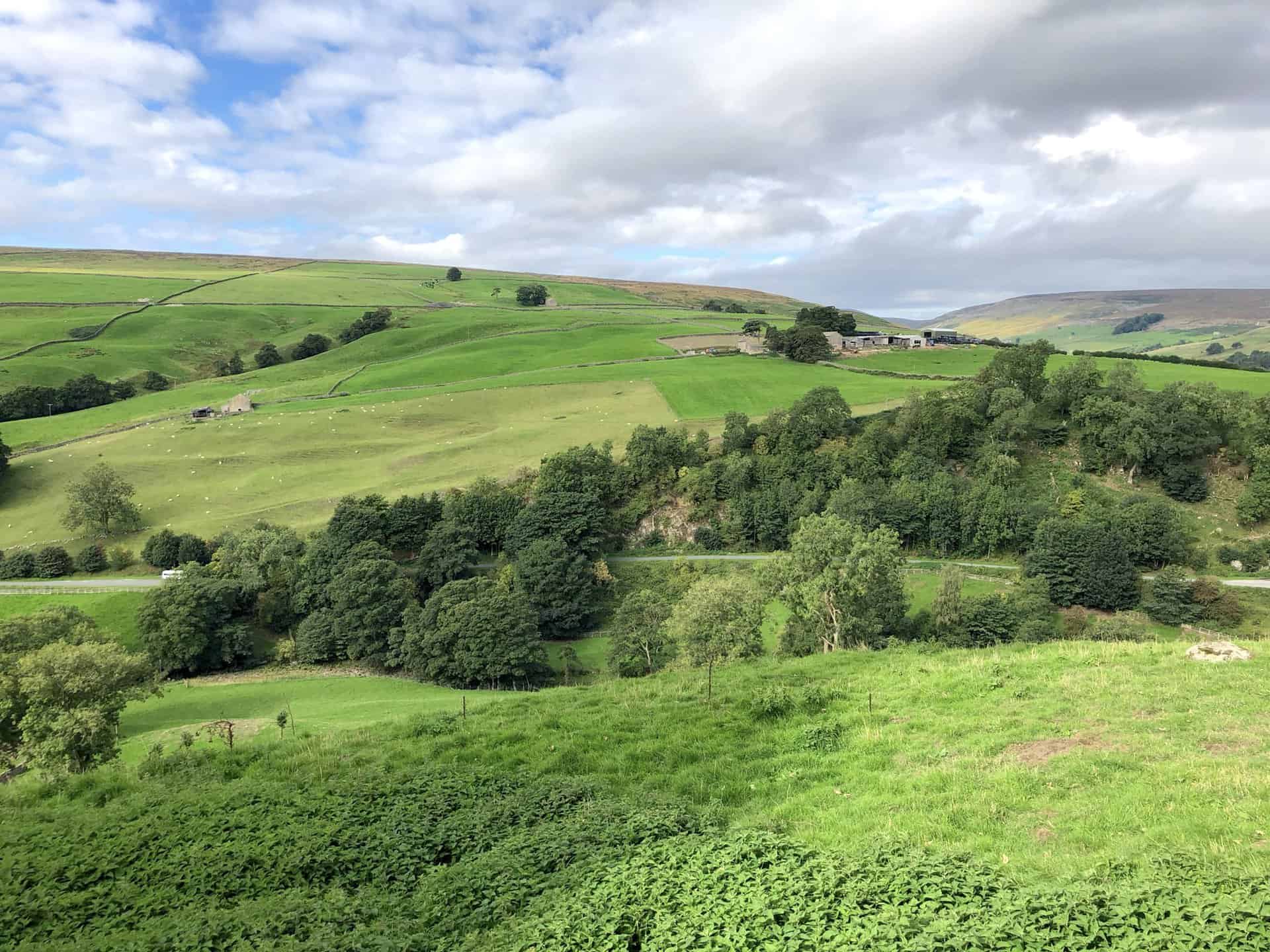
Nestled in the heart of the Nidderdale Area of Outstanding Natural Beauty, the Nidderdale Way LDP offers a circular walk of 54 miles. Most walkers start and conclude their journey in Pateley Bridge, following the river Nidd and winding their way up the valley to the Scar House Reservoir. Then the route descends, taking you all the way to the picturesque village of Ripley. Having been established in the 1980s, this path has swiftly become a favourite among walking enthusiasts. It’s an ideal trail for a long weekend, often divided into four stages, with no single stretch longer than 15 miles.
Notable Attractions on the Route
The journey will introduce you to the wind-sculpted formations of Brimham Rocks, which have been shaped over millennia by the forces of nature. Further along, the How Stean Gorge awaits with its mesmerising limestone ravine, teeming with rockpools and fringed with waterfalls. Another highlight is Yorke’s Folly, reminiscent of a window arch from a historical abbey. Of course, the grandeur of Ripley Castle is unmissable, especially its deer park and the famous 18th-century gardens conceived by Capability Brown.
The pathway also leads travellers through enchanting villages. Middlesmoor, with its hillside vantage, offers breathtaking views. Ramsgill presents a tranquil scene with its spacious green, stone cottages, and a prominent ivy-covered former hunting lodge. Then there’s Ripley, a 19th-century village inspired by French design, featuring a medieval market cross, stocks, and a unique ‘weeping cross’ in its churchyard.
The serene beauty of the Gouthwaite Reservoir, bustling with birdlife, and traces of ancient industries now reclaimed by nature, add to the trail’s charm. Throughout the journey, the River Nidd remains a constant companion, its banks inhabited by alders and frequented by herons and kingfishers.
Choosing Your Starting Point
Though Pateley Bridge is the conventional starting point, owing to its abundant amenities and transport links, the route remains adaptable to individual preferences. The high street of Pateley Bridge proudly displays the distinctive curlew motif signpost, marking both the start and end of the Nidderdale Way LDP. Yet, Ripley stands as a compelling alternative for many. The unique shape of Nidderdale means that sections of the outbound and return parts of the trail are in proximity, granting the flexibility to craft various day-long circular treks.
Treading the Path with Ease
Walking the Nidderdale Way LDP is more of a pleasure than a challenge. Predominantly, the trail hugs the riverbank and dalesides, interspersed with occasional elevated sections which soon yield to flatter terrains. Paths are diligently maintained and signposted, ensuring hassle-free navigation.
Mapping Your Nidderdale Way LDP Walk
To navigate the entirety of the Nidderdale Way LDP, the Ordnance Survey 1:25,000 Explorer 298 is a reliable choice, covering Nidderdale, Fountains Abbey, Ripon, and Pateley Bridge. For those seeking an alternative, Harvey Maps provide a durable, waterproof strip map dedicated to the Nidderdale Way LDP.
Recommended Ordnance Survey Map
The best map to use on this walk is the Ordnance Survey map of Nidderdale, reference OS Explorer 298, scale 1:25,000. It clearly displays footpaths, rights of way, open access land and vegetation on the ground, making it ideal for walking, running and hiking. The map can be purchased from Amazon in either a standard, paper version or a weatherproof, laminated version, as shown below.
Weatherproof Version
Ordnance Survey map of Nidderdale, reference OS Explorer 298, scale 1:25,000
Nidderdale Way Walk: My Photos
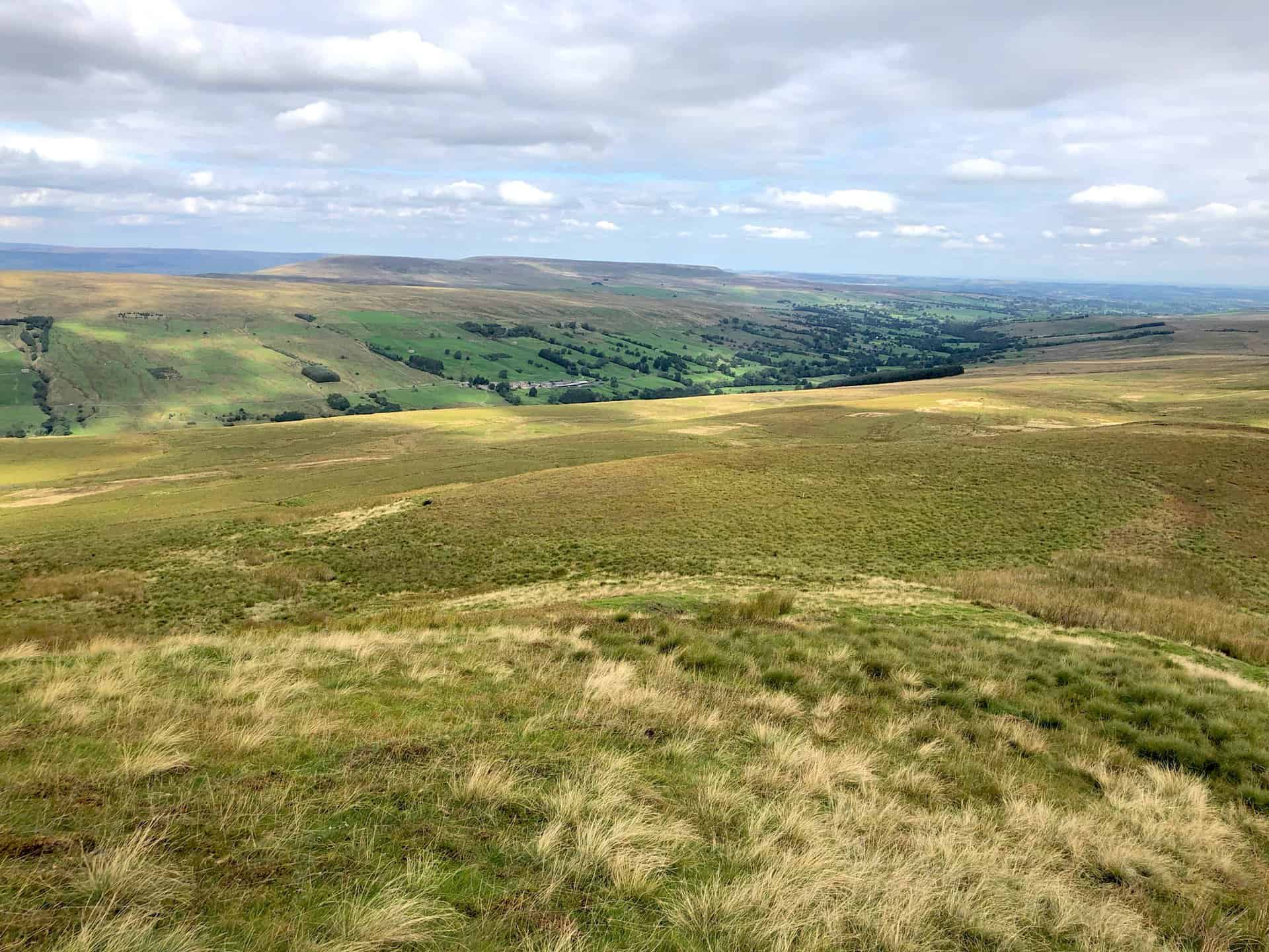
Looking west over Nidderdale towards In Moor.
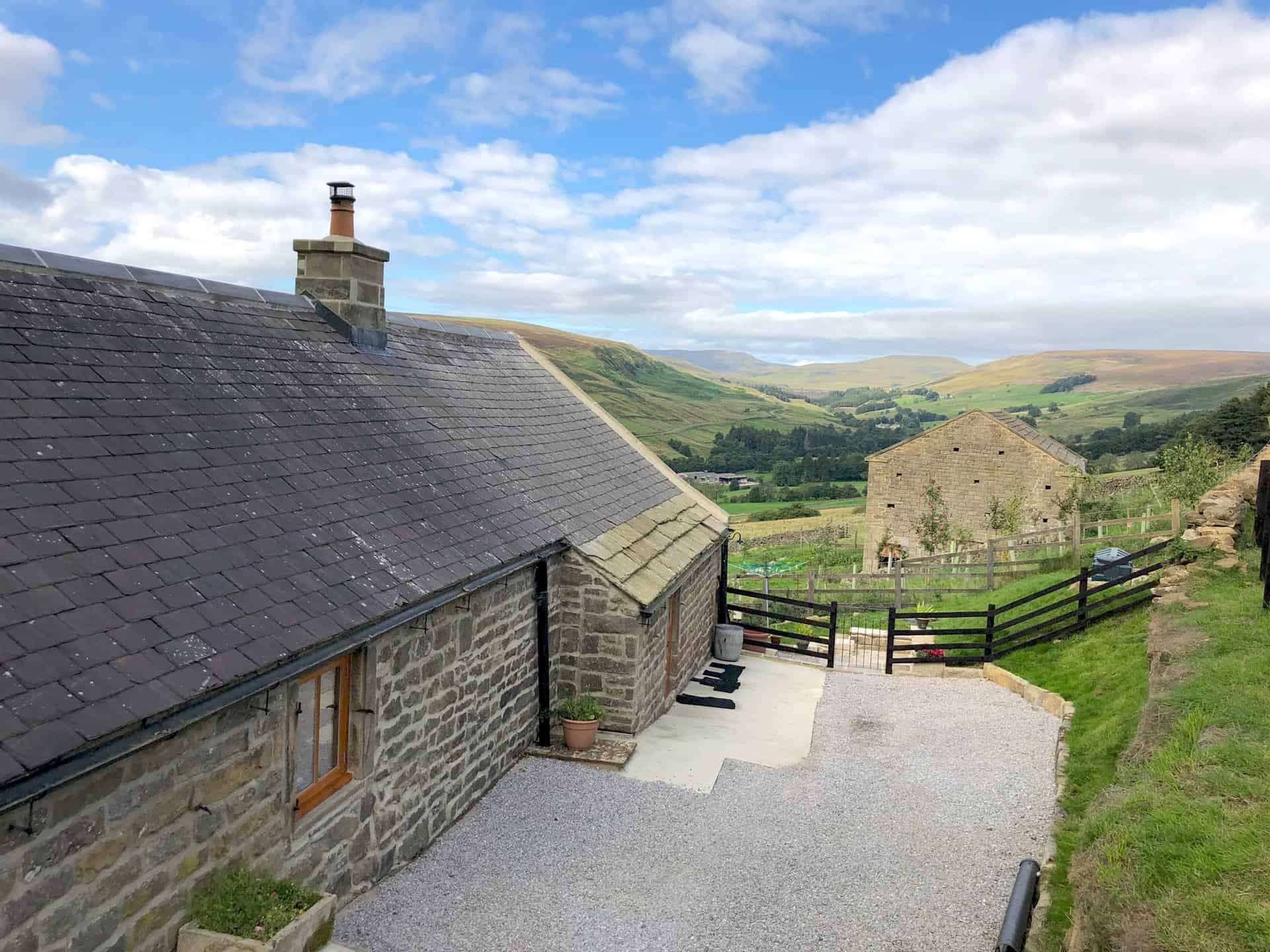
Cottages on the Nidderdale Way at Bracken Ridge, about a quarter of the way round this Nidderdale Way walk.
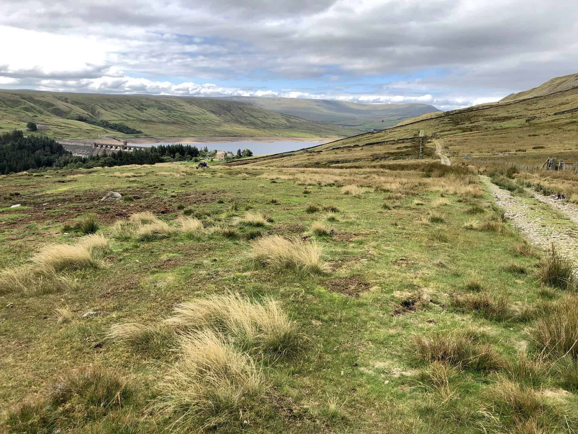
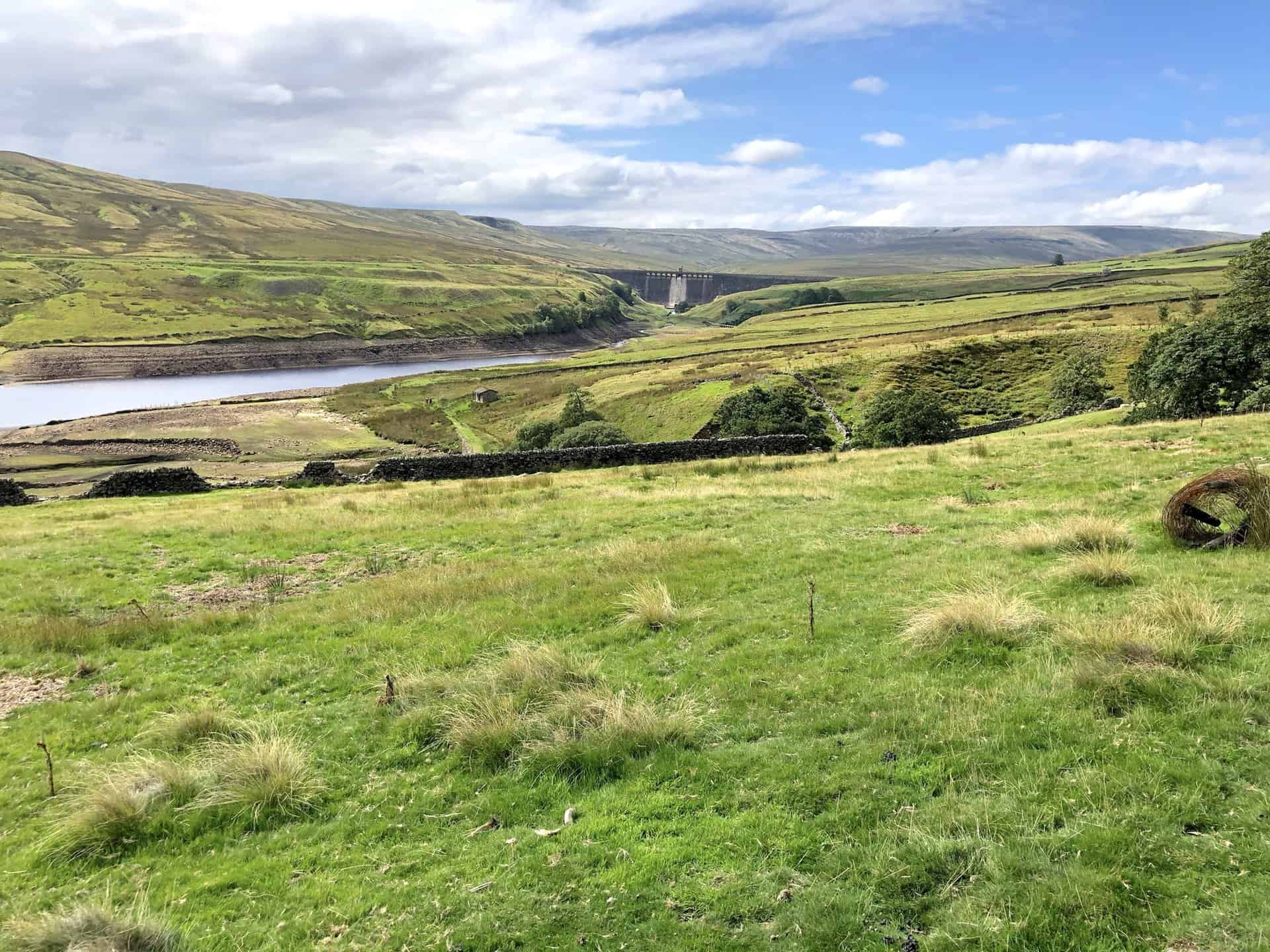
Looking west from the Nidderdale Way at Thornet Barn. The Scar House Reservoir dam can just be seen about a mile away.
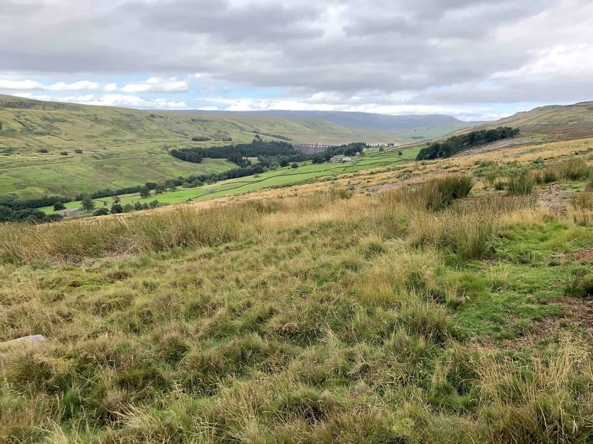
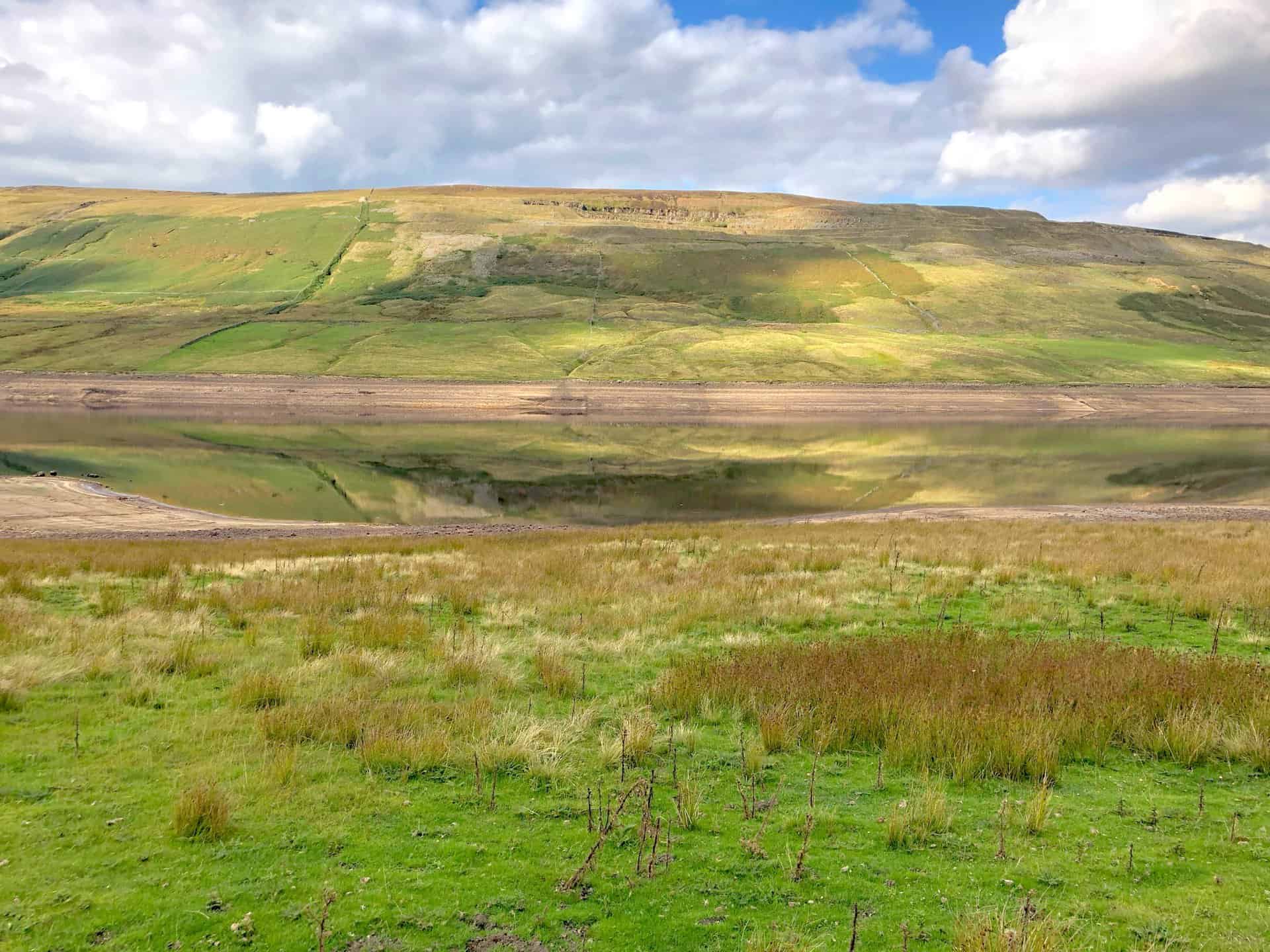
The view south-east over Nidderdale towards Lofthouse Moor (left) and In Moor (right).
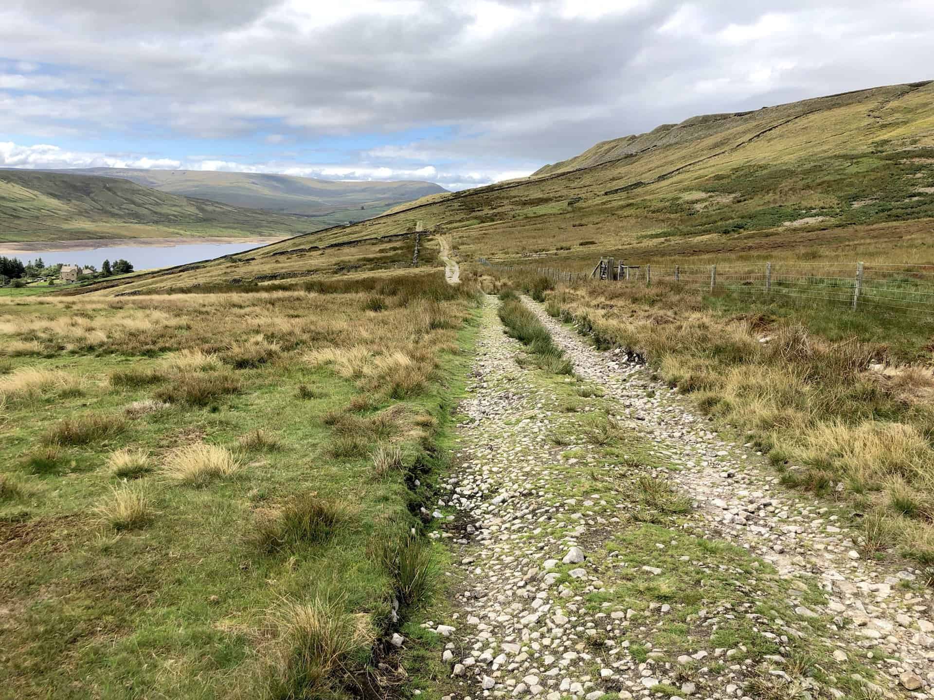
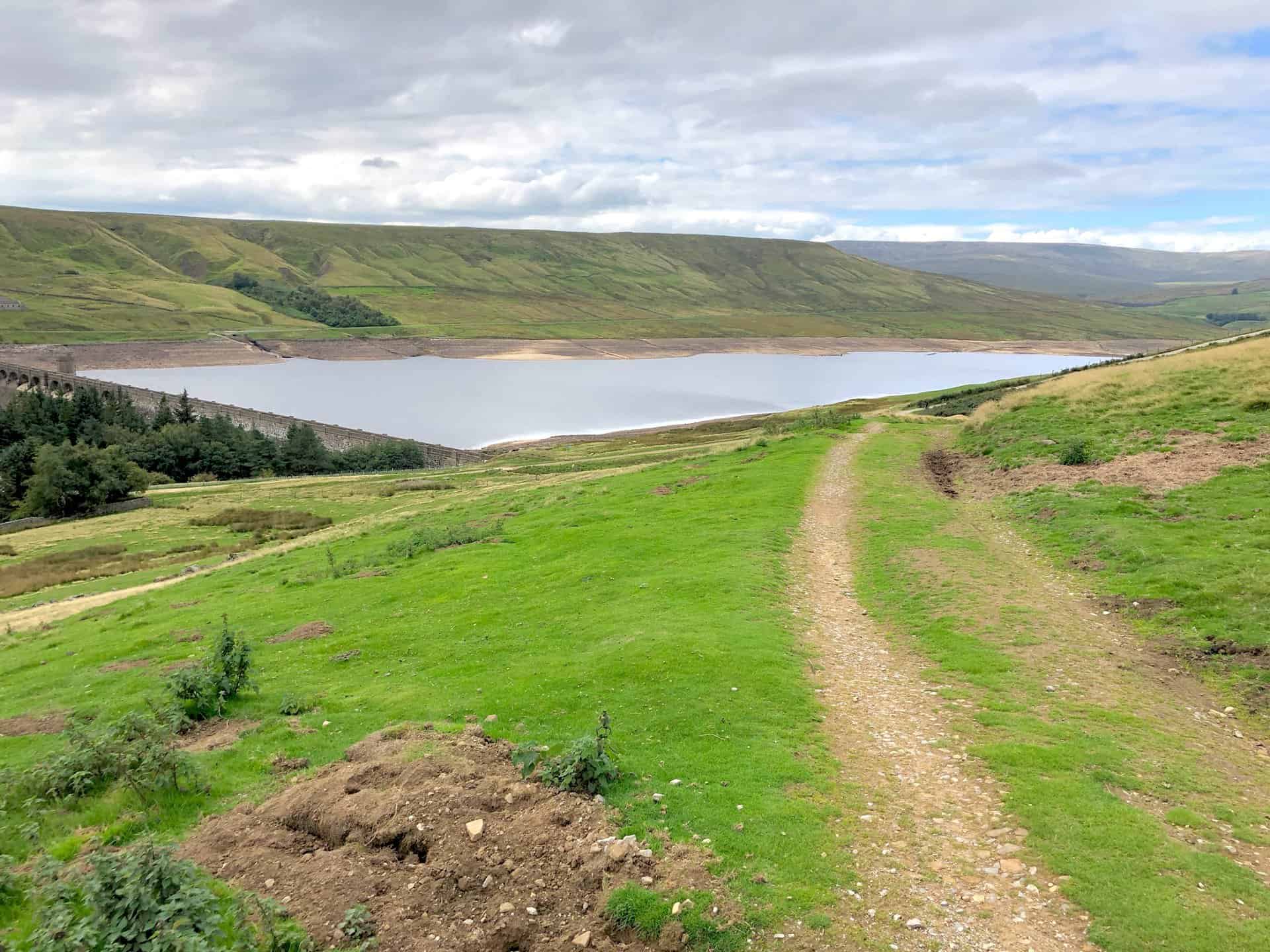
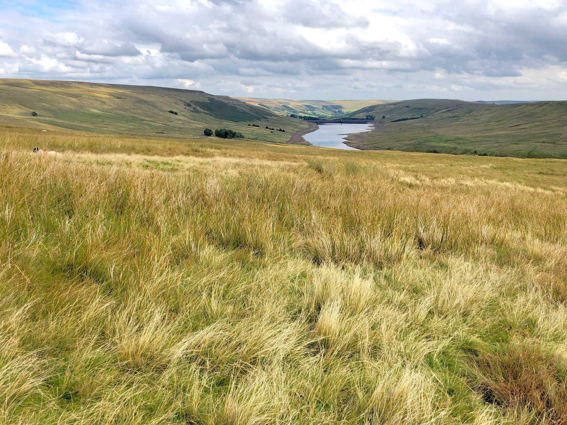
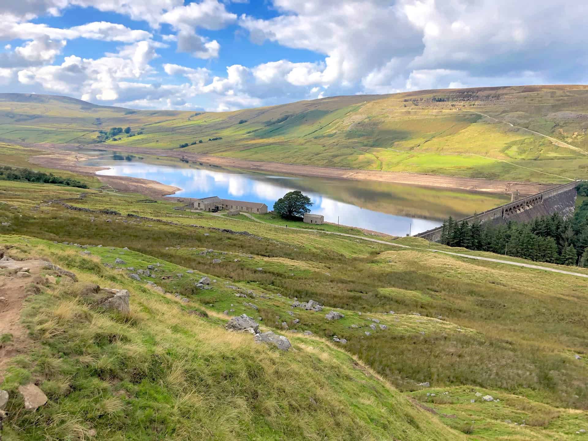
The approach to Scar House Reservoir.
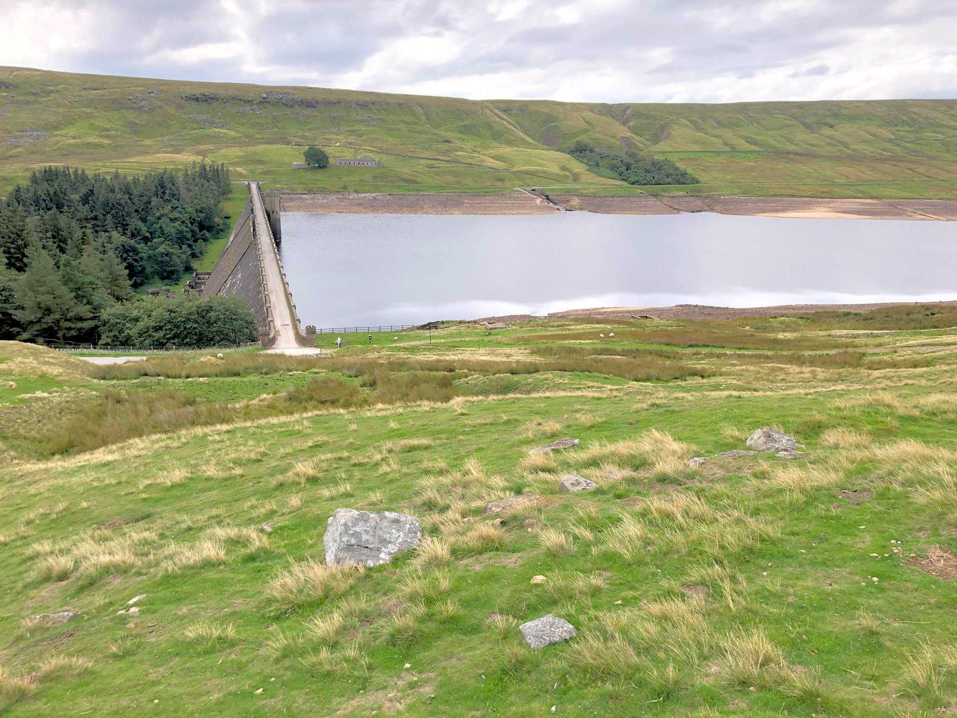
Nidderdale Way Walk: Scar House Reservoir
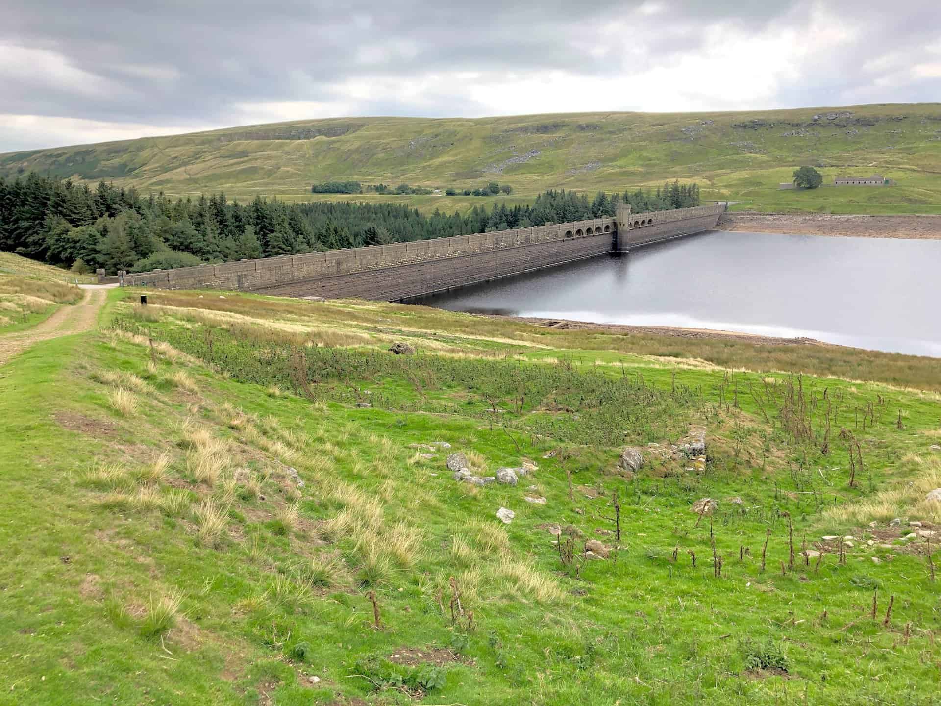
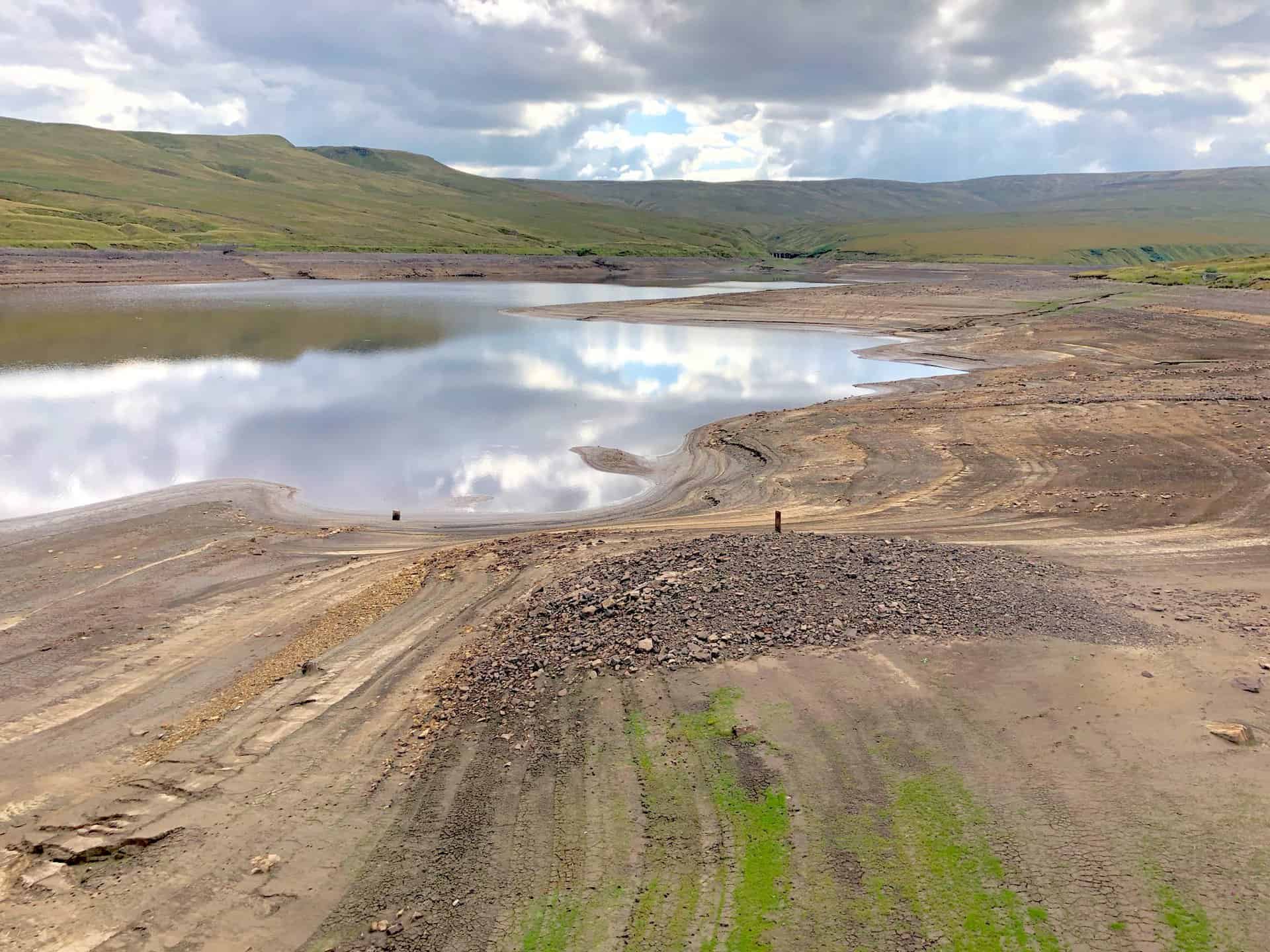
Scar House Reservoir is the second of the three reservoirs in Upper Nidderdale. The others are Angram Reservoir and Gouthwaite Reservoir. Angram and Scar House were built to supply water to the Bradford area of West Yorkshire. Water is transferred to Chellow Heights via the Nidd Aqueduct using only gravity and no pumping.
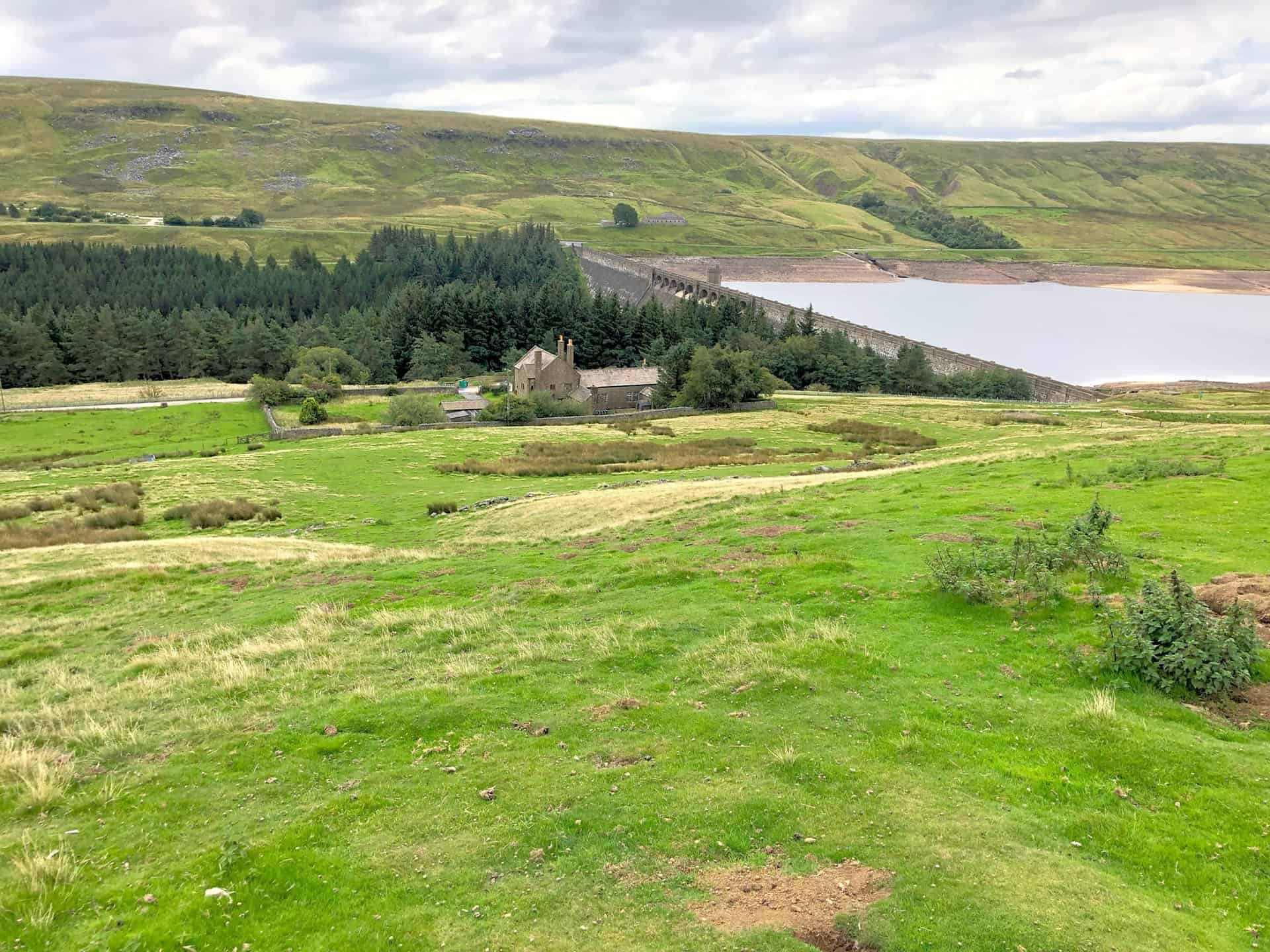
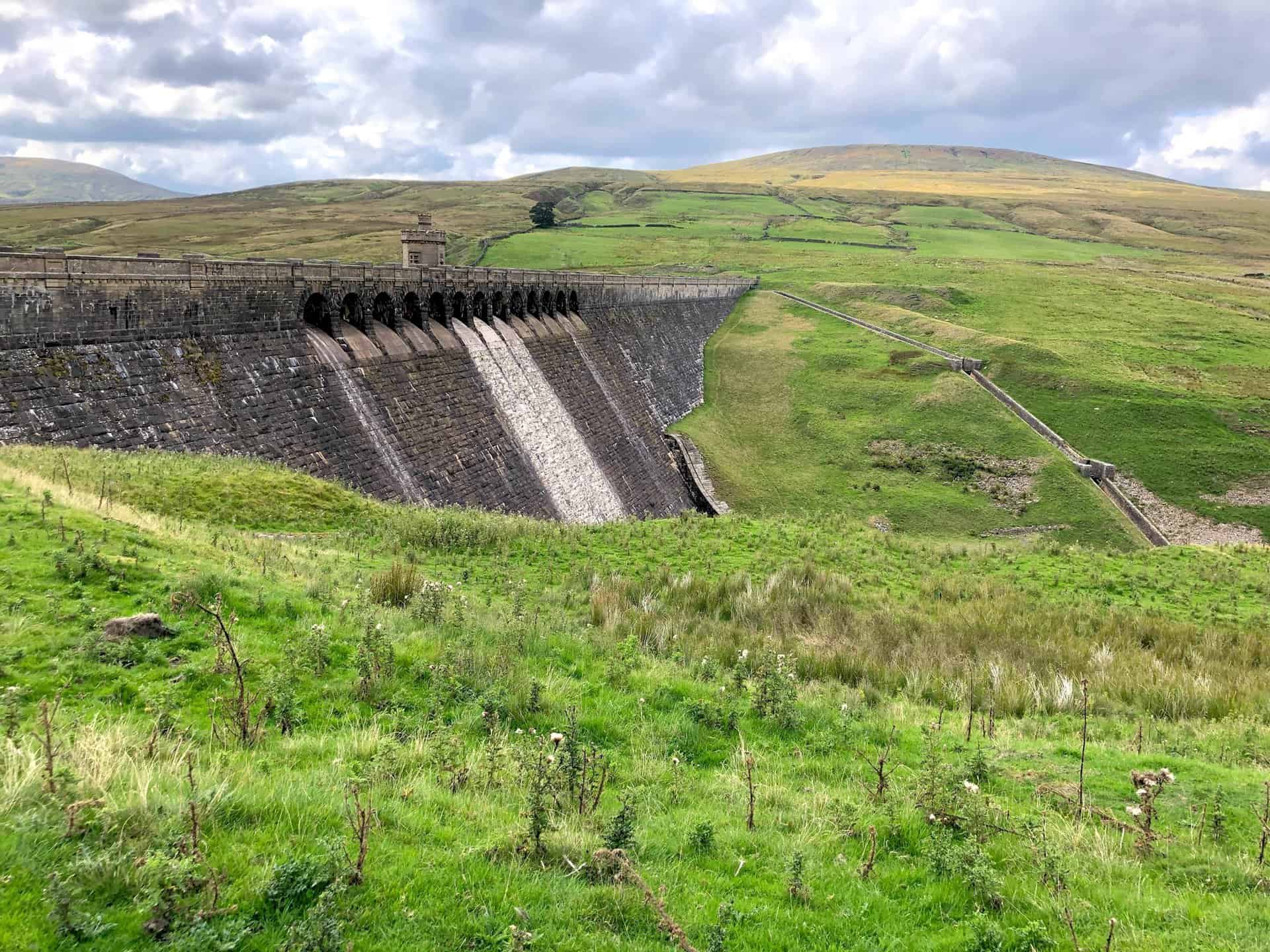
The dam contains over one million tonnes of masonry, rises to 55 metres above the river and is almost 600 metres long. It was completed in 1936. The reservoir is fed almost exclusively from Angram reservoir, which in turn is fed predominantly from the flanks of Great Whernside.
Scar House was the last reservoir to be built in the Nidd Valley and took fifteen years to complete. Stone for the dam was quarried from Carle Fell Side, to the north-west of the dam. Scar House was once home to more than 1250 villagers who built the Nidderdale dam, and evidence of the village can be seen in the form of concrete bases on the approach road to the reservoir.
The Nidd Valley Light Railway was constructed to enable the reservoirs at Scar House and Angram to be completed. The railway opened in 1907 and closed in 1937. In 1932, the former church building at Scar House was moved to St Martin’s Church in Heaton, Bradford.
The track leading to Scar House, on the north-east side of the reservoir dam.
A rare sighting as this little creature scurried across the path. Moles are common in Britain but spend almost their entire life underground. It’s the first time I have ever seen one alive in the wild.


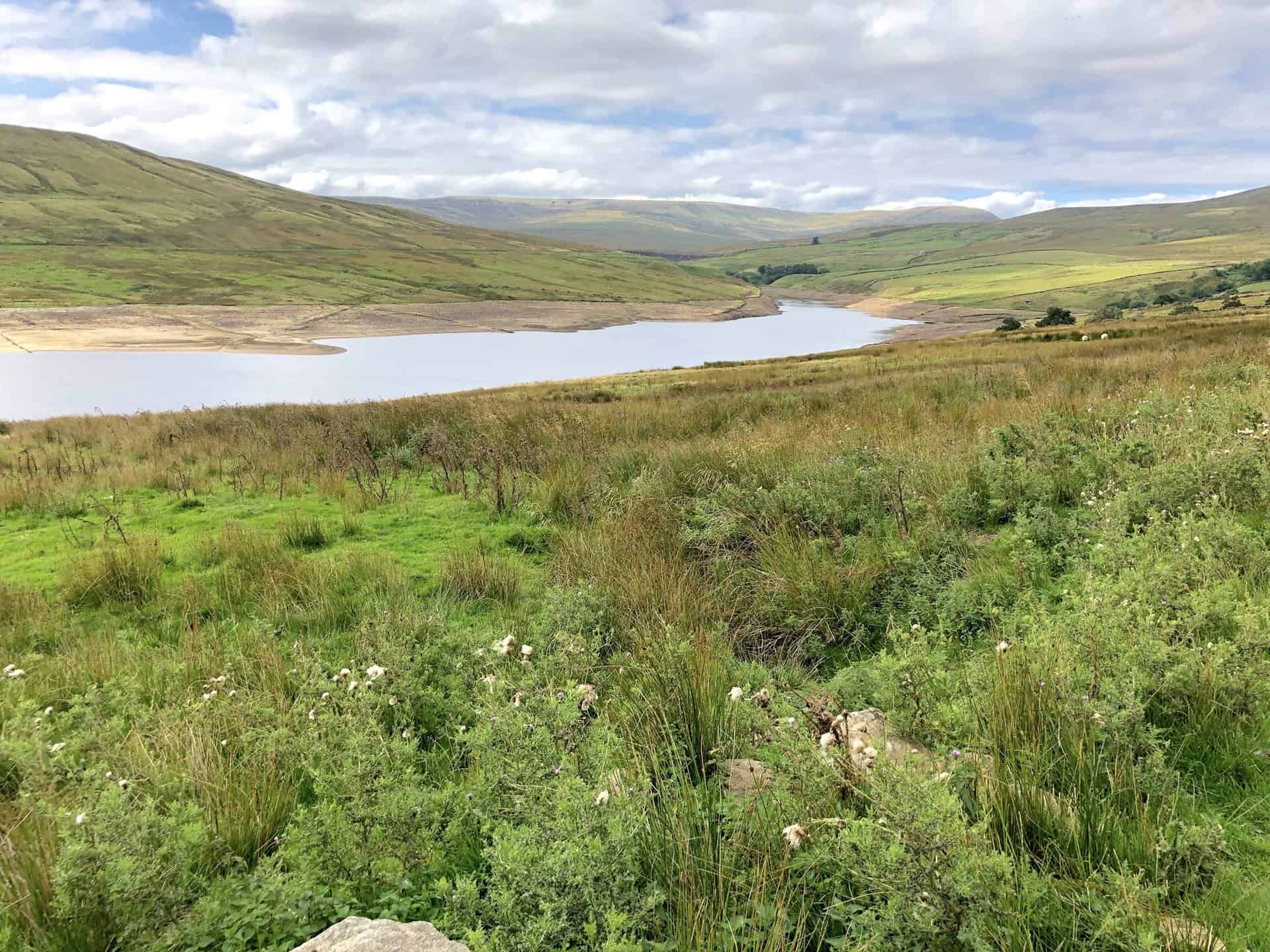
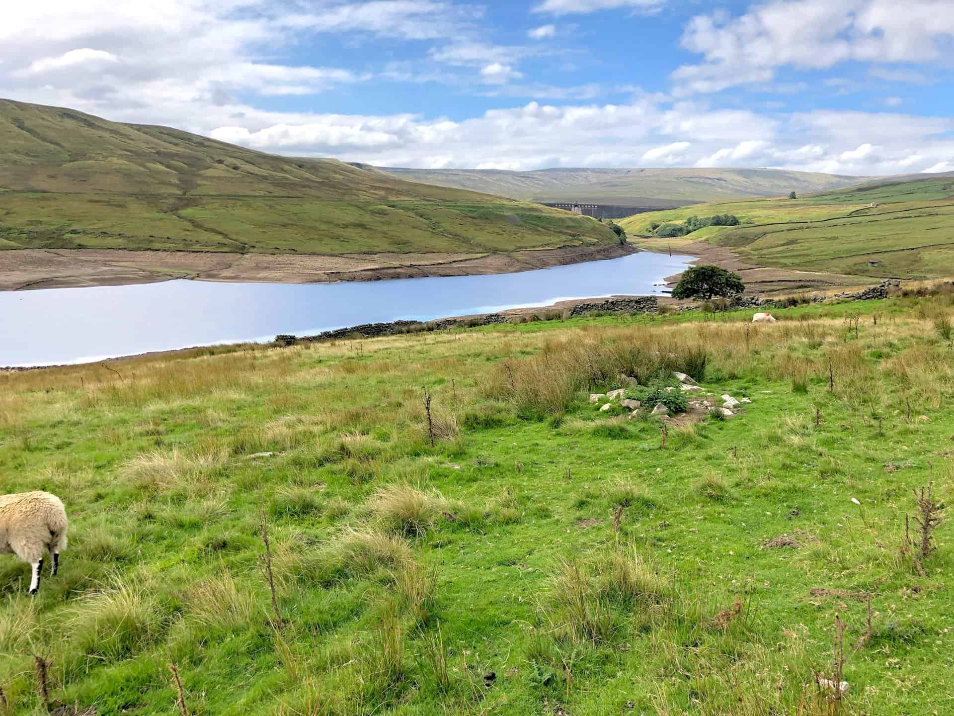
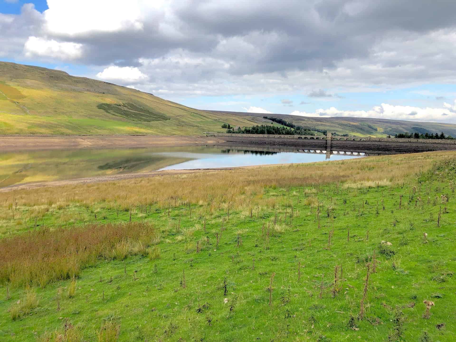
The western end of Scar House Reservoir, with Great Whernside in the background. The halfway point of this Nidderdale Way walk.
The view south-west towards the dam of Angram Reservoir.
Superb views of Nidderdale from the southern flanks of Little Whernside.
Low water levels after the long hot summer.
The view of Carle Fell above Scar House Reservoir.
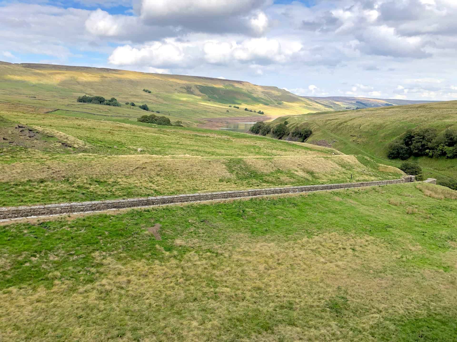
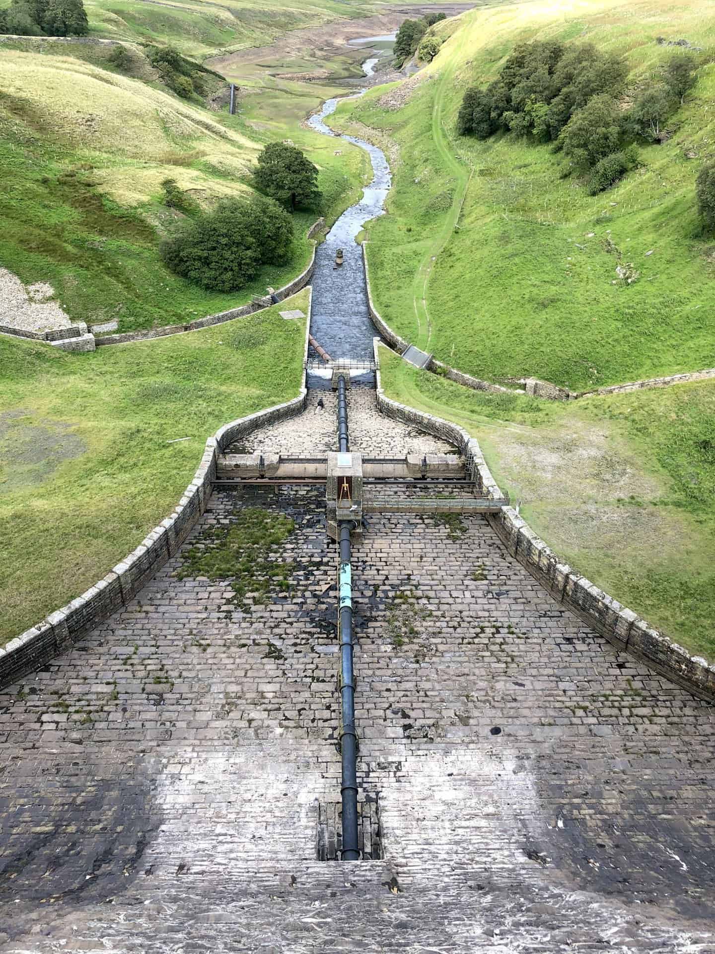
Overflow weir of Angram Reservoir, one of the highlights of this Nidderdale Way walk.
Angram Reservoir dam and tower. The hill in the background is Little Whernside.
Carle Fell Side.
Scar House Reservoir.
Scar House Reservoir. The quarry on Carle Fell Side can be seen in the background. Stone from this quarry was used to build the dam.
Amazon’s Top Walking Boots: Four Standout Choices for Men and Women
For walking and hiking, the right boots are essential for both comfort and safety. While Amazon boasts a wide range, certain boots emerge as top-sellers. From those, here are four I personally favour. As an Amazon affiliate, I may earn a small commission from any purchases made through the links provided. This helps support the upkeep of this website. Rest assured, you won’t pay a penny extra, but your purchase will contribute to keeping my site running smoothly. Happy walking!

Berghaus Men’s Hillmaster II Gore-Tex Walking Boots
These fully waterproof leather walking boots feature a Gore-Tex lining, ensuring no water enters whilst allowing feet to breathe and stay cool. Made from full-grain leather, they promise unmatched durability and comfort. The boots come with memory foam tongues and cuffs that mould to your feet for a tailored fit, and the Vibram Hillmaster outsoles offer confidence on challenging terrains.

Salewa Men’s Mountain Trainer Mid Gore-Tex Walking Boots
Made from durable suede and abrasion-resistant textile, these men’s hiking boots are both lightweight and sturdy. The upper material is enhanced by a 360° full rubber sheath. Their dual-layer midsole with Bilight technology ensures ergonomic cushioning and grip, especially on extended hikes. The Vibram Wrapping Thread Combi outsoles allow a natural walking feel, and the Gore-Tex lining provides waterproofing, breathability, and optimal weather protection. Furthermore, the patented Salewa 3F system ensures flexibility, a secure heel grip, and a blister-free fit.

Berghaus Women’s Supalite II Gore-Tex Walking Boots
Specially designed for women, these hiking boots offer waterproofing and breathability, thanks to their Gore-Tex lining. Crafted from full-grain abrasion-resistant leather, they’re durable enough for the toughest hikes. The Supalite soles ensure stability and traction, and the EVA midsoles add comfort for extended walks.

Merrell Women’s Moab 3 Mid Gore-Tex Walking Boots
These hiking boots incorporate a Gore-Tex waterproof membrane, blending breathability with superior waterproof performance. The combination of pigskin leather and mesh on the uppers, along with the suede outer material, ensure durability and style. Enhancements include 100% recycled laces, webbing, and mesh lining. Additionally, bellows tongues, protective toe caps, and Vibram TC5+ rubber soles ensure protection and ease on any terrain.