Adventures Await on the Scar House Reservoir Walk from Lofthouse
Begin your Scar House Reservoir walk by parking in Lofthouse village centre. Head north on Thrope Lane towards Thrope Farm. Continue on the Nidderdale Way, passing Limley Farm and Thwaite House. Your path leads to Bracken Ridge, where you’ll turn west.
Proceed along the Nidderdale Way past Summerstone Lodge, heading towards Turnacar. Descend into the valley, crossing the valley floor and the River Nidd near Low Woodale. This scenic route is a highlight of the Scar House Reservoir walk.
Continue west along a minor road leading directly to Scar House Reservoir dam. Once there, head north across the dam. This area offers stunning views and interesting features, making it a memorable part of your walk around Scar House Reservoir.
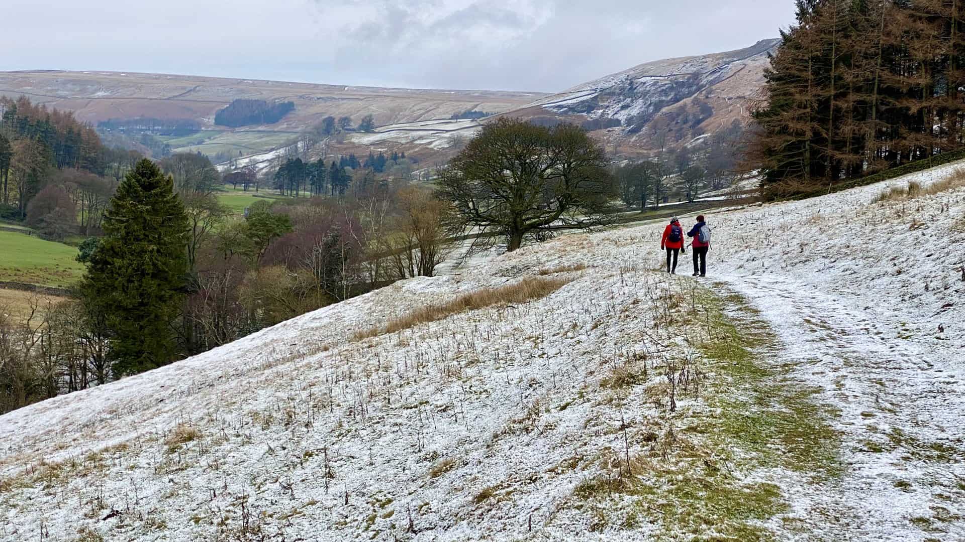
Turn east, rejoining the Nidderdale Way, and ascend onto the moorland after crossing the ford at Woo Gill. Head further east towards Masham Moor. Navigate via Dale Edge, then head south across Lofthouse Moor. This segment offers great views down into the Nidderdale valley.
Join the minor road at High Scar, then make your way back to the village via Trapping Hill. This 11-mile Scar House Reservoir walk offers a comprehensive exploration of Nidderdale’s landscapes and is one of the best walks in the area.
Scar House Reservoir Walk: Maps and Tools
Visit either the OS Maps website or the Outdooractive website to view this walking route in greater detail. Both platforms offer a range of features, including the ability to print the route, download it to your device, and export the route as a GPX file. You can also watch a 3D fly-over and share the route on social media.
Scar House Reservoir Walk: Distance, Duration, Statistics
Distance: 11¼ miles
Distance: 18¼ kilometres
Duration: 5½ hours
Ascent: 1648 feet
Ascent: 502 metres
Type: Circular walk
About Scar House Reservoir
Scar House Reservoir is one of a trio of reservoirs in Upper Nidderdale, accompanied by Angram Reservoir and Gouthwaite Reservoir. These reservoirs collectively attract approximately 150,000 visitors annually, with many enjoying the Scar House Reservoir walk. Angram and Scar House Reservoirs were constructed to supply water to the Bradford area of West Yorkshire, transferring water to Chellow Heights via the Nidd Aqueduct, utilising gravity and eliminating the need for pumping.
Spanning across 70 hectares (170 acres), Scar House Reservoir boasts a maximum depth of 36.3 metres (119 feet) and a water volume of 10 million cubic metres. The dam, completed in 1936, contains over one million tonnes of masonry, rising 55 metres (180 feet) above the river and extending almost 600 metres (2000 feet) in length. The dam’s height measures 71 metres (233 feet), and the reservoir is primarily fed by Angram Reservoir, which in turn receives water predominantly from the flanks of Great Whernside.
Scar House Reservoir marked the last reservoir to be constructed in the Nidd Valley. Construction commenced in 1921 and took fifteen years to complete under the guidance of Lewis Mitchell, Bradford’s city engineer at the time. The dam’s stones were sourced from a quarry on Carle Fell to the north and north-west of the dam. To facilitate the transportation of stones from the quarry to the dam site, an inclined railway was constructed.
During the 1920s, over 1250 villagers called Scar House home as they lived and worked on the Nidderdale dam project. Evidence of this village remains visible today, with concrete bases located to the left of the reservoir approach road and an original building situated just below the car park, now repurposed by a local farm. Upon completion of the reservoir, the old village hall was relocated to Darley, where it continues to serve as a village hall.
The Nidd Valley Light Railway was instrumental in the completion of Scar House and Angram Reservoirs. Constructed to support the reservoir projects, the railway operated between 1907 and 1937. In 1932, the former church building at Scar House was moved to St Martin’s Church in Heaton, Bradford.
The Scar House Reservoir walk not only holds historical significance but also presents visitors with a chance to immerse themselves in nature’s beauty. This route, winding through undulating terrain with views of the reservoir’s shimmering water, offers a serene and tranquil retreat, perfect for those seeking respite from the hustle and bustle of city life.
Recommended Ordnance Survey Map
The best map to use on this walk is the Ordnance Survey map of Nidderdale, reference OS Explorer 298, scale 1:25,000. It clearly displays footpaths, rights of way, open access land and vegetation on the ground, making it ideal for walking, running and hiking. The map can be purchased from Amazon in either a standard, paper version or a weatherproof, laminated version, as shown below.
Weatherproof Version
Ordnance Survey map of Nidderdale, reference OS Explorer 298, scale 1:25,000
Scar House Reservoir Walk: My Photos
Trekking north on the Nidderdale Way (Thrope Lane) towards Thrope Farm on a brisk, fresh morning with a light dusting of snow underfoot.
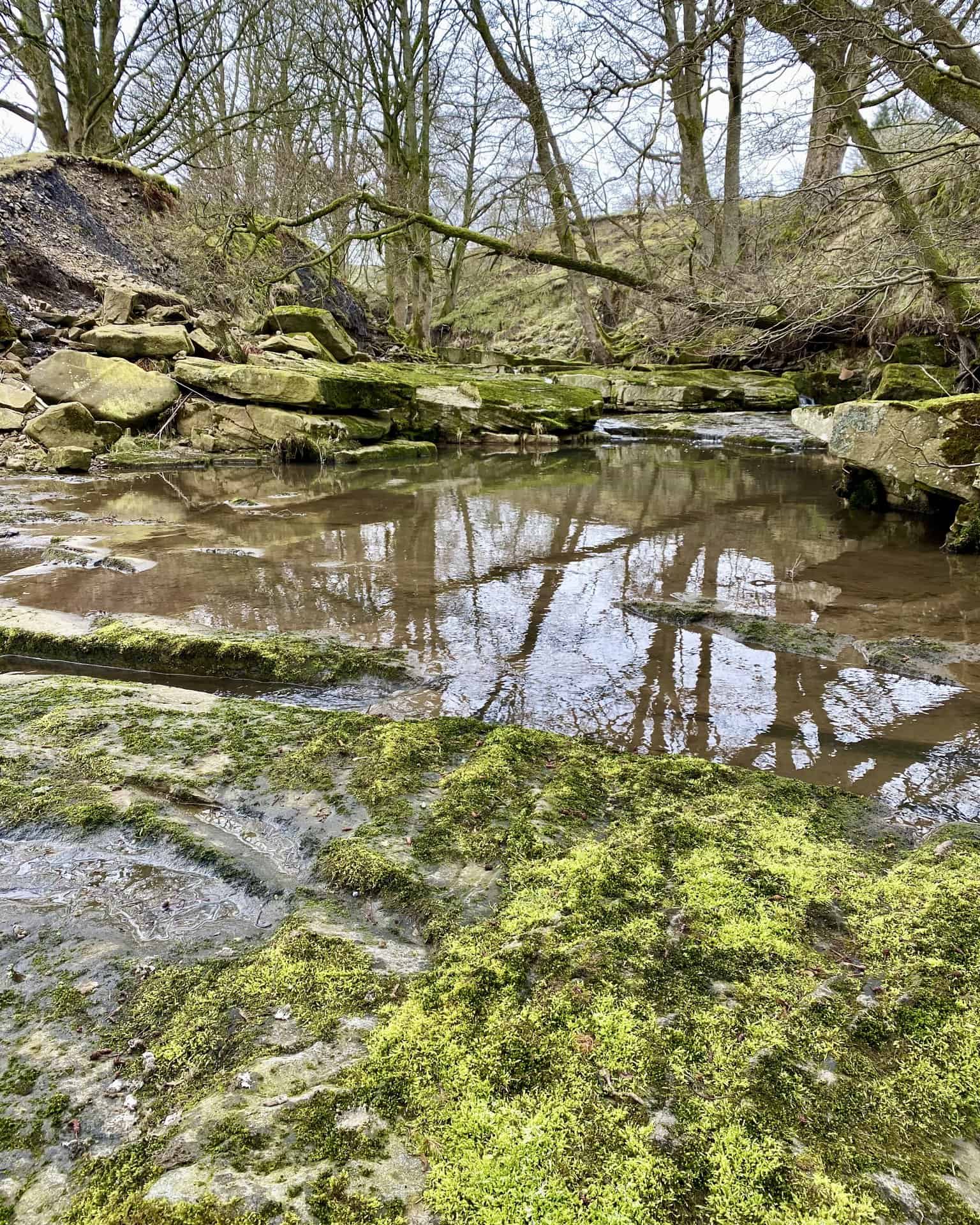
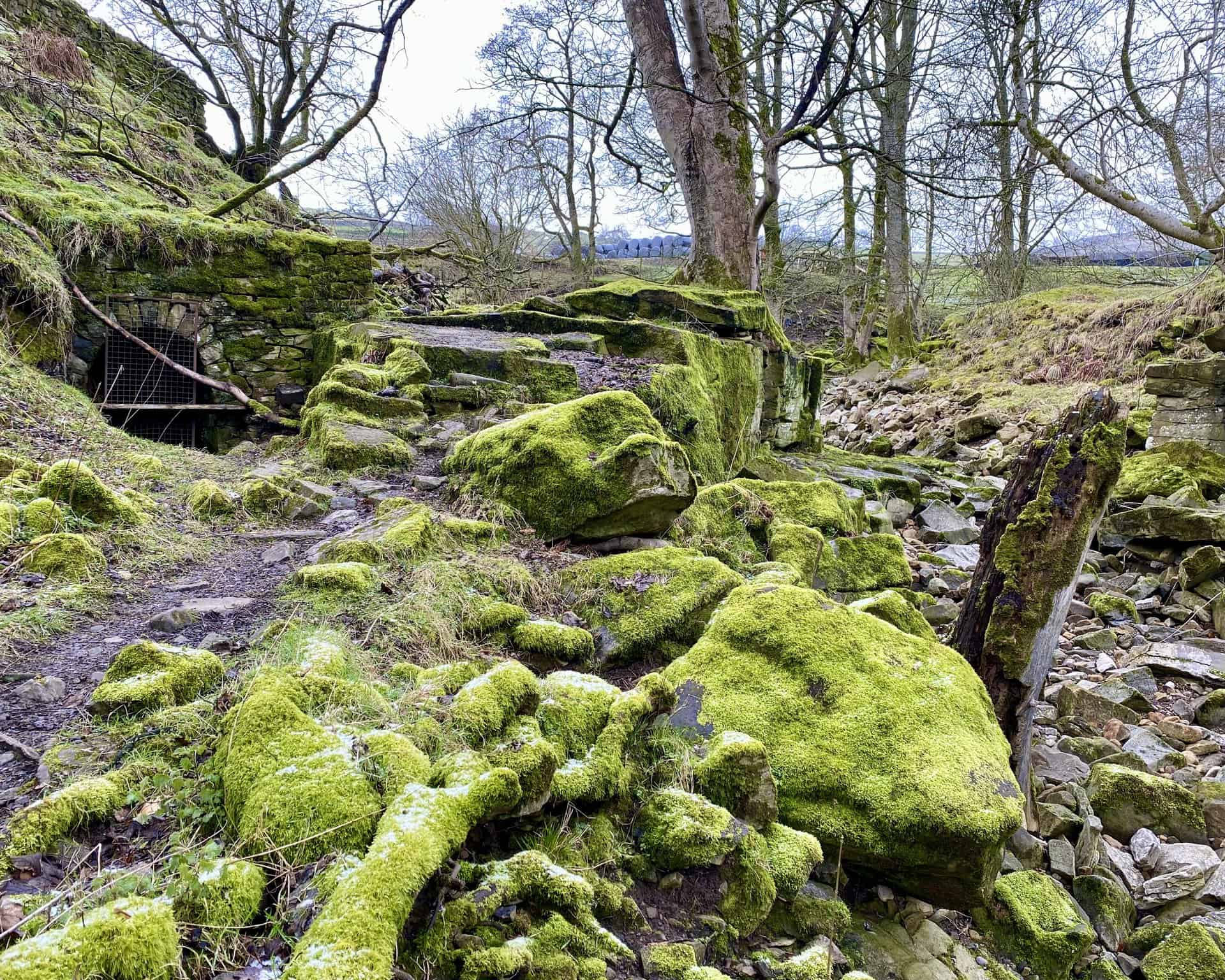
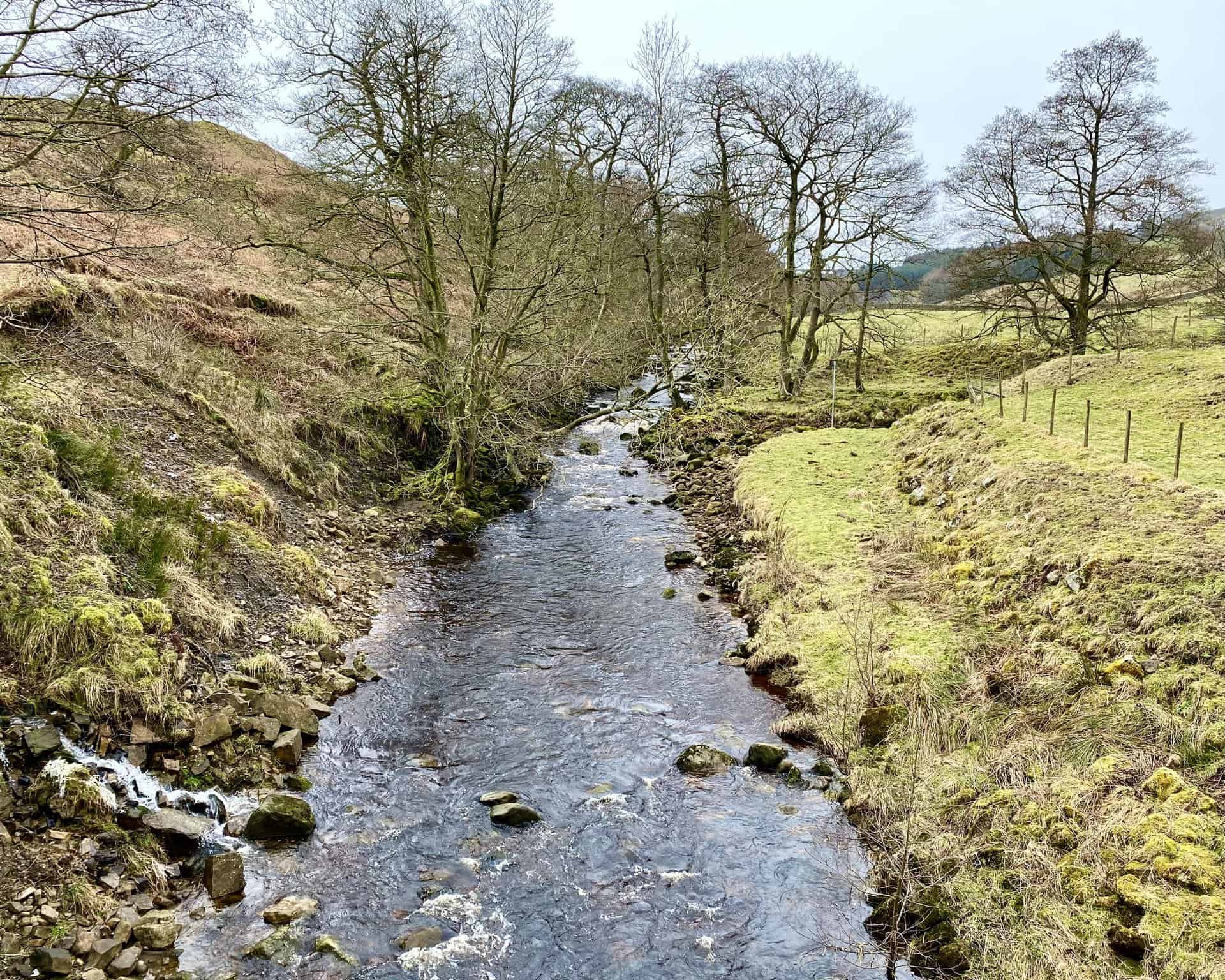
Tranquil waters of the River Nidd between Thrope Farm and Limley Farm, characterised by huge, moss-covered stones.
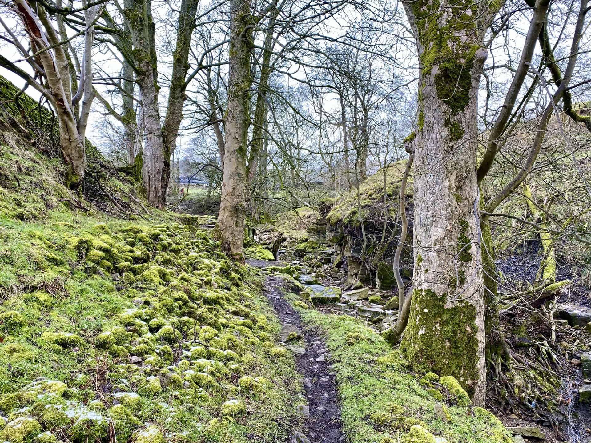
Along the Nidderdale Way, adjacent to the River Nidd near Limley Farm. A picturesque scene with ancient trees and riverside boulders adorned in lush, green moss.
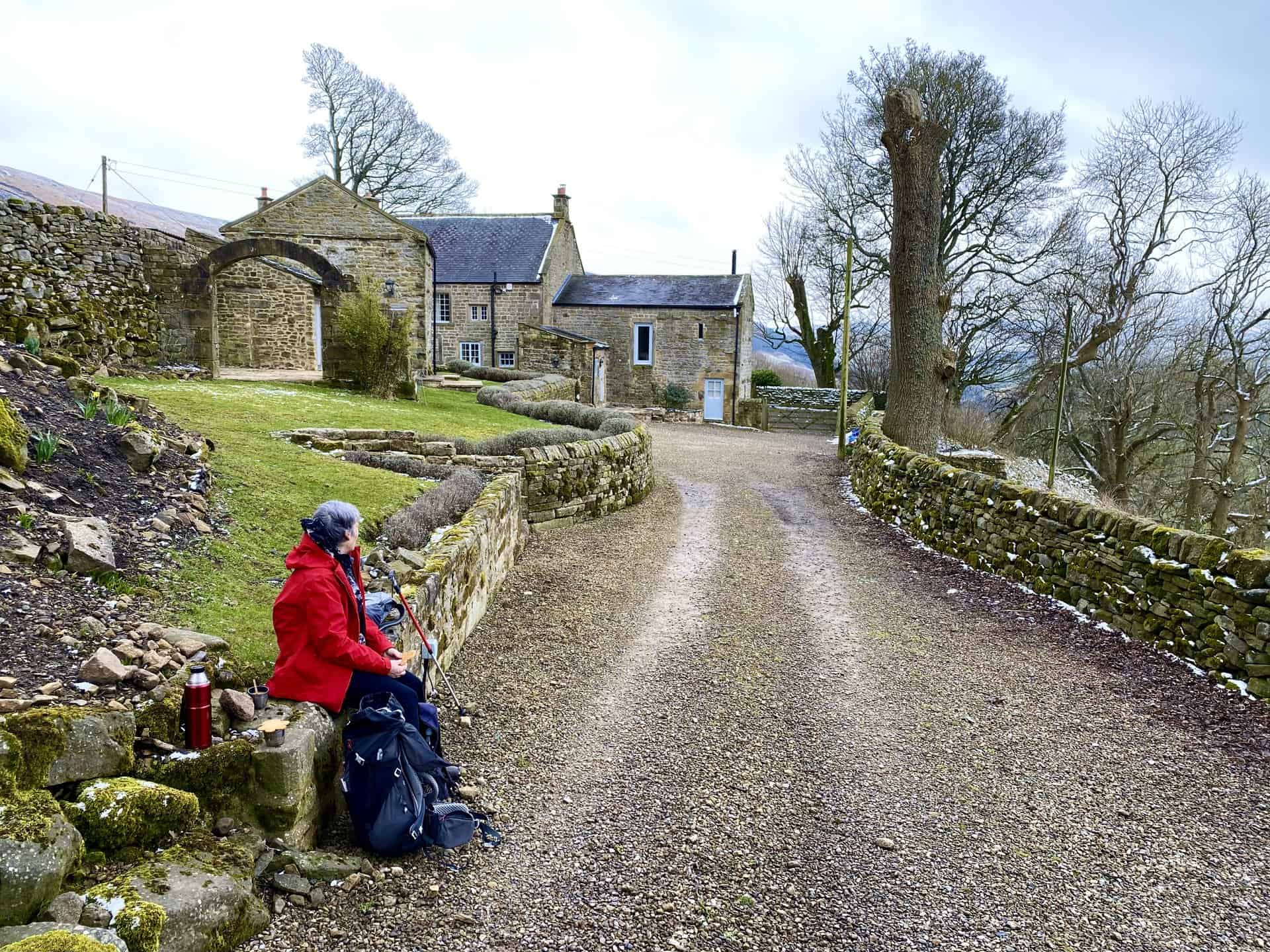
Pausing for a break at Thwaite House, a delightful property amidst stunning surroundings.
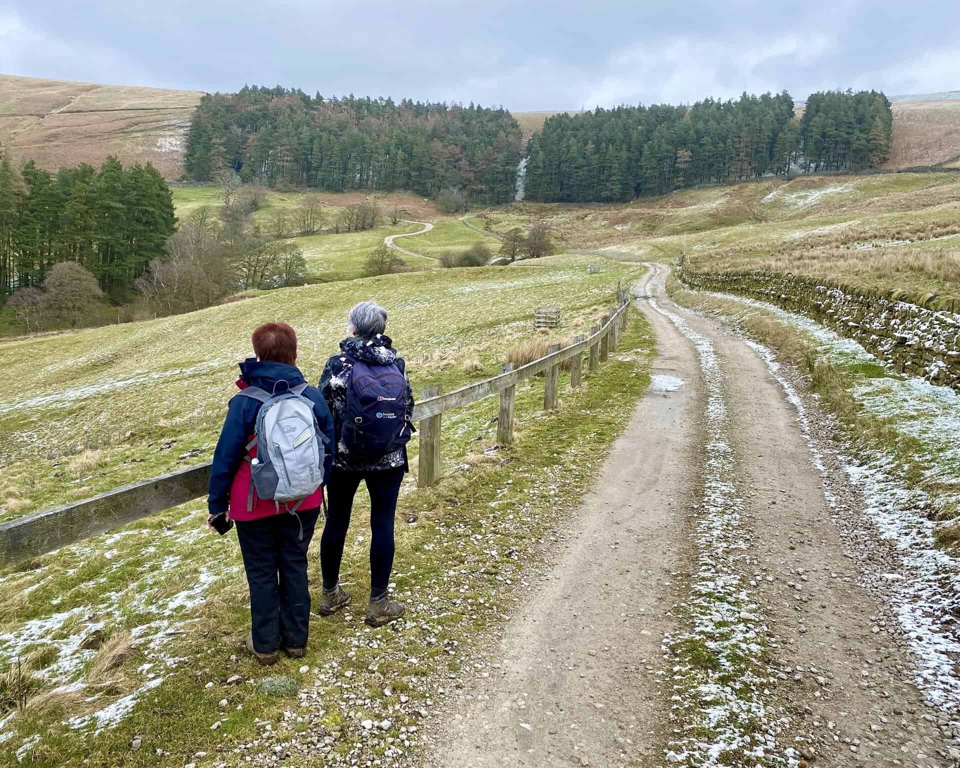
Captivating views just north of Thwaite House on our Scar House Reservoir walk, with Angy and Sandra relishing the landscape.
A panoramic vista westwards through the Nidderdale valley from Bracken Ridge on the Nidderdale Way, with the Scar House Reservoir dam faintly visible in the distance.
Gazing west from Summerstone Lodge towards the Scar House Reservoir dam, against the backdrop of snow-dusted Little Whernside, a highlight of our Scar House Reservoir walk.
Crossing the River Nidd via the footbridge at Low Woodale, a serene moment on our journey.
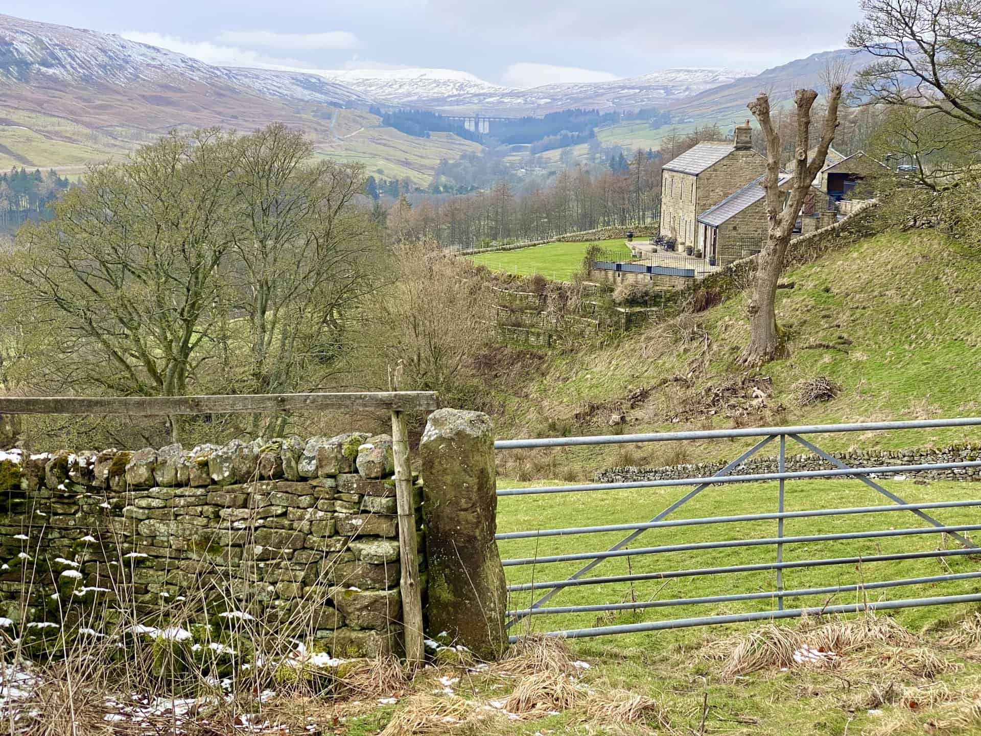
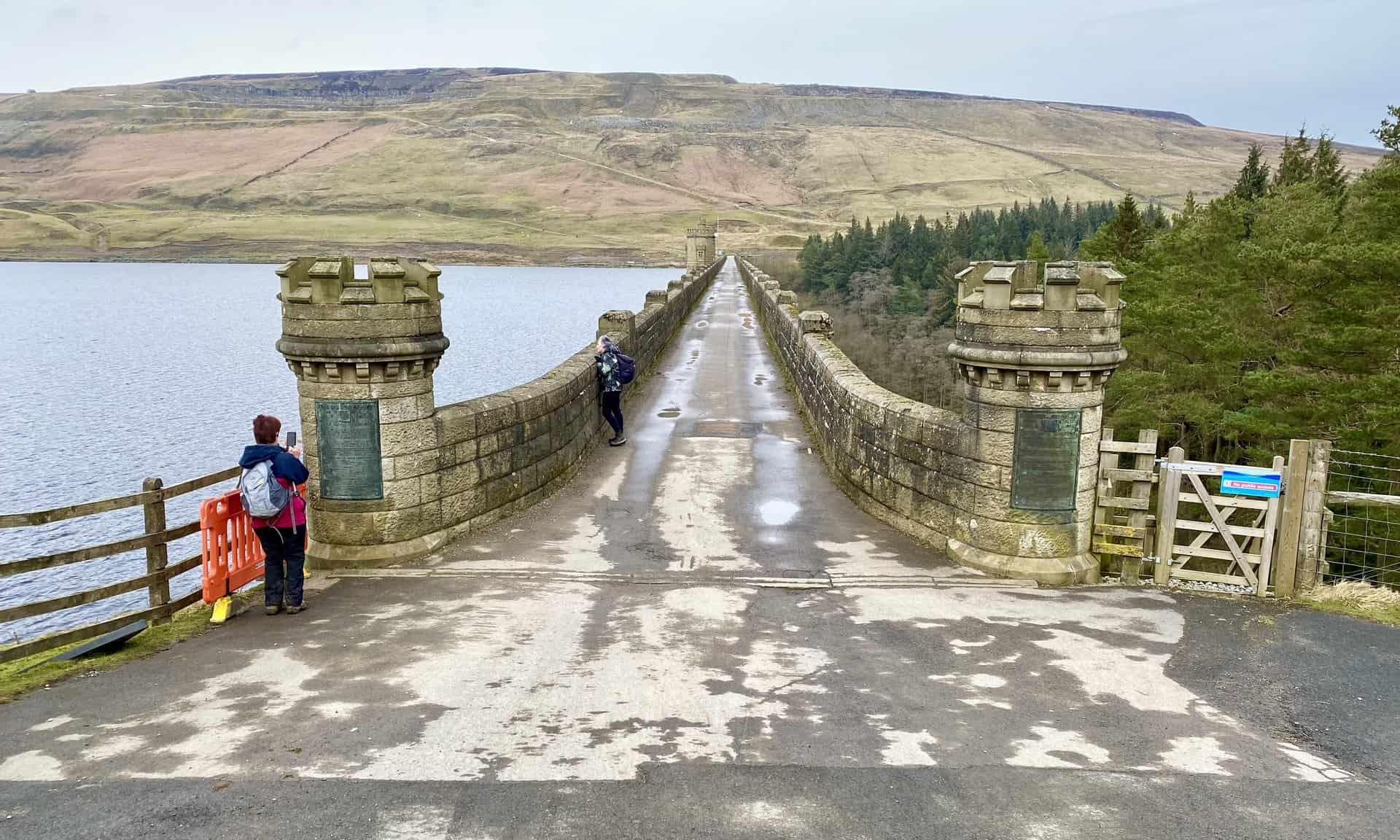
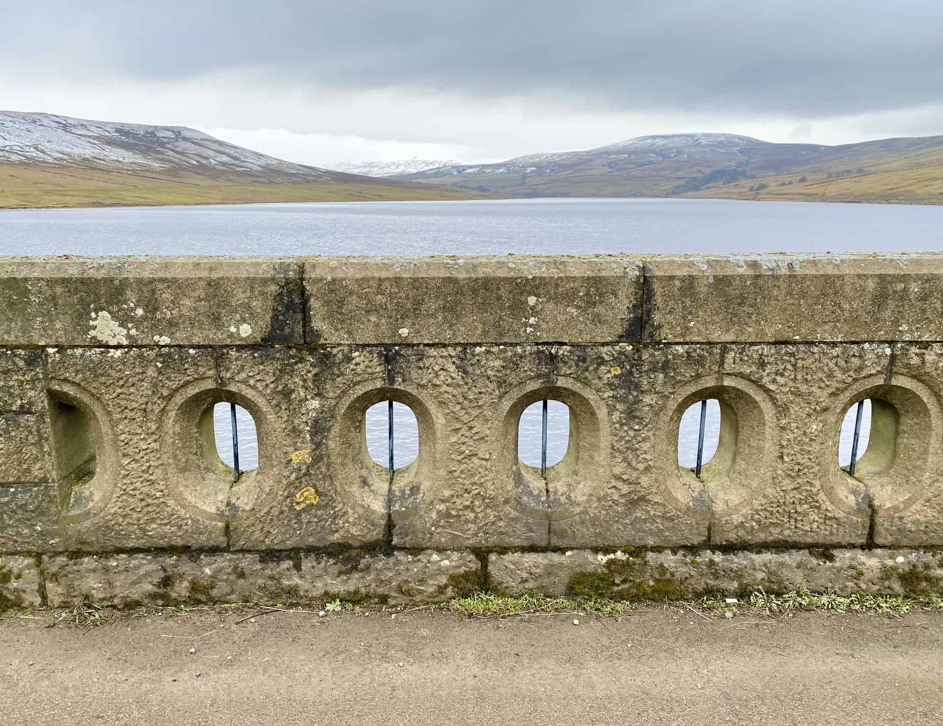
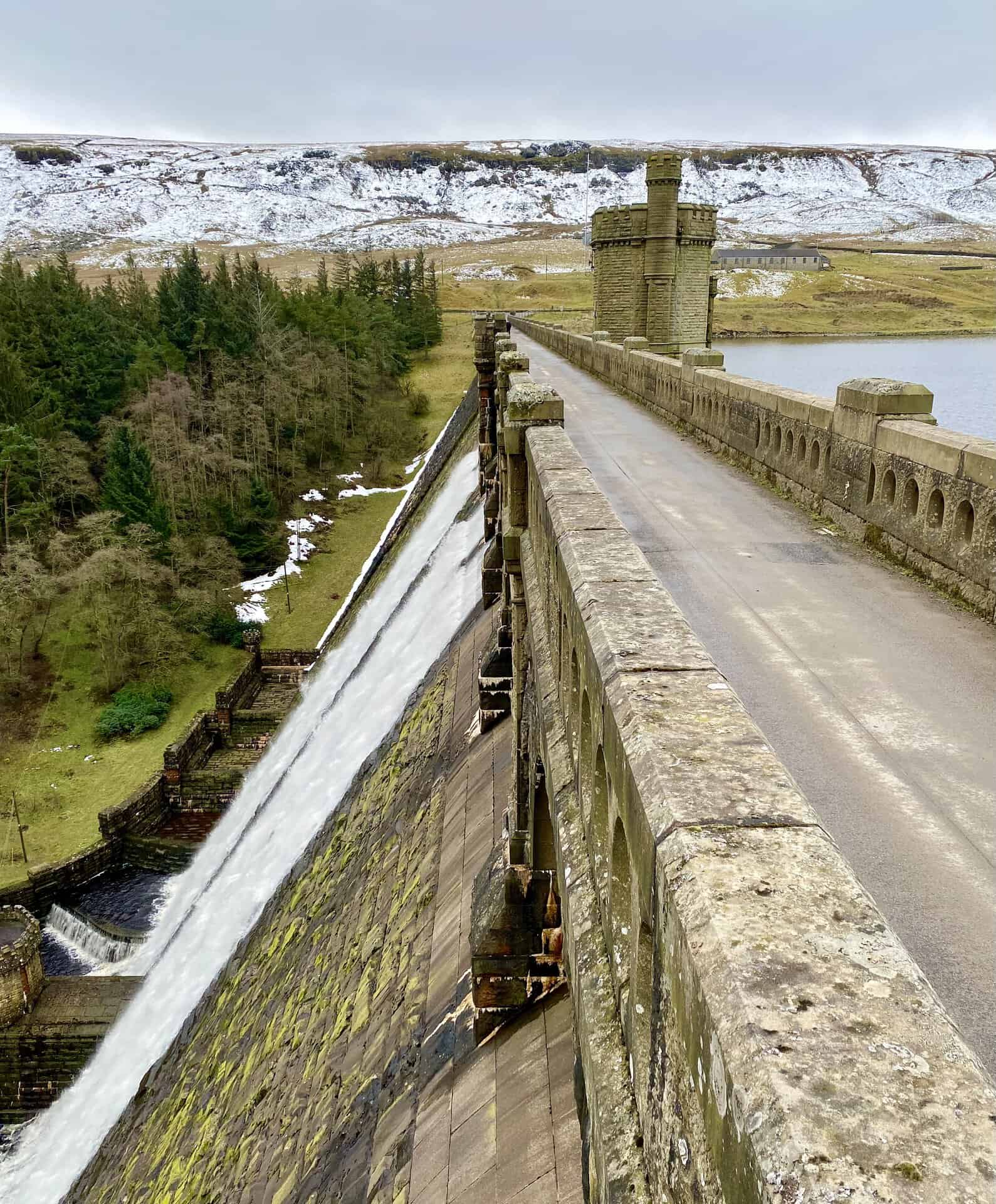
The path across the Scar House Reservoir dam from south to north, backed by Carle Fell Side and its historical quarry, integral to the dam’s construction.
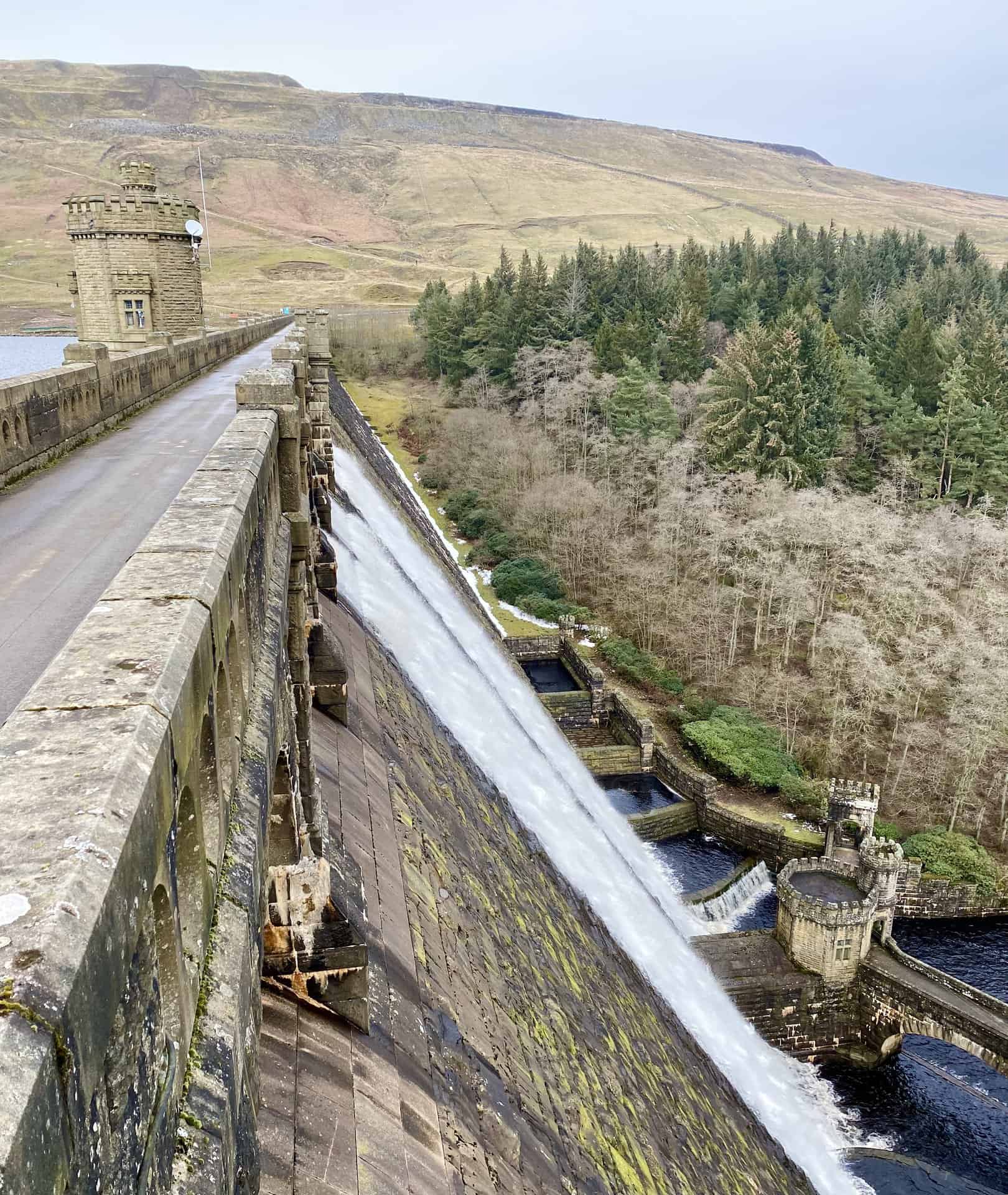
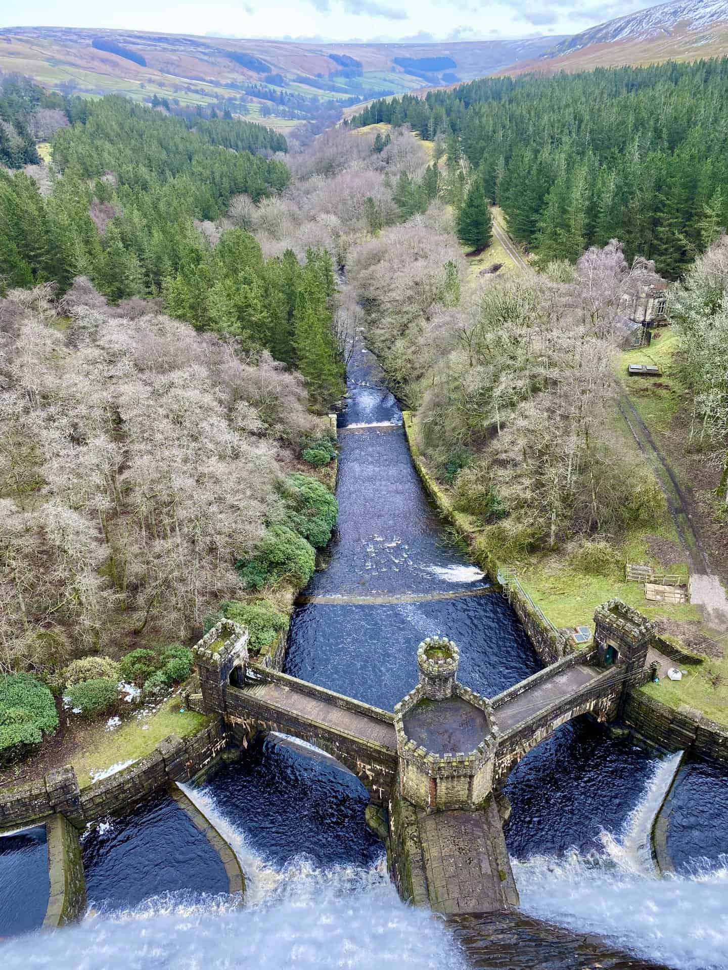
Waters cascading from the east side of the Scar House Reservoir dam, continuing their eastward flow through the Nidderdale valley.
Westward view from the Scar House Reservoir dam, showcasing the majestic Little Whernside and Great Whernside, a key view during our Scar House Reservoir walk.
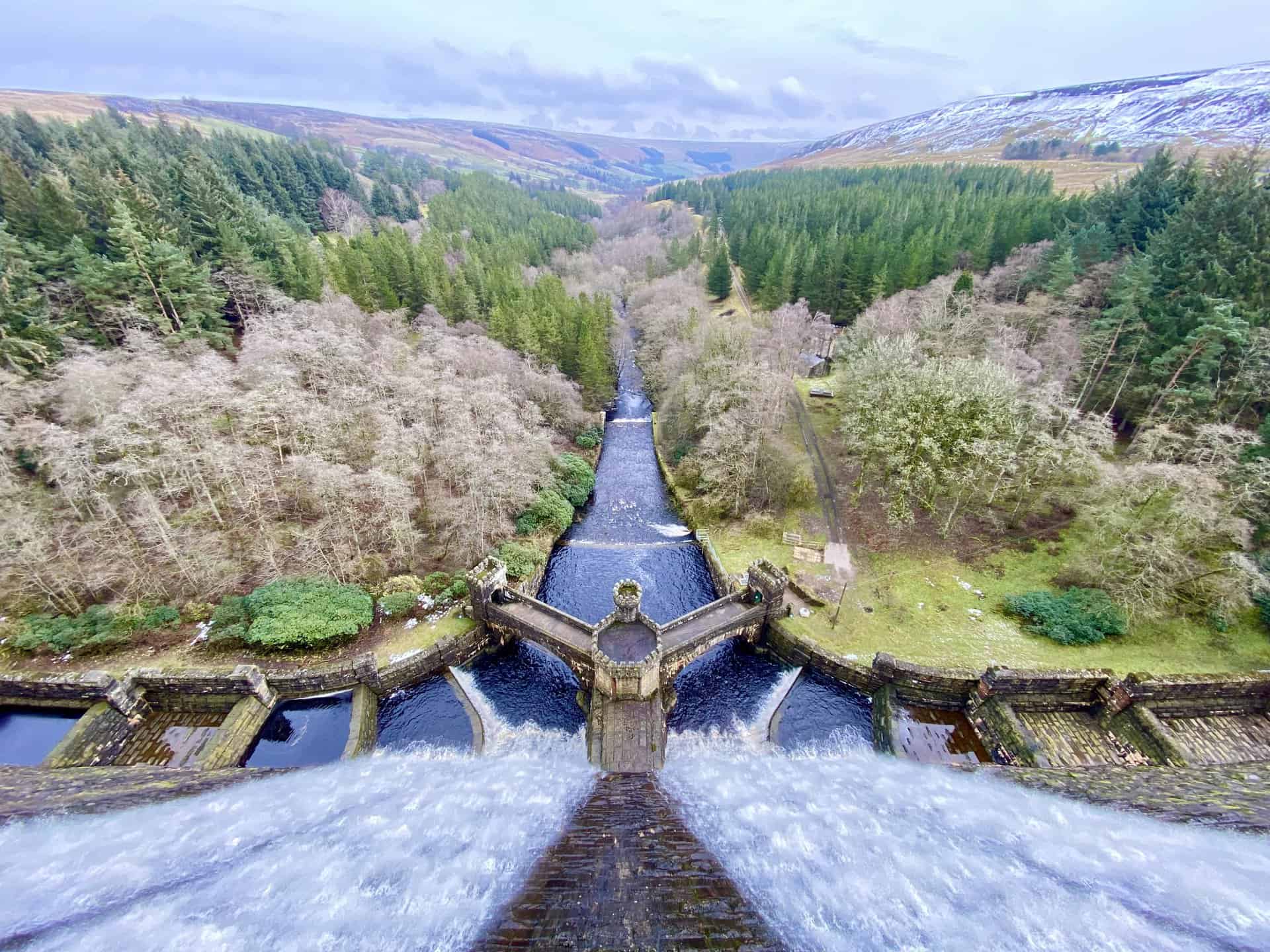
Eastward vista from the Scar House Reservoir dam, revealing the splendid Nidderdale countryside.
Surveying the length of the reservoir dam from north to south, with the scenic Scar House Pasture hillside as a backdrop.
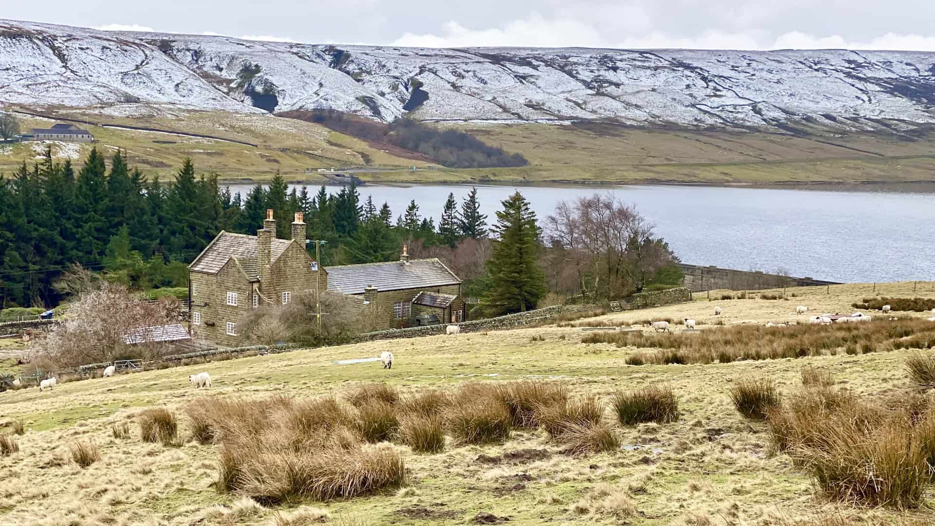
Scar House, proudly standing on the northern side of the reservoir dam, an iconic sight on our Scar House Reservoir walk.
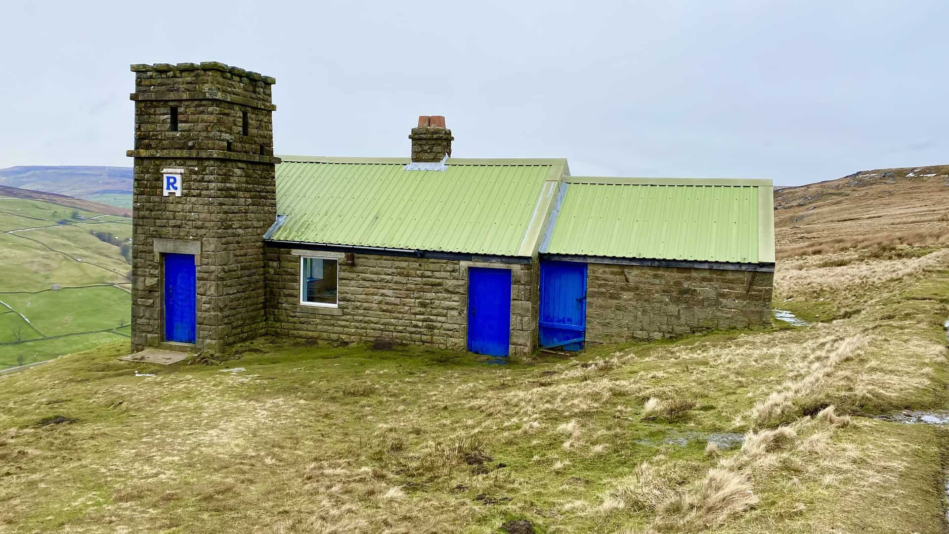
The shooting house above Thrope Edge on Lofthouse Moor, its bright green corrugated roof and vivid blue doors striking against the natural hues of the countryside.
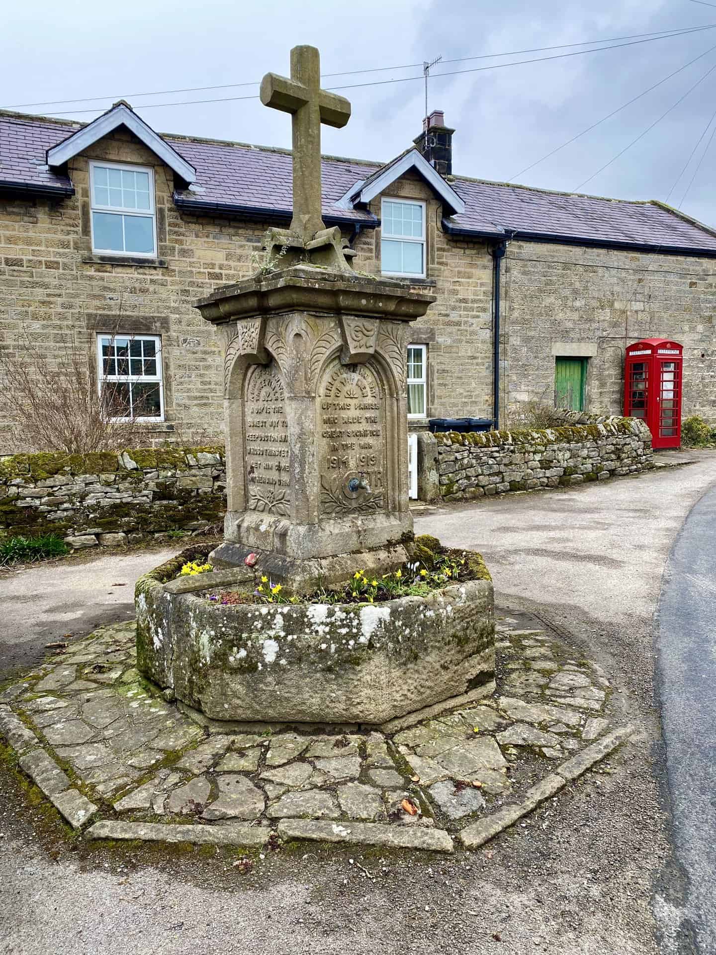
The war memorial in Lofthouse village centre, a solemn tribute to the fallen and missing residents of Lofthouse from the Great War (World War I). For another great walk from Lofthouse check out my Nidderdale Way walk.
Amazon’s Top Walking Boots: Four Standout Choices for Men and Women
For walking and hiking, the right boots are essential for both comfort and safety. While Amazon boasts a wide range, certain boots emerge as top-sellers. From those, here are four I personally favour. As an Amazon affiliate, I may earn a small commission from any purchases made through the links provided. This helps support the upkeep of this website. Rest assured, you won’t pay a penny extra, but your purchase will contribute to keeping my site running smoothly. Happy walking!

Berghaus Men’s Hillmaster II Gore-Tex Walking Boots
These fully waterproof leather walking boots feature a Gore-Tex lining, ensuring no water enters whilst allowing feet to breathe and stay cool. Made from full-grain leather, they promise unmatched durability and comfort. The boots come with memory foam tongues and cuffs that mould to your feet for a tailored fit, and the Vibram Hillmaster outsoles offer confidence on challenging terrains.

Salewa Men’s Mountain Trainer Mid Gore-Tex Walking Boots
Made from durable suede and abrasion-resistant textile, these men’s hiking boots are both lightweight and sturdy. The upper material is enhanced by a 360° full rubber sheath. Their dual-layer midsole with Bilight technology ensures ergonomic cushioning and grip, especially on extended hikes. The Vibram Wrapping Thread Combi outsoles allow a natural walking feel, and the Gore-Tex lining provides waterproofing, breathability, and optimal weather protection. Furthermore, the patented Salewa 3F system ensures flexibility, a secure heel grip, and a blister-free fit.

Berghaus Women’s Supalite II Gore-Tex Walking Boots
Specially designed for women, these hiking boots offer waterproofing and breathability, thanks to their Gore-Tex lining. Crafted from full-grain abrasion-resistant leather, they’re durable enough for the toughest hikes. The Supalite soles ensure stability and traction, and the EVA midsoles add comfort for extended walks.

Merrell Women’s Moab 3 Mid Gore-Tex Walking Boots
These hiking boots incorporate a Gore-Tex waterproof membrane, blending breathability with superior waterproof performance. The combination of pigskin leather and mesh on the uppers, along with the suede outer material, ensure durability and style. Enhancements include 100% recycled laces, webbing, and mesh lining. Additionally, bellows tongues, protective toe caps, and Vibram TC5+ rubber soles ensure protection and ease on any terrain.