Explore Historic Breweries and Stunning Landscapes on This Masham Walk
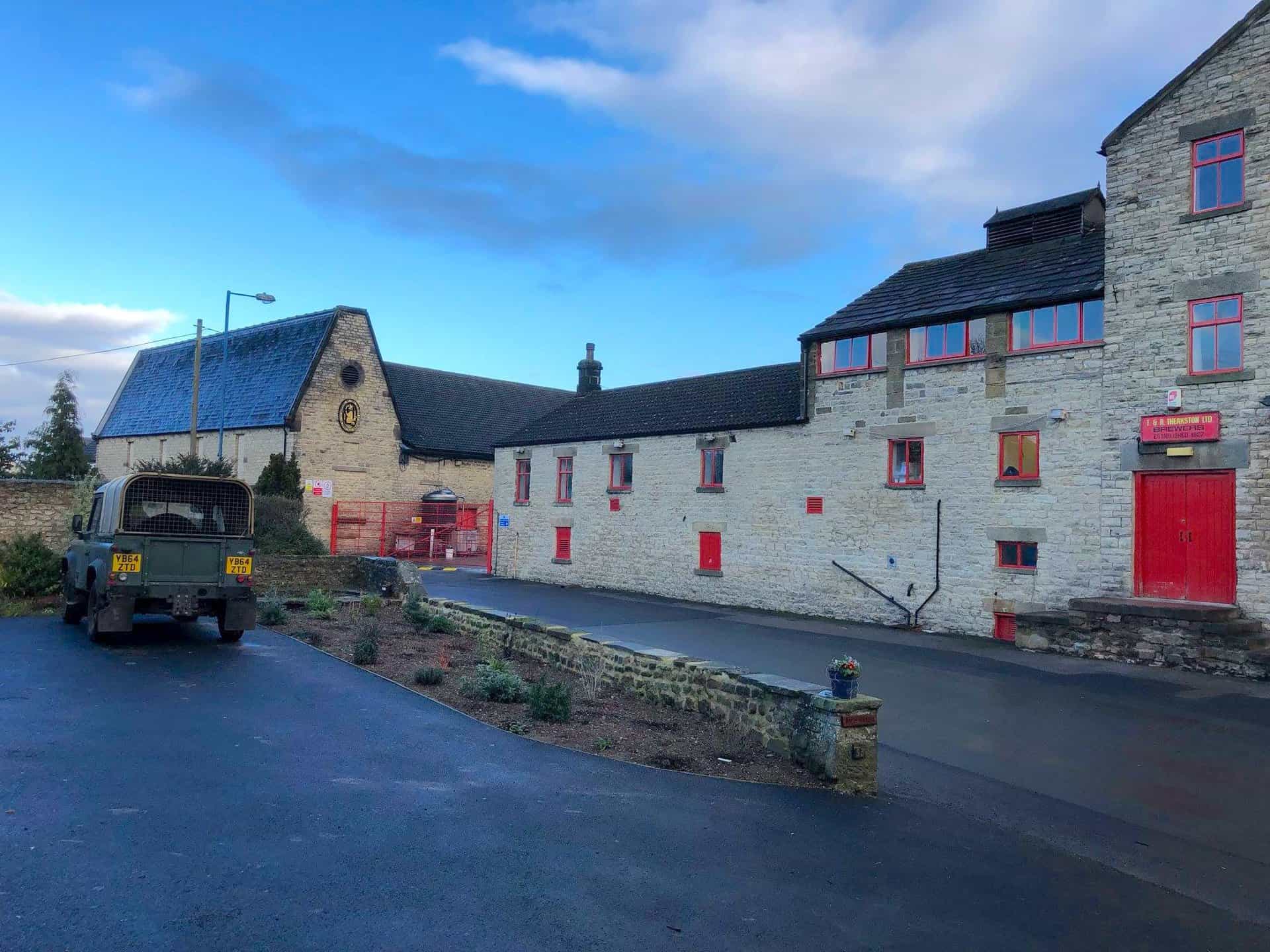
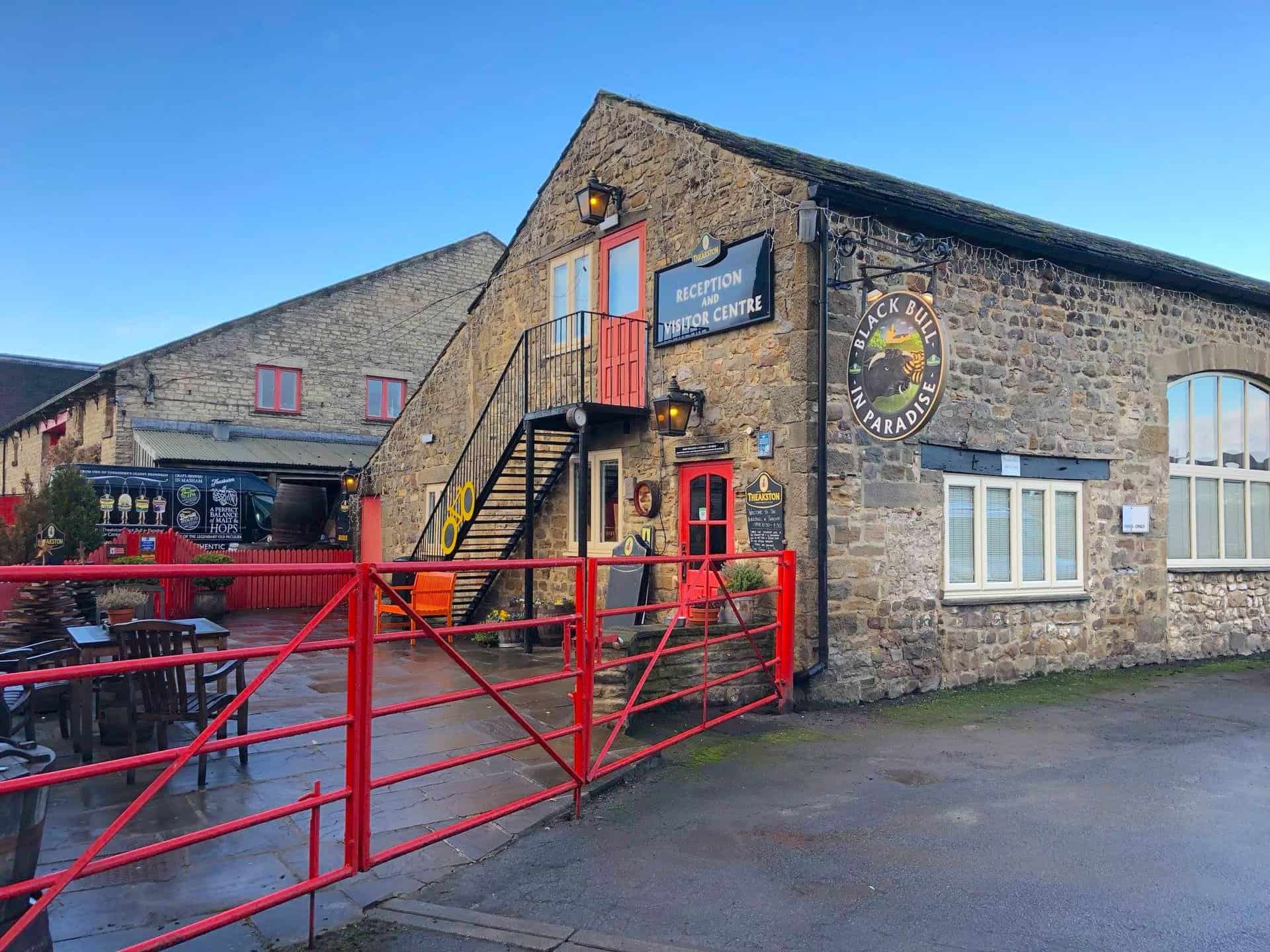
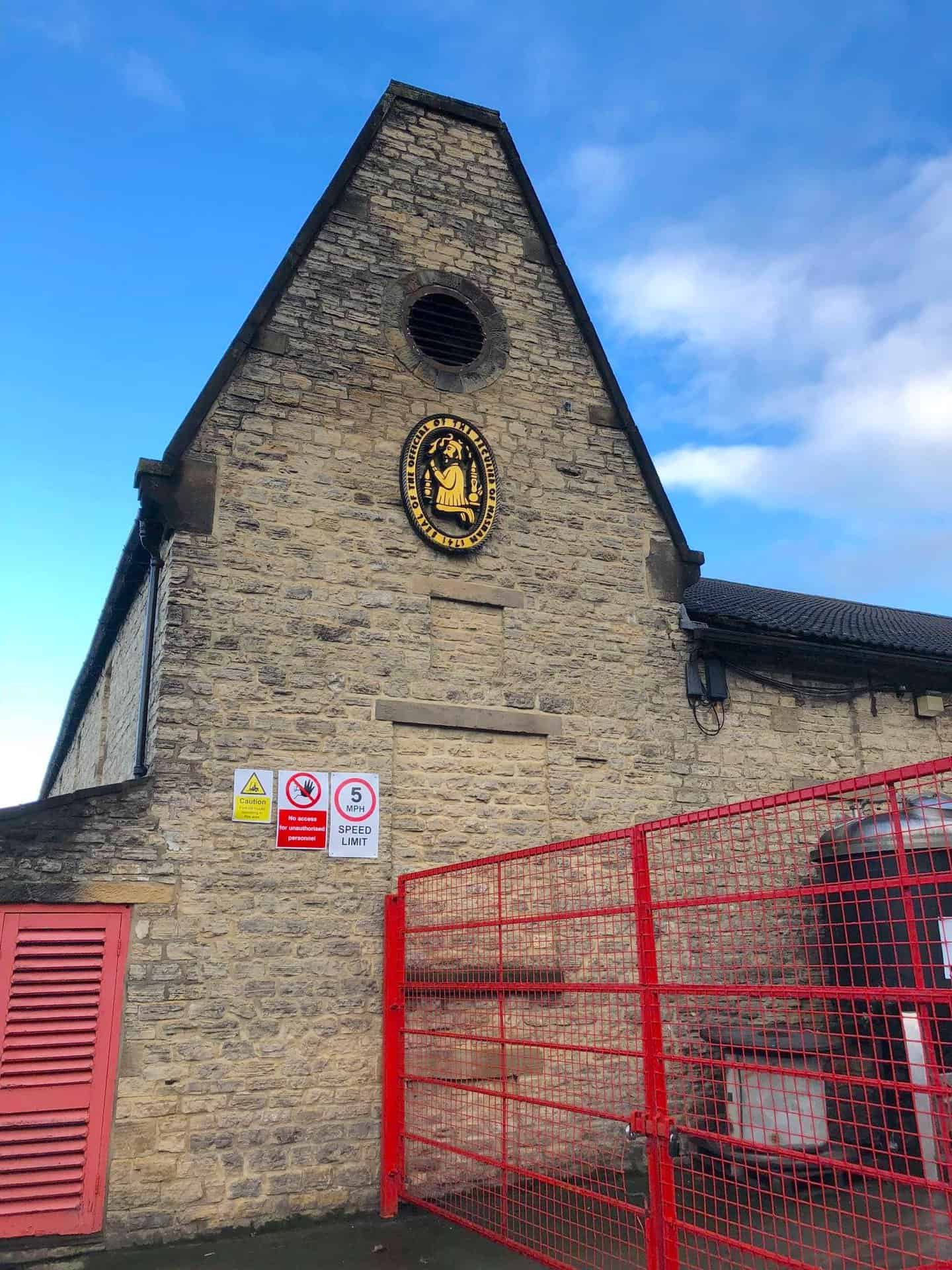
Begin your Masham walk in the bustling heart of Masham town centre. Allocate time to admire the historic architecture of T&R Theakston Ltd, an iconic brewery established in 1827, integral to Masham’s heritage. Then, set off west from the town centre on the Ripon Rowel Walk, directing your steps towards Micklebury Lane. Continue westward, traversing the open landscapes of Fearby Low Moor.
Your Masham walk then takes you south through the peaceful Sole Beck Gill valley, leading towards Ilton. Embrace the natural beauty as you follow a south-west path across Ilton Moor, extending to Arnagill Moor. Descend north towards the Roundhill Reservoir dam, a segment of the Masham walk known for its breathtaking scenery with plenty to see.
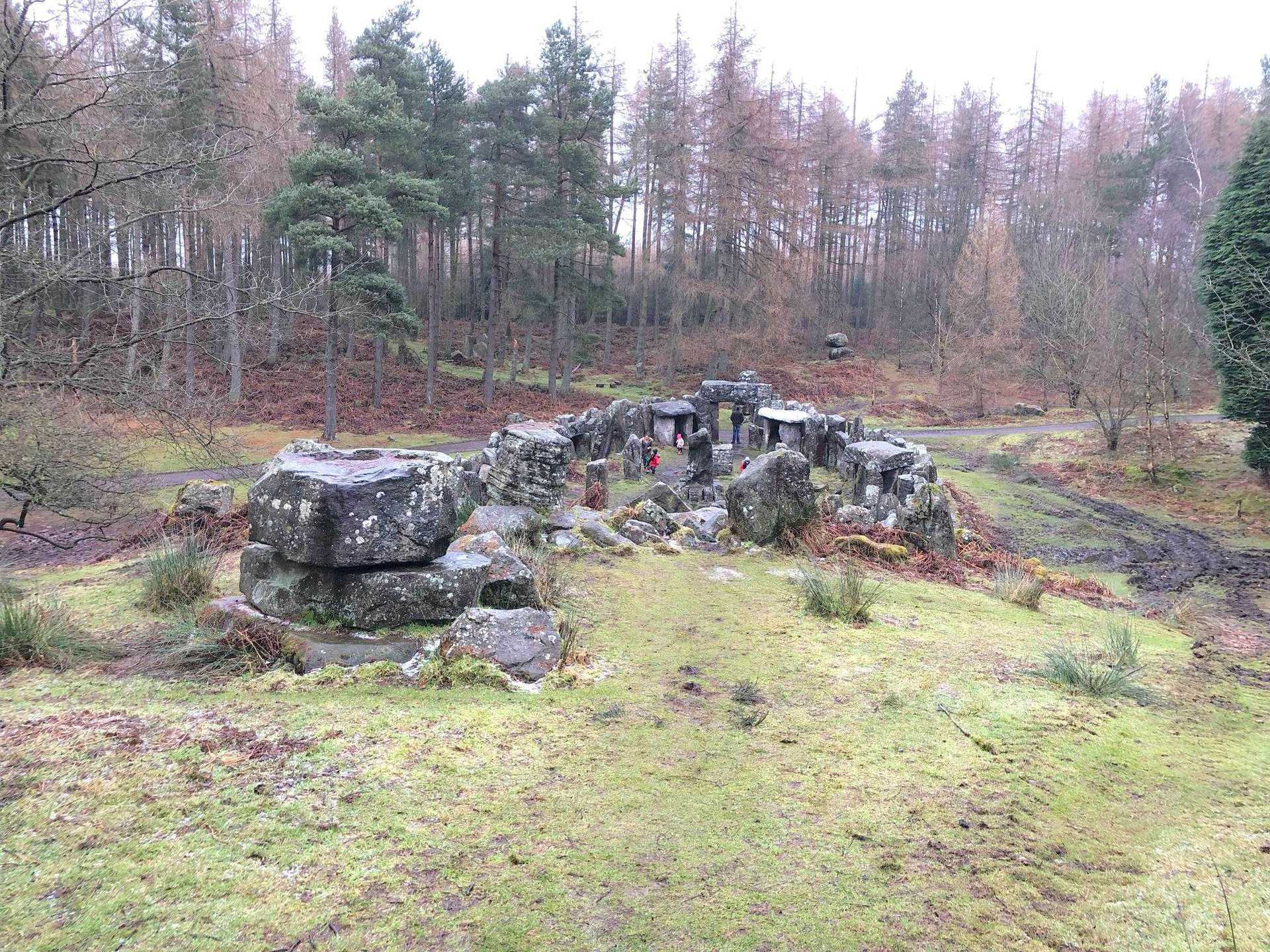
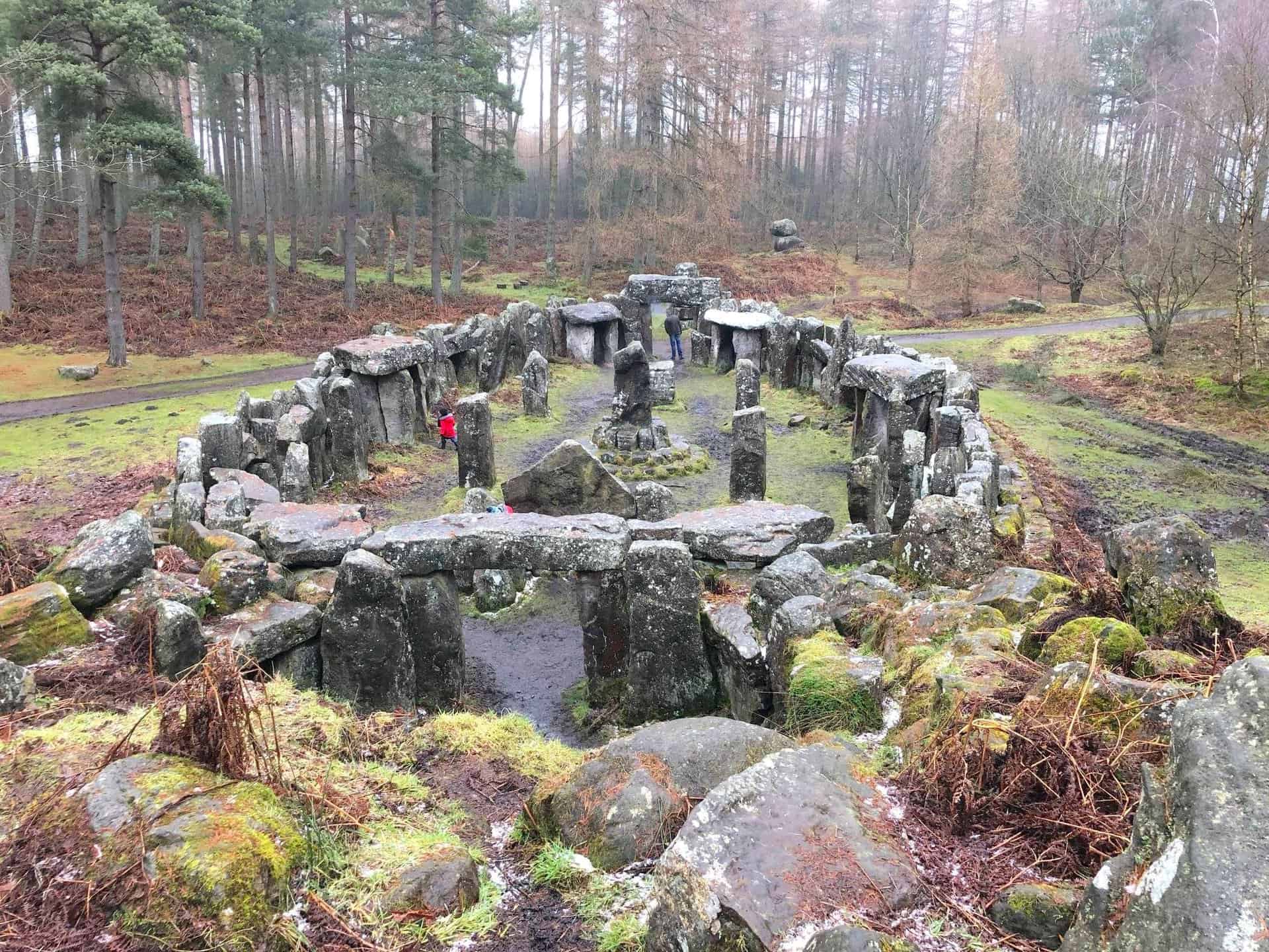
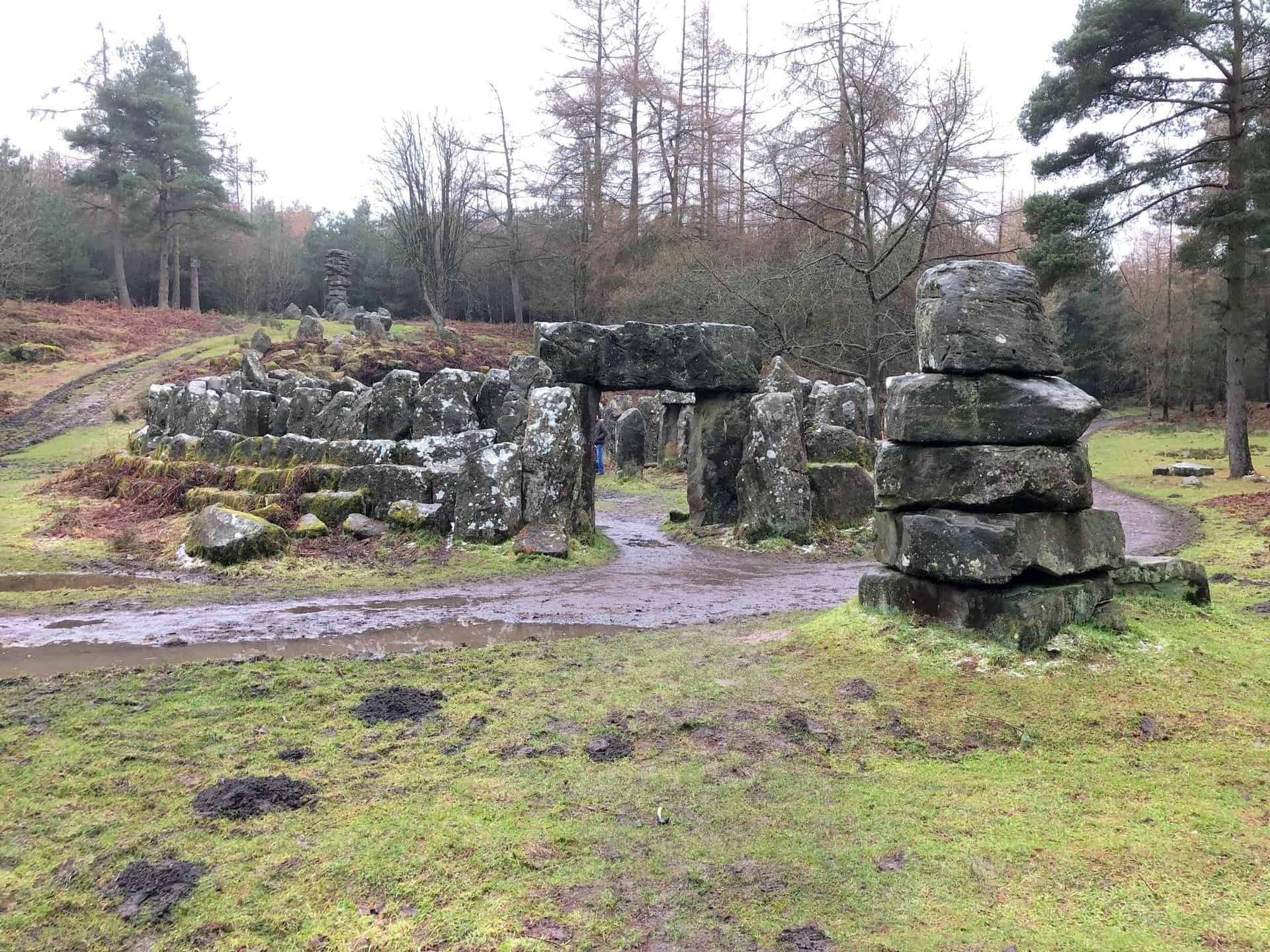
The Masham walk route then guides you north-east, meandering along paths that border the southern perimeter of Leighton Reservoir. A highlight of the Masham walk is the visit to Druid’s Temple, located in the tranquil Druid’s Plantation woodland. This 18th-century folly, a creation of William Danby, adds a historical dimension to your adventure.
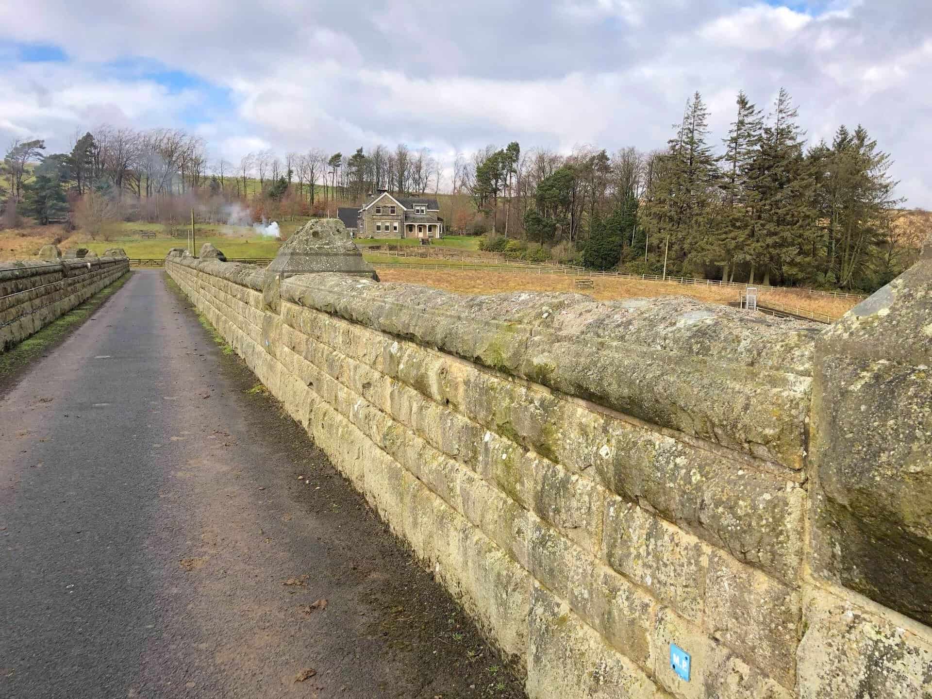
To complete your Masham walk, proceed north-east via Knowle Lane, making your way back to Fearby Low Moor. Conclude by returning to Masham via the Ripon Rowel Walk. The entire Masham walk covers an enriching 14½ miles, showcasing the stunning beauty of the Nidderdale area.
Masham Walk: Maps and Tools
Visit either the OS Maps website or the Outdooractive website to view this walking route in greater detail. Both platforms offer a range of features, including the ability to print the route, download it to your device, and export the route as a GPX file. You can also watch a 3D fly-over and share the route on social media.
Masham Walk: Distance, Duration, Statistics
Distance: 14½ miles
Distance: 23½ kilometres
Duration: 6¾ hours
Ascent: 1650 feet
Ascent: 501 metres
Type: Circular walk
About Masham
Masham, a market town and civil parish in North Yorkshire, England, is located in Wensleydale on the western bank of the River Ure. Its name, originating from the Anglo-Saxon ‘Mæssa’s Ham’ (Mæssa’s homestead), reflects its rich history. The Romans once had a presence in Masham, but it was the Angles who were the first permanent settlers. The town was significantly affected by a Viking invasion around 900AD, which led to the introduction of sheep farming, a practice Masham is still known for.
Historically, Masham was part of a larger parish in the North Riding of Yorkshire, encompassing several townships. By 1866, these townships became separate civil parishes. The area, excluding Burton-on-Yore, was commonly referred to as Mashamshire from the 12th century. Notably, Masham Moor, an expanse of moorland to the west, was shared between Masham and East Witton until its division in 1934.
St Mary’s Church, believed to be founded in the seventh century, is a significant historical site in Masham. Although it incorporates Anglo-Saxon features, the current structure is predominantly Norman with 15th-century additions. Masham’s connection to York Minster during the medieval period led to its designation as a peculiar, a parish under the direct control of the Archbishop.
In the Middle Ages, Masham flourished with industries like milling, mining, cloth making, and tanning. Its first market charter, granted in 1251, played a key role in establishing Masham as a major sheep market, which is reflected in its large market place and Georgian architecture. The town’s proximity to Jervaulx and Fountains Abbeys, both renowned for their sheep flocks, further boosted its market importance.
Masham was connected to the North Eastern Railway from 1875, with passenger services running until 1930 and goods traffic until 1963. The station was situated across the River Ure at Low Burton.
The town is also notable for being the birthplace of naturalist Charles Hedley (1862-1926), whose father was the local vicar. In 2014, Masham was on the route of the Tour de France Stage 1 from Leeds to Harrogate.
Masham is home to two breweries, Black Sheep Brewery and Theakstons, both located near each other. The Black Sheep Brewery is known for sponsoring annual folk festivals in Masham, with past performers including Hugh Cornwell of The Stranglers. The town’s brewing history also includes the former Lightfoot Brewery, which was absorbed by the Theakston family in the 1920s and its premises now occupied by Black Sheep.
In summary, Masham’s rich history, from its early settlements to its current status as a hub for brewing and cultural events, makes it a unique and significant location in North Yorkshire. This Masham walk, encompassing its historical and cultural landmarks, offers a glimpse into the town’s past and present.
Recommended Ordnance Survey Map
The best map to use on this walk is the Ordnance Survey map of Nidderdale, reference OS Explorer 298, scale 1:25,000. It clearly displays footpaths, rights of way, open access land and vegetation on the ground, making it ideal for walking, running and hiking. The map can be purchased from Amazon in either a standard, paper version or a weatherproof, laminated version, as shown below.
Weatherproof Version
Ordnance Survey map of Nidderdale, reference OS Explorer 298, scale 1:25,000
Masham Walk: My Photos
T&R Theakston Ltd in Masham, a family brewing company founded in 1827.


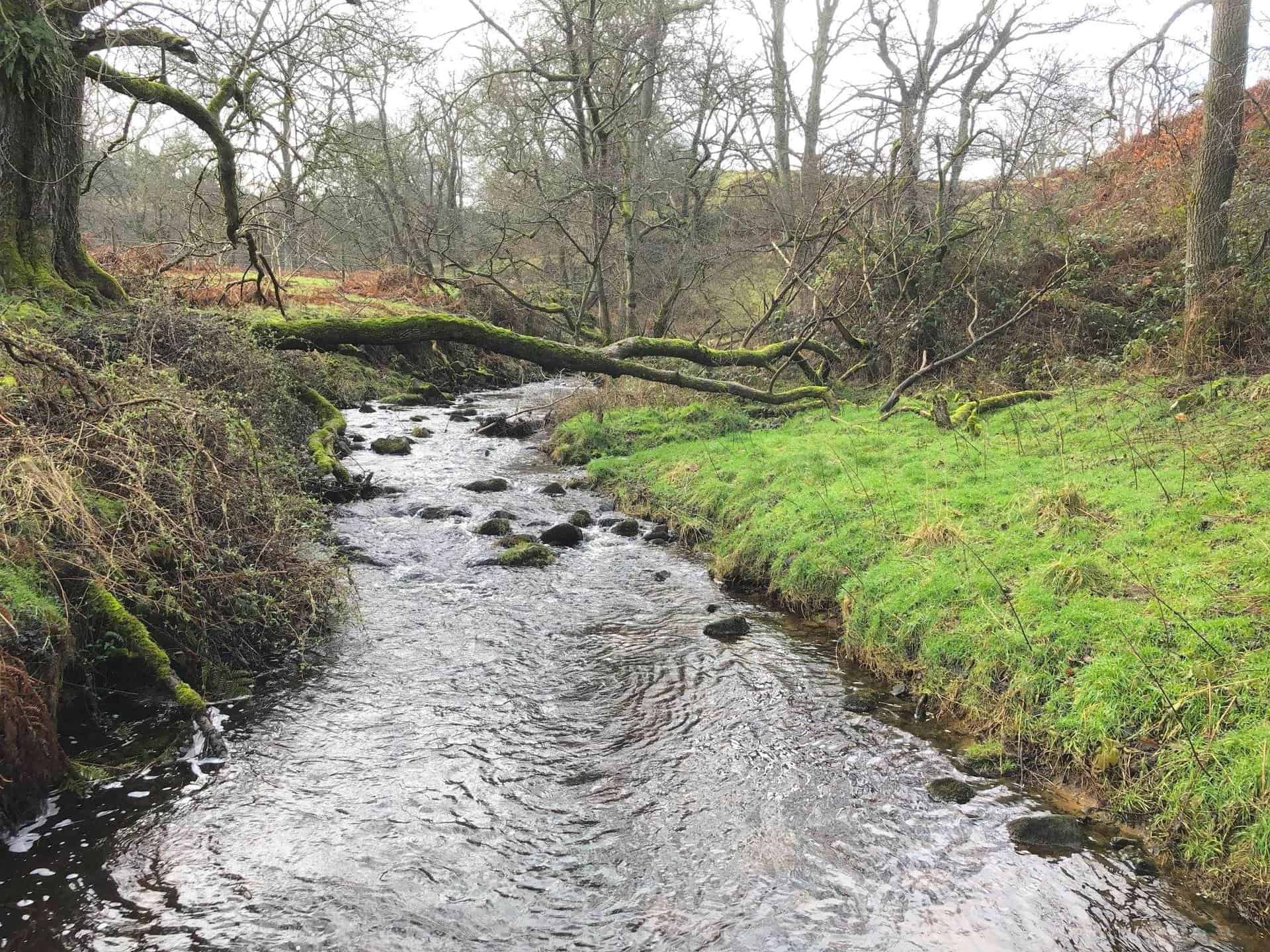
Sole Beck Gill near Ilton.
Sole Beck, about one-quarter of the way round this Masham walk.
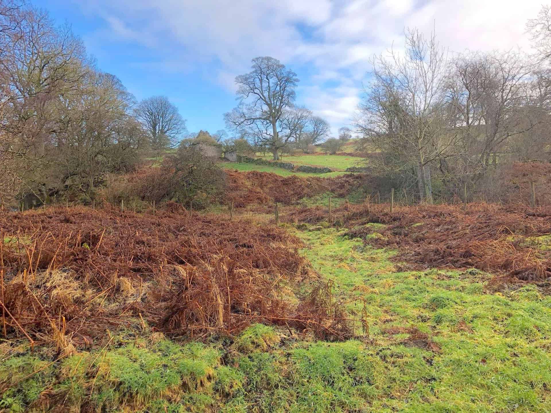
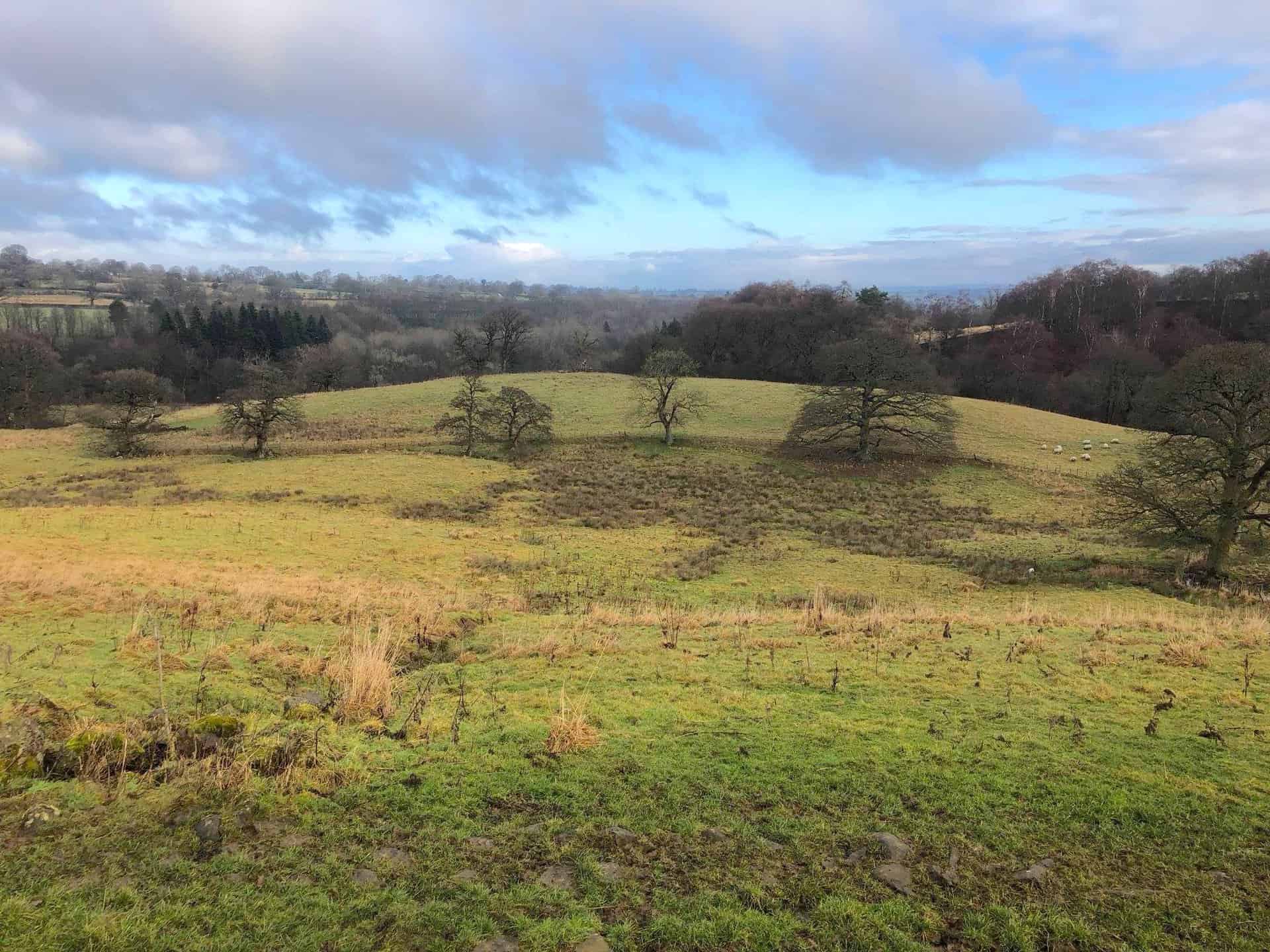
Countryside near Ilton, south-west of Masham.
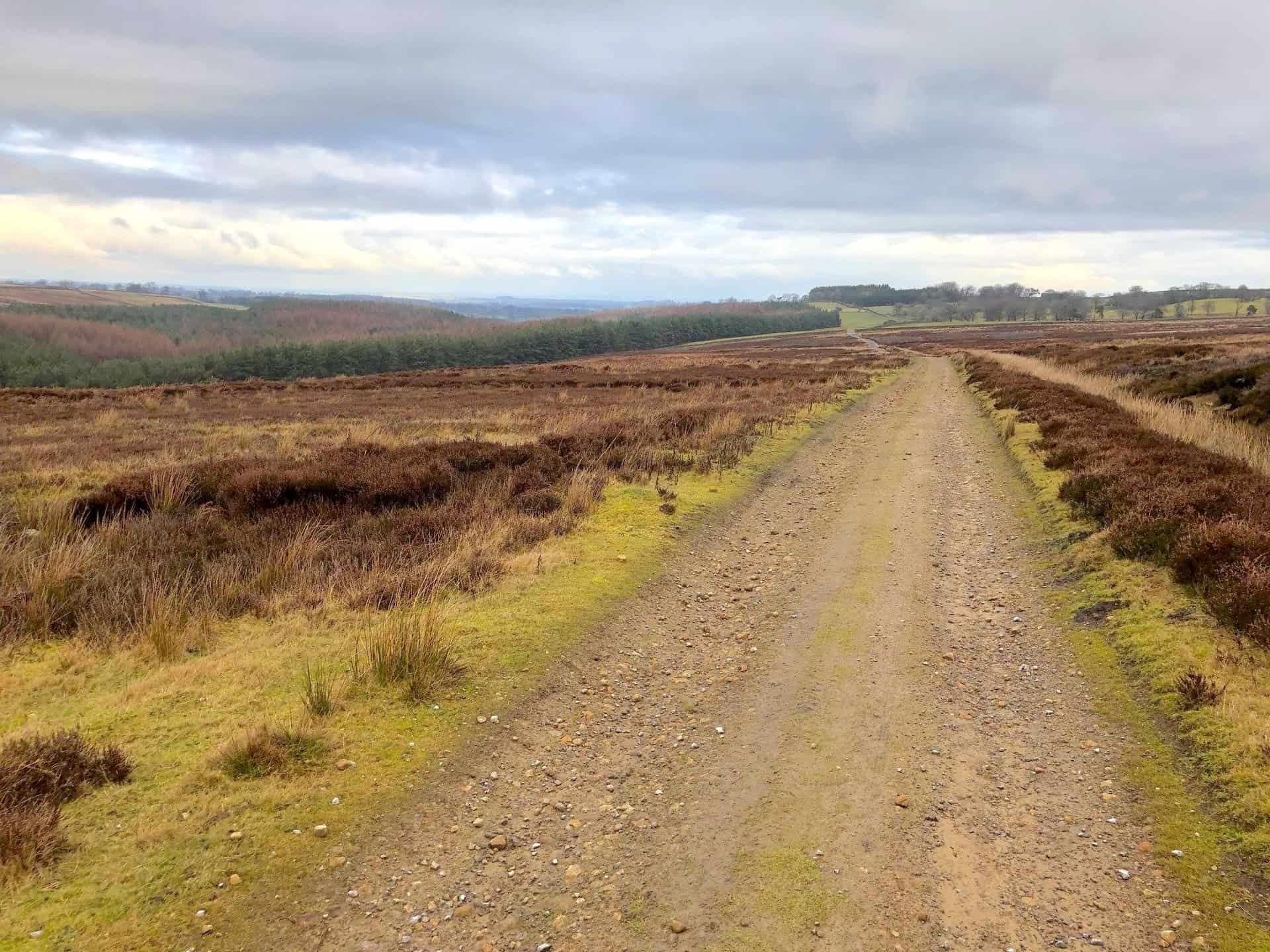
The track across Ilton Moor.
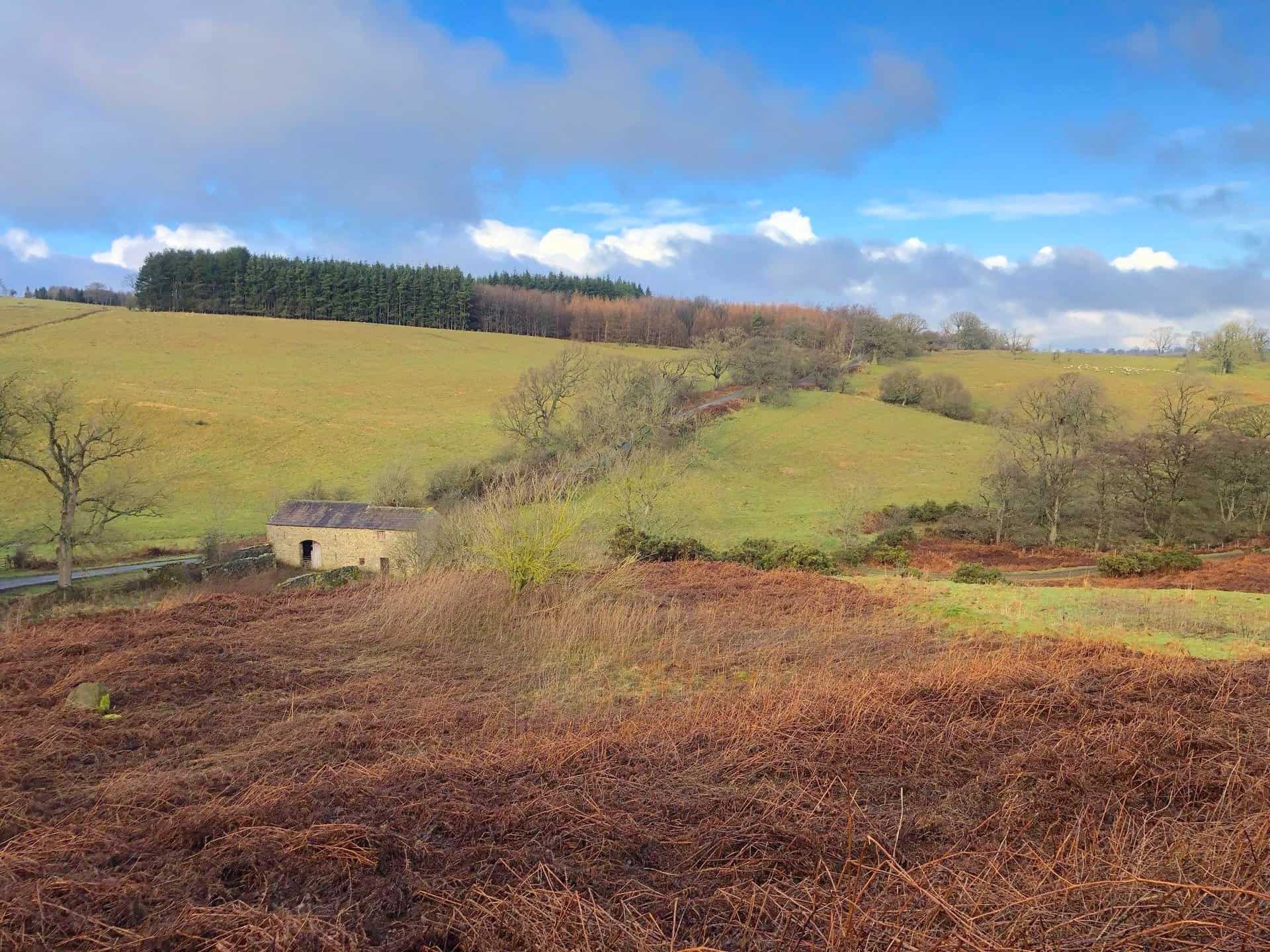
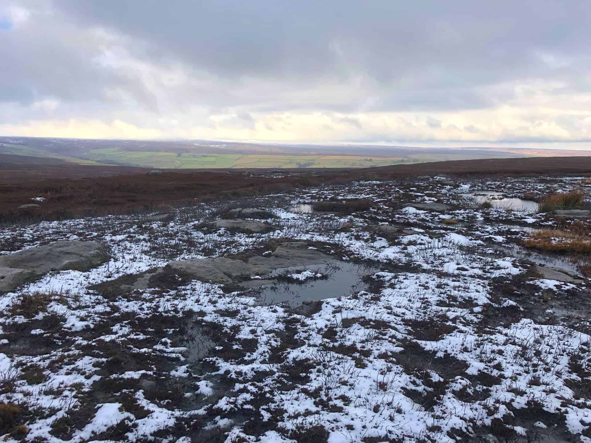
Boggy ground on Ilton Moor.
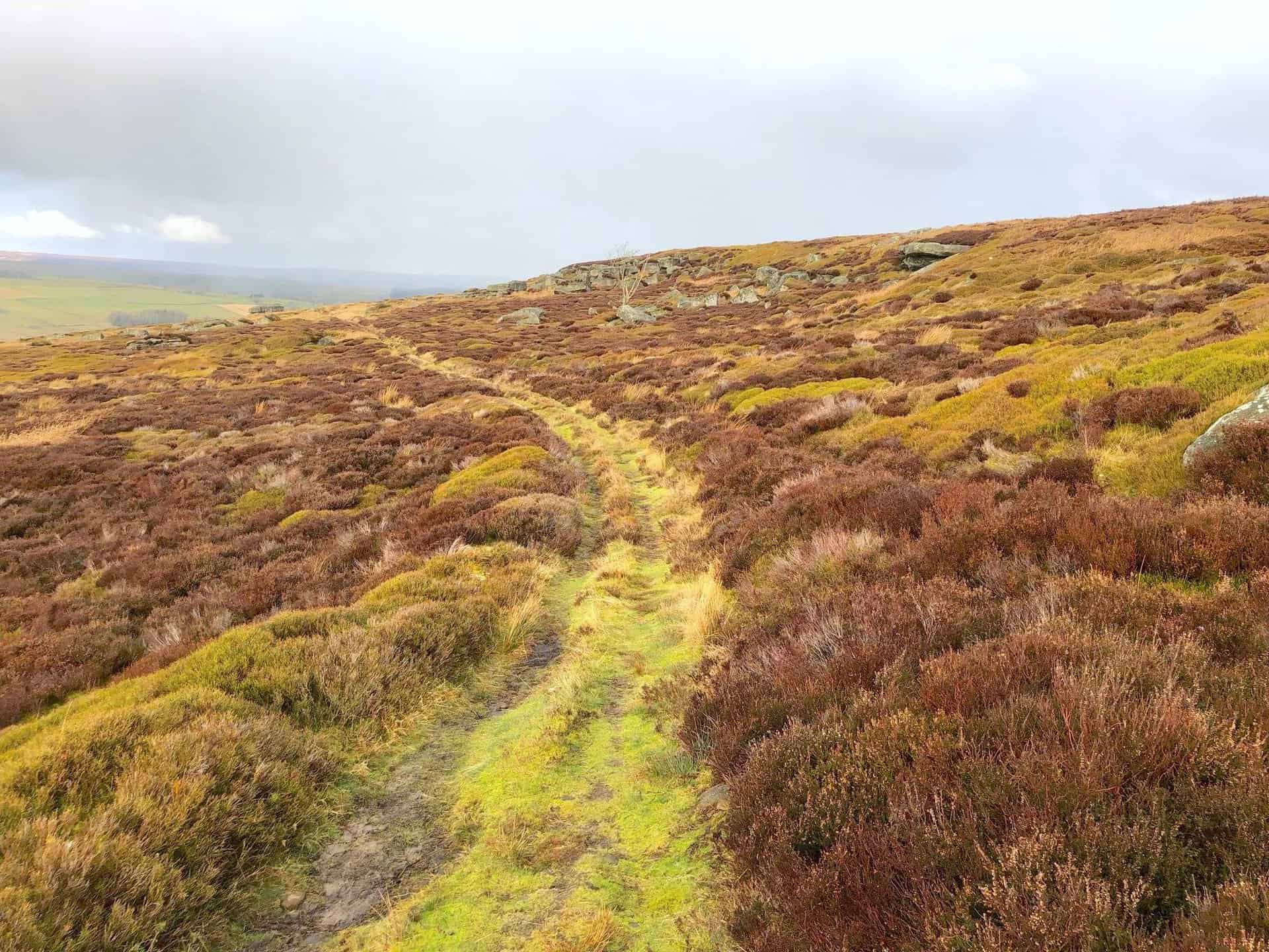
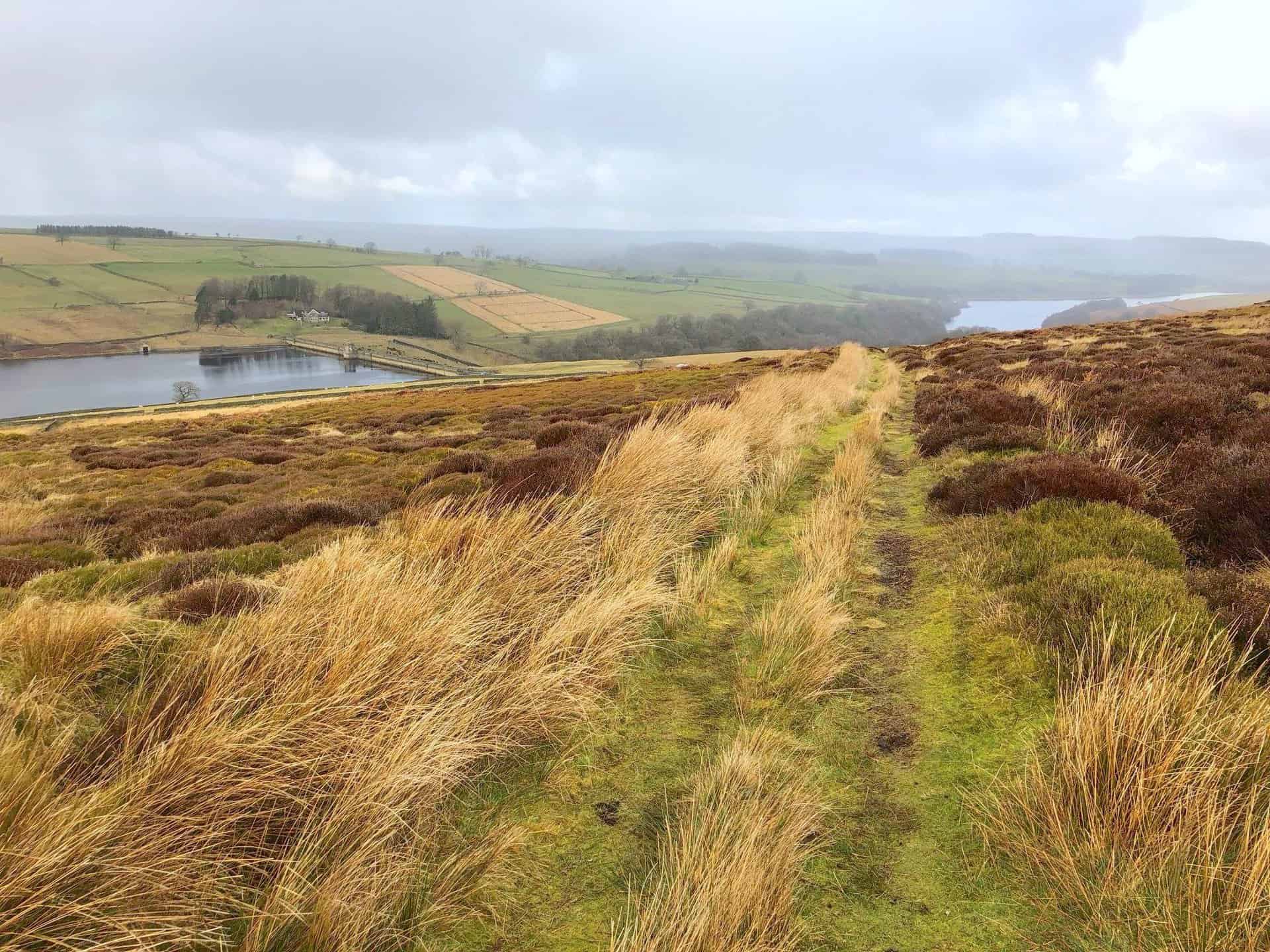
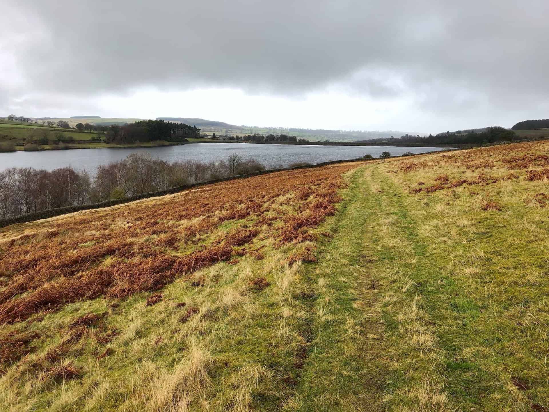
The path leading down to Roundhill Reservoir, roughly the halfway point of this Masham walk.
The view north-west towards Roundhill Reservoir.
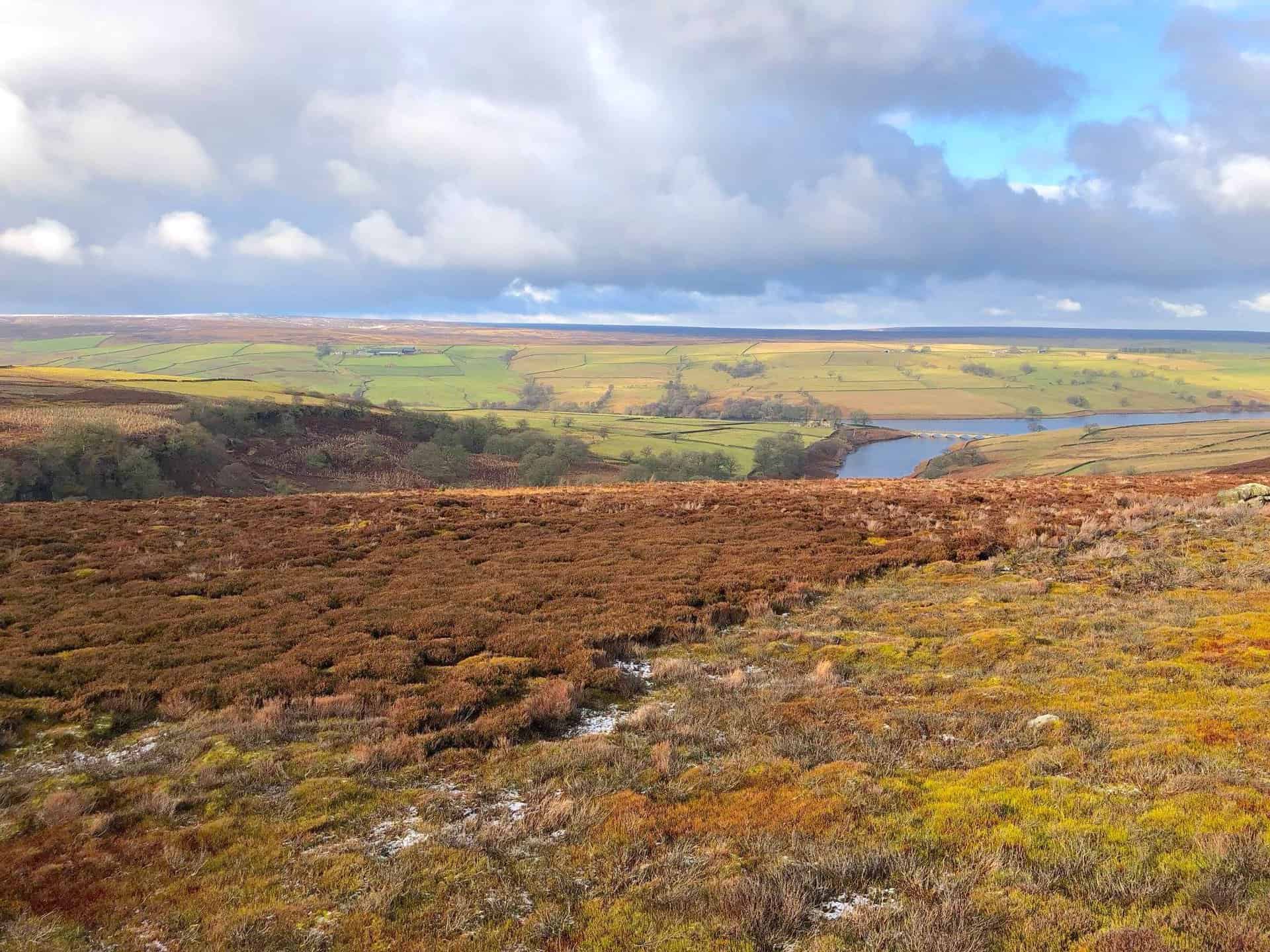
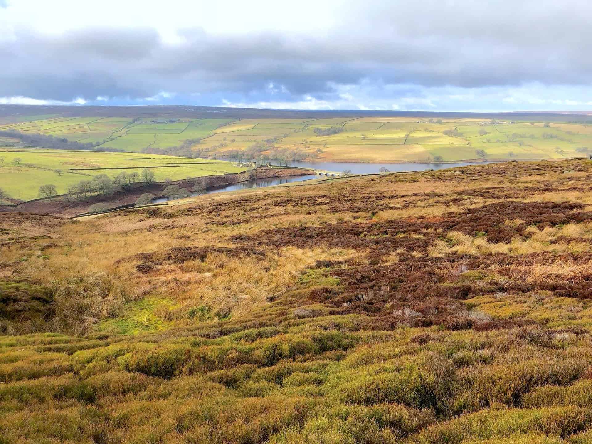
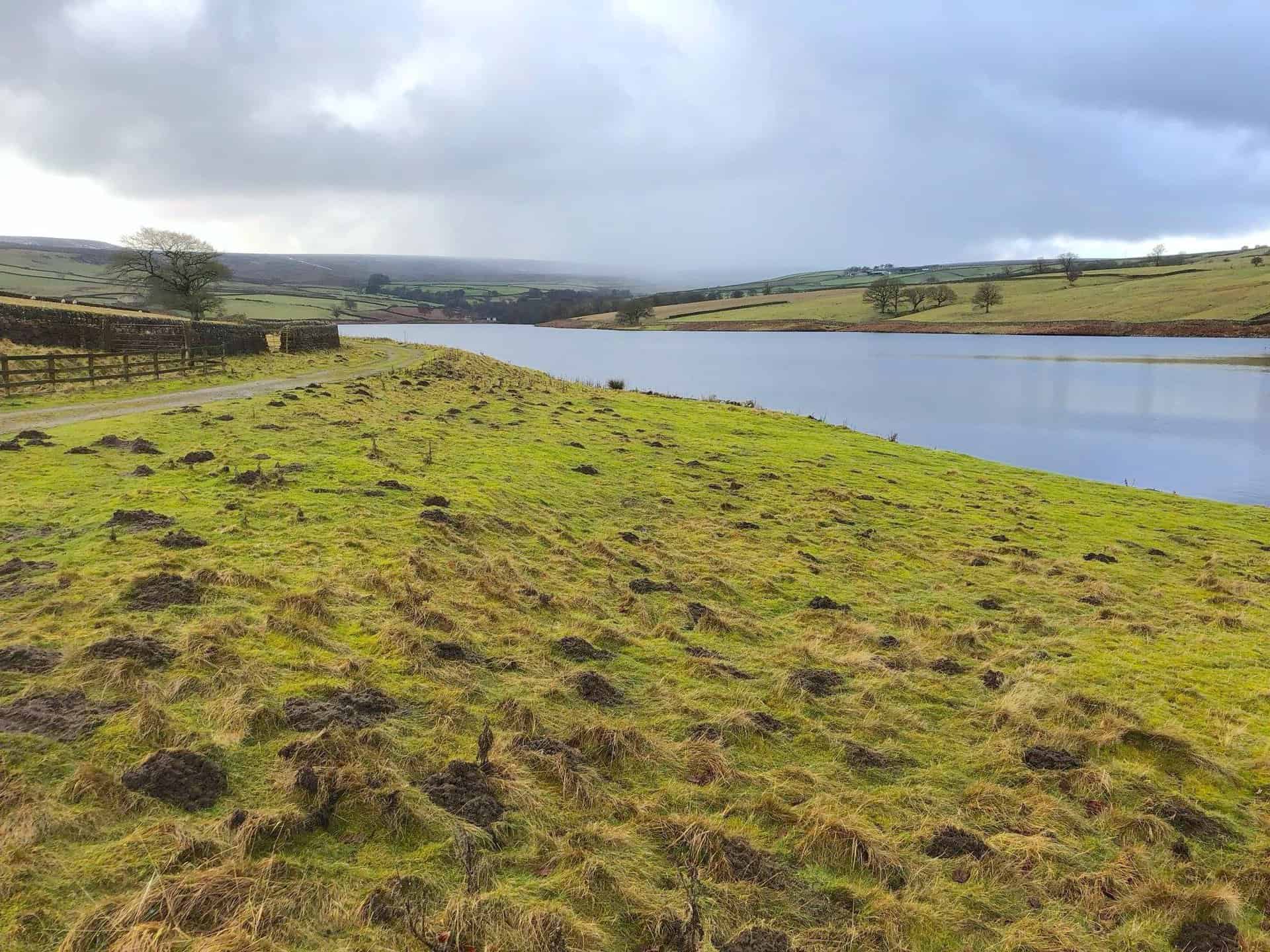
The view of Roundhill Reservoir on the left and Leighton Reservoir on the right.
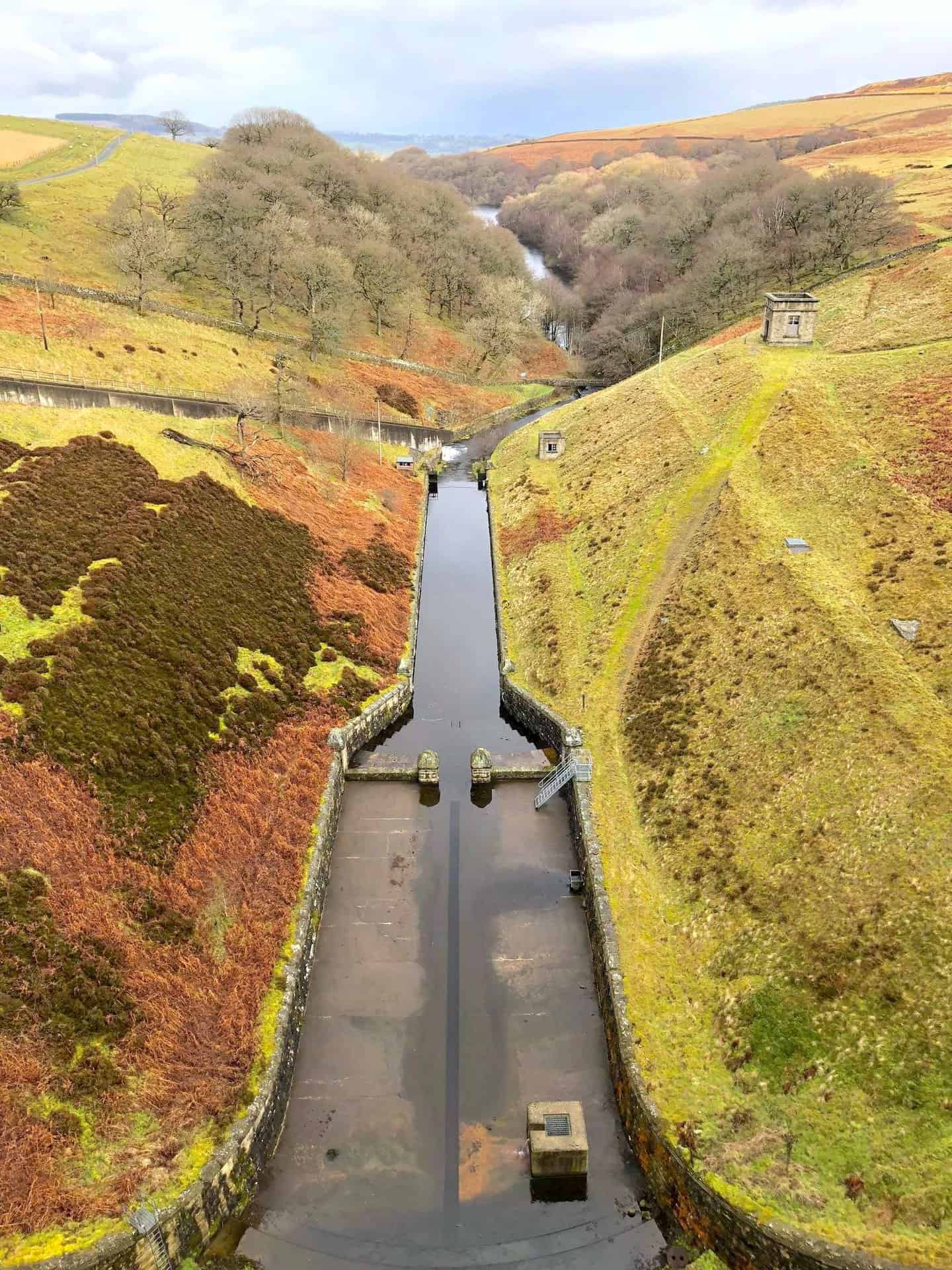
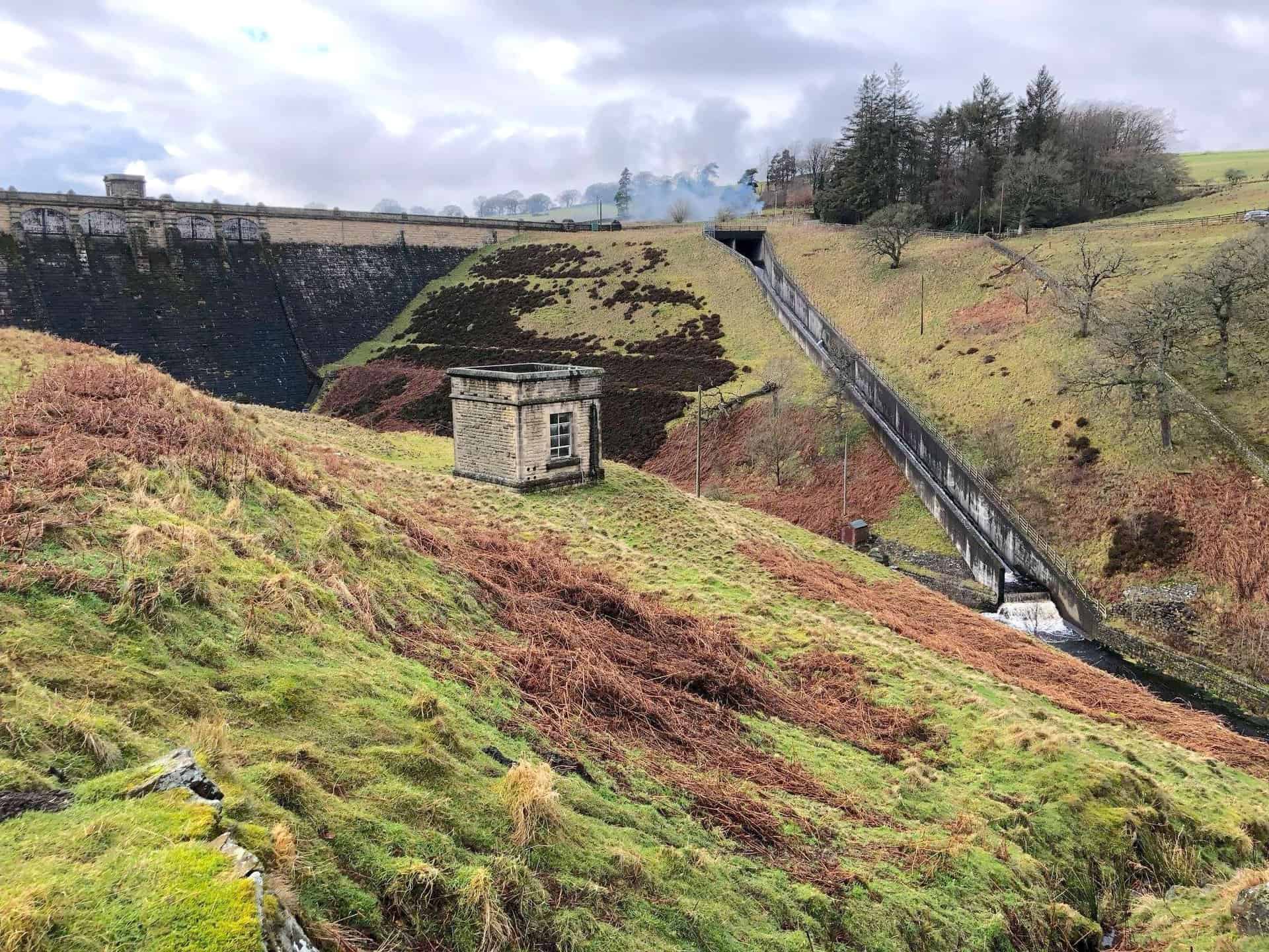
Roundhill Reservoir dam.
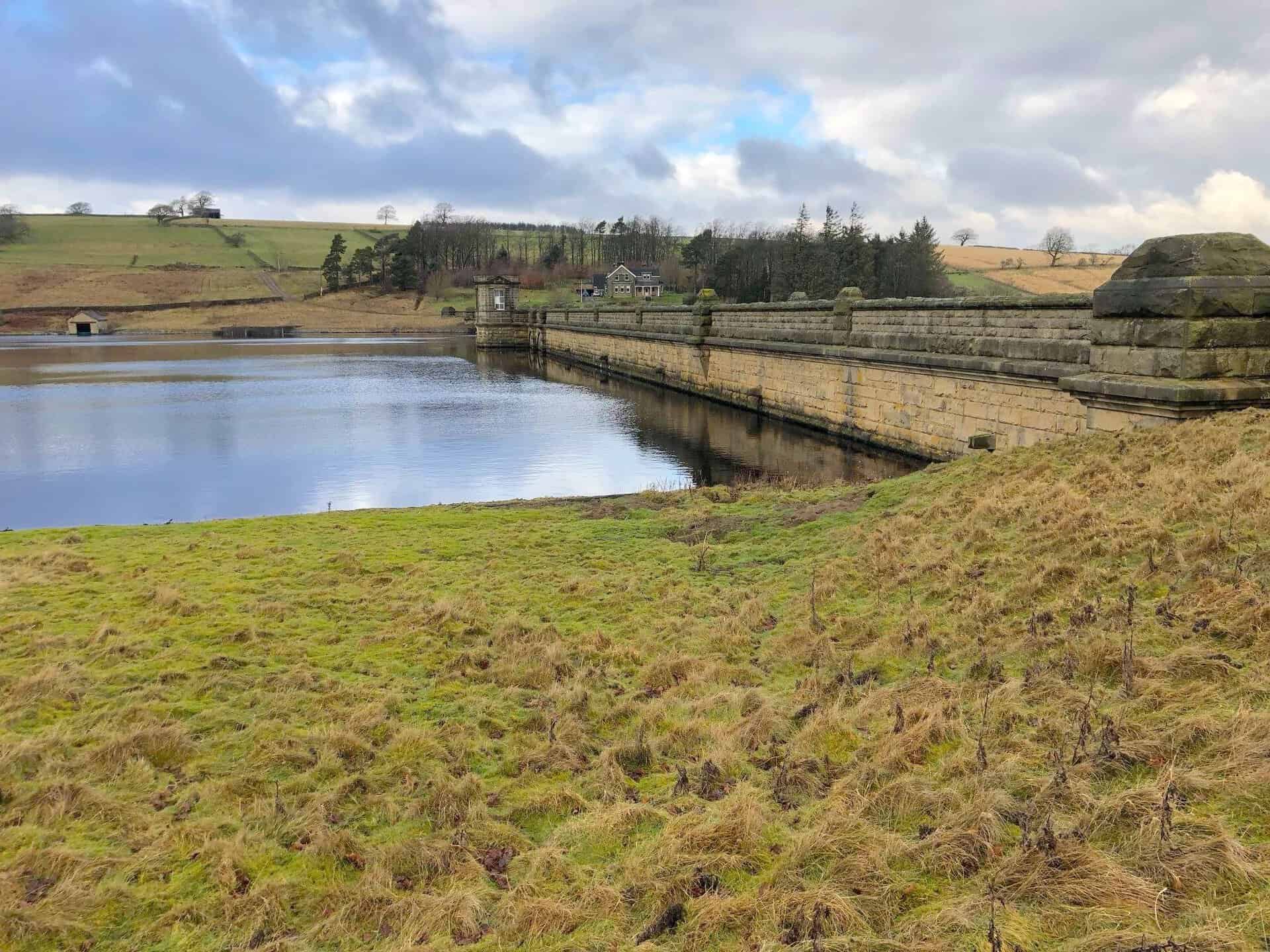
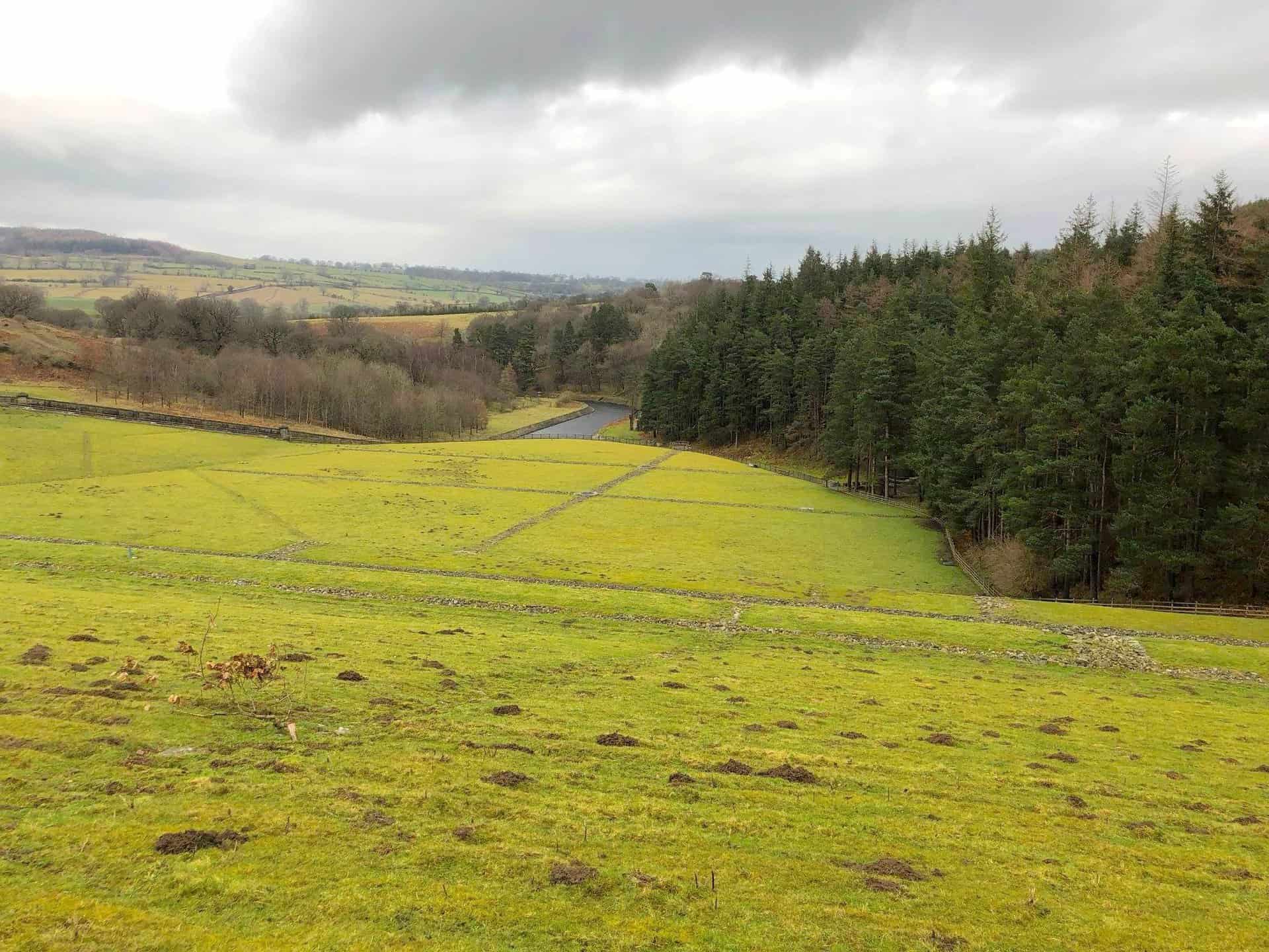
Roundhill Reservoir overflow which fills Leighton Reservoir.
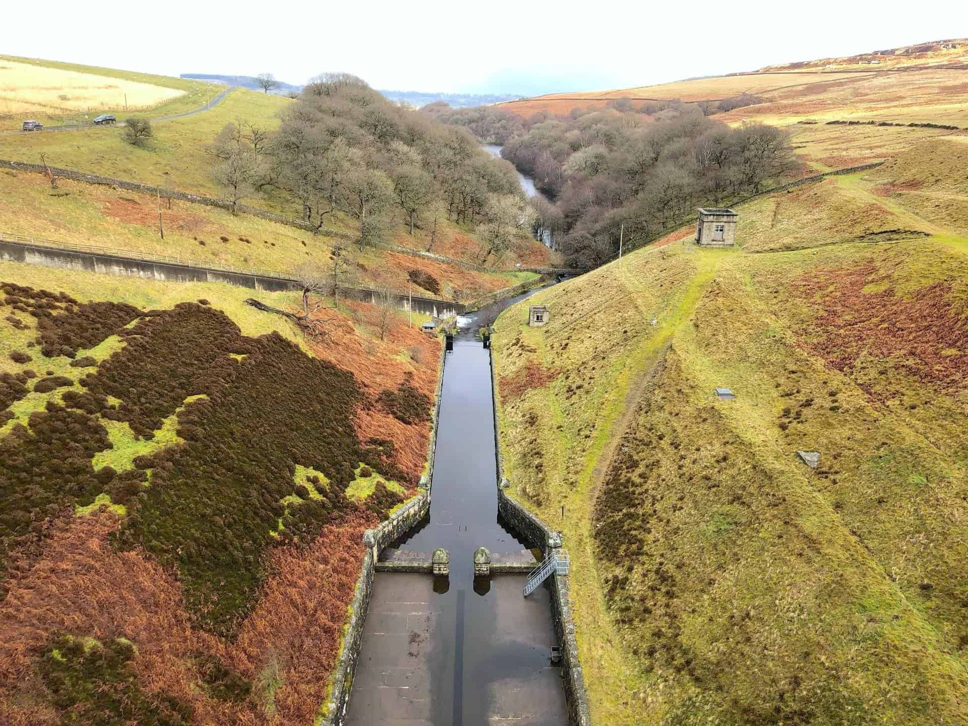
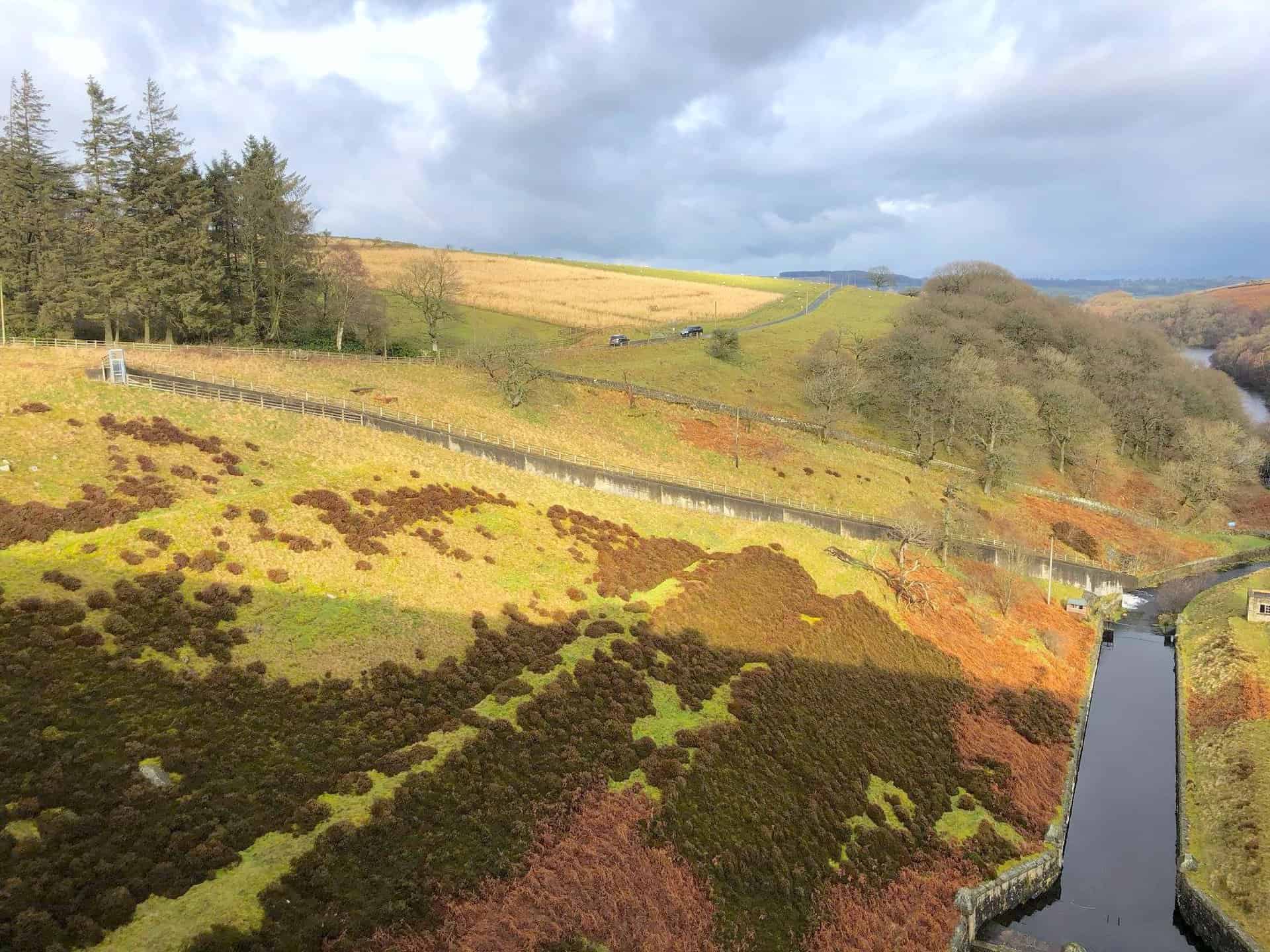
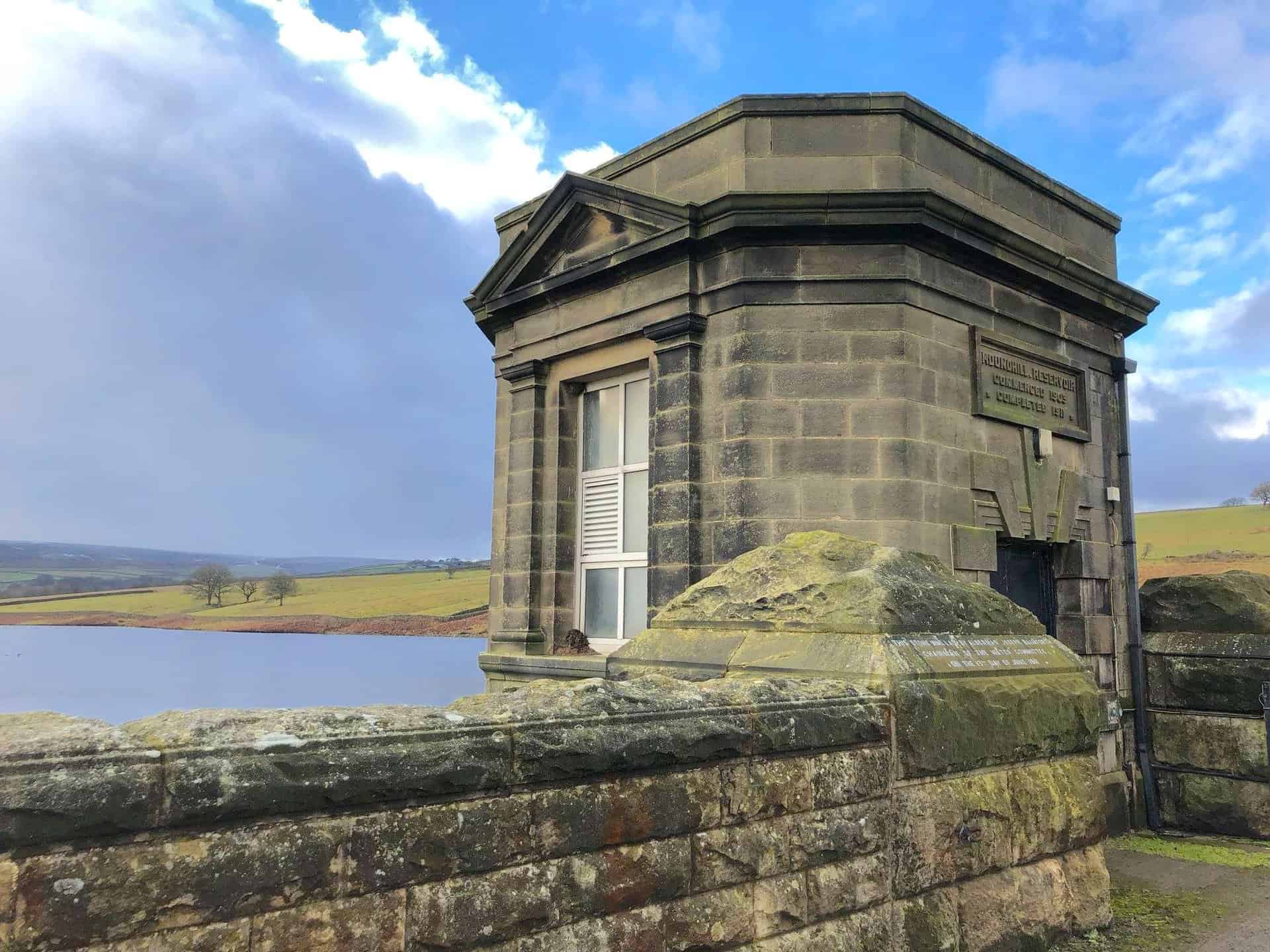
The back of Roundhill Reservoir dam.
Leighton Reservoir.
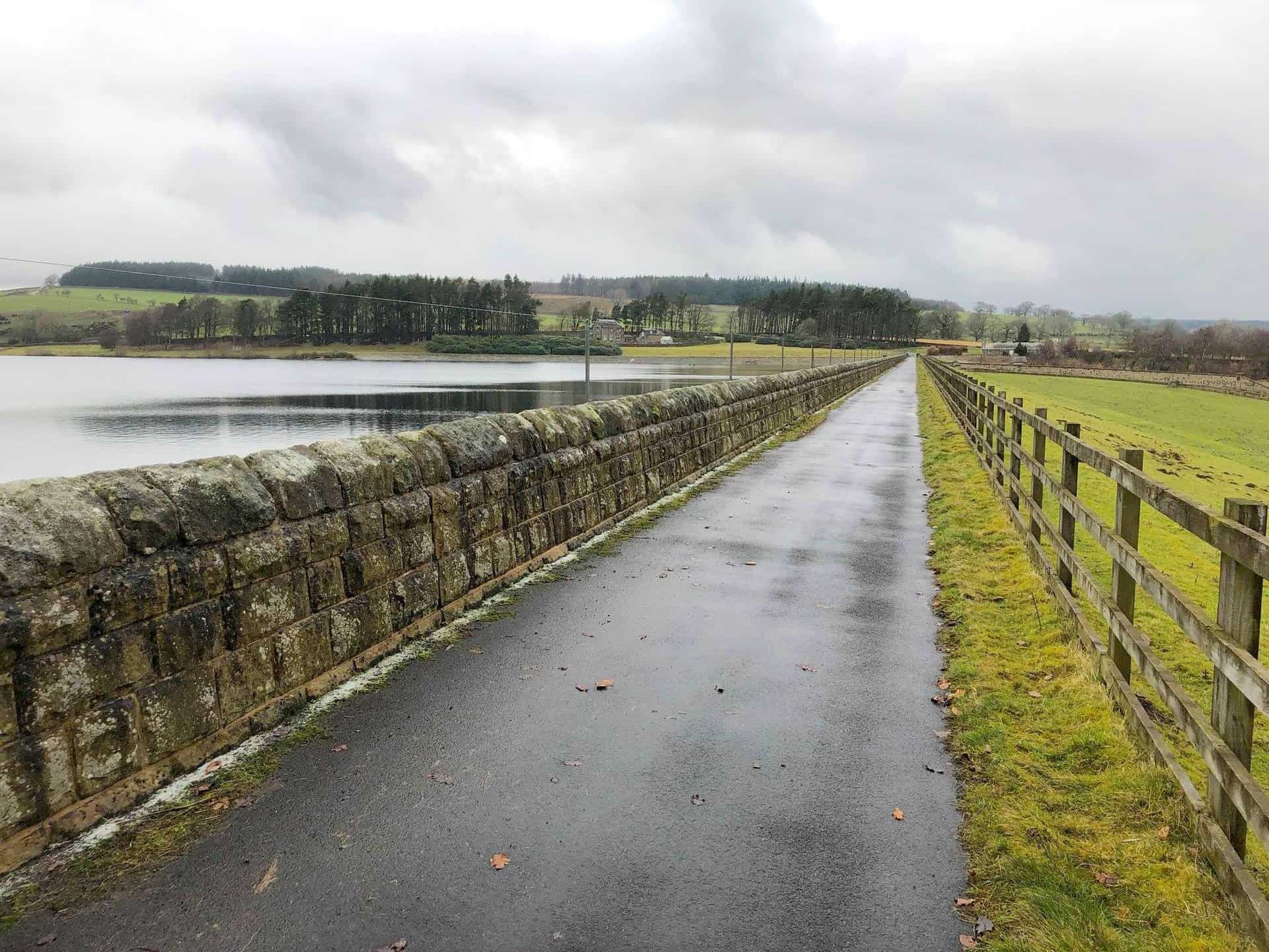
The grassy bank of Leighton Reservoir dam.
The path across Leighton Reservoir dam.
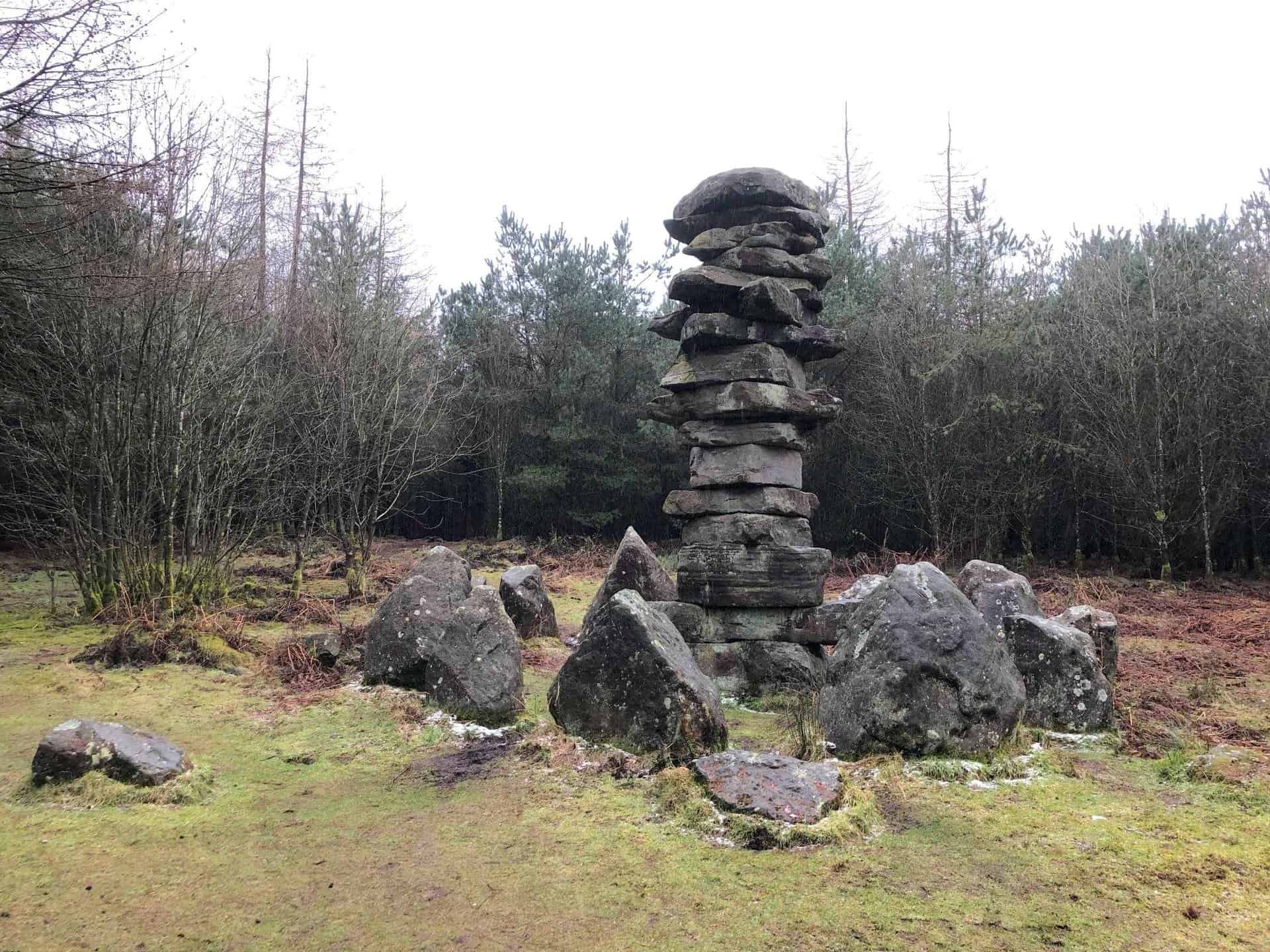
Stone statues in Druid’s Plantation.
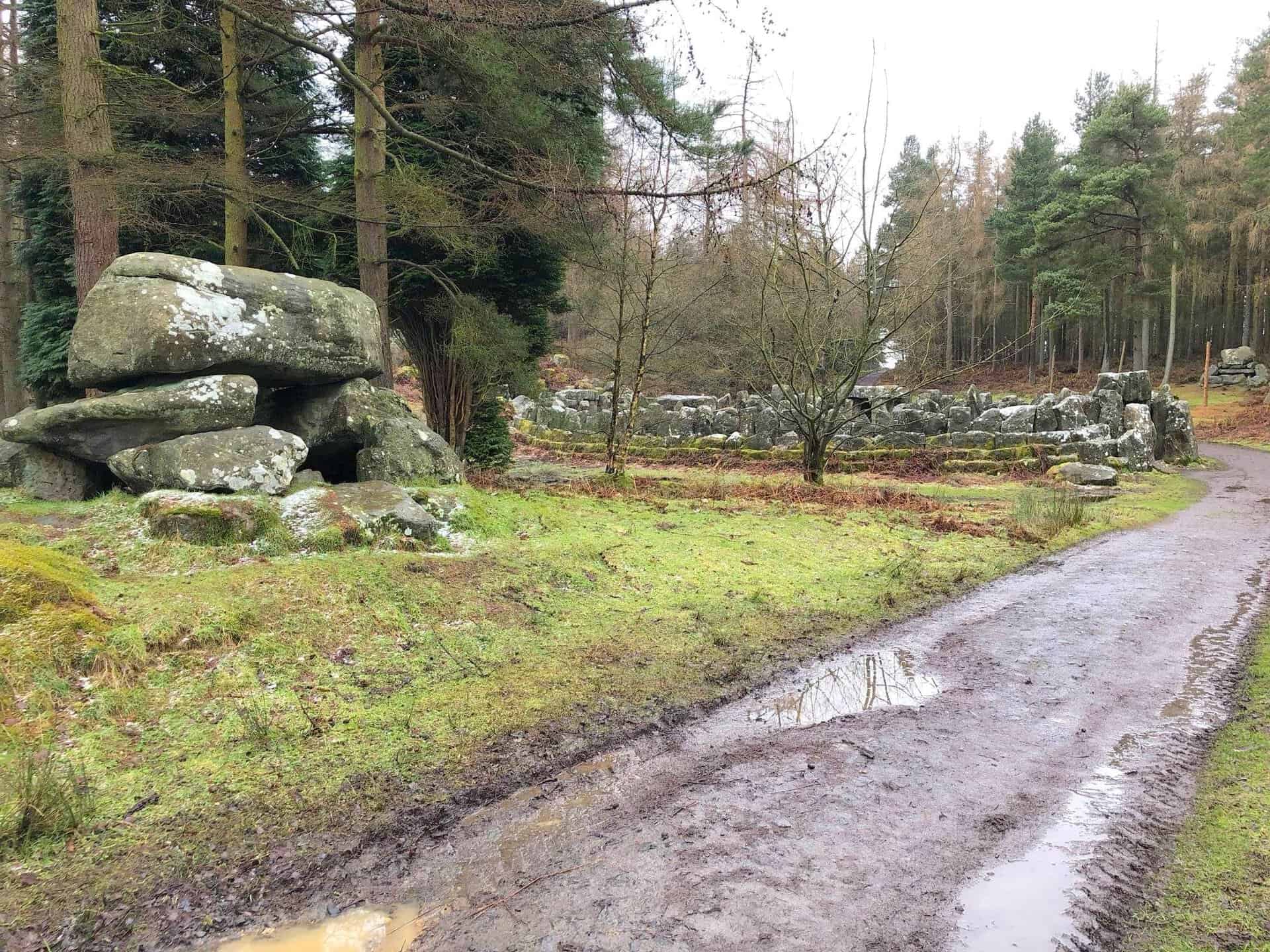
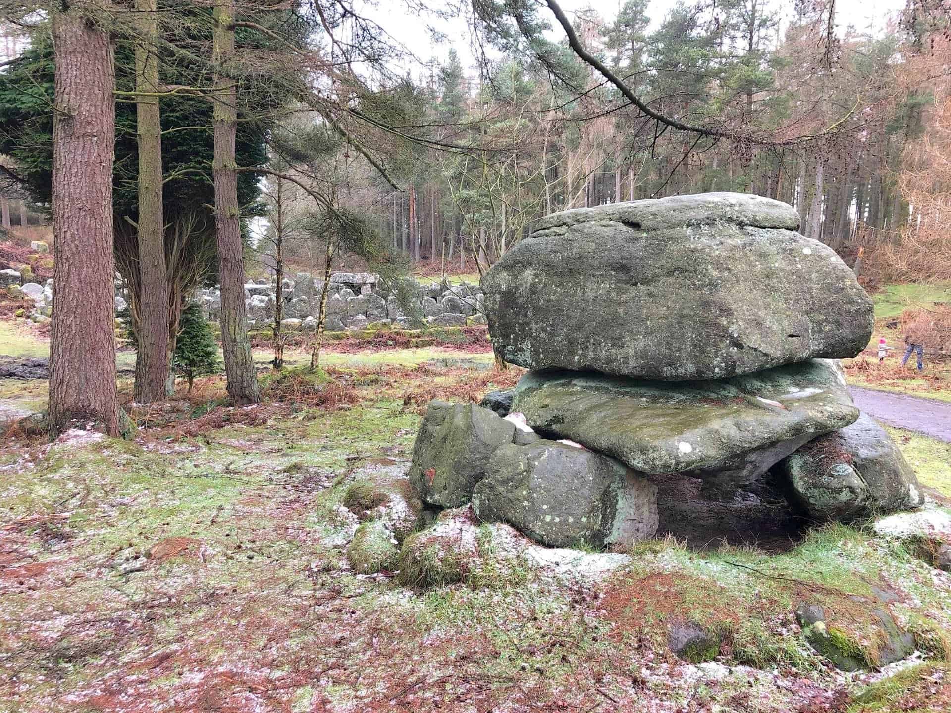
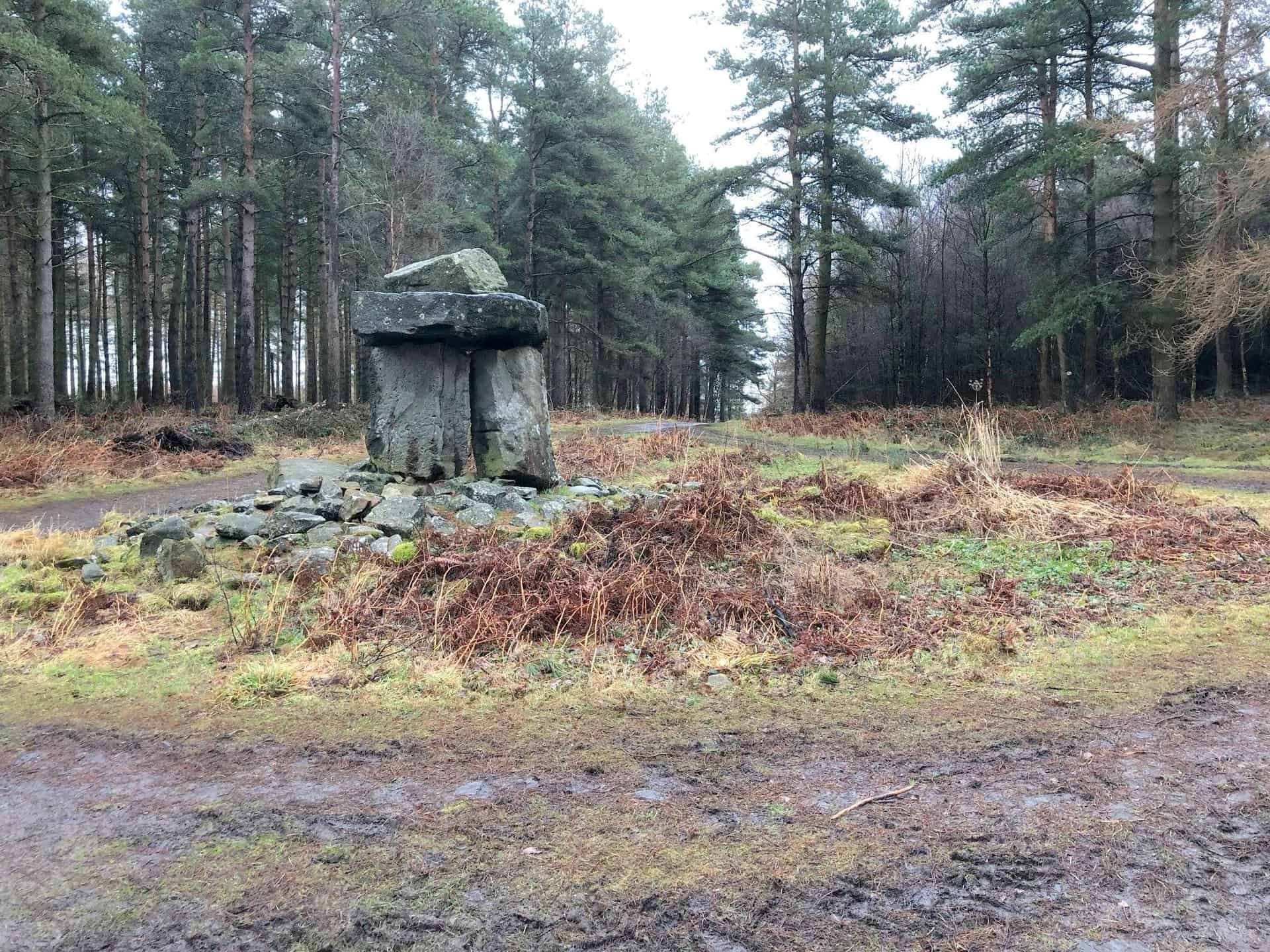
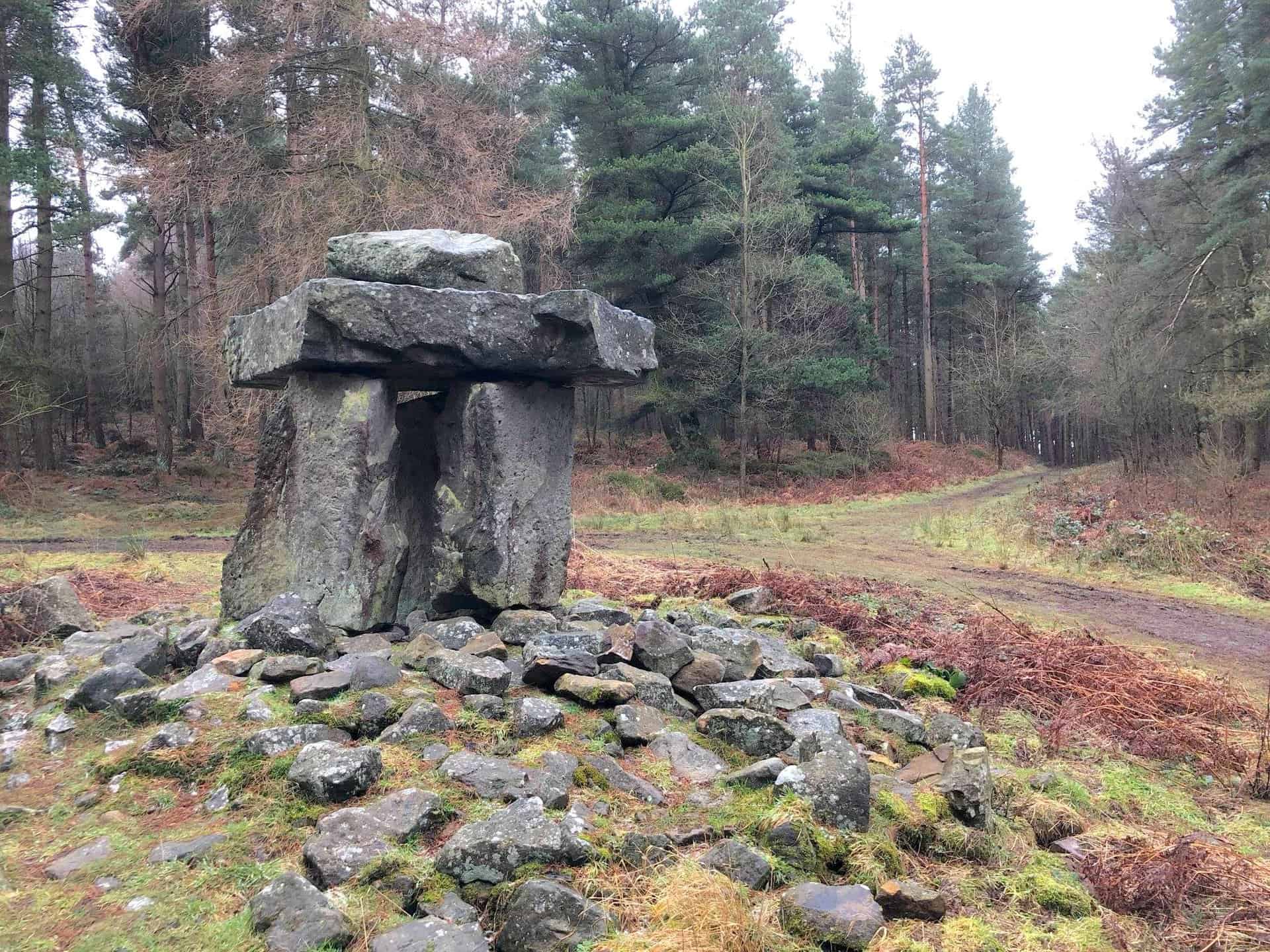
Druid’s Temple, about three-quarters of the way round this Masham walk.
Amazon’s Top Walking Boots: Four Standout Choices for Men and Women
For walking and hiking, the right boots are essential for both comfort and safety. While Amazon boasts a wide range, certain boots emerge as top-sellers. From those, here are four I personally favour. As an Amazon affiliate, I may earn a small commission from any purchases made through the links provided. This helps support the upkeep of this website. Rest assured, you won’t pay a penny extra, but your purchase will contribute to keeping my site running smoothly. Happy walking!

Berghaus Men’s Hillmaster II Gore-Tex Walking Boots
These fully waterproof leather walking boots feature a Gore-Tex lining, ensuring no water enters whilst allowing feet to breathe and stay cool. Made from full-grain leather, they promise unmatched durability and comfort. The boots come with memory foam tongues and cuffs that mould to your feet for a tailored fit, and the Vibram Hillmaster outsoles offer confidence on challenging terrains.

Salewa Men’s Mountain Trainer Mid Gore-Tex Walking Boots
Made from durable suede and abrasion-resistant textile, these men’s hiking boots are both lightweight and sturdy. The upper material is enhanced by a 360° full rubber sheath. Their dual-layer midsole with Bilight technology ensures ergonomic cushioning and grip, especially on extended hikes. The Vibram Wrapping Thread Combi outsoles allow a natural walking feel, and the Gore-Tex lining provides waterproofing, breathability, and optimal weather protection. Furthermore, the patented Salewa 3F system ensures flexibility, a secure heel grip, and a blister-free fit.

Berghaus Women’s Supalite II Gore-Tex Walking Boots
Specially designed for women, these hiking boots offer waterproofing and breathability, thanks to their Gore-Tex lining. Crafted from full-grain abrasion-resistant leather, they’re durable enough for the toughest hikes. The Supalite soles ensure stability and traction, and the EVA midsoles add comfort for extended walks.

Merrell Women’s Moab 3 Mid Gore-Tex Walking Boots
These hiking boots incorporate a Gore-Tex waterproof membrane, blending breathability with superior waterproof performance. The combination of pigskin leather and mesh on the uppers, along with the suede outer material, ensure durability and style. Enhancements include 100% recycled laces, webbing, and mesh lining. Additionally, bellows tongues, protective toe caps, and Vibram TC5+ rubber soles ensure protection and ease on any terrain.