Breathtaking Sights and Unforgettable Moments on the Druid’s Temple Walk
Begin your Druid’s Temple walk from Masham town centre. Make your way westwards, following the Ripon Rowel Walk until you intersect with Micklebury Lane. Continue west, adhering to the Ripon Rowel Walk across Fearby Low Moor. Cross the River Burn and head south-west along the minor road towards Broadmires.
From Broadmires, proceed to Leighton. Then, travel south-west around the northern edge of Leighton Reservoir to reach the dam of Roundhill Reservoir. After crossing the dam, journey north-east along the southern perimeter of Leighton Reservoir, ascending into Druid’s Plantation, the site of the enigmatic Druid’s Temple.
Next, head east through High Knowle towards the quaint village of Ilton. Then, move north-east, passing Hilltop House, en route to the minor road near Quarry House.
Complete your journey by passing through the grounds of Swinton Park, then continuing north-east along the minor road, leading back to Masham. This marks the completion of the 14-mile walk in the stunning Nidderdale area, encapsulating the delightful experience of the Druid’s Temple walk.
Druid’s Temple Walk: Maps and Tools
Visit either the OS Maps website or the Outdooractive website to view this walking route in greater detail. Both platforms offer a range of features, including the ability to print the route, download it to your device, and export the route as a GPX file. You can also watch a 3D fly-over and share the route on social media.
Druid’s Temple Walk: Distance, Duration, Statistics
Distance: 13¾ miles
Distance: 22 kilometres
Duration: 6¼ hours
Ascent: 1499 feet
Ascent: 457 metres
Type: Circular walk
About Druid’s Temple
The Druid’s Temple, a fascinating structure located near Ilton, North Yorkshire, is steeped in history and mystery. Despite its name, this intriguing landmark is not a relic of ancient Druidic practices, but rather a relatively modern construction. The temple was built in the late 1700s to early 1800s, by William Danby, the then-owner of the nearby Swinton Estate.
William Danby was an Englishman of considerable wealth and eccentricity. He envisioned the Druid’s Temple as a means to alleviate local unemployment. By creating this project, he provided work for the local population during a time of economic hardship. Danby paid workers the equivalent of a shilling a day, a substantial sum in those times, to construct the temple. His intentions were not just philanthropic; Danby was also motivated by a desire to create a folly – a building constructed primarily for decoration but in the style of older-historical structures.
The design of the Druid’s Temple is an intriguing blend of historical and fantastical elements. It mimics the style of ancient megalithic sites, such as Stonehenge, with large standing stones arranged in a circular pattern. This arrangement gives the temple an aura of antiquity and mystery, despite its relatively recent construction. The temple comprises a large stone circle, a sacrificial altar, and a number of smaller, subsidiary stone circles. The central stone circle is the most impressive feature, with towering, rough-hewn stones creating a dramatic and imposing presence.
In addition to the stone circles, the temple includes a number of intriguing features. There is a cave-like structure that may have served as a hermitage. Legend has it that Danby offered a salary to any man willing to live as a hermit in the cave for seven years. The hermit, if reports are to be believed, lasted only four years before leaving, finding the solitude too challenging to endure.
Over time, the Druid’s Temple has become a popular tourist attraction, drawing visitors intrigued by its mysterious origins and picturesque location. The temple is situated in a tranquil woodland setting known as Druid’s Plantation, making it an ideal spot for those seeking a peaceful retreat from the hustle and bustle of modern life. The surrounding woods add to the atmosphere of the site, with ancient trees and a variety of wildlife contributing to the sense of stepping back in time.
Despite its name and design, there is no evidence to suggest that the Druid’s Temple was ever used for any religious or ceremonial purposes. Its construction date, several millennia after the period of the Druids, indicates that it was not used for such purposes. However, this has not stopped various myths and legends from forming around the site. Some locals believe the temple to be haunted or imbued with ancient energies, adding to its allure and mystique.
As a piece of architectural history, the Druid’s Temple is a remarkable example of the folly tradition in English landscaping. It represents a curious blend of philanthropy, eccentricity, and historical pastiche. You’re sure to enjoy it as part of your Druid’s Temple walk.
Recommended Ordnance Survey Map
The best map to use on this walk is the Ordnance Survey map of Nidderdale, reference OS Explorer 298, scale 1:25,000. It clearly displays footpaths, rights of way, open access land and vegetation on the ground, making it ideal for walking, running and hiking. The map can be purchased from Amazon in either a standard, paper version or a weatherproof, laminated version, as shown below.
Weatherproof Version
Ordnance Survey map of Nidderdale, reference OS Explorer 298, scale 1:25,000
Druid’s Temple Walk: My Photos
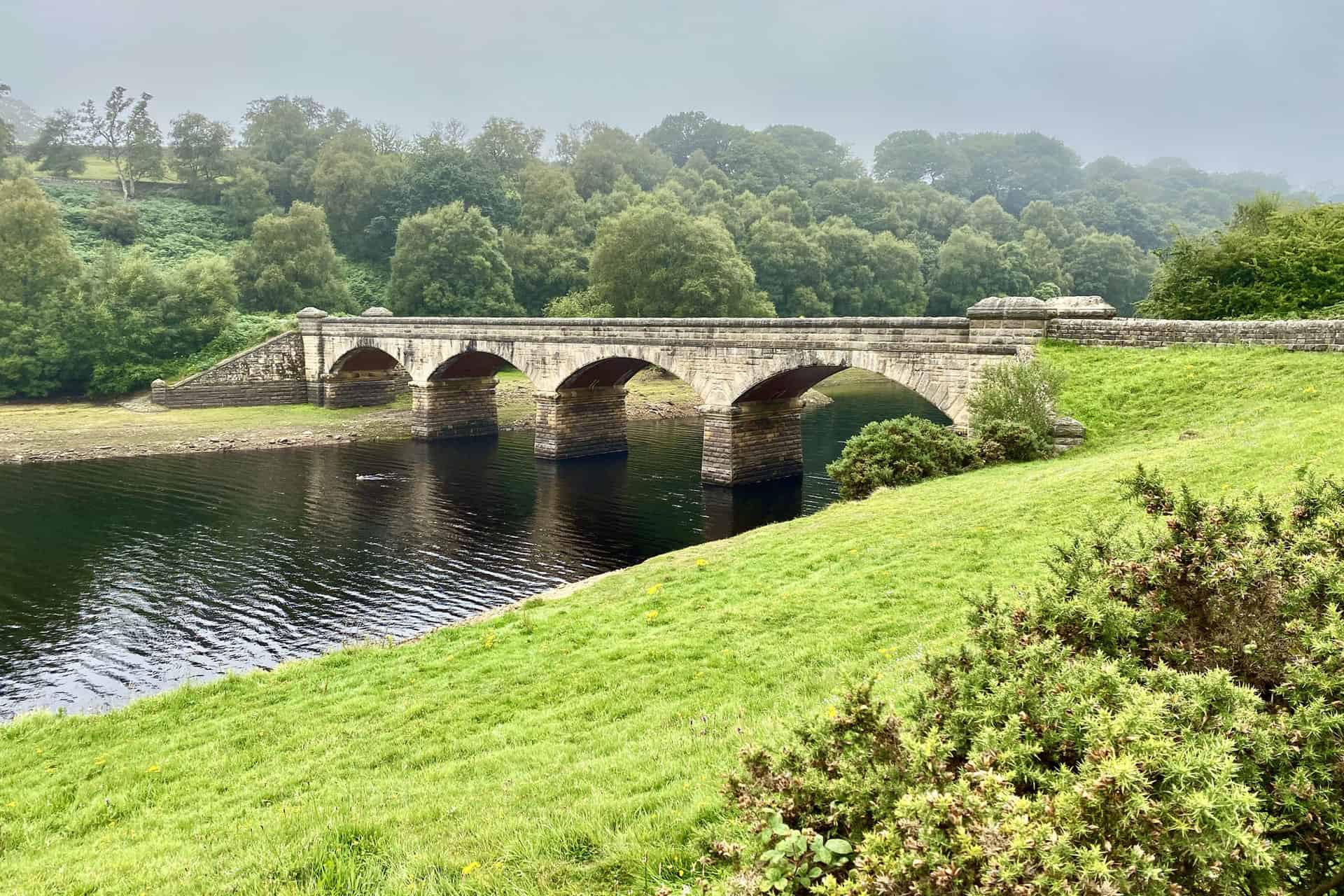
A view of the road bridge across Leighton Reservoir.
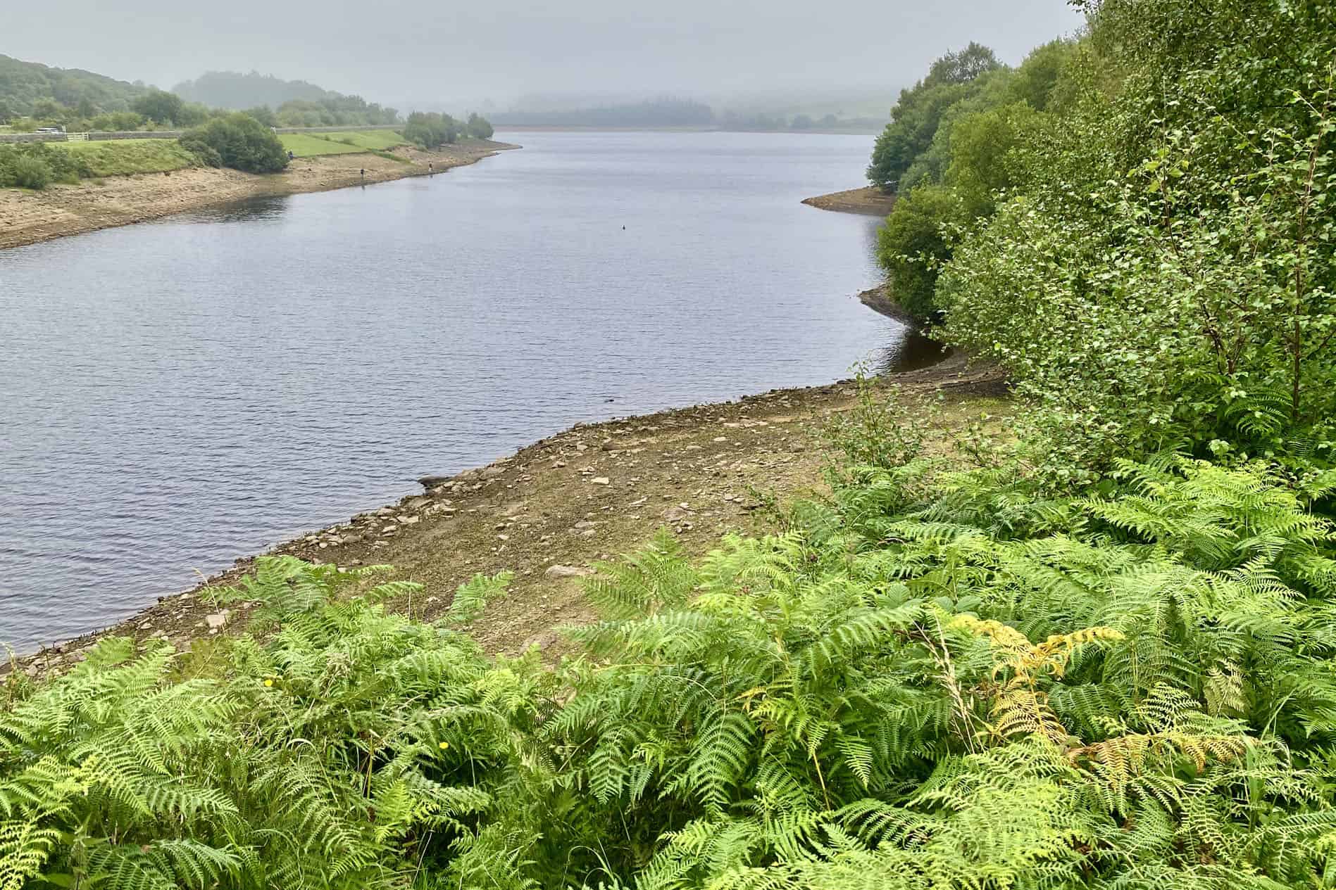
The natural splendour of Leighton Reservoir.
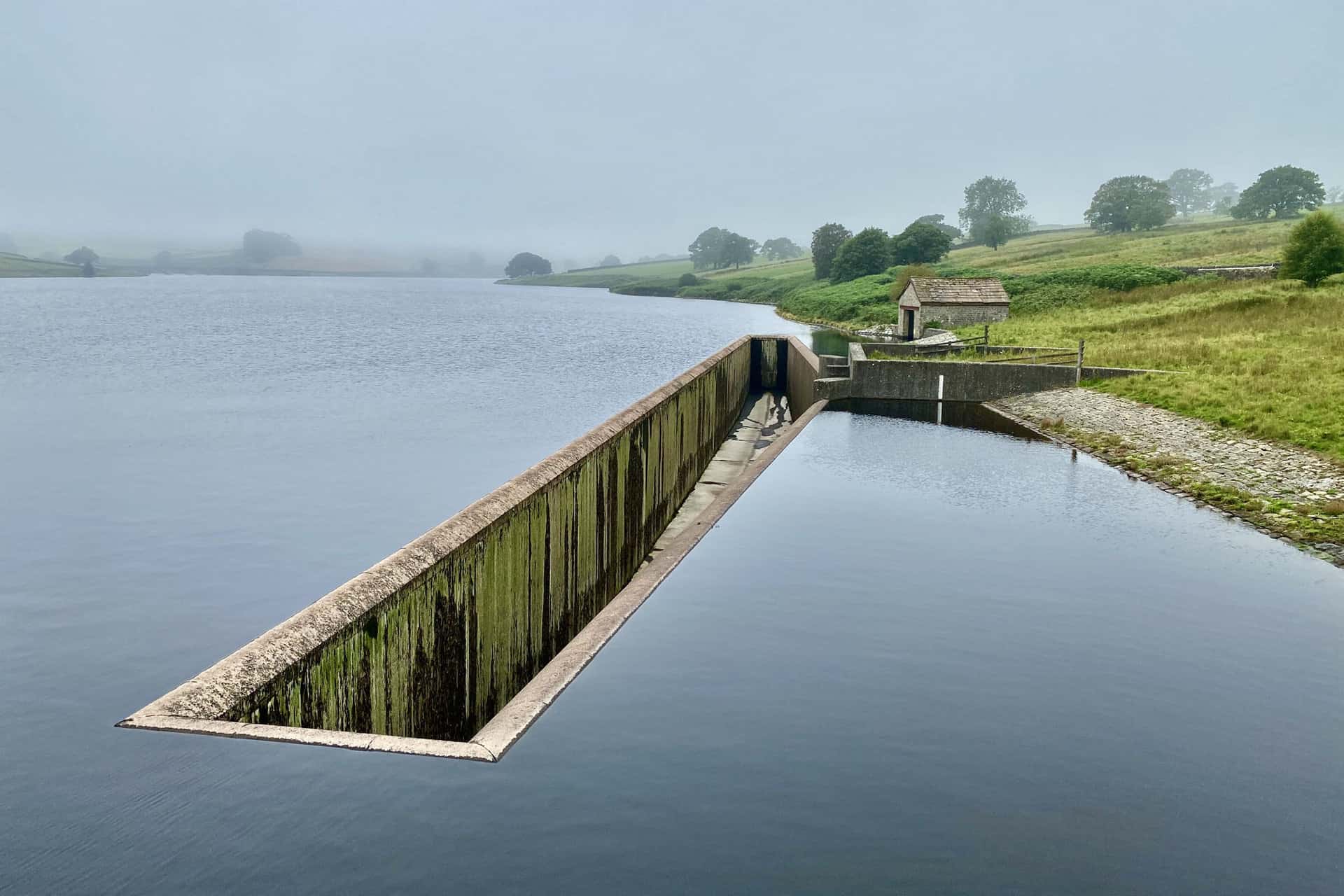
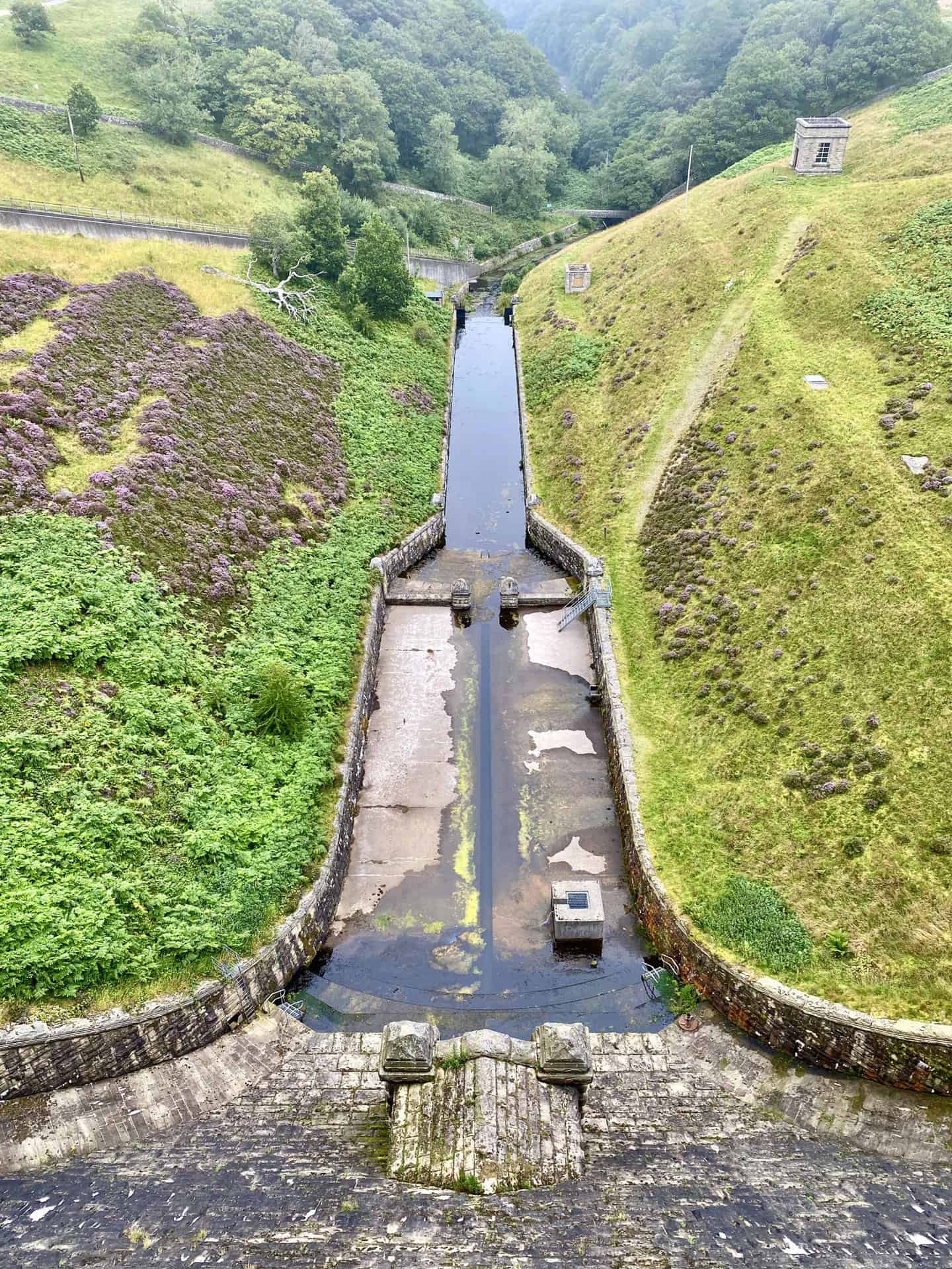
The overflow at the north-west corner of Roundhill Reservoir, part of the Druid’s Temple walk.
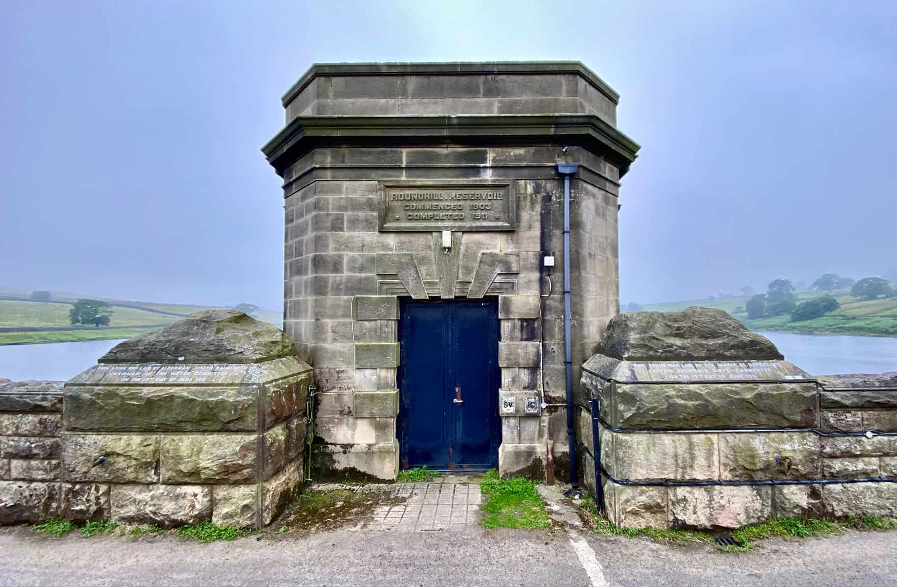
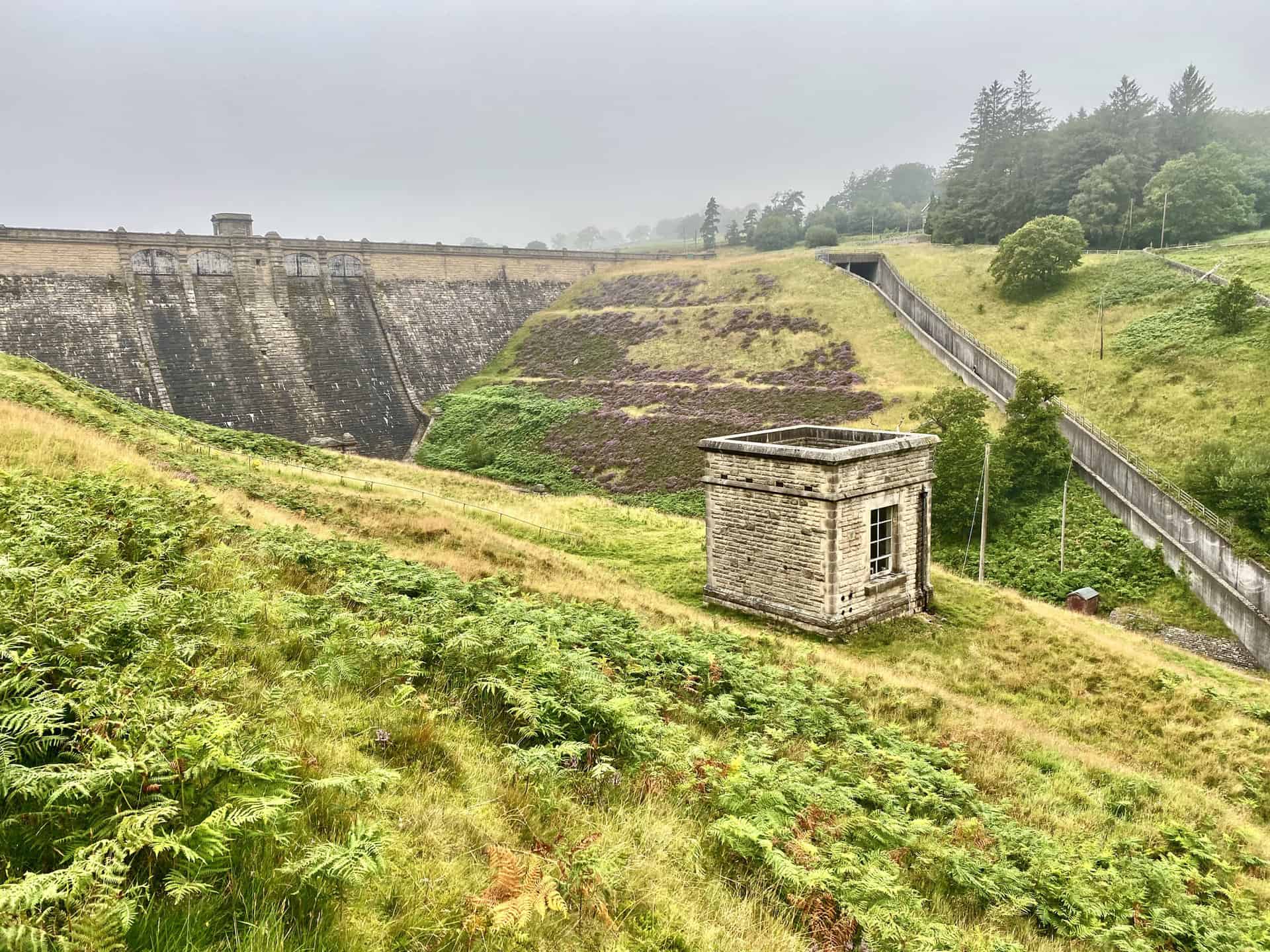
Roundhill Reservoir tower with the inscription:
ROUNDHILL.RESERVOIR
COMMENCED 1903
COMPLETED 1911
The outlet of Roundhill Reservoir filling into Leighton Reservoir.
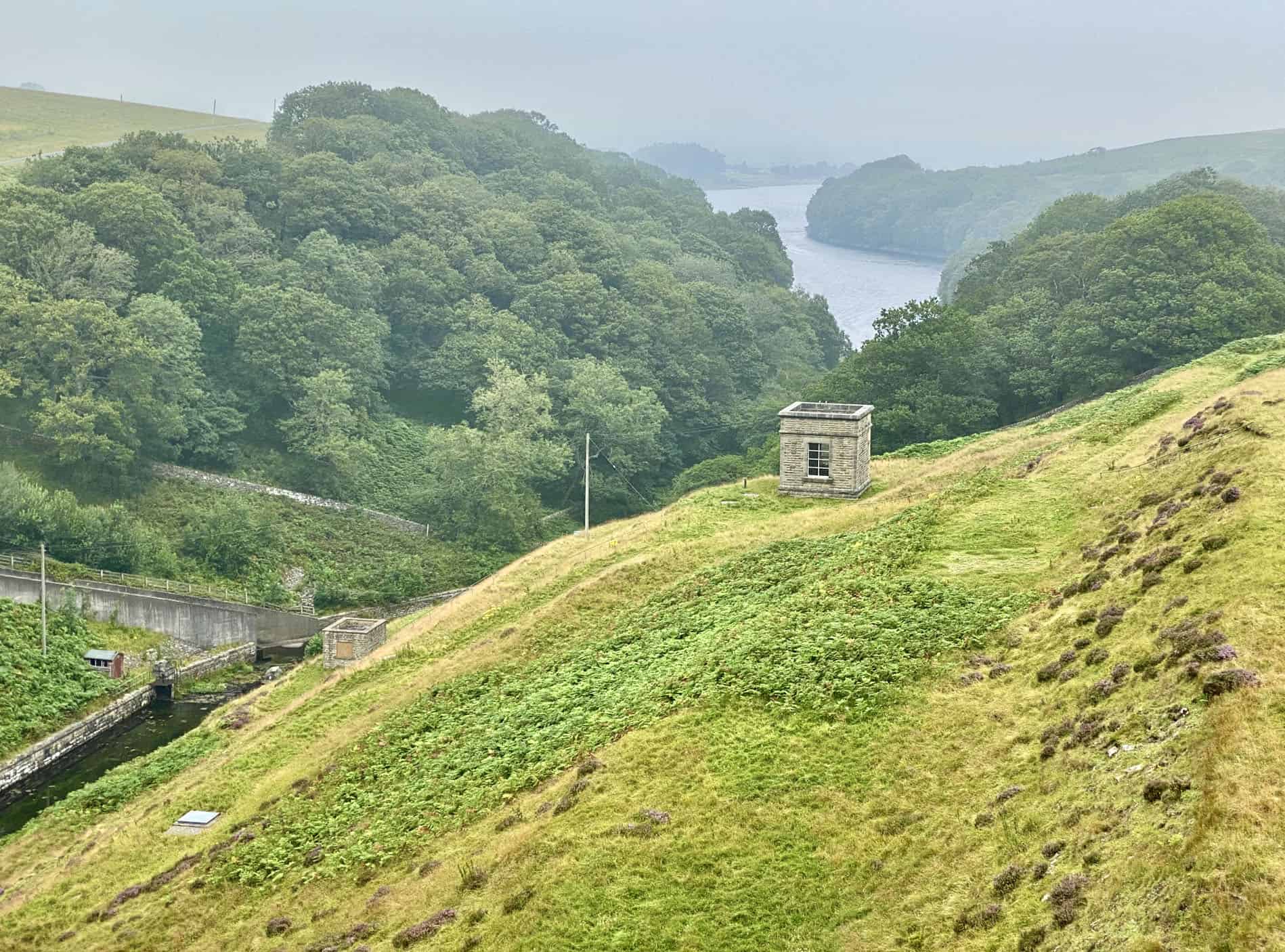
Panoramic north-east view from Roundhill Reservoir dam towards Leighton Reservoir, a segment of the Druid’s Temple walk.
The majestic Roundhill Reservoir dam is a testament to engineering.
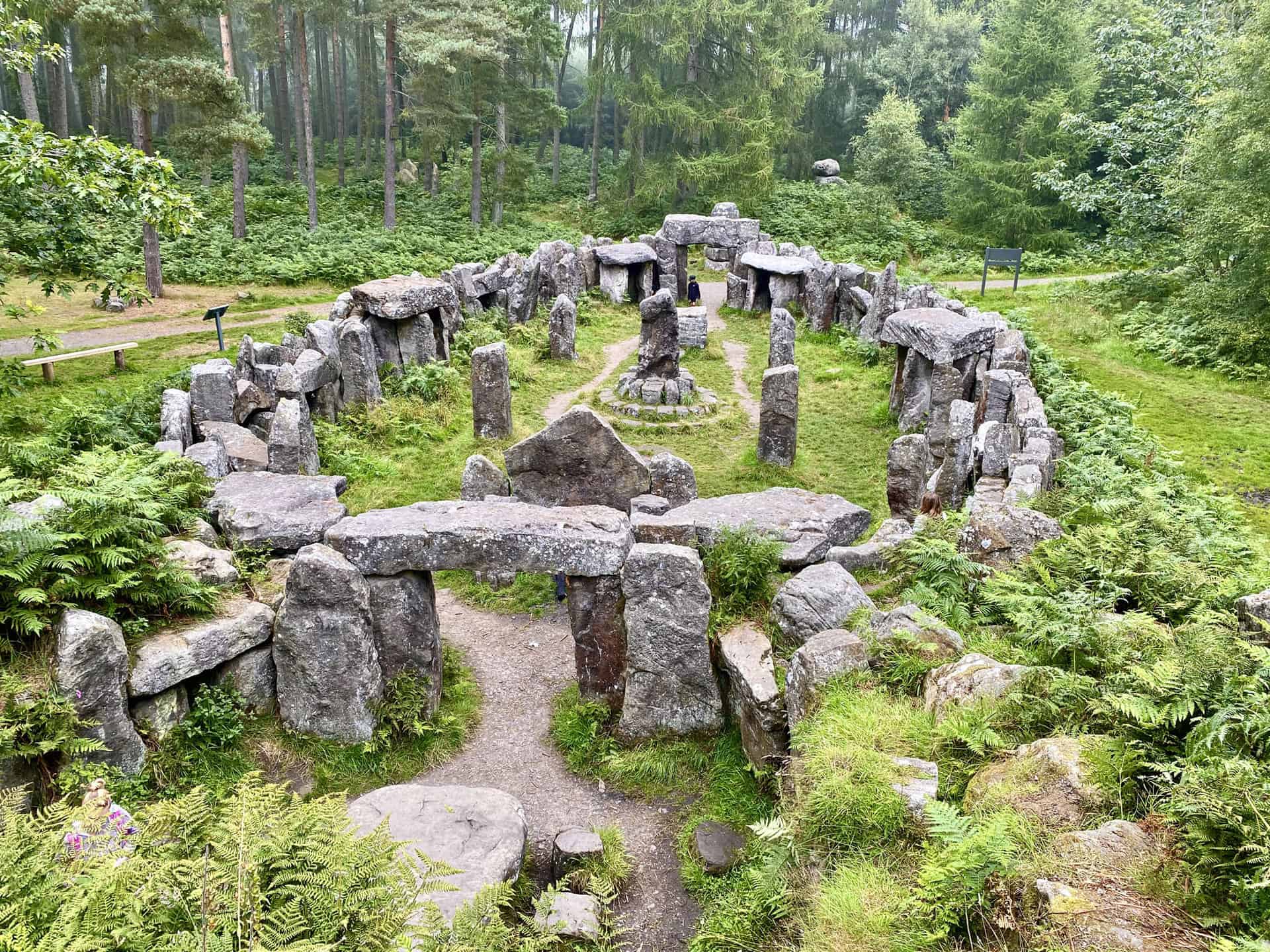
Druid’s Temple
There is much mystery surrounding the Druid’s Temple. We don’t even know for sure when it was built, but we do know that it’s not prehistoric – it’s an elaborate folly. It’s generally agreed that the temple was built by estate workers at some point between the late 1700s and the early 1800s. The work was commissioned by William Danby, the owner of the Swinton estate.
Danby had travelled extensively around Europe, which inspired him to build more varied and striking contrasts of scenery at Swinton. He was also probably influenced by the Romantic movement, with its nostalgia for ancient customs and emphasis on the beauty of nature. Poets such as Blake and Wordsworth were intrigued by Druidism and druids were seen by some as England’s earliest men of learning. It’s even said that Danby employed a hermit to live at the temple, speaking to no one and allowing his beard and hair to grow.
The design of the temple and surrounding stone features must have been meticulously researched. There are several elements that bear a symbolic resemblance to an authentic Druid’s temple. The first chamber contains the four symbols of the elements – air, earth, fire and water. Behind the three stones forming a screen is the solar chamber and beyond this is the Tomb of Transformation. On the hill above, the high stack of stones is the symbol of deity with the twelve signs of the zodiac surrounding it. Today the temple is an attraction for families, walkers and nature lovers to visit and enjoy the woodland setting and the surrounding views of the Swinton estate.
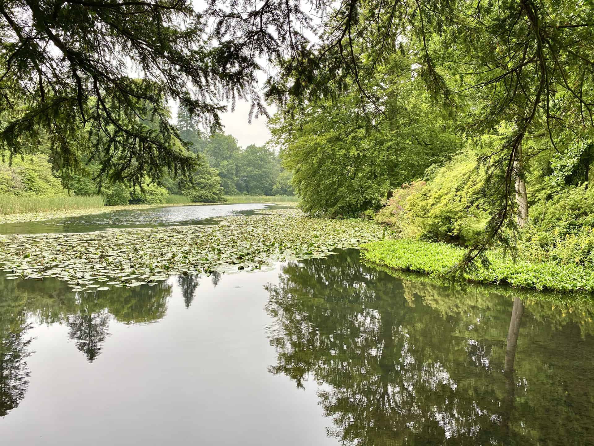
Coffin Pond, Swinton Park
During the 1750s William Danby started to landscape the grounds surrounding his Swinton Park home. He had a stream constructed that carried spring water off the moors to run into the five lakes that flow through the parkland. Coffin Pond is the fourth of these, and has some very attractive planting that creates a blaze of spring and autumn colour. A more dramatic style was added to the lake in the early 1800s with the boulders and promontory at the far end of the lake, along with the addition of two stone coffins. These were excavated in a quarry close to Masham, and it was thought that they had been from the burial ground of an abbey. Another feature built was a boathouse which is now a ruin having lost its roof many years ago.
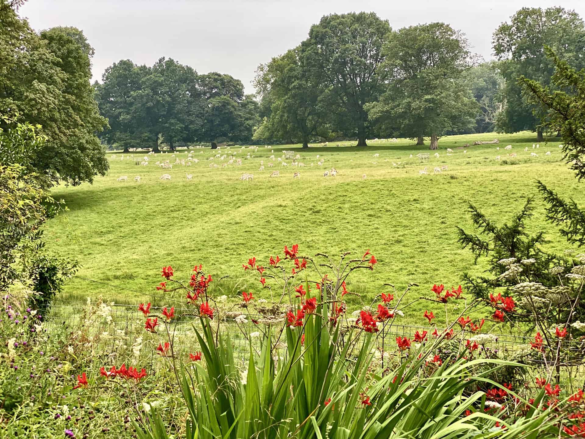
Deer Park on the grounds of the Swinton estate, a highlight on the Druid’s Temple walk.
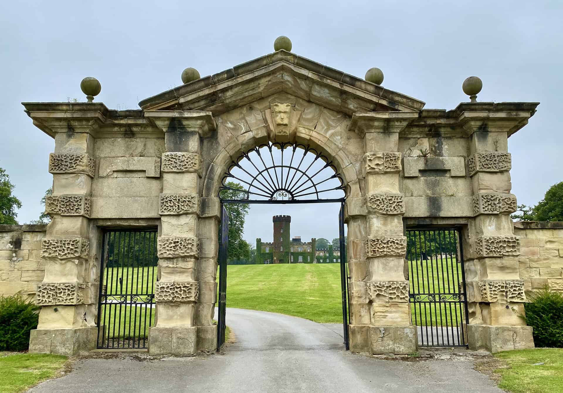
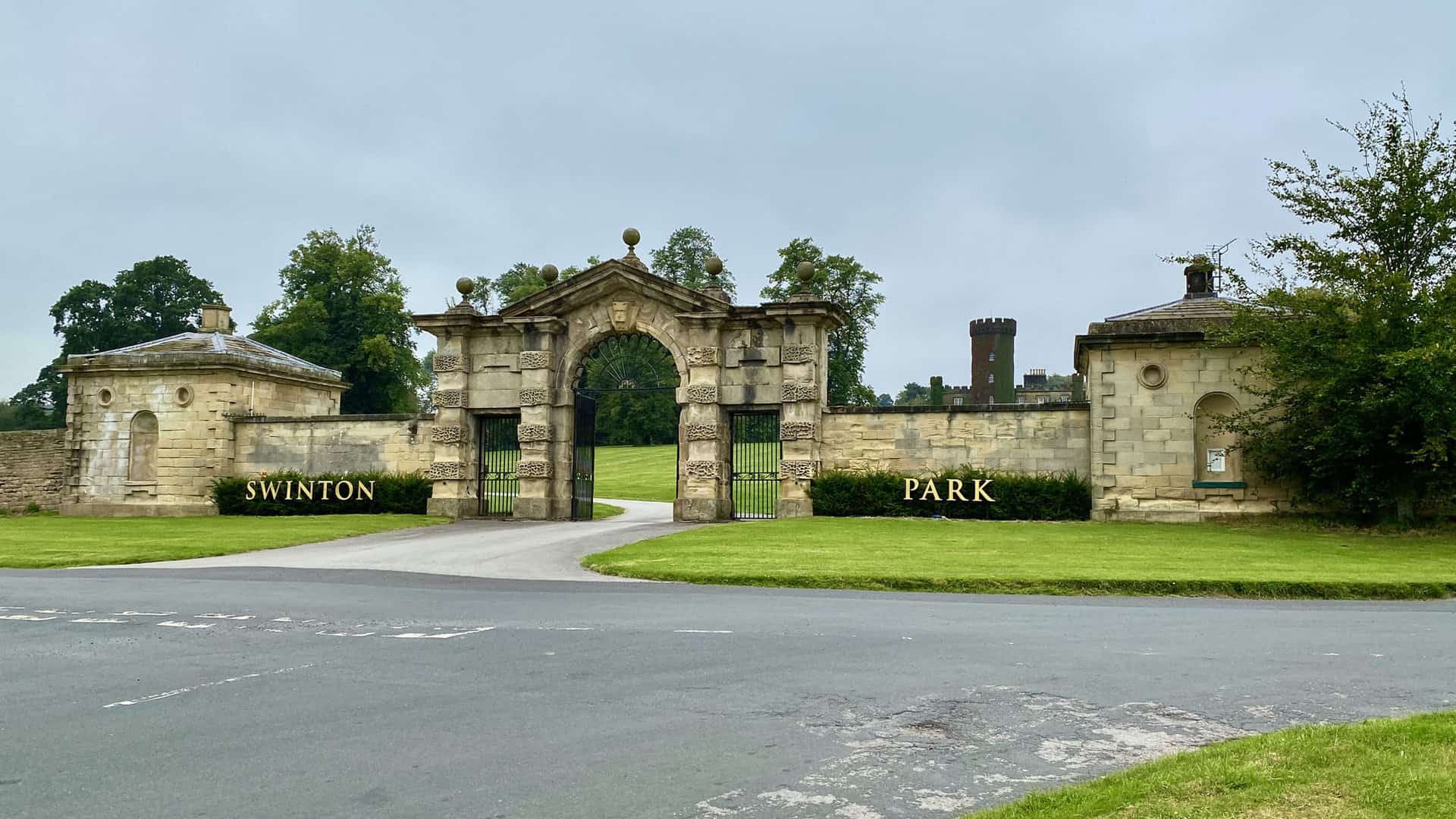
The grand entrance to Swinton Park offers a gateway to elegance.
T&R Theakston Ltd in Masham, a family brewing company founded in 1827. Discoverable at the beginning and end of the Druid’s Temple walk from Masham.


Amazon’s Top Walking Boots: Four Standout Choices for Men and Women
For walking and hiking, the right boots are essential for both comfort and safety. While Amazon boasts a wide range, certain boots emerge as top-sellers. From those, here are four I personally favour. As an Amazon affiliate, I may earn a small commission from any purchases made through the links provided. This helps support the upkeep of this website. Rest assured, you won’t pay a penny extra, but your purchase will contribute to keeping my site running smoothly. Happy walking!

Berghaus Men’s Hillmaster II Gore-Tex Walking Boots
These fully waterproof leather walking boots feature a Gore-Tex lining, ensuring no water enters whilst allowing feet to breathe and stay cool. Made from full-grain leather, they promise unmatched durability and comfort. The boots come with memory foam tongues and cuffs that mould to your feet for a tailored fit, and the Vibram Hillmaster outsoles offer confidence on challenging terrains.

Salewa Men’s Mountain Trainer Mid Gore-Tex Walking Boots
Made from durable suede and abrasion-resistant textile, these men’s hiking boots are both lightweight and sturdy. The upper material is enhanced by a 360° full rubber sheath. Their dual-layer midsole with Bilight technology ensures ergonomic cushioning and grip, especially on extended hikes. The Vibram Wrapping Thread Combi outsoles allow a natural walking feel, and the Gore-Tex lining provides waterproofing, breathability, and optimal weather protection. Furthermore, the patented Salewa 3F system ensures flexibility, a secure heel grip, and a blister-free fit.

Berghaus Women’s Supalite II Gore-Tex Walking Boots
Specially designed for women, these hiking boots offer waterproofing and breathability, thanks to their Gore-Tex lining. Crafted from full-grain abrasion-resistant leather, they’re durable enough for the toughest hikes. The Supalite soles ensure stability and traction, and the EVA midsoles add comfort for extended walks.

Merrell Women’s Moab 3 Mid Gore-Tex Walking Boots
These hiking boots incorporate a Gore-Tex waterproof membrane, blending breathability with superior waterproof performance. The combination of pigskin leather and mesh on the uppers, along with the suede outer material, ensure durability and style. Enhancements include 100% recycled laces, webbing, and mesh lining. Additionally, bellows tongues, protective toe caps, and Vibram TC5+ rubber soles ensure protection and ease on any terrain.