The Ultimate Guide to Enjoying the High Cup Nick Walk
Begin your High Cup Nick walk by parking in Dufton. The car park, centrally located in the village, is conveniently situated beside the road, just behind the public toilets. Dufton is a charming village worth exploring before you set out on your journey.
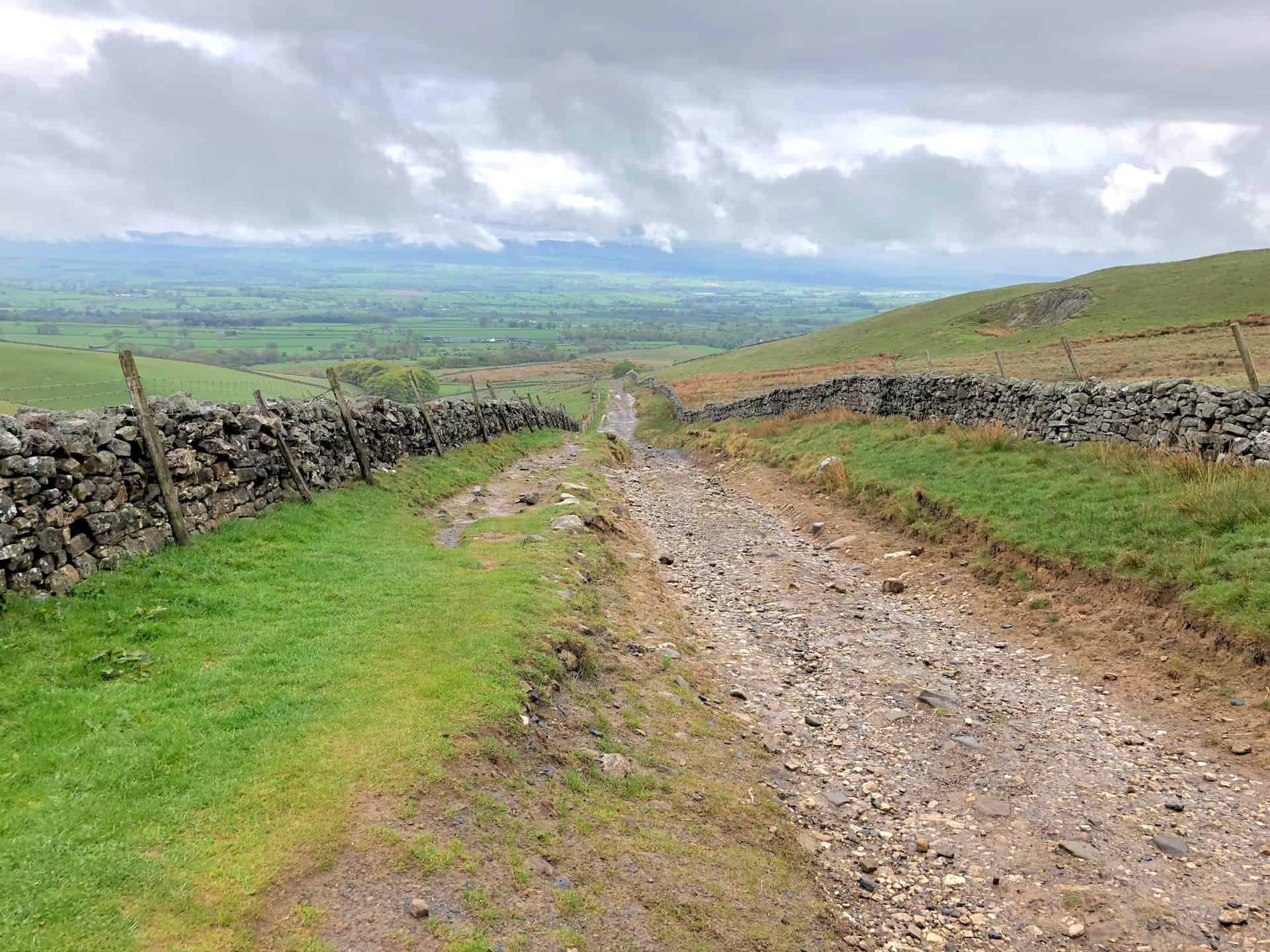
From the car park, head south-east down the road towards Town Head, then proceed along the Pennine Way, which is clearly signposted and leads eastwards. As you gradually ascend towards Bow Hall, the well-marked route through this scenic area allows you to fully enjoy the stunning countryside.
Continue eastward and upward, following the Pennine Way. This segment of the journey takes you beneath the southern flanks of Dod Hill, towards Peeping Hill, and past the remnants of a disused quarry. The ascent provides increasingly impressive views, marking a captivating phase of your High Cup Nick walk.
Advance north-east on the Pennine Way, following a path known as Narrow Gate on the Ordnance Survey map. This part of the walk presents simply amazing views of the High Cup Gill valley, a standout feature of the route. Upon reaching High Cup Nick at the valley’s head, you’ll be greeted with stunning vistas that are truly unforgettable.
After reaching High Cup Nick, prepare for the return trip. Head back along the southern side of the High Cup Gill valley, following a path that runs along the top of the valley slopes towards Middle Tongue. Gradually descend to Harbour Flatt, passing by High Cup House.
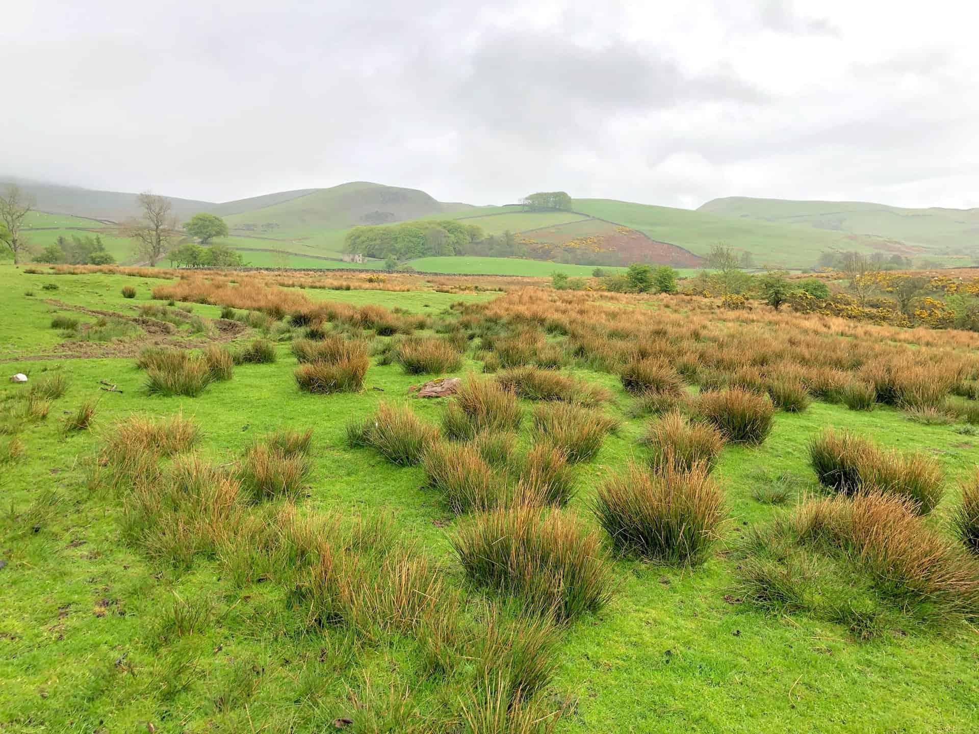
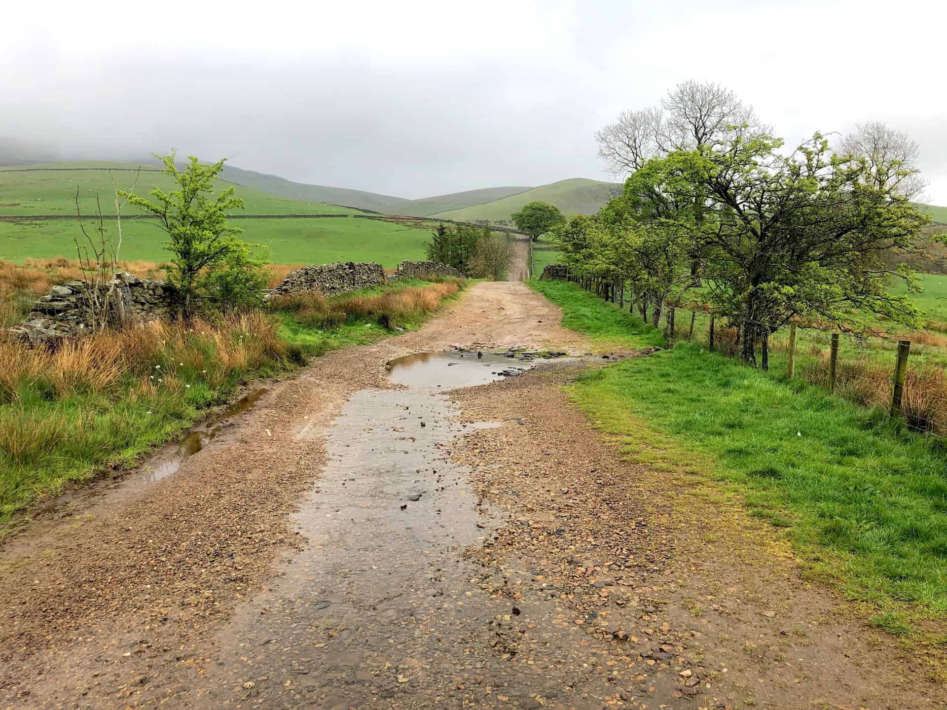
Next, cross the minor road and continue across farmland to Brackenthwaite, then venture south into the woodland. Upon emerging on the other side, follow a path north-west along the edge of the woods, passing Flakebridge House, before heading north into Flakebridge Wood.
Exiting the woods on the north side, proceed north-west across the countryside to Greenhow, and conclude your journey back in Dufton. Covering roughly 12 miles, this spectacular High Cup Nick walk is estimated to take approximately 5½ to 6 hours to complete. Given the breathtaking scenery you’ll encounter, I would recommend allowing additional time to fully enjoy the stunning views, which are among the finest in Northern England.
High Cup Nick Walk: Maps and Tools
Visit either the OS Maps website or the Outdooractive website to view this walking route in greater detail. Both platforms offer a range of features, including the ability to print the route, download it to your device, and export the route as a GPX file. You can also watch a 3D fly-over and share the route on social media.
High Cup Nick Walk: Distance, Duration, Statistics
Distance: 11½ miles
Distance: 18½ kilometres
Duration: 5½ hours
Ascent: 1947 feet
Ascent: 593 metres
Type: Circular walk
About High Cup Nick
High Cup Nick, strikingly U-shaped, seamlessly cuts into the Pennine escarpment north-east of Appleby-in-Westmorland in Cumbria, nestled within the North Pennines Area of Outstanding Natural Beauty (AONB) in Northern England. Attributed to glacial activity, the valley’s formation was significantly influenced by ice during various ice ages. Surrounding this feature, Murton Fell lies to the south-east, while Dufton Fell is positioned to the north.
Despite its official designation as High Cup Gill by the Ordnance Survey, the area is commonly referred to as High Cup Nick. This latter name actually more accurately describes the point at the valley’s north-eastern end where the headwaters of High Cupgill Beck cascade from the relatively level High Cup Plain over the edge of High Cup Scar and into the valley.
Originating from Norse, ‘gill’ and ‘beck’ denote a narrow valley and a stream, respectively, terms that are prevalent in the hills of Northern England. Offering a breathtaking view south-west over the Vale of Eden from its summit, High Cup Nick is rightfully regarded as one of the most spectacular natural wonders in Northern England.
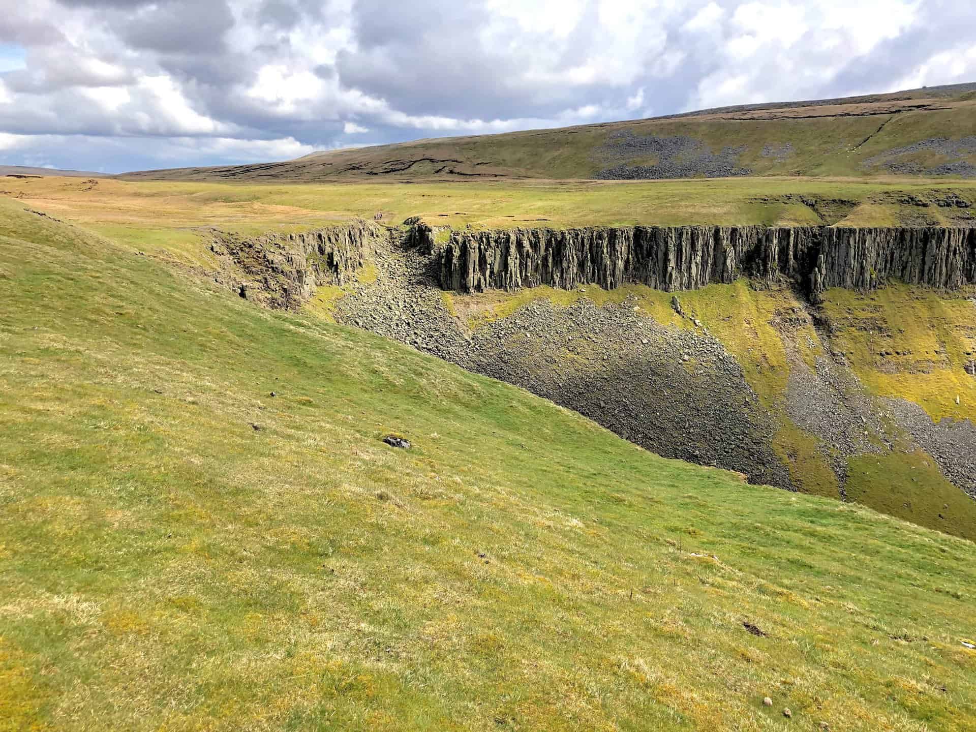
Moreover, High Cup Scar is characterised by a pronounced outcrop of the Whin Sill, a dolerite intrusion from the late Carboniferous period, prevalent throughout the North Pennines and the north-east of England. The slopes beneath the scar are dotted with tumbled blocks of this geological material. Notably, on the valley’s northern side, a distinctive rock pinnacle known as Nichol Chair pays homage to a local cobbler who, legend has it, once worked from its peak as part of a bet.
The Whin Sill intrudes into the Alston Formation, part of the Yoredale Group, which is composed of layers of limestone, sandstone, siltstone, and mudstone. Concealed by these dolerite blocks at the gill’s base are the older sedimentary rocks of the Ravenstonedale Group and, beneath them, the metamorphosed slates and sandstones of the Skiddaw Group, which hail from the Ordovician period.
Furthermore, the Pennine Way, a celebrated national trail, skirts the valley’s northern boundary via a traditional path known as Narrow Gate, as it runs from Forest in Teesdale westwards past Cauldron Snout and Maize Beck to Dufton. At Maize Beck, the trail splits into two paths, with the southern one passing through High Cup Nick. Distinguished by Britain’s Pathfinder Guides, the High Cup Nick walk is acknowledged as one of the best walks in the UK. Alfred Wainwright, the esteemed fell walker, famously described High Cup as “a great moment on the journey” in his Pennine Way Companion. Embarking on the High Cup Nick walk offers an unparalleled opportunity to experience this majestic landscape.
Lastly, the village of Dufton is strategically located between two of the Pennine Way’s most formidable sections. These higher stretches are known for their steep descents and the potential for strong Helm Wind currents through the valley. The entire valley falls within an area classified as open country under the Countryside and Rights of Way Act 2000, granting walkers the freedom to explore. This part of the Pennine Way, also a designated bridleway, is legally accessible to cyclists and horse riders, further enhancing its appeal for outdoor enthusiasts.
Recommended Ordnance Survey Map
The best map to use on this walk is the Ordnance Survey map of the Howgill Fells & Upper Eden Valley, reference OS Explorer OL19, scale 1:25,000. It clearly displays footpaths, rights of way, open access land and vegetation on the ground, making it ideal for walking, running and hiking. The map can be purchased from Amazon in either a standard, paper version or a weatherproof, laminated version, as shown below.
Standard Version
High Cup Nick Walk: My Photos
The view east from the Pennine Way just outside Dufton, with High Cup Gill lying beyond the hills.
The beginning of the three-mile ascent along the Pennine Way to High Cup Nick.
The track heading south between the hills of Gregory (left) and Harthwaite (right), leading towards Keisley Bank.
Looking back towards Appleby-in-Westmorland from the Pennine Way near Dod Hill.
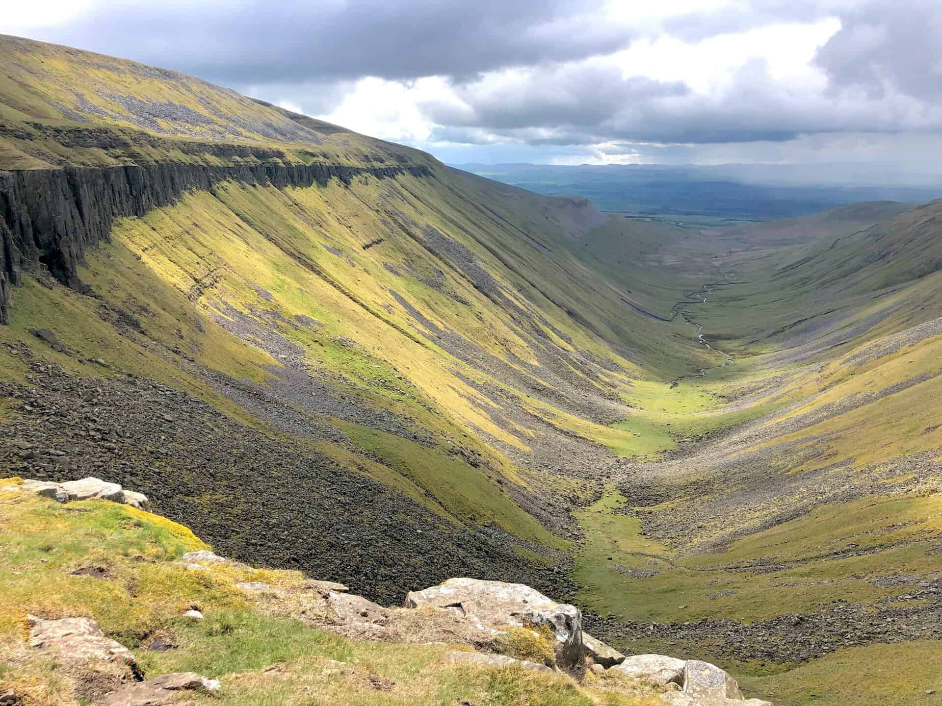
Our first glimpse of the High Cup Gill valley.
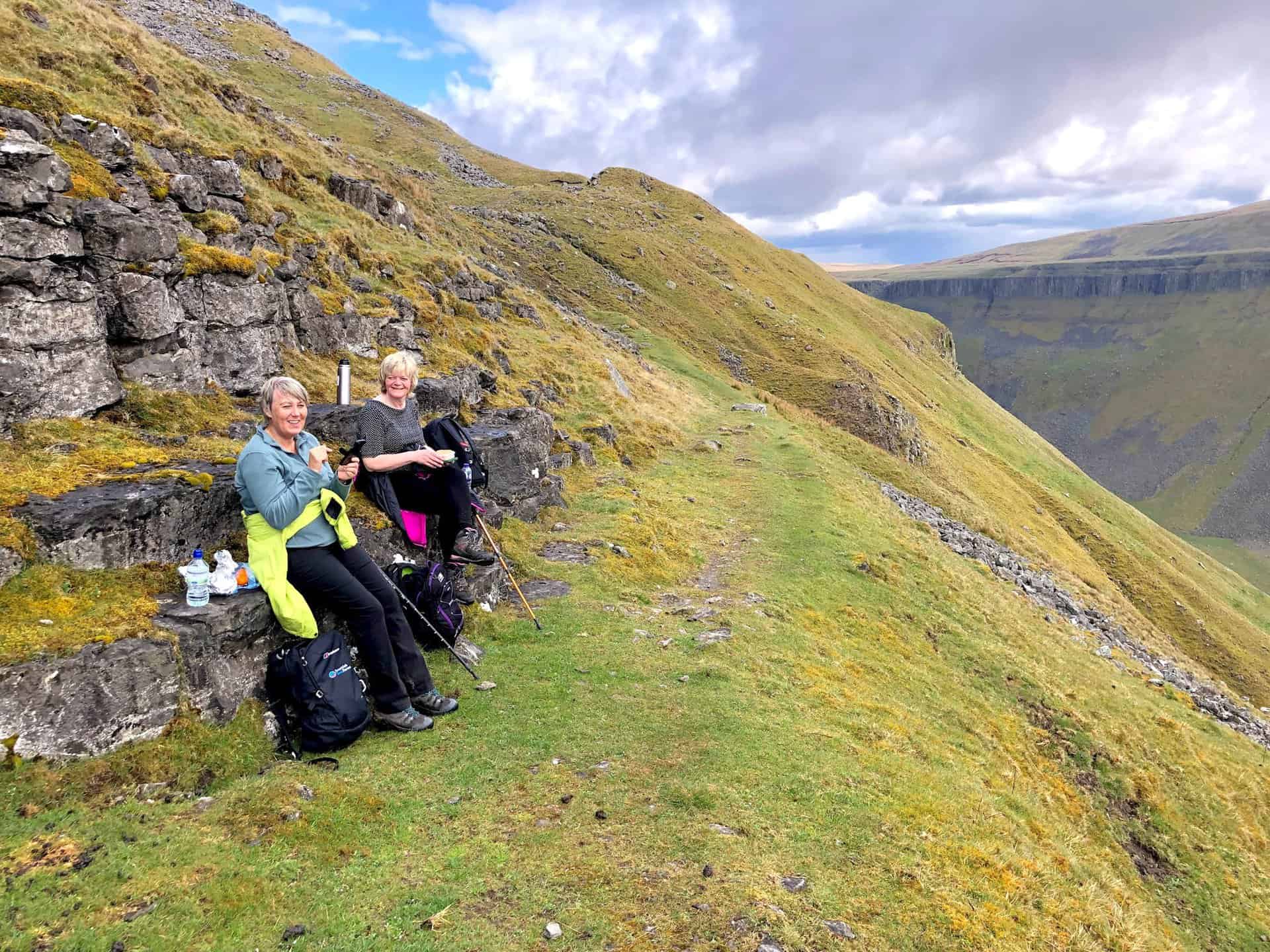
Lunch beside Narrow Gate, the path above the northern slopes of High Cup Gill.
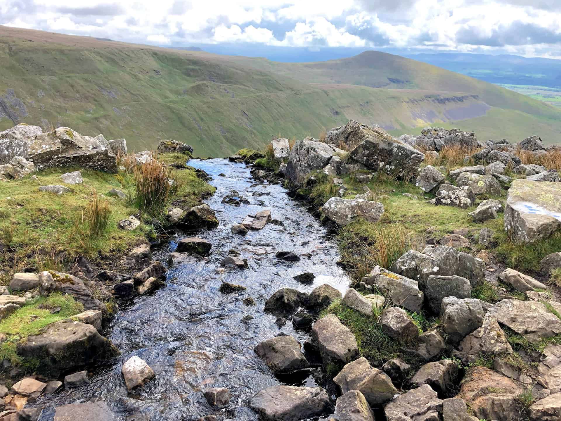
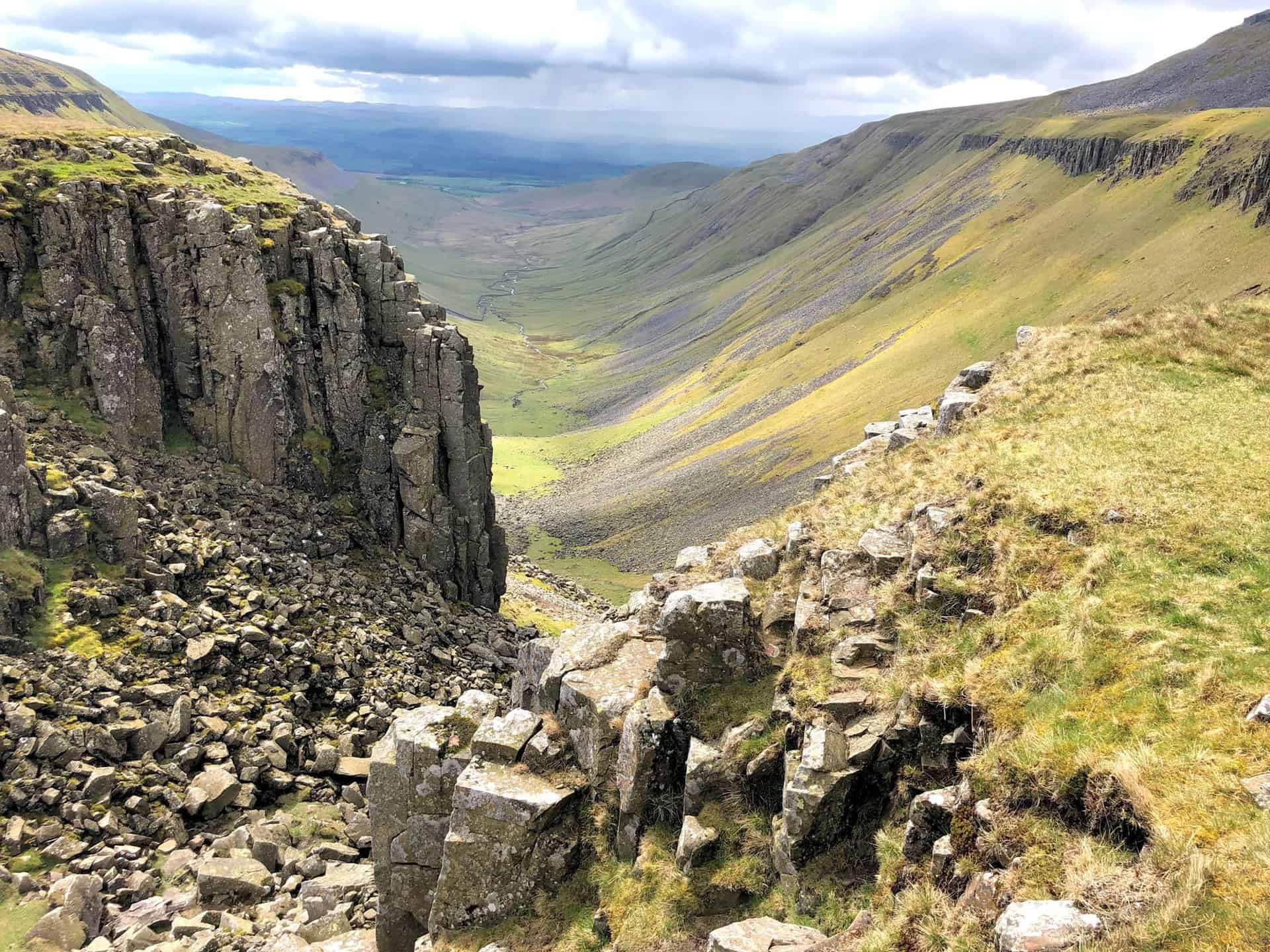
Strands Beck cascades over the edge, flowing into High Cup Gill Beck 200 metres below.
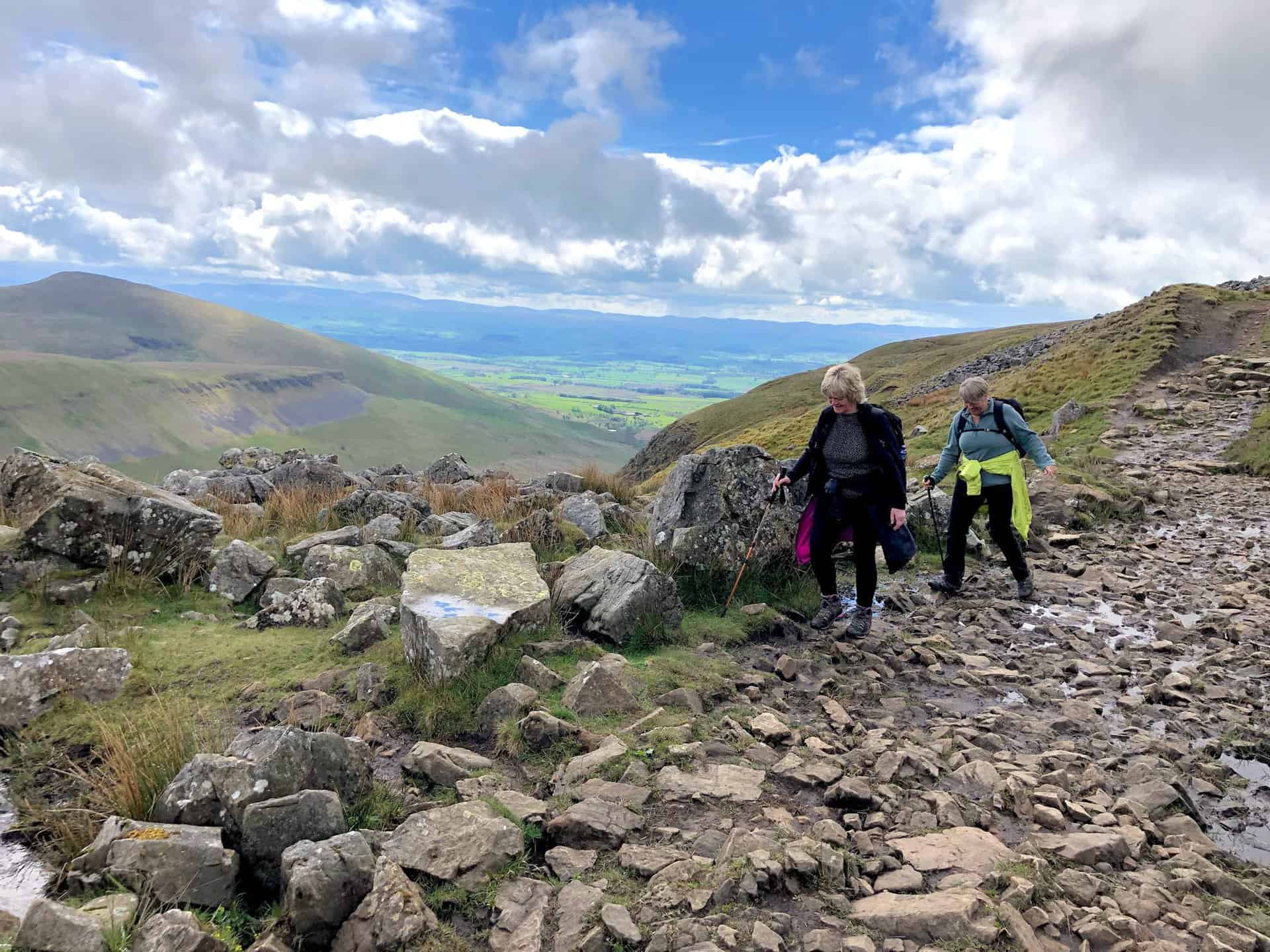
A rocky section of the Pennine Way, with the hills of the Yorkshire Dales visible on the horizon.
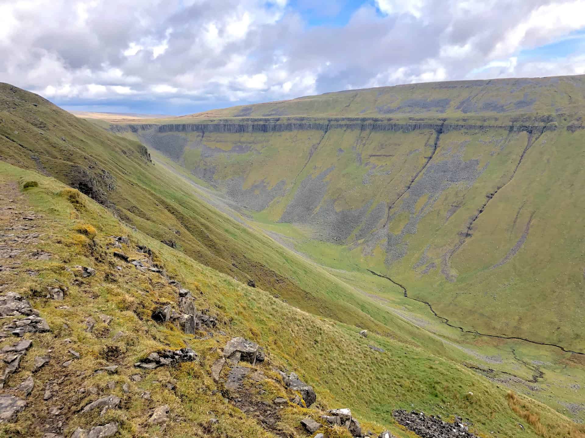
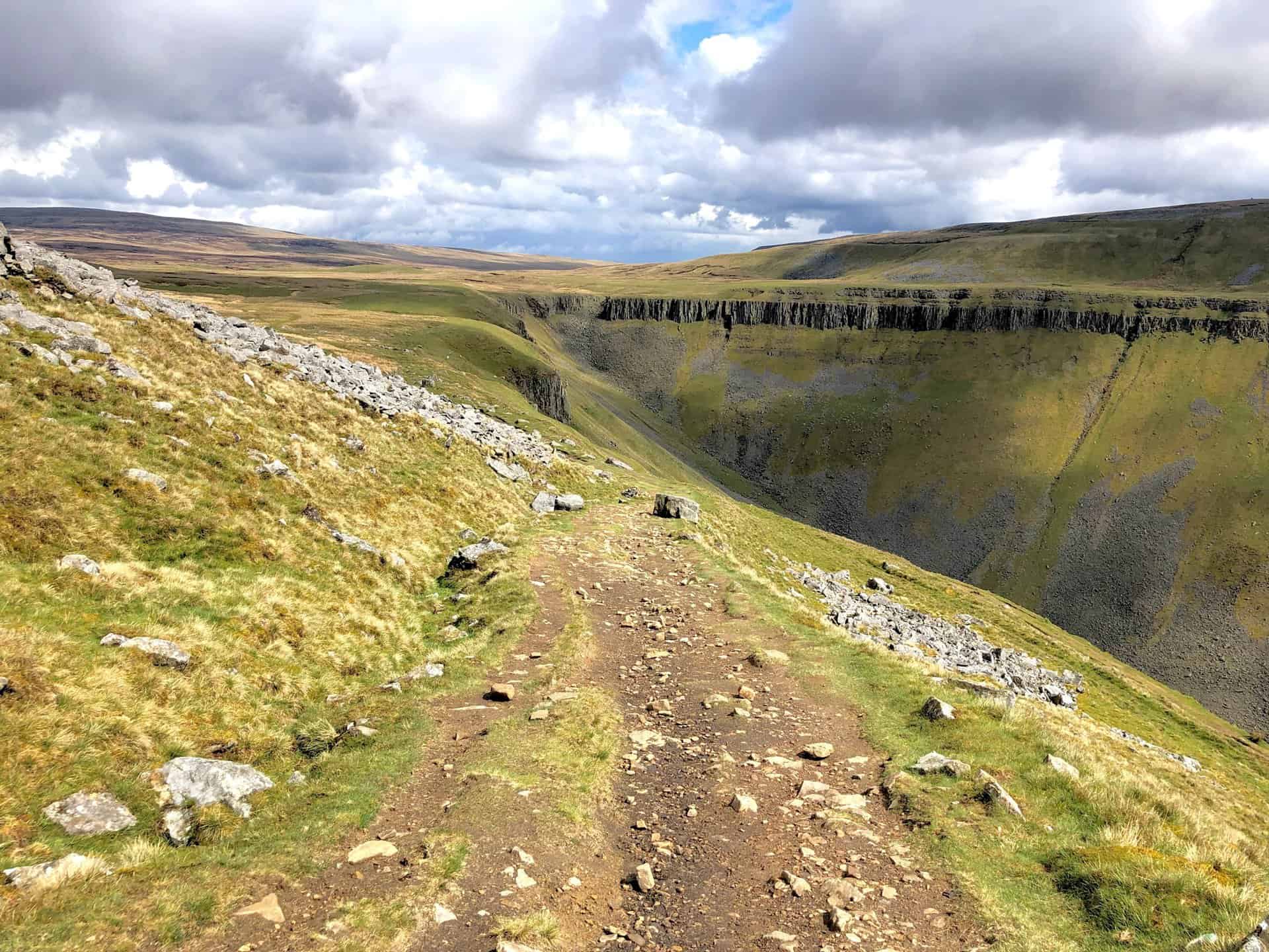
High Cup Nick, at the valley’s head, becomes visible from the Pennine Way; the prominent rocky feature is High Cup Scar.
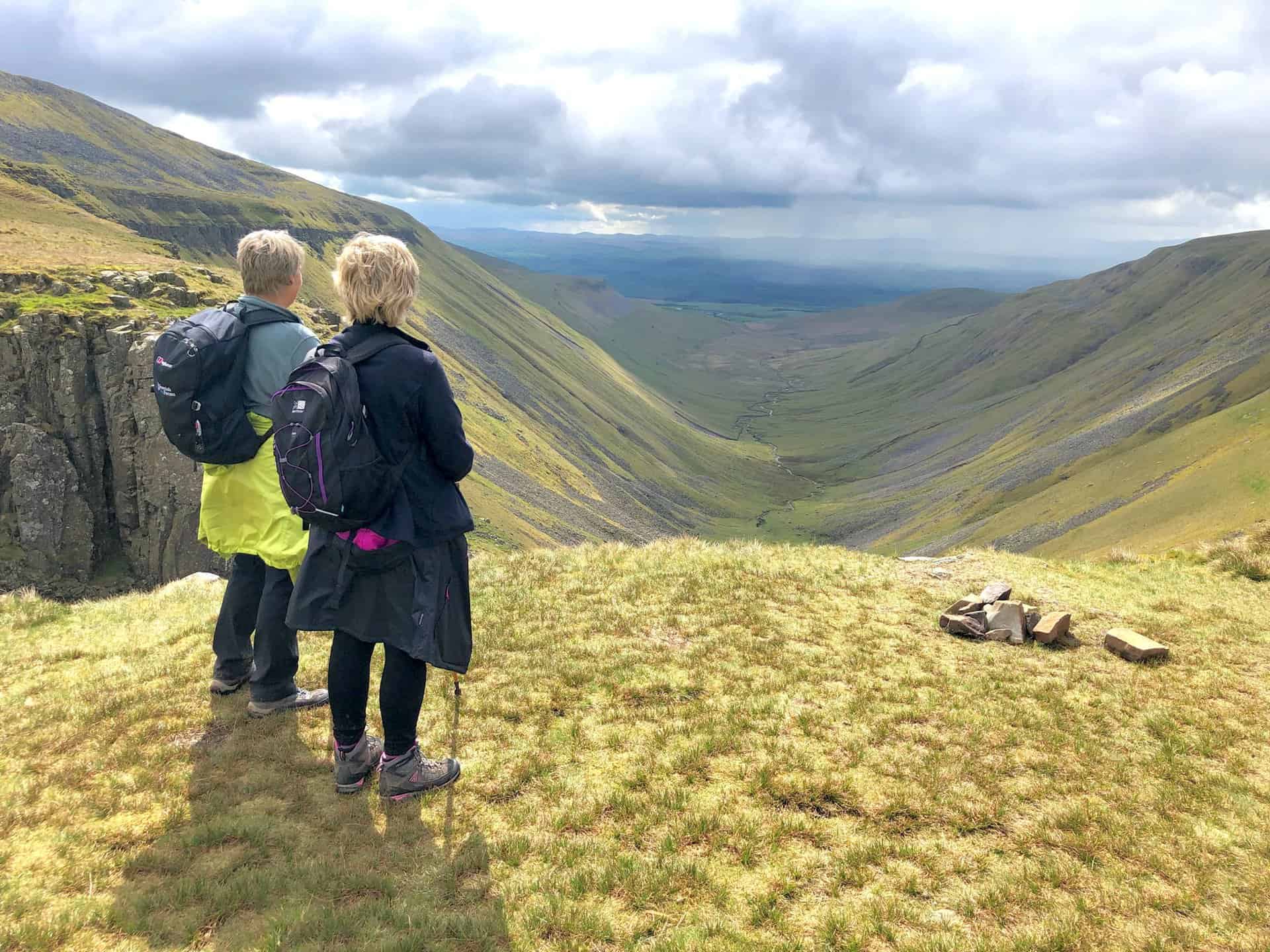
Viewing south-west down the valley towards Appleby-in-Westmorland, with the Yorkshire Dales’ hills in the distance.
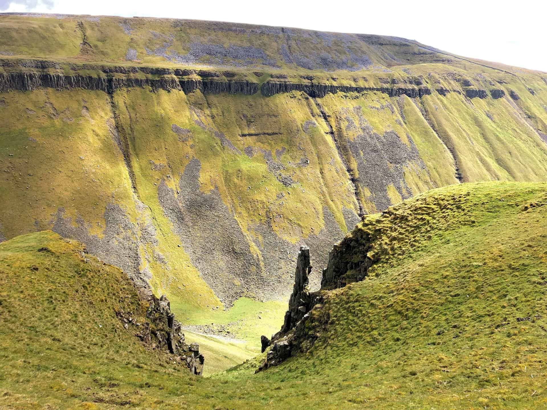
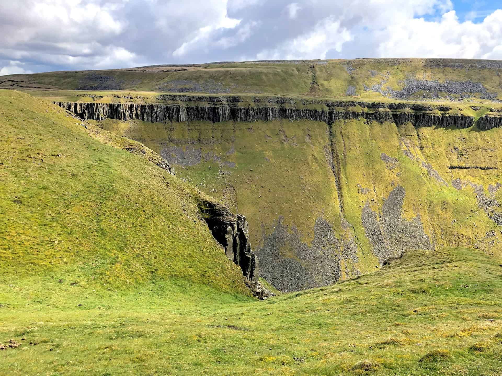
The dramatic, steep-sided slopes on the southern side of High Cup Gill.
Angy pauses to photograph this remarkable location.
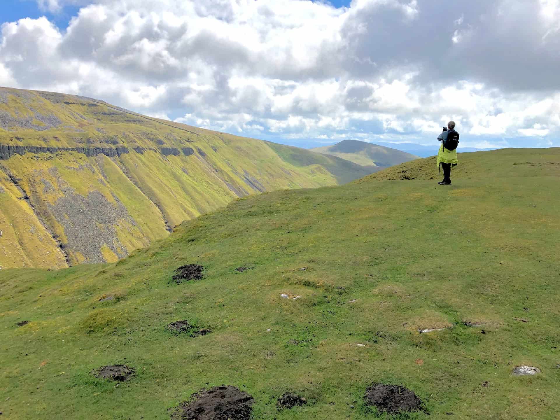
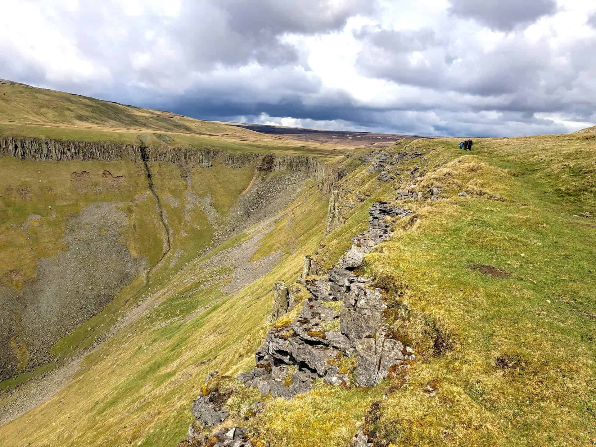
High Cup Nick at the valley’s head. This is about one-third of the way round this particular High Cup Nick walk.
Taking a moment to sit and immerse ourselves in the incredible views and serene atmosphere.
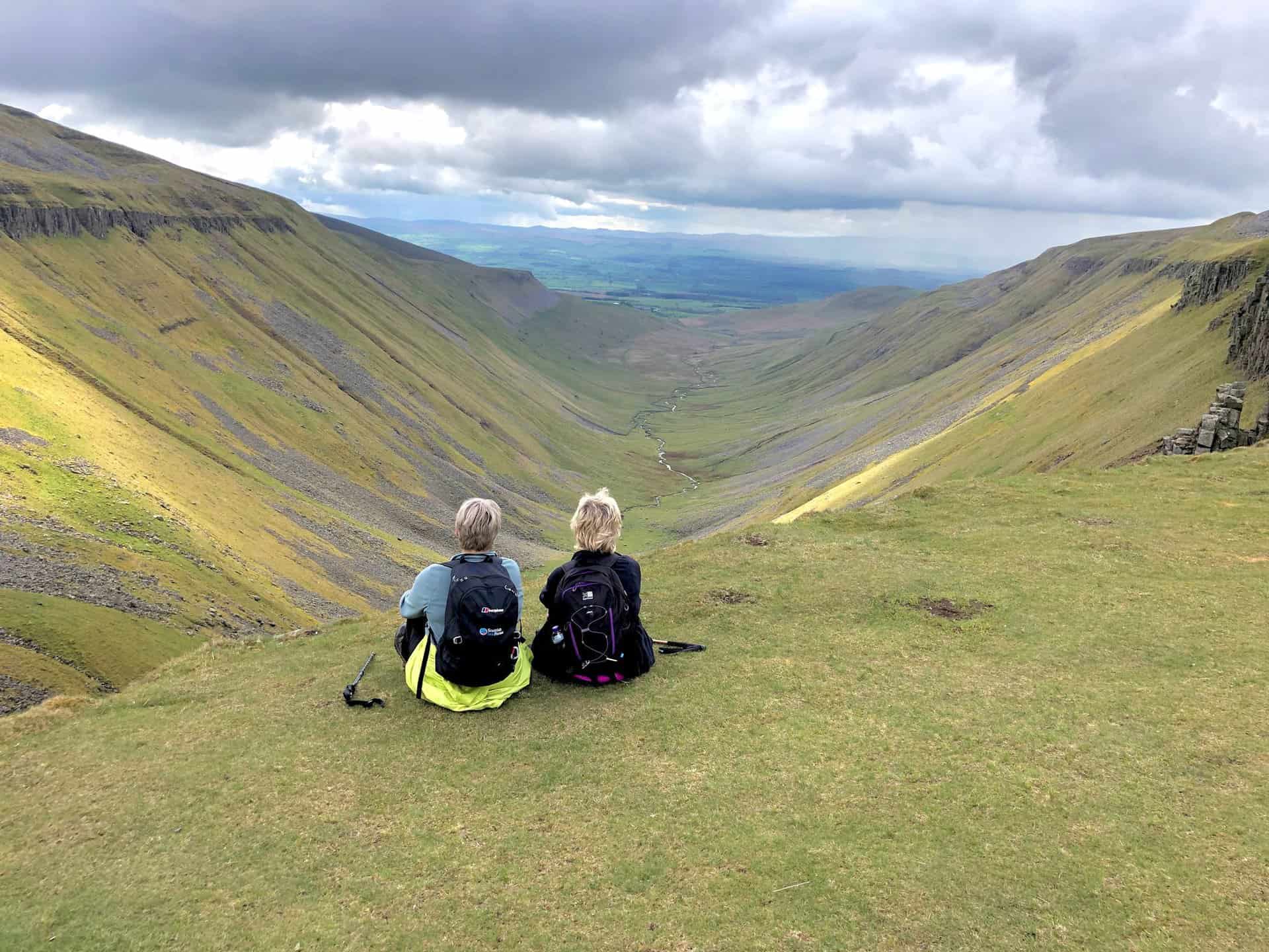
A pleasantly warm and clear day provides an excellent opportunity to relax and savour the landscape.

High Cup Gill Beck winds through the valley, joining other streams that flow into the River Eden.
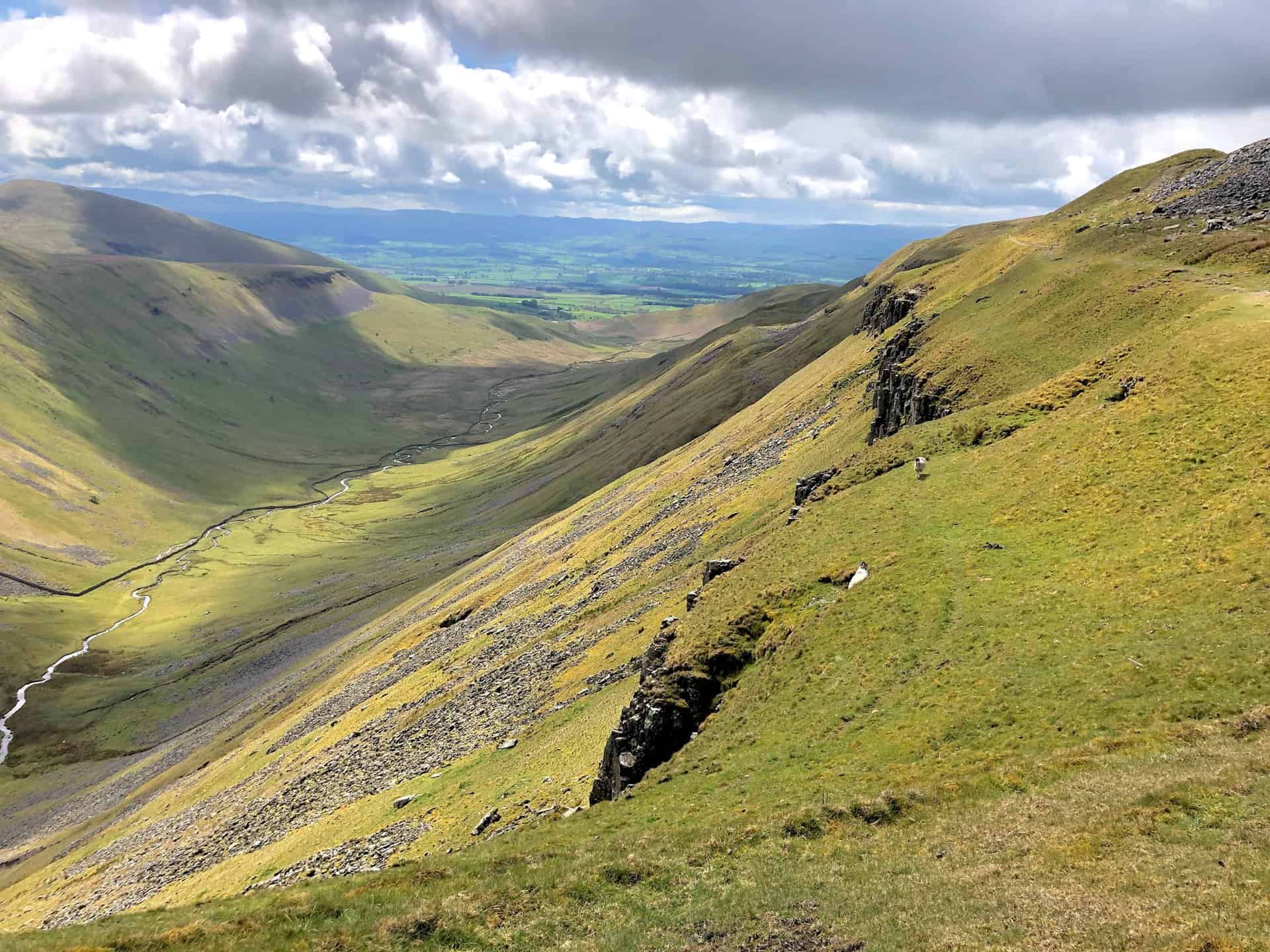
Glancing back at High Cup Nick from the path above the valley’s southern slopes.
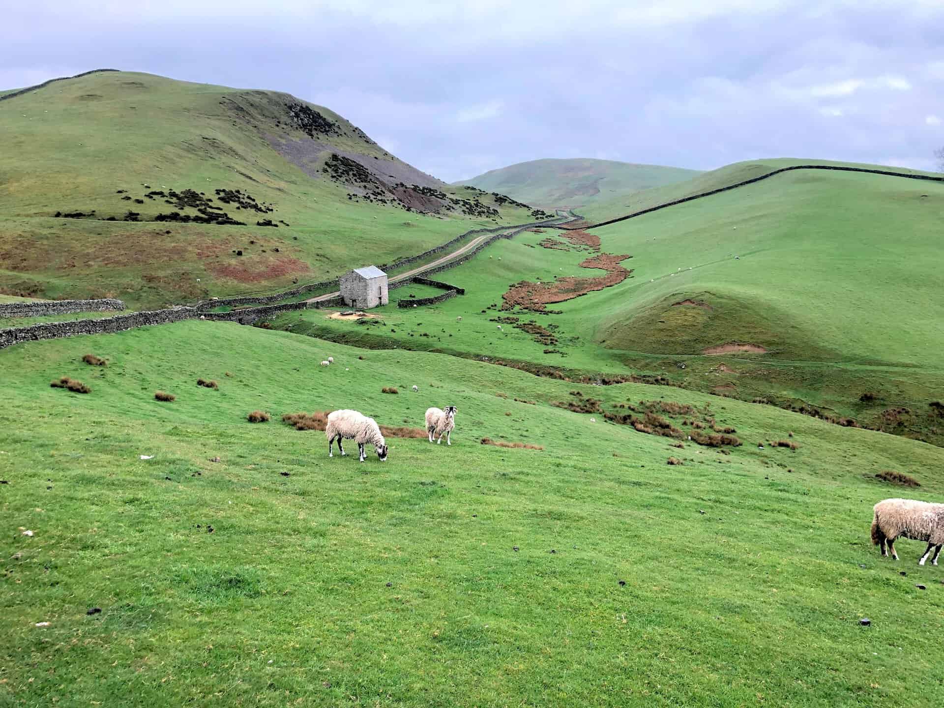
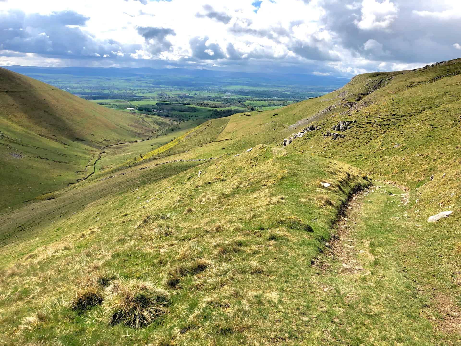
The view of Trundale Gill from the flanks of Middle Tongue. We are roughly halfway round our High Cup Nick walk.
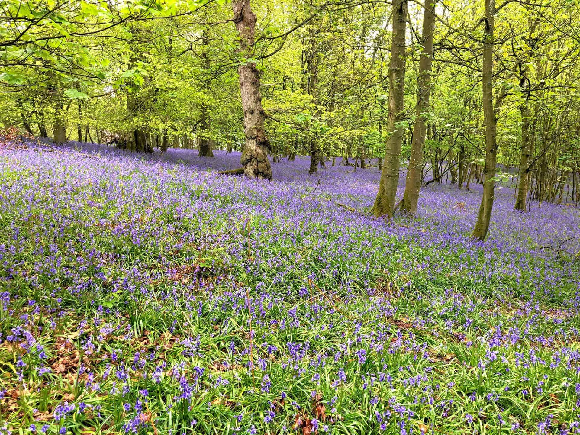
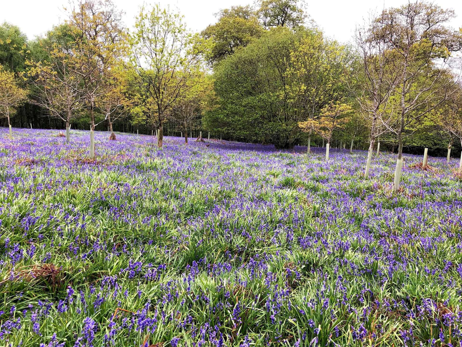
A walk along A Pennine Journey through Flakebridge Wood.
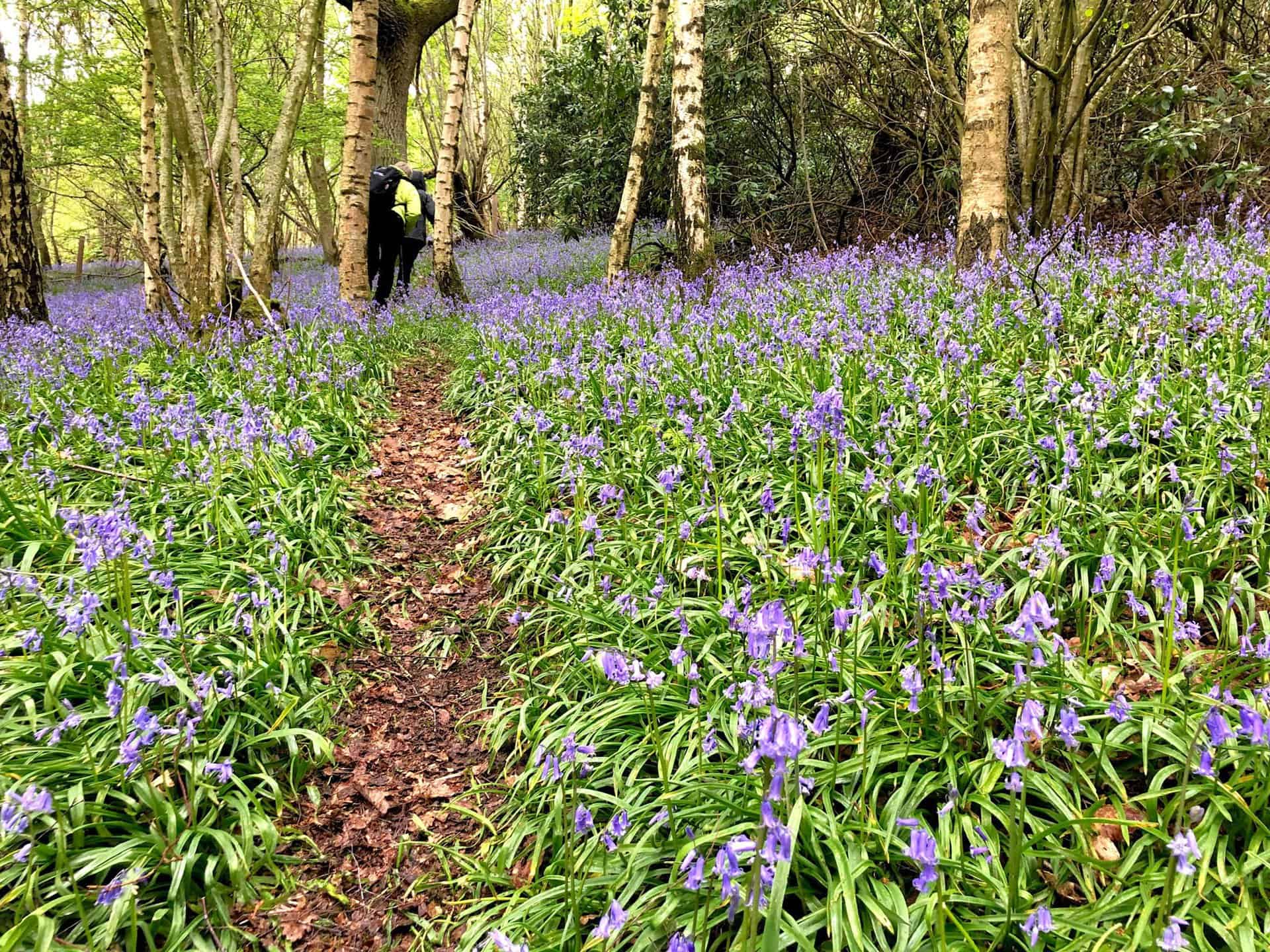
A mystical purple blanket of flowering bluebells in Flakebridge Wood.
Amazon’s Top Walking Boots: Four Standout Choices for Men and Women
For walking and hiking, the right boots are essential for both comfort and safety. While Amazon boasts a wide range, certain boots emerge as top-sellers. From those, here are four I personally favour. As an Amazon affiliate, I may earn a small commission from any purchases made through the links provided. This helps support the upkeep of this website. Rest assured, you won’t pay a penny extra, but your purchase will contribute to keeping my site running smoothly. Happy walking!

Berghaus Men’s Hillmaster II Gore-Tex Walking Boots
These fully waterproof leather walking boots feature a Gore-Tex lining, ensuring no water enters whilst allowing feet to breathe and stay cool. Made from full-grain leather, they promise unmatched durability and comfort. The boots come with memory foam tongues and cuffs that mould to your feet for a tailored fit, and the Vibram Hillmaster outsoles offer confidence on challenging terrains.

Salewa Men’s Mountain Trainer Mid Gore-Tex Walking Boots
Made from durable suede and abrasion-resistant textile, these men’s hiking boots are both lightweight and sturdy. The upper material is enhanced by a 360° full rubber sheath. Their dual-layer midsole with Bilight technology ensures ergonomic cushioning and grip, especially on extended hikes. The Vibram Wrapping Thread Combi outsoles allow a natural walking feel, and the Gore-Tex lining provides waterproofing, breathability, and optimal weather protection. Furthermore, the patented Salewa 3F system ensures flexibility, a secure heel grip, and a blister-free fit.

Berghaus Women’s Supalite II Gore-Tex Walking Boots
Specially designed for women, these hiking boots offer waterproofing and breathability, thanks to their Gore-Tex lining. Crafted from full-grain abrasion-resistant leather, they’re durable enough for the toughest hikes. The Supalite soles ensure stability and traction, and the EVA midsoles add comfort for extended walks.

Merrell Women’s Moab 3 Mid Gore-Tex Walking Boots
These hiking boots incorporate a Gore-Tex waterproof membrane, blending breathability with superior waterproof performance. The combination of pigskin leather and mesh on the uppers, along with the suede outer material, ensure durability and style. Enhancements include 100% recycled laces, webbing, and mesh lining. Additionally, bellows tongues, protective toe caps, and Vibram TC5+ rubber soles ensure protection and ease on any terrain.