Planning Your Day Out on the High Force Waterfall Walk in Teesdale
Start your High Force waterfall walk at Bowlees, making your way from the Gibson’s Cave Nature Reserve car park. The car park lies conveniently near the visitor centre, accessible via the B6277 between Middleton-in-Teesdale and Forest-in-Teesdale. From here, retreat to the road, then cross it to embark on the clearly marked public footpath leading down to the River Tees. Walk across Wynch Bridge, spanning the river, and ascend southwards. This path will guide you to a minor road close to Holwick.
Turn right and proceed westwards along the track towards the disused quarry at Holwick Scars. Continue through the quarry site, then press on west on the public bridleway. This stretches across open access land for approximately three miles until you encounter the public footpath near Fell Dike Sike. Head north briefly down the hill, then veer east on the Pennine Way, over Bracken Rigg. This route runs parallel to the River Tees, leading you to Bleabeck Force, where you can admire the waterfall and its surroundings.
The journey progresses along the Pennine Way to the awe-inspiring High Force waterfall. Maintaining your course eastwards, follow the Pennine Way beside the River Tees all the way to Low Force waterfall. The beauty of these cascades invites exploration and admiration, enriching your walking experience.
Conclude your adventure by retracing your steps across Wynch Bridge, returning to the car park at Bowlees. Covering just over seven miles, this trek takes roughly 3½ hours, but allocate more time to fully enjoy the trio of stunning waterfalls and the natural splendour of the area. This High Force waterfall walk is not just a route; it’s an invitation to explore the heart of Teesdale in the North Pennines.
High Force Waterfall Walk: Maps and Tools
Visit either the OS Maps website or the Outdooractive website to view this walking route in greater detail. Both platforms offer a range of features, including the ability to print the route, download it to your device, and export the route as a GPX file. You can also watch a 3D fly-over and share the route on social media.
High Force Waterfall Walk: Distance, Duration, Statistics
Distance: 7¼ miles
Distance: 11½ kilometres
Duration: 3½ hours
Ascent: 853 feet
Ascent: 2799 metres
Type: Circular walk
About the Waterfall
High Force is a waterfall located on the River Tees, close to Middleton-in-Teesdale, within the Teesdale area. It lies in the North Pennines Area of Outstanding Natural Beauty (AONB). The site marks the historic county border, with the North Riding of Yorkshire to the south and County Durham to the north.
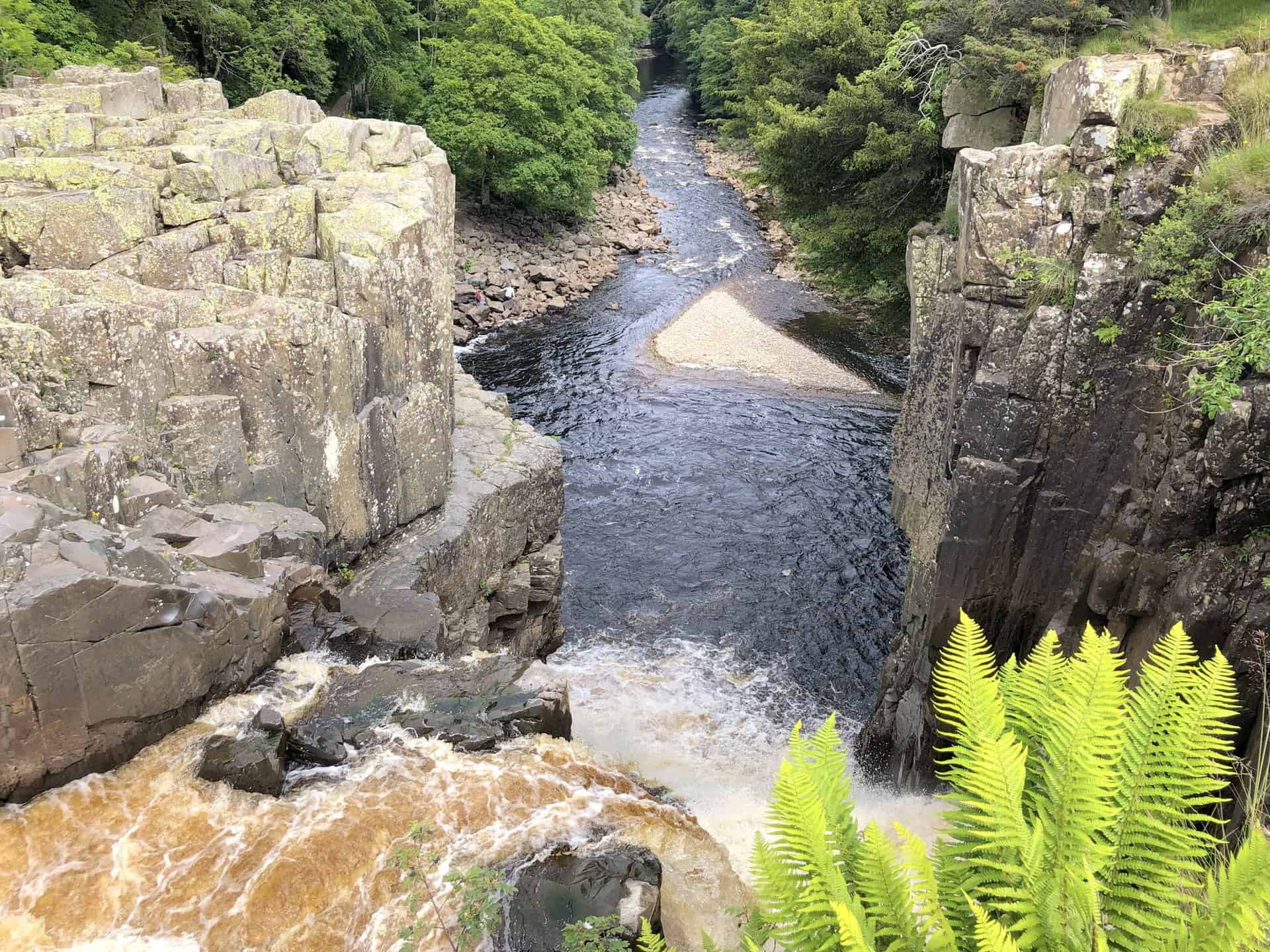
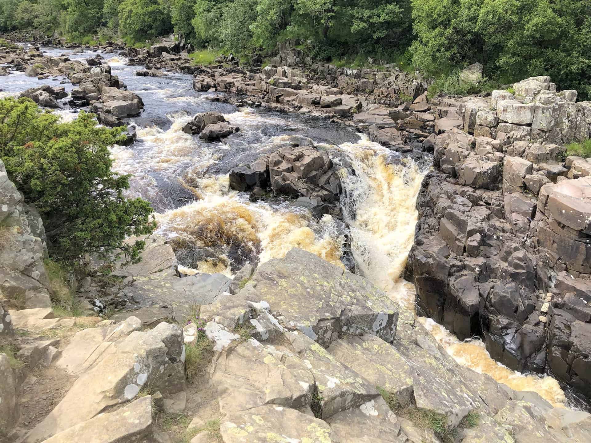
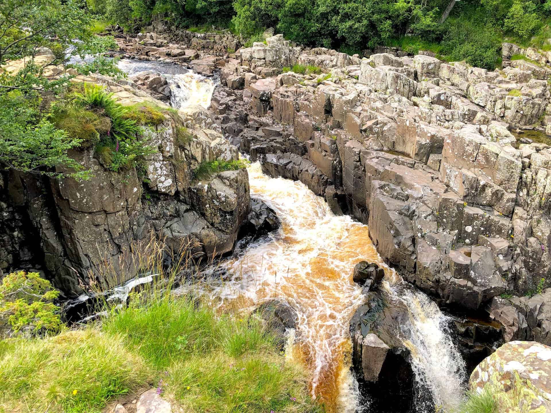
The River Tees cascades down 21 metres (70 feet) in two stages over a steep cliff. In periods of heavy rain, the river flows over a usually dry channel on the right, forming a second waterfall. Exceptionally, when the river level is very high, as last seen in December 2015 after Storm Desmond, it can overflow the central rock section. During severe winters, the falls can freeze, forming large ice structures.
Access to High Force from the north is through a private path on the Raby estate, which requires a fee. However, the southern bank is accessible for free via the Pennine Way, as detailed in this High Force waterfall walk.
Geological Significance and Comparisons
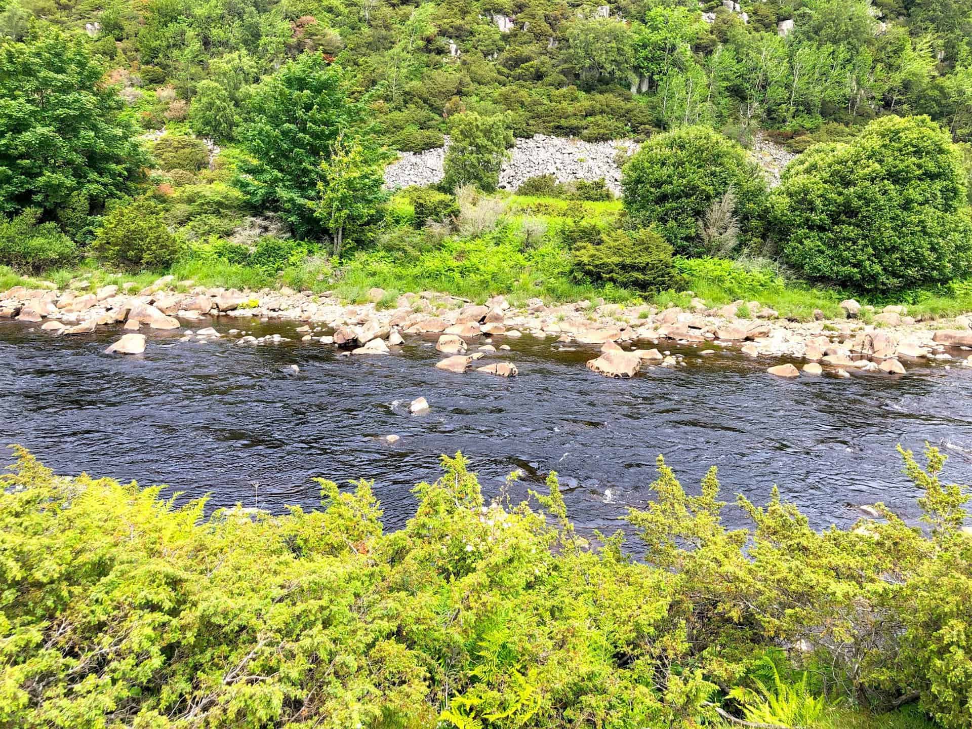
The waterfall exists where the River Tees crosses the Whin Sill, a durable igneous rock layer. This Whin Sill rock formation can also be seen on my High Cup Nick walk. High Force comprises three rock types: the top layer is hard whinstone or dolerite, resistant to erosion. Beneath this is softer Carboniferous Limestone, easily eroded, with a thin layer of hardened Carboniferous sandstone in between, hardened by the heat from the molten Whin Sill 295 million years ago. This erosion process is gradually moving the waterfall upstream, creating a deep gorge. The riverbed upstream is narrow and strewn with large boulders, whereas downstream, it broadens and meanders.
Despite common belief, High Force is not England’s tallest waterfall. Cautley Spout in Cumbria and Hardraw Force in North Yorkshire have greater drops. Moreover, Fell Beck falls 96 metres (315 feet) underground at Gaping Gill near Ingleborough. Nonetheless, High Force has the highest volume of water falling over an unbroken drop at full flow, hence its Nordic name ‘High Fosse’. The High Force waterfall walk invites visitors to explore this unique feature and its surrounding beauty.
Recommended Ordnance Survey Map
The best map to use on this walk is the Ordnance Survey map of the North Pennines, reference OS Explorer OL31, scale 1:25,000. It clearly displays footpaths, rights of way, open access land and vegetation on the ground, making it ideal for walking, running and hiking. The map can be purchased from Amazon in either a standard, paper version or a weatherproof, laminated version, as shown below.
High Force Waterfall Walk: My Photos
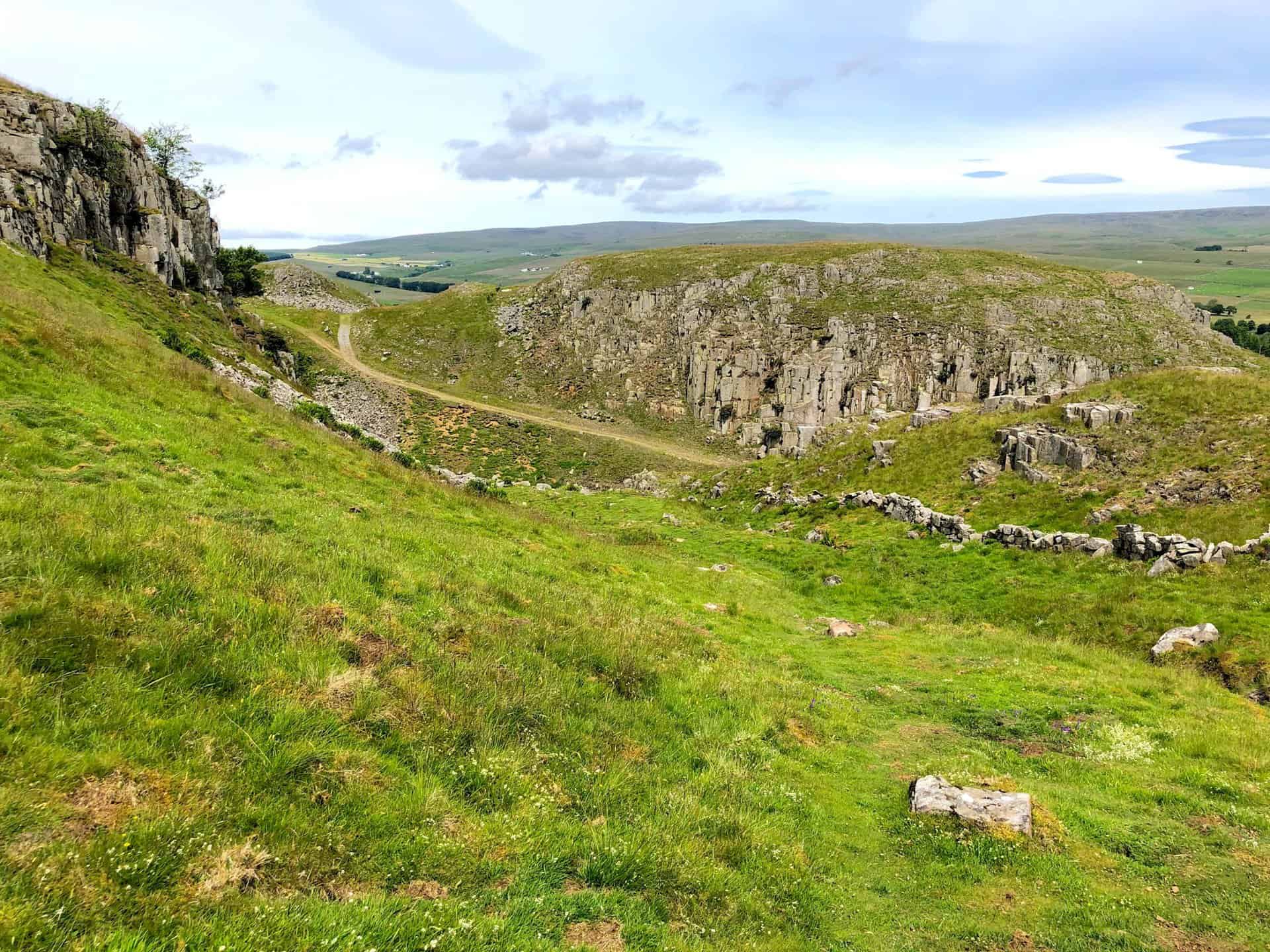
Holwick Scars, a rugged limestone landscape known for its dramatic views and geological interest.
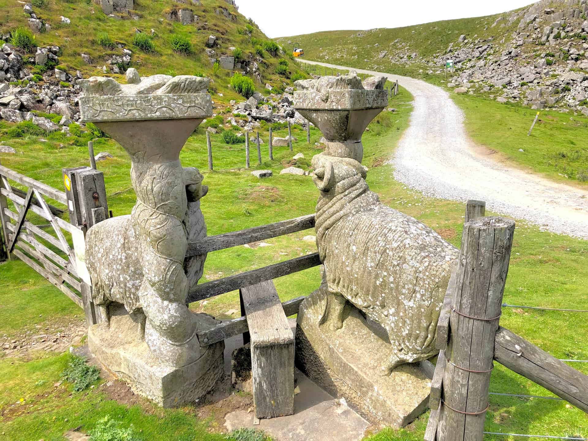
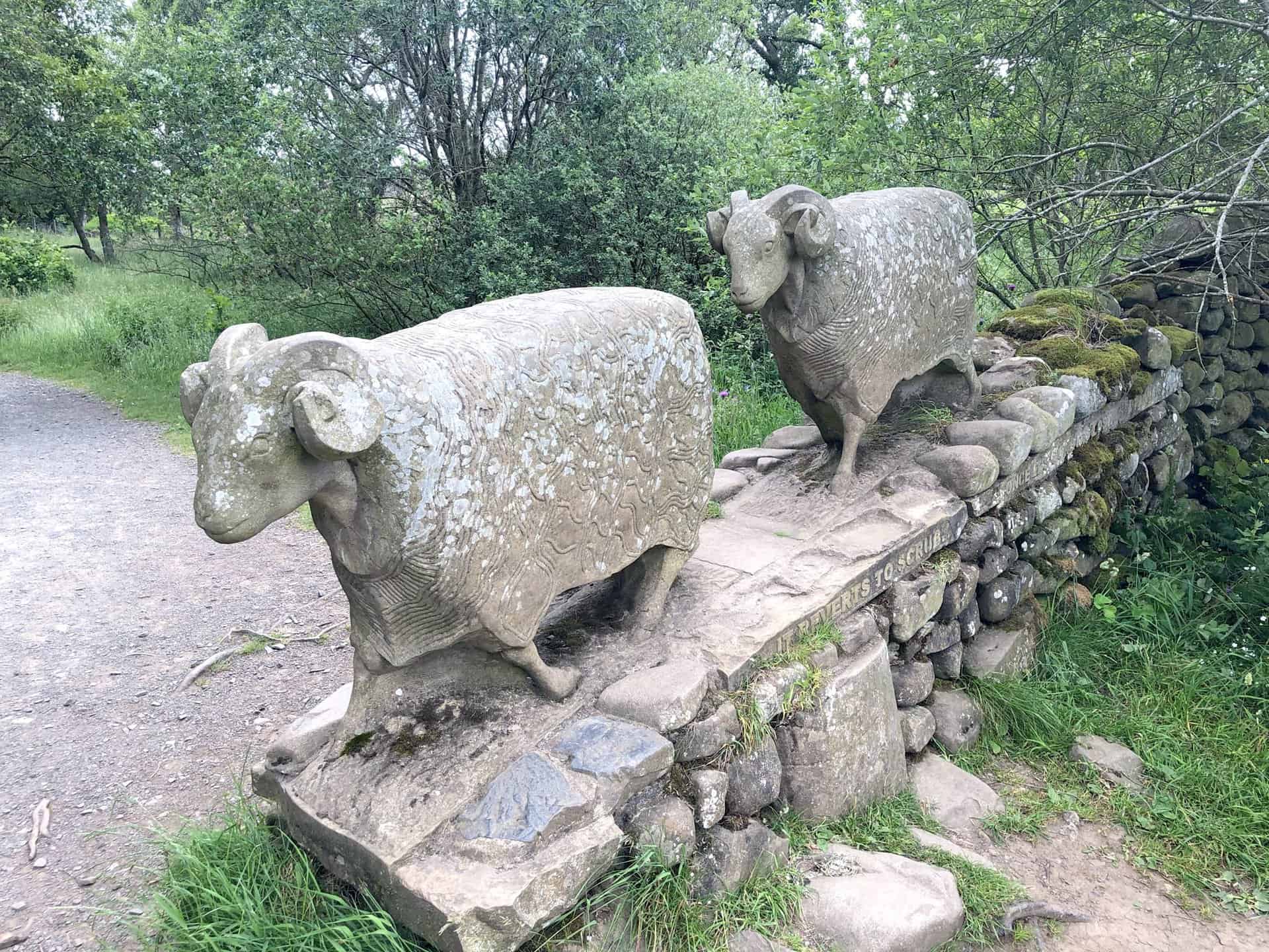
Intricately crafted stone sheep flank a stile near Holwick Scars, blending art with the natural landscape.
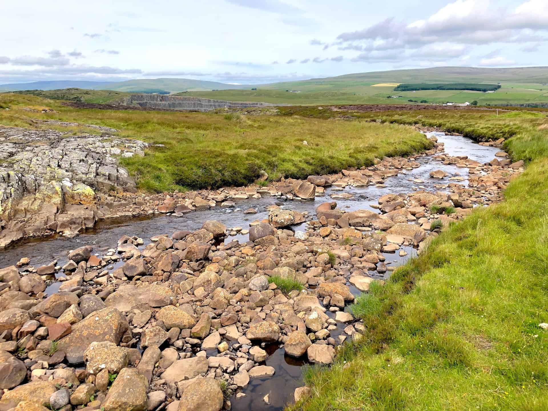
Blea Beck, set to join the River Tees later on, meanders through the countryside.
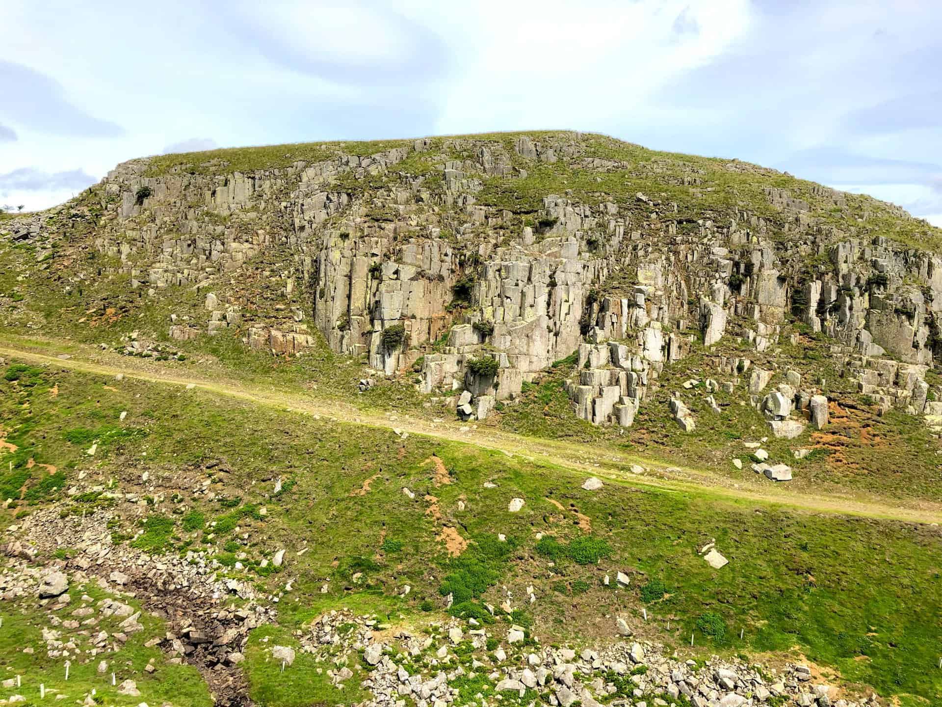
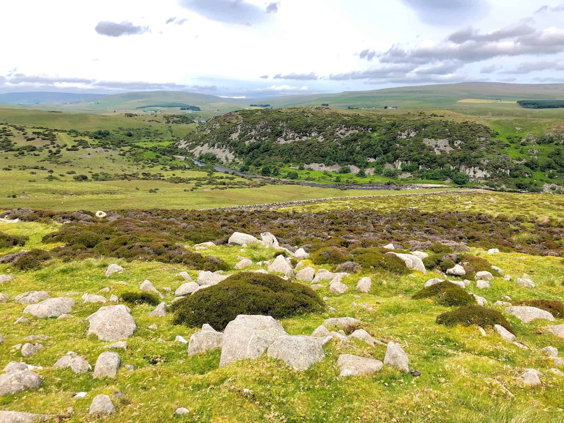
The imposing Dine Holm Scar, as viewed from the vantage point of Whiteholm Bank, almost halfway round this High Force waterfall walk.
The expansive view north-west over Upper Teesdale reveals a landscape rich in natural beauty and diverse habitats.
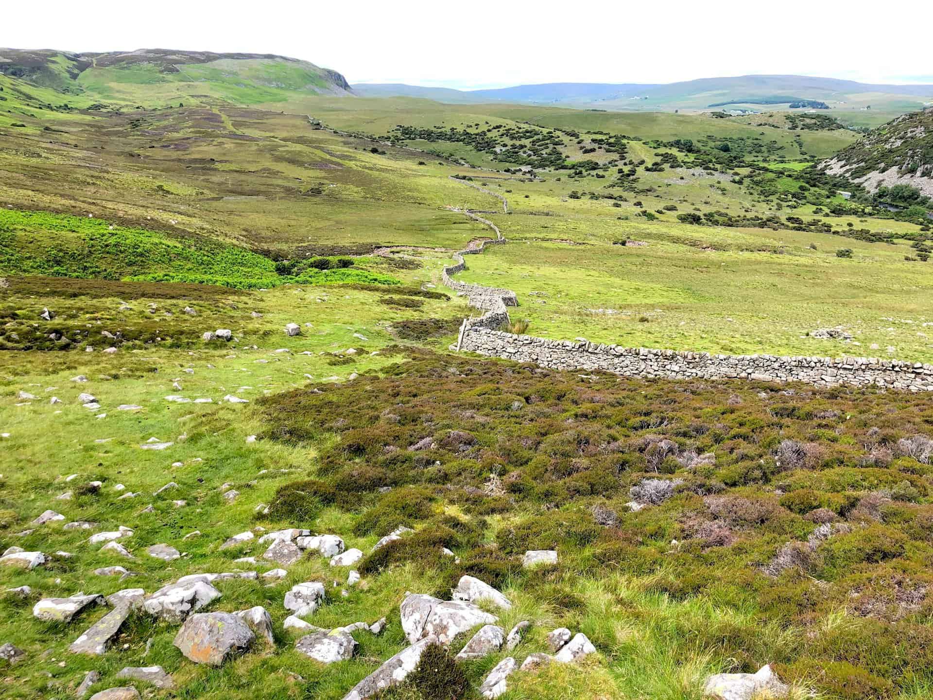
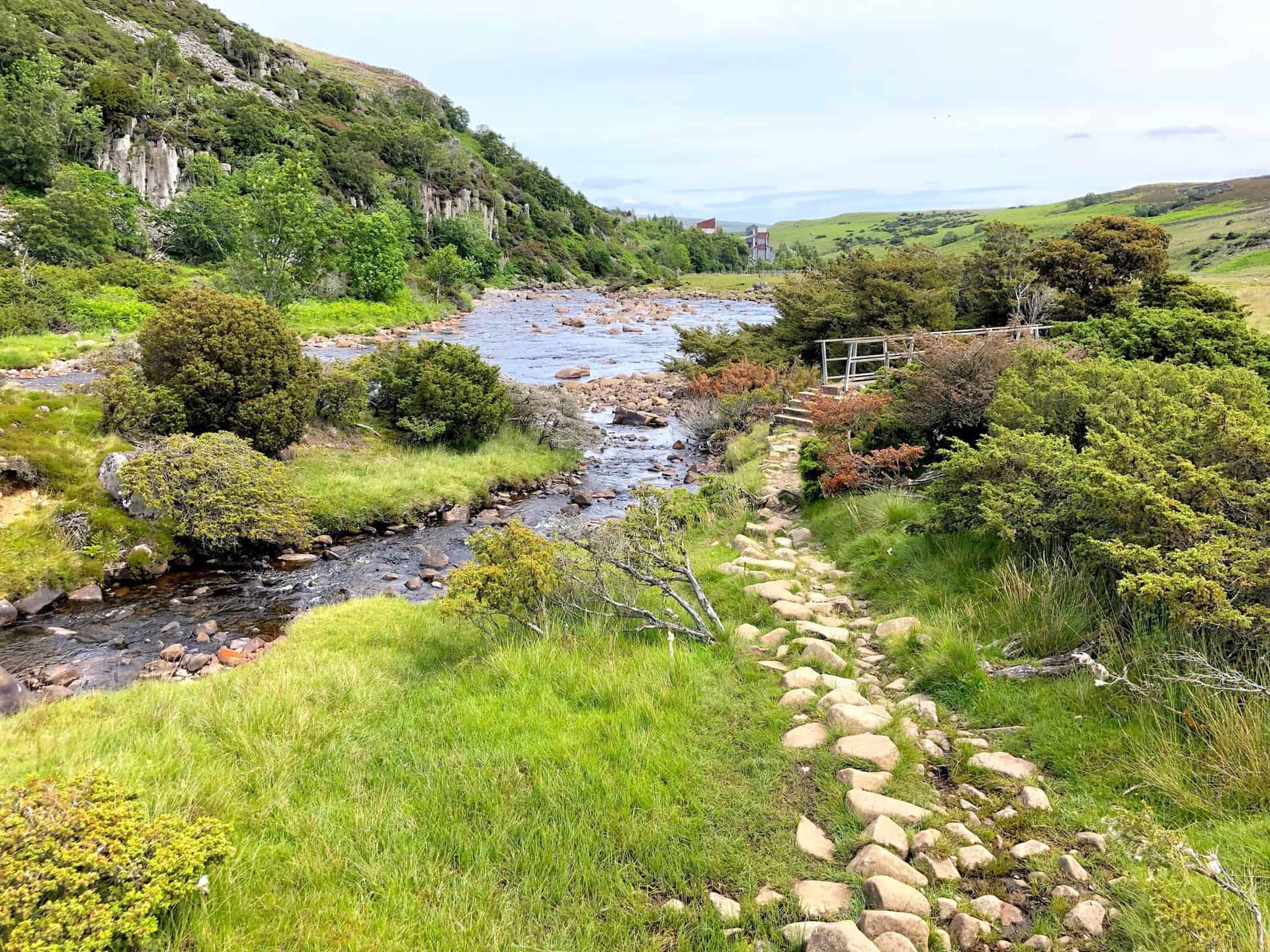
The Pennine Way meanders alongside the River Tees, offering a serene path below the towering Dine Holm Scar.
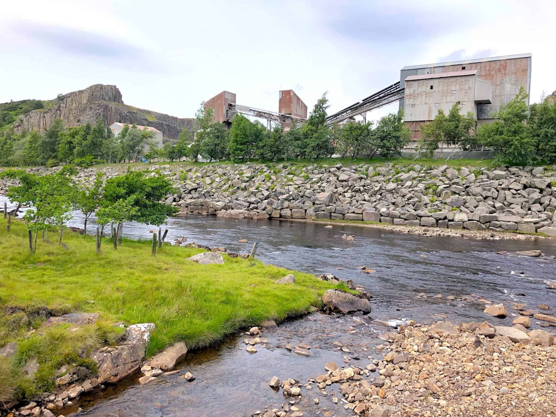
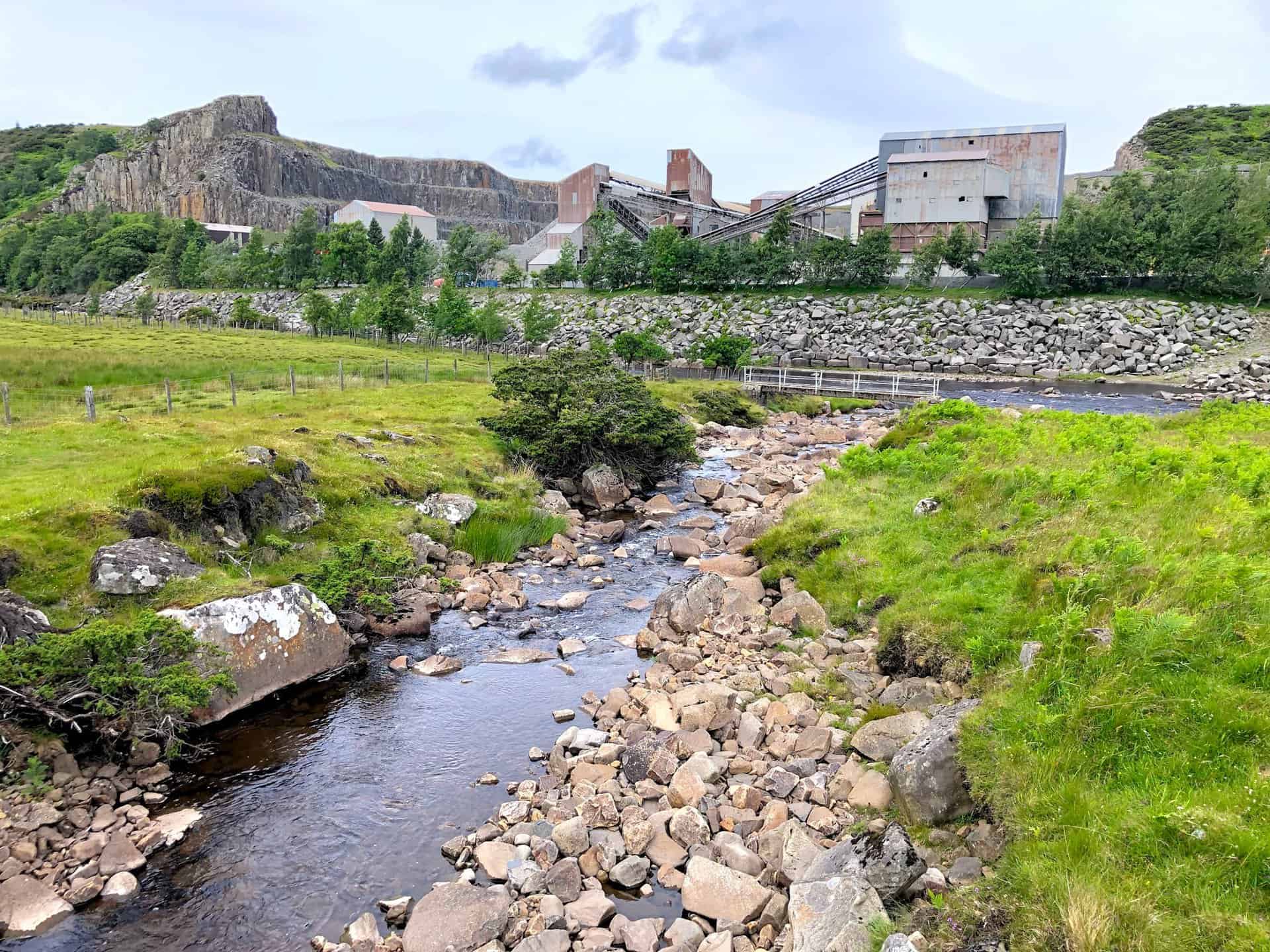
A fully operational stone quarry on the north side of the River Tees, just east of Dine Holm Scar, underscores the area’s continuing industrial activity.
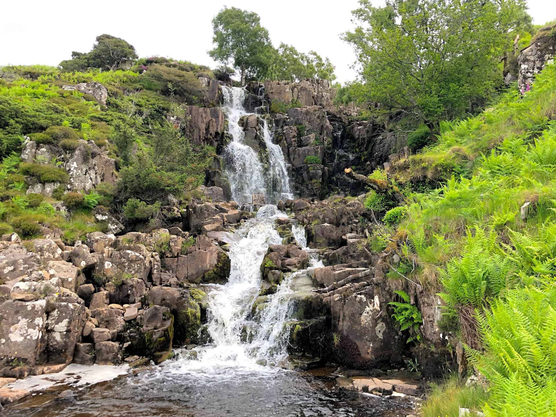
Blea Beck joins the River Tees in a confluence just beyond the cascade of Bleabeck Force waterfall.
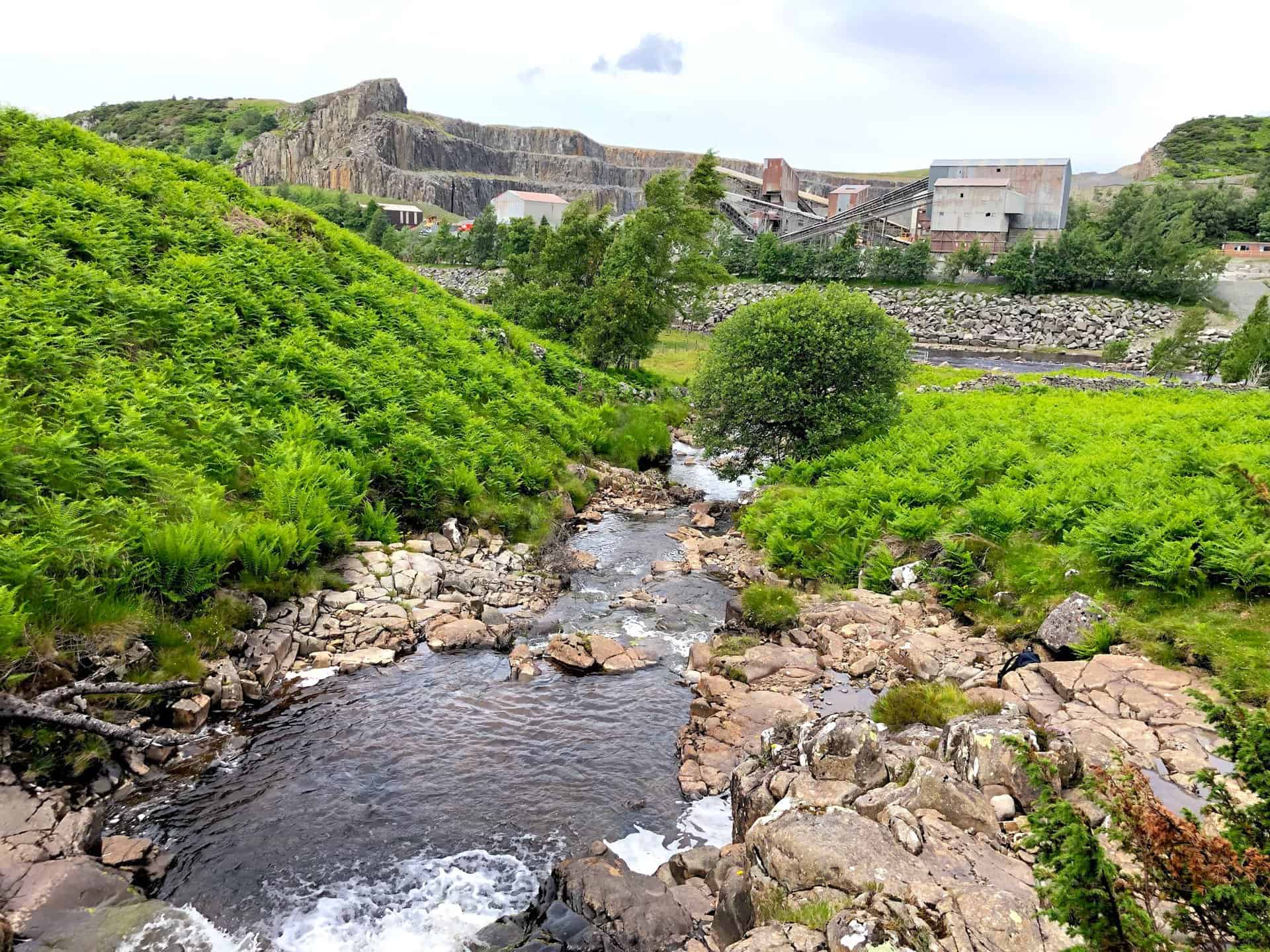
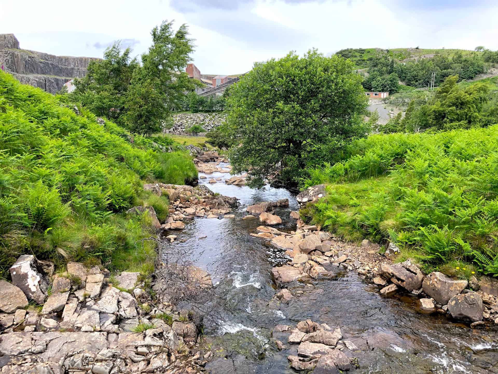
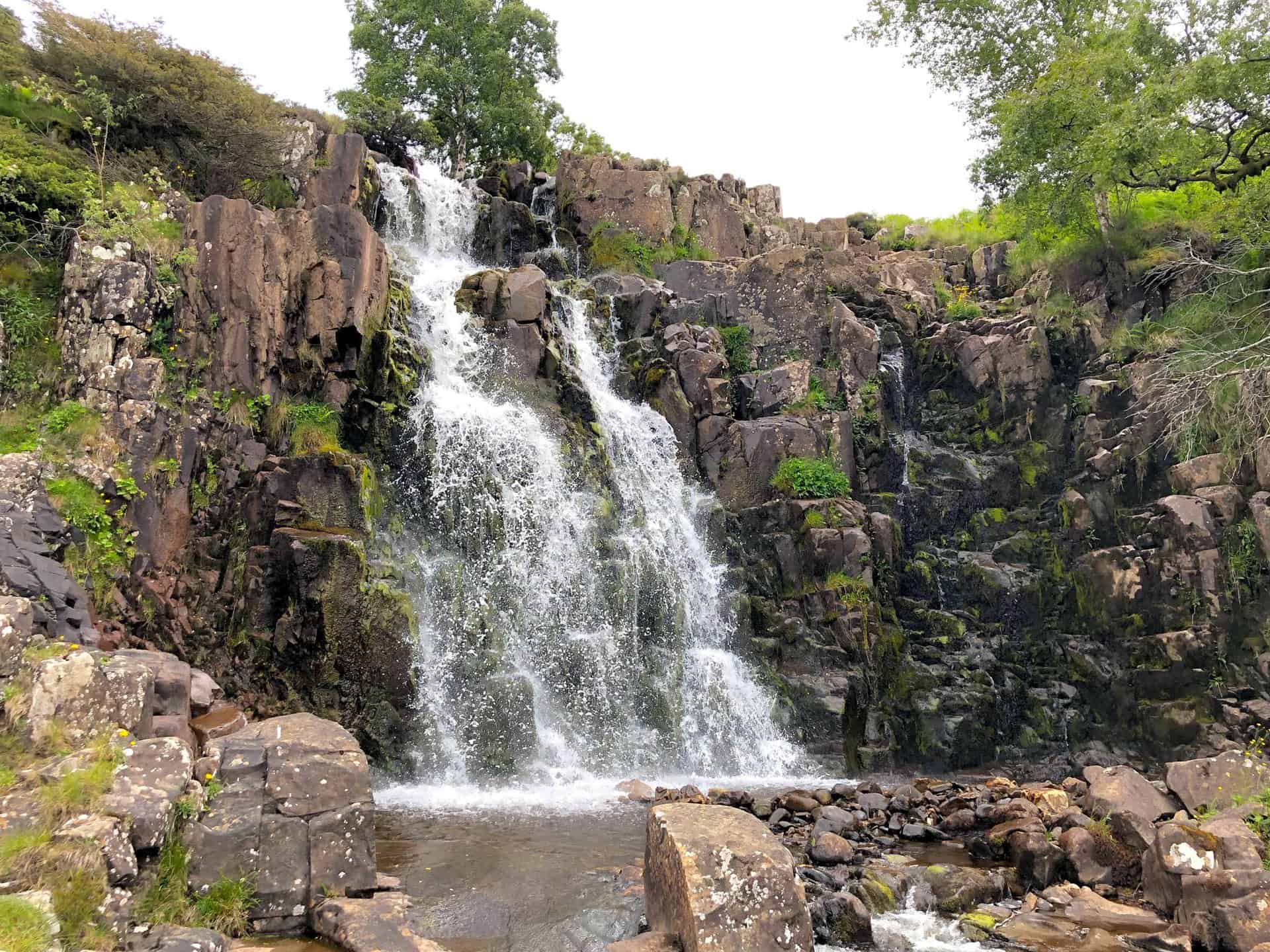
Bleabeck Force, a captivating waterfall where Blea Beck tumbles down in a series of cascades.
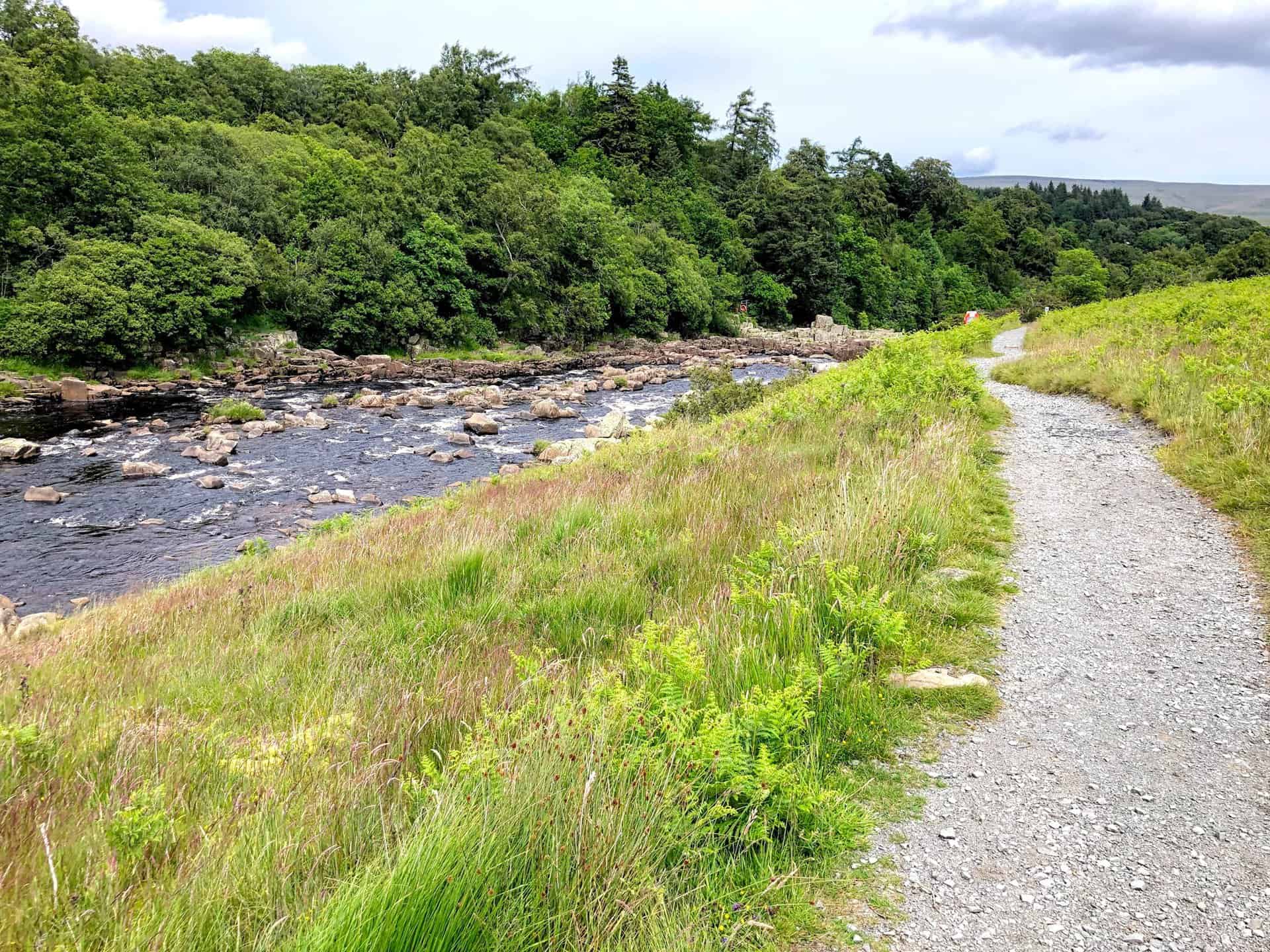
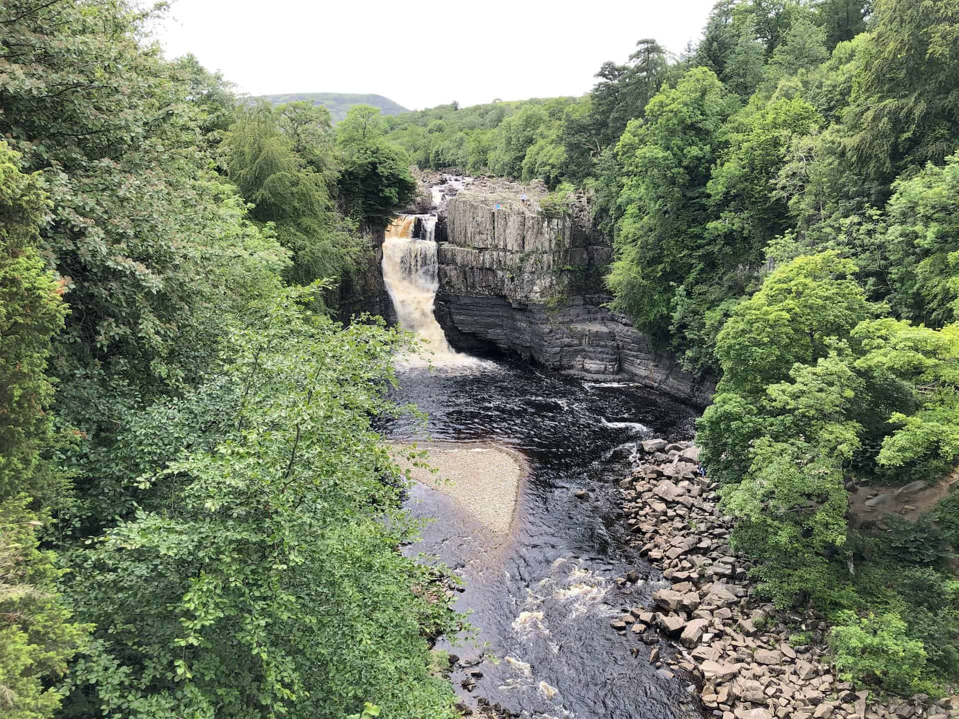
The scenic route of the Pennine Way leads adventurers towards High Force, following the River Tees closely.
High Force, a spectacular waterfall on the River Tees, stands as one of the most impressive natural features in the area, about five miles north-west of Middleton-in-Teesdale. At High Force you are roughly three-quarters of the way round this High Force waterfall walk.
A Cinnabar moth, originally named after the bright red mineral ‘cinnabar’ once used by artists as a red pigment for painting. Visit https://www.buglife.org.uk/bugs-and-habitats/cinnabar-moth for more information.

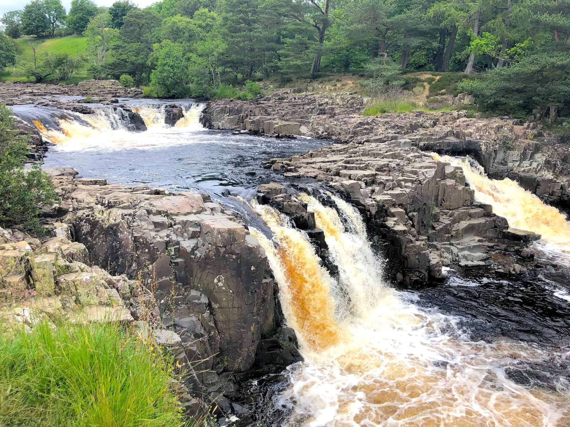
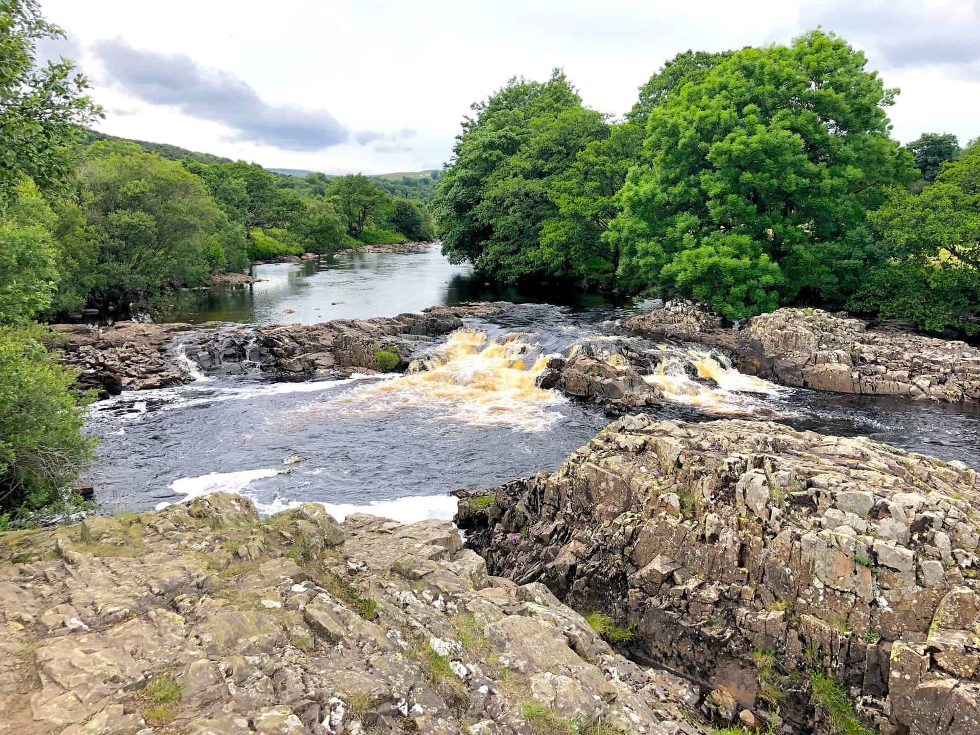
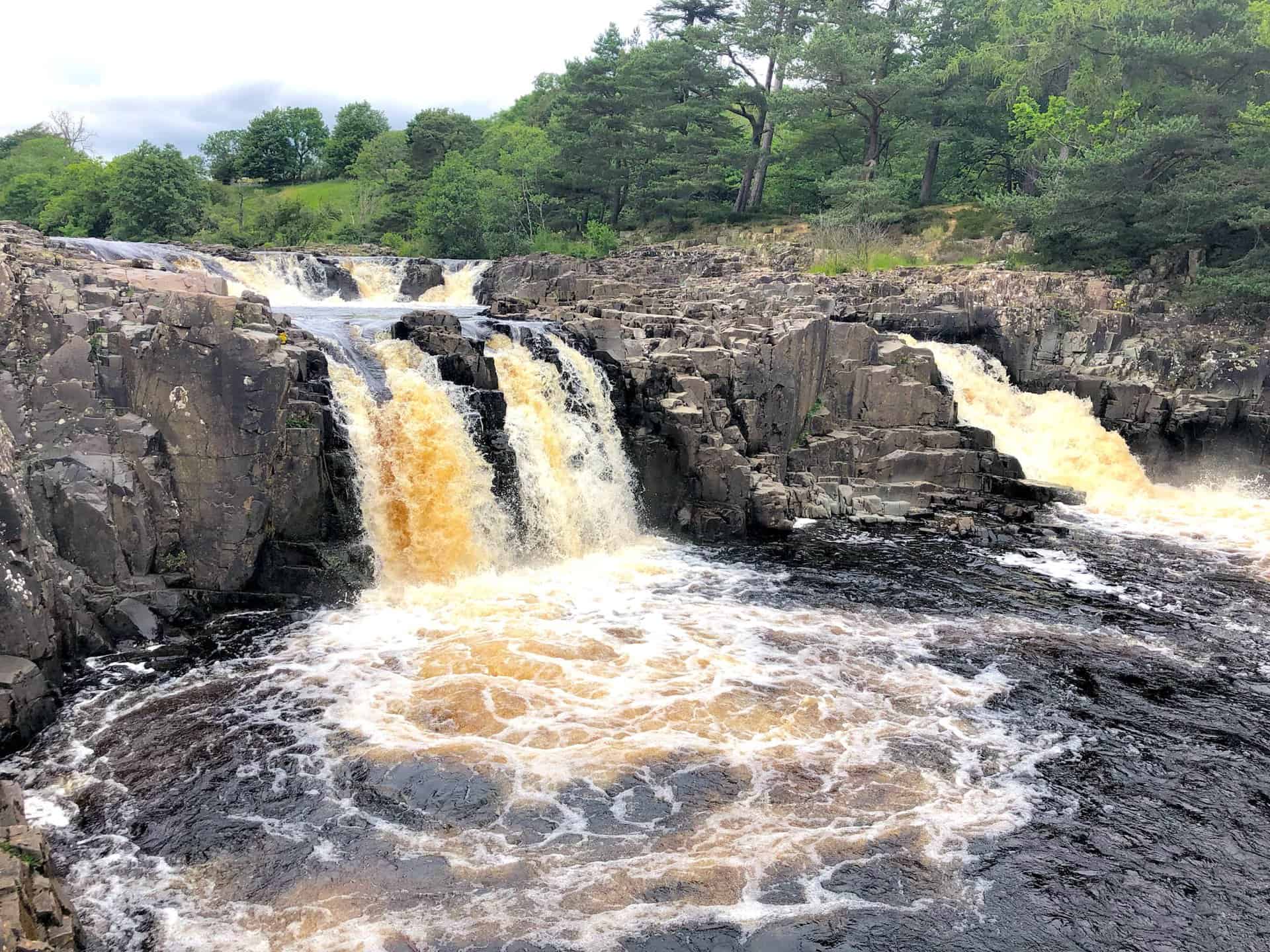
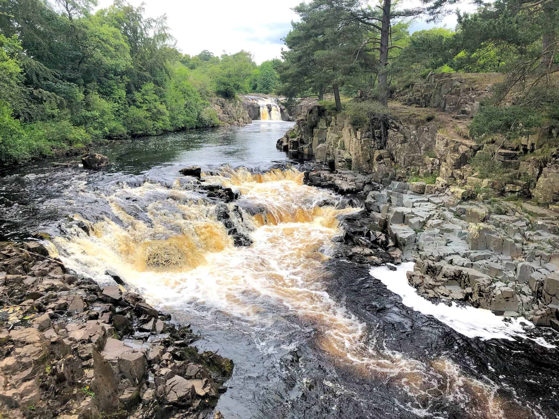
Low Force presents a series of picturesque waterfalls on the River Tees, located approximately 3½ miles north-west of Middleton-in-Teesdale.
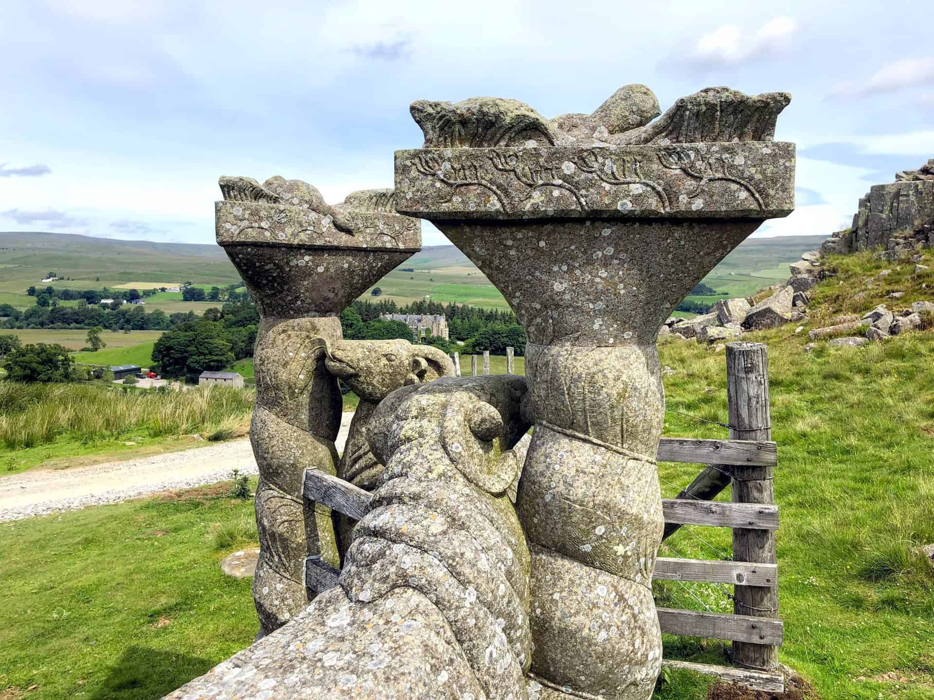
A charming pair of stone sheep near Wynch Bridge, symbolising the area’s pastoral beauty. Cross the bridge to return to Bowlees, marking the end of your High Force waterfall walk.
Highly Rated Osprey Hiking Backpacks for Outdoor Enthusiasts
Osprey’s reputation for crafting high-quality hiking backpacks is well-established, offering a range of options that cater to both men and women. The following four backpacks stand out for their excellent sales and customer ratings on Amazon, making them a top choice for outdoor enthusiasts seeking reliability and comfort. As an Amazon affiliate, I may earn a small commission from any purchases made through the links provided. This helps support the upkeep of this website. Rest assured, you won’t pay a penny extra, but your purchase will contribute to keeping my site running smoothly. Happy walking!

Osprey Tempest 20 Women’s Hiking Backpack
The Tempest 20 stands out as the ideal solution for day-hiking, biking, or peak-bagging, tailored specifically for women. It features a panel-loading design for ease of access, complemented by an internal zippered mesh pocket with a key clip for secure storage. Unique to this model are the Stow-on-the-Go trekking pole and LidLock bike helmet attachments, enhancing its versatility. Side stretch mesh pockets, along with an easy-access, expandable stretch mesh harness pocket, offer ample storage. Additionally, it includes a blinker light attachment (light not included) and a large stretch mesh front panel pocket for extra carrying capacity.

Osprey Talon 22 Men’s Hiking Backpack
Designed for the active adventurer, the Talon 22 provides an optimal panel-loading design suitable for day-hiking, biking, or peak-bagging. Key features include dual-zippered panel access to the main compartment and a tuck-away ice ax attachment with a bungee tie-off. It boasts a top panel zippered slash pocket for quick access items and lower side compression straps for load management. An external hydration reservoir sleeve and dual-zippered fabric hipbelt pockets enhance hydration and storage, while a large stretch mesh front panel pocket increases its utility for various activities.

Osprey Tempest 30 Women’s Hiking Backpack
The Tempest 30, designed with a women’s-specific fit, is a streamlined top-loader ideal for both extensive day trips and light-and-fast overnight adventures. It includes a fixed top lid with an external zippered slash pocket and an under-lid zippered mesh pocket with a key clip for organised storage. The pack features a tuck-away ice ax attachment with a bungee tie-off, dual upper and lower side compression straps for load adjustment, and an external hydration reservoir sleeve. For added convenience, it offers an easy-access, expandable stretch mesh harness pocket and dual-zippered fabric hip-belt pockets.

Osprey Talon 33 Men’s Hiking Backpack
The Talon 33 is engineered for dynamic movement, making it the perfect streamlined top-loader for committed day trips or light-and-fast overnight excursions. It features top load access to the main compartment for easy packing and retrieval. The backpack is equipped with a large stretch mesh front panel pocket, Stow-on-the-Go trekking pole attachment, and stretch mesh side pockets for versatile storage options. Additionally, an easy-access, expandable stretch mesh harness pocket and dual-zippered fabric hip-belt pockets offer convenient storage solutions for essential gear.