A Guide to the Breathtaking High Cup Nick Circular Walk in the North Pennines
Start this High Cup Nick circular walk from the quaint village of Murton, located just off the A66 near Appleby-in-Westmorland, in the breathtaking North Pennines. Your journey begins in the car park situated at the north-eastern extremity of the village, nestled at the foot of Murton Pike. From there, head north and then north-east on the stone track that gently winds around the lower slopes of Murton Pike. For those seeking an additional challenge, consider taking a detour to the summit of Murton Pike. The extra effort rewards you with stunning, far-reaching views that are well worth the climb.
After savouring the panoramic vistas, descend Murton Pike and continue your trek north-east, then north. You will cross the picturesque Trundle Gill, leading you to the top of the slopes on the southern side of the High Cup Gill valley. Here, follow the path along the valley’s upper slopes, indulging in the spectacular views. This scenic route will eventually guide you to High Cup Nick, the dramatic head of the valley, where you will intersect with the renowned Pennine Way.
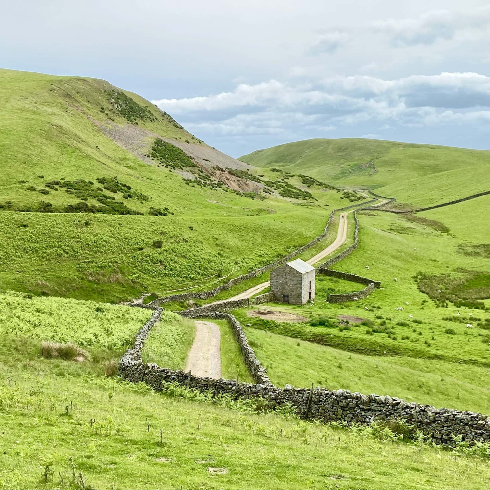
Upon joining the Pennine Way, follow it around the valley’s rim, walking south-west along the path known as Narrow Gate. This section, part of the Pennine Way, offers a unique perspective of the valley below. Continue south-east on the well-trodden stone track towards the southern flanks of Dod Hill. Then, veer left, following a track that passes a barn and goes between the hills of Gregory to your left and Harthwaite to your right.
Your journey leads you towards Town Head, where you will cross a minor road near Keisley. From here, continue to A Pennine Journey, which will usher you into the serene environs of Flakebridge Wood. Go through the wood, then follow the path south-east along the wood’s southern edge, passing Flakebridge House, to reach Shepherd’s Cottage.
For the final leg of your adventure, head east across the picturesque countryside to Town Foot, bringing you back to Murton. This 11-mile High Cup Nick circular walk in the North Pennines offers a blend of challenging ascents, tranquil woodland paths, and awe-inspiring views, making it a memorable experience for walking and hiking enthusiasts.
High Cup Nick Circular Walk: Maps and Tools
Visit either the OS Maps website or the Outdooractive website to view this walking route in greater detail. Both platforms offer a range of features, including the ability to print the route, download it to your device, and export the route as a GPX file. You can also watch a 3D fly-over and share the route on social media.
High Cup Nick Circular Walk: Distance, Duration, Statistics
Distance: 11¼ miles
Distance: 18¼ kilometres
Duration: 5¾ hours
Ascent: 2260 feet
Ascent: 689 metres
Type: Circular walk
About High Cup Nick
High Cup Nick is a remarkably U-shaped valley that carves deeply into the Pennine escarpment to the north-east of Appleby-in-Westmorland, Cumbria. It sits within the North Pennines Area of Outstanding Natural Beauty (AONB) in Northern England. The valley owes its shape to the effects of glaciers during various ice ages. Murton Fell is located to the south-east of this geographical feature, and Dufton Fell lies to the north.
Although officially named High Cup Gill by Ordnance Survey, it is more popularly known as High Cup Nick. The name ‘High Cup Nick’ specifically refers to the area at the valley’s north-eastern end. Here, the waters of High Cupgill Beck dramatically plunge from the flat High Cup Plain, cascading over High Cup Scar and into the valley below.
The terms ‘gill’ and ‘beck’, deriving from Norse, mean a narrow valley and a stream, respectively. These terms are commonly used in the hilly regions of Northern England. High Cup Nick offers an extraordinary view from its peak, looking south-west across the Vale of Eden. It is celebrated as one of the most awe-inspiring natural sights in Northern England.
High Cup Scar stands out because of a prominent rock formation made of Whin Sill. This is a type of dolerite that was formed in the late Carboniferous period. It is a common feature across the North Pennines and the north-east of England. The slopes beneath High Cup Scar are scattered with large chunks of this rock. On the valley’s northern side, there’s a distinctive rock formation called Nichol Chair. According to local lore, this name commemorates a cobbler who is said to have worked from its summit as part of a wager.
Whin Sill forms part of the Alston Formation within the Yoredale Group, consisting of limestone, sandstone, siltstone, and mudstone layers. Hidden at the bottom of the valley are older sedimentary rocks from the Ravenstonedale Group. Below these, one finds the even older, metamorphosed slates and sandstones of the Skiddaw Group from the Ordovician period.
Additionally, the Pennine Way, a famous national trail, runs along the valley’s northern edge. It follows a route known as Narrow Gate from Forest in Teesdale westwards past Cauldron Snout and Maize Beck to Dufton. At Maize Beck, the trail divides, with one path leading through High Cup Nick. This walk through High Cup Nick is highly regarded, even featured in Britain’s Pathfinder Guides as one of the UK’s finest walks. Alfred Wainwright, a renowned fell walker, highlighted High Cup as a significant highlight in his guide to the Pennine Way. Walking this route provides a unique chance to immerse oneself in the stunning landscape.
Dufton village serves as a key point between two challenging sections of the Pennine Way, known for their steep slopes and the potential for strong Helm Wind currents. The valley is designated as open country under the Countryside and Rights of Way Act 2000. This designation allows public access for walking, and as a bridleway, it is also open to cyclists and horse riders. This accessibility makes it an attractive destination for those who love outdoor activities.
Recommended Ordnance Survey Map
The best map to use on this walk is the Ordnance Survey map of the Howgill Fells & Upper Eden Valley, reference OS Explorer OL19, scale 1:25,000. It clearly displays footpaths, rights of way, open access land and vegetation on the ground, making it ideal for walking, running and hiking. The map can be purchased from Amazon in either a standard, paper version or a weatherproof, laminated version, as shown below.
Standard Version
High Cup Nick Circular Walk: My Photos
The track over Moley Hill between Murton and Murton Pike, with Murton Crag in the background.
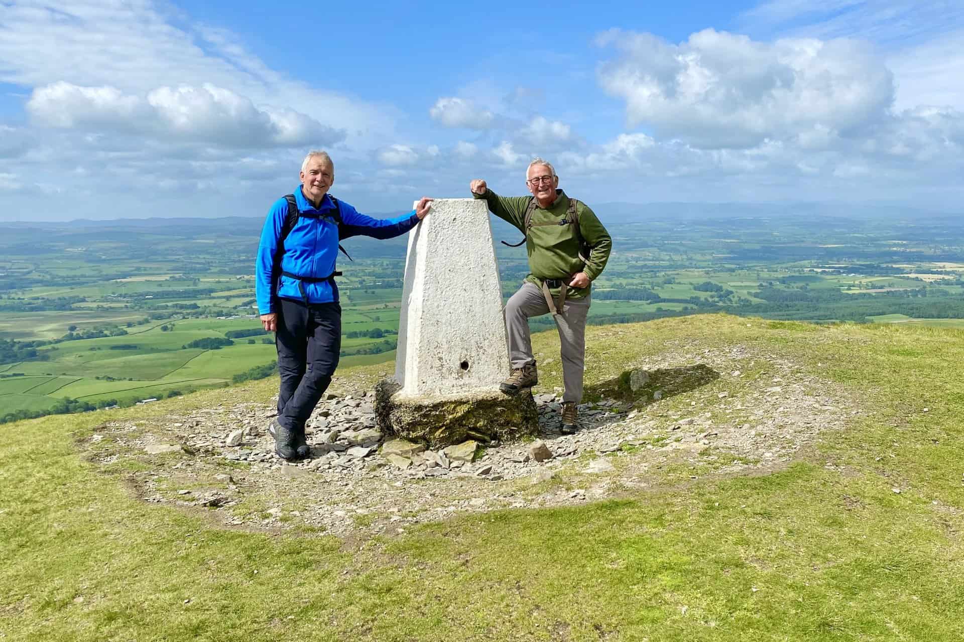
Triangulation pillar on Murton Pike summit, height 594 metres (1949 feet).
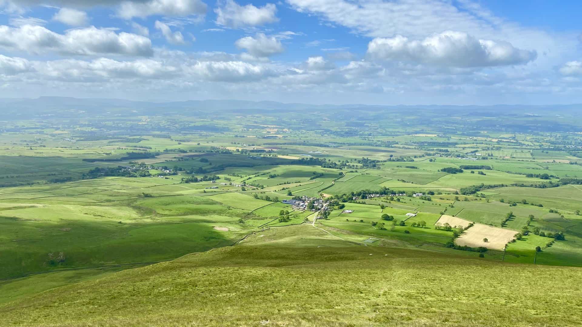
Murton Pike is cone-shaped and from its summit there are excellent 360-degree views of the surrounding landscape.
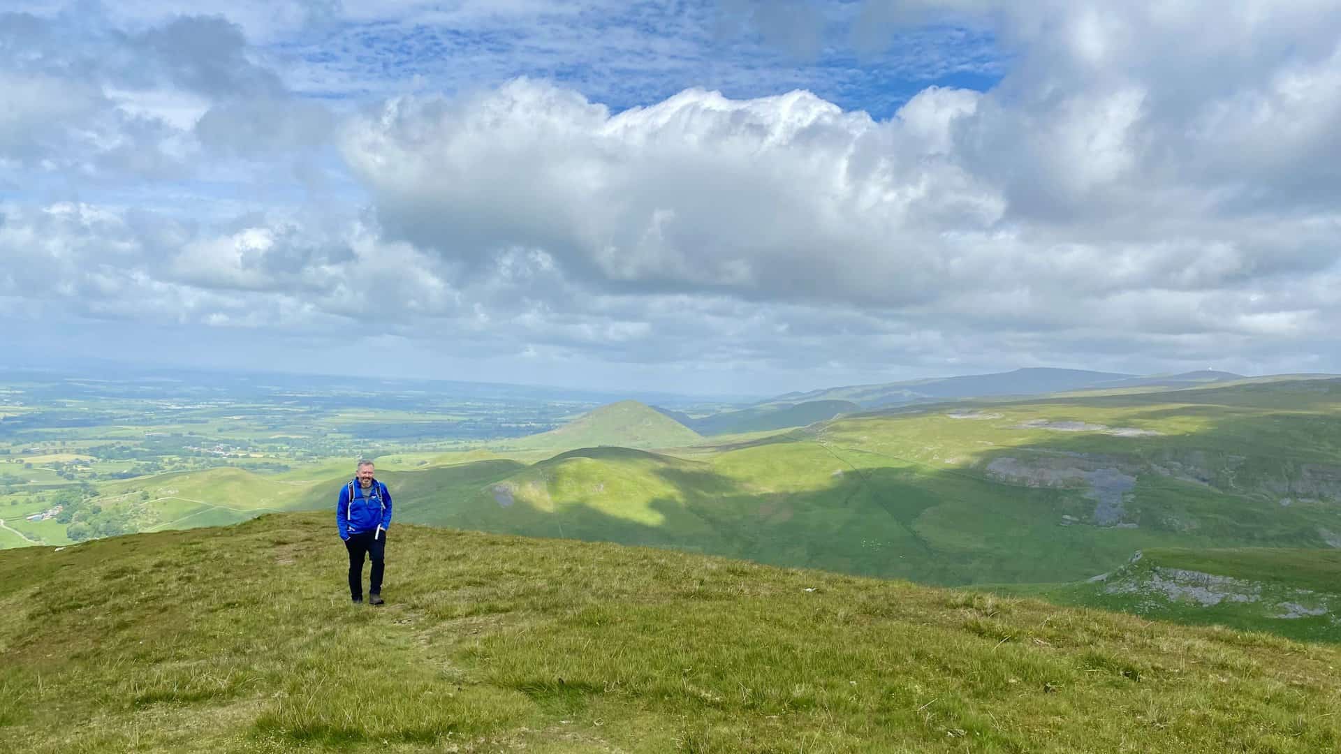
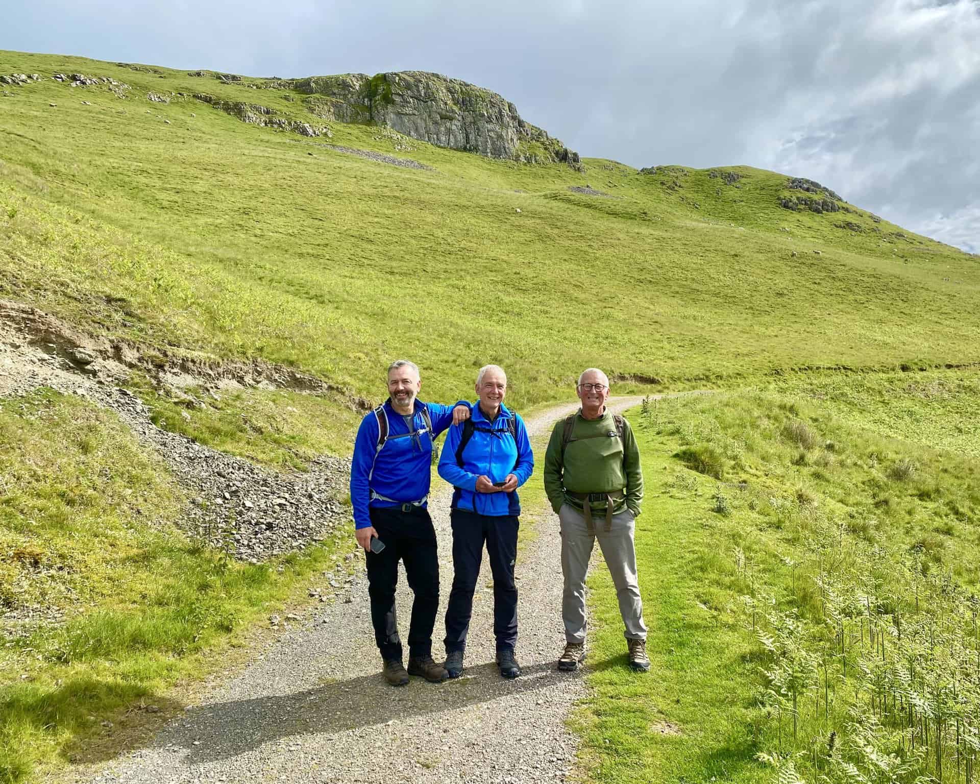
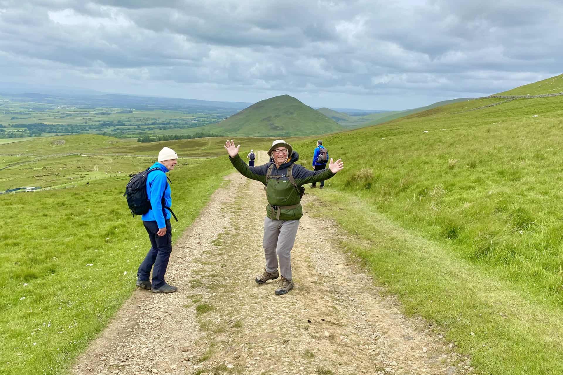
Time for a break on the eastern flanks of Murton Pike.
The view south-east from Murton Pike towards Delfekirk Scar, with Roman Fell in the distance.
Looking back towards Murton Pike from the head of the Trundale Gill valley.
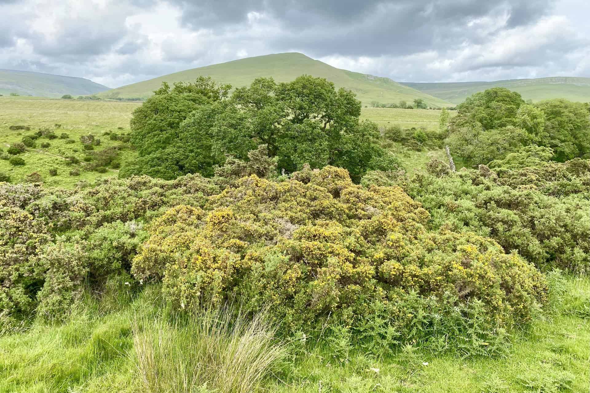
High Cup Gill becomes visible to the west shortly after passing the head of the Trundale Gill valley.
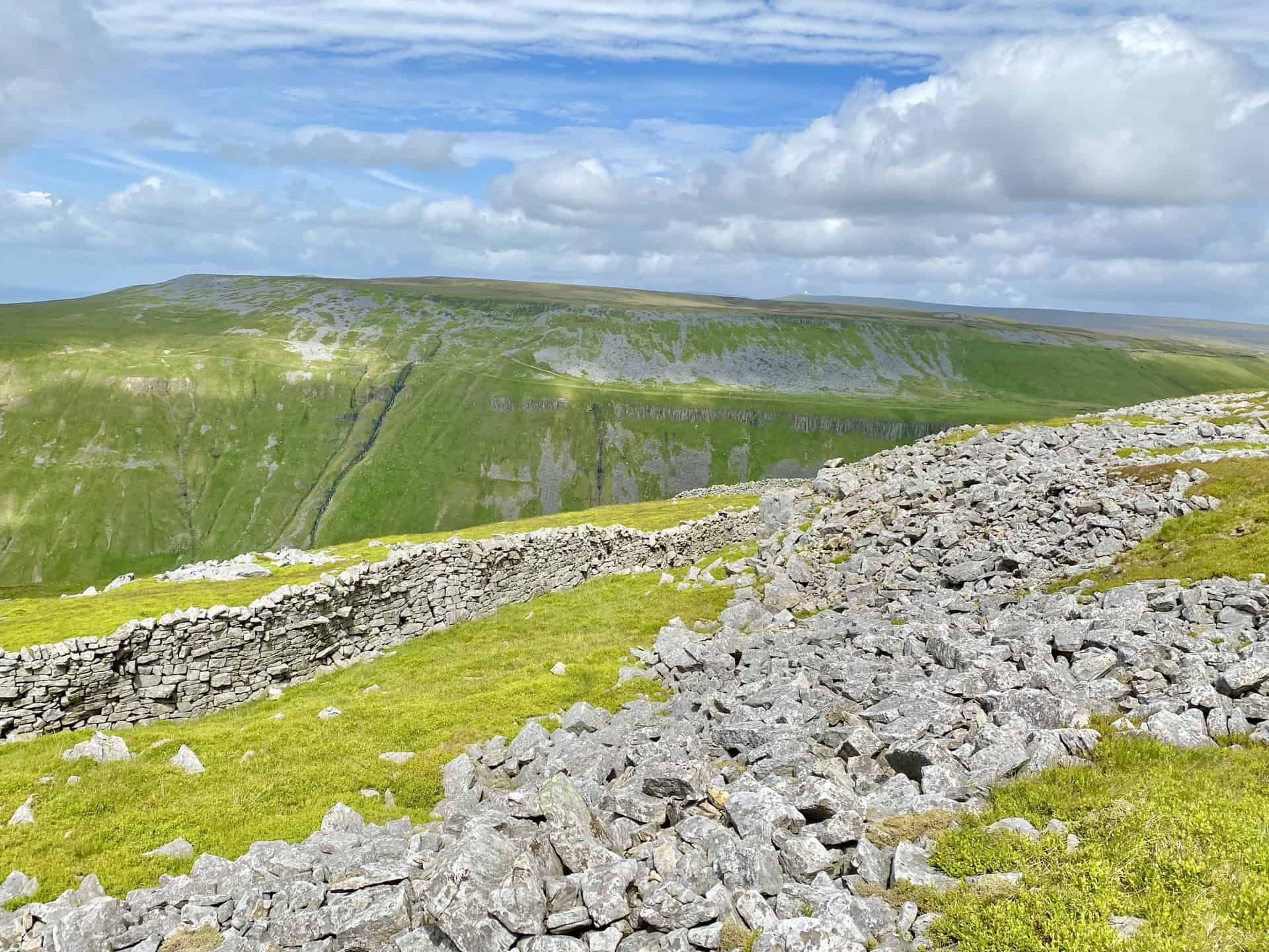
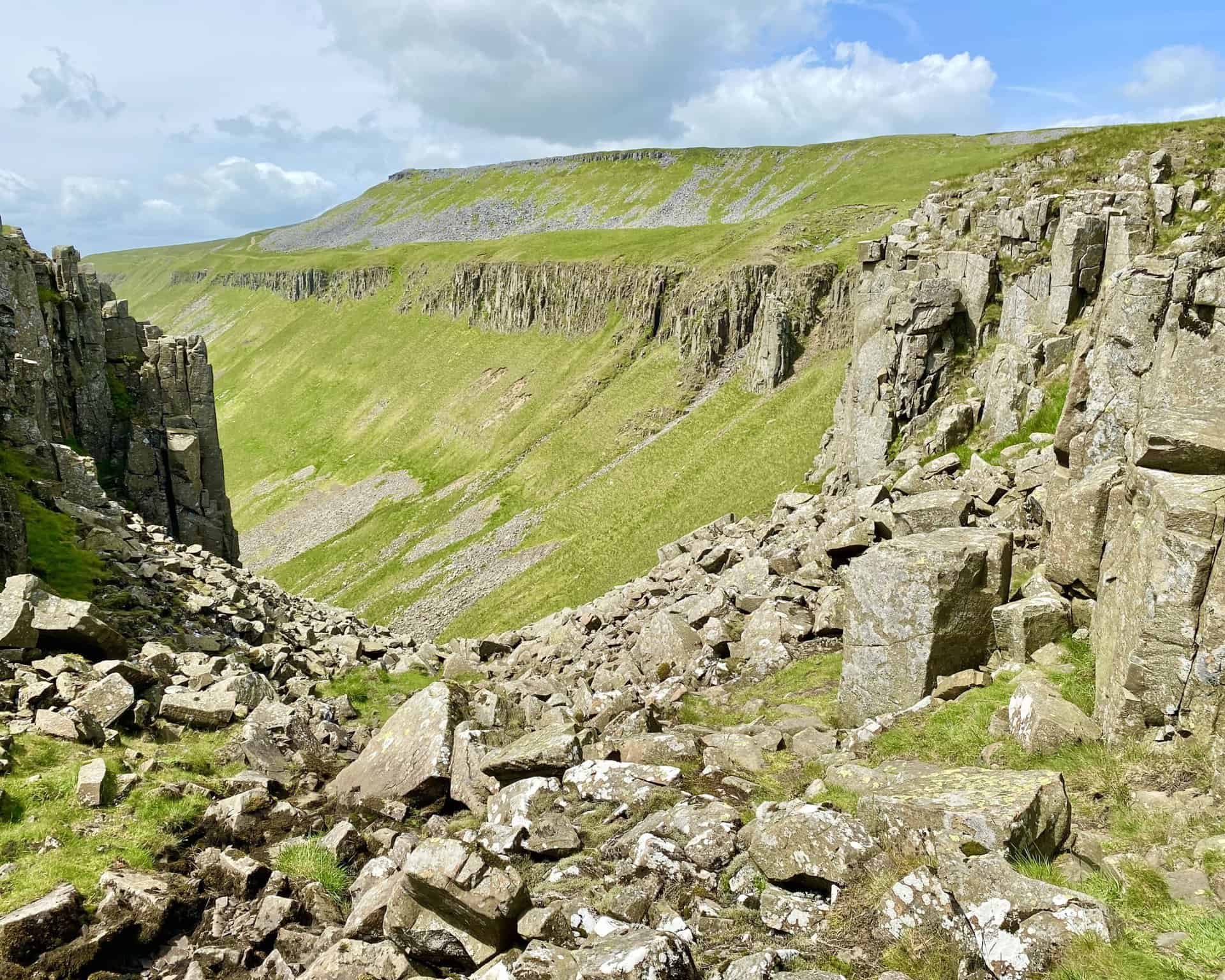
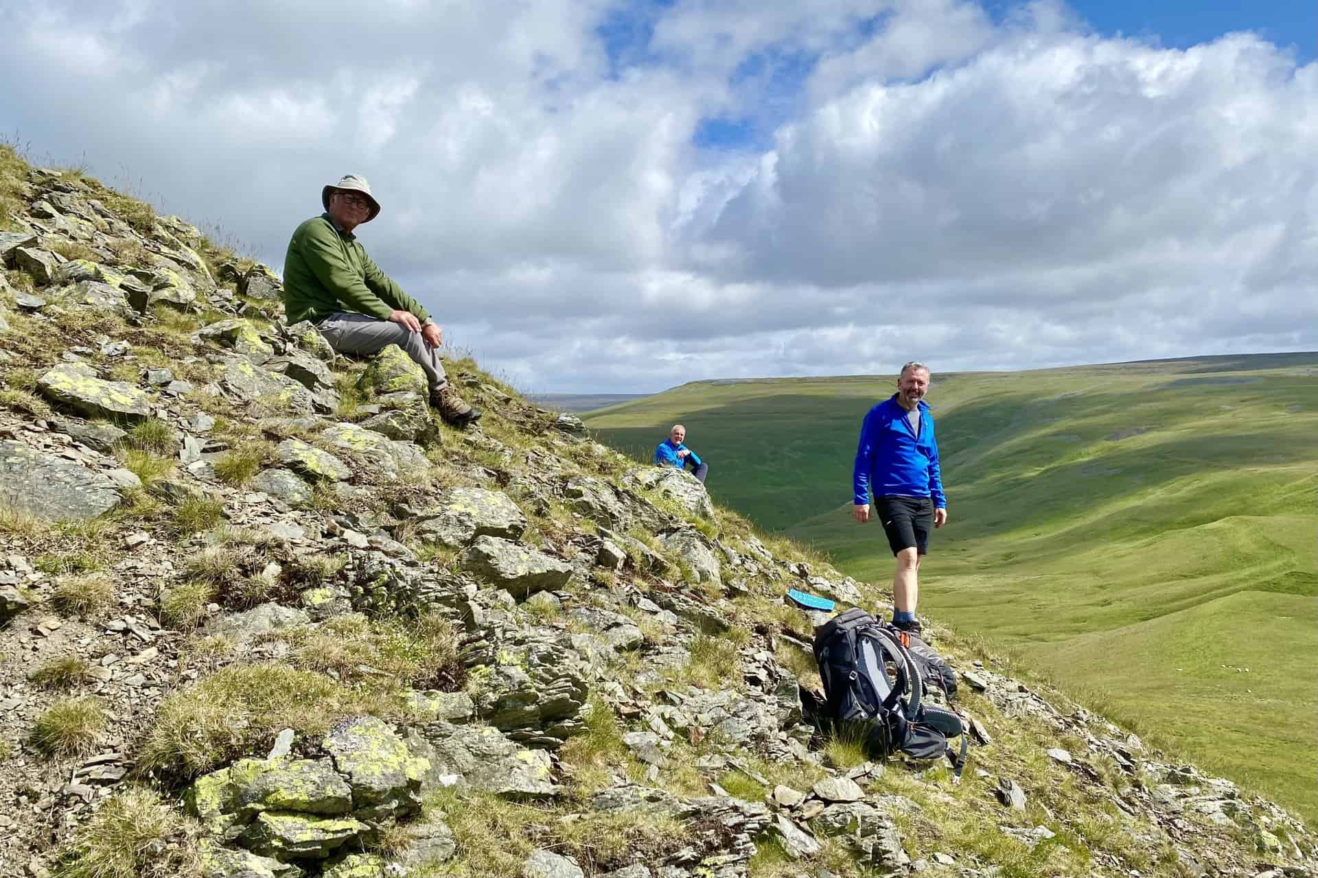
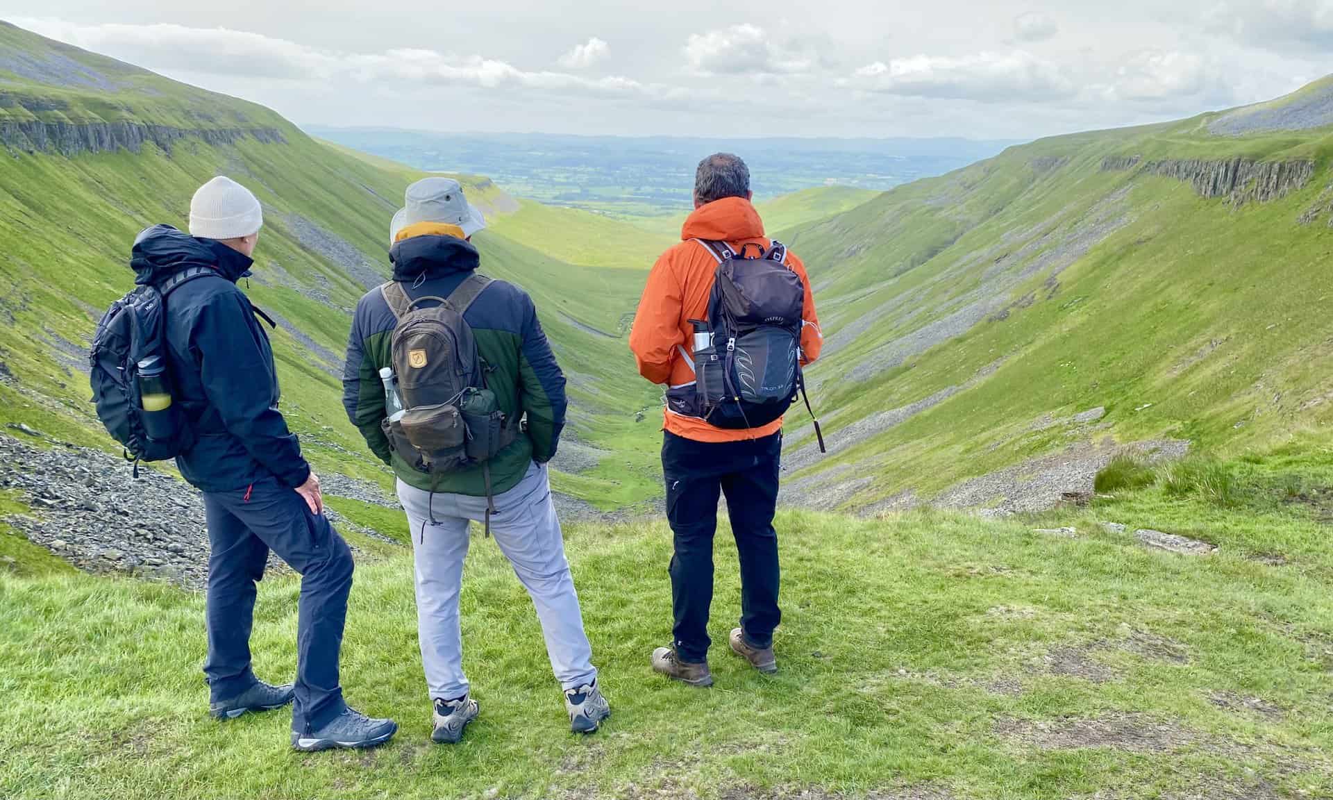
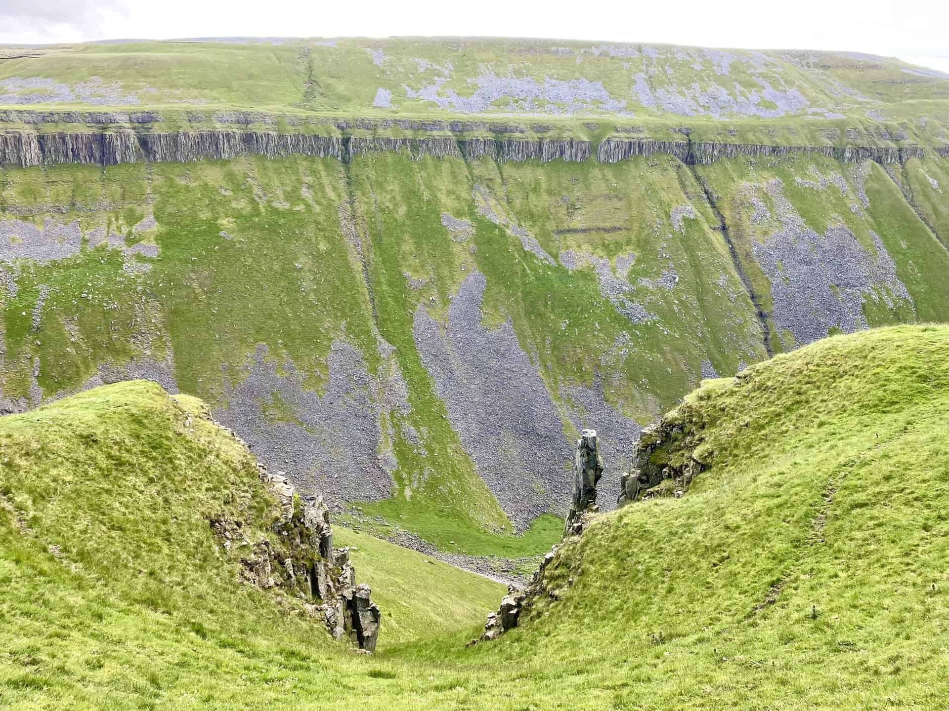
Making our way towards High Cup Nick on the upper of two paths above High Cup Scar, a key section of this High Cup Nick circular walk..
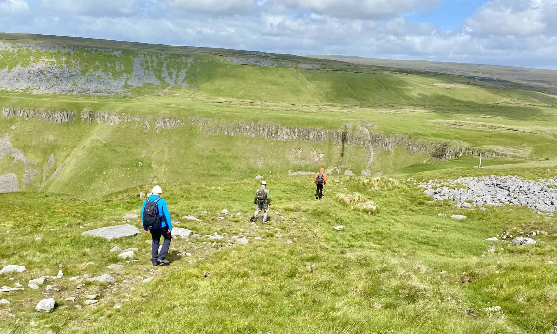
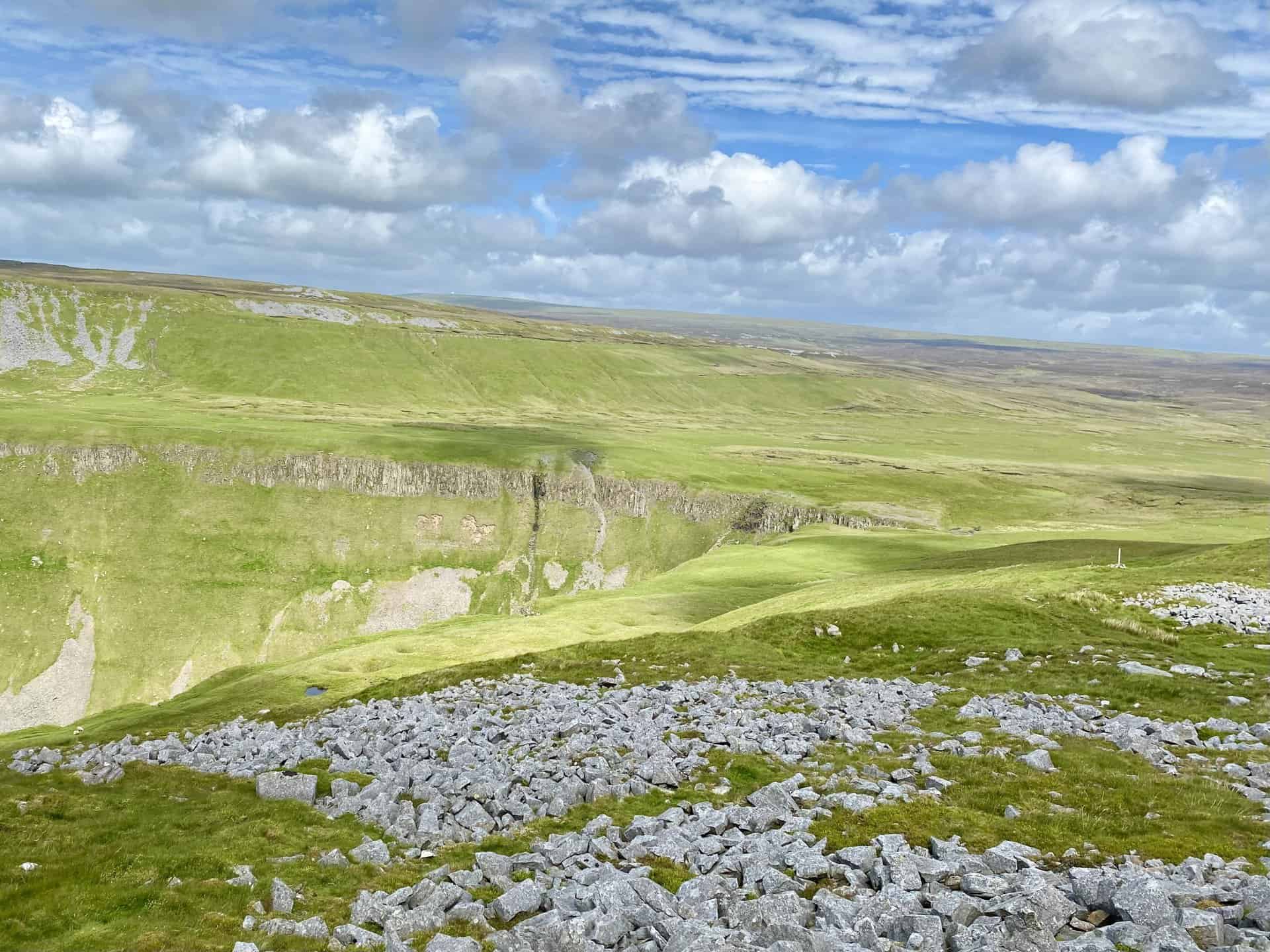
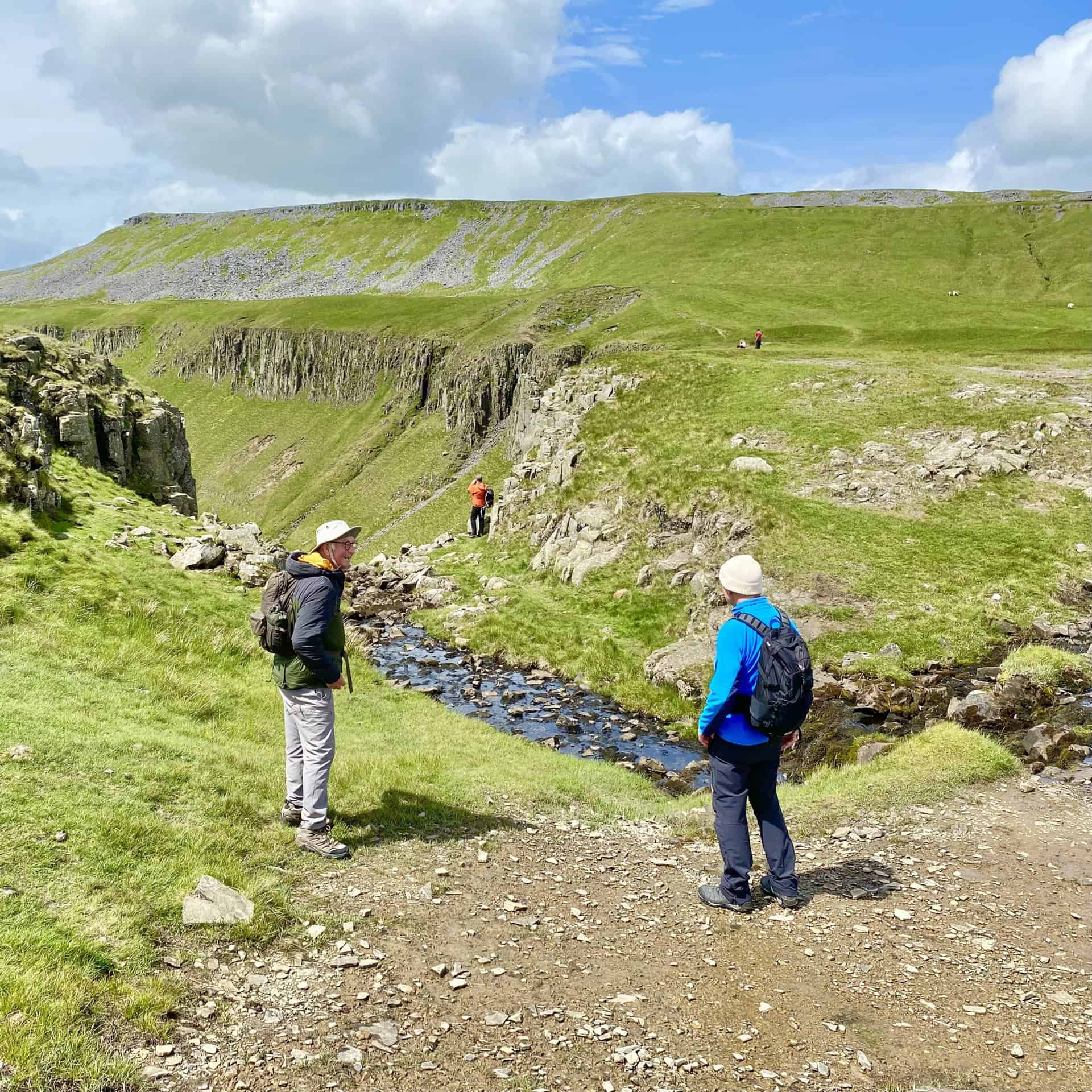
We reach High Cupgill Head where a small stream topples over the rocky crags into the valley below.
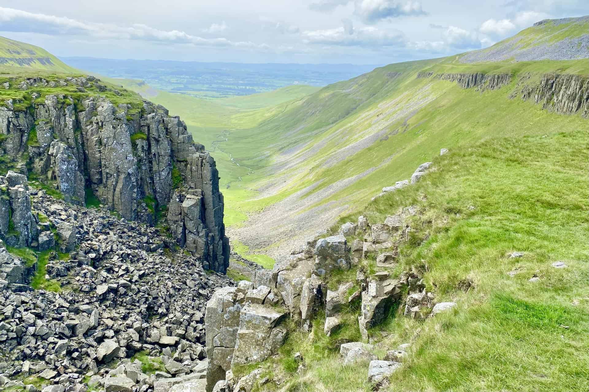
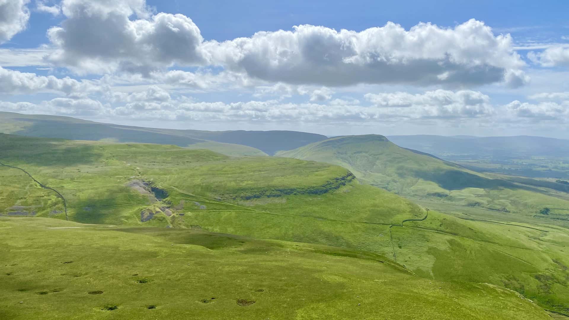
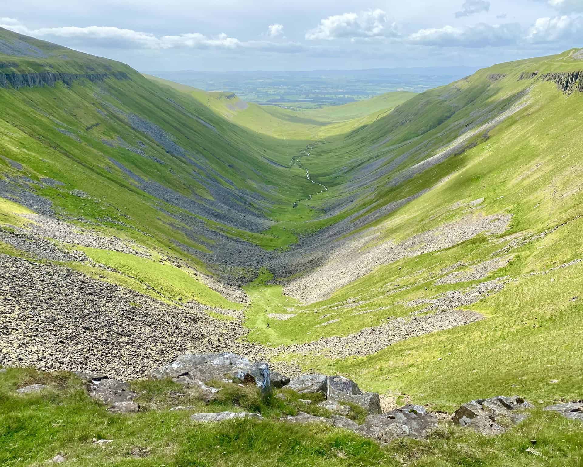
Amazing views from High Cup Nick of the High Cup Gill valley, which is thought to be glacial in origin and almost perfectly U-shaped.
High Cupgill Beck meanders through the valley and joins other streams which flow into the River Eden.
The northern side of the valley near the head is known as Nichol Chair after a local cobbler who, for a bet, practised his craft perched on the rocks.
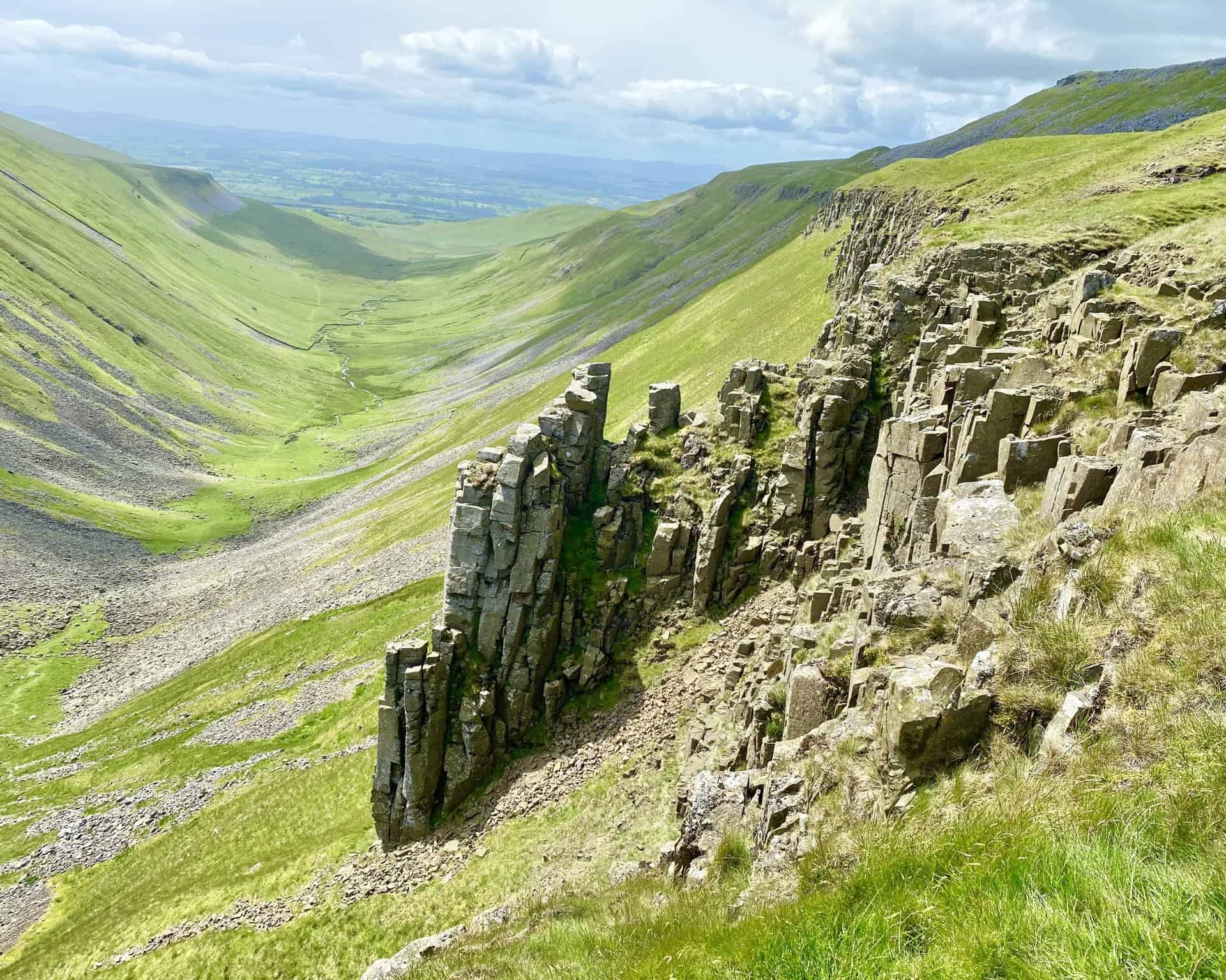
The view from Nicole Chair of the dramatic steep-sided slopes on the southern side of the valley beneath High Cup Scar.
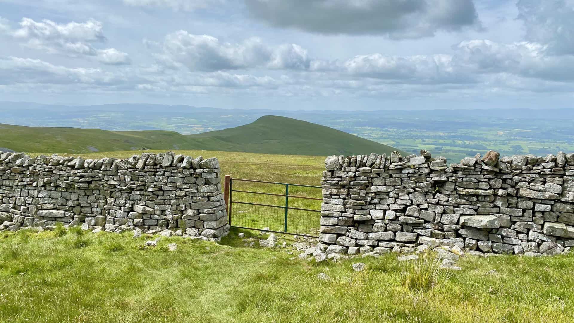
The site of a disused quarry near Peeping Hill, a historical point along the High Cup Nick circular walk.
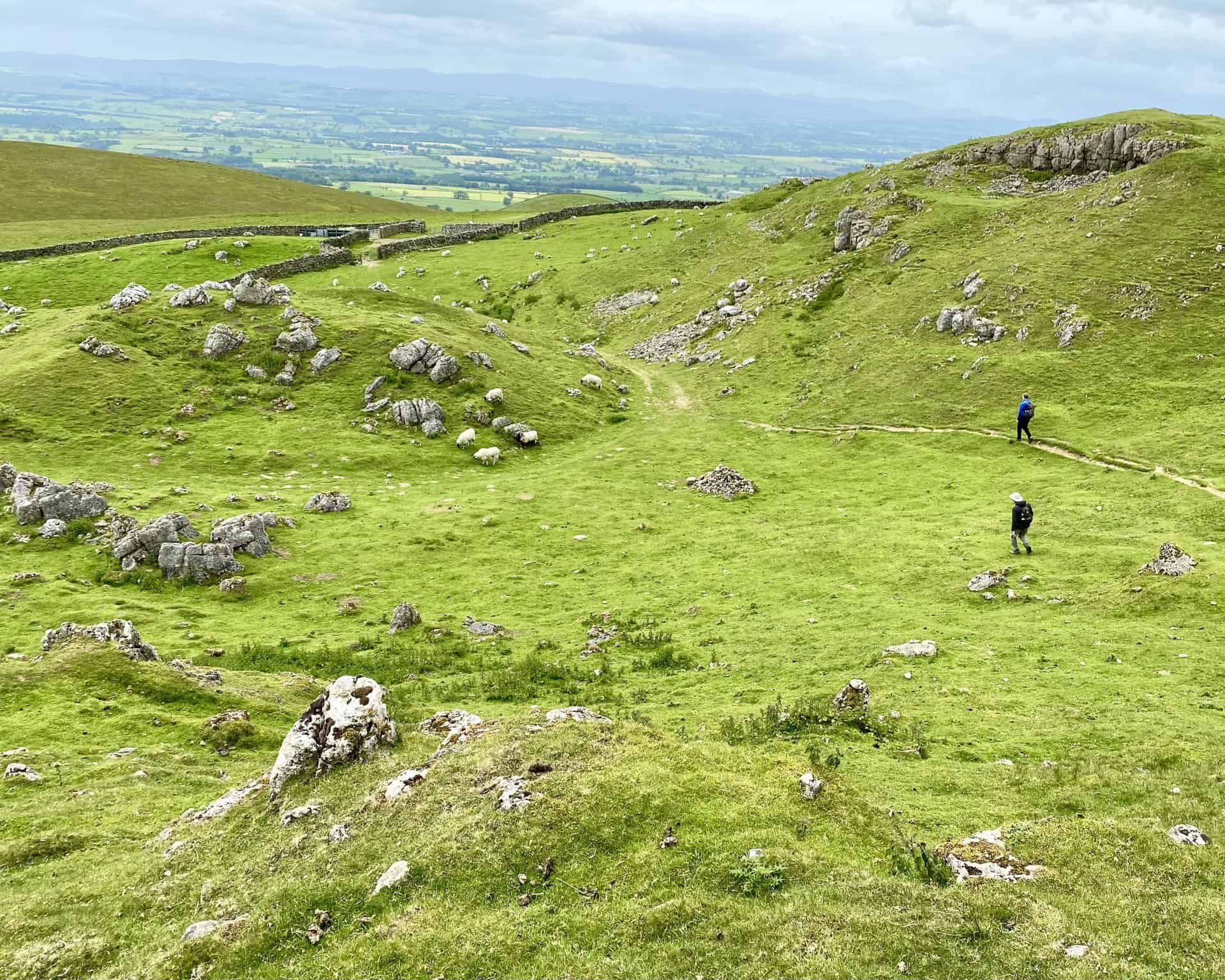
The Pennine Way between Peeping Hill and Dod Hill. The pyramidal Dufton Pike is in the background.
The view from the Pennine Way near Dod Hill south towards Gregory.
The track heading south between the hills of Gregory and Harthwaite towards Keisley Bank.
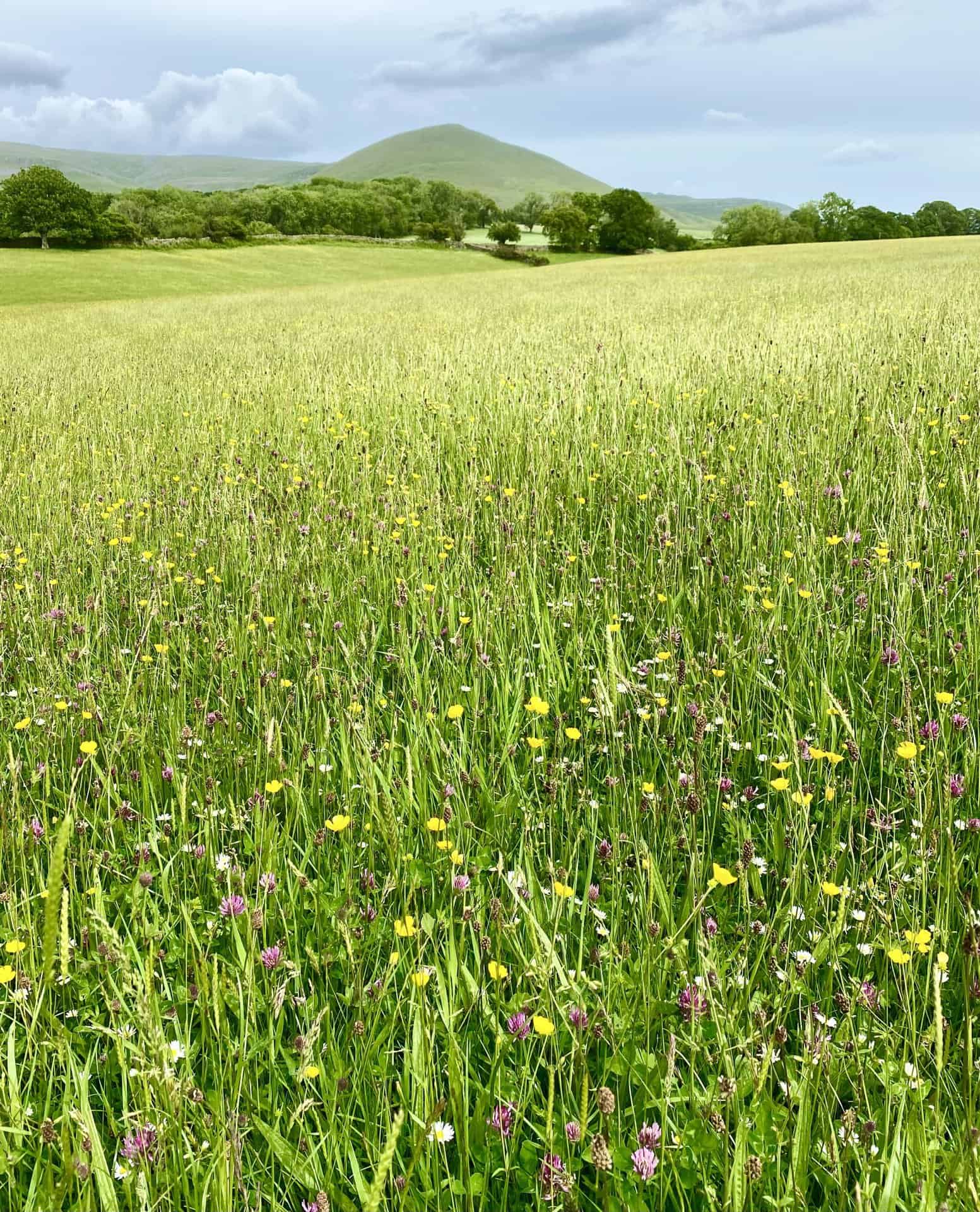
Looking east across beautiful meadowland from Castle Hill towards Murton Pike.
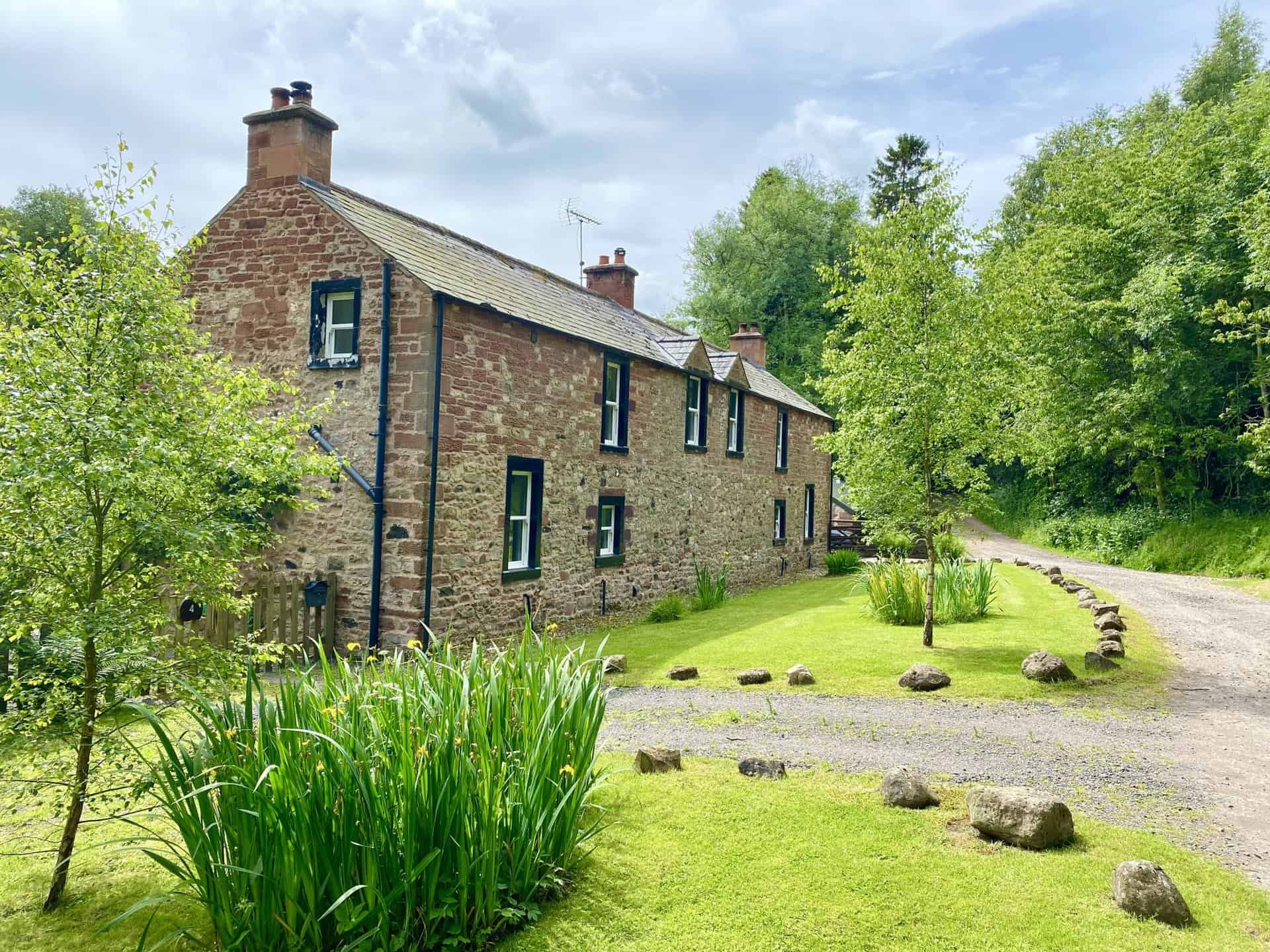
Flakebridge House on the southern edge of Flakebridge Wood.
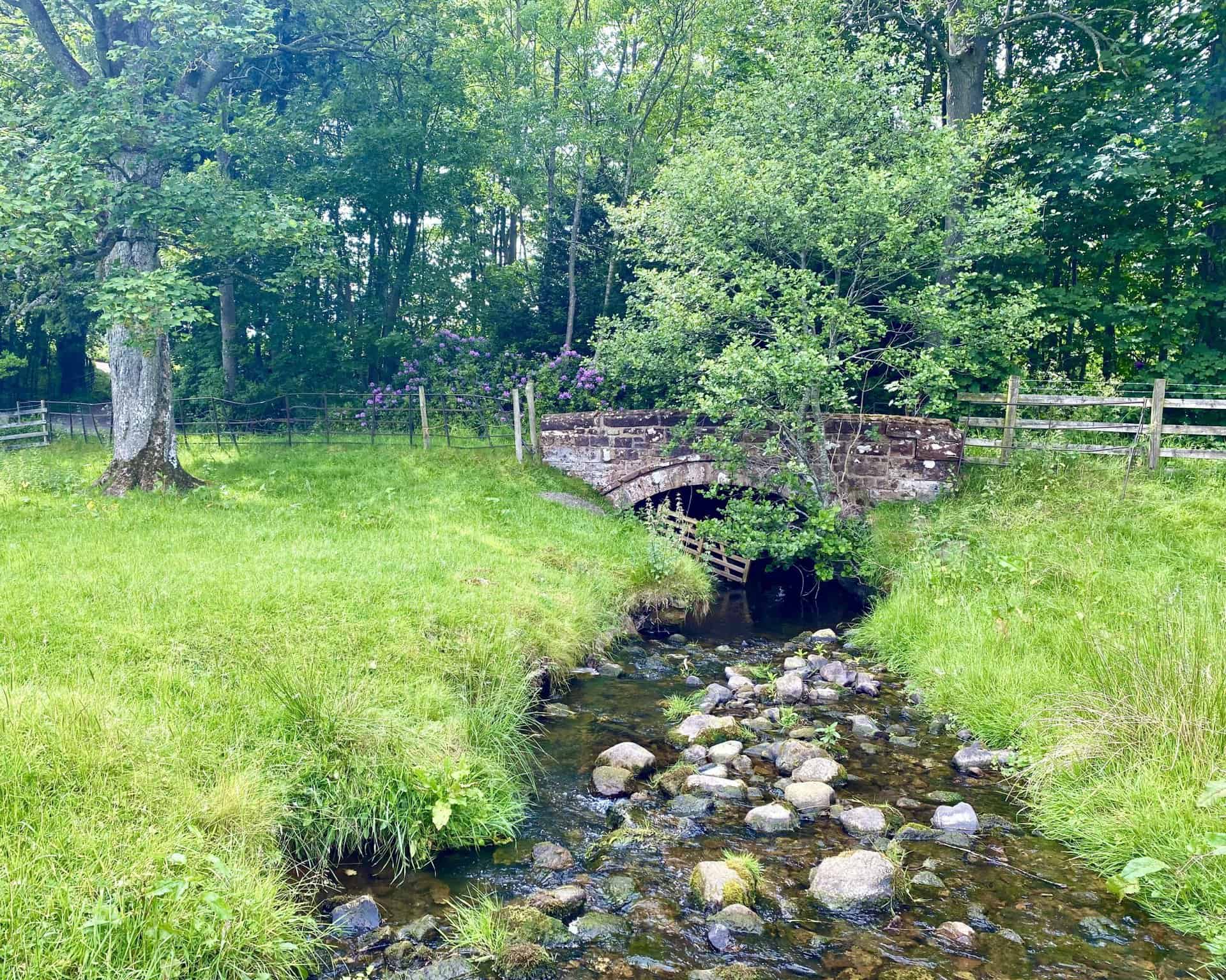
Murton Beck, a tranquil spot near the conclusion of the High Cup Nick circular walk.
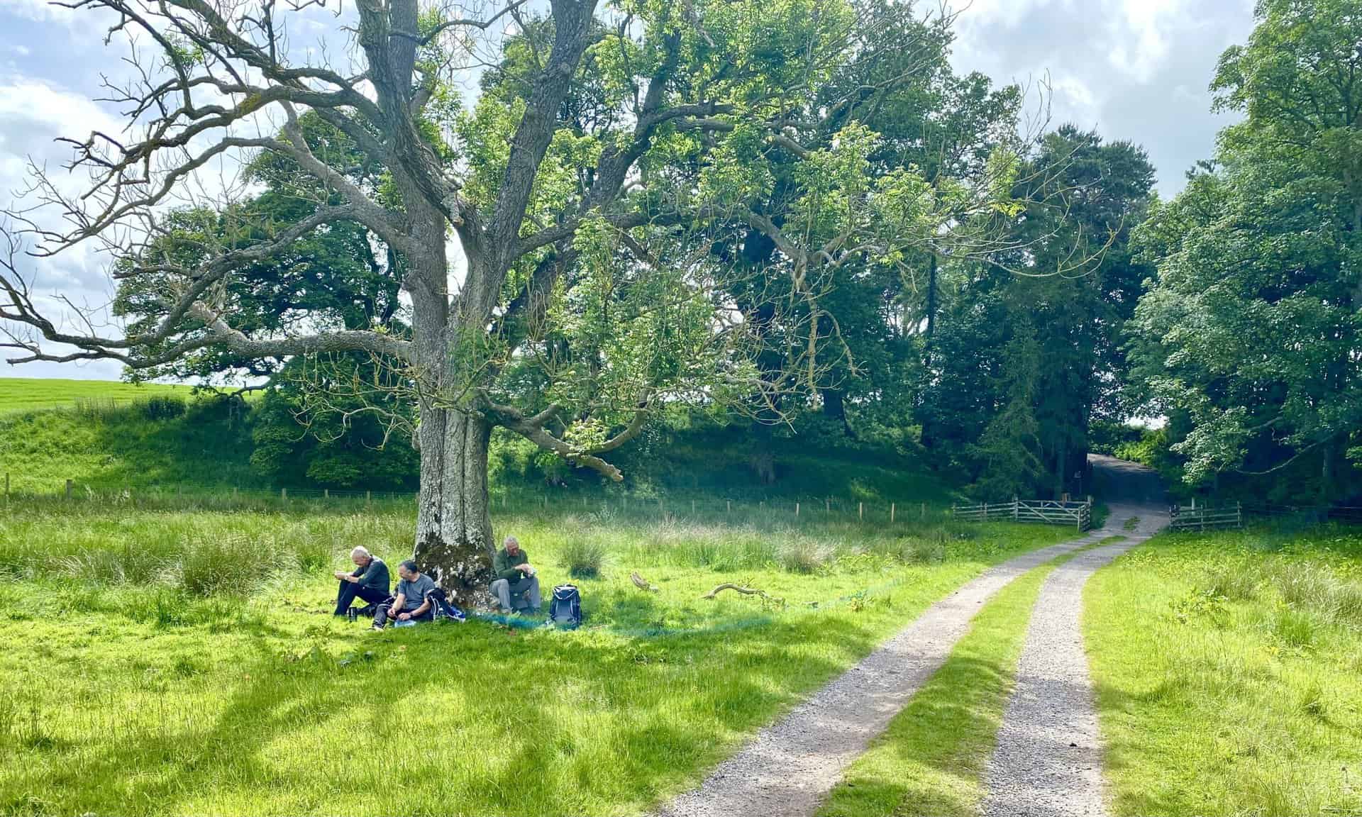
Coffee time beneath an old ash tree near Shepherd’s Cottage.
Murton Pike as seen from the path between Shepherd’s Cottage and Town Foot.
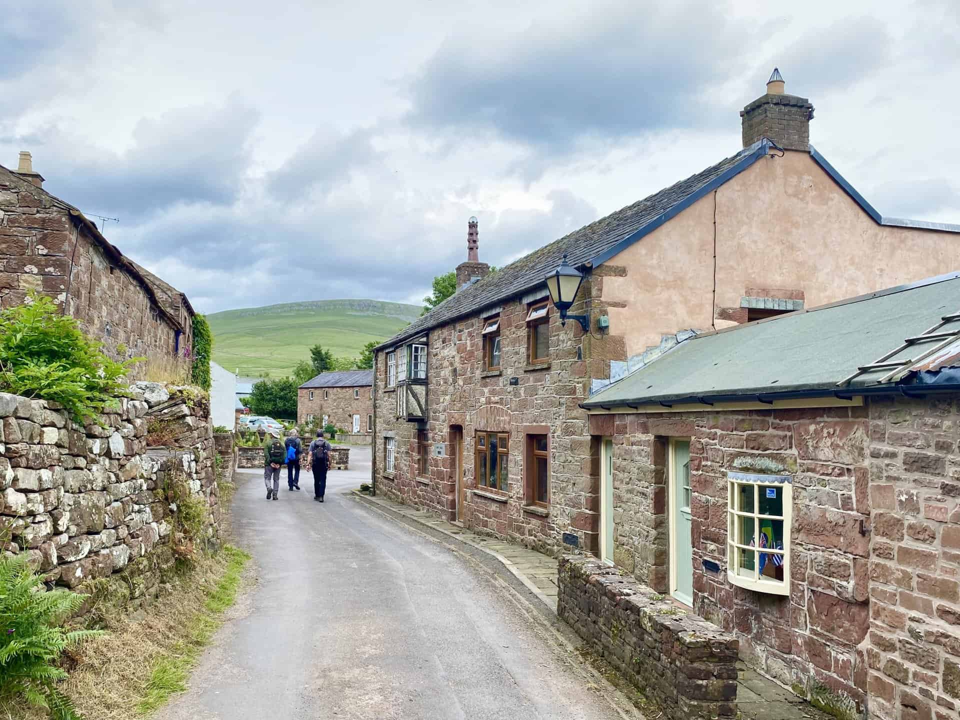
The village of Murton, the starting and ending point of this High Cup Nick circular walk.
Highly Rated Osprey Hiking Backpacks for Outdoor Enthusiasts
Osprey’s reputation for crafting high-quality hiking backpacks is well-established, offering a range of options that cater to both men and women. The following four backpacks stand out for their excellent sales and customer ratings on Amazon, making them a top choice for outdoor enthusiasts seeking reliability and comfort. As an Amazon affiliate, I may earn a small commission from any purchases made through the links provided. This helps support the upkeep of this website. Rest assured, you won’t pay a penny extra, but your purchase will contribute to keeping my site running smoothly. Happy walking!

Osprey Tempest 20 Women’s Hiking Backpack
The Tempest 20 stands out as the ideal solution for day-hiking, biking, or peak-bagging, tailored specifically for women. It features a panel-loading design for ease of access, complemented by an internal zippered mesh pocket with a key clip for secure storage. Unique to this model are the Stow-on-the-Go trekking pole and LidLock bike helmet attachments, enhancing its versatility. Side stretch mesh pockets, along with an easy-access, expandable stretch mesh harness pocket, offer ample storage. Additionally, it includes a blinker light attachment (light not included) and a large stretch mesh front panel pocket for extra carrying capacity.

Osprey Talon 22 Men’s Hiking Backpack
Designed for the active adventurer, the Talon 22 provides an optimal panel-loading design suitable for day-hiking, biking, or peak-bagging. Key features include dual-zippered panel access to the main compartment and a tuck-away ice ax attachment with a bungee tie-off. It boasts a top panel zippered slash pocket for quick access items and lower side compression straps for load management. An external hydration reservoir sleeve and dual-zippered fabric hipbelt pockets enhance hydration and storage, while a large stretch mesh front panel pocket increases its utility for various activities.

Osprey Tempest 30 Women’s Hiking Backpack
The Tempest 30, designed with a women’s-specific fit, is a streamlined top-loader ideal for both extensive day trips and light-and-fast overnight adventures. It includes a fixed top lid with an external zippered slash pocket and an under-lid zippered mesh pocket with a key clip for organised storage. The pack features a tuck-away ice ax attachment with a bungee tie-off, dual upper and lower side compression straps for load adjustment, and an external hydration reservoir sleeve. For added convenience, it offers an easy-access, expandable stretch mesh harness pocket and dual-zippered fabric hip-belt pockets.

Osprey Talon 33 Men’s Hiking Backpack
The Talon 33 is engineered for dynamic movement, making it the perfect streamlined top-loader for committed day trips or light-and-fast overnight excursions. It features top load access to the main compartment for easy packing and retrieval. The backpack is equipped with a large stretch mesh front panel pocket, Stow-on-the-Go trekking pole attachment, and stretch mesh side pockets for versatile storage options. Additionally, an easy-access, expandable stretch mesh harness pocket and dual-zippered fabric hip-belt pockets offer convenient storage solutions for essential gear.