Navigate the Best Walks in the Yorkshire Dales with This Comprehensive Guide
Discover the 23 best walks in the Yorkshire Dales, a breathtaking region boasting a wealth of natural beauty and historical landmarks. Embark on captivating circular trails spanning 7 to 11 miles in length, taking you approximately 3 to 5 hours to complete. These walks encompass the picturesque Yorkshire Dales regions of Swaledale, Wensleydale, Wharfedale, and more.
Meander through charming villages such as Bainbridge, Buckden, Hubberholme, Muker, Reeth, West Burton, Langthwaite, Gunnerside, and Grassington. Marvel at cascading waterfalls like Aysgarth Falls, Catrigg Force, Stainforth Force, The Strid, and Janet’s Foss. Additionally, you’ll encounter serene bodies of water, including Semer Water, Embsay Reservoir, Malham Tarn, Whernside Tarns, and Upper Barden Reservoir.
Delight in the rich history of the Yorkshire Dales with stops at Bolton Castle, Ribblehead Viaduct, Arten Gill Viaduct, and Dent Head Viaduct. Explore historic industrial landmarks such as Crackpot Hall, Old Gang Smelting Mills, and Swinner Gill Lead Mines. Challenge yourself with climbs up Ingleborough, Whernside, Great Knoutberry Hill, and Simon’s Seat.
Immerse yourself in the stunning scenery of Leyburn Shawl, Fremington Edge, Ingleborough National Nature Reserve, and Barden Moor. Gaze at geological wonders like Kilnsey Crag, Attermire Scar, Malham Cove, Trollers Gill, and Gordale Scar. Lastly, enjoy peaceful walks alongside the River Ribble, River Swale, River Ure, and River Wharfe.
Each walk in my guide provides route directions, a few photos captured during the walk, and recommendations for which Ordnance Survey Maps to use, as well as purchase options. Additionally, all 23 walks have links to both the OS Maps website and the Outdooractive website, allowing you to view the routes in greater detail. Benefit from features such as printing the route, downloading it to your device, exporting it as a GPX file, watching a 3D fly-over, and sharing your adventure on social media.
Embark on the best walks in the Yorkshire Dales and create unforgettable memories in this enchanting region. With an abundance of picturesque trails, breathtaking viewpoints, and charming villages, the Yorkshire Dales is a true walker’s paradise. Read on to discover my carefully curated selection of 23 awe-inspiring walks that will take you through lush valleys, dramatic moorlands, and along meandering rivers.
23 Best Walks in the Yorkshire Dales: Summary of the Walks
| Number | Walk Name | Distance | Duration | Total Ascent |
|---|---|---|---|---|
| 1 | Fremington Edge Walk | 9 Miles | 4½ Hours | 1530 Feet |
| 2 | Crackpot Hall Walk | 9 Miles | 4¾ Hours | 1862 Feet |
| 3 | Yockenthwaite Walk | 7 Miles | 3¼ Hours | 731 Feet |
| 4 | Aysgarth Falls Walk | 8 Miles | 3¾ Hours | 947 Feet |
| 5 | Semer Water Walk | 9 Miles | 4½ Hours | 1507 Feet |
| 6 | Bolton Abbey Walk | 9 Miles | 4¼ Hours | 1491 Feet |
| 7 | Trollers Gill Walk | 8 Miles | 4 Hours | 1124 Feet |
| 8 | Malham Cove Walk | 9 Miles | 4¼ Hours | 1057 Feet |
| 9 | Ingleborough Walk | 10 Miles | 5 Hours | 2156 Feet |
| 10 | Stainforth Force Walk | 8 Miles | 4 Hours | 1277 Feet |
| 11 | Settle Walk | 9 Miles | 4¼ Hours | 1260 Feet |
| 12 | Grassington Walk | 10 Miles | 4¾ Hours | 1311 Feet |
| 13 | Whernside Walk | 10 Miles | 5 Hours | 1853 Feet |
| 14 | Barden Moor Walk | 10 Miles | 5 Hours | 1641 Feet |
| 15 | Dent Head Viaduct Walk | 11 Miles | 5½ Hours | 2008 Feet |
| 16 | Ingleborough Reserve Walk | 11 Miles | 5½ Hours | 1956 Feet |
| 17 | Catrigg Force Walk | 11 Miles | 5½ Hours | 1932 Feet |
| 18 | West Burton Waterfall Walk | 10 Miles | 4¾ Hours | 1645 Feet |
| 19 | Leyburn Shawl Walk | 10 Miles | 4½ Hours | 881 Feet |
| 20 | Wensleydale Walk | 10 Miles | 4½ Hours | 1202 Feet |
| 21 | Gunnerside Walk | 9 Miles | 4½ Hours | 1722 Feet |
| 22 | Swaledale Walk | 10 Miles | 4½ Hours | 1385 Feet |
| 23 | Langthwaite Walk | 10 Miles | 4¾ Hours | 1624 Feet |
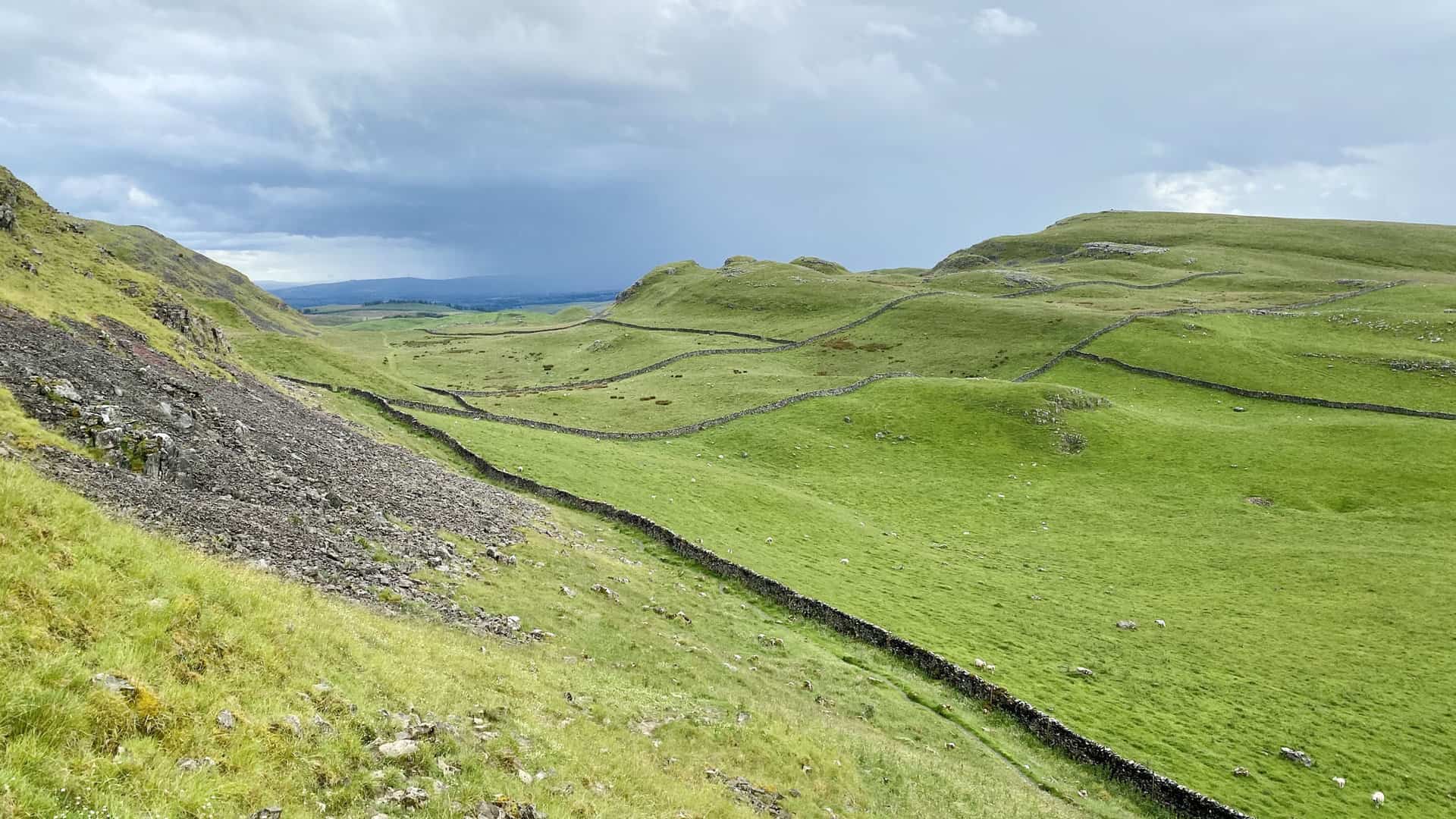
1. Fremington Edge Walk: A Picturesque Route through Arkengarthdale
Distance: 9 Miles | Duration: 4½ Hours | Total Ascent: 1530 Feet
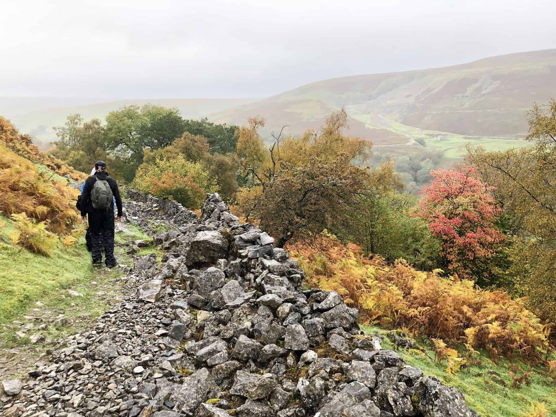
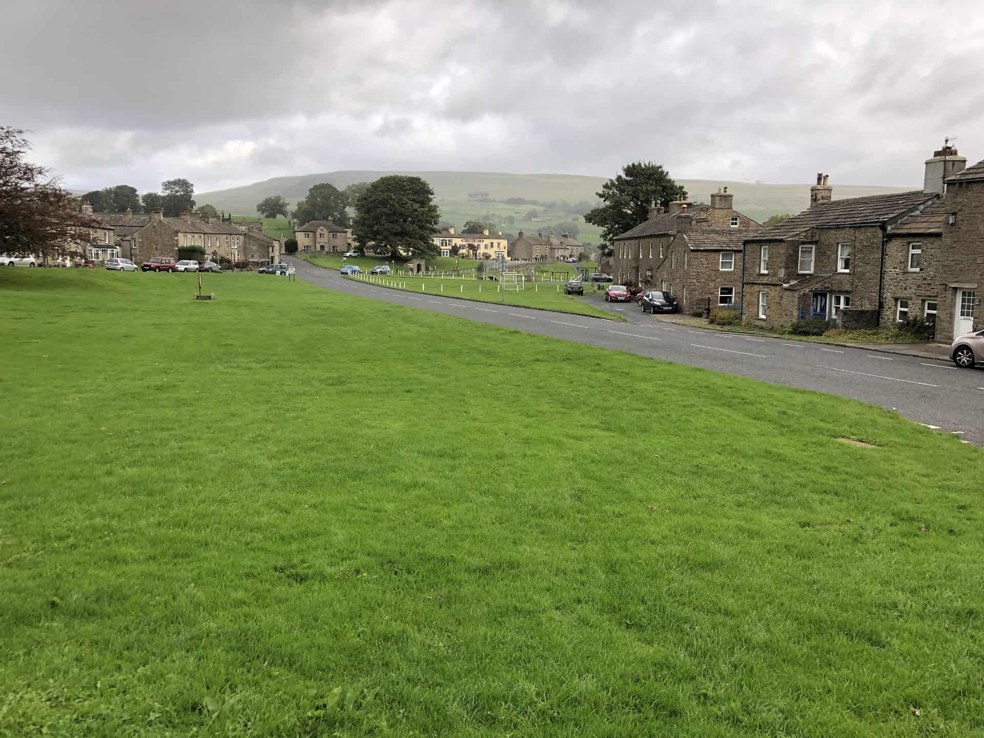
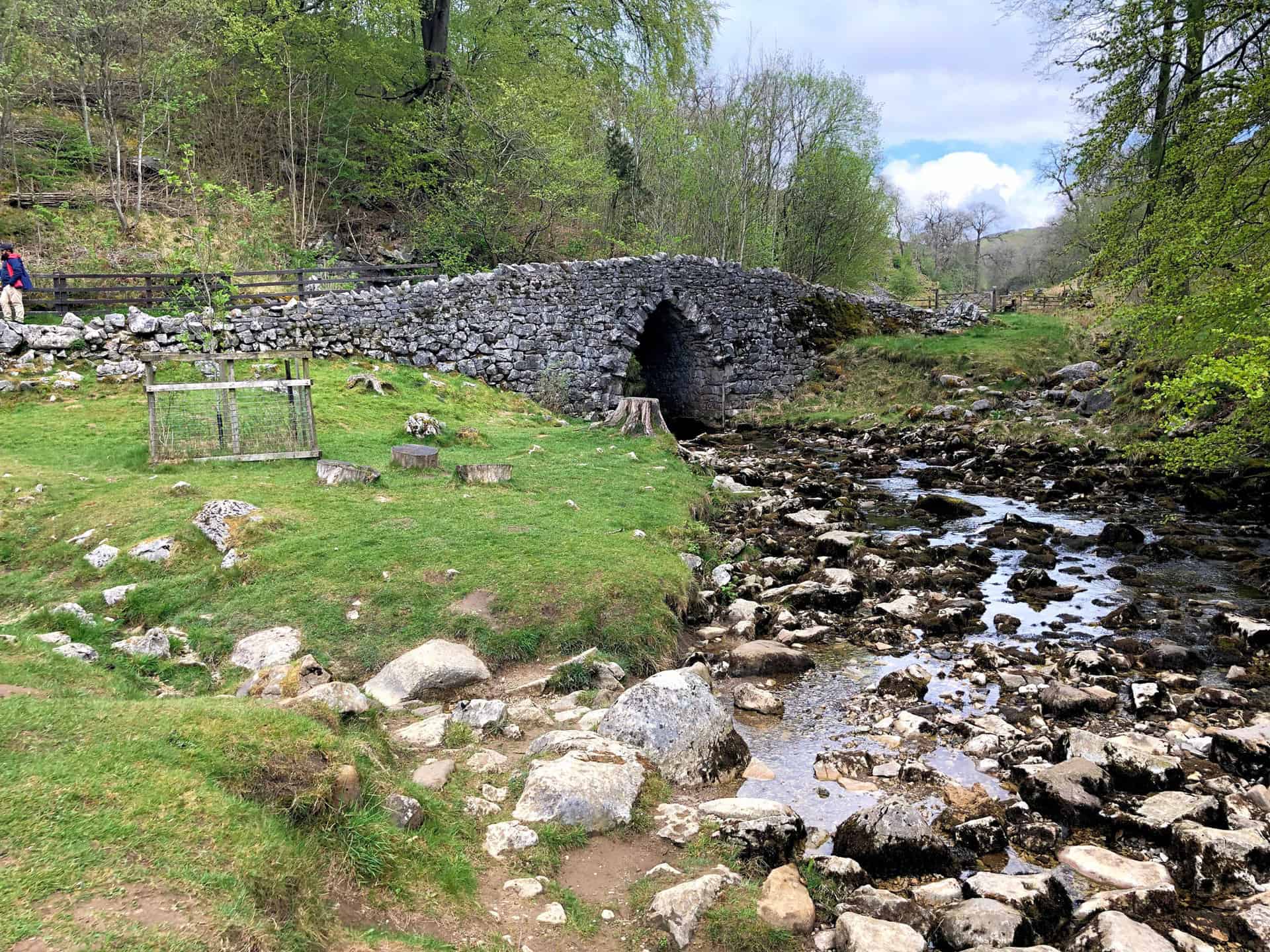
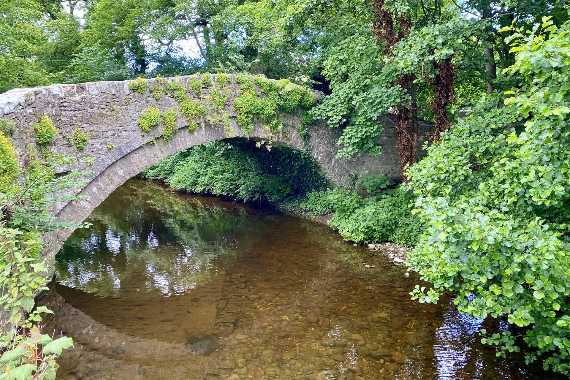
Begin your Yorkshire Dales walk in the charming village of Reeth, setting off eastwards across Reeth Bridge towards High Fremington. From there, head north into Intake Wood, followed by a challenging ascent to the top of Fremington Edge. As you traverse the top of Fremington Edge in a north-westerly direction for approximately two miles, you’ll be rewarded with spectacular views of the surrounding countryside.
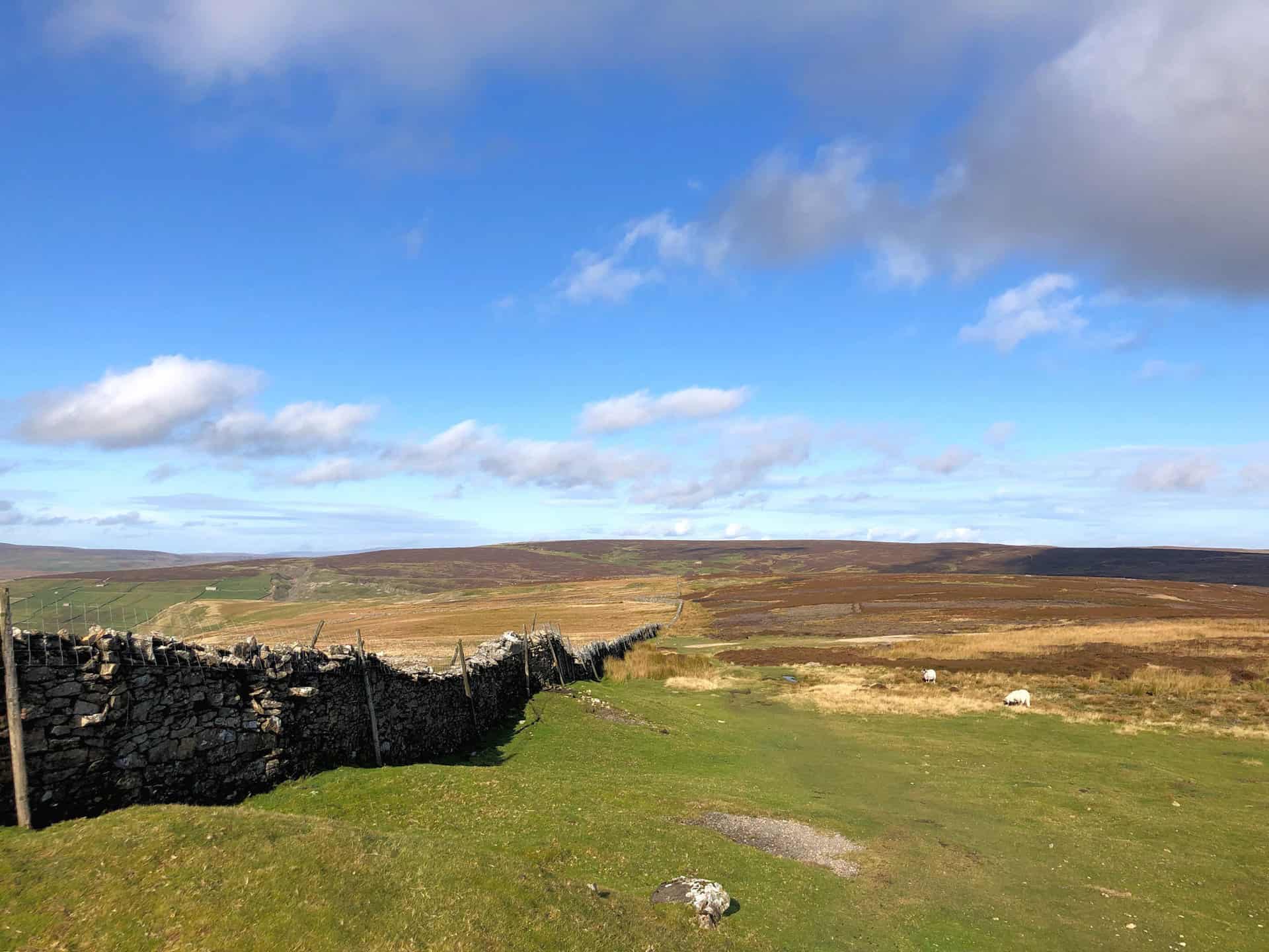
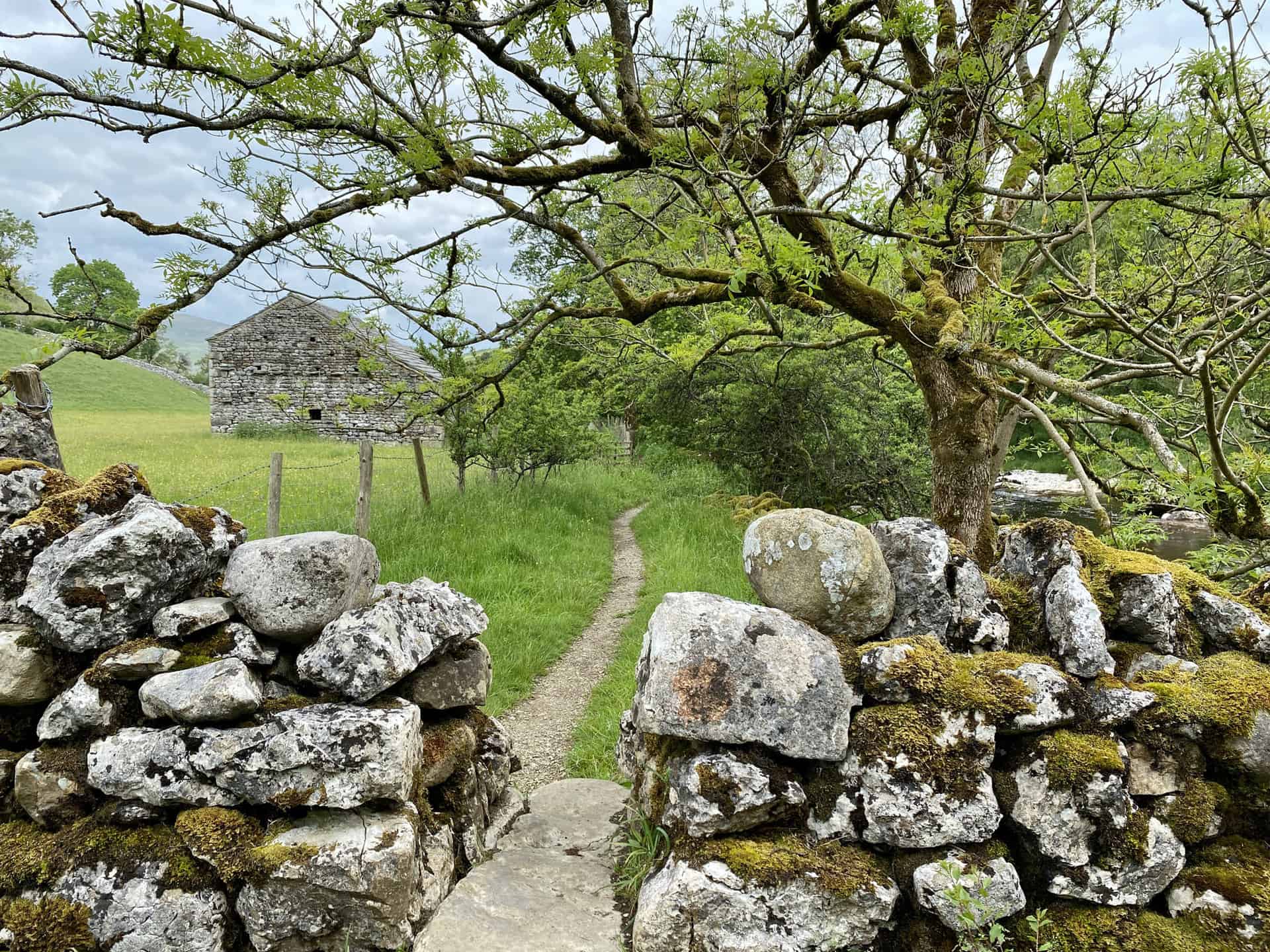
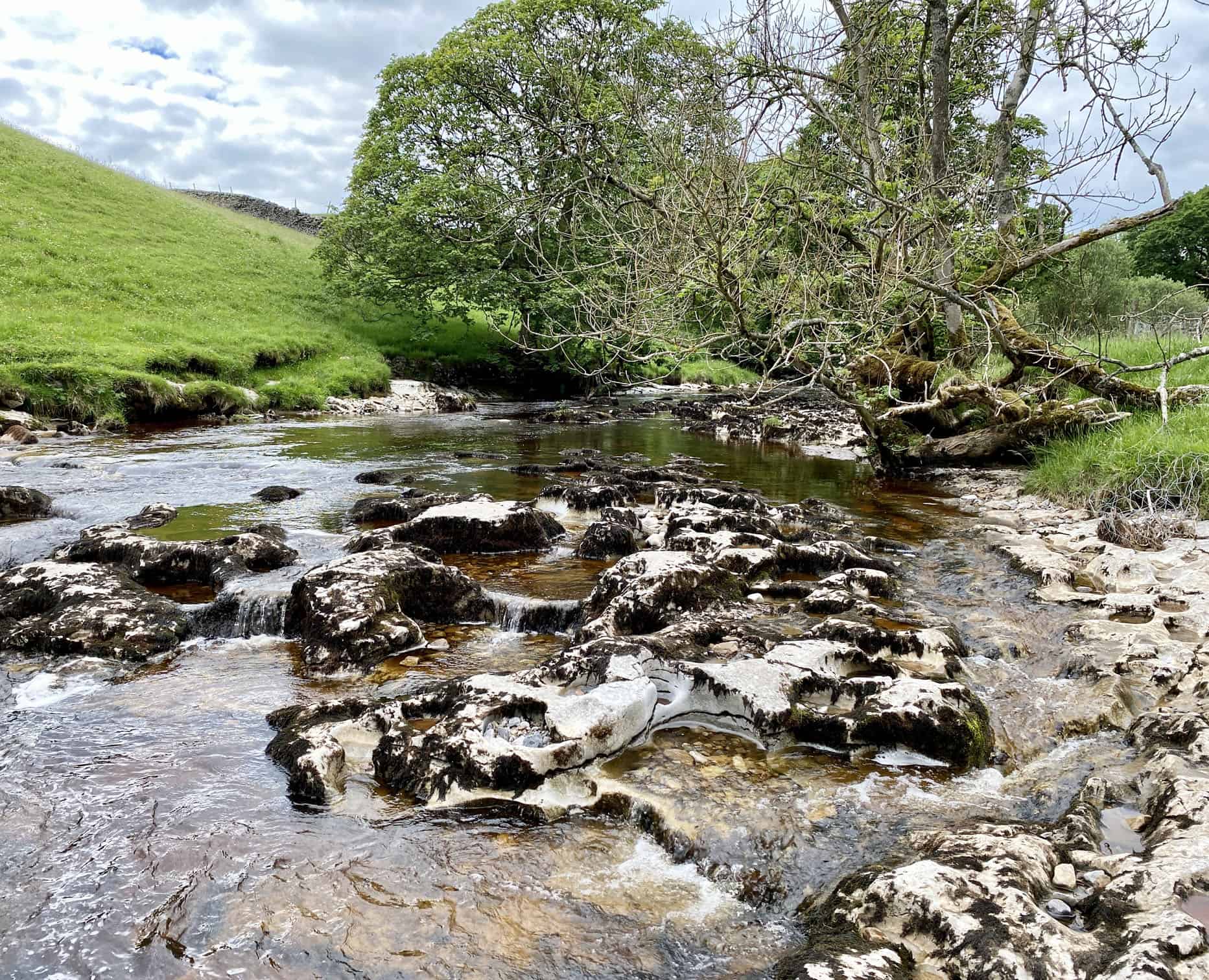
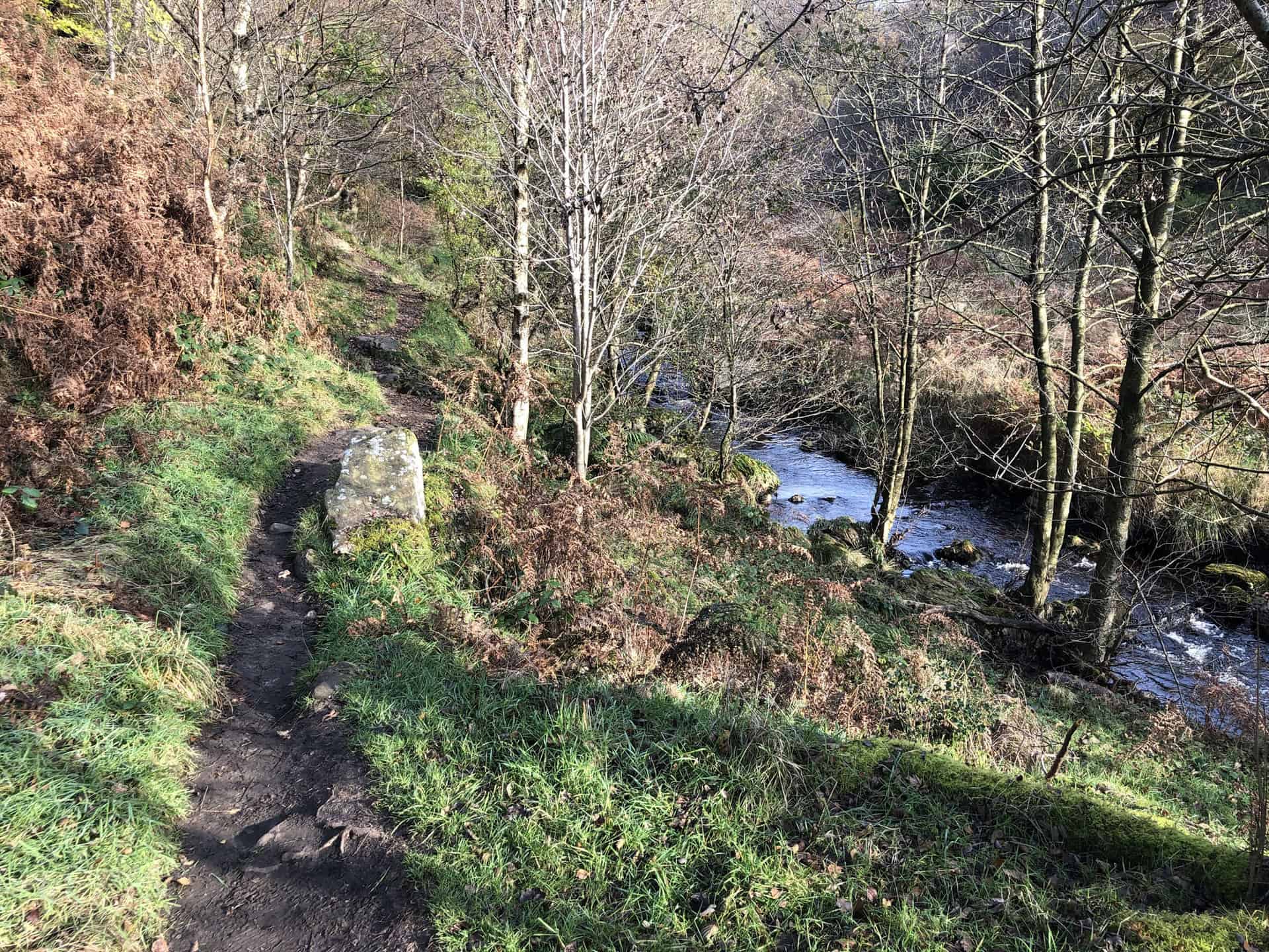
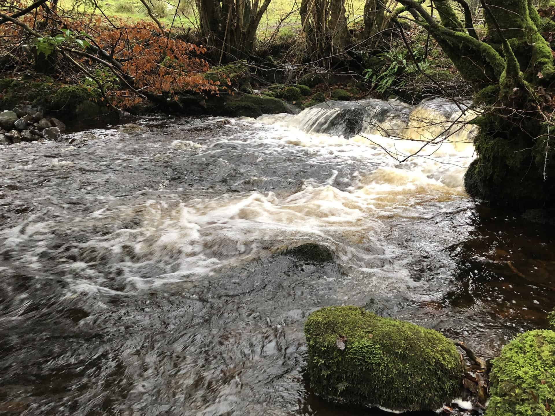
Upon reaching Fell End, explore the remnants of disused lead mines, then descend into a quaint valley near Storthwaite Hall. Continue west through the hamlet of Booze, nestled beneath Scotty Hill, and arrive at the picturesque village of Langthwaite. Here, make a U-turn and follow a well-trodden track alongside the lovely Arkle Beck, a key feature of this Yorkshire Dales walk.
The remainder of your walk takes a south-easterly route through enchanting woodland and vibrant meadows, encompassing the essence of the stunning Arkengarthdale valley. The path faithfully tracks the course of Arkle Beck, guiding you back to your starting point in Reeth. Throughout this 9-mile adventure, expect a total ascent of 1530 feet and an estimated duration of 4½ hours, making it an unforgettable day out in the Yorkshire Dales.
Fremington Edge Walk Route
Visit either the OS Maps website or the Outdooractive website to view this walking route in greater detail. Both platforms offer a range of features, including the ability to print the route, download it to your device, and export the route as a GPX file. You can also watch a 3D fly-over and share the route on social media.
Recommended Ordnance Survey Map
The best map to use on this walk is the Ordnance Survey map of the Yorkshire Dales Northern & Central Area, reference OS Explorer OL30, scale 1:25,000. It clearly displays footpaths, rights of way, open access land and vegetation on the ground, making it ideal for walking, running and hiking. The map can be purchased from Amazon in either a standard, paper version or a weatherproof, laminated version, as shown below.
Standard Version
2. Crackpot Hall Walk: Explore Muker, Kisdon Force, and Keld
Distance: 9 Miles | Duration: 4¾ Hours | Total Ascent: 1862 Feet
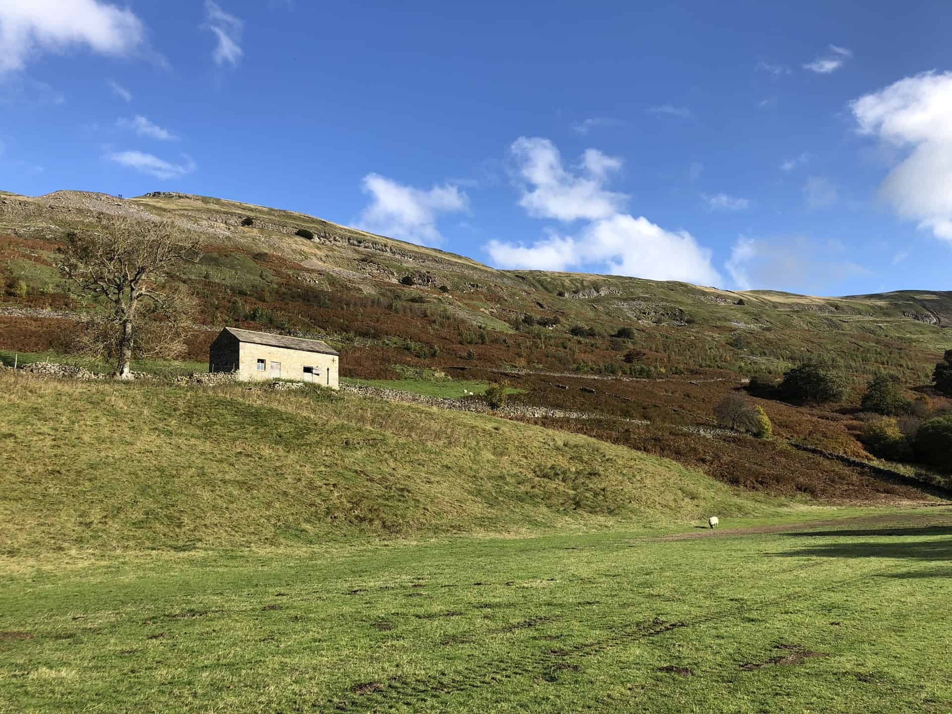
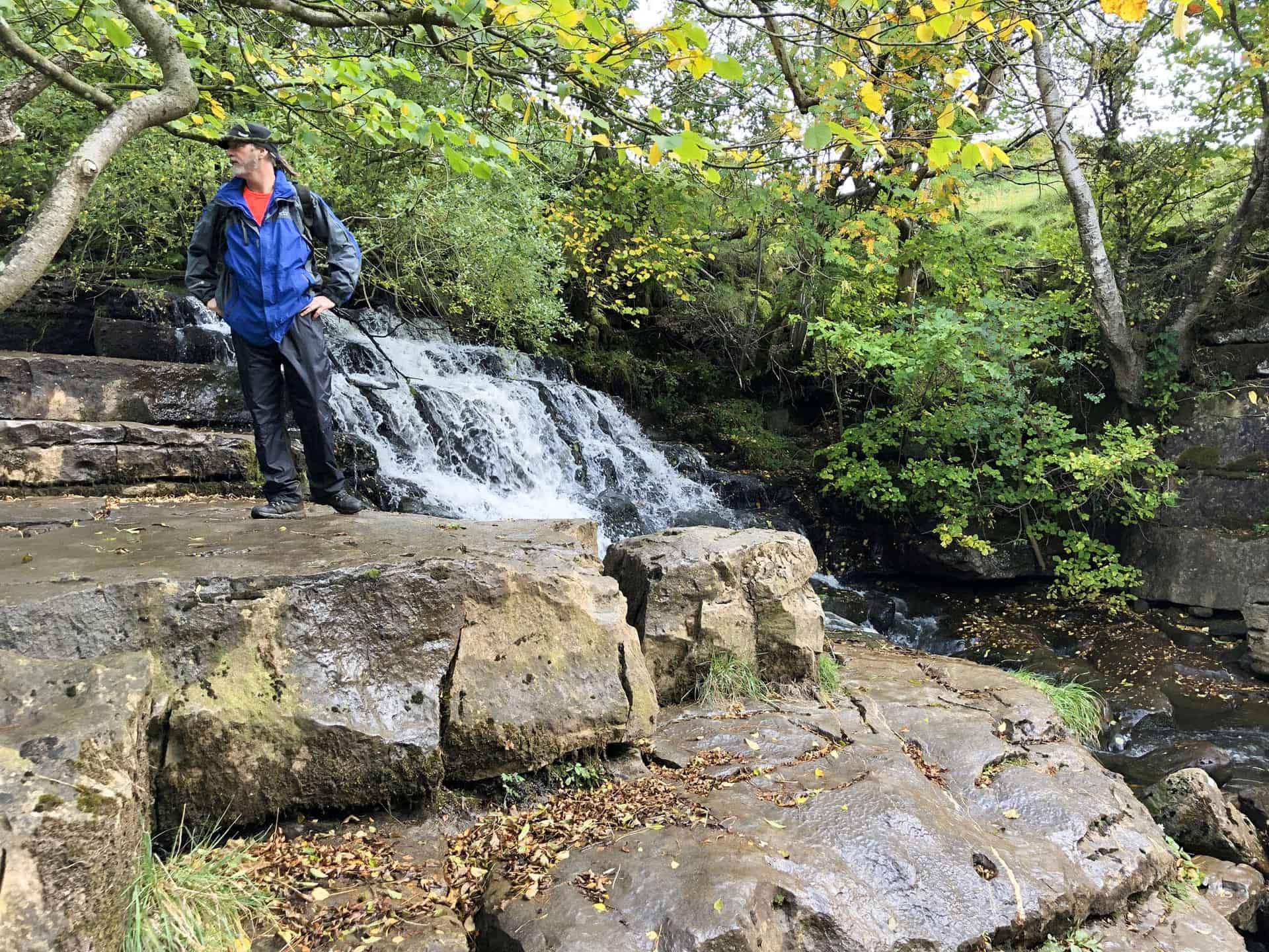
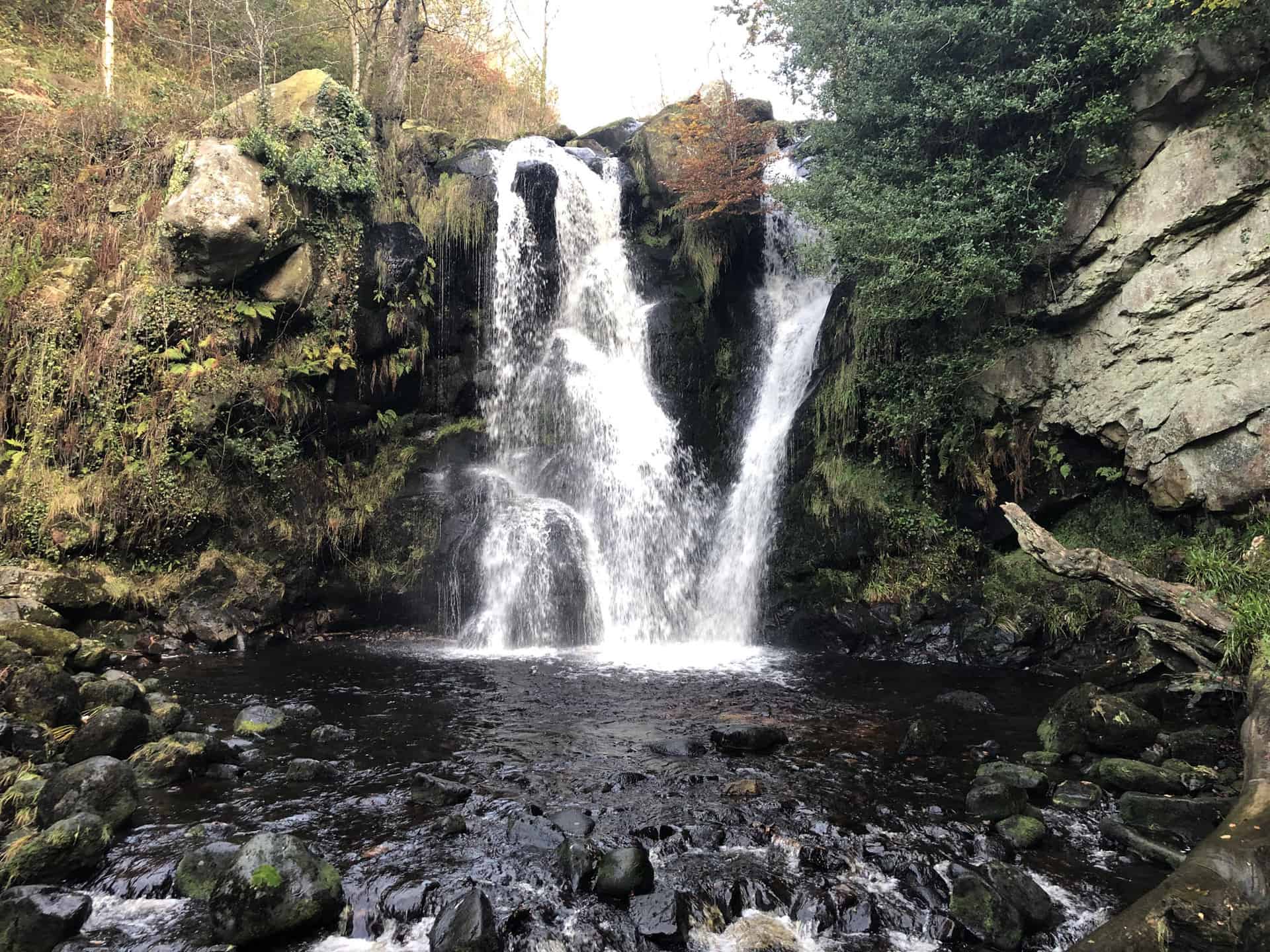
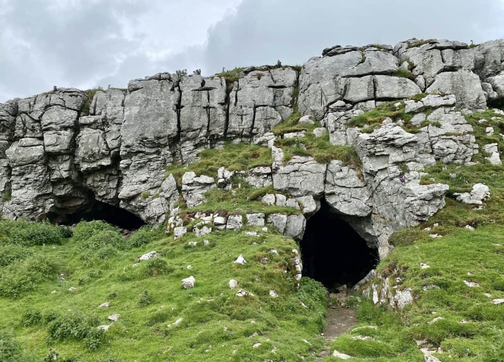
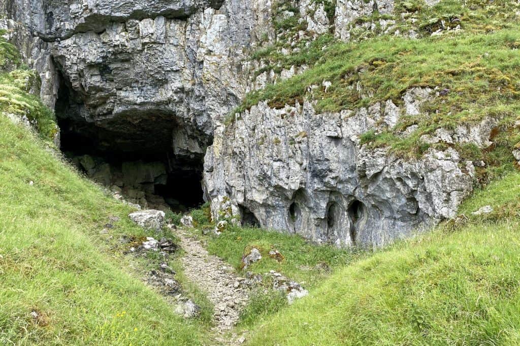
Start your Yorkshire Dales ramble at the picturesque village of Muker, where you’ll head north-west and ascend steeply to join the Pennine Way near Kisdon. As you venture north, enjoy the striking views from North Gang Scar and Kisdon Side before reaching Rukin Wood and Birk Hill. Take a brief detour to marvel at the captivating Kisdon Force waterfall before continuing north-west to a footbridge crossing the River Swale just before Keld, where you’ll encounter more stunning waterfalls.
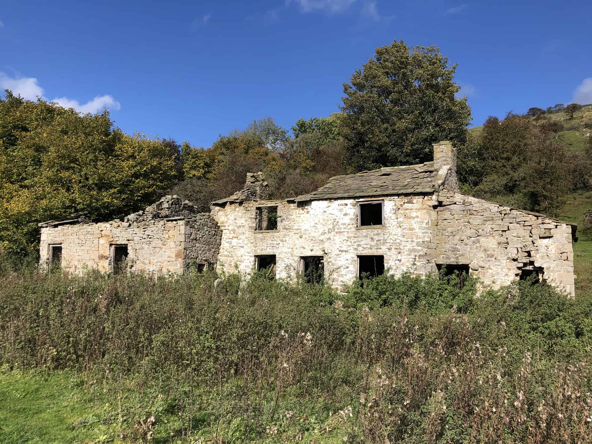
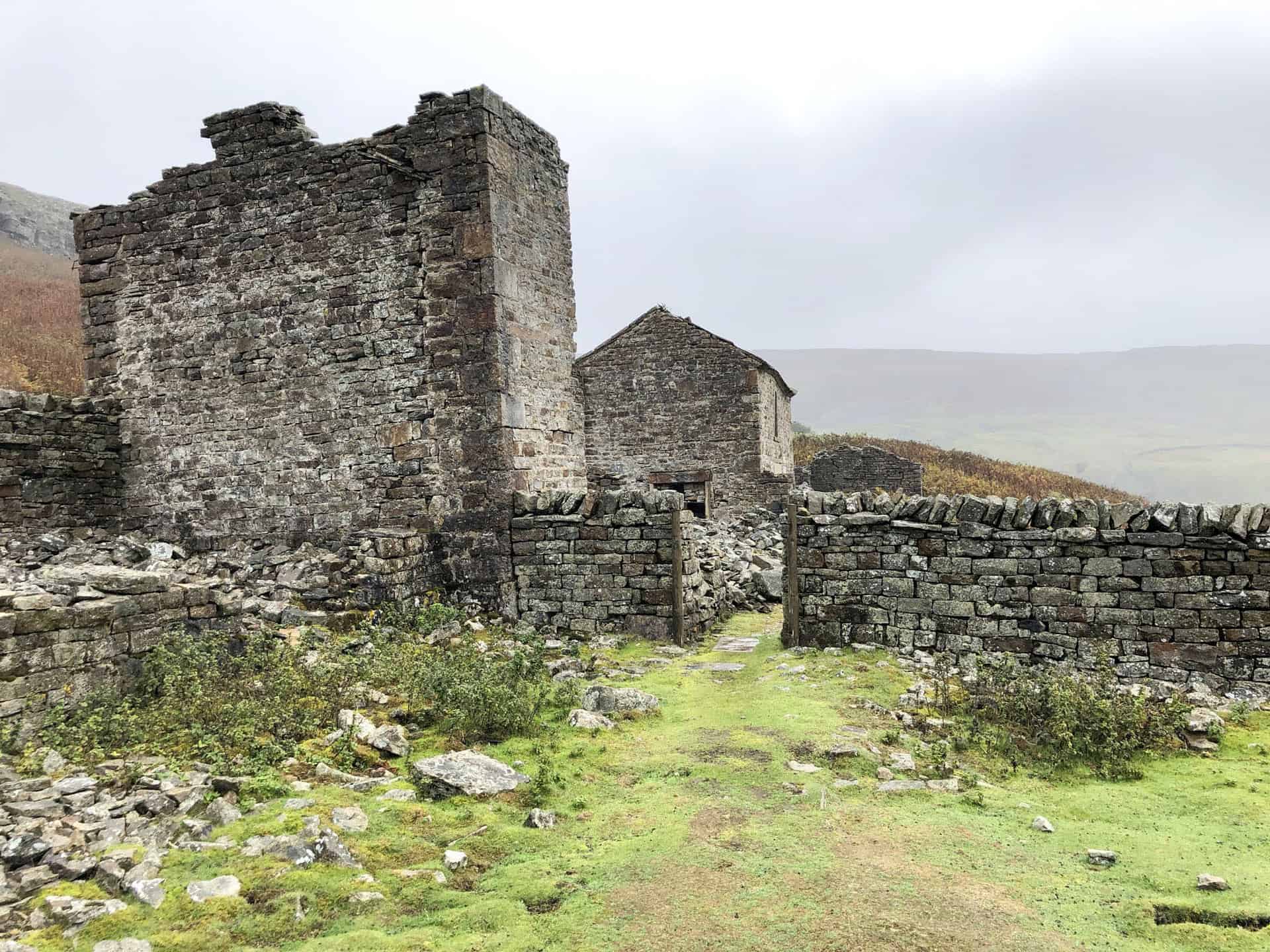
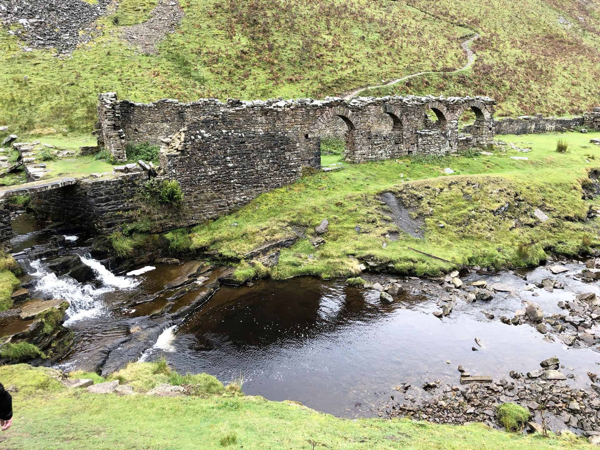
From Keld, set off eastward towards Crackpot Hall, a fascinating ruin steeped in history. Next, explore the disused Swinner Gill Lead Mines, a testament to the area’s rich industrial past. Proceed south along Arn Gill Scar and Ivelet Broads, eventually reaching Ivelet Side. This stretch of the route showcases the natural beauty of the Yorkshire Dales.
To complete your Yorkshire Dales ramble, head east via Kisdon Scar to the quaint hamlet of Ivelet, where you’ll join A Pennine Journey. Finally, make your way westward back to Muker along the banks of the River Swale, soaking in the tranquil riverside scenery. The entire 9-mile walk takes approximately 4¾ hours to complete, with a total ascent of 1862 feet, making it a rewarding experience for all who undertake this picturesque adventure through the Yorkshire Dales.
Crackpot Hall Walk Route
Visit either the OS Maps website or the Outdooractive website to view this walking route in greater detail. Both platforms offer a range of features, including the ability to print the route, download it to your device, and export the route as a GPX file. You can also watch a 3D fly-over and share the route on social media.
Recommended Ordnance Survey Map
The best map to use on this walk is the Ordnance Survey map of the Yorkshire Dales Northern & Central Area, reference OS Explorer OL30, scale 1:25,000. It clearly displays footpaths, rights of way, open access land and vegetation on the ground, making it ideal for walking, running and hiking. The map can be purchased from Amazon in either a standard, paper version or a weatherproof, laminated version, as shown below.
Standard Version
3. Yockenthwaite Walk: From Buckden Rake to Historic Hubberholme
Distance: 7 Miles | Duration: 3¼ Hours | Total Ascent: 731 Feet
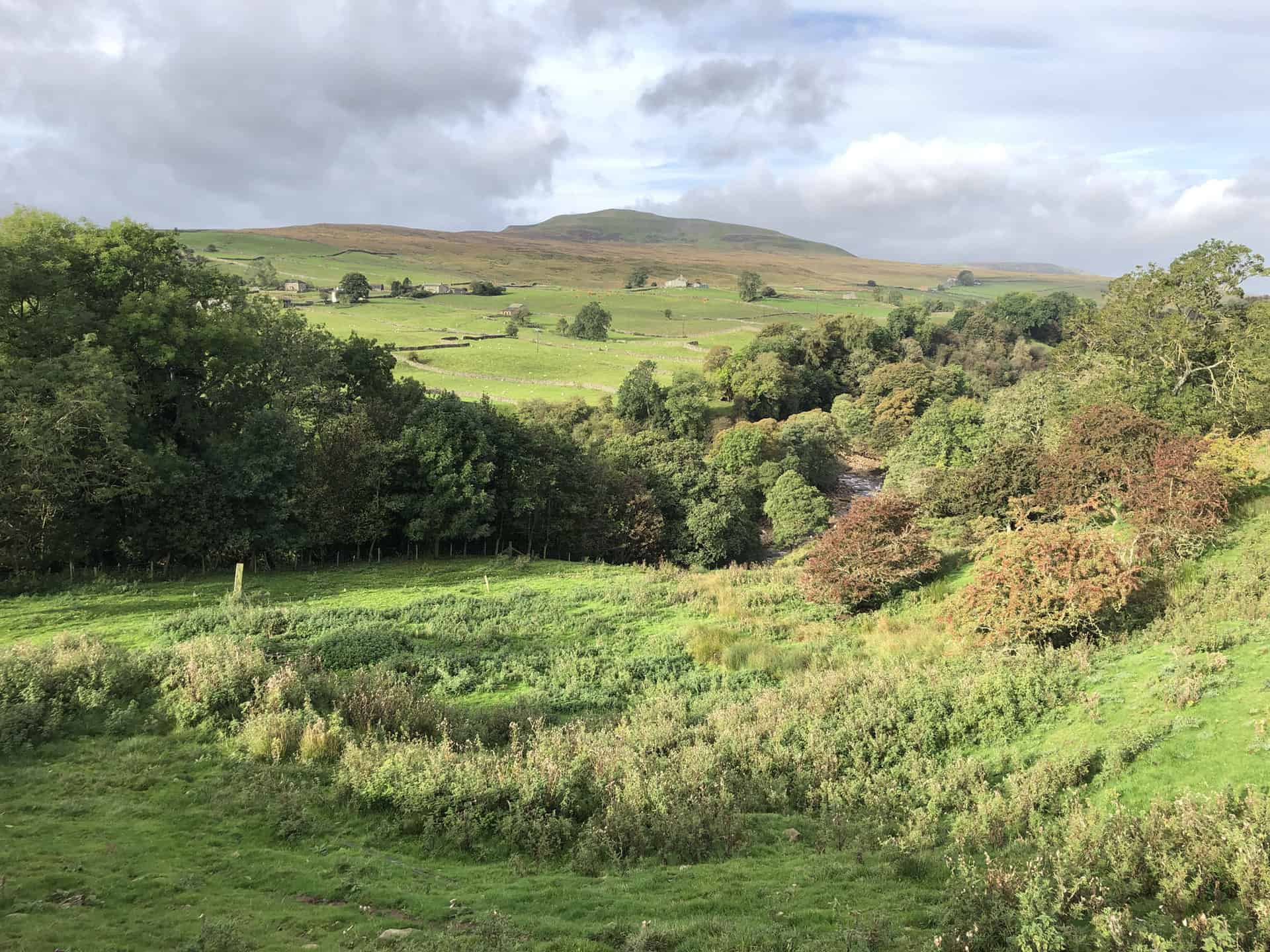
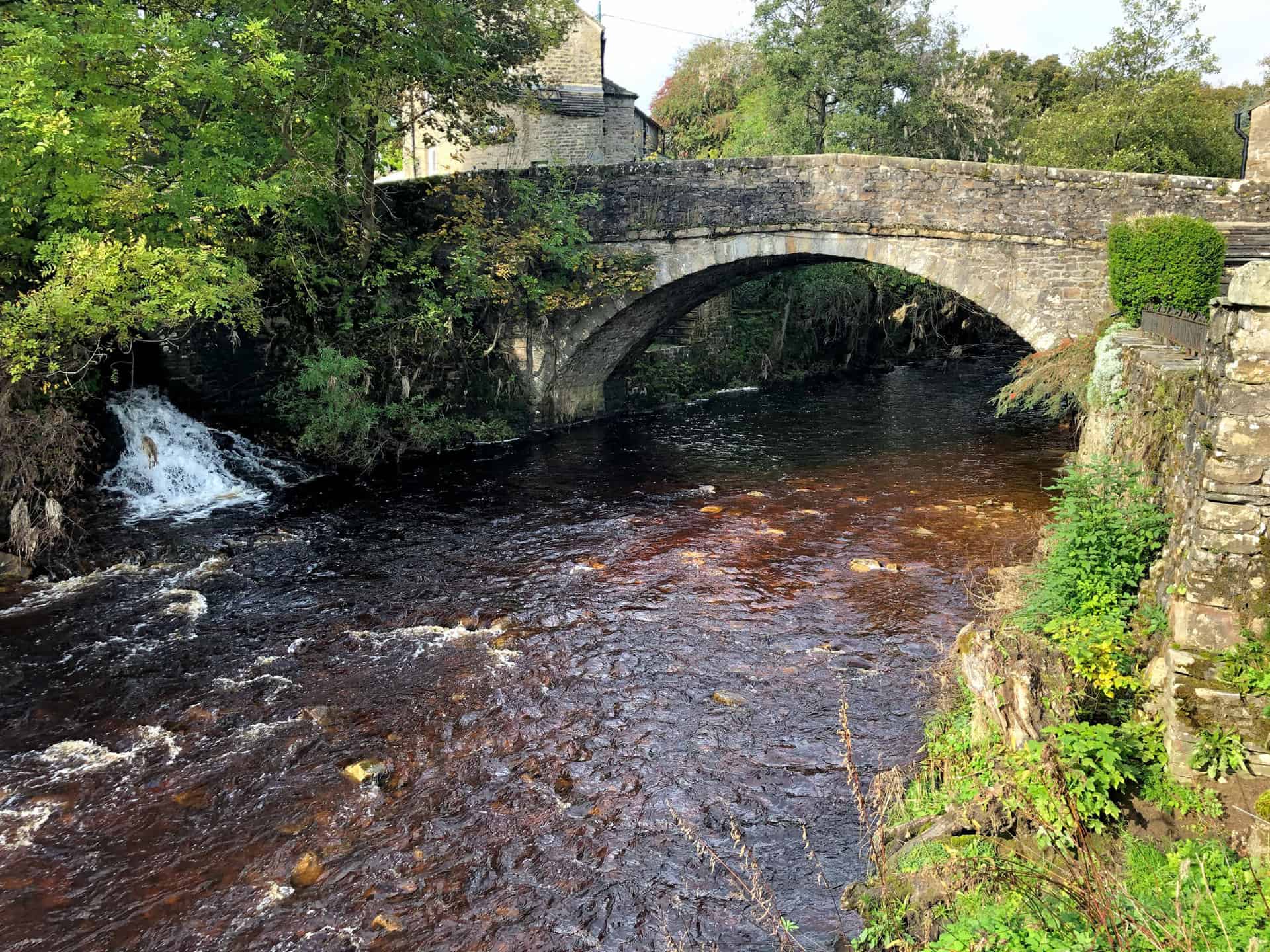
Begin your walk in the Yorkshire Dales at the charming village of Buckden, where you’ll embark on a 7-mile journey that should take approximately 3¼ hours to complete. This picturesque route, with a total ascent of only 731 feet, will guide you through some of the most delightful landscapes in the area. Starting northwards from Buckden, follow the path through Rakes Wood and continue along Buckden Rake, where you’ll reach the tiny hamlet of Cray. Next, cross the road, pass through the farm, and venture westward across the top of the ridge to Scar House.
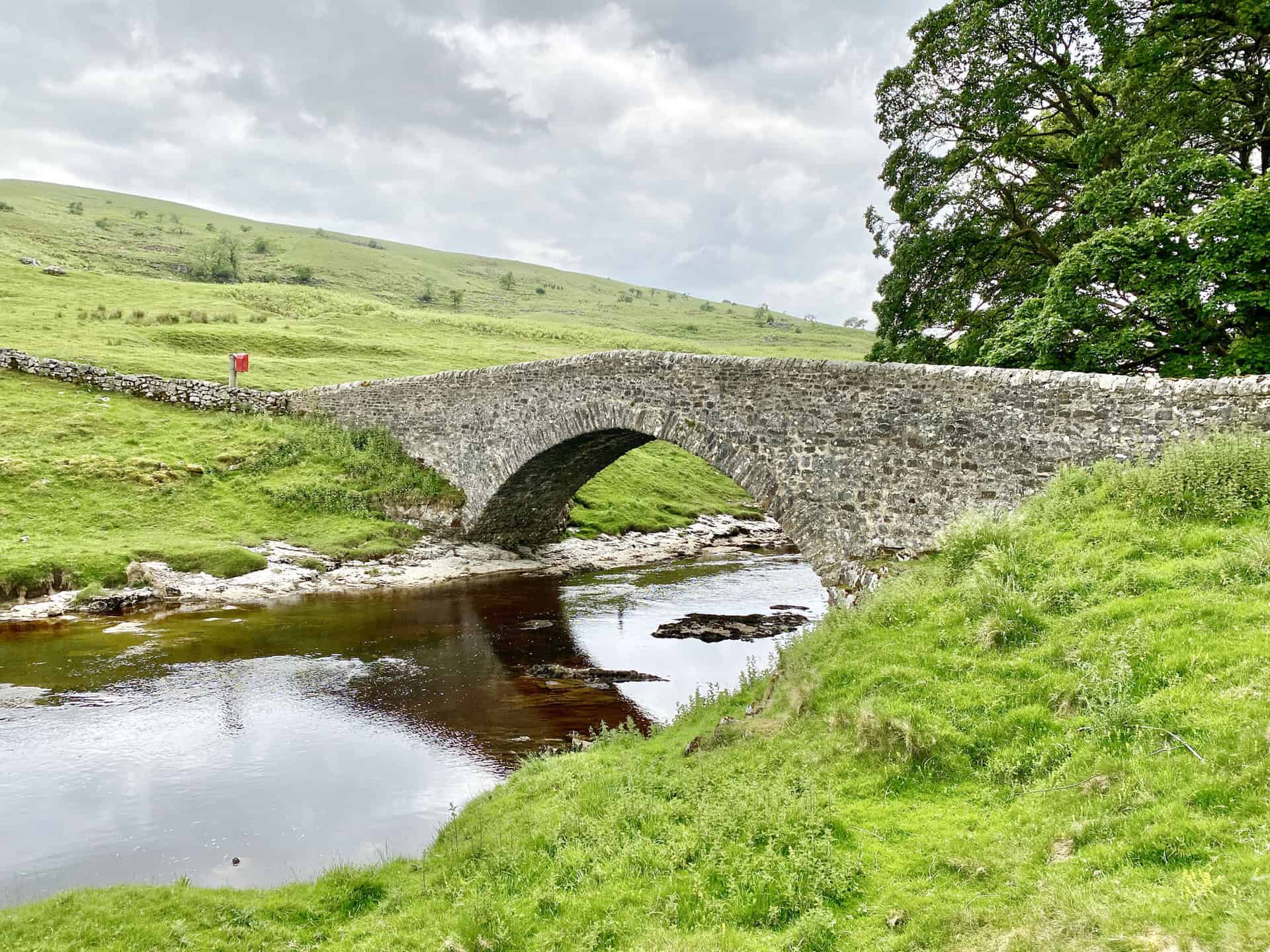
Descending through the woodland, you’ll arrive at the hamlet of Yockenthwaite, which boasts a Grade 2 listed 18th-century bridge over the River Wharfe. From here, make a U-turn and head east alongside the river’s banks, taking in the beauty of the Wharfe Valley as you walk towards the idyllic village of Hubberholme. This section of the walk in the Yorkshire Dales is particularly enchanting.
As you approach the final leg of your journey, follow the Dales Way and A Pennine Journey south-east back to Buckden. This well-trodden path is popular among walkers and provides a fitting conclusion to a memorable day spent exploring the captivating scenery of the Yorkshire Dales.
Yockenthwaite Walk Route
Visit either the OS Maps website or the Outdooractive website to view this walking route in greater detail. Both platforms offer a range of features, including the ability to print the route, download it to your device, and export the route as a GPX file. You can also watch a 3D fly-over and share the route on social media.
Recommended Ordnance Survey Map
The best map to use on this walk is the Ordnance Survey map of the Yorkshire Dales Northern & Central Area, reference OS Explorer OL30, scale 1:25,000. It clearly displays footpaths, rights of way, open access land and vegetation on the ground, making it ideal for walking, running and hiking. The map can be purchased from Amazon in either a standard, paper version or a weatherproof, laminated version, as shown below.
Standard Version
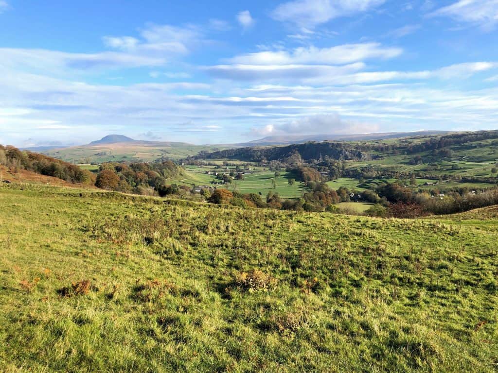
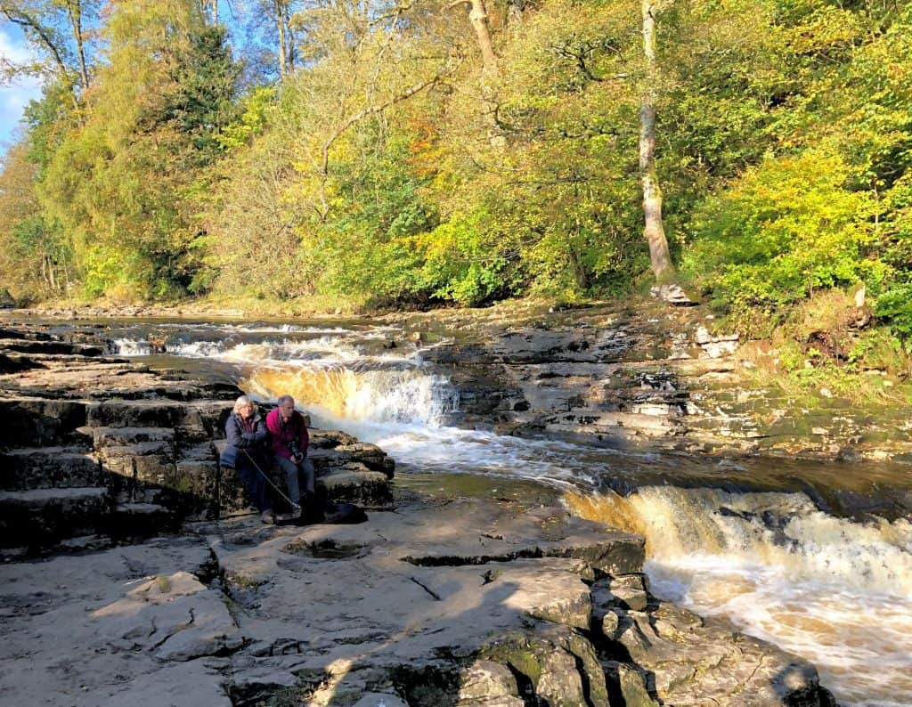
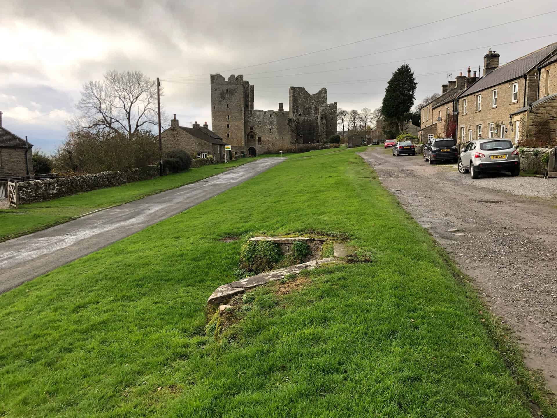
4. Aysgarth Falls Walk: A Memorable Journey to Bolton Castle Ruins
Distance: 8 Miles | Duration: 3¾ Hours | Total Ascent: 947 Feet
Embark on an 8-mile Yorkshire Dales trail through the picturesque landscapes of Aysgarth Falls and Castle Bolton. This scenic route takes approximately 3¾ hours to complete and boasts a total ascent of 947 feet. The journey commences at the breathtaking Aysgarth Falls High Force, proceeding north towards the charming village of Carperby. From there, continue north-west through West End Farm until you reach a footpath leading north-east beneath the impressive Ponderledge Scar.
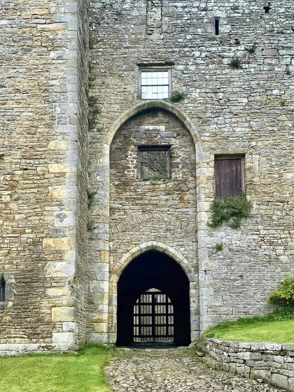
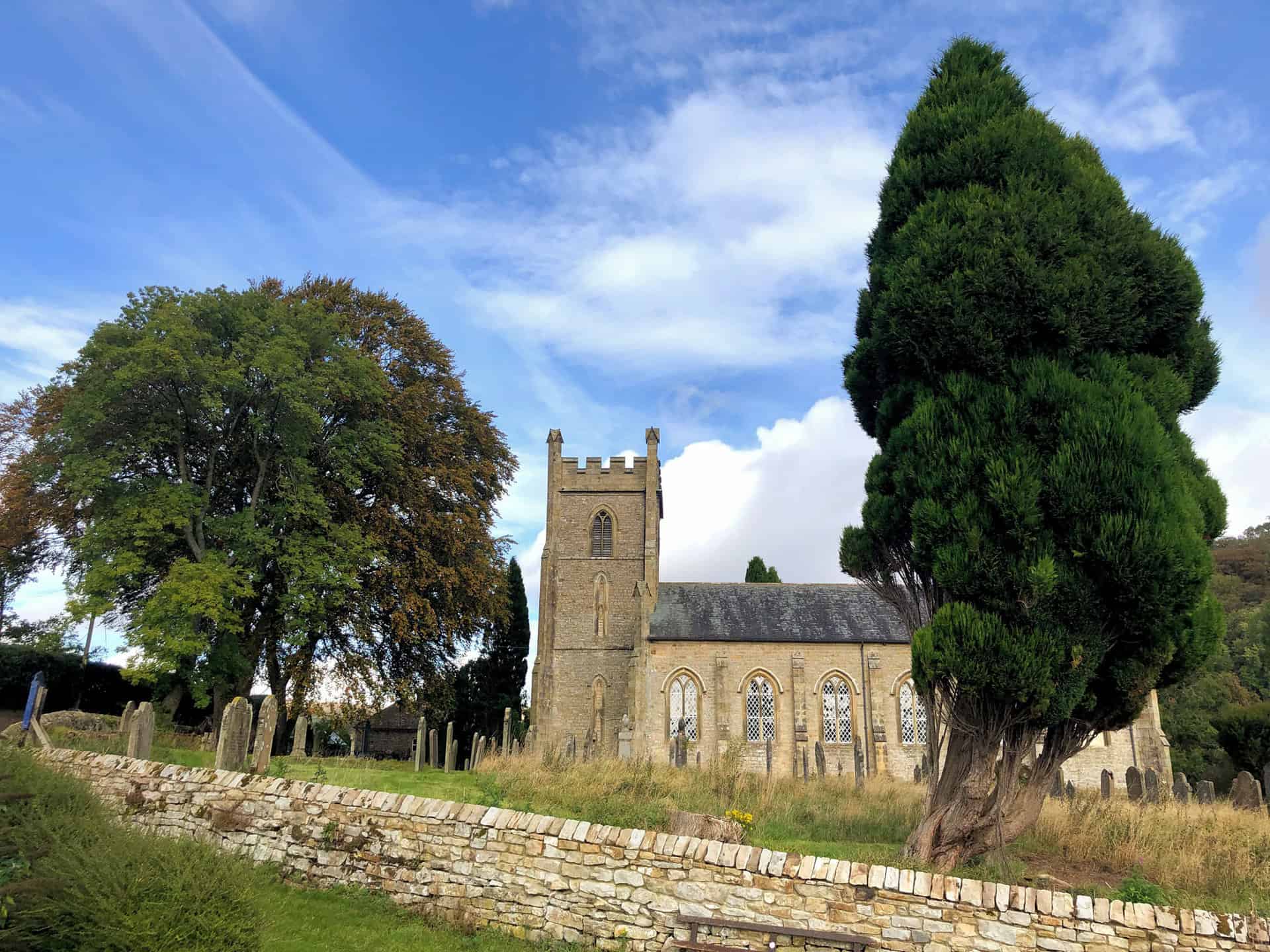
Venturing further north, cross the moorland by following a distinct stone path. Eventually, the route veers east through Intake Plantation, leading to the historic village of Castle Bolton. Here, take a moment to appreciate the striking ruins of Bolton Castle. To make your way back to Aysgarth Falls, start by heading south-west across picturesque farmland, following well-defined paths and tracks.
Pass by High Thoresby and Hollins House en route to Aysgarth Falls. Ensure you don’t miss the opportunity to explore the captivating Lower Force and Middle Force waterfalls by taking brief detours. This unforgettable Yorkshire Dales trail offers a perfect blend of natural beauty and historical intrigue, providing an exceptional walking experience for outdoor enthusiasts.
Aysgarth Falls Walk Route
Visit either the OS Maps website or the Outdooractive website to view this walking route in greater detail. Both platforms offer a range of features, including the ability to print the route, download it to your device, and export the route as a GPX file. You can also watch a 3D fly-over and share the route on social media.
Recommended Ordnance Survey Map
The best map to use on this walk is the Ordnance Survey map of the Yorkshire Dales Northern & Central Area, reference OS Explorer OL30, scale 1:25,000. It clearly displays footpaths, rights of way, open access land and vegetation on the ground, making it ideal for walking, running and hiking. The map can be purchased from Amazon in either a standard, paper version or a weatherproof, laminated version, as shown below.
Standard Version
5. Semer Water Walk: A Delightful 9-Mile Adventure from Bainbridge
Distance: 9 Miles | Duration: 4½ Hours | Total Ascent: 1507 Feet
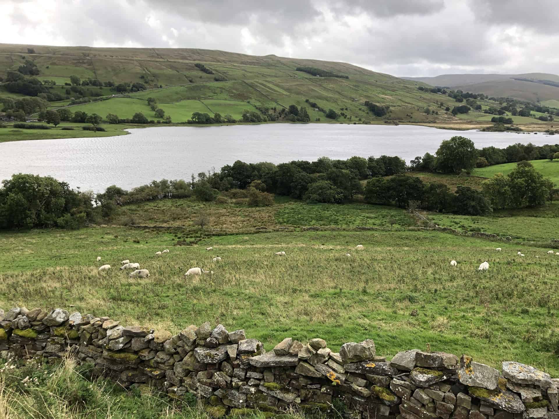
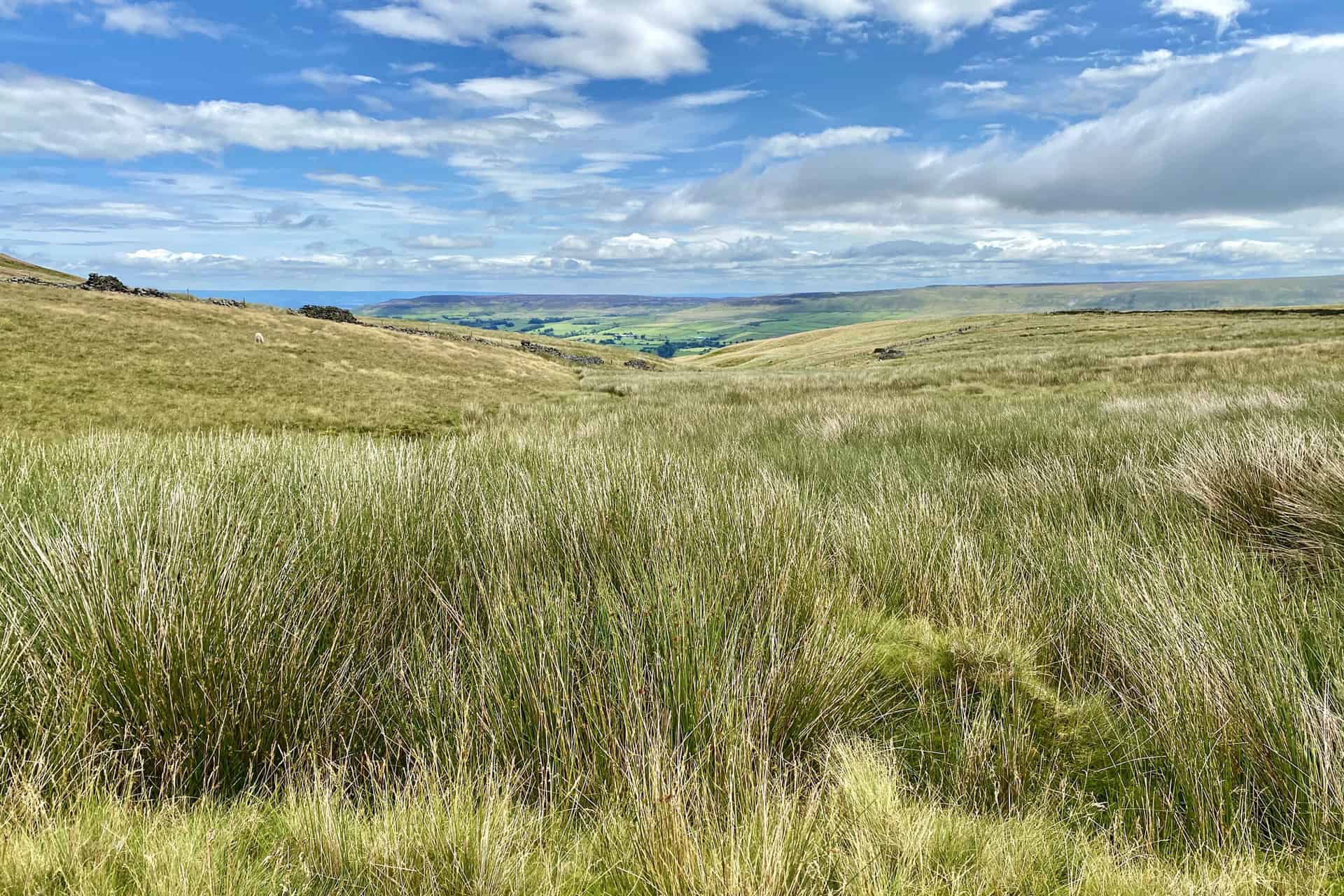
Discover one of the best walks in the Yorkshire Dales with a delightful 9-mile circular route, beginning at Bainbridge and journeying to Semer Water. Starting from the charming village, head south-west on A Pennine Journey, keeping to the east side of the River Bain, while admiring the picturesque landscape. As you approach Semer Water, continue around the lake, passing by Low Blean and Thwaite End House. Further on, make your way south-west towards Stalling Busk, a quaint hamlet perfect for a short rest.
Next, venture along Busk Lane, descending to Marsett, a peaceful spot to catch your breath. Following this, prepare for a challenging yet rewarding ascent up Marsett Cow Pasture and Green Scar. After reaching the top, take a moment to appreciate the stunning panorama, which is undoubtedly one of the highlights of this captivating walk in the Yorkshire Dales.
Finally, head north-east on the historic Cam High Road, a Roman road that leads you across Bainbridge High Pasture, back to your starting point. This well-rounded 9-mile walk, with a total ascent of 1507 feet and an estimated duration of 4½ hours, offers a perfect blend of natural beauty, history, and tranquillity. Suitable for both casual walkers and experienced hikers, this route is sure to become a favourite amongst those seeking the best walks in the Yorkshire Dales.
Semer Water Walk Route
Visit either the OS Maps website or the Outdooractive website to view this walking route in greater detail. Both platforms offer a range of features, including the ability to print the route, download it to your device, and export the route as a GPX file. You can also watch a 3D fly-over and share the route on social media.
Recommended Ordnance Survey Map
The best map to use on this walk is the Ordnance Survey map of the Yorkshire Dales Northern & Central Area, reference OS Explorer OL30, scale 1:25,000. It clearly displays footpaths, rights of way, open access land and vegetation on the ground, making it ideal for walking, running and hiking. The map can be purchased from Amazon in either a standard, paper version or a weatherproof, laminated version, as shown below.
Standard Version
6. Bolton Abbey Walk: Explore the Paths to Simon’s Seat and The Strid
Distance: 9 Miles | Duration: 4¼ Hours | Total Ascent: 1491 Feet
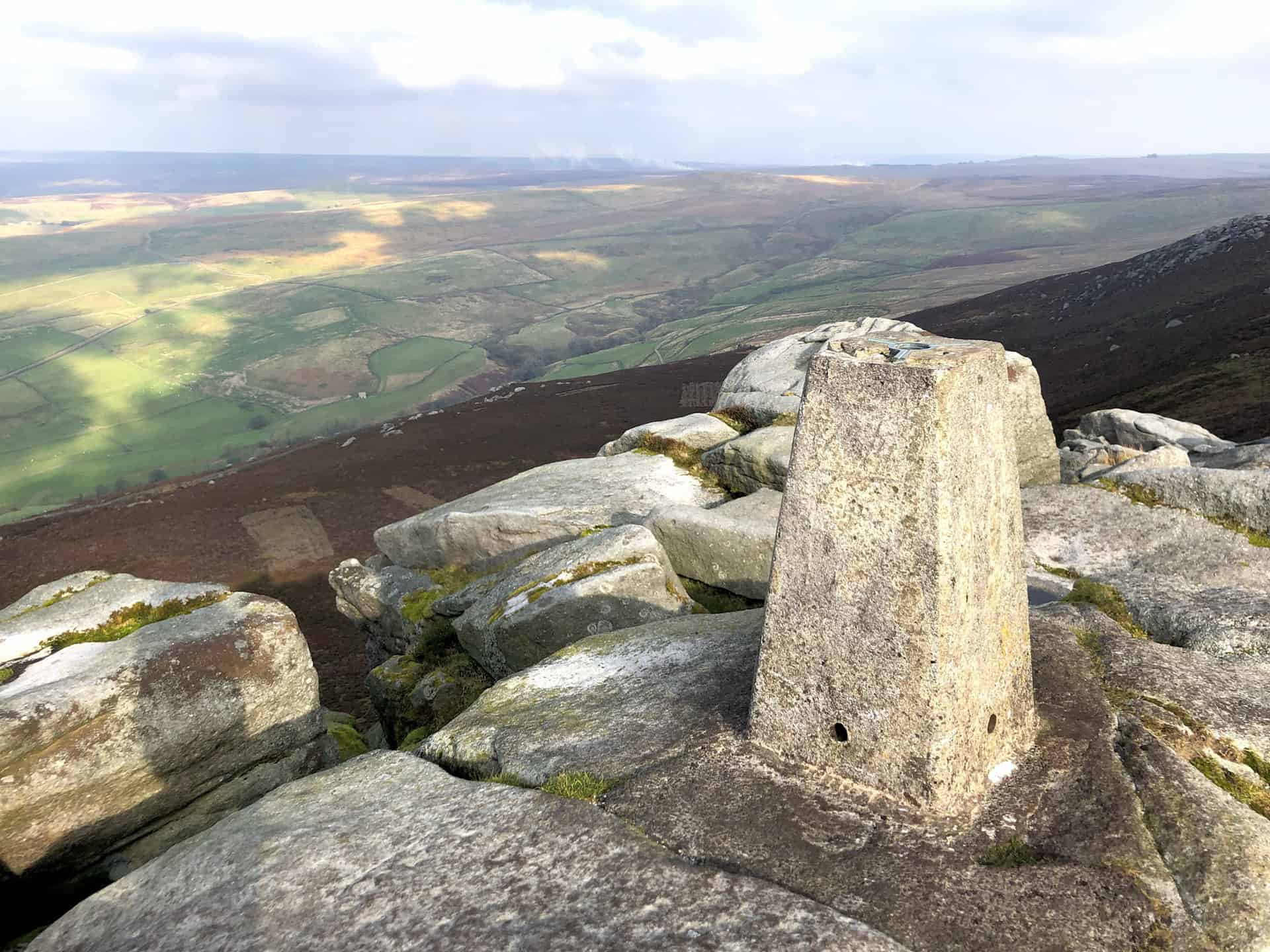
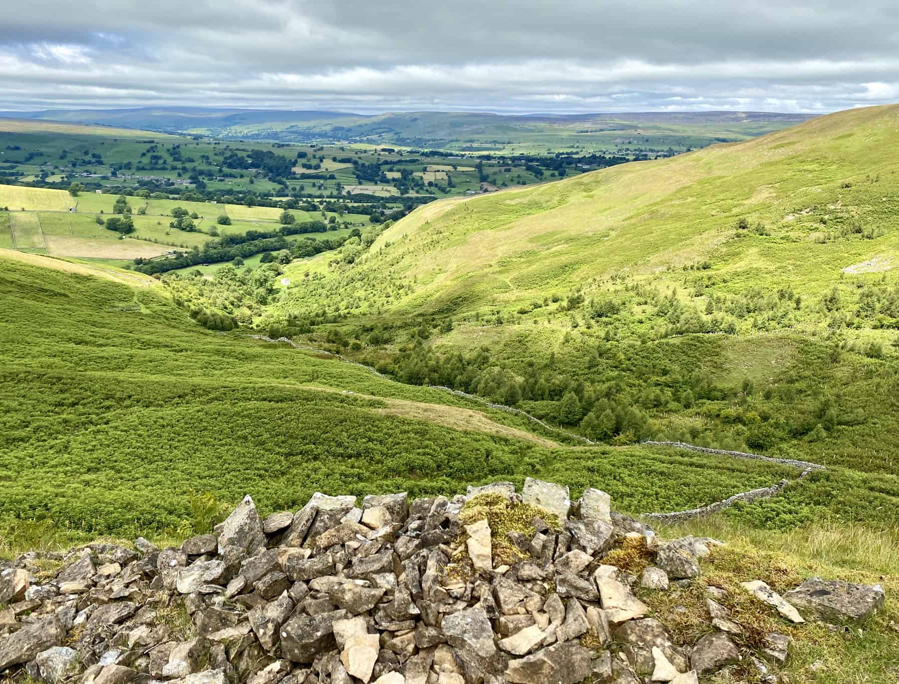
Set out on a delightful 9-mile Yorkshire Dales hike that begins at the iconic Bolton Abbey and includes the summit of Simon’s Seat. This adventure will take approximately 4¼ hours to complete and involves a total ascent of 1,491 feet. Starting at the Wooden Bridge on the Bolton Abbey Estate, head north towards Posforth Bridge and follow the path through the picturesque Posforth Gill. Continuing northwards, you will enter the enchanting Valley of Desolation before walking through the woods of Sheepshaw Plantation.
Emerging from the plantation, venture onto Barden Fell and follow the well-defined stone track that leads you across the expansive Barden Fell moorland. Ultimately, you will reach the summit of Simon’s Seat, where stunning panoramic views of the Yorkshire Dales await. After taking in the breathtaking scenery, make your way south-west towards Upper Fell Plantation, situated just below Flask Brow. From there, head west through the woods, descending towards the River Wharfe via Howgill.
Finally, stroll south-west along the Dales Way, which traces the course of the River Wharfe, towards Barden Bridge. After crossing the bridge, turn south-east and follow the western bank of the river back to Bolton Abbey. Along the way, marvel at the impressive natural wonder of The Strid and Strid Wood. This Yorkshire Dales hike offers a fascinating blend of enchanting landscapes, superb views, and invigorating exercise.
Bolton Abbey Walk Route
Visit either the OS Maps website or the Outdooractive website to view this walking route in greater detail. Both platforms offer a range of features, including the ability to print the route, download it to your device, and export the route as a GPX file. You can also watch a 3D fly-over and share the route on social media.
Recommended Ordnance Survey Map
The best map to use on this walk is the Ordnance Survey map of the Yorkshire Dales Southern & Western Area, reference OS Explorer OL2, scale 1:25,000. It clearly displays footpaths, rights of way, open access land and vegetation on the ground, making it ideal for walking, running and hiking. The map can be purchased from Amazon in either a standard, paper version or a weatherproof, laminated version, as shown below.
Standard Version
7. Trollers Gill Walk: A Must-Do Scenic Adventure from Burnsall Village
Distance: 8 Miles | Duration: 4 Hours | Total Ascent: 1124 Feet
Begin your 8-mile hike in the Yorkshire Dales at the picturesque village of Burnsall, crossing the historic Burnsall Bridge to follow the Dales Way south-east. As you walk along the banks of the River Wharfe, you’ll pass by the Fold Bottom campsite and eventually cross Stangs Lane, leading you to the quaint hamlet of Howgill. Soak in the beauty of the surrounding countryside while heading north-east along Howgill Lane, and eventually making your way to a point between Eastwood Head and Dalehead Farm. Once there, take a path north across the meadowlands, descending into High Skyreholme.
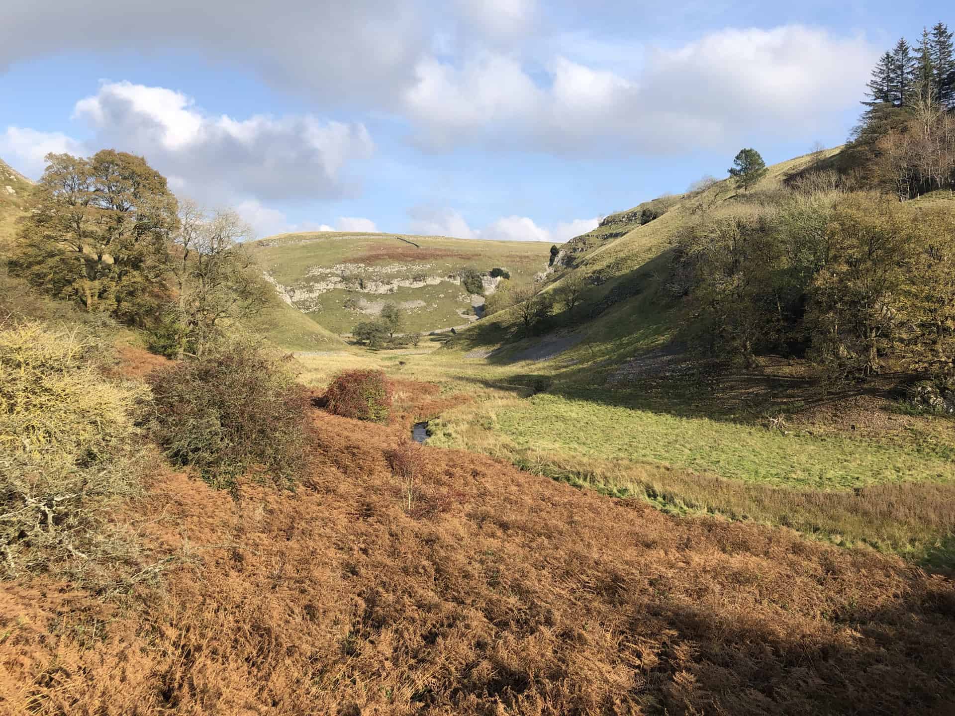
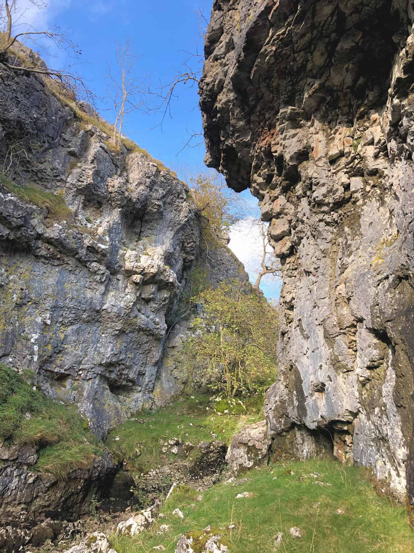
Next, venture westward along the minor road towards Middle Skyreholme, before turning north to walk alongside the tranquil Skyreholme Beck. This path will guide you to the awe-inspiring Trollers Gill limestone gorge, an absolute gem in the heart of the Yorkshire Dales. Here, you’ll navigate through the dramatic gorge, admiring the unique geological formations around you. As you climb out of the valley at Gill Heads, prepare for the final stretch of this unforgettable hike.
Make your way back to Burnsall via Kail Lane (Track) and Hartlington Bridge. This route offers a diverse array of scenery, from peaceful riverside paths to striking limestone formations, all while showcasing the best of what a hike in the Yorkshire Dales has to offer. As you complete this 4-hour adventure, with a total ascent of 1,124 feet, you’ll surely have a newfound appreciation for the captivating beauty of this region.
Trollers Gill Walk Route
Visit either the OS Maps website or the Outdooractive website to view this walking route in greater detail. Both platforms offer a range of features, including the ability to print the route, download it to your device, and export the route as a GPX file. You can also watch a 3D fly-over and share the route on social media.
Recommended Ordnance Survey Map
The best map to use on this walk is the Ordnance Survey map of the Yorkshire Dales Southern & Western Area, reference OS Explorer OL2, scale 1:25,000. It clearly displays footpaths, rights of way, open access land and vegetation on the ground, making it ideal for walking, running and hiking. The map can be purchased from Amazon in either a standard, paper version or a weatherproof, laminated version, as shown below.
Standard Version
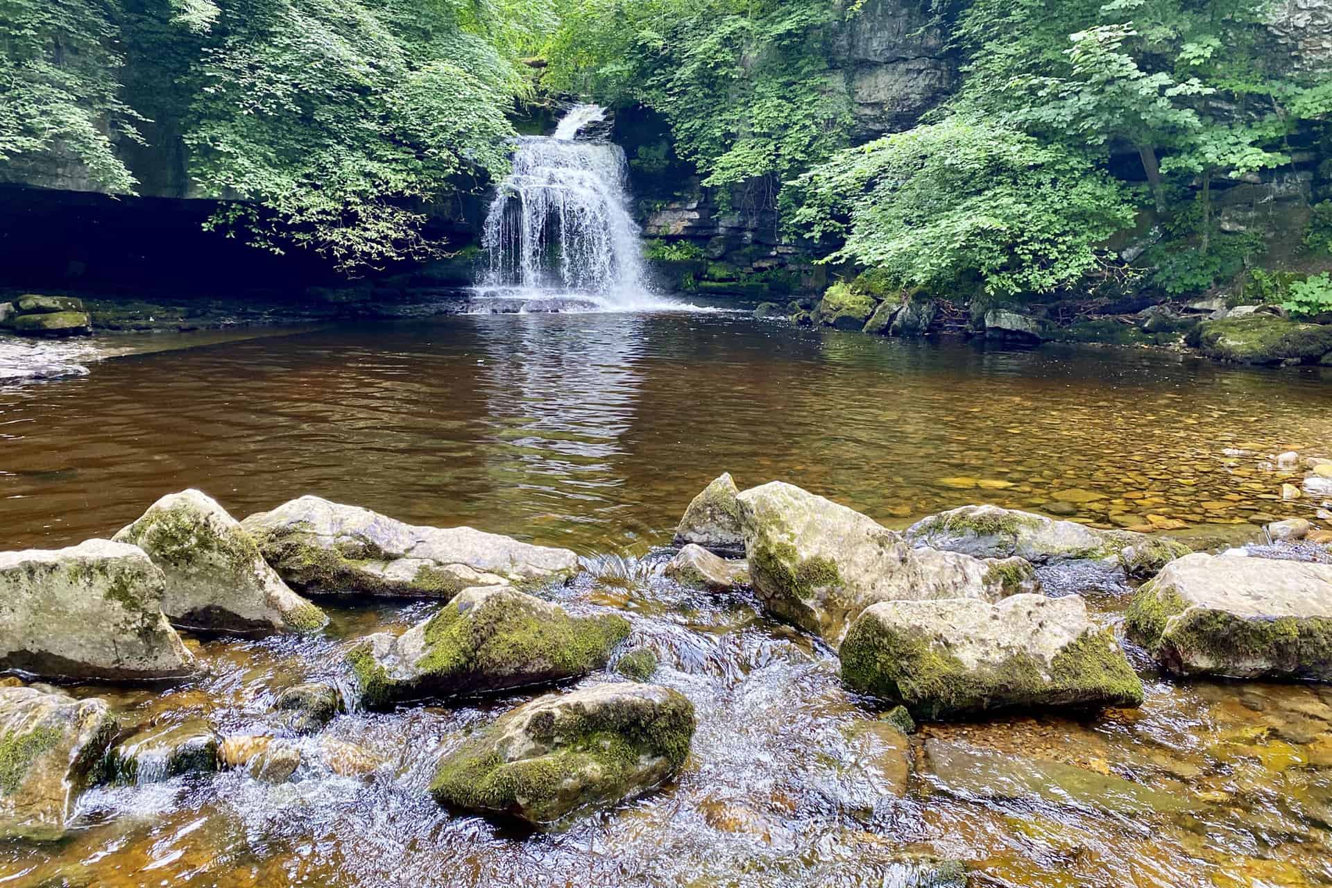
8. Malham Cove Walk: Unforgettable Route via Janet’s Foss, Gordale Scar, and Malham Tarn
Distance: 9 Miles | Duration: 4¼ Hours | Total Ascent: 1057 Feet
Check out this classic Yorkshire Dales 9-mile trail, which takes approximately 4¼ hours and includes a total ascent of 1057 feet. Begin your Yorkshire Dales walk by heading south from Malham along the Pennine Way towards Mires Barn. From there, change course to a north-easterly direction and pass through New Laithe and Wedber Wood, ultimately reaching Janet’s Cave and Janet’s Foss. Shortly after, you’ll arrive at Hawthorns Lane, then cross Gordale Bridge, and head north to have a look at the impressive Gordale Scar.
Once you’ve taken in the breathtaking views at Gordale Scar, retrace your steps to Hawthorns Lane. Next, follow the Dales High Way westwards until you reach a minor road near Shorkley Hill. From there, head north towards Malham Tarn, passing through Malham Lings. As you circle around the eastern and northern lower slopes of Great Close Hill, you’ll arrive at the peaceful Malham Tarn. This tranquil spot is the perfect place to pause, reflect, and appreciate the natural beauty of the Yorkshire Dales.
Finally, continue south from Malham Tarn, once again following the Pennine Way, until you reach Comb Hill. Proceed south-east towards the top of Malham Cove via the Watlowes dry valley, where you’ll be greeted by magnificent views. After carefully climbing down to the base of Malham Cove, conclude your Yorkshire Dales walk by returning to Malham along Cove Road.
Malham Cove Walk Route
Visit either the OS Maps website or the Outdooractive website to view this walking route in greater detail. Both platforms offer a range of features, including the ability to print the route, download it to your device, and export the route as a GPX file. You can also watch a 3D fly-over and share the route on social media.
Recommended Ordnance Survey Map
The best map to use on this walk is the Ordnance Survey map of the Yorkshire Dales Southern & Western Area, reference OS Explorer OL2, scale 1:25,000. It clearly displays footpaths, rights of way, open access land and vegetation on the ground, making it ideal for walking, running and hiking. The map can be purchased from Amazon in either a standard, paper version or a weatherproof, laminated version, as shown below.
Standard Version
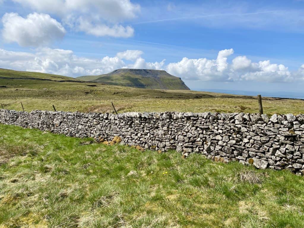
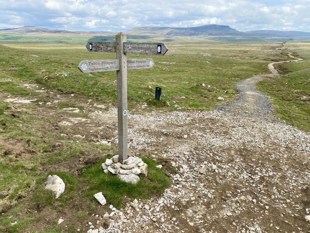
9. Ingleborough Walk: Experience One of the Yorkshire Three Peaks
Distance: 10 Miles | Duration: 5 Hours | Total Ascent: 2156 Feet
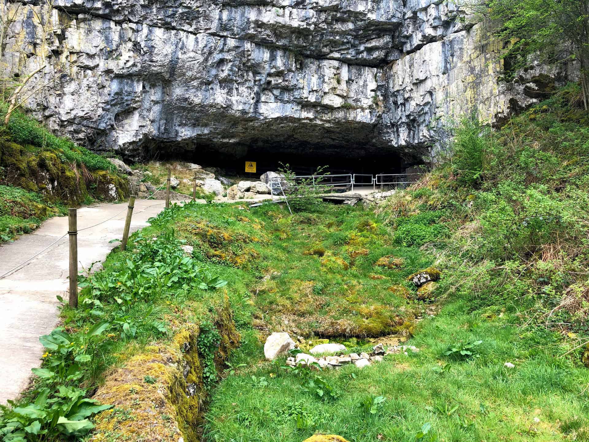
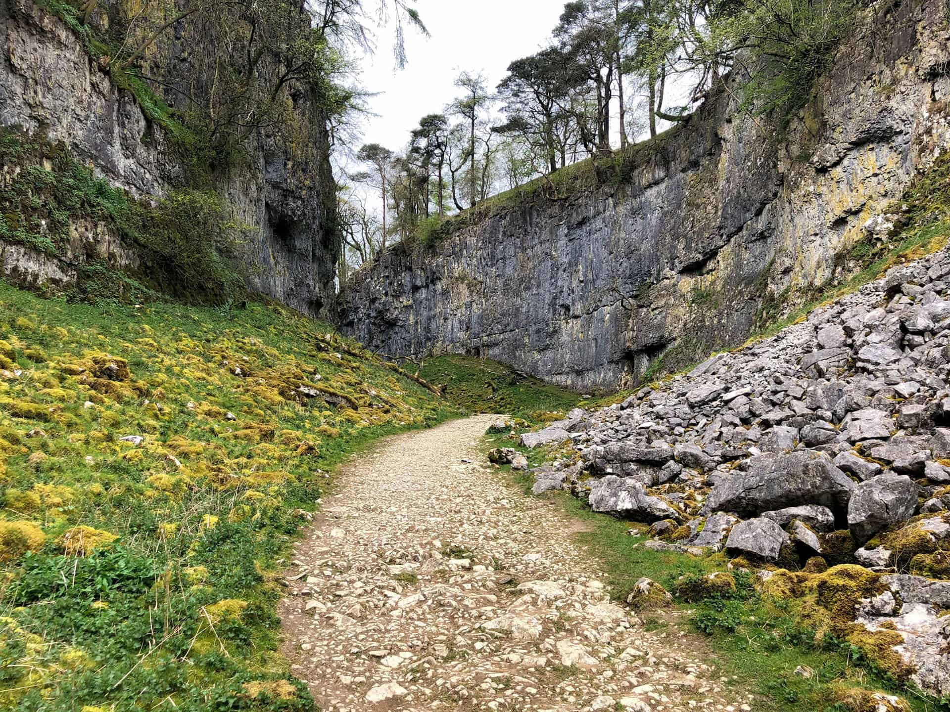
Begin your walk in the Yorkshire Dales National Park at the charming village of Clapham, heading north along the west side of Clapdale Wood. Continue onwards for a look at the Ingleborough Cave entrance before crossing the picturesque stone bridge over Clapham Beck. You’ll soon reach the impressive Trow Gill dry gorge, an ideal spot for a photo opportunity. As you follow A Pennine Journey, marvel at the stunning scenery while gradually ascending towards Gaping Gill and Little Ingleborough.
Upon reaching Little Ingleborough, you’ll be rewarded with breathtaking views as you make your way to the summit of Ingleborough, one of the iconic Yorkshire Three Peaks. Once you’ve conquered the summit, proceed in an easterly direction along the Dales High Way, navigating your way towards Nick Pot. Head south across the beautiful limestone landscape, one of the geological wonders that make this walk in the Yorkshire Dales National Park so memorable.
Finally, join the Pennine Bridleway near Long Scar and make your way south-west, then south, back towards Clapham. As you pass beneath Thwaite Scars, you’ll walk along Long Lane (Track) and rejoin A Pennine Journey, which will guide you back to the starting point. This circular walk, covering a distance of 10 miles with a total ascent of 2156 feet, is a fantastic way to experience the beauty of the Yorkshire Dales National Park, and can be comfortably completed within 5 hours.
Ingleborough Walk Route
Visit either the OS Maps website or the Outdooractive website to view this walking route in greater detail. Both platforms offer a range of features, including the ability to print the route, download it to your device, and export the route as a GPX file. You can also watch a 3D fly-over and share the route on social media.
Recommended Ordnance Survey Map
The best map to use on this walk is the Ordnance Survey map of the Yorkshire Dales Southern & Western Area, reference OS Explorer OL2, scale 1:25,000. It clearly displays footpaths, rights of way, open access land and vegetation on the ground, making it ideal for walking, running and hiking. The map can be purchased from Amazon in either a standard, paper version or a weatherproof, laminated version, as shown below.
Standard Version
10. Stainforth Force Walk: A Picturesque Journey Through the Yorkshire Dales
Distance: 8 Miles | Duration: 4 Hours | Total Ascent: 1277 Feet
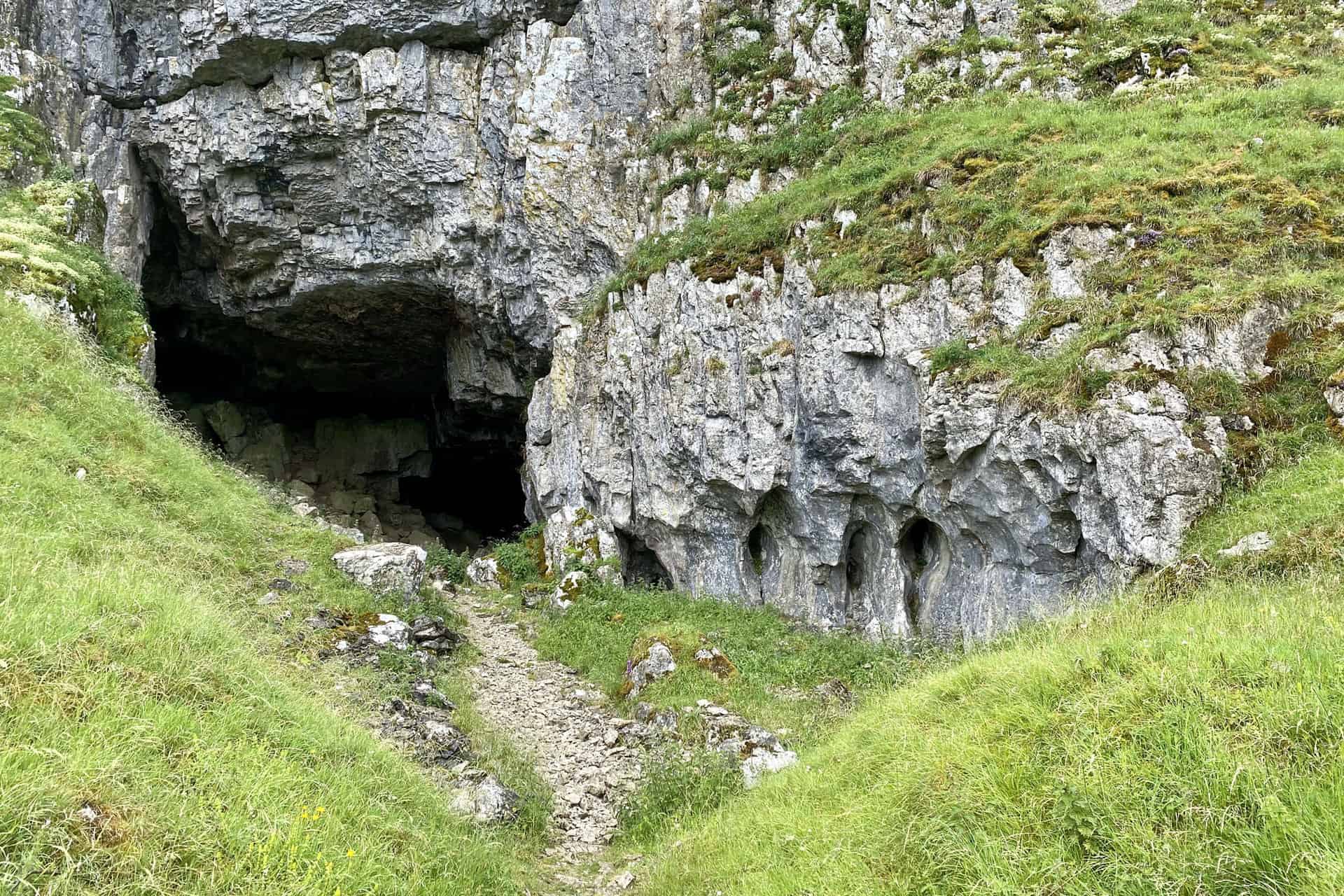
Experience one of the most scenic walks in the Yorkshire Dales with this 8-mile route, boasting a total ascent of 1277 feet and taking approximately 4 hours to complete. The adventure starts in Stainforth, heading south-east along the Pennine Bridleway to the awe-inspiring Catrigg Force waterfall. From there, venture south-west to Upper Winskill, and continue south-east along the edge of the picturesque Winskill Stones Nature Reserve. Upon reaching a minor road and cattle grid, head further south, passing the intriguing Victoria Cave.

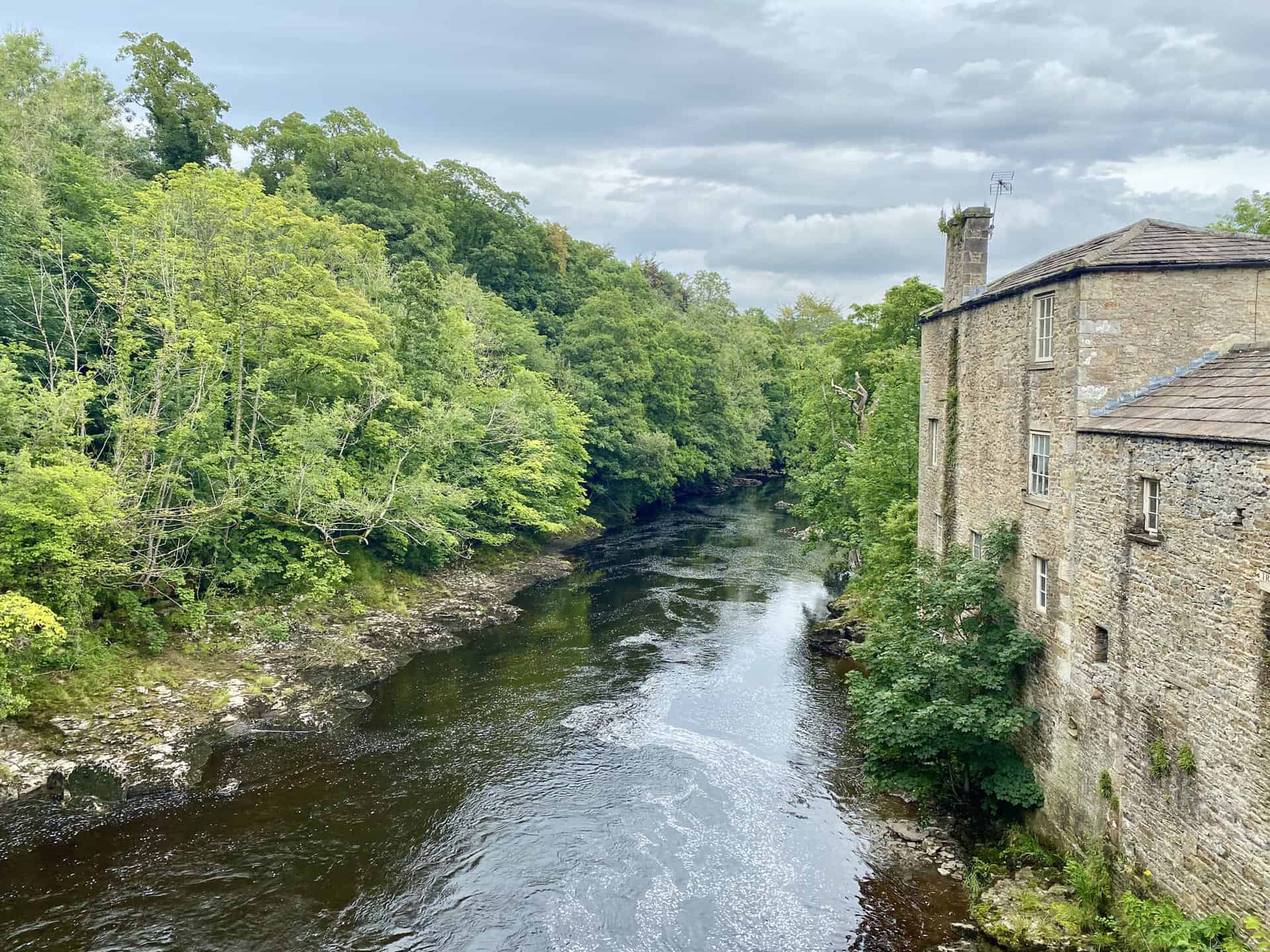
Next, make your way beneath Brent Scar and Attermire Scar, taking in the stunning views of the limestone cliffs. After visiting Attermire Cave, turn west along the Dales High Way, eventually meeting the Pennine Bridleway. Continue south-west to reach Settle, a charming market town. Here, explore the town’s historic centre then cross the River Ribble to join the Ribble Way/Dales High Way northwards.
Finally, make your way towards Stackhouse, reconnecting with the River Ribble for a pleasant riverside stroll to the enchanting Stainforth Force waterfall. Conclude this memorable walk in the Yorkshire Dales by returning east to the village of Stainforth, having experienced a perfect blend of natural beauty, geological wonders, and charming local settlements.
Stainforth Force Walk Route
Visit either the OS Maps website or the Outdooractive website to view this walking route in greater detail. Both platforms offer a range of features, including the ability to print the route, download it to your device, and export the route as a GPX file. You can also watch a 3D fly-over and share the route on social media.
Recommended Ordnance Survey Map
The best map to use on this walk is the Ordnance Survey map of the Yorkshire Dales Southern & Western Area, reference OS Explorer OL2, scale 1:25,000. It clearly displays footpaths, rights of way, open access land and vegetation on the ground, making it ideal for walking, running and hiking. The map can be purchased from Amazon in either a standard, paper version or a weatherproof, laminated version, as shown below.
Standard Version
11. Settle Walk: Discover Stainforth Force & More on this Settle Trail in Yorkshire
Distance: 9 Miles | Duration: 4¼ Hours | Total Ascent: 1260 Feet
One of the finest hikes in Yorkshire, this 9-mile circular route showcases the beauty of the Yorkshire Dales National Park. The adventure commences in Settle, heading north-west to the B6479 road, and crossing the picturesque River Ribble. Proceed west towards Giggleswick, before turning north via Catteral Hall, eventually reaching the B6480 road. Next, head east up towards Lord’s Wood, and then circle the upper rim of the quarry.
Continuing north to the Schoolboys Tower (Cairn), venture north-west to Giggleswick Scar and north to Feizor Thwaite. From there, make your way north-west to Feizor, before turning east to follow the Dales High Way beneath Pot Scar and Smearsett Scar. Enjoy the stunning views along the Dales High Way as you pass through Little Stainforth, eventually reaching the majestic Stainforth Force waterfall.
Finally, make your way back south to Settle, following the course of the River Ribble via Stackhouse on the Dales High Way. With a total ascent of 1260 feet and an estimated duration of 4¼ hours, this hike offers a splendid experience of the Yorkshire Dales’ natural beauty. Lace up your walking boots and journey through one of the most captivating hikes in Yorkshire.
Settle Walk Route
Visit either the OS Maps website or the Outdooractive website to view this walking route in greater detail. Both platforms offer a range of features, including the ability to print the route, download it to your device, and export the route as a GPX file. You can also watch a 3D fly-over and share the route on social media.
Recommended Ordnance Survey Map
The best map to use on this walk is the Ordnance Survey map of the Yorkshire Dales Southern & Western Area, reference OS Explorer OL2, scale 1:25,000. It clearly displays footpaths, rights of way, open access land and vegetation on the ground, making it ideal for walking, running and hiking. The map can be purchased from Amazon in either a standard, paper version or a weatherproof, laminated version, as shown below.
Standard Version
12. Grassington Walk: Journey Through Conistone, Threshfield Quarry, and Linton Falls
Distance: 10 Miles | Duration: 4¾ Hours | Total Ascent: 1311 Feet
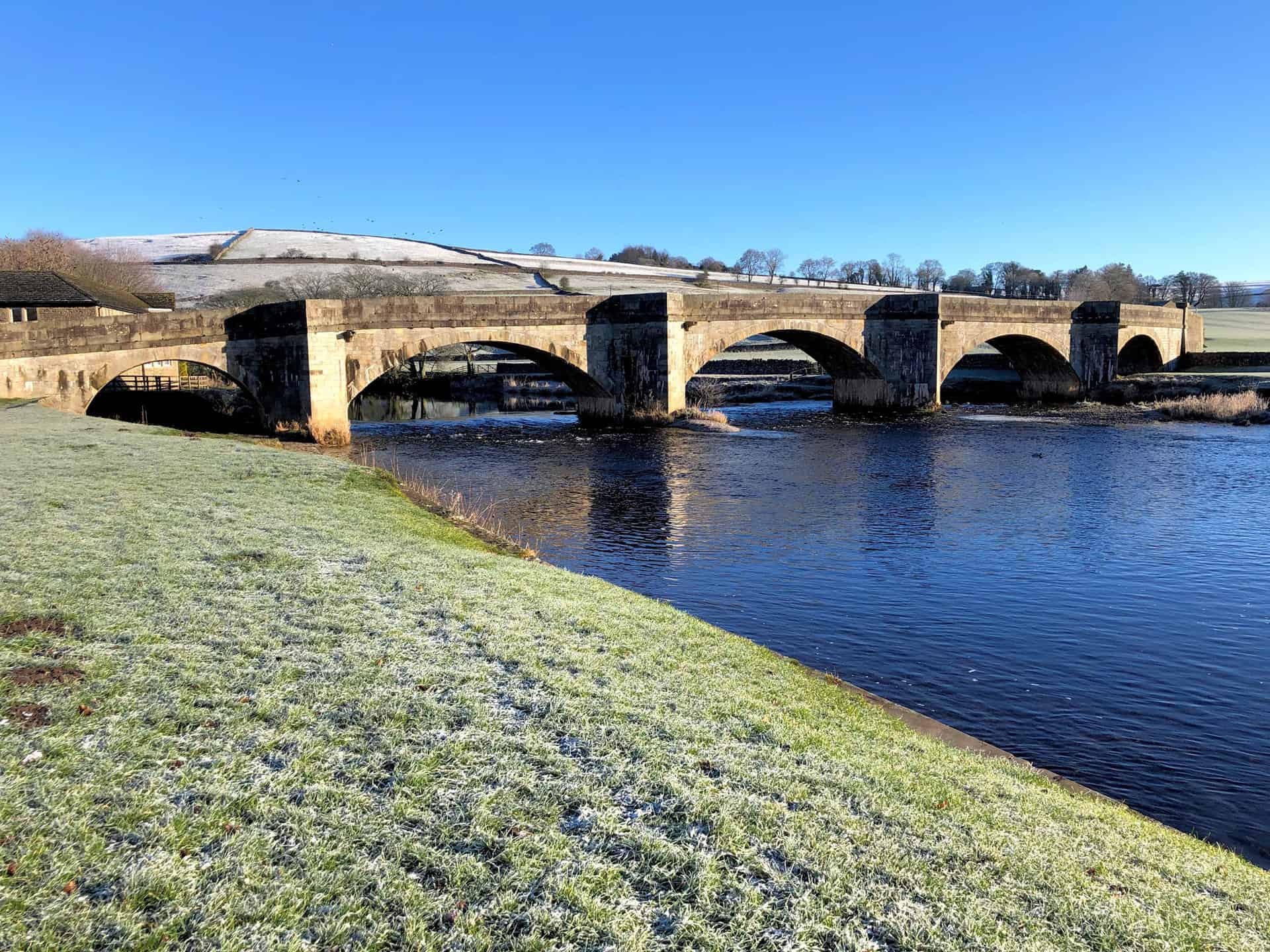
Begin your ramble from the charming village of Grassington, following the Dales Way northwards for approximately 2½ miles across the picturesque Lea Green and Old Pasture countryside. Next, head south-west towards Bull Scar and make your way into the village of Conistone. From there, venture west and cross the River Wharfe via the historic Conistone Bridge to arrive in the village of Kilnsey.
Continuing your journey, follow the ancient Mastiles Lane south-west beneath Cool Scar Quarry, taking you towards Howgill. As you progress south over the sweeping moorland, you’ll pass Green Haw Hill before heading east to view the fascinating Threshfield Quarry. Take a leisurely stroll around the quarry’s perimeter, soaking in the captivating geological features and local history.
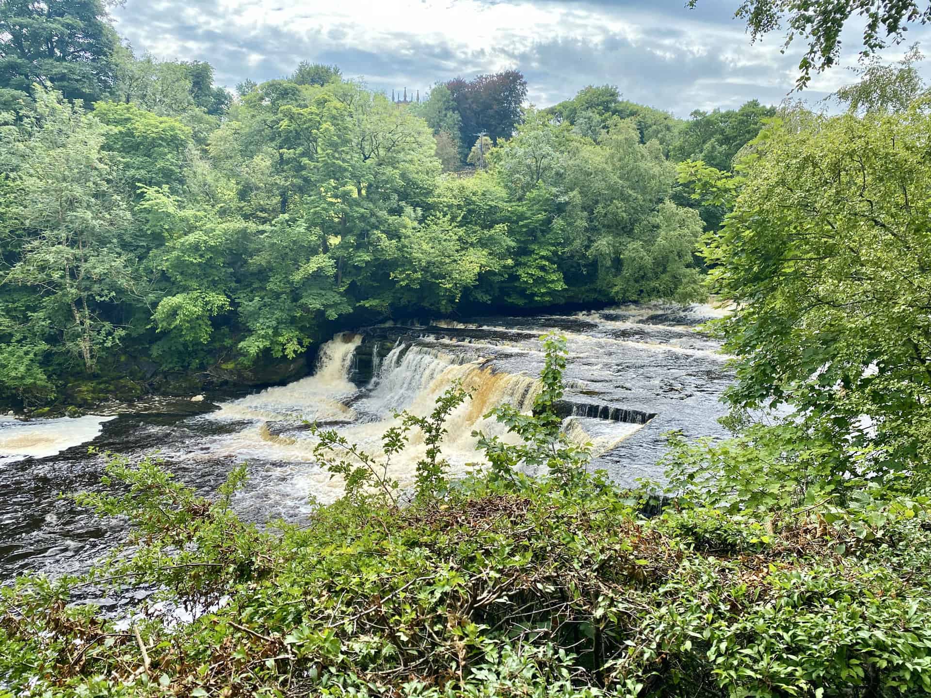
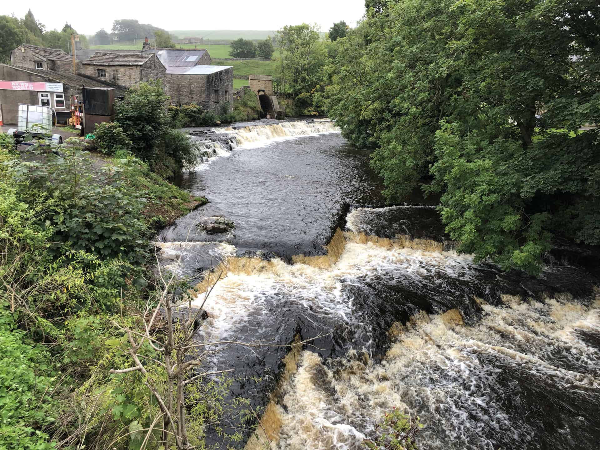
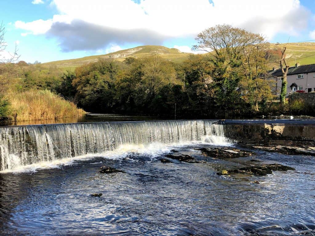
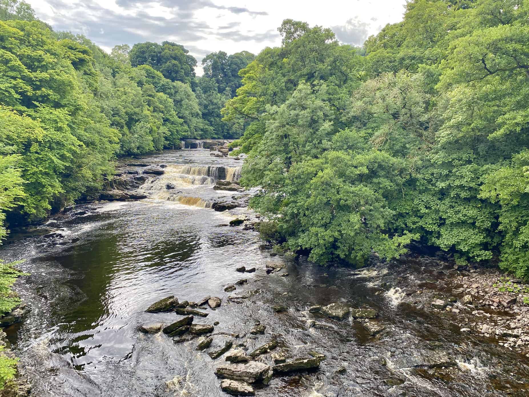
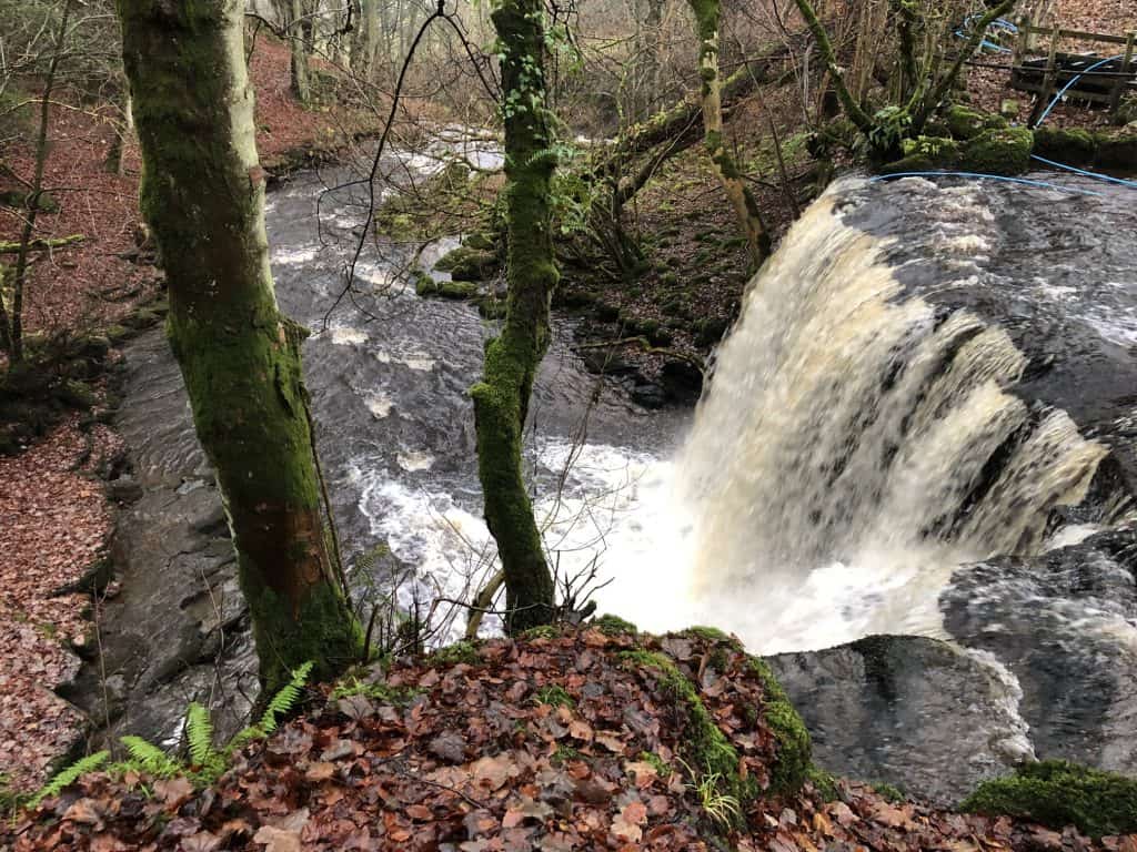
Lastly, journey south to connect with Wood Lane, leading you to the picturesque settlement of Skirethorns. From there, follow Skirethorns Lane eastwards to the village of Threshfield. Proceed south-east across the farmland, making your way to the mesmerising Linton Falls. To complete your delightful ramble in the Yorkshire Dales, return to Grassington via Sedber Lane, reflecting on the natural beauty and rich heritage experienced throughout your 10-mile adventure.
Grassington Walk Route
Visit either the OS Maps website or the Outdooractive website to view this walking route in greater detail. Both platforms offer a range of features, including the ability to print the route, download it to your device, and export the route as a GPX file. You can also watch a 3D fly-over and share the route on social media.
Recommended Ordnance Survey Map
The best map to use on this walk is the Ordnance Survey map of the Yorkshire Dales Southern & Western Area, reference OS Explorer OL2, scale 1:25,000. It clearly displays footpaths, rights of way, open access land and vegetation on the ground, making it ideal for walking, running and hiking. The map can be purchased from Amazon in either a standard, paper version or a weatherproof, laminated version, as shown below.
Standard Version
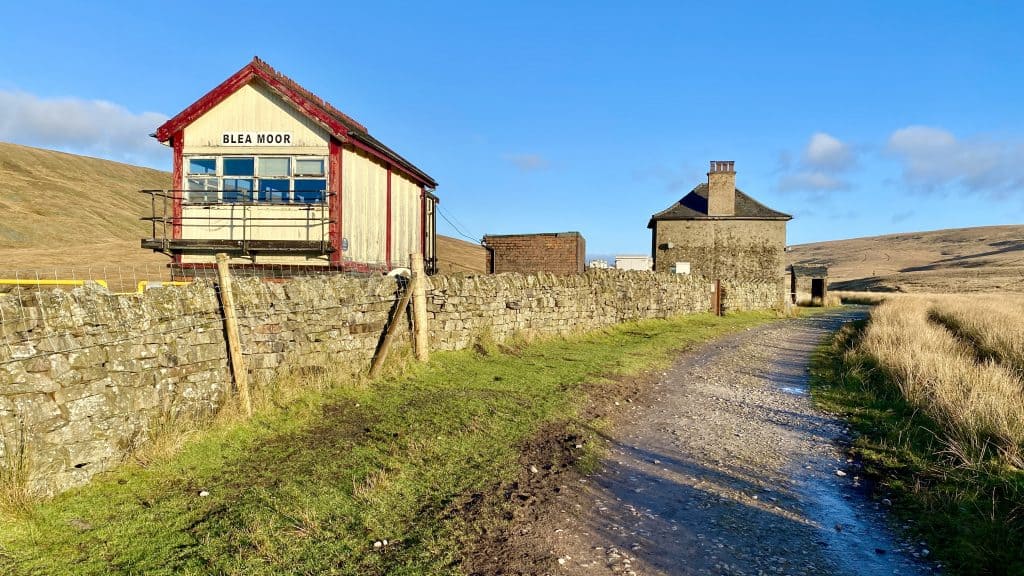
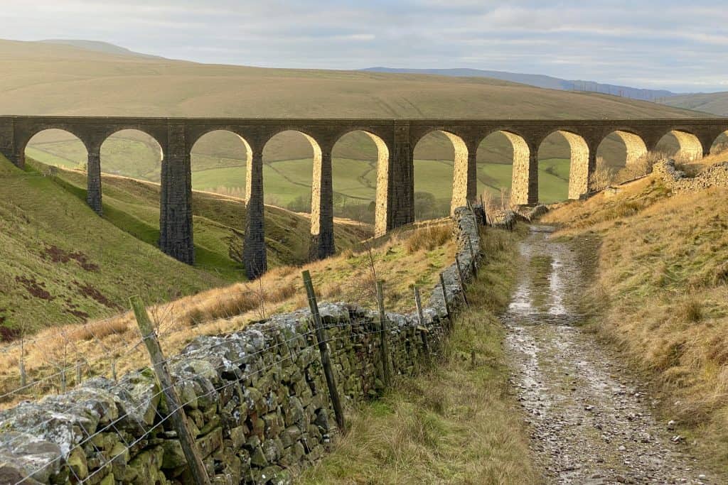
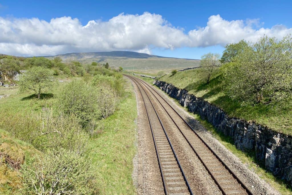
13. Whernside Walk: Unforgettable Hiking Experience from Ribblehead Viaduct
Distance: 10 Miles | Duration: 5 Hours | Total Ascent: 1853 Feet
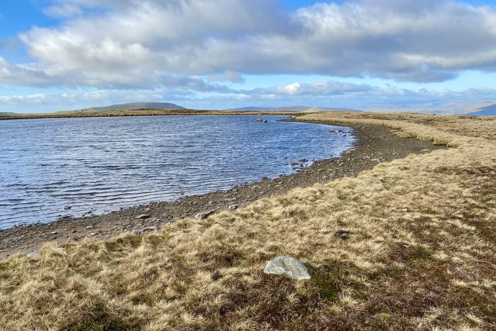
Begin this classic Yorkshire trail by setting off from the B6255 roadside car park and heading north-west towards the iconic Ribblehead Viaduct. Continue north, passing Bleamoor Sidings and following Blue Clay Ridge until you reach the impressive aqueduct near Smithy Hill. Proceed north-west on the Dales High Way, crossing Craven Wold until you arrive at Boot of the Wold. Next, turn south and join A Pennine Journey, which will lead you up towards Whernside.
As you follow A Pennine Journey, you’ll pass Whernside Tarns, ultimately reaching the summit of Whernside. Here, take a moment to enjoy the breathtaking views of the surrounding landscape. Then, head south and begin your descent of the mountain, remaining on A Pennine Journey until you reconnect with the Dales High Way near Bruntscar.
In the final leg of your walk, continue north-east through Broadrake and The Scar, stopping just before Winterscales Farm. From there, journey south-east towards Gunnerfleet Farm, ultimately returning to the Ribblehead Viaduct. Throughout this 10-mile Yorkshire trail, you will have experienced remarkable scenery and historical landmarks, making it a truly unforgettable adventure.
Whernside Walk Route
Visit either the OS Maps website or the Outdooractive website to view this walking route in greater detail. Both platforms offer a range of features, including the ability to print the route, download it to your device, and export the route as a GPX file. You can also watch a 3D fly-over and share the route on social media.
Recommended Ordnance Survey Map
The best map to use on this walk is the Ordnance Survey map of the Yorkshire Dales Southern & Western Area, reference OS Explorer OL2, scale 1:25,000. It clearly displays footpaths, rights of way, open access land and vegetation on the ground, making it ideal for walking, running and hiking. The map can be purchased from Amazon in either a standard, paper version or a weatherproof, laminated version, as shown below.
Standard Version
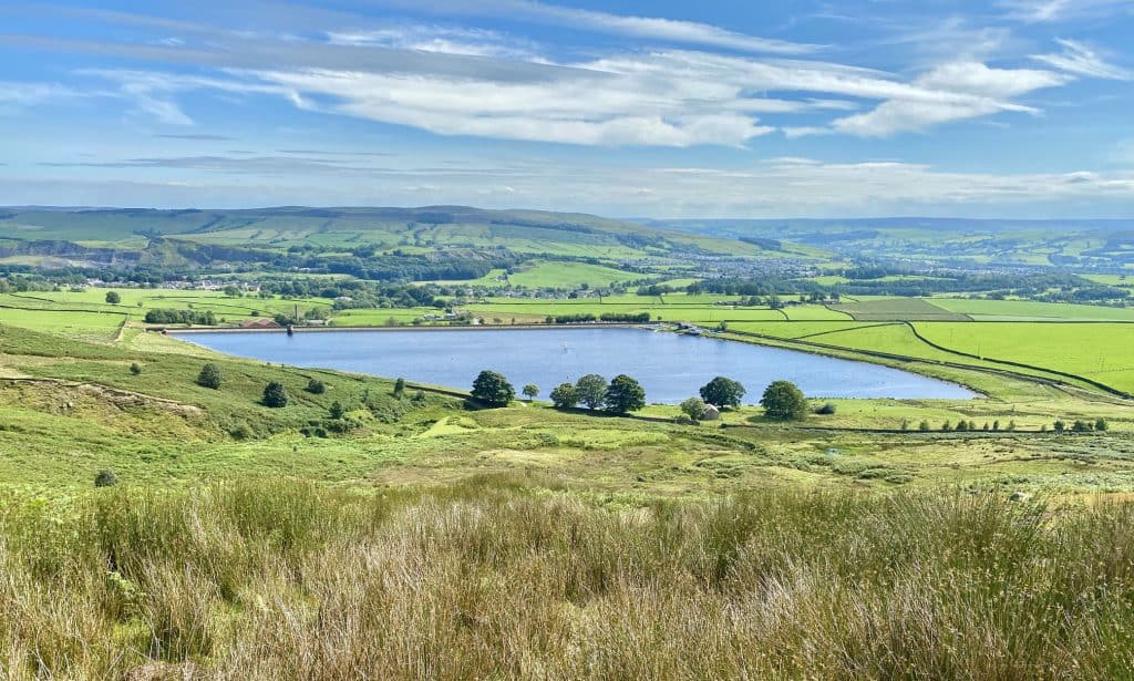
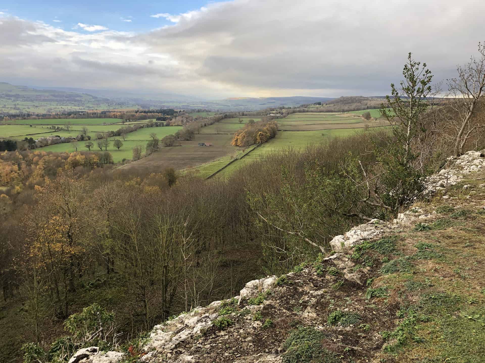
14. Barden Moor Walk: Explore Tranquil Reservoirs and Peaceful Moorland
Distance: 10 Miles | Duration: 5 Hours | Total Ascent: 1641 Feet
Experience one of the top walks in the Yorkshire Dales National Park, as you explore the Embsay and Barden Moor circuit. Starting from the charming village of Embsay, head north-east towards Eastby, following well-marked footpaths. Continue in a north-easterly direction, passing through Eastby Gate. As you approach Lower Barden Reservoir, admire the serene waters, which provide a perfect backdrop for a short break. From here, travel north-west on a stone track, leading you to Upper Barden Reservoir. Optionally, take a leisurely stroll along the reservoir’s northern banks, soaking in the peaceful atmosphere.
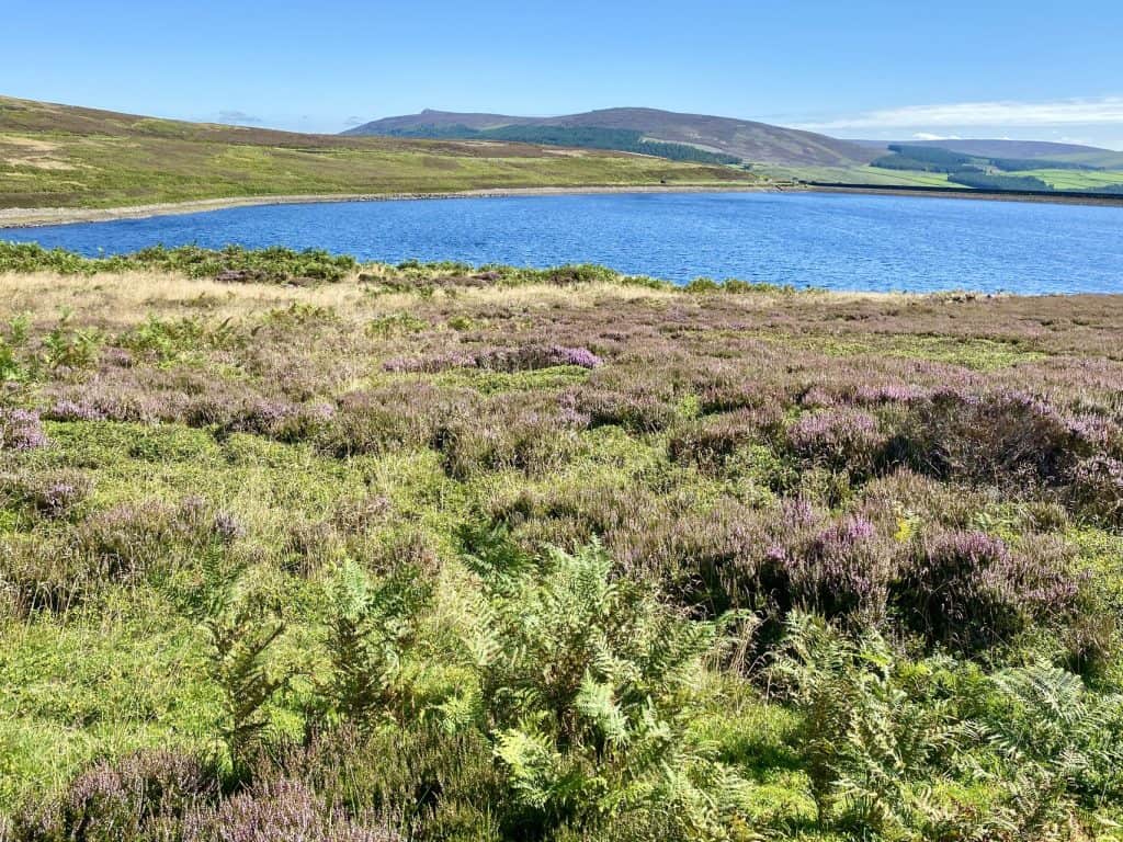
Next, cross the impressive reservoir dam, and venture south-west towards the bridleway on Brown Bank. Make your way westward along Bilton Ings, then head south to East Harts Hill. Continue south and prepare for the final stretch of your adventure. Descend towards Embsay Reservoir, a popular spot for walkers and nature enthusiasts alike. Wander around its banks in a clockwise direction, appreciating the picturesque setting and thriving birdlife.
Finally, head south-east, returning to Embsay, where you can reflect on the day’s journey and perhaps enjoy a well-deserved treat in the local pub. The total distance of this delightful walk is approximately 10 miles, with a duration of around 5 hours and a total ascent of 1,641 feet.
Barden Moor Walk Route
Visit either the OS Maps website or the Outdooractive website to view this walking route in greater detail. Both platforms offer a range of features, including the ability to print the route, download it to your device, and export the route as a GPX file. You can also watch a 3D fly-over and share the route on social media.
Recommended Ordnance Survey Map
The best map to use on this walk is the Ordnance Survey map of the Yorkshire Dales Southern & Western Area, reference OS Explorer OL2, scale 1:25,000. It clearly displays footpaths, rights of way, open access land and vegetation on the ground, making it ideal for walking, running and hiking. The map can be purchased from Amazon in either a standard, paper version or a weatherproof, laminated version, as shown below.
Standard Version
15. Dent Head Viaduct Walk: A Memorable Journey Through Yorkshire Dales
Distance: 11 Miles | Duration: 5½ Hours | Total Ascent: 2008 Feet
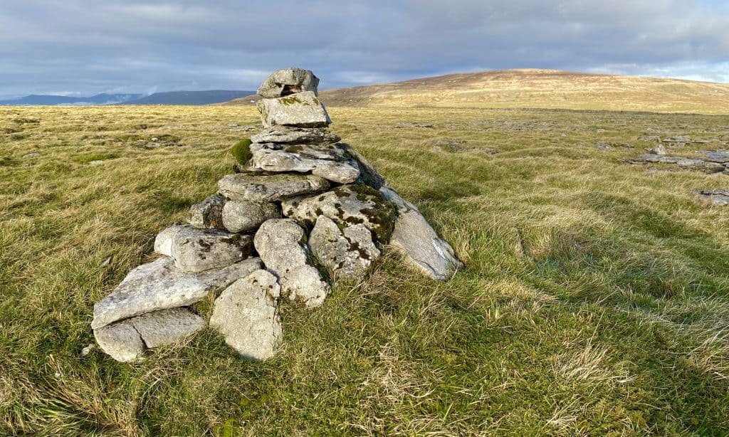
Start your hike in the Yorkshire Dales at Dent Head Viaduct, where you will head north-west along the minor road towards Bridge End Cottage. Then, continuing south through Dent Head Farm, you’ll encounter the northern entrance of Bleamoor Tunnel before venturing up into the woodlands of Mossy Bottom. Following a U-turn in the woodland, follow the minor road south-east towards Newby Head Gate. Next, head north along the Pennine Bridleway, and take a detour to the summit of Wold Fell, offering spectacular views of the surrounding countryside.
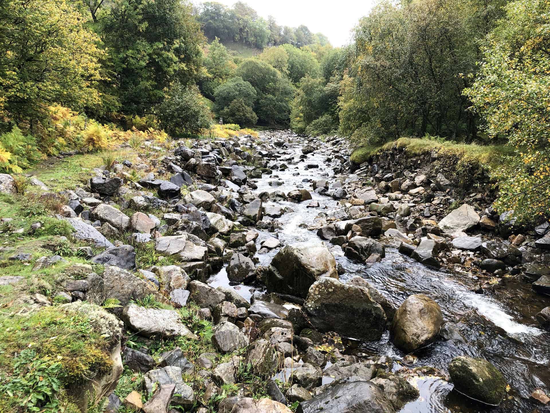
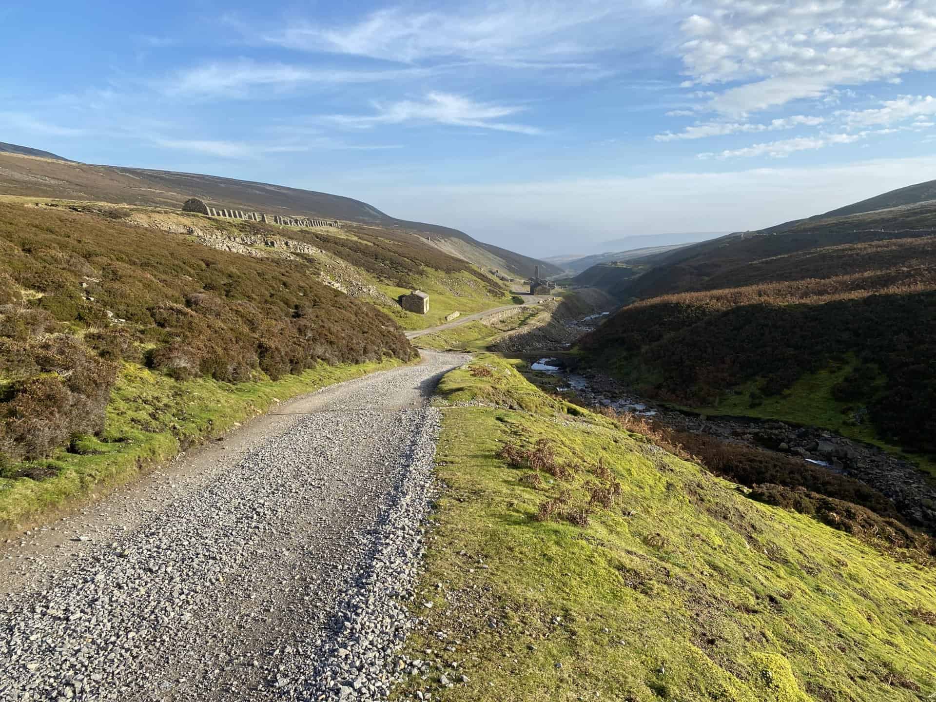
From Wold Fell, continue north to reach the summit of Great Knoutberry Hill, another highlight of this hike in the Yorkshire Dales. As you descend westwards alongside a dry stone wall, you’ll rejoin the Pennine Bridleway near Green Bank. Traverse the western and southern flanks of Great Knoutberry Hill in an anti-clockwise direction, then make your way westwards through Arten Gill. Here, you’ll be greeted by the impressive Arten Gill Viaduct and the lovely descent towards Stonehouse Farm.
As you approach the end of this 11-mile hike, which takes roughly 5½ hours and includes a total ascent of 2008 feet, head south back to Dent Head Viaduct along the minor road. Be sure to take a moment to appreciate the picturesque waterfalls on the River Dee, which can be found beside the road. This captivating and invigorating hike in the Yorkshire Dales promises an unforgettable experience, showcasing the region’s stunning natural beauty and remarkable landmarks.
Dent Head Viaduct Walk Route
Visit either the OS Maps website or the Outdooractive website to view this walking route in greater detail. Both platforms offer a range of features, including the ability to print the route, download it to your device, and export the route as a GPX file. You can also watch a 3D fly-over and share the route on social media.
Recommended Ordnance Survey Map
The best map to use on this walk is the Ordnance Survey map of the Yorkshire Dales Southern & Western Area, reference OS Explorer OL2, scale 1:25,000. It clearly displays footpaths, rights of way, open access land and vegetation on the ground, making it ideal for walking, running and hiking. The map can be purchased from Amazon in either a standard, paper version or a weatherproof, laminated version, as shown below.
Standard Version
16. Ingleborough National Nature Reserve Walk: Experience the Best of Ribblesdale
Distance: 11 Miles | Duration: 5½ Hours | Total Ascent: 1956 Feet
Discover one of the best Yorkshire Dales walks by embarking on an 11-mile journey through the stunning Ingleborough National Nature Reserve. This invigorating hike, taking approximately 5½ hours to complete, boasts a total ascent of 1956 feet. Begin by heading south-east along Gauber Road for 250 metres, before approaching Colt Park. From here, prepare for a challenging south-westerly ascent to reach the summit of Park Fell. Continue south-west, conquering another climb to Simon Fell, before descending and heading south to join the Dales High Way.
Next, make your way east towards Nick Pot and on to Sulber in the heart of the Ingleborough National Nature Reserve. Take a moment to appreciate the striking beauty of this protected area, rich in limestone pavements and unique flora. Afterwards, proceed north-east, descending into the picturesque Ribblesdale valley. Cross the B6479 road, pass under the railway line, and cross the River Ribble to meet with the Pennine Bridleway.
Lastly, follow the trail north to High Birkwith, then venture north-west towards the intriguing God’s Bridge. Continue your journey via Nether Lodge and Ingman Lodge, a popular route among Yorkshire Three Peaks Challenge walkers. Conclude your adventure by returning to Gauber Road, having experienced one of the finest excursions the Yorkshire Dales has to offer.
Ingleborough National Nature Reserve Walk Route
Visit either the OS Maps website or the Outdooractive website to view this walking route in greater detail. Both platforms offer a range of features, including the ability to print the route, download it to your device, and export the route as a GPX file. You can also watch a 3D fly-over and share the route on social media.
Recommended Ordnance Survey Map
The best map to use on this walk is the Ordnance Survey map of the Yorkshire Dales Southern & Western Area, reference OS Explorer OL2, scale 1:25,000. It clearly displays footpaths, rights of way, open access land and vegetation on the ground, making it ideal for walking, running and hiking. The map can be purchased from Amazon in either a standard, paper version or a weatherproof, laminated version, as shown below.
Standard Version
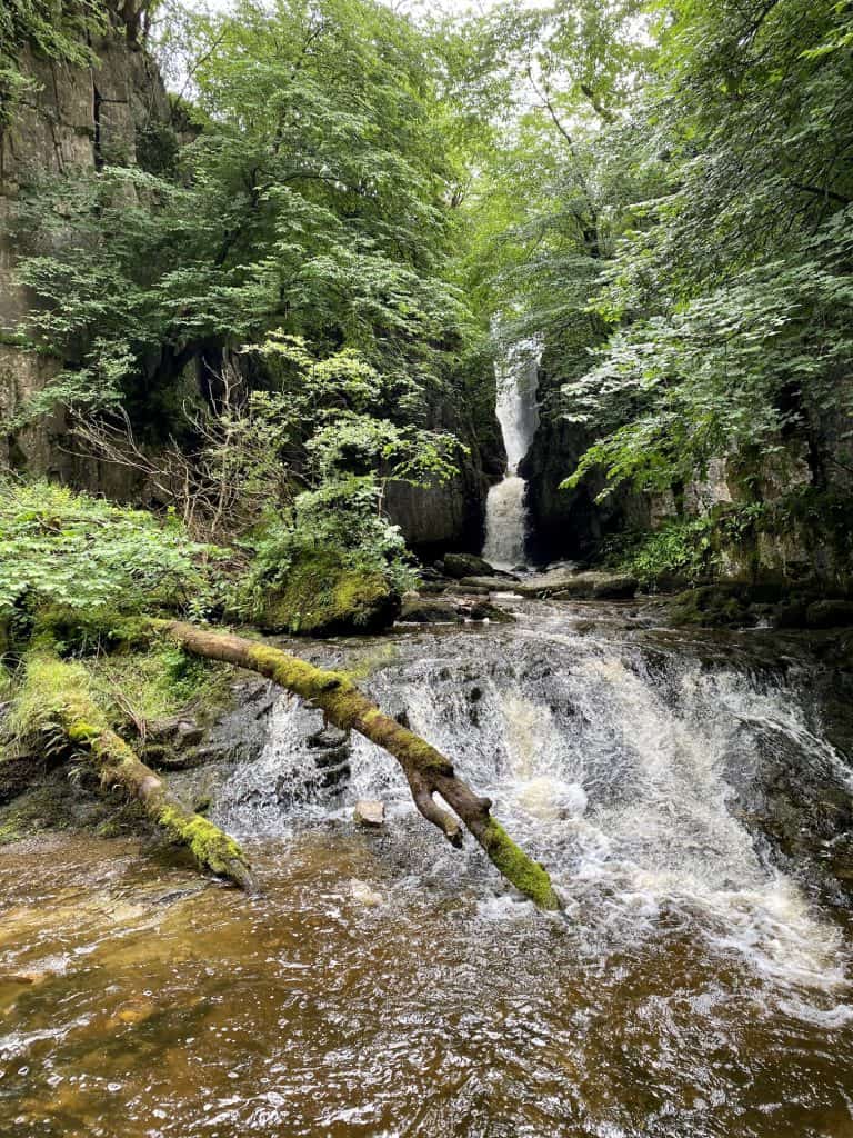
17. Catrigg Force Walk: Explore Waterfalls and Caves in Yorkshire Dales
Distance: 11 Miles | Duration: 5½ Hours | Total Ascent: 1932 Feet
Begin your Yorkshire Dales walk in the charming village of Langcliffe, setting off north-east towards Lower Winskill and then Upper Winskill. From there, continue to Catrigg Force, a captivating waterfall on Stainforth Beck. Next, head south-east to the cattle grid near Cowside on a minor road. Follow the road south-west to another cattle grid, and proceed south until you reach the Pennine Bridleway near Jubilee Cave.
In the second stage of your journey, walk east along the Pennine Bridleway, taking in the stunning landscape of Langcliffe Scar. Upon reaching Langscar, venture south-west across Grizedales, a picturesque area filled with natural beauty. Afterward, head west on the combined Pennine Bridleway and Dales High Way to Attermire Cave, a fascinating geological feature worth exploring.
Finally, make your way north through the dry valley nestled below Attermire Scar and Brent Scar, marvelling at the distinctive terrain. Arrive at the intriguing Victoria Cave, another highlight of this Yorkshire Dales walk. To complete your trek, follow a path and minor road westward, which will lead you back to the starting point in Langcliffe. This 11-mile route, with a total ascent of 1932 feet, can be comfortably completed in approximately 5½ hours, offering a memorable and rewarding experience for all who undertake it.
Catrigg Force Walk Route
Visit either the OS Maps website or the Outdooractive website to view this walking route in greater detail. Both platforms offer a range of features, including the ability to print the route, download it to your device, and export the route as a GPX file. You can also watch a 3D fly-over and share the route on social media.
Recommended Ordnance Survey Map
The best map to use on this walk is the Ordnance Survey map of the Yorkshire Dales Southern & Western Area, reference OS Explorer OL2, scale 1:25,000. It clearly displays footpaths, rights of way, open access land and vegetation on the ground, making it ideal for walking, running and hiking. The map can be purchased from Amazon in either a standard, paper version or a weatherproof, laminated version, as shown below.
Standard Version
18. West Burton Waterfall Walk: Experience the Charm of Wensleydale from Carlton
Distance: 10 Miles | Duration: 4¾ Hours | Total Ascent: 1645 Feet
Begin your Yorkshire Dales trek in the charming village of Carlton, where you’ll head west towards Howden Scar. Follow the well-defined path as it crosses the scenic moorland between Harland Hill and Height of Hazely, before descending towards the little hamlet of Cote. Continue northwards, via Cote Bridge and walking along the eastern bank of Walden Beck until you reach the picturesque West Burton waterfall, a perfect spot for a well-deserved break.
As you explore West Burton, take time to appreciate the delightful village atmosphere before crossing Burton Bridge and proceeding north-east along Morpeth Gate. This route will lead you to the remarkable Morpeth Scar, which boasts breathtaking views over the vast expanse of Wensleydale. From here, head east along High Lane, making your way towards Penhill Farm.
Finally, embark on the last leg of your Yorkshire Dales trek by heading south along a quiet country road before venturing onto the open moors. Traverse the undulating landscape of Melmerby Moor and make your descent back to Carlton. By the end of this 10-mile trek, you will have experienced some of the most captivating sights that Wensleydale has to offer, making it an unforgettable adventure for anyone exploring the Yorkshire Dales.
West Burton Waterfall Walk Route
Visit either the OS Maps website or the Outdooractive website to view this walking route in greater detail. Both platforms offer a range of features, including the ability to print the route, download it to your device, and export the route as a GPX file. You can also watch a 3D fly-over and share the route on social media.
Recommended Ordnance Survey Map
The best map to use on this walk is the Ordnance Survey map of the Yorkshire Dales Northern & Central Area, reference OS Explorer OL30, scale 1:25,000. It clearly displays footpaths, rights of way, open access land and vegetation on the ground, making it ideal for walking, running and hiking. The map can be purchased from Amazon in either a standard, paper version or a weatherproof, laminated version, as shown below.
Standard Version
19. Leyburn Shawl Walk: A Perfect Introduction to the Yorkshire Dales
Distance: 10 Miles | Duration: 4½ Hours | Total Ascent: 881 Feet
Enjoy one of the most popular walks in the Yorkshire Dales, as you explore the picturesque 10-mile route through Wensleydale, starting from Leyburn. This leisurely walk, with a duration of approximately 4½ hours and a total ascent of just 881 feet, begins by heading west across the stunning Leyburn Shawl, offering breath-taking views of the Wensleydale valley. Continue on towards Tullis Cote before arriving at the charming village of Preston-under-Scar.
Upon reaching Preston-under-Scar, wander through the village and enjoy the tranquil atmosphere before setting off across the fields in a westerly direction to a point just before Hargill Lane. Then walk south, and you’ll descend towards the quaint village of Redmire, where you can explore its historic charm. Once you’re ready to move on, head south-east out of Redmire along Well Lane, which will guide you towards West Wood.
In the final stretch of this captivating walk, you’ll follow a track through West Wood, passing by the impressive Bolton Hall and continuing through the scenic Wensley Park to get to the village of Wensley. Complete the loop by traversing the picturesque farmland that connects Wensley back to your starting point in Leyburn. This unforgettable journey through the Yorkshire Dales provides a perfect blend of natural beauty and charming villages, making it an ideal choice for walkers seeking an authentic Wensleydale experience.
Leyburn Shawl Walk Route
Visit either the OS Maps website or the Outdooractive website to view this walking route in greater detail. Both platforms offer a range of features, including the ability to print the route, download it to your device, and export the route as a GPX file. You can also watch a 3D fly-over and share the route on social media.
Recommended Ordnance Survey Map
The best map to use on this walk is the Ordnance Survey map of the Yorkshire Dales Northern & Central Area, reference OS Explorer OL30, scale 1:25,000. It clearly displays footpaths, rights of way, open access land and vegetation on the ground, making it ideal for walking, running and hiking. The map can be purchased from Amazon in either a standard, paper version or a weatherproof, laminated version, as shown below.
Standard Version
20. Wensleydale Walk: West Burton, Aysgarth Falls, and River Ure Delights
Distance: 10 Miles | Duration: 4½ Hours | Total Ascent: 1202 Feet
Check out this delightful 10-mile Wensleydale walk from West Burton to Aysgarth Falls, which takes approximately 4½ hours to complete and includes a total ascent of 1202 feet. The journey begins by heading north from West Burton along Eshington Lane, crossing picturesque fields before reaching the A684 road. From here, continue to the charming church near Aysgarth Falls, then follow the River Ure north-east towards Hestholme Farm. As you progress along the trail, take in the stunning views of the river, its waterfalls, and surrounding countryside.
Continuing on this Wensleydale walk, venture further north-east, keeping the River Ure to your left as you make your way towards Wanlass Park. Upon reaching High Wanless, turn south and join Flats Lane, which will guide you to the quaint village of West Witton. As you leave the village, head west via Green Gate towards Morpeth Scar, a fantastic vantage point offering great views of Wensleydale’s hills and landscapes.
To conclude your Wensleydale walk, descend south-west along Morpeth Gate, where you will be greeted by the enchanting West Burton waterfall. After soaking in the atmosphere of the falls, make your way back to the village of West Burton, completing this unforgettable 10-mile journey through the heart of the Yorkshire Dales.
Wensleydale Walk Route
Visit either the OS Maps website or the Outdooractive website to view this walking route in greater detail. Both platforms offer a range of features, including the ability to print the route, download it to your device, and export the route as a GPX file. You can also watch a 3D fly-over and share the route on social media.
Recommended Ordnance Survey Map
The best map to use on this walk is the Ordnance Survey map of the Yorkshire Dales Northern & Central Area, reference OS Explorer OL30, scale 1:25,000. It clearly displays footpaths, rights of way, open access land and vegetation on the ground, making it ideal for walking, running and hiking. The map can be purchased from Amazon in either a standard, paper version or a weatherproof, laminated version, as shown below.
Standard Version
21. Gunnerside Walk: Lead Mines, Moors, and Breathtaking Views
Distance: 9 Miles | Duration: 4½ Hours | Total Ascent: 1722 Feet
Begin your adventure with one of the best walks in the Yorkshire Dales by setting off northward from the charming village of Gunnerside. Follow the picturesque Gunnerside Beck through the valley, ultimately arriving at the historic lead mines in Gunnerside Gill.
Next, head east across the windswept Melbecks Moor, passing the remnants of Old Gang Mines. Continue onwards to Hard Level Gill, and from there, travel south-east alongside the babbling Old Gang Beck. This route will guide you to the Old Gang Smelting Mills, an important piece of Yorkshire’s lead mining history. Once you have explored these impressive ruins, make your way to the nearby Surrender Bridge, where you will find a minor road.
Follow the road southward for approximately 300 metres before veering south-west around Feetham Pasture. As you approach Blades, shift your course westward, allowing you to take in the magnificent panoramas of the Swaledale valley. With each step, admire the stunning views and immerse yourself in the beauty of the Yorkshire Dales. Finally, descend back towards Gunnerside, where your unforgettable walk in this remarkable region of North Yorkshire began.
Gunnerside Walk Route
Visit either the OS Maps website or the Outdooractive website to view this walking route in greater detail. Both platforms offer a range of features, including the ability to print the route, download it to your device, and export the route as a GPX file. You can also watch a 3D fly-over and share the route on social media.
Recommended Ordnance Survey Map
The best map to use on this walk is the Ordnance Survey map of the Yorkshire Dales Northern & Central Area, reference OS Explorer OL30, scale 1:25,000. It clearly displays footpaths, rights of way, open access land and vegetation on the ground, making it ideal for walking, running and hiking. The map can be purchased from Amazon in either a standard, paper version or a weatherproof, laminated version, as shown below.
Standard Version
22. Swaledale Walk: Scenic Waterfalls and an Ancient Iron Age Settlement
Distance: 10 Miles | Duration: 4½ Hours | Total Ascent: 1385 Feet
Explore a delightful 10-mile Yorkshire Dales walk, as you set out from the charming village of Healaugh, heading east towards the impressive suspension bridge over the River Swale near Reeth. From there, continue your journey by ascending south-west via Harkerside, then following a minor road and going uphill to discover the ancient Iron Age settlement of Maiden Castle. As you traverse the northern flanks of High Harker Hill, make your way along the bridleway beneath High Carl to reach Whitaside Moor.
Next, descend from Whitaside Moor, crossing the minor road and continuing downhill to marvel at the stunning waterfalls of Haverdale Beck, located just outside the hamlet of Crackpot. After taking in the beauty of these cascades, proceed towards Isles Bridge to cross the River Swale once more. Following the river, head north-east and cross the B6270 near Feetham Wood.
Lastly, navigate through picturesque fields towards Barney Beck High Bridge, which spans the scenic Barney Beck. Crossing the bridge, follow a minor road that leads you back to the starting point in Healaugh, completing your 4½-hour adventure with a total ascent of 1385 feet.
Swaledale Walk Route
Visit either the OS Maps website or the Outdooractive website to view this walking route in greater detail. Both platforms offer a range of features, including the ability to print the route, download it to your device, and export the route as a GPX file. You can also watch a 3D fly-over and share the route on social media.
Recommended Ordnance Survey Map
The best map to use on this walk is the Ordnance Survey map of the Yorkshire Dales Northern & Central Area, reference OS Explorer OL30, scale 1:25,000. It clearly displays footpaths, rights of way, open access land and vegetation on the ground, making it ideal for walking, running and hiking. The map can be purchased from Amazon in either a standard, paper version or a weatherproof, laminated version, as shown below.
Standard Version
23. Langthwaite Walk: Explore Quaint Villages and Breathtaking Landscapes
Distance: 10 Miles | Duration: 4¾ Hours | Total Ascent: 1624 Feet
Embark on an invigorating 10-mile hike in the Yorkshire Dales, taking in the picturesque villages of Langthwaite and Reeth. Begin in Langthwaite and head south along Raw Bank, a minor road, towards the hamlet of Arkle Town. Prepare for a rewarding climb across the moors, where you’ll conquer the summit of Calver Hill. Next, descend and venture east across the moorland, passing Riddings Farm before strolling along Skelgate Lane and into the village of Reeth. Allocate time for a well-deserved break, perhaps enjoying a refreshing beverage in one of Reeth’s inviting pubs, and explore the village’s captivating charm.
Cross the historic Reeth Bridge over Arkle Beck, and continue north-west, tracing the picturesque route of Arkle Beck through the Arkengarthdale valley. Along the way, discover the impressive landmarks of Castle, Storthwaite Hall, and Booze. As you progress westward, pass beneath Langthwaite Scar before making a northern turn. Following a U-turn at Windegg Lane, descend into the valley, and prepare to cross Arkle Beck once more. As you approach the end of your hike in the Yorkshire Dales, venture south past the charming church and return to the starting point in Langthwaite village.
This 10-mile hike in the Yorkshire Dales offers an unforgettable experience, taking approximately 4¾ hours to complete with a total ascent of 1624 feet. Lace up your walking boots, and embrace the stunning beauty of the Yorkshire Dales as you follow this delightful route through Langthwaite, Reeth, and the breathtaking Arkengarthdale valley.
Langthwaite Walk Route
Visit either the OS Maps website or the Outdooractive website to view this walking route in greater detail. Both platforms offer a range of features, including the ability to print the route, download it to your device, and export the route as a GPX file. You can also watch a 3D fly-over and share the route on social media.
Recommended Ordnance Survey Map
The best map to use on this walk is the Ordnance Survey map of the Yorkshire Dales Northern & Central Area, reference OS Explorer OL30, scale 1:25,000. It clearly displays footpaths, rights of way, open access land and vegetation on the ground, making it ideal for walking, running and hiking. The map can be purchased from Amazon in either a standard, paper version or a weatherproof, laminated version, as shown below.
Standard Version
Amazon’s Top Walking Boots: Four Standout Choices for Men and Women
For walking and hiking, the right boots are essential for both comfort and safety. While Amazon boasts a wide range, certain boots emerge as top-sellers. From those, here are four I personally favour. As an Amazon affiliate, I may earn a small commission from any purchases made through the links provided. This helps support the upkeep of this website. Rest assured, you won’t pay a penny extra, but your purchase will contribute to keeping my site running smoothly. Happy walking!

Berghaus Men’s Hillmaster II Gore-Tex Walking Boots
These fully waterproof leather walking boots feature a Gore-Tex lining, ensuring no water enters whilst allowing feet to breathe and stay cool. Made from full-grain leather, they promise unmatched durability and comfort. The boots come with memory foam tongues and cuffs that mould to your feet for a tailored fit, and the Vibram Hillmaster outsoles offer confidence on challenging terrains.

Salewa Men’s Mountain Trainer Mid Gore-Tex Walking Boots
Made from durable suede and abrasion-resistant textile, these men’s hiking boots are both lightweight and sturdy. The upper material is enhanced by a 360° full rubber sheath. Their dual-layer midsole with Bilight technology ensures ergonomic cushioning and grip, especially on extended hikes. The Vibram Wrapping Thread Combi outsoles allow a natural walking feel, and the Gore-Tex lining provides waterproofing, breathability, and optimal weather protection. Furthermore, the patented Salewa 3F system ensures flexibility, a secure heel grip, and a blister-free fit.

Berghaus Women’s Supalite II Gore-Tex Walking Boots
Specially designed for women, these hiking boots offer waterproofing and breathability, thanks to their Gore-Tex lining. Crafted from full-grain abrasion-resistant leather, they’re durable enough for the toughest hikes. The Supalite soles ensure stability and traction, and the EVA midsoles add comfort for extended walks.

Merrell Women’s Moab 3 Mid Gore-Tex Walking Boots
These hiking boots incorporate a Gore-Tex waterproof membrane, blending breathability with superior waterproof performance. The combination of pigskin leather and mesh on the uppers, along with the suede outer material, ensure durability and style. Enhancements include 100% recycled laces, webbing, and mesh lining. Additionally, bellows tongues, protective toe caps, and Vibram TC5+ rubber soles ensure protection and ease on any terrain.