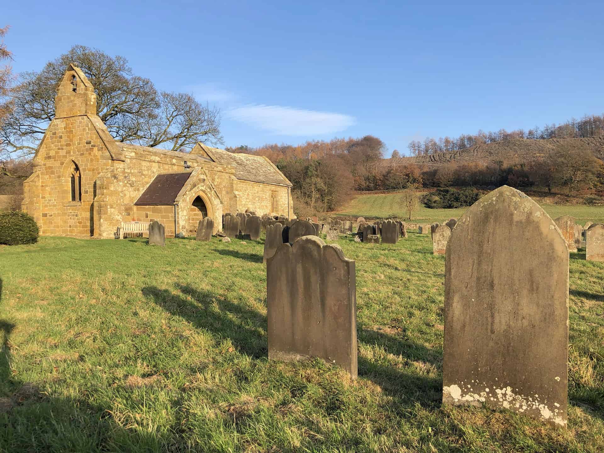
Experience the Best Walks in the North York Moors with This Ultimate Directory
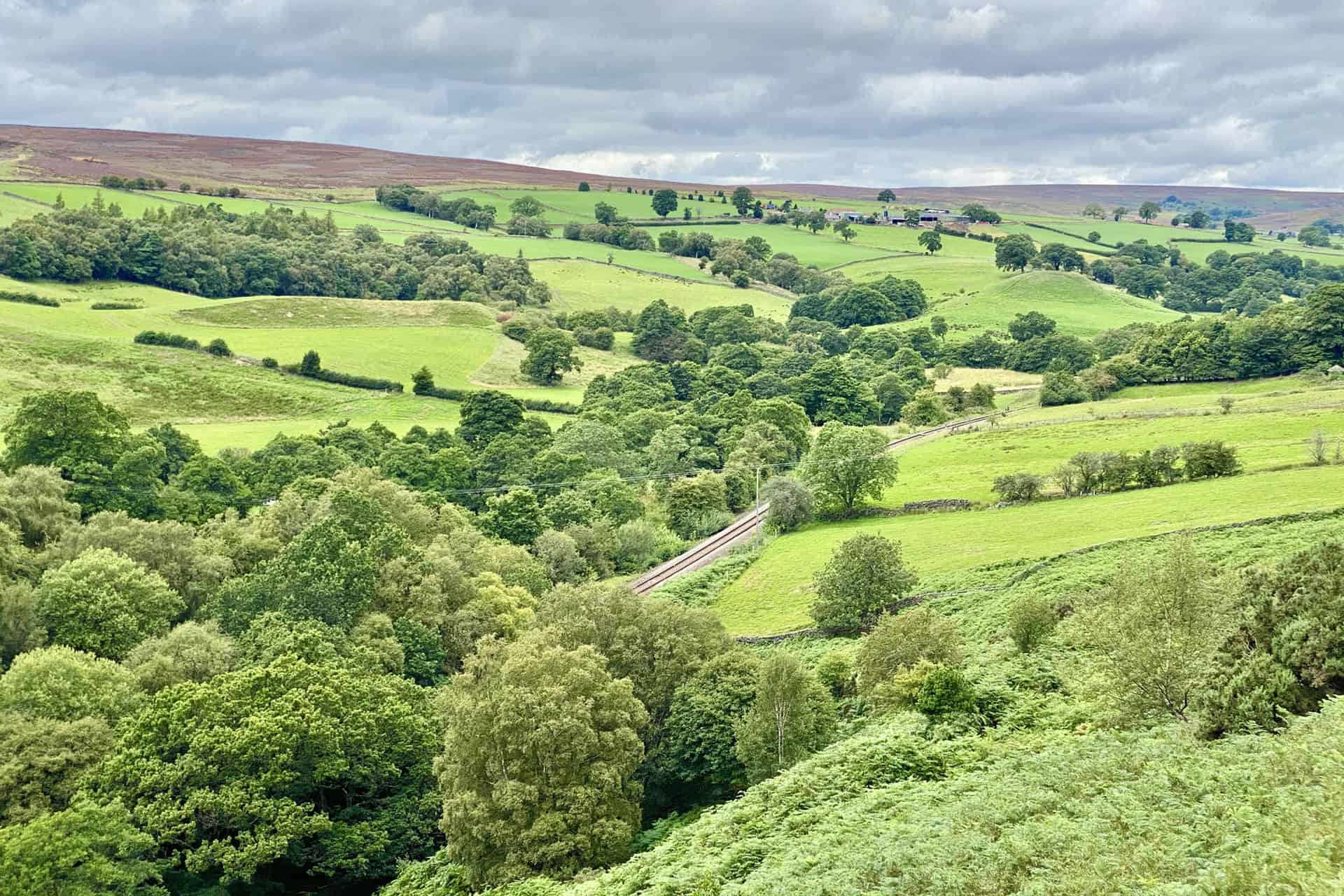
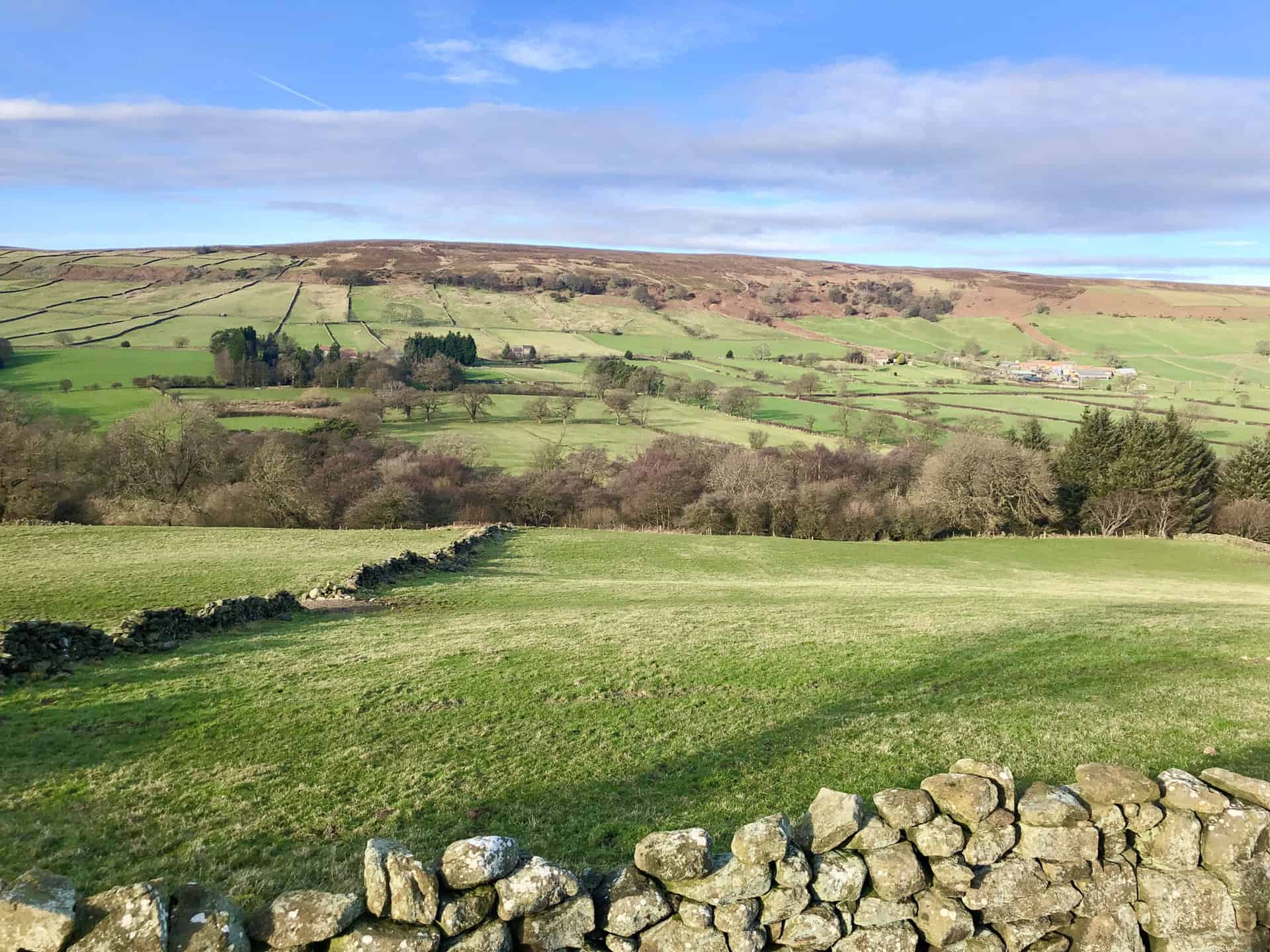
Uncover the 17 best walks in the North York Moors, a picturesque region renowned for its dramatic moorland, tranquil woodlands, and stunning coastlines. Embark on circular trails spanning between 9 and 12 miles, taking you an estimated 4 to 6 hours to complete. These walks traverse the captivating North York Moors regions including Robin Hood’s Bay, Glaisdale, Ravenscar, Grosmont, Sinnington, and Hackness.
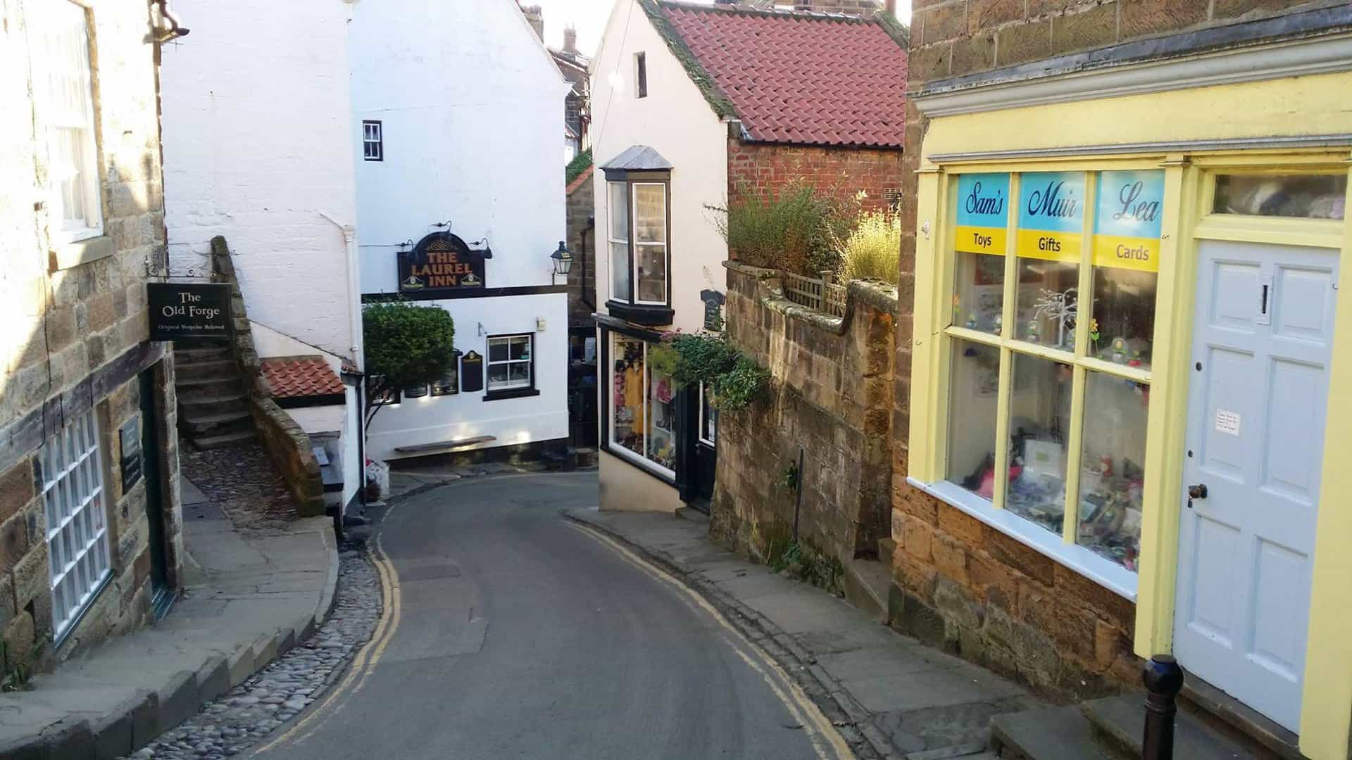
Meander through charming villages such as Egton Bridge, Lockton, Commondale, and Rosedale Abbey. Marvel at stunning geographical features like the cliffs of the Cleveland Way, the tranquil Glaisdale valley, the scenic Esk Valley, and the fascinating Bridestones Nature Reserve. Additionally, you’ll encounter serene bodies of water, including Lowdales Beck, the River Esk, and the River Seven.
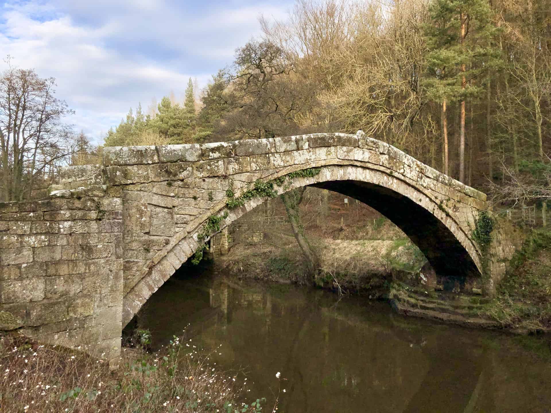
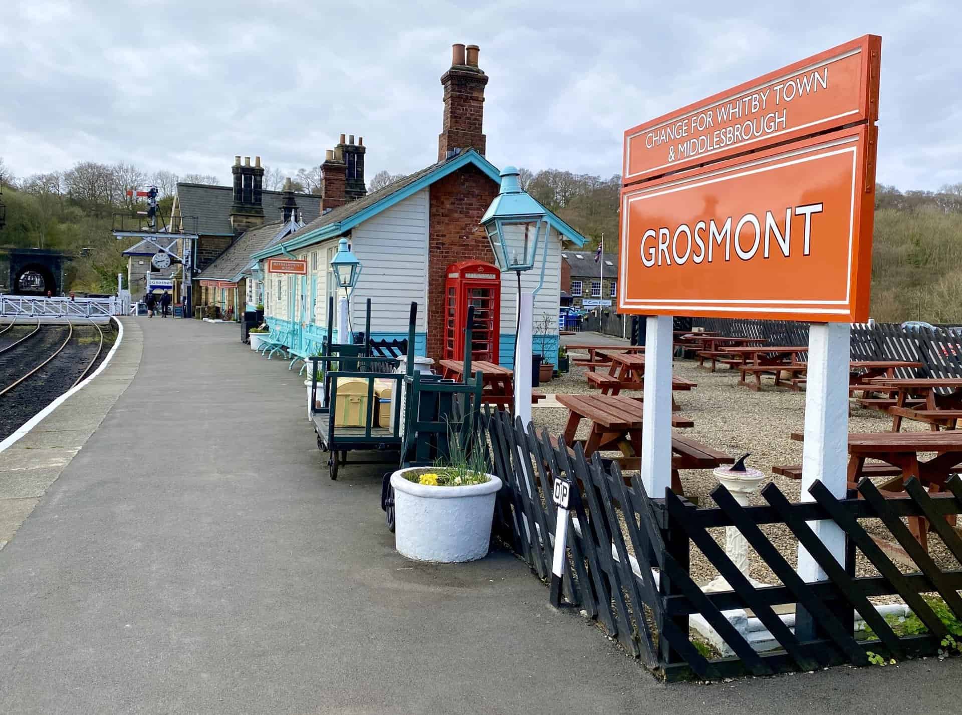
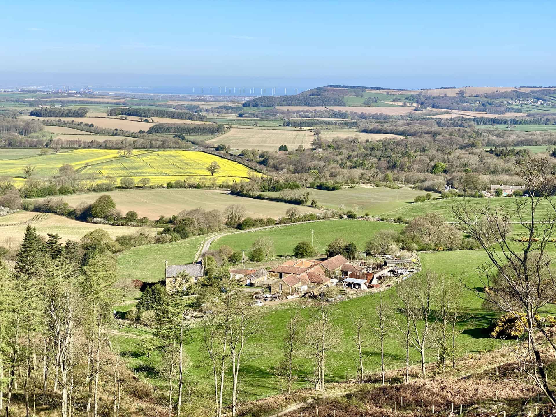
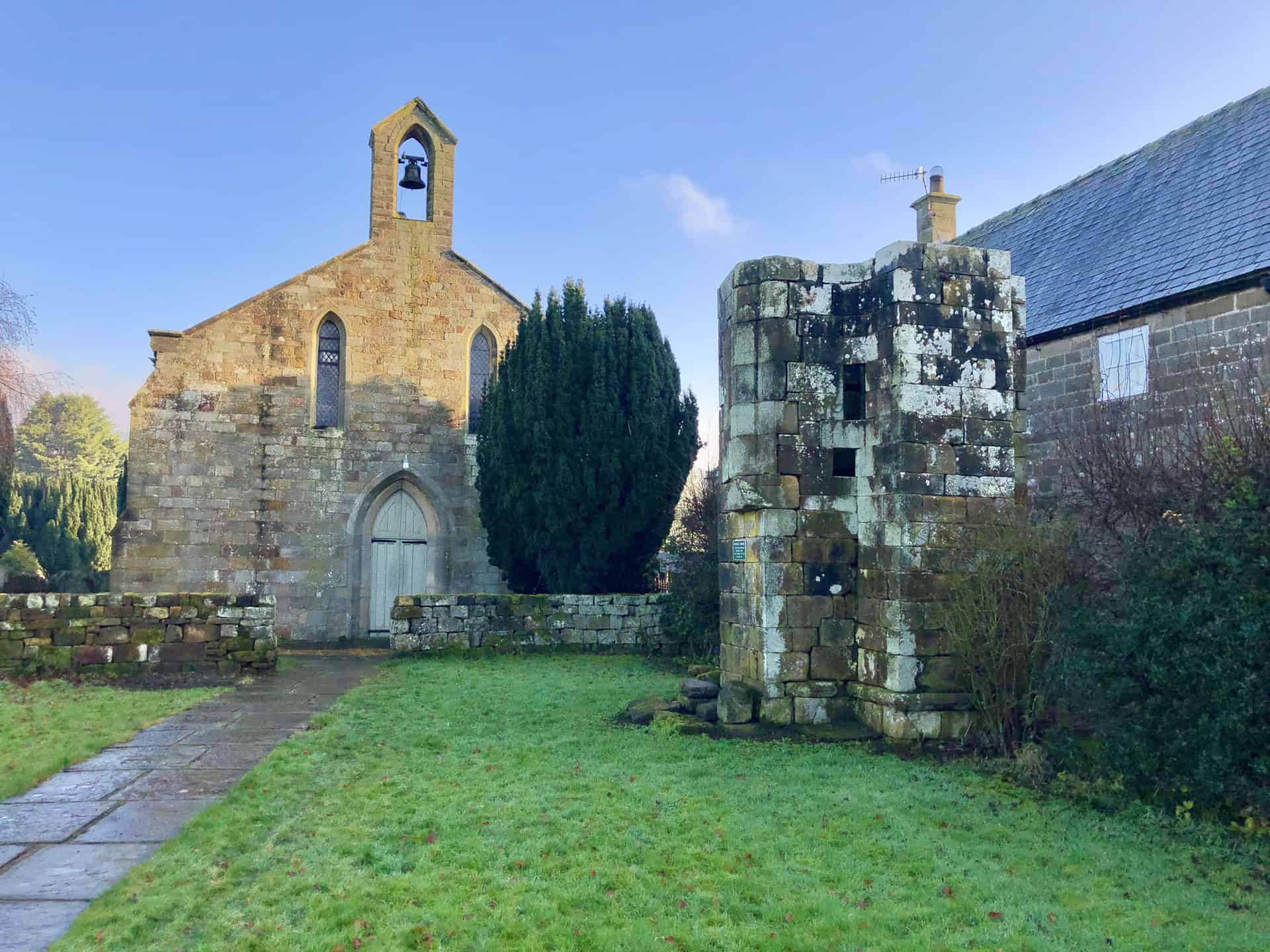
Experience the rich heritage of the North York Moors with highlights such as the historic Grosmont Railway Station, the Beggar’s Bridge in Glaisdale, and the fascinating railway heritage between Grosmont and Goathland. Immerse yourself in the untouched beauty of regions like Cropton Forest, Dalby Forest, and Guisborough Woods. Challenge yourself with climbs up Black Hambleton, Highcliff Nab, and Hanging Stone.
Dive into the stunning scenery of Thwaite Wood, Staindale Lodge, Ellers Wood, and the tranquil Whisper Dales. Gaze at unique geological formations like the Hole of Horcum and marvel at the rural charm of the farming villages that dot your paths. Lastly, enjoy peaceful walks alongside the many rivers and streams that run through this region, including the River Esk and River Seven.
Each walk in my guide provides route directions, a few photos captured during the walk, and recommendations for which Ordnance Survey Maps to use, as well as purchase options. Additionally, all 17 walks have links to both the OS Maps website and the Outdooractive website, allowing you to view the routes in greater detail. Benefit from features such as printing the route, downloading it to your device, exporting it as a GPX file, watching a 3D fly-over, and sharing your adventure on social media.
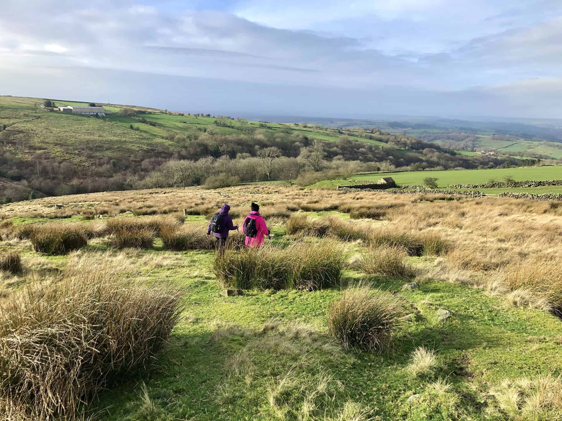
Embark on the best walks in the North York Moors and create unforgettable memories in this mesmerising region. With a wealth of enchanting trails, breathtaking viewpoints, and quaint villages, the North York Moors is a walker’s paradise. Read on to discover my carefully curated selection of 17 awe-inspiring walks that will guide you through lush woodlands, moorlands, and along scenic coastlines.
17 Best Walks in the North York Moors: Summary of the Walks
| Number | Walk Name | Distance | Duration | Total Ascent |
|---|---|---|---|---|
| 1 | Robin Hood’s Bay Walk | 9 Miles | 4 Hours | 1150 Feet |
| 2 | Falling Foss Walk | 10 Miles | 4½ Hours | 1323 Feet |
| 3 | Glaisdale Walk | 10 Miles | 4¾ Hours | 1562 Feet |
| 4 | Ravenscar Walk | 10 Miles | 4¾ Hours | 1507 Feet |
| 5 | Goathland Walk | 11 Miles | 5 Hours | 1657 Feet |
| 6 | Grosmont Walk | 11 Miles | 5¼ Hours | 1387 Feet |
| 7 | Cropton Forest Walk | 11 Miles | 5¼ Hours | 1336 Feet |
| 8 | Whisper Dales Walk | 9 Miles | 4 Hours | 640 Feet |
| 9 | Thornton-le-Dale Walk | 11 Miles | 5 Hours | 1000 Feet |
| 10 | Bridestones Walk | 10 Miles | 4¾ Hours | 1343 Feet |
| 11 | Beck Hole Walk | 9 Miles | 4¼ Hours | 1373 Feet |
| 12 | Littlebeck Walk | 10 Miles | 4¾ Hours | 1716 Feet |
| 13 | Guisborough Woods Walk | 11 Miles | 5 Hours | 1414 Feet |
| 14 | Castleton and Danby Walk | 10 Miles | 4¾ Hours | 1484 Feet |
| 15 | Black Hambleton Walk | 11 Miles | 5¼ Hours | 1598 Feet |
| 16 | Farndale Walk | 11 Miles | 5 Hours | 1367 Feet |
| 17 | Rosedale Abbey Walk | 12 Miles | 5½ Hours | 1423 Feet |
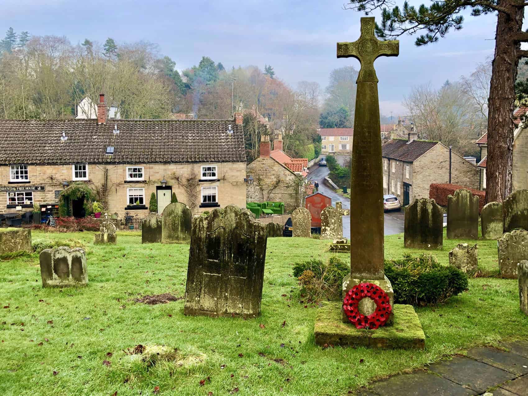
1. Robin Hood’s Bay Walk: Coastal and Countryside Trek to Ravenscar
Distance: 9 Miles | Duration: 4 Hours | Total Ascent: 1150 Feet
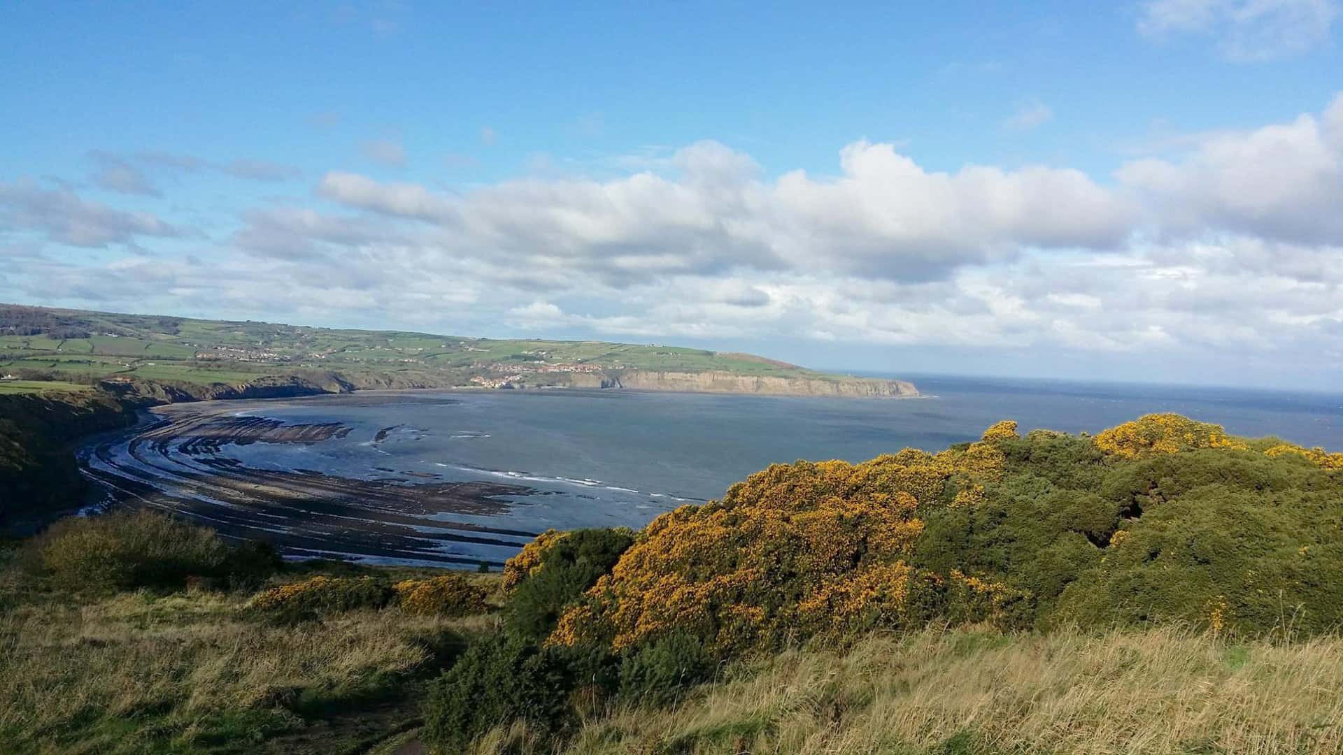
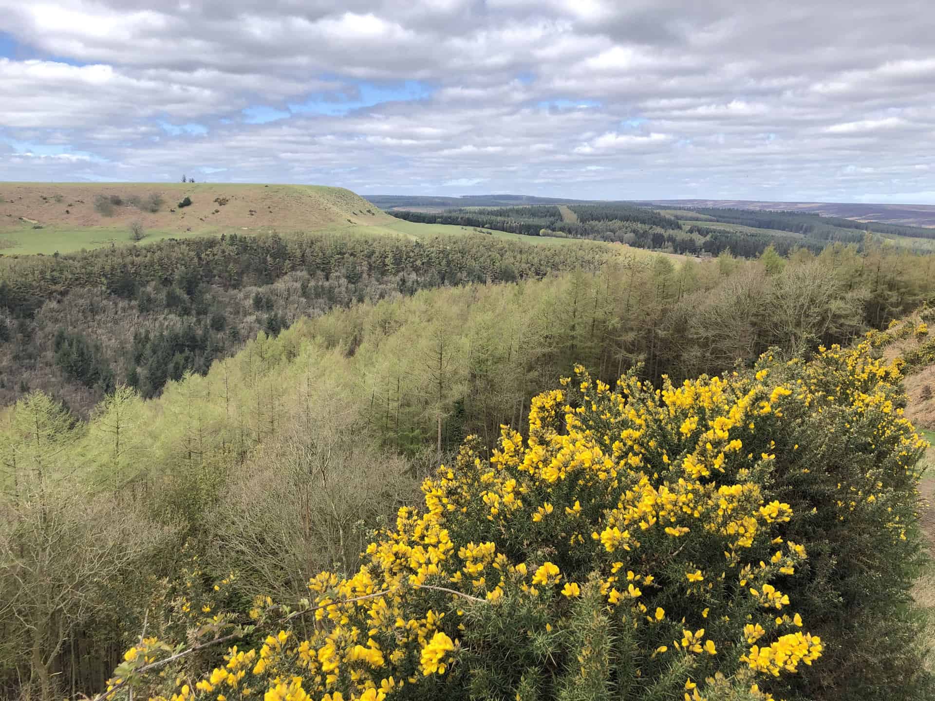
Embark on a superb 9-mile North York Moors walk from Robin Hood’s Bay, heading south via the Cleveland Way. Traverse the scenic coastal cliffs, offering panoramic sea views, leading you to Boggle Hole. This spot is ideal for a rest, perhaps with a warming cuppa and a bite to eat at the local YHA café. Continue your journey south-east, along the cliff tops on the Cleveland Way, ensuring you enjoy the stunning vistas back towards Robin Hood’s Bay and ahead to Ravenscar.
As you near Ravenscar, make a stop at the intriguing Peak Alum Works, a testament to the region’s industrial past. A brief stretch further will take you to Ravenscar, a quaint coastal village and an ideal spot for a breather. From Ravenscar, prepare for your return journey, which offers a change of scenery. You will be picking up the Cinder Track, an old railway line rich in history, adding a delightful sense of nostalgia to your North York Moors walk.
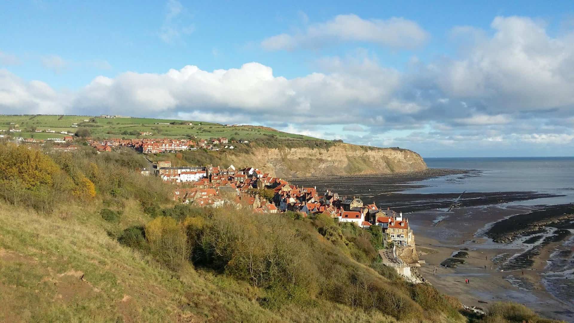
The Cinder Track meanders its way back across the countryside, leading you past Stoupe Brow and providing the opportunity to visit Fylingthorpe. Each bend in the track adds to the picturesque charm of this North York Moors walk. Your journey concludes back at Robin Hood’s Bay, completing the circular route. With a total ascent of 1150 feet, this walk should comfortably take around four hours.
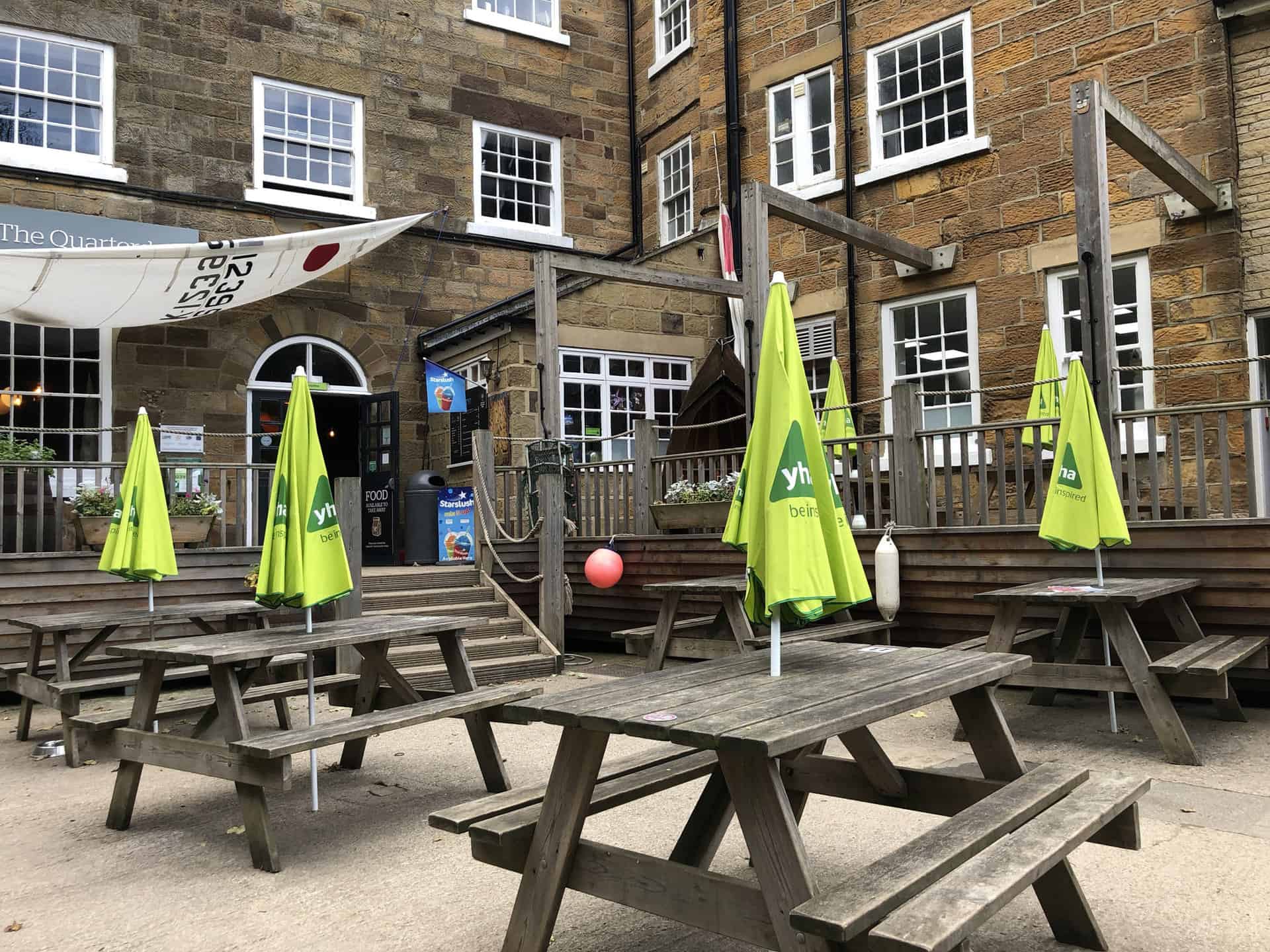
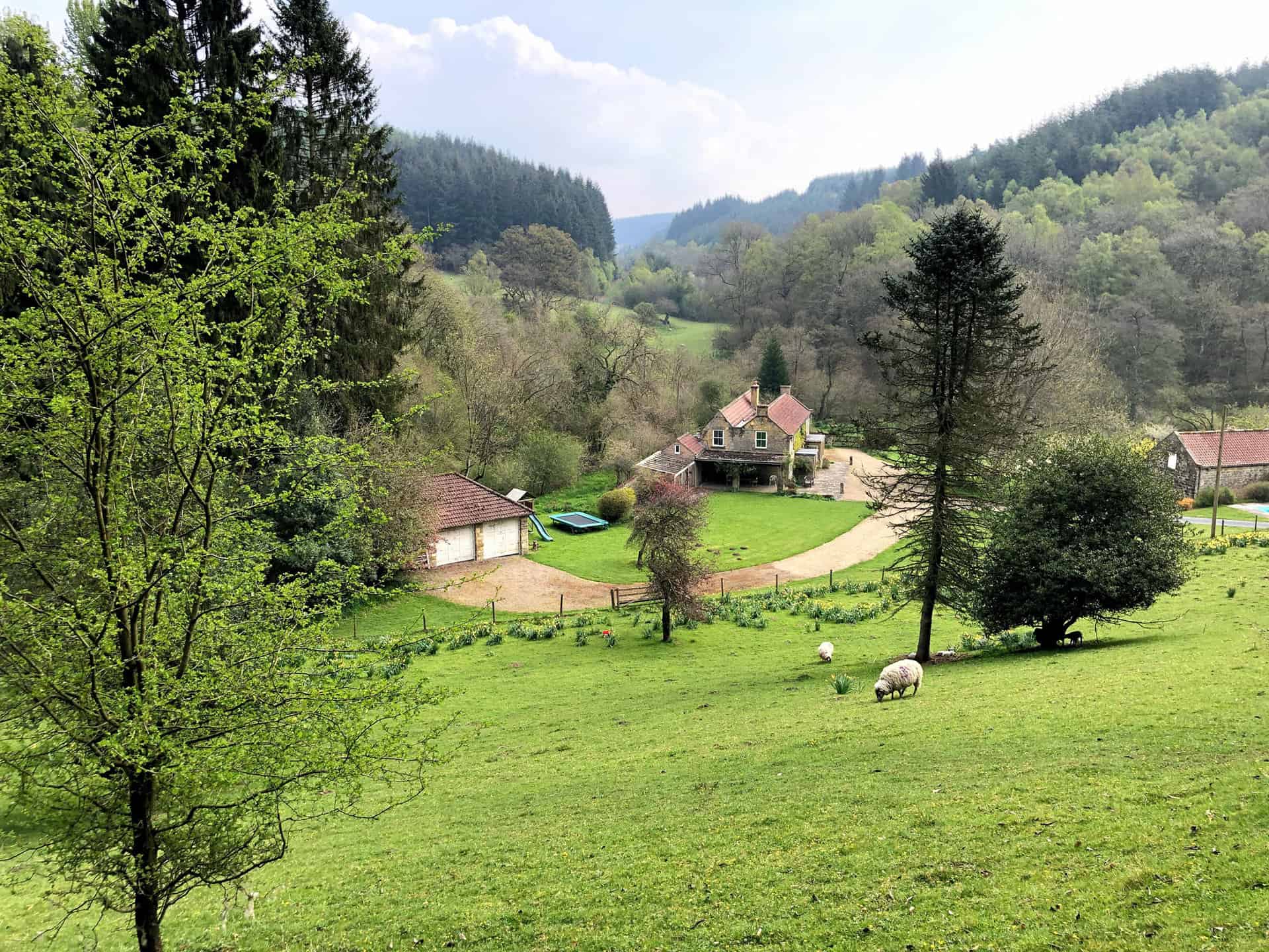
If you’re planning to stay in the Robin Hood’s Bay area while exploring this walk, consider Sea Fern Cottage as your ideal retreat. This luxurious and dog-friendly holiday cottage is superbly located for walkers and cyclists, just a stone’s throw away from Robin Hood’s Bay and nestled within the picturesque North York Moors National Park. With its emphasis on comfort, cleanliness, and modern conveniences, Sea Fern Cottage provides a tranquil and welcoming base, ensuring a delightful and restful end to your day of coastal exploration.
Robin Hood’s Bay Walk Route
Visit either the OS Maps website or the Outdooractive website to view this walking route in greater detail. Both platforms offer a range of features, including the ability to print the route, download it to your device, and export the route as a GPX file. You can also watch a 3D fly-over and share the route on social media.
Recommended Ordnance Survey Map
The best map to use on this walk is the Ordnance Survey map of the North York Moors Eastern Area, reference OS Explorer OL27, scale 1:25,000. It clearly displays footpaths, rights of way, open access land and vegetation on the ground, making it ideal for walking, running and hiking. The map can be purchased from Amazon in either a standard, paper version or a weatherproof, laminated version, as shown below.
2. Falling Foss Walk: Discover Littlebeck on this North York Moors Route
Distance: 10 Miles | Duration: 4½ Hours | Total Ascent: 1323 Feet
Begin your adventure in the North York Moors at the top of Blue Bank. The car park is by the side of the A169 road just south of Sleights, a popular starting point for some of the best walks in the North York Moors. Navigate southwards across the picturesque moorland, almost reaching High Quebec Farm. Skirt briefly west towards the main road, before venturing further south across Sleights Moor to encounter the historic track of Whinstone Ridge.
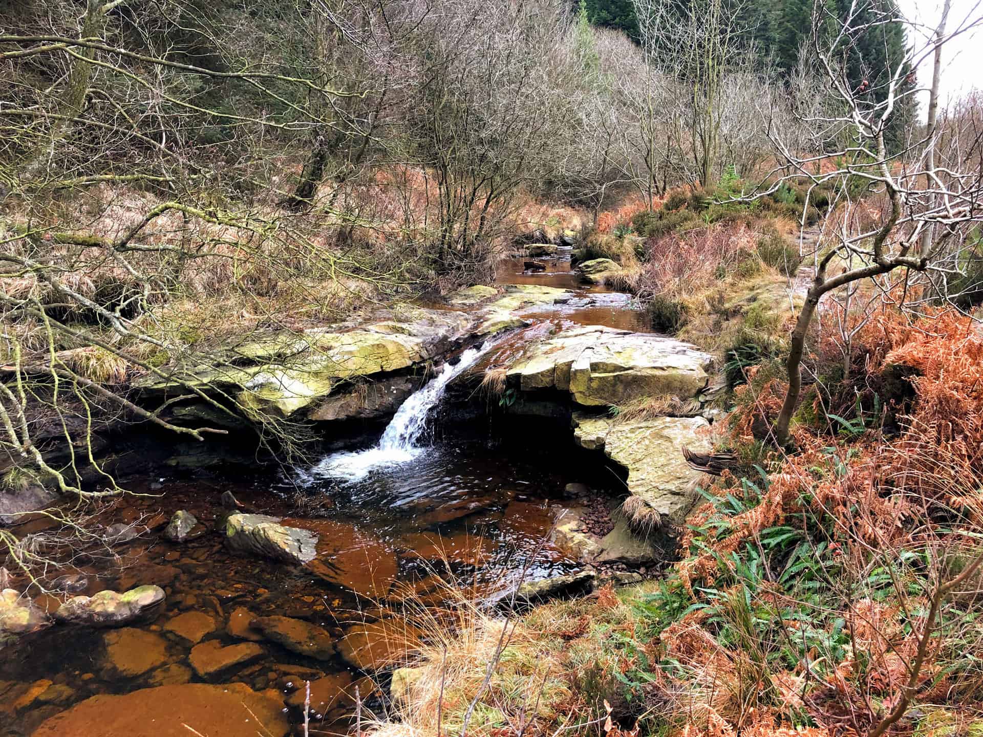
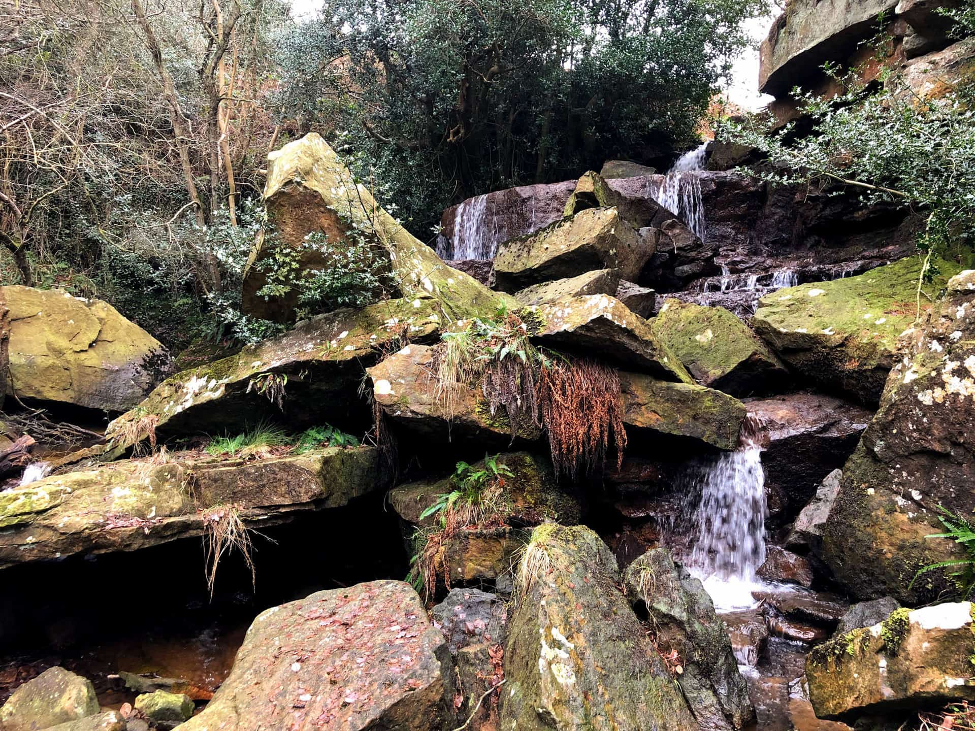
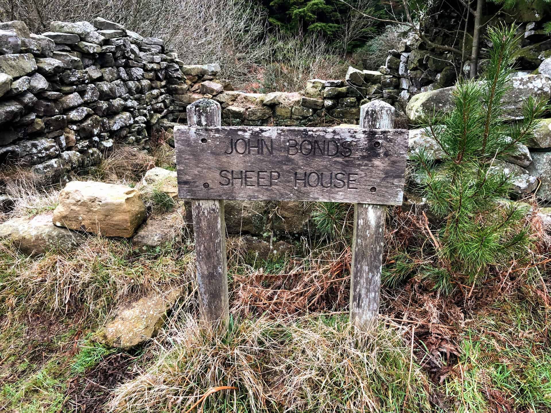
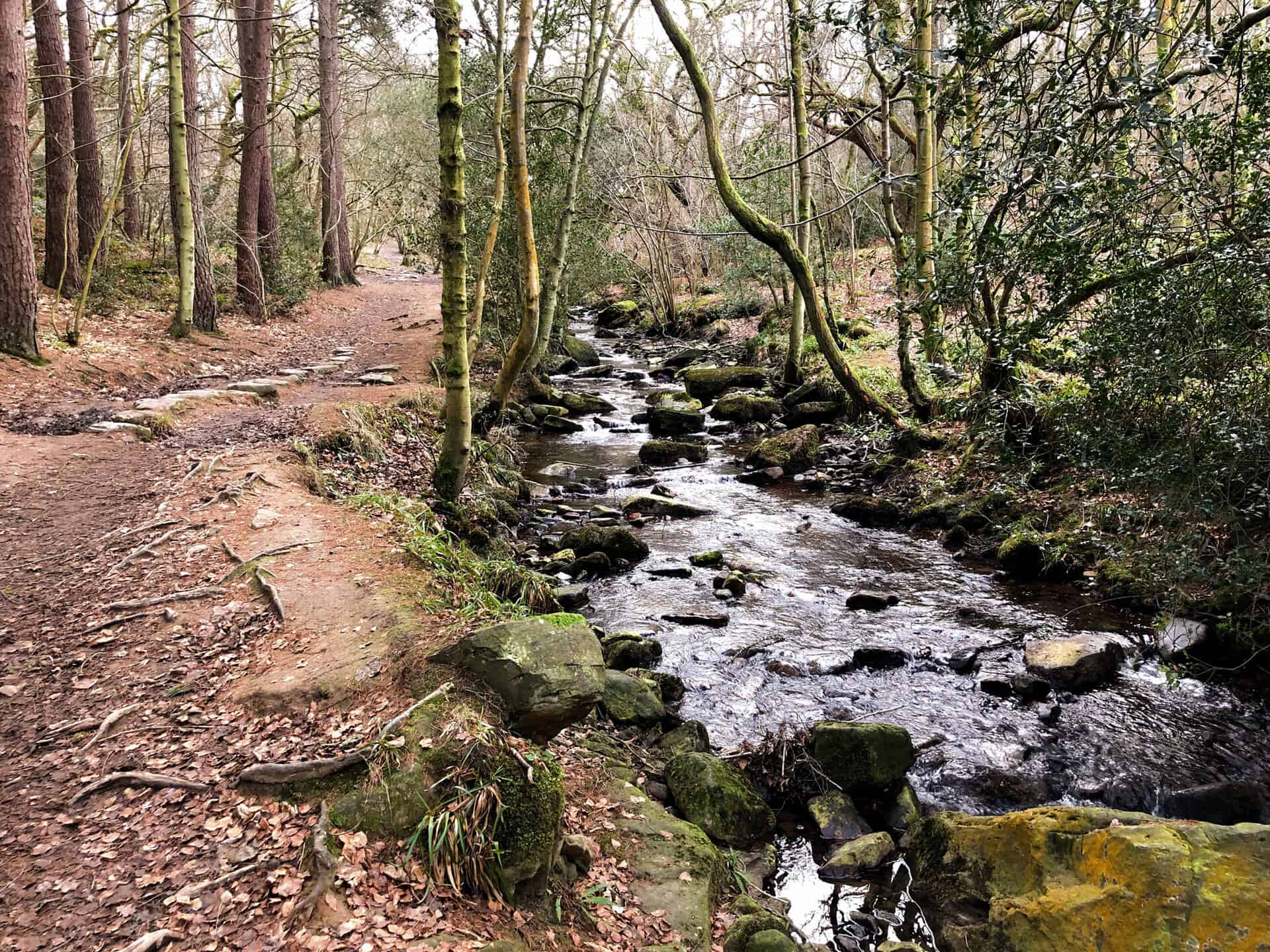
Head south-east from here into the peaceful woodland of Newton House Plantation. Enjoy the tranquil woodland paths leading down to the charmingly named John Bond’s Sheep House. Turn north, follow the babbling May Beck, and wander through the woodland to the popular May Beck car park and picnic spot. Continue your journey north, tracing the course of May Beck to discover the Falling Foss waterfall, an absolute gem located near Midge Hall.
Walk through more beautiful woodland, passing the intriguing landmark known as The Hermitage, en route to the idyllic village of Littlebeck. Follow the minor road west, climbing out of the valley and continuing north, passing Hillside Farm. This delightful 10-mile journey culminates in your return to the Blue Bank car park, completing one of the best walks in the North York Moors. Duration is approximately 4.5 hours, with a total ascent of 1323 feet, providing ample opportunities to appreciate the beauty and tranquillity of the North York Moors.
Falling Foss Walk Route
Visit either the OS Maps website or the Outdooractive website to view this walking route in greater detail. Both platforms offer a range of features, including the ability to print the route, download it to your device, and export the route as a GPX file. You can also watch a 3D fly-over and share the route on social media.
Recommended Ordnance Survey Map
The best map to use on this walk is the Ordnance Survey map of the North York Moors Eastern Area, reference OS Explorer OL27, scale 1:25,000. It clearly displays footpaths, rights of way, open access land and vegetation on the ground, making it ideal for walking, running and hiking. The map can be purchased from Amazon in either a standard, paper version or a weatherproof, laminated version, as shown below.
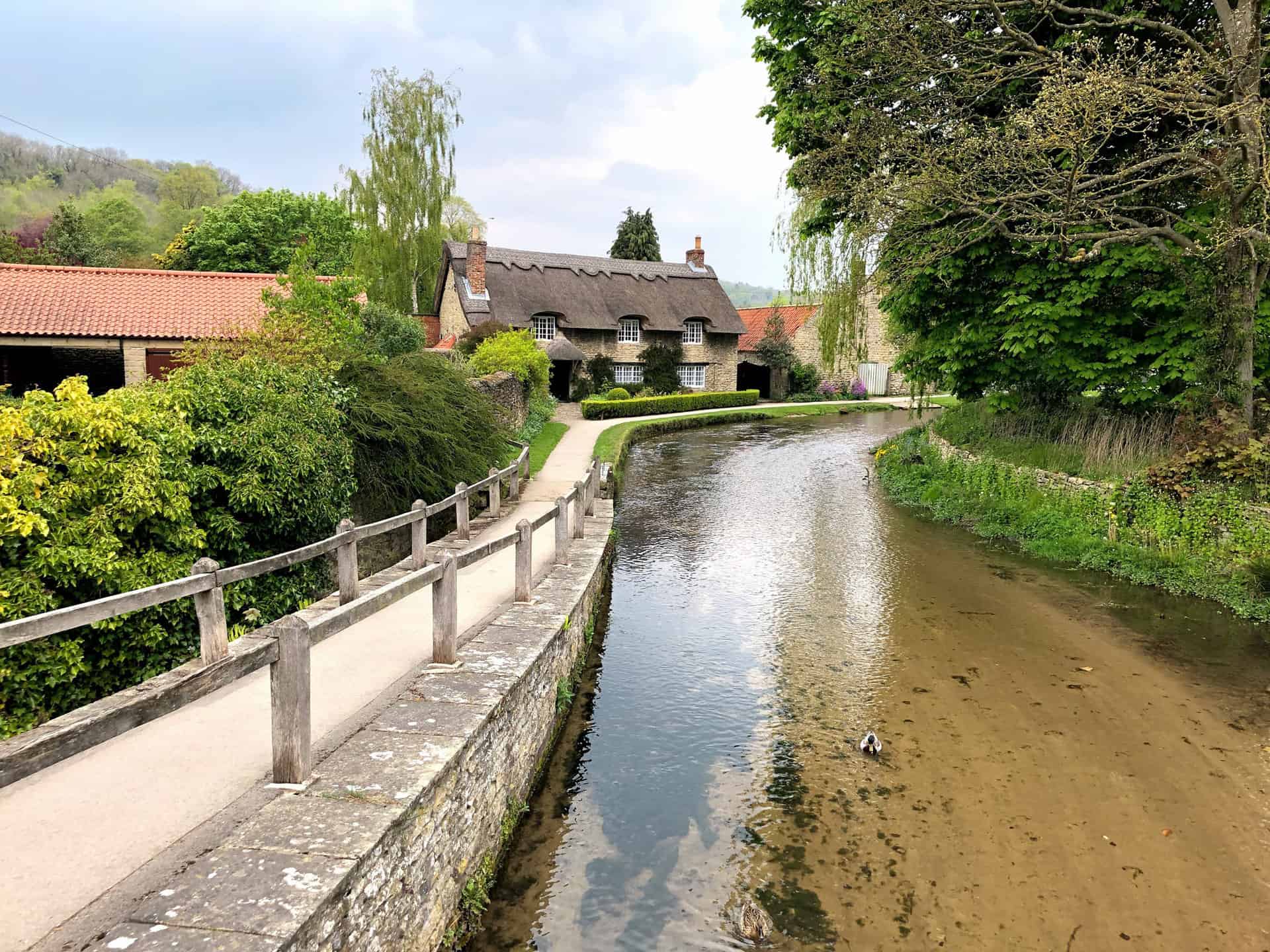
3. Glaisdale Walk: A North York Moors Ramble Featuring Glaisdale Rigg and Beggar’s Bridge
Distance: 10 Miles | Duration: 4¾ Hours | Total Ascent: 1562 Feet
Start your North York Moors ramble from the heart of Glaisdale village. Saunter past Glaisdale Hall, before directing your steps south-west across Glaisdale Rigg, aiming for Hart Leap. Shift your route south-east, strolling past Highdale Farm, then descend gently into the beautiful Glaisdale valley.
Your journey continues on a minor road, circumnavigating the head of the Glaisdale valley. The road leads past Yew Grange, Mountain Ash Farm and onwards to Nab End. At Low Gill Beck Farm, adjust your course to head south and upwards into the nearby woodland. From here, walk north-east, enjoying amazing views of the valley, until you reach Smith’s Lane. This road crosses Egton Grange, situated above Bank House Brow Plantation.
Conclude your 10-mile North York Moors ramble with a descent to Beggar’s Bridge. From this historical site, make a detour to have a look at the Glaisdale village railway station. Finally, head west through the village to return to your starting point. The total journey will take you around 4¾ hours and incorporates a total ascent of 1562 feet through the diverse landscapes of the North York Moors.
Glaisdale Walk Route
Visit either the OS Maps website or the Outdooractive website to view this walking route in greater detail. Both platforms offer a range of features, including the ability to print the route, download it to your device, and export the route as a GPX file. You can also watch a 3D fly-over and share the route on social media.
Recommended Ordnance Survey Map
The best map to use on this walk is the Ordnance Survey map of the North York Moors Eastern Area, reference OS Explorer OL27, scale 1:25,000. It clearly displays footpaths, rights of way, open access land and vegetation on the ground, making it ideal for walking, running and hiking. The map can be purchased from Amazon in either a standard, paper version or a weatherproof, laminated version, as shown below.
4. Ravenscar Walk: A 10-Mile Adventure Along Yorkshire’s Stunning Coastline
Distance: 10 Miles | Duration: 4¾ Hours | Total Ascent: 1507 Feet
Start your journey in Robin Hood’s Bay, a scenic location perfect for some of the best walks in the North York Moors. Head west towards the charming village of Fylingthorpe before turning south onto Middlewood Lane. You’ll soon encounter the Cinder Track, a disused railway line path that’s a must-see for walkers and cyclists. As you follow the Cinder Track, leading all the way to the destination of Ravenscar, enjoy the captivating vistas of the coastline and countryside before you.
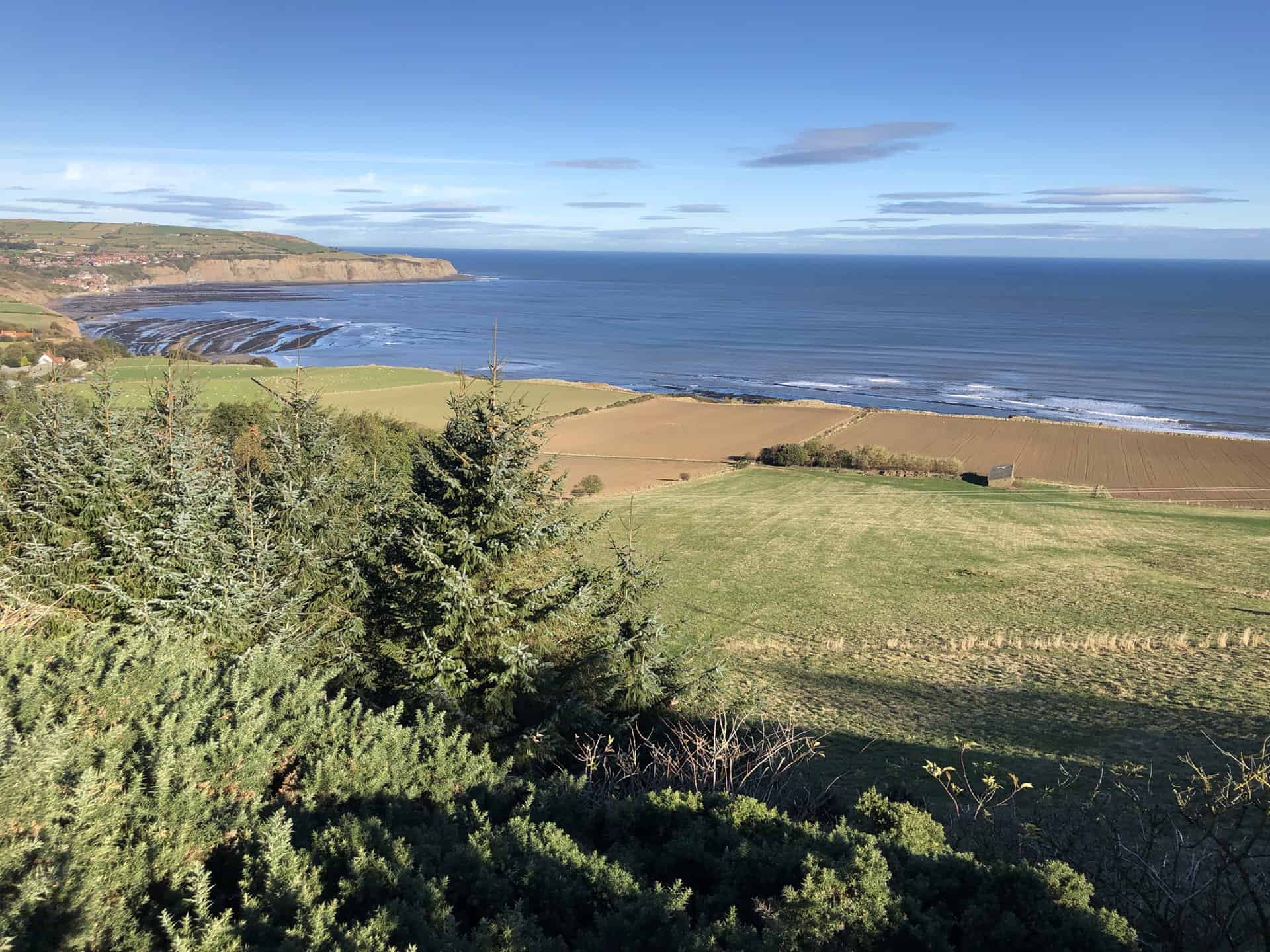
Once in Ravenscar, seize the opportunity to refresh at the National Park Visitor Centre, a perfect pit-stop for a cup of tea and a pause. Explore Ravenscar beach, accessible by descending steps from the local golf course. This unspoilt, rugged beach promises a unique experience before your journey continues. Ascend back up the steps, navigating around the golf course, and you’ll encounter the Cleveland Way. This renowned trail will guide you to the historical Peak Alum Works, providing an intriguing window into the region’s past.
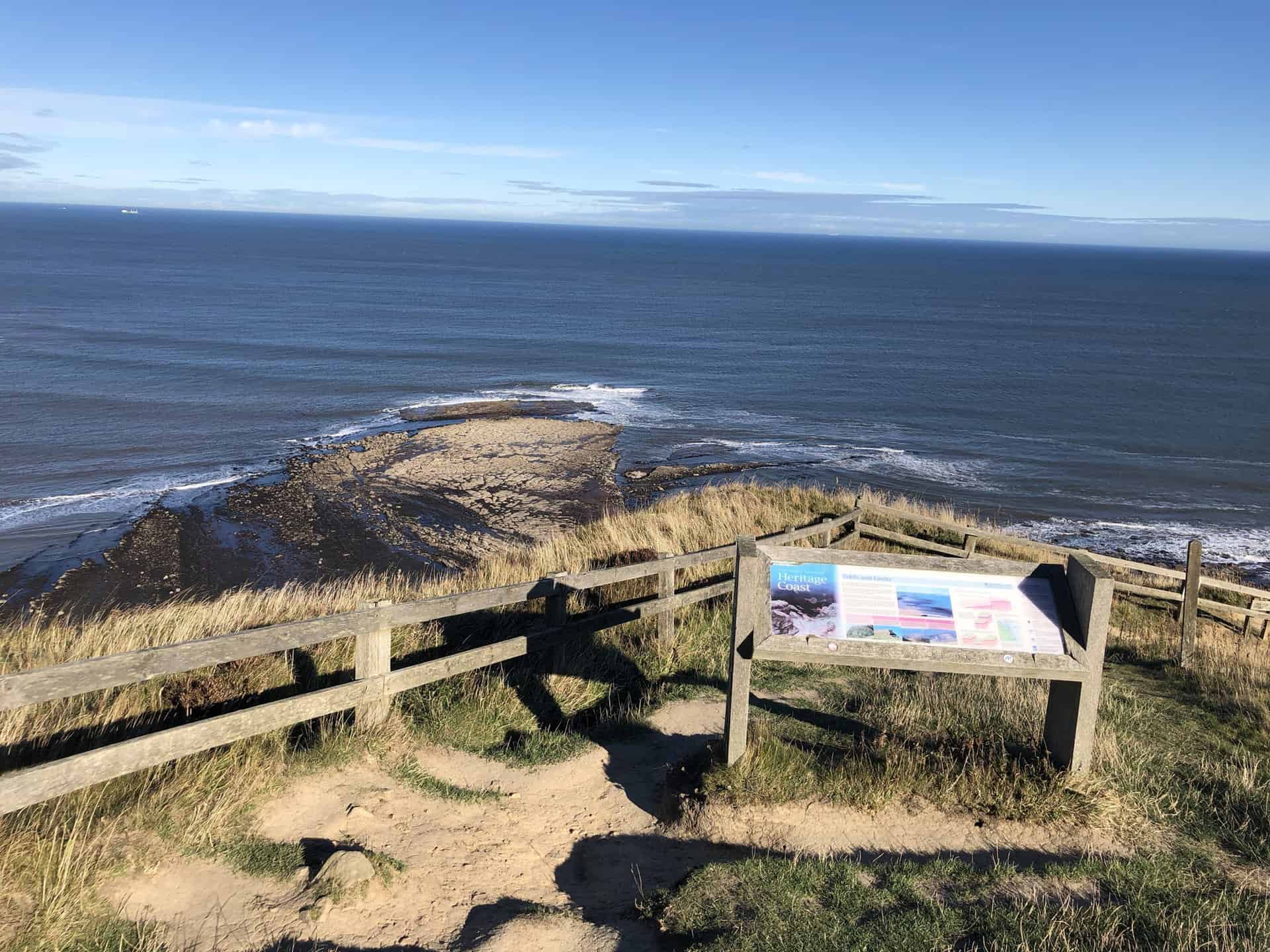
Continuing on the Cleveland Way, you’ll traverse cliff tops with sweeping views, before descending to the secluded Stoupe Beck Sands beach. This route, assuming the tide is out, offers an opportunity for a peaceful beach walk leading to Boggle Hole. Here, a welcoming café is ready to serve weary walkers. Finally, ascend back to the cliff tops, with the Cleveland Way guiding you back to Robin Hood’s Bay. This approximately 10-mile walk is one of the best walks in the North York Moors, encompassing stunning coastal views, rich history, and inviting stops along the way.
Ravenscar Walk Route
Visit either the OS Maps website or the Outdooractive website to view this walking route in greater detail. Both platforms offer a range of features, including the ability to print the route, download it to your device, and export the route as a GPX file. You can also watch a 3D fly-over and share the route on social media.
Recommended Ordnance Survey Map
The best map to use on this walk is the Ordnance Survey map of the North York Moors Eastern Area, reference OS Explorer OL27, scale 1:25,000. It clearly displays footpaths, rights of way, open access land and vegetation on the ground, making it ideal for walking, running and hiking. The map can be purchased from Amazon in either a standard, paper version or a weatherproof, laminated version, as shown below.
5. Goathland Walk: A Scenic Journey from Grosmont to the Mallyan Spout Waterfall
Distance: 11 Miles | Duration: 5 Hours | Total Ascent: 1657 Feet
Commencing your North York Moors walk from the woodland car park in Grosmont, head east along Front Street. Pass through the village, go uphill, and veer southwards through the tranquillity of Doctors Wood until you reach a track guiding you to Dale End. Journey further south towards Morton Close, then take a brief eastward detour on a minor road. From here, head south again, passing Hawthorn Hill Farm and along Mill Scar, arriving at the railway station in Goathland.
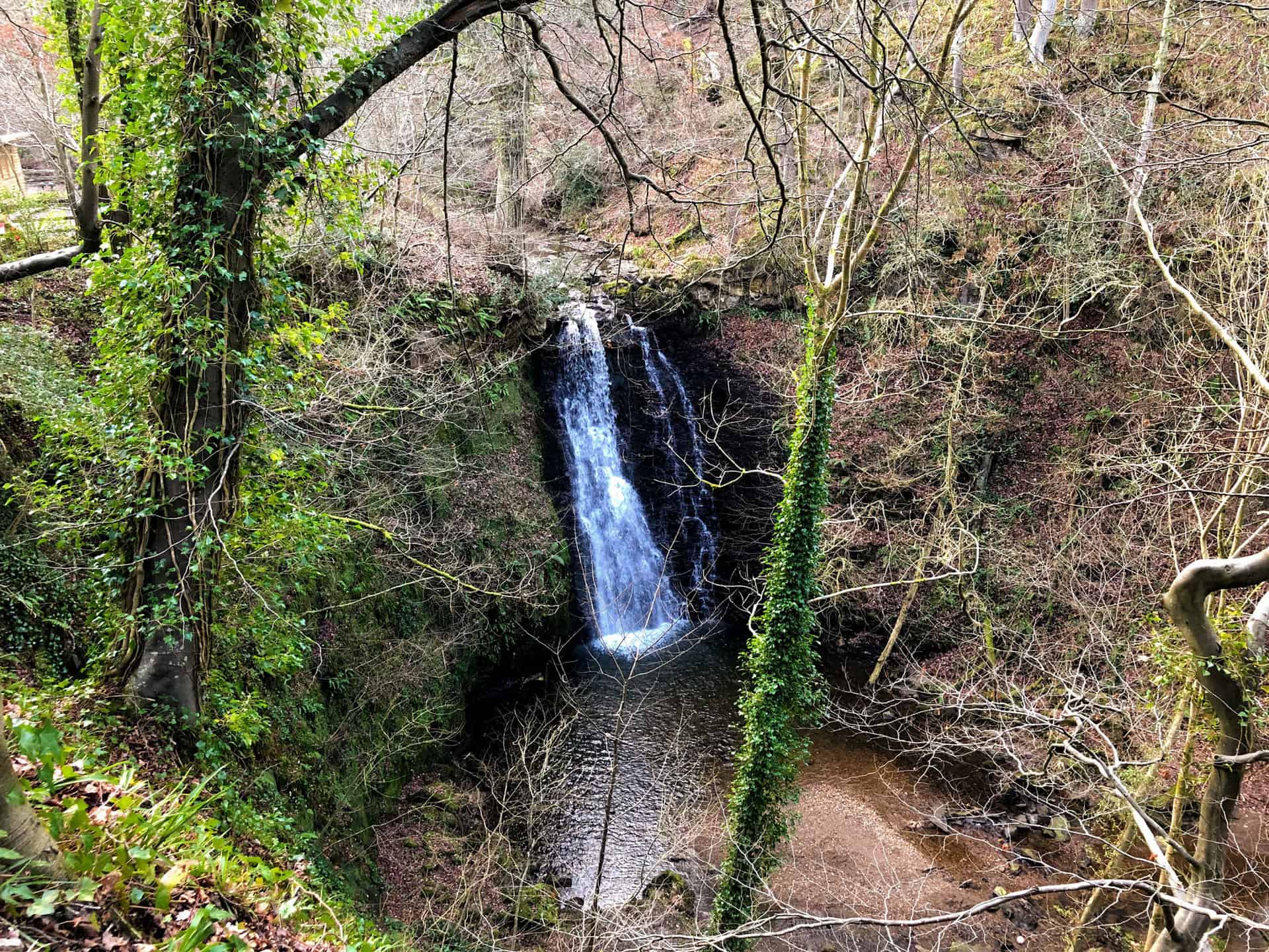
In the second leg of your journey, travel south-east to find a minor road which crosses both Eller Beck and the railway line. Here, take a U-turn, followed by a north-west stroll along a bridleway for approximately ¾ mile. Then, shift your direction westwards, towards the renowned Mallyan Spout Hotel nestled in Goathland. Take time to visit the captivating Mallyan Spout Waterfall, a prominent landmark of this North York Moors walk.
Finally, venture north through the vibrant woodland, crossing picturesque countryside to reach Beck Hole. The last leg of your journey is the relaxing Goathland to Grosmont Rail Trail, a straightforward track leading back to your starting point. This North York Moors walk, covering 11 miles and offering a total ascent of 1657 feet, provides a diverse and memorable experience for all walkers. Your journey, set against the backdrop of North York Moors, promises the reward of stunning views and unique natural encounters over an estimated duration of 5 hours.
Goathland Walk Route
Visit either the OS Maps website or the Outdooractive website to view this walking route in greater detail. Both platforms offer a range of features, including the ability to print the route, download it to your device, and export the route as a GPX file. You can also watch a 3D fly-over and share the route on social media.
Recommended Ordnance Survey Map
The best map to use on this walk is the Ordnance Survey map of the North York Moors Eastern Area, reference OS Explorer OL27, scale 1:25,000. It clearly displays footpaths, rights of way, open access land and vegetation on the ground, making it ideal for walking, running and hiking. The map can be purchased from Amazon in either a standard, paper version or a weatherproof, laminated version, as shown below.
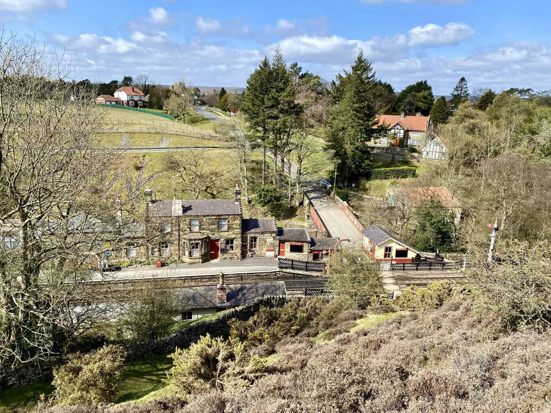
6. Grosmont Walk: Uncover Railway Heritage and the Scenic Esk Valley on Foot
Distance: 11 Miles | Duration: 5¼ Hours | Total Ascent: 1387 Feet
Check out this delightful 11-mile North York Moors hiking route. Start east from the tranquil village of Egton Bridge, following a distinct stone track alongside the River Esk. This scenic route will lead you to Grosmont, a charming railway village perfect for train enthusiasts.
Venture further east along Fair Head Lane, ascending to meet the footpath at Lowther’s Crag. Navigate south across the open moorland, passing Arundel Hill, and continue to Mill Scar. This section of your walk culminates at Goathland Railway Station, a site that will captivate you with its nostalgic charm. Head westward, strolling through the quaint village of Goathland, then veer north-west along minor roads until you reach the peaceful hamlet of Beck Hole.
Your return journey heads north to Grosmont, following the Rail Trail footpath. Enjoy the stunning vistas as you trace the course of the Murk Esk river through the enchanting Esk Valley. Finally, complete your North York Moors hiking route by returning to Egton Bridge on the same picturesque River Esk track used at the start. With a total ascent of 1387 feet and approximate duration of 5¼ hours, this route offers a satisfying blend of leisurely walking and gentle climbing.
Grosmont Walk Route
Visit either the OS Maps website or the Outdooractive website to view this walking route in greater detail. Both platforms offer a range of features, including the ability to print the route, download it to your device, and export the route as a GPX file. You can also watch a 3D fly-over and share the route on social media.
Recommended Ordnance Survey Map
The best map to use on this walk is the Ordnance Survey map of the North York Moors Eastern Area, reference OS Explorer OL27, scale 1:25,000. It clearly displays footpaths, rights of way, open access land and vegetation on the ground, making it ideal for walking, running and hiking. The map can be purchased from Amazon in either a standard, paper version or a weatherproof, laminated version, as shown below.
7. Cropton Forest Walk: Journey from Sinnington to Appleton-le-Moors and Cropton
Distance: 11 Miles | Duration: 5¼ Hours | Total Ascent: 1336 Feet
Commence your amble through the North York Moors in the idyllic village of Sinnington. This journey of 11 miles with a total ascent of 1336 feet, initially follows the tranquil banks of the River Seven northward to Cliff Wood. Then shift your direction westward along a rustic track known as The Stripe until you reach Sun Seven. From here, proceed north, taking in the rural charm of Appleton-le-Moors village. Exiting the village at its northern end, navigate east via Hamley Lane and reach the River Seven near Appleton Mill Farm. Here, you’ll need to cross the river.
Continue your walk through the North York Moors, moving further north on Low Lane. Soon after, head north along the road named Moor Lane to Blackpark Lodge. Upon entering the woods, go north-east towards Spiers House, nestled within the heart of Cropton Forest. Progress eastward until you encounter Sutherland Road, marking the start of your return journey.
Next, direct yourself south through Cropton Forest, passing the picturesque Sycamore Farm, to arrive at the village of Cropton. The final leg of your walk will have you returning to Sinnington, tracing a path via Bull Ing Lane and Wiley Flat Lane. After 5¼ hours, your memorable amble through the North York Moors concludes.
Cropton Forest Walk Route
Visit either the OS Maps website or the Outdooractive website to view this walking route in greater detail. Both platforms offer a range of features, including the ability to print the route, download it to your device, and export the route as a GPX file. You can also watch a 3D fly-over and share the route on social media.
Recommended Ordnance Survey Map
The best map to use on this walk is the Ordnance Survey map of the North York Moors Eastern Area, reference OS Explorer OL27, scale 1:25,000. It clearly displays footpaths, rights of way, open access land and vegetation on the ground, making it ideal for walking, running and hiking. The map can be purchased from Amazon in either a standard, paper version or a weatherproof, laminated version, as shown below.
8. Whisper Dales Walk: Trek Through Majestic Woodlands and Farming Villages
Distance: 9 Miles | Duration: 4 Hours | Total Ascent: 640 Feet
Explore one of the best walks in the North York Moors, covering a rewarding 9-mile route with an ascent of 640 feet. Begin your journey at the quaint village of Hackness, heading north-west and tracing the gentle meanders of Lowdales Beck until you reach the tranquil setting of Lowdales Farm. Continue your voyage due north through the serene landscapes of Low Dales and Whisper Dales, presenting a delightful natural panorama.
Experience the rustic charm of a woodland pathway, ascending steadily on a stone forestry track to arrive at the Reasty Hill Top. Here, capture breathtaking views of the vast North York Moors, a true testament to this region’s natural beauty. Continue your journey west, walking along the top of the imposing inland cliff until you reach Barns Cliff End. Execute a U-turn here, and proceed south-east through the enchanting woods to reach Oak Rigg.
Your adventure continues further south for an additional two miles to Broxa, an authentic North York Moors farming village. From Broxa, take a south-east direction across the verdant expanse of Broxa Rigg until you reach Hackness Head. Finally, journey downhill back to your starting point at Hackness, completing one of the best walks in the North York Moors. This wonderful 9-mile excursion promises an unforgettable experience in the heart of Yorkshire’s captivating landscapes, all within a manageable 4-hour duration.
Whisper Dales Walk Route
Visit either the OS Maps website or the Outdooractive website to view this walking route in greater detail. Both platforms offer a range of features, including the ability to print the route, download it to your device, and export the route as a GPX file. You can also watch a 3D fly-over and share the route on social media.
Recommended Ordnance Survey Map
The best map to use on this walk is the Ordnance Survey map of the North York Moors Eastern Area, reference OS Explorer OL27, scale 1:25,000. It clearly displays footpaths, rights of way, open access land and vegetation on the ground, making it ideal for walking, running and hiking. The map can be purchased from Amazon in either a standard, paper version or a weatherproof, laminated version, as shown below.
9. Thornton-le-Dale Walk: Through Dalby Forest Woodlands in the North York Moors
Distance: 11 Miles | Duration: 5 Hours | Total Ascent: 1000 Feet
Begin your North York Moors ramble in the charming village of Lockton. Proceed eastward, crossing the A169 road, and continue south through an open field towards Thwaite Wood. Navigate through the woodland down to Staindale Lodge. From here, head south for approximately 2½ miles, following the woodland edge, staying on the western side of Thornton Dale. Your trail will lead you to Ellers Wood.
Continue your journey south-west past Paper Mill Pond. A short walk from here, you’ll find yourself in the peaceful hamlet of Ellerburn, just a stone’s throw away from Thornton-le-Dale. Take a while to explore the idyllic village of Thornton-le-Dale, visit its quaint shops, and admire its famous thatched cottage before you continue. Your next checkpoint will be High Paper Mill Farm, located north-east of Thornton-le-Dale.
Embark on the northern trail through the dense Dalby Forest woodlands, a hotspot for natural beauty in the North York Moors. Your route should take you to Low Dalby and past the exhilarating Go Ape adventure park. Remember to keep to the east side of Thornton Dale for this part of your ramble. Your final leg takes you north-west via High Dalby House, returning to Staindale Lodge. Retrace your steps along the initial path and you’ll soon find yourself back in Lockton, the starting point of your 11-mile North York Moors ramble. A rough estimate for this adventure is about 5 hours, with a total ascent of 1000 feet.
Thornton-le-Dale Walk Route
Visit either the OS Maps website or the Outdooractive website to view this walking route in greater detail. Both platforms offer a range of features, including the ability to print the route, download it to your device, and export the route as a GPX file. You can also watch a 3D fly-over and share the route on social media.
Recommended Ordnance Survey Map
The best map to use on this walk is the Ordnance Survey map of the North York Moors Eastern Area, reference OS Explorer OL27, scale 1:25,000. It clearly displays footpaths, rights of way, open access land and vegetation on the ground, making it ideal for walking, running and hiking. The map can be purchased from Amazon in either a standard, paper version or a weatherproof, laminated version, as shown below.
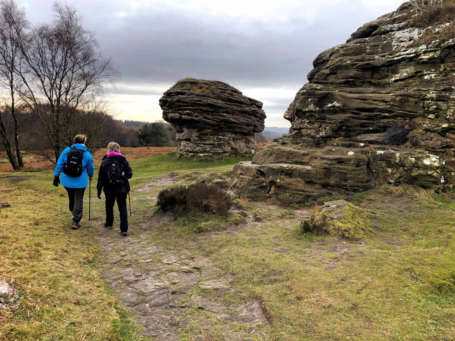
10. Bridestones and Hole of Horcum Walk: Encounter Unique Rock Formations and More
Distance: 10 Miles | Duration: 4¾ Hours | Total Ascent: 1343 Feet
Begin your 10-mile North York Moors walk at the conveniently located Saltergate car park beside the A169. Venture briefly northwards before shifting your course south-east, following the well-trodden Old Wife’s Way above Newgate Brow. Your path will guide you towards the remarkable Bridestones Nature Reserve. Marvel at the Bridestones, a series of impressive sandstone rock formations sculpted over millennia by wind and rain. The myriad of shapes, forms, and crevices make these geological wonders an unmissable highlight in this popular North York Moors walk.
Next, immerse yourself in the tranquillity of Stain Dale, following the course of Staindale Beck towards Staindale Lodge. Steer your path north, crossing the A169, before arriving at the quaint village of Lockton. Take your time to appreciate this rural gem, with its historic houses and welcoming community, before venturing westwards down through the woodland, joining Mill Bank Road, then ascending out of the valley and following a scenic woodland route north along Levisham Brow.
Finally, continue north across the open meadowlands of the Hole of Horcum, a vast natural amphitheatre, until reaching the old farm building at Low Horcum. This marks the last stretch of your North York Moors walk. Take a moment to admire the beautiful countryside before commencing the steady climb out of the hollow. The homeward path runs parallel to the A169, offering amazing views of the Hole of Horcum you’ve walked through. Anticipate a total ascent of 1343 feet during this engaging 4¾ hour North York Moors walk.
Bridestones and Hole of Horcum Walk Route
Visit either the OS Maps website or the Outdooractive website to view this walking route in greater detail. Both platforms offer a range of features, including the ability to print the route, download it to your device, and export the route as a GPX file. You can also watch a 3D fly-over and share the route on social media.
Recommended Ordnance Survey Map
The best map to use on this walk is the Ordnance Survey map of the North York Moors Eastern Area, reference OS Explorer OL27, scale 1:25,000. It clearly displays footpaths, rights of way, open access land and vegetation on the ground, making it ideal for walking, running and hiking. The map can be purchased from Amazon in either a standard, paper version or a weatherproof, laminated version, as shown below.
11. Beck Hole Walk: Experiencing the Grosmont to Goathland Rail Trail
Distance: 9 Miles | Duration: 4¼ Hours | Total Ascent: 1373 Feet
Kickstart your hike from the North York Moors National Park woodland car park, located just outside Grosmont. Journey eastward, strolling past the picturesque Grosmont Railway Station. Your route unfolds along Front Street, which climbs uphill, guiding you out of Grosmont. Then, venture south into the tranquil heart of Doctors Wood. A track will lead you towards a farm nestled at Dale End.
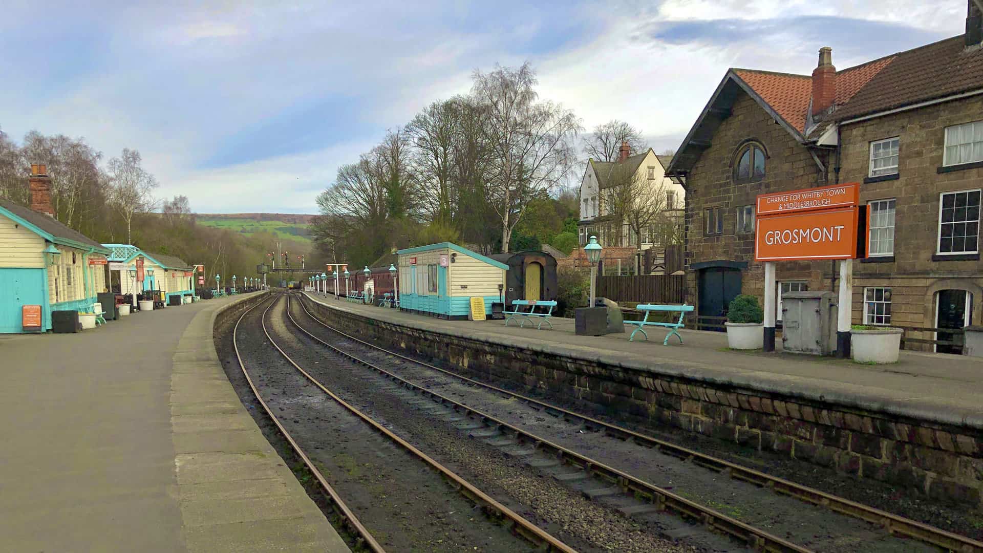
As you continue your adventure, head further south, bypassing Birch House and meandering through Morton Close. You’ll find yourself at a minor road at Green End. Your path will then guide you past Braithwaite Cottages and onto Hollin Garth. An open moorland trail awaits, leading you to Hill Farm. Head east, above the scenic valley towards Sheep Bield, before descending south along Mill Scar. Your destination is the charming Goathland Railway Station.
After exploring Goathland’s delightful village, it’s the perfect stop for a café break. Once refreshed, follow the minor road south-west towards the Mallyan Spout Hotel. Descend the steps by the side of the hotel to witness the spectacular Mallyan Spout waterfall. Proceed north to Beck Hole, and round off your North York Moors hike by following the Goathland to Grosmont Rail Trail. This trail traces the course of the Murk Esk, offering a peaceful and easy walk through the valley. Your 9-mile hike, climbing a total of 1373 feet, should take approximately 4¼ hours.
Beck Hole Walk Route
Visit either the OS Maps website or the Outdooractive website to view this walking route in greater detail. Both platforms offer a range of features, including the ability to print the route, download it to your device, and export the route as a GPX file. You can also watch a 3D fly-over and share the route on social media.
Recommended Ordnance Survey Map
The best map to use on this walk is the Ordnance Survey map of the North York Moors Eastern Area, reference OS Explorer OL27, scale 1:25,000. It clearly displays footpaths, rights of way, open access land and vegetation on the ground, making it ideal for walking, running and hiking. The map can be purchased from Amazon in either a standard, paper version or a weatherproof, laminated version, as shown below.
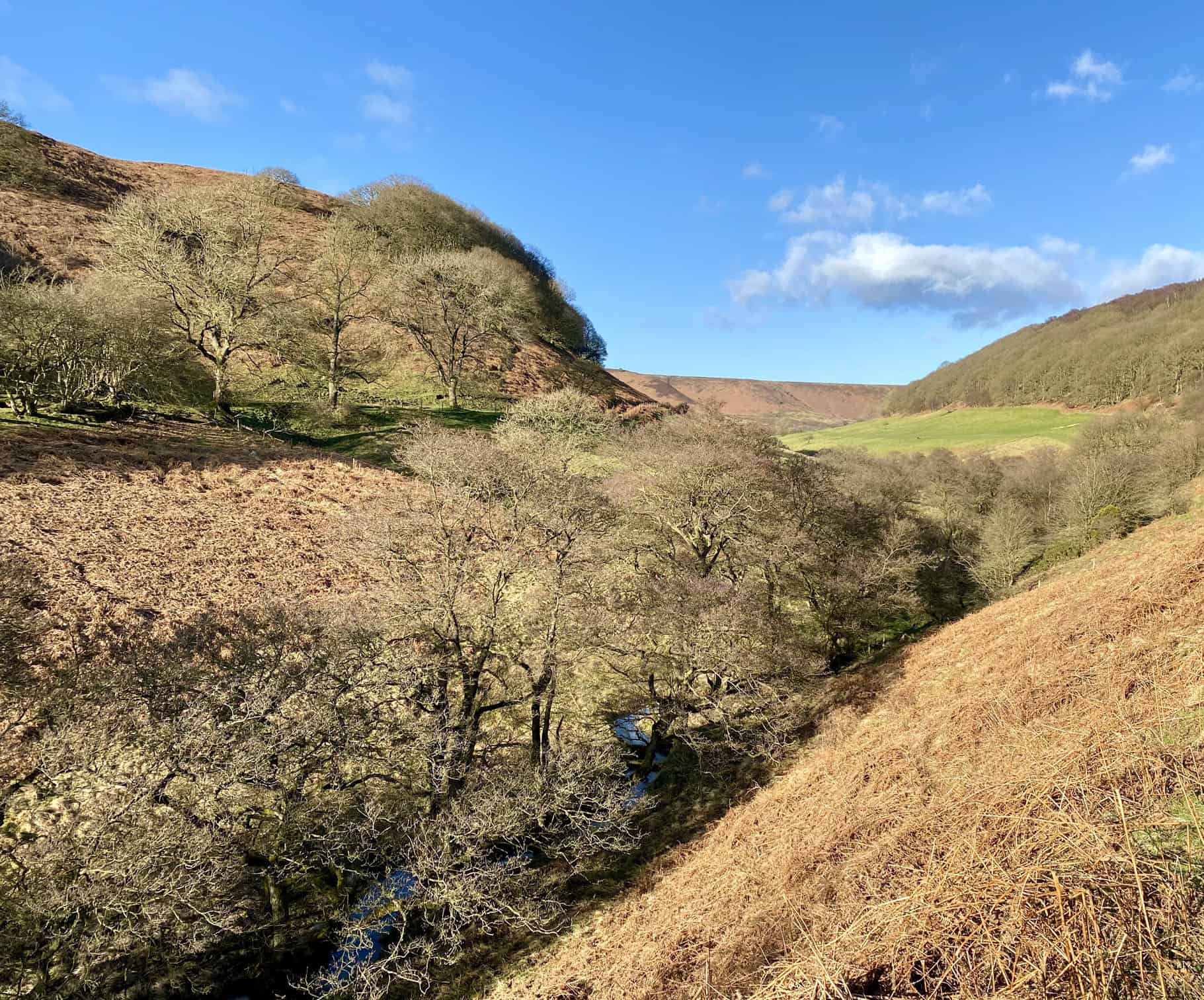
12. Littlebeck Walk: Discovering The Hermitage on a North York Moors Trail
Distance: 10 Miles | Duration: 4¾ Hours | Total Ascent: 1716 Feet
Embark on a great walk in the North York Moors from the handy car park next to the A169 at the top of Blue Bank. Journey south across the moors, your first destination being the quaint High Quebec Farm. Head east, traversing through the farm towards Low Quebec Farm and further on to Intake Farm. Travel south-east to Leas Head Farm, before turning east again to reach Foss Farm. Proceed south into the dense woodland of Newton House Plantation.
In Newton House Plantation, guide your steps north-east down to John Bond’s Sheep House. Journey northward alongside the peaceful May Beck, bypassing another car park and continuing north. Enjoy the woodland paths and tracks, leading you to the impressive Falling Foss waterfall. Further northward, through more woods, you’ll encounter The Hermitage. It’s a unique historical attraction, a sandstone boulder hand-carved into a small room, providing a glimpse into the past and adding to the allure of your walk in the North York Moors.
Your journey continues to Littlebeck. Finally, take a north-west direction along a minor road to lift yourself out of the valley and return to your starting point. This 10-mile circular walk combines stunning views, historical landmarks, and a satisfying workout with a total ascent of 1716 feet, completed in about 4¾ hours.
Littlebeck Walk Route
Visit either the OS Maps website or the Outdooractive website to view this walking route in greater detail. Both platforms offer a range of features, including the ability to print the route, download it to your device, and export the route as a GPX file. You can also watch a 3D fly-over and share the route on social media.
Recommended Ordnance Survey Map
The best map to use on this walk is the Ordnance Survey map of the North York Moors Eastern Area, reference OS Explorer OL27, scale 1:25,000. It clearly displays footpaths, rights of way, open access land and vegetation on the ground, making it ideal for walking, running and hiking. The map can be purchased from Amazon in either a standard, paper version or a weatherproof, laminated version, as shown below.
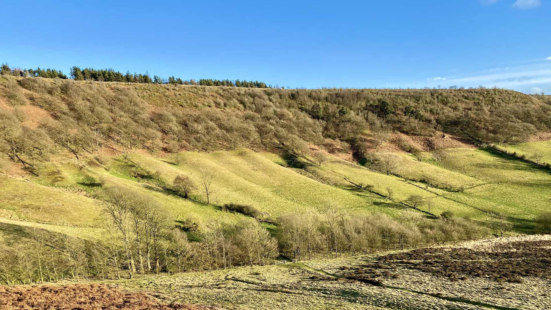
13. Guisborough Woods Walk: Following the Cleveland Way to Highcliff Nab
Distance: 11 Miles | Duration: 5 Hours | Total Ascent: 1414 Feet
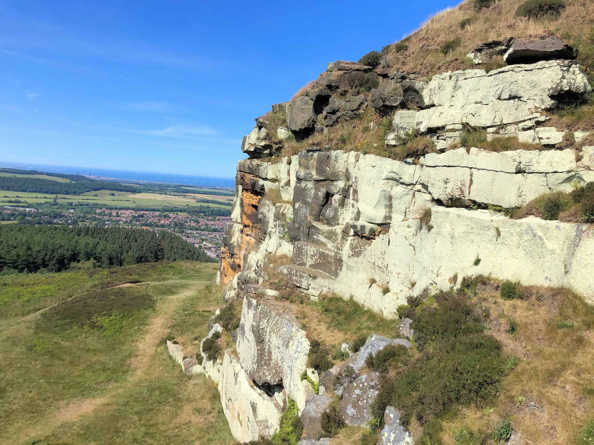
Begin your engaging 11-mile walk in the North York Moors at Little Waterfall Farm near Slapewath. Venture south-east into Spa Wood, then shift south-west, tracing the renowned Cleveland Way through Guisborough Woods. Arrive at Highcliff Nab and savour panoramic views over the bustling market town of Guisborough.
Next, proceed south across Gisborough Moor, keeping to the west side of Sleddale until you reach the minor road known as Percy Cross Rigg. Journey north-west across Hutton Moor and into the tranquil Hutton Lowcross Woods.
Finish your adventure by descending towards Hutton Village Road and heading east to Brown Hill. Return to your starting point via Belmangate, then follow the disused railway line. This journey, with a total ascent of 1414 feet, takes roughly five hours, offering a rewarding experience for keen walkers.
Guisborough Woods Walk Route
Visit either the OS Maps website or the Outdooractive website to view this walking route in greater detail. Both platforms offer a range of features, including the ability to print the route, download it to your device, and export the route as a GPX file. You can also watch a 3D fly-over and share the route on social media.
Recommended Ordnance Survey Map
The best map to use on this walk is the Ordnance Survey map of the North York Moors Western Area, reference OS Explorer OL26, scale 1:25,000. It clearly displays footpaths, rights of way, open access land and vegetation on the ground, making it ideal for walking, running and hiking. The map can be purchased from Amazon in either a standard, paper version or a weatherproof, laminated version, as shown below.
14. Castleton and Danby Walk: Historical Churches and Silver Birches
Distance: 10 Miles | Duration: 4¾ Hours | Total Ascent: 1484 Feet
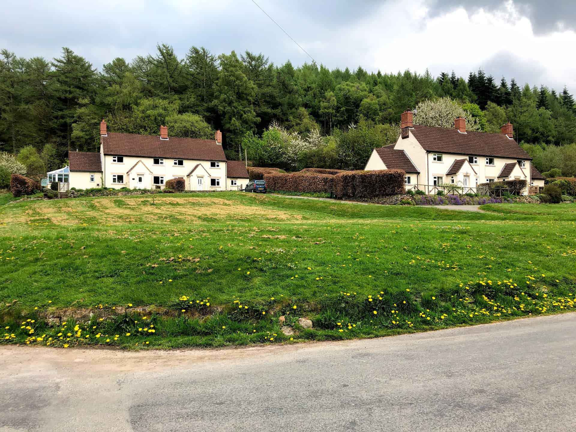
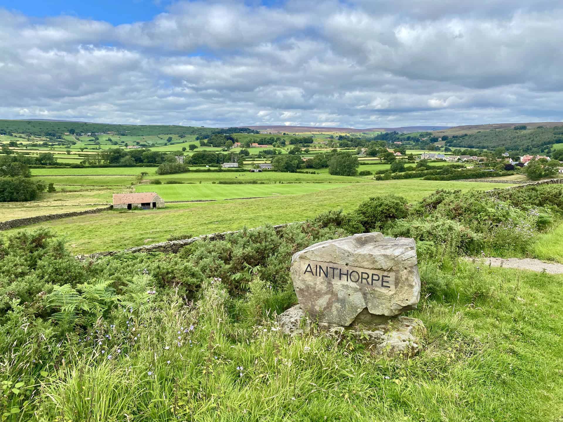
Check out one of the best walks in the North York Moors, commencing from Commondale. Journey south-east along a stone-laden track, meandering through Foul Green and Box Hall, until you intersect the main road just north of Castleton. Here, join the renowned Esk Valley Walk, navigating eastward. Traverse through Danby Park, a delightful woodland teeming with majestic silver birch trees, and then continue to Danby, a charming village nestled in the heart of the North York Moors.
Venture southwards from Danby, through the picturesque hamlet of Ainthorpe. Then, ascend onto the moorland of Ainthorpe Rigg. From here, pivot west, descending into the rolling landscape of Danby Dale. Here you’ll reach a minor road known as Tofts Lane, located near Church House. Take time to visit the lovely church.
Follow the Esk Valley Walk north-west through the dale, making your way to High Castleton. Round off this invigorating journey by returning to Commondale, passing through farmland that spans Scale Foot, Thornhill Farm, and Westgate Farm. This 10-mile excursion is an ideal experience for walkers aiming to explore the best walks in the North York Moors. The duration of this walk is approximately 4¾ hours, with a total ascent of 1484 feet.
Castleton and Danby Walk Route
Visit either the OS Maps website or the Outdooractive website to view this walking route in greater detail. Both platforms offer a range of features, including the ability to print the route, download it to your device, and export the route as a GPX file. You can also watch a 3D fly-over and share the route on social media.
Recommended Ordnance Survey Map
The best map to use on this walk is the Ordnance Survey map of the North York Moors Western Area, reference OS Explorer OL26, scale 1:25,000. It clearly displays footpaths, rights of way, open access land and vegetation on the ground, making it ideal for walking, running and hiking. The map can be purchased from Amazon in either a standard, paper version or a weatherproof, laminated version, as shown below.
15. Black Hambleton Walk: Venturing to Hanging Stone and Thimbleby Plantation
Distance: 11 Miles | Duration: 5¼ Hours | Total Ascent: 1598 Feet
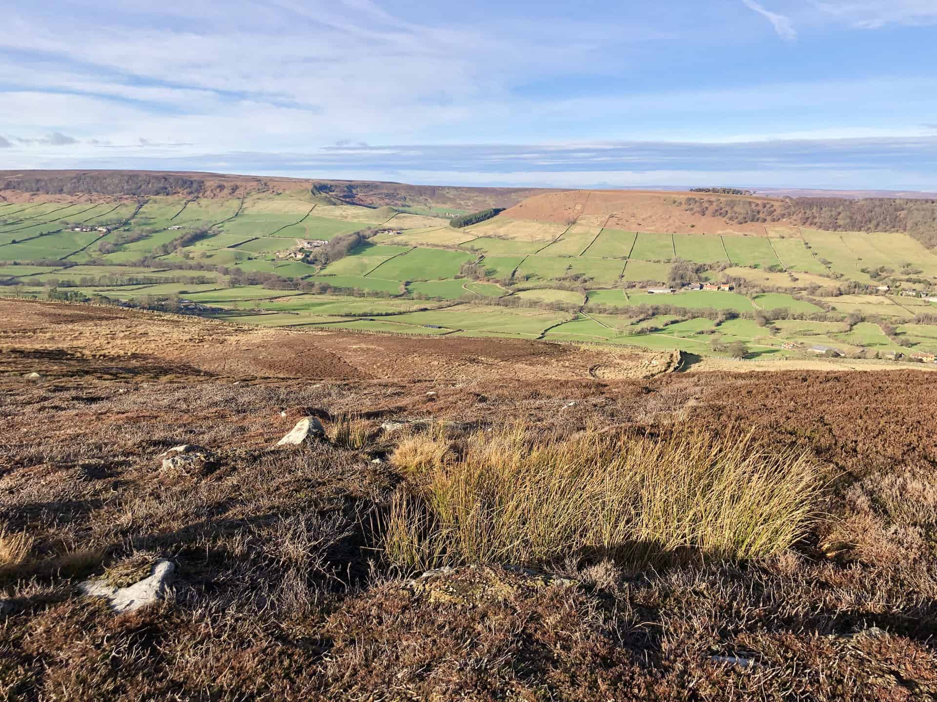
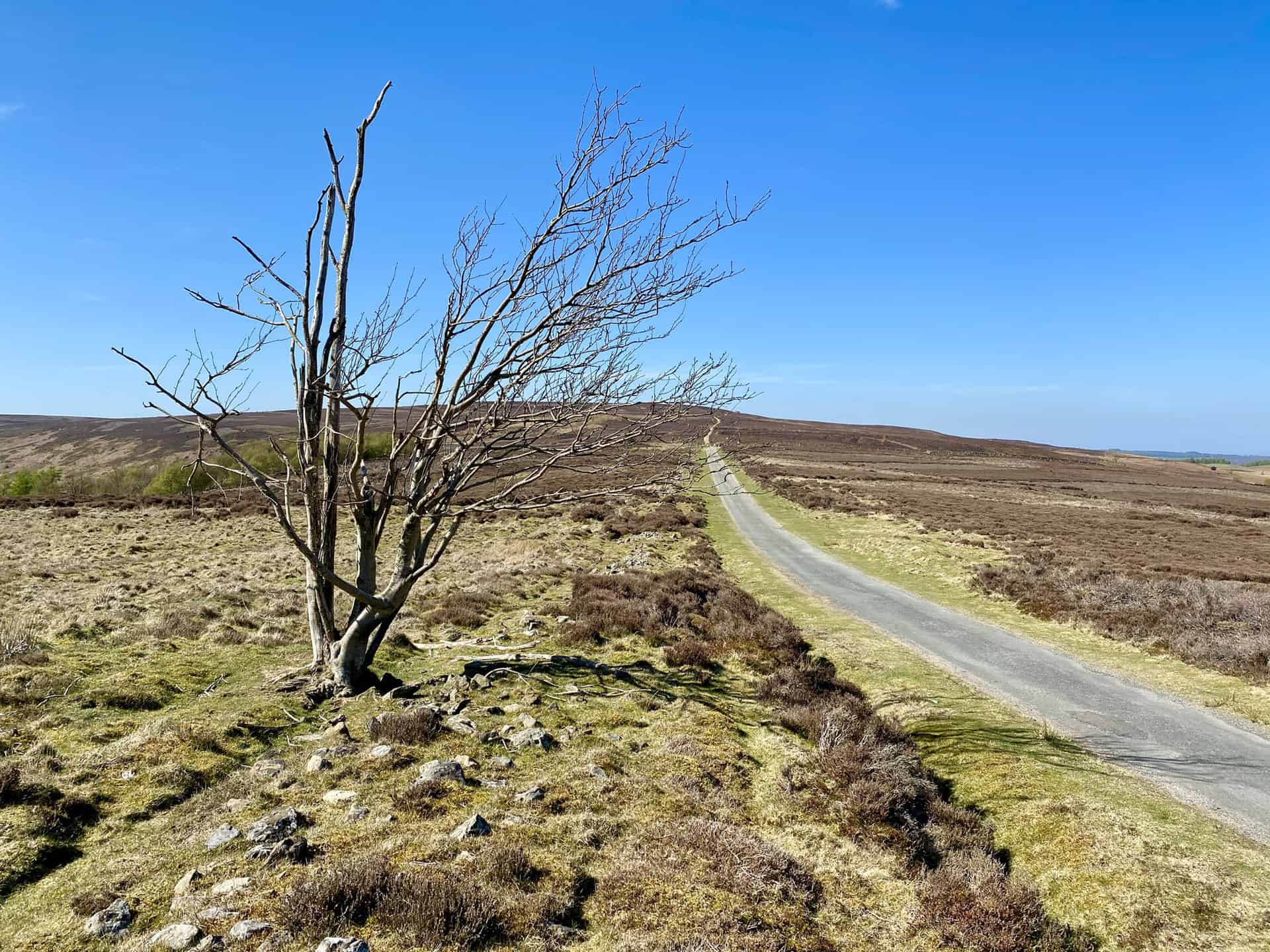
Begin your North York Moors trail at Square Corner car park, situated roughly two miles south-east of Osmotherley village centre. Start on the Cleveland Way, heading southwards to ascend to the summit of Black Hambleton. From there, continue south-east along the Cleveland Way, which leads you to White Gill Head. Journey south for approximately 1½ miles before you depart from the Cleveland Way near Clarke Scars. At this point, the trail veers downhill towards Gallow Hill.
Venturing north-west, your route will guide you between Butcher’s Wood and Cowesby Wood, leading you to Kepwick. From this point, press on north-west across the picturesque farmland towards the quaint village of Nether Silton. From this village, follow the northern trail towards Over Silton, passing the charming local church, a delightful feature of this North York Moors trail. Continue northwards, journeying through woodland until you reach the Hanging Stone, an enchanting spot offering great views along your trail.
To conclude your North York Moors trail, move north-east through Thimbleby Bank Plantation to Big Wood. Then, proceed east via Oak Dale, which will guide you back to Square Corner car park. This circular, 11-mile route in the North York Moors serves as an excellent choice for walking enthusiasts. The entire trek takes approximately 5¼ hours, with a total ascent of 1598 feet, rendering it a moderate trail suitable for most walkers.
Black Hambleton Walk Route
Visit either the OS Maps website or the Outdooractive website to view this walking route in greater detail. Both platforms offer a range of features, including the ability to print the route, download it to your device, and export the route as a GPX file. You can also watch a 3D fly-over and share the route on social media.
Recommended Ordnance Survey Map
The best map to use on this walk is the Ordnance Survey map of the North York Moors Western Area, reference OS Explorer OL26, scale 1:25,000. It clearly displays footpaths, rights of way, open access land and vegetation on the ground, making it ideal for walking, running and hiking. The map can be purchased from Amazon in either a standard, paper version or a weatherproof, laminated version, as shown below.
16. Farndale Walk: Experience the Charm of Church Houses and Low Mill
Distance: 11 Miles | Duration: 5 Hours | Total Ascent: 1367 Feet
Prepare for a delightful 11-mile North York Moors walk, commencing in the quaint village of Church Houses. Heading west, the journey leads you up to Monket House, continuing uphill to merge with the moorland track, known as Westside Road, which crosses Rudland Rigg. Follow this southern track for approximately three miles, as the stone path underfoot gradually transforms into a tarmac road, just before reaching Hope Inn Farm.

At this juncture, direct your journey eastward, venturing across the expanse of Harland Moor and descending through a verdant woodland towards Dale End Bridge. Proceed northwards from here, traversing the dale and passing the farms of Ewecote and Underhill. The trail will guide you to Rawson Syke, from where you can amble along Daleside Road until you reach the village of Low Mill.
The final section of your North York Moors walk unfolds along the enchanting ‘Farndale Daffodil Walk’, particularly delightful in April when daffodils bloom. Stride northward beside the River Dove, leading you to High Mill and eventually returning to the starting point at Church Houses. This engaging North York Moors walk presents a blend of diverse landscapes and farmlands, with a total ascent of 1367 feet, and an estimated duration of five hours.
Farndale Walk Route
Visit either the OS Maps website or the Outdooractive website to view this walking route in greater detail. Both platforms offer a range of features, including the ability to print the route, download it to your device, and export the route as a GPX file. You can also watch a 3D fly-over and share the route on social media.
Recommended Ordnance Survey Map
The best map to use on this walk is the Ordnance Survey map of the North York Moors Western Area, reference OS Explorer OL26, scale 1:25,000. It clearly displays footpaths, rights of way, open access land and vegetation on the ground, making it ideal for walking, running and hiking. The map can be purchased from Amazon in either a standard, paper version or a weatherproof, laminated version, as shown below.
17. Rosedale Abbey Walk: Discovering Lastingham and Hutton-le-Hole
Distance: 12 Miles | Duration: 5½ Hours | Total Ascent: 1423 Feet
Begin your journey at the quaint village of Rosedale Abbey, nestled in the heart of the North York Moors. Embark on a leisurely stroll southwards along Gill Lane, before continuing southeast. Along the way, you’ll pass the hotel and Newlands Farm until you reach Hollins Farm. From this point, skirt around the eastern edge of Spaunton Moor, following the course of the River Seven, which is tucked away in the valley below on your left. Your next milestone is High Askew, a spot that promises refreshing views of the Moors.
Venture westwards from here, cutting across farmland towards the quintessential village of Lastingham. This stop definitely warrants a pause for exploration, its ancient church adding a touch of historical allure. From Lastingham, set off westwards to Hutton-le-Hole, another idyllic location within the North York Moors.
Depart from Hutton-le-Hole, steering north along Lodge Road. This track stretches across the Hutton Ridge to High Snapes. From here, adjust your course north-east, leading you back to the start at Rosedale Abbey via Bank Top and Chimney Bank Cottages. Completing this 12-mile walk, which has a total ascent of 1423 feet, takes approximately 5½ hours. It offers an enchanting glimpse into the best walks in the North York Moors. With its straightforward route and stunning vistas, it’s the ideal choice for walkers and nature enthusiasts.
Rosedale Abbey Walk Route
Visit either the OS Maps website or the Outdooractive website to view this walking route in greater detail. Both platforms offer a range of features, including the ability to print the route, download it to your device, and export the route as a GPX file. You can also watch a 3D fly-over and share the route on social media.
Recommended Ordnance Survey Map
The best map to use on this walk is the Ordnance Survey map of the North York Moors Western Area, reference OS Explorer OL26, scale 1:25,000. It clearly displays footpaths, rights of way, open access land and vegetation on the ground, making it ideal for walking, running and hiking. The map can be purchased from Amazon in either a standard, paper version or a weatherproof, laminated version, as shown below.
Amazon’s Top Walking Boots: Four Standout Choices for Men and Women
For walking and hiking, the right boots are essential for both comfort and safety. While Amazon boasts a wide range, certain boots emerge as top-sellers. From those, here are four I personally favour. As an Amazon affiliate, I may earn a small commission from any purchases made through the links provided. This helps support the upkeep of this website. Rest assured, you won’t pay a penny extra, but your purchase will contribute to keeping my site running smoothly. Happy walking!

Berghaus Men’s Hillmaster II Gore-Tex Walking Boots
These fully waterproof leather walking boots feature a Gore-Tex lining, ensuring no water enters whilst allowing feet to breathe and stay cool. Made from full-grain leather, they promise unmatched durability and comfort. The boots come with memory foam tongues and cuffs that mould to your feet for a tailored fit, and the Vibram Hillmaster outsoles offer confidence on challenging terrains.

Salewa Men’s Mountain Trainer Mid Gore-Tex Walking Boots
Made from durable suede and abrasion-resistant textile, these men’s hiking boots are both lightweight and sturdy. The upper material is enhanced by a 360° full rubber sheath. Their dual-layer midsole with Bilight technology ensures ergonomic cushioning and grip, especially on extended hikes. The Vibram Wrapping Thread Combi outsoles allow a natural walking feel, and the Gore-Tex lining provides waterproofing, breathability, and optimal weather protection. Furthermore, the patented Salewa 3F system ensures flexibility, a secure heel grip, and a blister-free fit.

Berghaus Women’s Supalite II Gore-Tex Walking Boots
Specially designed for women, these hiking boots offer waterproofing and breathability, thanks to their Gore-Tex lining. Crafted from full-grain abrasion-resistant leather, they’re durable enough for the toughest hikes. The Supalite soles ensure stability and traction, and the EVA midsoles add comfort for extended walks.

Merrell Women’s Moab 3 Mid Gore-Tex Walking Boots
These hiking boots incorporate a Gore-Tex waterproof membrane, blending breathability with superior waterproof performance. The combination of pigskin leather and mesh on the uppers, along with the suede outer material, ensure durability and style. Enhancements include 100% recycled laces, webbing, and mesh lining. Additionally, bellows tongues, protective toe caps, and Vibram TC5+ rubber soles ensure protection and ease on any terrain.