Experience Art and Nature on the Crackpots Mosaic Trail in Dallowgill
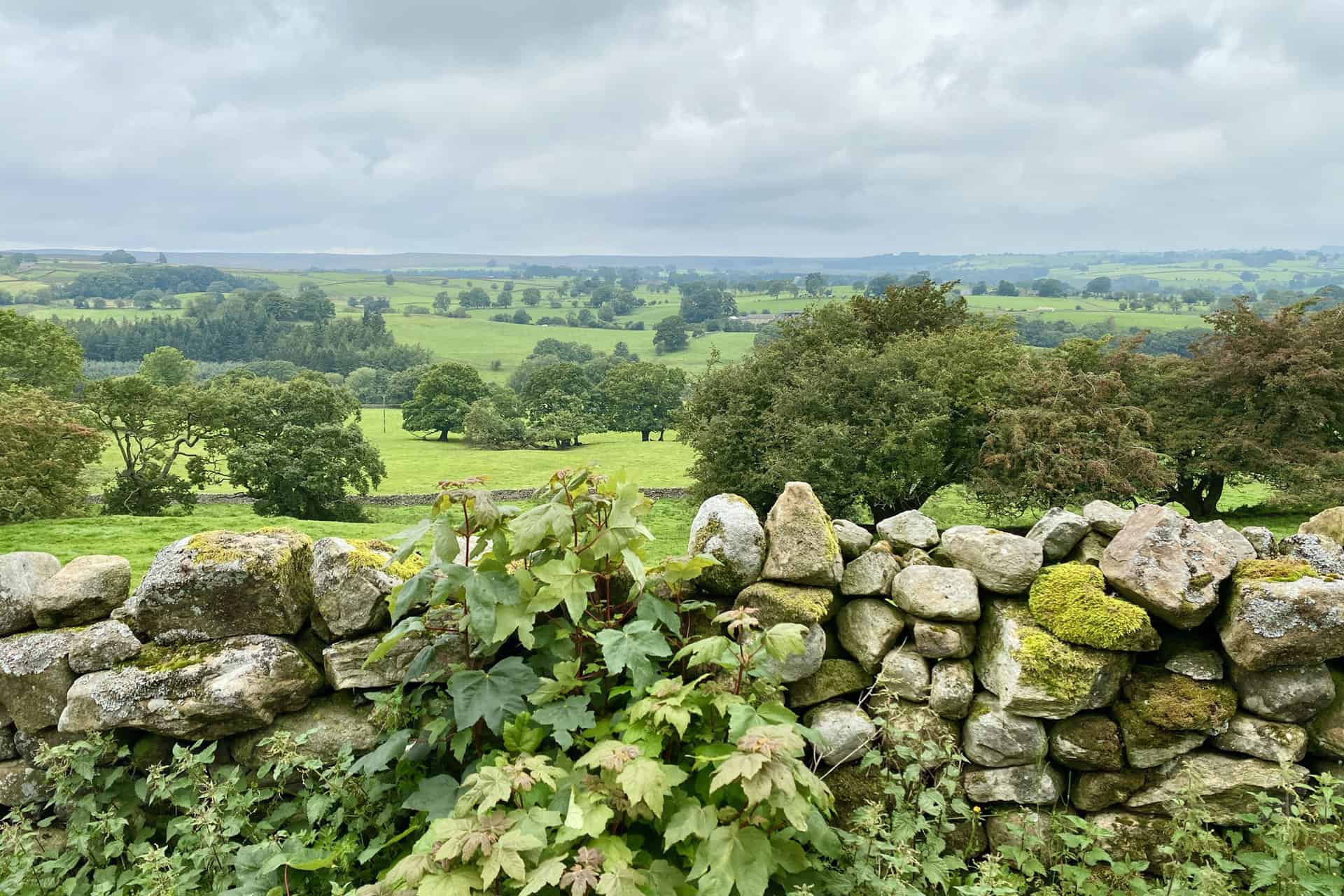
The Crackpots Mosaic Trail is a unique and captivating 7-mile walking route located in the stunning landscape of Dallowgill, Nidderdale, North Yorkshire. Winding through picturesque fields, charming hamlets, and lush woodlands, the trail offers walkers an unforgettable experience as they encounter 22 illuminated mosaics that celebrate the local scenery, flora, and fauna.
The idea for the trail was born in 1997 when Nidderdale was designated as an Area of Outstanding Natural Beauty (AONB). To commemorate this honor and to encourage people to explore and appreciate the natural beauty of the region, a community project was initiated to create a series of mosaics. These mosaics would not only serve as an artistic expression but also provide an interactive element for walkers to engage with during their journey.
The artists behind these mosaics are a talented group of people known as ‘The Crackpots’ from the nearby village of Kirkby Malzeard. These individuals, passionate about their local heritage, collaborated under the guidance of Margaret Murphy from Rural Arts North Yorkshire to create the 22 mosaics that adorn the trail. Each mosaic is a labor of love, crafted with intricate detail and bursting with local charm.
The mosaics depict a variety of subjects, including the flora and fauna found along the trail, as well as scenes from the surrounding landscape. From a delicate wild rose to a majestic deer, each mosaic captures the essence of Nidderdale’s natural beauty. The artists have also incorporated elements of local history and culture, such as the Roman Soldier mosaic, connecting the past with the present.
Location of the Crackpots Mosaic Trail
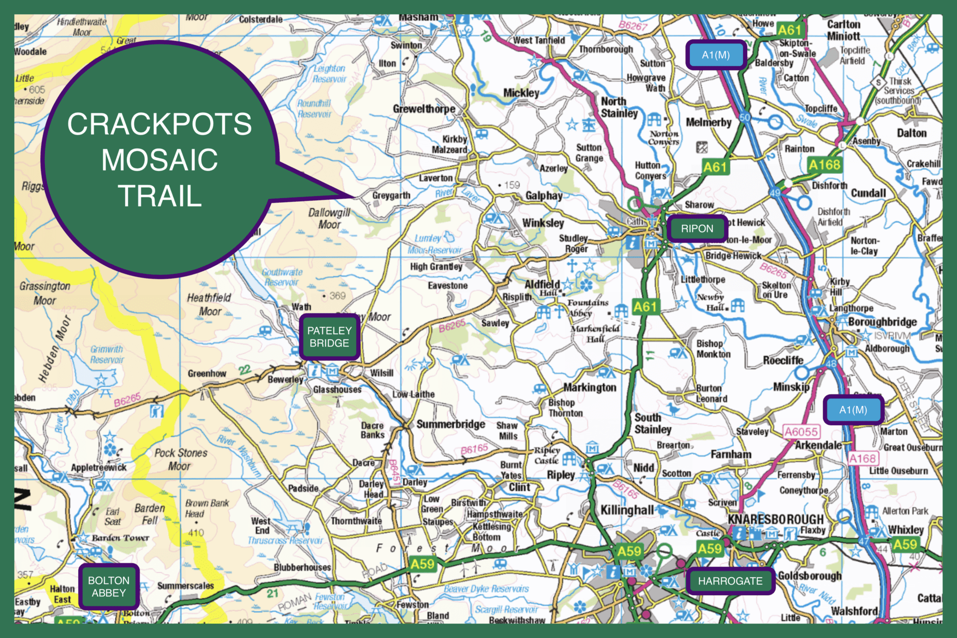
The Crackpots Mosaic Trail is located in the picturesque area of Dallowgill, within the Nidderdale AONB in North Yorkshire. The trail is accessible from several nearby towns and cities, including Harrogate, Ripon, and Pateley Bridge. The starting point for the Crackpots Mosaic Trail is a small car parking area on Kirkby Malzeard moor near Tom Corner, close to the junction of Kirkby Moor Road and Greystone Head.
About the Crackpots Mosaic Trail
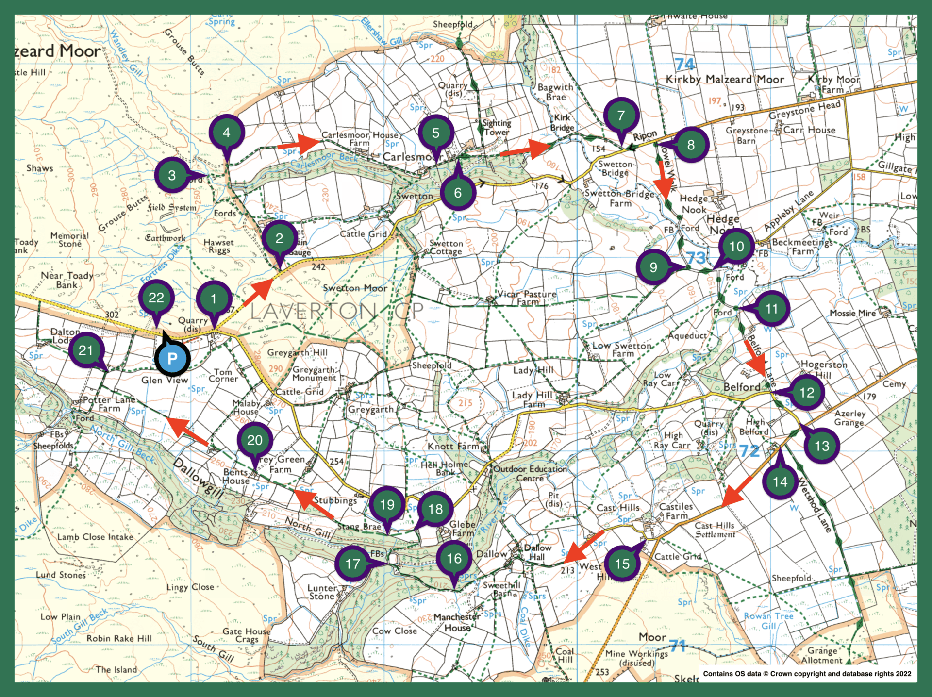
The Crackpots Mosaic Trail is a circular walk that takes you through the beautiful landscape of Dallowgill in Nidderdale, where you’ll encounter 22 stunning mosaics celebrating the local scenery and wildlife. The trail is best enjoyed in a clockwise direction, starting at the car parking area on Kirkby Malzeard moor near Tom Corner. As you follow the walking route, you’ll hunt for the the 22 mosaics, some of which are tricky to find.
Throughout the 7-mile walk, you’ll experience a variety of paths, gravel tracks, fields, and minor roads, making the entire route a moderate yet enjoyable journey. The trail takes approximately four hours to complete, offering ample time to admire the scenery, enjoy a leisurely stroll, and appreciate the craftsmanship of the mosaics.
Recommended Ordnance Survey Map
The best map to use on this walk is the Ordnance Survey map of Nidderdale, reference OS Explorer 298, scale 1:25,000. It clearly displays footpaths, rights of way, open access land and vegetation on the ground, making it ideal for walking, running and hiking. The map can be purchased from Amazon in either a standard, paper version or a weatherproof, laminated version, as shown below.
Weatherproof Version
Ordnance Survey map of Nidderdale, reference OS Explorer 298, scale 1:25,000
Crackpots Mosaic Trail Summary
Location: Dallowgill, Nidderdale, North Yorkshire.
Map: Ordnance Survey map of Nidderdale, reference OS Explorer 298.
Distance: Approximately seven miles.
Time to complete: About four hours.
Starting point: Car parking area on Kirkby Malzeard moor near Tom Corner.
Terrain: Moderate route with tarmac roads, gravel tracks and fields.
Trail highlights: 22 illuminated mosaics depicting local scenes, flora and fauna.
Mosaics: 1 Sheep; 2 Red Grouse; 3 Dragonfly; 4 Adder; 5 Potato House; 6 Sighting Tower; 7 Wild Rose; 8 Great Spotted Woodpecker; 9 Friesian Cow; 10 Flag Iris & Tadpoles; 11 Brown Trout; 12 Leaves; 13 Curlew; 14 Boots & Beer; 15 Bluebells; 16 Fungi; 17 Deer; 18 Rabbits; 19 Barn Owl; 20 Bents House; 21 Pheasant; 22 Roman Soldier.
Crackpots Mosaic Trail Step-by-Step Directions
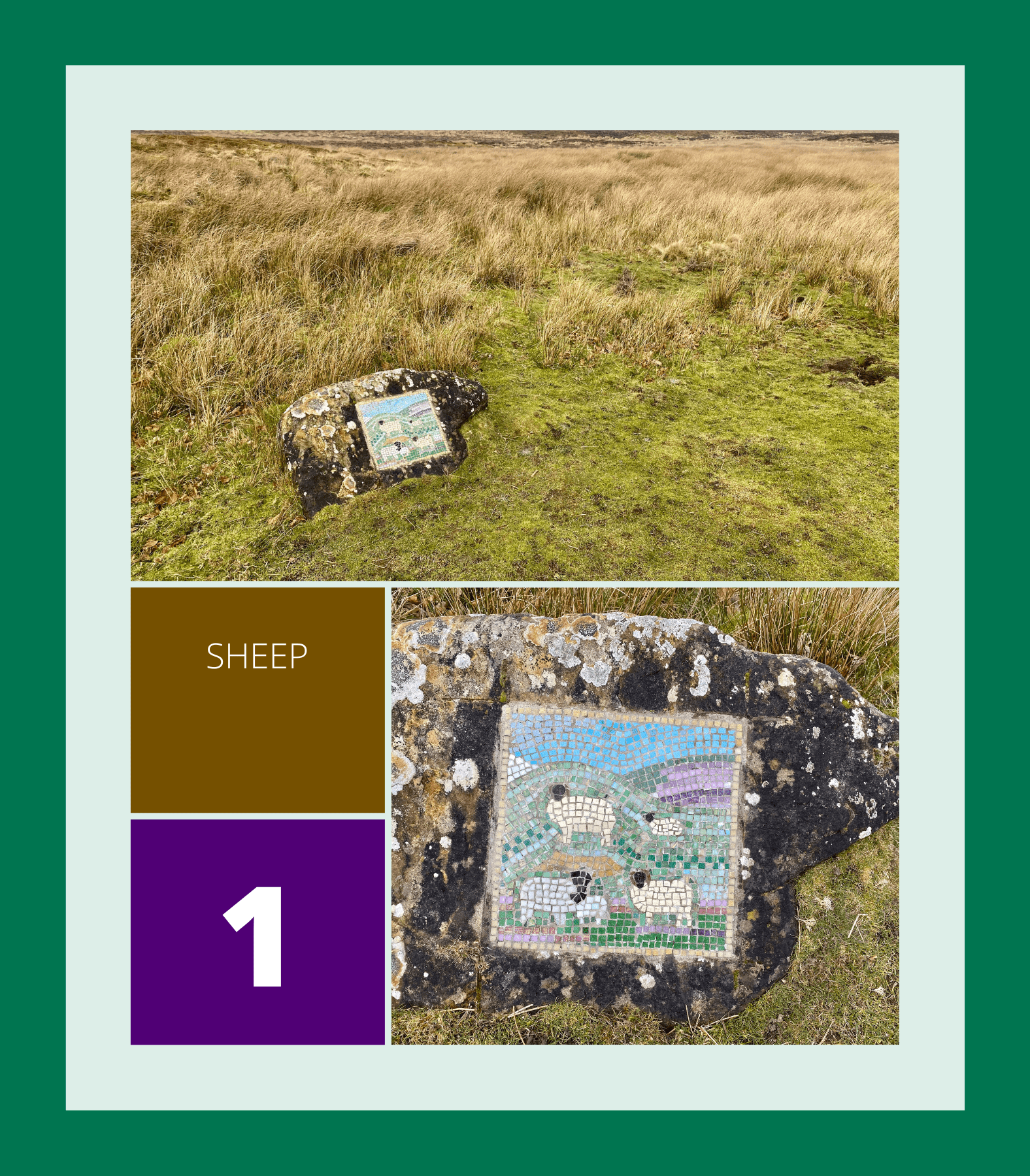
1. Sheep
Head east from the car park along the minor road until you reach a forked junction. Look for the Sheep mosaic at this point.
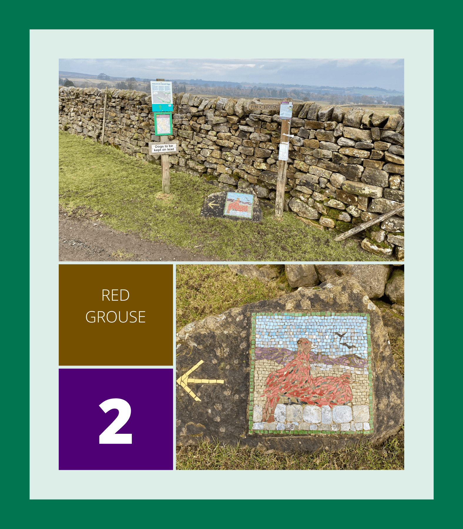
2. Red Grouse
Take the left-hand fork and continue north-east along the road to a dry stone wall on your left. Here, you’ll find the Red Grouse mosaic.
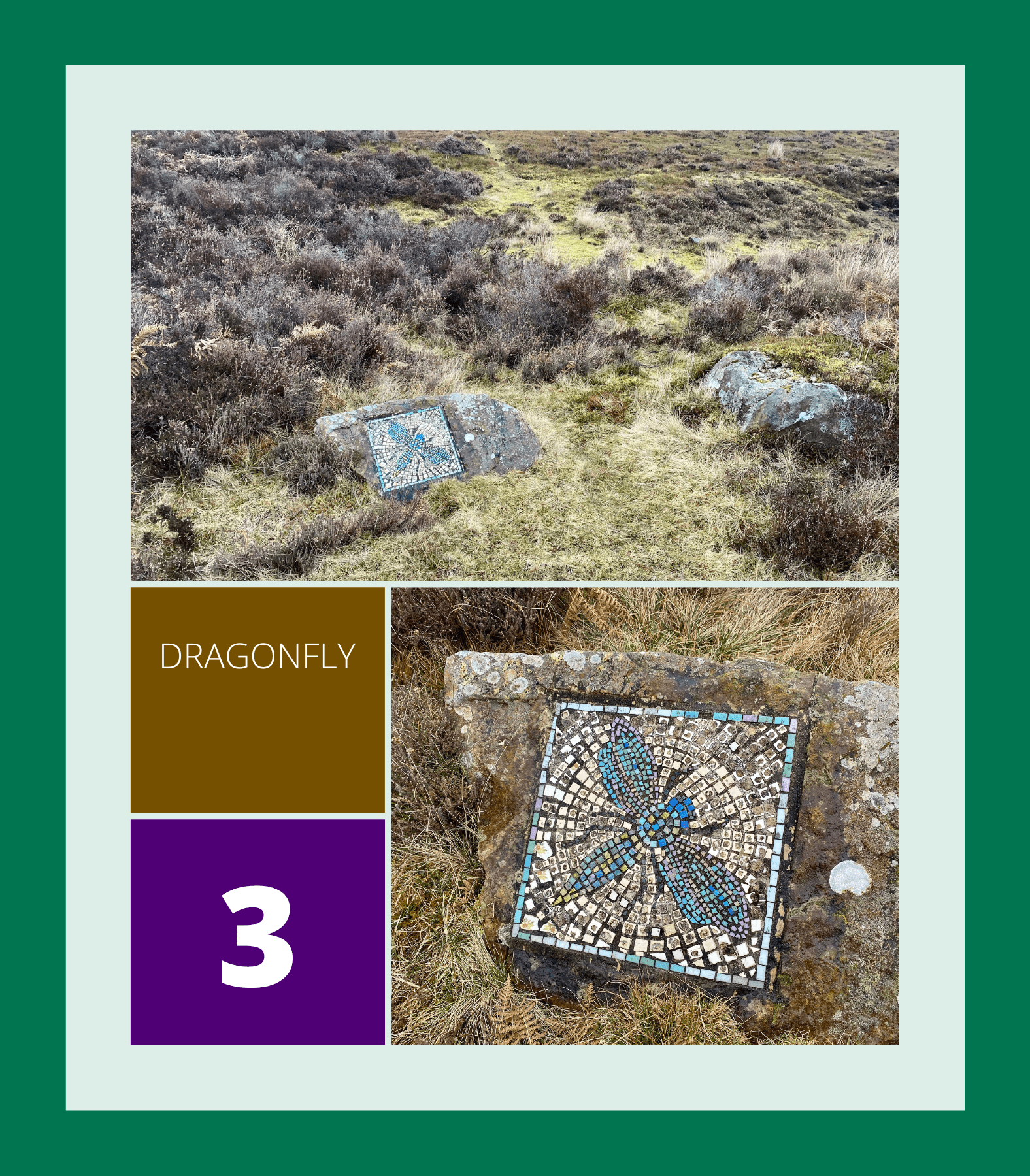
3. Dragonfly
Head north-west on the track initially alongside the wall until you arrive at a sheep pen where you’ll see the Dragonfly mosaic.
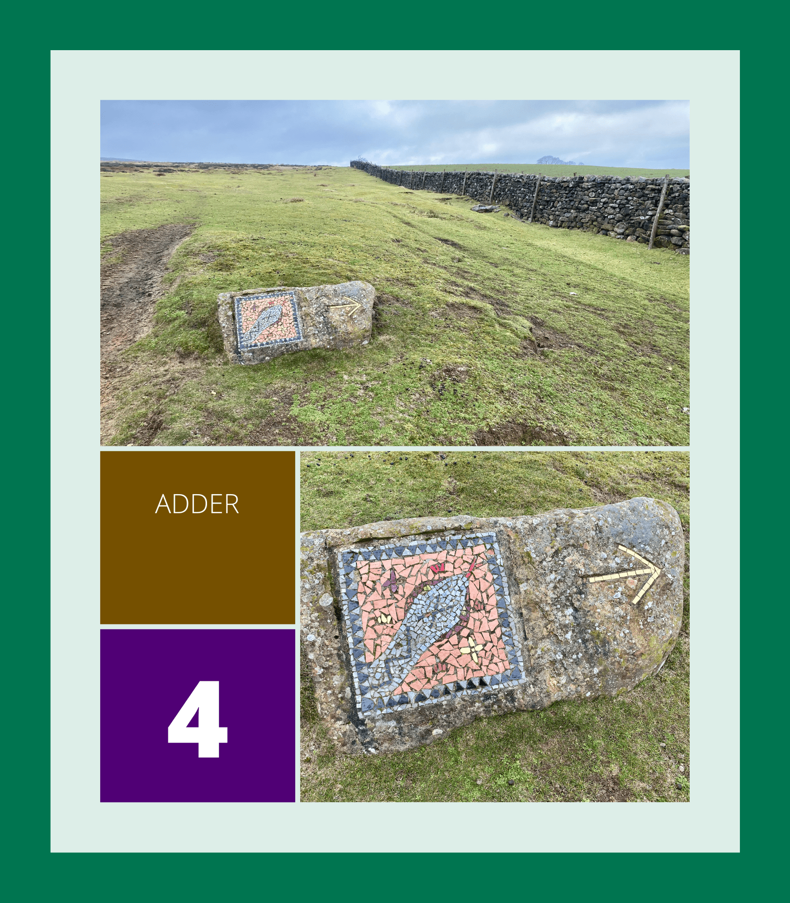
4. Adder
Go east and uphill towards the dry stone wall where the Adder mosaic is situated.
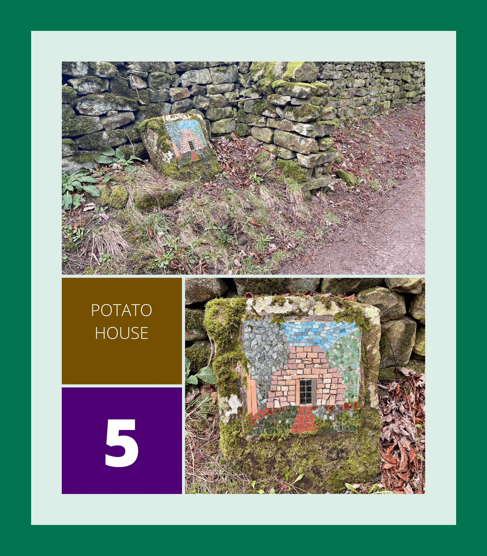
5. Potato House
Walk east along the lane past Carlesmoor House Farm and through the hamlet of Carlesmoor. Look out for the Potato House mosaic shortly after.
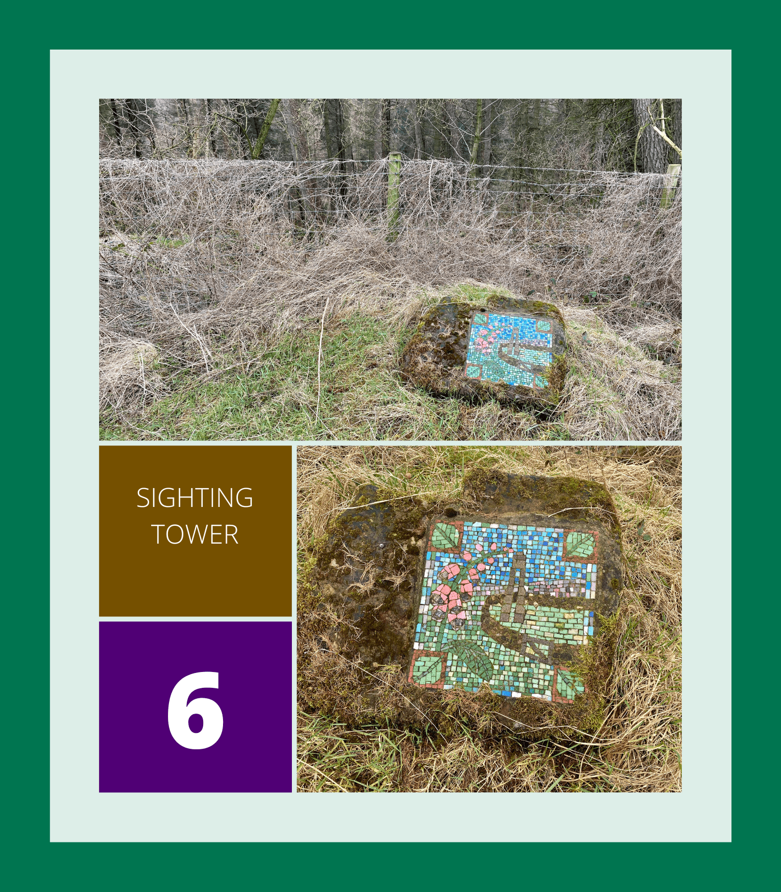
6. Sighting Tower
A little further along the lane, you’ll come across the Sighting Tower mosaic.
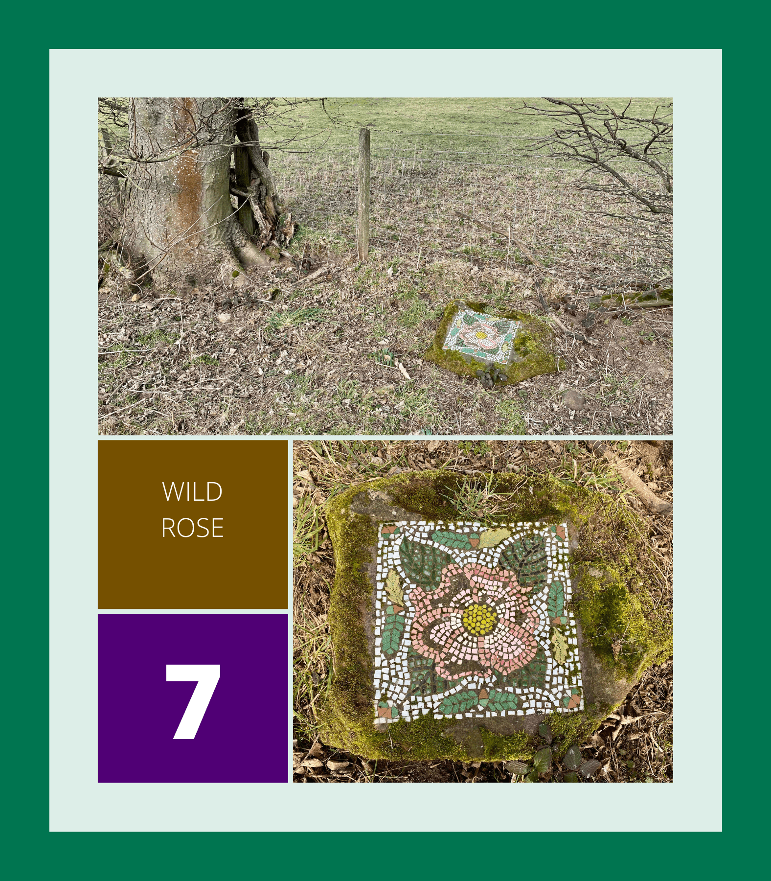
7. Wild Rose
Continue heading east along the lane until you reach a minor road where the Wild Rose mosaic is located.
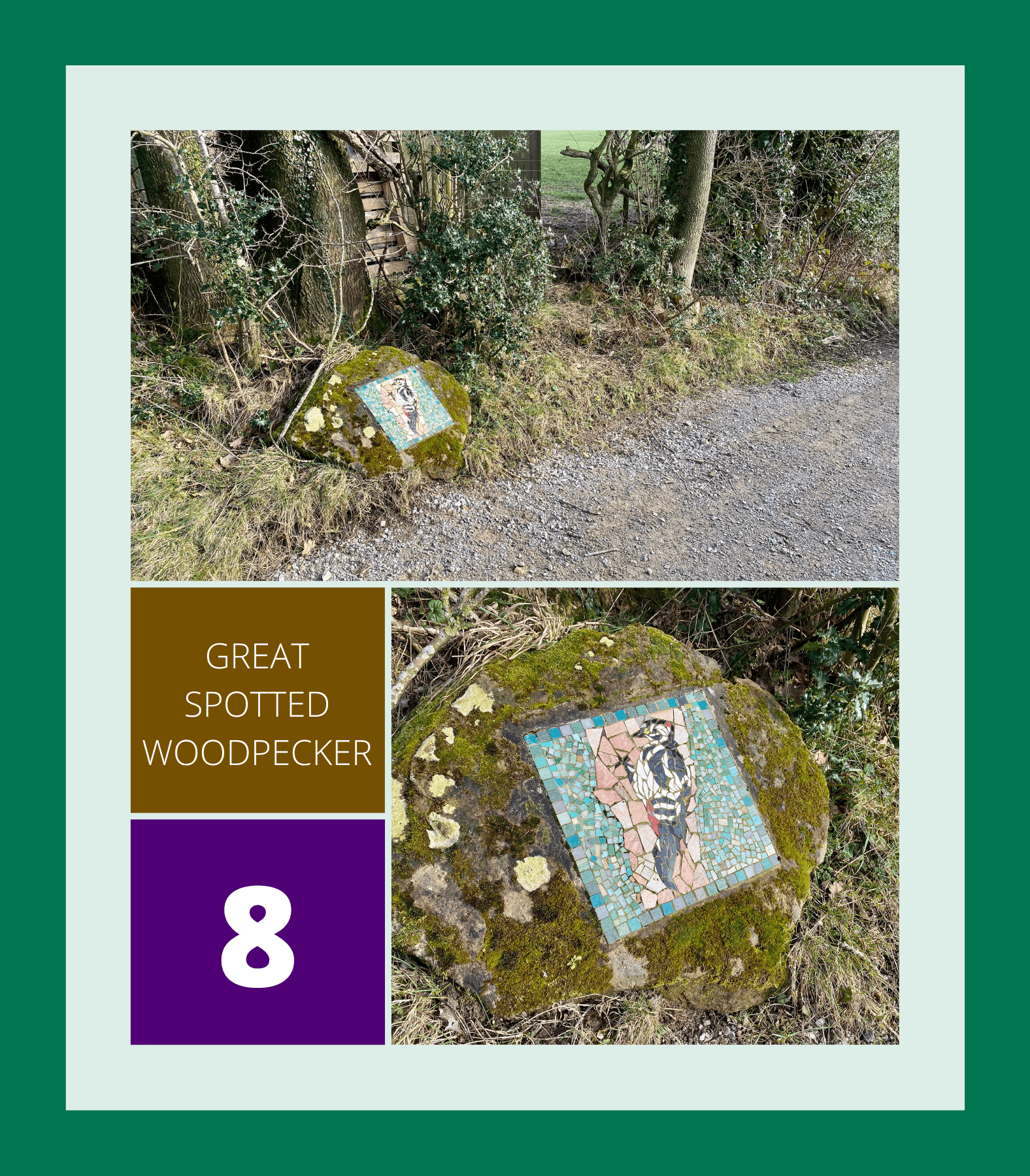
8. Great Spotted Woodpecker
Take a left and head uphill briefly to the east along the road before making a right turn onto the Ripon Rowel Walk. You’ll see the Great Spotted Woodpecker mosaic.
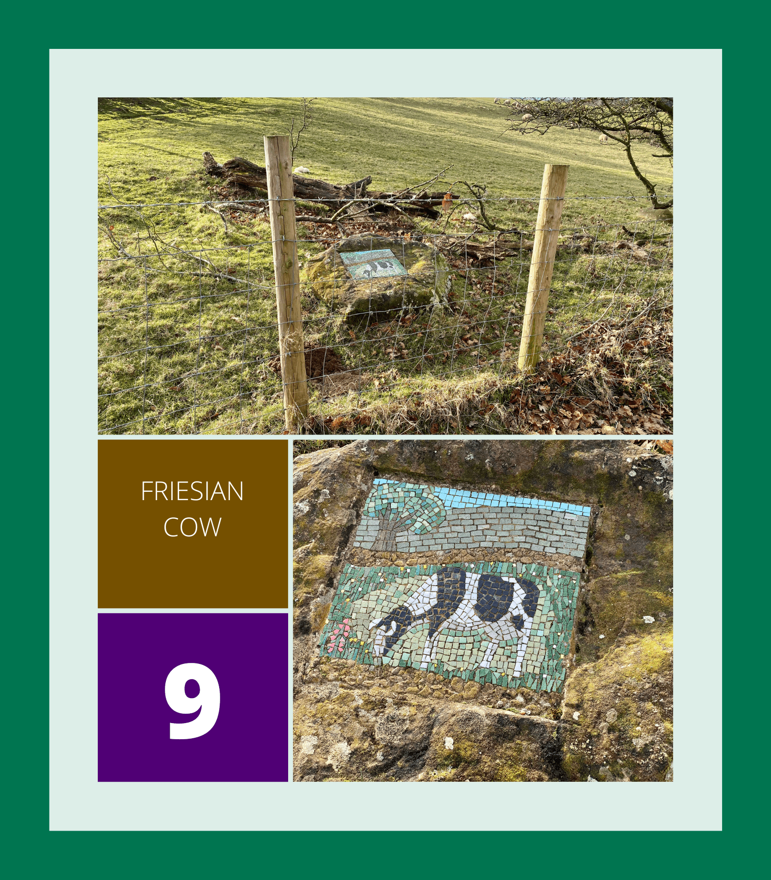
9. Friesian Cow
Head south along the Ripon Rowel Walk, cross the footbridge, and go uphill to find the Friesian Cow mosaic.
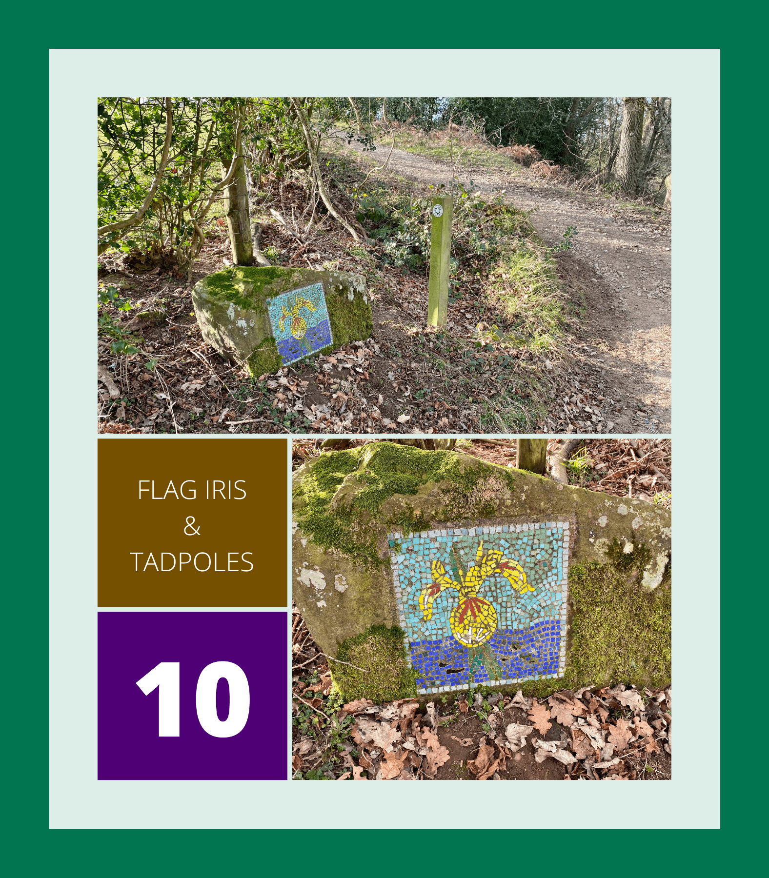
10. Flag Iris & Tadpoles
Head east along the track until you reach the point where it bears right. Here, you’ll find the Flag Iris & Tadpoles mosaic.
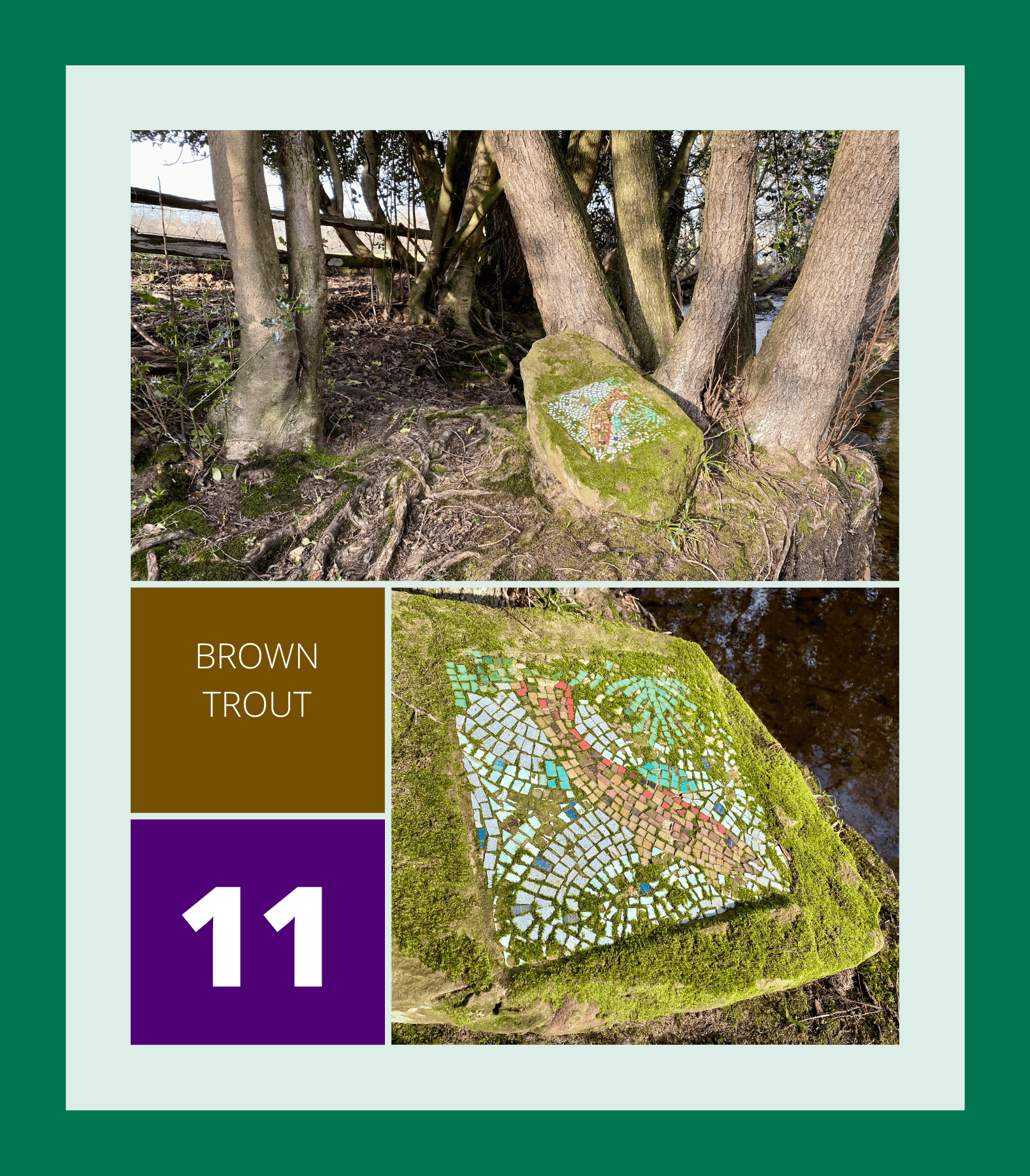
11. Brown Trout
Walk south along the lane and use the footbridge to cross the stream, then continue uphill until you find the Brown Trout mosaic.
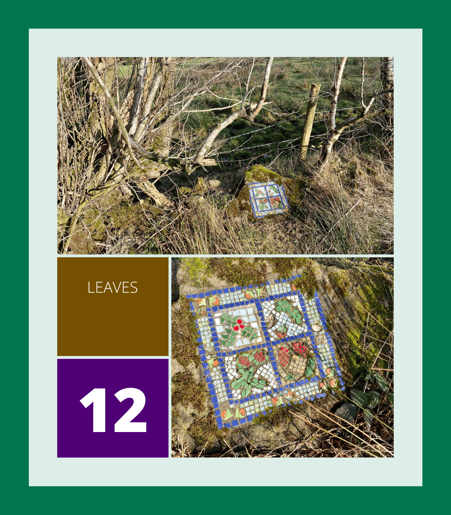
12. Leaves
Continue south-east along Belford Lane until you reach a minor road with a farm on your left, where the Leaves mosaic is situated.
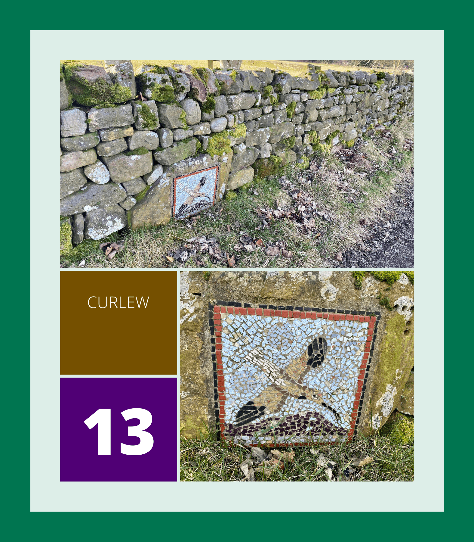
13. Curlew
Walk further south-east along the minor road until you reach the junction with the main road (Dallowgill Road), where the Curlew mosaic can be found.
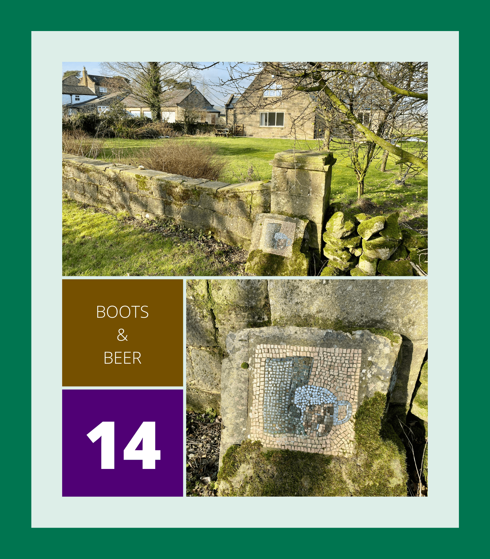
14. Boots & Beer
Make a right turn at the main road and head south-west until you reach the Boots & Beer mosaic near a house with a large lawned garden.
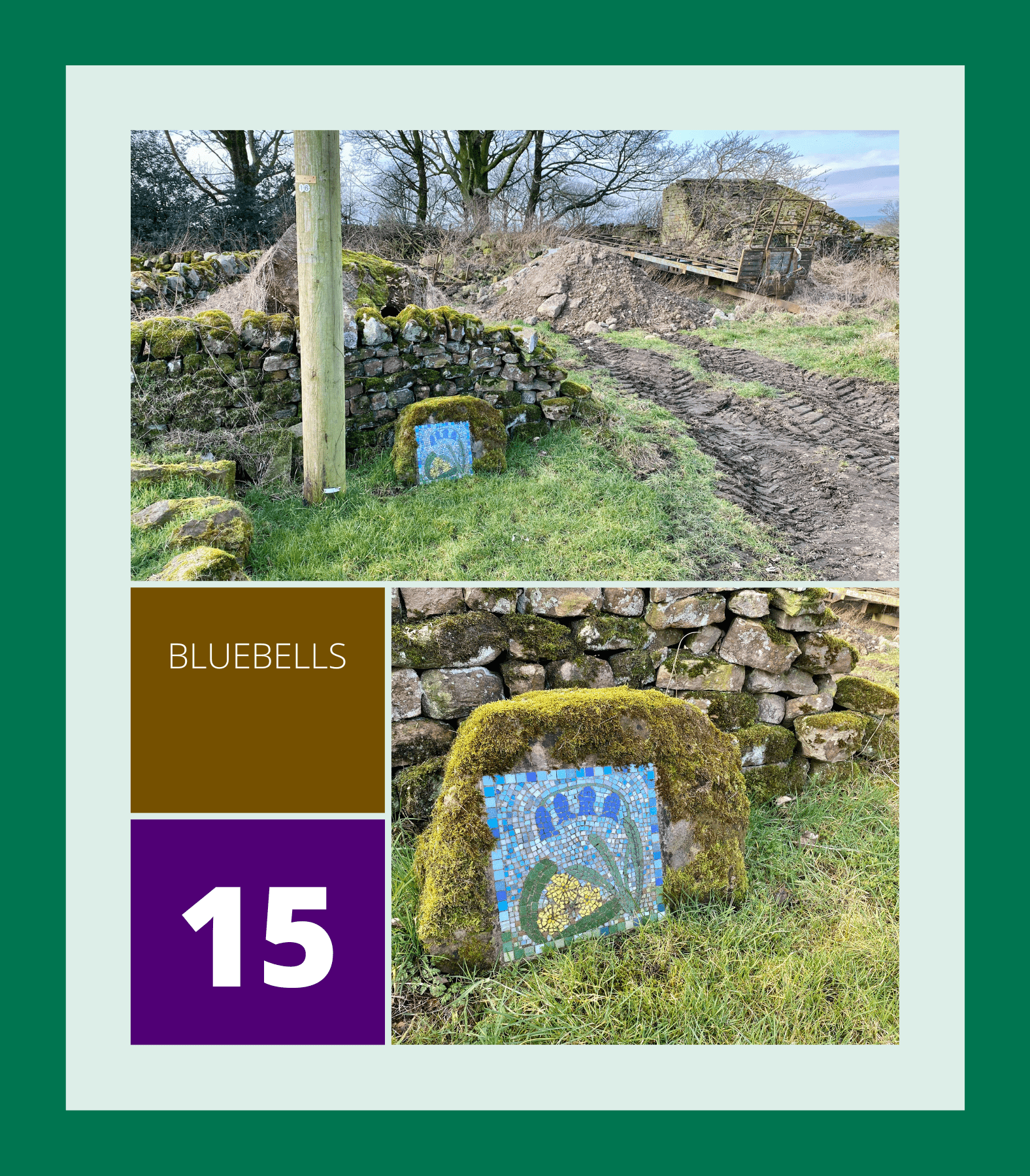
15. Bluebells
Continue along the main road in a south-west direction, then take a right turn at Castiles Farm into Dallow Lane. Here, you’ll see the Bluebells mosaic.
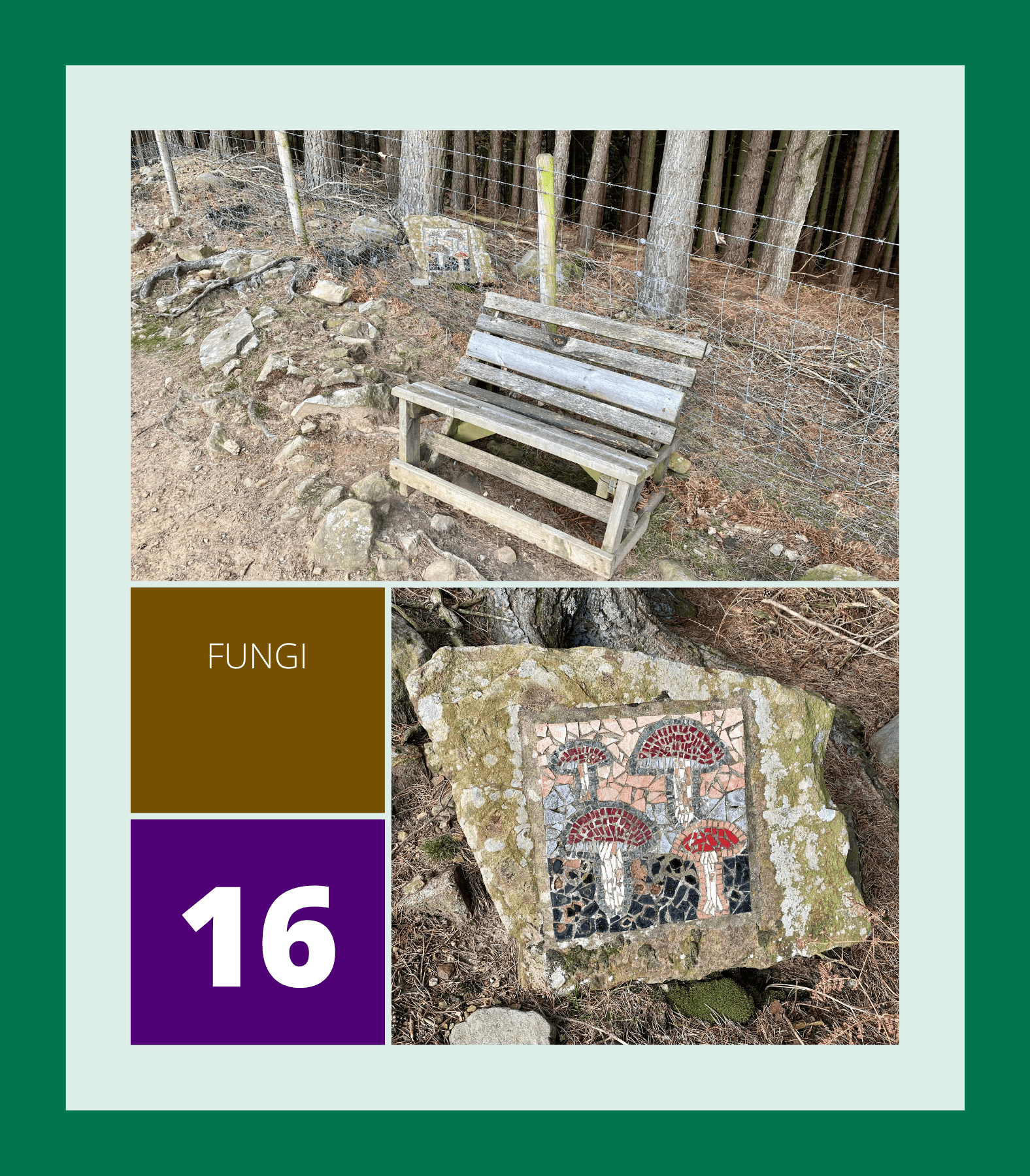
16. Fungi
Follow Dallow Lane through the hamlet of Dallow and along the side of the woodland until you find the Fungi mosaic.
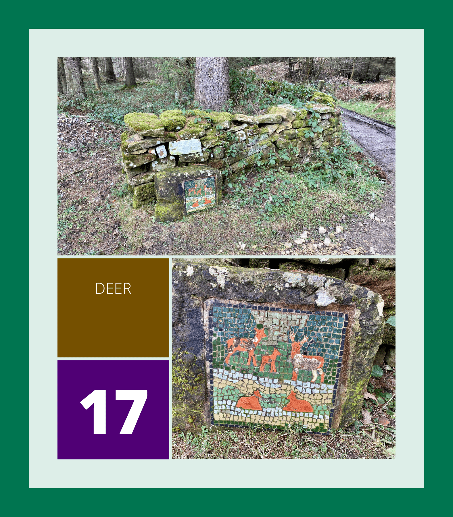
17. Deer
Walk down through the woods and cross the footbridge to reach a woodland clearing where the Deer mosaic can be found.
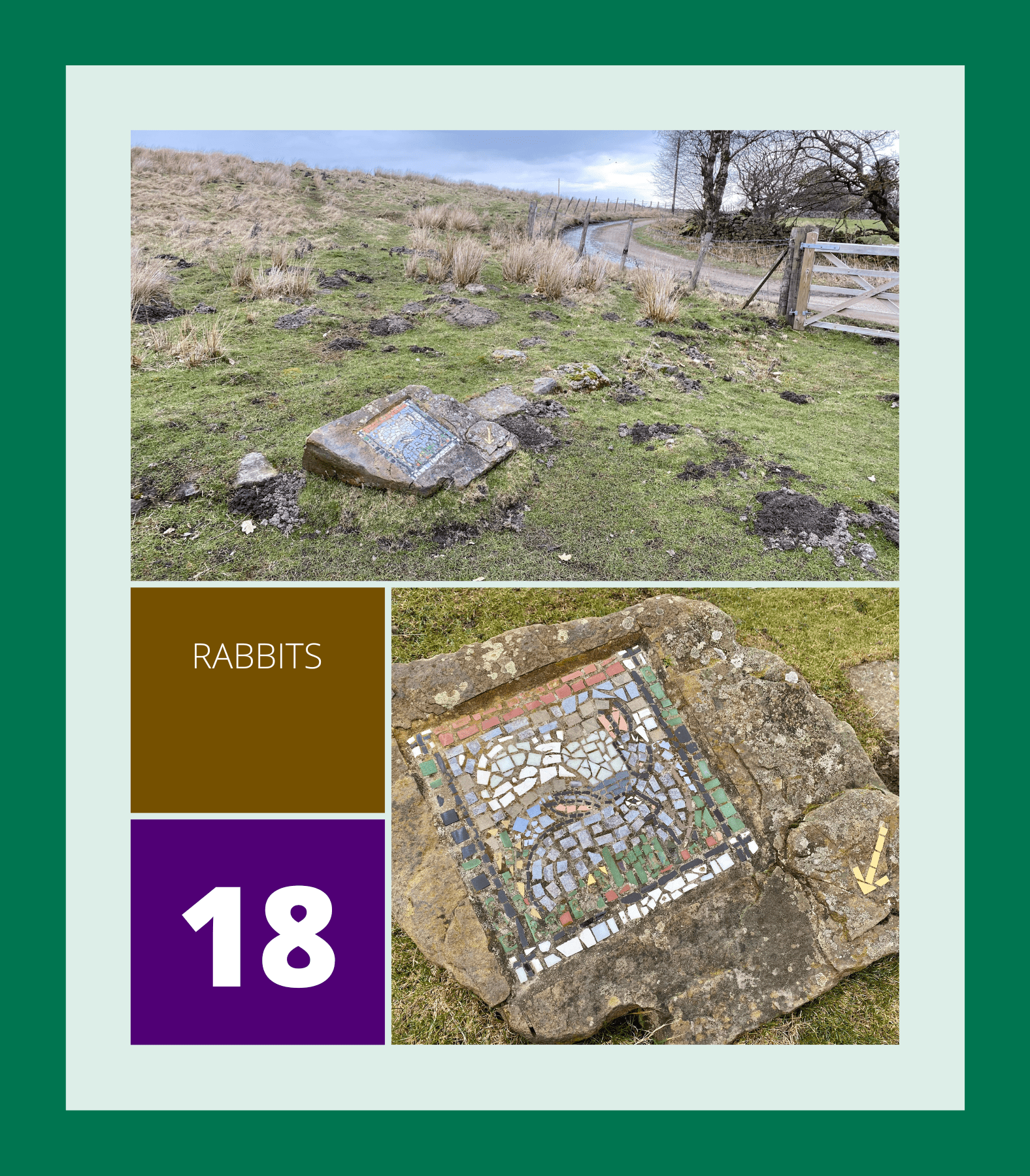
18. Rabbits
Bear right and walk uphill along the track heading north-east, then turn north and enter the field on your left to see the Rabbits mosaic.
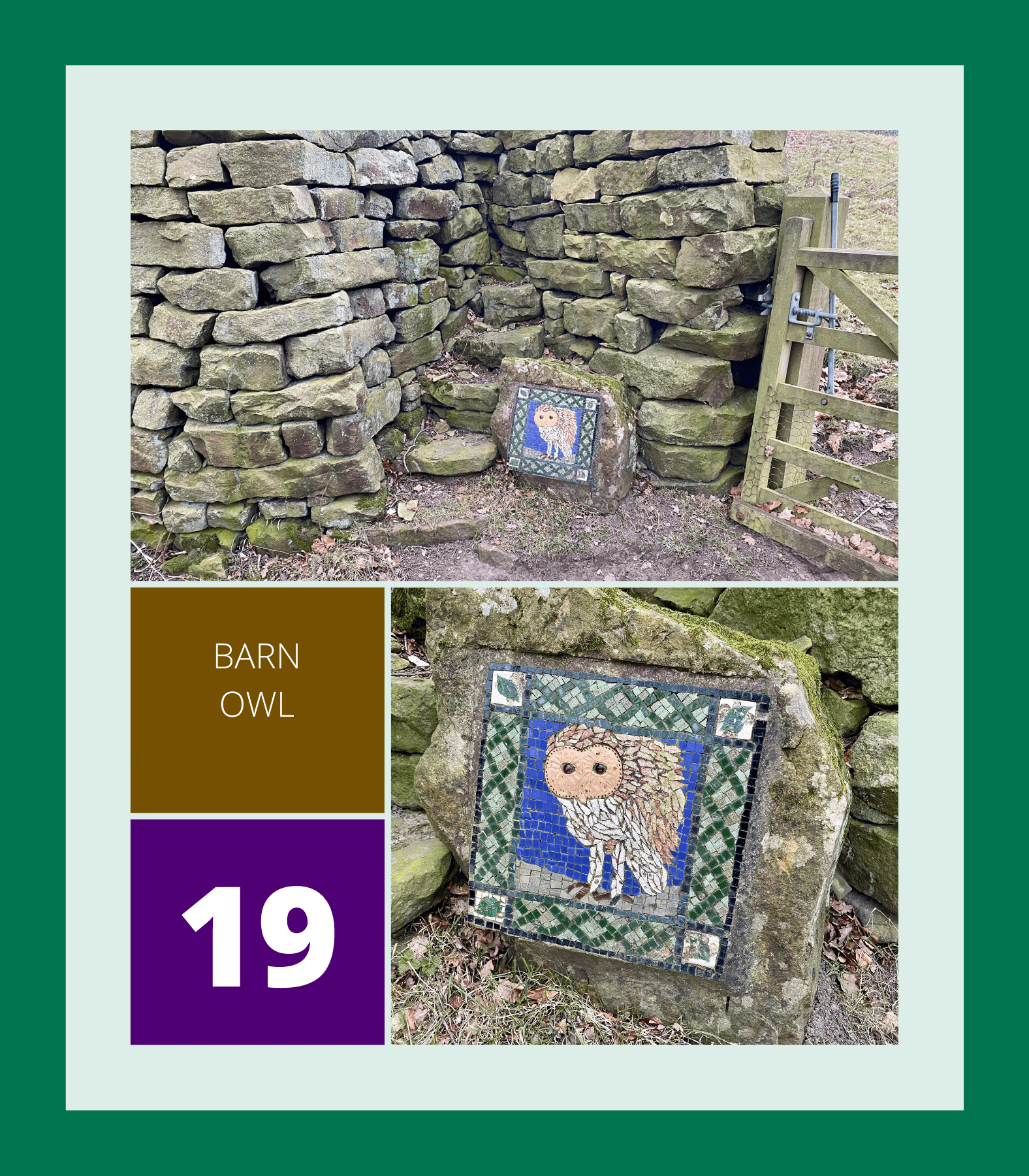
19. Barn Owl
Head west across the field into the bottom left-hand corner and enter the woodland to find the Barn Owl mosaic.
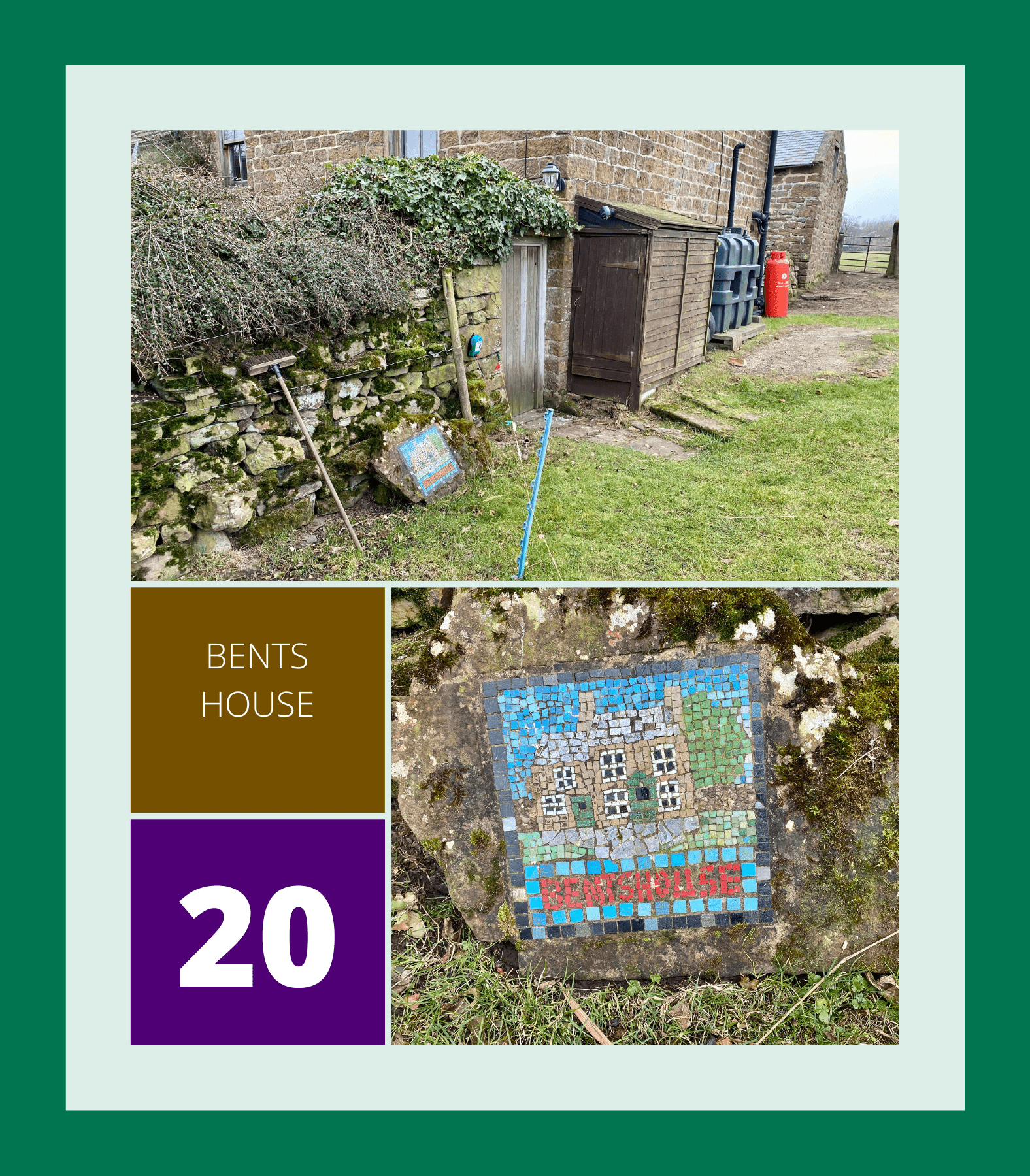
20. Bents House
Follow the path through the woods until you emerge into open fields, then head north-west until you reach Bents House where the Bents House mosaic is located.
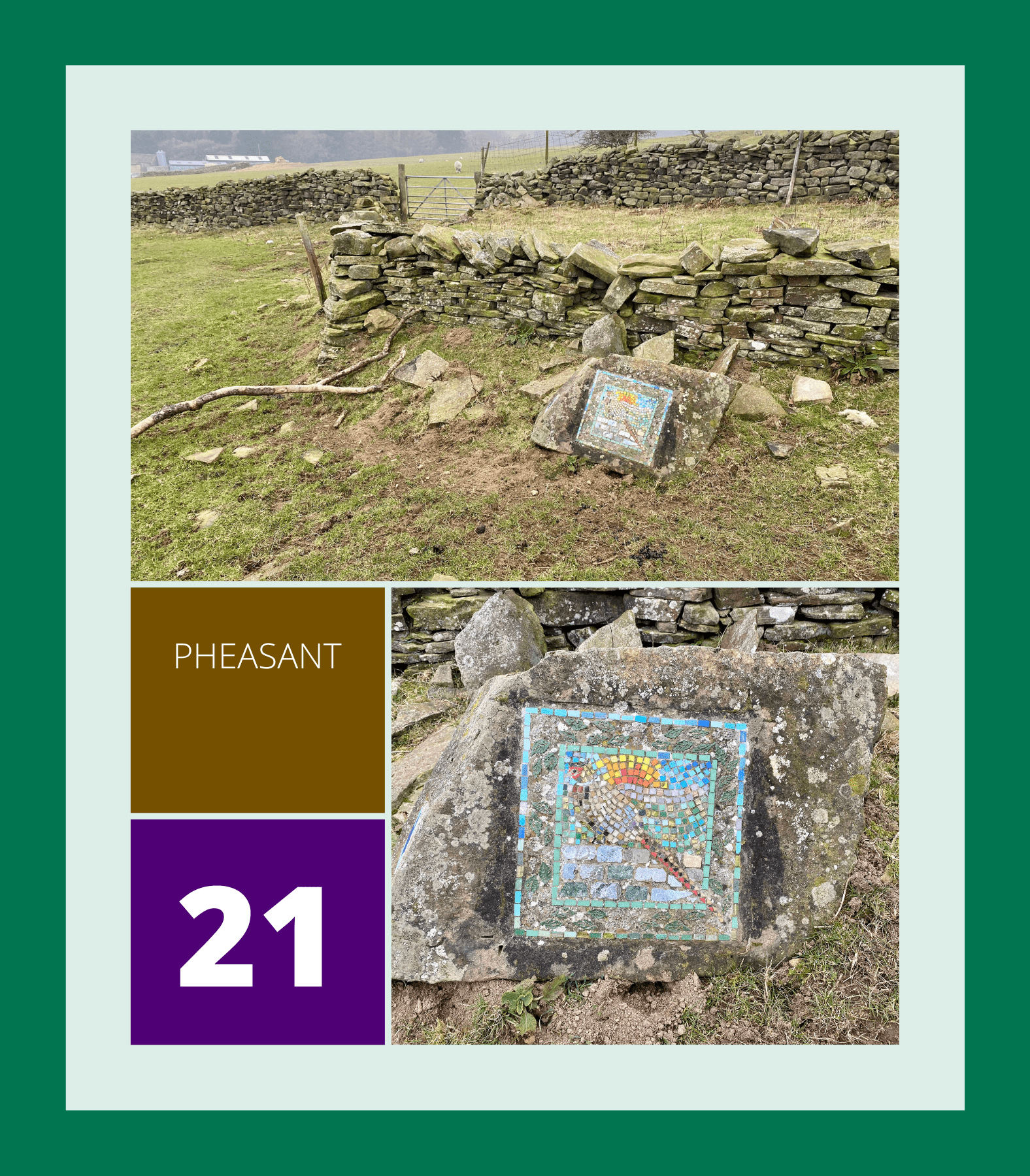
21. Pheasant
Walk past the buttressed barn and past another set of buildings, then head north-west across the fields towards Potter Lane Farm. Turn right at Potter Lane and walk north-east to a barn where the Pheasant mosaic can be found.
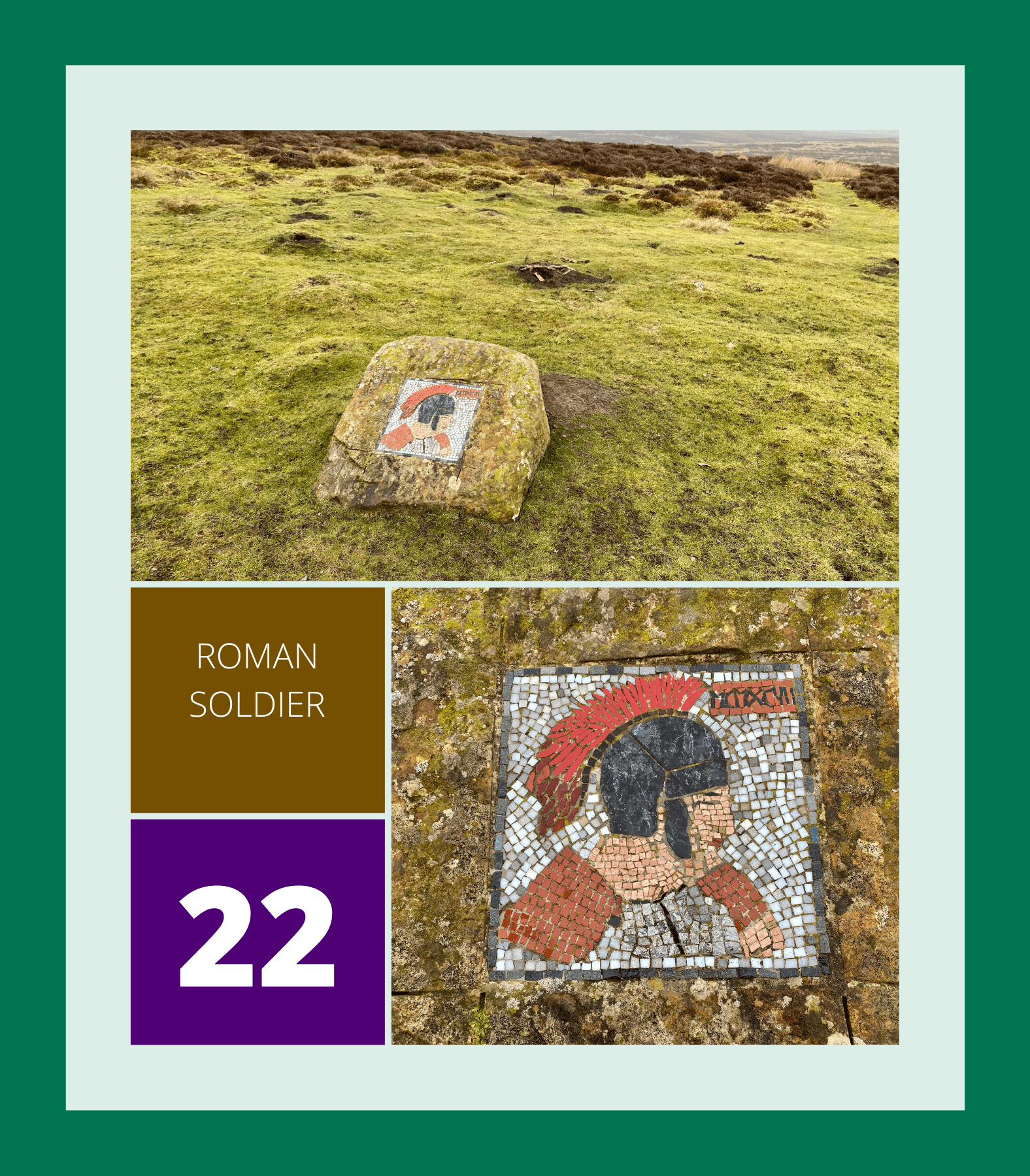
22. Roman Soldier
Follow the sunken path lined with gorse bushes north-east until you reach a minor road at the top. Turn right and head east towards the car park to find the Roman Soldier mosaic.
Print the Crackpots Mosaic Trail Walking Route
If you’re interested in completing the Crackpots Mosaic Trail, feel free to open and print the PDF file below and take it with you. It contains all the information you’ll need to enjoy the walking route and find the mosaics.
Amazon’s Top Walking Boots: Four Standout Choices for Men and Women
For walking and hiking, the right boots are essential for both comfort and safety. While Amazon boasts a wide range, certain boots emerge as top-sellers. From those, here are four I personally favour. As an Amazon affiliate, I may earn a small commission from any purchases made through the links provided. This helps support the upkeep of this website. Rest assured, you won’t pay a penny extra, but your purchase will contribute to keeping my site running smoothly. Happy walking!

Berghaus Men’s Hillmaster II Gore-Tex Walking Boots
These fully waterproof leather walking boots feature a Gore-Tex lining, ensuring no water enters whilst allowing feet to breathe and stay cool. Made from full-grain leather, they promise unmatched durability and comfort. The boots come with memory foam tongues and cuffs that mould to your feet for a tailored fit, and the Vibram Hillmaster outsoles offer confidence on challenging terrains.

Salewa Men’s Mountain Trainer Mid Gore-Tex Walking Boots
Made from durable suede and abrasion-resistant textile, these men’s hiking boots are both lightweight and sturdy. The upper material is enhanced by a 360° full rubber sheath. Their dual-layer midsole with Bilight technology ensures ergonomic cushioning and grip, especially on extended hikes. The Vibram Wrapping Thread Combi outsoles allow a natural walking feel, and the Gore-Tex lining provides waterproofing, breathability, and optimal weather protection. Furthermore, the patented Salewa 3F system ensures flexibility, a secure heel grip, and a blister-free fit.

Berghaus Women’s Supalite II Gore-Tex Walking Boots
Specially designed for women, these hiking boots offer waterproofing and breathability, thanks to their Gore-Tex lining. Crafted from full-grain abrasion-resistant leather, they’re durable enough for the toughest hikes. The Supalite soles ensure stability and traction, and the EVA midsoles add comfort for extended walks.

Merrell Women’s Moab 3 Mid Gore-Tex Walking Boots
These hiking boots incorporate a Gore-Tex waterproof membrane, blending breathability with superior waterproof performance. The combination of pigskin leather and mesh on the uppers, along with the suede outer material, ensure durability and style. Enhancements include 100% recycled laces, webbing, and mesh lining. Additionally, bellows tongues, protective toe caps, and Vibram TC5+ rubber soles ensure protection and ease on any terrain.