ADVERTISEMENT
Following the River Wharfe Through the Yorkshire Dales on This Hebden Walk
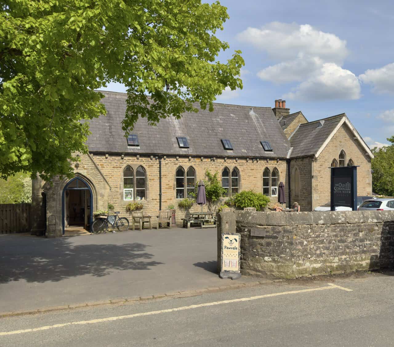
This Hebden walk begins in the village of Hebden, on the B6265. The walk starts from Main Street, just off the main road, where there is plenty of roadside parking either alongside the dry stone wall opposite Green Terrace or near The Old School Tea Room.
From your parking spot, walk back to the B6265 and turn left towards Grassington and Skipton. Continue past the Clarendon Hotel to the end of the village. Just after the large bus and coach garage, you will see two public footpaths on the right. Ignore the first, which is signposted to Tinkers’ Lane, and take the second, signposted to Grassington via High Lane.
Follow the yellow waymarker arrows across several grassy fields, passing through gated gaps in the walls, for about half a mile until you reach a patch of woodland. An interpretation board confirms that you have entered Grassington Park Estate Meadows. At the crossroads on the edge of the woodland, continue ahead on the footpath signposted to Grassington. After leaving the woodland, keep to the flagged stone path straight ahead, then follow further yellow waymarkers through another stretch of woodland.
Once you leave the Grassington Park Estate Meadows behind, carry straight on across more grassy fields, passing through gaps in the dry stone walls, some with stiles. The route is well marked with yellow arrows and wooden signposts. The path eventually joins a wider stone track called High Lane, which leads downhill into Grassington.
The track brings you out onto Low Lane. Turn right here and follow the road downhill to the front of Grassington Town Hall. Turn left onto Main Street and walk all the way down through the village, past the shops, cafés and pubs, until you reach the B6265, also known as Hebden Road.
ADVERTISEMENT
Turn right, then immediately right again onto Wood Lane. Continue along Wood Lane, passing Grassington Police Station on your left, and shortly afterwards turn right onto Moody Sty Lane. At the end of Moody Sty Lane, turn left onto Garrs End Lane. Pass a house named Garrs End Laithe on your left and go straight across the crossroads that follows.
Carry on as the tarmac lane becomes a stone track, with allotments on your left. This is Cove Lane, hemmed in by dry stone walls on either side. Follow the lane as it bends sharply to the left and passes two large stone barns, then take the signposted footpath into the woodland. A sign welcomes you to Grass Wood Nature Reserve.
Walk past the large interpretation board and head straight up into Grass Wood, passing through the site of an Iron Age settlement. Shortly afterwards, the path forks. Instead of taking the right-hand fork, which is signposted as a public footpath, bear left onto a narrower woodland path that climbs gently through the trees. As the path begins to level out, look for a set of old wooden steps on your left and follow them uphill. A wooden sign indicates that you are heading towards Fort Gregory, a Brigantian hill fort thought to date from around AD 70.
At the fort, which now amounts to little more than a few scattered stones, the path swings round to the right and then immediately back to the left. It becomes rocky and starts to descend the hillside. After this short rocky section, turn right onto the woodland path and continue along the main path through the trees, ignoring any side paths to the left and right.
After about a third of a mile, the path forks again. The right-hand fork heads downhill, but you want the left, which sweeps around in a U-turn before continuing more steeply down. At a T-junction with a slightly wider path, turn left, then almost immediately turn right. This brings you down to a stile over the wall and out onto a road called Grass Wood Lane. You are now roughly halfway around your Hebden walk.
Cross the road and go straight ahead through the gate directly opposite, into Lower Grass Wood. Just behind the gate, the path splits three ways. Take the middle path, which leads down to the banks of the River Wharfe. Follow the riverside path with the river on your right. Where the path splits in two, turn right and take a flight of stone steps down towards the river.
Continue along the path and out of Lower Grass Wood, then carry straight on along the riverside. The path follows the grassy banks of the river for about a quarter of a mile to Ghaistrill’s Strid, and then for a further three quarters of a mile to the arched stone road bridge on the western edge of Grassington.
ADVERTISEMENT
Follow the path up to the road, cross over, and take the footpath directly opposite, signposted as the Dales Way to Hebden and Burnsall. The path crosses a grassy meadow, passing Linton Falls Hydro, a small hydroelectric power station, before reaching the footbridge at Linton Falls. Do not cross the bridge. Instead, continue straight ahead, still following the Dales Way to Hebden and Burnsall.
Cross the fields to a tarmac lane and turn right, still following the signs for Hebden and Burnsall. The lane eventually narrows into a footpath running alongside the river. At the next junction, three options are signposted: Linton Church via the stepping stones, the Dales Way to Burnsall, and the public footpath to Hebden. Take the middle route, signposted as the Dales Way to Burnsall.
Continue along the footpath beside the River Wharfe. After about a mile and a quarter, you will reach Hebden Suspension Bridge. Do not cross it. Turn left instead, following the signpost to Hebden. Very shortly afterwards, you will come to a narrow tarmac lane called Mill Lane. Turn right and follow Mill Lane to the bridge over Hebden Beck.
Turn left at the bridge, where a sign indicates a public footpath to Hebden and Bank Top. Walk between the two houses and follow the path up through the woodland into open meadowland, then over the footbridge across Hebden Beck near the weir. Continue up the valley, gradually climbing on the left-hand side, until you arrive back on Main Street in Hebden. The path brings you out at The Old School Tea Room and your parking area, completing the Hebden walk.
Hebden Walk: Maps and Tools
Visit either the OS Maps website or the Outdooractive website to view this walking route in greater detail. Both platforms offer a range of features, including the ability to print the route, download it to your device, and export the route as a GPX file. You can also watch a 3D fly-over and share the route on social media. Additionally, this page includes a printable version of the walk in PDF format. Plus there is a supporting video, available for you to watch on YouTube.
Hebden Walk: Distance, Duration, Statistics
Distance: 8½ miles
Distance: 13½ kilometres
Duration: 3¾ hours
Ascent: 816 feet
Ascent: 249 metres
Type: Circular walk
ADVERTISEMENT
Recommended Ordnance Survey Map
The best map to use on this walk is the Ordnance Survey map of the Yorkshire Dales Southern & Western Area, reference OS Explorer OL2, scale 1:25,000. It clearly displays footpaths, rights of way, open access land and vegetation on the ground, making it ideal for walking, running and hiking. The map can be purchased from Amazon in either a standard, paper version or a weatherproof, laminated version, as shown below.
Standard Version
Yorkshire Dales Walking Guidebooks
Walking in the Yorkshire Dales: South and West, by Jan and Dennis Kelsall, describes 44 circular day walks of 3.5 to 13 miles across Wharfedale, Littondale, Malhamdale, Dentdale and Ribblesdale, plus the Yorkshire Three Peaks Challenge, with Ordnance Survey mapping and notes on parking and refreshments.
Short Walks Yorkshire Dales, by Rachel Crolla and Carl McKeating, covers the area around Grassington, Skipton, Malham and Ilkley. Its 15 routes of 2.5 to 6 miles each take under three hours, ideal for families or a relaxed half day out. Both books can be purchased from Amazon, as shown below.
Walking the Yorkshire Dales
About Grass Wood Nature Reserve
Grass Wood Nature Reserve is a majestic woodland set in the celebrated landscape of the Yorkshire Dales, and one of the natural highlights of this Hebden walk that passes through this part of Wharfedale. Take time to explore and you’ll discover limestone scars and open grassy areas tucked in among the trees. This range of habitats provides a haven for a wide variety of plants and animals, making the wood a rewarding place to wander at any time.
A visit in spring can be a real treat, as birdsong fills the air. Residents commonly seen or heard include nuthatch, great spotted woodpecker and treecreepers, joined in summer by visiting redstarts, wood warblers and blackcaps. Nest boxes have been placed around the wood to supplement the natural nest sites in hollow trees and scrub, giving these birds plenty of places to raise their young.
Grass Wood is also a fine place for wildflowers and other plants, with something to see in every season. Flowers range from the tiny dog violet to the majestic beech tree, and another real delight is the appearance of the delicate lily-of-the-valley, its little bell-like flowers shining bright in the shade during May and June. In most years there is a wealth of fungi too, with many fascinating shapes and colours to look out for, growing from the leaf litter, dead and rotting wood, tree trunks and almost anywhere else. Look out for clouded agaric and purple deceiver among the more striking species.
Related Walk: Similar to the Hebden Walk
Enjoy the River Wharfe and Hebden Suspension Bridge on this Linton walk
Insect life in the wood is particularly diverse, with many beetles such as the northern dung beetle thriving on the abundance of rabbit and deer droppings. Other eye-catching insects to look out for include a day-flying moth called the speckled yellow, and the northern brown argus butterfly, both of which can be seen in spring. With this much variety underfoot and overhead, the wood feels alive at every turn of this Hebden walk.
Grass Wood is owned and looked after by Yorkshire Wildlife Trust, working with a committed team of volunteers to conserve and increase the number of species while providing access for quiet enjoyment. Visitors are asked to keep dogs on leads at all times due to the presence of ground-nesting and feeding birds, and groups planning a visit are encouraged to contact the Trust beforehand so that visits can be planned to reduce the impact on the site. With a little care and respect, Grass Wood remains a wonderful place to enjoy as part of this Hebden walk for many years to come.
Hebden Walk: My Photos
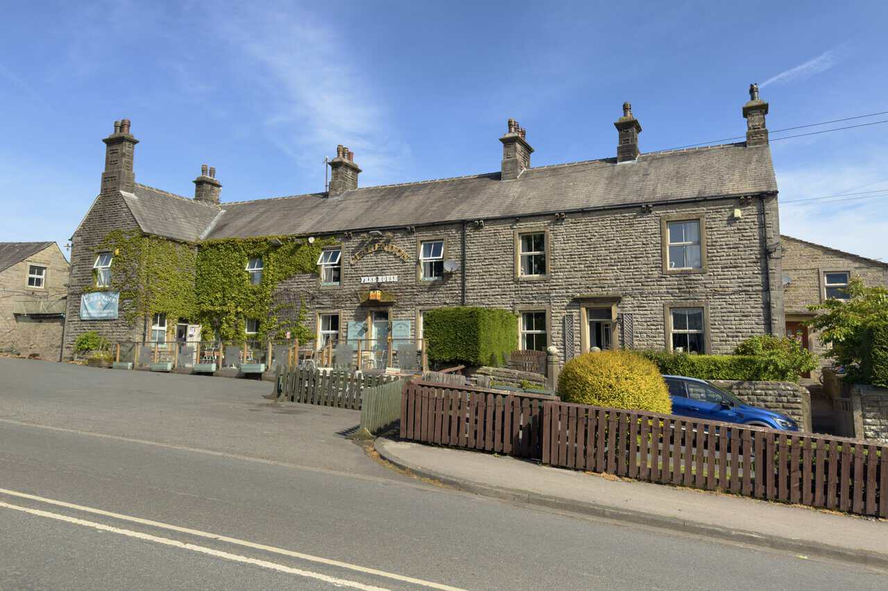
After parking on Main Street, I set off on my Hebden walk and soon pass the Clarendon Hotel on my way through the village. This stone-built country inn dates back to 1753 and has traded under several names over the centuries, eventually taking on the Clarendon name in 1901. With its ivy-clad frontage and traditional Dales character, it makes for a fine first landmark of the day.
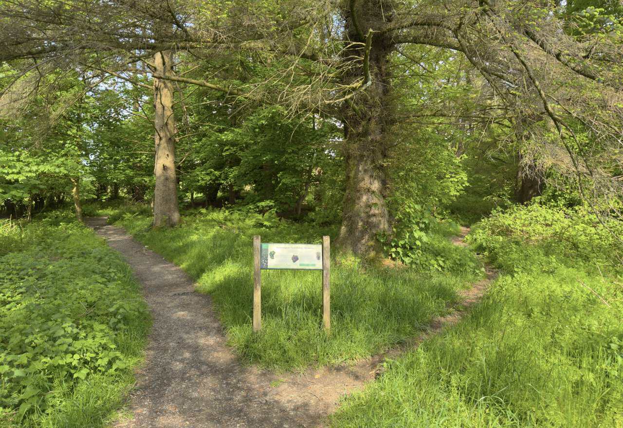
Leaving Hebden behind, I cross several grassy fields before reaching a patch of woodland, where an interpretation board welcomes me to Grassington Park Estate Meadows. The board explains that these flower-rich meadows have been designated a Site of Special Scientific Interest, owing to the extraordinary variety of plants growing here. A recent survey counted over fifty species, including eleven different sorts of grass alone.
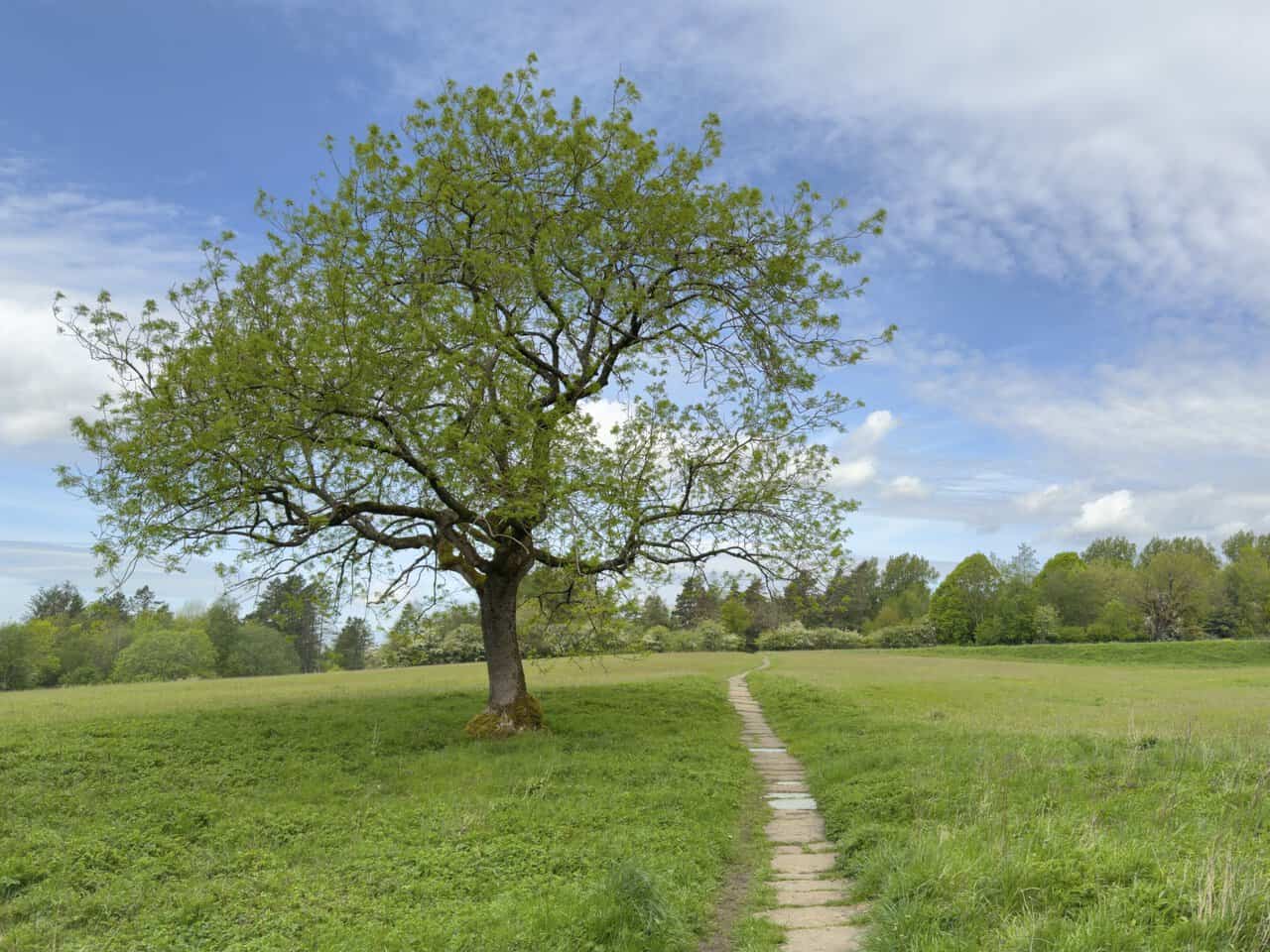
The path opens out into the meadow itself, where a beautifully shaped lone tree stands beside the route. A stone flagged path leads gently through the long grass, laid to protect the rare wildflowers underfoot from the wear of passing boots. At peak flowering, the field becomes a sea of white oxeye daisies, deep red great burnet, purple self-heal and the bright yellow of rough hawksbit.
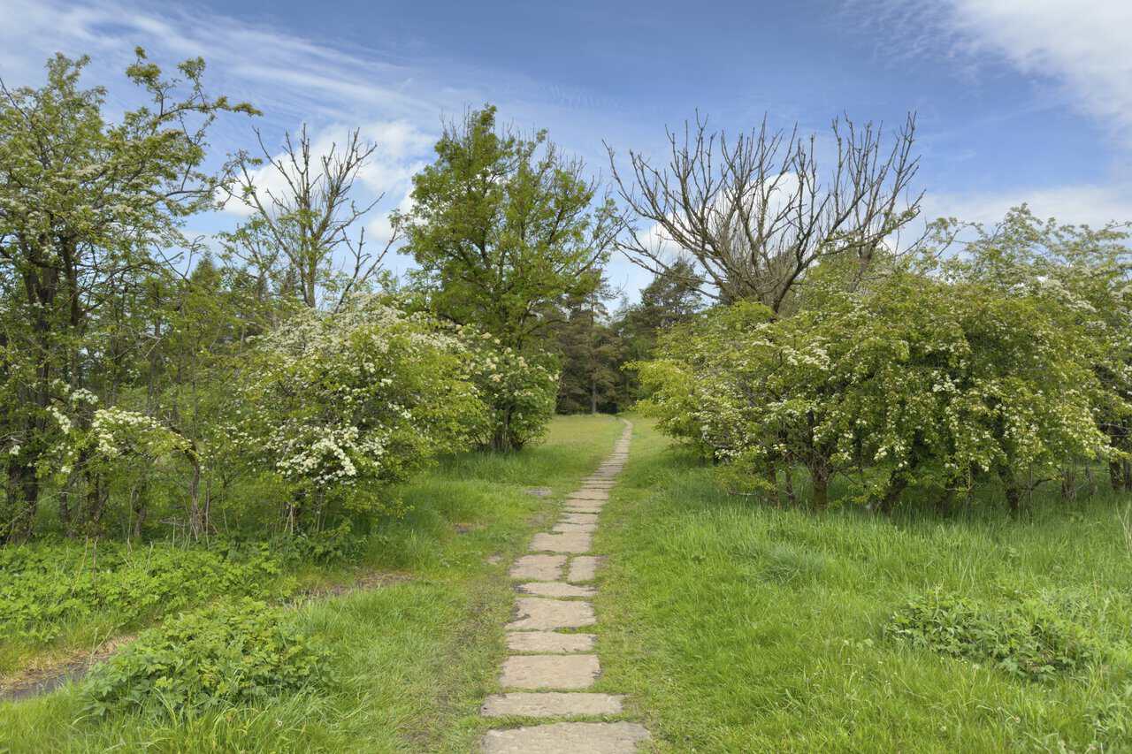
Ahead, the flagged path threads between hawthorn trees heavy with creamy white blossom. The hay cut from these meadows is still fed to sheep and cattle, but the flowers themselves once held meaning of their own. Two kinds of lady’s mantle grow here, and the plant’s Latin name, Alchemilla, comes from medieval alchemy, when the silver droplets of dew that collect on its hairy leaves were thought to help turn common metals into gold. Almost every flower I might spot in this meadow once had a medicinal use or folk story attached to it.
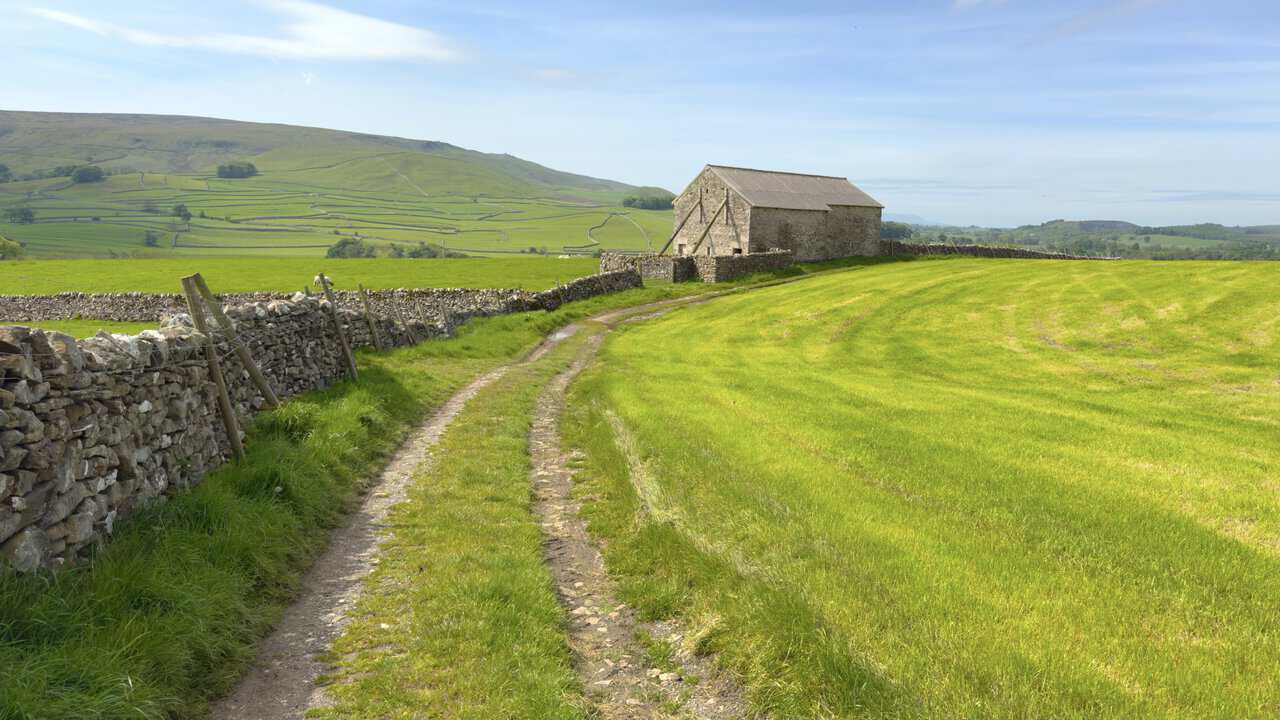
Across High Field Lathe, the footpath opens up to a fine south-westerly view, and I pause for a moment on this Hebden walk to enjoy it. A stone barn sits in the middle of the scene, backed by the rolling hills of Barden Moor and a patchwork of dry stone walls climbing the slopes. On the skyline, the obelisk on top of Cracoe Fell can just be made out, a gritstone war memorial erected in 1922 in memory of the local men who lost their lives in the First and Second World Wars.
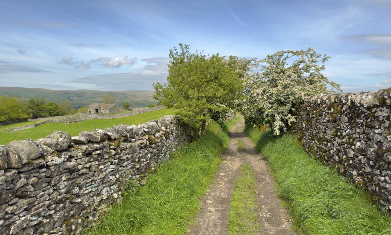
The path then meets High Lane, a broad stone track that will carry me north-west down into Grassington. Hemmed in on both sides by sturdy dry stone walls, the lane draws my eye towards the far horizon, where the hills of Kilnsey Moor and Malham Moor rise gently above the patchwork of fields. It’s a classic Yorkshire Dales scene, and a fine place to take it all in.

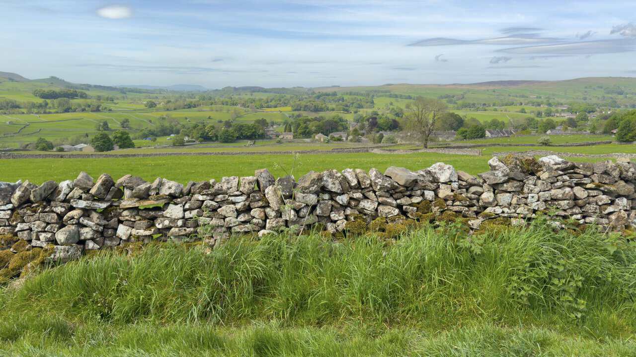
Glancing over the wall to my left, the rooftops of Grassington begin to appear, nestled among the patchwork of fields and trees. Further back, the unmistakable silhouette of Pendle Hill rises faintly on the horizon. Although Pendle sits across the border in Lancashire, it can be glimpsed from many parts of the Yorkshire Dales on a clear day, and it’s a welcome surprise to spot from this stretch of the route.
High Lane proves easy underfoot, broad and straightforward to walk. I particularly enjoy the way the hawthorn bushes lean in from either side, their creamy blossom forming a natural tunnel above the path. Beyond the wall to the left, a stone barn sits quietly among the fields, with the hills rising softly into the distance.
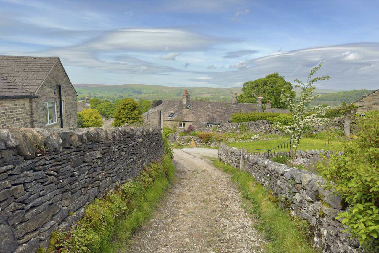
The end of High Lane brings me into the upper edge of Grassington, where stone cottages with weathered slate roofs come quietly into view ahead. The track will lead me down to Low Lane, where I’ll then follow the road down to the town hall at the northern end of the village.
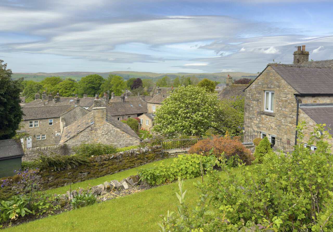
As I make my way down, the rooftops of Grassington spread out on my left, the village fitting neatly into the curve of the dale on this Hebden walk. Chimneys, slate tiles and weathered stone gables jostle together in characterful clusters, with mature trees softening the gaps in between. Beyond the village, the moors roll gently towards the horizon, a reminder of just how seamlessly Grassington sits within its Yorkshire Dales surroundings.
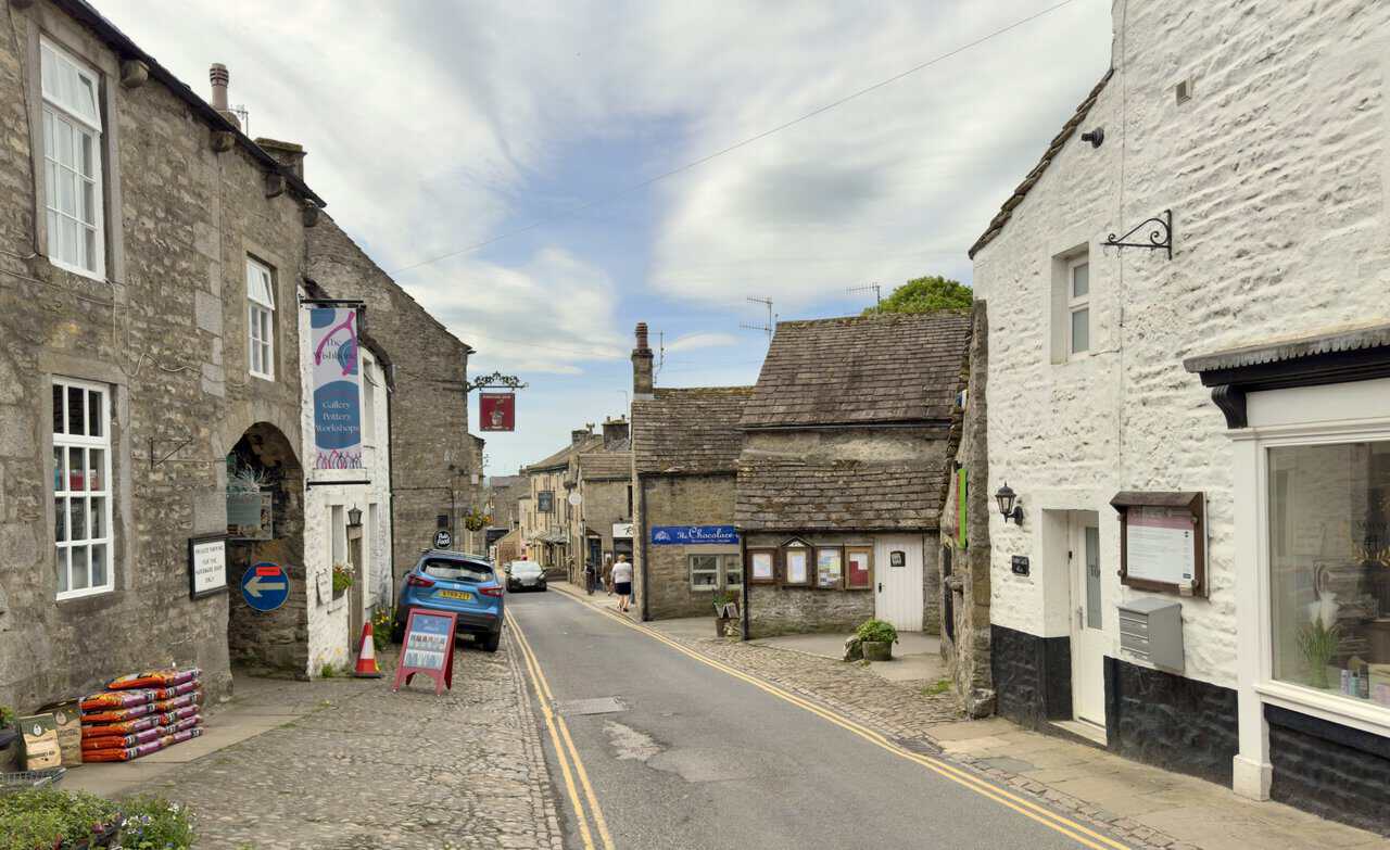
Reaching Main Street, I find myself walking down through the heart of Grassington, a former lead-mining village that has grown into a real hub for both locals and visitors. The cobbled streets are lined with stone buildings dating from the 17th and 18th centuries, with traditional shopfronts opening straight onto the pavement. Today, lead has long since given way to crafts, cafés and warm hospitality, and the village feels welcoming and unhurried.
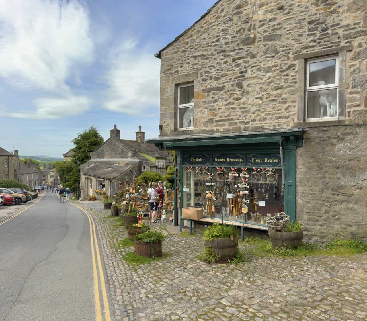
Independent retailers dominate the scene, with art galleries, pottery workshops, gift shops, bookshops and craft outlets sitting side by side. There are chocolatiers, bakeries and outdoor clothing specialists too, alongside friendly cafés and traditional pubs. Grassington’s calendar is just as varied, with a music and arts festival each June, a much-loved Dickensian Festival in December, and a 1940s weekend in September that grows in popularity year on year.
The cobbled market square at the heart of Grassington is home to the Upper Wharfedale Folk Museum, which traces the lead-mining, farming and cloth-making heritage of the village and the wider dale. Two and a half centuries ago, this was a boom town with a reputation for being somewhat rough, before settling into the gentle character it has today. There is something timeless about strolling past these weathered stone walls and characterful shopfronts.
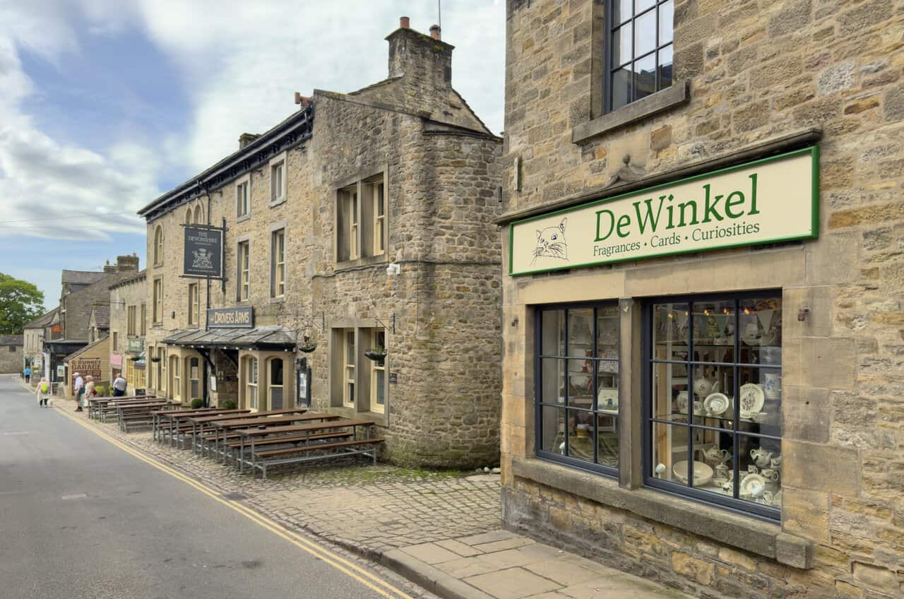
Towards the bottom of the square stands The Devonshire, a traditional inn serving Timothy Taylor’s real ales and locally sourced food. It may look familiar to many visitors, as it doubles as The Drovers Arms in Channel 5’s All Creatures Great and Small, in which Grassington stands in for the fictional village of Darrowby. During filming, the exterior is dressed with period signage and props to recreate 1940s Yorkshire, and the pub now proudly displays both names in recognition of its on-screen fame.

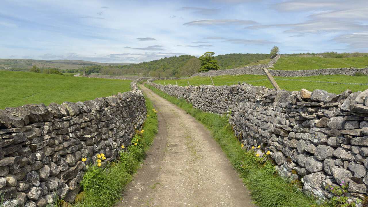
Leaving Grassington behind on this Hebden walk, I work my way around the western edge of the village along Wood Lane, Moody Sty Lane and Garrs End Lane, before slipping back into open countryside on Cove Lane. Hemmed in on both sides by tall dry stone walls, the track stretches invitingly ahead, with grassy banks and a scattering of yellow wildflowers softening its edges. Beyond the walls, fields roll gently away towards the wooded slopes that mark the approach to Grass Wood.
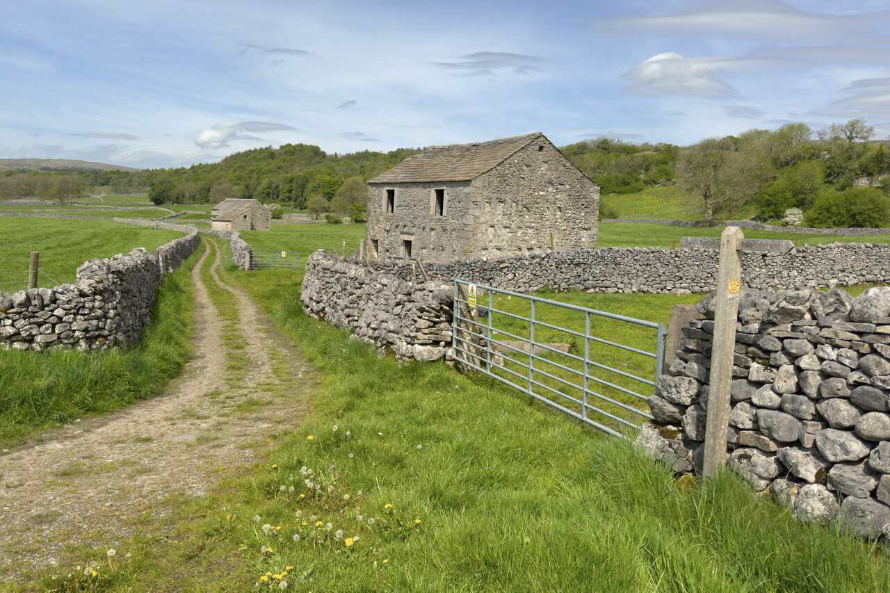
Cove Lane swings sharply to the left, where two large stone barns sit quietly amid the surrounding fields. A wooden public footpath sign points the way ahead, with a yellow waymarker arrow confirming the route into Grass Wood, whose tree-covered slopes are now in clear view just beyond the meadows. The combination of weathered stone, open pasture and approaching woodland feels quintessentially Yorkshire Dales.
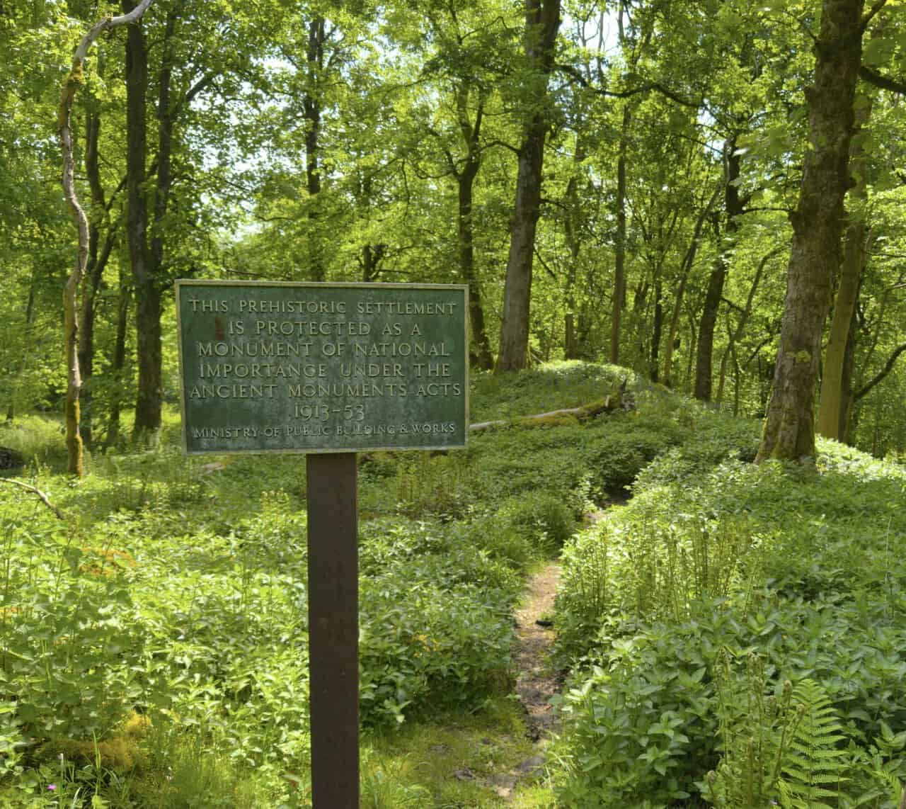
Stepping into Grass Wood, I’m soon greeted by a weathered green plaque set among the undergrowth. It informs me that this prehistoric Iron Age settlement is protected as a monument of national importance under the Ancient Monuments Acts of 1913 to 1953, placed here by the former Ministry of Public Building and Works. Grass Wood itself is one of the largest stretches of ancient ash woodland in the Yorkshire Dales, now managed as a nature reserve by the Yorkshire Wildlife Trust, and people have lived and worked across these limestone terraces for many thousands of years.
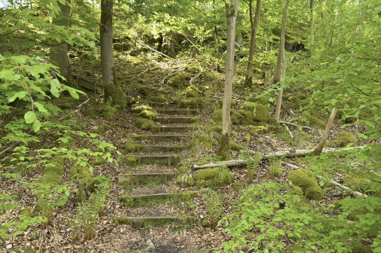
Beyond the settlement, I come across a set of old wooden steps cutting up through the leaf-strewn hillside. Moss-covered stones and ferns crowd in on either side as the path climbs through the dappled light, with mature trees rising overhead. There’s a real sense of stepping further back in time the higher I go.
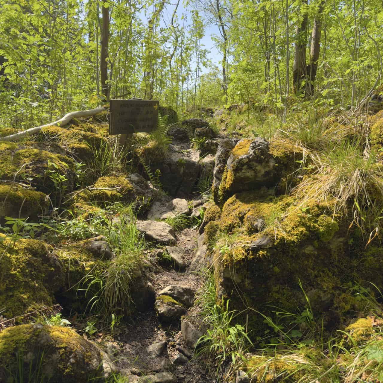
As the path levels out and becomes rocky underfoot, a wooden sign confirms what lies ahead: Ancient Monument, Fort Gregory AD 70, Brigantian Hill Fort, with a polite request not to disturb. The Brigantes were the Iron Age Celtic tribe whose territory once stretched across much of northern England, and this small hilltop enclosure is thought to have played a part in their resistance to the Roman advance.
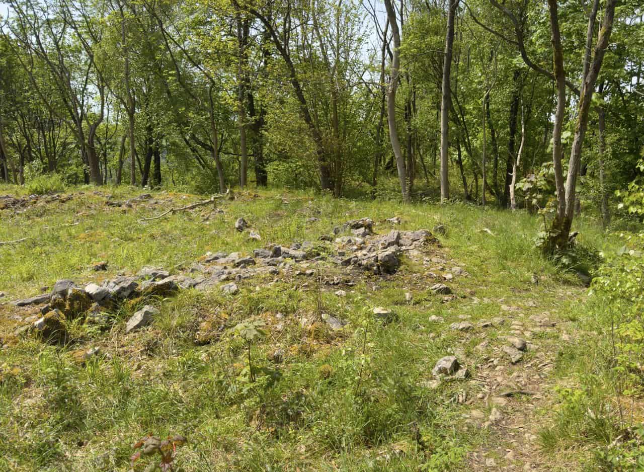
At the fort itself, I find what looks at first glance like little more than a few scattered stones in the long grass on this Hebden walk. Yet these modest remains mark the outline of a small defended enclosure, perched on a limestone ridge with steep slopes falling away on either side. Although historians now think it may have served as a defended farmstead or refuge rather than a grand stronghold, it’s a quietly atmospheric spot, with nearly two thousand years of history beneath my feet.
Beyond Fort Gregory, the path begins to drop back down through the woodland, weaving between mossy boulders and the gnarled trunks of mature trees. Grass Wood feels like something of a maze at this point, with paths branching off in various directions, and I’m grateful for my GPS device to keep me on the right course. My aim is to reach Grass Wood Lane, a quiet country road on the western side of the wood that marks the halfway point of the route.
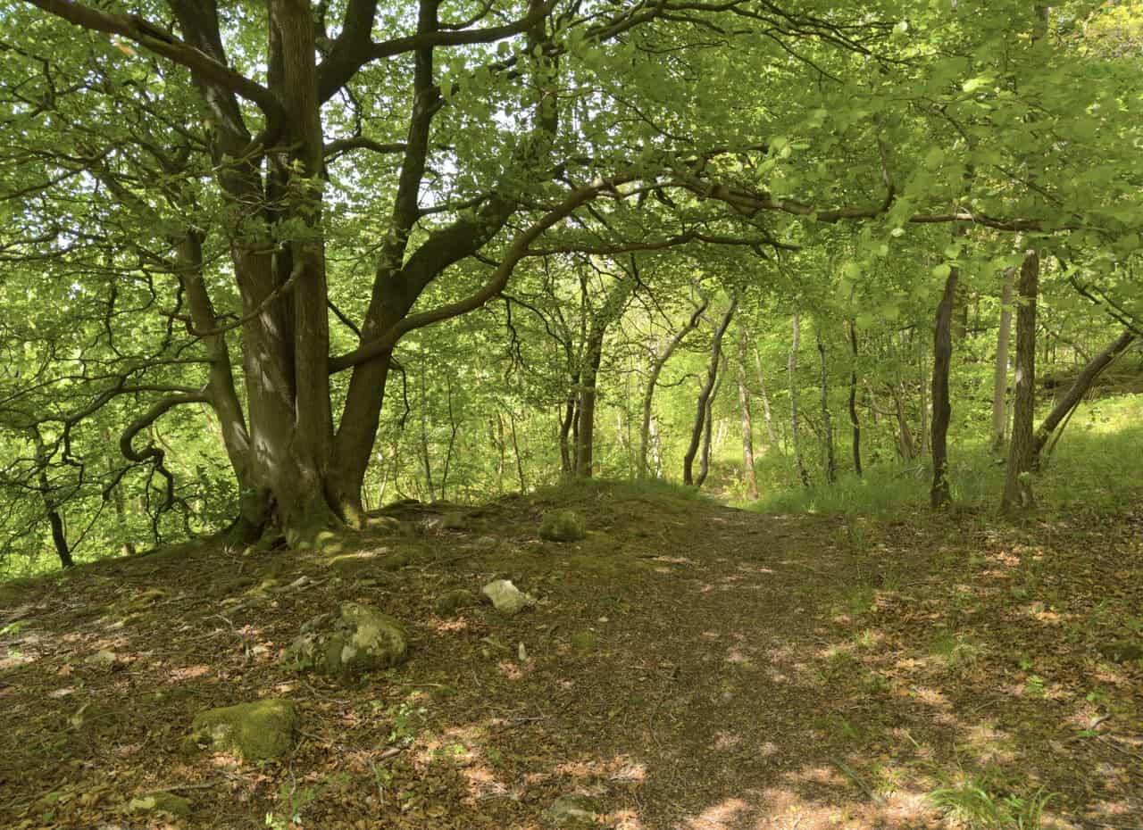
The path leads me out of Lower Grass Wood and onto the open banks of the River Wharfe, where I find myself on a gentle riverside ramble. The Wharfe runs for around sixty-five miles from the high fells of Langstrothdale down through Wharfedale and on past Ilkley and Tadcaster before meeting the Ouse. Smooth grassy stretches give way to scattered limestone outcrops, with the river slipping by quietly to my right and a stone barn visible across the water on the far bank. The sound of rushing water up ahead tells me that Ghaistrill’s Strid is not far away.
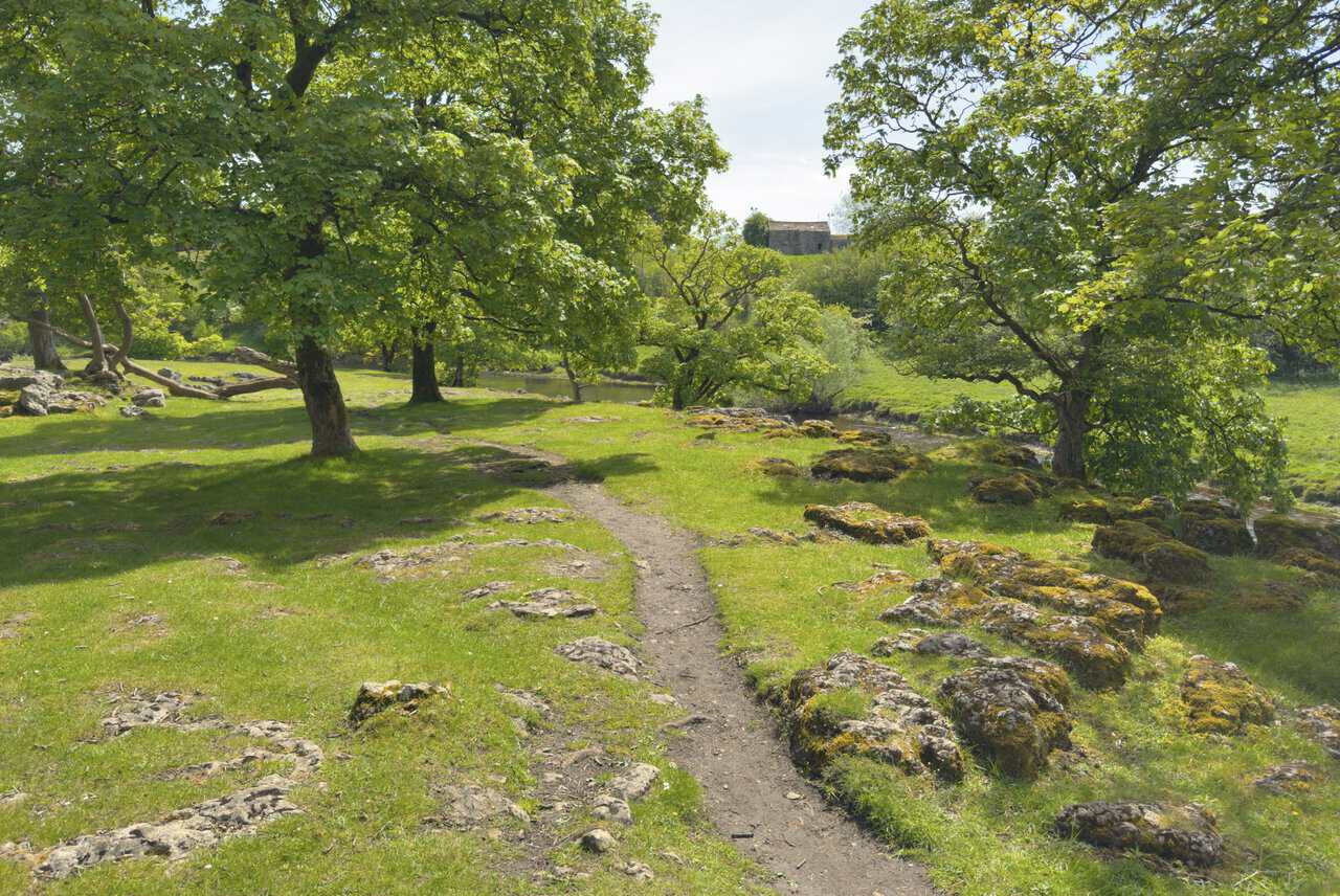
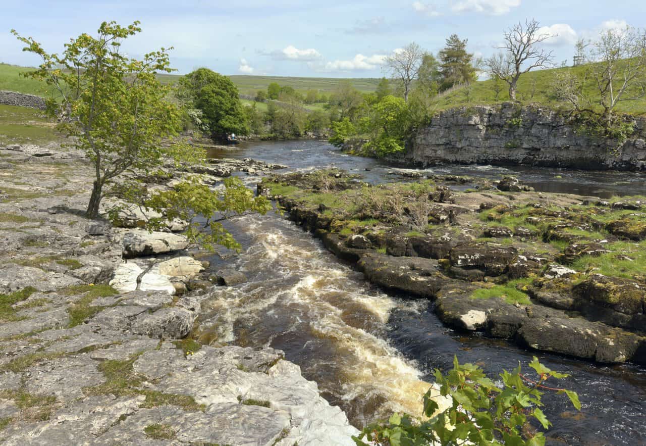
At Ghaistrill’s Strid, the River Wharfe is suddenly squeezed through a narrow channel carved into the limestone bedrock, creating a churning rush of white water as it tumbles over the rocks. The name combines “Ghaistrill”, thought to be an old local surname, with “strid”, derived from the Old English word for a narrow channel. Although nowhere near as treacherous as the famous Strid further downstream near Bolton Abbey, it’s still an impressive spot, and a place that has long captured the imagination of locals and visitors alike.
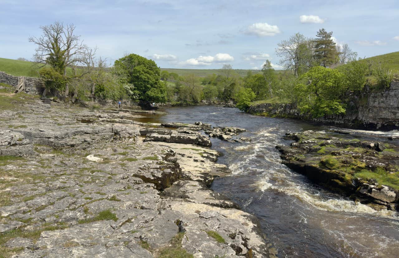
A little further along, the view opens out to take in the full sweep of Ghaistrill’s Strid, with the river curving past pale limestone slabs and over a series of small rapids. Local folklore tells some darker tales here, including the story of Tom Lee, a Grassington blacksmith hanged in 1768 for the murder of the village doctor, whose gibbet irons were said to have been cast into the deep pools below. Today, it is a tranquil and rather magical spot, well worth a pause before continuing on towards Grassington Bridge.
After a steady walk along the riverside, I reach the arched stone road bridge on the western edge of Grassington on this Hebden walk. While my route brings me out at the left-hand end of the bridge, I can’t help noticing the smaller arch tucked alongside the three larger ones. It’s actually possible to pass through this smaller arch to reach the other side, although the water level inside means it is rarely walkable, and today is no exception.
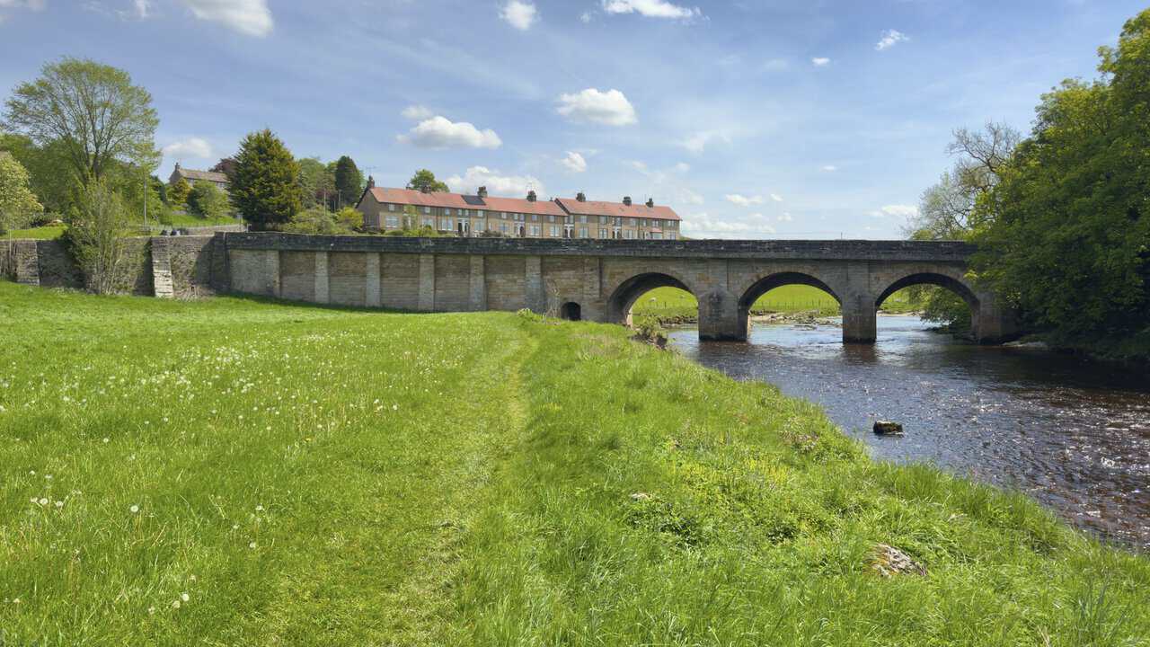
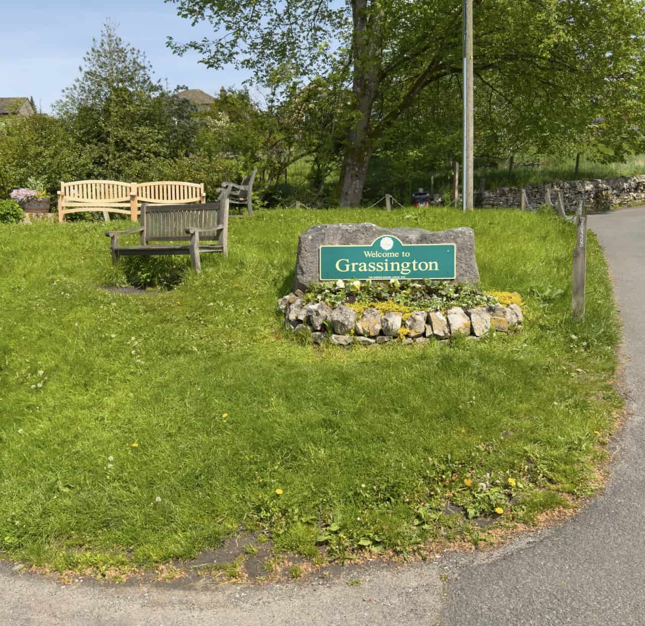
At the road by the bridge, I’m greeted by a small grassy area with a few wooden benches set out beside a “Welcome to Grassington” stone, marking the western entrance to the village. It’s a great place for a coffee. The road bridge here carries the B6265 across the River Wharfe between Grassington and Threshfield.
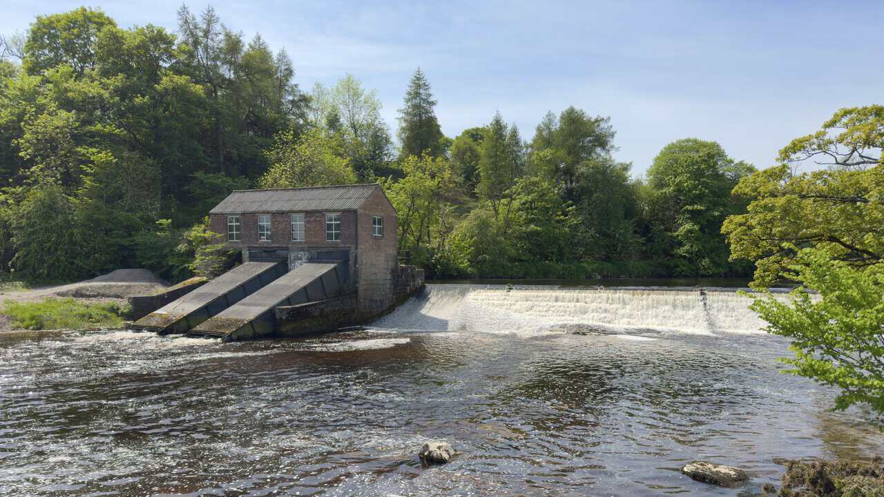
Joining the Dales Way, an eighty-mile long-distance footpath that runs from Ilkley to Bowness-on-Windermere, I follow the south bank of the River Wharfe and soon come to Linton Falls Hydro, a small hydroelectric station tucked beside the upper weir. The red-brick turbine house was originally built in 1909 by the Grassington Electricity Supply Company, bringing the very first electric light to the village. Its sloping turbine channels make it look every bit the piece of industrial heritage that it is.
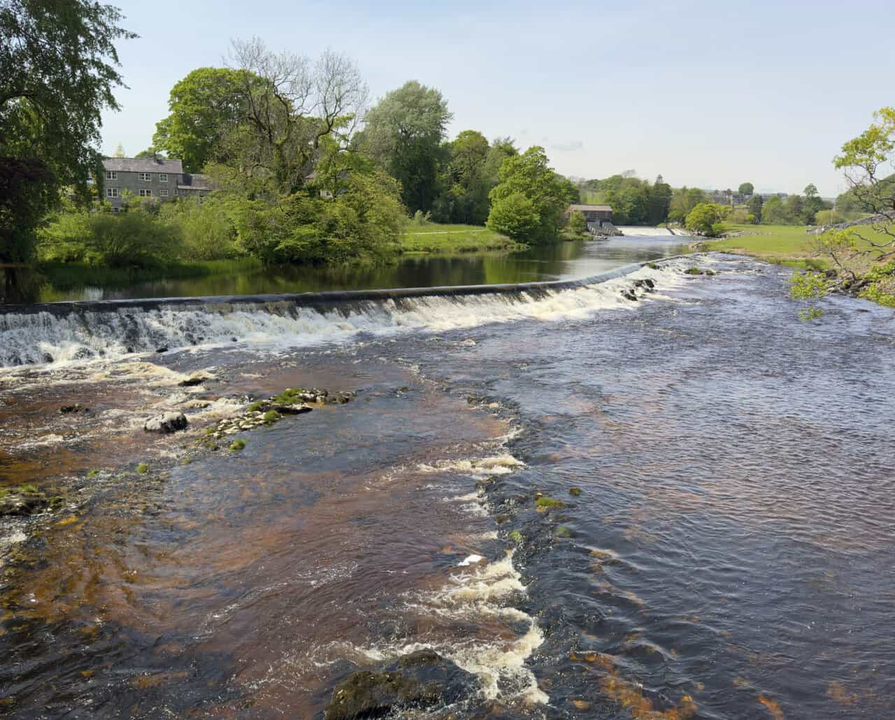
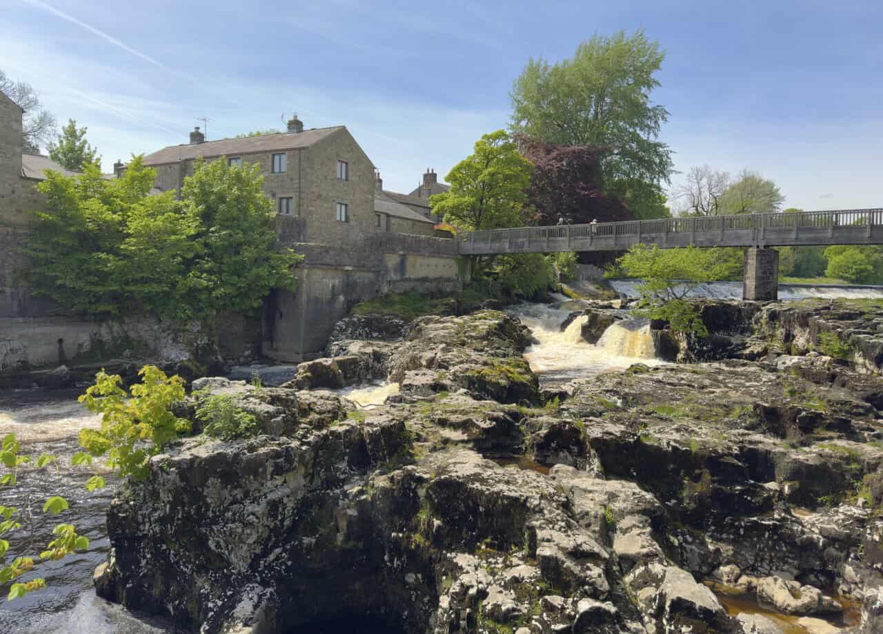
From the footbridge at Linton Falls, I look back to see the hydro station beyond the weir, with the river tumbling over the stepped rocks below. Although the original station fell silent in 1948 when the National Grid reached the Dales, the building was protected as a scheduled monument in 2001 and restored in 2012. Two Archimedean screw turbines now generate enough green electricity each year to power around ninety homes, giving this century-old site a fitting second life.
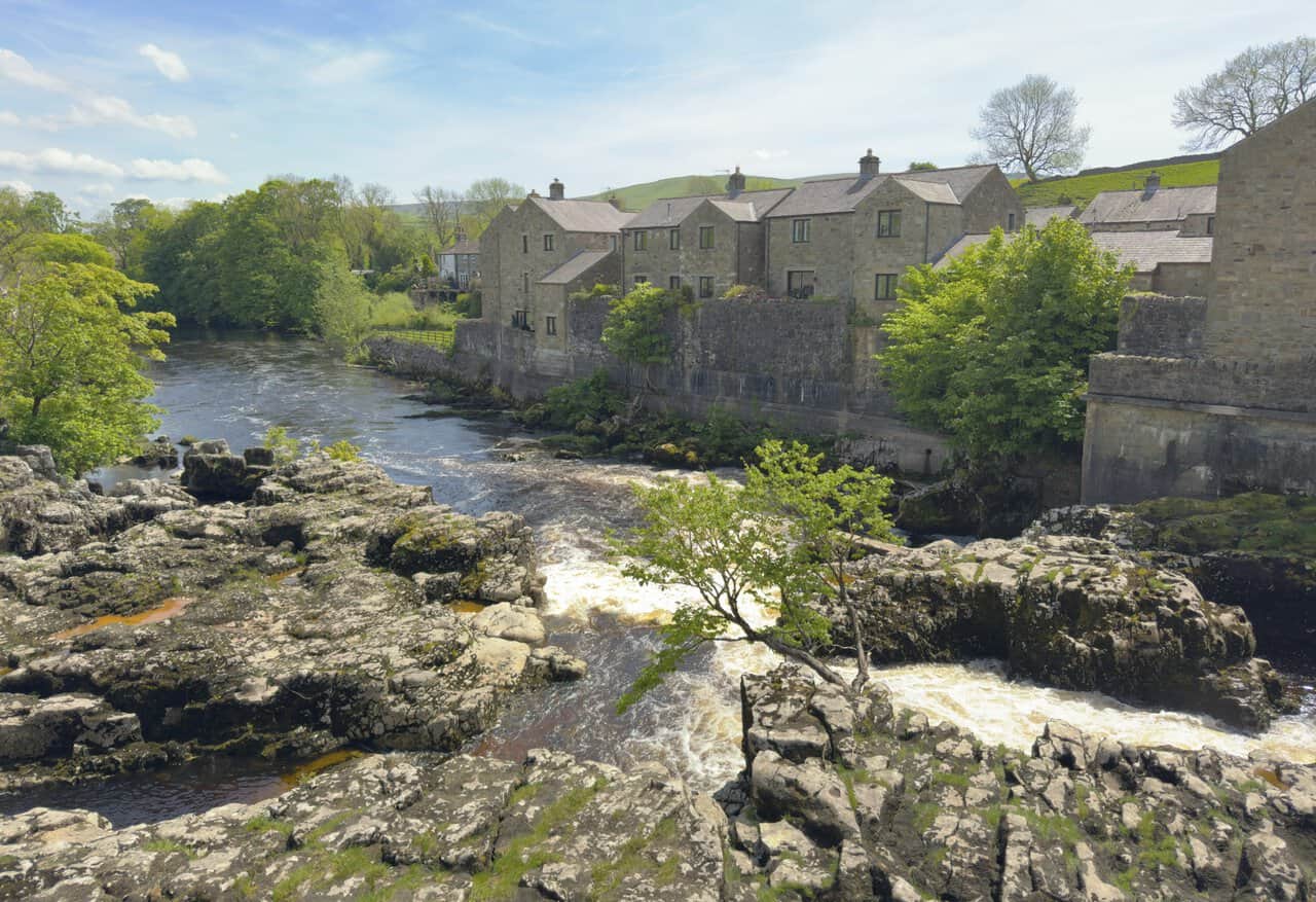
The view from the footbridge is one of the highlights of the walk. Below me, the River Wharfe tumbles dramatically through channels carved deep into the limestone bedrock, marking one of the easternmost features of the Craven Fault. This series of geological fault lines shifted millions of years ago, raising the limestone to the north higher than that to the south, and after heavy rain the water thundering beneath the bridge can be an awe-inspiring sight.
From the riverbank, I glance back at the wooden footbridge, with stone cottages clustered beside the falls. The nearby weirs once channelled water into Linton Mill, a large textile mill that has long since been demolished but which gave this stretch of the Wharfe much of its industrial past. Linton Falls is one of the most memorable spots on my Hebden walk, and it’s hard not to linger a little longer to take it all in.
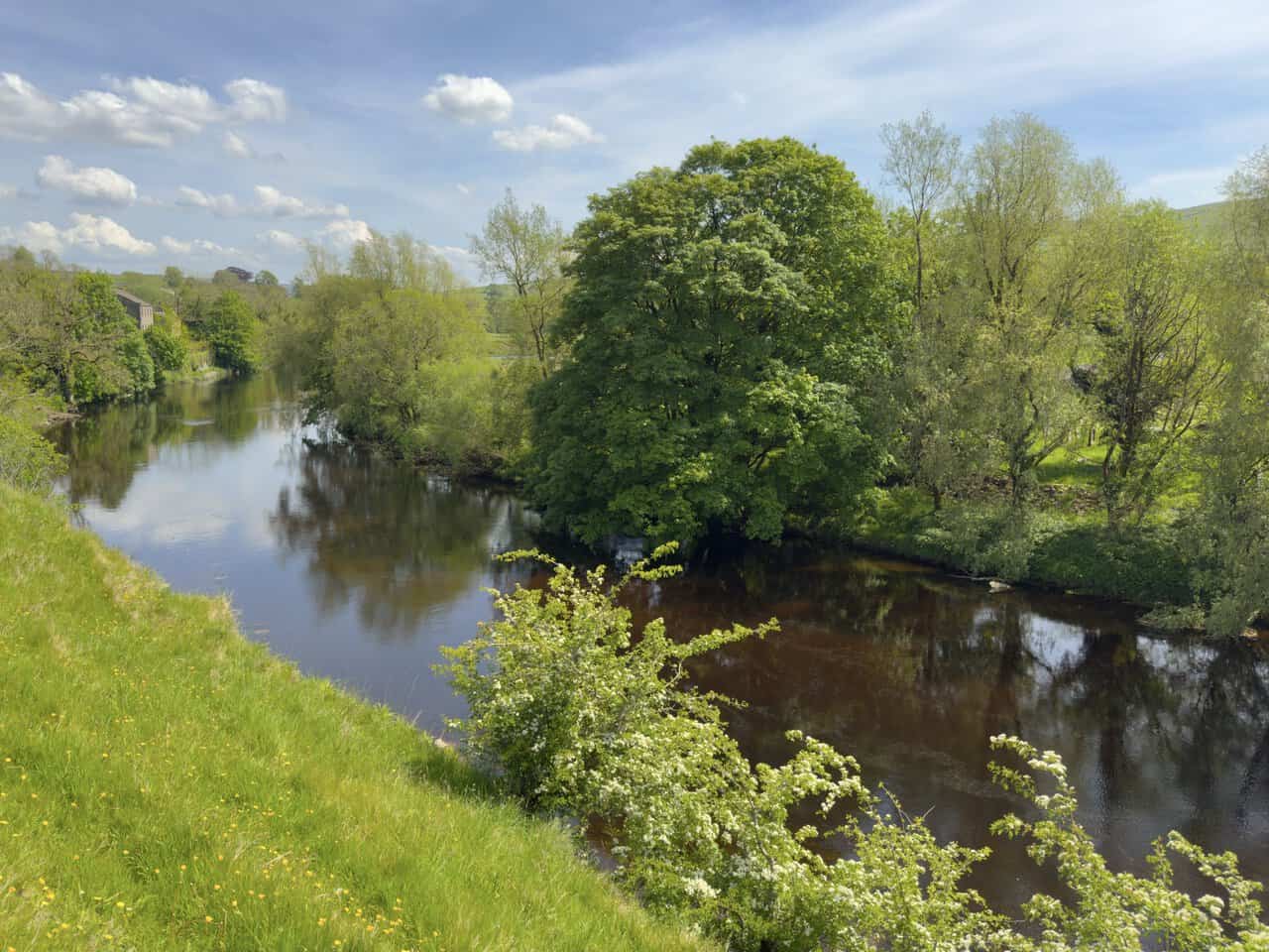
Continuing on the Dales Way beyond Linton Falls, the River Wharfe quietens noticeably, its surface settling into a mirror-smooth flow that reflects the trees lining the banks. Hawthorn blossom drapes over the water’s edge and grassy meadows roll back from the path, with the gentle hills of Wharfedale rising softly into view. After the drama of the falls, this calmer stretch is a welcome contrast and a pleasant place to walk.
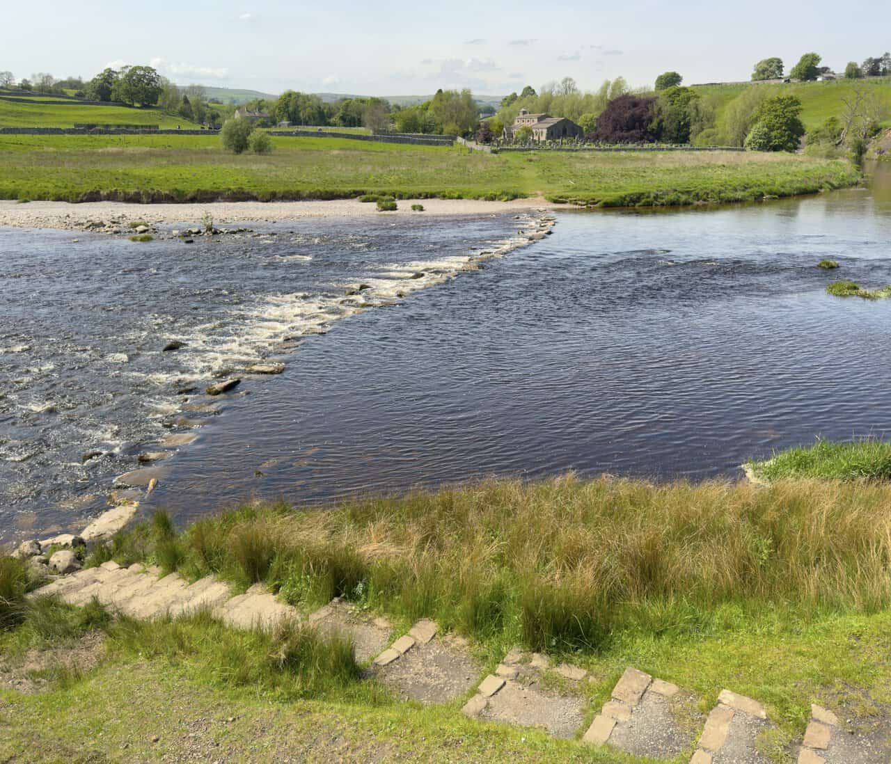
A little further along, I come to a junction where three routes are signposted: Linton Church via the stepping stones, the Dales Way to Burnsall, and the public footpath to Hebden. I’ll be taking the middle route to Burnsall on this Hebden walk, but the stepping stones across to Linton Church are too intriguing not to take a closer look. The river here is quite low yet the stones are still not passable, which makes me wonder just how rarely they are actually crossable.
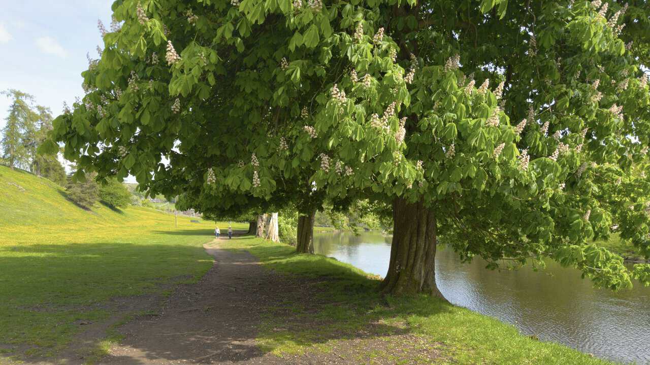
This stretch of the Dales Way alongside the River Wharfe is an absolute joy to walk, and it’s easy to see why it’s such a popular route. A line of chestnut trees casts welcome shade over the path, their candle-like blossoms standing out against the fresh green leaves, while the river slips quietly by to the right. With buttercups dotting the meadow on one side and gentle reflections shimmering on the water, the going feels almost effortless as I make my way towards Hebden Suspension Bridge.
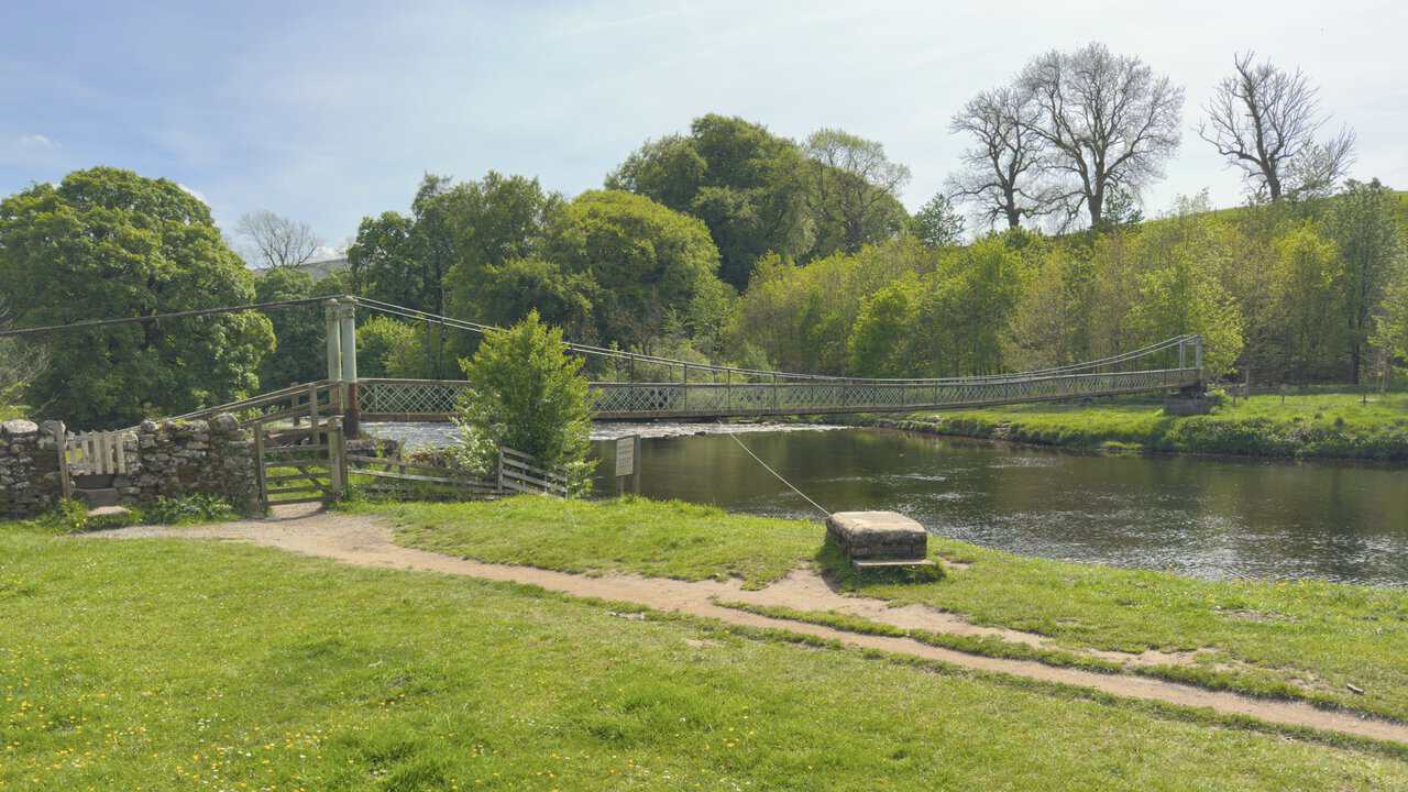
I arrive at Hebden Suspension Bridge, set about half a mile south of Hebden village on this Hebden walk. The bridge was built in 1885 by local blacksmith William Bell, using 262 yards of surplus steel rope purchased from the Hebden Moor Mining Company. It was constructed after a storm destroyed Burnsall Bridge two years earlier, leaving villagers with limited access across the river, and the funds were raised through public donations. Its opening was marked with a fine celebration, complete with a brass band and a public tea.
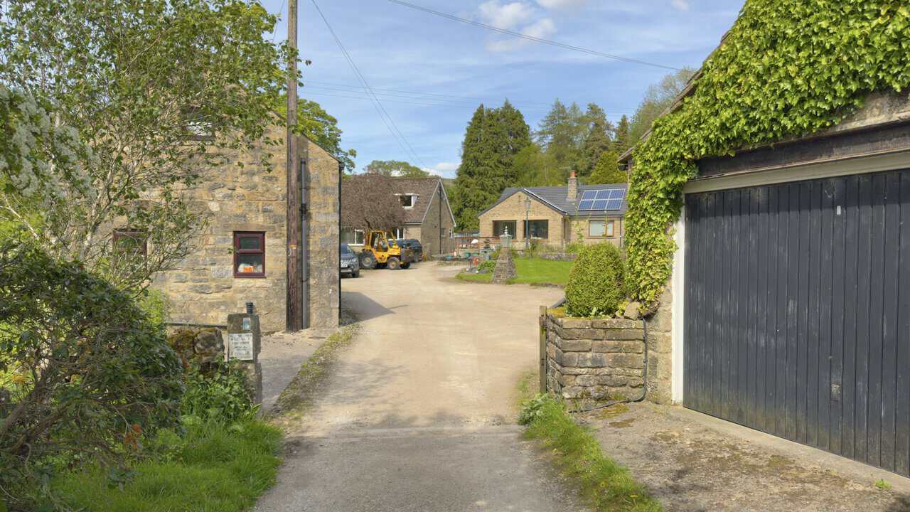
Leaving the bridge behind, I follow Mill Lane for a short distance before joining a public footpath signposted to Hebden and Bank Top. At first, it feels rather as though I’m stepping onto someone’s private property, as the path runs down a driveway between two stone houses with a clear sign reassuring walkers that this is indeed the right way. The small stone post by the bush politely asks visitors to keep to the footpath between the houses, with no cycling or running.
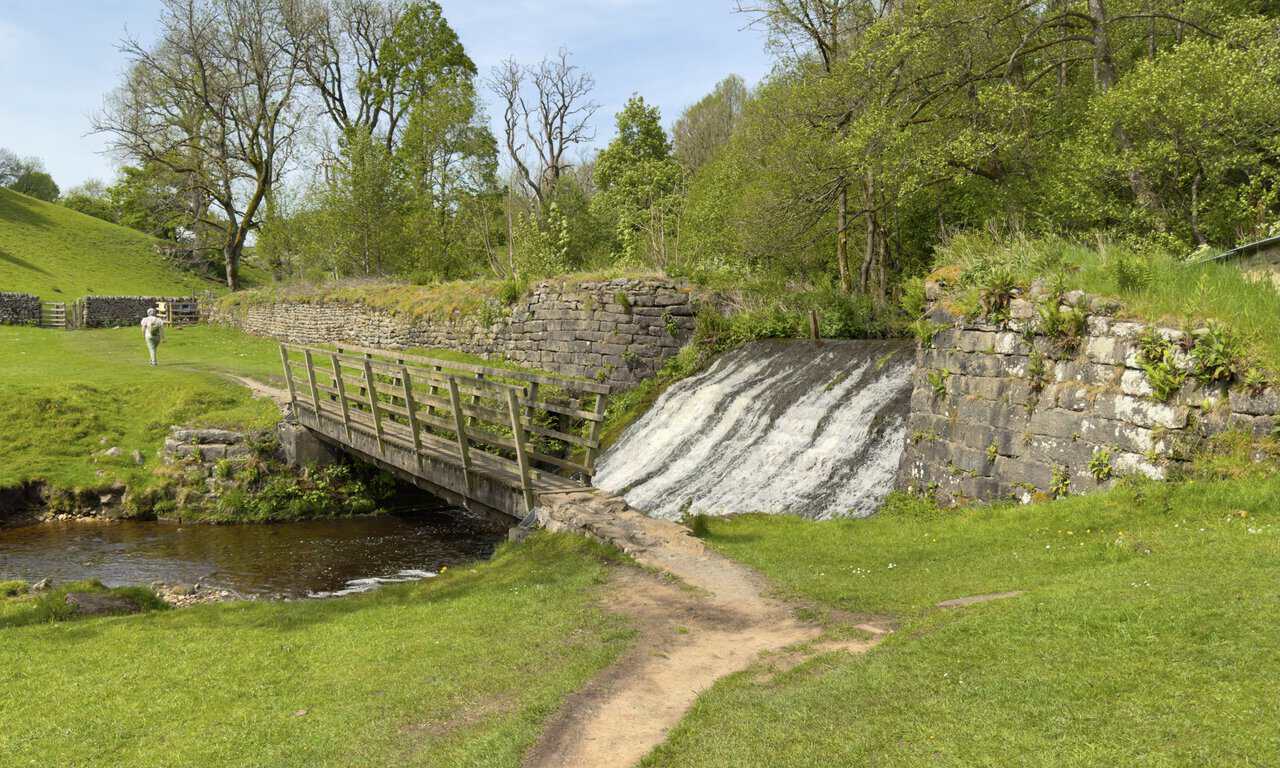
The trail back to Hebden follows a pleasant route through a shallow valley, eventually leading me to a picturesque wooden footbridge across Hebden Beck. A small weir tumbles white water down beside the bridge, with stone walls framing the scene and open meadowland stretching away on either side. It’s a peaceful little spot, and one that feels almost tucked away from the wider Yorkshire Dales landscape.
A gentle climb up the left-hand side of the valley brings me back onto Main Street in Hebden, with the path emerging right beside The Old School Tea Room. Set in the village’s former schoolhouse and unmistakable for its Gothic-arched windows, the tea room serves homemade meals, cakes and afternoon teas, and has a tea garden that’s home to a pair of Pygmy goats. With my car parked just steps away, it’s the perfect place to round off my Hebden walk with a well-earned cuppa.