Enjoy Panoramic Views with the Hawnby Hill Walk in North Yorkshire
Begin your Hawnby Hill walk by parking in the Newgate Bank Forestry Commission car park, located on the B1257 between Great Broughton and Helmsley, approximately five miles north of Helmsley. This car park is positioned on a bend at the top of Newgate Bank, so exercise caution when entering or leaving due to the busy road. Before setting off, take a moment to find the viewpoint, which offers breathtaking vistas over the moors and towards Easterside Hill.
Leave the car park and turn left onto the B1257. Carefully cross the road to find a path heading south, which you will follow for about a quarter of a mile. Then, turn right and follow the forestry track downhill through Newgate Plantation. The track zigzags down to Broadway Foot. From there, head south to reach the minor road at Shaken Bridge.

Next, continue west along this road, crossing the bridge, and proceed until you see a footpath on your right just before Ristbrow Farm. Take this path and walk west across the farmland until you reach Hawnby Bridge over the River Rye. After crossing the bridge, follow the road north into the charming village of Hawnby.
At the village crossroads, go straight on and pick up the path that starts your ascent to the top of Hawnby Hill. This trail will lead you across the ridge to the hill’s highest point at the northern end. Pause to enjoy the panoramic views before descending the northern slopes to meet a minor road at the bottom.

Cross this road and walk north-east along the track leading to the farm at Sportsman’s Hall. Walk around the northern side of the farm and descend into the valley. Use the footbridge to cross Ladhill Beck, then, after a short climb, follow the path south through the valley, passing Low Banniscue and Little Banniscue, until you reach the minor road near Ladhill Beck Bank.
Turn left and walk up the road, known as Easterside Lane. This road circles around the southern slopes of Easterside Hill. After about three-quarters of a mile, take the path on your right through the woods and across fields to reach a footbridge over the River Seph. After crossing the river, head south towards Fair Hill Farm and continue south to return to Broadway Foot, where you were earlier in the day.
Retrace your steps uphill through Newgate Plantation to return to the main road, then turn left to get back to your car park. This nine-mile Hawnby Hill walk in the North York Moors offers a delightful blend of stunning landscapes and challenging paths, making it a truly memorable hike.
Hawnby Hill Walk: Maps and Tools
Visit either the OS Maps website or the Outdooractive website to view this walking route in greater detail. Both platforms offer a range of features, including the ability to print the route, download it to your device, and export the route as a GPX file. You can also watch a 3D fly-over and share the route on social media.
Hawnby Hill Walk: Distance, Duration, Statistics
Distance: 9¼ miles
Distance: 14¾ kilometres
Duration: 4½ hours
Ascent: 1728 feet
Ascent: 527 metres
Type: Circular walk

Walking in the Yorkshire Dales with 43 Circular Routes
AD This Cicerone guidebook includes 43 circular walks exploring valleys, hills, and moors between Kirkby Stephen and Pateley Bridge. With OS maps, local highlights, and routes ranging from 3–11 miles, it is a year-round companion for walkers of all abilities.
Recommended Ordnance Survey Map
The best map to use on this walk is the Ordnance Survey map of the North York Moors Western Area, reference OS Explorer OL26, scale 1:25,000. It clearly displays footpaths, rights of way, open access land and vegetation on the ground, making it ideal for walking, running and hiking. The map can be purchased from Amazon in either a standard, paper version or a weatherproof, laminated version, as shown below.
About Hawnby Hill
Hawnby Hill, situated in the North York Moors of North Yorkshire, Northern England, rises just north of the village of Hawnby. The hill’s peak, at its northern end, reaches an elevation of 298 metres (978 feet).
Viewed from above, Hawnby Hill resembles an elongated oval, with a ridge running north to south for approximately half a mile. A footpath traverses this ridge, offering a scenic route for walkers. Surrounding the hill, picturesque farmland and woodland provide stunning views of the countryside.
To the North and South of Hawnby Hill
To the north, the landscape transitions into Hawnby Moor, an expansive moorland. Nestled at the base of the hill’s north-east slopes, Nova Scotia Farm adds to the area’s charm. South of the hill lies the village of Hawnby. The northern and southern slopes are gentler compared to the steeper eastern and western slopes.
The Eastern Side of Hawnby Hill
On the eastern side, a blend of moorland and woodland covers the steep slopes. At the base of the south-eastern flanks sits Long Acres Farm. A minor road runs along the eastern boundary in a north-south direction, connecting Hawnby to Square Corner, just east of Osmotherley, approximately seven miles away. This road is part of the National Cycle Network Route 656, a challenging route that primarily runs on-road and connects Coxwold to Hawnby via Sutton Bank National Park Centre.
The Western Side of Hawnby Hill
The western slope features Hawnby Hill Crag, a striking geological formation. The terrain here is more rugged, with areas of moorland and woodland similar to those on the eastern side. A bridleway and two footpaths run north to south below the western slope, providing excellent walking routes.
The Eastern Valley of Hawnby Hill
On the eastern side of the hill, a valley cradles Ladhill Beck, which flows from north to south before joining the River Rye. Opposite this valley stands Easterside Hill, a neighbouring elevation slightly higher than Hawnby Hill but with a broader plateau.
The Western Valley of Hawnby Hill
The western valley of Hawnby Hill hosts the River Rye, which flows from the north and passes under Hawnby Bridge, just south of the village. A network of paths and tracks crisscrosses the area, allowing walkers and hikers to explore the hill’s eastern and western valleys and their scenic surroundings.
Hawnby Hill’s varied landscape and extensive network of trails make it an ideal destination for nature enthusiasts and walkers alike. Whether you prefer a challenging hike or a leisurely stroll, the beauty and diversity of Hawnby Hill and its surroundings will not disappoint.
Hawnby Hill Walk: My Photos
Looking north-west towards Easterside Hill from the car park viewpoint at Newgate Bank.

Grisport Unisex Adult Peaklander Hiking Boots
AD The Grisport Unisex Adult Peaklander Hiking Boots are crafted in Italy with a durable waxed leather upper, Spotex breathable lining, and a reliable Track-on rubber sole. Waterproof and weighing just 1120g, they offer comfort, resilience, and dependable performance on demanding trails.
The forestry track through Newgate Plantation soon after the start of our Hawnby Hill walk.


Grisport Unisex Adult Peaklander Hiking Boots
AD The Grisport Unisex Adult Peaklander Hiking Boots are crafted in Italy with a durable waxed leather upper, Spotex breathable lining, and a reliable Track-on rubber sole. Waterproof and weighing just 1120g, they offer comfort, resilience, and dependable performance on demanding trails.
Easterside Hill comes into view as we make our way down through Newgate Plantation.

Easterside Hill as seen from the minor road between Shaken Bridge and Hawnby.

Fifty Walks Across the Beautiful North York Moors National Park
AD Discover 50 routes across the North York Moors, from short easy strolls to challenging high-level hikes. With OS maps, route descriptions, and local highlights, it also includes the legendary 40-mile Lyke Wake Walk, described in four accessible stages.
Hawnby Hill is visible in the distance as we walk along the minor road towards Hawnby.

Hawnby Bridge which crosses the River Rye, just south of Hawnby village.

Fifty Walks Across the Beautiful North York Moors National Park
AD Discover 50 routes across the North York Moors, from short easy strolls to challenging high-level hikes. With OS maps, route descriptions, and local highlights, it also includes the legendary 40-mile Lyke Wake Walk, described in four accessible stages.
The River Rye near Hawnby Bridge. The river rises in the Cleveland Hills at an elevation of 200 meters, just south of Osmotherley. It flows through several towns and villages including Hawnby, Rievaulx, Helmsley, Nunnington, West and East Ness, Butterwick, Brawby, and Ryton before eventually meeting the River Derwent near the town of Malton. The total size of the River Rye’s basin is 330 square miles, and it forms part of the River Derwent’s larger river system in Yorkshire.

The lower area of Hawnby, home to Hawnby Stores & Tea Room.
Find out more at http://www.hawnbytearoom.co.uk

Osprey Hikelite Unisex Backpack for Comfortable and Lightweight Hiking
AD The Osprey Hikelite backpack combines lightweight design with practical features, including a breathable mesh back panel, soft webbing straps, and stretch mesh water bottle pockets. With zipped storage and an organiser compartment, it is ideal for day hikes and outdoor use.
Gypsy pony in Hawnby, roughly one-third of the way round our Hawnby Hill walk.

The Owl, Hawnby, a 19th-century country pub and restaurant with ensuite accommodation.
Check out their website at https://www.theowlhawnby.co.uk

Osprey Hikelite Unisex Backpack for Comfortable and Lightweight Hiking
AD The Osprey Hikelite backpack combines lightweight design with practical features, including a breathable mesh back panel, soft webbing straps, and stretch mesh water bottle pockets. With zipped storage and an organiser compartment, it is ideal for day hikes and outdoor use.
The view south towards Hawnby from the southern slopes of Hawnby Hill.

Cairn at the top of Hawnby Hill, height 294 meters (965 feet). Across the valley to the east is Easterside Hill.

Peak Bagging Wainwrights with Routes to Complete All Fells
AD This comprehensive guide offers 45 circular routes linking all 214 Wainwright fells. With maps, GPX downloads, elevation profiles, and practical advice, it provides efficient yet inspiring ways to complete this classic Lake District challenge at your own pace.
Looking west from Hawnby Hill across the River Rye valley towards the tree-covered Coomb Hill.

Time for a coffee on Hawnby Hill and a chance to admire the scenery.

Peak Bagging Wainwrights with Routes to Complete All Fells
AD This comprehensive guide offers 45 circular routes linking all 214 Wainwright fells. With maps, GPX downloads, elevation profiles, and practical advice, it provides efficient yet inspiring ways to complete this classic Lake District challenge at your own pace.
The path across the Hawnby Hill ridge. The highest point is at the northern end of the hill, at 298 meters (977 feet).

Lovely views across the River Rye floodplain during the descent of Hawnby Hill. Arden Great Moor can be seen behind North Moor to the north-west.

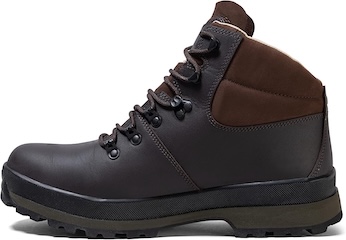
Berghaus Hillmaster II GTX Men's High Rise Hiking Boots
AD The Berghaus Hillmaster II GTX men’s hiking boots feature a waterproof, breathable GORE-TEX membrane, a memory foam tongue and collar for a personalised fit, and a Vibram sole delivering exceptional grip, stability, and shock protection for confident performance on any terrain.
The track across the moorland to Sportsman’s Hall is easy to spot from Hawnby Hill.

Footbridge across Ladhill Beck, the halfway point of our Hawnby Hill walk.

Berghaus Hillmaster II GTX Men's High Rise Hiking Boots
AD The Berghaus Hillmaster II GTX men’s hiking boots feature a waterproof, breathable GORE-TEX membrane, a memory foam tongue and collar for a personalised fit, and a Vibram sole delivering exceptional grip, stability, and shock protection for confident performance on any terrain.
Ancient woodland at Low Banniscue.

An old barn by the side of the path between Wass House and Fair Hill Farm. A rather muddy section of our Hawnby Hill walk.

Kendal Mint Co Energy Gel with Citrus and Mint Flavour
AD Kendal Mint Co energy gels deliver 27g of fast-absorbing carbohydrates plus electrolytes and B vitamins for improved performance. Vegan, gluten free, and Informed Sport certified, these caffeine-free gels are refreshing, easy to digest, and ideal for running, cycling, and endurance.
