ADVERTISEMENT
Relax and Unwind with the Complete Guide to the Cod Beck Reservoir Walk
Begin your Cod Beck Reservoir walk in Osmotherley. You can park in the village centre, with spaces available opposite the Queen Catherine Hotel or along the roadsides elsewhere in the village. Public toilets are located on South End near the village hall. Start your walk at the war memorial, which stands on the small, triangular village green. From there, head uphill on the road named North End, following signs for Cote Ghyll Caravan Park and Cote Ghyll Youth Hostel.
As you ascend North End, you will pass the village store on your left, followed shortly by the historic Osmotherley Pinfold. After leaving the village, ignore the track on your left marked as the Cleveland Way to Scarth Nick and Lady Chapel. Shortly after, you will come across two additional routes branching off, both of which you should ignore. The first is a bridleway to the BT installation on your left, and the second is a path leading to Red Briar Farm on your right. Continue straight on, and shortly after, the road bends to the left near a large stone house. Immediately after the house, turn right onto a narrow tarmac lane, signposted to the Cote Ghyll caravan and camping park, holiday cottages, youth hostel, and holiday apartments.

ADVERTISEMENT
Follow the tarmac lane downhill, crossing the bridge over Cod Beck. Continue straight on along the lane, passing the youth hostel and holiday apartments on your right. When the road ends, take the footpath on your left, signposted as a public footpath to the reservoir. The path climbs uphill through woodland, offering a peaceful start to this section of the Cod Beck Reservoir walk. When the path splits near Cote Garth, take the left-hand path, clearly marked for the reservoir. Follow it as it curves left, passing the ruins of a stone building. Shortly after, walk along a tunnel-like path created by arching tree branches overhead.
At the end of this short path, turn left and descend to Cod Beck Reservoir. Once there, cross the dam and turn right at the far end, where a woodland path leads along the northern shore of the reservoir. This well-surfaced track leads through the woods, with the reservoir on your right. Walk all the way to the reservoir’s northern end, where you will find a kissing gate. Pass through the gate and continue along the road, passing a small car park on your right, followed by a larger car park further along.

ADVERTISEMENT
The next stretch of your walk follows the road for a short while. This road is usually quiet, and it is easy to step onto the grass verge to allow cars to pass. As you continue, the road gently ascends between hills on either side. After approximately half a mile, you will reach a stone track on your left. This track is signposted as a public bridleway, and you should follow it uphill.
The bridleway leads you up to Scarth Wood Moor. As you climb, the track bends sharply left and merges with the Cleveland Way public bridleway. Continue uphill along this track, which eventually becomes a flagged stone path. Stay on this path as it guides you across Scarth Wood Moor. At the far end of the moor, go through the first gate. Do not take the second gate on your right, as it leads to the Cleveland Way footpath. Instead, turn left onto the grassy bridleway, keeping the dry-stone wall on your right.
Follow the grassy bridleway until it meets a narrow tarmac lane. Continue straight on along this lane, heading south for about a mile. The lane eventually rejoins the main road you walked earlier in the day. Turn right and follow the road downhill, retracing your steps into the village of Osmotherley. This marks the end of your 5-mile (8-kilometre) Cod Beck Reservoir walk, leaving you to enjoy the charm of the village or relax at one of its welcoming cafés or pubs.
Cod Beck Reservoir Walk: Maps and Tools
Visit either the OS Maps website or the Outdooractive website to view this walking route in greater detail. Both platforms offer a range of features, including the ability to print the route, download it to your device, and export the route as a GPX file. You can also watch a 3D fly-over and share the route on social media. Additionally, this page includes a printable version of the walk in PDF format. Plus there is a supporting video, available for you to watch on YouTube.
Cod Beck Reservoir Walk: Distance, Duration, Statistics
Distance: 5 miles
Distance: 8 kilometres
Duration: 2½ hours
Ascent: 576 feet
Ascent: 176 metres
Type: Circular walk
ADVERTISEMENT
Recommended Ordnance Survey Map
The best map to use on this walk is the Ordnance Survey map of the North York Moors Western Area, reference OS Explorer OL26, scale 1:25,000. It clearly displays footpaths, rights of way, open access land and vegetation on the ground, making it ideal for walking, running and hiking. The map can be purchased from Amazon in either a standard, paper version or a weatherproof, laminated version, as shown below.
North York Moors Walking Guidebooks
The North York Moors, by Paddy Dillon, describes 50 walks of 4 to 14 miles across the Tabular Hills, Hambleton Hills, Cleveland Hills, high moors and Cleveland coast, plus the Lyke Wake Walk in four stages, with Ordnance Survey mapping and notes on transport and refreshments.
North York Moors Short Walks Made Easy, published by Ordnance Survey, brings together 10 accessible routes of 2.5 to 4.5 miles, each taking around a couple of hours, ideal for families or anyone short on time. Both books can be purchased from Amazon, as shown below.
Walking the North York Moors
The North York Moors, by Paddy Dillon, a Cicerone guidebook of 50 walks throughout the National Park
About Cod Beck Reservoir
Cod Beck Reservoir is a man-made lake located within the North York Moors National Park, near the village of Osmotherley in North Yorkshire. It is named after Cod Beck, the small river that feeds into it. The reservoir was constructed between 1948 and 1953, with the dam reaching a height of 24.4 metres (80 feet). To facilitate the build, an old clay pit at Crathorne was reopened in 1950 to provide material for lining the dam.
In 2006, the treatment works at Cod Beck Reservoir were shut down due to deteriorating water quality from the surrounding moorland and the presence of Cryptosporidium. Since then, water for Northallerton, Thirsk, and Osmotherley has been supplied by Thornton Steward Reservoir. Despite the closure, Cod Beck Reservoir still serves as a compensation reservoir, maintaining downstream flow into Cod Beck. The local water company continues to operate and maintain it for this purpose.
Two car parks are available at the northern end of the reservoir, making it easy for visitors to access the area. A well-maintained 1½-mile (2.4-kilometre) circular path runs around the reservoir, providing a scenic walk. The path is even and suitable for prams, wheelchairs, and mobility scooters, ensuring accessibility for all. Visitors can enjoy the tranquil surroundings and the convenience of a straightforward and enjoyable walking route.
Cod Beck Reservoir Walk: My Photos
The village green and war memorial in Osmotherley mark the starting point of my Cod Beck Reservoir walk. The green is a charming spot with plenty of signposts pointing in various directions. I follow the one marked for Cote Ghyll Caravan Park, leading me uphill along North End.

ADVERTISEMENT
As I walk uphill on North End, I soon pass the delightful village store, known as ‘Top Shop’. It sells a variety of items, including fresh bread, meat, fruit, vegetables, milk, beers, spirits, soft drinks, and more. Its quaint appearance adds to the village’s charm.

Further up North End, I reach Osmotherley Pinfold, a fascinating piece of history. A pinfold is an enclosure used to impound stray animals until their owners paid a fine to the pinder. This particular pinfold dates back to the 18th century, though it may be even older. It was restored in 2011 and is a registered Common as well as a Grade II listed building. The pinfold is not connected to the house visible in the photograph.

ADVERTISEMENT
Continuing uphill, I come across a large property bathed in sunlight. This marks the point where I turn right, leaving the road to head downhill towards Cote Ghyll Caravan Park. If I continued straight on, I would reach Cod Beck Reservoir, but I prefer the scenic route through the caravan park.

I follow the tarmac lane downhill towards Cote Ghyll Caravan Park. Signs state that it is a private drive. However, after checking my map, I confirm it is a public footpath, and the signs only apply to vehicles. Reassured, I carry on.

ADVERTISEMENT
At the bottom of the lane, my path takes me past Cote Ghyll Youth Hostel and holiday apartments. The youth hostel, originally a flax mill in the 1800s, has an interesting history. The linen produced here was used for sailcloth and even to cover the wings of early aircraft.

Nearby, Cod Beck flows beneath a bridge and forms a charming stepped waterfall. This man-made feature adds a picturesque touch to the route and provides a moment of tranquillity on my Cod Beck Reservoir walk.

ADVERTISEMENT
Shortly after passing the youth hostel, the tarmac lane ends. I turn left, following the public footpath uphill towards the reservoir.

Before reaching Cote Garth, the path splits at a signpost. I take the left-hand path, signposted to the reservoir. Interestingly, the right-hand path is signposted to Moscow, over 2000 miles away—a fun detail that makes me smile.

ADVERTISEMENT
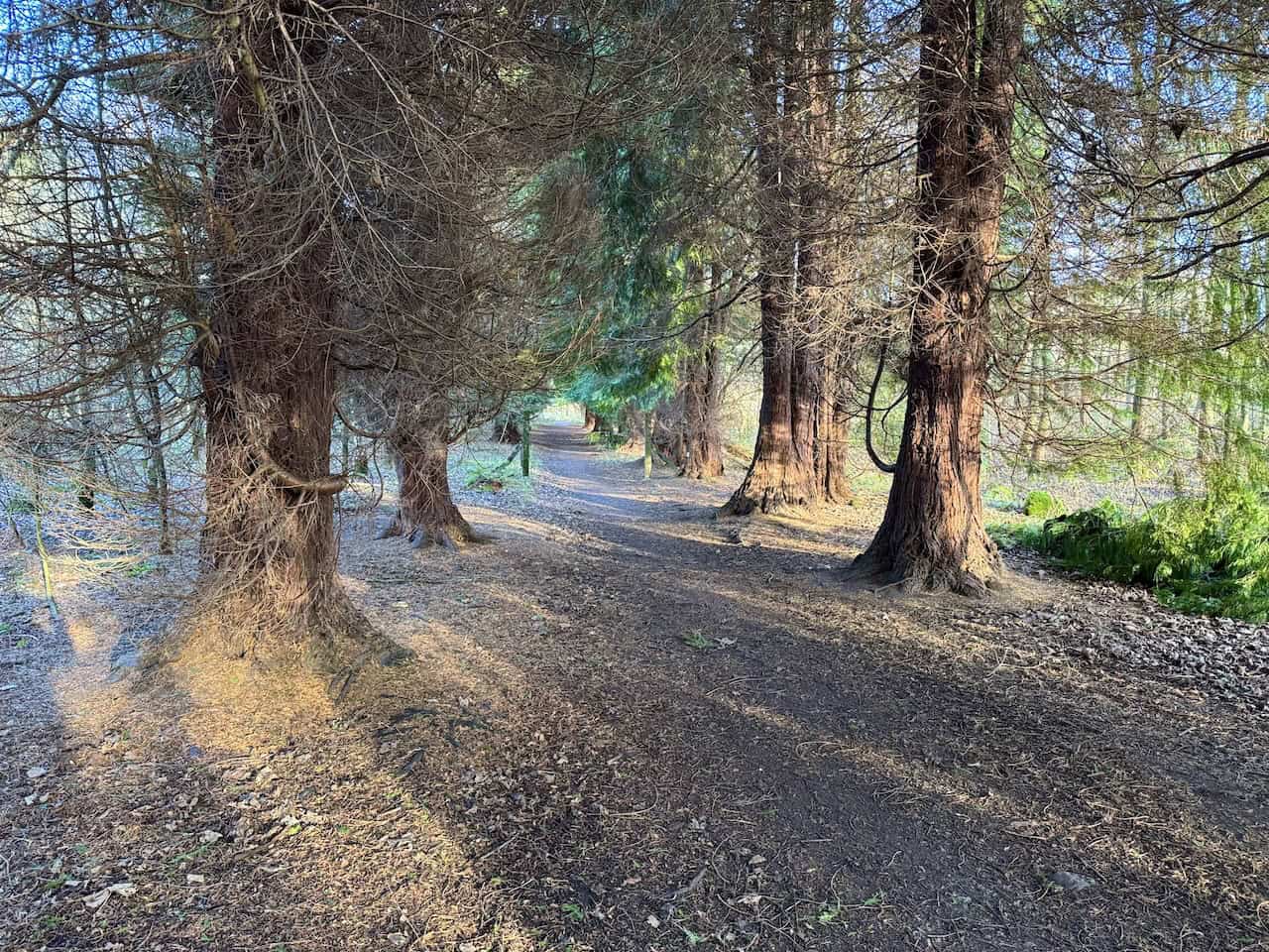
My route bends left and enters a beautiful woodland. The trees form a tunnel-like canopy over the path, creating a magical atmosphere. Some of the trees are enormous, like the one pictured here on the left.

This stretch of the path is lined with towering trees with thick trunks. Sunlight filters through the branches, casting patterns on the ground and illuminating parts of the trail. I wish this path were longer, but sadly, it is only a short section.
I reach the south-eastern tip of Cod Beck Reservoir. The calm, reflective water mirrors the clear blue sky, while the vibrant green grass along the banks adds a burst of colour.

ADVERTISEMENT
I feel fortunate to have chosen such a perfect day for my Cod Beck Reservoir walk. The stillness of the water creates a serene, mirror-like effect. I pause to enjoy a coffee from my flask, soaking in the peaceful atmosphere.

Crossing the reservoir dam, I admire the mix of natural beauty and human engineering. The stone parapet and gravel path form a striking boundary to the water. The dam blends seamlessly into its surroundings, adding to the reservoir’s charm.

Looking north-east across the reservoir from the dam, the vast, tranquil water is bordered by dense woodlands. This view is one of the highlights of my Cod Beck Reservoir walk.

ADVERTISEMENT
At the far end of the dam, I encounter the reservoir’s water management infrastructure. The stone tower, metal barriers, arched entrance tunnel, and barbed wire create an intriguing juxtaposition with the natural landscape.

After crossing the dam, I follow the path along the reservoir’s north-western shores. This side of the reservoir feels equally peaceful and inviting.
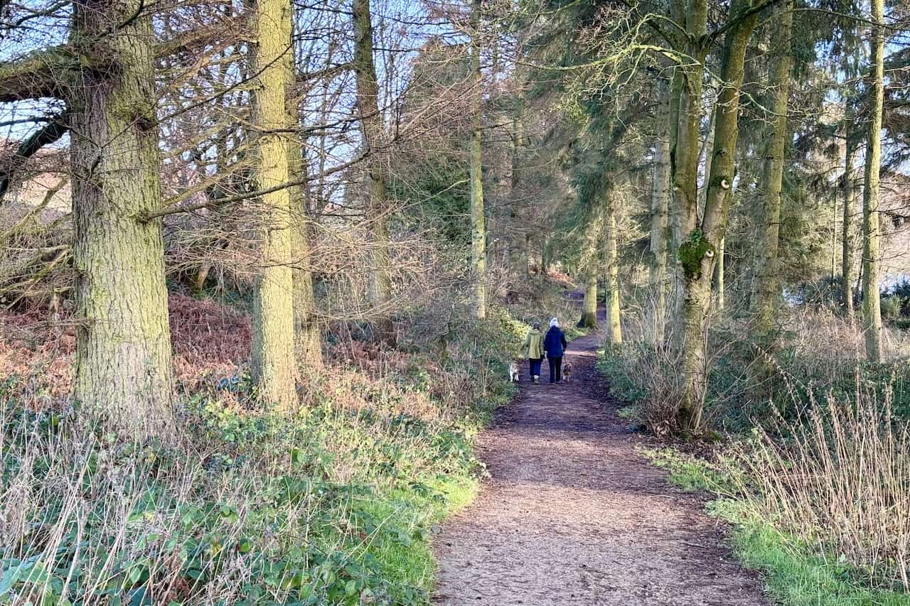
The path around the reservoir is well-maintained, with an even surface suitable for prams, wheelchairs, and mobility scooters. Visitors can park at the car park at the northern tip and enjoy the 1½-mile loop around the reservoir.

ADVERTISEMENT
Benches are thoughtfully placed along the trail. I take advantage of one to rest, enjoy the view, and have a quick snack before continuing my walk.

After leaving Cod Beck Reservoir, I follow a quiet road north before climbing onto higher ground. A bridleway leads me to an elevation of about 240 metres. From here, I enjoy fantastic views of Whorl Hill and Roseberry Topping in the distance, and the village of Swainby in the valley below.

A slightly leaning signpost points me along the Cleveland Way public bridleway, which heads west across Scarth Wood Moor.

ADVERTISEMENT
Crossing Scarth Wood Moor is always exhilarating. The open moorland, with its expansive views across the Tees Valley, is breathtaking on a clear day.

The path across the moor is easy to walk and well-defined. In some sections, the flagged stone path is a real treat, making the walk even more enjoyable.

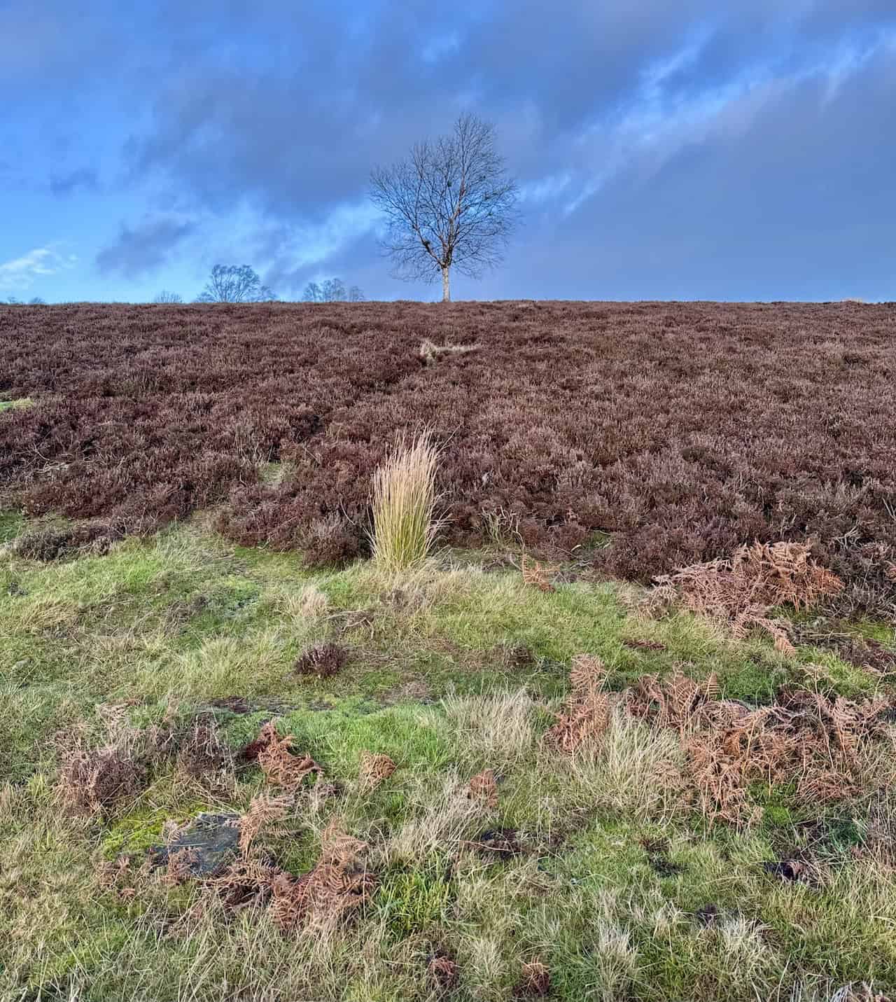
A solitary silver birch tree catches my attention. Its slender form stands elegantly against the bright blue sky, with its silver bark glowing in the sunlight.
I notice clumps in the branches of some silver birch trees, which I used to assume were birds’ nests. In reality, they are Witch’s Broom, a dense cluster of twigs and branches growing from a single point. This growth anomaly can result from fungi, viruses, bacteria, insects, mites, or even physical damage. Although it may not always harm the tree, Witch’s Broom can stunt growth and weaken the tree’s structure.

ADVERTISEMENT
As I near the end of Scarth Wood Moor, I look back and take in the stunning views one last time before continuing my Cod Beck Reservoir walk.

From the bridleway across Beacon Hill, I enjoy sweeping views to the east. At around 290 metres, the elevated position offers breathtaking scenery.

The bridleway is a wide, grassy track that remains firm underfoot, even in winter. It’s a pleasure to walk here, surrounded by such beauty.

From the bridleway, looking south-east, Black Hambleton dominates the horizon. It rises to an impressive height of around 400 metres, making it one of the tallest points in this area. While Black Hambleton stands tall at around 400 metres, the highest point in the North York Moors is Round Hill on Urra Moor, reaching 454 metres.

ADVERTISEMENT
The dry stone walls here display earthy tones, from deep browns to mossy greens. Beyond them, the scattered tussocks of grass add texture, their golden hues contrasting with the green fields.

The grassy bridleway transitions to a narrow tarmac lane. Along the way, I pass an old stone building marked as ‘Black Share’ on the Ordnance Survey map. Its history and current use remain a mystery to me.

Further along, I catch a glimpse of the reservoir’s northern tip, visible to the east from my elevated position on Swinestye Hill.

I spot a lone sheep standing on a grassy slope. Behind it, the woodlands form a layered patchwork of browns and greens, creating a picturesque scene.

ADVERTISEMENT
Nearing the end of the bridleway, I look down at the large stone house I passed earlier, now seen from the rear.

I finish my Cod Beck Reservoir walk back in Osmotherley. This 5-mile route on the western edge of the North York Moors National Park has been truly fantastic.

ADVERTISEMENT