ADVERTISEMENT
Route Map and Key Highlights for the Barden Bridge Walk in Wharfedale
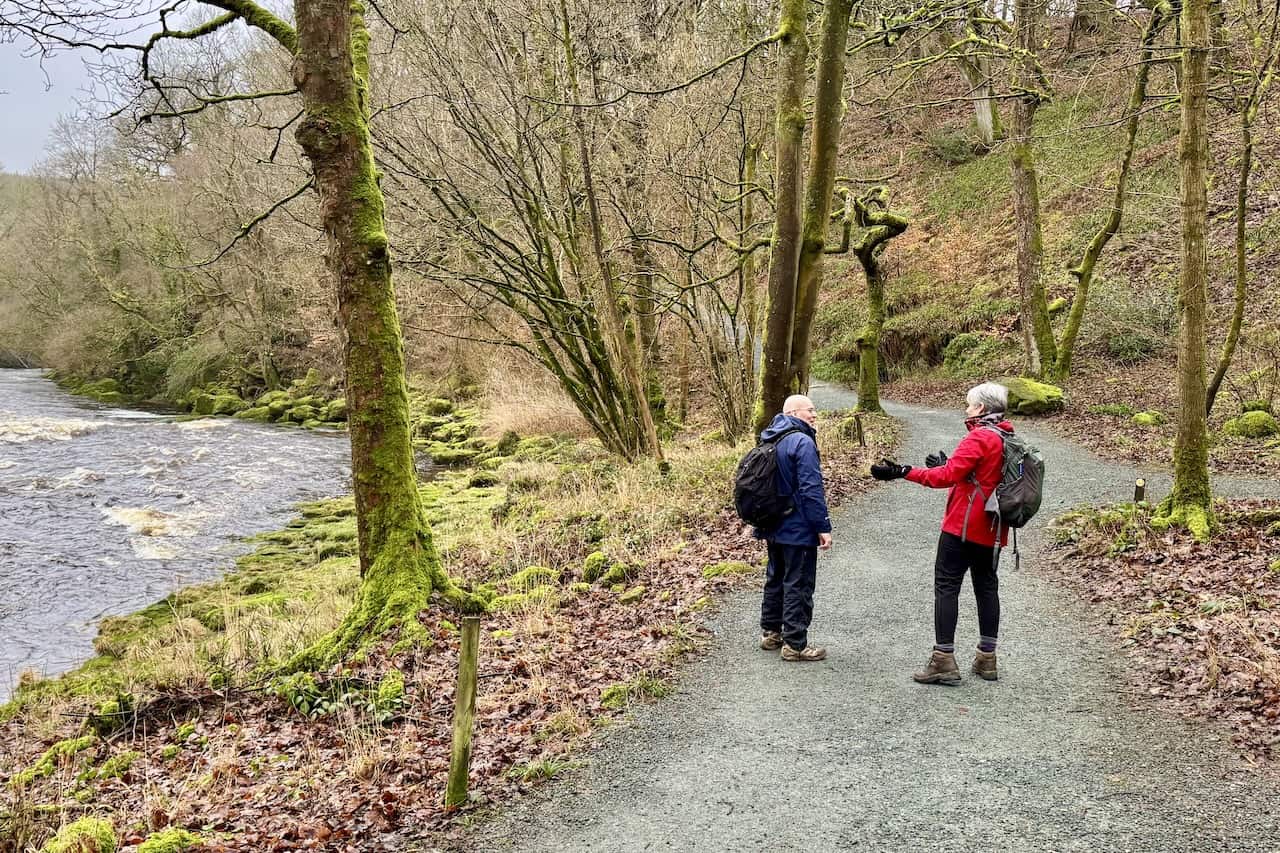
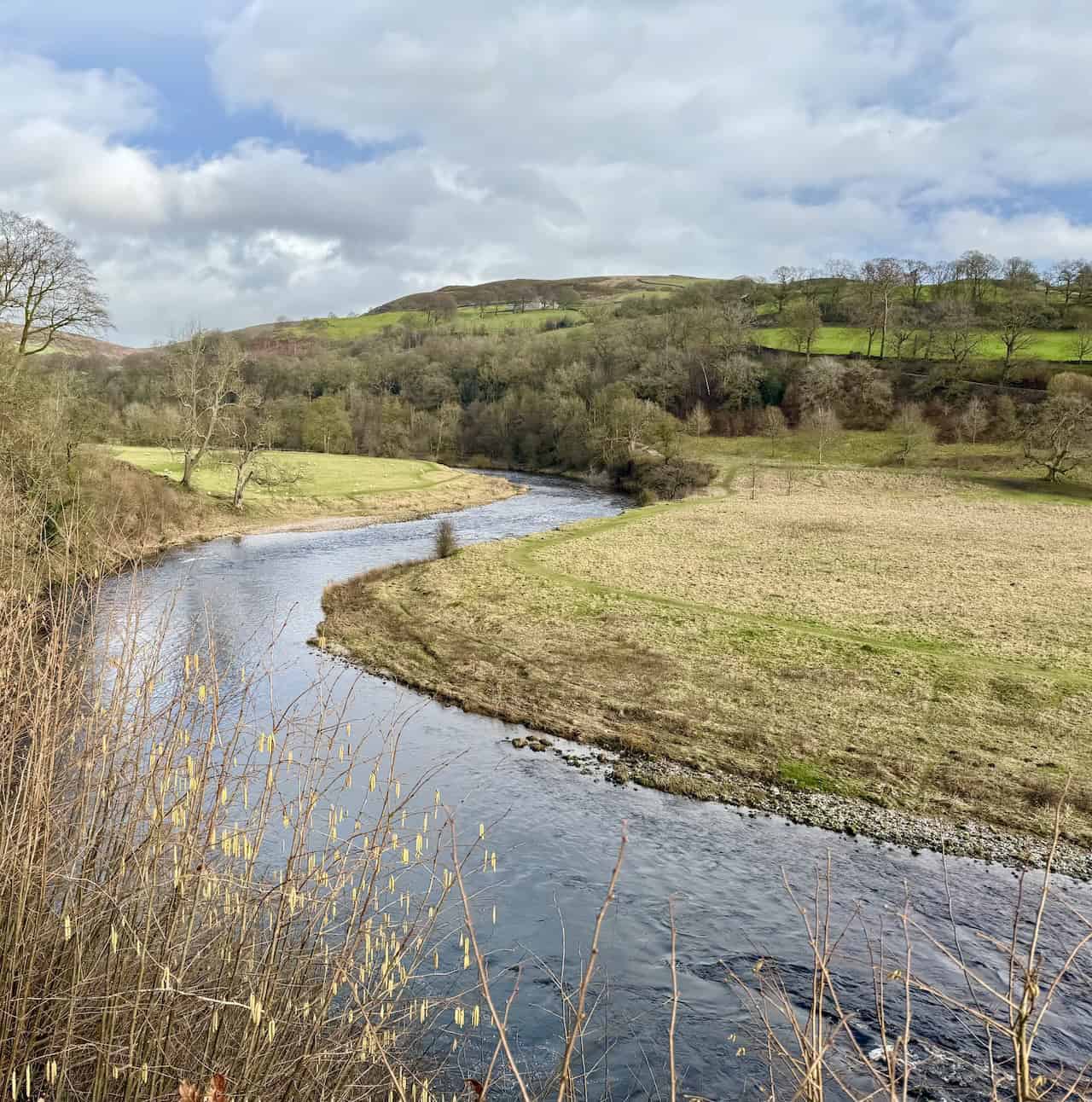
This Barden Bridge walk starts from Barden Bridge in Wharfedale, in the Yorkshire Dales. The stone road bridge crosses the River Wharfe on the Bolton Abbey Estate. You reach it from the B6160, taking the minor road near Barden Tower that leads towards Howgill and Appletreewick. Barden Tower sits on the B6160, roughly halfway between Bolton Bridge and Burnsall.
ADVERTISEMENT
Barden Bridge is an old stone bridge over the River Wharfe at the northern end of the Bolton Abbey Estate, close to Barden Tower. Historically, it helped local people, traders and estate traffic cross the Wharfe near Barden Tower, which was an important hunting lodge and administrative centre for the Clifford family. Improvements to the crossing in the 17th century, when Barden Tower and its surrounding buildings were still active, made it easier for scattered farms and hamlets in upper Wharfedale to reach markets and churches further down the dale. Today it survives as a modest but atmospheric historic structure, often photographed alongside the ruins of Barden Tower and used as a handy starting point for Bolton Abbey circular walks.
ADVERTISEMENT
There is a small roadside car park beside the bridge. It is a free, lay-by-style parking area, but spaces are limited and it fills quickly on busy days. There is also some additional roadside parking on the B6160 at Barden Tower. If you park there, it is worth having a look at Barden Tower.
Barden Tower was one of six hunting lodges and was rebuilt in the 16th century by Henry, 10th Lord of Skipton. Born during the Wars of the Roses, he spent his early years hidden in the fells of Cumberland with shepherds. Henry, commonly known as the Shepherd Lord, chose to make Barden his principal residence because of its remote location and defensive position against raiding Scots.
ADVERTISEMENT
Starting the Barden Bridge Walk and Reaching Barden Aqueduct
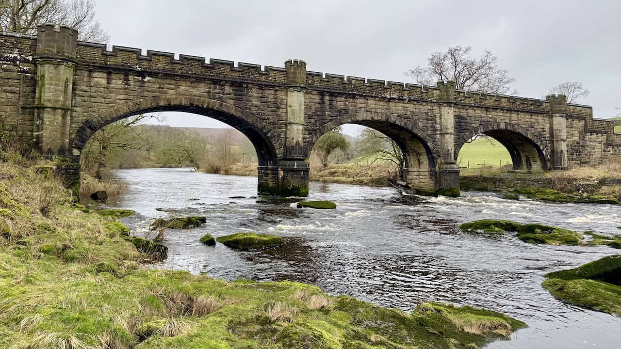
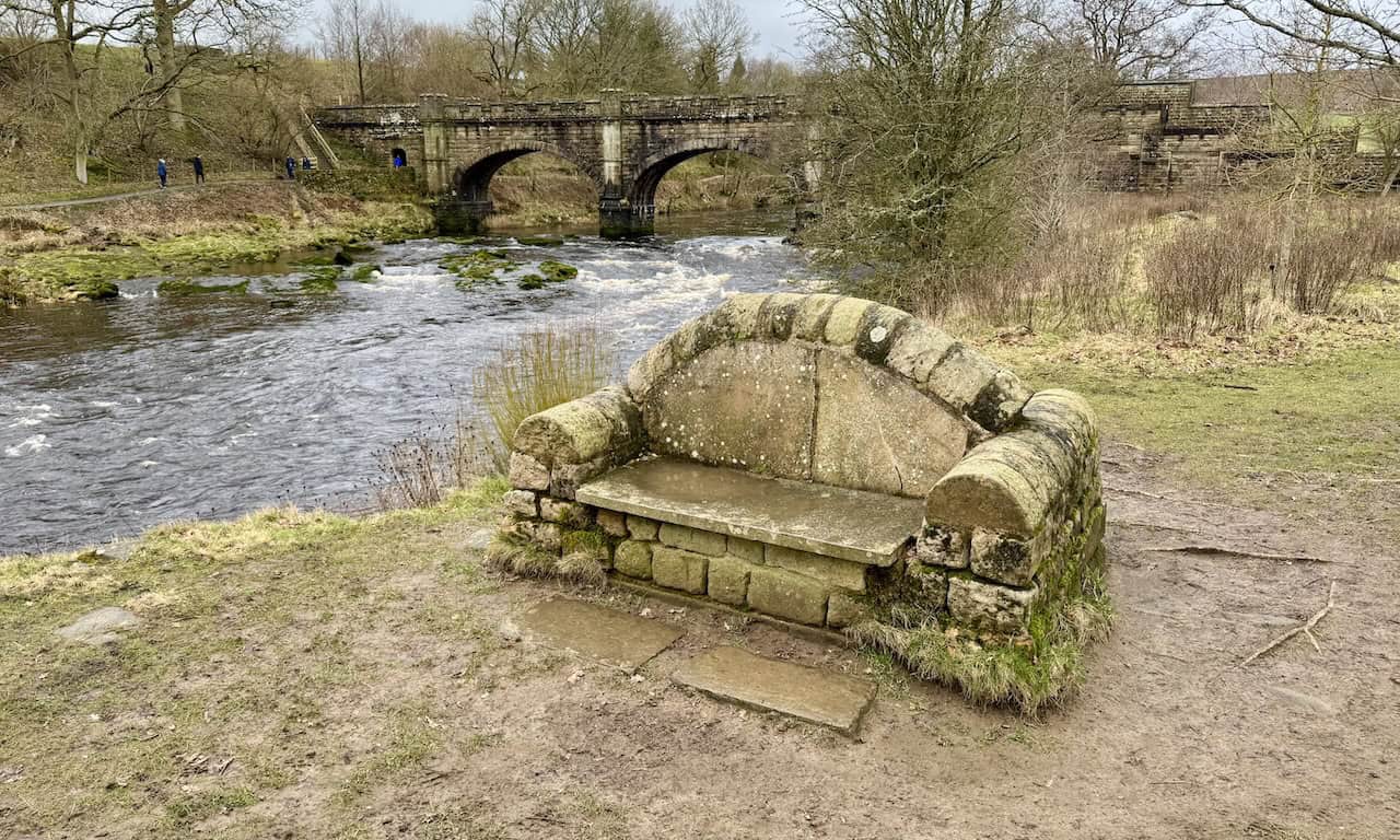
To begin, cross over Barden Bridge and head south on the permissive footpath, keeping close to the south-western bank of the River Wharfe. After about half a mile, you reach Barden Aqueduct, the large turreted stone bridge over the Wharfe a short way downstream from Barden Bridge. It looks like a decorative castellated footbridge, but it was built in the Victorian period to carry a covered water pipe as part of the Barden aqueduct system supplying Bradford and other West Yorkshire towns with drinking water. It still serves that practical purpose today while also acting as a well-known crossing point on local circular walks between Barden Bridge, Strid Wood and the Cavendish Pavilion.
ADVERTISEMENT
Barden Bridge Walk: Maps and Tools
Visit either the OS Maps website or the Outdooractive website to view this walking route in greater detail. Both platforms offer a range of features, including the ability to print the route, download it to your device, and export the route as a GPX file. You can also watch a 3D fly-over and share the route on social media.
The Strid on the Barden Bridge Walk
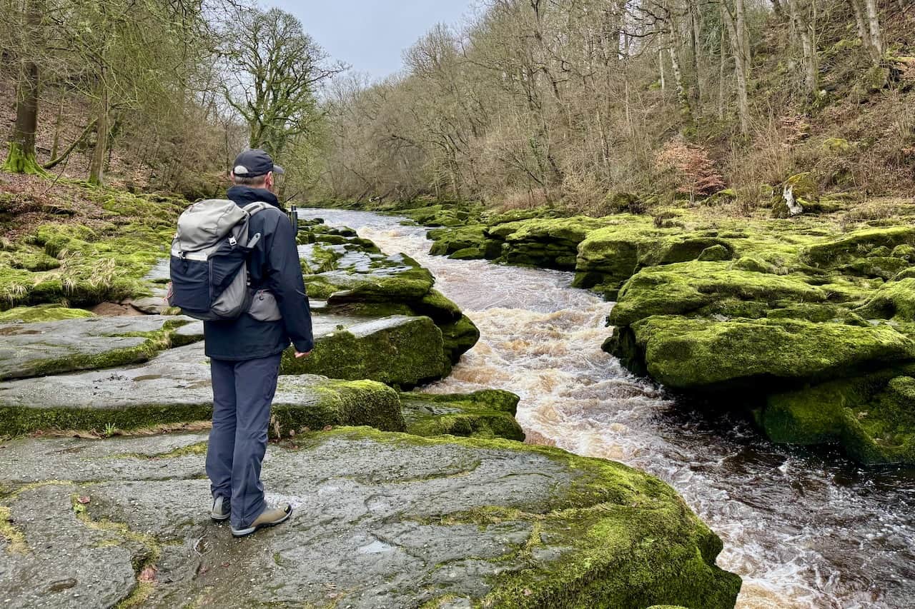
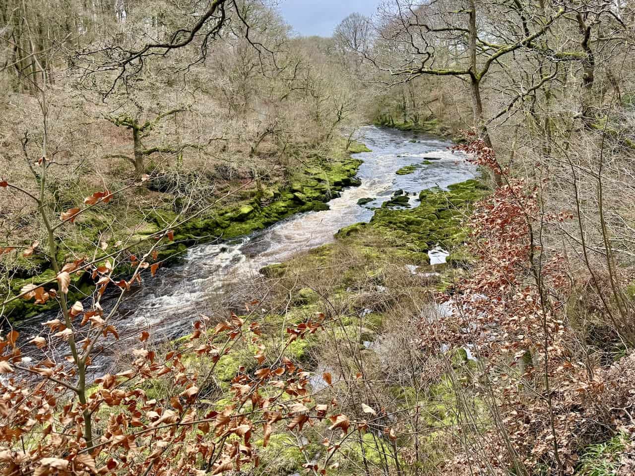
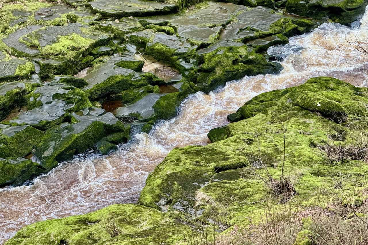
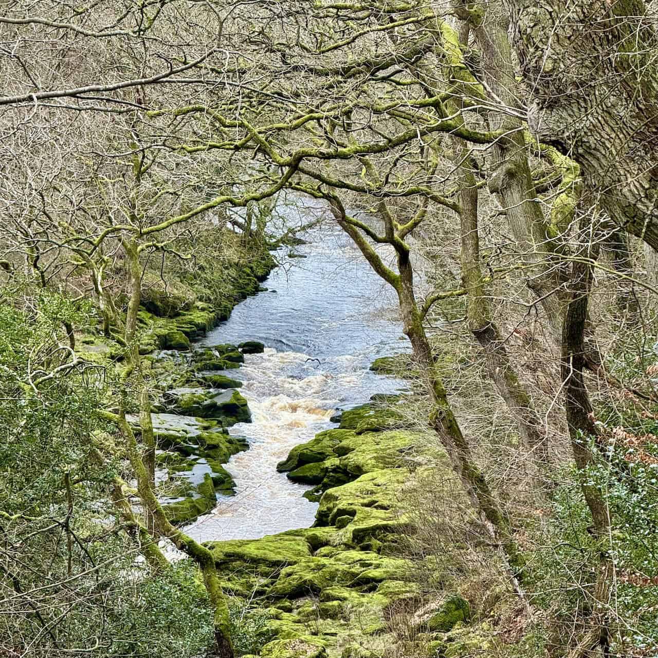
After about a mile, the path drops into woodland to reach The Strid, a short but dramatic gorge where the river is forced from a broad channel into a narrow, deep slot in the rock. Upstream the Wharfe is around 27 metres wide, but at the start of The Strid it narrows to a gap of roughly 2 metres. The name is commonly linked to how the rocks pinch in so tightly that it looks as though you could stride from one side to the other. The Strid lies within Strid Wood, a Site of Special Scientific Interest known for its ancient sessile oak woodland. This section is one of the highlights of the Barden Bridge walk.
The Strid has a long history as a visitor attraction. In 1810, William Carr, the Rector, obtained the consent of the 6th Duke of Devonshire to open Strid Wood to the public, and many of the paths and viewpoints reflect that early landscaping. Although the setting feels peaceful, the gorge was created by major geological processes and immense erosion over a very long period. Some of the rocks here are hundreds of millions of years old, and the river has cut down into sandstone and other sedimentary rocks, undercutting the banks and forming a deep, pot-holed slot with chutes, rapids and short waterfalls.
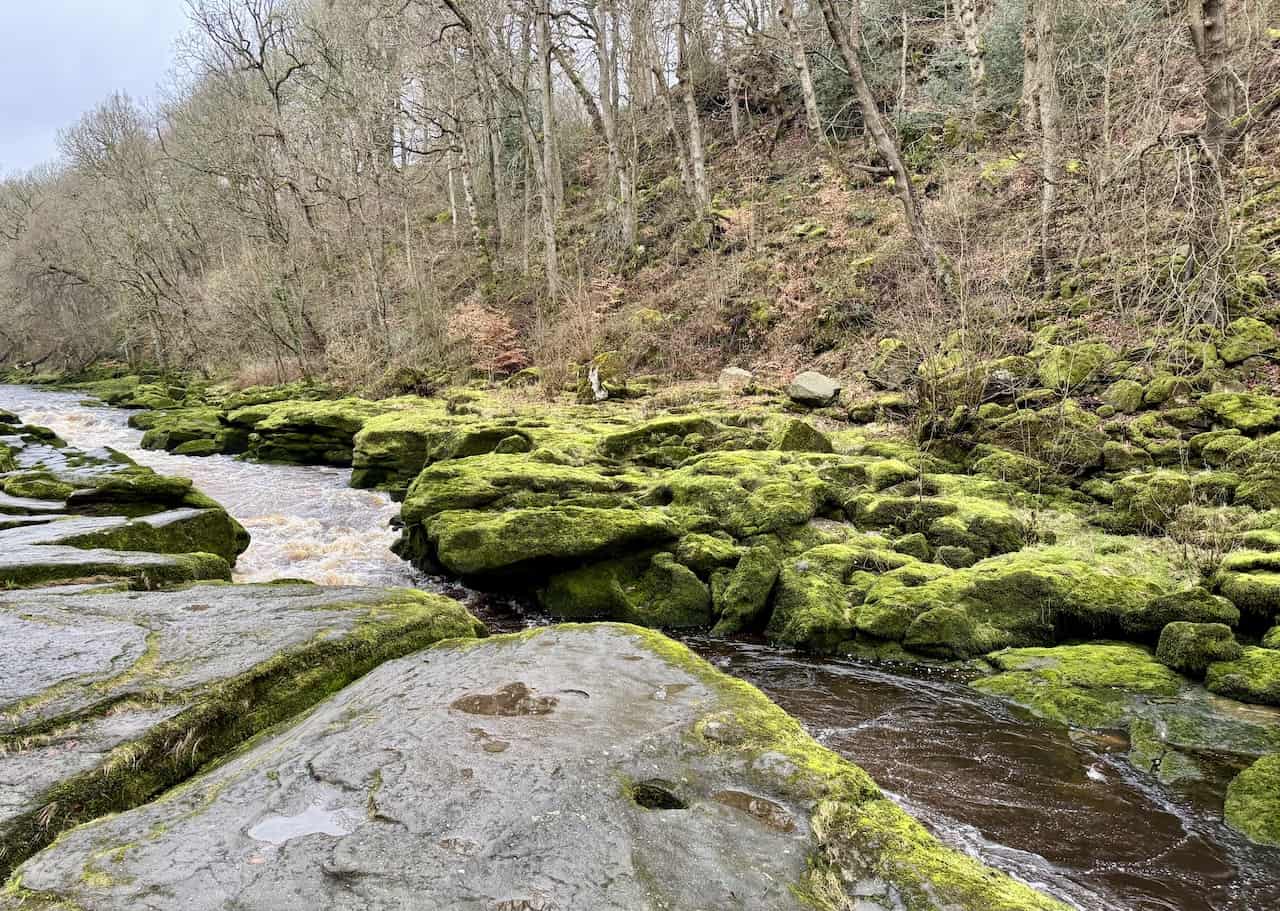
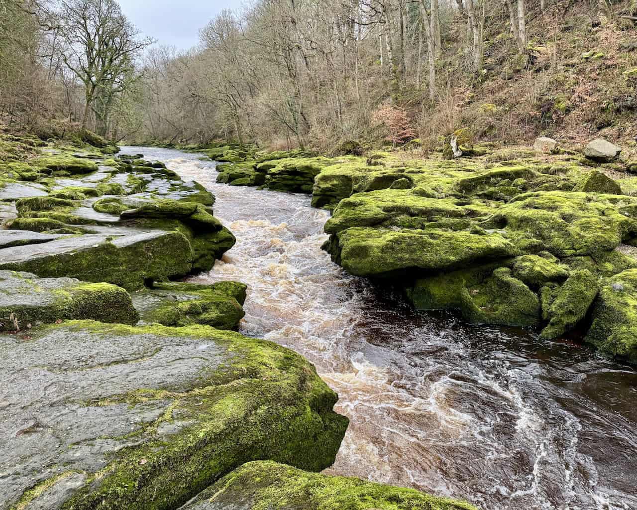
The gorge is over 9 metres deep in places, with powerful currents and undercurrents. In normal conditions, you see fast, foaming water rushing through a narrow gap, but after heavy rain it becomes a much more powerful torrent, with much of the turbulence hidden below the surface. Downstream, the river quickly widens and looks far gentler, which adds to the contrast.
Despite its beauty, The Strid has a fearsome reputation for danger. The hazards include extreme depth, powerful currents, and undercut banks and caves that can trap anything that falls in. The surface can look deceptively crossable, but the water below may be many metres deep with complex hydraulics.
There have been multiple fatalities here, including a well-reported incident in 1998 involving a honeymooning couple who were swept away after the river was in spate. Visitors are strongly warned not to approach the edge or attempt to cross, and to keep dogs and children well back from the banks.
ADVERTISEMENT
The Strid has also inspired local legends and Victorian-era tales. One often repeated story is that of the Boy of Egremont, who supposedly tried to leap the gap and drowned, with his dog raising the alarm. Modern research into medieval records suggests the historical figure lived to adulthood, but the story remains a powerful warning tale linked to the place.
Strid Wood and the Wharfe support a rich range of wildlife. Otters have recolonised the riverbanks, kingfishers breed in holes along the bank, and greater spotted woodpeckers use the mature broadleaved trees. You may also see common sandpipers, goosanders and mallards, and if you are lucky you may hear tawny owls at night. The water here is very clean, supporting brown trout and grayling, along with the insects and larvae they feed on. Crayfish shelter under stones during the day and become more active at night. The rocks here are Millstone Grit, a coarse sandstone over 325 million years old.
Climb Towards Lower Barden Reservoir and Black Hill
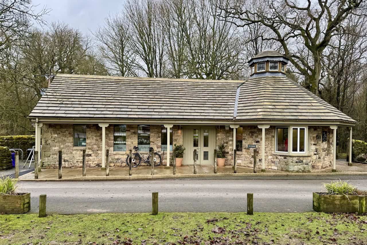
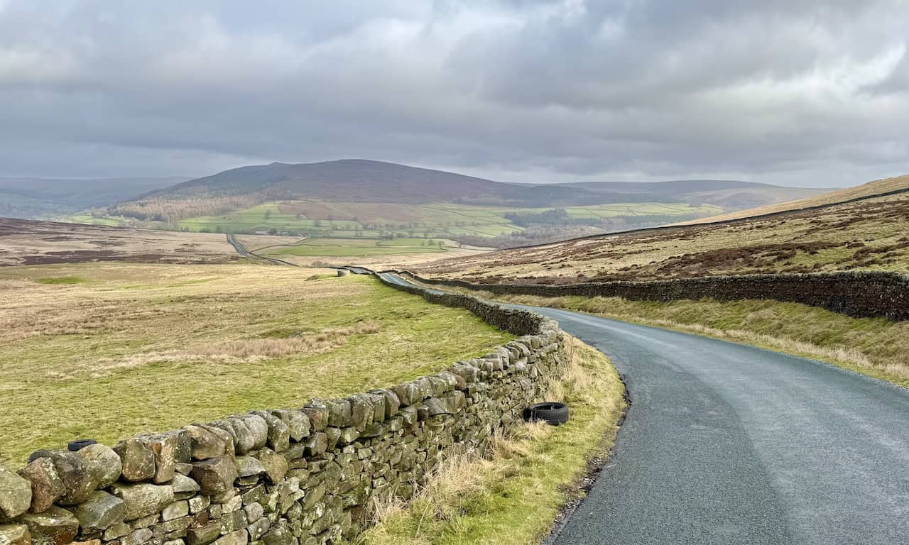
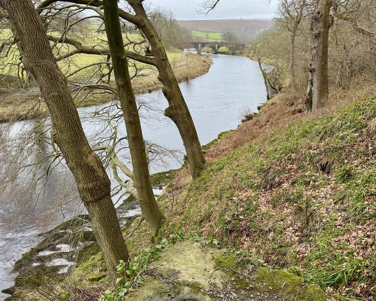
From The Strid, a path leads up to the Strid car park by the B6160. As you gain height on this section, there are fine views of the River Wharfe stretching northwards into the distance. There is a tearoom here serving hot and cold drinks, cakes and light snacks, as well as toilet facilities. Cross the main road opposite the car park and take the public footpath that climbs west across the fields. In wet weather this section can be boggy, though it is generally fine in dry conditions. There are also open views across Wharfedale along this stretch of the Barden Bridge to Bolton Abbey walk.
ADVERTISEMENT
The path eventually reaches a minor road with views over Lower Barden Reservoir. Lower Barden Reservoir is the lower of a pair of upland reservoirs on Barden Moor, above the Bolton Abbey Estate. It lies below Upper Barden Reservoir, and together they form part of the water supply system that sends drinking water down towards Bolton Abbey and then on to West Yorkshire via the Barden Aqueduct. The reservoir is held back by a substantial earth and masonry dam and is surrounded by open moorland, making it a popular feature on Bolton Abbey Estate walking routes linking the reservoirs with Barden Tower and the River Wharfe.
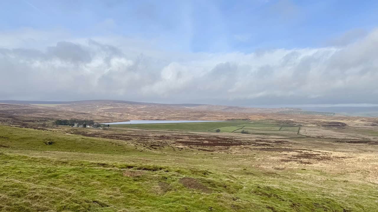
Follow the road uphill in a south-westerly direction to a car park on Black Hill. From here there are clear views across to Simon’s Seat, a prominent gritstone summit on the eastern side of Wharfedale, a little north of Bolton Abbey. It rises to about 485 metres and is crowned with a trig point and weathered boulders, giving it a distinctive outline. Its elevated position provides wide panoramas over Wharfedale and the surrounding Dales, which helps explain its popularity with walkers. The top forms part of the Bolton Abbey Estate and sits on access land, and most people reach it by permissive paths rather than public rights of way. The name is first recorded in the 18th century, and several local stories have been attached to it over time.
ADVERTISEMENT
Across Middle Hare Head on the Barden Bridge Walk
From the car park on Black Hill, take the grassy bridleway heading east, which crosses Middle Hare Head (306 metres) and continues across open countryside. There can be a couple of boggy patches along this section of the Barden Bridge walk, but they are usually easy enough to pass.
Bolton Priory and the Historic Heart of the Route
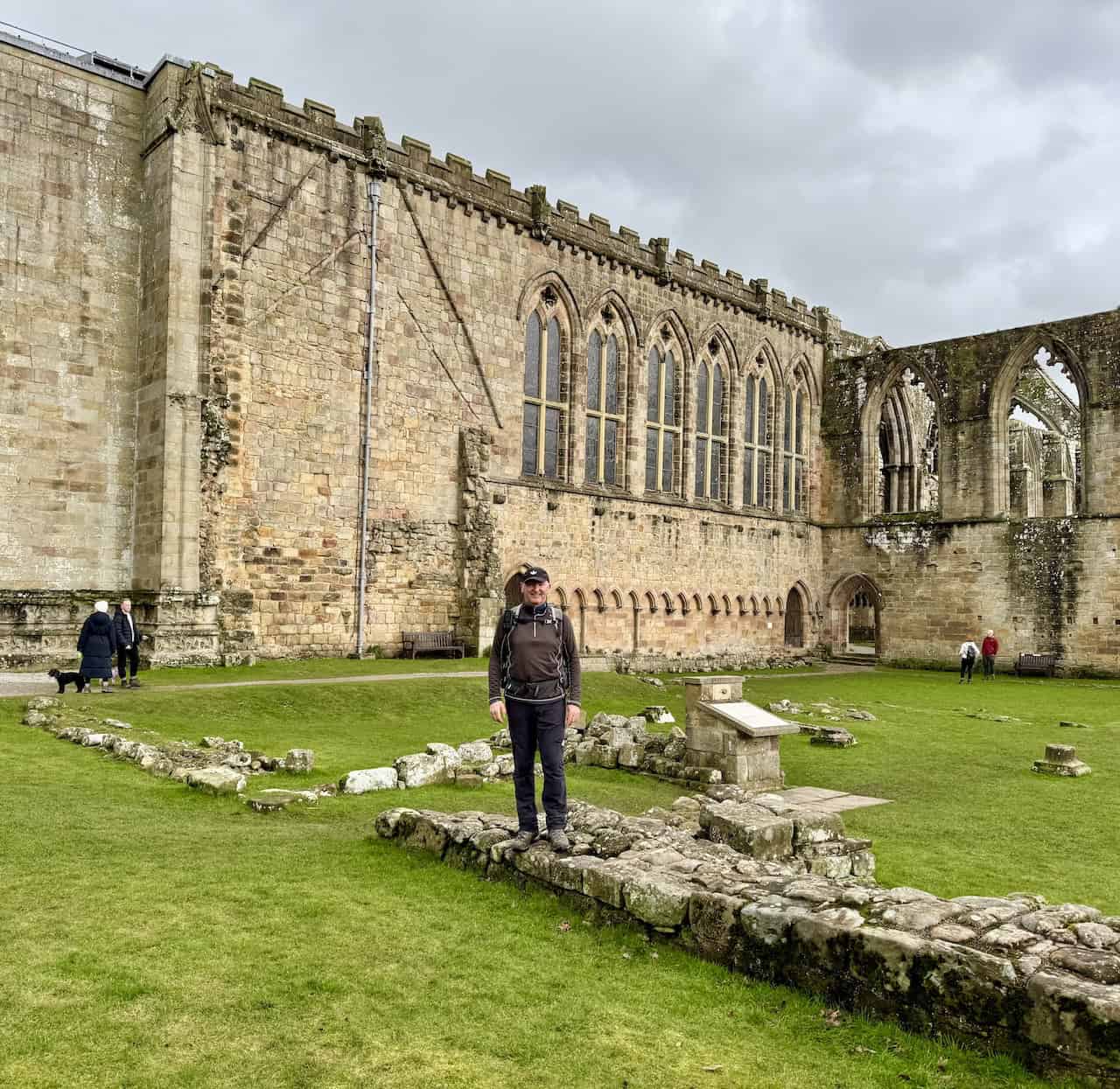
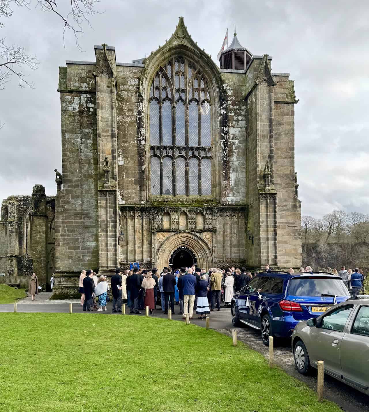
The bridleway then crosses fields and enters Westy Bank Wood. Follow it through the woodland and continue south-east to reach the road at Bolton Abbey. From here you can head down to see the remains of Bolton Priory, the ruined part of an Augustinian monastery. The surviving nave still serves as the parish church, while much of the rest of the priory stands roofless, leaving a striking mix of intact church and open-air ruins. The priory was dissolved in 1539 under Henry VIII, with valuable materials removed and stone later reused locally. Today the setting is managed by the Bolton Abbey Estate.
Bolton Priory was established in 1154 or 1155, when Augustinian canons were granted land by Alice de Romille after an earlier site at nearby Embsay proved inadequate. Over time the canons developed a substantial estate, funded by activities including sheep farming, lead mining and river tolls, and built a church, cloisters, chapter house and domestic ranges. The nave also served local parishioners from an early date.
ADVERTISEMENT
Like many northern monasteries, Bolton Priory was affected by the Dissolution in 1539, when lead roofs, bells and valuables were stripped. Its unusual survival as both church and ruin reflects the canons’ role in local parish life. Prior Moone negotiated to preserve the western nave as the parish church, separated from the roofless choir and transepts that now form the principal ruins. Stone from other buildings was reused elsewhere in the valley, while the estate passed through the Clifford family and later the Cavendishes, Dukes of Devonshire. Today the site remains one of Wharfedale’s most distinctive historic landmarks, combining medieval ruins, an active church and a riverside setting.
Cavendish Memorial and Riverside Paths to the Pavilion
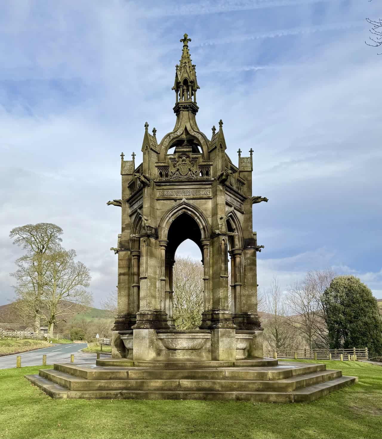
After visiting the priory, return to the main road and head north to the Cavendish Memorial Fountain. This tall, ornate Gothic-style drinking fountain was erected in 1886 in memory of Lord Frederick Cavendish, who was murdered in Dublin’s Phoenix Park in 1882. Standing in parkland just north of the priory, it serves both as a functional fountain and as a prominent stone memorial linked to the Cavendish family, who have long owned the Bolton Abbey Estate.
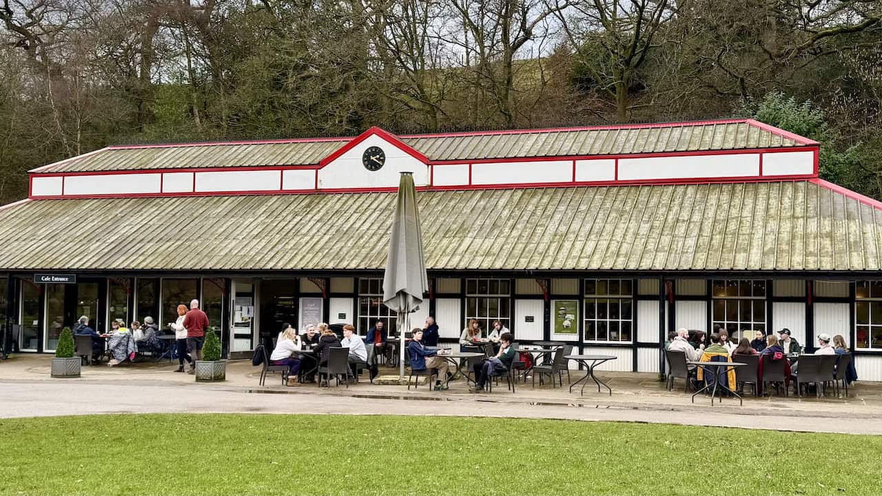
From the memorial, follow the path down across the grassy banks to the River Wharfe, then walk along the western bank towards the Cavendish area of the estate. Here you will find the Cavendish Pavilion, a large riverside café with indoor and outdoor seating, serving hot and cold drinks, light meals, cakes and ice cream. There are toilets and parking, and it is an ideal place to pause for refreshments during the Barden Bridge walk.
ADVERTISEMENT
Return Leg of the Barden Bridge Walk via Strid Wood
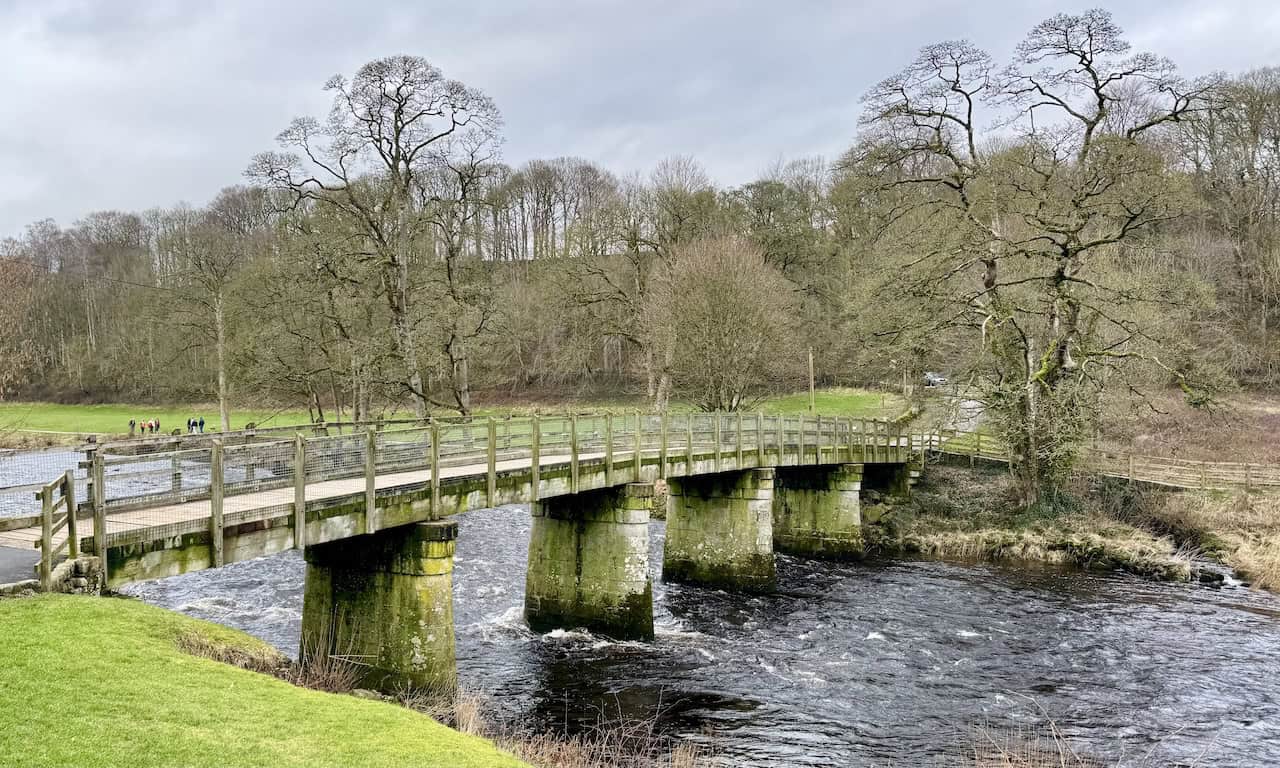
Cross the River Wharfe using the bridge marked as Wooden Bridge on Ordnance Survey maps. On the far side, turn left and follow the footpath along the eastern bank. This is a lovely riverside section that stays close to the Wharfe for much of the way back. For many walkers, this return leg is the most scenic part of the walk from Barden Bridge.
The River Wharfe is around 65 miles (105 km) long. It rises on high moorland in Langstrothdale Chase near Beckermonds in the Yorkshire Dales National Park, at about 310 metres above sea level, and flows generally south-east through Wharfedale past places including Buckden, Kettlewell, Grassington, Appletreewick and Bolton Abbey, before continuing through lower reaches such as Ilkley, Otley and Wetherby. It eventually joins the River Ouse near Cawood.
Its course passes through a varied landscape shaped by geology and glaciation, including gorges, waterfalls and wooded stretches. That wider context helps explain the contrast seen on this Barden Bridge walk between the broader, calmer reaches of the Wharfe and the sudden constriction at The Strid. Historically, the river was important for mills, trade and monastic sites such as Bolton Priory, and today it remains central to walking, angling and tourism in Wharfedale.
ADVERTISEMENT
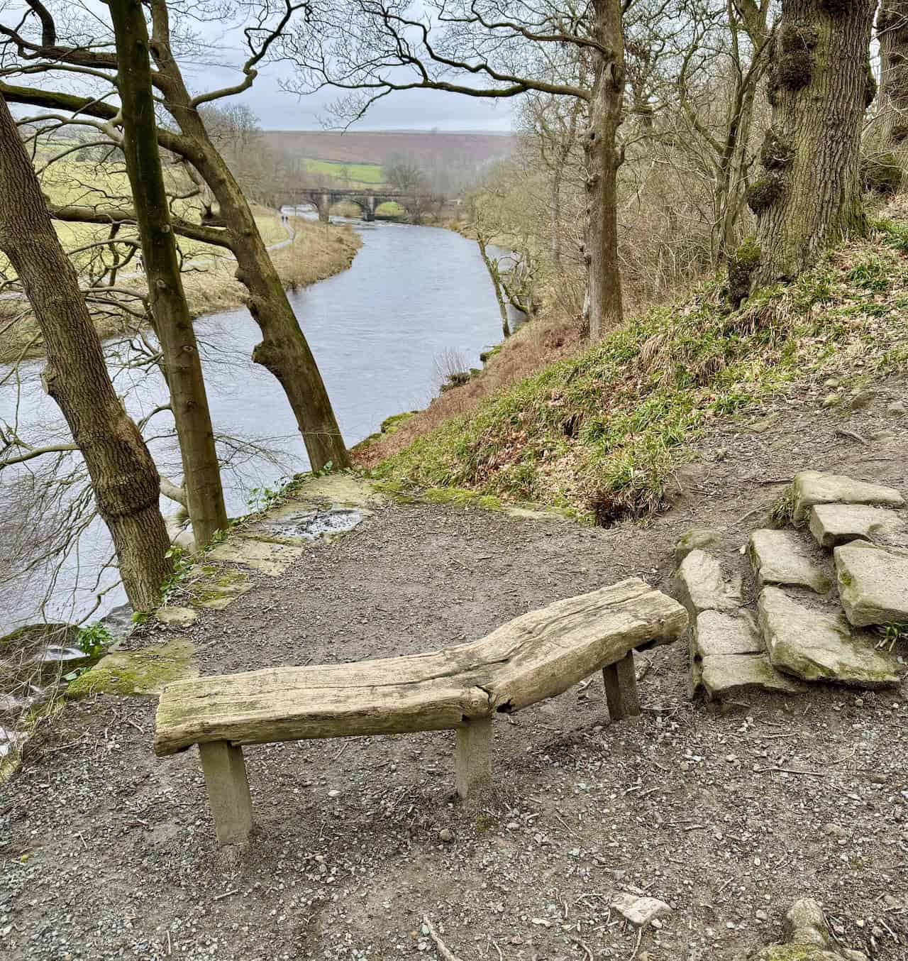
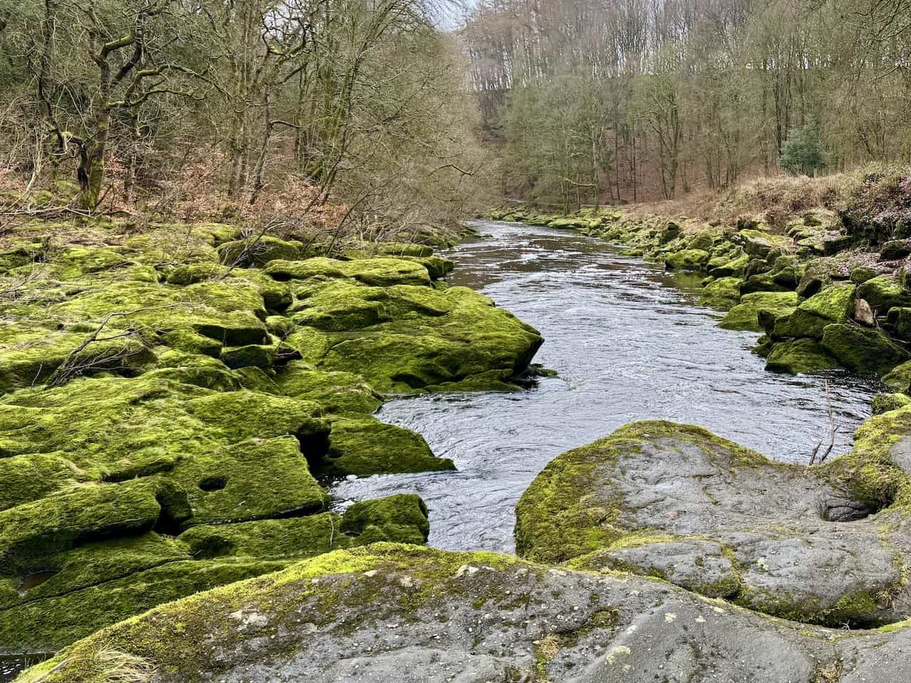
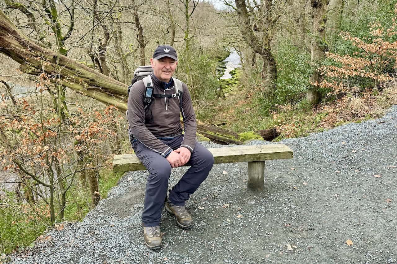
You return through Strid Wood, this time with a different view of The Strid from the opposite side. The path here is higher, giving a clearer look down into the gorge and a better sense of how the river suddenly narrows. The route then continues through woodland on well-surfaced paths that are easy to follow and still offer excellent riverside views. There is also an ornate stone bench near the aqueduct where you can stop for a break, perhaps for a coffee, before the path leads out into open fields and returns to Barden Bridge and the car park.
Barden Bridge Walk Difficulty and Route Conditions
Overall, it is a wonderful walk of about ten miles. It is fairly easy, with no overly steep climbs. You may find the odd boggy or muddy stretch, so hiking boots are strongly recommended.
There is the steady climb up towards Middle Hare Head, but it is not especially steep and should suit most people with a reasonable level of fitness.
Dog Guidance for the Barden Bridge Walk
I have checked the Bolton Abbey Estate dog guidance and, based on the route described above, all sections on this circular are suitable for dogs, provided you follow the lead and control requirements where they apply.
The Estate welcomes dogs on the riverside paths, and asks that dogs are kept on a lead on woodland trails, including Strid Wood, and also on the Priory Trail and Welly Walk. Please also be mindful of other visitors, as not everyone is comfortable around dogs.
ADVERTISEMENT
The Estate’s guidance also states that dogs are not permitted on Barden Fell and Barden Moor open access areas, including the Valley of Desolation and Simon’s Seat. This route does not go onto Barden Fell open access land at all. It only passes briefly through the Barden Moor area by sticking to a minor public road and a public bridleway, which are public rights of way in their own right.
In short, this Barden Bridge walk is fine for dog walkers, with the main requirement being to keep dogs on a lead through Strid Wood and on the signed trails. I am not a dog walker myself, but I am fairly confident I have understood the guidance correctly. If I have misunderstood any part of it, I apologise.
Related Post: Walks in Wharfedale
Discover two walks in Wharfedale with scenic hillside and river views
ADVERTISEMENT