ADVERTISEMENT
Wide Views and Open Moorland Found Along This Great Ayton Walk Route
Begin your Great Ayton walk from the small car park and roadside parking area at the eastern end of High Street, close to Great Ayton’s large village green. The car park sits at the junction of High Street, Newton Road and Station Road. From here, head south along Station Road, which is signposted towards Little Ayton and the railway station.
At the mini roundabout, follow the road straight ahead, again signed for Little Ayton. At the next junction, immediately before the road bridge over the River Leven, turn left. This turning leads to Brookside Farm and may also carry a sign for Fletcher’s Farm Coffee Shop.
Carry on along the tarmac road, which passes through the farm and becomes a stone track as it continues past Fletcher’s Farm Coffee Shop. The coffee shop is set in a large wooden building on your left. Continue along the track and over the bridge crossing the railway line. Beyond the bridge, go straight ahead through the metal gates.
At the end of the track, turn right onto the narrow tarmac bridleway. The lane gradually narrows into a track, then tightens further as the route steepens and crosses an area of exposed tree roots. Keep following the bridleway uphill. Where the path splits and a footpath climbs left into Ayton Banks Wood, ignore this and stay on the bridleway, ignoring any further paths to the left or right.
The bridleway eventually emerges from the woodland into more open countryside. Follow it around the side of the hill, keeping a dry stone wall on your right. The path re-enters woodland a short while later. Carry straight on here, avoiding the right hand path that drops down the hill. Soon you reach a T-junction; turn left following the bridleway sign.
ADVERTISEMENT
Continue your Great Ayton walk along this broadening forestry track for about a mile until you emerge onto a tarmac lane. Turn left and head uphill, passing Bankside Farm on your right. Carry on climbing along the lane through the woodland of Pale End Plantation. At the top of the bank, ignore the left turn onto the Cleveland Way National Trail and stay on the tarmac lane.
The lane now descends towards Lonsdale Farm. Walk past the farm on your right and continue downhill. Near several large barns, the lane bends left towards Oak Tree Farm, but instead carry straight ahead onto the stone track, which climbs back uphill into the woodland at Nab End.
At the top, you reach a tarmac lane and crossroads on Percy Cross Rigg. Turn left here and then immediately go through the gates. Avoid the grassy public footpath on the left and instead take the public bridleway stone track straight ahead. To continue your Great Ayton walk, follow this across the moorland for almost a mile until you reach a set of gates on Hutton Moor.
Turn left here, joining the Cleveland Way National Trail. After about a third of a mile, the stone track begins to ascend gently and bends slightly to the left. As it does so, two tracks lead off to the right; take the second of these, just before the Cleveland Way wooden signpost. This track leads down towards Hanging Stone, a large rock outcrop. Where the track swings sharply to the left, take the narrow public footpath on your right down through the trees to Hanging Stone itself.
After visiting Hanging Stone, retrace your steps along the narrow path back through the trees to the track and turn right. Follow this track to a crossroads, then walk through the gate or cross the stile to enter the National Trust’s Roseberry Topping area. Continue straight ahead across the moorland with the dry stone wall on your right. In the distance, also to your right, you will see Roseberry Topping.
ADVERTISEMENT
You will rejoin the Cleveland Way National Trail at a crossroads. Turn right here, through the gate, and begin making your way downhill on stone steps. The path takes you around the left hand side of the small cone shaped hill known as Little Roseberry, with Roseberry Topping rising in the distance ahead of you.
At the lowest point between Little Roseberry and Roseberry Topping, you will see an interpretation board about the Roseberry Topping pathways improvement works. Turn left here and walk through the large gate. Follow this route for about three quarters of a mile down to Aireyholme Farm.
On reaching the farm, where a large wooden barn stands directly in front of you, turn right through the gates and across the cattle grid. You come to a stone built house with a grey slate roof; here, turn left and walk along the edge of the grassy field. Continue straight ahead past a small cluster of larch trees to an interpretation board about Captain Cook’s cottage.
At this sign, turn left, then almost immediately turn right and drop down into Cliff Ridge Wood. Follow the path downhill through the trees, passing two large concrete pillars set into the ground on your right. At a crossroads in the paths near a wrought iron gate, continue straight ahead down some stone steps.
You will emerge into the open countryside of Rye Hill. Keep following the path downhill alongside the fence on your right. The path continues straight across the railway line, then through more sets of wrought iron gates before reaching the main road in Great Ayton. Turn left here to return to the car park and complete your Great Ayton walk.
Great Ayton Walk: Maps and Tools
Visit either the OS Maps website or the Outdooractive website to view this walking route in greater detail. Both platforms offer a range of features, including the ability to print the route, download it to your device, and export the route as a GPX file. You can also watch a 3D fly-over and share the route on social media. Additionally, this page includes a printable version of the walk in PDF format. Plus there is a supporting video, available for you to watch on YouTube.
Great Ayton Walk: Distance, Duration, Statistics
Distance: 9¼ miles
Distance: 14¾ kilometres
Duration: 4½ hours
Ascent: 1459 feet
Ascent: 448 metres
Type: Circular walk
ADVERTISEMENT
Recommended Ordnance Survey Map
The best map to use on this walk is the Ordnance Survey map of the North York Moors Western Area, reference OS Explorer OL26, scale 1:25,000. It clearly displays footpaths, rights of way, open access land and vegetation on the ground, making it ideal for walking, running and hiking. The map can be purchased from Amazon in either a standard, paper version or a weatherproof, laminated version, as shown below.
North York Moors Walking Guidebooks
The North York Moors, by Paddy Dillon, describes 50 walks of 4 to 14 miles across the Tabular Hills, Hambleton Hills, Cleveland Hills, high moors and Cleveland coast, plus the Lyke Wake Walk in four stages, with Ordnance Survey mapping and notes on transport and refreshments.
North York Moors Short Walks Made Easy, published by Ordnance Survey, brings together 10 accessible routes of 2.5 to 4.5 miles, each taking around a couple of hours, ideal for families or anyone short on time. Both books can be purchased from Amazon, as shown below.
Walking the North York Moors
The North York Moors, by Paddy Dillon, a Cicerone guidebook of 50 walks throughout the National Park
About Great Ayton
Location and Geography
Great Ayton is a picturesque village and civil parish set at the foot of the Cleveland Hills in North Yorkshire, on the edge of the North York Moors National Park. The River Leven, a tributary of the River Tees, flows gently through the village and links its two centres, High Green and Low Green. To the north, the view is dominated by the distinctive 320-metre profile of Roseberry Topping, often referred to as the “Yorkshire Matterhorn” thanks to its striking half-cone shape. The wider landscape is shaped by the Cleveland Dyke, a narrow band of hard whinstone rock that runs across the area, and by the surrounding moorlands, whose sandstone foundations date back to the Jurassic period. The village sits around three miles south-east of Middlesbrough, five miles from Guisborough, and within easy reach of Easby Moor, making it an ideal base for anyone planning a Great Ayton walk.
History and Heritage
The name Great Ayton comes from the Old English “Ea-tun”, meaning “river farm”, with “Great” added later to distinguish it from the smaller settlement of Little Ayton just to the south. The village is an ancient one, recorded in the Domesday Book of 1086, when its lands were divided into three manors. Its most famous historical connection is with Captain James Cook, the great 18th-century explorer and navigator, whose family moved to Great Ayton in 1736 when he was eight years old. His father worked at Aireyholme Farm under Thomas Skottowe, the lord of the manor, who paid for young James to attend the Postgate School in the village.
Great Ayton also has a strong industrial past. During the 17th and 18th centuries, linen production was a major local trade, with a significant share of the population involved in spinning and weaving. Other historic industries included tanning, brewing and tile making, alongside the quarrying of whinstone, ironstone, jet and alum from the surrounding hills. The Religious Society of Friends, or Quakers, also left a lasting mark on the village, particularly through the philanthropy of Thomas Richardson, who founded the North of England Agricultural School here in 1841. Later known as the Friends’ School, it remained an important presence until its closure in 1997.
Related Walk: Similar to the Great Ayton Walk
Enjoy a memorable hike on the Roseberry Topping walk from Great Ayton
Community and Lifestyle
In 2022, Great Ayton was named one of the Sunday Times’ “Best Places to Live” in the United Kingdom, with judges praising its blend of countryside, connectivity, independence and imagination. The village retains a strong sense of community, supported by groups such as Brighten Up Great Ayton, the Great Ayton History Society and the Leven Sword longsword dance group. The Great Ayton Discovery Centre, housed in the former British School, serves as a modern community hub run entirely by volunteers.
Day to day life centres around the independent High Street, which is home to long-standing local favourites such as Petch’s Butchers, well known for its award-winning pies, and Suggitt’s Ices, a village institution dating back to 1925. There is also a thriving cafe culture, with popular spots including The Velveteen Rabbit and the Pomegranate Persian Tea Room. The village calendar features a number of cherished social events, including the biennial Village Fete on High Green and the much-loved Carols on the Green at Christmas.
Landmarks and Tourism
Great Ayton is a significant destination for heritage tourism, particularly for visitors following the Captain Cook trail. The Captain Cook Schoolroom Museum, set within the former Postgate School where Cook received his early education, features a reconstructed 18th-century classroom and exhibits charting his early life and later voyages. On Bridge Street stands an obelisk made of granite from Point Hicks in Australia, marking the site of the Cook family cottage which was dismantled and shipped to Melbourne in 1934, where it now stands in Fitzroy Gardens. All Saints Church, a Grade I listed 12th-century building, was the family’s place of worship and contains the grave of Cook’s mother and several of his siblings in its churchyard. On High Green, a bronze statue by sculptor Nicholas Dimbleby depicts James Cook as a 16-year-old, looking out in the direction of Staithes, where he first felt the call of the sea.
Beyond the village itself, Roseberry Topping and Captain Cook’s Monument are among the most popular walking destinations in the area. The monument, a 60-foot stone obelisk erected in 1827, stands on Easby Moor and offers wide-ranging views across the Cleveland plain, the moors and out towards the coast. Closer to the village centre, Waterfall Park is a quiet spot beside the River Leven, ideal for a picnic and for enjoying the small waterfall after which it is named. Together, these landmarks make Great Ayton not only a charming place to live, but a rewarding destination for anyone setting out on a Great Ayton walk.
Great Ayton Walk: My Photos
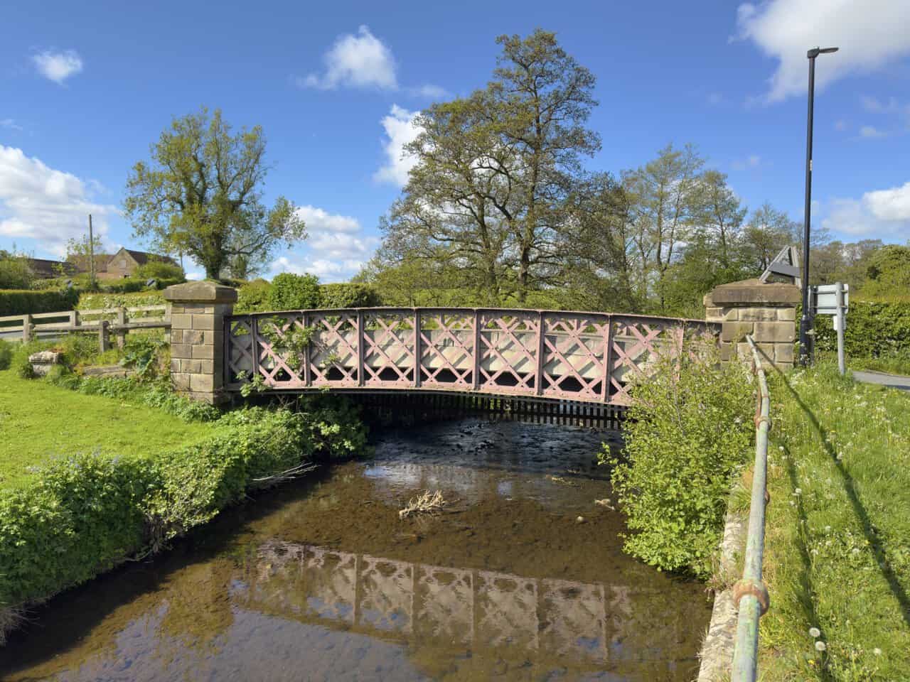
I set off from the village along Station Road at the start of my Great Ayton walk, and after about fifteen minutes I reach this handsome iron footbridge spanning the River Leven. Its decorative lattice ironwork and stone abutments make a fine sight against the trees and open sky. I don’t cross the bridge here, instead turning off towards Fletcher’s Farm Coffee Shop.
ADVERTISEMENT
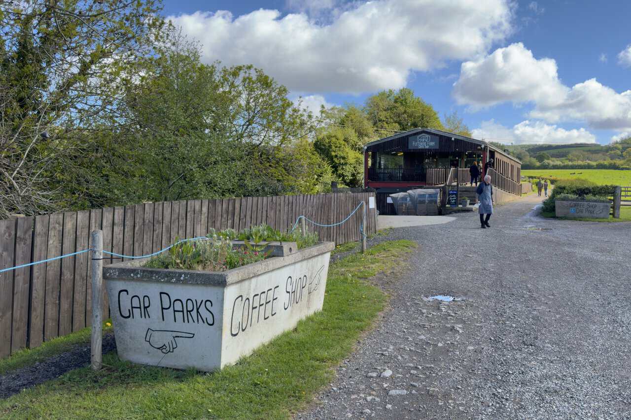
A short way further on I pass Fletcher’s Farm Coffee Shop, set in a large wooden building beside the track. A painted sign on a stone planter points the way to the car park and coffee shop, and a few visitors are already heading in for their morning refreshments. It looks as busy and inviting as ever, and although I won’t be calling in today, I’ve enjoyed visits here before.
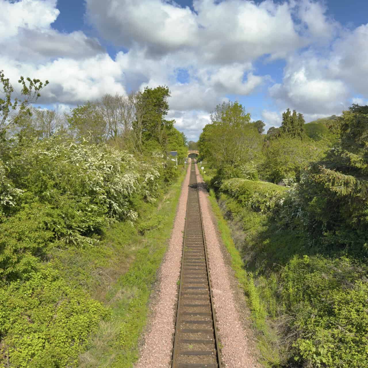
Beyond the coffee shop, the track leads me over a high bridge spanning the railway line. From the parapet I look north along the cutting, the single track running dead straight between dense hedgerows of hawthorn and trees in fresh leaf. In the distance I can pick out the next bridge and a glimpse of Great Ayton Station.
ADVERTISEMENT
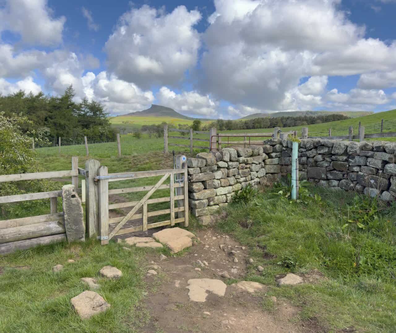
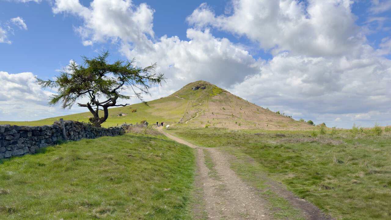
The bridleway climbs gradually up the flank of Round Hill, and when I pause to look back I’m treated to a fine view. A simple wooden gate set into a sturdy dry stone wall frames the scene perfectly, with the distinctive cone of Roseberry Topping rising above the fields and plantations in the distance.
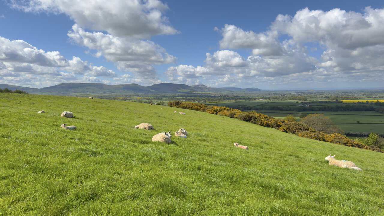
It isn’t long before I have gained enough height on my Great Ayton walk to enjoy good views south towards the Cleveland Hills. Sheep and lambs lie scattered across the grassy slope in front of me, with a line of yellow gorse running along the field edge. Beyond, the patchwork of fields rolls away to the long ridgeline of the hills on the horizon.
ADVERTISEMENT
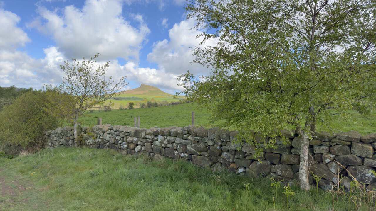
I stop for another look back at Roseberry Topping and its distinctive profile. The hill’s striking shape owes much to a partial collapse of the summit in 1912, caused by a geological fault and undermining from nearby ironstone and alum mining. Until then, the top resembled a rounded sugarloaf rather than the jagged half-cone seen today, framed here between two slender trees above a sturdy dry stone wall.
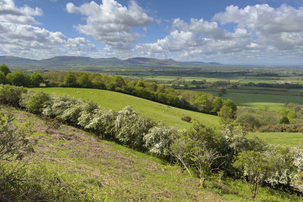
The countryside really starts to open out now, with sweeping views south towards the Cleveland Hills. From left to right, the four most distinctive summits on the horizon are Hasty Bank, Cold Moor, Cringle Moor and Carlton Bank, all linked by a fine ridge walk that I have enjoyed in the past. In the foreground, sheep graze on a gently sloping green field bordered by hedges of hawthorn in full bloom.
ADVERTISEMENT
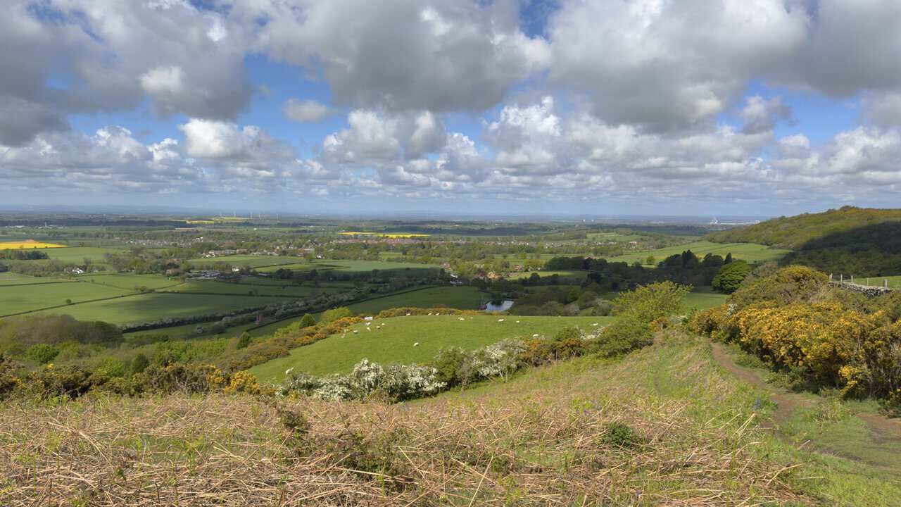
From the edge of Ayton Banks Wood, I glance over my right shoulder and look north-west across a wonderful sweep of countryside. The rooftops of Great Ayton sit comfortably among fields, hedgerows and clusters of trees, with sheep grazing on the slopes in the middle distance and gorse in full yellow bloom catching the light to my right. Further off, the built-up areas of Middlesbrough and Stockton-on-Tees can be made out across the wide green plain.
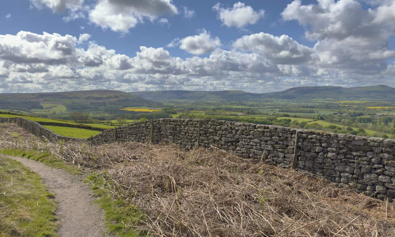
The bridleway leads me through more woodland before emerging again into open countryside, where another sweeping view opens up to the south. A sturdy dry stone wall on my right keeps me on track, although the path itself is clear enough to follow. Beyond a line of conifers, the familiar profile of the Cleveland Hills runs along the horizon, with fields of bright yellow oilseed rape adding a splash of colour to the rolling farmland below.
ADVERTISEMENT
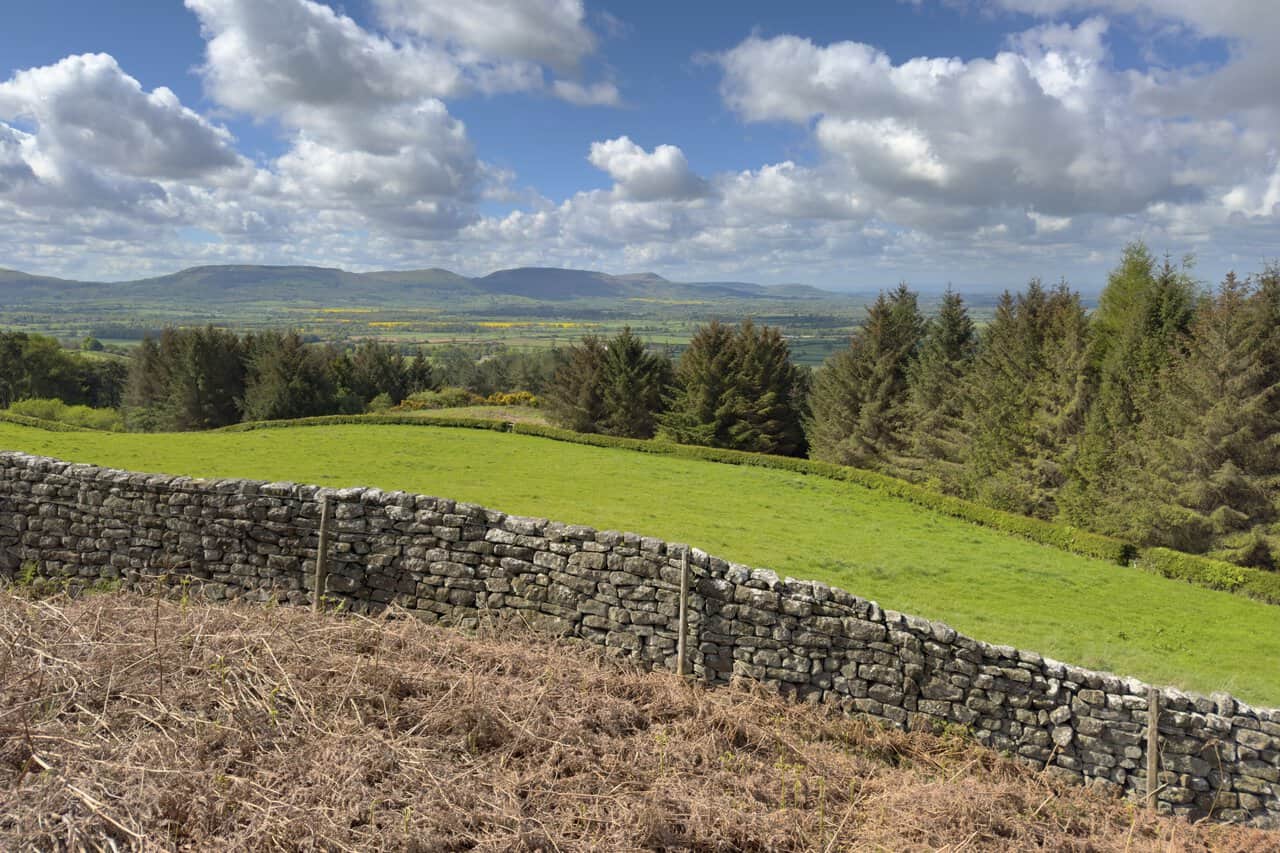
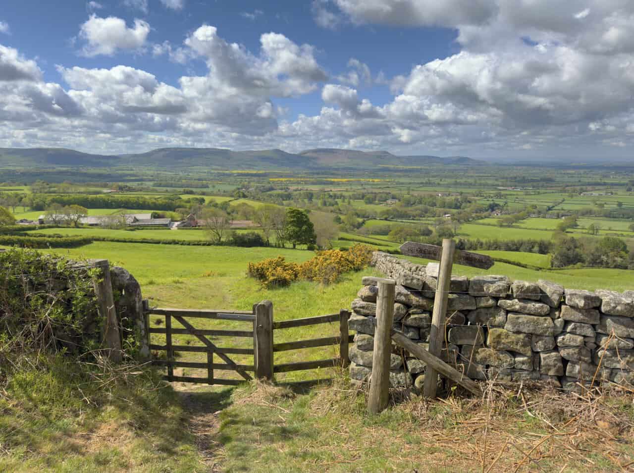
The bridleway continues south, with the dry stone wall now on my right and the Cleveland Hills filling the horizon ahead. They wrap around the lower land of Ingleby Greenhow and Greenhow Bottom, with Urra Moor and Greenhow Moor rising to the east of the flat-topped Hasty Bank. Urra Moor is crowned by Round Hill, the highest point on the North York Moors at 454 metres (1,490 feet).
A footpath drops away to the right from the bridleway, heading down through a wooden gate in the dry stone wall and on towards Borough Green Farm. It’s tempting, with another good view over the patchwork of fields and farmland to the Cleveland Hills beyond, but it isn’t the way I am going today. Instead, I follow the bridleway signpost and continue straight ahead.
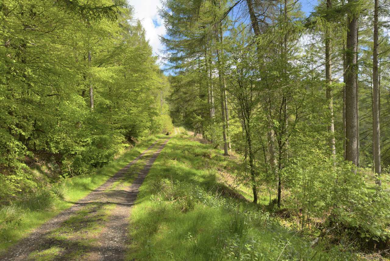
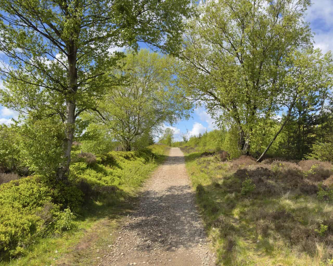
As I round the flanks of the hill below Easby Moor, the path leads me into the woodland of Mill Bank Wood. Here I follow a really delightful forestry track for about a mile, broad and easy to navigate, with light filtering down through the fresh green leaves of beech and the taller spires of conifer. It makes for a peaceful and shaded stretch of the route.
ADVERTISEMENT
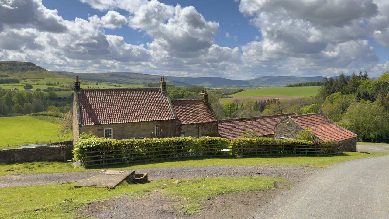
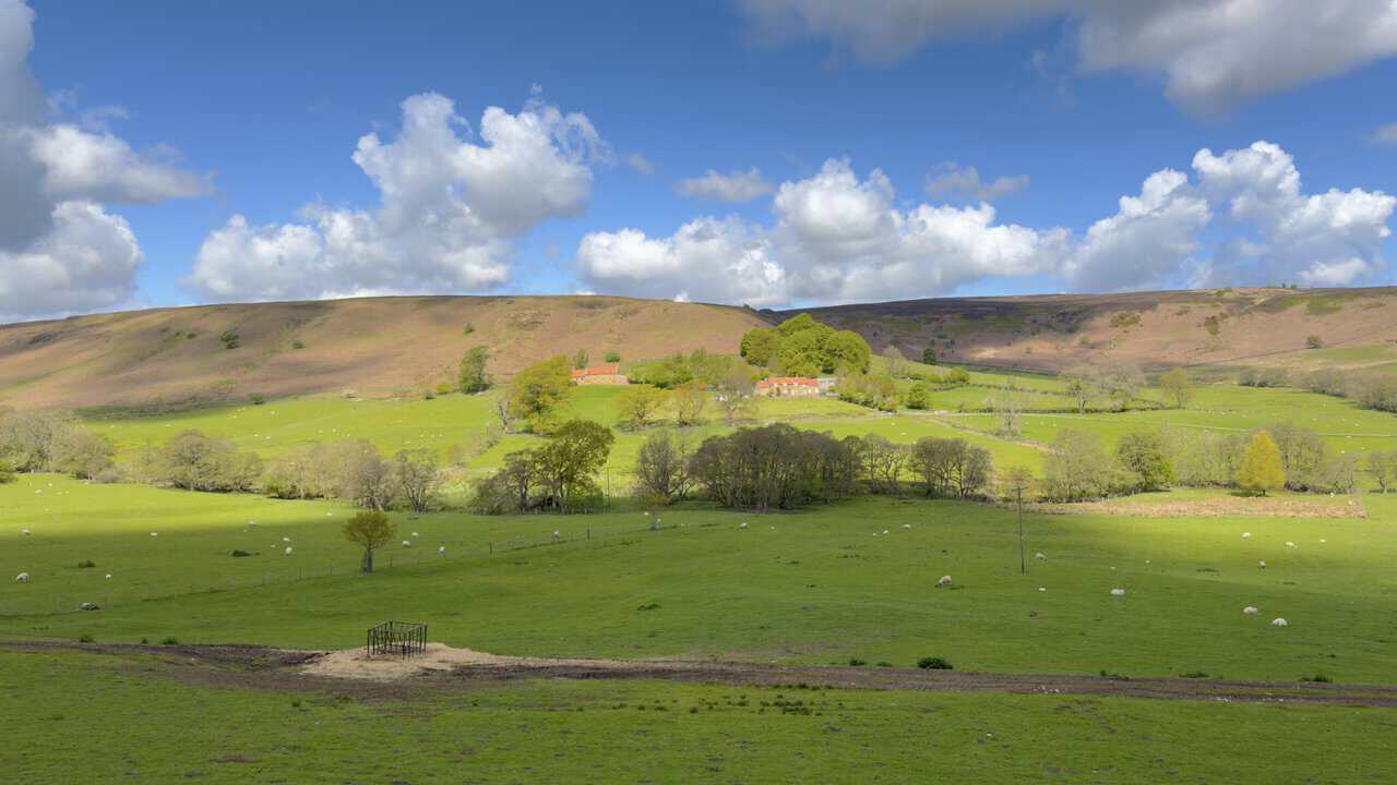
Leaving Mill Bank Wood, I join a tarmac lane that climbs gently uphill past Bankside Farm. The farmhouse and its outbuildings are a handsome sight, built from honey-coloured stone and topped with traditional red pantile roofs that stand out against the green of the surrounding fields. Beyond the farm, the Cleveland Hills form a fine backdrop, with Warren Moor, Battersby Moor, Ingleby Moor and Greenhow Moor stretching across the horizon.
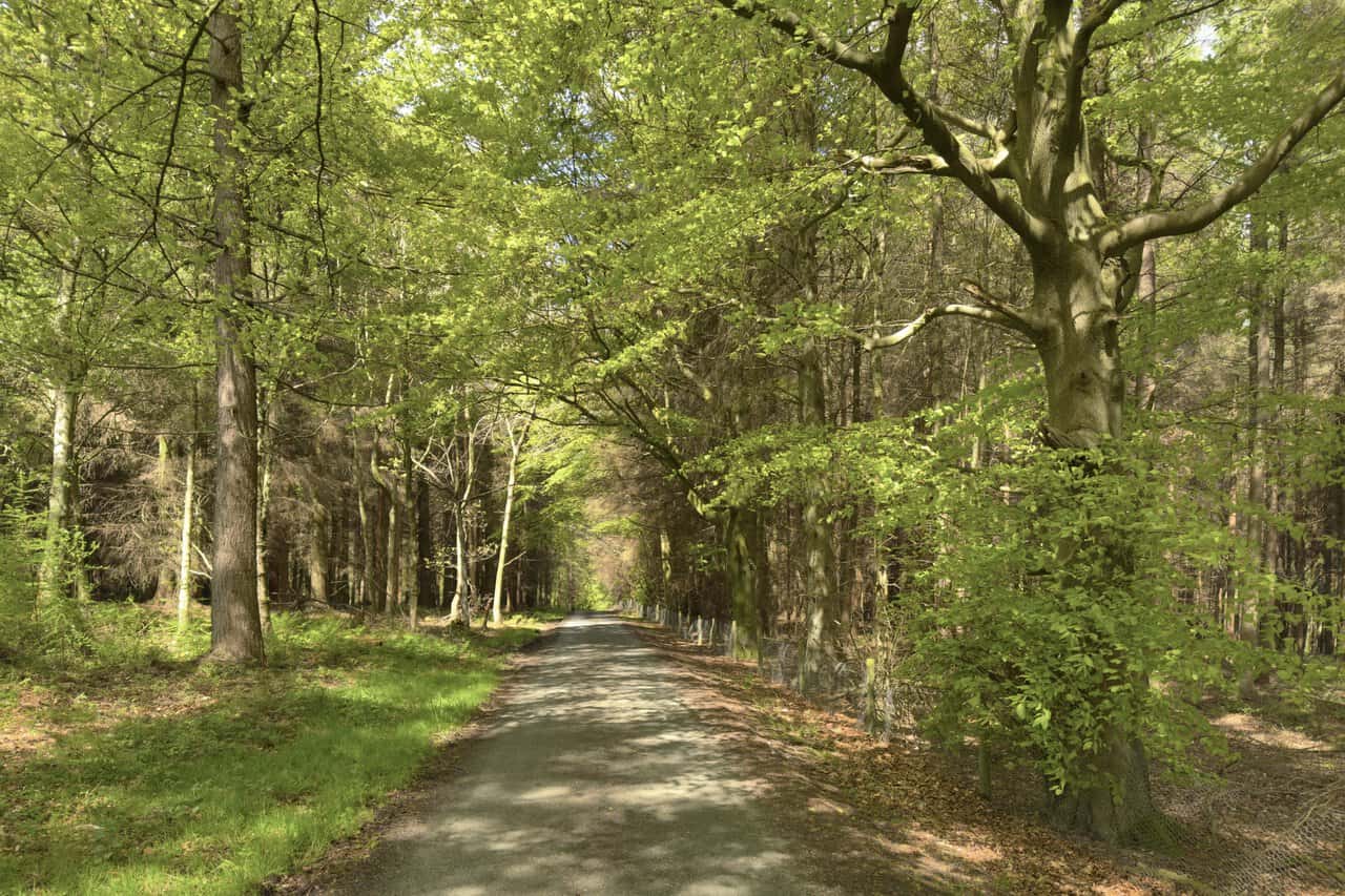
The lane climbs steadily uphill from Bankside Farm into Pale End Plantation, where it levels out beneath a fine canopy of mature trees. Sunlight filters through the fresh green leaves of beech and oak, dappling the quiet tarmac ahead. Once the lane flattens out at the top of the bank, it begins its descent again towards Lonsdale Farm.
As I make my way downhill towards Lonsdale Farm, I’m treated to wonderful views to my left. Oak Tree Farm stands out neatly against the rising backdrop of Great Ayton Moor, its stone buildings and red pantile roofs nestled among mature trees. Sheep graze contentedly across the green pastures in the foreground, with the heather-clad moorland sweeping up behind to meet a sky full of bright cloud.
ADVERTISEMENT
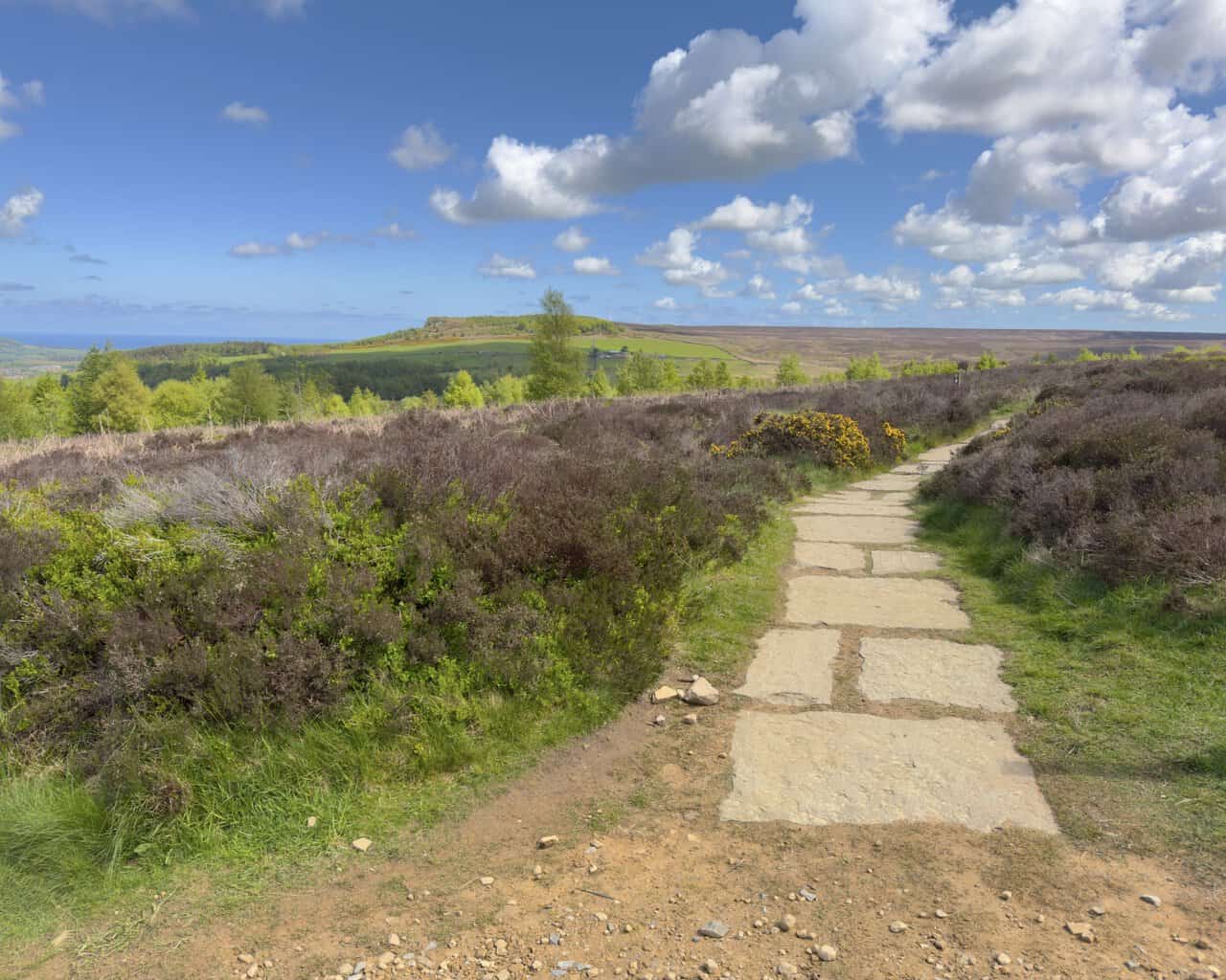
Having reached the lane on Percy Cross Rigg, I now make my way north-west along a stone track that strikes out across the sweeping moorland. The route here is a public bridleway, broad and well surfaced, and is a great option for cyclists as well as walkers. This open stretch makes for a real change of mood on my Great Ayton walk, with wide skies and uninterrupted moorland views in every direction.
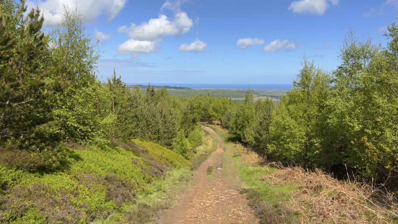
As I progress along the bridleway, I look north-east towards Highcliff Nab in the distance, a rocky outcrop visible above the trees. Highcliff Nab is a striking sandstone outcrop on the northern edge of the North York Moors, standing at around 310 metres above sea level and overlooking the market town of Guisborough. Beyond it, the patchwork of fields stretches away to the coast, where offshore wind turbines and the silvery line of the North Sea sit on the horizon.
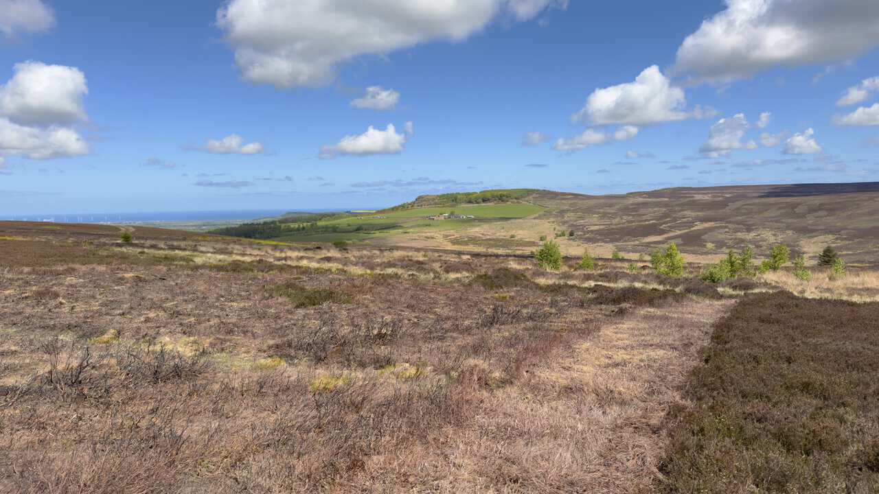
Looking directly north from the same bridleway, my eye is drawn out across the patchwork of farmland towards the North Sea. The turbines of Teesside Wind Farm, sitting off the coast at Redcar, are clearly visible on the horizon, while Highcliff Nab now appears a little more sharply defined as a rocky outcrop above the surrounding fields. Slightly further away lies the wooded ridge of Errington Wood, known locally as Marske Woods.
ADVERTISEMENT
As I cross Hutton Moor on the bridleway, I notice a footpath branching off to my right. This is the Cleveland Way National Trail heading off towards Highcliff Nab, but I’m not taking that route on this occasion. The path here is well laid with stone slabs, sensibly so given the heavy footfall the Cleveland Way attracts, with Highcliff Nab itself visible ahead as a small rocky bluff topped with trees.
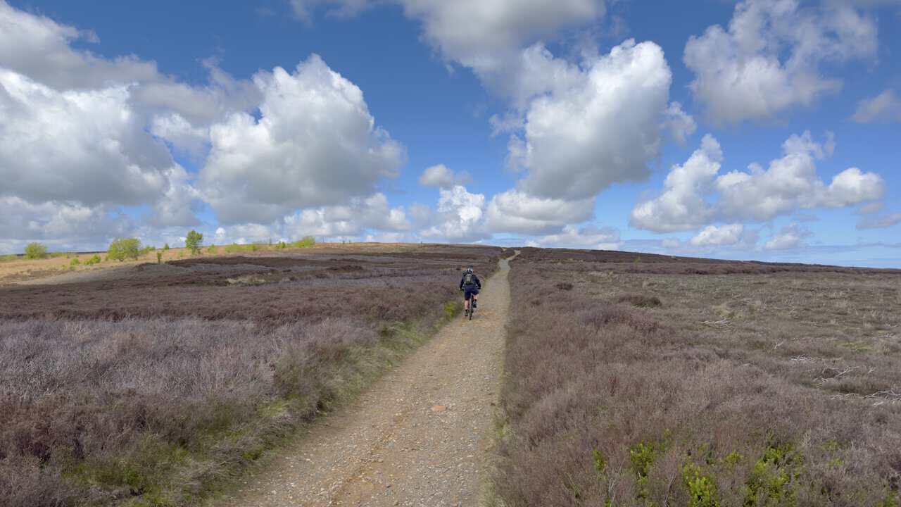
Joining the Cleveland Way National Trail, I now head west along a lovely stone track. The path runs fairly level here, lined with silver birch trees whose fresh green leaves catch the light against the heather and bilberry below. My next destination on this Great Ayton walk is Hanging Stone.
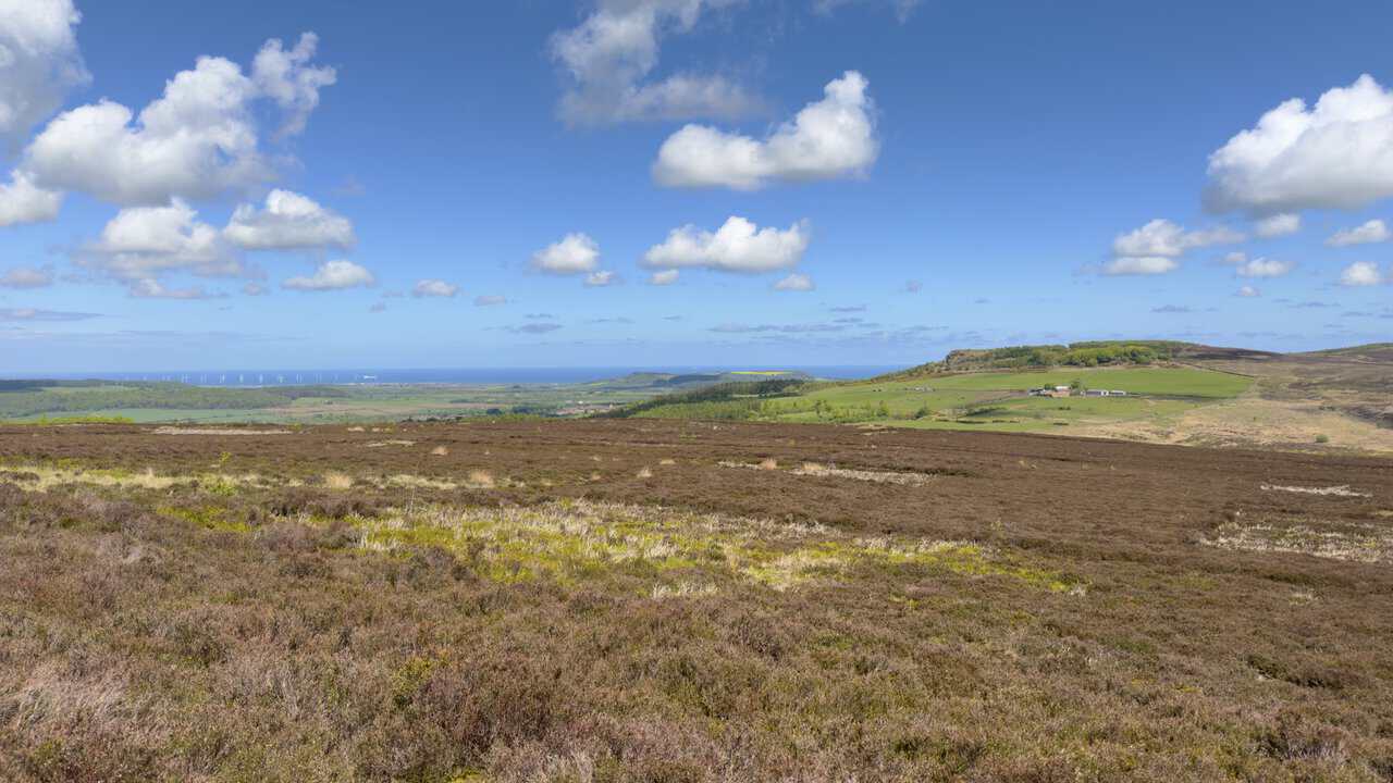
To reach Hanging Stone, I briefly leave the Cleveland Way National Trail and follow a track heading north and slightly downhill. The path winds gently between young conifers and birch trees, with a wonderful view opening up ahead towards the North Sea and the turbines of Teesside Wind Farm in the distance. It feels like a real change of scene, dropping away from the open moor into a more enclosed and sheltered stretch.
ADVERTISEMENT
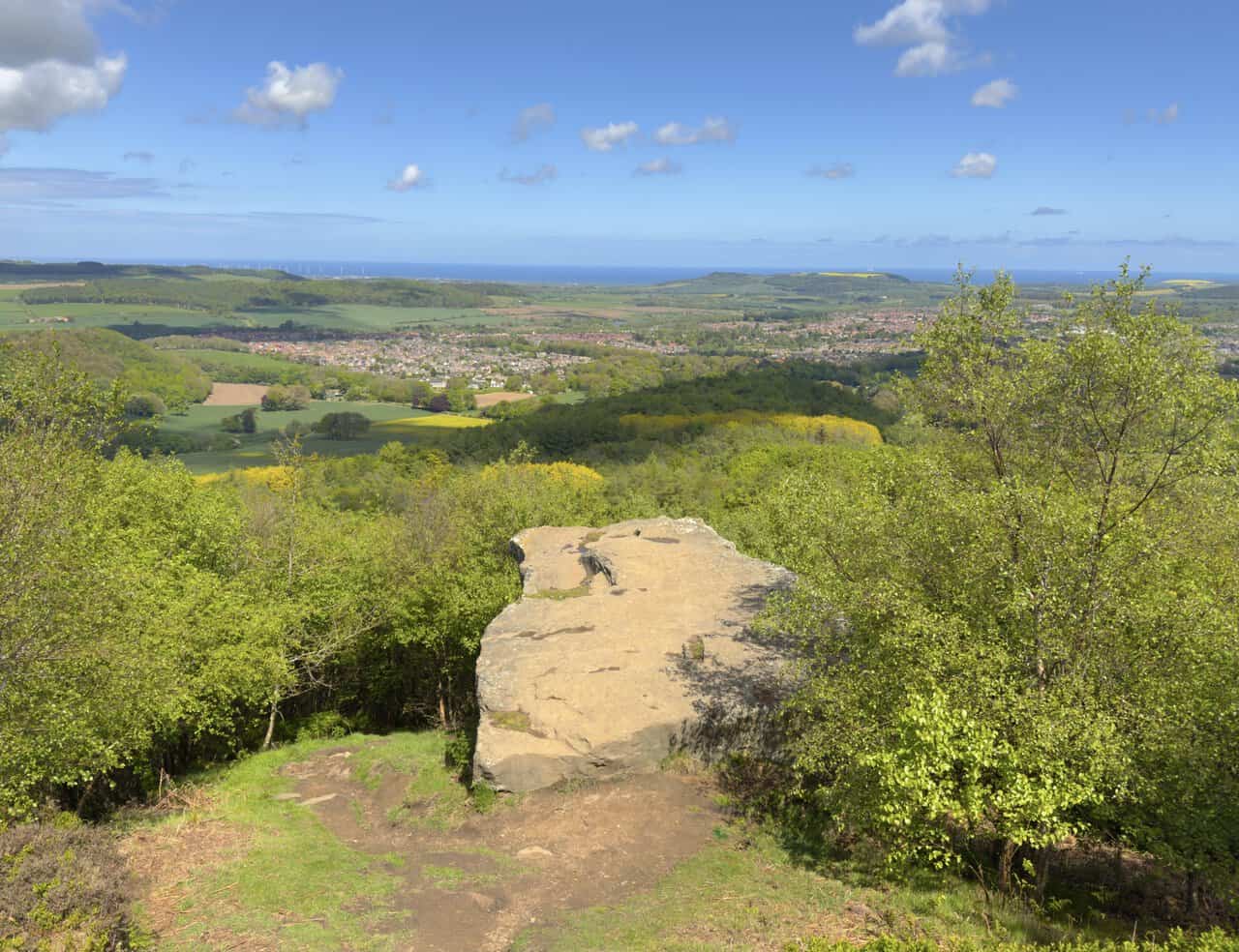
I emerge at Hanging Stone, a large sandstone outcrop perched dramatically on the edge of the escarpment with a sweeping outlook to the north. The flat-topped slab projects out from the steep wooded slope like a natural platform, offering an uninterrupted view across the rooftops of Guisborough below and onwards to the wooded ridges, fields and the distant North Sea. Thought to be part of an old quarry, Hanging Stone is one of several prominent viewpoints in the area believed to have held significance for our prehistoric ancestors, with nearby Bronze Age burial mounds suggesting a long history of human activity along this ridge.
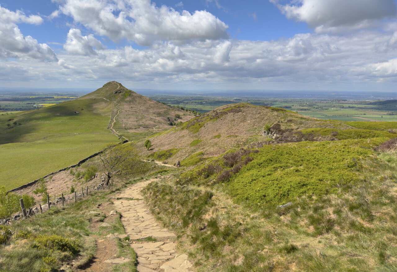
From Hanging Stone, I rejoin the Cleveland Way and make my way down a well-preserved stone conservation path. The route takes me along the left-hand side of Little Roseberry, with Roseberry Topping rising clearly ahead and its summit alive with walkers enjoying the views. This is by far the busiest stretch of my Great Ayton walk, with several other walkers visible along the path, but it’s easy to see why the area is so popular.
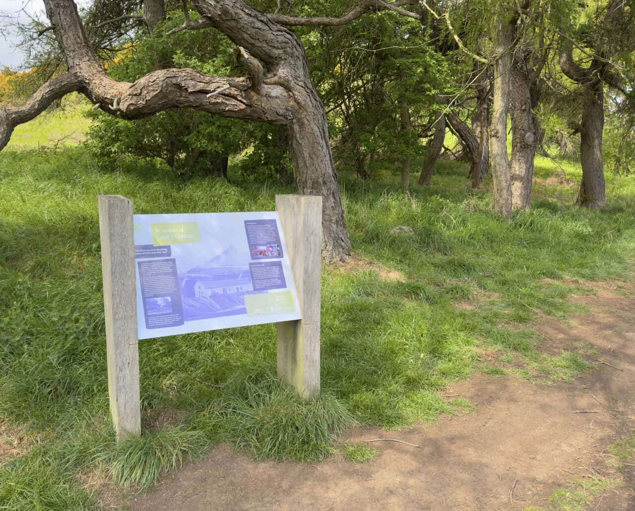
I follow the Cleveland Way across Roseberry Common in the direction of Roseberry Topping, the distinctive cone-shaped hill rising impressively ahead. A solitary larch tree leans away from the prevailing wind beside the dry stone wall on my left, framing the scene. I’m not climbing Roseberry Topping today, instead heading for the interpretation board where I’ll turn left through the gate and make my way towards Aireyholme Farm.
After passing Aireyholme Farm, I come to an interpretation board beside a group of larch trees on the northern edge of Cliff Ridge Wood. Titled “In search of Cook’s Cottage”, it explains how the family of the famous explorer Captain James Cook moved here from Marton in 1736 when his father, James Cook senior, was appointed manager of Aireyholme Farm by Thomas Skottowe. A photograph from the 1930s, taken at this very spot, shows the then tenant farmer William Martin standing in front of larch trees thought to mark the site of the Cook family cottage. Excavations carried out in 2015 by the Captain Cook and Great Ayton History Societies uncovered fragments of handmade bricks, roof tiles, stone and lime mortar, suggesting a building once stood here, although nothing found could prove conclusively that it was the Cook home. The board also notes how the wider landscape has changed since Cook’s time, with large-scale whinstone quarrying nearby only beginning after the railway arrived in 1864.
ADVERTISEMENT
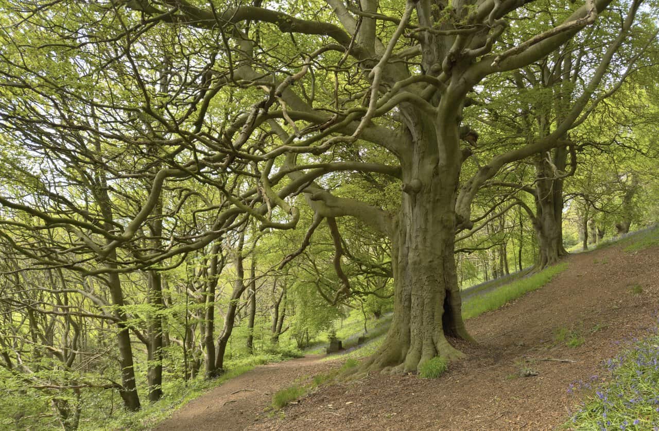
I descend along the path through Cliff Ridge Wood, where the woodland takes on a wonderfully timeless feel. A magnificent old beech tree stands beside the path, its thick trunk and gnarled, twisted branches arching out in all directions to form a striking canopy overhead. Bluebells carpet the slopes beneath, adding their delicate colour to a real highlight of my Great Ayton walk.
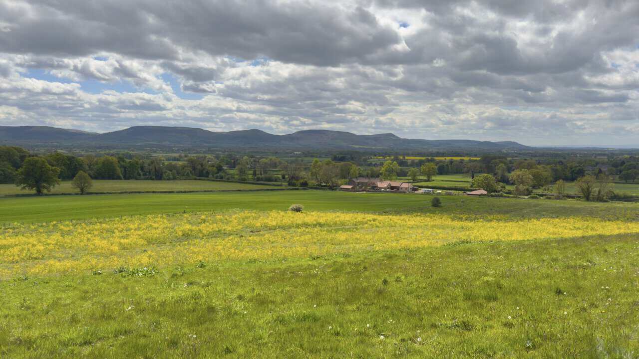
After leaving the wood, my route opens out once again into the rolling countryside of Rye Hill. The long ridgeline of the Cleveland Hills sits comfortably along the horizon, with a working farm tucked neatly into the patchwork of fields, hedgerows and mature trees in the middle distance. A swathe of wildflowers in the foreground adds a splash of bright yellow to the scene.
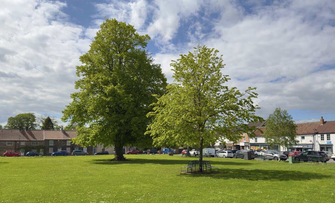
I return to Great Ayton and conclude my Great Ayton walk with a well-earned rest on one of the benches around the village green. Two fine mature trees stand at the heart of the green, with a circular bench wrapped around the base of the younger one, looking out across to the pubs, shops and traditional stone cottages that line the village. It’s the perfect spot to pause and reflect before heading off for some refreshments.
ADVERTISEMENT