ADVERTISEMENT
Viewpoints Towards Simon’s Seat and Lord’s Seat on the Trollers Gill Walk
Start your Trollers Gill walk from the large car park at Grimwith Reservoir. Standing in the car park and looking towards the water, you’ll see the toilet block over to your left. Head across to it, and behind it you’ll reach a tarmac road. Turn left here and walk past several farm buildings to join a stone track leading through a gate. Continue south along this track for a little under two-thirds of a mile to reach the B6265 main road.
Cross the road with care and take the track opposite. This isn’t the track leading through the gate into the field, but the one just to the left of it, running between the fields and enclosed by dry stone walls on both sides. Follow it straight ahead for just over half a mile to reach a minor road, part of the 688 cycle route and known as New Road.
Turn left when you reach New Road, and shortly afterwards take the public footpath on your right, signposted Skyreholme. As you pass Hell Hole Wood on your left, make a mental note of the first valley on your right, with a path running through it. This is the alternative way down if the Trollers Gill ravine is impassable after very heavy rainfall, although that is rarely the case.
ADVERTISEMENT
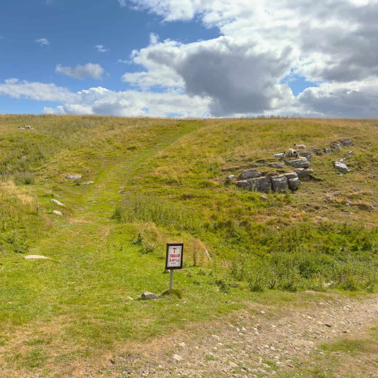
Continue until you meet a wider stone track and turn right. Follow the track until it bends sharply to the right, and at this bend carry straight on along the grassy path, slightly uphill, signposted Trollers Gill. The track bending away to the right is the one leading into that first valley you noted earlier. Follow the grassy footpath up and across Gill Heads, with waymarker arrows on wooden posts to guide you.
The ravine is the highlight of the Trollers Gill walk. Carry on down through two gates, cross Skyreholme Beck by the footbridge, then turn right, following the course of the beck downstream through the valley and into the rocky ravine for about half a mile. Unless there has been exceptionally heavy rain, the beck dries up partway along and continues its course underground. The route through the ravine is easy to follow and straightforward, though it is rocky and uneven underfoot, so take your time.
After emerging from the steep-sided ravine, continue straight ahead through the valley, still following the line of Skyreholme Beck. You’ll notice the beck resurfacing here, and you’ll rejoin the official public footpath, marked with yellow waymarker arrows. Continue along this valley footpath for another half a mile until you reach the minor road near the entrance to Parcevall Hall, then turn right.
Follow the road past Ghyll House Farm towards Middle Skyreholme. At the junction by Skyramgate Farmhouse, carry straight on rather than turning right. This tarmac road, called Skyreholme Bank, takes you all the way through High Skyreholme, passing several stone-built houses and other buildings on your right. There are fine views in the same direction towards Simon’s Seat and Lord’s Seat.
ADVERTISEMENT
The road climbs steeply out of the valley and becomes a stony track, where you’ll see a signpost for Stump Cross. A little further along, where the track splits, take the left-hand fork. This is Black Hill Road, and it forms the longest continuous stretch of the Trollers Gill walk, running north for just over one and a quarter miles. Keep to the main track as it descends and begins to curve to the right.
A little further on, where the track bends left towards the B6265, leave it and continue straight ahead on the grassy path instead. This runs parallel to the dry stone wall and the main road, both on your left. Follow it for about a quarter of a mile until you reach a gate on your left in the wall. Go through the gate and cross the main road to a small clearing, often used as a car park, and turn left onto the public footpath signposted to Grimwith Reservoir.
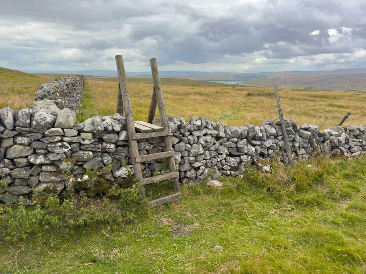
Follow the grassy footpath uphill, heading for the rocky outcrops of Nursery Knot. Walk past them and cross the dry stone wall by the stile, and Grimwith Reservoir comes into view in the distance. Stick to the grassy path running diagonally across the field, then follow it alongside a dry stone wall on your left, with the reservoir opening up more fully as you descend. Soon afterwards you’ll reach a wooden signpost, where you turn left, cross the wall and follow the path across the heather moorland. More signposts guide you from here, and after half a mile you’ll reach the stone track encircling the reservoir. Turn left, head towards the thatched building known as Grimwith High Laithe, and immediately after it turn right onto the Yorkshire Water permissive waterside footpath. Follow this for about two-thirds of a mile back to the car park, to finish your Trollers Gill walk.
Trollers Gill Walk: Maps and Tools
Visit either the OS Maps website or the Outdooractive website to view this walking route in greater detail. Both platforms offer a range of features, including the ability to print the route, download it to your device, and export the route as a GPX file. You can also watch a 3D fly-over and share the route on social media. Plus there is a supporting video, available for you to watch on YouTube.
Trollers Gill Walk: Distance, Duration, Statistics
Distance: 7½ miles
Distance: 12 kilometres
Duration: 3¾ hours
Ascent: 1146 feet
Ascent: 349 metres
Type: Circular walk
ADVERTISEMENT
Recommended Ordnance Survey Map
The best map to use on this walk is the Ordnance Survey map of the Yorkshire Dales Southern & Western Area, reference OS Explorer OL2, scale 1:25,000. It clearly displays footpaths, rights of way, open access land and vegetation on the ground, making it ideal for walking, running and hiking. The map can be purchased from Amazon in either a standard, paper version or a weatherproof, laminated version, as shown below.
Standard Version
Yorkshire Dales Walking Guidebooks
Walking in the Yorkshire Dales: South and West, by Jan and Dennis Kelsall, describes 44 circular day walks of 3.5 to 13 miles across Wharfedale, Littondale, Malhamdale, Dentdale and Ribblesdale, plus the Yorkshire Three Peaks Challenge, with Ordnance Survey mapping and notes on parking and refreshments.
Short Walks Yorkshire Dales, by Rachel Crolla and Carl McKeating, covers the area around Grassington, Skipton, Malham and Ilkley. Its 15 routes of 2.5 to 6 miles each take under three hours, ideal for families or a relaxed half day out. Both books can be purchased from Amazon, as shown below.
Walking the Yorkshire Dales
About Trollers Gill
Trollers Gill is a narrow limestone gorge in the Yorkshire Dales, close to the hamlet of Skyreholme and a few miles south-east of Grassington. It runs for about half a mile and is also known as Trollerdale. Despite sitting only a short distance from far busier parts of Wharfedale, it remains a quiet and rather secretive place, which is part of what makes the Trollers Gill walk such a rewarding day out.
The name is a good deal older than the spelling suggests. It combines the Old Norse word for troll with a term meaning backside, a word commonly applied to a rounded, buttock-shaped hill, and the present form was first recorded as recently as 1812. A survey from the reign of Edward II lists the gorge under an entirely different name, Gordale in Appletreewick. Scandinavian settlement across this part of Yorkshire has left its mark on many local names, and this is one of the more memorable examples.
The geology explains much of the drama. Skyreholme Beck flows through the gorge, although for most of the year the bed is dry and the water travels underground instead. The beck is a continuation of Dry Gill, an intermittent stream emerging from the Stump Cross Caverns system about a mile and a half to the north-east. Geologists believe the upper part of the gorge was once a cave whose roof collapsed, which accounts for the sheer walls rising on either side of a floor strewn with fallen rock. Several caves open off the gill, the largest being the pothole known as Hell Hole, some 55 metres deep with around 210 metres of passages, first explored in 1896.
Related Walk: Similar to the Trollers Gill Walk
Following the River Wharfe through the Yorkshire Dales on this Hebden walk
This is old mining country too. Lead was worked in and around the gill, and the site later produced fluorspar, with the nearby Gill Heads workings among the last underground mines operating anywhere in the Dales. Anyone doing the Trollers Gill walk will notice the pale spoil heaps and grassed-over levels scattered across the hillsides, a reminder of an industry that shaped these valleys for well over two centuries.
Folklore has attached itself to the place for generations. Trolls were said to live in the gorge and to push stones down the steep sides onto anyone passing below, while the gill is also known as the haunt of the barghest, a monstrous black dog said to turn onlookers to stone with a single glance. It has often been suggested that this legend influenced Sir Arthur Conan Doyle when he wrote The Hound of the Baskervilles, though the connection is a matter of local tradition rather than settled fact. The children’s television series Roger and the Rottentrolls borrowed the name for its setting, although the filming actually took place at Brimham Rocks nearby.
For walkers, the practical point is simple enough. In normal conditions the dry bed makes for slow but straightforward going, with loose rock underfoot and no scrambling required. After heavy or prolonged rain the underground channels cannot cope, water returns to the surface, and the gorge becomes genuinely hazardous. On those days the parallel valley to the west offers a safe alternative, and the Trollers Gill walk can still be completed in full.
Trollers Gill Walk: My Photos
Leaving Grimwith Reservoir on the stone track heading south, I glance back over my right shoulder and the water is already opening out behind me. Sunlight catches the grassy embankment, picking it out against the darker moorland beyond. It is a promising start to the Trollers Gill walk.
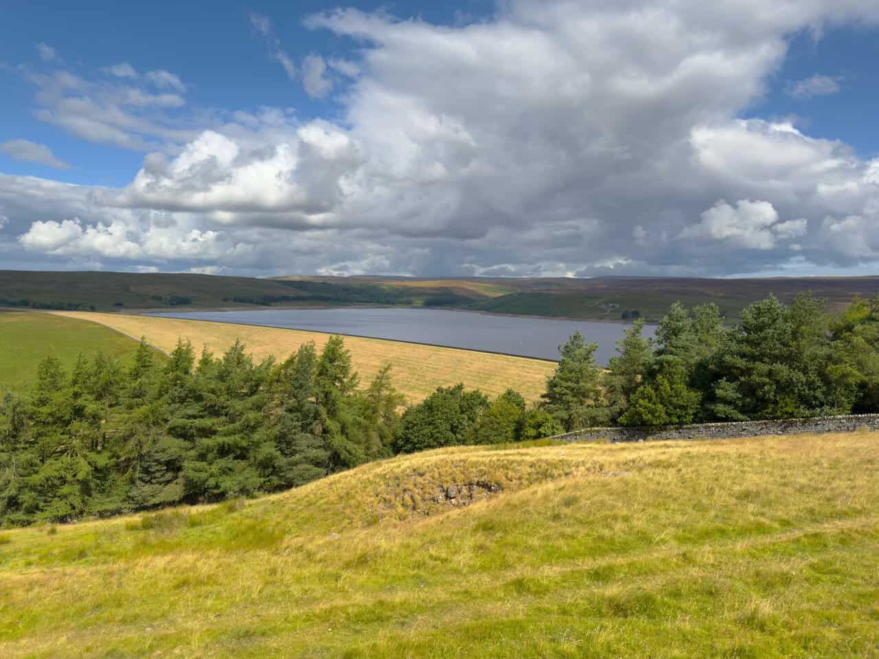
A little higher along the same track, the full length of the reservoir comes into view. The first dam here was built by Bradford Corporation between 1856 and 1864, and the reservoir was greatly enlarged in the 1980s to become the largest that Yorkshire Water owns in terms of storage. The light keeps shifting across the fells, lifting one stretch of ground and then another as the cloud moves through.
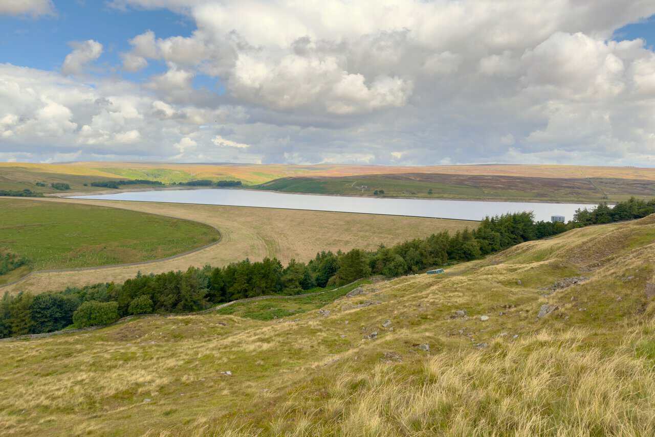
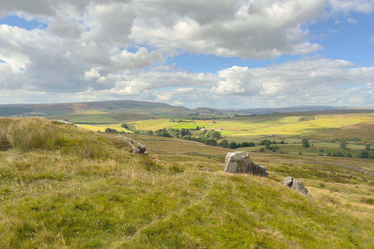
Looking south-west as I climb, the hills of Wharfedale fill the distance. Burnsall and Thorpe Fell forms the long, dark ridge across the skyline, with Stebden Hill and Elbolton alongside it, the pointed one and the rounded one sitting above the patchwork of walled fields.
After crossing the B6265 I join a lovely walled track heading south, the grass down the middle of it flanked by thistles and dry stone walls on either side. Simon’s Seat and Lord’s Seat sit on the horizon ahead, still a long way off at this stage.
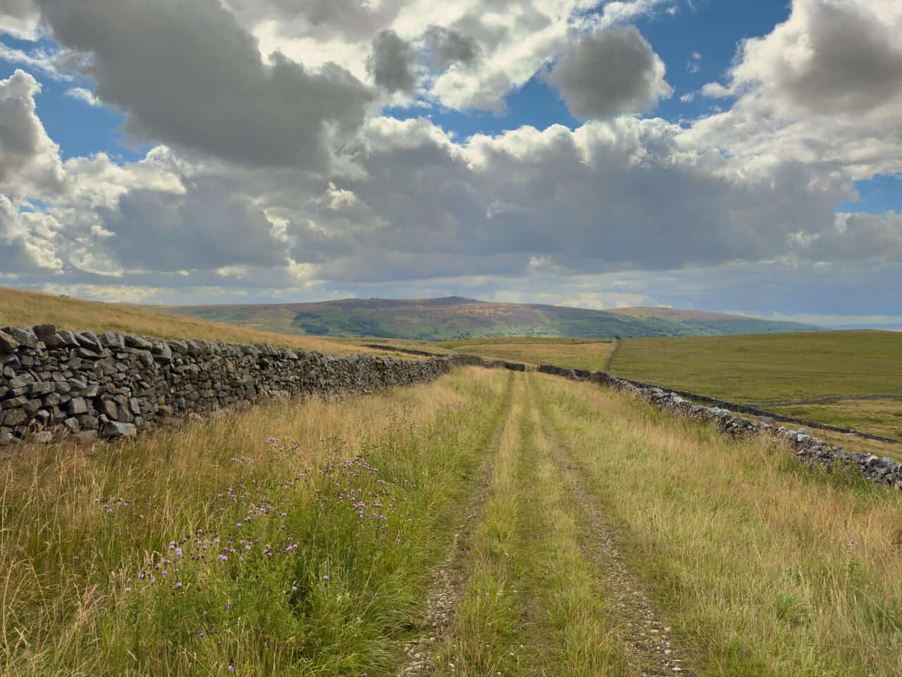
I carry on south along the track. The sun breaks through and lights up the north-facing slopes of Barden Fell, bringing out the browns and greens of the moor beneath a sky full of moving cloud.
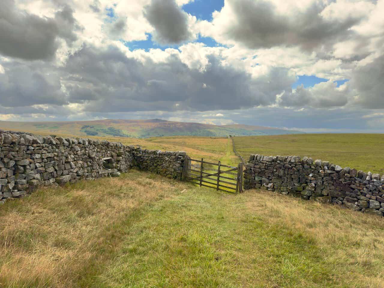
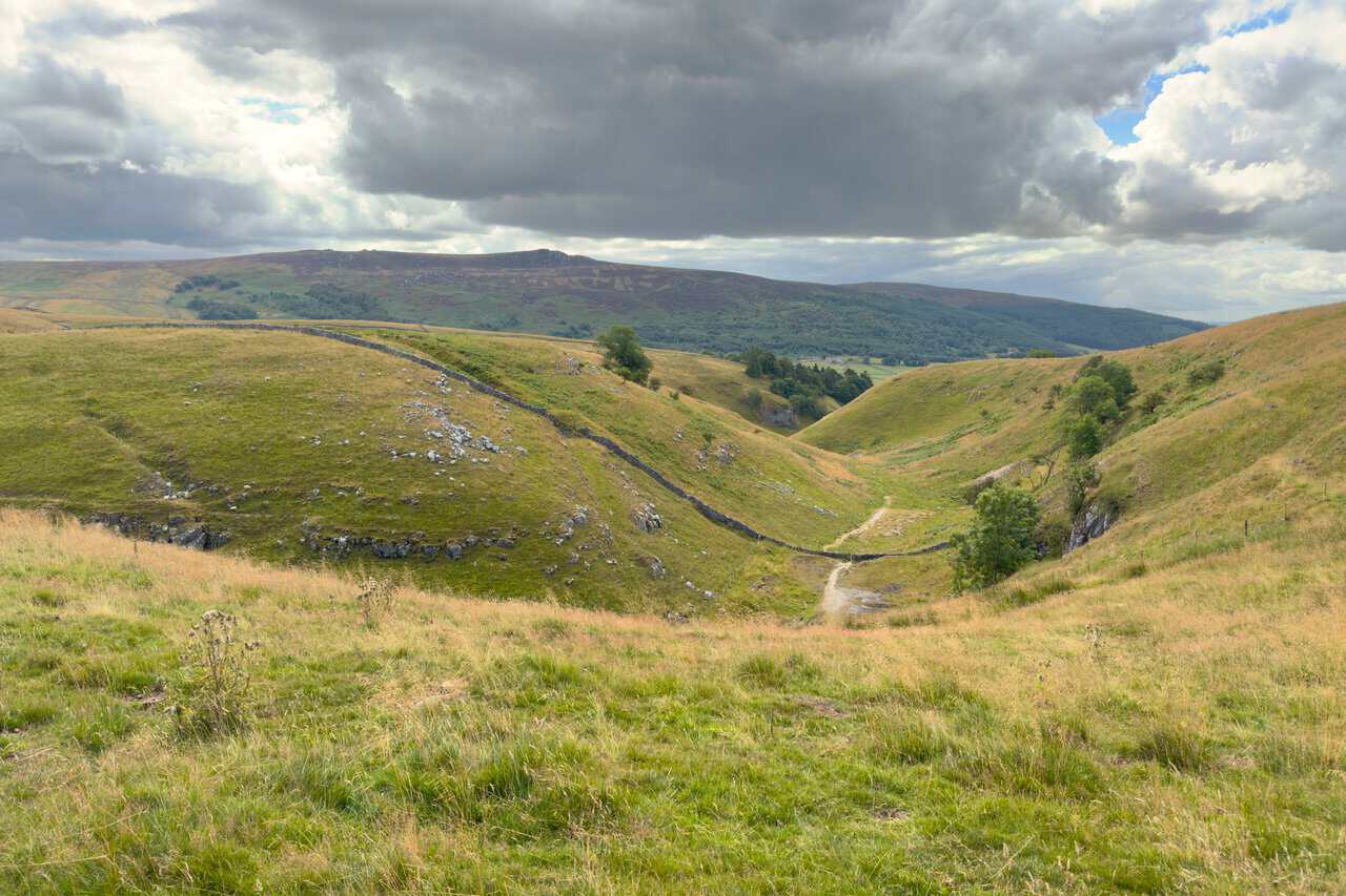
Passing Hell Hole Wood on my left, I make a mental note of the first valley on my right, with a path running through it. This is the alternative route if the ravine cannot be tackled, and it is worth knowing about before committing to the gill. After prolonged heavy rain, water that would normally sink underground stays on the surface, and the narrow floor of the ravine can hold standing water that makes the rocky footing slippery and awkward. In those conditions this valley offers a safe way down to Skyreholme, rejoining the main route lower in the dale, so the circuit can still be completed without a long retreat.
I follow the track until it bends sharply to the right, and at this bend carry straight on along the grassy path, slightly uphill, where a small hand-painted sign points the way to Troller Ghyll. Sheep are settled on the limestone outcrops to the right, and waymarker arrows on wooden posts lead the way up and across Gill Heads.
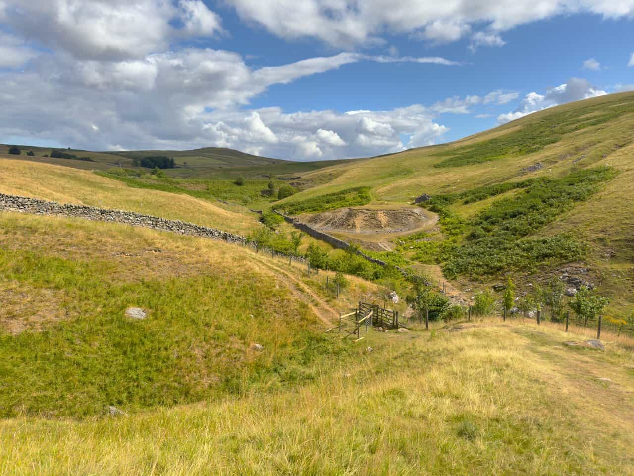
From the top of Gill Heads the ground falls away into the valley below, with the bare, pale scar of the old mine workings clearly visible on the far side. Lead was worked here from around 1700 until the turn of the twentieth century, and the site reopened in the 1920s for fluorspar, staying in production until the early 1980s and outlasting every other underground mine in the Dales. I drop down through two gates, cross the footbridge and turn right to begin my journey down the valley.
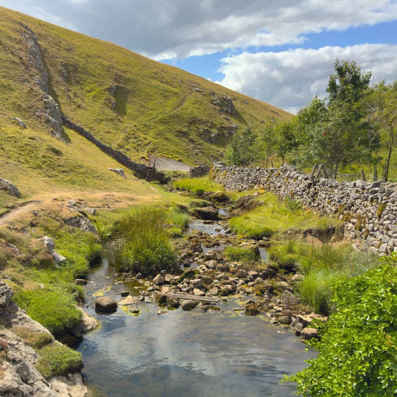
Here at the head of the valley the beck still has water in it, threading between rushes and rounded stones with a stone barn and dry stone walls above. The hillsides are steepening on both sides, and the first ribs of limestone are already breaking through the grass. It feels ordinary enough at this point, which makes what follows all the more striking.
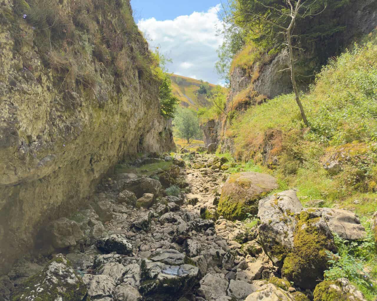
A little further down the character changes completely. The water has almost gone, and the bed of the Trollers Gill walk route is now a wide jumble of dry, bleached stones, with the path running along a grassy shelf on the left. The stream, which rises from the cave system near Stump Cross, sinks underground as it enters the ravine and leaves the channel dry for the whole length of the gorge.
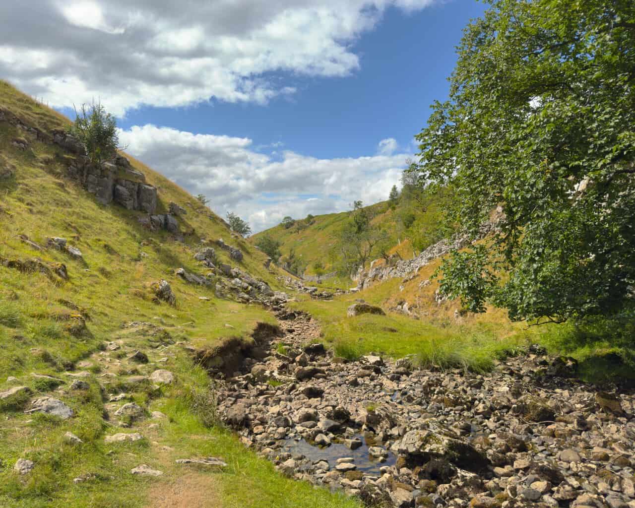
The valley narrows and the walls close in, grey limestone cliffs rising on the right above a rough channel of loose rock. Wind-shaped trees cling on wherever they can find a crack to root in. The path is still walkable here, though the footing needs attention.
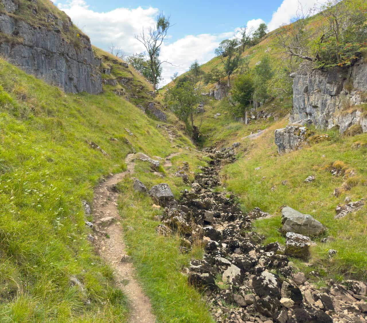
Deeper in, the sides become sheer and the light drops away. Overhanging rock forms shallow cave-like recesses at the base of the cliff, and the floor is a chaos of moss-covered boulders. It is easy to see why our ancestors gave this place a wide berth and filled it with trolls said to roll stones down onto anyone passing below.
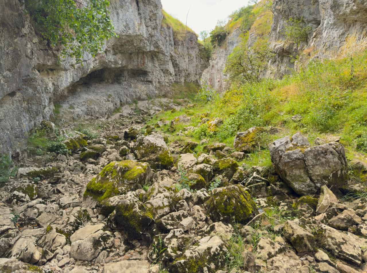
This is the heart of the gorge, with walls rising steeply on both sides and two climbers at work on the rock to my right, one on the face and the other below holding the ropes. Half a mile long and with cliffs reaching around sixty feet in places, this is also the supposed haunt of the barguest, a spectral black hound with eyes the size of saucers, which some believe helped inspire The Hound of the Baskervilles. The pair of them give a fair sense of the scale of the place.
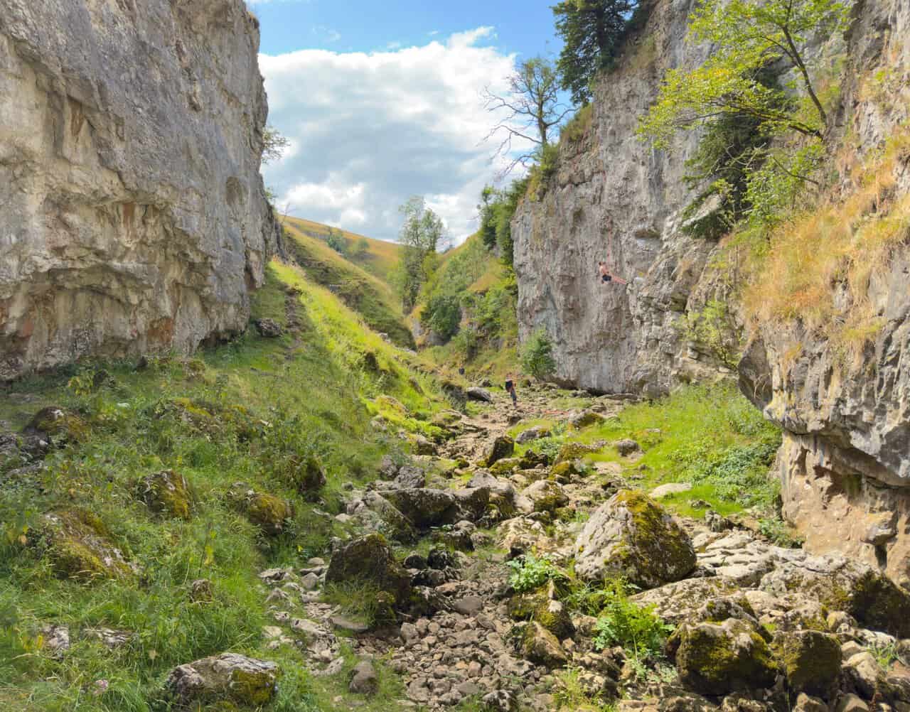
The last stretch of the ravine keeps its narrow feel, with grey walls on the left and boulders scattered across the bed. Progress is slow and deliberate over the uneven rock, but the way through is never in doubt. The Trollers Gill walk opens out shortly after this, and the beck reappears among the stones further down the valley.
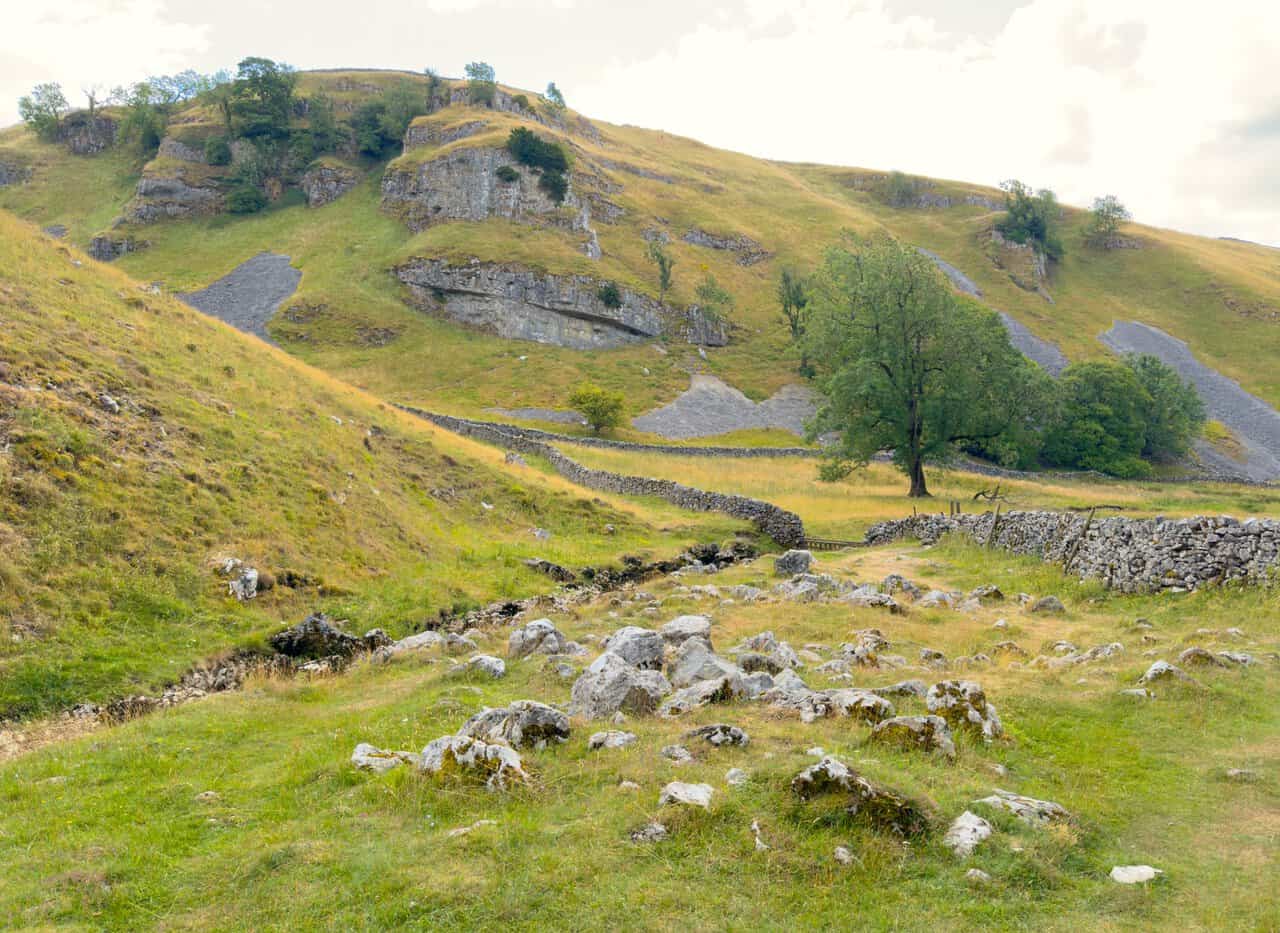
Out of the ravine now, the valley opens up and the scale of the limestone becomes easier to appreciate. Old Man’s Scar rises across the far side, its pale crags broken by long grey runs of scree spilling down between them, with a solitary tree standing out on the flat ground below. Beneath my feet the beck is still hidden, its course marked only by a scatter of bleached boulders in the grass.
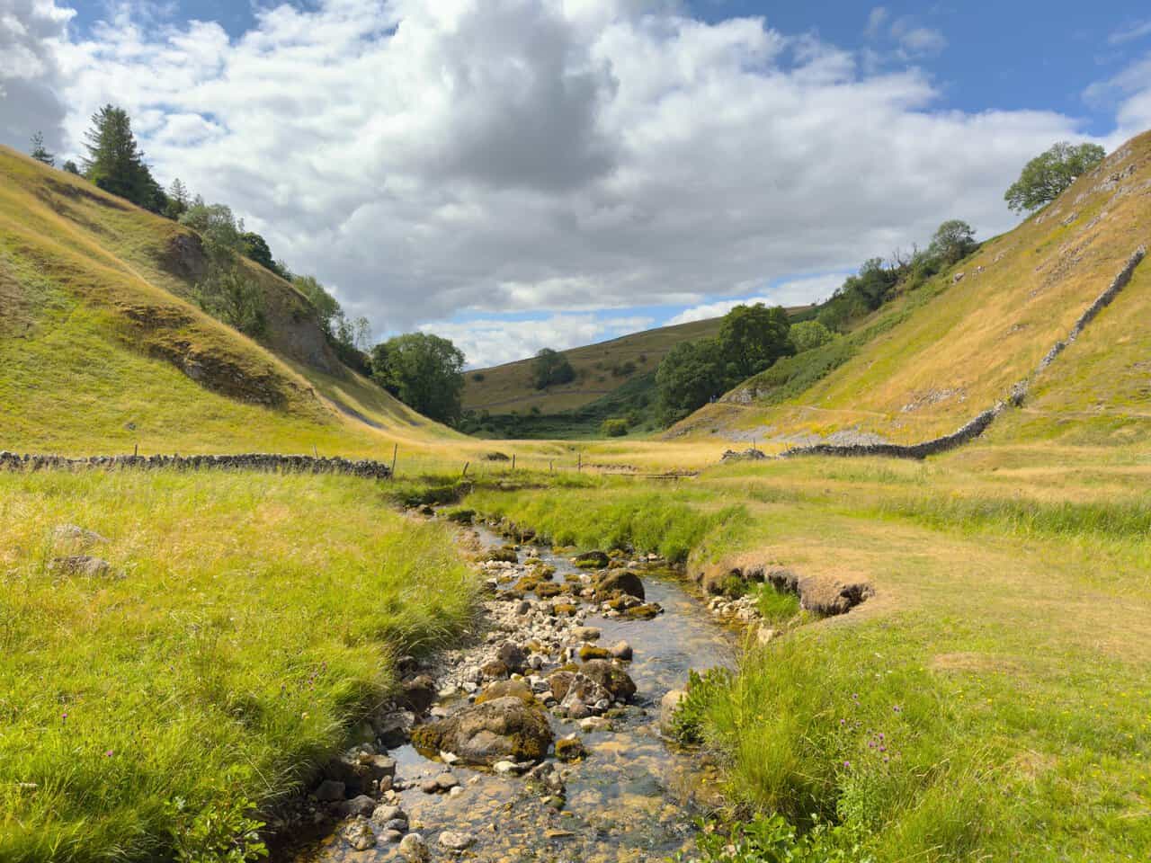
A little further down, the water reappears. Skyreholme Beck resurfaces among the stones and runs clear and shallow between grassy banks, having travelled unseen beneath the whole length of the gorge. The valley here is wide and green, with steep flanks on either side and the moor rising gently ahead.
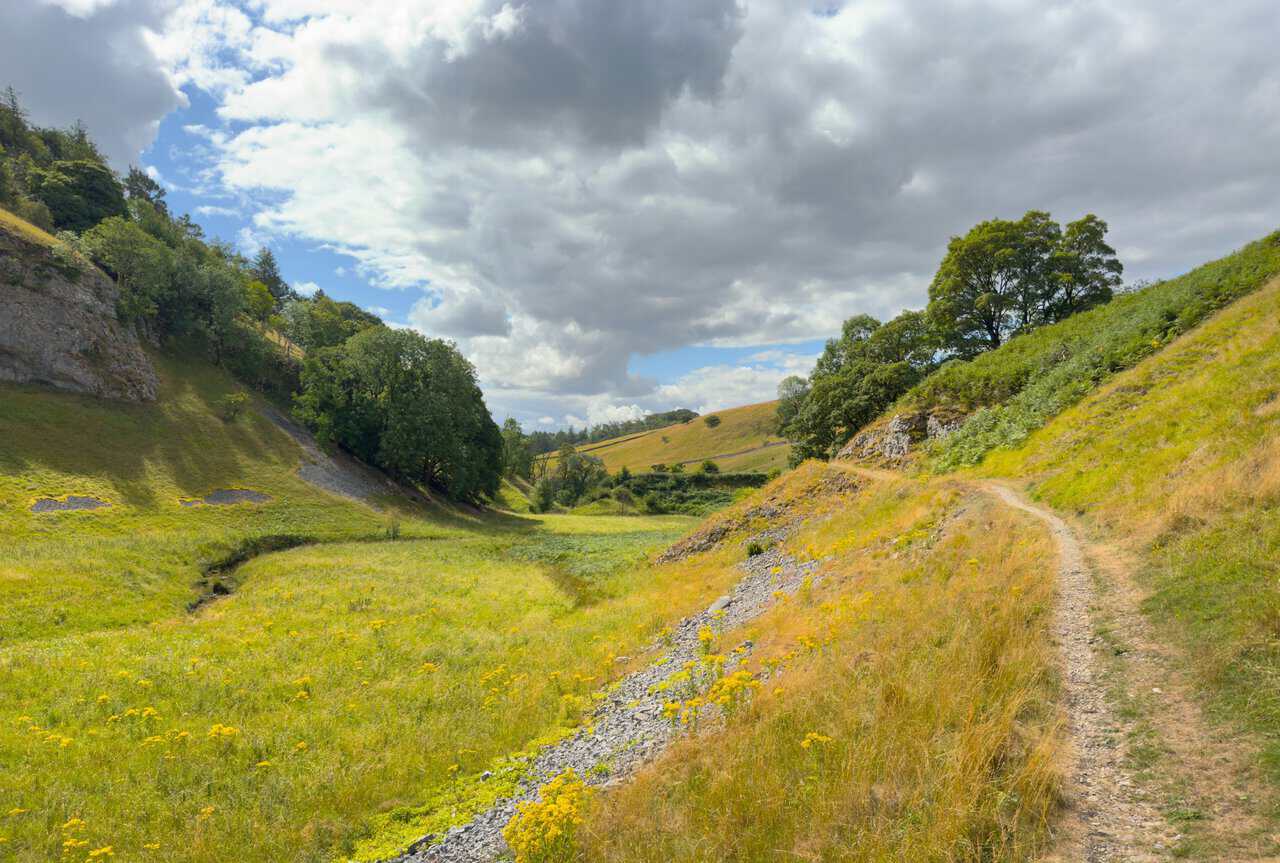
The path lifts onto the right-hand side of the valley and I follow it easily downstream, ragwort flowering bright yellow along the old spoil beside it. Trees gather in the bottom where the ground levels out, and the walled fields of Skyreholme come into view in the distance. After the enclosed gloom of the ravine, this is a gentle and welcome stretch of my Trollers Gill walk.
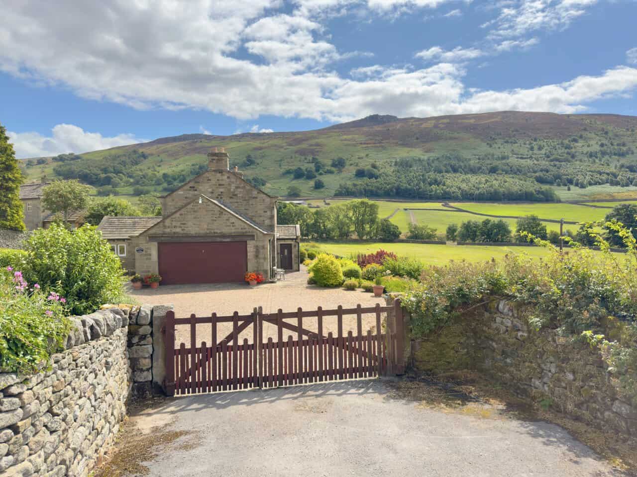
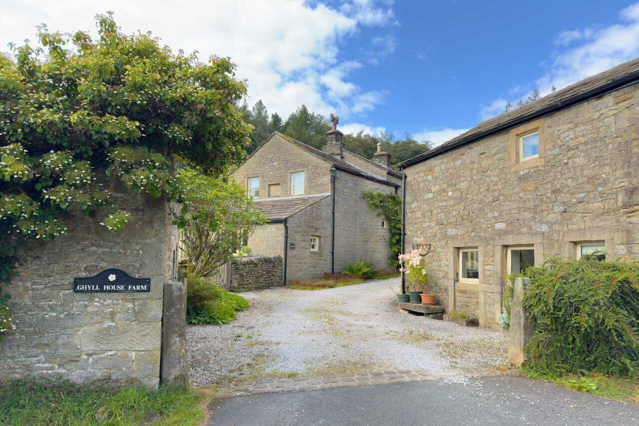
The valley path meets the road near the entrance to Parcevall Hall, whose gardens were laid out in the early twentieth century, and shortly afterwards I pass Ghyll House Farm, where a neat cluster of stone buildings sits behind a name plate set into the wall. Climbing shrubs spill over the gateway and the gravel yard runs between the old farmhouse and a converted barn, with woodland rising behind. It is a quiet, well-kept corner of Skyreholme.
Walking up through High Skyreholme there are lovely stone houses on my right, and the views in that direction are the best of the day so far. Across the fields the long moorland ridge of Lord’s Seat and Simon’s Seat fills the skyline, its heather turning purple-brown against the green pastures below.
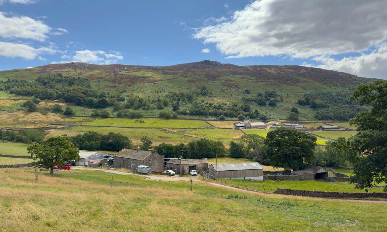
Further up Skyreholme Bank the view keeps improving as the road climbs. Looking back and across, a working farm sits below the fellside with its barns and yard spread out along the lane, and Simon’s Seat rises behind, the gritstone tor just visible on the top. The steep pull out of the valley is worth it for this alone.
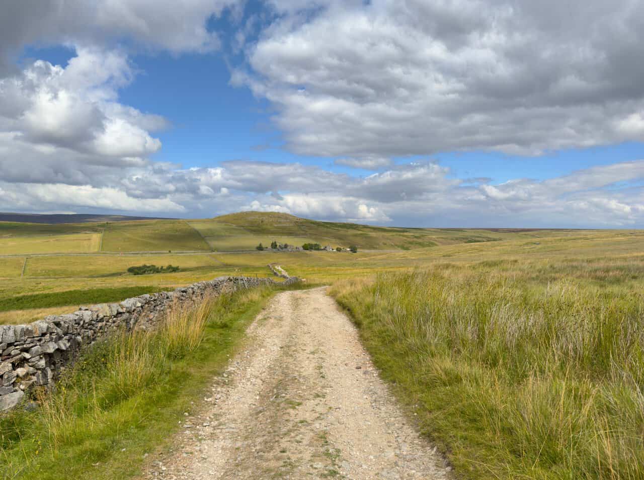
The tarmac gives way to a stony track and I settle into the long stretch of Black Hill Road. It runs north for well over a mile between dry stone walls and rough moorland grass, with the rounded hill of Nursery Knot standing out ahead in the distance, which I will pass later on my Trollers Gill walk.
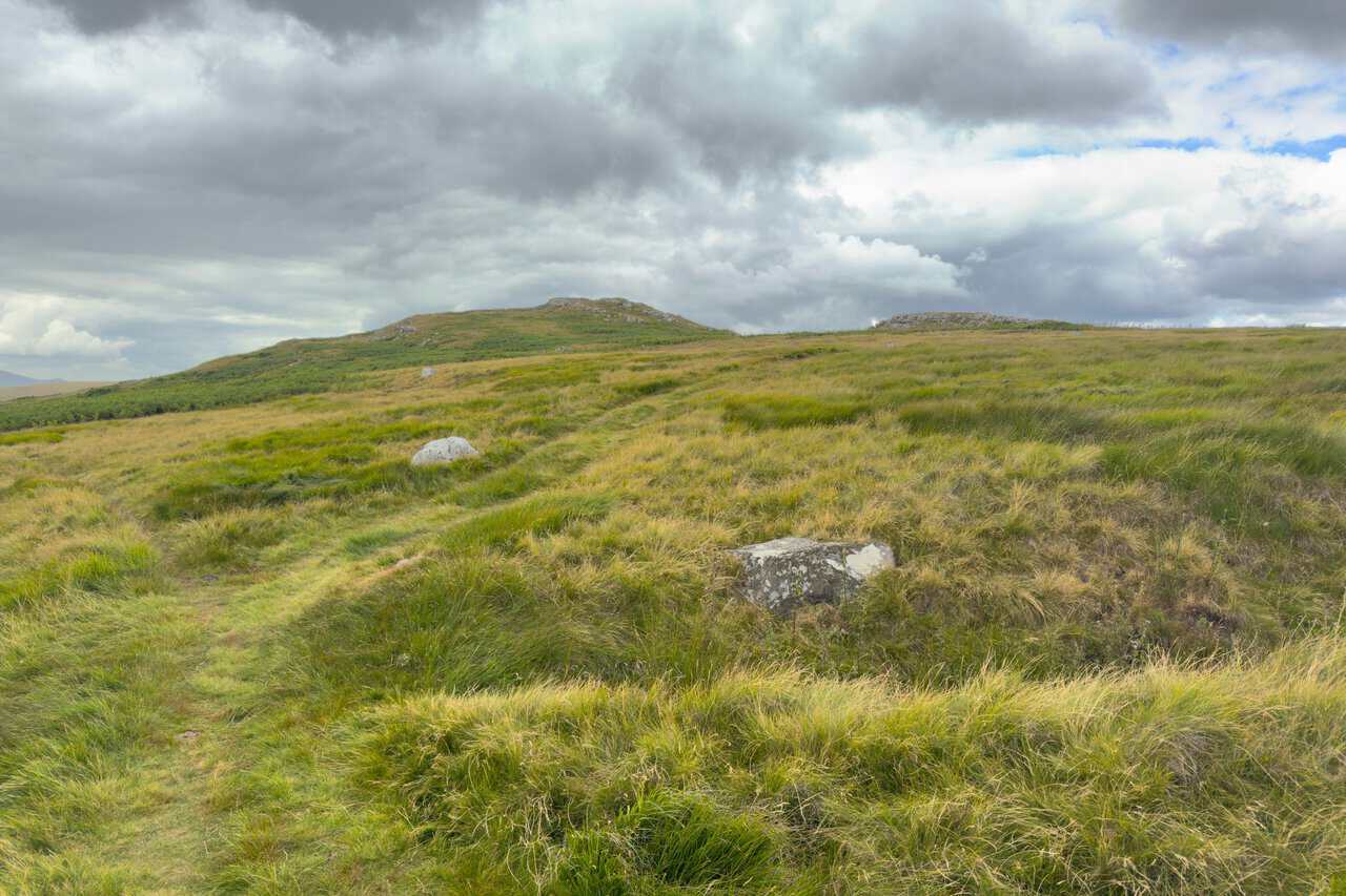
After crossing the main road I take the public footpath signposted to Grimwith Reservoir and follow the grassy path uphill. The way is faint but clear enough, threading between tussocks of moor grass with pale limestone boulders scattered about, and the rocky crest of Nursery Knot rising just ahead under a heavy sky.
Past the outcrops, a wooden stile takes me over the dry stone wall and the ground opens out completely. Grimwith Reservoir appears in the distance, a pale sheet of water lying low among the moors, with the fells of Nidderdale beyond.
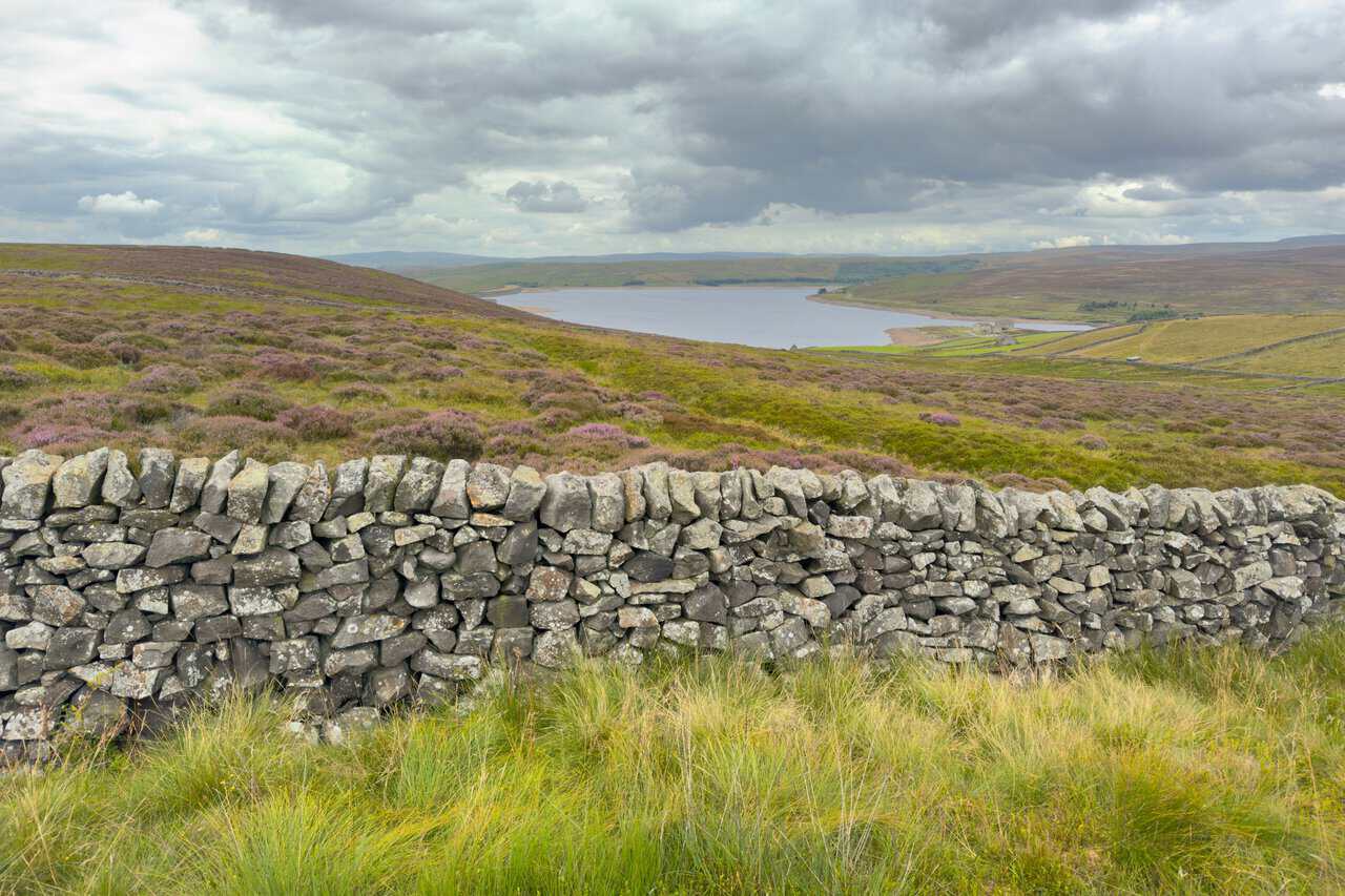
I follow the path down with a dry stone wall on my left, and the reservoir opens up more fully with every step. The heather is in flower here, spreading purple across the moor on both sides of the wall, and the whole sweep of the valley comes into view below.
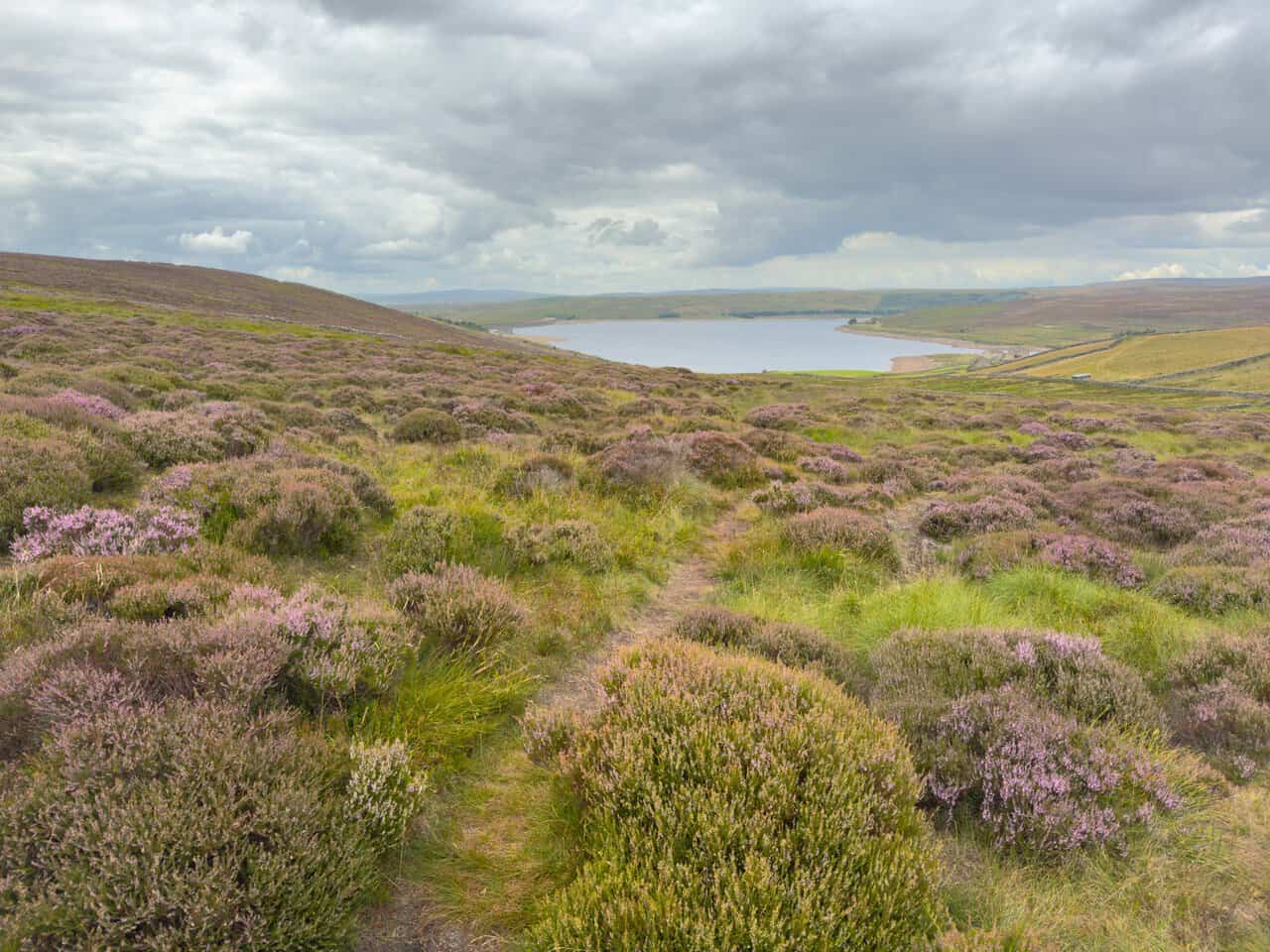
The path runs on across open heather moorland, with wooden signposts appearing at intervals to keep me right. The heather is in full flower, mounded pink and purple on both sides of a narrow trod, and the reservoir sits ahead in its shallow bowl of moorland.
The heather gives way to grassy pasture and the going becomes easier underfoot. High Shaws Lathe stands out ahead, a fine stone barn with an arched doorway looking out over the water, and the far shoreline curves away beneath a heavy grey sky.
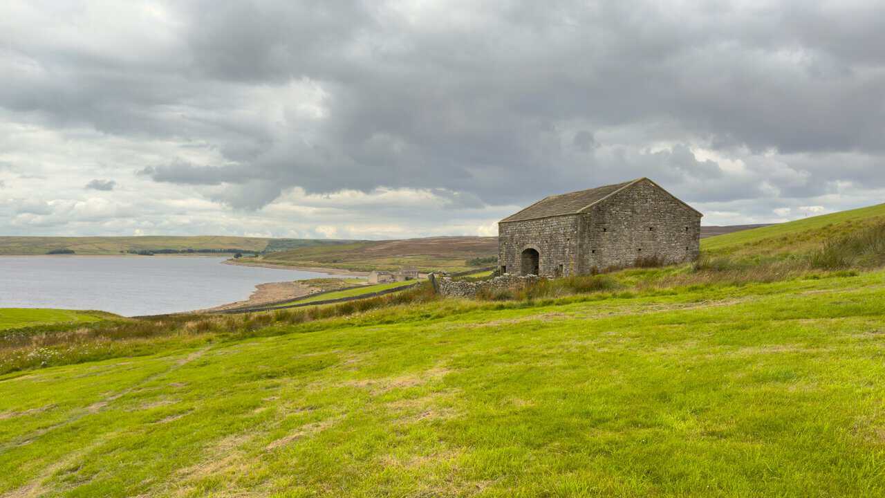
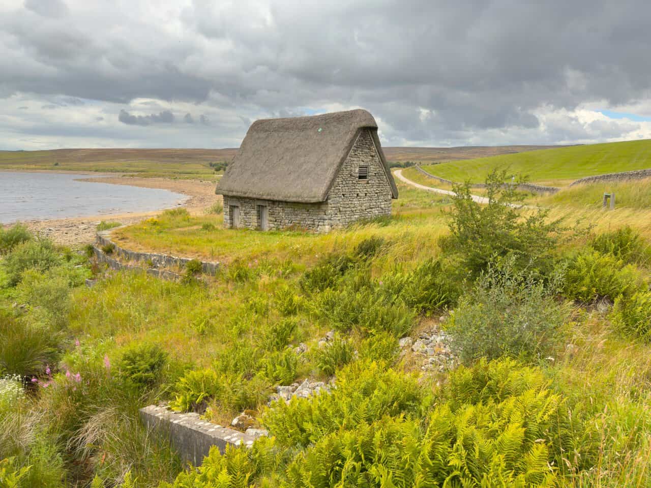
A little further on I come to Grimwith High Laithe, which is quite unlike any other barn around the reservoir. Its steep pitched roof is thatched with heather rather than covered in stone slate, giving it an unmistakable shape against the water behind. The word laithe itself comes from the Viking name for a barn.
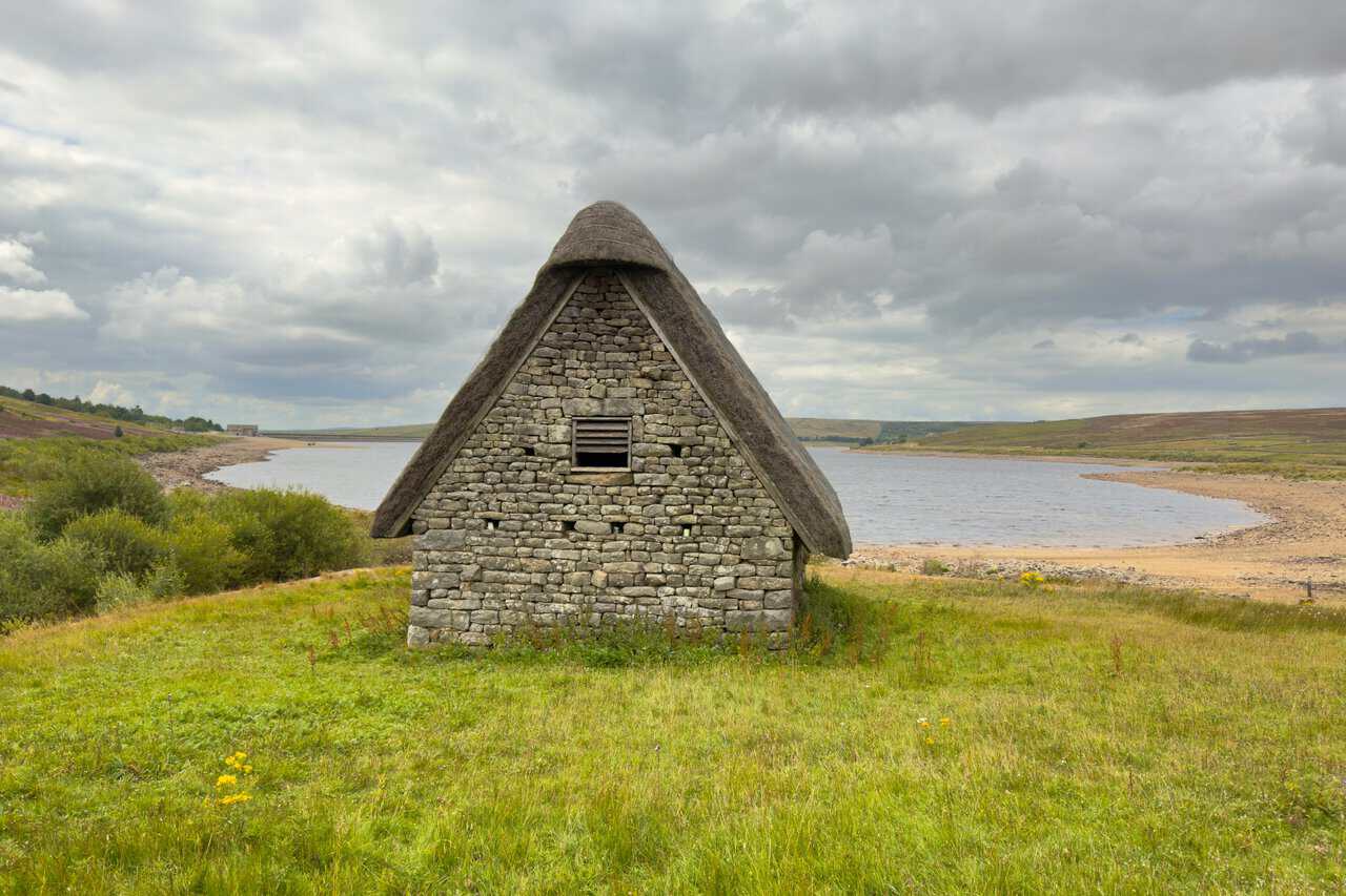
Seen from the side, the reason for that steep pitch becomes clear. This is a cruck barn, built around huge A-shaped timber frames of the kind used across the Dales in medieval times, with walls infilled and roofs thatched in straw or heather. By the seventeenth century the large trees needed for crucks had become scarce, so barns like this were gradually replaced by the stone-walled and stone-roofed ones seen everywhere today.
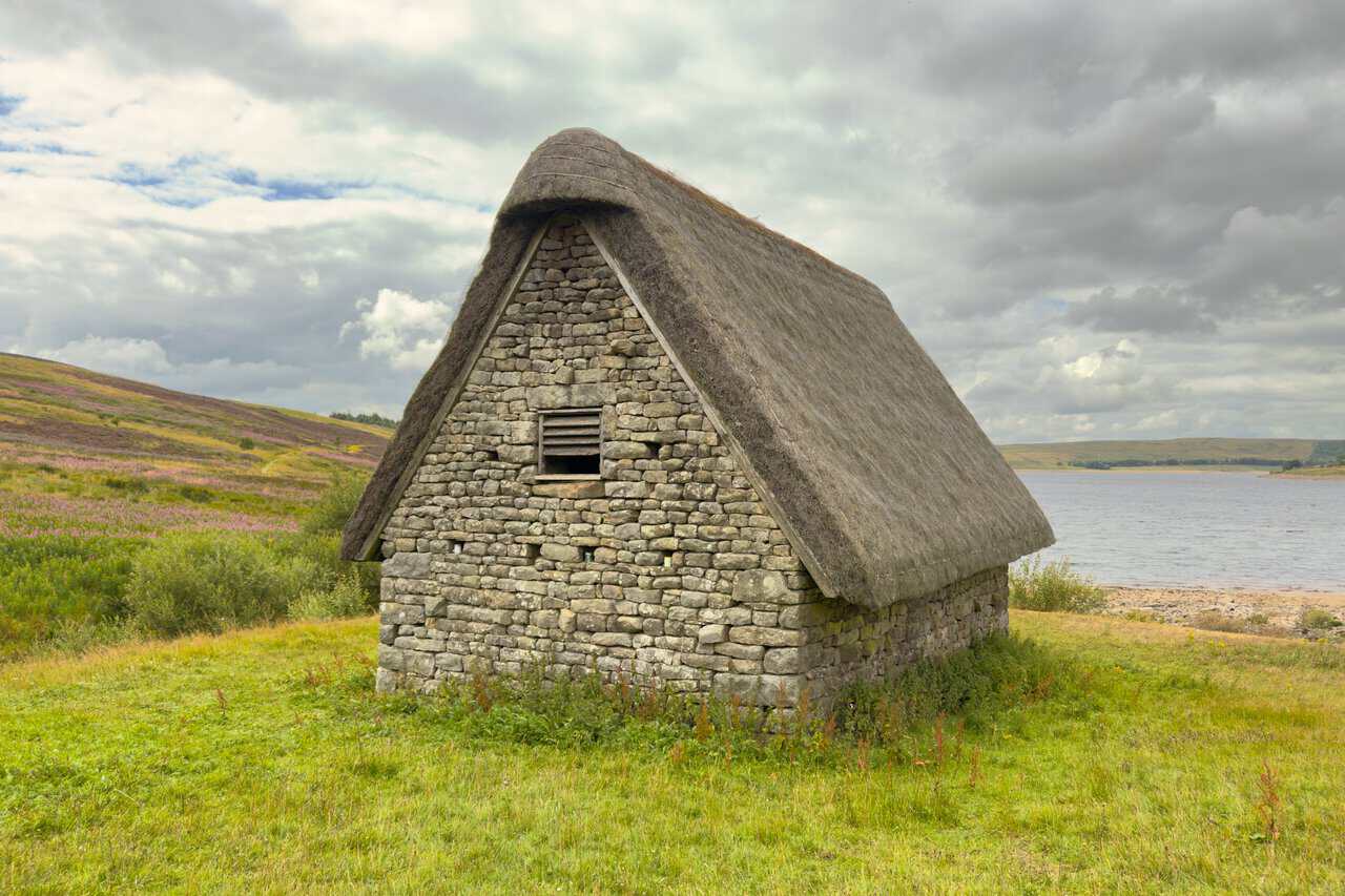
High Laithe probably dates from the very end of that period, which makes it around 400 years old. When the reservoir was enlarged in the 1970s its importance was recognised and the barn was preserved and restored rather than lost, and it now stands alone above the shoreline with the moors stretching away beyond.
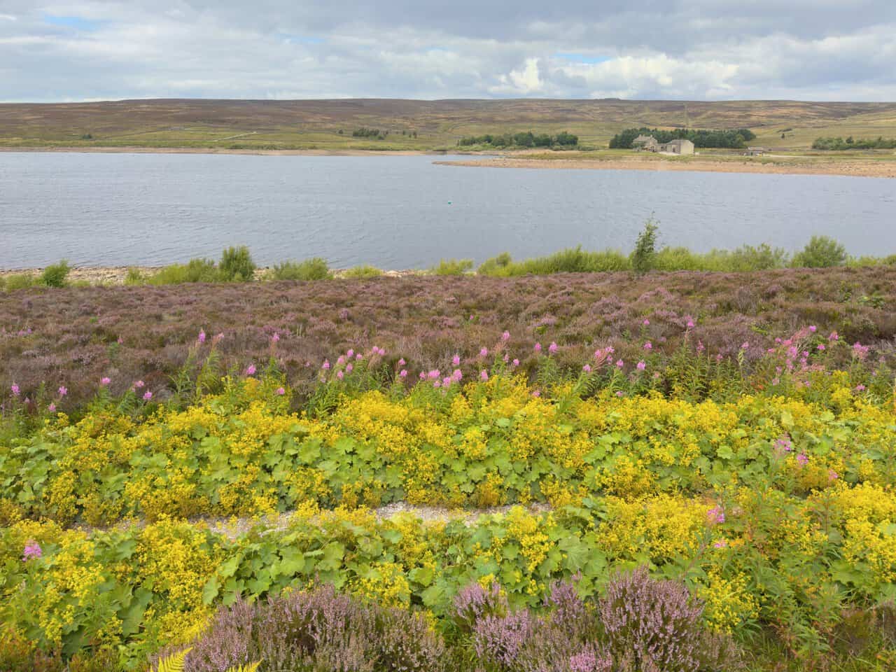
Immediately after the barn I turn right onto the Yorkshire Water permissive waterside footpath for the final two-thirds of a mile back to the car park. The narrow path threads between banks of lady’s mantle in bright yellow flower and tall pink spires of rosebay willowherb, with heather spreading along the slope above the water.
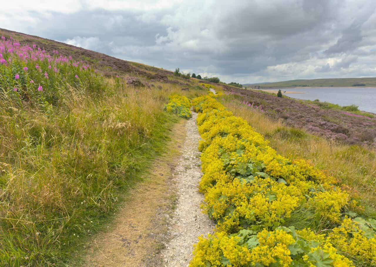
The views along this last stretch are lovely, with the reservoir wide and open on my right and the moors rising gently beyond. Flowers crowd the path edge all the way, and an old stone building sits alone on the far shore.
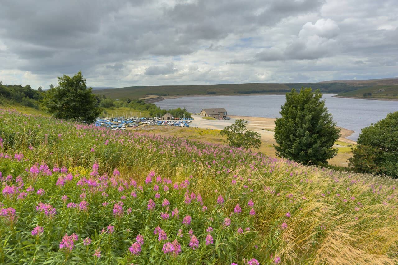
Near the end I look down on the Yorkshire Dales Sailing Club, its dinghies drawn up in neat blue and white rows beside the clubhouse and slipway. Rosebay willowherb fills the bank in front of me, and the car park is just a short distance further on, bringing my Trollers Gill walk to a close.