ADVERTISEMENT
Step Back in Time on the Rosedale Abbey Railway Walk in the North York Moors
Your journey on the Rosedale Abbey railway walk in the North York Moors begins at the well-marked Blakey Junction, also known to some as Little Blakey. Positioned just south of the Lion Inn, a convenient car park awaits beside the main road that traverses Blakey Ridge. From here, make your way down to the grey stone track, once the backbone of the Rosedale Railway. This adventure can unfold in either a clockwise or anti-clockwise direction; my narrative will follow the latter.
Commence by strolling south-east along the old railway line, now a path that runs along the western rim of the Rosedale valley. As you proceed in a south-easterly direction, the track’s clarity ensures you’ll never lose your way. The unfolding views are yours to relish. Gradually, the path curves eastward, skirting above Thorgill, until you find yourself by the historic kilns, eventually reaching the car park at Bank Top.
In order to get to Rosedale Abbey, a direct route down the road is available. Yet, for a scene more picturesque, retrace your steps slightly to find a footpath that descends through the Rosedale Abbey golf course, leading directly into the village. Here, the village green offers a perfect spot for a leisurely drink or bite to eat. Don’t miss the chance to visit the Church of St Mary & St Lawrence and the scant remains of the Cistercian Priory.
ADVERTISEMENT
Leaving the village behind, signs pointing towards Dunn Carr Bridge guide you north-west. This path meanders through the caravan park and across open fields, bringing you to a bridge that spans the River Seven. Do not cross the bridge, instead continue uphill, following a trail that veers north-east towards Bell End Farm. Upon reaching the road, a left turn followed by another left at the next junction takes you past landmarks such as Plane Tree Cottages, School Row, and Hill Cottages.
After Hill Cottages, a right turn leads you northward, up a hill and back onto the eastern flank of the Rosedale valley’s old railway line. Heading north, you’ll pass both Stone and Iron Kilns. The track remains straightforward to navigate. Keep moving north-east until reaching the railway line’s northernmost extremity, where the path loops back in an easily-followed U-turn, steering you southward towards the car park.
This exhilarating Rosedale Abbey railway walk spans approximately 12 miles through the North York Moors. Though the walk can be completed in around 5¼ hours, allow yourself more time to fully engage with the sights and historical points of interest that enrich this path. If you’re looking for a slightly less demanding journey, check out my shorter, 9-mile circuit at https://www.paulbeal.com/rosedale-railway-walk. This alternative route still offers a comprehensive tour around Rosedale, closely following the old railway line’s course and visiting most highlights, without visiting Rosedale Abbey village.
Rosedale Abbey Railway Walk: Maps and Tools
Visit either the OS Maps website or the Outdooractive website to view this walking route in greater detail. Both platforms offer a range of features, including the ability to print the route, download it to your device, and export the route as a GPX file. You can also watch a 3D fly-over and share the route on social media.
Rosedale Abbey Railway Walk: Distance, Duration, Statistics
Distance: 12 miles
Distance: 19 kilometres
Duration: 5¼ hours
Ascent: 974 feet
Ascent: 297 metres
Type: Circular walk
About the Rosedale Railway
A Marvel of Victorian Engineering
The Rosedale Railway was an impressive feat of engineering constructed across the rugged moorland terrain in the 1860s. Initially, as the ironstone mines in Rosedale produced increasingly valuable ore, the need for efficient transport to the blast furnaces in County Durham and Teesside became paramount. Consequently, a 12-mile railway line to the kilns at Bank Top was constructed in 1861. This was followed by a 5-mile loop to the East Kilns, completed in 1865. From Blakey Junction, the Rosedale Railway traversed the moors and descended Ingleby Incline, eventually connecting with the main rail network at Battersby Junction. This remarkable project was driven by the Victorian era’s ingenuity and a relentless pursuit of profits. The ironstone transported via this railway contributed significantly to the Industrial Revolution, with Blakey Junction playing a central role.
Life and Decline Along the Rosedale Railway
Along the railway, sidings, storehouses, and cottages sprang up to support the operation, housed by workers and their families dedicated to keeping the ironstone moving. Despite the isolation, these communities endured tough living conditions to ensure the railway’s success. However, the harsh winter of 1915-1916 severely impacted the line, blocking it for nearly five weeks and significantly affecting wages. Post-World War I, ironstone mining declined, leading to the railway’s closure in 1929. Over time, many of the structures were dismantled for materials, leaving little behind but the meandering trackbed of the Rosedale Railway, a poignant reminder of its vital role in the Victorian industrial era.
The Navvies’ Herculean Task
The construction of the Rosedale Railway, largely the work of navvies (itinerant labourers pivotal to Victorian construction projects), was an extraordinary challenge. The initial line to Bank Top, built with basic tools in just 15 months, and the subsequent loop to the East Kilns, necessitated the creation of high embankments, cuttings, and inclines, all achieved through sheer manual labour. These workers lived in temporary communal huts, leaving behind little evidence of their existence beyond the monumental railway they built. Their life was brutal, with society often viewing them as dangerous and immoral.
The Rosedale Abbey Railway Walk
For those interested in exploring this fascinating piece of history, the Rosedale Abbey railway walk offers a unique glimpse into the past. The walk along the old railway trackbed is not only a journey through beautiful landscapes but also a step back into the era of industrial innovation.
For a more in-depth exploration of the Rosedale Railway and its history, I have written a detailed article, which you can find here: https://www.paulbeal.com/rosedale-railway. This piece dives deeper into the railway’s construction, operation, and eventual decline, offering a comprehensive look at its legacy in the North York Moors.
Recommended Ordnance Survey Map
The best map to use on this walk is the Ordnance Survey map of the North York Moors Western Area, reference OS Explorer OL26, scale 1:25,000. It clearly displays footpaths, rights of way, open access land and vegetation on the ground, making it ideal for walking, running and hiking. The map can be purchased from Amazon in either a standard, paper version or a weatherproof, laminated version, as shown below.
North York Moors Walking Guidebooks
The North York Moors, by Paddy Dillon, describes 50 walks of 4 to 14 miles across the Tabular Hills, Hambleton Hills, Cleveland Hills, high moors and Cleveland coast, plus the Lyke Wake Walk in four stages, with Ordnance Survey mapping and notes on transport and refreshments.
North York Moors Short Walks Made Easy, published by Ordnance Survey, brings together 10 accessible routes of 2.5 to 4.5 miles, each taking around a couple of hours, ideal for families or anyone short on time. Both books can be purchased from Amazon, as shown below.
Walking the North York Moors
The North York Moors, by Paddy Dillon, a Cicerone guidebook of 50 walks throughout the National Park
Rosedale Abbey Railway Walk: My Photos
The view of Rosedale from the starting point of the Rosedale Abbey railway walk at Blakey Junction. On a clear day, the trackbed of the old railway line is visible across the dale, along with the distant remains of two sets of ironstone kilns.
ADVERTISEMENT
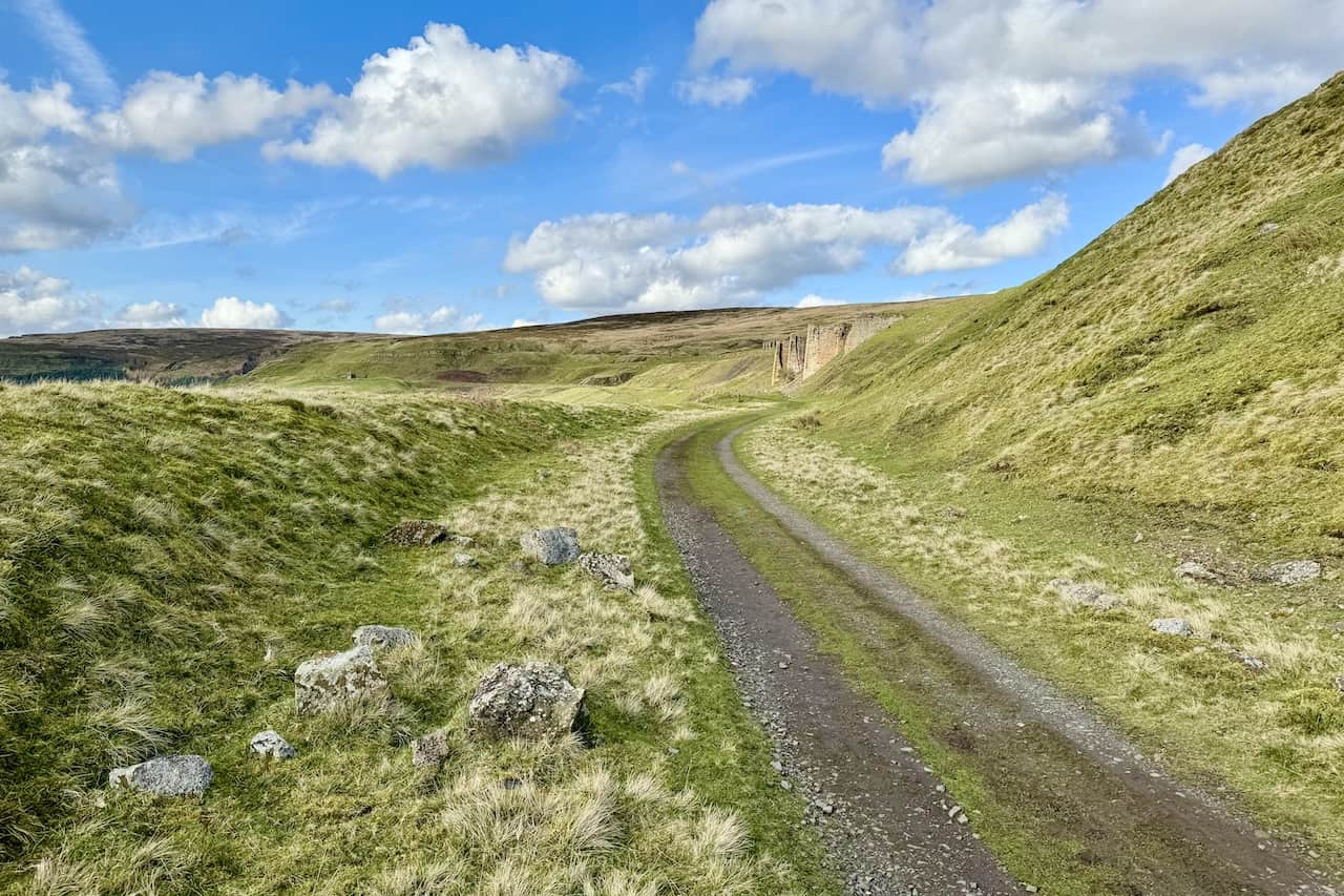
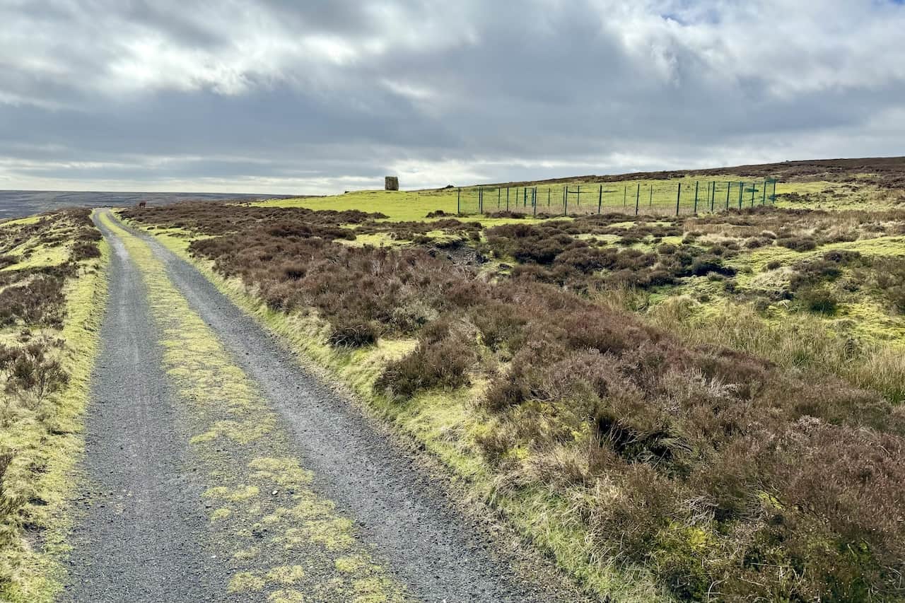
The old railway line’s trackbed heading south. The Rosedale Railway once transported iron ore from mines and kilns on both sides of the valley. The trackbed is maintained by landowners and the National Park Authority to facilitate access for management and the public.
ADVERTISEMENT
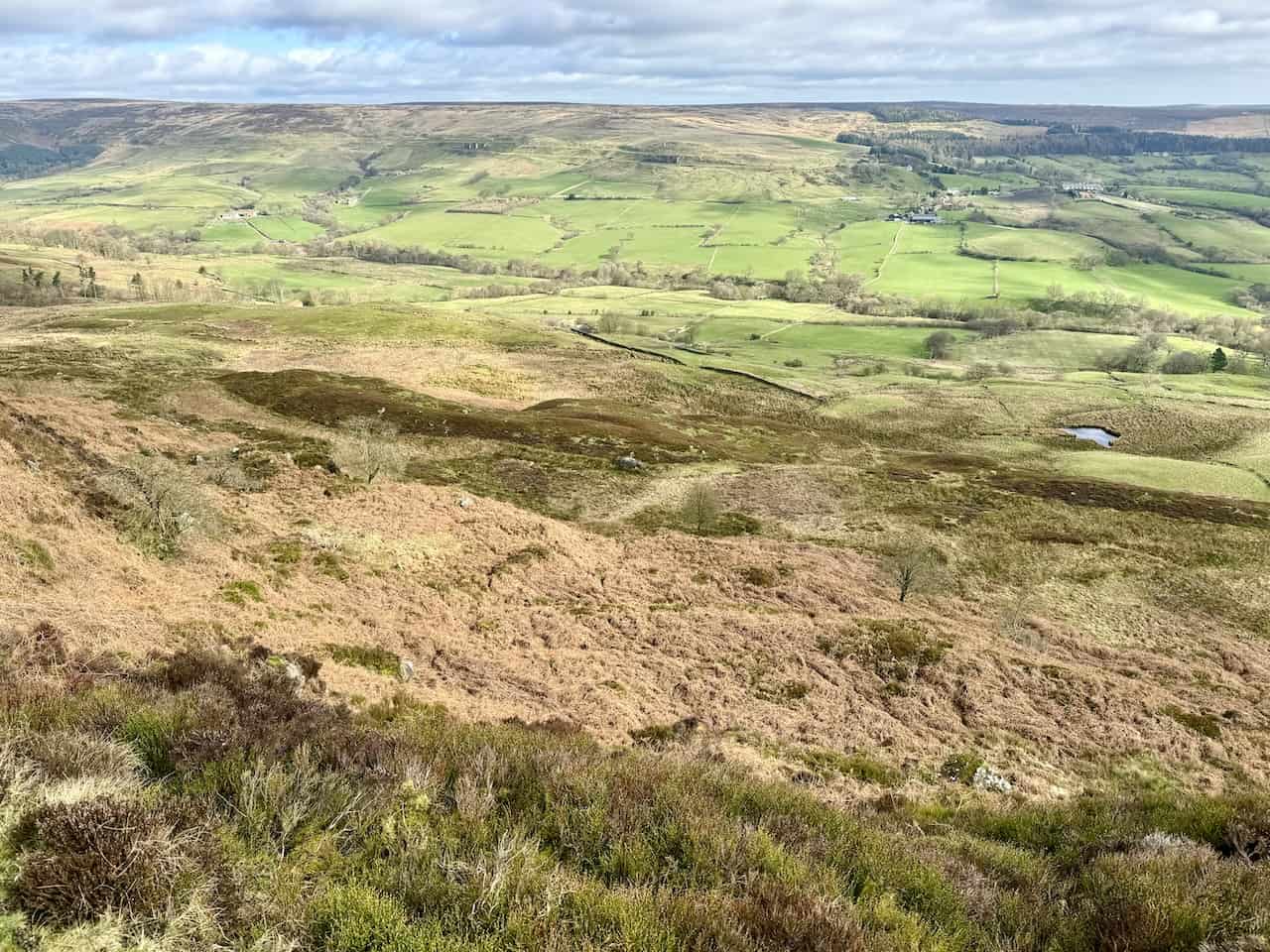
The view north from the disused railway line towards the head of the Rosedale valley.
ADVERTISEMENT
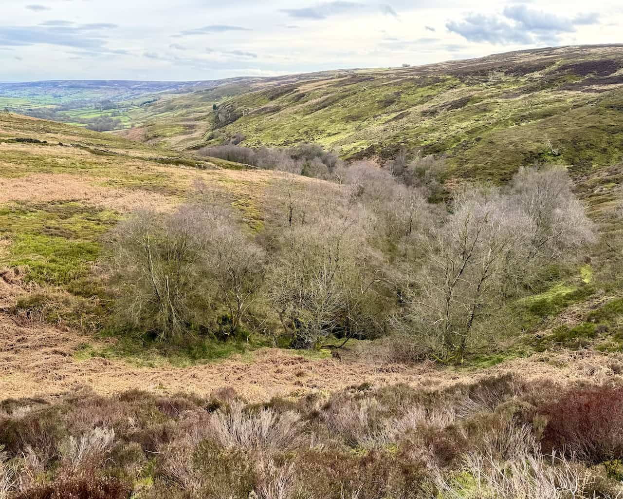
Looking east from the railway line’s trackbed across the Rosedale valley floor towards the kilns on the other side of the valley. The valley features a patchwork of farmers’ fields in different hues of green, with a scattering of farms dotting the landscape.
Looking south-east into Rosedale, with the location of Rosedale Abbey village in the distance, although it is not clearly visible at this stage of the walk.
ADVERTISEMENT
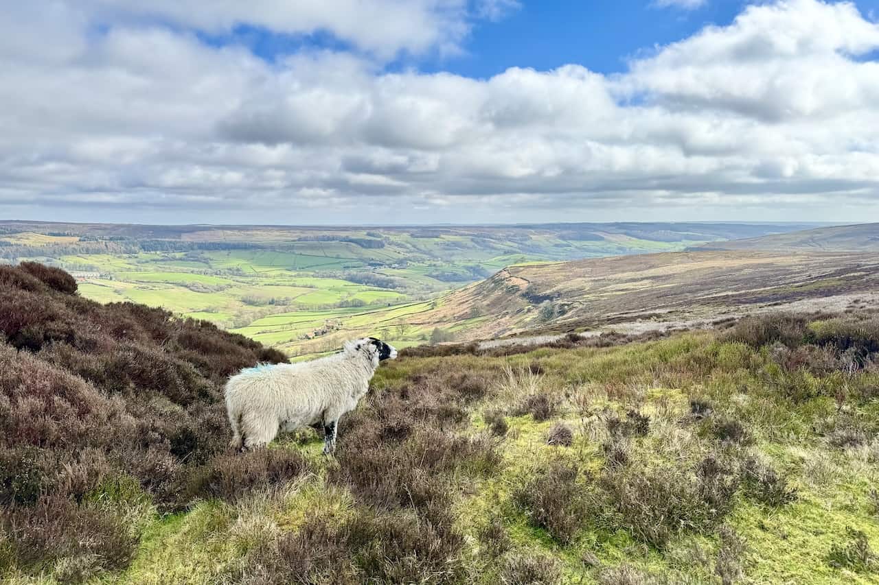
The sun beautifully illuminates the valley as I proceed along the railway line, looking north-east towards the ironstone kilns.
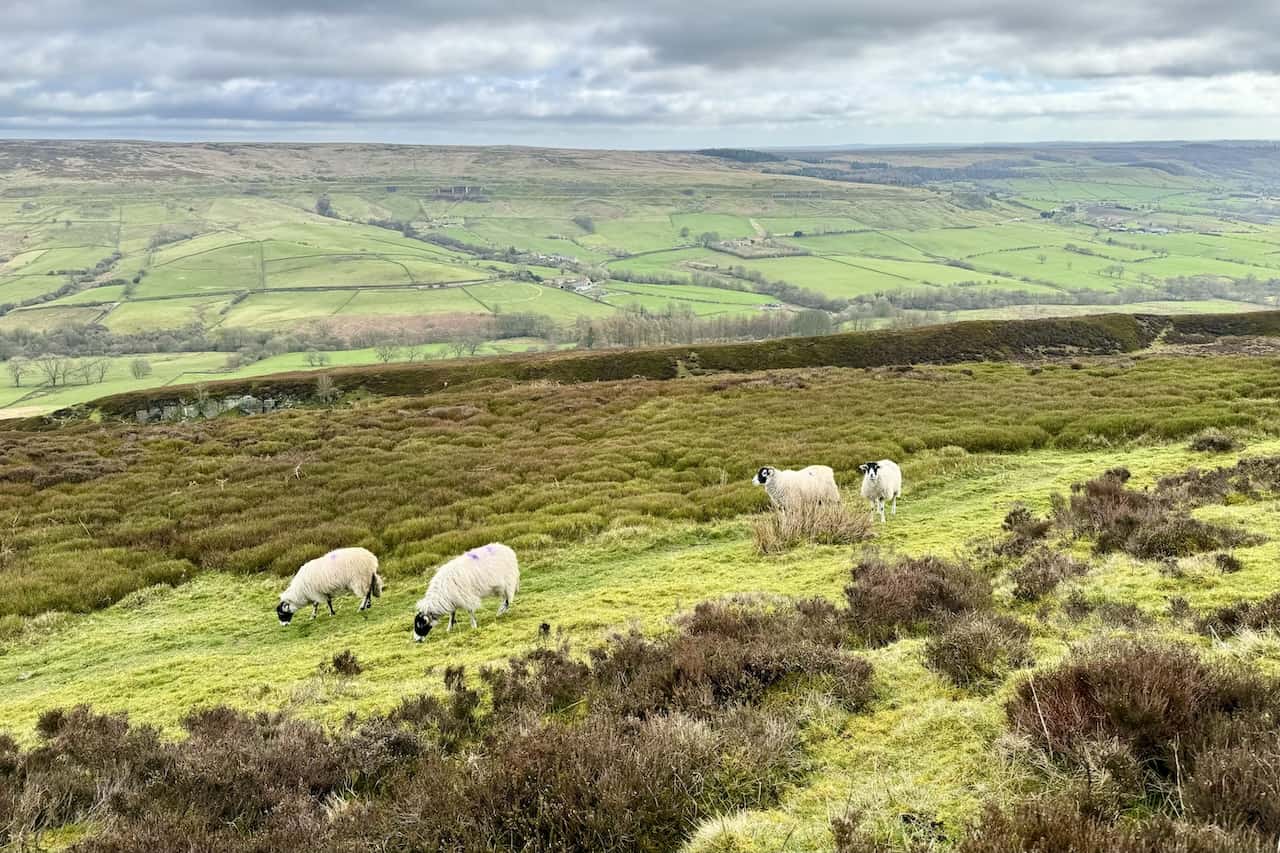
This sheep appears to be enjoying the views as much as I am.
ADVERTISEMENT
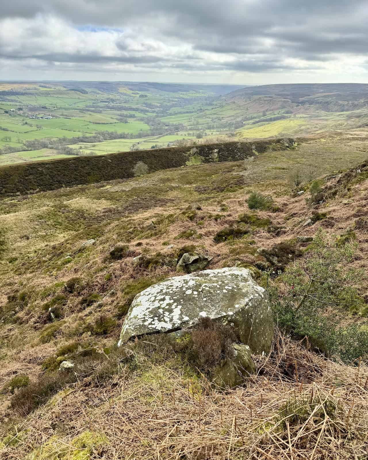
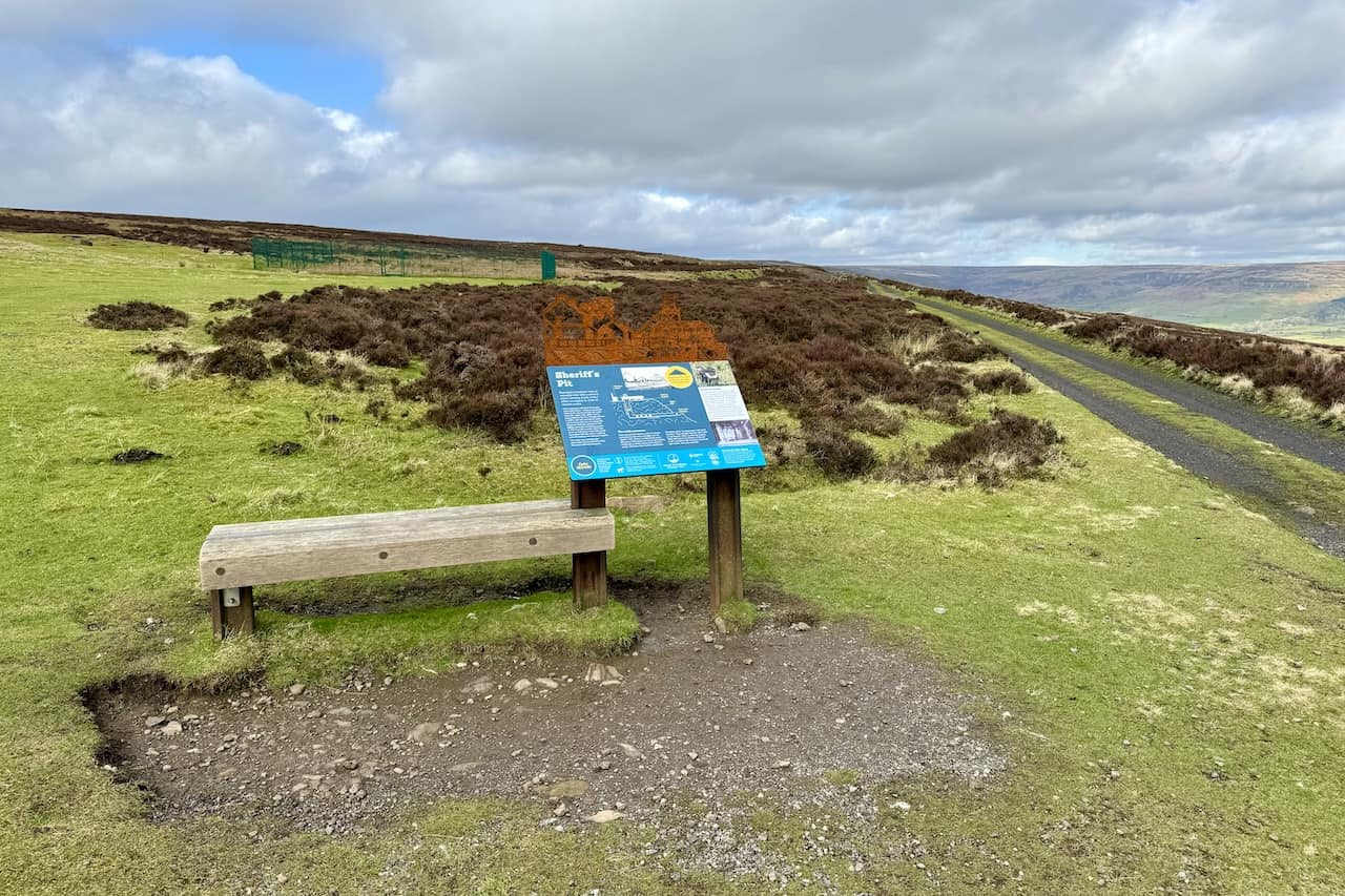
The trackbed passes the site of the Sheriff’s Pit. Early ironstone mines in Rosedale were drift mines, with a horizontal mine shaft driven into the seam from the valley side. Ironstone was removed by horse and cart. However, with the opening of the Rosedale Railway, a vertical shaft was sunk at this site, allowing laden mine tubs to be hoisted directly from the drift mine. The mine was named after Alexander Clunes Sheriff of the Rosedale Mining Company.
ADVERTISEMENT
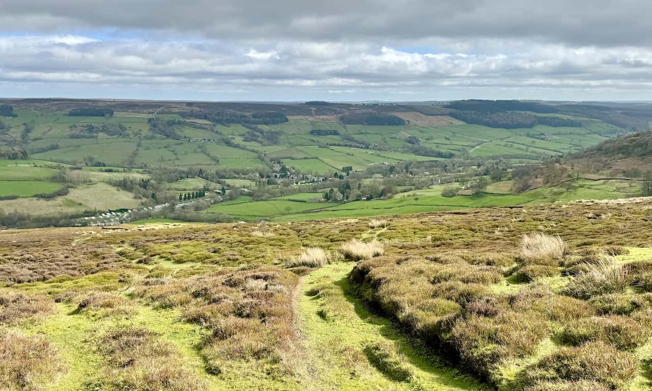
As the railway line circles around Thorgill and reaches the area above Thorgill Crag, the village of Rosedale Abbey becomes much clearer, including the caravan site on the north-west side of the village, which I will later walk through.
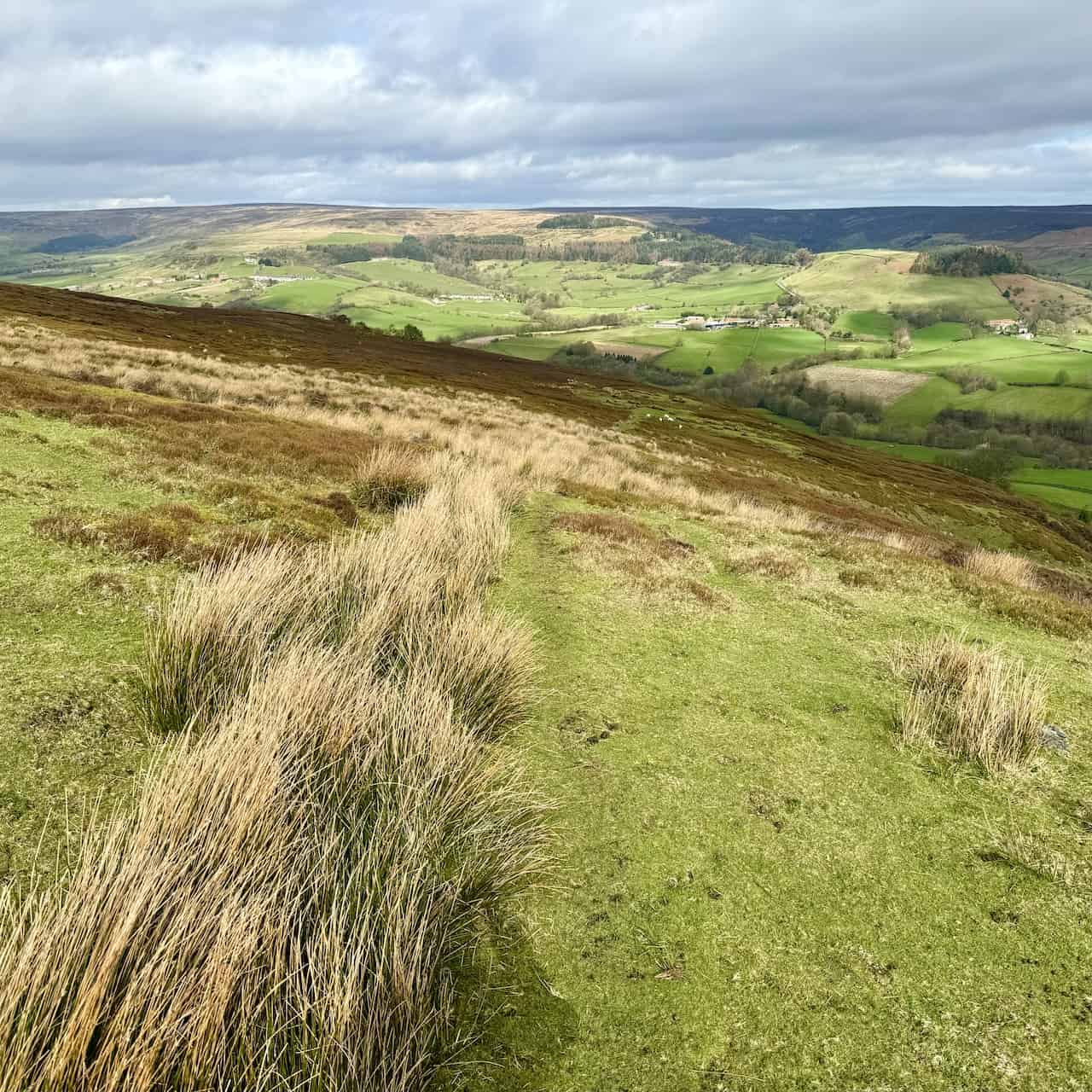
The view from above Thorgill Crag to the terraced houses of School Row and Hill Cottages in the distance, located at the foot of the Rosedale East Side moorland. These houses are on Daleside Road, which I will walk along later in this Rosedale Abbey railway walk.
ADVERTISEMENT
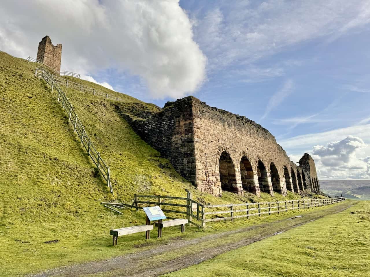
The remains of the kilns beside the moorland railway line at Bank Top. Ironstone needed initial on-site processing before being transported to distant blast furnaces for smelting. Ironstone from the mines was tipped into the kilns from above, mixed with coal, and ignited in a roasting process called ‘calcining’ to remove impurities and reduce its weight.
Cottages at Bank Top. I’m standing on one of the many grassy mounds, which are actually waste heaps produced during the processing of ironstone in the past.
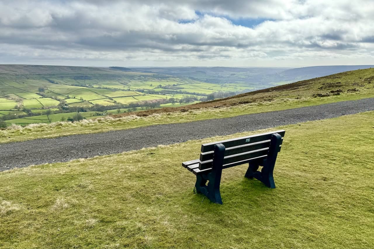
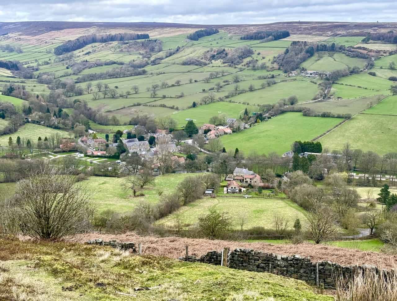
The view down to the village of Rosedale Abbey as seen from a small footpath just below Bank Top. This is about one-third of the way around this Rosedale Abbey railway walk.
ADVERTISEMENT
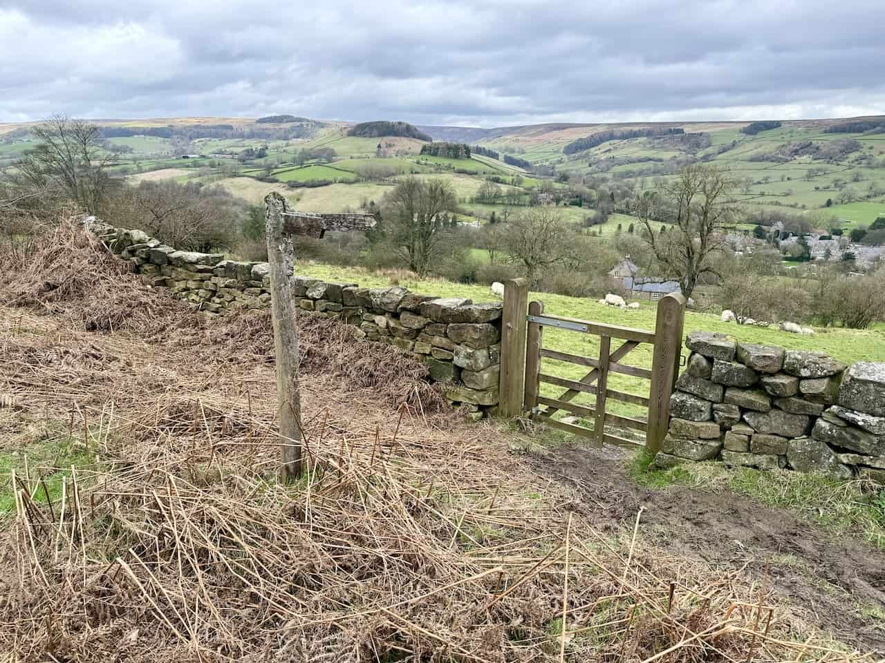
From Bank Top, one can descend to Rosedale Abbey using the minor road. However, I prefer the small footpath west of the road, leading downhill and passing the Rosedale Abbey golf club.
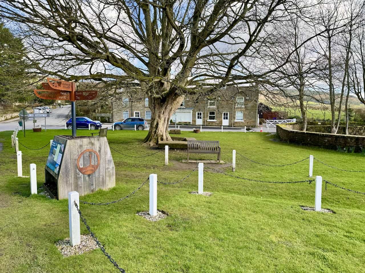
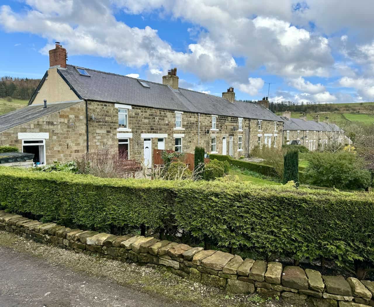
The village Green in Rosedale Abbey. This peaceful village, enjoyed by walkers and tourists, was once at the heart of Rosedale’s ironstone industry. In the 19th century, Rosedale saw an influx of workers. Houses, shops, chapels, and a school were built in the village and along the dale for the miners and railway workers.
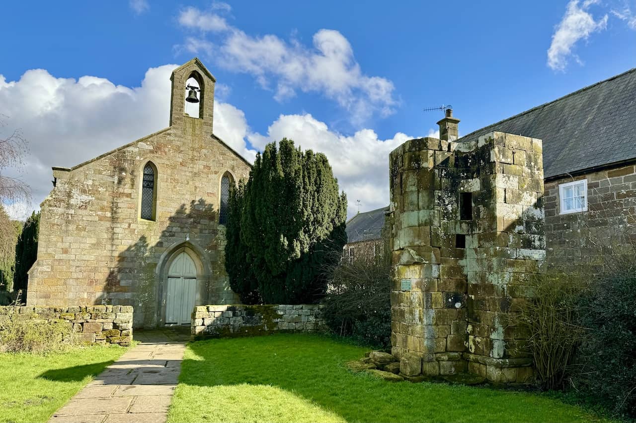
The Church of St Mary & St Lawrence, Rosedale Abbey. A Cistercian Priory once stood here at Rosedale Abbey. All that remains today is the staircase turret on the right of the photo. Founded in the 12th century, the priory was home to a small group of nuns, the first to farm sheep commercially in the region. It was abandoned after Henry VIII’s Dissolution of the Monasteries in 1536, and the buildings were later demolished, with much of the stone used to build the present church.
ADVERTISEMENT
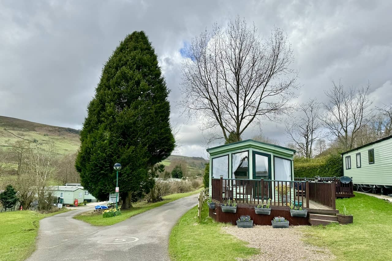
Rosedale Abbey Caravan Park, offering self-catering accommodation. It is a family business where visitors can pitch a tent, park a caravan or motorhome, enjoy glamping, or stay in one of six lovely holiday cottages.
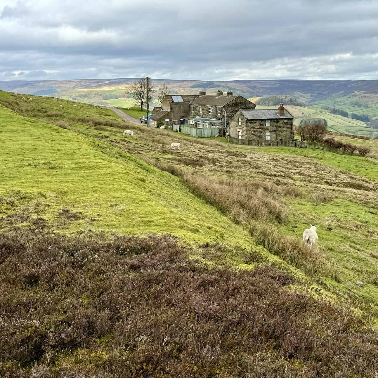
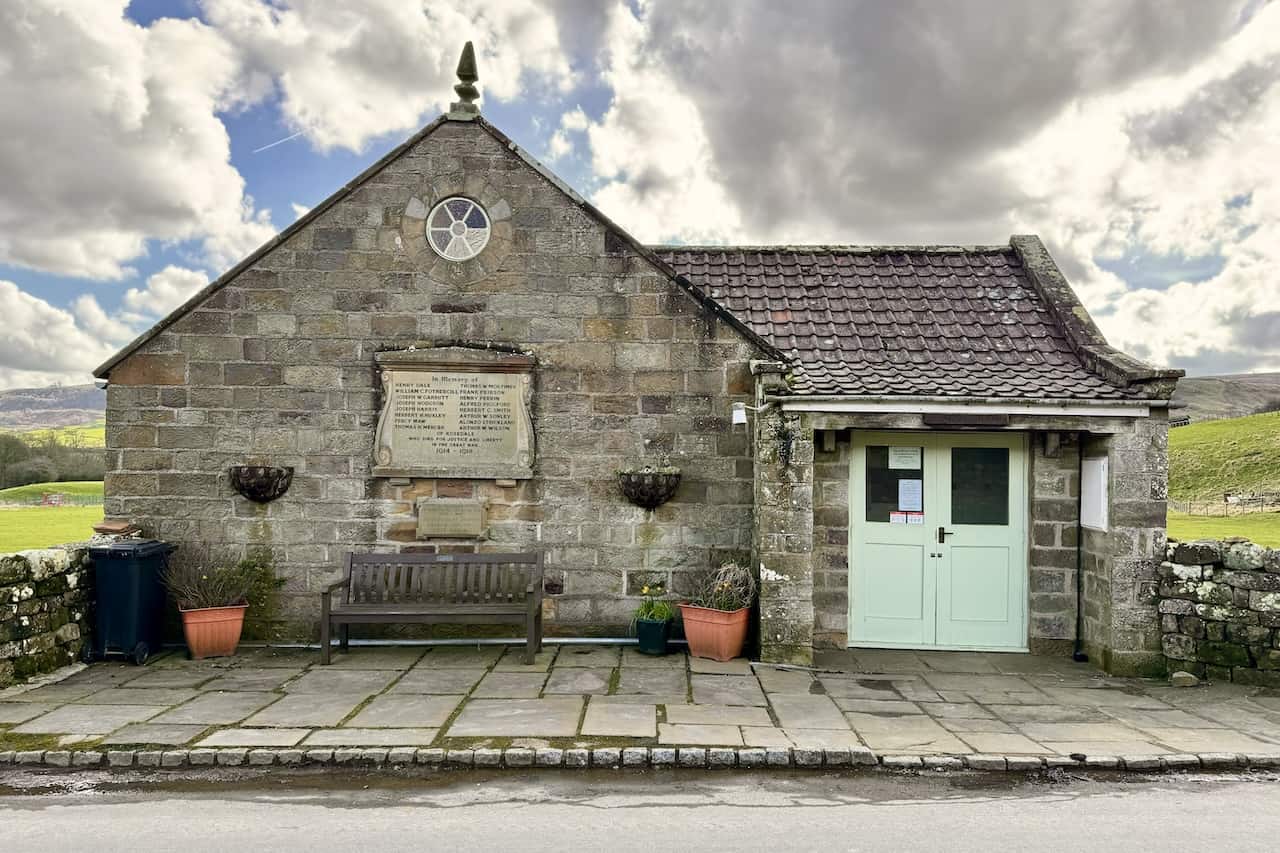
The village hall at School Row on Daleside Road. The inscription on the larger stone plaque commemorates Henry Dale, Thomas W. Mortimer, William C. Fothergill, Frank Peirson, Joseph W. Garbutt, Henry Perrin, Joseph Hodgson, Alfred Piggford, Joseph Harris, Herbert C. Smith, Herbert H. Huxley, Arthur W. Sonley, Percy Maw, Alonzo Strickland, Thomas H. Mercer, and Arthur W. Wilson of Rosedale, who died for justice and liberty in the Great War, 1914-1918. The inscription on the smaller stone plaque remembers John Douglas Dowson, Derrica Jeminson, and James Harland, who fell during the war, 1939-1945.
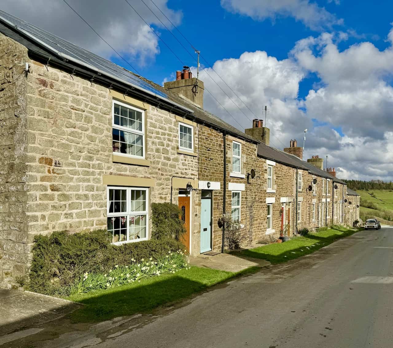
The terraced cottages of School Row located on Daleside Road in Rosedale East.
ADVERTISEMENT
The terraced houses of Hill Cottages, situated on Daleside Road in Rosedale East.
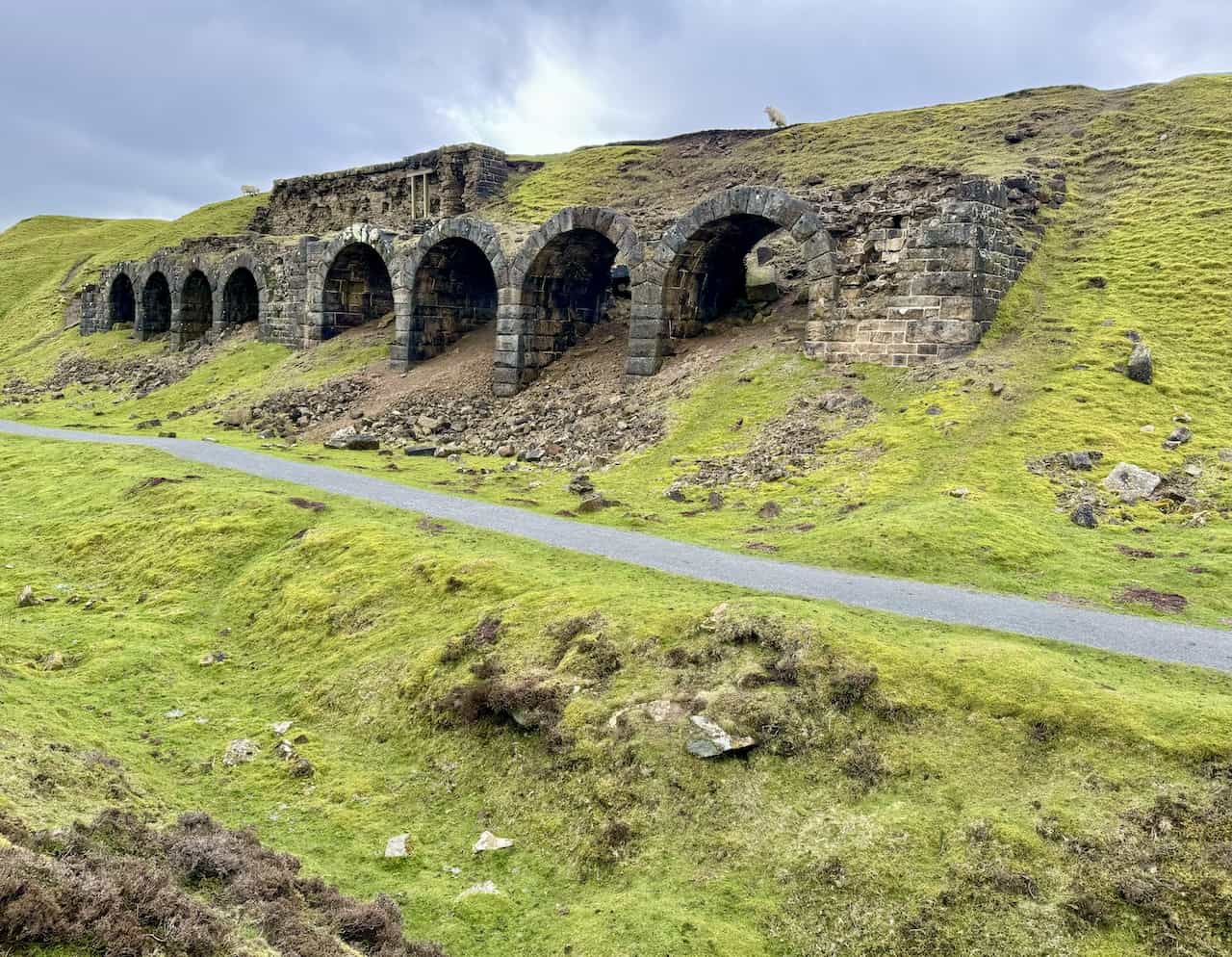
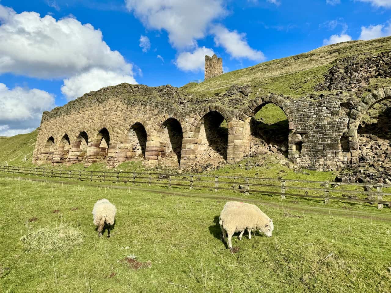
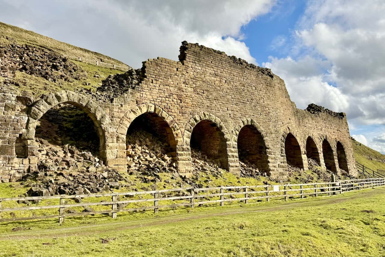
The Stone Kilns of Rosedale’s East Mines. These mines started operations around 1863 and are similar to the kilns at Bank Top. Ironstone was roasted or calcined here to remove impurities before being sent to blast furnaces. The calcine men had one of the most challenging and unpleasant jobs, loading wagons in an environment filled with thick smoke, noise from the kilns and mines, and the clatter of trains and carts all day long.
ADVERTISEMENT
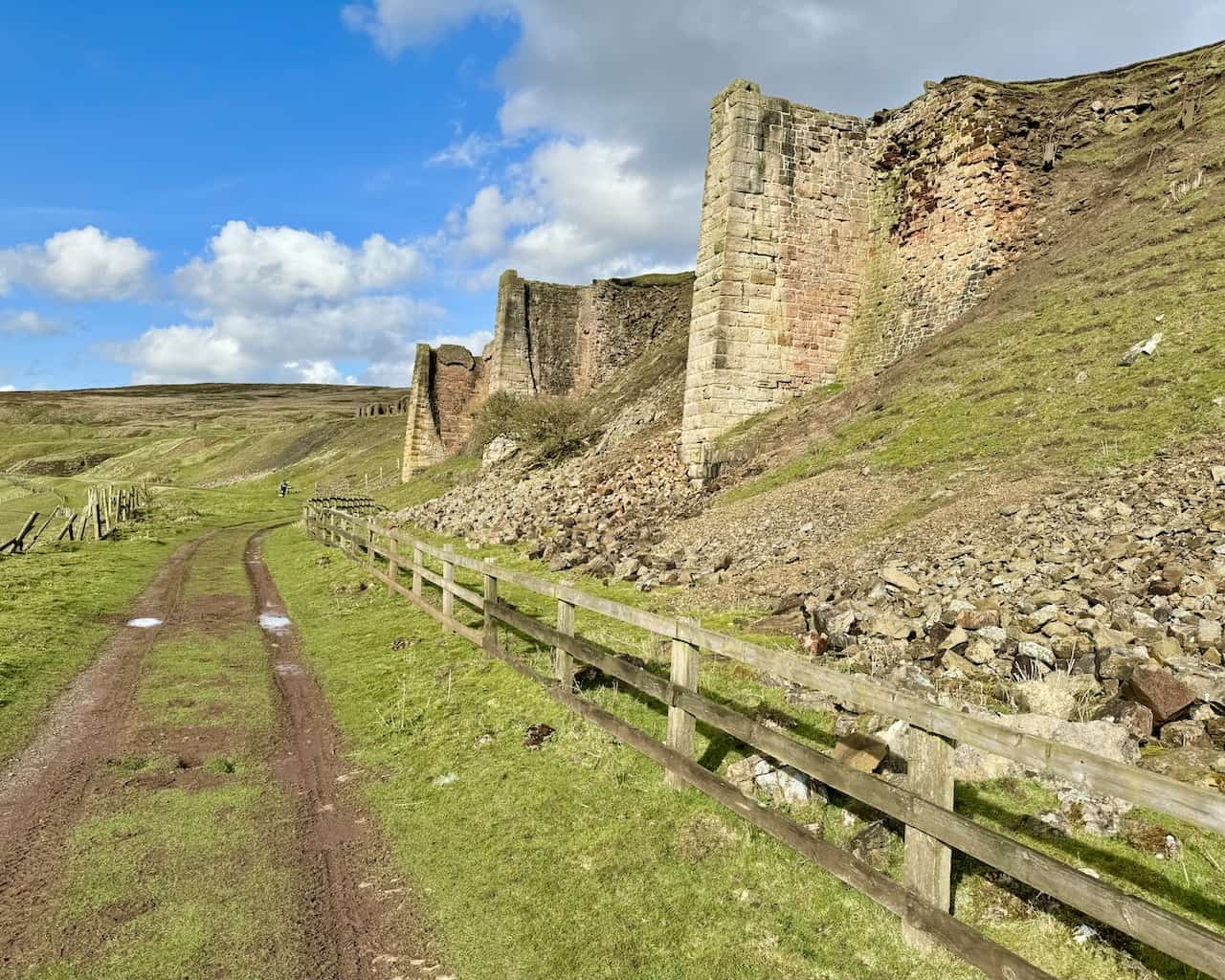
The trackbed of the disused railway line heading north between the Stone Kilns and the Iron Kilns on the eastern side of the Rosedale valley. This is about two-thirds of the way around this Rosedale Abbey railway walk.
The Iron Kilns of Rosedale’s East Mines. The remains of three enormous kiln compartments, lined with fire bricks and originally featuring massive iron fronts, are designed to roast or calcine the ironstone before it was transported to blast furnaces in Teesside and County Durham.
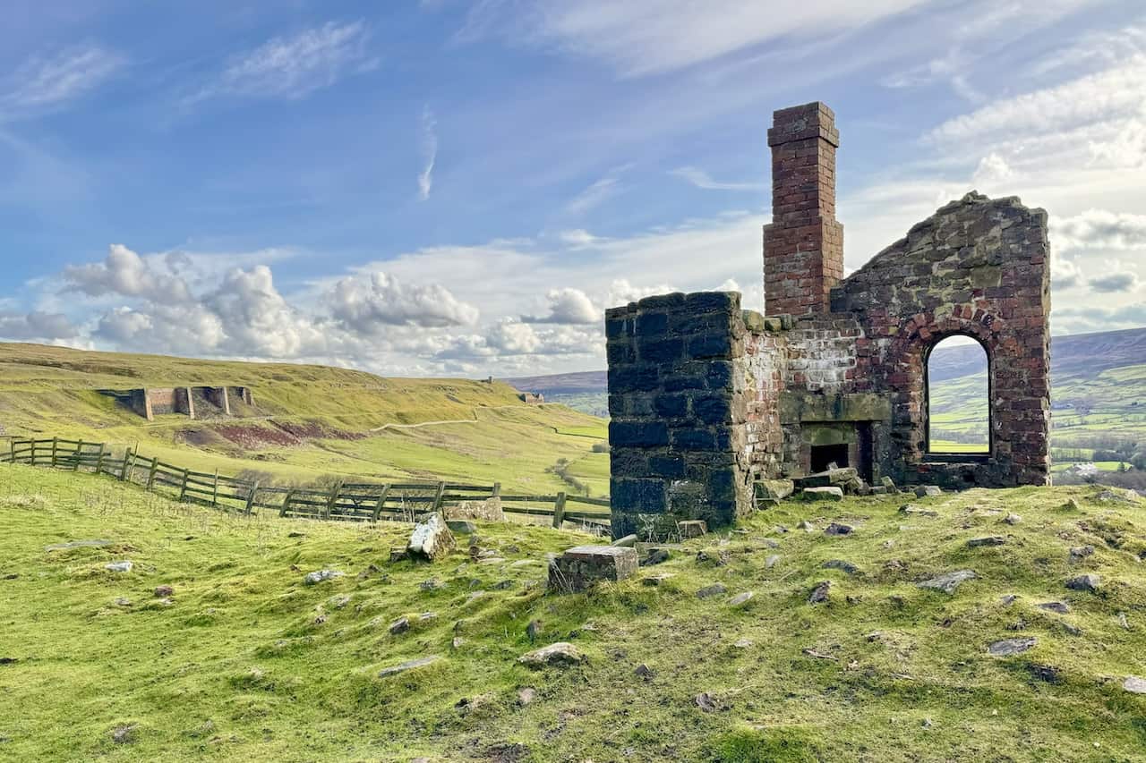
The remains of Black Houses cottages by the side of the Rosedale Railway, about a quarter of a mile north of the Iron Kilns, visible in the background on the left of the photograph.
ADVERTISEMENT
One of several large embankments built to carry the railway line around Rosedale.
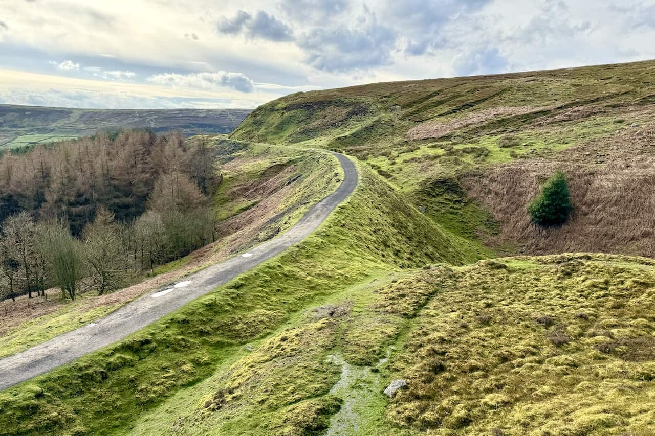
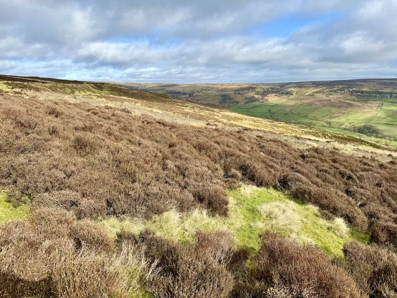
The view of the Rosedale valley from the railway line’s most northern point.
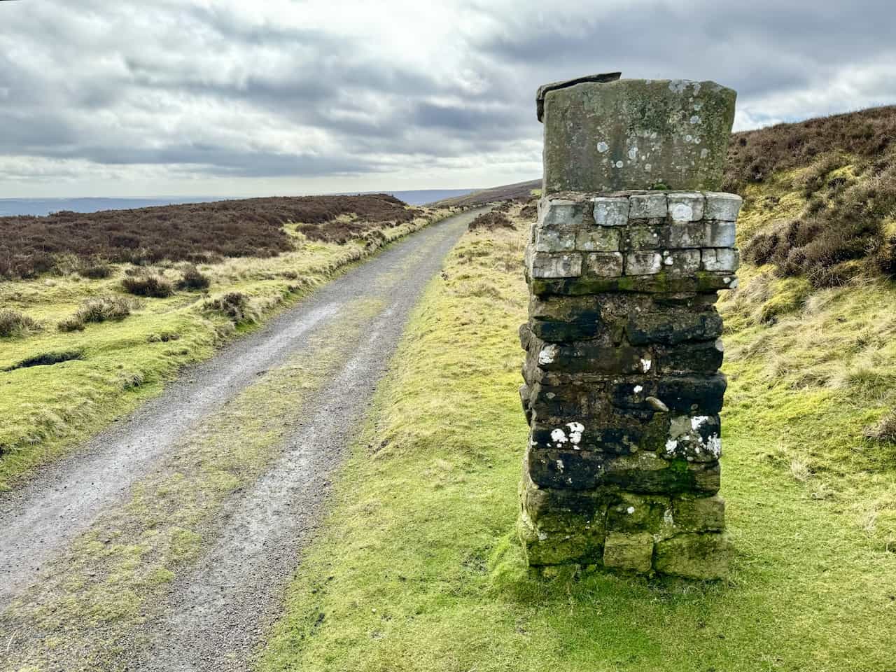
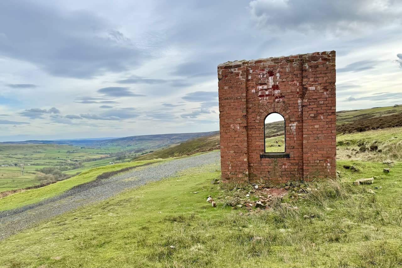
Water tower by the side of the Rosedale Railway, now back on the western side of the valley and almost at the end of this Rosedale Abbey railway walk.
ADVERTISEMENT