Enjoy a Memorable Day Out on the Fewston Reservoir Walk in Nidderdale
Embark on your Fewston Reservoir walk from the roadside car park adjacent to the A59 at Blubberhouses. Ascend the steps to reach the main road. Take a right, cross the River Washburn bridge, then turn onto the marked path.
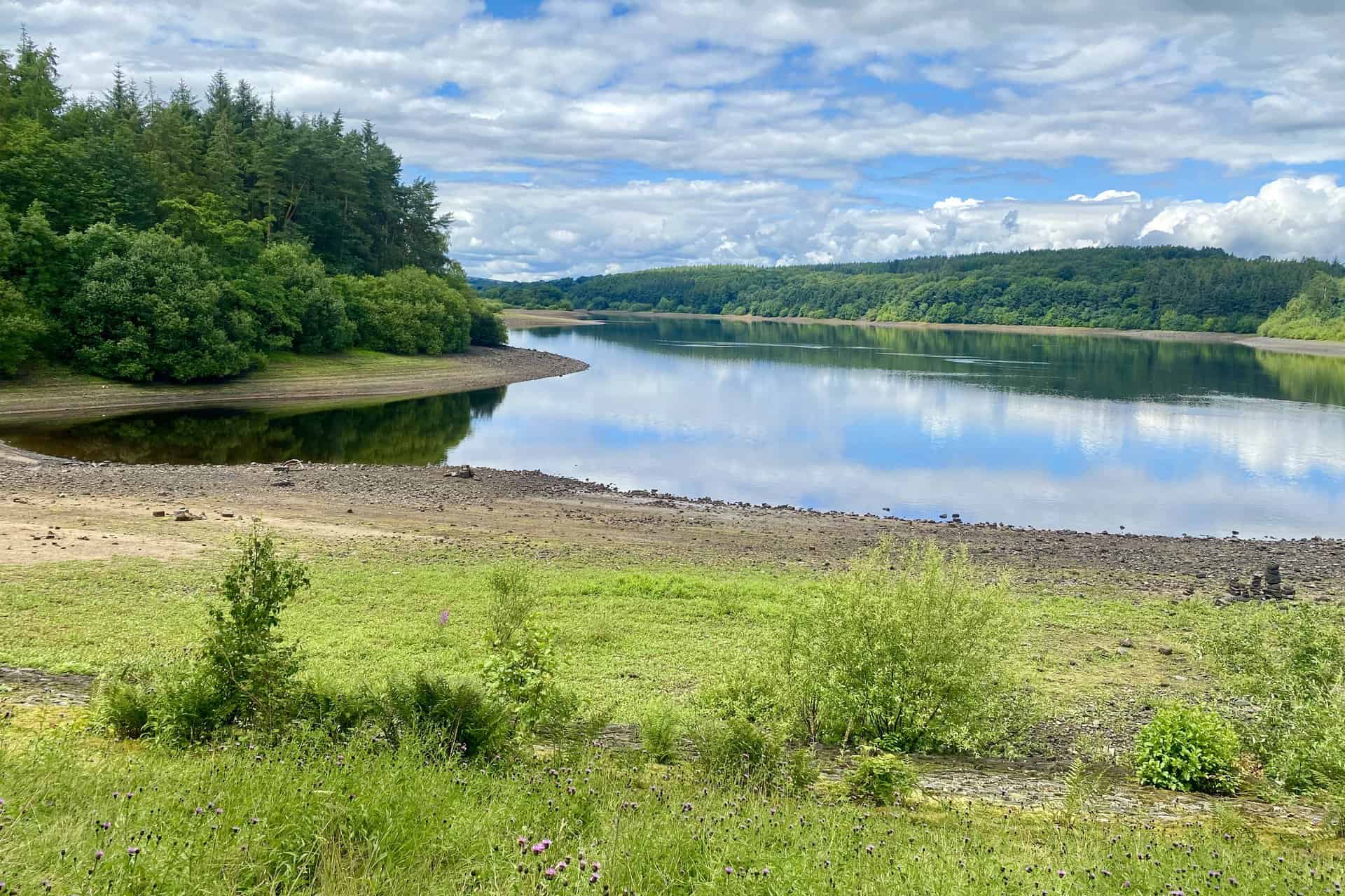
The walkway ahead invites you to venture along the beautiful edge of Fewston Reservoir. Keep the reservoir on your right. Absorb the calm atmosphere of the trail, stretching all the way to the northern tip of the Fewston Embankment.
Next, your path takes you along the serene north shoreline of Swinsty Reservoir. After a while, cross the Swinsty Reservoir causeway. The path then guides you along the reservoir’s eastern side, leading you to the quaint Swinsty Cottage.
Moving southwards, follow the footpath across open fields down to the River Washburn. Follow the river for almost a mile. Then, direct yourself southeast towards Folly Hall, continuing on to Mill House Farm. From here, a track leads you to Dobpark Bridge for a river crossing.
Venture northwest, following the Six Dales Trail along the River Washburn. This brings you to the farm of Nether Timble, after which you should follow High Lane until it intersects with the Harrogate Link. Journey down to Swinsty Hall.
Navigate north-west on the Six Dales Trail, passing through the wooded area of Swinsty Moor Plantation. This leads to the southern end of Fewston Embankment. The subsequent path trails along the western flank of Fewston Reservoir, with the water body on your right serving as your constant reference point.
The path returns you to the Blubberhouses car park, marking the end of a rewarding 10-mile Fewston Reservoir walk.
Fewston Reservoir Walk: Maps and Tools
Visit either the OS Maps website or the Outdooractive website to view this walking route in greater detail. Both platforms offer a range of features, including the ability to print the route, download it to your device, and export the route as a GPX file. You can also watch a 3D fly-over and share the route on social media.
Fewston Reservoir Walk: Distance, Duration, Statistics
Distance: 9½ miles
Distance: 15¼ kilometres
Duration: 4¼ hours
Ascent: 819 feet
Ascent: 250 metres
Type: Circular walk
About Fewston Reservoir
Fewston Reservoir is a captivating landmark in Yorkshire, England. Nestled in the scenic Washburn valley, it’s just north of Otley and west of Harrogate. Its construction started in 1874 by the Leeds Waterworks Company under Robert Brooks’s management. Edward Filliter of Leeds and Thomas Hawksley of Westminster served as consultants. The work wrapped up in 1879, making it an old but charming destination.
Part of the construction involved demolishing Fewston Mill and West House Mill at Blubberhouses. Interestingly, their stones were reused to build a wall around the reservoir. Locomotives and machinery from the neighbouring Swinsty Reservoir project played a role in its creation too.
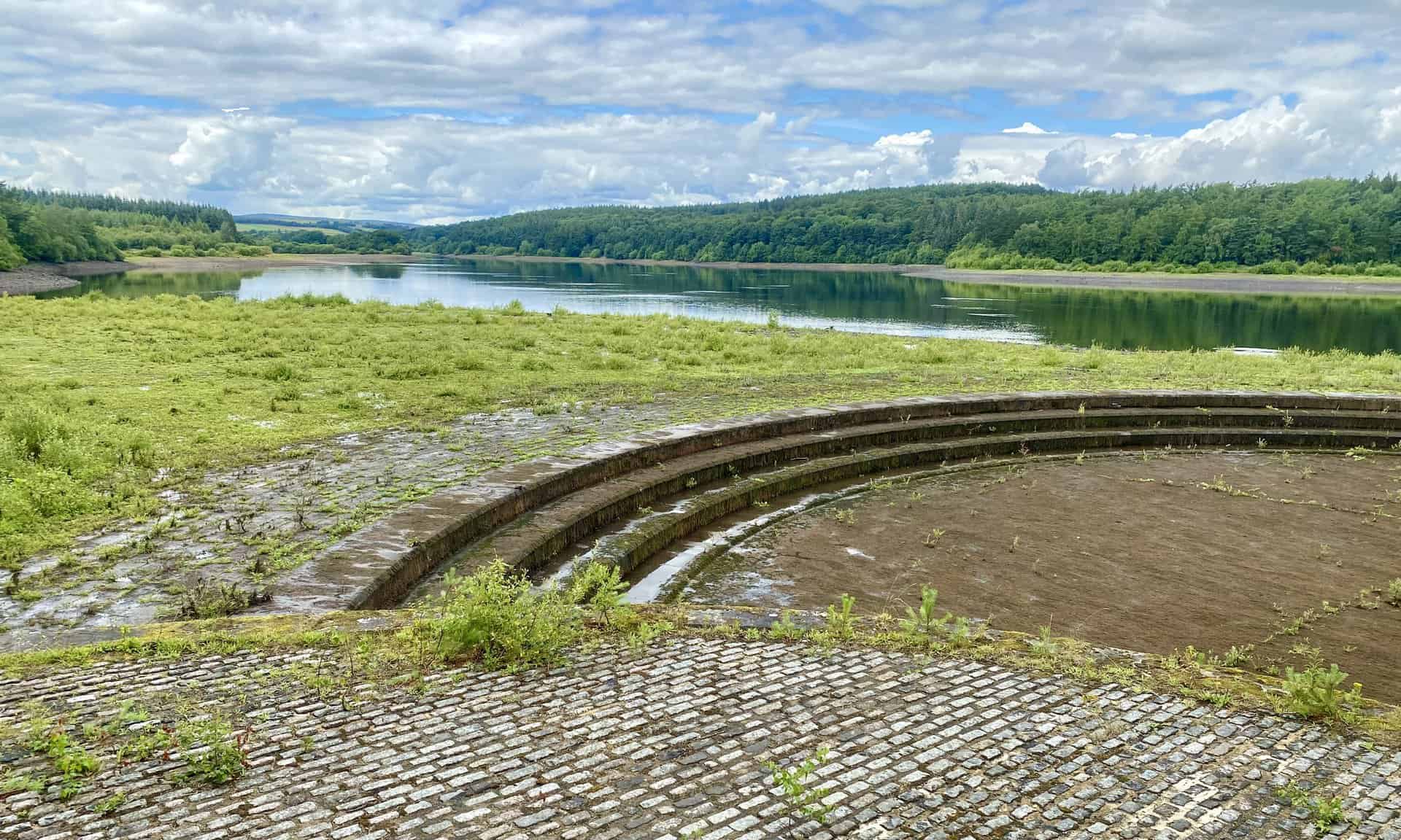
The reservoir has a noteworthy capacity of about 3.5 million cubic metres. Its overflow feeds directly into Swinsty Reservoir, indicating a thoughtful design. However, the original metal walkway circling this overflow is no longer present.
Today, Yorkshire Water owns the reservoir. They manage it with a keen focus on benefiting walkers, anglers, and wildlife. The Fewston Reservoir walk is popular, offering breathtaking views. Runners also enjoy its paths. Cyclists and horse-riders have their designated tracks in the encompassing woodlands.
Accessibility at Fewston Reservoir is commendable. The Swinsty Moor car park offers accessible toilets and parking spaces. The reservoir also provides an accessible route, thanks to its wide, well-surfaced paths with just a few moderate inclines. It’s an inviting place without steps, stiles or gates, making it a favoured spot for all nature lovers.
Recommended Ordnance Survey Map
The best map to use on this walk is the Ordnance Survey map of Lower Wharfedale & Washburn Valley, reference OS Explorer 297, scale 1:25,000. It clearly displays footpaths, rights of way, open access land and vegetation on the ground, making it ideal for walking, running and hiking. The map can be purchased from Amazon in either a standard, paper version or a weatherproof, laminated version, as shown below.
Fewston Reservoir Walk: My Photos
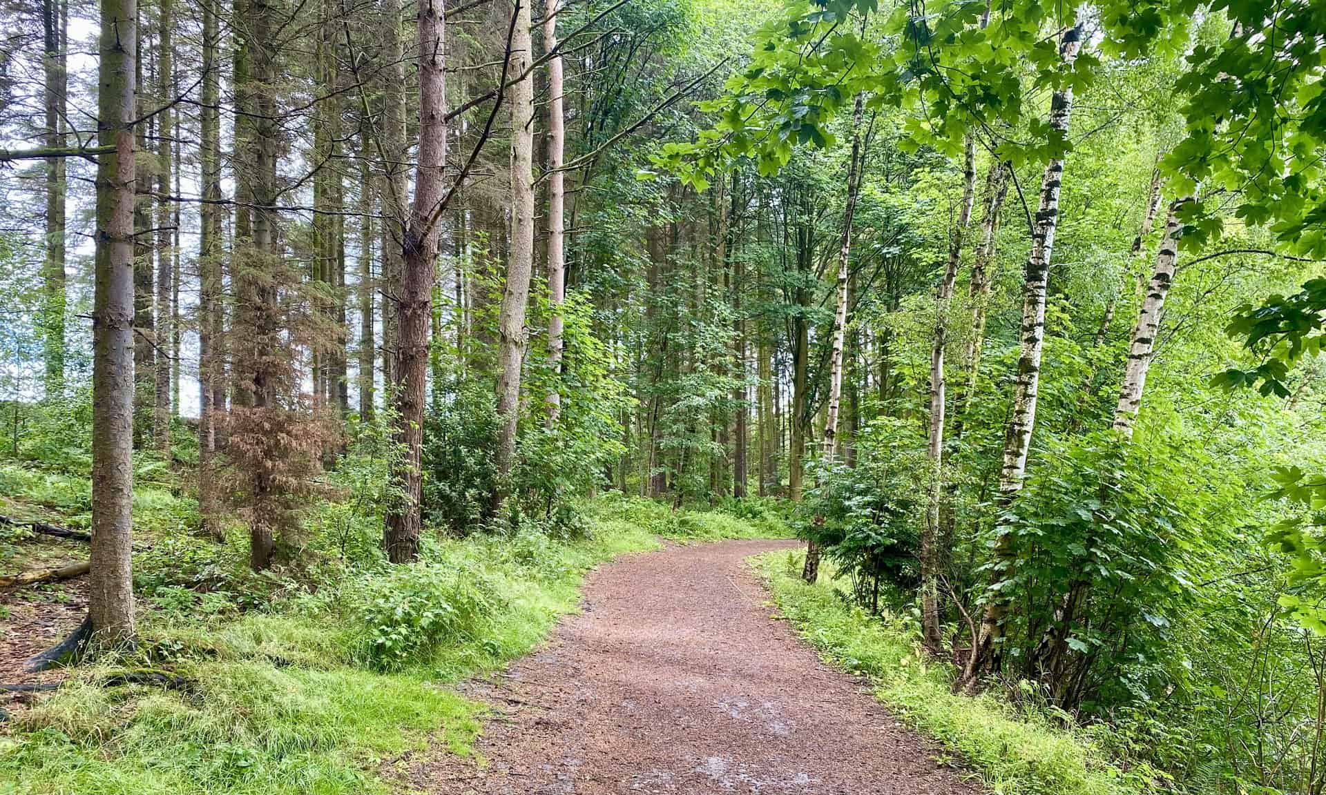
The walkway meandering through the northernmost woodland of Fewston Reservoir, south of the A59.
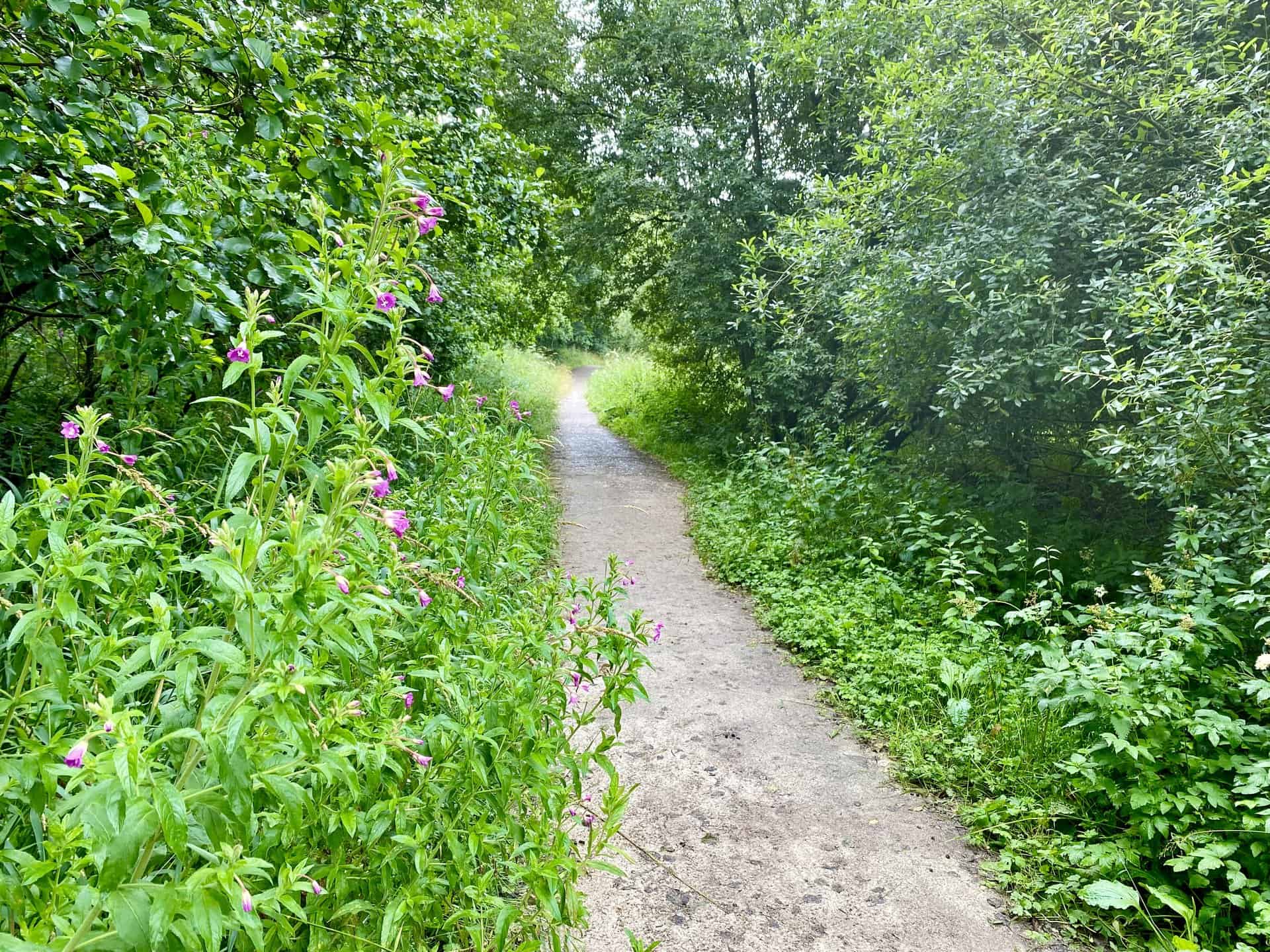
The tranquil trail running through the forest on the northern fringe of Fewston Reservoir.

Walking in the Yorkshire Dales with 43 Circular Routes
AD This Cicerone guidebook includes 43 circular walks exploring valleys, hills, and moors between Kirkby Stephen and Pateley Bridge. With OS maps, local highlights, and routes ranging from 3–11 miles, it is a year-round companion for walkers of all abilities.
The south-eastward view from Fewston Reservoir’s northern boundary towards Fewston Embankment.

Grisport Unisex Adult Peaklander Hiking Boots
AD The Grisport Unisex Adult Peaklander Hiking Boots are crafted in Italy with a durable waxed leather upper, Spotex breathable lining, and a reliable Track-on rubber sole. Waterproof and weighing just 1120g, they offer comfort, resilience, and dependable performance on demanding trails.
A relaxed stroll along the northern bank of Fewston Reservoir.
The north-westward perspective from the northern edge of Fewston Reservoir.
Grisport Unisex Adult Peaklander Hiking Boots
AD The Grisport Unisex Adult Peaklander Hiking Boots are crafted in Italy with a durable waxed leather upper, Spotex breathable lining, and a reliable Track-on rubber sole. Waterproof and weighing just 1120g, they offer comfort, resilience, and dependable performance on demanding trails.
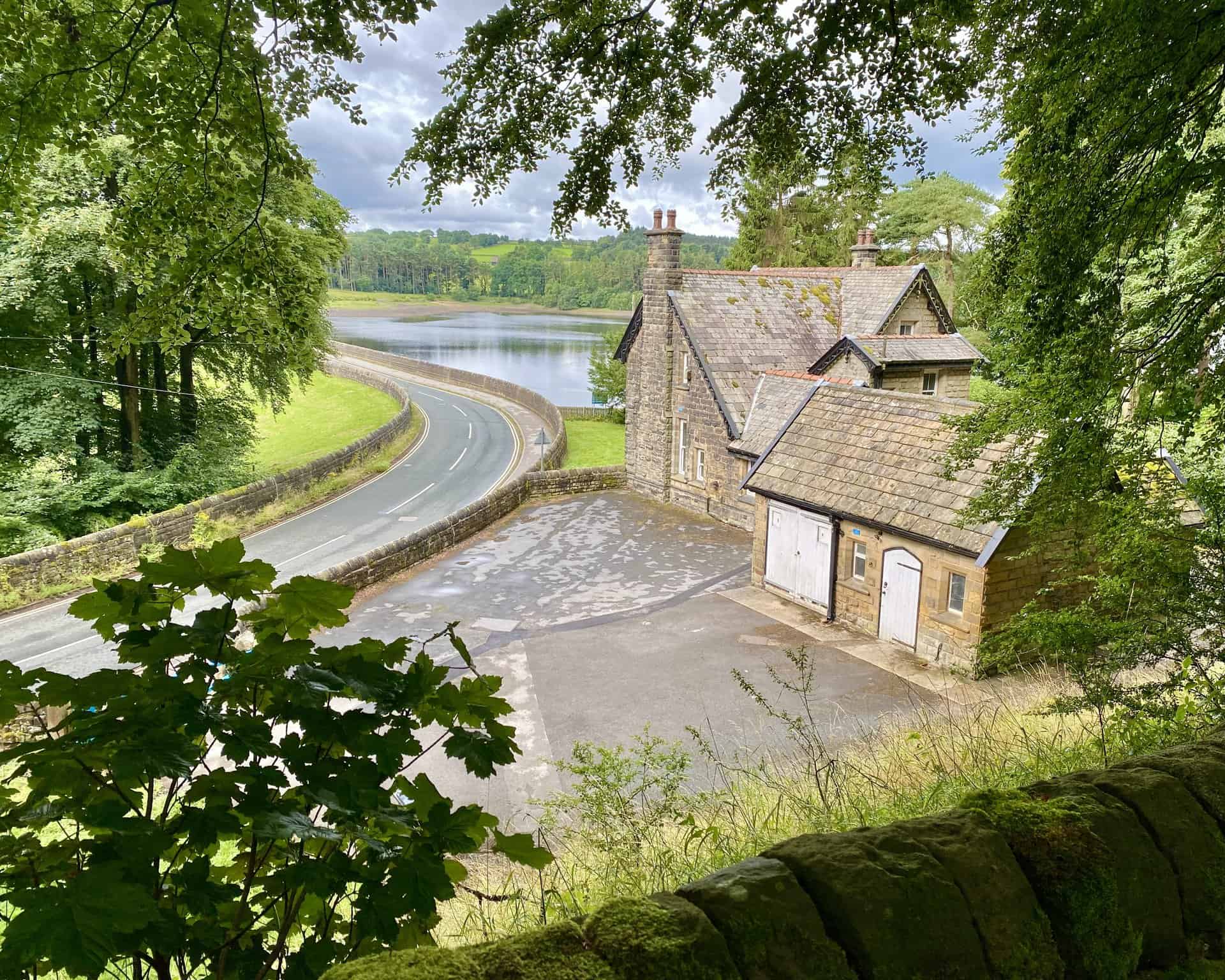
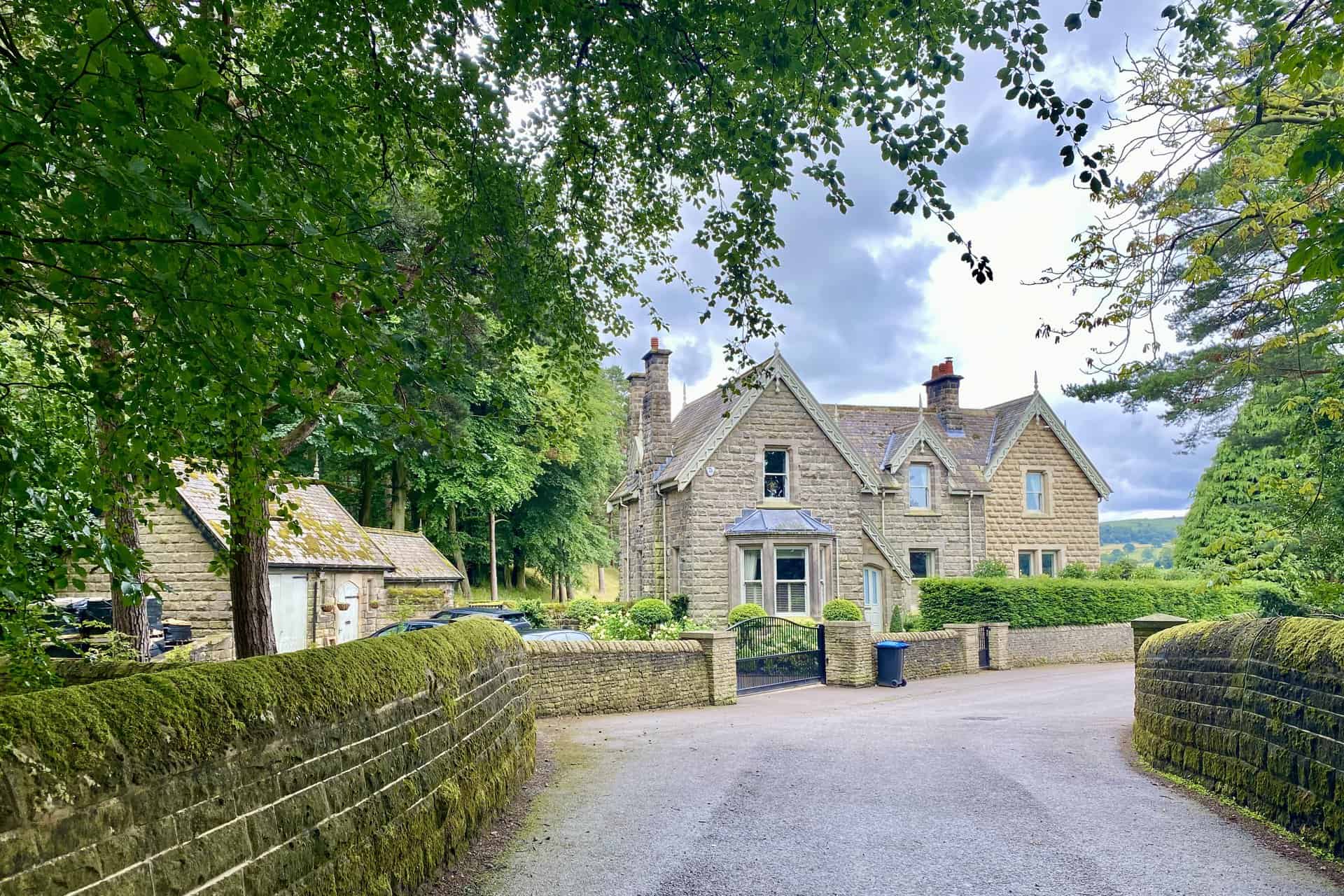
A downward view of Reservoir House at the northern extremity of Fewston Embankment.
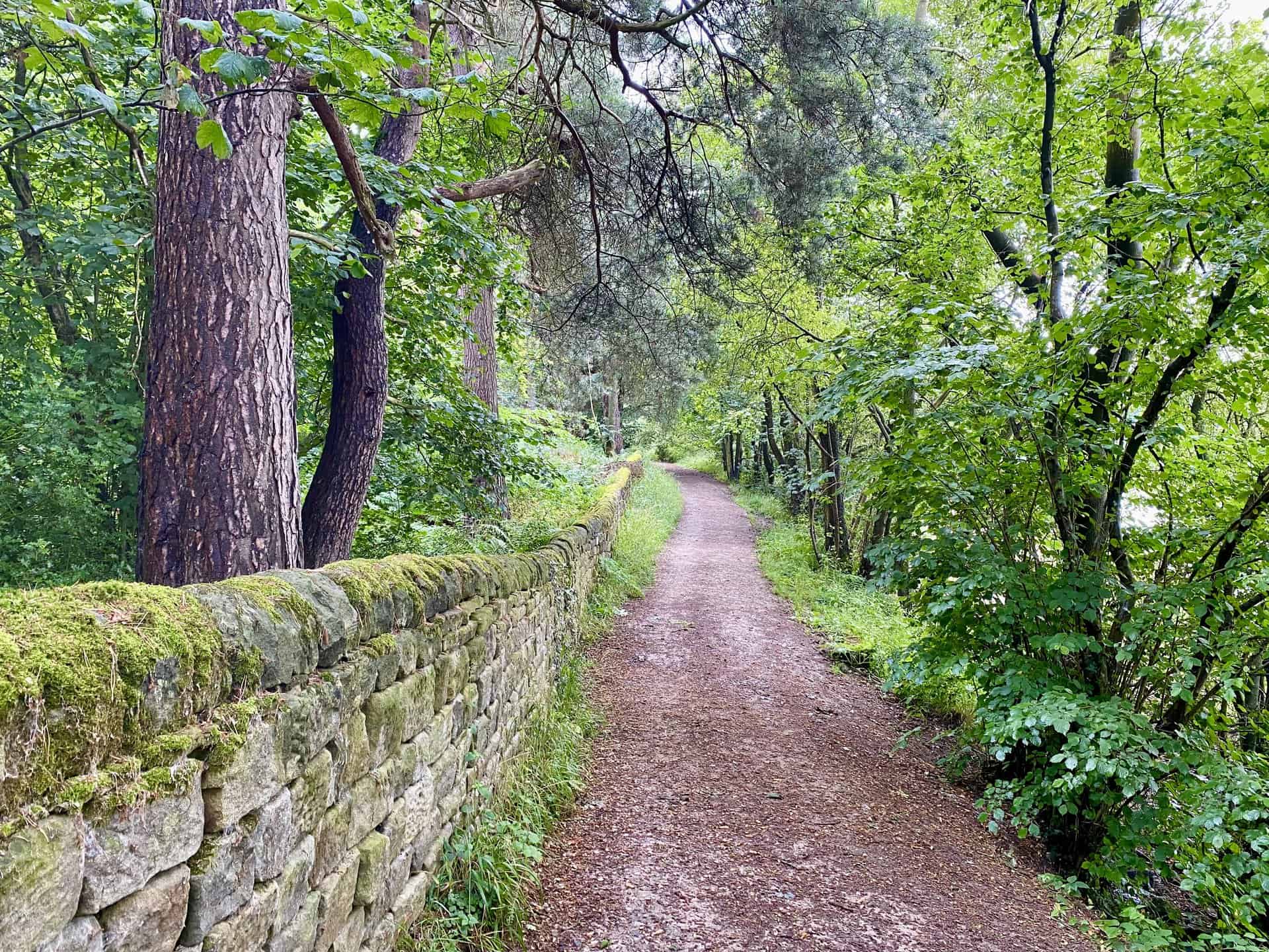
A pathway through the woodland at the northernmost point of Swinsty Reservoir.

Fifty Walks Across the Beautiful North York Moors National Park
AD Discover 50 routes across the North York Moors, from short easy strolls to challenging high-level hikes. With OS maps, route descriptions, and local highlights, it also includes the legendary 40-mile Lyke Wake Walk, described in four accessible stages.
The serene path tracing the northern shoreline of Swinsty Reservoir.

Swinsty Cottage, nestled at the easternmost edge of Swinsty Embankment.
Fifty Walks Across the Beautiful North York Moors National Park
AD Discover 50 routes across the North York Moors, from short easy strolls to challenging high-level hikes. With OS maps, route descriptions, and local highlights, it also includes the legendary 40-mile Lyke Wake Walk, described in four accessible stages.
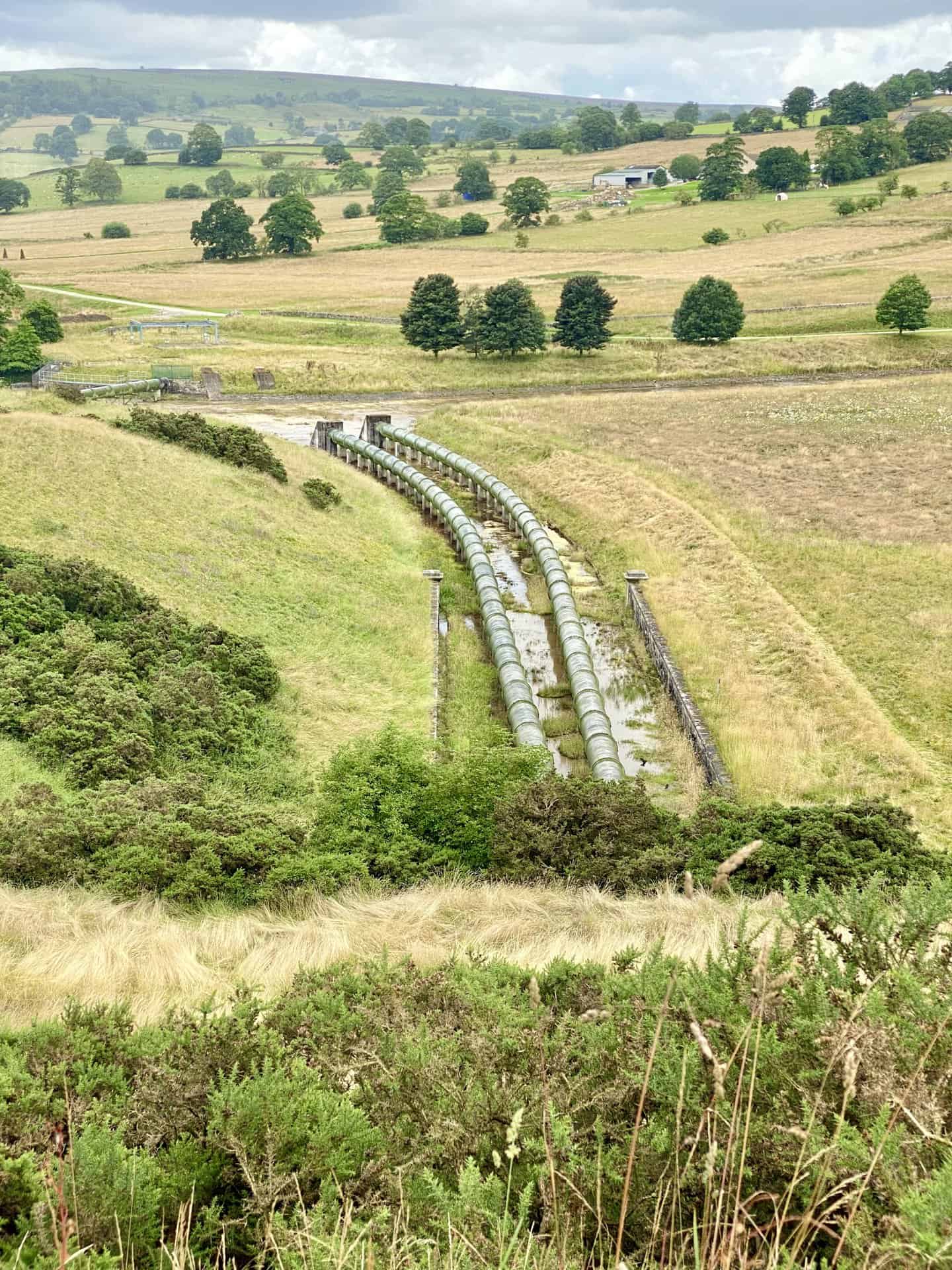
Large pipes sprouting from Swinsty Reservoir’s south-eastern corner.
Dobpark Bridge spanning the River Washburn, slightly over a mile south of Swinsty Embankment.

Osprey Hikelite Unisex Backpack for Comfortable and Lightweight Hiking
AD The Osprey Hikelite backpack combines lightweight design with practical features, including a breathable mesh back panel, soft webbing straps, and stretch mesh water bottle pockets. With zipped storage and an organiser compartment, it is ideal for day hikes and outdoor use.
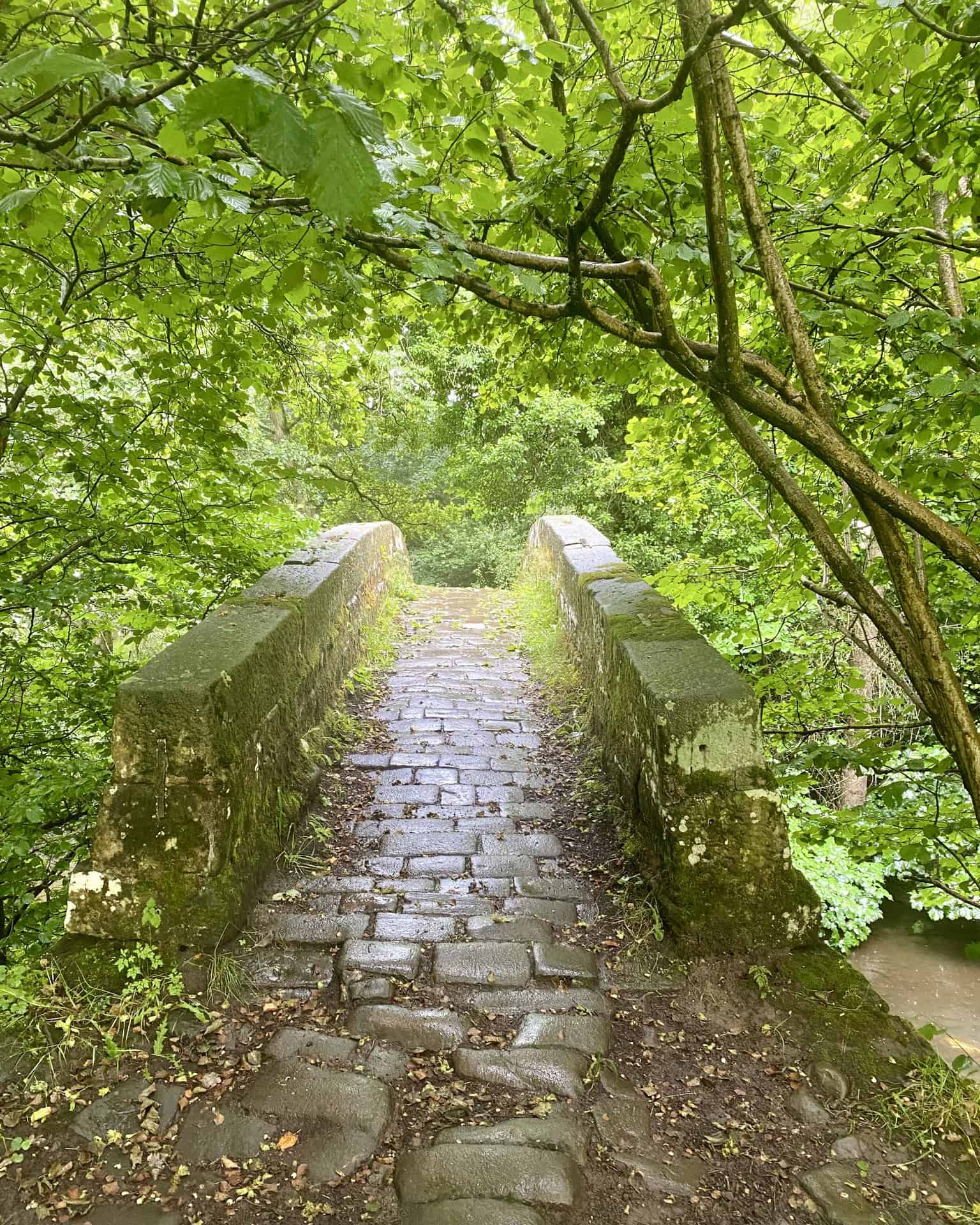
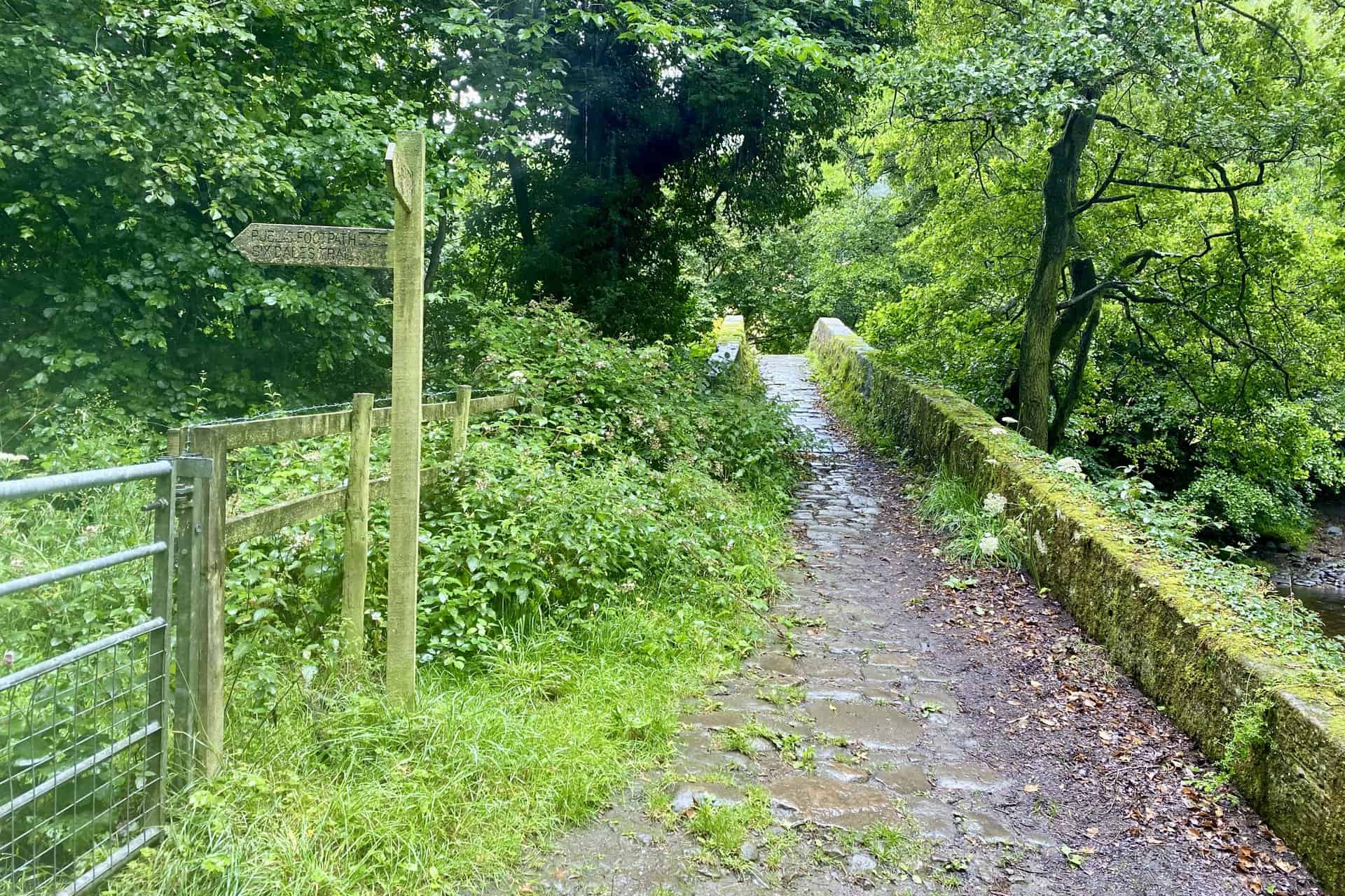
The idyllic Dobpark Bridge over the River Washburn. This is the halfway point of this Fewston Reservoir walk.
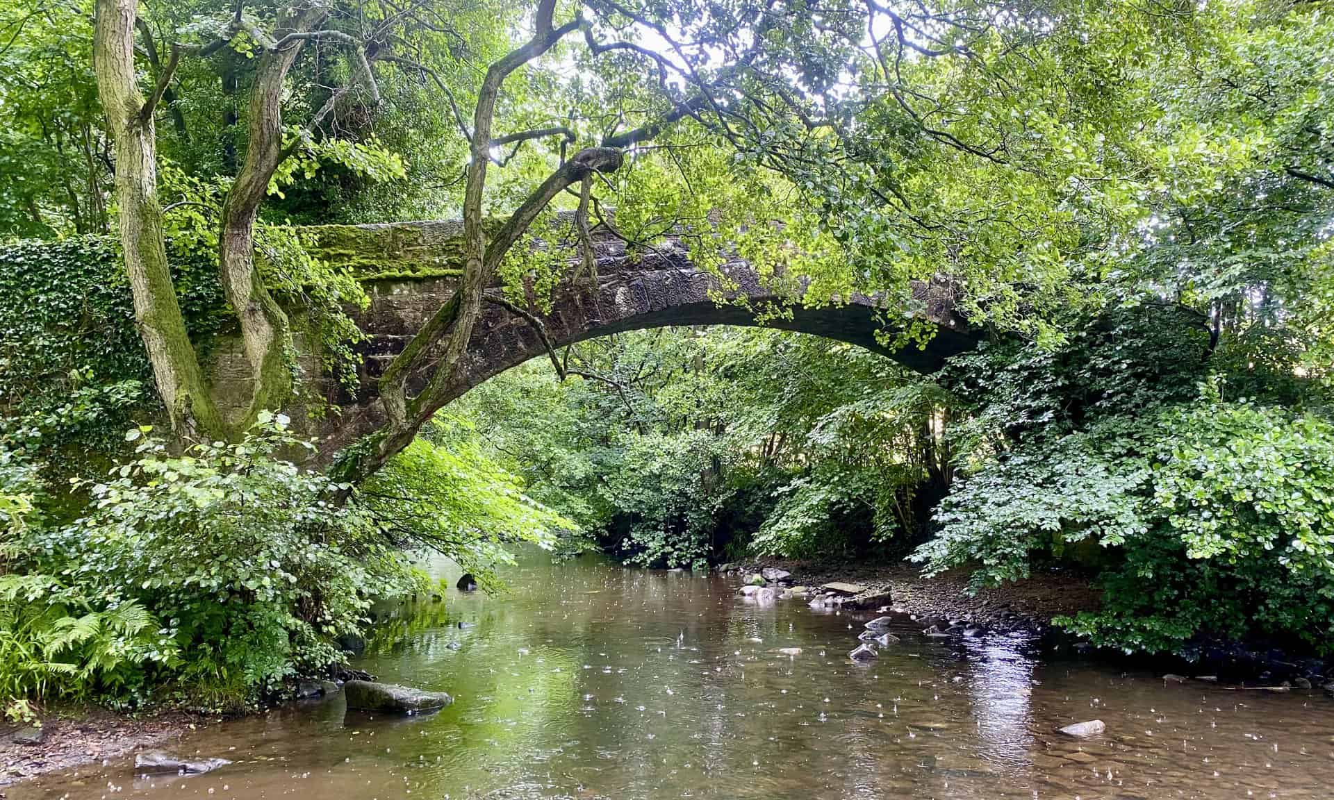
Dobpark Bridge over the River Washburn, with an accompanying signpost for the Six Dales Trail leading back to Swinsty Reservoir.
Osprey Hikelite Unisex Backpack for Comfortable and Lightweight Hiking
AD The Osprey Hikelite backpack combines lightweight design with practical features, including a breathable mesh back panel, soft webbing straps, and stretch mesh water bottle pockets. With zipped storage and an organiser compartment, it is ideal for day hikes and outdoor use.
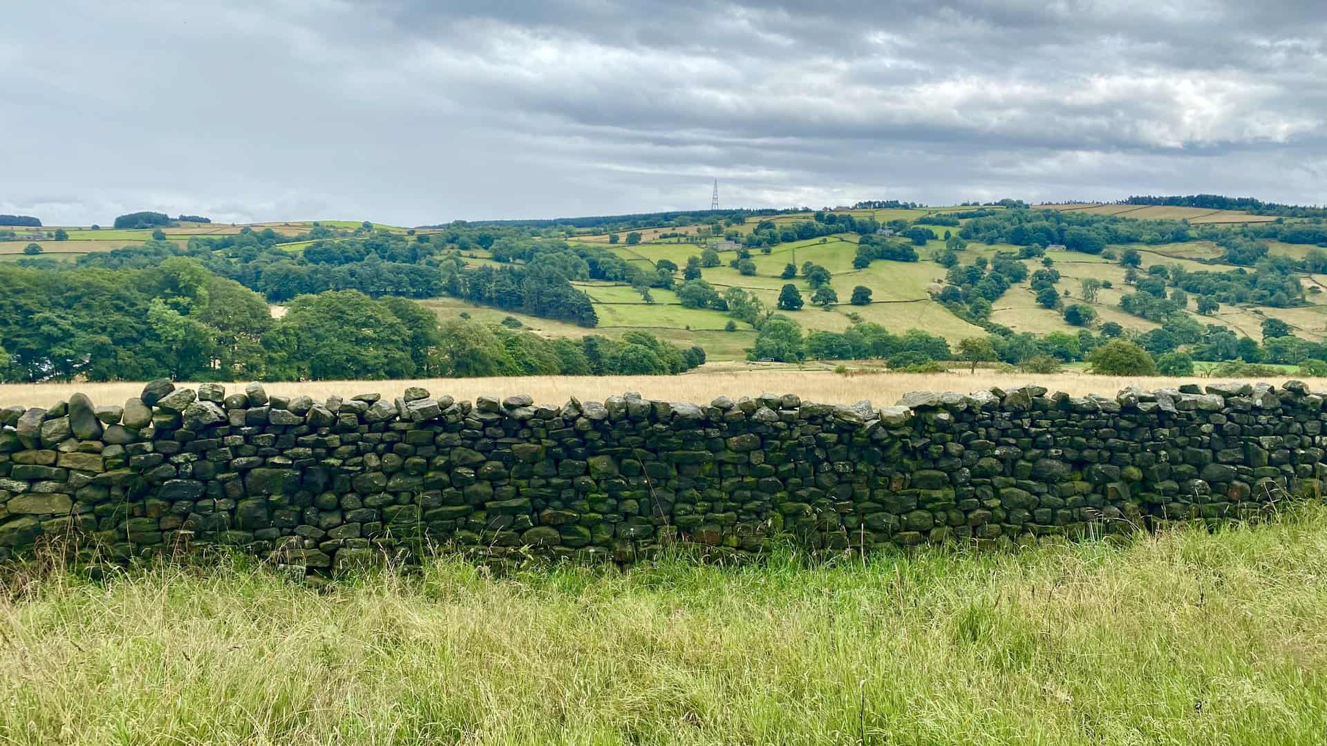
The eastward panorama across the River Washburn valley from High Lane.
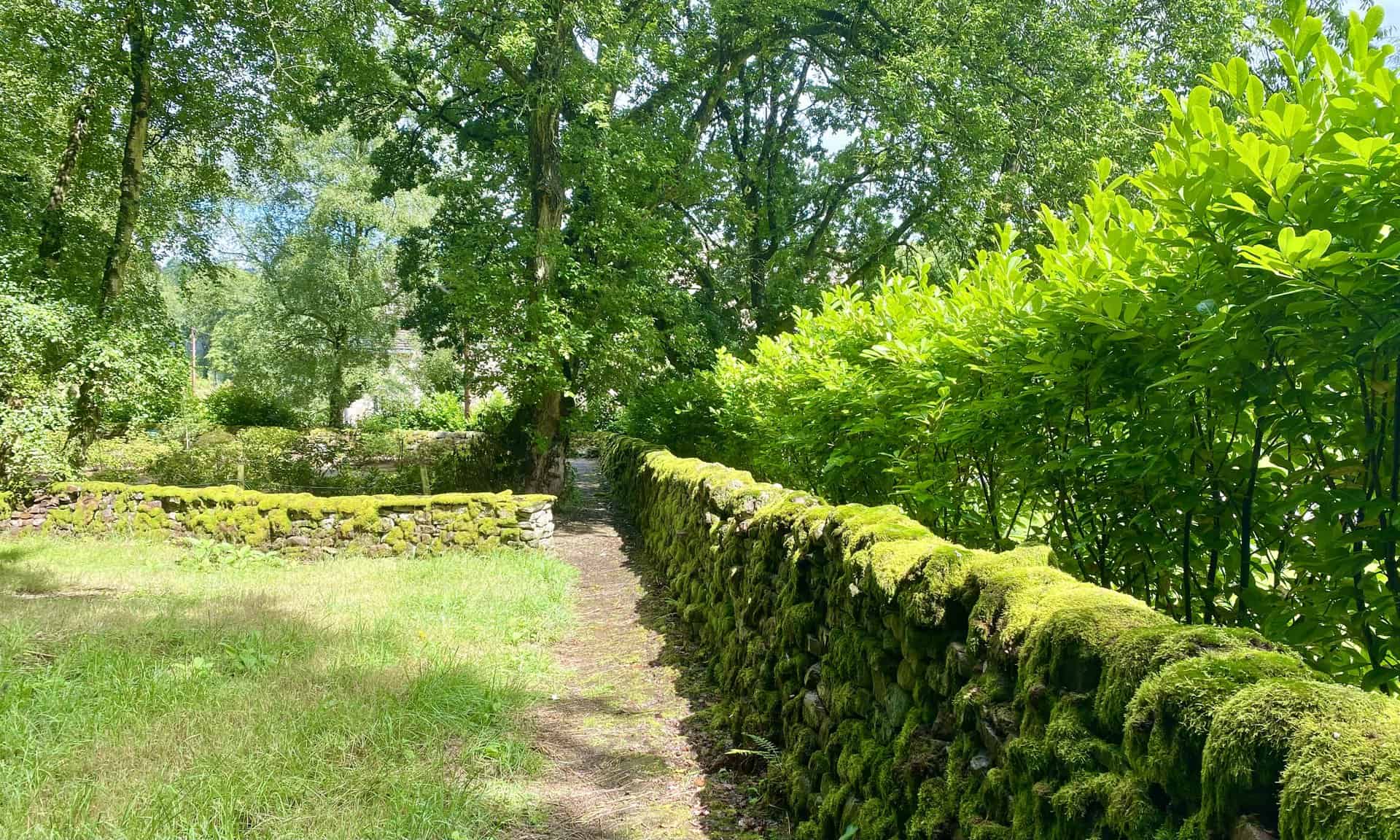
The public footpath meandering through the estate of Swinsty Hall.

Peak Bagging Wainwrights with Routes to Complete All Fells
AD This comprehensive guide offers 45 circular routes linking all 214 Wainwright fells. With maps, GPX downloads, elevation profiles, and practical advice, it provides efficient yet inspiring ways to complete this classic Lake District challenge at your own pace.
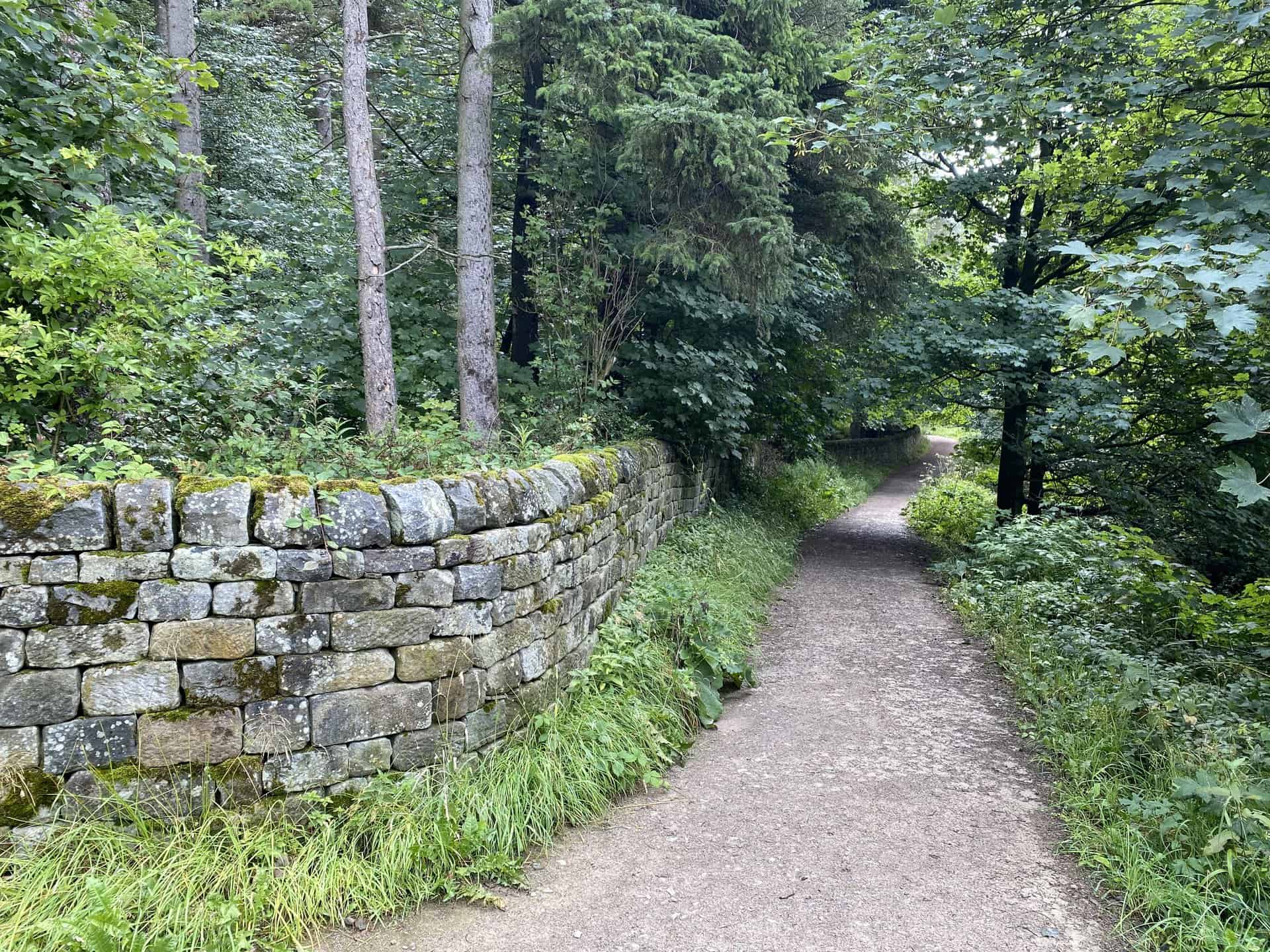
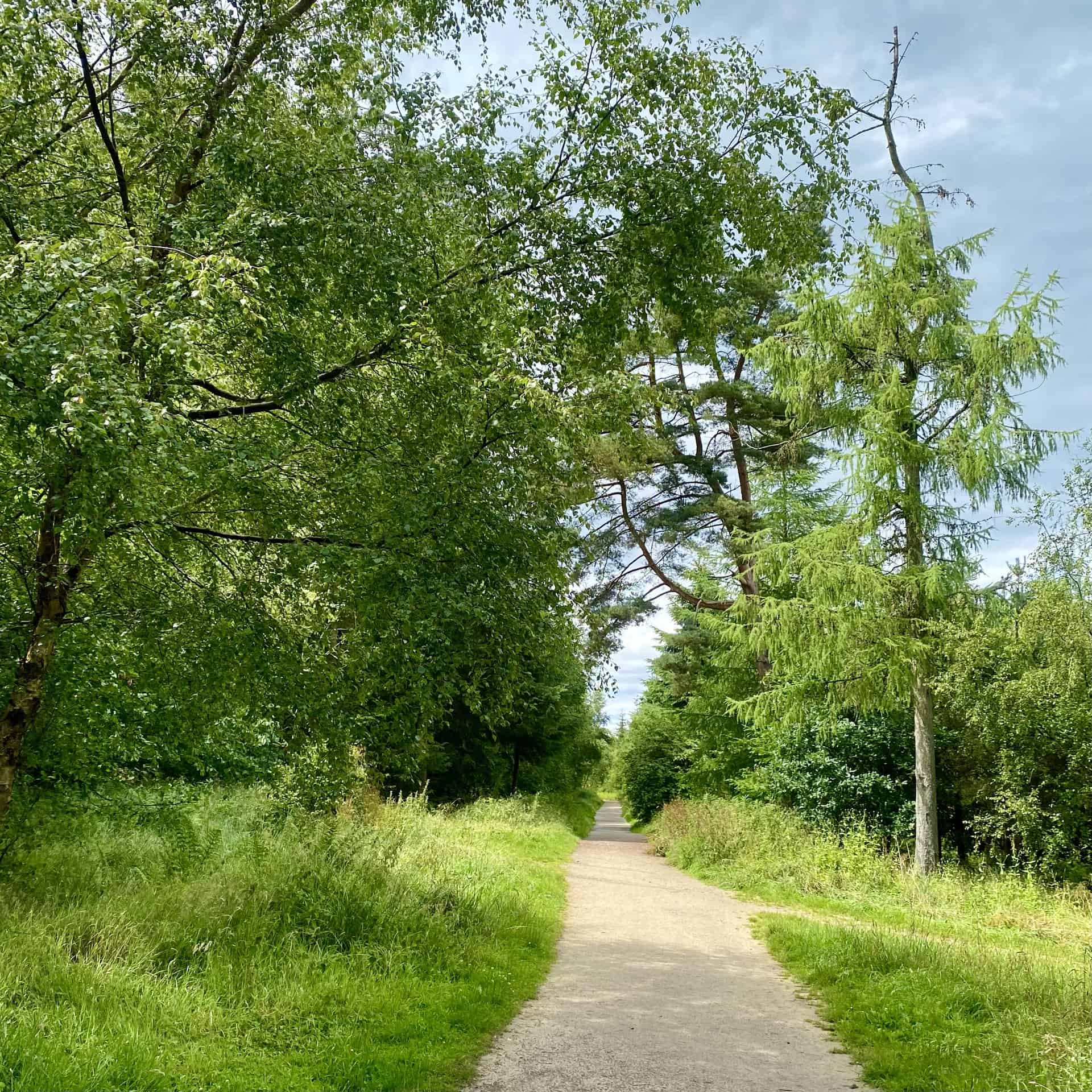
The journey through the woodland of Swinsty Moor Plantation via the Six Dales Trail, located on the western edge of Swinsty Reservoir. Roughly three-quarters of the way round this Fewston Reservoir walk.
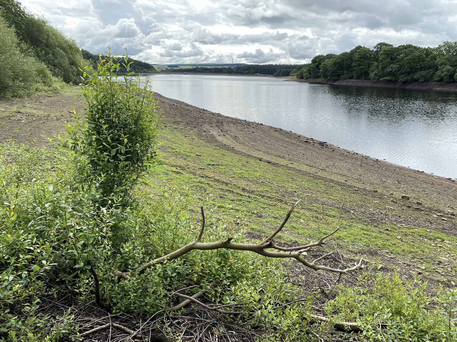
A view of Fewston Reservoir from the southernmost point of Fewston Embankment.
Peak Bagging Wainwrights with Routes to Complete All Fells
AD This comprehensive guide offers 45 circular routes linking all 214 Wainwright fells. With maps, GPX downloads, elevation profiles, and practical advice, it provides efficient yet inspiring ways to complete this classic Lake District challenge at your own pace.
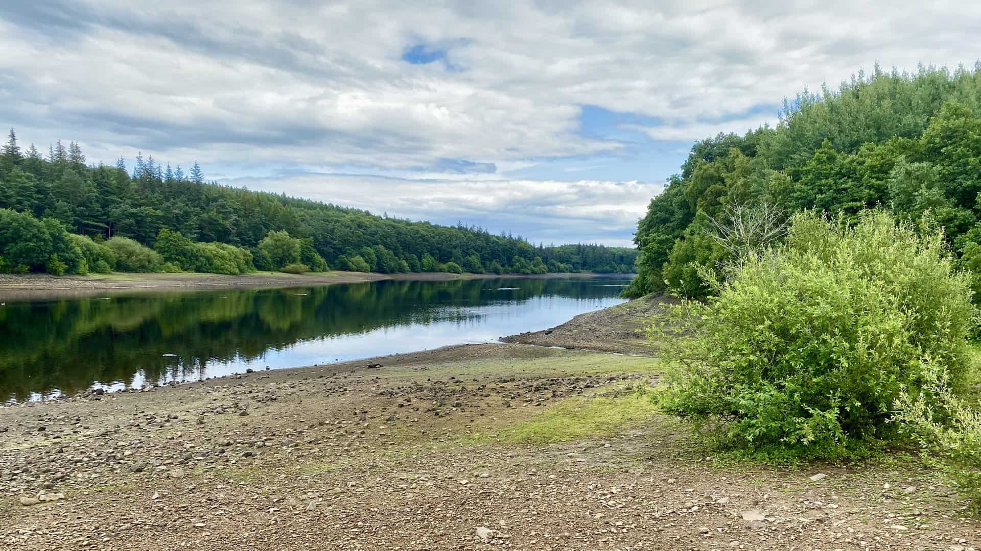
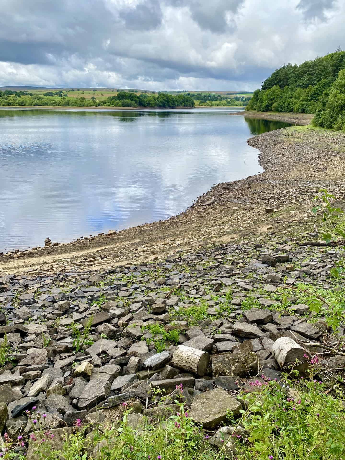
The southern tip of Fewston Reservoir’s banks, providing a scenic viewpoint of the reservoir.
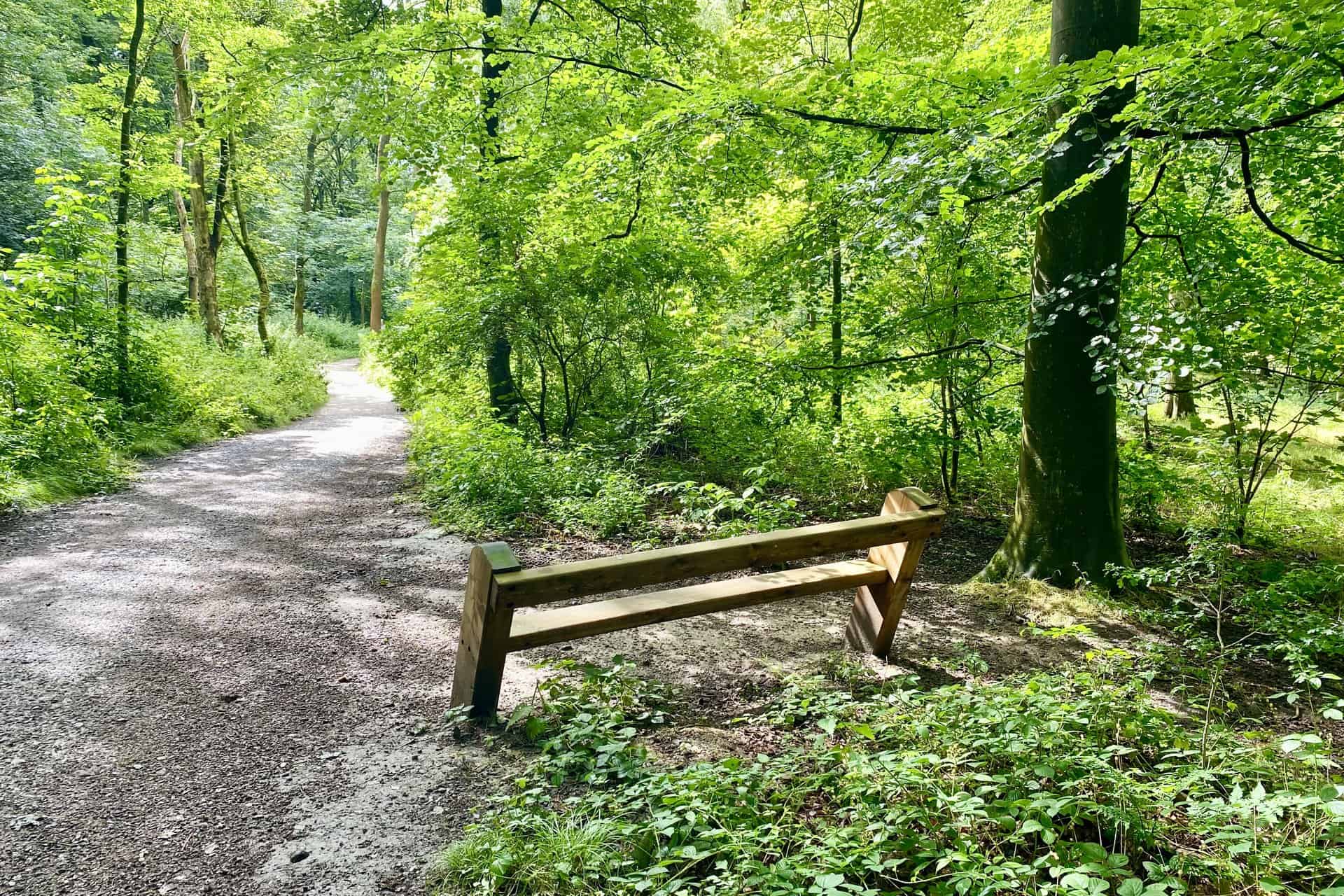
The forest trail adjacent to the south-western coastline of Fewston Reservoir.

Berghaus Hillmaster II GTX Men's High Rise Hiking Boots
AD The Berghaus Hillmaster II GTX men’s hiking boots feature a waterproof, breathable GORE-TEX membrane, a memory foam tongue and collar for a personalised fit, and a Vibram sole delivering exceptional grip, stability, and shock protection for confident performance on any terrain.
The south-eastward view from the western coastline of Fewston Reservoir.