Enjoy Stunning Views on the Gormire Lake Walk in North York Moors
Your Gormire Lake walk begins at the Sutton Bank National Park Centre, located at the top of Sutton Bank on the A170 between Thirsk and Helmsley. The centre offers ample parking and amenities such as a café, shop, and toilets. From the north-west end of the car park, take the scenic track through the woodland to access the Cleveland Way above Sutton Brow. Walk north-west along the Cleveland Way for a few minutes, then turn left and follow the path downhill through the woods until you reach the serene shores of Gormire Lake.
Upon reaching Gormire Lake, turn left and follow the path around the lake in a clockwise direction. As you approach the northern tip of the lake, follow a path north to exit the woodland at Southwood Lodge. Continue north to Midge Holm Gate, then pass a small lake on your left before veering off in a north-westerly direction. Proceed along this route to reach Tang Hall, then turn right and follow the track leading to Greendale.

After walking through the farm at Greendale, head up to the edge of the woods. Continue north through the woods, then descend to leave the wooded area. Follow the track across the countryside until you arrive at the picturesque village of Boltby. Take some time to explore this charming village before continuing your Gormire Lake walk.
From Boltby, head east along the road, ascending uphill as you leave the village behind. As the road curves to the left, you’ll see a path off to the right. Follow this path downhill across the farmland. At the bottom, prepare for a steep ascent eastward to reach the Cleveland Way at the top of the hill near High Barn. The path zigzags to ease the gradient, making the climb more manageable.

From High Barn, enjoy a pleasant 3-mile walk south along the Cleveland Way. This route offers stunning views over Boltby Scar, Whitestone Cliff, and Sutton Brow, with vistas stretching across the Tees Valley and the Vale of Mowbray. On clear days, you can see the hills and mountains of the Yorkshire Dales on the horizon. You’ll also get splendid views down to Gormire Lake, where you were earlier in the day.
Once you reach the Sutton Brow section of the Cleveland Way, retrace your steps through the woods back to the car park. Alternatively, take some time to visit the café and shop at the Sutton Bank National Park Centre, a great way to conclude your Gormire Lake walk.
This North York Moors trek spans just under nine miles, offering superb vistas throughout the journey. With its varied scenery and points of interest, this Gormire Lake walk is both rewarding and scenic, making it a delightful experience for everybody.
Gormire Lake Walk: Maps and Tools
Visit either the OS Maps website or the Outdooractive website to view this walking route in greater detail. Both platforms offer a range of features, including the ability to print the route, download it to your device, and export the route as a GPX file. You can also watch a 3D fly-over and share the route on social media.
Gormire Lake Walk: Distance, Duration, Statistics
Distance: 8¾ miles
Distance: 14 kilometres
Duration: 4¼ hours
Ascent: 1384 feet
Ascent: 422 metres
Type: Circular walk

Walking in the Yorkshire Dales with 43 Circular Routes
AD This Cicerone guidebook includes 43 circular walks exploring valleys, hills, and moors between Kirkby Stephen and Pateley Bridge. With OS maps, local highlights, and routes ranging from 3–11 miles, it is a year-round companion for walkers of all abilities.
Recommended Ordnance Survey Map
The best map to use on this walk is the Ordnance Survey map of the North York Moors Western Area, reference OS Explorer OL26, scale 1:25,000. It clearly displays footpaths, rights of way, open access land and vegetation on the ground, making it ideal for walking, running and hiking. The map can be purchased from Amazon in either a standard, paper version or a weatherproof, laminated version, as shown below.
About Gormire Lake
Gormire Lake is a natural lowland lake located below Whitestone Cliff on the west side of Garbutt Wood. You’ll walk down through this wood on your Gormire Lake walk. The lake has no major inflows or outflows, and it is believed to be filled by an underground spring and drained by a limestone channel at the base of the cliff to the east. Known alternatively as White Mere, Lake Gormire, or simply Gormire, the name Gormire means ‘filthy swamp’.
Gormire Lake was formed over 20,000 years ago by glacial erosion. As an ice sheet pushed its way between the Pennines and the North York Moors, it bulldozed the soft earth, carving the cliffs at Whitestone. The resulting mud blocked the water’s escape, forming this glacial lake. It is the fourth largest natural lake in Yorkshire, after Hornsea Mere, Malham Tarn, and Semerwater. In 1954, it was designated a Site of Special Scientific Interest (SSSI). In 1985, the SSSI status was extended to include the surrounding area, incorporating Garbutt Wood.
The lake is steeped in myths. One legend tells of Sir Harry Scriven, a knight who tricked the Abbot of Rievaulx Abbey into letting him ride his white mare. As they rode from an inn, the ride turned into a race. The abbot transformed into the devil, causing such panic in the knight that he couldn’t stop himself and his horse from plunging into Gormire Lake from the top of the cliff. The ‘devil’ then leapt into the lake after them, and the boiling effect is said to have darkened the lake’s waters. Other myths suggest the lake is bottomless, serves as the entrance to hell, conceals a submerged village, or that a goose once vanished in the lake only to reappear featherless in a well at Kirkbymoorside.
Gormire Lake is popular with wild swimmers due to its lack of streams, resulting in very little current and relatively warm waters. However, swimmers have reported it teems with leeches. The Times has named Gormire Lake one of the 20 best lakes and rivers in Britain for wild swimming. The lake is also a favourite among walkers, with several routes leading down to the lake from Sutton Bank. The Gormire Lake walk detailed on this page provides a scenic and enjoyable way to explore the beauty of Gormire Lake.
Gormire Lake Walk: My Photos
Gormire Lake, a serene natural lowland lake nestled below Whitestone Cliff on the west side of Garbutt Wood.

Grisport Unisex Adult Peaklander Hiking Boots
AD The Grisport Unisex Adult Peaklander Hiking Boots are crafted in Italy with a durable waxed leather upper, Spotex breathable lining, and a reliable Track-on rubber sole. Waterproof and weighing just 1120g, they offer comfort, resilience, and dependable performance on demanding trails.
A tranquil bridleway just north of Southwoods Lodge, inviting walkers to explore.

The charming gated entrance of Southwoods Hall, steeped in history and character.

Fifty Walks Across the Beautiful North York Moors National Park
AD Discover 50 routes across the North York Moors, from short easy strolls to challenging high-level hikes. With OS maps, route descriptions, and local highlights, it also includes the legendary 40-mile Lyke Wake Walk, described in four accessible stages.
Heading north from Midge Holm Gate towards Huggon Howl, a scenic part of the Gormire Lake walk.

A picturesque small pond near Midge Holm Gate, about a quarter of the way through the Gormire Lake walk.

Fifty Walks Across the Beautiful North York Moors National Park
AD Discover 50 routes across the North York Moors, from short easy strolls to challenging high-level hikes. With OS maps, route descriptions, and local highlights, it also includes the legendary 40-mile Lyke Wake Walk, described in four accessible stages.
A beautiful woodland path north-east of Greendale, perfect for a peaceful stroll.

The view down to the farm at Greendale, showcasing the area’s rural charm.

Osprey Hikelite Unisex Backpack for Comfortable and Lightweight Hiking
AD The Osprey Hikelite backpack combines lightweight design with practical features, including a breathable mesh back panel, soft webbing straps, and stretch mesh water bottle pockets. With zipped storage and an organiser compartment, it is ideal for day hikes and outdoor use.
Emerging from Cow Pasture Wood, with a stunning vista across farmland towards the village of Boltby.

The historic Holy Trinity Church in Boltby, founded in 1409 and rebuilt in 1802, standing proudly in the village.

Osprey Hikelite Unisex Backpack for Comfortable and Lightweight Hiking
AD The Osprey Hikelite backpack combines lightweight design with practical features, including a breathable mesh back panel, soft webbing straps, and stretch mesh water bottle pockets. With zipped storage and an organiser compartment, it is ideal for day hikes and outdoor use.

The beautiful and peaceful village of Boltby, nestled beneath the Hambleton Hills about a mile to the east, halfway through the Gormire Lake walk.

Peak Bagging Wainwrights with Routes to Complete All Fells
AD This comprehensive guide offers 45 circular routes linking all 214 Wainwright fells. With maps, GPX downloads, elevation profiles, and practical advice, it provides efficient yet inspiring ways to complete this classic Lake District challenge at your own pace.

Enjoying the breathtaking views of Boltby Forest and the surrounding countryside.

Peak Bagging Wainwrights with Routes to Complete All Fells
AD This comprehensive guide offers 45 circular routes linking all 214 Wainwright fells. With maps, GPX downloads, elevation profiles, and practical advice, it provides efficient yet inspiring ways to complete this classic Lake District challenge at your own pace.
The roots of these lovely trees, exposed where the soil has washed away, creating a unique natural sculpture.

A signpost on the Cleveland Way above Boltby Scar, pointing to Sneck Yate to the north, Sutton Bank to the south, and Hambleton Road to the east.

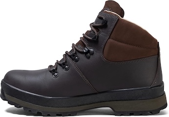
Berghaus Hillmaster II GTX Men's High Rise Hiking Boots
AD The Berghaus Hillmaster II GTX men’s hiking boots feature a waterproof, breathable GORE-TEX membrane, a memory foam tongue and collar for a personalised fit, and a Vibram sole delivering exceptional grip, stability, and shock protection for confident performance on any terrain.
The view west from Boltby Scar towards Boltby, offering a stunning perspective three-quarters of the way around the Gormire Lake walk.

Looking north over Boltby Forest from the top of Whitestone Cliff, presenting a breathtaking panorama.

Berghaus Hillmaster II GTX Men's High Rise Hiking Boots
AD The Berghaus Hillmaster II GTX men’s hiking boots feature a waterproof, breathable GORE-TEX membrane, a memory foam tongue and collar for a personalised fit, and a Vibram sole delivering exceptional grip, stability, and shock protection for confident performance on any terrain.
Amazing views of Gormire Lake and the sprawling flatland of the Vale of Mowbray, as seen from the Cleveland Way above Whitestone Cliff on the Gormire Lake walk.


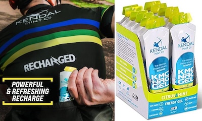
Kendal Mint Co Energy Gel with Citrus and Mint Flavour
AD Kendal Mint Co energy gels deliver 27g of fast-absorbing carbohydrates plus electrolytes and B vitamins for improved performance. Vegan, gluten free, and Informed Sport certified, these caffeine-free gels are refreshing, easy to digest, and ideal for running, cycling, and endurance.
Whitestone Cliff with South Woods below and Boltby Forest in the distance, a majestic sight near the end of the Gormire Lake walk.

