Experience Breathtaking Views on the Guisborough 3 Peaks Walking Route
This Guisborough 3 Peaks walk takes you on a scenic route across three stunning high points in the North York Moors National Park: Roseberry Topping, Hanging Stone, and Highcliff Nab. These three peaks rise above the town of Guisborough, offering breathtaking views that are officially recognised on Ordnance Survey maps. Marked with the blue viewpoint symbol, each summit rewards you with outstanding panoramic vistas, making this a must-do walk for those seeking an exhilarating and visually stunning adventure.
Your walk begins on Hutton Village Road, which you can access from the junction of The Avenue and Hutton Lane. Look for a section of roadside parking on a bend, about halfway between the main road and Hutton Village itself. Once parked, locate the lane that leads to Timber House, Lowcross House, Park House, and School House. Directly opposite this lane, on the other side of the road, you’ll find a gate leading to a grassy bank. Go through the gate and follow the semicircular path uphill, avoiding the first left-hand path. At the top, pass through another gate and enter Hutton Lowcross Woods. Follow the well-surfaced bridleway for about half a mile before reaching a fork—take the left-hand path uphill, not the right, which descends into High Bousdale Wood.
As you continue along the widening track, Roseberry Topping will soon come into view in the distance. Keep heading south-west towards it, following a dry stone wall and passing through a gate where the full magnificence of Roseberry Topping reveals itself. Another gate marks your entrance into the National Trust countryside, and the path ahead ascends gently over Roseberry Common. Just before reaching a wall with a gate, turn right and begin your climb, keeping the wall on your left. The ascent follows a zigzagging, well-constructed stone-stepped path, which is largely free of mud. Before long, you’ll reach the summit—your first peak of the Guisborough 3 Peaks walk. At this point, you’ll have covered around 1½ miles.

After taking in the views from Roseberry Topping, retrace your steps back down the hill. As you reach the bottom, follow the path that runs east alongside the wall, passing by the gate you encountered earlier. From here, head uphill towards the distinctive cone-shaped hill called Little Roseberry. You’ll be following the Cleveland Way, which runs alongside the dry stone wall on your right, on a stepped stone path that curves around the right-hand side of the hill. At the top, go through a gate onto Newton Moor, where three paths diverge. One track leads straight ahead (south-east) alongside a wall, another grassy path heads east (diagonally left) across the moorland, and a third heads directly left (north-east) alongside a wall. Take the left-hand path with the wall on your left-hand side, and follow it across the moorland. Cross a stile, leaving the National Trust area, and continue forward along the grassy track towards Hanging Stone.
As the track descends and bends sharply right, look for a narrow footpath on your left leading into the woodland. Follow this narrow path, which brings you to Hanging Stone, the second summit of your Guisborough 3 Peaks challenge. By now, you will have covered approximately 2¾ miles. After soaking in the views, retrace your steps along the narrow path, then turn left onto the stony track. Continue south through the woodland until you reach the Cleveland Way once more, then turn left onto a wide stone track heading east towards Highcliff Nab.
Pass through a gate and immediately reach a crossroads. Turn right, heading uphill onto Hutton Moor, then take the next left to stay on the Cleveland Way, which is marked by an acorn symbol. This part of the route follows a flagged stone path across open moorland, skirting the base of a small hill called Black Nab. The path is firm underfoot as you continue, always keeping the wall on your left. After passing through another gate, the path begins a gentle ascent, eventually bringing you alongside Highcliff Farm. Nearing the woodland, avoid the first left-hand path (a bridleway) and instead take the second left, marked as the Cleveland Way, passing through a gate near a bench.

Follow the path alongside a wall until you reach a signpost where the path splits to the left and right. Turn right, following the Cleveland Way uphill towards Highcliff Nab. Cross a wide stone track—remember this point—and continue uphill, eventually reaching the base of the Highcliff Nab rocky outcrop. Turn right, climbing a short flight of steps to reach the top—your third and final summit of the Guisborough 3 Peaks walk. By this point, you’ll have covered just under 5 miles.
After enjoying the far-reaching views from Highcliff Nab, retrace your steps back to the stone track and turn right. Follow this path downhill to a T-junction and turn left. The wide forestry track, which is occasionally surfaced with tarmac, leads downhill through the woodland. Ignore any side paths and continue as the track bends to the right. On this bend, take the sharper right-hand turn, descending steeply on a tarmac lane that leads to Hutton Village.
At the bottom, go through a gate and join the main road running through Hutton Village. Walk through the village and continue along the road until you reach the parking area where your Guisborough 3 Peaks adventure began. In total, you will have covered approximately 6½ miles, completing a fantastic circular route through some of the most breathtaking landscapes in the North York Moors.
Guisborough 3 Peaks: Maps and Tools
Visit either the OS Maps website or the Outdooractive website to view this walking route in greater detail. Both platforms offer a range of features, including the ability to print the route, download it to your device, and export the route as a GPX file. You can also watch a 3D fly-over and share the route on social media. Additionally, this page includes a printable version of the walk in PDF format. Plus there is a supporting video, available for you to watch on YouTube.
Guisborough 3 Peaks: Distance, Duration, Statistics
Distance: 6½ miles
Distance: 10½ kilometres
Duration: 3½ hours
Ascent: 1307 feet
Ascent: 398 metres
Type: Circular walk

Walking in the Yorkshire Dales with 43 Circular Routes
AD This Cicerone guidebook includes 43 circular walks exploring valleys, hills, and moors between Kirkby Stephen and Pateley Bridge. With OS maps, local highlights, and routes ranging from 3–11 miles, it is a year-round companion for walkers of all abilities.
Recommended Ordnance Survey Map
The best map to use on this walk is the Ordnance Survey map of the North York Moors Western Area, reference OS Explorer OL26, scale 1:25,000. It clearly displays footpaths, rights of way, open access land and vegetation on the ground, making it ideal for walking, running and hiking. The map can be purchased from Amazon in either a standard, paper version or a weatherproof, laminated version, as shown below.
About the Guisborough 3 Peaks
This Guisborough 3 Peaks walk is a scenic hiking route featuring three distinct peaks: Roseberry Topping, Hanging Stone, and Highcliff Nab. This rewarding hike takes walkers through a mix of moorland, woodland, and hilltop peaks, with breathtaking panoramic views at each summit.
1. Roseberry Topping
The First Peak of the Guisborough 3 Peaks Walk
Rising to 320 metres, Roseberry Topping is a striking hill located near Newton under Roseberry, between Guisborough and Great Ayton in North Yorkshire. Its distinctive half-cone shape and rugged cliff face have earned it comparisons to the Matterhorn in the Swiss-Italian Alps.
The hill is composed of sandstone deposited during the Middle and Lower Jurassic periods, approximately 208 to 165 million years ago. However, in 1912, a geological fault—likely worsened by alum and ironstone mining—caused the original summit to collapse, creating its iconic profile.
Reaching the summit is a rewarding experience, as it offers sweeping views over the Cleveland Plain. On a clear day, the visibility extends as far as the Pennines, some 40 to 50 miles away.
Related Walk: Similar to the Guisborough 3 Peaks Walk
Enjoy a memorable hike on the Roseberry Topping walk from Great Ayton
2. Hanging Stone
The Second Peak of the Guisborough 3 Peaks Walk
Hanging Stone is a prominent sandstone outcrop nestled within Hutton Lowcross Woods, near Guisborough. Thought to be part of an old quarry, this large rock formation stands out against the dense woodlands surrounding it.
There are several routes leading to Hanging Stone, with each offering a unique journey through the forested landscape. Hikers who make their way to the top are rewarded with far-reaching views, including Roseberry Topping and the vast expanse of the Cleveland Hills.
3. Highcliff Nab
The Third Peak of the Guisborough 3 Peaks Walk
Standing at approximately 320 metres, Highcliff Nab is a dramatic rocky outcrop located on the edge of Gisborough Moor. The ascent takes hikers through a mix of open moorland and woodland trails, leading to a spectacular viewpoint.
At the summit, visitors can enjoy wide-ranging views over Guisborough, the Tees Valley, and the North Sea. The area is popular with hikers and provides a quiet spot to rest and enjoy the North York Moors National Park.
Guisborough 3 Peaks: My Photos
From the roadside car parking area, I take in the view of the grassy bank opposite the lane leading to Timber House, Lowcross House, Park House, and School House. My Guisborough 3 Peaks walk begins here, as I follow the footpath curving to the left, leading to a gate at the edge of Hutton Lowcross Woods.

Grisport Unisex Adult Peaklander Hiking Boots
AD The Grisport Unisex Adult Peaklander Hiking Boots are crafted in Italy with a durable waxed leather upper, Spotex breathable lining, and a reliable Track-on rubber sole. Waterproof and weighing just 1120g, they offer comfort, resilience, and dependable performance on demanding trails.
I follow the woodland track through Hutton Lowcross Woods for nearly a mile before reaching a peaceful spot with a bench. Here, I start to see stunning views of Roseberry Topping, bathed beautifully in sunlight. The path is firm underfoot, making it easy to follow and navigate.

About a mile into my walk, after passing through the woods, I emerge into the National Trust Roseberry Topping open countryside. The views to the north are already impressive, stretching towards Teesside.

Grisport Unisex Adult Peaklander Hiking Boots
AD The Grisport Unisex Adult Peaklander Hiking Boots are crafted in Italy with a durable waxed leather upper, Spotex breathable lining, and a reliable Track-on rubber sole. Waterproof and weighing just 1120g, they offer comfort, resilience, and dependable performance on demanding trails.
As I cross Roseberry Common, the landscape opens up dramatically. I can see far into the distance, with views extending towards Teesside, Redcar, and the North Sea coast.

After crossing Roseberry Common, I begin my ascent of Roseberry Topping. The well-trodden path zigzags its way up the hillside, leading me towards my first summit on the Guisborough 3 Peaks route.

Fifty Walks Across the Beautiful North York Moors National Park
AD Discover 50 routes across the North York Moors, from short easy strolls to challenging high-level hikes. With OS maps, route descriptions, and local highlights, it also includes the legendary 40-mile Lyke Wake Walk, described in four accessible stages.
The climb up Roseberry Topping follows a well-maintained, stone-stepped path, making the ascent structured and clear.

My route to the summit is part of the Cleveland Way National Trail. Along the way, I come across a rock engraved with ‘Cleveland Way 1995 – Helmsley 46 miles, Filey 64 miles’. The date likely marks when the rock was carved and placed. An acorn symbol is also etched into the stone, signifying its status as a National Trail. The Cleveland Way, officially opened on 24 May 1969, was the second recognised National Trail in England and Wales.

Fifty Walks Across the Beautiful North York Moors National Park
AD Discover 50 routes across the North York Moors, from short easy strolls to challenging high-level hikes. With OS maps, route descriptions, and local highlights, it also includes the legendary 40-mile Lyke Wake Walk, described in four accessible stages.
After a bit of huffing and puffing, I soon reach the summit of Roseberry Topping. There are already people here enjoying the sunshine and the breathtaking views. Perhaps some of them are also tackling the Guisborough 3 Peaks—who knows?

At 320 metres above sea level, the triangulation pillar at the top of Roseberry Topping marks the first peak of my Guisborough 3 Peaks walk. People are sitting nearby, taking in the extensive 360-degree views.

Osprey Hikelite Unisex Backpack for Comfortable and Lightweight Hiking
AD The Osprey Hikelite backpack combines lightweight design with practical features, including a breathable mesh back panel, soft webbing straps, and stretch mesh water bottle pockets. With zipped storage and an organiser compartment, it is ideal for day hikes and outdoor use.
Looking southwest from the summit, I spot the village of Great Ayton, about 1½ miles (2.4 kilometres) away. Beyond that, the landscape stretches across the Cleveland Hills, the Vale of Mowbray, and even the distant peaks of the Yorkshire Dales.

To the north-west, a couple enjoys the sweeping view down to Newton under Roseberry. From this vantage point, I can see Middlesbrough, Billingham, Hartlepool, the Tees Mouth, and the North Sea.

Osprey Hikelite Unisex Backpack for Comfortable and Lightweight Hiking
AD The Osprey Hikelite backpack combines lightweight design with practical features, including a breathable mesh back panel, soft webbing straps, and stretch mesh water bottle pockets. With zipped storage and an organiser compartment, it is ideal for day hikes and outdoor use.
After soaking in the incredible scenery, I retrace my steps and begin my descent of Roseberry Topping. As I descend, I spot a well-defined path running alongside a dry stone wall, heading east across Roseberry Common and back up the hillside—this will be my next route.

As I make my way down, I look across Roseberry Common towards the north-east. In the distance, I can see Guisborough, and Errington Wood, just south of Marske-by-the-Sea.

Peak Bagging Wainwrights with Routes to Complete All Fells
AD This comprehensive guide offers 45 circular routes linking all 214 Wainwright fells. With maps, GPX downloads, elevation profiles, and practical advice, it provides efficient yet inspiring ways to complete this classic Lake District challenge at your own pace.
At the base of Roseberry Topping, I follow the Cleveland Way, keeping to the path beside the dry stone wall as I head east towards a cone-shaped hill called Little Roseberry. Instead of climbing straight to the top, I stick to the path by the wall around its right-hand side.

As I skirt the side of Little Roseberry, I glance back for an incredible view of Roseberry Topping. The people at the summit now appear tiny, like little ants against the sky.

Peak Bagging Wainwrights with Routes to Complete All Fells
AD This comprehensive guide offers 45 circular routes linking all 214 Wainwright fells. With maps, GPX downloads, elevation profiles, and practical advice, it provides efficient yet inspiring ways to complete this classic Lake District challenge at your own pace.
Continuing along the path beside Newton Moor, I am rewarded with more spectacular views, this time looking towards the industrial landscape of Teesside and the mouth of the River Tees.

The path leading towards Hanging Stone is flat, easy-going, and thoroughly enjoyable, especially in this glorious sunshine.

Berghaus Hillmaster II GTX Men's High Rise Hiking Boots
AD The Berghaus Hillmaster II GTX men’s hiking boots feature a waterproof, breathable GORE-TEX membrane, a memory foam tongue and collar for a personalised fit, and a Vibram sole delivering exceptional grip, stability, and shock protection for confident performance on any terrain.
To my left, a small grassy mound overlooks Hanging Stone Wood. From here, yet another stunning panoramic view unfolds before me.

From this elevated spot, I also get a magnificent view of Roseberry Topping to the west.

Berghaus Hillmaster II GTX Men's High Rise Hiking Boots
AD The Berghaus Hillmaster II GTX men’s hiking boots feature a waterproof, breathable GORE-TEX membrane, a memory foam tongue and collar for a personalised fit, and a Vibram sole delivering exceptional grip, stability, and shock protection for confident performance on any terrain.
Before long, I reach Hanging Stone, the second peak of the Guisborough 3 Peaks. From here, I have a fantastic vantage point over Guisborough, Errington Wood, and the distant North Sea.

Hanging Stone is an enormous natural sandstone outcrop, offering uninterrupted views of Guisborough. Over the years, many visitors have carved their initials into the rock.

Kendal Mint Co Energy Gel with Citrus and Mint Flavour
AD Kendal Mint Co energy gels deliver 27g of fast-absorbing carbohydrates plus electrolytes and B vitamins for improved performance. Vegan, gluten free, and Informed Sport certified, these caffeine-free gels are refreshing, easy to digest, and ideal for running, cycling, and endurance.
Stone steps lead down to the base of Hanging Stone, continuing even further downhill for those looking for a shortcut back to the roadside car parking area. But today, I stay on course, eager to complete my Guisborough 3 Peaks walk.

From Hanging Stone, I can clearly see the wind turbines of the Teesside Wind Farm, standing tall on the Redcar coast in the North Sea.

Kendal Mint Co Energy Gel with Citrus and Mint Flavour
AD Kendal Mint Co energy gels deliver 27g of fast-absorbing carbohydrates plus electrolytes and B vitamins for improved performance. Vegan, gluten free, and Informed Sport certified, these caffeine-free gels are refreshing, easy to digest, and ideal for running, cycling, and endurance.
Looking east, I spot Highcliff Nab, my next destination, about 1½ miles (2.4 kilometres) away.

After leaving Hanging Stone, I follow the Cleveland Way along the northern edge of Hutton Moor, with Highcliff Nab always in sight.

My route along the Cleveland Way is well-marked and pleasant to walk. The trail is lined with graceful silver birch trees, with woodland on my left and Hutton Moor stretching out to my right.

I continue along the moorland trail across an area marked as Black Nab on the Ordnance Survey map, keeping Highcliff Nab firmly in my sights.

The path descends gently before rising again past Highcliff Farm, which sits perched on the hillside.

Reaching the base of Highcliff Nab, I pause to explore the area before climbing to the top. This scenic spot is a perfect place for a coffee break.

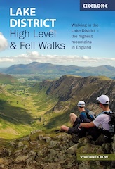
Lake District High Level and Fell Walks with Thirty Routes
AD This pocket-sized guide presents 30 routes on the Lake District’s highest fells, including Scafell Pike, Helvellyn, and Blencathra. With OS maps, colour photographs, and practical notes, it offers circular walks from 4–15 miles graded by difficulty.
Shortly after, I reach the summit of Highcliff Nab, the final peak of my Guisborough 3 Peaks challenge. Below me, Kemplah Wood gives way to the town of Guisborough, sprawling out in the valley beyond.

Looking north from Highcliff Nab, I can see Guisborough, Redcar, and the expansive north-east coastline.

Lake District High Level and Fell Walks with Thirty Routes
AD This pocket-sized guide presents 30 routes on the Lake District’s highest fells, including Scafell Pike, Helvellyn, and Blencathra. With OS maps, colour photographs, and practical notes, it offers circular walks from 4–15 miles graded by difficulty.
From this vantage point, I spot the track leading downhill, the next part of my Guisborough 3 Peaks journey.

I follow a wide, often tarmacked road that winds gently through the woodland, leading me down to Hutton Village.

Walking down to Hutton Village, I continue through the village and back to the car parking area, bringing my fantastic Guisborough 3 Peaks walk to a rewarding conclusion.

