Experience Yorkshire’s Rich Heritage and Views on the Rosedale Walk
To start your Rosedale walk, park in the centre of Rosedale Abbey village. Parking is available around the village green, with additional roadside spots nearby. From the village green, enter the churchyard through the rear gates and follow the path around the side of the church to the front. Exit through the main gate, cross the road, and walk through the iron gate opposite, following the signpost for Dunn Carr Bridge.
Continue along this short path, then turn right onto the tarmac lane. Head up the lane, passing a children’s playground on your left. As you approach the caravan park, take the right fork when the road splits. Keep straight on, and as the road curves left, pass through the large gate on your right. Follow this track across the fields, keeping to the public footpath leading towards Dunn Carr Bridge.
After crossing two large fields, follow the path as it descends into a wooded area to meet the River Seven. Avoid crossing the first footbridge on your left. When the path divides, take the left path and cross the boardwalk. Continue along the footpath into open countryside, passing through three expansive fields. At the end of the third field, go through the gate and turn right onto a broader stone track that leads uphill.

Follow the track as it winds through Low Bell End Farm. After exiting the farm, turn left and continue along a minor road until you reach the main road at the top. Turn left here, taking the lower of the two roads, signposted for Rosedale East and the Village Hall. Walk along this peaceful country lane for just under two-thirds of a mile until you reach Hill Cottages.
At Hill Cottages, walk past the red telephone box, then turn right onto a stone track marked as a public bridleway. Begin the uphill climb, passing a small stone barn on your right, followed by a large grey house on your left. At the top, go through a gate, but avoid turning right onto the public bridleway. Instead, keep straight along the stone track, passing some ruined buildings on your left.
As the track curves left, then right, a large spoil heap will appear ahead. Stay on the left side of the heap to access the disused railway line. Walk along this clear and elevated track, passing the Stone Kilns and later the Iron Kilns. After the Iron Kilns, continue along this elevated route for about three-quarters of a mile. Eventually, you’ll cross a substantial railway embankment, with a forested area visible below on your left.

Soon after, take the left-hand path that leads downhill to Dale Head Farm Tea Garden, marking roughly the halfway point of your Rosedale walk. At the tea garden, turn left onto the tarmac road and continue past a large farmhouse named Red House Farm. Shortly after, take a right turn onto another road, which descends into the valley.
Follow this road as it crosses the River Seven, then begins to ascend again. When the road levels out, turn left through a gate and follow the sign for a public bridleway. This path, known as Daleside Road, gradually improves in quality as you walk for almost two miles, leading you into the hamlet of Thorgill.
Continue through Thorgill, following the quiet tarmac road for about three-quarters of a mile. Pass Thorgill House on your right, followed by Hobb House Farm, also on your right. Watch for a public footpath on your left, which will guide you through a large field down to a footbridge.
The footpath leads you back into the caravan park, and from there, you’ll find your way back to the village of Rosedale Abbey. This completes your rewarding 8-mile Rosedale walk in the North York Moors, showcasing a delightful blend of history, varied landscapes, and local charm.
Rosedale Walk: Maps and Tools
Visit either the OS Maps website or the Outdooractive website to view this walking route in greater detail. Both platforms offer a range of features, including the ability to print the route, download it to your device, and export the route as a GPX file. You can also watch a 3D fly-over and share the route on social media. Additionally, this page includes a printable version of the walk in PDF format. Plus there is a supporting video, available for you to watch on YouTube.
Rosedale Walk: Distance, Duration, Statistics
Distance: 8 miles
Distance: 13 kilometres
Duration: 3¾ hours
Ascent: 949 feet
Ascent: 289 metres
Type: Circular walk


Walking in the Yorkshire Dales with 43 Circular Routes
AD This Cicerone guidebook includes 43 circular walks exploring valleys, hills, and moors between Kirkby Stephen and Pateley Bridge. With OS maps, local highlights, and routes ranging from 3–11 miles, it is a year-round companion for walkers of all abilities.
Recommended Ordnance Survey Map
The best map to use on this walk is the Ordnance Survey map of the North York Moors Western Area, reference OS Explorer OL26, scale 1:25,000. It clearly displays footpaths, rights of way, open access land and vegetation on the ground, making it ideal for walking, running and hiking. The map can be purchased from Amazon in either a standard, paper version or a weatherproof, laminated version, as shown below.
About Rosedale
Rosedale’s Location
Rosedale is a picturesque valley situated in the heart of the North York Moors National Park. This tranquil valley lies on the eastern side of Blakey Ridge, with Westerdale Moor to the north-west and Danby High Moor to the north-east. Rosedale Moor runs along the valley’s eastern side, while Spaunton Moor borders it to the south-east. At Dale Head, the River Seven begins its journey, winding down the valley to join the River Rye near Little Habton, close to Malton. Many visitors take a scenic Rosedale walk through this stunning landscape, soaking in views across the valley and surrounding moorland.
Rosedale and the Land of Iron
The modern village of Rosedale Abbey, built around the site of a former Cistercian priory, serves as the main settlement in the valley. Although peaceful and popular among walkers and tourists today, this village once thrived as the bustling centre of Rosedale’s ironstone industry. The region known as the ‘Land of Iron’ stretches from Rosedale and the Esk Valley to the River Tees. Here, ironstone mines, kilns, blast furnaces, and a moorland railway dramatically reshaped the landscape during the late 19th century.
In Rosedale, the ironstone boom spurred a fivefold increase in the local population as workers arrived from far and wide. New houses sprang up in the village and along the valley, with families tending freshly cultivated gardens and allotments. Shops, chapels, a school, lecture hall, and reading rooms appeared to serve the growing community of miners and railway workers. A Rosedale walk through this area today reveals traces of the industrial past set amidst tranquil, scenic landscapes.
Related Walk: Similar to the Rosedale Walk
Journey through the North York Moors with the Rosedale Abbey walk
Rosedale’s Wild Days
Today, Rosedale Abbey retains its Victorian charm, with workers’ cottages now cherished as part of the rural landscape. However, Rosedale’s ‘Klondike’ era was anything but genteel. Life in Rosedale was rough and boisterous, with workers packed into crowded boarding houses, often sharing beds. The local pub opened at 6am to serve those coming off the night shift, leading to frequent brawls and disorderly behaviour. Smoke and noise filled the air, with industry dominating the landscape.
In contrast, few residents of modern Rosedale work in farming. Instead, many properties now serve as second homes, significantly reducing the valley’s permanent population.
The Name Rosedale
Rosedale was not mentioned in the Domesday Book of 1086. However, an early version of the name, ‘Rozebi’, appears in the section for Pickering. Over the centuries, the English Place-Names Survey records a variety of spellings, including ‘Russedal(e)’ in 1130, ‘Rossedal(e)’ in 1186, ‘Rossdale’ in 1328, and both ‘Rosedale’ and ‘Rosedall’ by 1376.
The origin of the name ‘Rosedale’ likely has roots in Old Norse or Brittonic. It may mean ‘Russi’s valley’ or ‘valley beside high, level moorland promontory’. The term ‘dale’ comes from Old Norse dalr or Middle English dale, while ‘rose’ derives from Brittonic rōs, which might refer to Blakey Ridge, defining the valley’s western side.
Rosedale Walk: My Photos
This is the village green in Rosedale Abbey, where I start my Rosedale walk. This peaceful village was once the heart of Rosedale’s ironstone industry. It holds a long history, remaining largely unchanged as a small hamlet until the 1830s, when a new church, mill, and stone bridges were built.


Grisport Unisex Adult Peaklander Hiking Boots
AD The Grisport Unisex Adult Peaklander Hiking Boots are crafted in Italy with a durable waxed leather upper, Spotex breathable lining, and a reliable Track-on rubber sole. Waterproof and weighing just 1120g, they offer comfort, resilience, and dependable performance on demanding trails.
From the village green, I walk through a nearby gate into the churchyard of the Parish Church of St Mary and St Lawrence, Rosedale Abbey. The church is part of the Benefice of Lastingham, comprising five churches: St Mary’s Church, Lastingham; St Chad’s Church, Hutton-le-Hole; St Gregory’s Church, Cropton; St Lawrence’s Church, Rosedale Abbey; and Christ Church, Appleton-le-Moors.

I walk past the eastern end of the church, a Grade II-listed building constructed in 1839 to replace a 14th-century priory chapel. The eastern end of the Church of St Mary and St Lawrence features striking stonework and three tall lancet windows, embodying its Gothic Revival style. Surrounding the church, the yew trees add another layer of tradition; these trees, associated with longevity and eternal life, are fitting symbols in a churchyard.

Grisport Unisex Adult Peaklander Hiking Boots
AD The Grisport Unisex Adult Peaklander Hiking Boots are crafted in Italy with a durable waxed leather upper, Spotex breathable lining, and a reliable Track-on rubber sole. Waterproof and weighing just 1120g, they offer comfort, resilience, and dependable performance on demanding trails.
The stone path curves around the church’s northern end. Designed by architect Lewis Vulliamy, the church was built from local sandstone, with blocks varying in colour and texture from pale beige to deeper shades of ochre and brown. The architectural dressings, including the window frames, corners, and bellcote, are crafted from carefully cut ashlar stone, adding a refined contrast to the rugged stonework.

The church occupies the site of a former Cistercian priory, founded in the 12th century. The priory housed a small community of nuns who were among the first to farm sheep commercially in the region. After the Dissolution of the Monasteries, the priory was dismantled, and its stones were reused for local buildings, including the present church. Today, only a staircase turret remains from the original priory.


Fifty Walks Across the Beautiful North York Moors National Park
AD Discover 50 routes across the North York Moors, from short easy strolls to challenging high-level hikes. With OS maps, route descriptions, and local highlights, it also includes the legendary 40-mile Lyke Wake Walk, described in four accessible stages.
The staircase turret bears a metal plaque with the inscription:
ROSEDALE PRIORY
A CISTERCIAN NUNNERY
FOUNDED C1158
AND DISSOLVED IN 1535
ON THIS SITE

Following the path around to the western end of the church, I exit through the wooden gates. Directly across the road, I spot an iron gate in the wall. This is where I am heading to continue my Rosedale walk.

Fifty Walks Across the Beautiful North York Moors National Park
AD Discover 50 routes across the North York Moors, from short easy strolls to challenging high-level hikes. With OS maps, route descriptions, and local highlights, it also includes the legendary 40-mile Lyke Wake Walk, described in four accessible stages.
Leaving the village of Rosedale Abbey, I walk through Rosedale Abbey Caravan Park and follow a public footpath north-west, leading me down into a lovely wooded area on the way to Dunn Carr Bridge.

The path brings me down to the River Seven, a small river that originates on the high moorland near Rosedale Head and meanders through the middle of the Rosedale valley.


Osprey Hikelite Unisex Backpack for Comfortable and Lightweight Hiking
AD The Osprey Hikelite backpack combines lightweight design with practical features, including a breathable mesh back panel, soft webbing straps, and stretch mesh water bottle pockets. With zipped storage and an organiser compartment, it is ideal for day hikes and outdoor use.
The River Seven flows south through the valley and the village of Rosedale Abbey before continuing south to join the River Rye near Malton. It is a peaceful setting, especially beautiful with the autumnal colours. The river played an important role in Rosedale’s industrial past, providing water for various processes and for the mining communities’ daily needs during the 19th-century ironstone mining era.

As I continue my walk through the valley, I come across a Galineers Cob—or at least I believe it is. Also known as the Gypsy Cob or Gypsy Vanner, this breed is known for its distinctive piebald or skewbald coat patterns, robust build, and feathered legs. Originating from the British Isles, these horses were bred for strength, versatility, and a calm temperament, making them suitable for farm work, riding, and cart pulling.
Osprey Hikelite Unisex Backpack for Comfortable and Lightweight Hiking
AD The Osprey Hikelite backpack combines lightweight design with practical features, including a breathable mesh back panel, soft webbing straps, and stretch mesh water bottle pockets. With zipped storage and an organiser compartment, it is ideal for day hikes and outdoor use.
In the same field, I see a beautiful Shetland pony. Originating from Scotland’s Shetland Islands, Shetland ponies are among the smallest and hardiest pony breeds. Known for their stocky build, dense coats, and resilience to harsh climates, they have been used historically for farm work and as children’s riding ponies. Despite their size, they are strong and have a friendly, often spirited nature.

My route takes me through Low Bell End Farm, which offers a variety of experiences, from glamping and camping to farm produce and unique crafts. Visitors can buy home-reared meats, freshly prepared meals, and even handmade garden ornaments. The farm also offers activities like shooting let days and fishing.


Peak Bagging Wainwrights with Routes to Complete All Fells
AD This comprehensive guide offers 45 circular routes linking all 214 Wainwright fells. With maps, GPX downloads, elevation profiles, and practical advice, it provides efficient yet inspiring ways to complete this classic Lake District challenge at your own pace.
Continuing my Rosedale walk from Low Bell End Farm along a quiet road called Daleside Road, I pass Plane Tree Cottages on my left.

A little further along Daleside Road, on the right-hand side, there is a lovely row of terraced cottages at School Row.

Peak Bagging Wainwrights with Routes to Complete All Fells
AD This comprehensive guide offers 45 circular routes linking all 214 Wainwright fells. With maps, GPX downloads, elevation profiles, and practical advice, it provides efficient yet inspiring ways to complete this classic Lake District challenge at your own pace.
Opposite this row of terraced cottages is the village hall at School Row on Daleside Road. A bench invites me to sit down and enjoy a coffee or snack. The smaller stone plaque above the bench commemorates John Douglas Dowson, Derrica Jeminson, and James Harland, who fell during the Second World War, 1939–1945.

The larger stone plaque commemorates Henry Dale, Thomas W. Mortimer, William C. Fothergill, Frank Peirson, Joseph W. Garbutt, Henry Perrin, Joseph Hodgson, Alfred Piggford, Joseph Harris, Herbert C. Smith, Herbert H. Huxley, Arthur W. Sonley, Percy Maw, Alonzo Strickland, Thomas H. Mercer, and Arthur W. Wilson, who died for justice and liberty in the Great War, 1914–1918.


Berghaus Hillmaster II GTX Men's High Rise Hiking Boots
AD The Berghaus Hillmaster II GTX men’s hiking boots feature a waterproof, breathable GORE-TEX membrane, a memory foam tongue and collar for a personalised fit, and a Vibram sole delivering exceptional grip, stability, and shock protection for confident performance on any terrain.
Continuing along Daleside Road, I pass Hill Cottages, which include around 20 or so terraced cottages on the left-hand side and 10 or so cottages on the right.

Just after Hill Cottages, I turn right off Daleside Road onto a stone track that leads uphill. A concrete bench at the junction is inscribed:
In Loving Memory Of
John Henry Dent
13th September 1943 – 2nd July 2020
Proud To Serve His Country And Community
A True Friend Of The Dale

Berghaus Hillmaster II GTX Men's High Rise Hiking Boots
AD The Berghaus Hillmaster II GTX men’s hiking boots feature a waterproof, breathable GORE-TEX membrane, a memory foam tongue and collar for a personalised fit, and a Vibram sole delivering exceptional grip, stability, and shock protection for confident performance on any terrain.
I pass the Stone Kilns of Rosedale’s East Mines. These weathered stone structures were once the centrepiece of a vast industrial complex. The East Mines began operating around 1863–64, and soon after, a branch railway to Blakey Junction was constructed to transport the ironstone. Before it could be shipped to blast furnaces, the ironstone was processed in these immense kilns, where it was ‘roasted’ to remove impurities, increase iron concentration, and reduce large chunks to a suitable size for smelting. This process also removed waste material, which reduced transportation costs, sometimes by a third of the total cost.

Working at the kilns was challenging. Ironstone from the mines was dumped into the Stone Kilns from above, and after the roasting process—known as ‘calcining’—workers used heavy metal rakes to shift the hot stone. The processed ore was loaded into iron wagons, as wooden ones could not withstand the heat. The ‘calcine men’ who did this labour-intensive work held one of the dirtiest and toughest jobs on the site.


Kendal Mint Co Energy Gel with Citrus and Mint Flavour
AD Kendal Mint Co energy gels deliver 27g of fast-absorbing carbohydrates plus electrolytes and B vitamins for improved performance. Vegan, gluten free, and Informed Sport certified, these caffeine-free gels are refreshing, easy to digest, and ideal for running, cycling, and endurance.
Today, the haunting ruins of these Stone Kilns serve as a stark reminder of a once-unimaginable industrial environment that lasted over sixty years. The air would have been thick with smoke, the area filled with the constant noise of kilns, the shouts of workers, and the clatter of trains and carts—a relentless atmosphere day in and day out.

I follow the trackbed of the disused railway line heading north, between the Stone Kilns and the Iron Kilns on the eastern side of the Rosedale valley.

Kendal Mint Co Energy Gel with Citrus and Mint Flavour
AD Kendal Mint Co energy gels deliver 27g of fast-absorbing carbohydrates plus electrolytes and B vitamins for improved performance. Vegan, gluten free, and Informed Sport certified, these caffeine-free gels are refreshing, easy to digest, and ideal for running, cycling, and endurance.
Here are the Iron Kilns of Rosedale’s East Mines, also known as the North Kilns. Built in the latter half of the 19th century, these kilns were essential for ‘calcining’ ironstone before it was transported to blast furnaces in Teesside and County Durham for iron and steel production. Each kiln had three large compartments lined with firebricks, originally fitted with iron fronts. Although the process was relatively crude, it was efficient enough to meet the demands of the industry during its peak.

Today, these impressive Iron Kilns still stand. The three remaining compartments, along with the distinctive red calcine waste heaps marking the hillside, highlight the scale of the ironstone operations that continued until the 1920s. Although the landscape has changed, these ruins evoke the scale of an industry that once dominated the area.


Thermos Stainless King Flask for Travel and Daily Adventures
AD The Thermos Stainless King 470ml flask keeps drinks hot for 18 hours or cold for 24. With durable stainless steel, vacuum insulation, a serving cup, and a leakproof design, it is perfect for commutes, journeys, and outdoor adventures.
Just past the Iron Kilns, I find a seating area—perfect for a lunch break. Two benches and a sturdy wooden table provide a welcome spot to rest.

The table includes four fantastic information boards with lots of details about the kilns and the ironstone industry. In the middle of the table is a magnificent cast-iron replica of the Iron Kilns.

Thermos Stainless King Flask for Travel and Daily Adventures
AD The Thermos Stainless King 470ml flask keeps drinks hot for 18 hours or cold for 24. With durable stainless steel, vacuum insulation, a serving cup, and a leakproof design, it is perfect for commutes, journeys, and outdoor adventures.
Continuing north along the trackbed of the disused railway line, I take a last look back at the impressive Iron Kilns.

This is all that remains of ‘Black Houses’ cottages, north of the Iron Kilns. The cottages earned their name because they were painted with weatherproofing black tar.

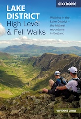
Lake District High Level and Fell Walks with Thirty Routes
AD This pocket-sized guide presents 30 routes on the Lake District’s highest fells, including Scafell Pike, Helvellyn, and Blencathra. With OS maps, colour photographs, and practical notes, it offers circular walks from 4–15 miles graded by difficulty.
I continue my Rosedale walk along the elevated route on the eastern side of the Rosedale valley.

It’s November, and even though it’s misty, I still enjoy views across the valley floor. I can see a patchwork of irregularly shaped green fields, bracken, and woodland.

Lake District High Level and Fell Walks with Thirty Routes
AD This pocket-sized guide presents 30 routes on the Lake District’s highest fells, including Scafell Pike, Helvellyn, and Blencathra. With OS maps, colour photographs, and practical notes, it offers circular walks from 4–15 miles graded by difficulty.
When I reach the large railway embankment with a forested area on my left, I know I am close to the point where I turn left off the track and head towards Dale Head Farm.
A sign clearly indicates the way downhill towards Dale Head Farm Tea Garden.


Super Sparrow Stainless Steel Insulated Water Bottle with Two Lids
AD The Super Sparrow stainless steel water bottle keeps drinks cold for 12 hours or hot for several. With a straw lid, bamboo cap, BPA-free construction, and durable 18/8 steel, it is ideal for sport, travel, work, and outdoor use.
The path leads downhill from the disused railway line, skirting the north-western side of the forested area.

My descending path is carpeted with fallen autumn leaves in rich reds, oranges, and browns. It winds gently downhill through a tunnel of bare-branched trees, their trunks covered in moss.

Super Sparrow Stainless Steel Insulated Water Bottle with Two Lids
AD The Super Sparrow stainless steel water bottle keeps drinks cold for 12 hours or hot for several. With a straw lid, bamboo cap, BPA-free construction, and durable 18/8 steel, it is ideal for sport, travel, work, and outdoor use.
The descent steepens, and trees line each side of this beautiful, narrow path. Their branches form a natural canopy overhead, making this a highlight of my Rosedale walk.

I arrive at Dale Head Farm Tea Garden, a charming spot at the head of Rosedale. Owned by Maggie Barraclough, this working hill farm has been in her family for over 20 years. Since opening the Tea Garden in 2010, Maggie has served weary walkers with sandwiches, cakes, loose-leaf teas, Taylors of Harrogate coffee, and refreshing homemade drinks.


Mountain Warehouse Merino Womens Long Sleeve V Neck Top
AD This Mountain Warehouse Merino top combines warmth, comfort, and practicality. Made with high-quality wool, it is naturally antibacterial, lightweight, and easy to pack. Designed for outdoor activities, it keeps you fresh and warm, and comes with a two-year warranty.
Visitors can sit at spacious outdoor tables, or if the wind picks up, in the shelter of a shooting butt. During colder months, a covered seating area with a wood-burning stove provides a cosy escape, seating around 40 people—perfect for large walking groups.

The menu celebrates Yorkshire recipes made from locally sourced ingredients. Maggie’s homemade cakes are a must-try, showcasing Yorkshire’s rich culinary traditions.

Mountain Warehouse Merino Womens Long Sleeve V Neck Top
AD This Mountain Warehouse Merino top combines warmth, comfort, and practicality. Made with high-quality wool, it is naturally antibacterial, lightweight, and easy to pack. Designed for outdoor activities, it keeps you fresh and warm, and comes with a two-year warranty.
The kitchen at Dale Head Farm fills the air with mouth-watering aromas. Maggie’s baked goods, once shared at North Yorkshire’s farmers’ markets, are now available in her tea room. For more information, visit daleheadfarmteagarden.co.uk.

From Dale Head Farm, I follow a quiet lane to the valley floor and cross the River Seven. Near the bridge, I find a lovely secluded spot in a patch of woodland. A small waterfall flows over a dark rock face into the river, which might contain ironstone—a common mineral in Rosedale, known for its ironstone mining history.

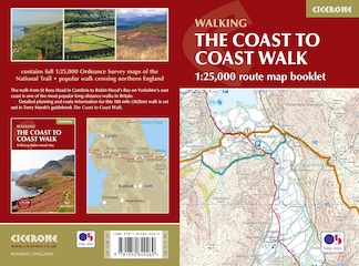
The Coast to Coast Walk Map Booklet with OS Mapping
AD This handy map booklet covers the full 188-mile Coast to Coast route from St Bees to Robin Hood’s Bay. Featuring 1:25,000 OS maps, it is pocket-sized, practical, and designed for use in either direction across England’s landscapes.
On Daleside Road, an old tree trunk makes a perfect resting spot for a quick coffee from my flask before continuing my Rosedale walk. The path starts off a bit muddy but soon improves.

As I approach High House Farm, Daleside Road transitions from a grassy, muddy route to a more solid stone track.

The Coast to Coast Walk Map Booklet with OS Mapping
AD This handy map booklet covers the full 188-mile Coast to Coast route from St Bees to Robin Hood’s Bay. Featuring 1:25,000 OS maps, it is pocket-sized, practical, and designed for use in either direction across England’s landscapes.
I continue my Rosedale walk south-east past High Thorgill Farm and a few charming cottages.

I reach the picturesque hamlet of Thorgill. Just over a mile remains to complete my Rosedale walk.

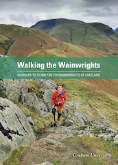
Walking the Wainwrights with Routes Covering Every Lake District Fell
AD This book includes 64 carefully designed routes that allow walkers to complete all 214 Wainwright fells. Intended to complement the original Pictorial Guides, it provides full-day circular walks that link multiple summits for a rewarding and practical challenge.
Back in Rosedale, I walk through the church gates and follow the path around the side of the church, which leads me back to the village green where I parked.