Eight Wainwrights in One Walk with the Kentmere Horseshoe
Begin an unforgettable walk in the Lake District with the Kentmere Horseshoe, also known as the Kentmere Round. This captivating 13-mile trek encompasses eight of Alfred Wainwright’s Far Eastern Fells: Yoke, Ill Bell, Froswick, Thronthwaite Crag, Mardale Ill Bell, Harter Fell, Kentmere Pike, and Shipman Knotts. For those seeking an extended adventure, a detour to High Street, a ninth Wainwright, adds 1¾ miles to your walk, transforming it into an eight-hour exploration, not accounting for rest breaks.
Start your adventure in the quaint village of Kentmere, venturing west along the Garburn Pass. Near Garburn Nook, find a path leading north, ascending towards Yoke, your first Wainwright. The trail continues, with a descent and subsequent climb to Ill Bell, the second Wainwright.
Push onwards, navigating another descent and ascent to reach Froswick, the third Wainwright. The path then stretches north across the ridge above Wander Scar, leading to Thronthwaite Crag, the fourth Wainwright, marked by a towering beacon. This point represents the walk’s highest elevation unless you opt for the High Street extension.
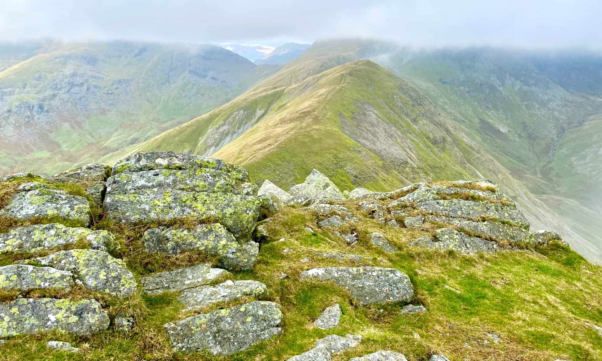
After conquering Thronthwaite Crag, head east around the head of the Kentmere valley to Mardale Ill Bell, the fifth Wainwright of the Kentmere Horseshoe. The route then veers south-east, descending to the Nan Bield Pass, where a shelter offers a potential break from the wind. From here, ascend to Harter Fell, your sixth Wainwright, before heading south towards The Knowe.
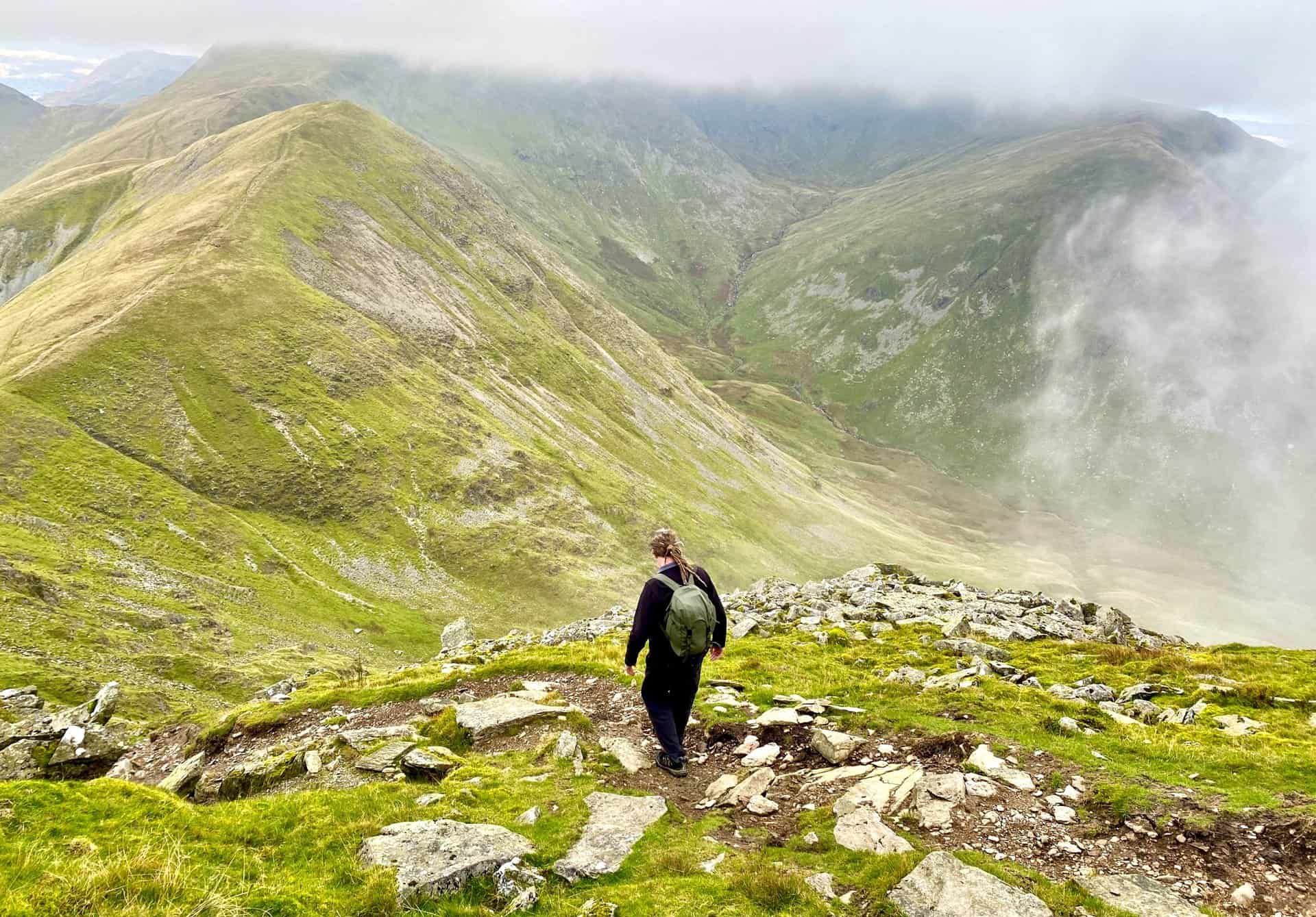
Continue your walk south-east via Brown Howe, reaching Kentmere Pike, the seventh Wainwright. The path maintains its south-east direction, guiding you to Shipman Knotts, the eighth and final Wainwright. The descent south towards Wray Crag, followed by a further descent, leads to a path directing you west towards Stile End. Join the minor road here and follow it south-east, returning to Kentmere.
This exhilarating and challenging walk is a must-do for anyone exploring the Lakes, offering unparalleled views and a fulfilling sense of achievement. As a distinguished classic horseshoe circuit in the Lake District, it ranks with other eminent walks like the Coledale Horseshoe and Newlands Horseshoe.
Kentmere Horseshoe: Maps and Tools
Visit either the OS Maps website or the Outdooractive website to view this walking route in greater detail. Both platforms offer a range of features, including the ability to print the route, download it to your device, and export the route as a GPX file. You can also watch a 3D fly-over and share the route on social media.
Kentmere Horseshoe: Distance, Duration, Statistics
Distance: 12¾ miles
Distance: 20¼ kilometres
Duration: 7 hours
Ascent: 3643 feet
Ascent: 1110 metres
Type: Circular walk
About the Kentmere Horseshoe Valley
The Kentmere Horseshoe narrow valley spans about three miles in length and begins with a bowl of hills which surround Kentmere Reservoir. The River Kent originates from Hall Cove, a corrie at the valley’s head, subsequently flowing through the reservoir. Access to this secluded part of the valley is facilitated through various routes: the ancient Roman High Street, crossing over Nan Bield Pass, journeying from Troutbeck across Garburn Pass, or following an old bridleway that ascends from the village.
Nestled between Troutbeck on the west and Longsleddale on the east, the valley is only accessible by road through the village of Staveley. This village, positioned at the valley’s entrance, is where the River Kent merges with the River Gowan from Ings. Historically, there were drove roads crossing over the northern horseshoe to the now submerged village of Mardale, beneath Haweswater Reservoir. Moreover, it was a cherished tradition among the valley’s inhabitants to traverse from Kentmere to Mardale village church on Easter Sunday.
The source of the River Kent is located above the reservoir, amidst the heights of Bleathwaite Crag, where it commences its journey. The river gathers waters beneath Kentmere Common before being directed into the reservoir, constructed in 1848 to regulate water flow to the pastures below. Additionally, Lingmell Gill, alongside other tributaries, contributes to the reservoir’s inflow, adjacent to which stands a disused quarry and a maintenance cottage. As the river continues southward, it broadens into Kentmere Tarn, just south of the confluence with Hall Gill. Historically, this lake has transitioned between visibility and marshland, with notable drainage in 1840 for agricultural purposes. However, over the past century, the ‘mere’ has reemerged, now spanning one mile in length.
Also, within the valley, tributaries such as Ullstone Gill and Nunnery Beck, alongside Nuttera Beck, Park Beck, and Hall Beck, enrich the river’s ecosystem. Just north of the Kentmere village, the Force Jump waterfall presents a natural spectacle, while at the Staveley end of the valley, two bridges capture attention. Barley Bridge, with its dramatic weir, and further up, Scrogg’s Bridge, which spans the Kent, add to the valley’s charm.
Adjacent to Kentmere Hall, the ‘Brock Stone’, or Badger Rock, a prominent rhyolite boulder, presents a formidable challenge to climbers. Indeed, the Kentmere Horseshoe valley boasts over 125 recorded climbing problems, making it a pinnacle of climbing activity in the Lake District. The geological landscape of the area is characterised by green slate and granite, with sporadic findings of opal. The local tradition of constructing field boundaries using the dry stone walling technique further exemplifies the historical and sustainable use of natural resources. Notably, below the reservoir, Jumb Quarry is designated as a Geological Conservation Review site. Its significance lies in the volcanic rock that displays ‘bird’s-eye tuffs’, containing lapilli that bear witness to ancient volcanic activity. These lapilli, originally spherical, were compressed into elliptical shapes by the immense pressure during the Caledonian Mountains’ formation, adding a fascinating geological dimension to the valley’s diverse landscape.
Recommended Ordnance Survey Map
The best map to use on this walk is the Ordnance Survey map of the Lake District South-Eastern Area, reference OS Explorer OL7, scale 1:25,000. It clearly displays footpaths, rights of way, open access land and vegetation on the ground, making it ideal for walking, running and hiking. The map can be purchased from Amazon in either a standard, paper version or a weatherproof, laminated version, as shown below.
Standard Version
Kentmere Horseshoe: My Photos
The view of Kentmere Reservoir from Yoke. Behind the reservoir Lingmell Gill flows down through the valley between Mardale Ill Bell (horizon, left) and Harter Fell (cloud-covered, right).
Looking north from Ill Bell. The path leading to the summit of Froswick is clearly visible.
The view from Ill Bell across the Trout Beck valley on the western side of the Kentmere Horseshoe.
Froswick (left) and Lingmell End (right). Between the two, in the valley, a series of streams meet to form the River Kent, which flows into the Kentmere Reservoir. The river then continues its 20-mile journey to Morecambe Bay.
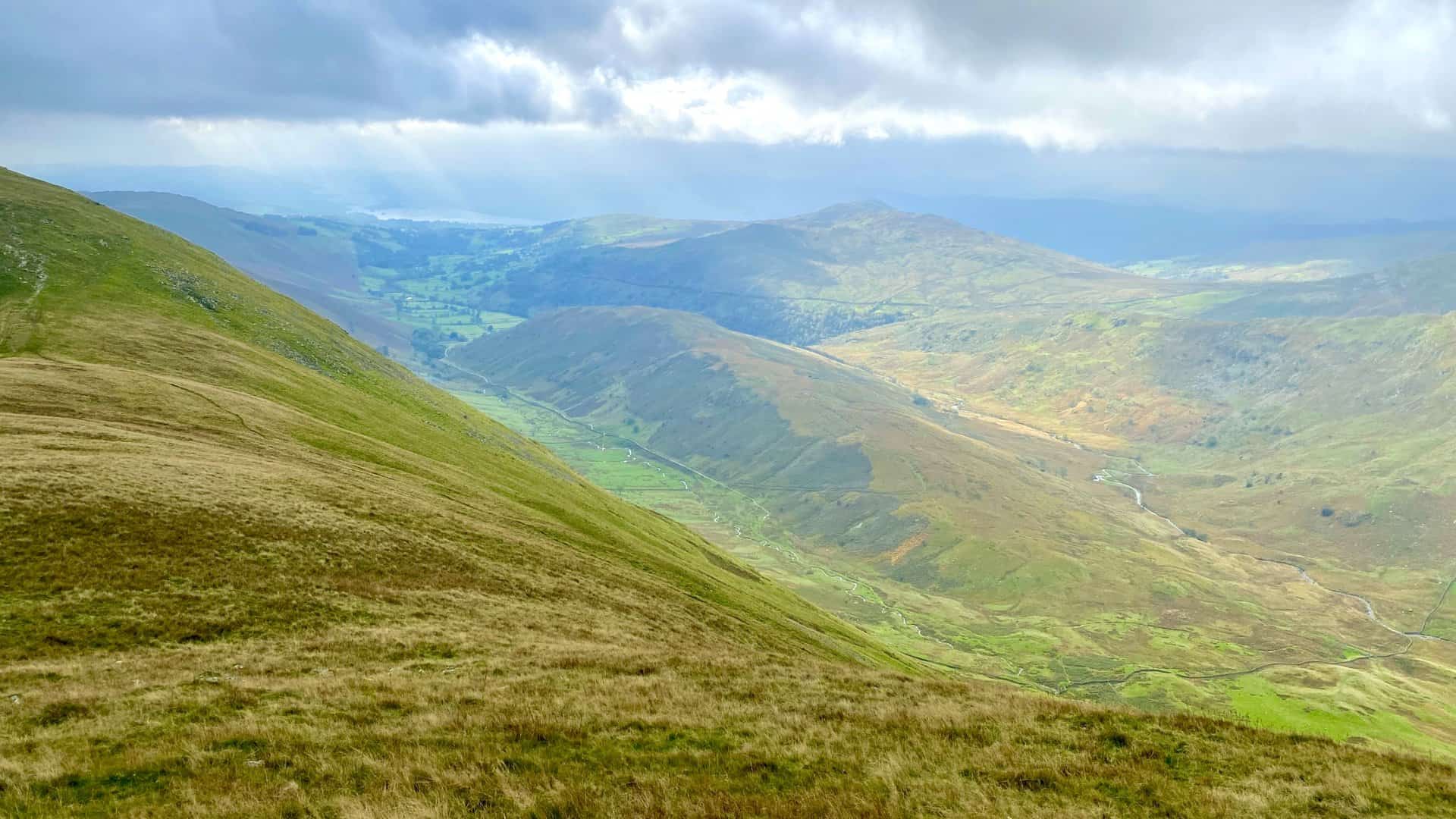
The view south-west from Froswick. The high ground in the middle of the wide valley is The Tongue, with Hagg Gill flowing on its left (east) side and Trout Beck on its right (west) side. The pointed fell in the distance is Wansfell.
Kentmere Reservoir as seen from Froswick, the third Wainwright on the Kentmere Horseshoe.
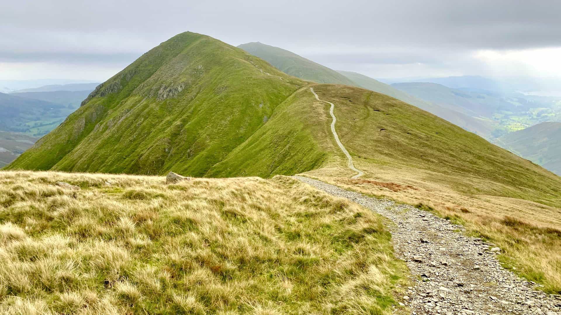
Looking back to Froswick and Ill Bell from the path above Wander Scar.
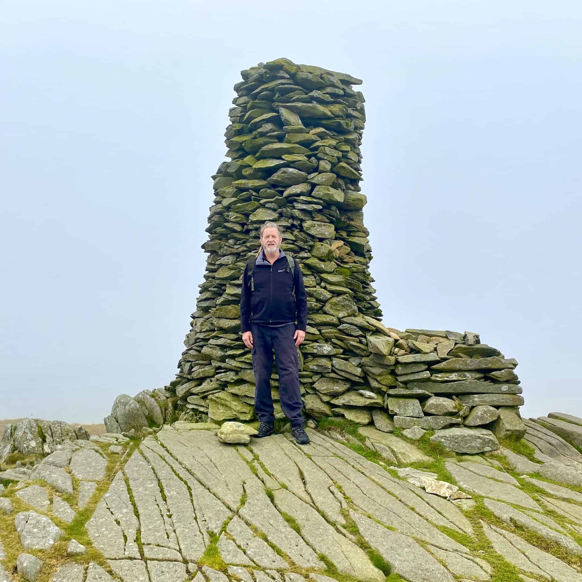
Thornthwaite Crag’s 14-foot-tall summit beacon. Thornthwaite Crag is the highest of the eight Wainwright fells we are visiting, at 784 metres (2572 feet).
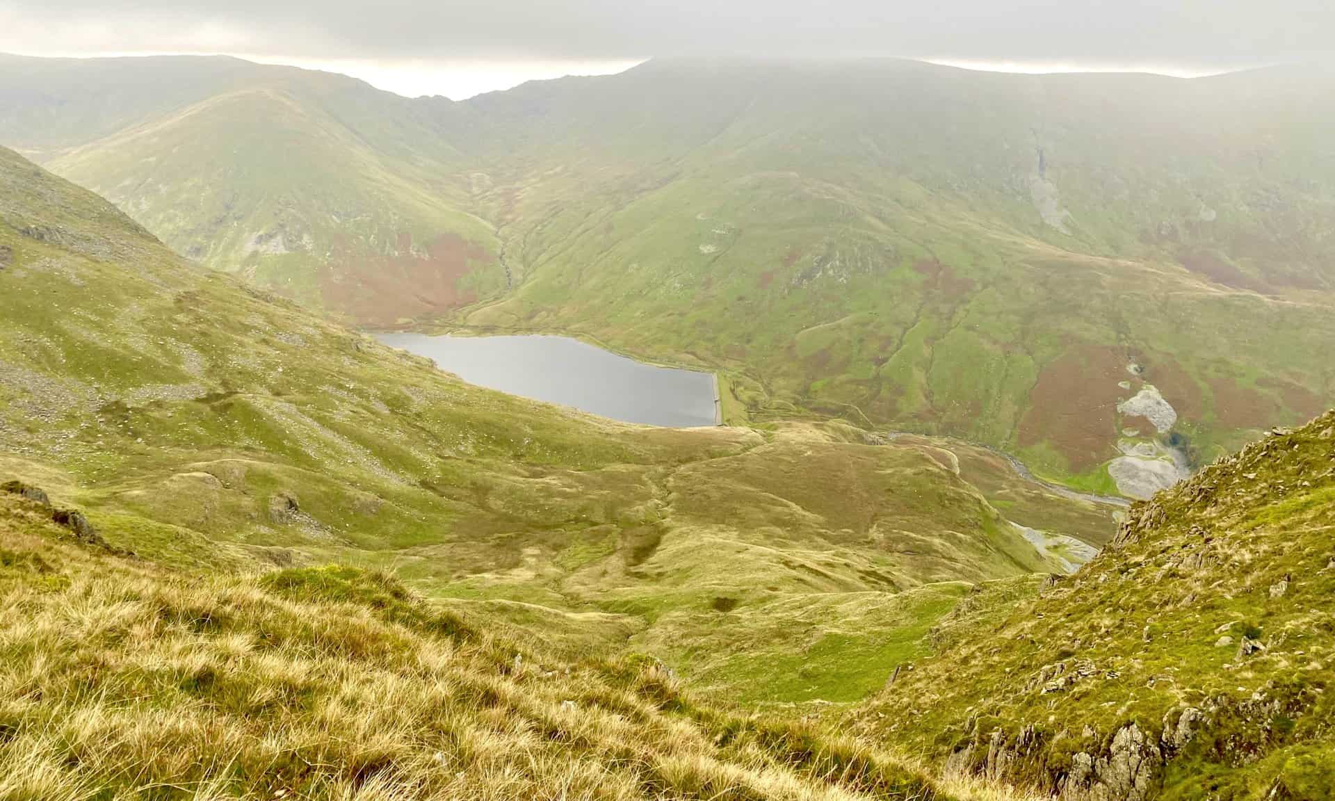
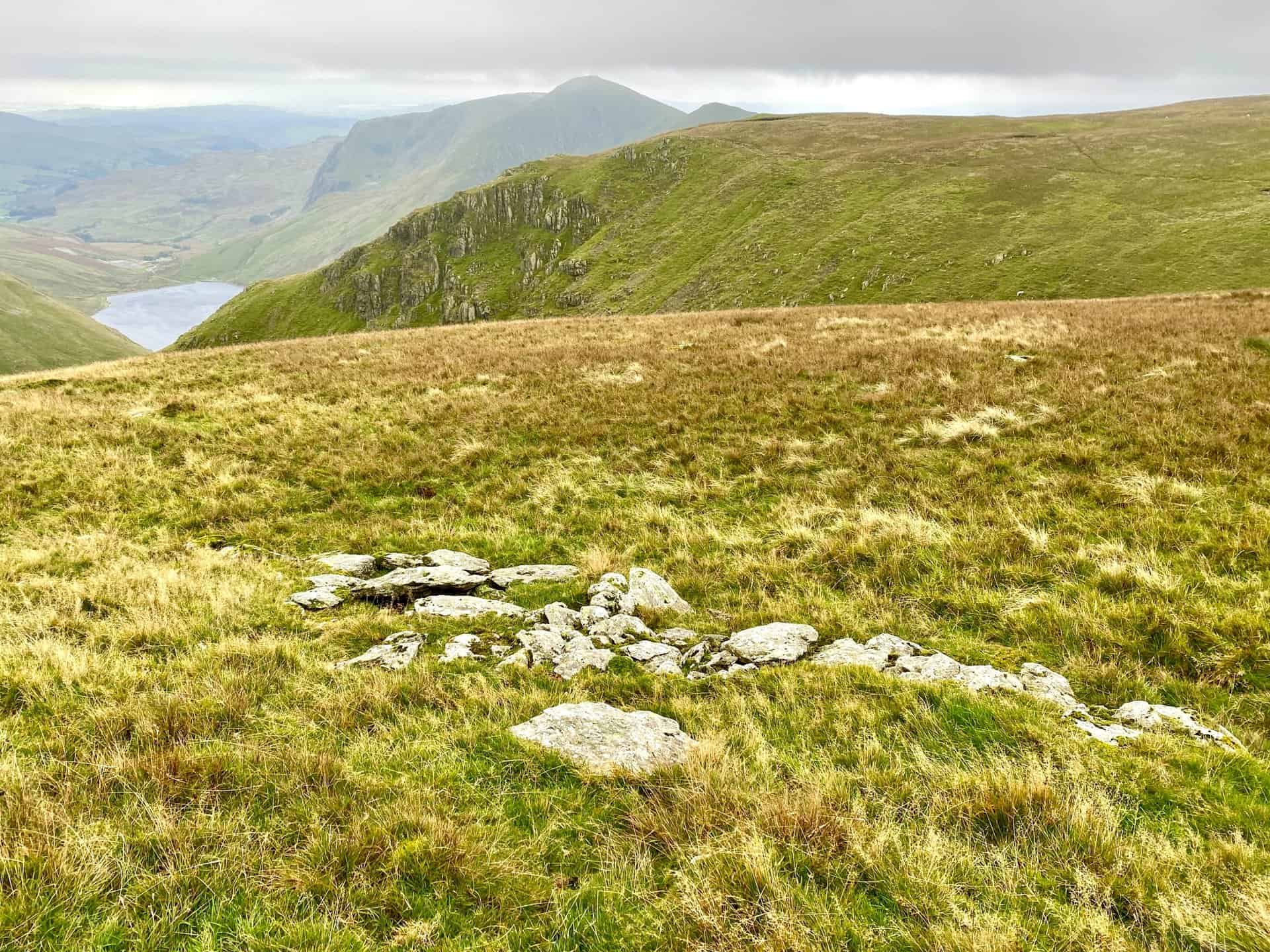
The view down to Kentmere Reservoir from the head of the Kentmere Horseshoe valley between Thornthwaite Crag and Mardale Ill Bell.
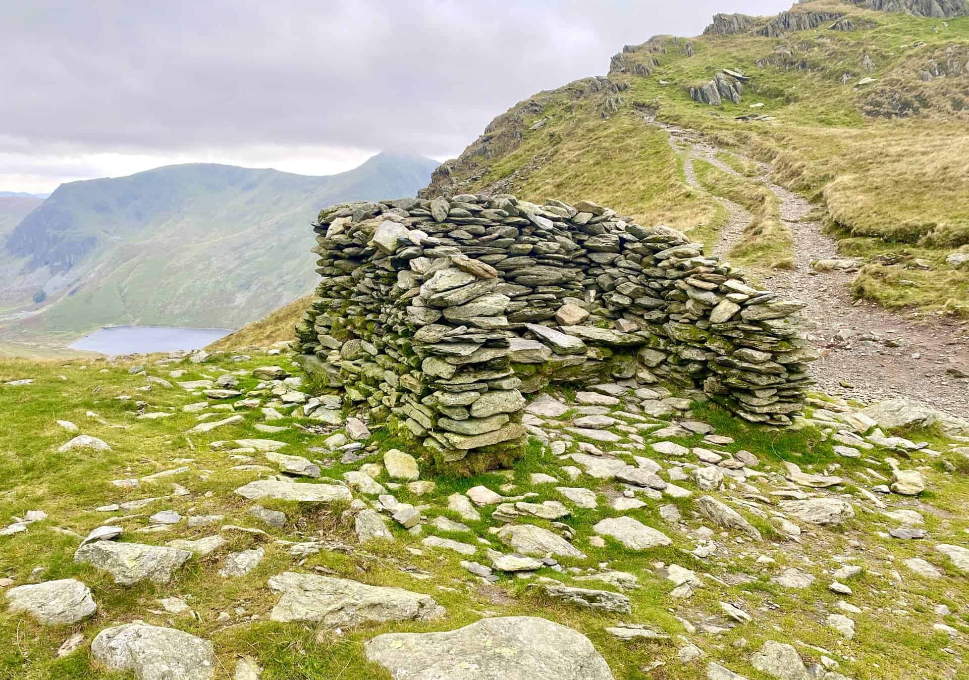
Shelter between Mardale Ill Bell and Harter Fell, at the point where our path crosses Nan Bield Pass.
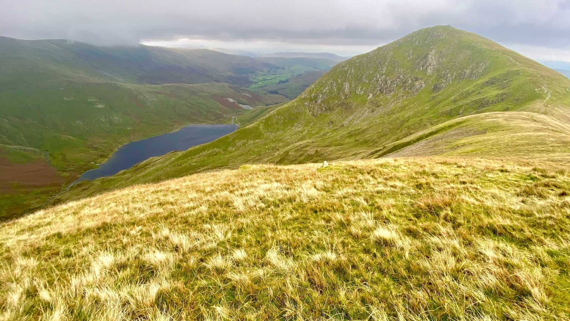
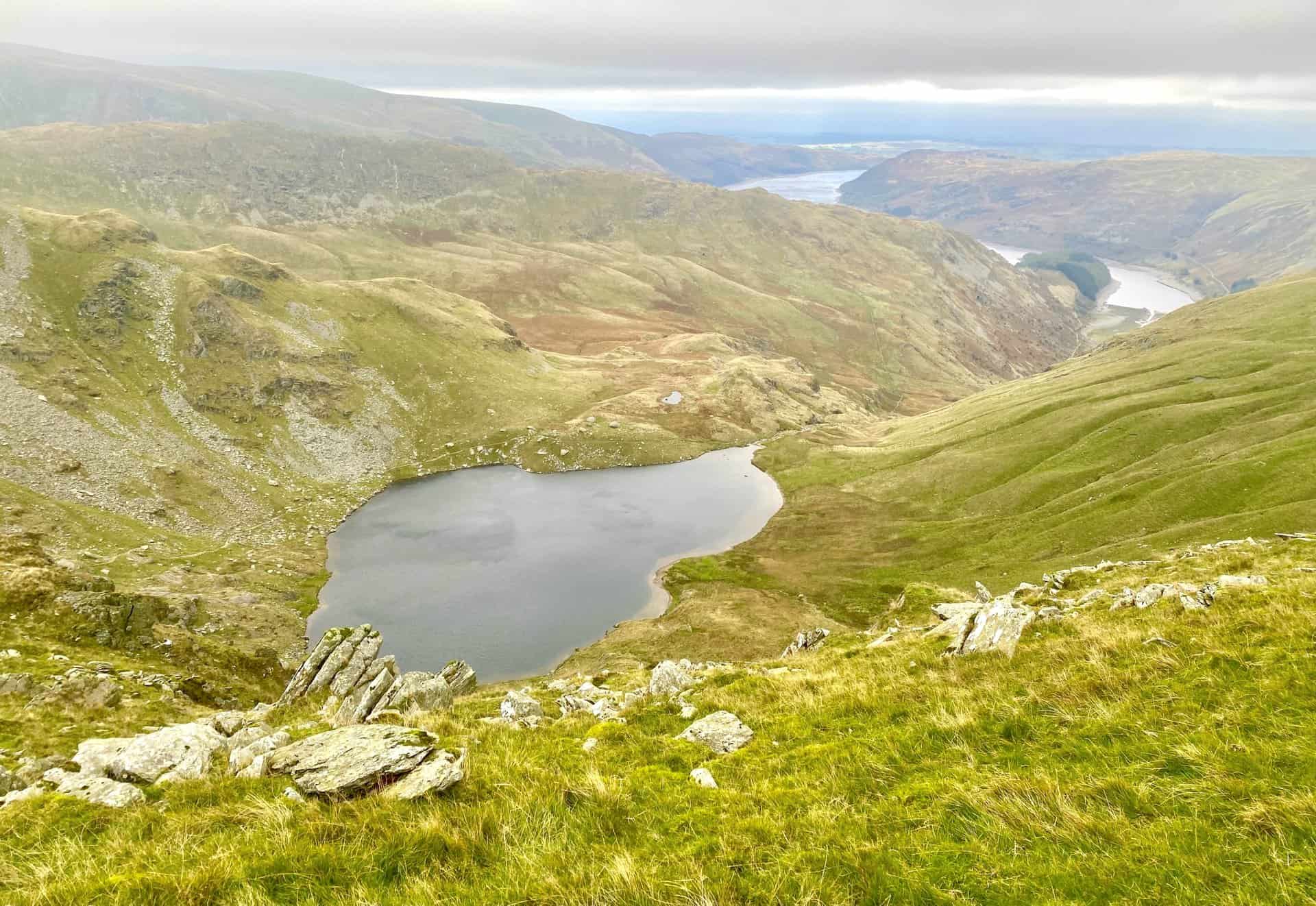
Smallwater (foreground) and Haweswater Reservoir. A highlight of the Kentmere Horseshoe.
Highly Rated Osprey Hiking Backpacks for Outdoor Enthusiasts
Osprey’s reputation for crafting high-quality hiking backpacks is well-established, offering a range of options that cater to both men and women. The following four backpacks stand out for their excellent sales and customer ratings on Amazon, making them a top choice for outdoor enthusiasts seeking reliability and comfort. As an Amazon affiliate, I may earn a small commission from any purchases made through the links provided. This helps support the upkeep of this website. Rest assured, you won’t pay a penny extra, but your purchase will contribute to keeping my site running smoothly. Happy walking!

Osprey Tempest 20 Women’s Hiking Backpack
The Tempest 20 stands out as the ideal solution for day-hiking, biking, or peak-bagging, tailored specifically for women. It features a panel-loading design for ease of access, complemented by an internal zippered mesh pocket with a key clip for secure storage. Unique to this model are the Stow-on-the-Go trekking pole and LidLock bike helmet attachments, enhancing its versatility. Side stretch mesh pockets, along with an easy-access, expandable stretch mesh harness pocket, offer ample storage. Additionally, it includes a blinker light attachment (light not included) and a large stretch mesh front panel pocket for extra carrying capacity.

Osprey Talon 22 Men’s Hiking Backpack
Designed for the active adventurer, the Talon 22 provides an optimal panel-loading design suitable for day-hiking, biking, or peak-bagging. Key features include dual-zippered panel access to the main compartment and a tuck-away ice ax attachment with a bungee tie-off. It boasts a top panel zippered slash pocket for quick access items and lower side compression straps for load management. An external hydration reservoir sleeve and dual-zippered fabric hipbelt pockets enhance hydration and storage, while a large stretch mesh front panel pocket increases its utility for various activities.

Osprey Tempest 30 Women’s Hiking Backpack
The Tempest 30, designed with a women’s-specific fit, is a streamlined top-loader ideal for both extensive day trips and light-and-fast overnight adventures. It includes a fixed top lid with an external zippered slash pocket and an under-lid zippered mesh pocket with a key clip for organised storage. The pack features a tuck-away ice ax attachment with a bungee tie-off, dual upper and lower side compression straps for load adjustment, and an external hydration reservoir sleeve. For added convenience, it offers an easy-access, expandable stretch mesh harness pocket and dual-zippered fabric hip-belt pockets.

Osprey Talon 33 Men’s Hiking Backpack
The Talon 33 is engineered for dynamic movement, making it the perfect streamlined top-loader for committed day trips or light-and-fast overnight excursions. It features top load access to the main compartment for easy packing and retrieval. The backpack is equipped with a large stretch mesh front panel pocket, Stow-on-the-Go trekking pole attachment, and stretch mesh side pockets for versatile storage options. Additionally, an easy-access, expandable stretch mesh harness pocket and dual-zippered fabric hip-belt pockets offer convenient storage solutions for essential gear.