Enjoy the Toft Gate Lime Kiln and Coldstones Quarry on this Coldstones Cut Walk
Begin your Coldstones Cut walk by parking on the small road, Nidd Walk, near the Pillars Past Sculpture in Pateley Bridge town centre. Cross the River Nidd using the road bridge. Then head west from Bridgehouse Gate on the Nidderdale Way, passing Riggs House, until you reach Hillend.
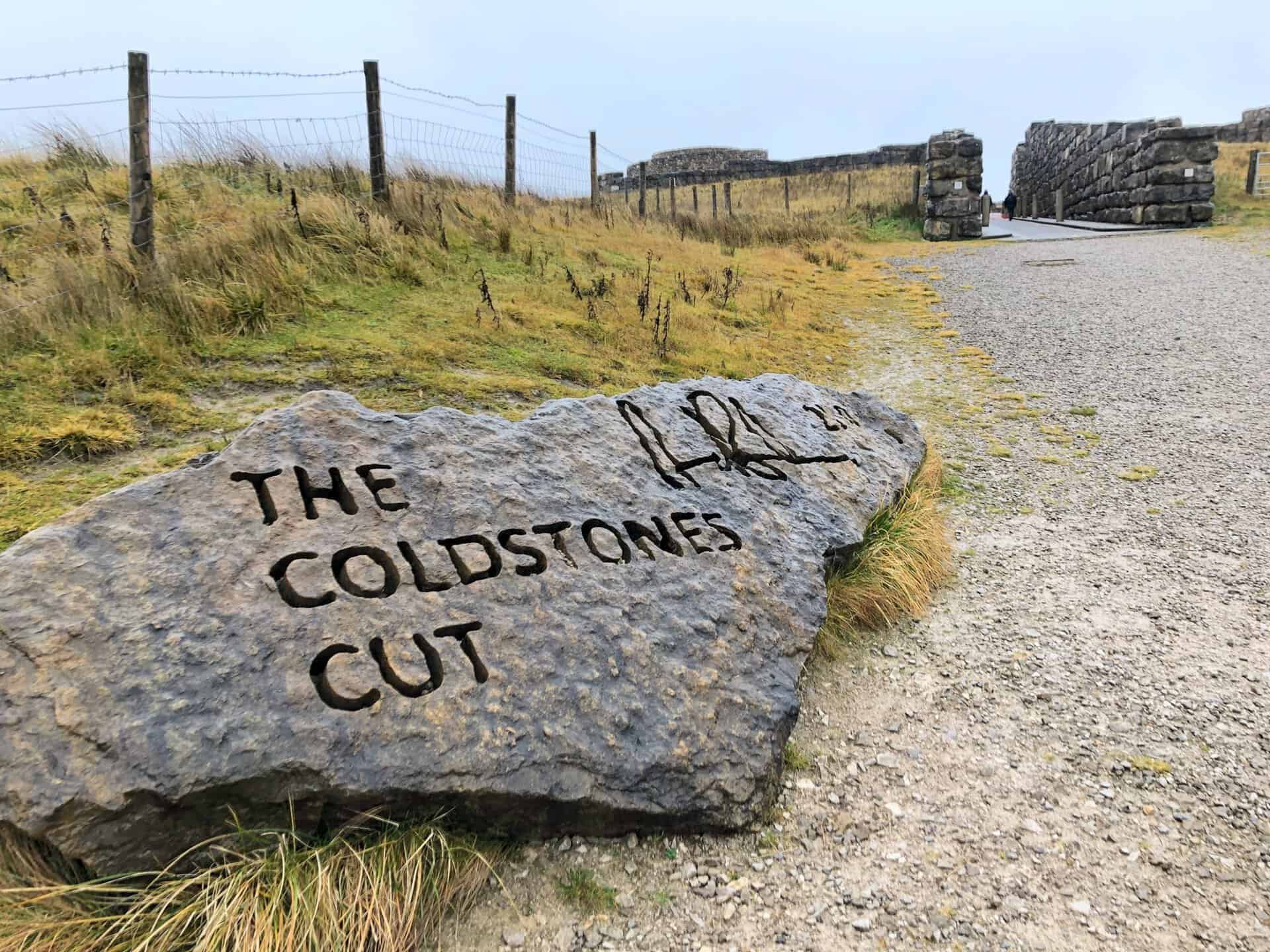
From Hillend, head south across the picturesque countryside until the B6265 main road comes into view. Cross this road to discover the historic Toft Gate Lime Kiln. A short distance away, marvel at the sights of Coldstones Cut and Coldstones Quarry.
For the next phase of your Coldstones Cut walk, return to the B6265. Proceed west along the road, making use of the adjacent footpath available for most of the journey, until you arrive at Greenhow. From here, venture north across Bewerley Moor, then north-east to the landmarks of Providence House and Prosperous Smelt Mill, located beside Ashfold Side Beck.
Concluding this 9-mile Nidderdale journey, head east following the Nidderdale Way. This will guide you back to the River Nidd near Brig House. Stroll south-east alongside the river, returning you to Pateley Bridge. Round off your adventure with a leisurely exploration of Pateley Bridge town and a revisit to the Pillars Past Sculpture.
Coldstones Cut Walk: Maps and Tools
Visit either the OS Maps website or the Outdooractive website to view this walking route in greater detail. Both platforms offer a range of features, including the ability to print the route, download it to your device, and export the route as a GPX file. You can also watch a 3D fly-over and share the route on social media.
Coldstones Cut Walk: Distance, Duration, Statistics
Distance: 9¼ miles
Distance: 15 kilometres
Duration: 4½ hours
Ascent: 1406 feet
Ascent: 429 metres
Type: Circular walk
About Coldstones Cut
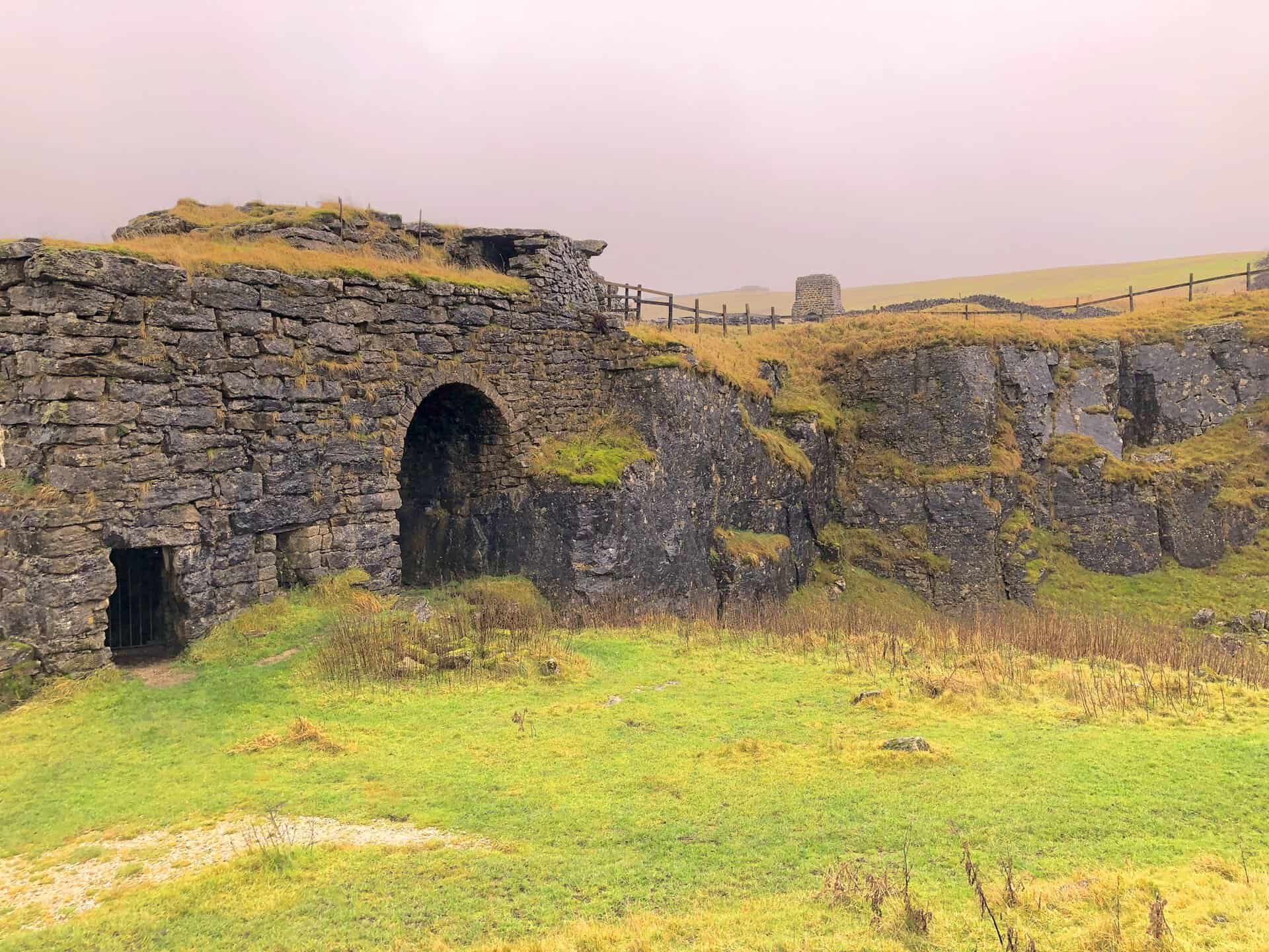
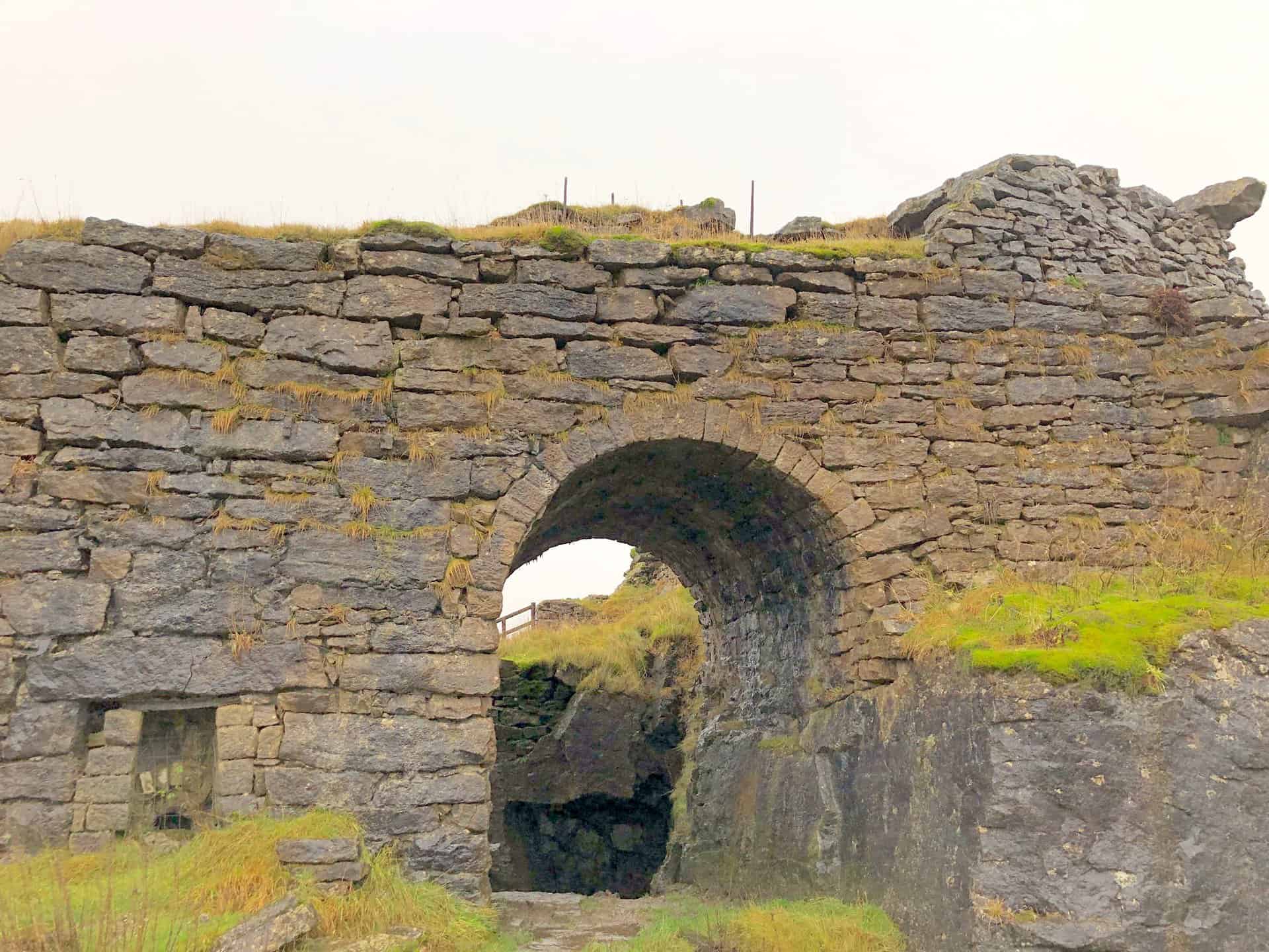
The Coldstones Cut is a unique attraction in Yorkshire. Designed by the artist Andrew Sabin, it’s a vast structure you can freely explore. Perched 1375 feet above sea level, the Coldstones Cut overlooks the expansive Coldstones Quarry and provides breathtaking views of Nidderdale’s scenery.
This monumental piece of public art offers platforms for visitors to view not only the limestone quarrying operations but also the captivating Nidderdale Area of Outstanding Beauty. The sculpture also sheds light on the surrounding landscape’s industrial heritage and its connection to the quarry. Integrating elements of a modern streetscape and the grandeur of ancient stone constructions, experiencing the Coldstones Cut walk firsthand is unmatched.
Coldstones Quarry, located on Greenhow Hill, is one of the highest quarries in England. Despite its vastness, its position and protective earth bund keep it concealed. In 2006, a decision was made to replace an existing viewing platform with a more enduring piece of public art, enhancing the site’s appeal and educational value. Nidderdale visual arts and Hanson Aggregates, who operate the quarry, commissioned Andrew Sabin for the design.
The design journey spanned three years, encompassing artistic evaluations, technical assessments, and public consultations that revealed substantial support. Partners like Harrogate Borough Council and The Nidderdale Plus Partnership were instrumental in bringing the vision to life. By late 2009, planning permission and funding were secured. Construction began in March 2010, and the Coldstones Cut was officially inaugurated by Dr. Penelope Curtis, Director of Tate Britain, on 16th September 2010.
To visit, you’ll find the Coldstones Cut on the B6265 between Skipton and Pateley Bridge, just two miles from Pateley Bridge. Convenient parking is available at the Toft Gate Lime Kiln car park, and from there, a footpath leads you 40 metres upwards over 500 metres to the sculpture. For a different experience, instead of driving and parking, why not try the Coldstones Cut walk starting from Pateley Bridge?
For those interested in capturing or viewing Coldstones Cut from a unique aerial perspective, a visit to Drone Adventure’s website is highly recommended. At https://www.droneadventure.co.uk/places-to-fly/coldstone-cut, you can explore breathtaking drone footage and stunning aerial photographs of the site. These visuals not only highlight the vastness and beauty of the Coldstones Cut but also offer a different vantage point that enriches the appreciation of this impressive landscape.
Recommended Ordnance Survey Map
The best map to use on this walk is the Ordnance Survey map of Nidderdale, reference OS Explorer 298, scale 1:25,000. It clearly displays footpaths, rights of way, open access land and vegetation on the ground, making it ideal for walking, running and hiking. The map can be purchased from Amazon in either a standard, paper version or a weatherproof, laminated version, as shown below.
Weatherproof Version
Ordnance Survey map of Nidderdale, reference OS Explorer 298, scale 1:25,000
Coldstones Cut Walk: My Photos
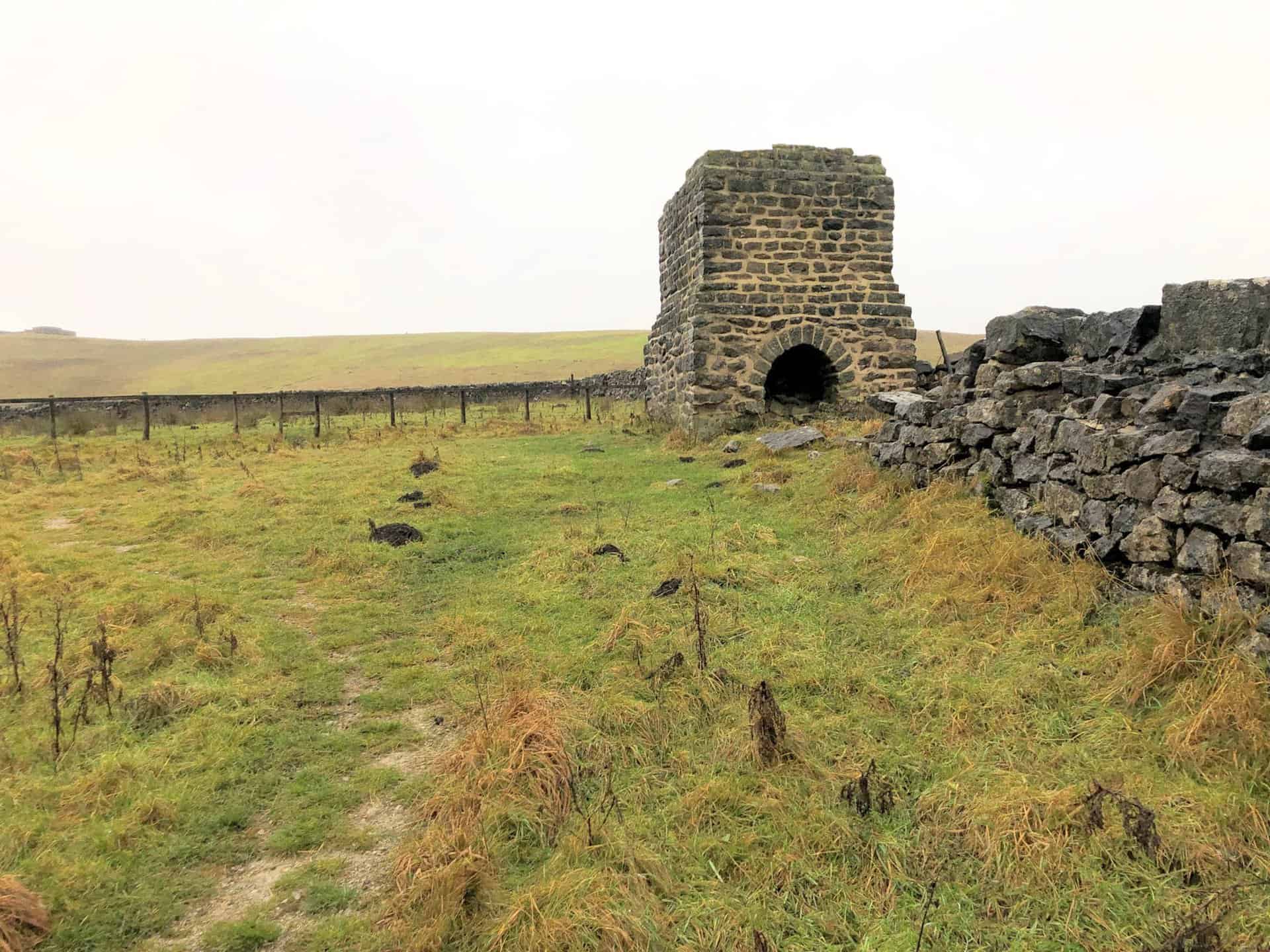
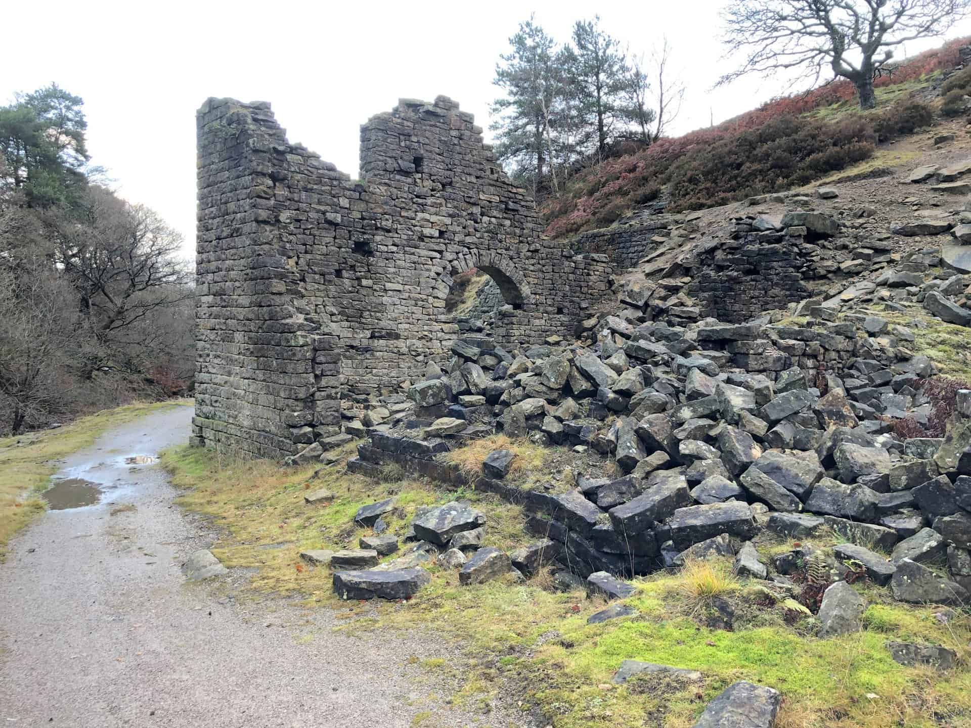
Toft Gate Lime Kiln
Built sometime during the 1860s, the Toft Gate Lime Kiln was designed to feed the Victorian need for huge volumes of lime which was essential for mortar and as a fertiliser. The production process was difficult and often hazardous, and sometimes even children were expected to work long days breaking limestone to size. Despite this hardship, the kiln produced lime for over five decades.
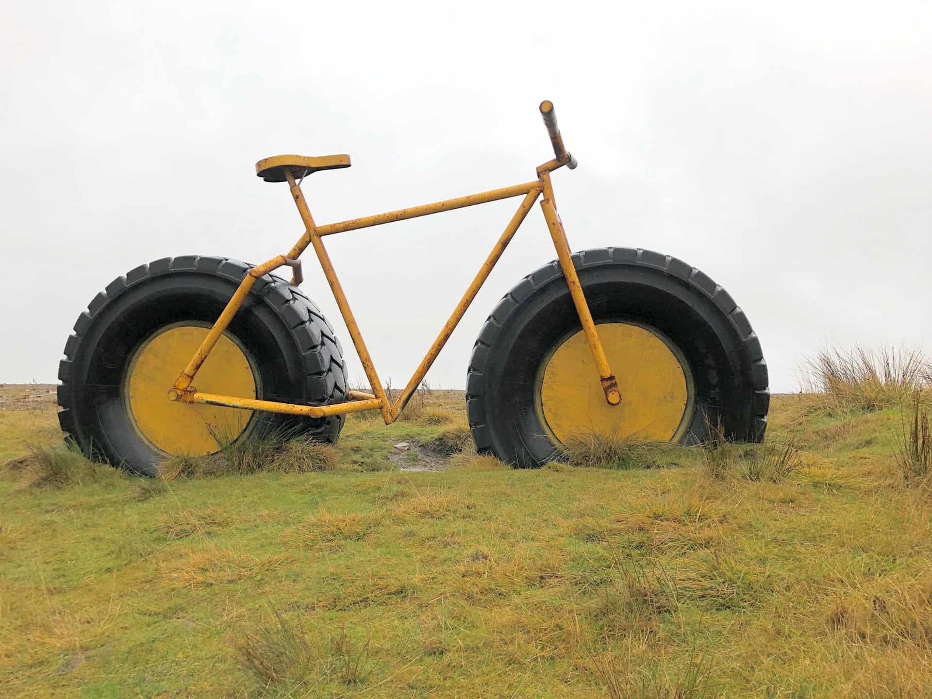
Large yellow bicycle with tractor-sized tyres at Coldstones Cut.
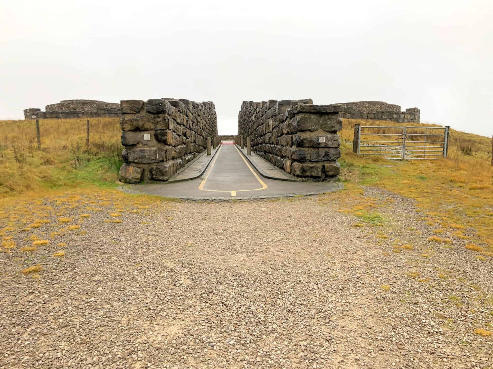
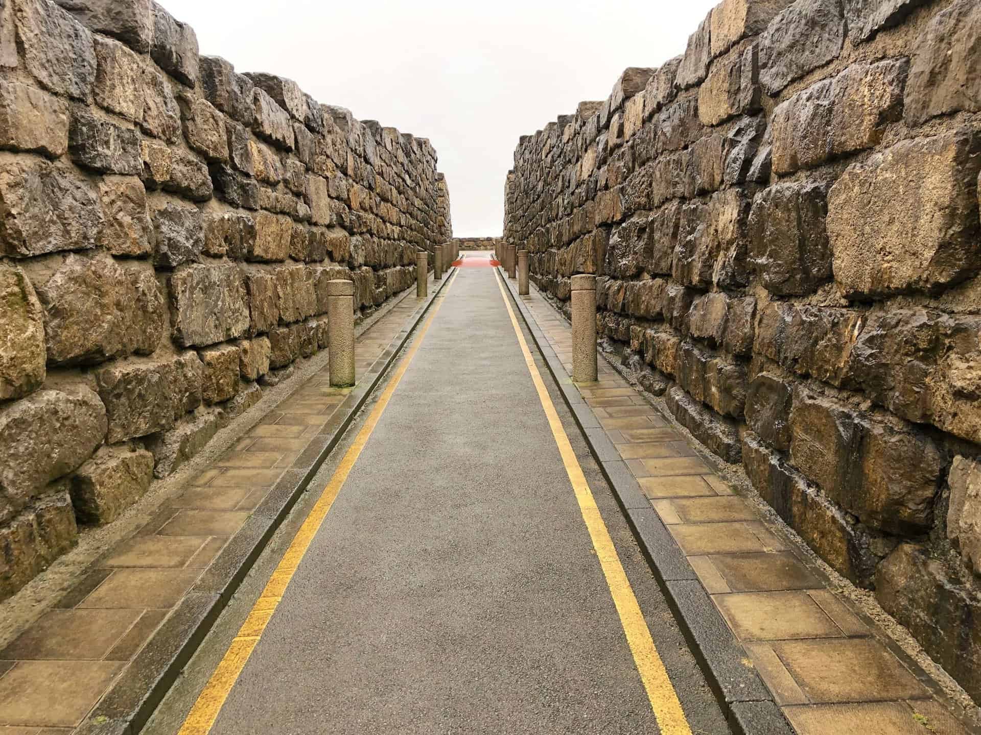
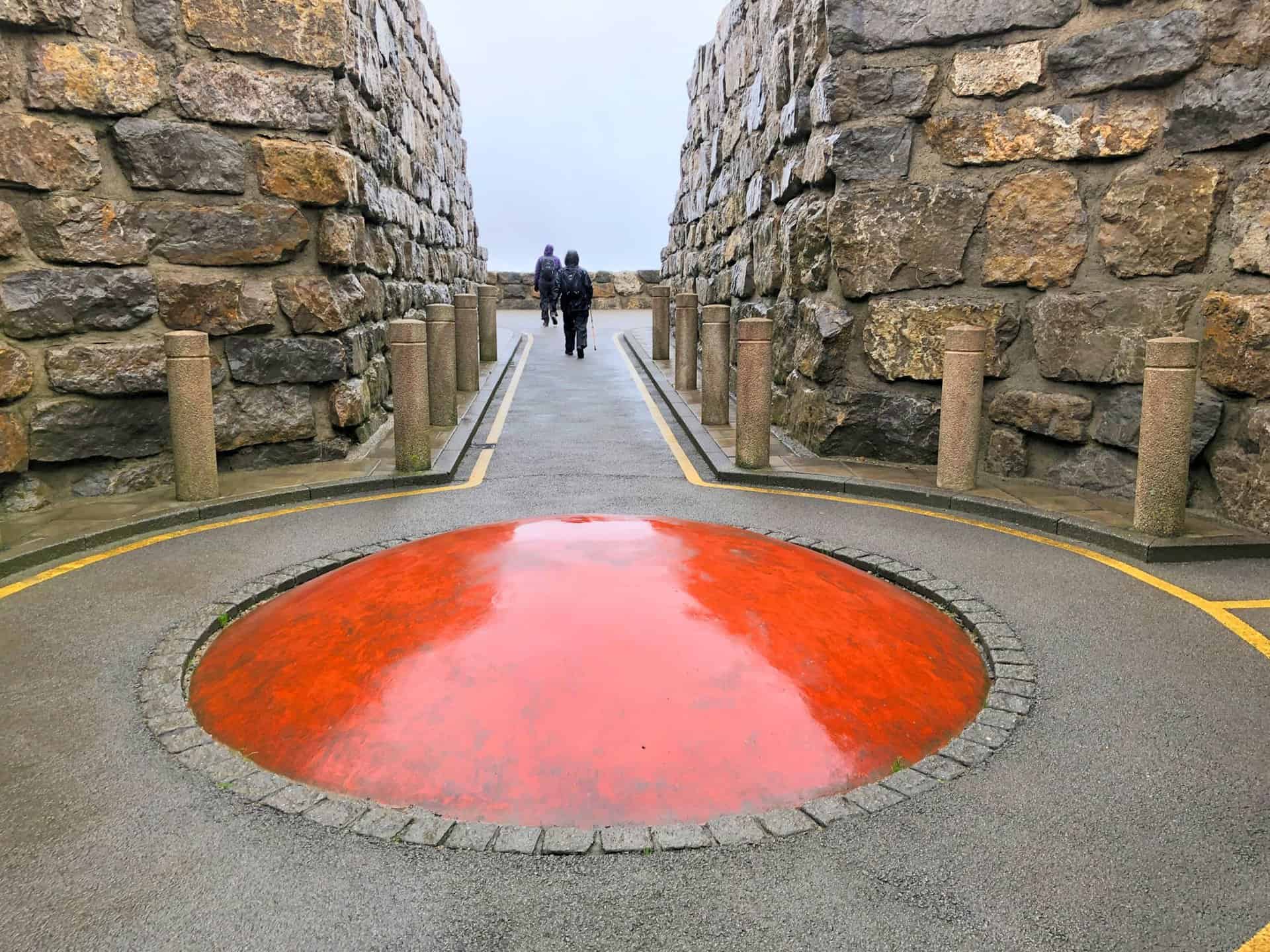
Coldstones Cut Walk: The Sculpture
This huge stone sculpture was designed by artist Andrew Sabin and its viewing platform overlooks Coldstones Quarry. The site is on the B6265 about two miles west of Pateley Bridge.
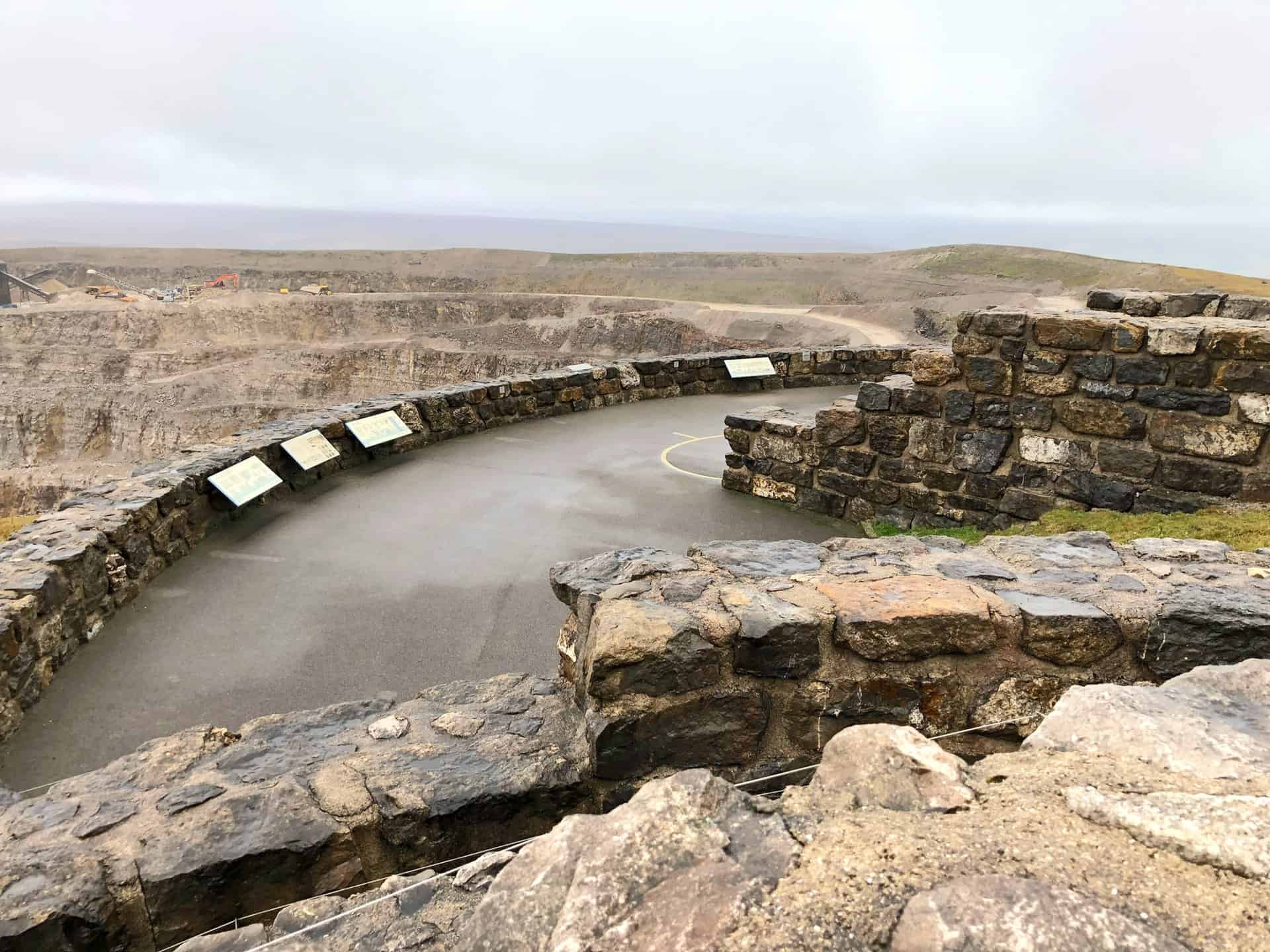
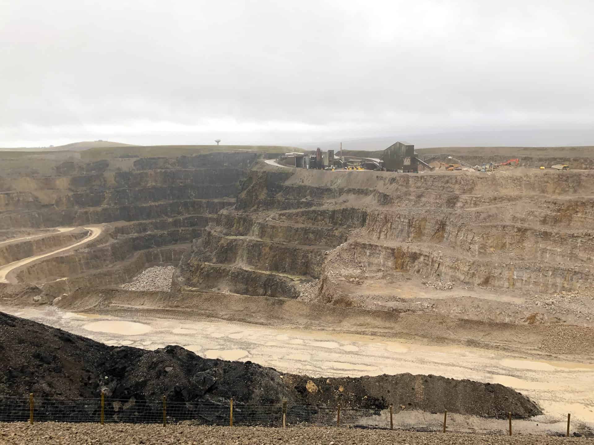
Coldstones Cut Walk: Coldstones Quarry
This is one of the highest quarries in the UK, situated about 1400 feet above sea level between Pateley Bridge and Greenhow. Operated by Hanson, it provides aggregates and asphalt for the construction industry and covers an area of about 30 hectares. It has six levels or benches, each one 15 to 18 metres high, and is 300 metres deep. The quarry is roughly one-third of the way round this Coldstones Cut walk.
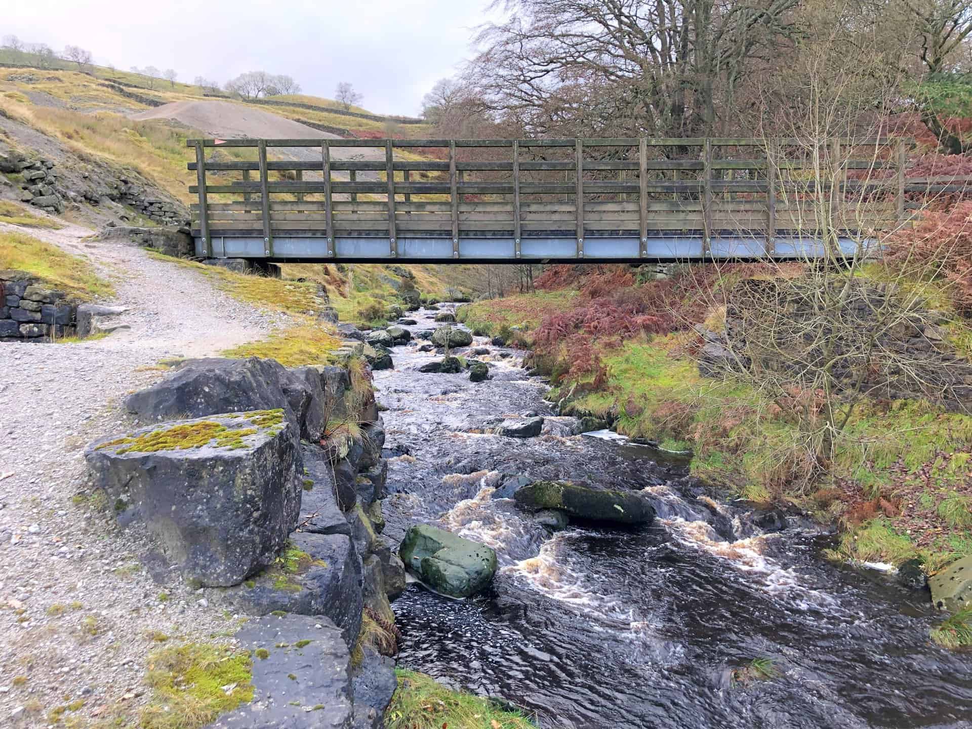
Prosperous Smelt Mill
Situated by the side of Ashfold Side Beck about 2½ miles west of Pateley Bridge, this was once a noisy, smelly and busy smelt mill. For over 100 years the mill processed lead ore dug from mineral veins that cross this landscape. The ore was heated in the smelt mill to extract the lead which could be sold for profit. The mine closed towards the end of the 19th century as lead prices began to fall due to competition from foreign imports. The more accessible levels had been exhausted and opening new ones proved too difficult and expensive.

Ashfold Side Beck, roughly two-thirds of the way round this Coldstones Cut walk.
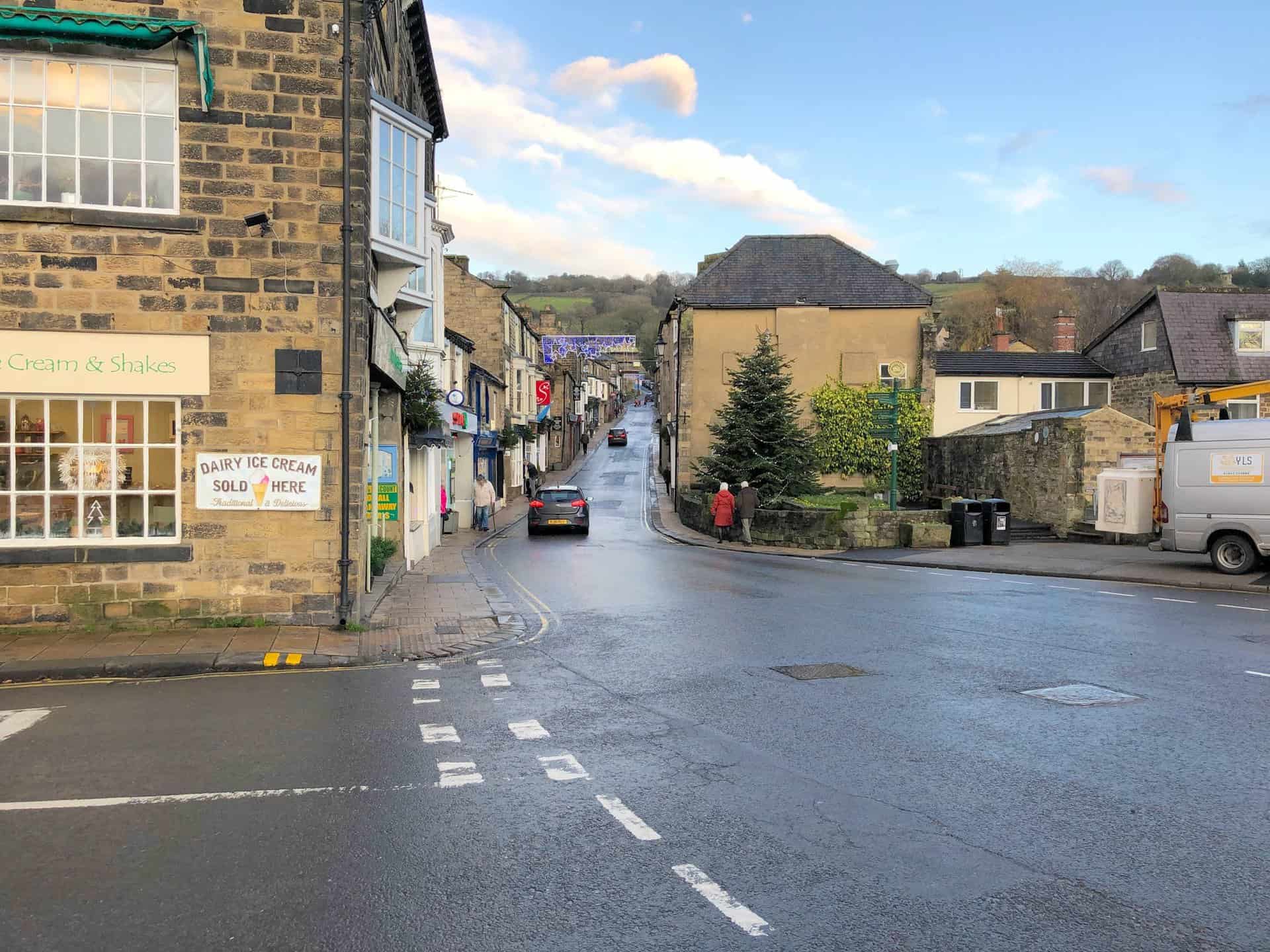
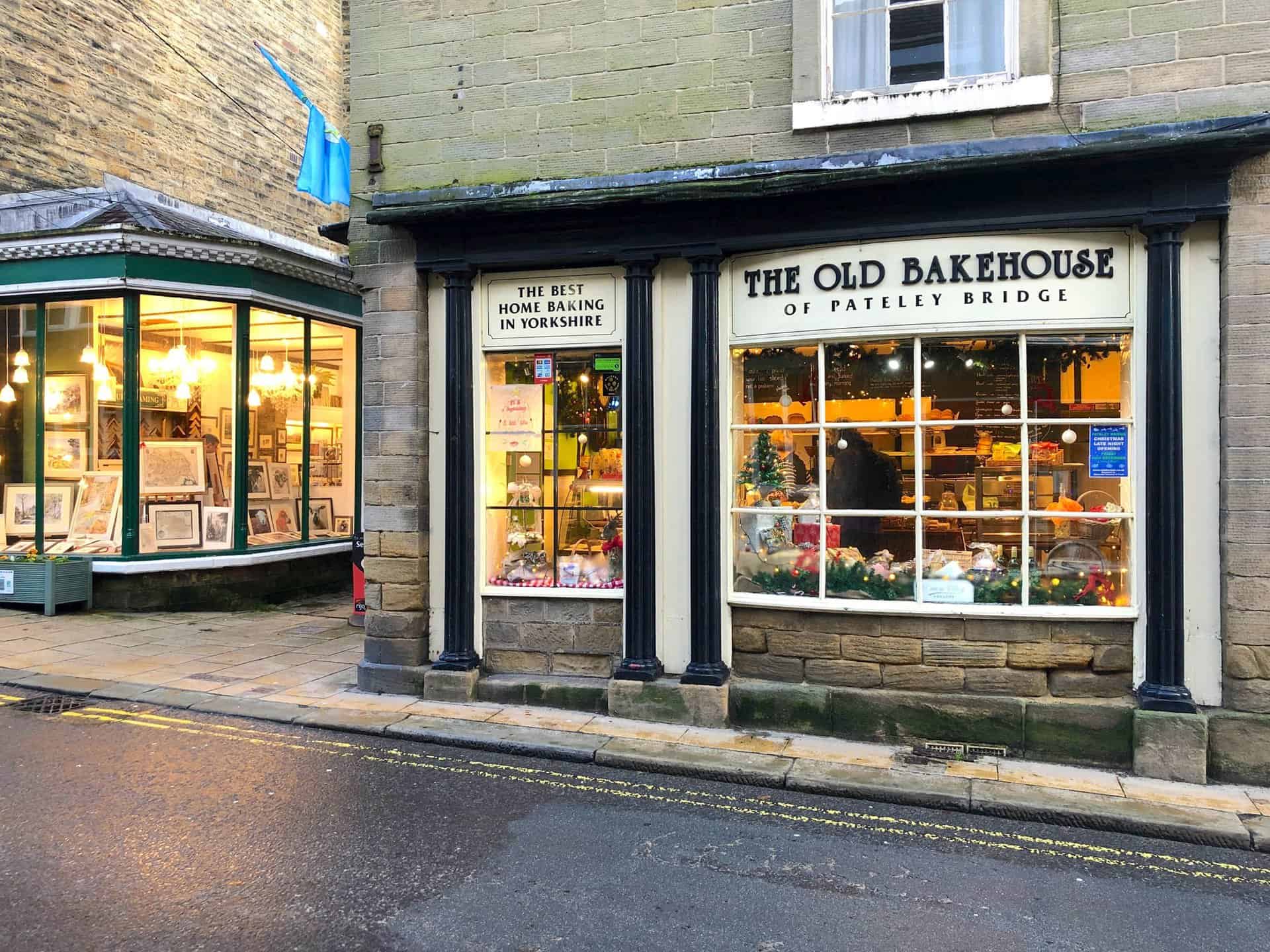
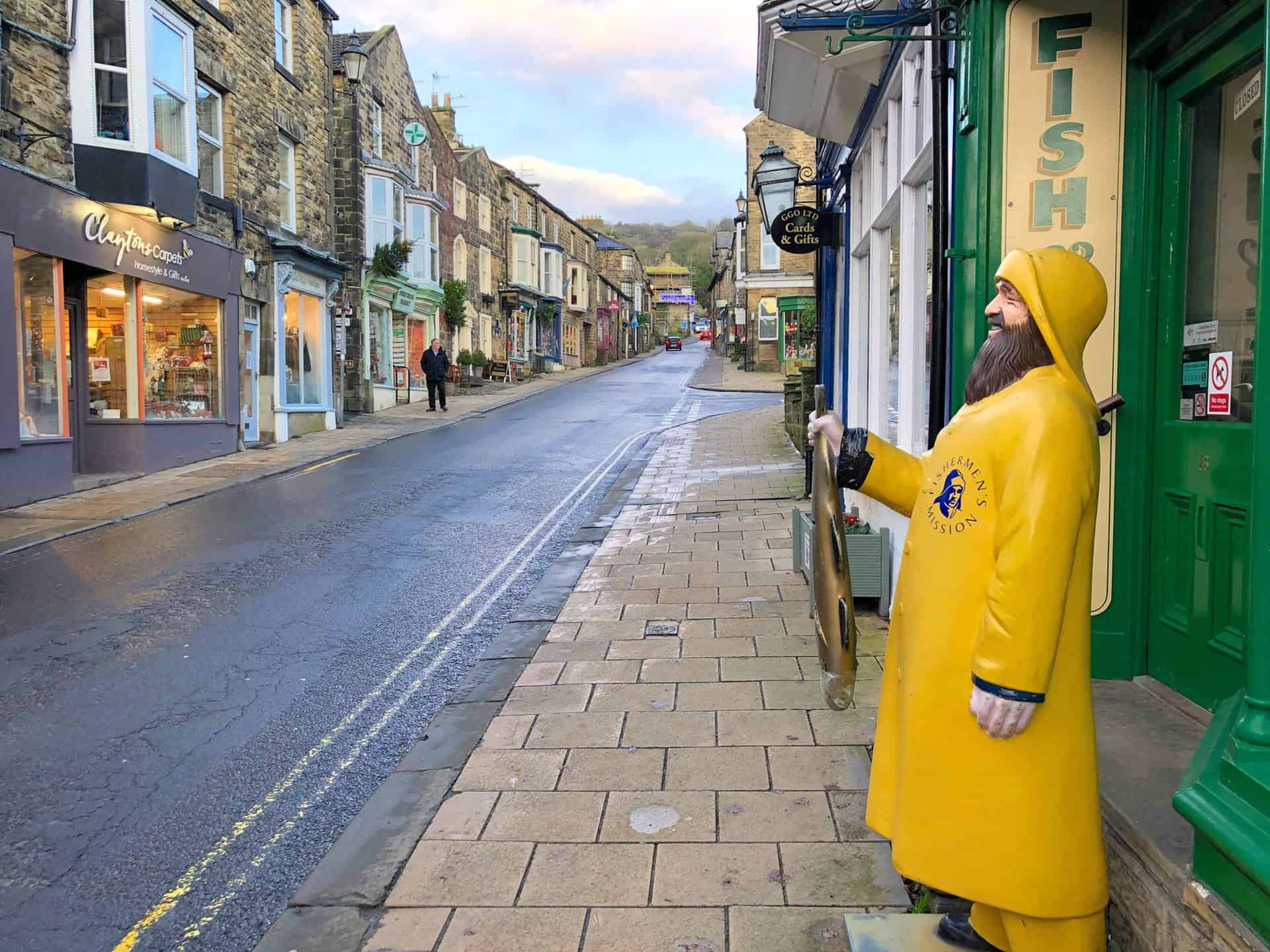
Pateley Bridge
This is the only town in the Nidderdale AONB (Area of Outstanding Natural Beauty). Its high street is dominated by independent retailers, including the Oldest Sweet Shop in the world, as validated by the Guinness World Records 2014 publication.
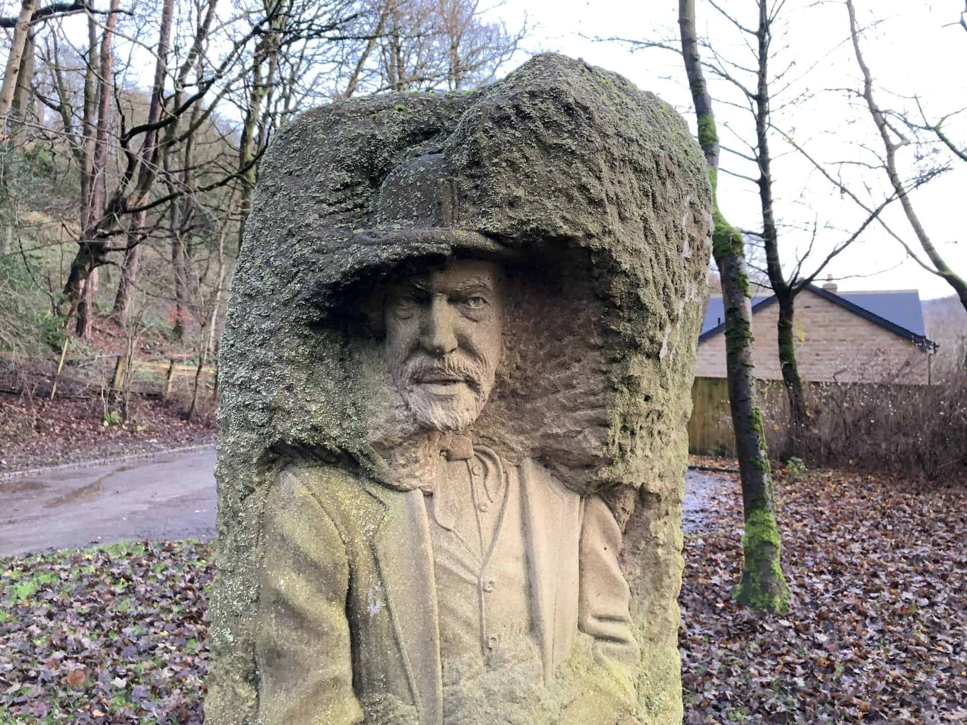
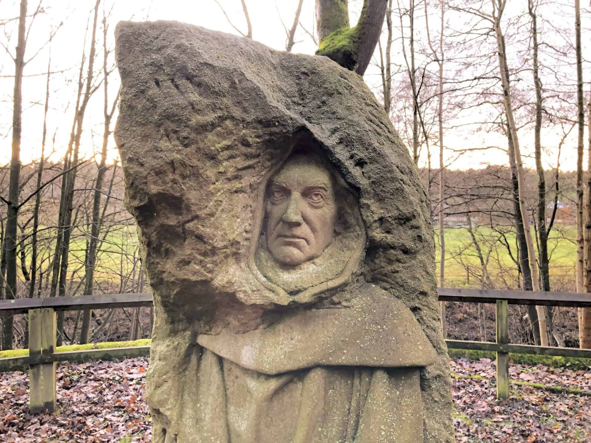
Pillars Past Sculpture
Created by Joseph Hayton, Pillars Past comprises three figures, in a circular formation, representing the lead mining, agricultural and monastic past that has shaped the landscape in and around Pateley Bridge. The sculpture sits on an old railway turntable which operated between 1862 and 1964. Engines were turned around here to pull carriages back along the single track to Harrogate.
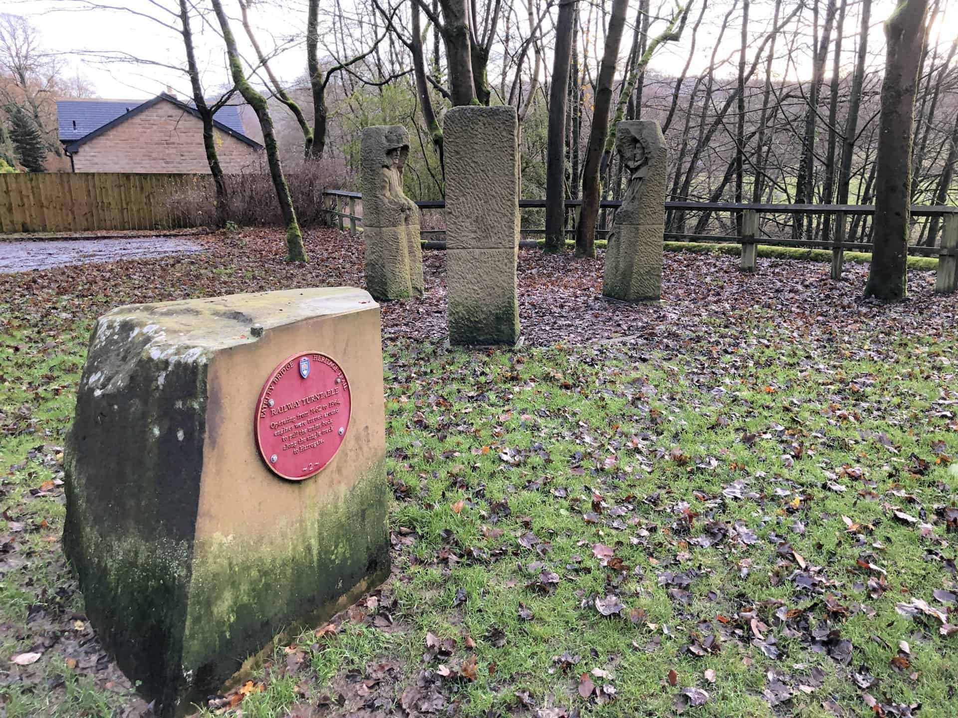
Pillars Past Sculpture: The Sheep Farmer
Sheep farming has been crucial to the economy of Nidderdale since medieval times. Fountains Abbey and Bylands Abbey had substantial granges where sheep farming was predominant. Sheep farming continues to dominate the land today. The shepherd figure was based on John Rayner, a sheep farmer. His farm at Gouthwaite, established in the 1200s, is on record for supplying produce to Fountains Abbey.
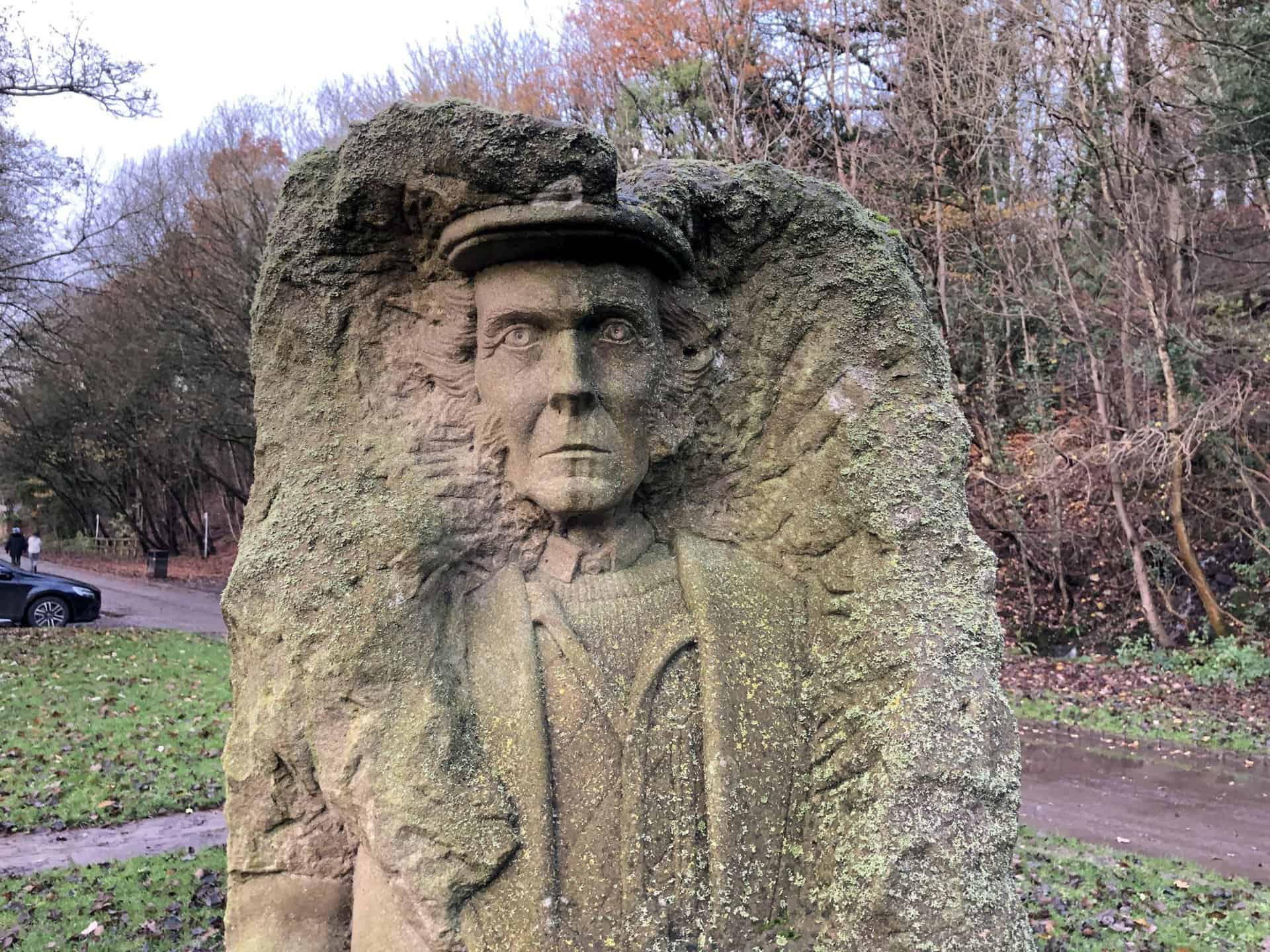
Pillars Past Sculpture: The Lead Miner
Lead mining dates back to Roman times in the dale and had a major impact on the local economy until around the 1890s. Lead extraction ceased due to cheap imports. The figure of the lead miner was based on Paul Reinsch, who has been helping to restore local mines in Greenhow, which you’ll visit on this Coldstones Cut walk.
Pillars Past Sculpture: The Monk
Fountains Abbey and Bylands Abbey shaped Nidderdale, having major landholdings from 1200 until the dissolution of the monasteries. The Archbishop of York once owned the township of Pateley Bridge. The figure of the monk was based on John Hayton, Joseph’s father.
Amazon’s Top Walking Boots: Four Standout Choices for Men and Women
For walking and hiking, the right boots are essential for both comfort and safety. While Amazon boasts a wide range, certain boots emerge as top-sellers. From those, here are four I personally favour. As an Amazon affiliate, I may earn a small commission from any purchases made through the links provided. This helps support the upkeep of this website. Rest assured, you won’t pay a penny extra, but your purchase will contribute to keeping my site running smoothly. Happy walking!

Berghaus Men’s Hillmaster II Gore-Tex Walking Boots
These fully waterproof leather walking boots feature a Gore-Tex lining, ensuring no water enters whilst allowing feet to breathe and stay cool. Made from full-grain leather, they promise unmatched durability and comfort. The boots come with memory foam tongues and cuffs that mould to your feet for a tailored fit, and the Vibram Hillmaster outsoles offer confidence on challenging terrains.

Salewa Men’s Mountain Trainer Mid Gore-Tex Walking Boots
Made from durable suede and abrasion-resistant textile, these men’s hiking boots are both lightweight and sturdy. The upper material is enhanced by a 360° full rubber sheath. Their dual-layer midsole with Bilight technology ensures ergonomic cushioning and grip, especially on extended hikes. The Vibram Wrapping Thread Combi outsoles allow a natural walking feel, and the Gore-Tex lining provides waterproofing, breathability, and optimal weather protection. Furthermore, the patented Salewa 3F system ensures flexibility, a secure heel grip, and a blister-free fit.

Berghaus Women’s Supalite II Gore-Tex Walking Boots
Specially designed for women, these hiking boots offer waterproofing and breathability, thanks to their Gore-Tex lining. Crafted from full-grain abrasion-resistant leather, they’re durable enough for the toughest hikes. The Supalite soles ensure stability and traction, and the EVA midsoles add comfort for extended walks.

Merrell Women’s Moab 3 Mid Gore-Tex Walking Boots
These hiking boots incorporate a Gore-Tex waterproof membrane, blending breathability with superior waterproof performance. The combination of pigskin leather and mesh on the uppers, along with the suede outer material, ensure durability and style. Enhancements include 100% recycled laces, webbing, and mesh lining. Additionally, bellows tongues, protective toe caps, and Vibram TC5+ rubber soles ensure protection and ease on any terrain.