Enjoy Diverse Landscapes from Hills to Moorlands on the Lordstones Walk
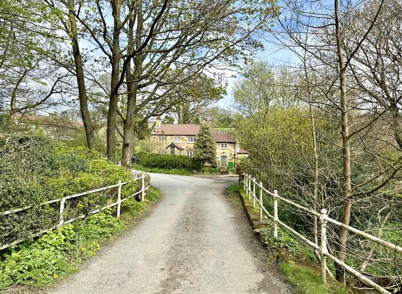
This captivating Lordstones walk in the North York Moors begins at the car park adjacent to the B1257 road, just a couple of miles south-east of Great Broughton. Start by heading south from the car park, walking briefly alongside the main road, then take a right onto the Cleveland Way. Climb the stone steps leading uphill to your first vantage point, White Hill, which offers breathtaking views.
Continue westward on the Cleveland Way to reach Wainstones. Navigating through this magnificent rocky formation involves a mild scramble, yet it’s easily manageable. After descending from Wainstones, the trail leads westward, preparing you for an ascent up Cold Moor. This marks the second of a trio of climbs on this section of the walk, presenting splendid panoramas, especially towards the distant Teesside to the north.
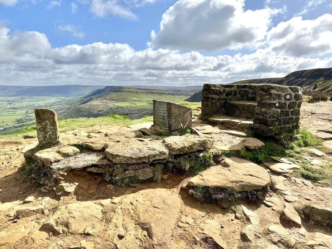
Proceed by descending from Cold Moor, followed by a third climb, this time to reach Cringle Moor. Savour the expansive views from the Cringle Moor viewpoint, which features a large stone seat, perfect for a restful break. Descend westward to Lordstones, where the Lordstones café provides an ideal spot for refreshments.
Leaving Lordstones, turn left at the road and walk briefly east, then take a right along a track leading down to Thwaites House. Continue through fields and farmland, passing by a farm at Staindale. Head south, following the footpath to Raisdale Mill Plantation. Here, navigate the stone forestry track to nearly the woodland’s edge, then turn right onto an easy-to-miss footpath, which will guide you through Raisdale Mill Cottages, emerging onto Raisdale Road.
Turn right on Raisdale Road, walking south-east towards Chop Gate village. If walking along Raisdale Road feels uncomfortable, consider the quieter footpaths through fields on the northern side, though the road itself sees minimal traffic. At Chop Gate, follow the footpath beside the main B1257 road north, then veer right across a road bridge at Seave Green. Climb the minor road to Bilsdale Hall, then take the public bridleway skirting the hall’s right side, leading steeply uphill to Medd Crag on the western edge of Urra Moor.
Stride northward along the path, enjoying the dramatic views to your left over the Bilsdale valley. The path curves eastward, descends into a small valley, then climbs out, continuing north. Eventually, you’ll arrive at a gate and bench at the hilltop viewpoint. From there, descend to the main road, turn right, and conclude your 11-mile Lordstones walk back at the car park, ending a memorable journey through the North York Moors.
Lordstones Walk: Maps and Tools
Visit either the OS Maps website or the Outdooractive website to view this walking route in greater detail. Both platforms offer a range of features, including the ability to print the route, download it to your device, and export the route as a GPX file. You can also watch a 3D fly-over and share the route on social media.
Lordstones Walk: Distance, Duration, Statistics
Distance: 11 miles
Distance: 17¾ kilometres
Duration: 5¾ hours
Ascent: 2351 feet
Ascent: 7217 metres
Type: Circular walk
About the Lordstones
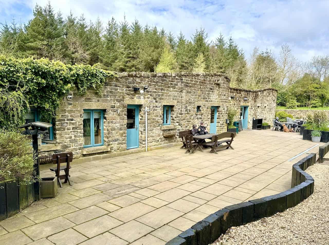
Lordstones is a privately-owned country park nestled in the North York Moors National Park. Located on Carlton Bank, it lies in the valley between the summits of Cringle Moor and Carlton Moor. This unique rural destination offers glamping, camping, a café, a restaurant, and a farm shop.
In terms of accommodation, Lordstones provides luxury glamping and camping options in the picturesque North York Moors. The farm shop at Lordstones stocks the finest quality produce, much of which is locally sourced, showcasing the best that North Yorkshire has to offer.
The café at Lordstones, a local landmark, now boasts first-class facilities set against unmatched surroundings. Additionally, the Beltie Bar & Grill serves high-quality, grass-fed Belted Galloway steaks in a welcoming atmosphere. This restaurant is a seasonal favourite for both on-site guests and visitors.
Alongside the Lordstones walk on this page, the park is a starting point for numerous other trails in the vicinity, catering to a variety of interests and fitness levels. Many visitors choose to park at Lordstones for a short walk to the Cringle Moor viewpoint with their children. Others prefer to explore the park at a leisurely pace, enjoying the expansive views towards Teesside and beyond.
Recommended Ordnance Survey Map
The best map to use on this walk is the Ordnance Survey map of the North York Moors Western Area, reference OS Explorer OL26, scale 1:25,000. It clearly displays footpaths, rights of way, open access land and vegetation on the ground, making it ideal for walking, running and hiking. The map can be purchased from Amazon in either a standard, paper version or a weatherproof, laminated version, as shown below.
Lordstones Walk: My Photos
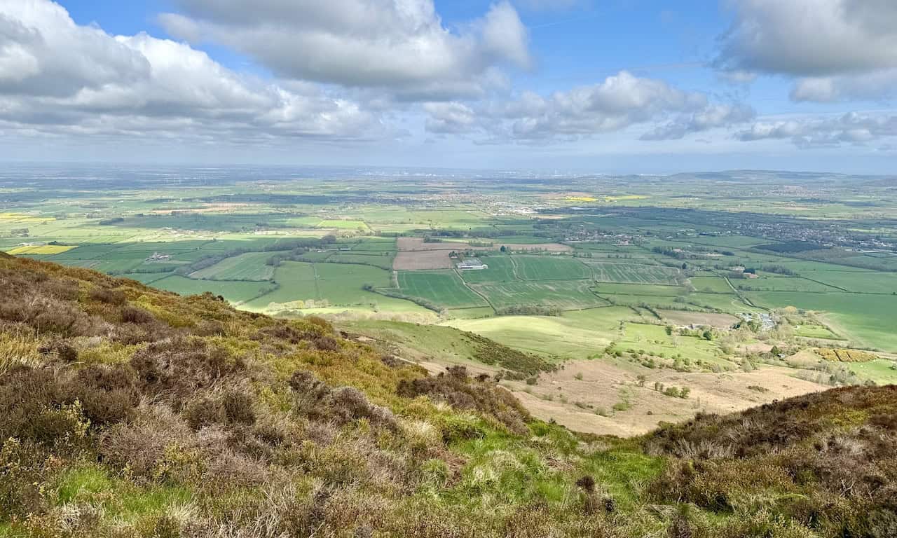
The view north from the car park on Clay Bank, adjacent to the B1257 road. The car park marks the start of our Lordstones walk. The patchwork of green farmland fields in the Ingleby Greenhow area of the North York Moors is a lovely sight. To the south of Ingleby Greenhow, Greenhow Bottom is enclosed by the Cleveland Hills on the east, west, and south sides, forming a U-shape around it. Roseberry Topping is distinctly visible on the horizon towards the left of the centre of the photograph.
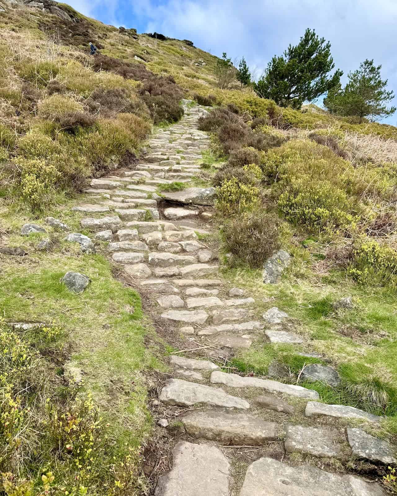
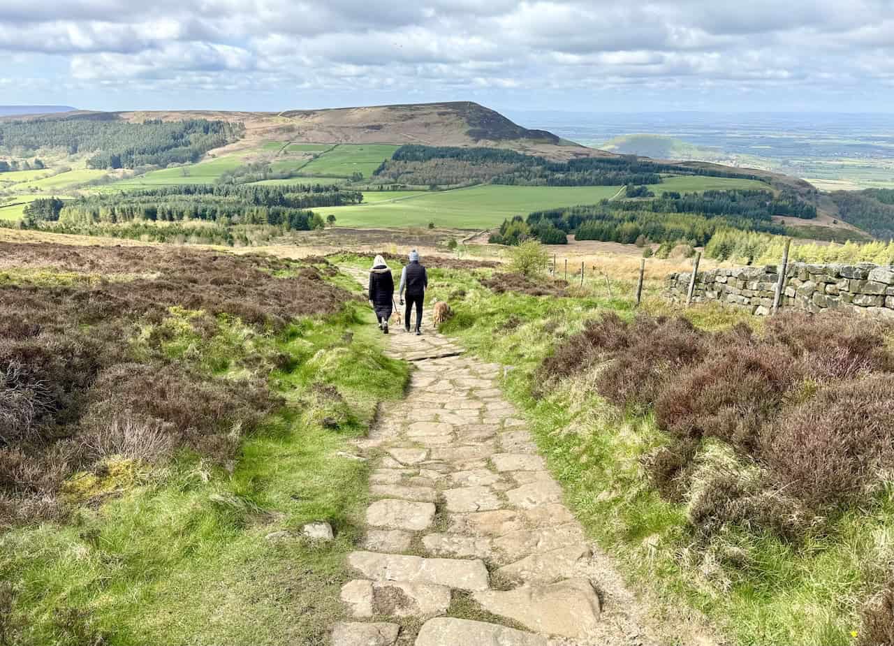
The stone steps of the Cleveland Way lead steeply west uphill towards the summit of White Hill, encountered shortly after beginning our Lordstones walk.
As we ascend White Hill on the Cleveland Way, fantastic views unfold to the north. The patchwork of green farmland fields spreads west of Great Broughton and Stokesley. Roseberry Topping remains in sight, its distinctive claw-shaped profile prominent.
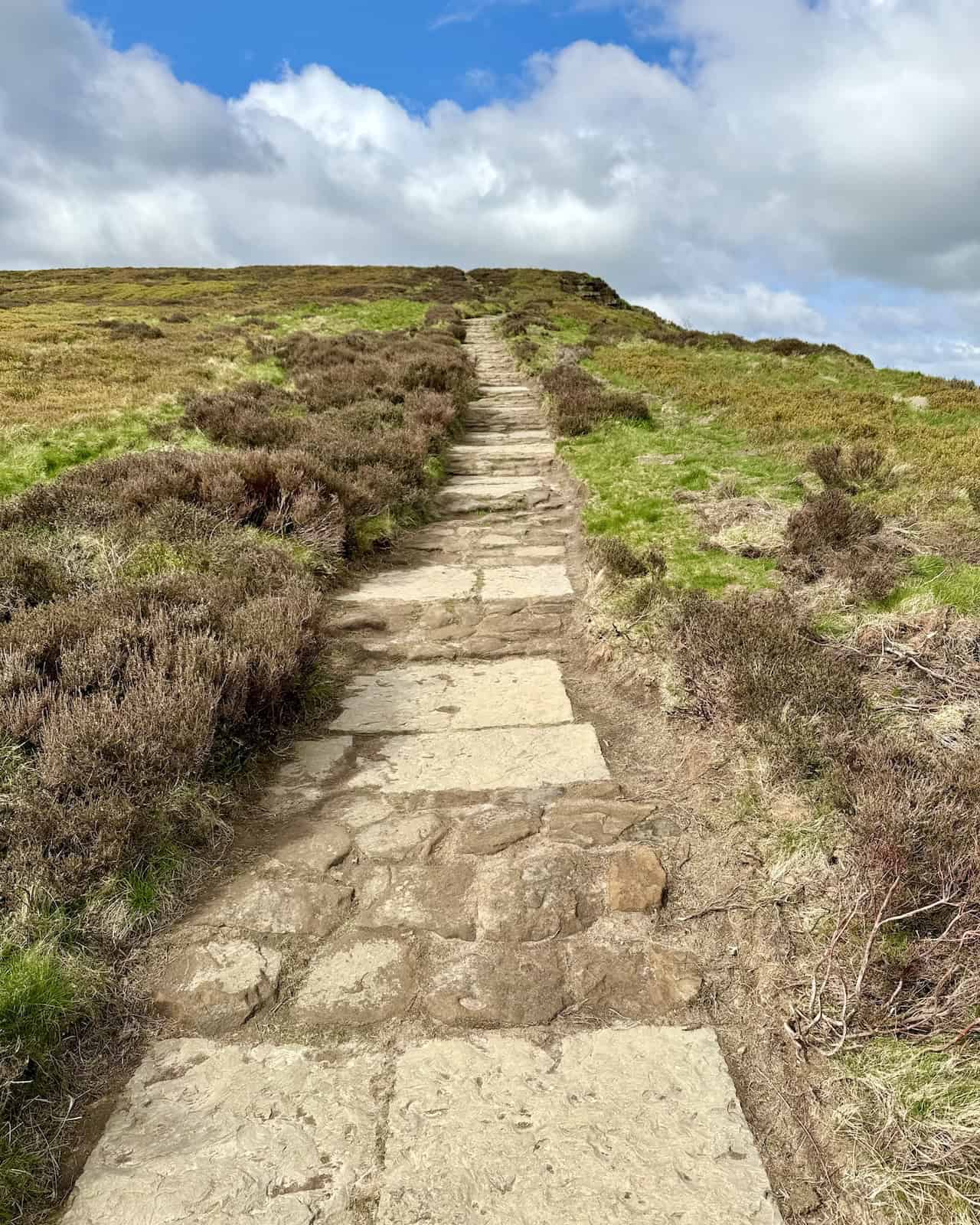
Continuing west across the Cleveland Way on White Hill at 398 metres (1306 feet), the path becomes easier after the initial climb. The well-defined footpath, paved with large stone slabs, facilitates a pleasant walk.
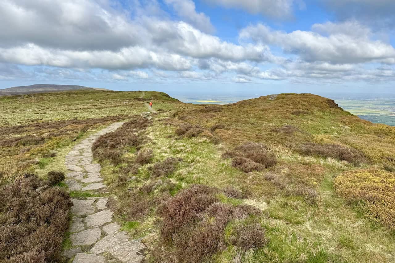
The views to the north are breathtaking as we progress west across the top of Hasty Bank towards Wainstones. Hasty Bank features the southern-facing slopes of White Hill. Below, the trees form Broughton Plantation on the steep slopes of Broughton Bank, which faces north. The built-up areas of Great Broughton and Stokesley, along with Teesside regions like Stockton-on-Tees, Middlesbrough, and Hartlepool, are visible in the distance.
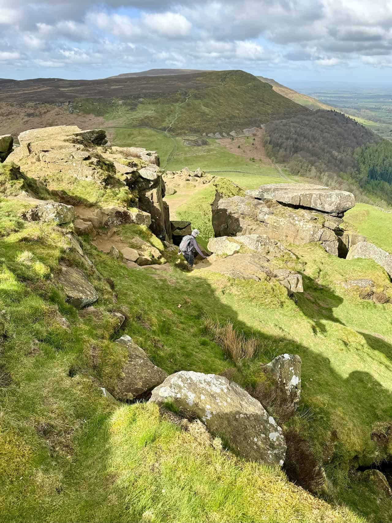
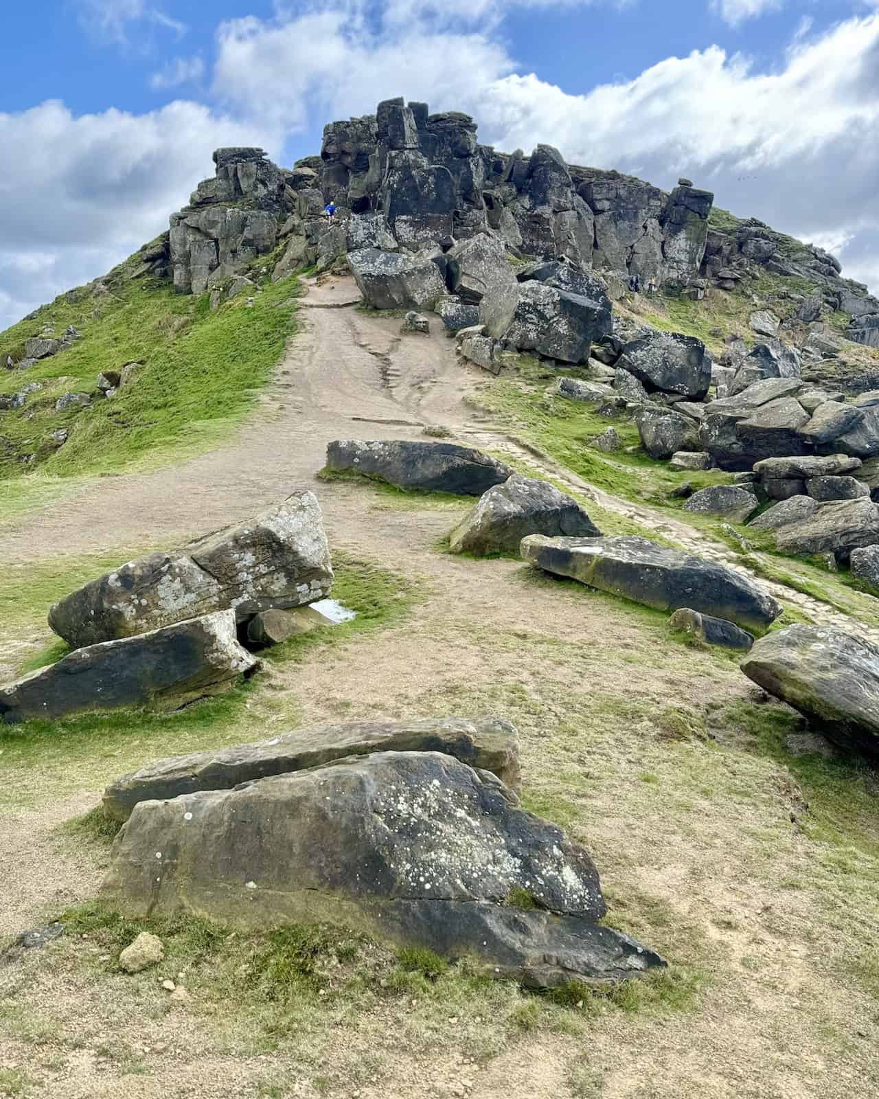
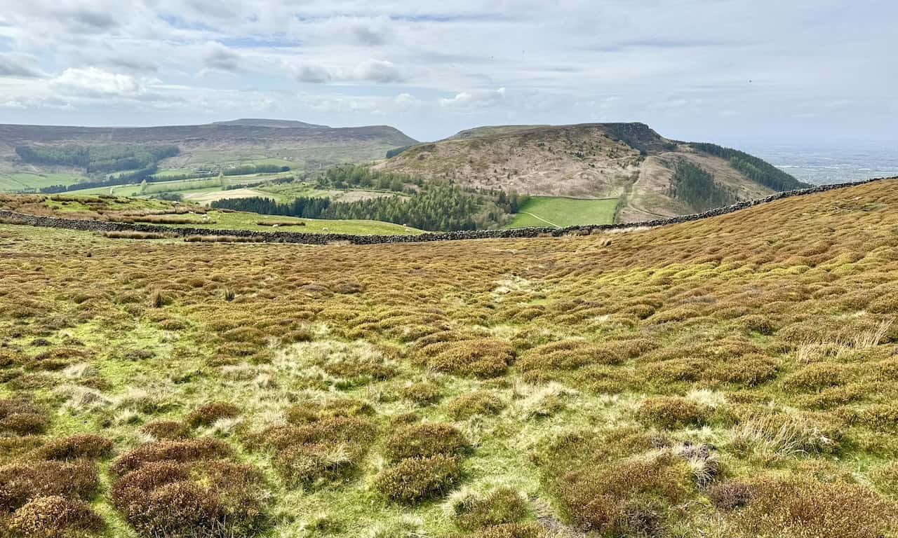
Upon reaching the western end of Hasty Bank, we encounter Wainstones, presenting a slightly challenging scramble through this rocky formation. However, it’s nothing too difficult and is manageable. To the west, the next uphill section of our walk, the ascent of Cold Moor, is visible. For those preferring a less strenuous route, a flat footpath runs above the tree line on the northern side of the hill, leading to the same destination.
The view south from Wainstones overlooks the valley known as Bilsdale. The B1257 road traverses the valley towards Chop Gate and then on to Helmsley, a route popular among motorcyclists.
Looking back at the striking rocky formation of Wainstones as we continue our walk west. This area is a favourite among rock climbers who can often be seen practising with their ropes and climbing gear. Due to its popularity, the path here has become quite eroded.
Continuing west down the stone track towards Garfit Gap, nestled between Wainstones and Cold Moor. The next climb, up to the top of Cold Moor, is clearly visible, as is the alternative path around the northern side of the hill for those who prefer not to ascend to the summit.
The view looking back towards Wainstones as we begin our ascent of Cold Moor captures the beauty of the area, especially on a clear day.
Spectacular views north from the summit of Cold Moor at 402 metres (1318 feet) include Broughton Banks Farm and the sweeping countryside towards Great Broughton, Stokesley, Great Ayton, and the distant Teesside.
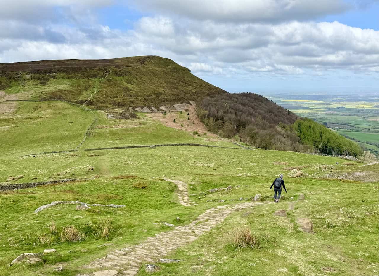
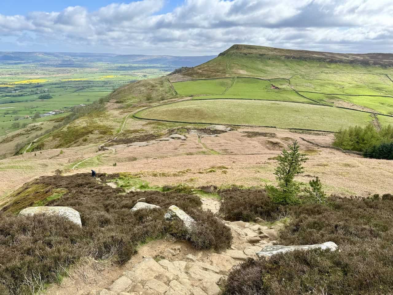
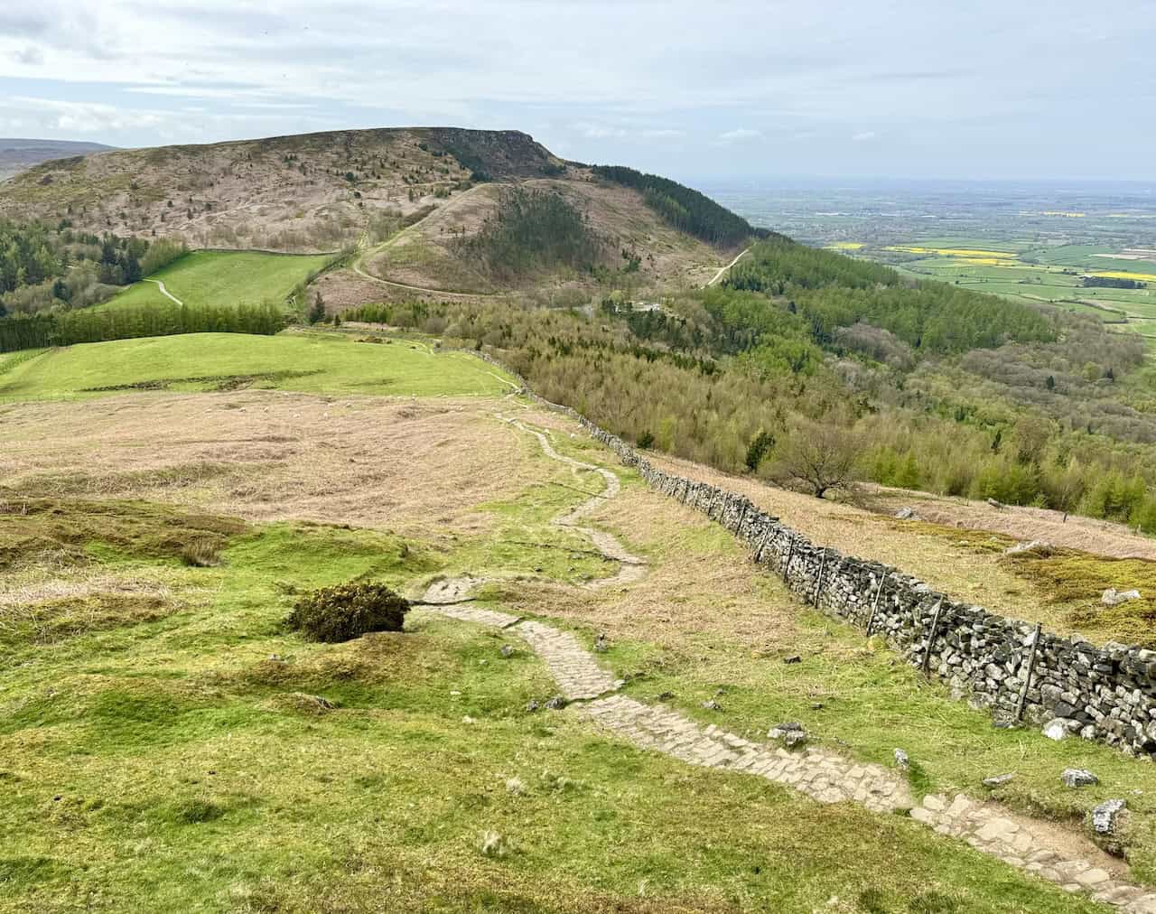
From the summit of Cold Moor, the track descends westward, and our next ascent, the climb to the top of Cringle Moor, comes into view. A path around the northern side offers a gradient-free alternative to the summit, leading to the same location at Lordstones.
The steps leading up the side of Kirby Bank to reach the top of Cringle Moor. Kirby Bank is the northern-facing side of Cringle Moor. We continue our journey on the Cleveland Way.
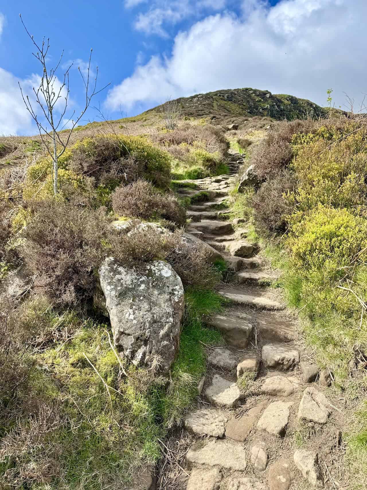
The view back to Cold Moor as we climb the steps up Kirby Bank to reach the summit of Cringle Moor.
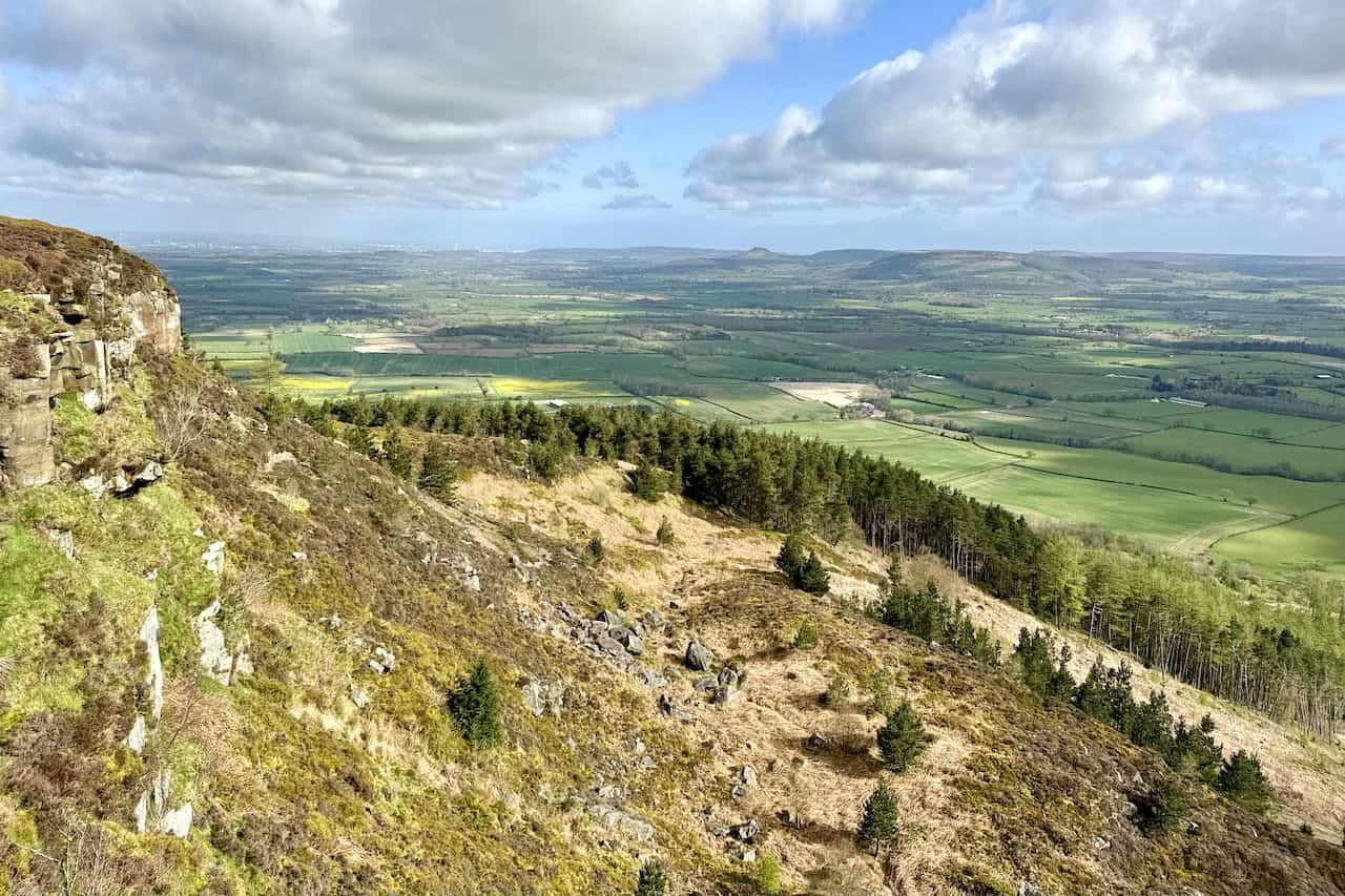
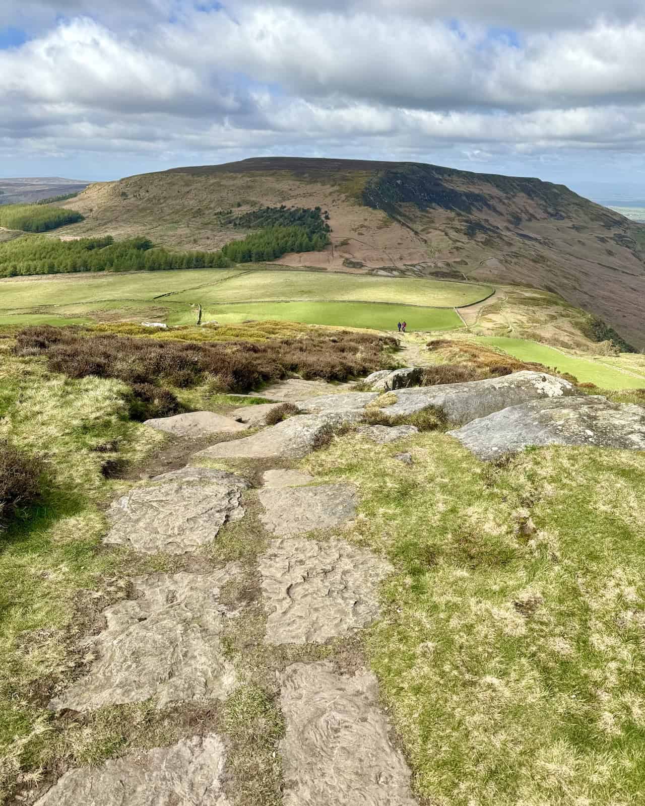
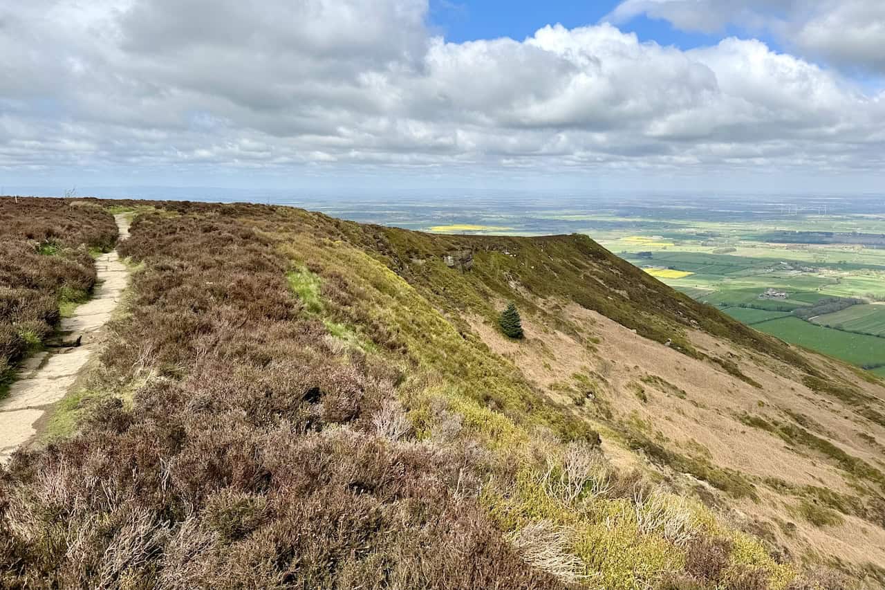
After the ascent, the path across the top of Kirby Bank is well-paved with large flagstones, making it easy to walk along. We continue following the Cleveland Way west. The Cleveland Way skirts the northern side of the true summit of Cringle Moor, known as Drake Howe, which stands at 432 metres (1417 feet).
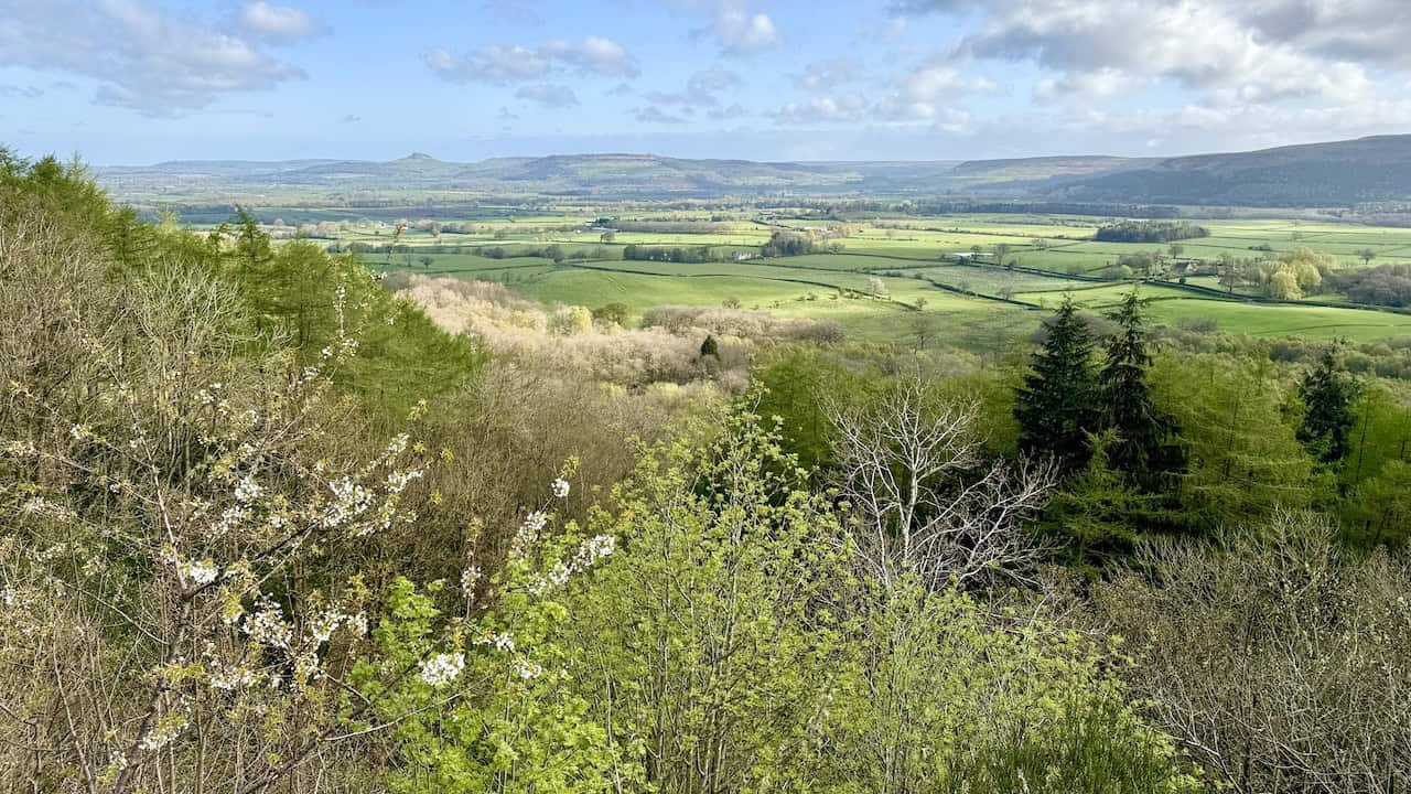
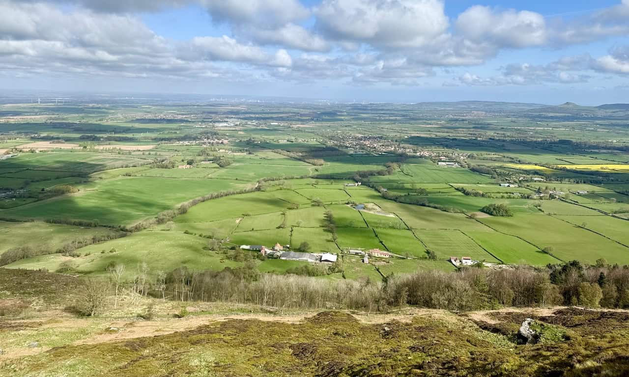
From the top of Cringle Moor, the views north are spectacular and a highlight of the Lordstones walk.
We continue along the footpath, which bends to the right to reach a fantastic viewpoint on the north-western side of Cringle Moor.
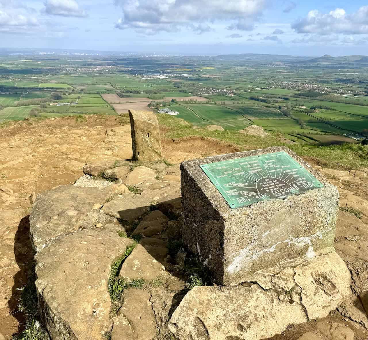
At the viewpoint on Cringle Moor, there is a seat and a topographical plate erected by the friends of Alec Falconer (1884-1968) in his memory. The plate commemorates Alec as a rambler. On clear days, the superb views explain why one would cherish time spent here.
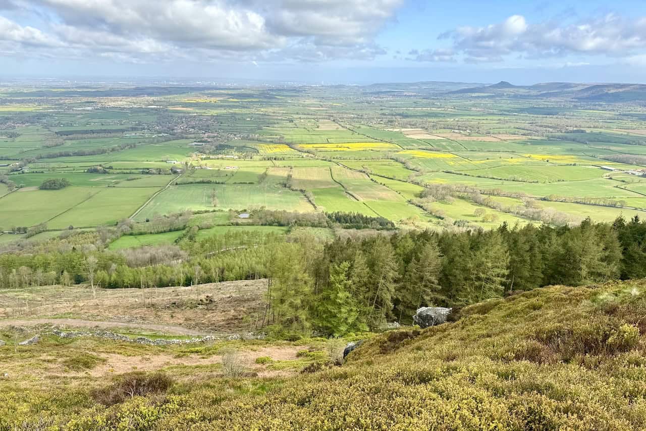
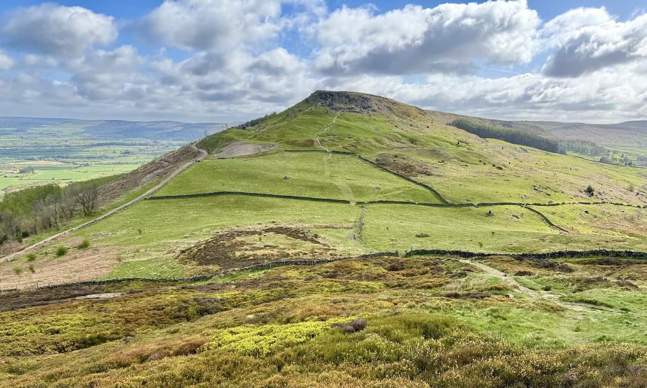
Continuing along the Cleveland Way downhill from Cringle Moor towards Lordstones, Carlton Bank looms in the distance, though we will not tackle it today. Lordstones is nestled in the trees on the right-hand side of the picture. The distinct profiles of White Hill, Cold Moor, Cringle Moor, and Carlton Bank are easily recognisable from the north and visible from as far as Middlesbrough and Stockton-on-Tees.
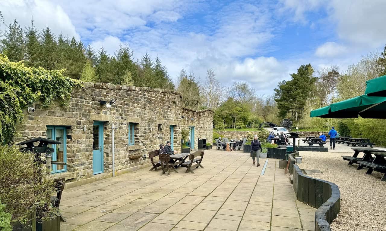
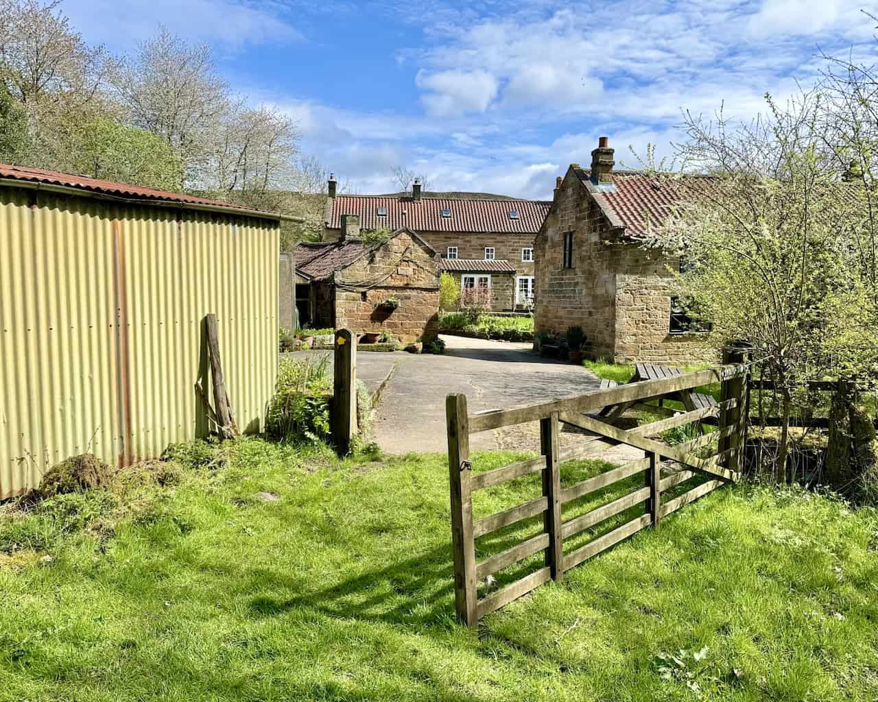
We reach Lordstones, a café, bar and grill, farm shop, and a spot for glamping and camping. It’s a pleasant place for coffee, snacks, and a break, attracting visitors from afar. On one occasion, we witnessed a group flown in by helicopter from Leeds to enjoy lunch here.
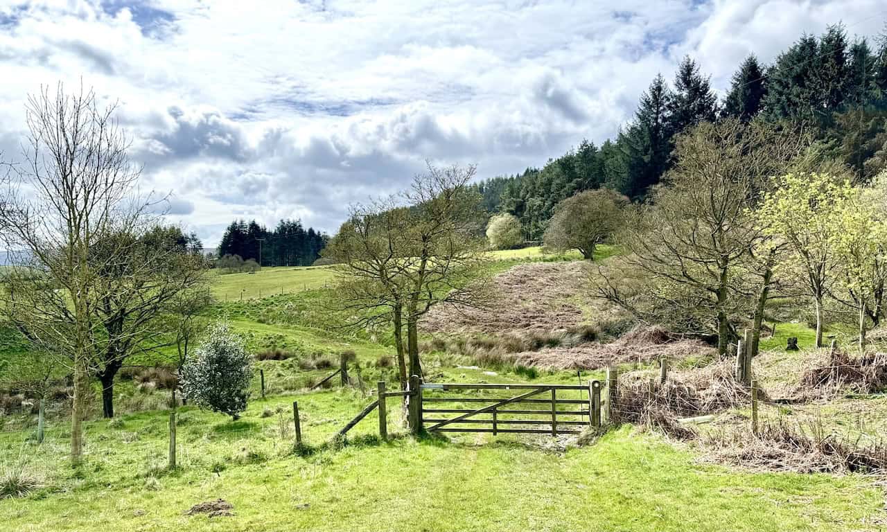
South of Lordstones, we traverse the public footpath across fields from Thwaites House towards Staindale in the valley known as Raisdale. While some areas of this stretch can be slightly boggy, the path is predominantly dry.
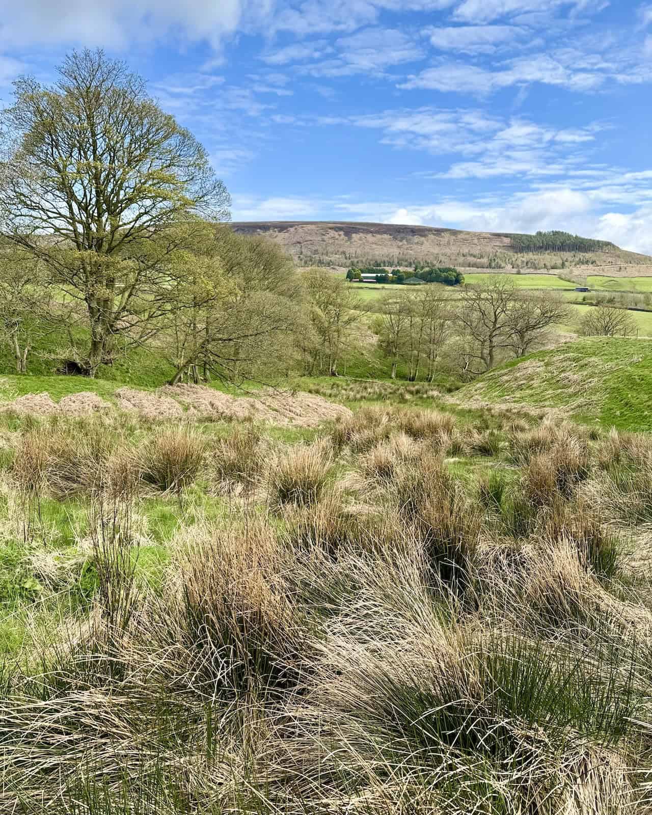
The view east between Thwaites House and Staindale looks towards the southern part of Cringle Moor.
The view north-east towards Wath Hill as we descend to Raisdale Mill Plantation. A public footpath across the top of the hill invites exploration on another occasion.
Passing through Raisdale Mill Cottages, a charming spot beside Raisdale Beck, we proceed towards Raisdale Road.
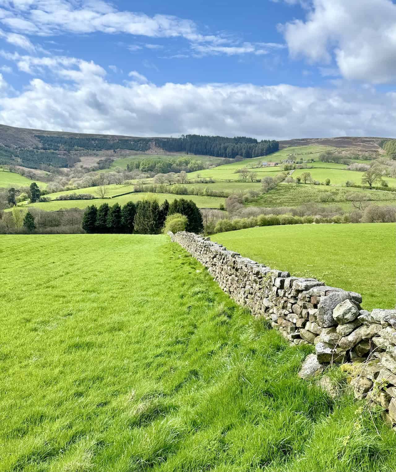
The view west from Raisdale Road spans towards Barker’s Ridge, part of the Cleveland Hills, which separates Raisdale and Scugdale.
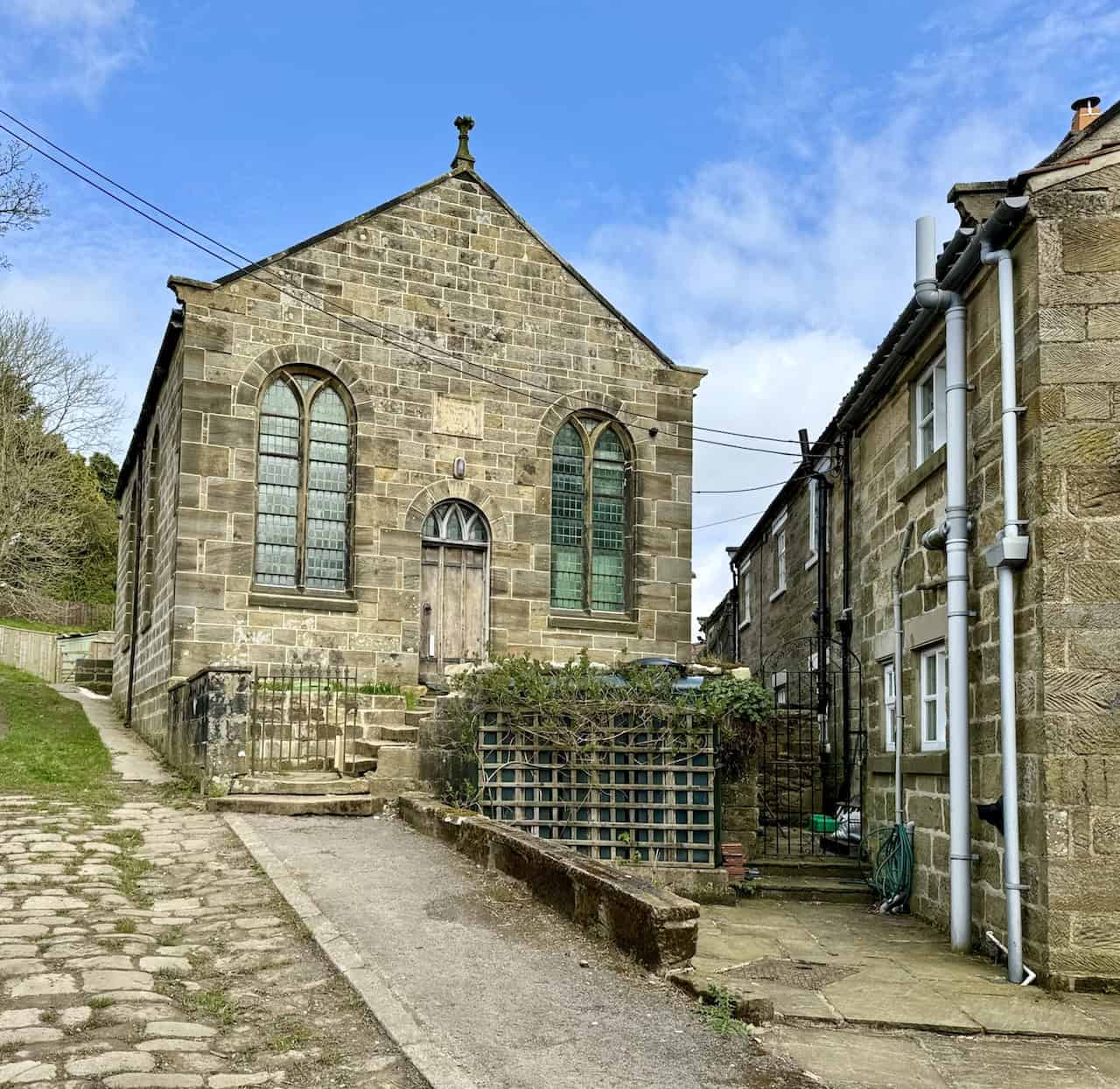
Chop Gate Wesleyan Methodist Chapel is situated on Cold Moor Lane near the junction with Raisdale Road and the B1257 at Chop Gate village.
The road bridge over Bilsdale Beck at Seave Green, a quaint hamlet north of Chop Gate.
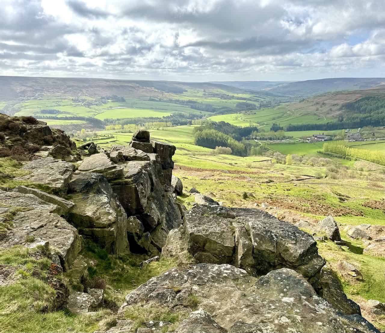
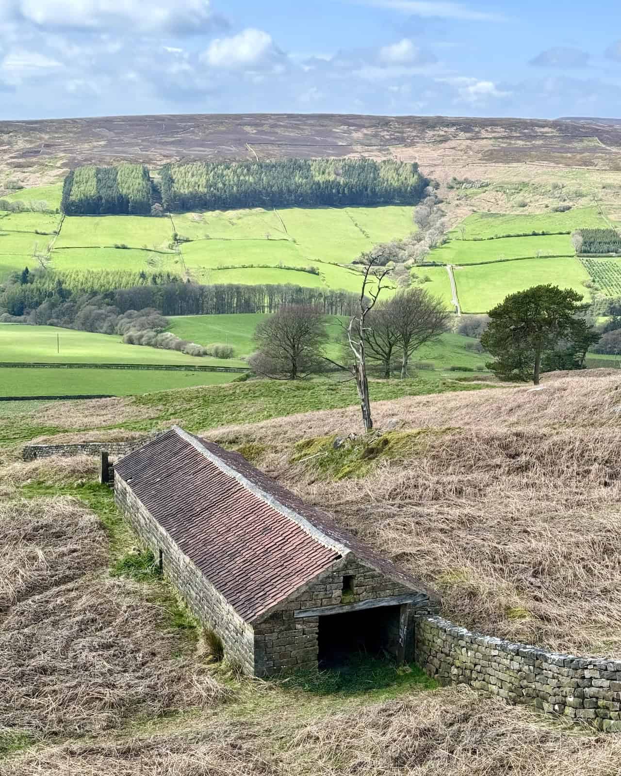
Excellent views west across the Bilsdale valley towards Cold Moor from the location of an old barn near Medd Crag.
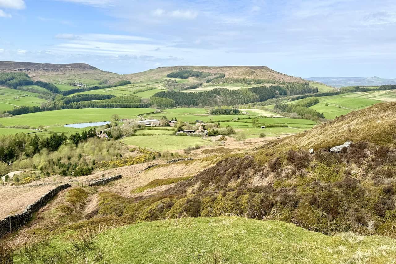
Heading north on the path skirting the western slopes of Urra Moor, there are fantastic view north-west across Bilsdale towards Hasty Bank, where we walked earlier.
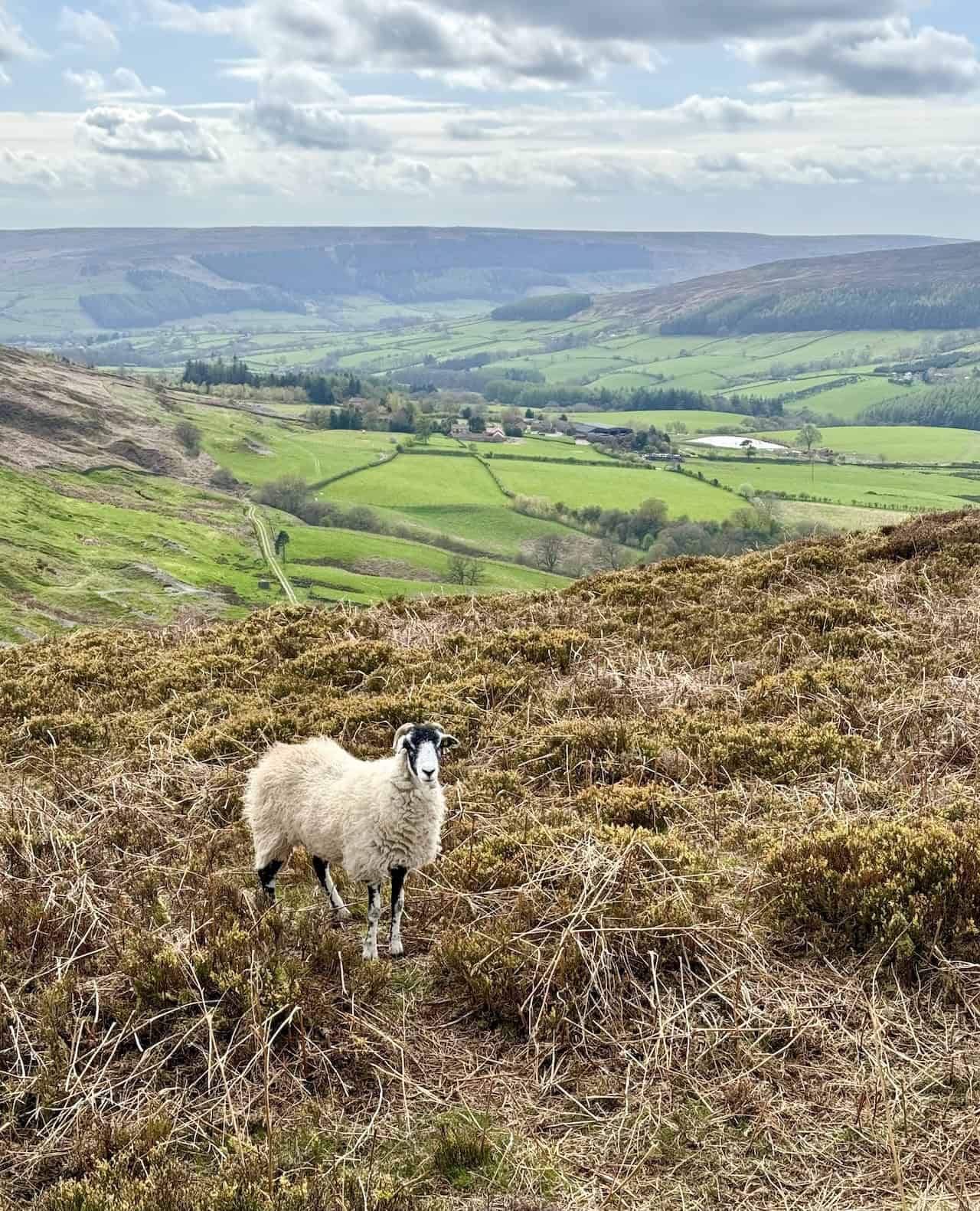
Looking south-west down into Bilsdale from a point near Carr Ridge. The valley is framed by the hills of Snilesworth Moor, part of the Cleveland Hills.
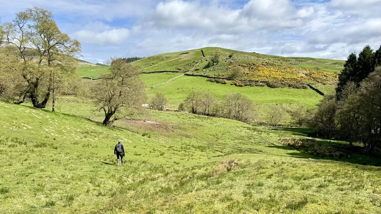
Overlooking the three hills we ascended earlier, from right to left: White Hill, Cold Moor, and Cringle Moor.
The descent from Carr Ridge down to the car park concludes our remarkable Lordstones walk.
Amazon’s Top Walking Boots: Four Standout Choices for Men and Women
For walking and hiking, the right boots are essential for both comfort and safety. While Amazon boasts a wide range, certain boots emerge as top-sellers. From those, here are four I personally favour. As an Amazon affiliate, I may earn a small commission from any purchases made through the links provided. This helps support the upkeep of this website. Rest assured, you won’t pay a penny extra, but your purchase will contribute to keeping my site running smoothly. Happy walking!

Berghaus Men’s Hillmaster II Gore-Tex Walking Boots
These fully waterproof leather walking boots feature a Gore-Tex lining, ensuring no water enters whilst allowing feet to breathe and stay cool. Made from full-grain leather, they promise unmatched durability and comfort. The boots come with memory foam tongues and cuffs that mould to your feet for a tailored fit, and the Vibram Hillmaster outsoles offer confidence on challenging terrains.

Salewa Men’s Mountain Trainer Mid Gore-Tex Walking Boots
Made from durable suede and abrasion-resistant textile, these men’s hiking boots are both lightweight and sturdy. The upper material is enhanced by a 360° full rubber sheath. Their dual-layer midsole with Bilight technology ensures ergonomic cushioning and grip, especially on extended hikes. The Vibram Wrapping Thread Combi outsoles allow a natural walking feel, and the Gore-Tex lining provides waterproofing, breathability, and optimal weather protection. Furthermore, the patented Salewa 3F system ensures flexibility, a secure heel grip, and a blister-free fit.

Berghaus Women’s Supalite II Gore-Tex Walking Boots
Specially designed for women, these hiking boots offer waterproofing and breathability, thanks to their Gore-Tex lining. Crafted from full-grain abrasion-resistant leather, they’re durable enough for the toughest hikes. The Supalite soles ensure stability and traction, and the EVA midsoles add comfort for extended walks.

Merrell Women’s Moab 3 Mid Gore-Tex Walking Boots
These hiking boots incorporate a Gore-Tex waterproof membrane, blending breathability with superior waterproof performance. The combination of pigskin leather and mesh on the uppers, along with the suede outer material, ensure durability and style. Enhancements include 100% recycled laces, webbing, and mesh lining. Additionally, bellows tongues, protective toe caps, and Vibram TC5+ rubber soles ensure protection and ease on any terrain.