Burniston and Hayburn Wyke
East from Burniston along Field Lane to the coast, then north on the Cleveland Way / England Coast Path all the way to Ravenscar Tearooms. South on the Cinder Track to Cloughton, then back to Burniston via the footpath alongside the A171. A 14-mile walk along the Yorkshire Coast.
Recommended Ordnance Survey Map
The best map to use on this walk is the Ordnance Survey map of the North York Moors Eastern Area, reference OS Explorer OL27, scale 1:25,000. It clearly displays footpaths, rights of way, open access land and vegetation on the ground, making it ideal for walking, running and hiking. The map can be purchased from Amazon in either a standard, paper version or a weatherproof, laminated version, as shown below.
My Photos
One of many dips in the Cleveland Way footpath between Saltburn and Filey. This is near Hundale Point, just south of Cloughton Wyke.

Cloughton Wyke.

Hayburn Wyke.


Walking in the Yorkshire Dales with 43 Circular Routes
AD This Cicerone guidebook includes 43 circular walks exploring valleys, hills, and moors between Kirkby Stephen and Pateley Bridge. With OS maps, local highlights, and routes ranging from 3–11 miles, it is a year-round companion for walkers of all abilities.
The view south from Hayburn Wyke.


Grisport Unisex Adult Peaklander Hiking Boots
AD The Grisport Unisex Adult Peaklander Hiking Boots are crafted in Italy with a durable waxed leather upper, Spotex breathable lining, and a reliable Track-on rubber sole. Waterproof and weighing just 1120g, they offer comfort, resilience, and dependable performance on demanding trails.
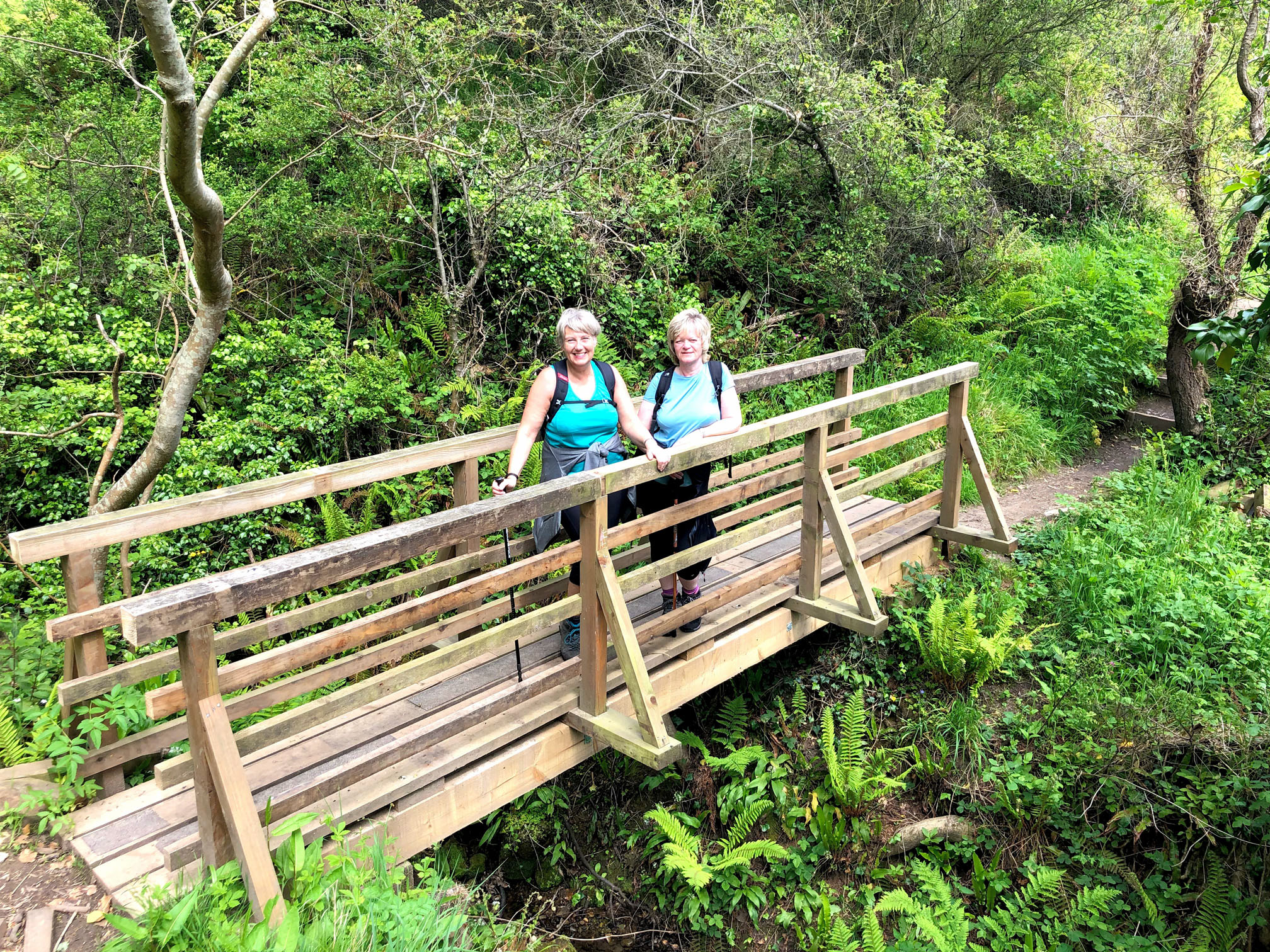
A new footbridge installed over a small stream at Hayburn Wyke. A significant landslip closed the Cleveland Way in this area for about a year. Extensive work was carried out by the Cleveland Way National Trail volunteers, including the erection of new staircases and boardwalks.

Grisport Unisex Adult Peaklander Hiking Boots
AD The Grisport Unisex Adult Peaklander Hiking Boots are crafted in Italy with a durable waxed leather upper, Spotex breathable lining, and a reliable Track-on rubber sole. Waterproof and weighing just 1120g, they offer comfort, resilience, and dependable performance on demanding trails.
Common Cliff, just south of Ravenscar.

The Cleveland Way above Common Cliff, just south of Ravenscar.


Fifty Walks Across the Beautiful North York Moors National Park
AD Discover 50 routes across the North York Moors, from short easy strolls to challenging high-level hikes. With OS maps, route descriptions, and local highlights, it also includes the legendary 40-mile Lyke Wake Walk, described in four accessible stages.
The former railway station at Staintondale, in use from 1885 to 1965. The station is on the old Scarborough to Whitby railway line and is now used for residential purposes. The railway platform opposite the building is still in place.


Fifty Walks Across the Beautiful North York Moors National Park
AD Discover 50 routes across the North York Moors, from short easy strolls to challenging high-level hikes. With OS maps, route descriptions, and local highlights, it also includes the legendary 40-mile Lyke Wake Walk, described in four accessible stages.