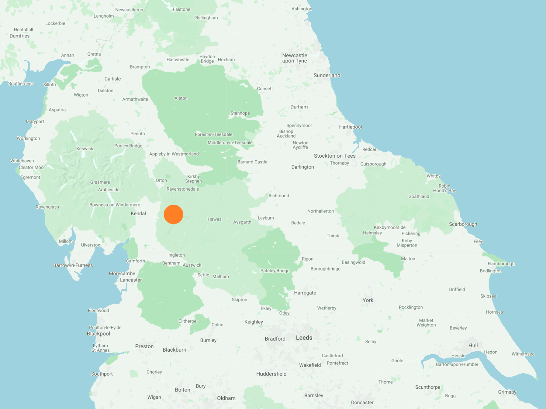
South-west from Dent village centre to meet Green Lane (Track), then south-east for about a mile before climbing to the summits of Crag Hill and Great Coum. South from Great Coum in the direction of Gatty Pike followed by an easterly descent and hike across to High Pike and High Moss. North, dropping down into the Deepdale valley and continuing along Deepdale Lane to Slack and Howgill Bridge. Finally back to the village along the Dales Way which follows the course of the River Dee. An 11-mile walk in the Yorkshire Dales.
Recommended Ordnance Survey Map
The best map to use on this walk is the Ordnance Survey map of the Yorkshire Dales Southern & Western Area, reference OS Explorer OL2, scale 1:25,000. It clearly displays footpaths, rights of way, open access land and vegetation on the ground, making it ideal for walking, running and hiking. The map can be purchased from Amazon in either a standard, paper version or a weatherproof, laminated version, as shown below.
Standard Version
The waters of Flinter Gill flowing over the ‘Dancing Flags’ just outside Dent village centre. The ‘Dancing Flags’ is an area of flat, natural rock slabs used for centuries by local weavers for ‘waulking’ their newly-woven lengths of cloth, called ‘webs’. This was done by first wetting the fabric thoroughly and then treading it with bare feet, causing it to shrink slightly and ‘felt up’ to create a thicker and warmer material. At one time this was a universal practice known as ‘dancing the web’, hence the name of the stones. Its association with webs and dancing may account for the lingering belief that fairies frequented this particular spot.
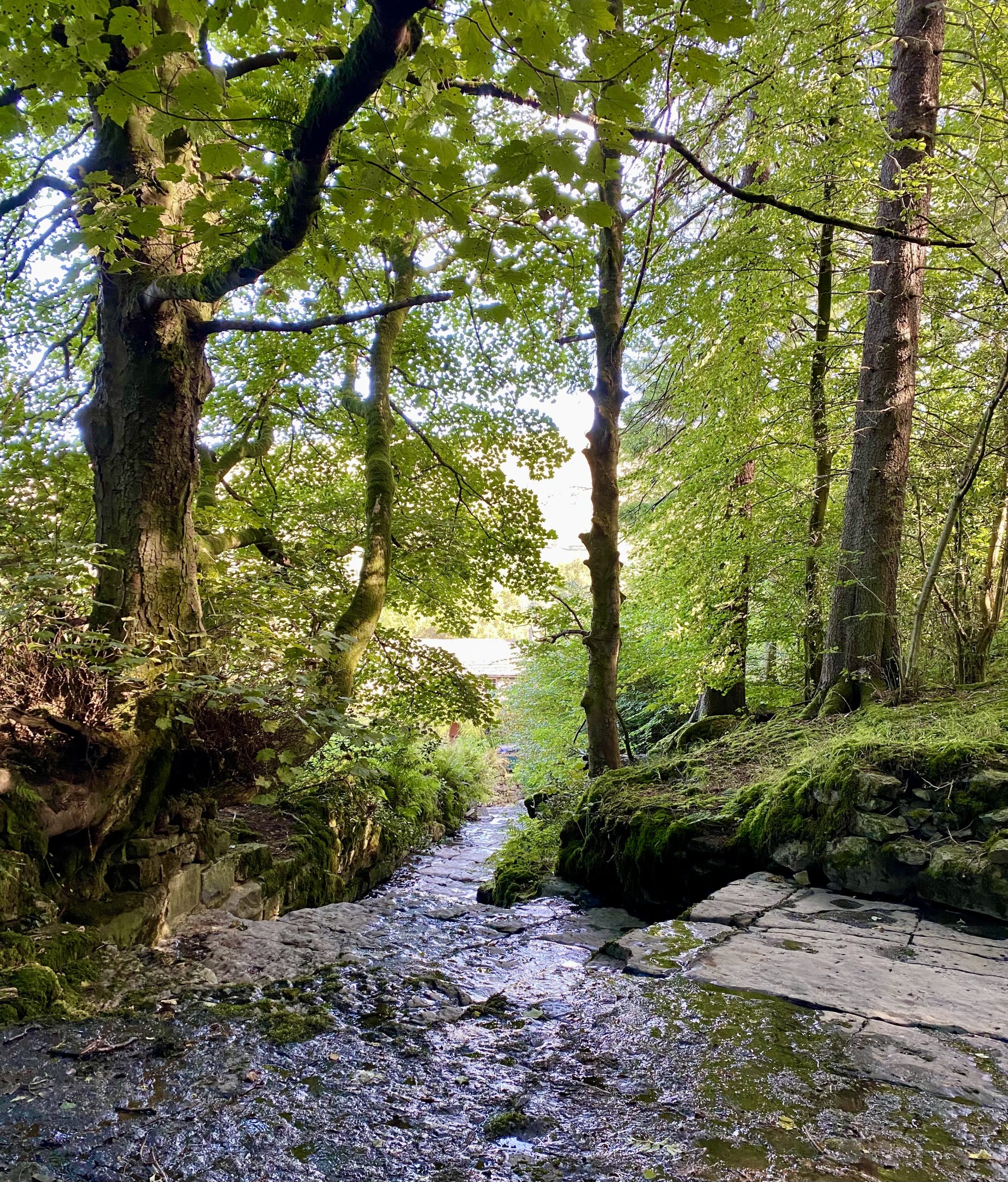
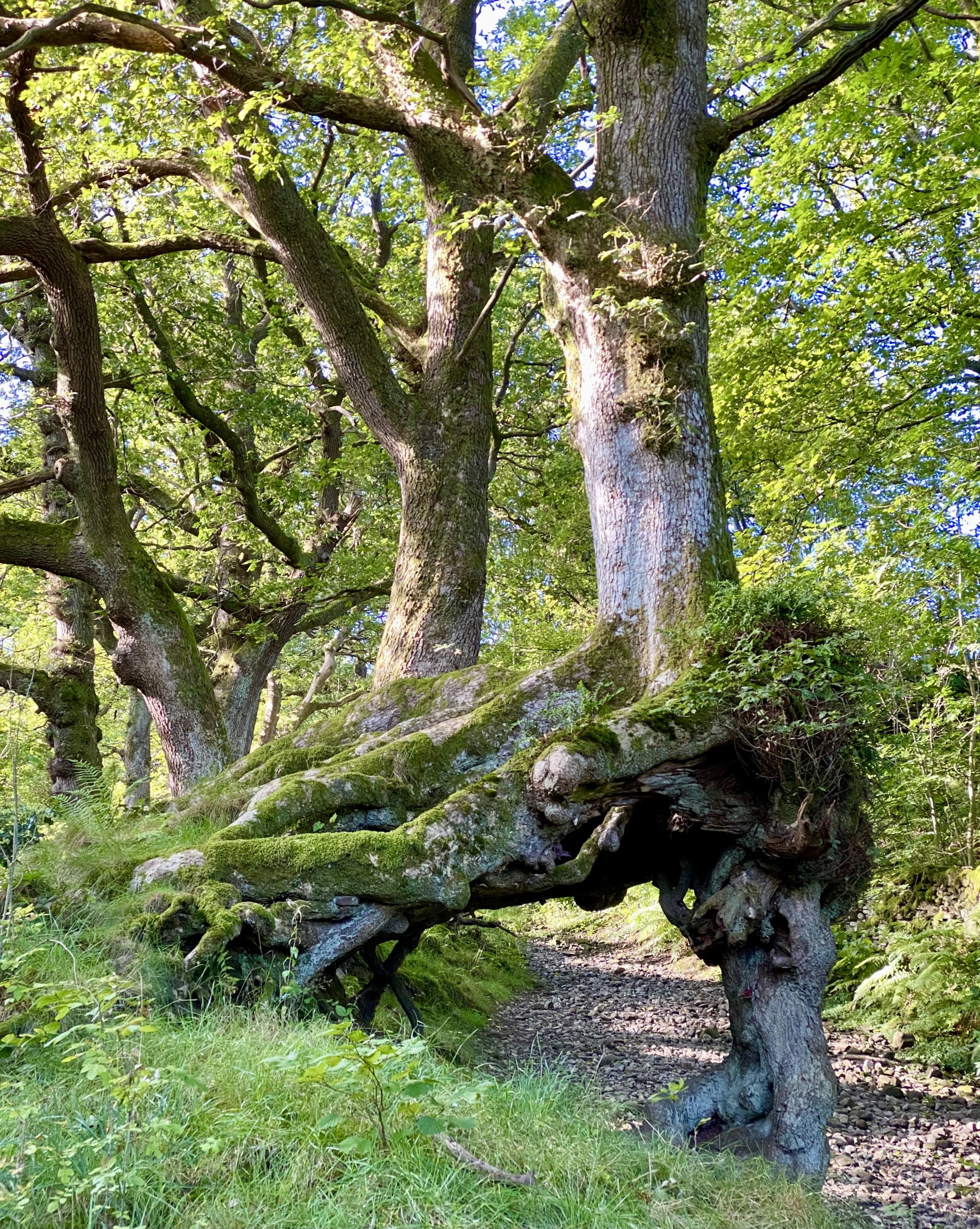
The centuries-old ‘Wishing Tree’ by the side of the stone track through the Flinter Gill ravine. The tree’s guardian spirit traditionally promised to grant a wish to all those who made their way ‘deiseal’ (clockwise) three times through the twisted arch of knotted roots around its base. Bad luck would fall upon anybody who went ‘widdershins’ (anti-clockwise) around the tree.
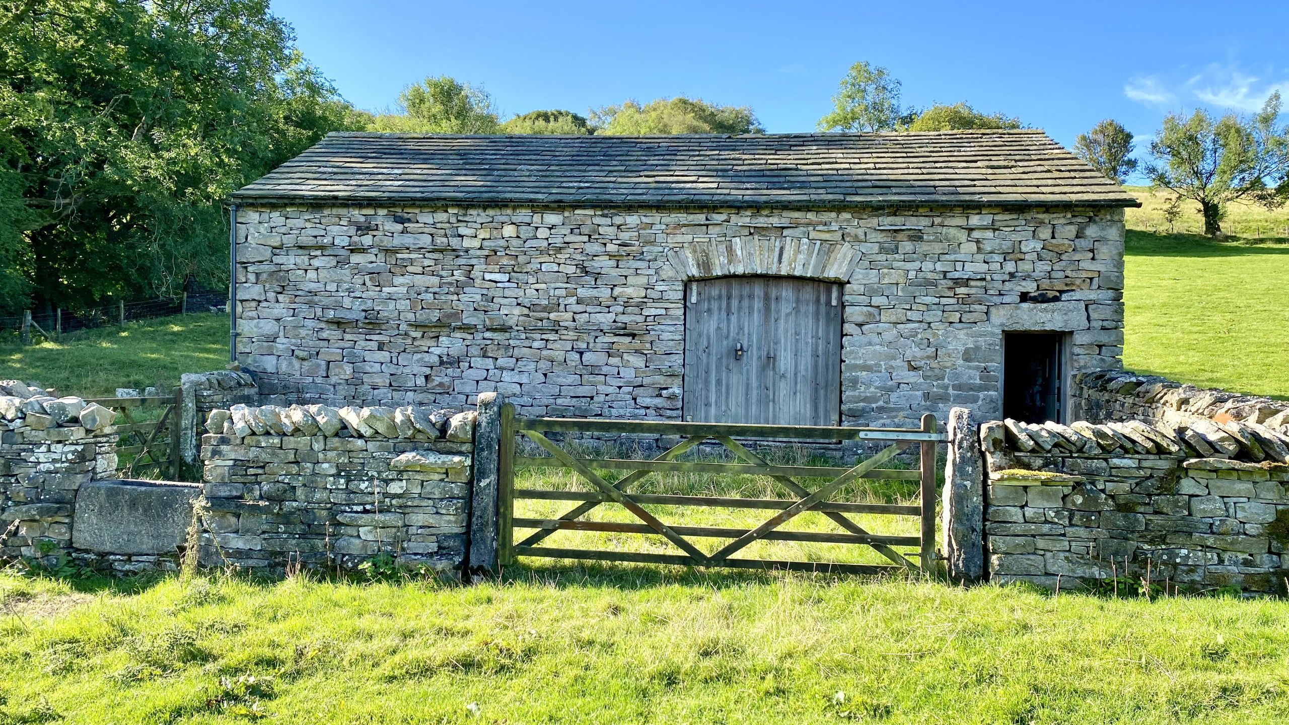
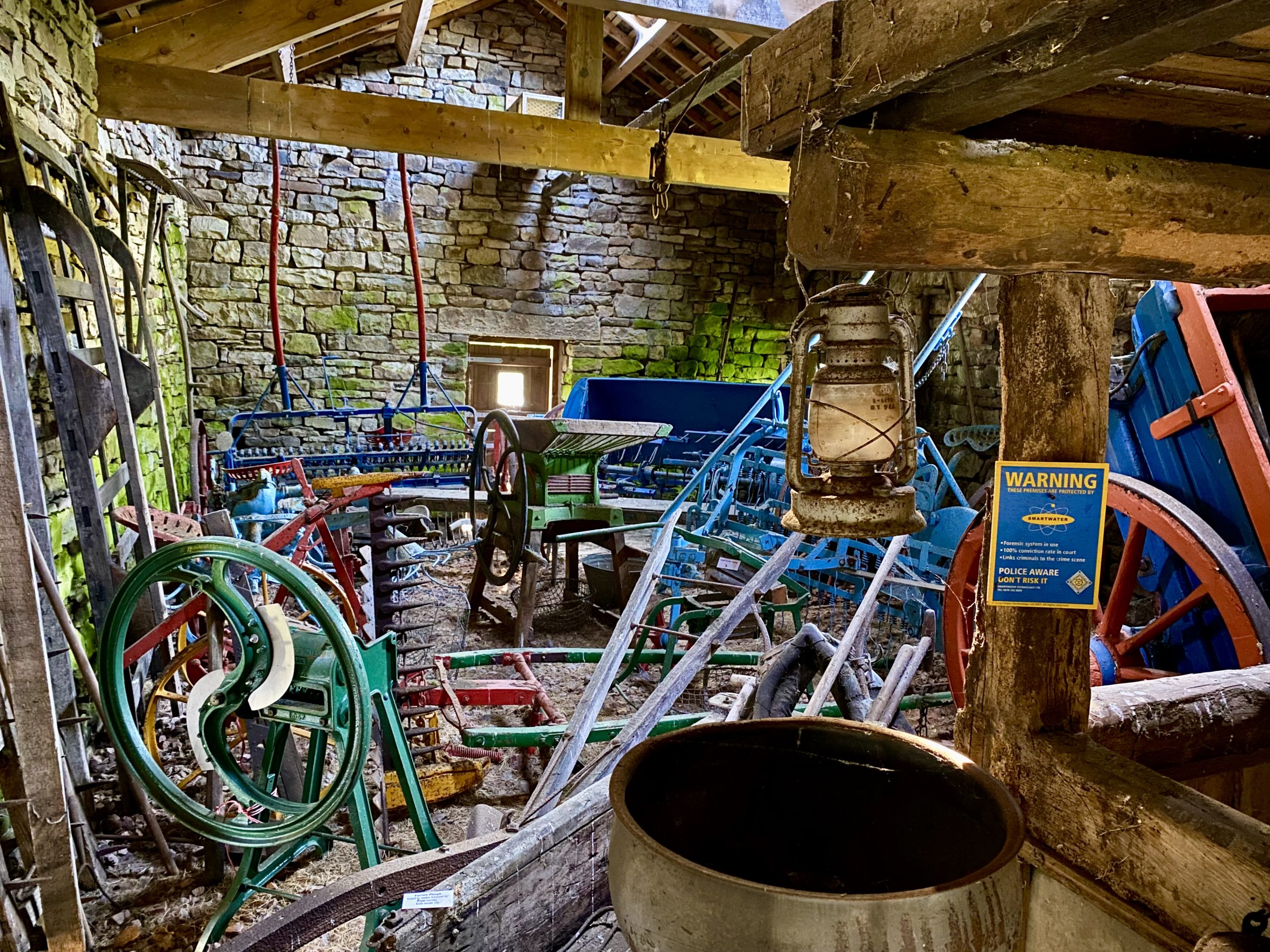
High Ground Farmstead, about half way through the Flinter Gill ravine. The barn is open for viewing and houses a fascinating collection of period farm machinery and implements.

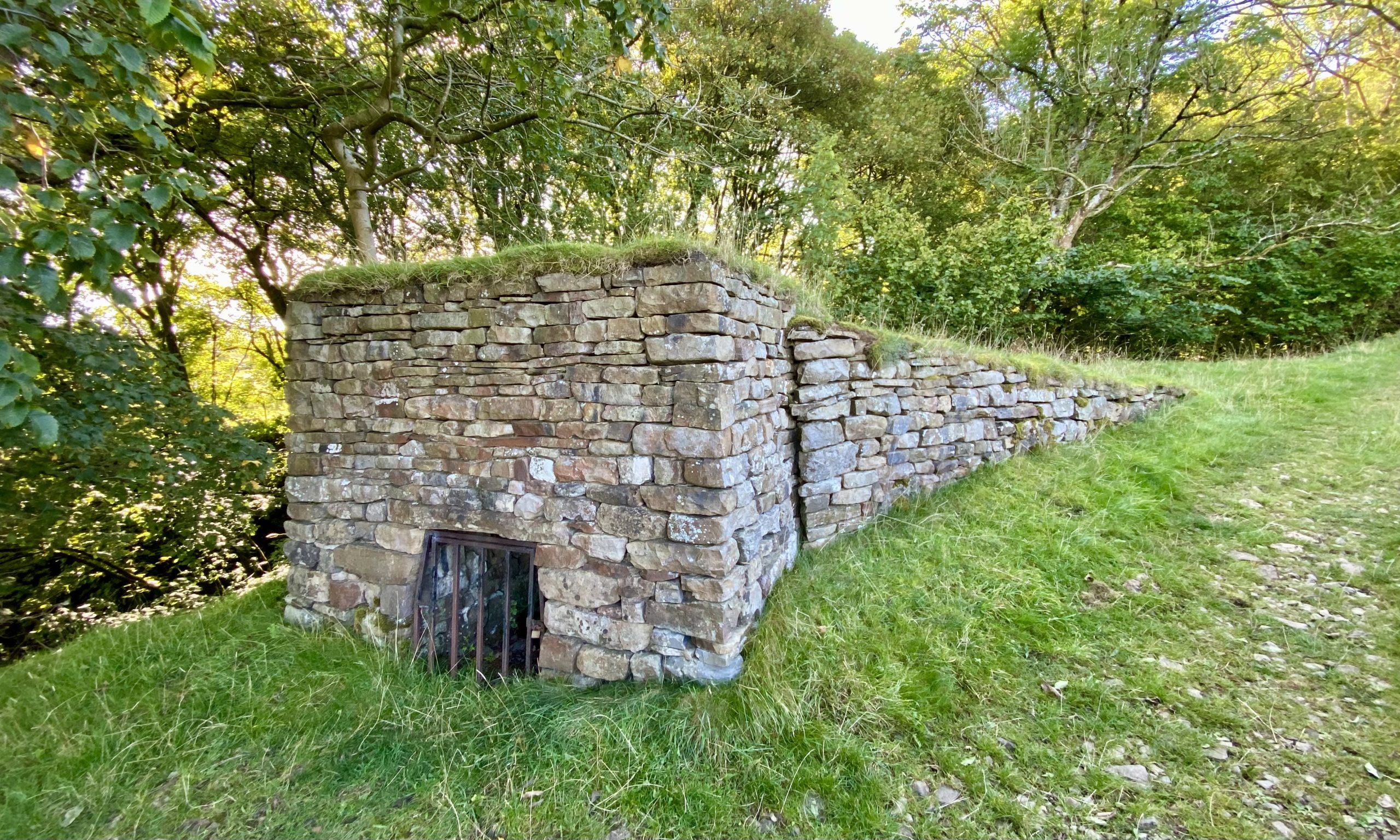
A recently excavated lime kiln opposite the barn at High Ground Farmstead. The burning of lime was once a major task on many a Yorkshire Dales farm. The process involved filling the bowl of the kiln with coppice wood, peat, or even coal whenever it was available locally, as it was in Dentdale. This was then layered with broken limestone and allowed to burn for a few days, after which the cobs of lime were raked out and ‘slaked’ with water to produce what was known as quicklime, for which many uses, both domestic and agricultural, were found.
A sign inside the kiln reads as follows:
- Built around 1750, restored to original state in 2006
- Constructed of limestone, outer walls, draw hole and access ramp
- The bowl in the kiln is built of sandstone
- To produce quicklime in the limestone bowl, the method was
- Layers of timber, peat, coal and raw limestone from the quarry
- It was covered with turf on the top, the draw hole scaled to control heat
- Water and carbon dioxide was driven off from the limestone and calcium carbonate is converted to calcium oxide (quicklime)
- Heated to above 900 degrees centigrade for three days
- Lime used for building houses, rendering walls, tearing flagged roofs, white washing houses and inside farm buildings
- To cultivate the land by reducing the acidity of the soils
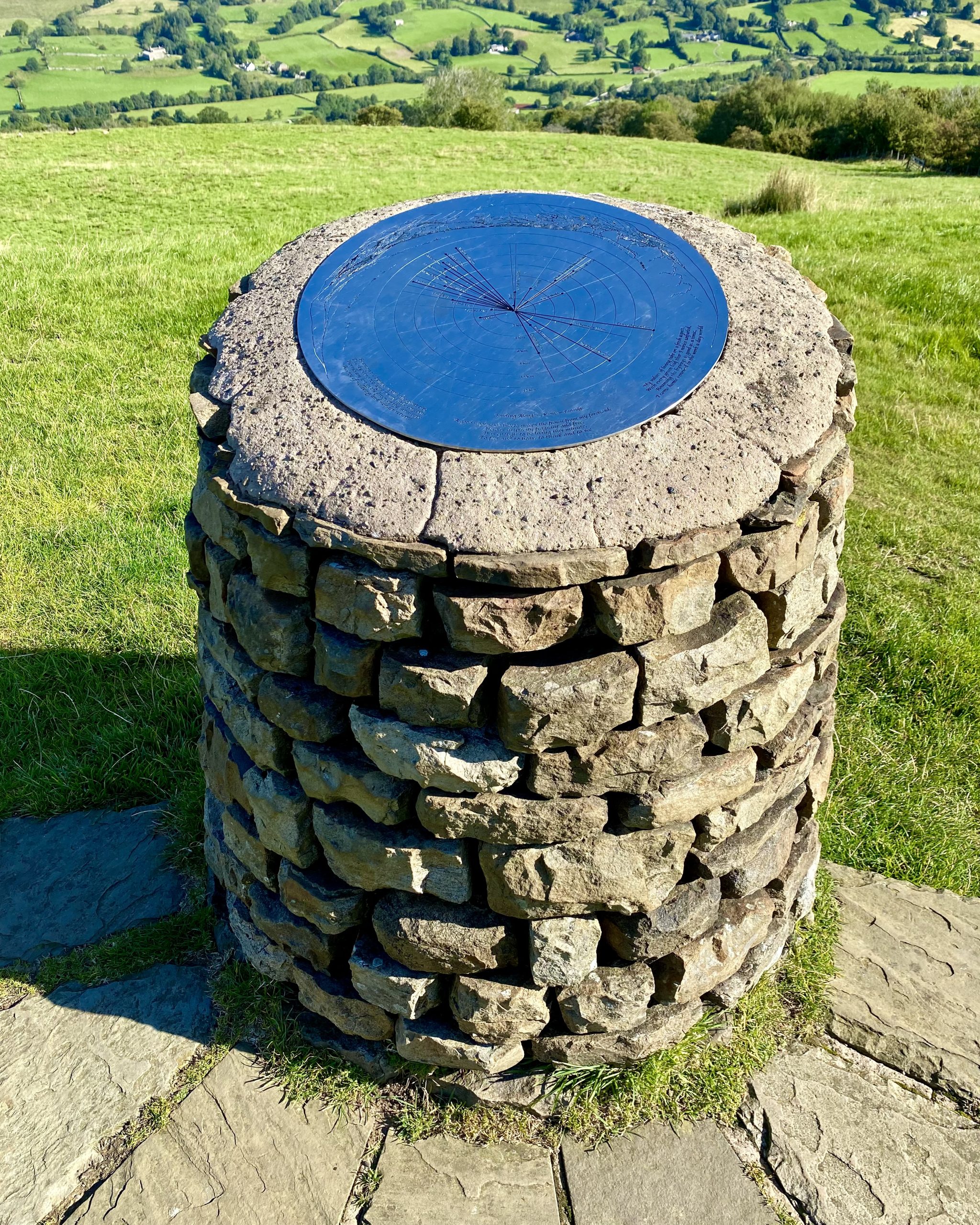
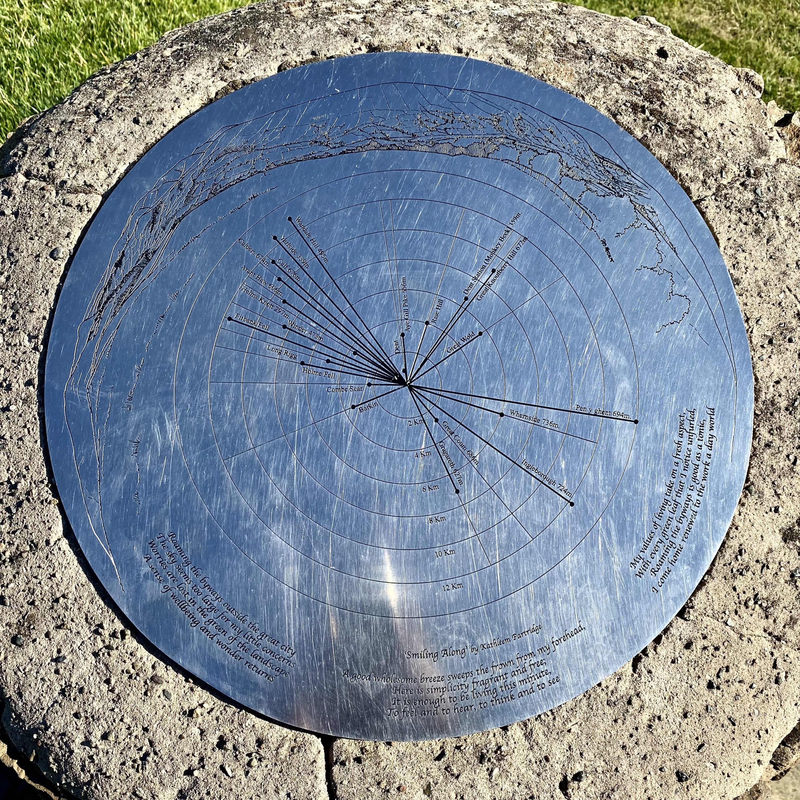
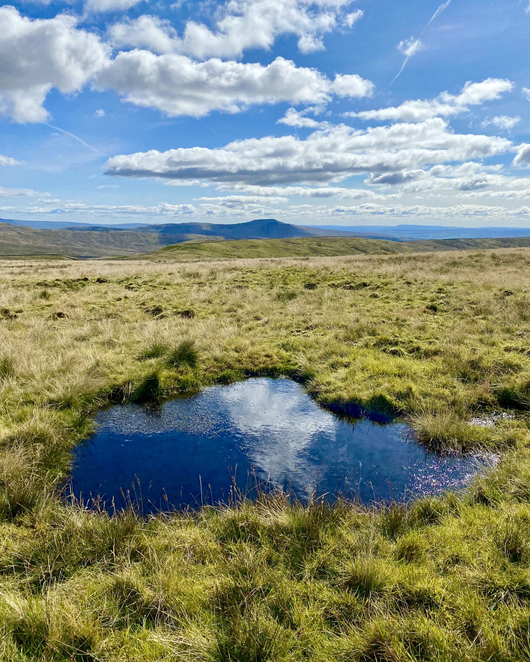
Toposcope at the top of the Flinter Gill ravine and superb views of the surrounding landscape.

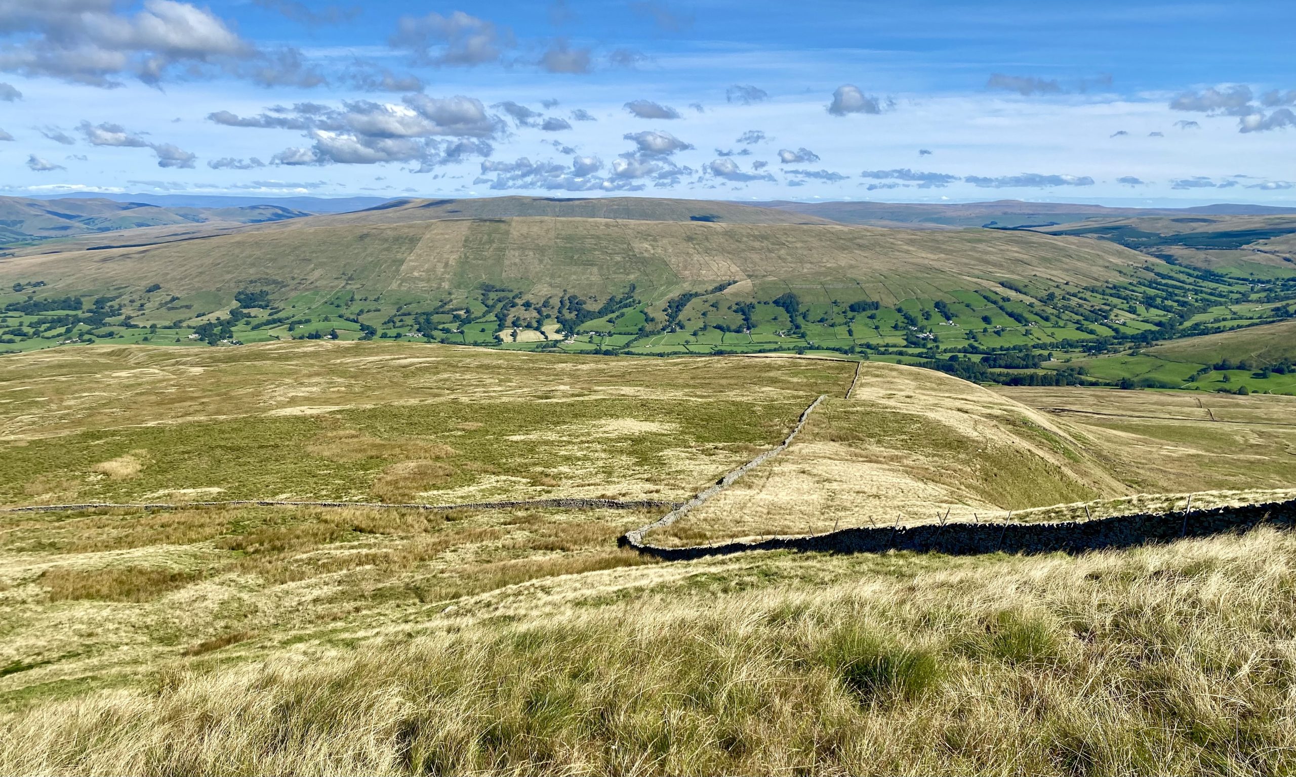
The view north-west towards the Howgill Fells from the grassy slopes of Great Coum.

Looking north-east from Crag End, Great Coum towards Aye Gill Pike on the northern side of the Dentdale valley.
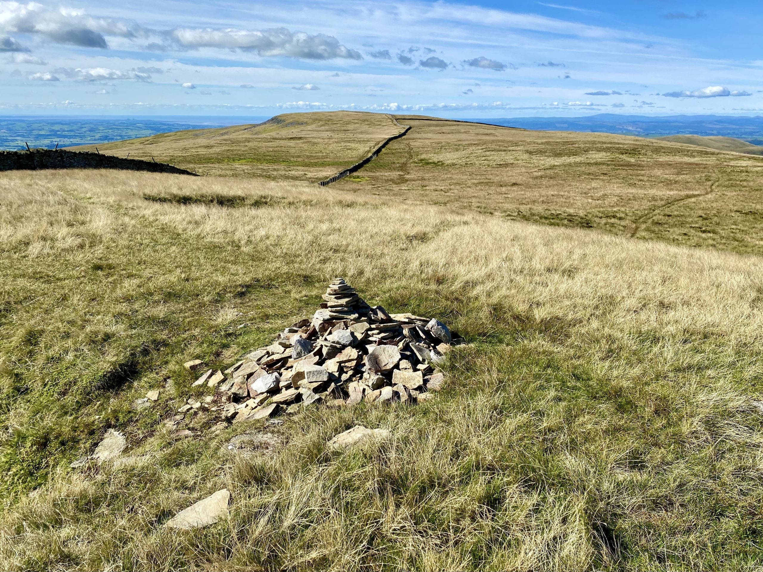
Cairn about 200 metres to the west of the Great Coum summit, with Crag Hill in the background.
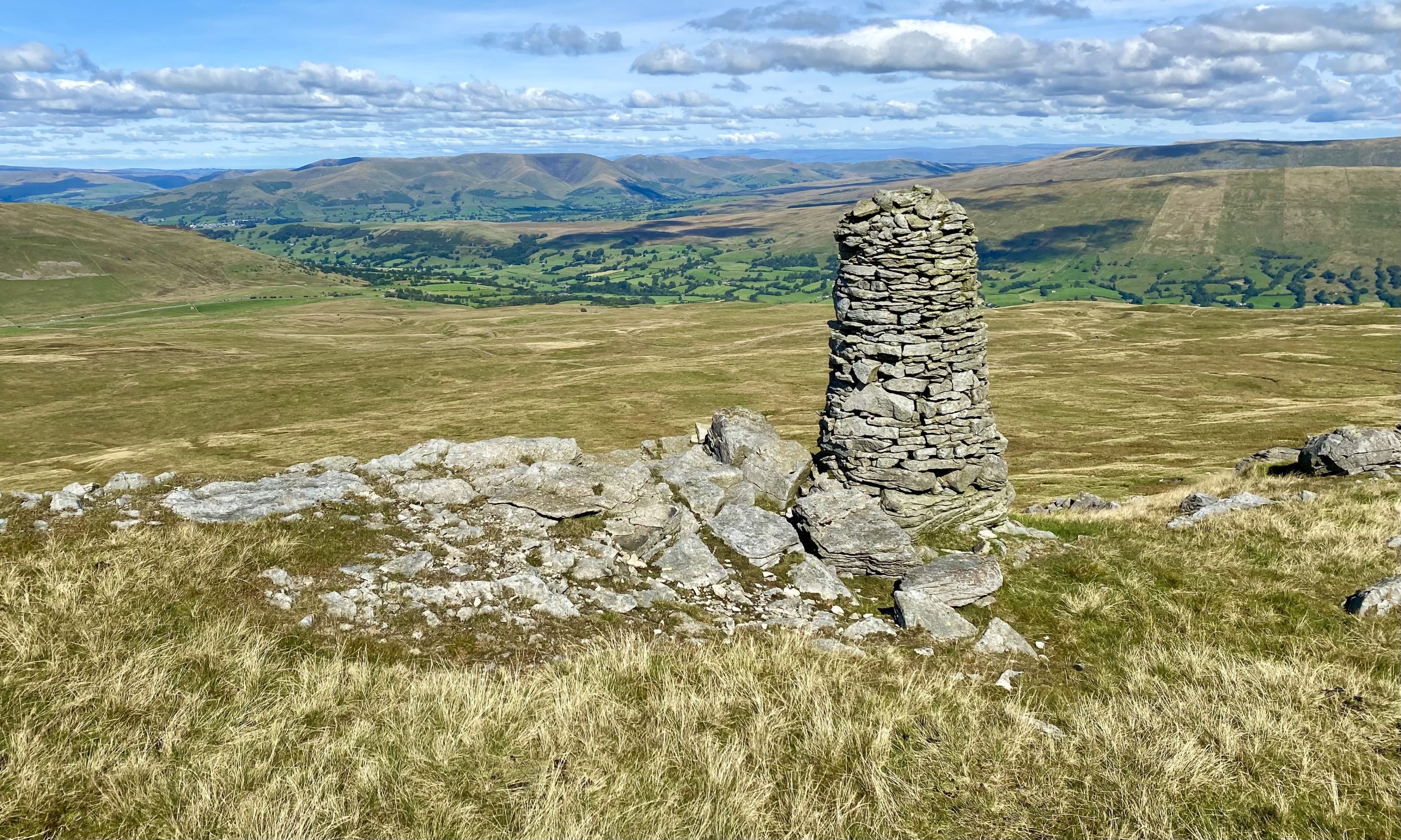
Magnificent cairn above The Crag between Great Coum and Crag Hill with spectacular views of the Howgill Fells and surrounding countryside. The Lake District mountains can be seen on the horizon to the west.
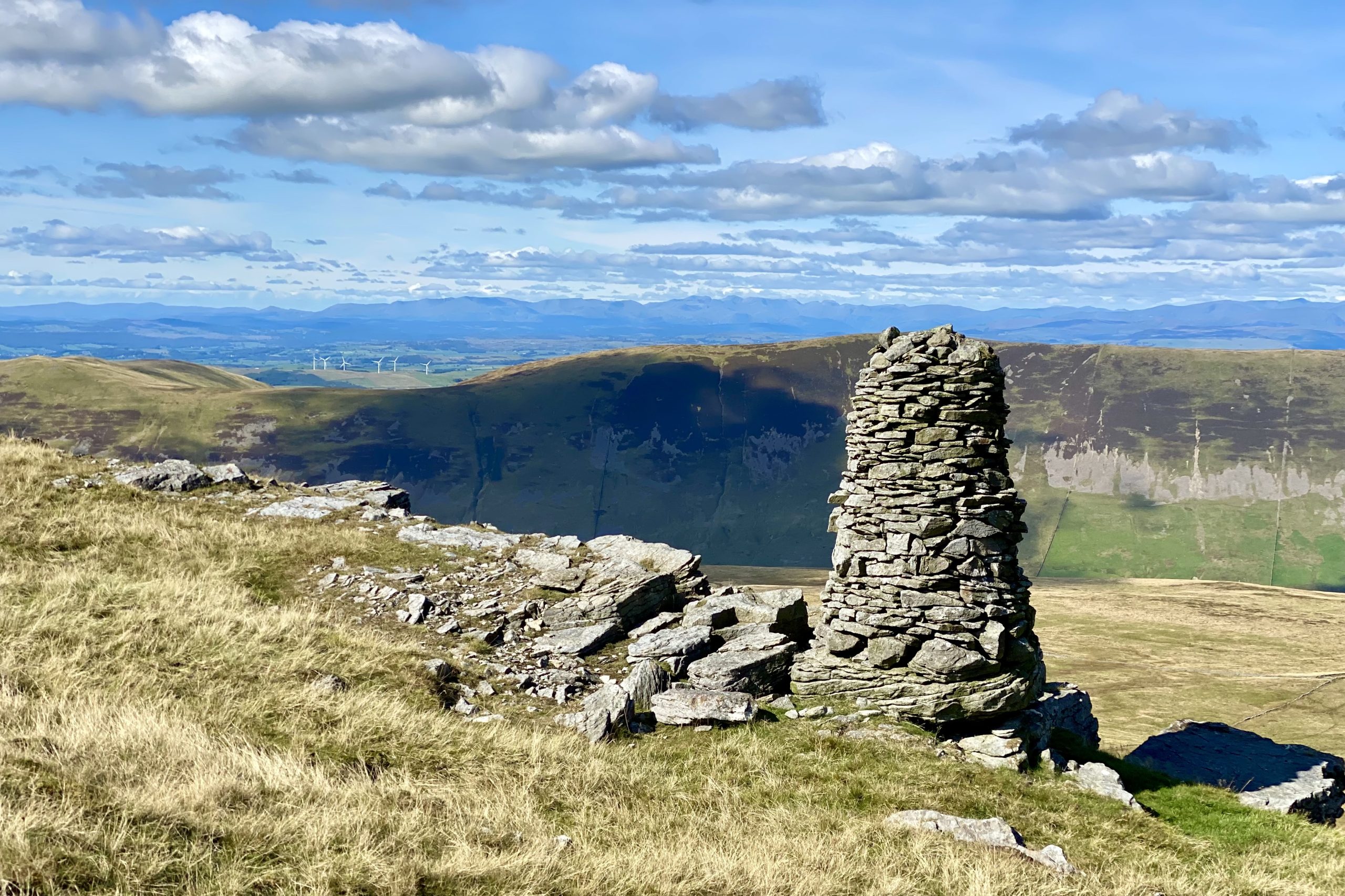
The view west from The Crag towards Calf Top which overlooks Barbondale.
Triangulation pillar on the Crag Hill summit, height 682 metres (2238 feet).

From Crag Hill, Morecambe Bay is visible to the south-west.
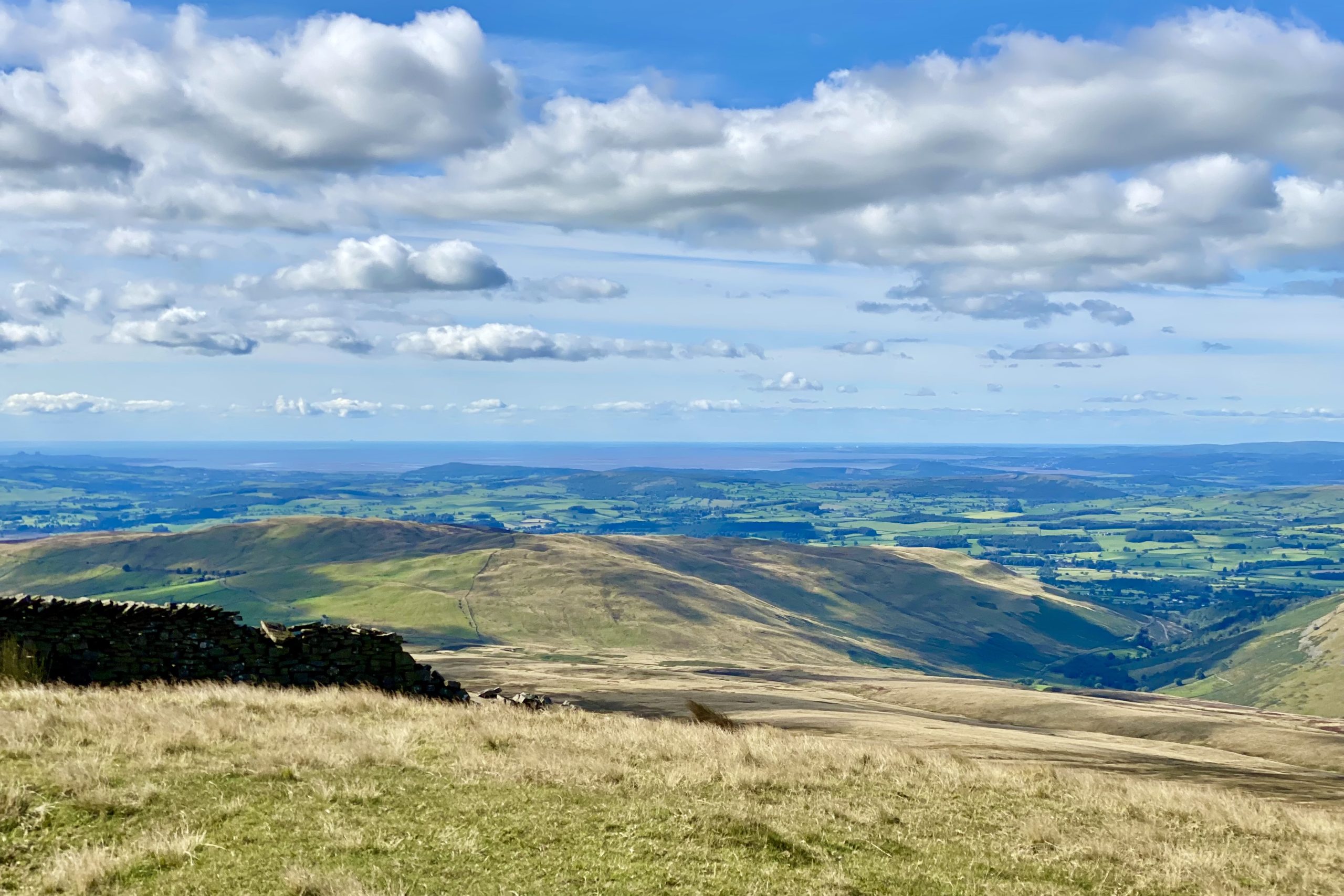
Looking south-east from Crag Hill over to Ingleborough, recognisable by its distinctive plateau.
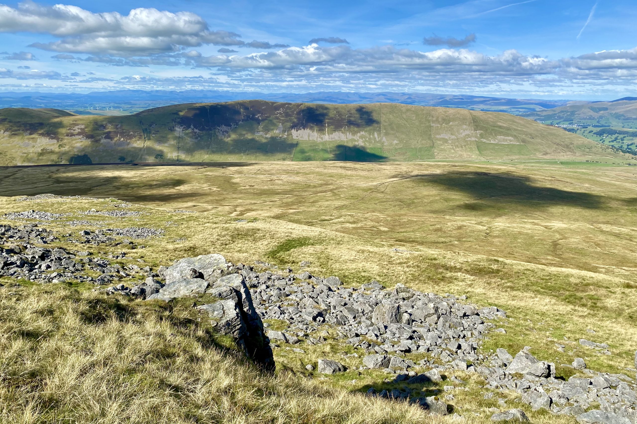
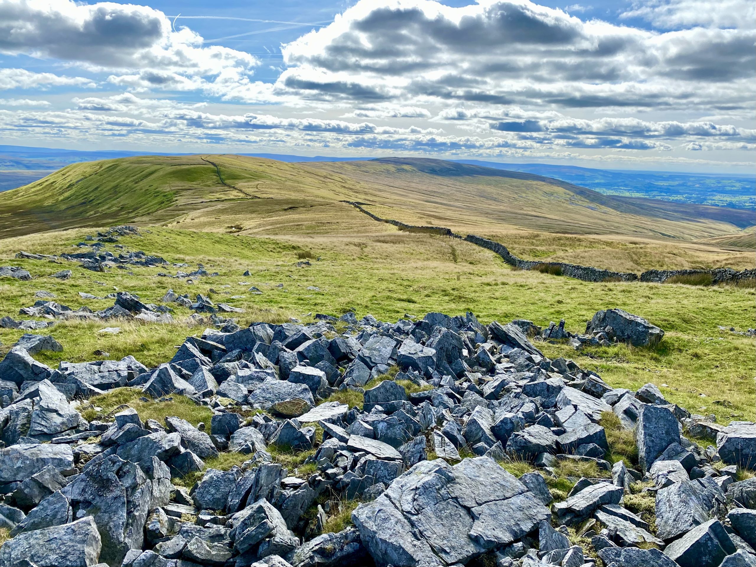
An area of boulders at Gatty Pike, with Gragareth in the background. Although there are no official footpaths here, the wall can be used to navigate between Great Coum and Gragareth, and the going is fairly easy.
Another view over towards Ingleborough, this time from Gatty Pike.

The western slopes of Whernside just over two miles away.
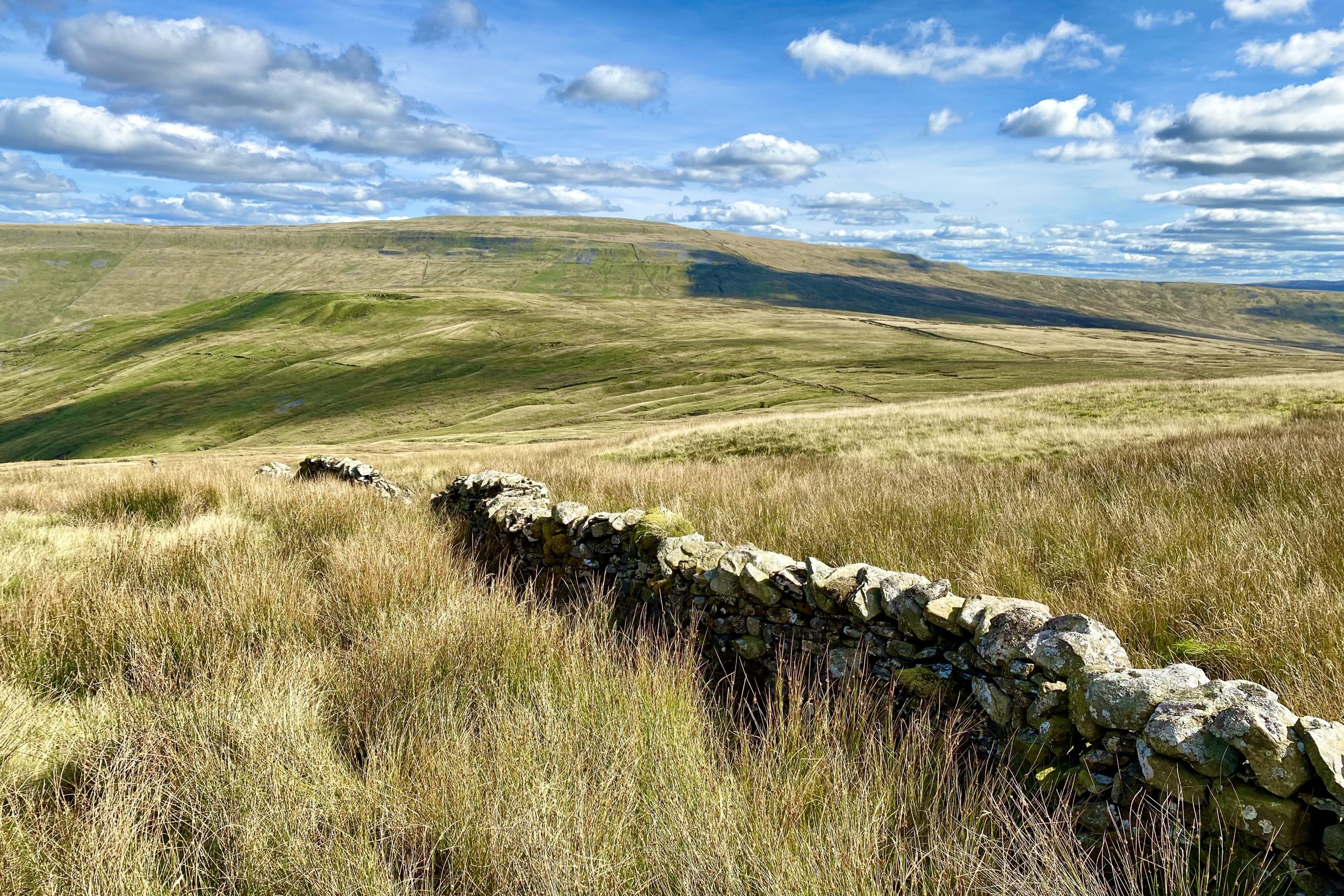
The view north-east towards Deepdale as I make my descent from Coal Pits Hill.

Looking north through the Deepdale valley from the minor road at Witton Lathe.


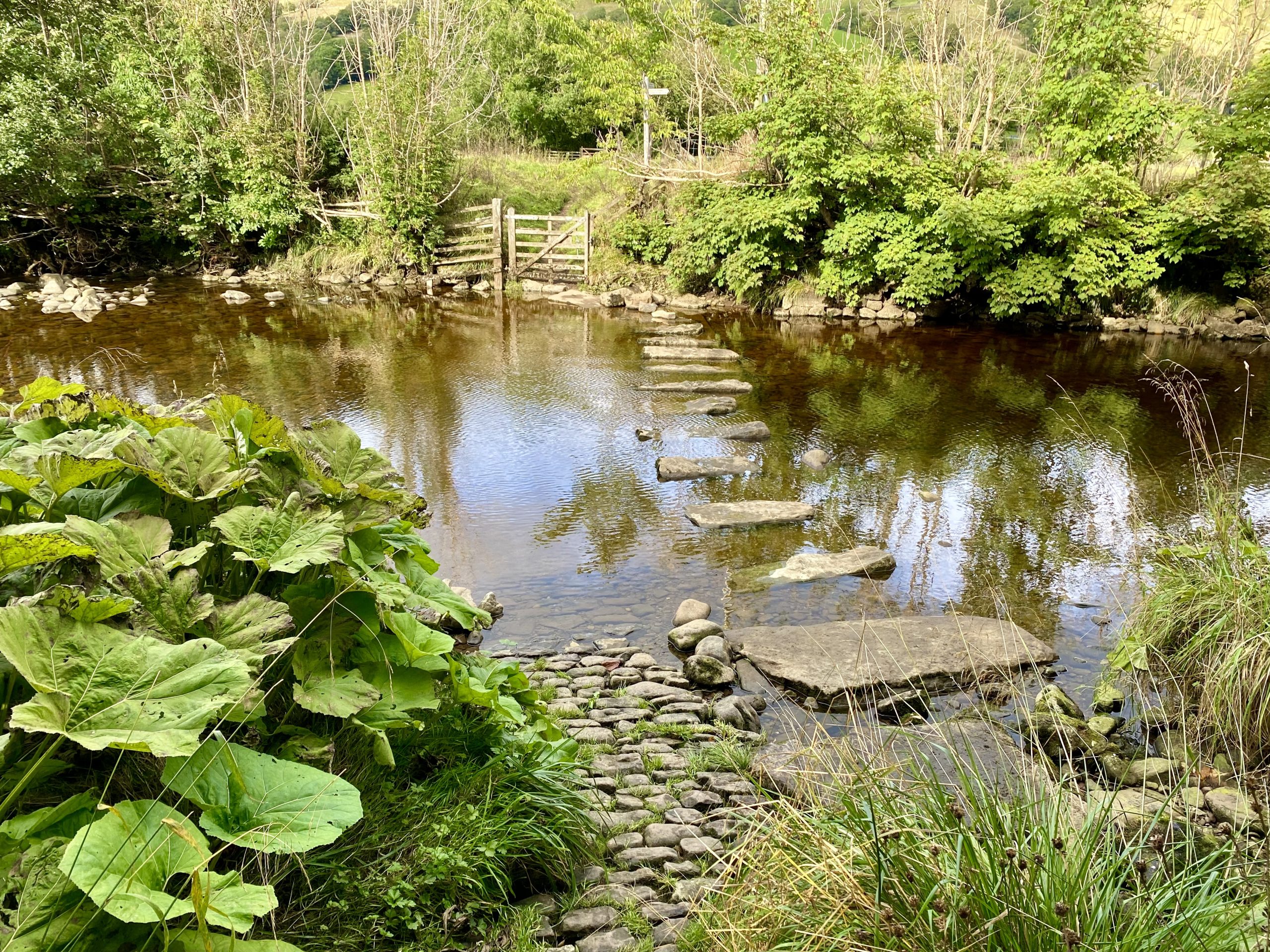
Stepping stones on the River Dee in Dentdale, about a mile east of Dent.
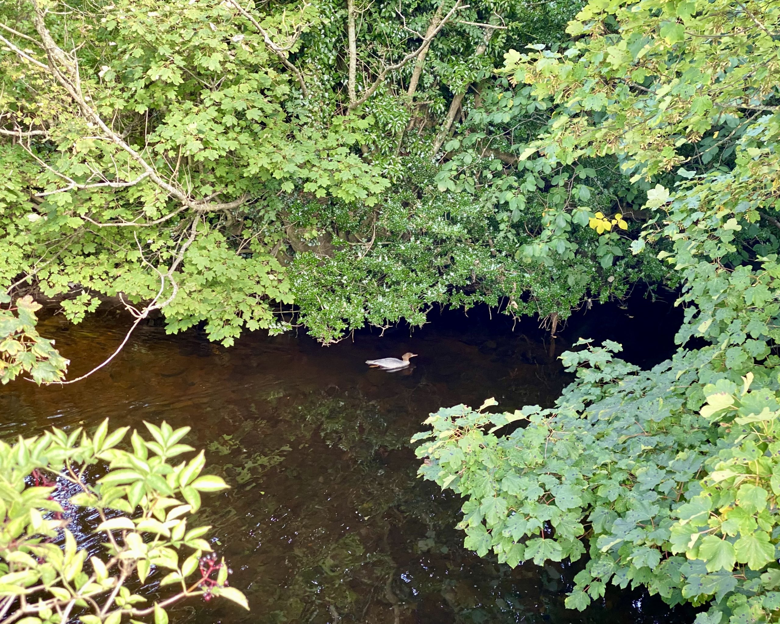
As I walk along the Dales Way I catch sight of a female Goosander in the River Dee.
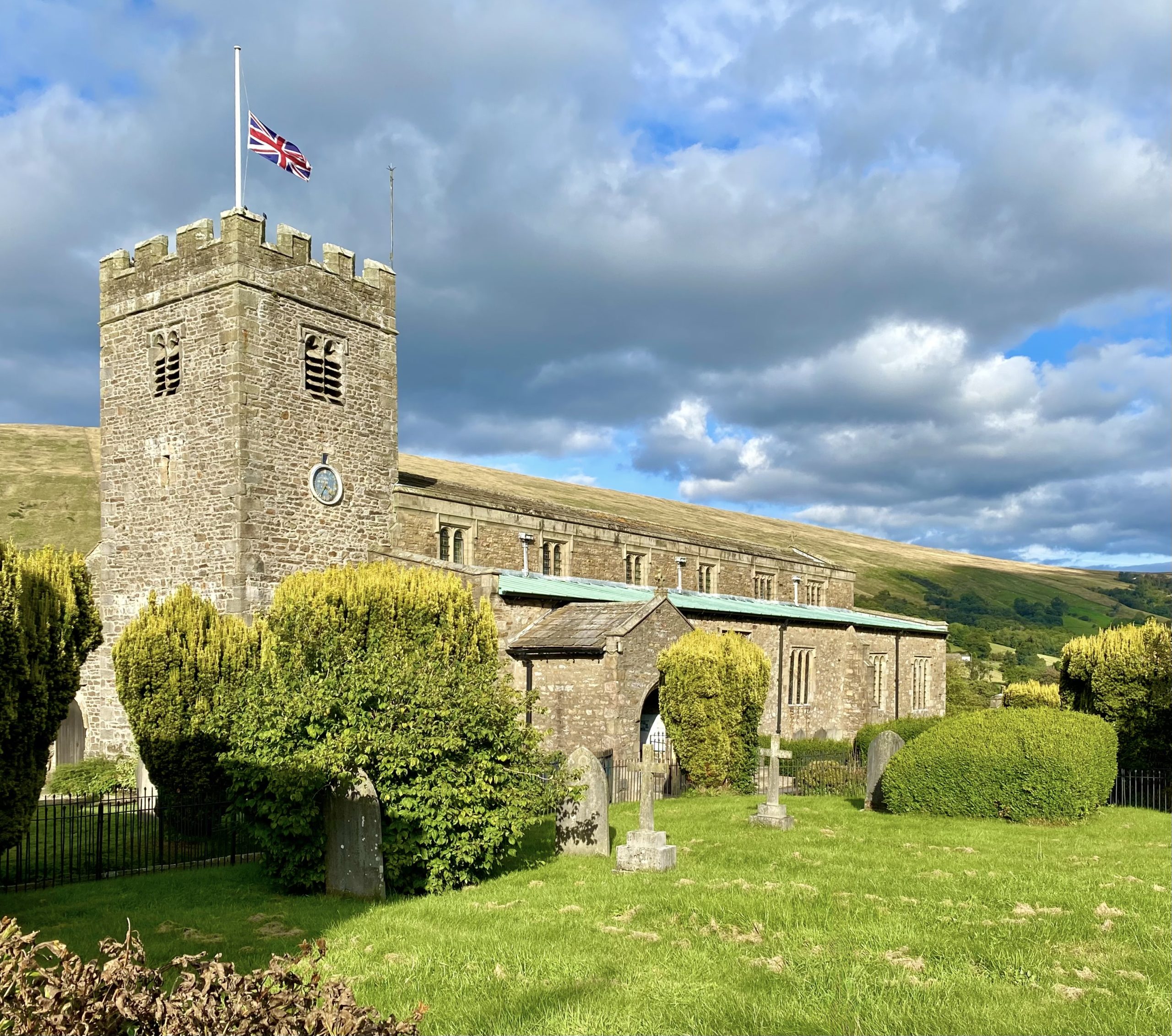
St Andrew’s Church, Dent. The 12th-century church was rebuilt in 1417 and probably came under the care of the monks of Coversham Abbey near Middleham. Further restorations were carried out in 1590, 1787 and 1889.
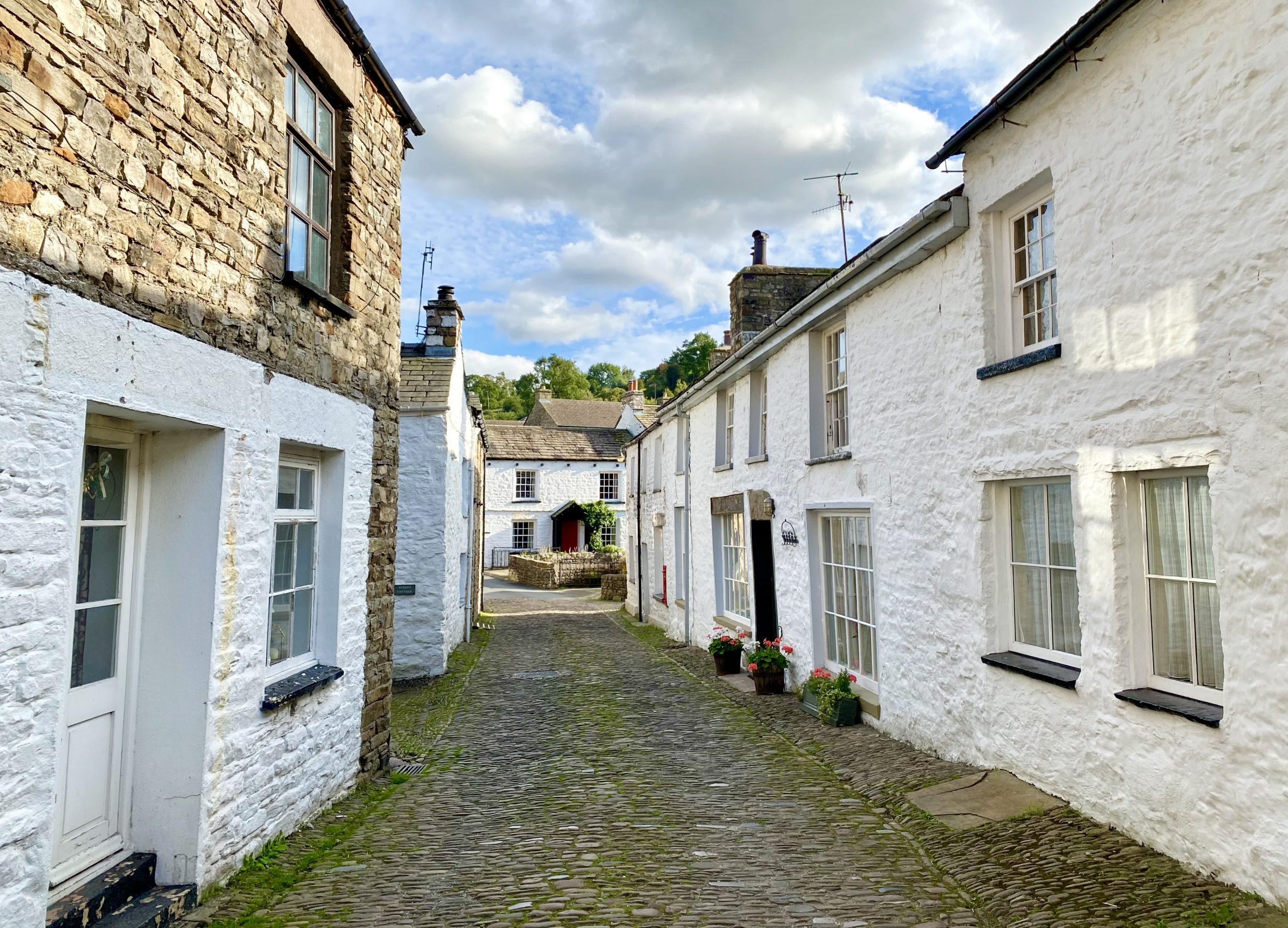
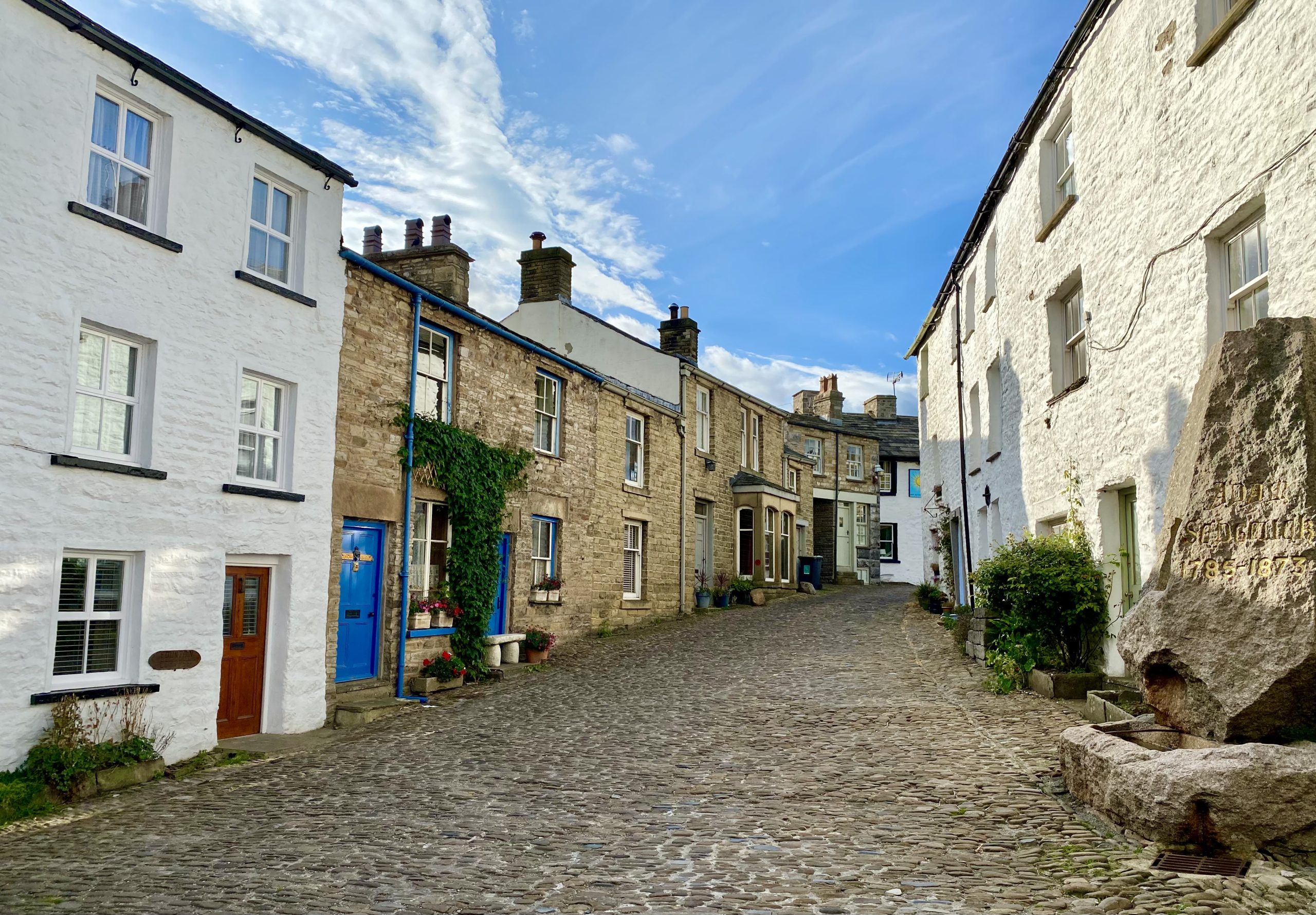
The beautiful, cobbled streets and white-walled cottages in Dent village centre.