North-west from Dent Head Viaduct along the minor road to Bridge End Cottage, then south via Dent Head Farm to the woodlands of Mossy Bottom. East towards Newby Head Gate and north by way of the Pennine Bridleway to the summit of Wold Fell. Further north all the way to the top of Great Knoutberry Hill, followed by a westerly descent to rejoin the Pennine Bridleway near Green Bank. Anti-clockwise around the southern flanks of Great Knoutberry Hill, west via Arten Gill to Stonehouse Farm, and finally south back to Dent Head Viaduct along the minor road. An 11-mile walk in the Yorkshire Dales.
Recommended Ordnance Survey Map
The best map to use on this walk is the Ordnance Survey map of the Yorkshire Dales Southern & Western Area, reference OS Explorer OL2, scale 1:25,000. It clearly displays footpaths, rights of way, open access land and vegetation on the ground, making it ideal for walking, running and hiking. The map can be purchased from Amazon in either a standard, paper version or a weatherproof, laminated version, as shown below.
Standard Version
The view north-east from Mossy Bottom towards Wold Fell (right) and Great Knoutberry Hill (left).
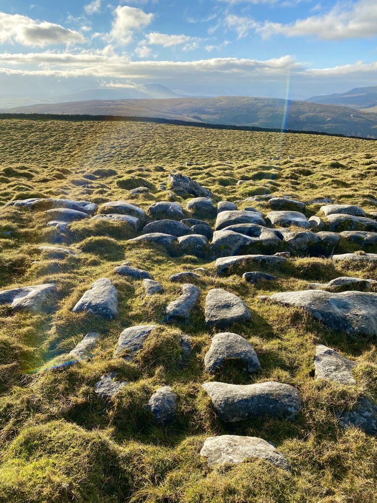
Limestone pavement on Wold Fell. In the far distance, on the horizon left of centre, the silhouette of Ingleborough can be seen beneath the clouds.
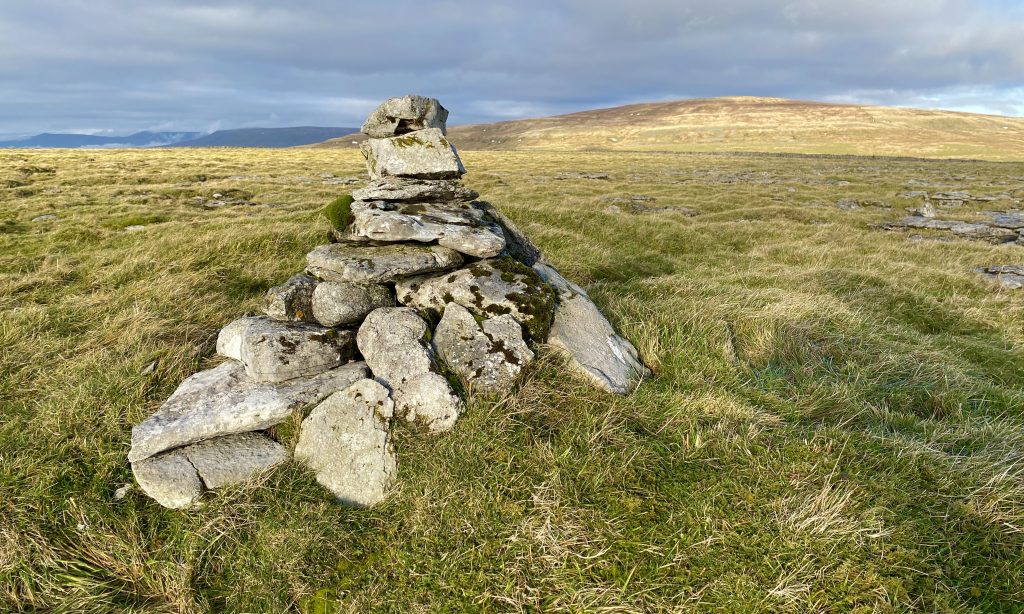
A small cairn marks the summit of Wold Fell, height 558 metres (1831 feet).
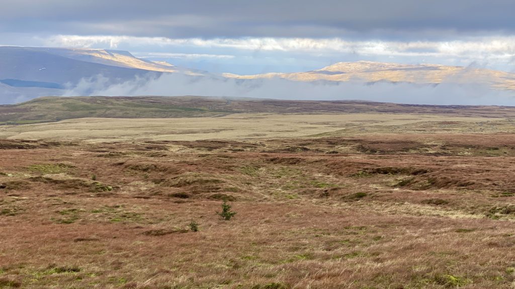
Looking south-west over to Whernside during the ascent of Great Knoutberry Hill.
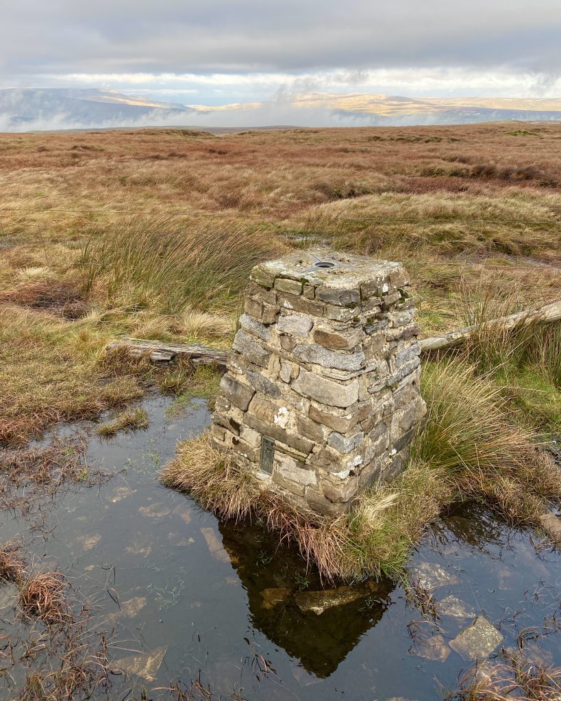
Triangulation pillar on Great Knoutberry Hill summit, height 672 metres (2205 feet).
The view north from Great Knoutberry Hill towards the hills and mountains in the Mallerstang area, south of Kirkby Stephen.
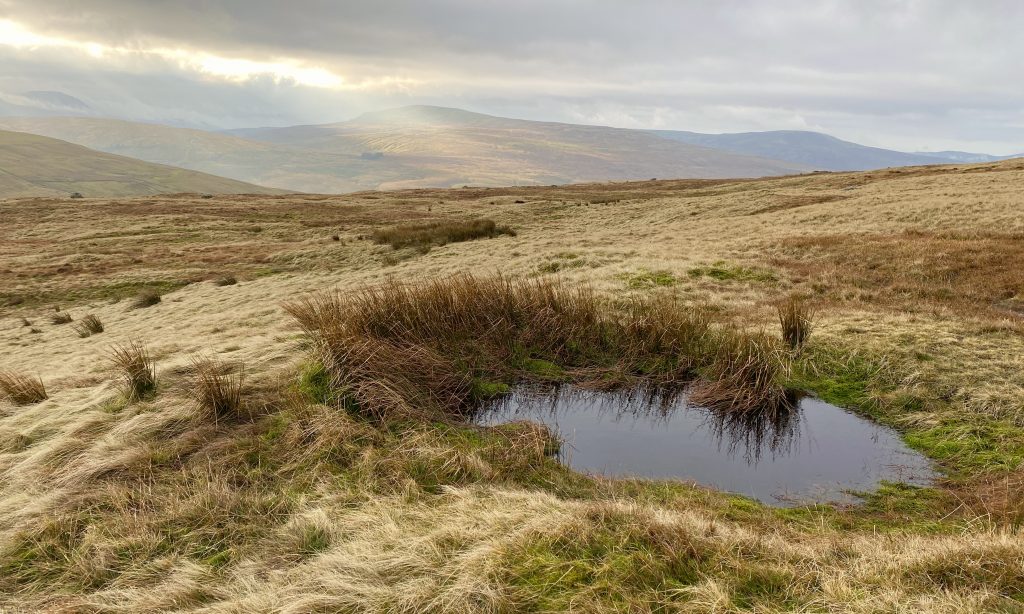
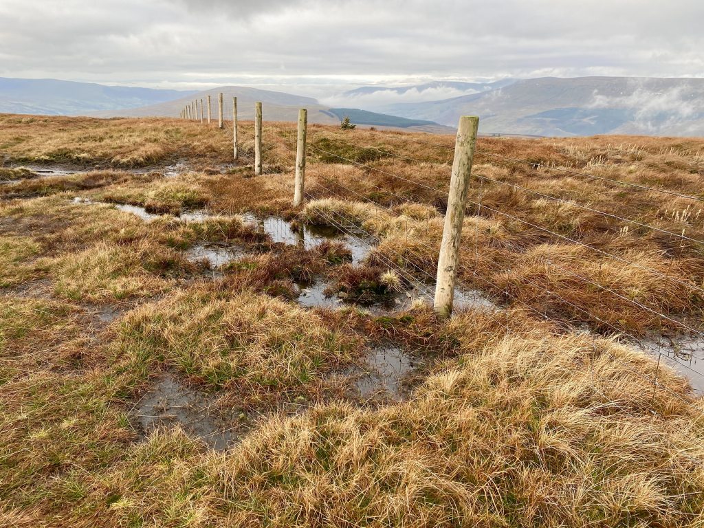
The westerly path off Great Knoutberry Hill follows the fence line and navigation is easy. However, in winter the ground is boggy.
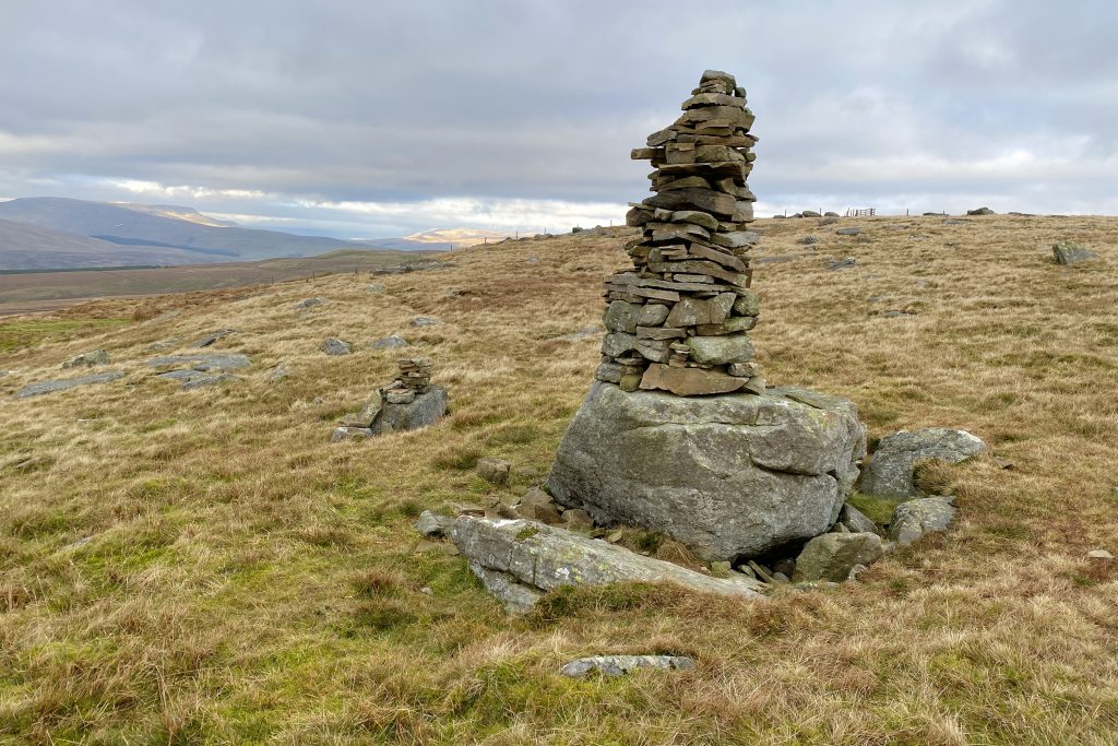
One of a series of cairns on Pikes Edge.
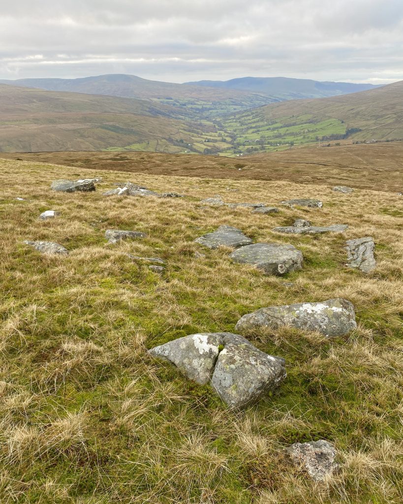
Looking down into the Dentdale valley from Pikes Edge.
The path from Great Knoutberry Hill joins the Pennine Bridleway at Green Bank.
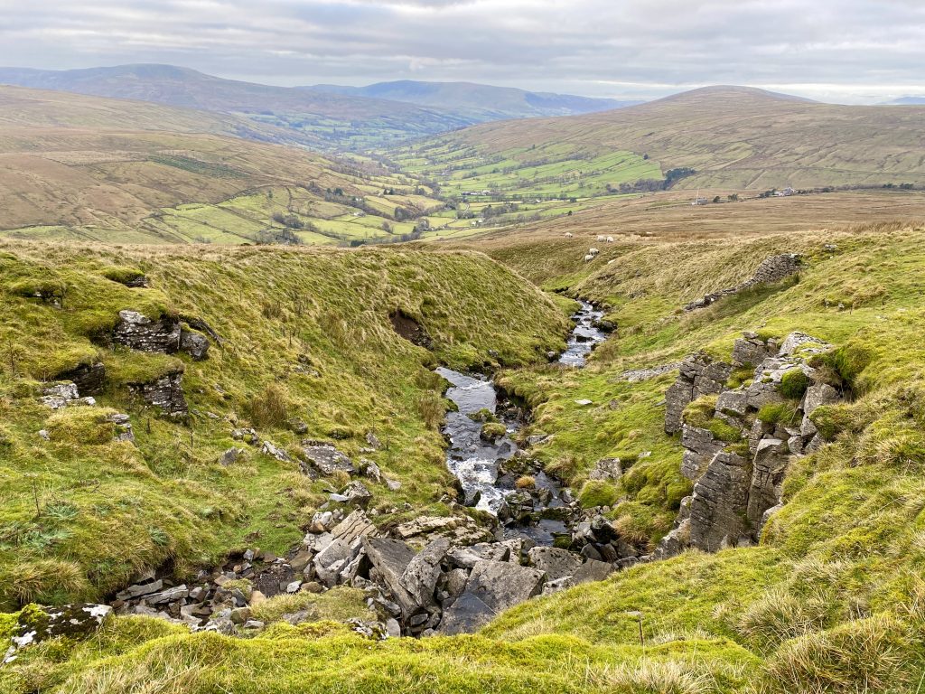
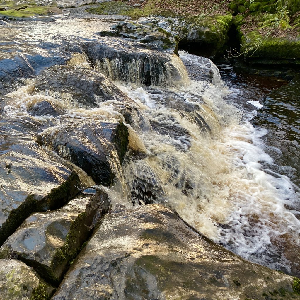
One of several streams flowing off Great Knoutberry Hill and into the River Dee in Dentdale.
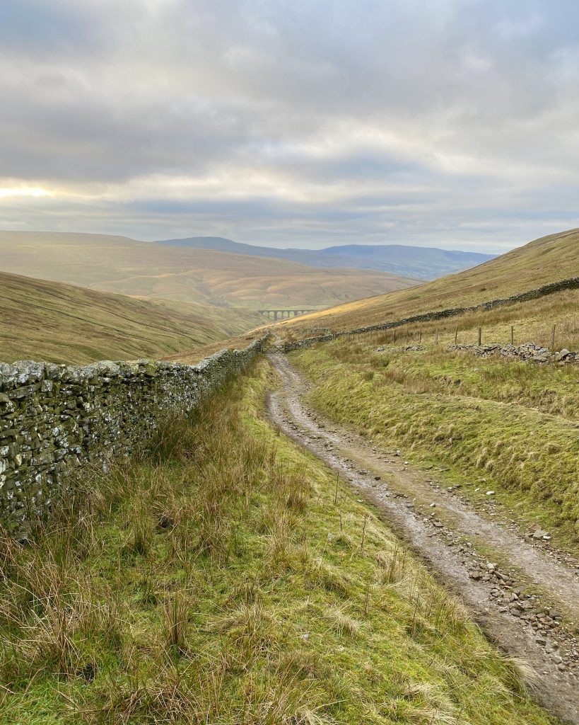
Heading west on the Pennine Bridleway track through Arten Gill towards the Arten Gill Viaduct.
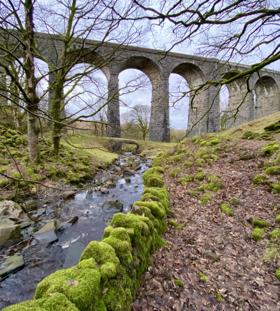
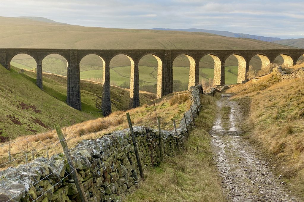
The Grade 2 listed Arten Gill Viaduct which carries the Settle to Carlisle railway line over Artengill Beck. The bridge has 11 arches and was constructed partly from Dent Marble, a type of limestone quarried nearby. It is 200 metres long, 36 metres high and the parapets are 340 metres above sea level. Groundwork on the site was started in 1870, work on the viaduct itself began in 1871 and the project was completed in 1875.
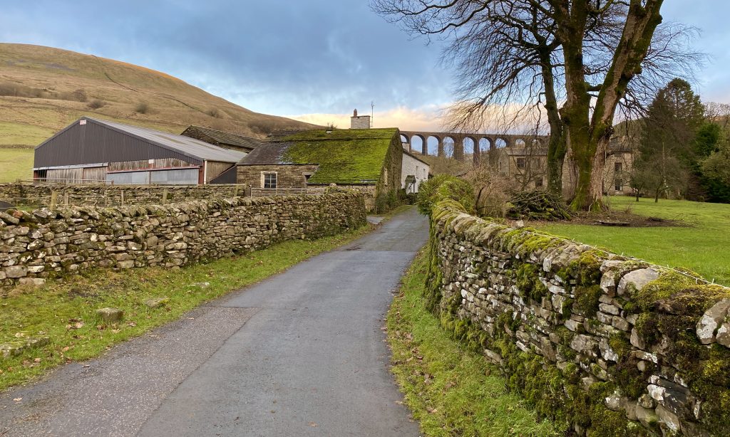
Stonehouse Farm at the foot of Arten Gill, with Arten Gill Viaduct in the background.
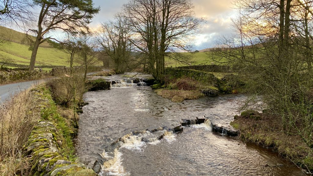
The River Dee which rises above Dent Head Farm and flows through Dentdale on its way to meet the River Rawthey near Sedburgh.
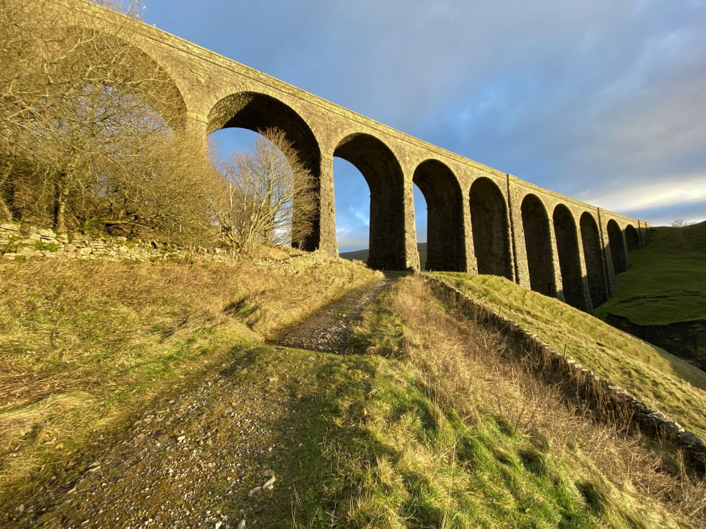
The Grade 2 listed Dent Head Viaduct, about a mile south of Arten Gill Viaduct, also carrying the Settle to Carlisle railway line. With 10 arches, the bridge is 182 metres long, 30 metres high and the parapets are 350 metres above sea level. It was constructed from a local limestone known as Blue Limestone between 1869 and 1875.