Gauber and Ingleborough National Nature Reserve
Briefly south-east along Gauber Road followed by a steep south-westerly ascent to reach the summit of Park Fell. Further south-west to Simon Fell and south to join the Dales High Way before heading east over to Sulber and the Ingleborough National Nature Reserve. North-east across the Ribblesdale valley to meet up with the Pennine Bridleway, crossing the B6479 and the River Ribble on the way, then north to High Birkwith. Finally north-west back to Gauber Road via Nether Lodge and Ingman Lodge, a route used by walkers of the Yorkshire Three Peaks Challenge. An 11-mile walk in the Yorkshire Dales.
Recommended Ordnance Survey Map
The best map to use on this walk is the Ordnance Survey map of the Yorkshire Dales Southern & Western Area, reference OS Explorer OL2, scale 1:25,000. It clearly displays footpaths, rights of way, open access land and vegetation on the ground, making it ideal for walking, running and hiking. The map can be purchased from Amazon in either a standard, paper version or a weatherproof, laminated version, as shown below.
Standard Version
My Photos
The Settle to Carlisle Railway
This 72-mile railway line was built by the Midland Railway Company and was completed for passenger travel in 1876. It took six years to build, by men who had to endure harsh conditions in a challenging landscape. According to Visit Cumbria (https://www.visitcumbria.com/carlset), the railway boasts the following features:
- 380 numbered bridges (including 14 tunnels & 21 viaducts).
- 20 stations (11 open, 9 closed).
- 12 signal boxes (10 operational, 2 preserved).
- Approximately 150 railway workers’ houses (all now in private ownership).
- Approximately 100 line-side huts (all disused and in various stages of decay).
- One aqueduct (recently restored).
- One original water tower (in Settle, recently restored as a home).
Salt Lake Quarry Nature Reserve, originally the northern half of a quarry that was dug to provide stone for the Settle to Carlisle railway line.

Stone kiln next to the Salt Lake Quarry Nature Reserve.


Walking in the Yorkshire Dales with 43 Circular Routes
AD This Cicerone guidebook includes 43 circular walks exploring valleys, hills, and moors between Kirkby Stephen and Pateley Bridge. With OS maps, local highlights, and routes ranging from 3–11 miles, it is a year-round companion for walkers of all abilities.
Limestone pavement near Colt Park, with Whernside in the background.


Grisport Unisex Adult Peaklander Hiking Boots
AD The Grisport Unisex Adult Peaklander Hiking Boots are crafted in Italy with a durable waxed leather upper, Spotex breathable lining, and a reliable Track-on rubber sole. Waterproof and weighing just 1120g, they offer comfort, resilience, and dependable performance on demanding trails.
The view back to Colt Park as we start the ascent of Park Fell.

Mike on the lower north-east slopes of Park Fell.

Grisport Unisex Adult Peaklander Hiking Boots
AD The Grisport Unisex Adult Peaklander Hiking Boots are crafted in Italy with a durable waxed leather upper, Spotex breathable lining, and a reliable Track-on rubber sole. Waterproof and weighing just 1120g, they offer comfort, resilience, and dependable performance on demanding trails.
Triangulation pillar on Park Fell summit, height 563 metres (1847 feet).


Fifty Walks Across the Beautiful North York Moors National Park
AD Discover 50 routes across the North York Moors, from short easy strolls to challenging high-level hikes. With OS maps, route descriptions, and local highlights, it also includes the legendary 40-mile Lyke Wake Walk, described in four accessible stages.
The view north from Souther Scales Fell towards Whernside and Blea Moor.

The view of Ingleborough from the northern flanks of Simon Fell.
Fifty Walks Across the Beautiful North York Moors National Park
AD Discover 50 routes across the North York Moors, from short easy strolls to challenging high-level hikes. With OS maps, route descriptions, and local highlights, it also includes the legendary 40-mile Lyke Wake Walk, described in four accessible stages.
Great views of Ingleborough from Simon Fell as we traverse the limestone pavement and peat bogs.


Osprey Hikelite Unisex Backpack for Comfortable and Lightweight Hiking
AD The Osprey Hikelite backpack combines lightweight design with practical features, including a breathable mesh back panel, soft webbing straps, and stretch mesh water bottle pockets. With zipped storage and an organiser compartment, it is ideal for day hikes and outdoor use.

Footpath between Nick Pot and Sulber, well used by walkers of the Yorkshire Three Peaks Challenge.

Osprey Hikelite Unisex Backpack for Comfortable and Lightweight Hiking
AD The Osprey Hikelite backpack combines lightweight design with practical features, including a breathable mesh back panel, soft webbing straps, and stretch mesh water bottle pockets. With zipped storage and an organiser compartment, it is ideal for day hikes and outdoor use.


Peak Bagging Wainwrights with Routes to Complete All Fells
AD This comprehensive guide offers 45 circular routes linking all 214 Wainwright fells. With maps, GPX downloads, elevation profiles, and practical advice, it provides efficient yet inspiring ways to complete this classic Lake District challenge at your own pace.
The distinctive junction at Sulber. The Ingleborough to Horton in Ribblesdale path crosses the B6479 to Clapham Pennine Bridleway.

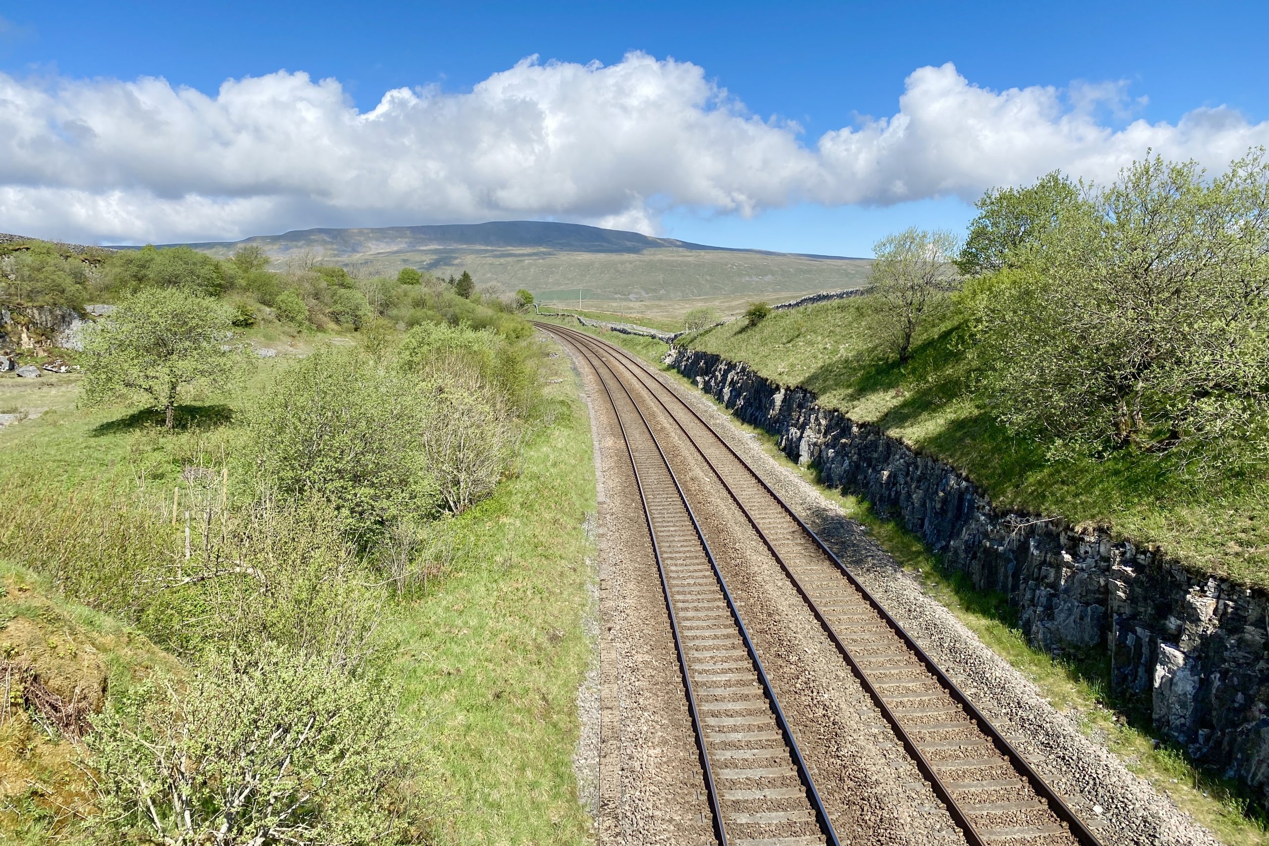
The Pennine Bridleway between the B6479 and the Settle to Carlisle railway line.

Peak Bagging Wainwrights with Routes to Complete All Fells
AD This comprehensive guide offers 45 circular routes linking all 214 Wainwright fells. With maps, GPX downloads, elevation profiles, and practical advice, it provides efficient yet inspiring ways to complete this classic Lake District challenge at your own pace.
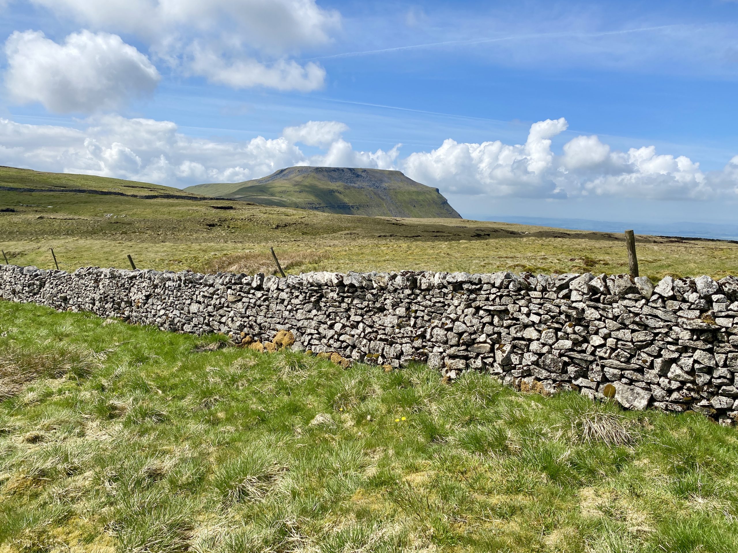
Pen-y-ghent and the Ribblesdale valley floor.

Wooden footbridge carrying the Pennine Bridleway across the River Ribble.


Berghaus Hillmaster II GTX Men's High Rise Hiking Boots
AD The Berghaus Hillmaster II GTX men’s hiking boots feature a waterproof, breathable GORE-TEX membrane, a memory foam tongue and collar for a personalised fit, and a Vibram sole delivering exceptional grip, stability, and shock protection for confident performance on any terrain.
The River Ribble, which begins at the confluence of Gayle Beck and Batty Wife Beck near Ribblehead Viaduct. It is the only major river rising in Yorkshire which flows westward, following a course through Settle, Clitheroe, Ribchester and Preston before emptying into the Irish Sea between Lytham St. Annes and Southport.


Berghaus Hillmaster II GTX Men's High Rise Hiking Boots
AD The Berghaus Hillmaster II GTX men’s hiking boots feature a waterproof, breathable GORE-TEX membrane, a memory foam tongue and collar for a personalised fit, and a Vibram sole delivering exceptional grip, stability, and shock protection for confident performance on any terrain.
Brow Gill Beck flowing beneath God’s Bridge between High Birkwith and Nether Lodge.

Footbridge across Ling Gill Beck at Nether Lodge.


Kendal Mint Co Energy Gel with Citrus and Mint Flavour
AD Kendal Mint Co energy gels deliver 27g of fast-absorbing carbohydrates plus electrolytes and B vitamins for improved performance. Vegan, gluten free, and Informed Sport certified, these caffeine-free gels are refreshing, easy to digest, and ideal for running, cycling, and endurance.
Ling Gill Beck at Nether Lodge.

The view across to Ashes Eller Bank from Gauber Road.

Kendal Mint Co Energy Gel with Citrus and Mint Flavour
AD Kendal Mint Co energy gels deliver 27g of fast-absorbing carbohydrates plus electrolytes and B vitamins for improved performance. Vegan, gluten free, and Informed Sport certified, these caffeine-free gels are refreshing, easy to digest, and ideal for running, cycling, and endurance.