Grassington and Conistone Pie
North through Grassington village centre following the Dales Way to Cove Scar, then north-west to Conistone by way of the public footpath on the eastern side of Bastow Wood. North-east from the village via Scot Gate Lane to rejoin the Dales Way, then north-west past Conistone Pie and along Swineber Scar to Highgate Leys Lane. East on paths and tracks uphill to Capplestone Gate followed by a south-western descent on Conistone Turf Road and Bycliffe Road. Finally south, again on the Dales Way, all the way back to Grassington. A 12-mile walk in the Yorkshire Dales.
Recommended Ordnance Survey Map
The best map to use on this walk is the Ordnance Survey map of the Yorkshire Dales Southern & Western Area, reference OS Explorer OL2, scale 1:25,000. It clearly displays footpaths, rights of way, open access land and vegetation on the ground, making it ideal for walking, running and hiking. The map can be purchased from Amazon in either a standard, paper version or a weatherproof, laminated version, as shown below.
Standard Version
My Photos
Area of historic settlements and field systems just north of Bastow Wood.


Small steep-sided valley cut out by Dib Beck which flows westwards into the River Wharfe.


Walking in the Yorkshire Dales with 43 Circular Routes
AD This Cicerone guidebook includes 43 circular walks exploring valleys, hills, and moors between Kirkby Stephen and Pateley Bridge. With OS maps, local highlights, and routes ranging from 3–11 miles, it is a year-round companion for walkers of all abilities.
Kilnsey Crag becomes visible on the easy-going grassy path which leads to Conistone.


Grisport Unisex Adult Peaklander Hiking Boots
AD The Grisport Unisex Adult Peaklander Hiking Boots are crafted in Italy with a durable waxed leather upper, Spotex breathable lining, and a reliable Track-on rubber sole. Waterproof and weighing just 1120g, they offer comfort, resilience, and dependable performance on demanding trails.
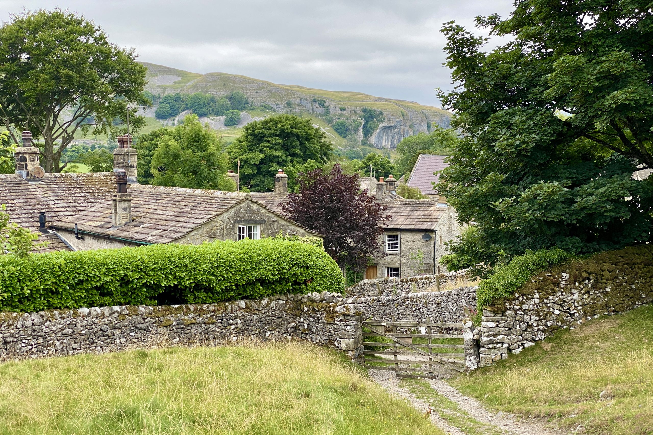
The rooftops of old stone houses in the village of Conistone.

Conistone, with Kilnsey Crag in the background.
Grisport Unisex Adult Peaklander Hiking Boots
AD The Grisport Unisex Adult Peaklander Hiking Boots are crafted in Italy with a durable waxed leather upper, Spotex breathable lining, and a reliable Track-on rubber sole. Waterproof and weighing just 1120g, they offer comfort, resilience, and dependable performance on demanding trails.
St Mary’s Church, Conistone.


Fifty Walks Across the Beautiful North York Moors National Park
AD Discover 50 routes across the North York Moors, from short easy strolls to challenging high-level hikes. With OS maps, route descriptions, and local highlights, it also includes the legendary 40-mile Lyke Wake Walk, described in four accessible stages.
The village of Kilnsey and Kilnsey Crag as seen from Scot Gate Lane on Wassa Hill.

The view across to the dry valley on the north-eastern side of Conistone. The well known ‘Conistone Dib’ footpath runs through the valley.

Fifty Walks Across the Beautiful North York Moors National Park
AD Discover 50 routes across the North York Moors, from short easy strolls to challenging high-level hikes. With OS maps, route descriptions, and local highlights, it also includes the legendary 40-mile Lyke Wake Walk, described in four accessible stages.
The approach to Conistone Pie on the Dales Way.

Conistone Pie, a distinctive limestone outcrop shaped like, you guessed it, a pie.

Osprey Hikelite Unisex Backpack for Comfortable and Lightweight Hiking
AD The Osprey Hikelite backpack combines lightweight design with practical features, including a breathable mesh back panel, soft webbing straps, and stretch mesh water bottle pockets. With zipped storage and an organiser compartment, it is ideal for day hikes and outdoor use.
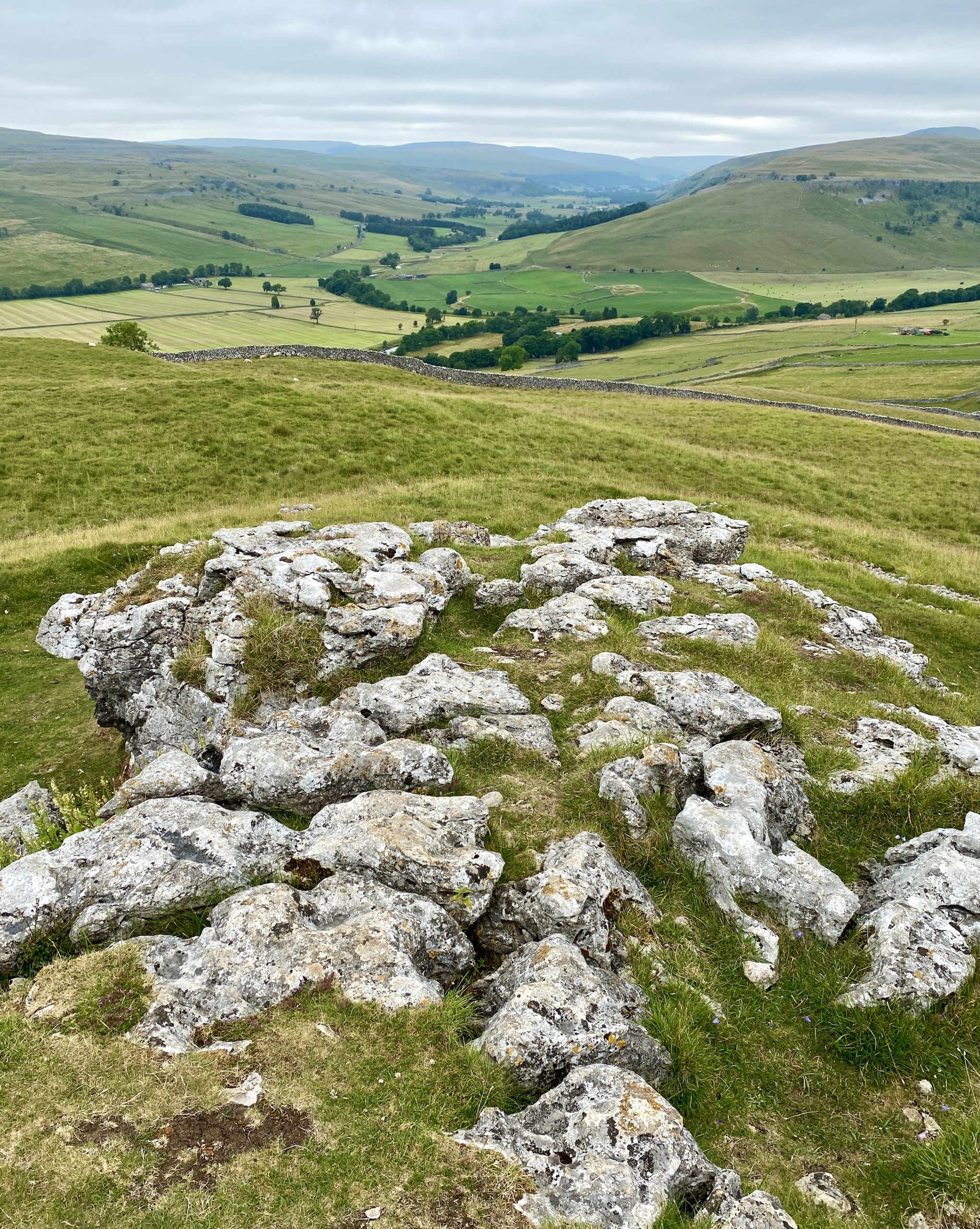
The view north-west from Conistone Pie towards Littondale.
Looking west from Conistone Pie over to Kilnsey Crag.


Peak Bagging Wainwrights with Routes to Complete All Fells
AD This comprehensive guide offers 45 circular routes linking all 214 Wainwright fells. With maps, GPX downloads, elevation profiles, and practical advice, it provides efficient yet inspiring ways to complete this classic Lake District challenge at your own pace.
Area of disused lead mines on Conistone Moor between Langcliffe Pot and Capplestone Gate.

Triangulation pillar at Capplestone Gate, height 512 metres (1680 feet).

Peak Bagging Wainwrights with Routes to Complete All Fells
AD This comprehensive guide offers 45 circular routes linking all 214 Wainwright fells. With maps, GPX downloads, elevation profiles, and practical advice, it provides efficient yet inspiring ways to complete this classic Lake District challenge at your own pace.
Descending the hillside on Conistone Turf Road.

Footpath down to Conistone Dib.


Berghaus Hillmaster II GTX Men's High Rise Hiking Boots
AD The Berghaus Hillmaster II GTX men’s hiking boots feature a waterproof, breathable GORE-TEX membrane, a memory foam tongue and collar for a personalised fit, and a Vibram sole delivering exceptional grip, stability, and shock protection for confident performance on any terrain.
The view down towards Conistone Dib, a dry channel in the limestone landscape most likely formed by glacial meltwater during the last ice age.

Lime kiln by the side of the Dales Way near Old Pasture, built about 150 years ago. Locally quarried limestone was burned in it to produce lime, which farmers used to spread on the land to improve the grass.

Berghaus Hillmaster II GTX Men's High Rise Hiking Boots
AD The Berghaus Hillmaster II GTX men’s hiking boots feature a waterproof, breathable GORE-TEX membrane, a memory foam tongue and collar for a personalised fit, and a Vibram sole delivering exceptional grip, stability, and shock protection for confident performance on any terrain.
Layers of limestone and coal were loaded into the top of the kiln. Kindling at the bottom of the kiln was then lit, and the limestone was then left to burn for about three days. The arch at the front drew air into the kiln to keep the fire burning. When the limestone had burnt, the lime which was left was raked out at the bottom of the kiln through a small hole called the ‘eye’.

The kiln is privately owned and was consolidated with support from the Yorkshire Dales National Park in 1994.


Kendal Mint Co Energy Gel with Citrus and Mint Flavour
AD Kendal Mint Co energy gels deliver 27g of fast-absorbing carbohydrates plus electrolytes and B vitamins for improved performance. Vegan, gluten free, and Informed Sport certified, these caffeine-free gels are refreshing, easy to digest, and ideal for running, cycling, and endurance.
The view south from Cove Scar towards Threshfield and Grassington.
