Starting from Hebden, south to the suspension bridge over the River Wharfe, then south-west to the village of Thorpe. South up to Burnsall & Thorpe Fell and over to the war memorial on Cracoe Fell. North-west down to Cracoe, and north-east for about two miles to reach Linton. Finally, over to Linton Falls and east along the banks of the River Wharfe back to Hebden. A 13-mile walk in the Yorkshire Dales.
Recommended Ordnance Survey Map
The best map to use on this walk is the Ordnance Survey map of the Yorkshire Dales Southern & Western Area, reference OS Explorer OL2, scale 1:25,000. It clearly displays footpaths, rights of way, open access land and vegetation on the ground, making it ideal for walking, running and hiking. The map can be purchased from Amazon in either a standard, paper version or a weatherproof, laminated version, as shown below.
Standard Version
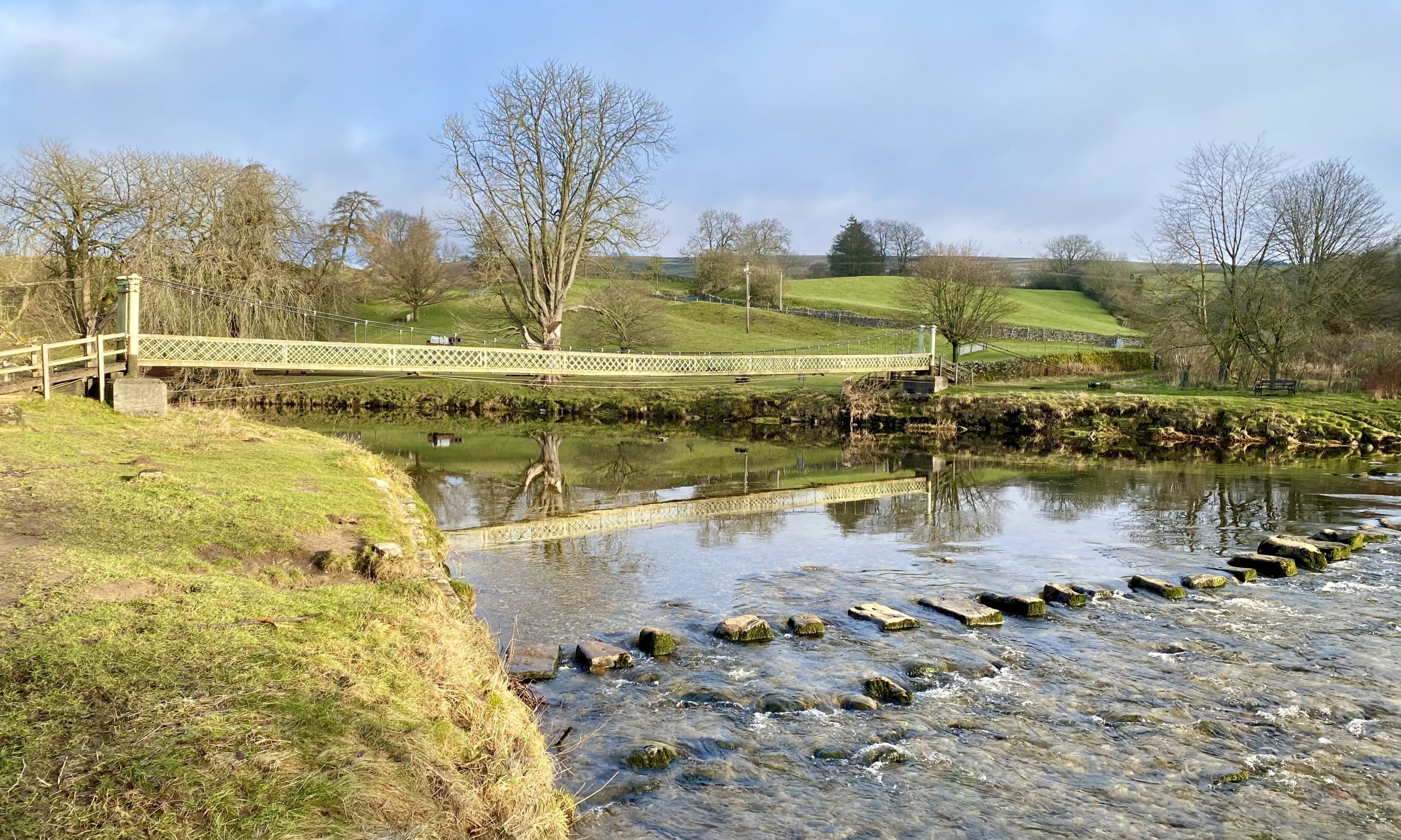
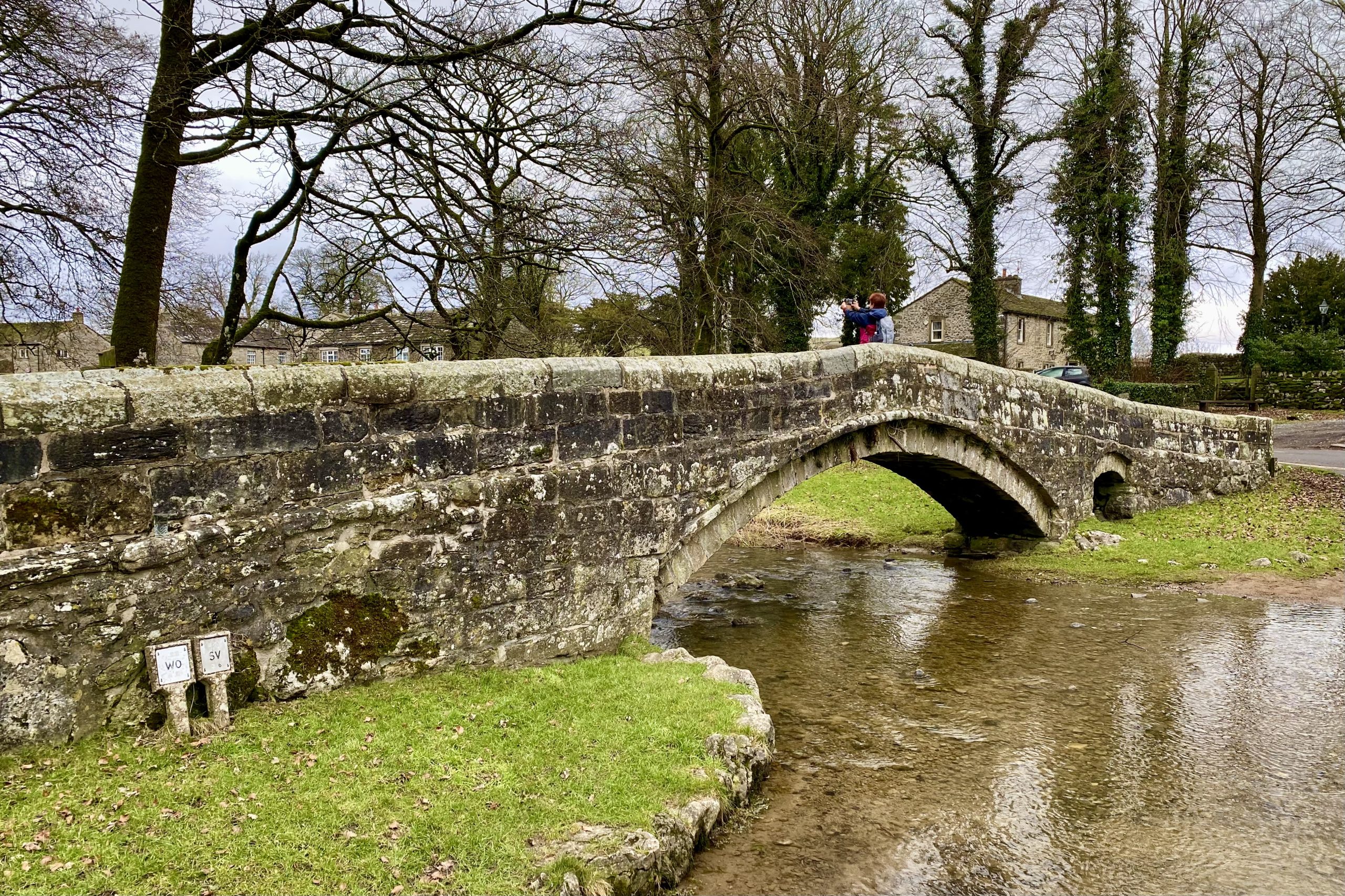
Hebden Suspension Bridge
Hebden Suspension Bridge is located around half a mile south of Hebden village. It was built in 1884 after a tragic incident where a local man drowned while trying to cross the River Wharfe using the stepping stones. The bridge was constructed to address the transportation problems the villagers faced due to the destruction of Burnsall Bridge in a storm the previous year.
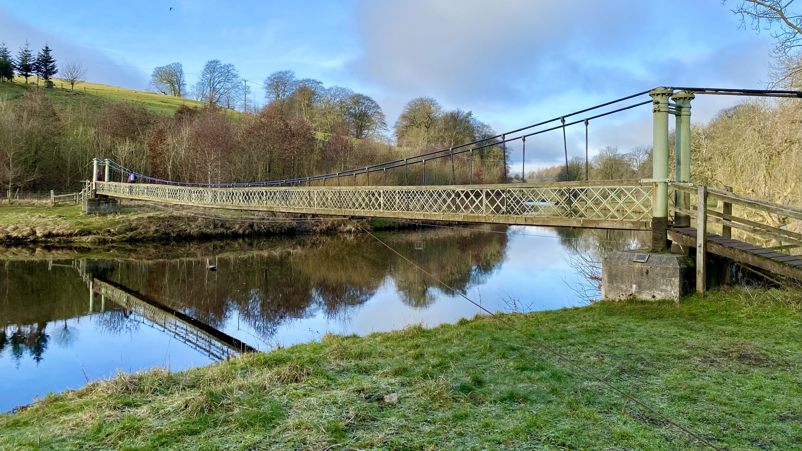
The bridge, designed as a suspension bridge, was built by William Bell, the village blacksmith, using 262 yards of redundant steel rope purchased from the Hebden Moor Mining Company. The funds for the project were raised through public subscription, and the bridge was officially opened in 1885 with a grand celebration that included a brass band and public tea.
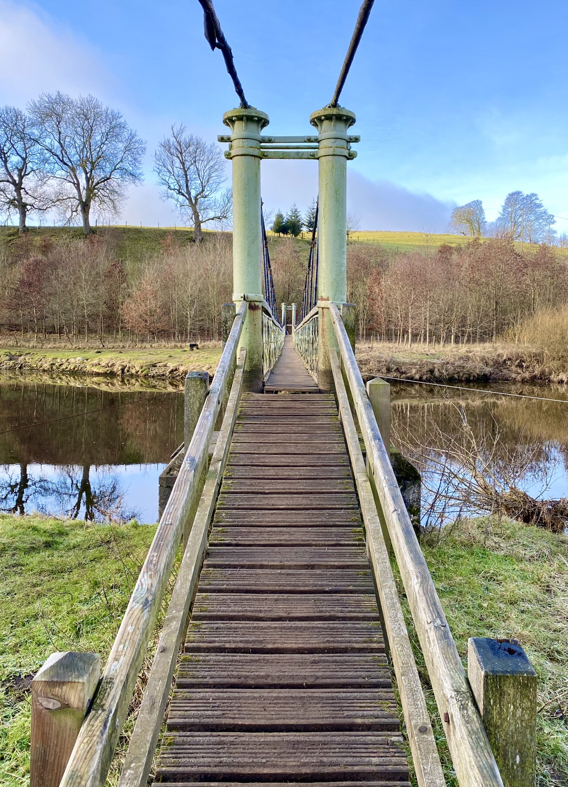
Today, Hebden Suspension Bridge is an important footbridge that provides a public footpath across the River Wharfe for walkers. The bridge offers beautiful views of the river and is a popular attraction for visitors to the village. Recently, the National Park Authority has refurbished the bridge, ensuring that it remains safe and functional for continued use.
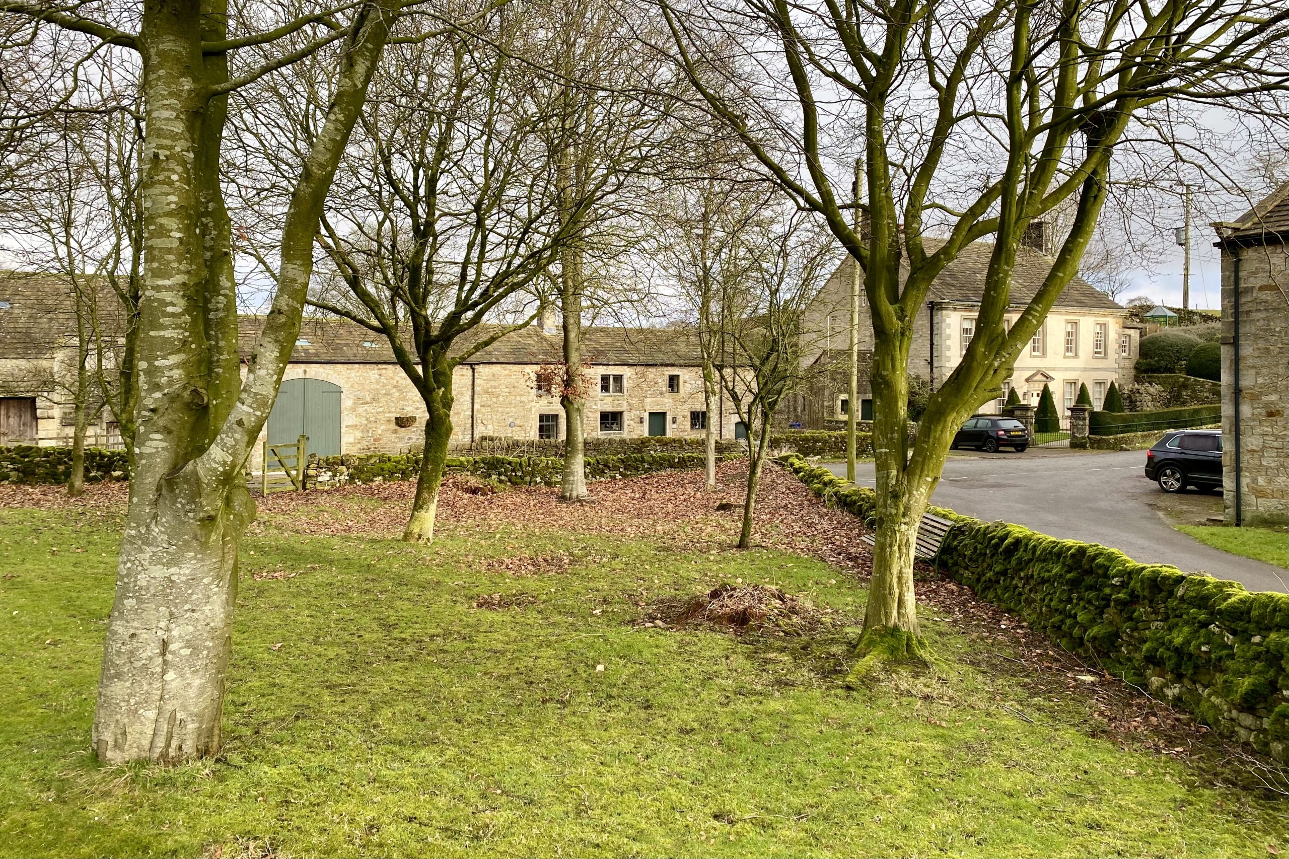
The village green in Thorpe.
Heading south along Thorpe Fell Lane before we begin the climb up to Burnsall & Thorpe Fell.
Shooting lodge on Burnsall & Thorpe Fell.

The Cracoe Fell war memorial
The war memorial stands at the top of Cracoe Fell, which is 500 metres (1640 feet) high and overlooks the villages of Cracoe and Rylstone on its western slopes. The memorial was built in 1922 using local sandstone and a concrete cap at a cost of £56. The obelisk is 7.2 metres tall and 2.7 metres wide at the base and is divided into three sections: the lower section is empty and contains a time capsule with a copy of the Craven Herald and some coins in a sealed bottle, while the middle section is also empty and the upper section is solid.
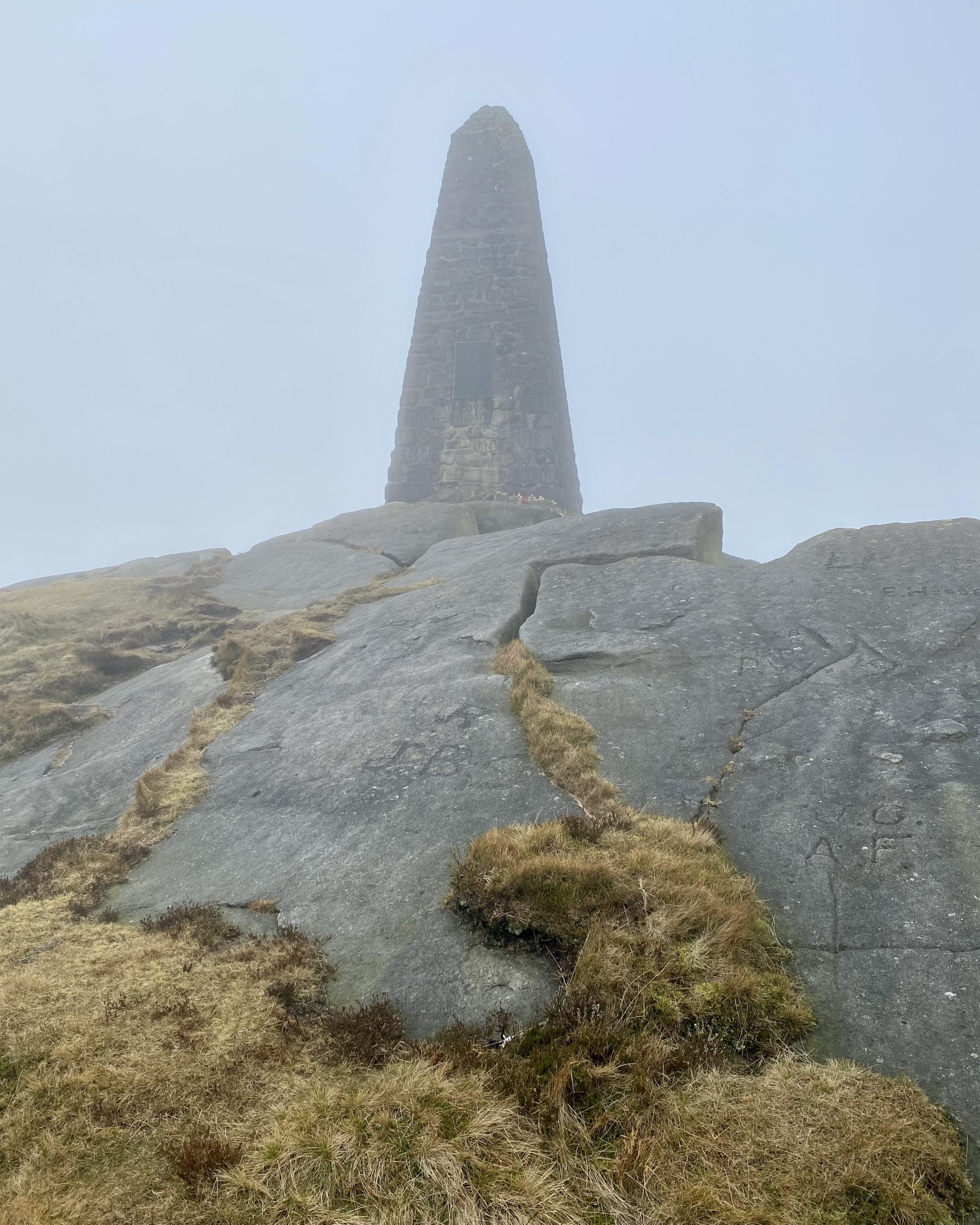
The memorial honours the sacrifices of 13 men who served in the First World War and three who served in the Second World War. The soldiers’ initials and dates of enlistment and death were initially carved into the stone and are still visible today. Later, an alabaster tablet was added, and it was subsequently replaced by a bronze plaque, which reads as follows:
ROLL OF HONOUR OF THE MEN
OF THIS PARISH WHO GAVE THEIR LIVES
IN TWO WORLD WARS
1914 TO 1919
JOHN DENT PTE. BORDER REG.
FRANK HIGHAM CPL. WEST RIDING REG.
CHARLES HYMAS PTE. LABOUR CORPS.
HORACE MARSHALL PTE. WEST RIDING REG.
GERALD W. E. MAUDE CAPT. YORKS REG.
MICHAEL D. W. MAUDE CAPT. YORKS REG.
FRED NELSON PTE. SOUTH STAFFS. REG.
J. NORMAN PROCTER LT. WEST RIDING REG.
THOMAS B. RENTON PTE. MACHINE GUN CORPS.
RHODES SPENCE PTE. WEST RIDING REG.
JAMES H. SWALES SEAMAN R.N.
TOM SWALES PTE. WEST RIDING REG.
JOHN W. WHITFIELD PTE. WEST RIDING REG.
1939 TO 1945
SIDNEY DAGGETT P.O. R.A.F.
RICHARD M. PROCTER L/BDR. R. A.
CURTIS WALKER DRIVER R.A.S.C.

A gap in the dry stone wall on Fell Side Laithe is neatly closed up with rocks.

Angy takes a moment to marvel at this incredible ash tree. The trunk is hollow and doubled over and it’s easy to imagine that it was shaped by the strong, unrelenting winds that sweep across the farmland. The lifeless tree has given up the fight against the unforgiving elements.

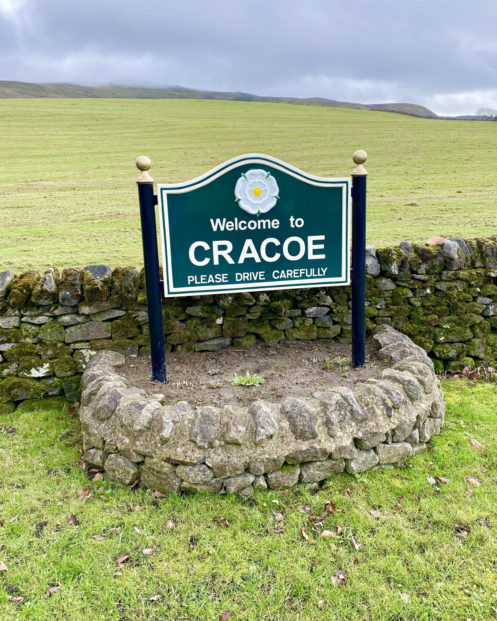
Welcome sign by the side of the road at the north-eastern end of the village.
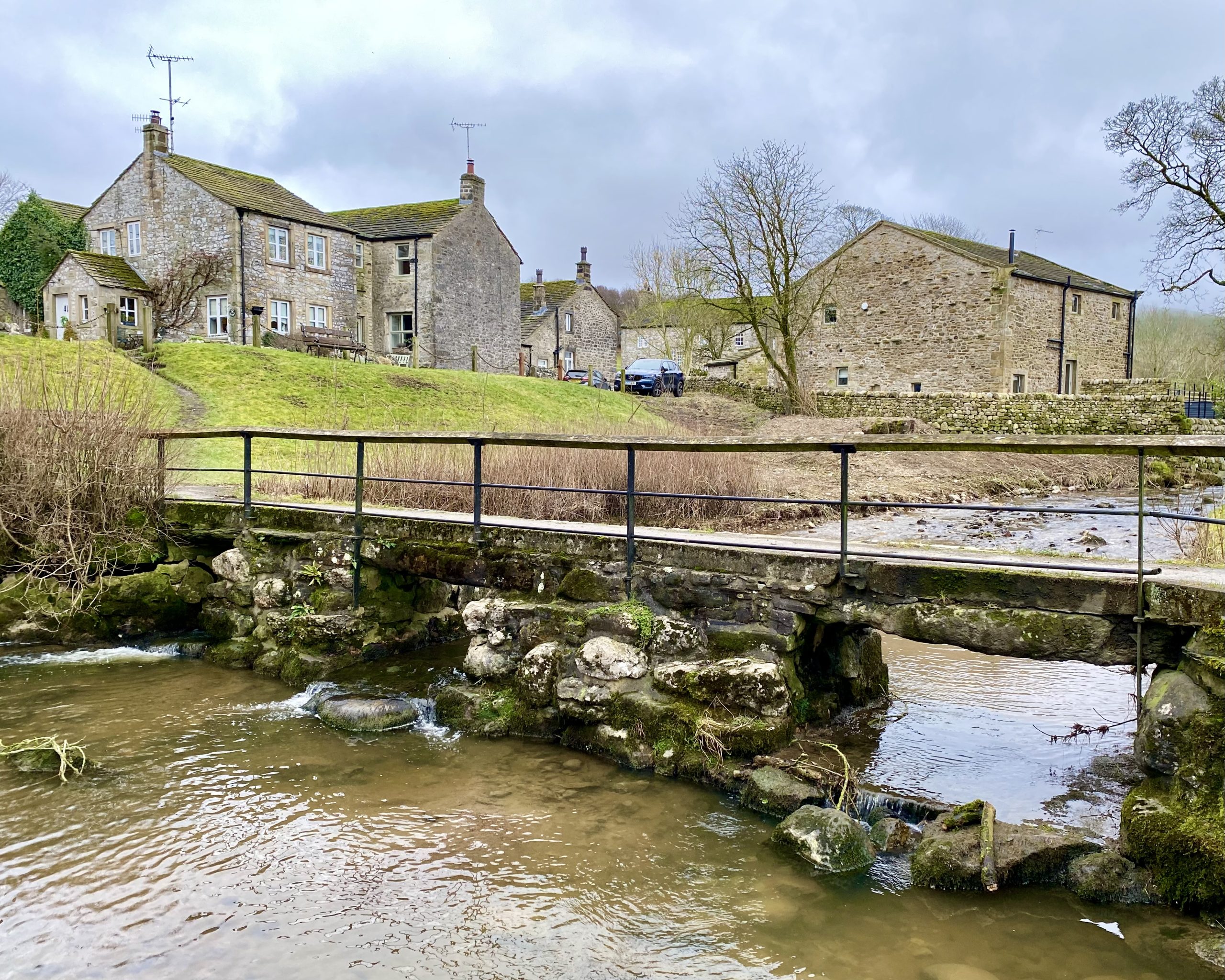
Two very different footbridges across Linton Beck in Linton village.
The Fountaine Hospital Almshouse, Linton, North Yorkshire
The Fountaine Hospital in Linton was originally built as an almshouse, a type of charitable housing for the poor that dates back to medieval times. While almshouses were traditionally established by religious orders, in the 1700s and 1800s they became more urban and were often funded by wealthy philanthropists. In Linton, the Fountaine Hospital was the result of Richard Fountaine’s bequest in his will. Fountaine was born in Linton in 1639 but made his fortune in London as a haberdasher, becoming well known and respected in wealthy merchant circles during the reign of the Stuarts.
When Fountaine died in 1722, he left instructions for an almshouse to be built in his home village, with funds for a minister’s salary and for six local residents to live there. However, his surviving relatives were outraged by his generosity, and there is no record of who commissioned the architect or the style of the building. In addition, Fountaine left a large sum to his carer Christian Fountaine, who had adopted his surname.
The first Chief Executor of the will, John Colton, who was responsible for commissioning the almshouse, died in 1724. It is believed that he had chosen the architect and Baroque style design for the front of the building. However, the building was only partially complete when he died, with only the impressive baroque front facade completed. The rest of the building, including the simpler sides and back, was completed later with reduced funding.

Jane Houlton, who discovered the building on a bus trip in the Dales with her late husband, architect Michael Devenish, has extensively researched the Fountaine Hospital and published a book entitled ‘An Almshouse for Linton’. She believes that the lack of documentation on the building’s commissioning and design is due to the family’s displeasure at the cost of the almshouse reducing their expected inheritance. Houlton also believes that the original architect was laid off and that the remaining family deliberately disrupted the project when they saw it as eating up their money.
Jane Houlton has finally solved the mystery of the architect behind The Fountaine Hospital. Her extensive research, which involved examining John Colton’s records, visiting the Thorpe Fell quarry that provided the Yorkshire stone, and exploring the distinctive coat of arms at the College of Heralds, as well as delving deep into the Fountaine family archives, led to a definitive answer.
It turns out that the architect was William Etty of York, a renowned artist and member of the Royal Academy. Etty’s portfolio included other notable buildings such as the frontage of the Mansion House in York, Holy Trinity Church in Leeds, and the long-since-demolished Moot Hall in Leeds.

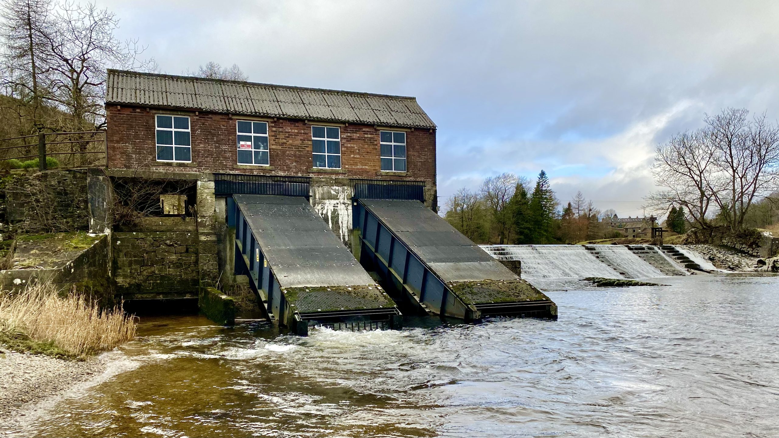
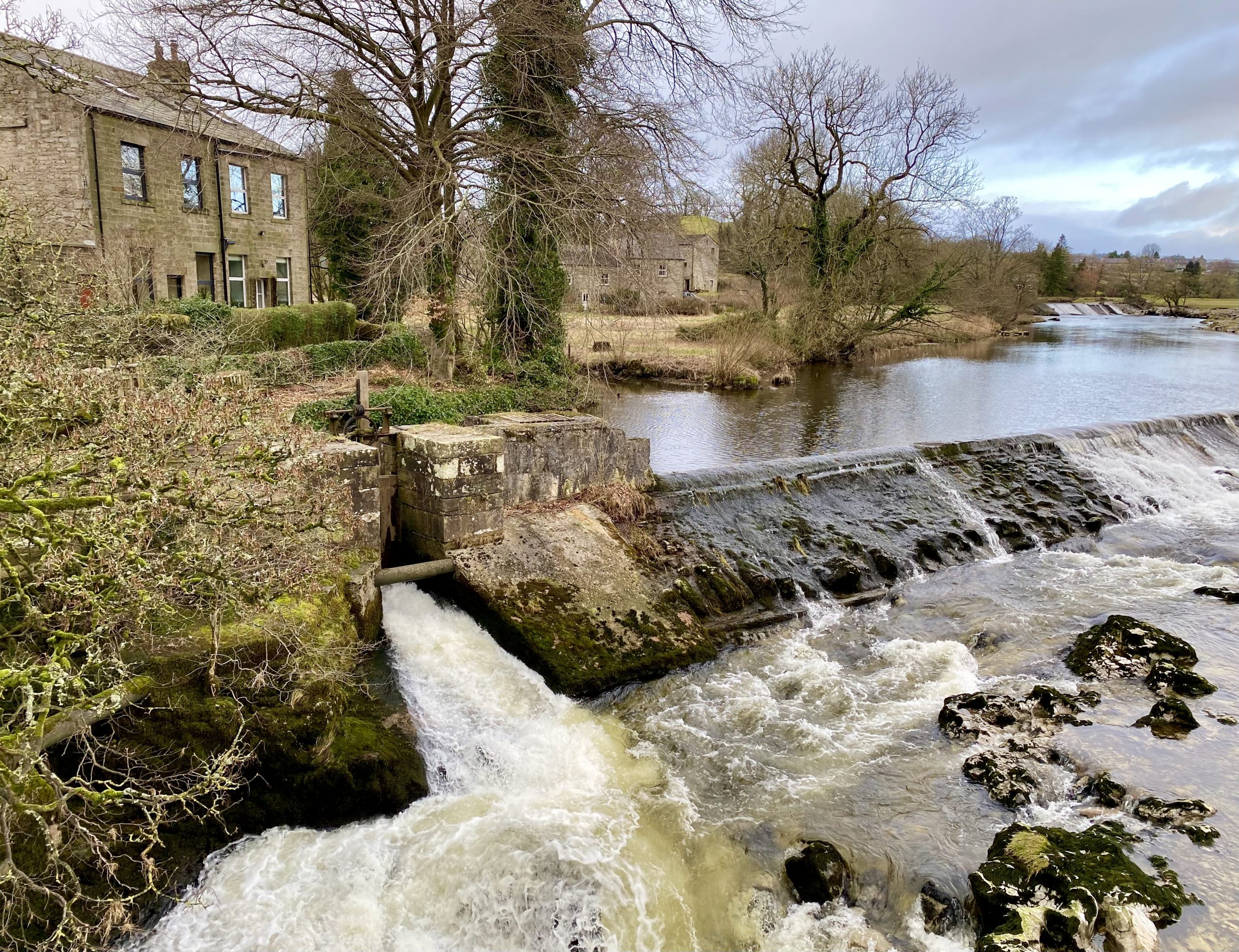
Linton Falls Hydro
Linton Falls Hydro is a hydroelectric power station located on the River Wharfe at Linton Falls. It was built on the same site as the original hydroelectric scheme that was opened in 1909 by the Grassington Electric Supply Company. Unfortunately, the project had to shut down in 1948 when the National Grid arrived. The current power station was developed by an engineering firm based in Skipton. It was opened in March 2012 and uses the original building.
The plant utilizes two screw turbines, each with a diameter of 7 feet 10 inches, to generate electricity. These turbines were delivered to the site by the manufacturer Spaans Babcock in July 2011. The scheme has a head of water of 9 feet 2 inches, a maximum flow rate of 160 cubic feet per second, and an installed capacity of 100 kilowatts, capable of generating 500,000 kilowatt hours annually.
In addition to producing clean energy, Linton Falls Hydro aims to minimise its impact on the local wildlife. The area is home to rare species such as bats, white-clawed crayfish, and fine-lined pea mussels. Therefore, the screws are designed to allow for the safe passage of aquatic animals through the turbines.
The hydroelectric building is now a scheduled monument recognised for being an industrial construction in the largely non-industrial Yorkshire Dales. It was nominated in the 2012 English Heritage Angel Awards, which acknowledges the dedication and expertise of volunteers and craftsmen who work on threatened buildings, monuments, and other heritage sites.
Linton Falls Hydro generates enough renewable electricity to power 90 to 122 homes and demonstrates how we can harness natural resources to generate electricity while minimising harm to the environment and historical structures.
Linton Falls, Grassington
Linton Falls is a spectacular waterfall located on the River Wharfe between the villages of Linton and Grassington. The River Wharfe originates from the confluence of Greenfield Beck and Oughtershaw Beck at Beckermonds and flows for a total length of 65 miles before joining the River Ouse near Cawood.
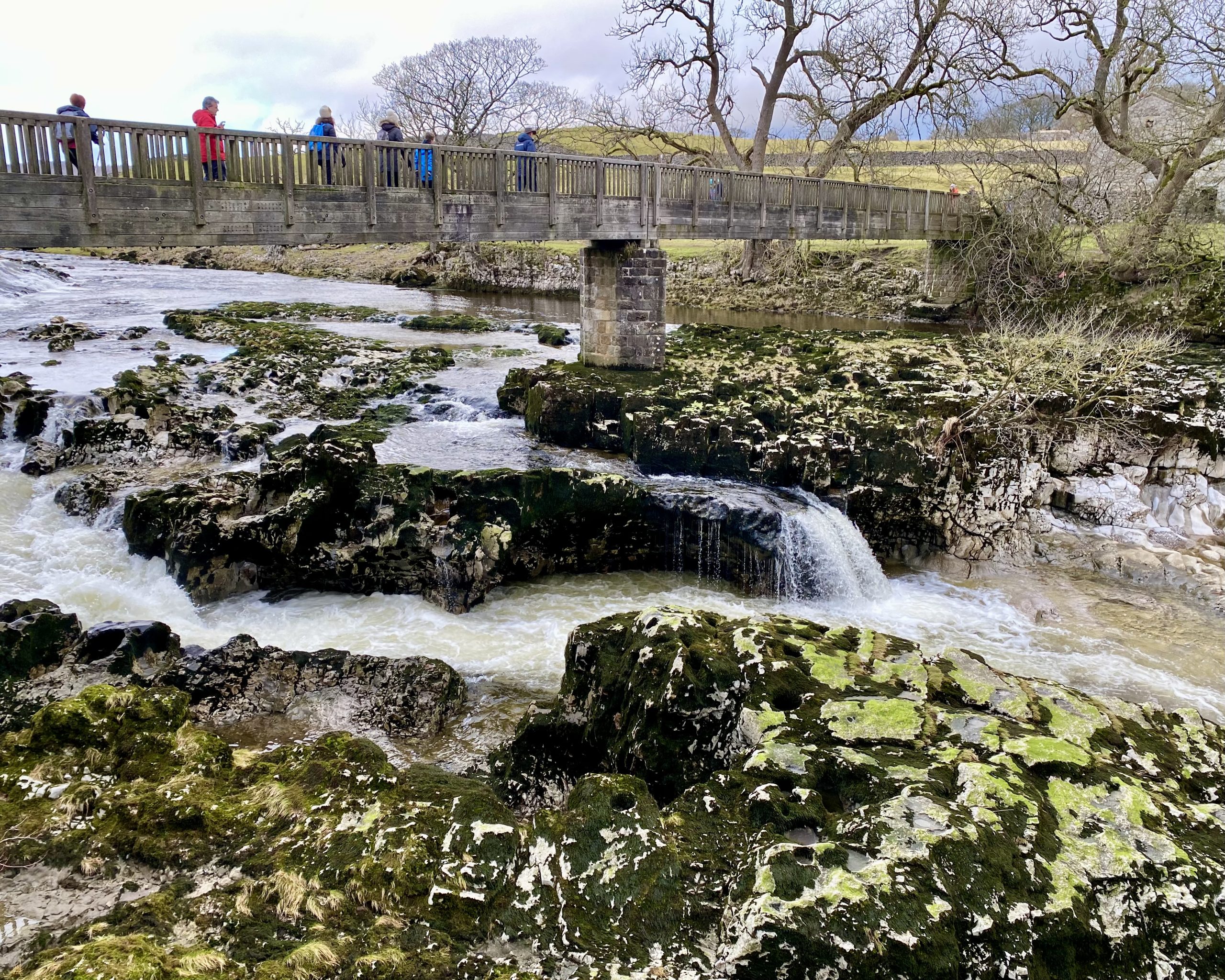
The falls are the largest on the River Wharfe and a popular visitor attraction, reachable by foot from Grassington via Sedber Lane. Visitors can park their vehicles in the Yorkshire Dales National Park Authority car park.
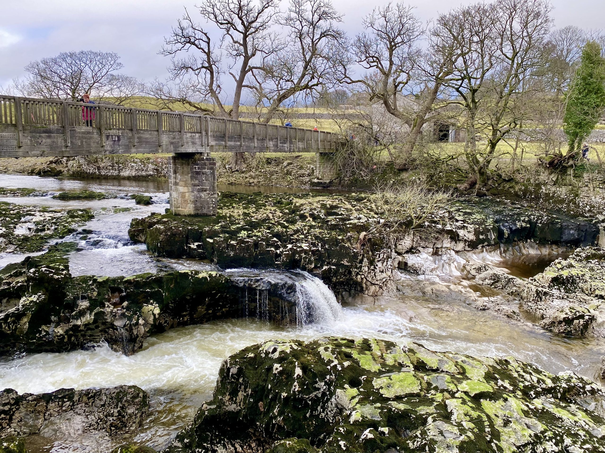
Linton Falls is crossed by a footbridge built in 1989, and the river cascades over limestone outcrops below the bridge, creating a dramatic sight, especially after heavy rainfall.
The formation of Linton Falls dates back millions of years to when a geological fault, known as the Craven Fault, caused a shift in the earth’s crust. This raised the limestone rocks to the north higher than those to the south, resulting in the formation of some quite spectacular limestone features in the Yorkshire Dales.
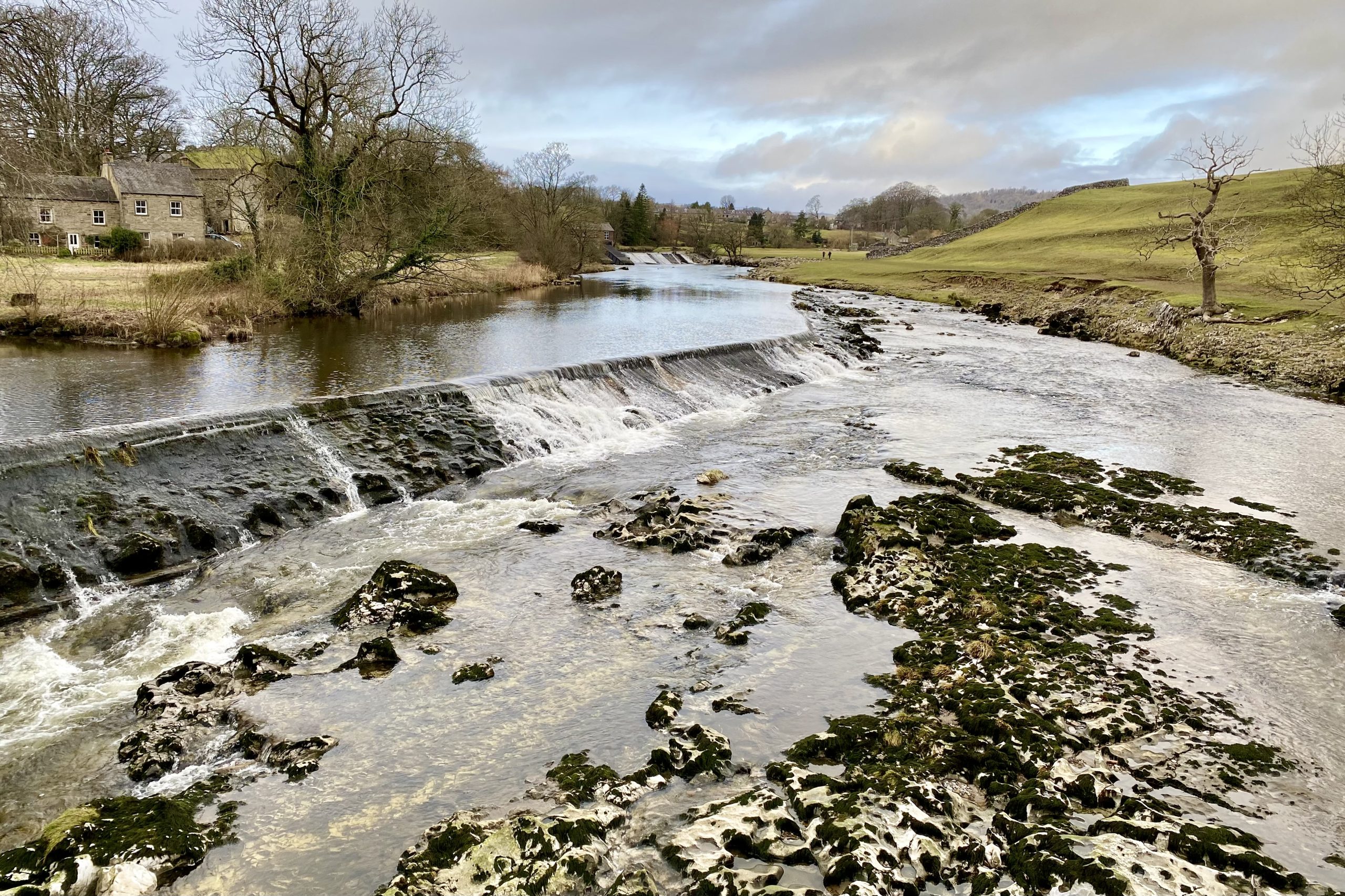
Nearby weirs were once used to channel water into a large textile mill, which has since been demolished. Today, visitors can enjoy the natural beauty of the falls and the surrounding area, with several walking trails and vantage points to appreciate the stunning scenery.
