From Aisgill Moor Cottages, east across the railway bridge then north to Hellgill Force. Continuing north on footpaths to Elmgill, crossing the B6259 and following A Pennine Journey to Pendragon Castle. Return by way of the B6259 through Outhgill, on to the Pennine Bridleway at The Thrang, and via a footpath at Hell Gill Bridge. A 10-mile walk in the Yorkshire Dales.
Recommended Ordnance Survey Map
The best map to use on this walk is the Ordnance Survey map of the Howgill Fells & Upper Eden Valley, reference OS Explorer OL19, scale 1:25,000. It clearly displays footpaths, rights of way, open access land and vegetation on the ground, making it ideal for walking, running and hiking. The map can be purchased from Amazon in either a standard, paper version or a weatherproof, laminated version, as shown below.
Standard Version
Settle to Carlisle railway line running through the valley of Mallerstang.
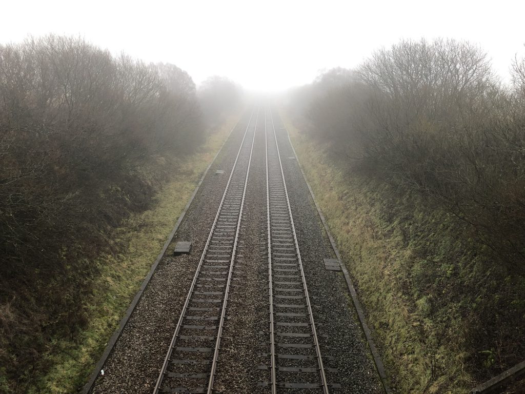
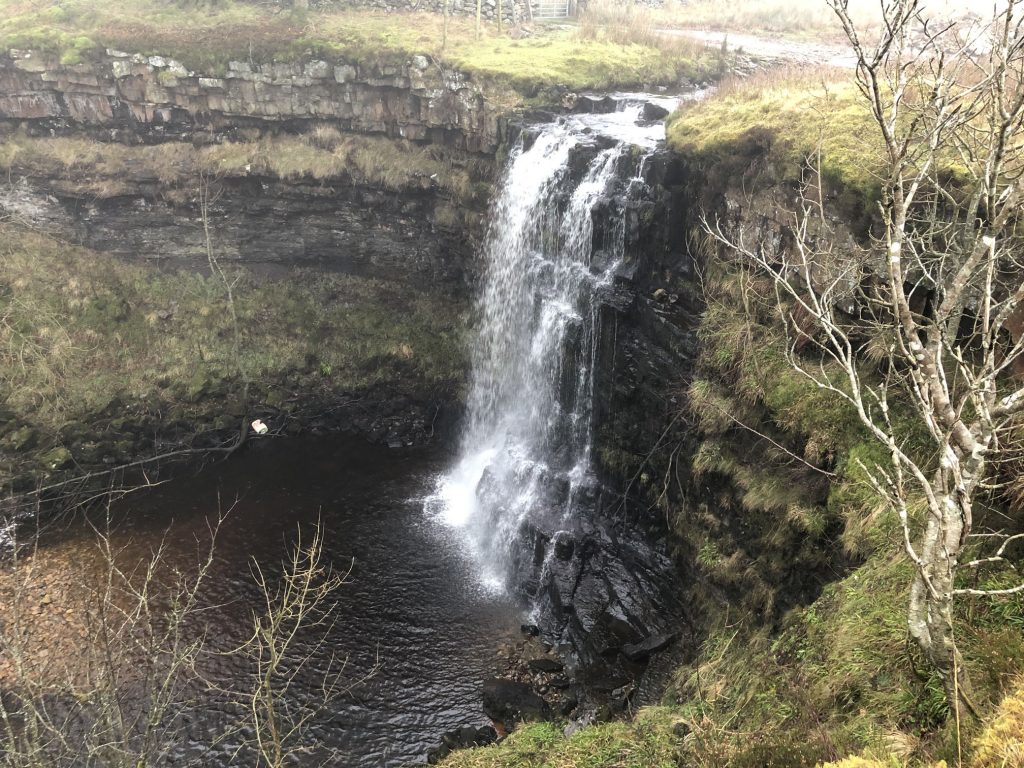
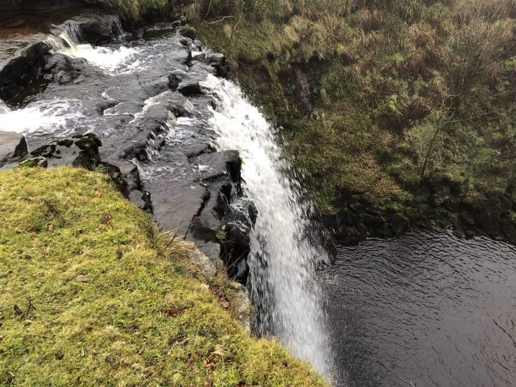
Hellgill Force.
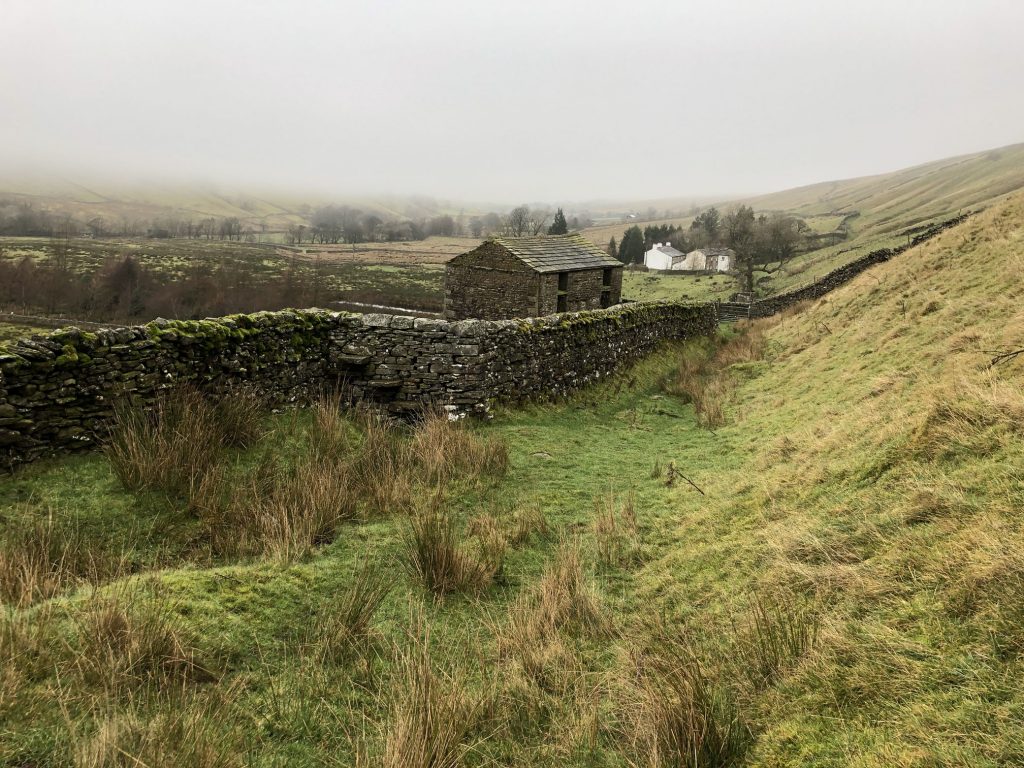
Looking north along the dale of Mallerstang.
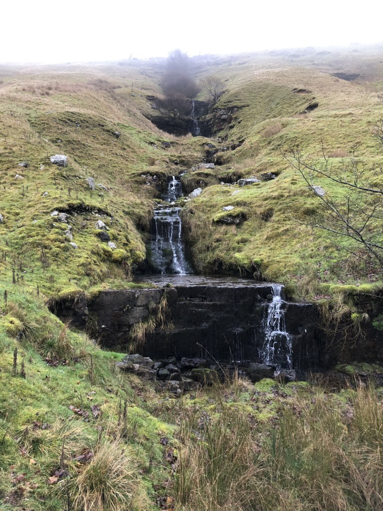
Waterfalls beneath Hanging Lund Scar.
Dead moles hanging on barbed wire.

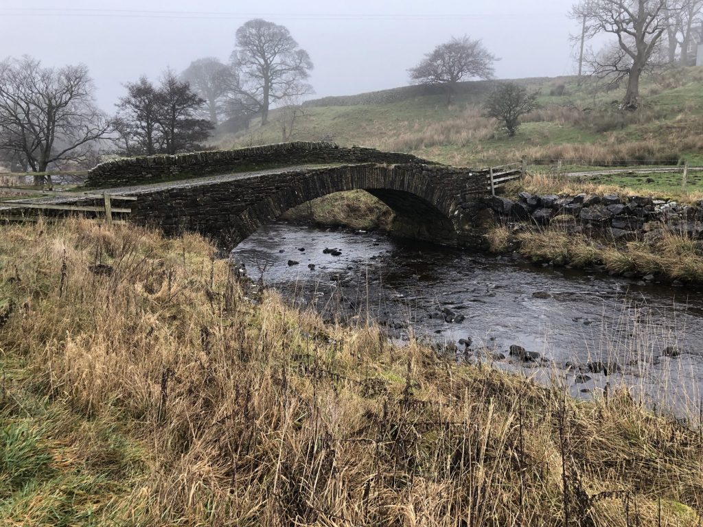
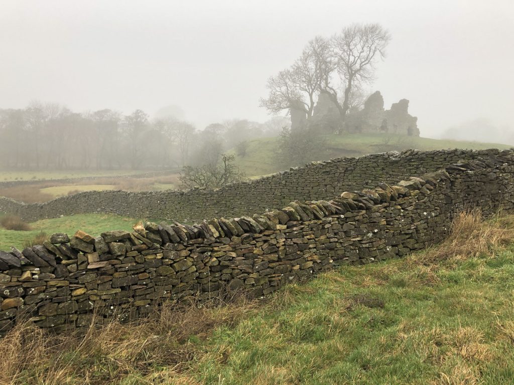
Thrang Bridge across the River Eden.
Pendragon Castle
Pendragon Castle is now a ruin in the Mallerstang valley to the south of Kirkby Stephen. It occupies a site close to a young River Eden with the peaks of Wild Boar Fell and Mallerstang Edge towering over it. The castle is steeped in history.
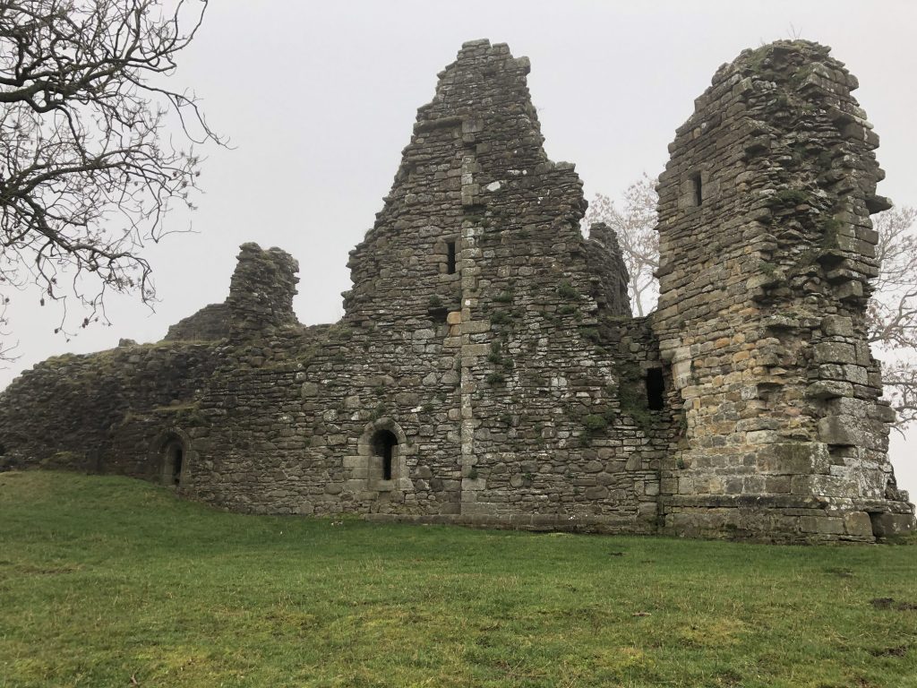
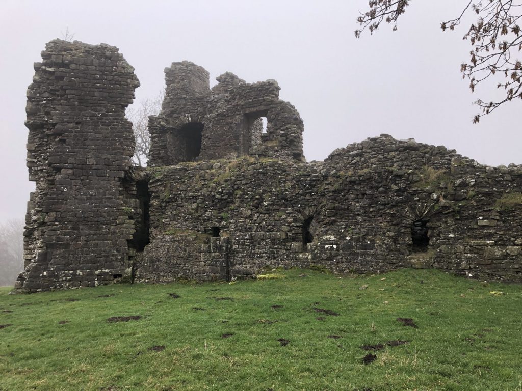
According to legend the original castle was built by Uther Pendragon, father of King Arthur, in the 5th century and may have been the site of his death when a well was poisoned by the Saxons. However, there is no evidence to support the legend that there was a castle here before the 12th century.
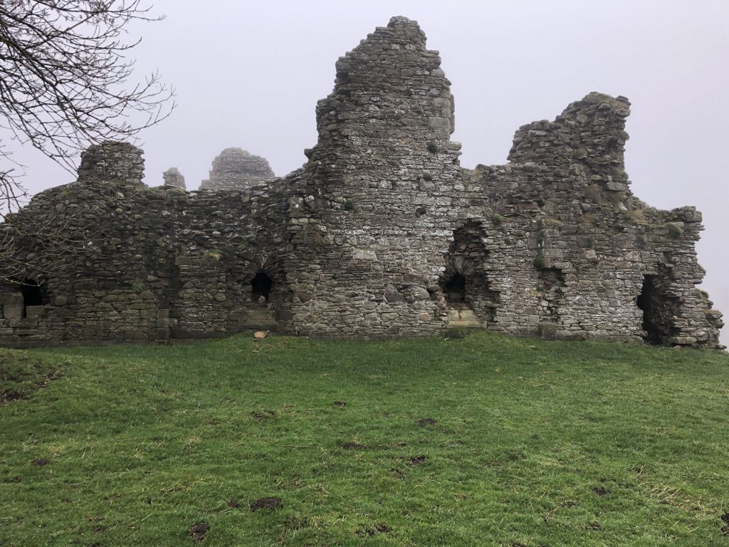
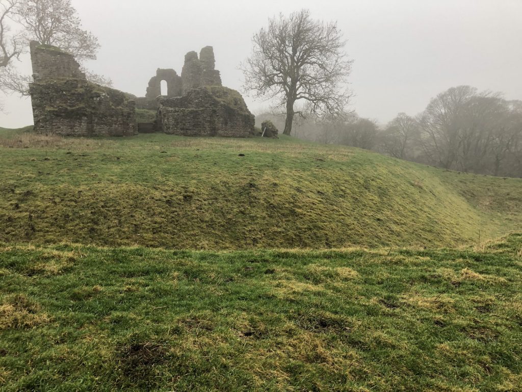
Pendragon Castle has had several notable owners including Sir Hugh de Morville – one of the knights who murdered Sir Thomas Beckett in 1170. He was Lord of Westmorland and Hugh’s Seat – a peak on the Mallerstang ridge – is named after him. Lady Anne Clifford was a very well known landowner who rebuilt the castle after it had been destroyed by a Scott’s raiding party. She added a brewhouse, bakery, stables and coach house and was a frequent visitor until her death in 1676.
St Mary’s Church, Outhgill, in the Mallerstang valley.

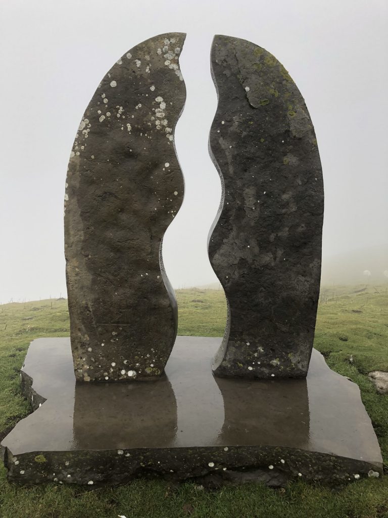
Eden Benchmarks
Eden Benchmarks is a series of 10 contemporary stone sculptures located at intervals along the length of the River Eden between its source above the Mallerstang valley and Rockliffe, north of Carlisle, where it runs into the Solway Firth.
The first sculpture in the series is called ‘Water Cut’ and is located a few miles from the source of the River Eden, high up on the eastern side of the Mallerstang valley. Like a huge milestone, it stands alongside the ancient green road known as Lady Anne Clifford’s Way. The space carved between the two vertical pillars creates the shape of a meandering river in the sky and provides a ‘window’ onto the real river in the valley below. It also symbolises the power of the River Eden cutting through the rock on its journey through East Cumbria and our own human journeys through the rural landscape and through life. Made from Salterwath Limestone, taken from a quarry near Shap, it also resembles the gate posts and stiles in drystone walls, which are so characteristic of the area, whilst its outer curve refers to the viaduct arches on the nearby Settle to Carlisle railway line.
Old Roman road across Hellgill Wold.

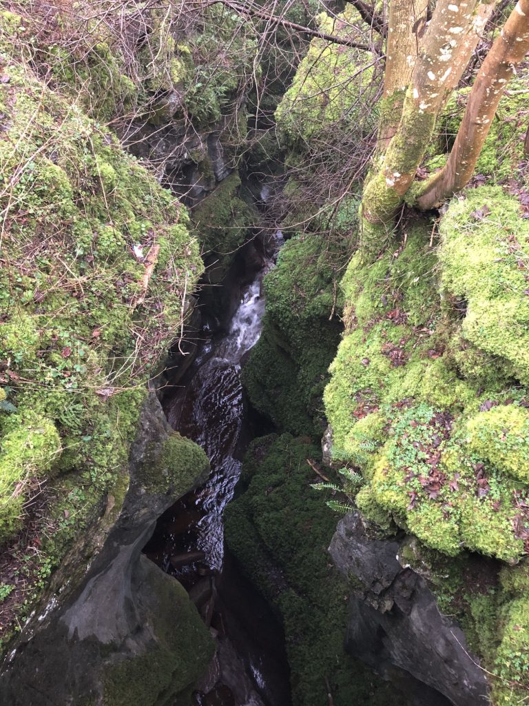
A deep narrow ravine cut out by Hell Gill Beck.
Hell Gill Bridge.

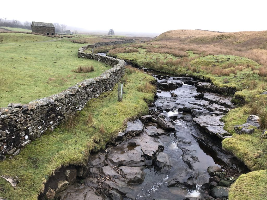
Hell Gill Beck, which becomes the River Eden further down.