North-west from the village of Muker to join the Pennine Way near Kisdon, then north and north-west above North Gang Scar and Kisdon Side to Keld. Across the footbridge over the River Swale between Catrake Force and Kisdon Force and further north-west past Currack Force to meet Stonesdale Lane. North via Carr House to rejoin the Pennine Way at Haw Shaws before returning south to the waterfalls near East Stonesdale. South-east above West Wood to Swinner Gill and back to Muker following the course of the River Swale through Swaledale. A 9-mile walk in the Yorkshire Dales.
Recommended Ordnance Survey Map
The best map to use on this walk is the Ordnance Survey map of the Yorkshire Dales Northern & Central Area, reference OS Explorer OL30, scale 1:25,000. It clearly displays footpaths, rights of way, open access land and vegetation on the ground, making it ideal for walking, running and hiking. The map can be purchased from Amazon in either a standard, paper version or a weatherproof, laminated version, as shown below.
Standard Version
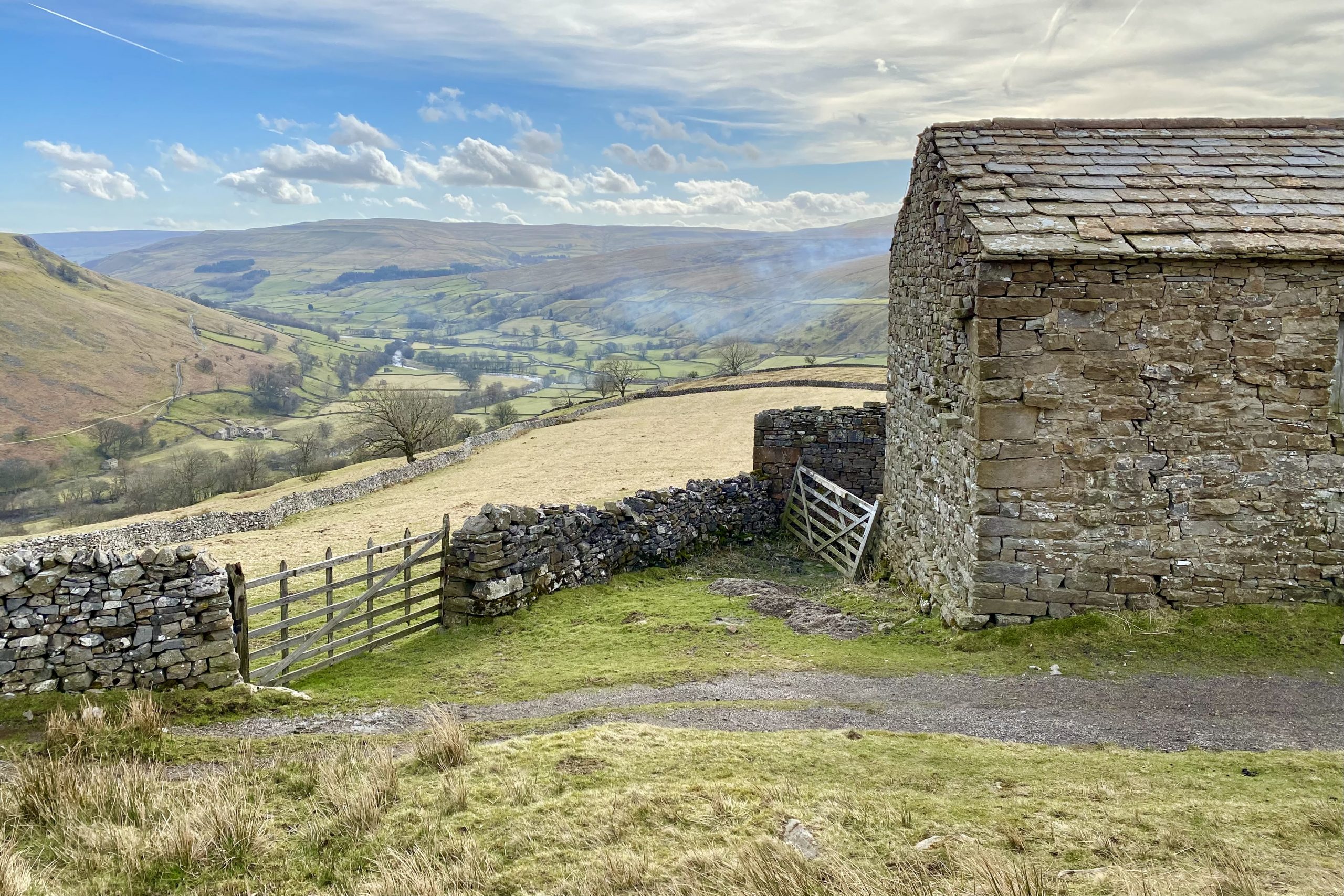
The view of Swaledale from the Pennine Way near Kisdon.
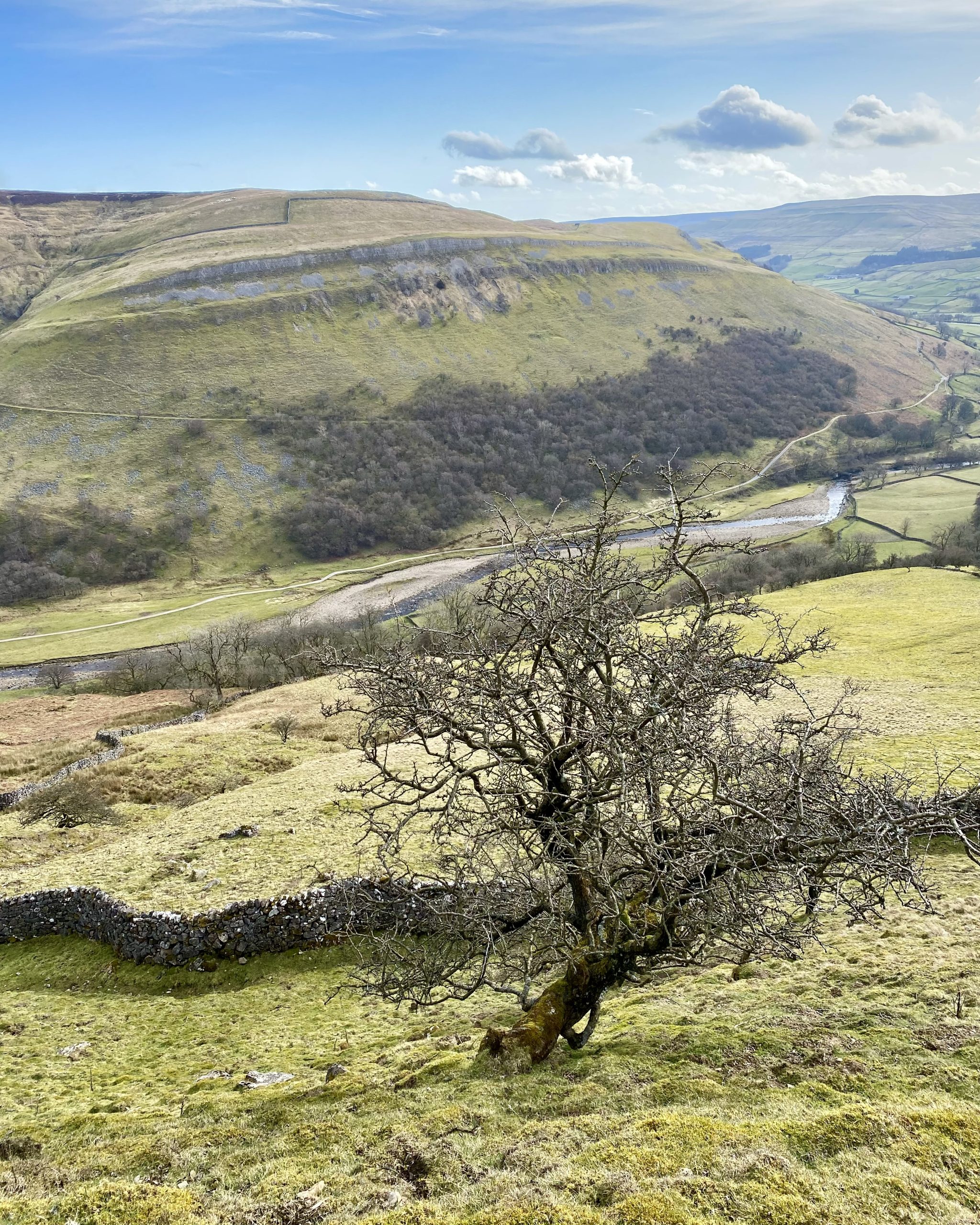
Looking east across the Swaledale valley towards Ivelet Side and Ivelet Wood.
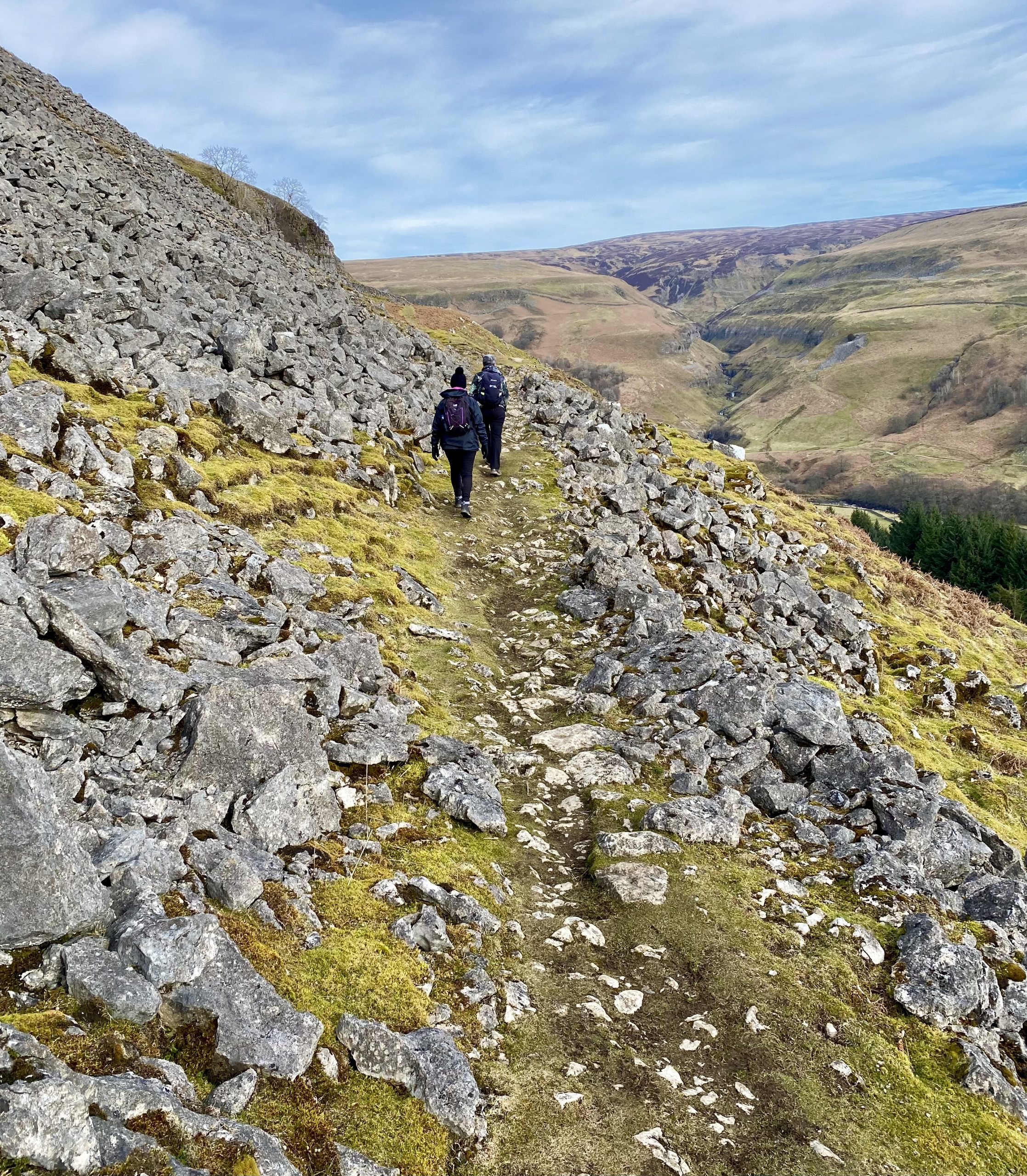
Heading north on the Pennine Way on the east-facing slopes of Kisdon.
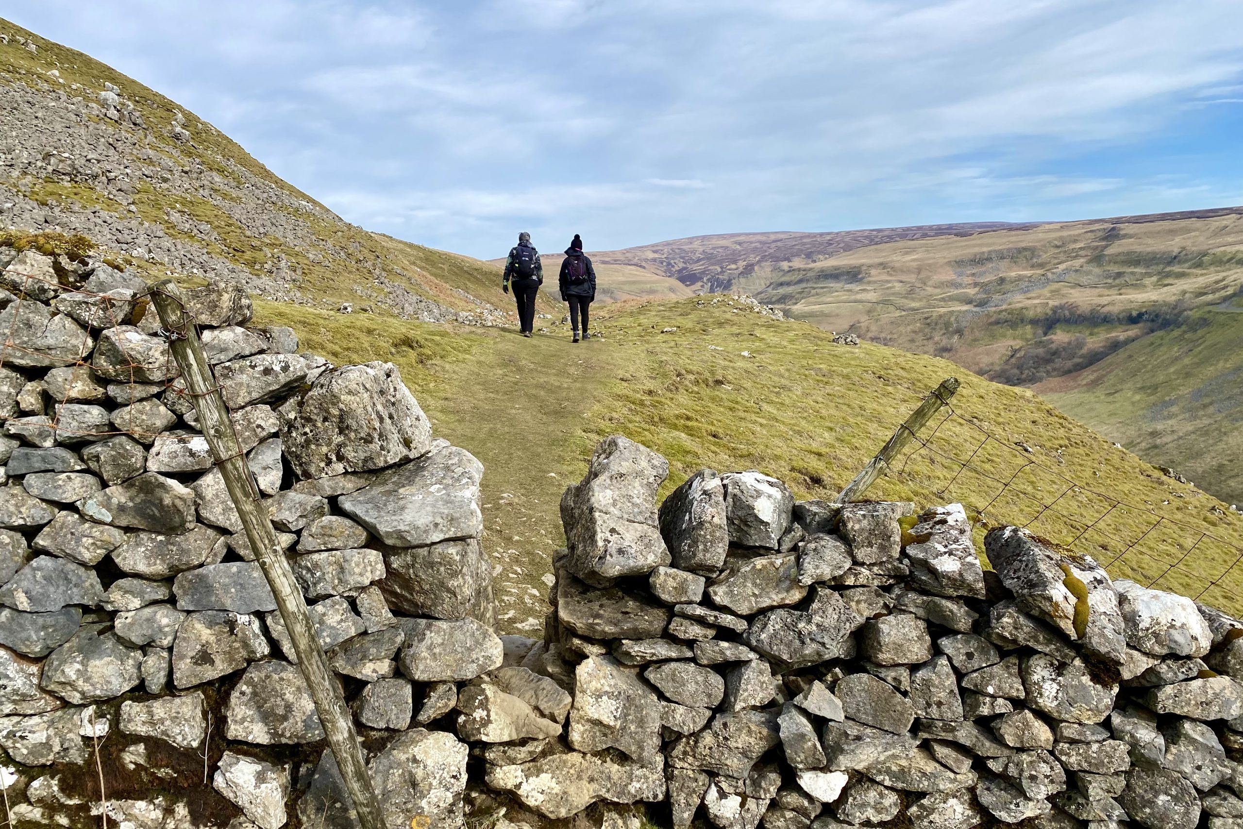
Superb views of the Swaledale valley and surrounding hills.
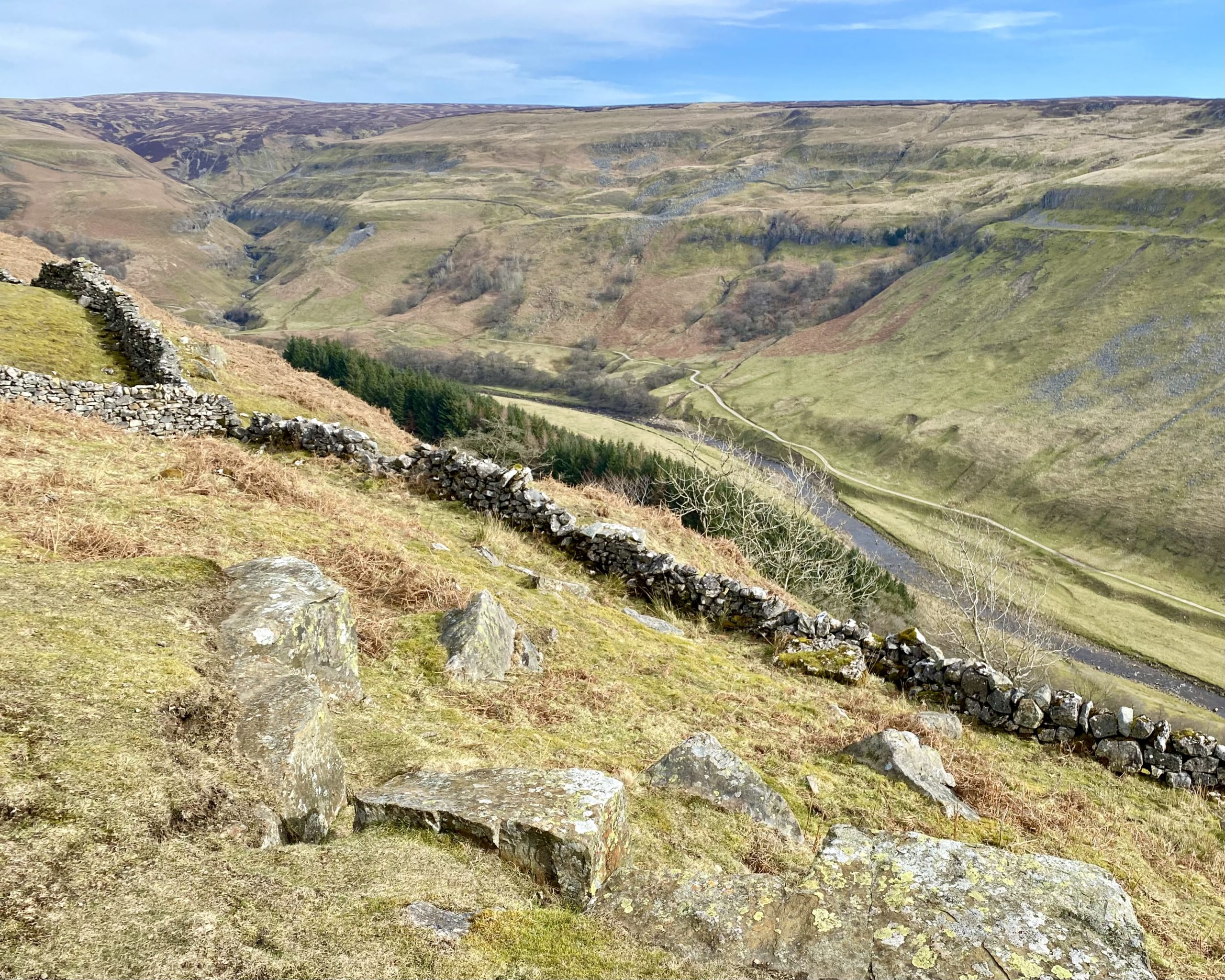
Walking along the Pennine Way above North Gang Scar.
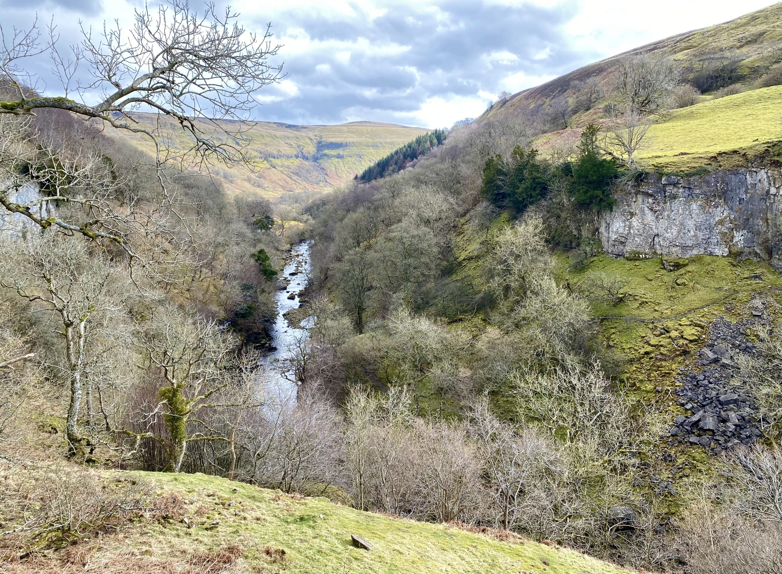
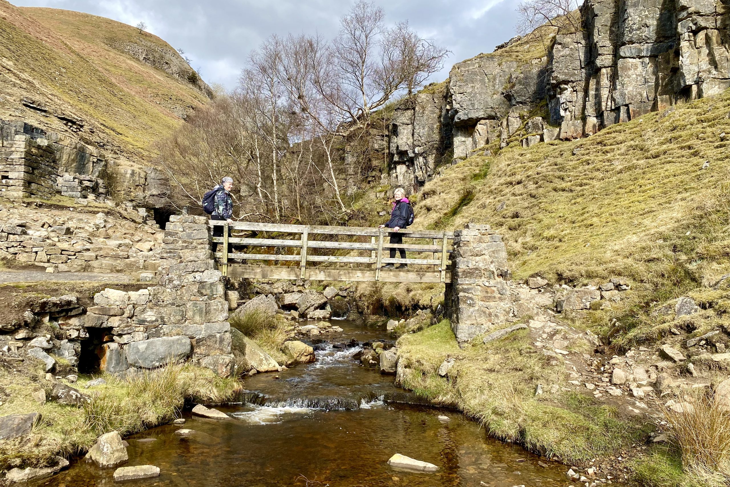
Swinner Gill, a V-shaped valley cut into the hillside by the stream which flows down to join the River Swale.
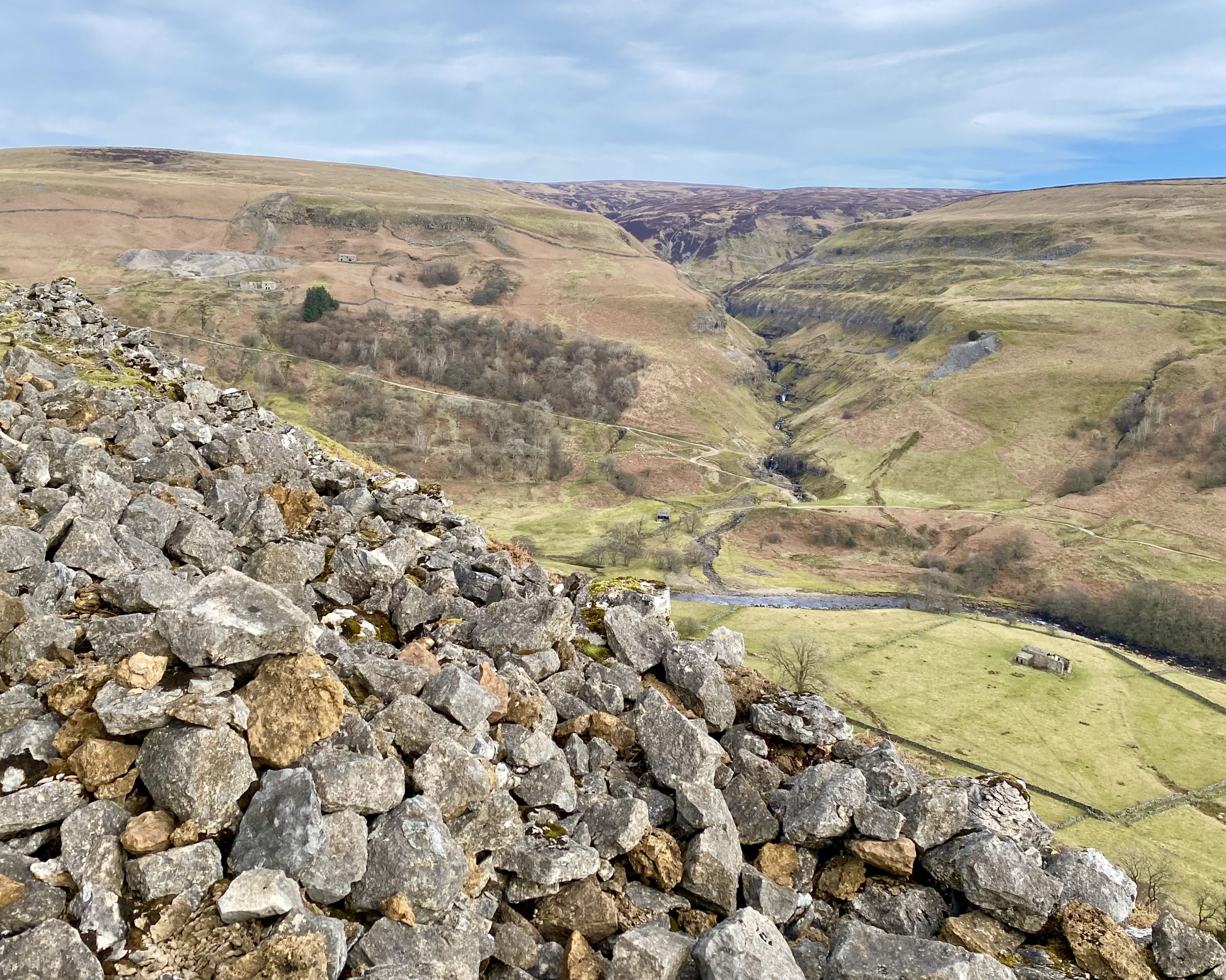
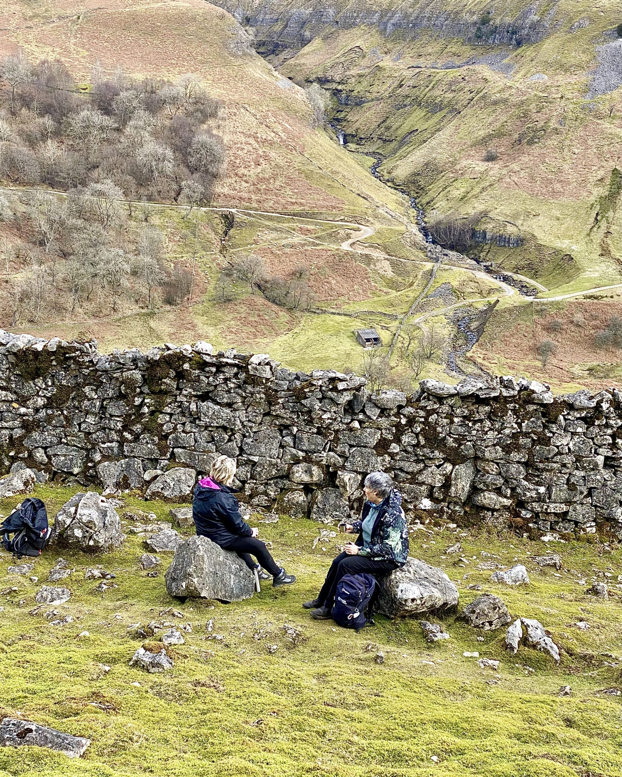
Looking across the steep-sided valley near Kisdon Force. The River Swale can’t be seen from here but is down below, and the waterfall can be clearly heard.
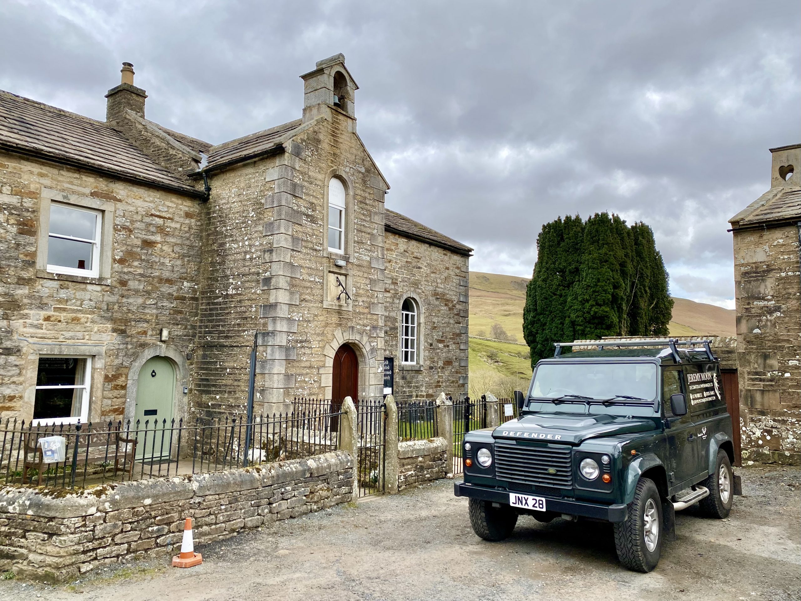
Keld United Reformed Church
A chapel has existed on this site for over 450 years but for a long period of time laid in ruins . The current chapel was founded by the Reverend Edward Stillman as an independent church in 1789. The church joined the United Reformed Church in 1972 and is always open to visitors.
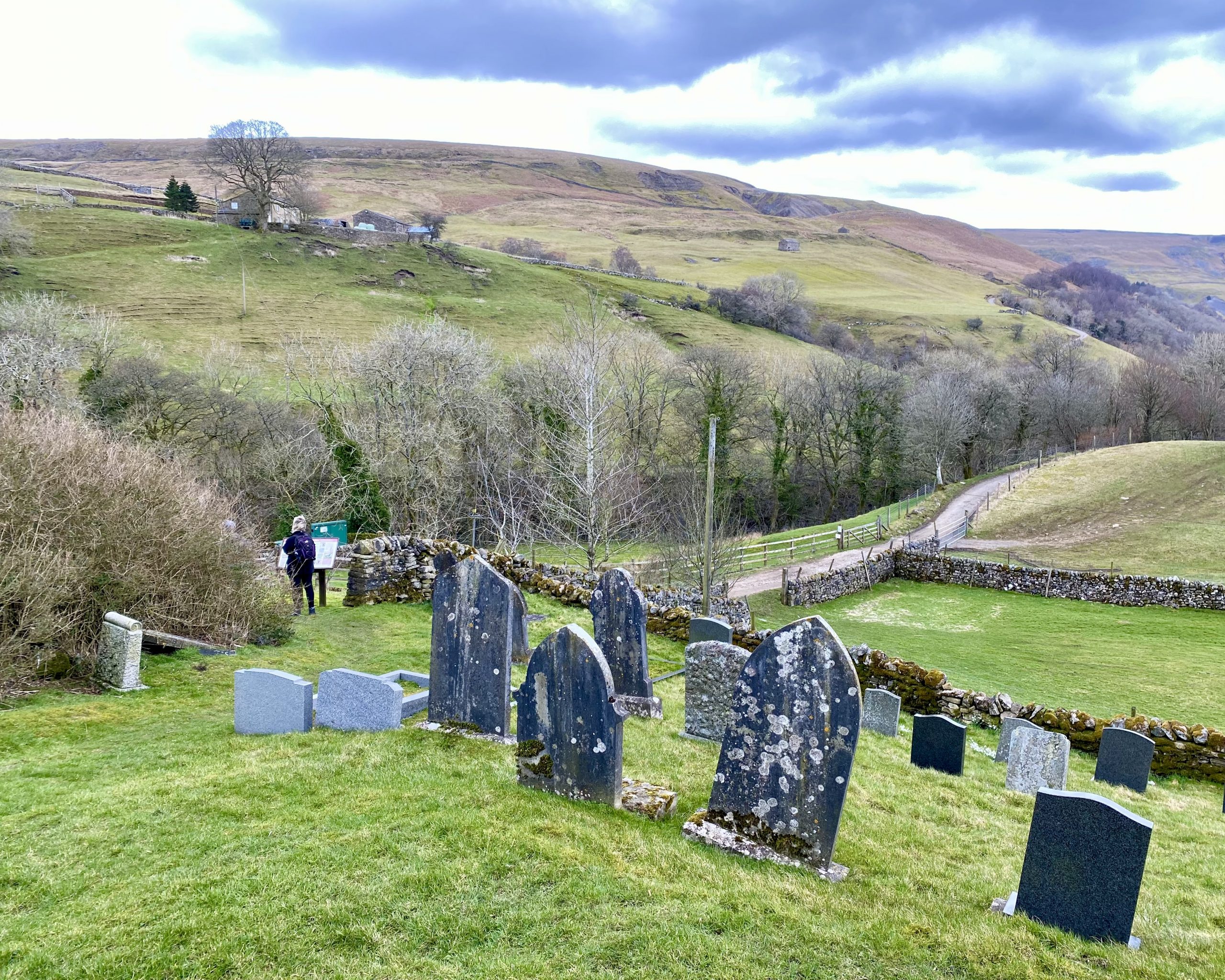
The Keld United Reformed Church graveyard.
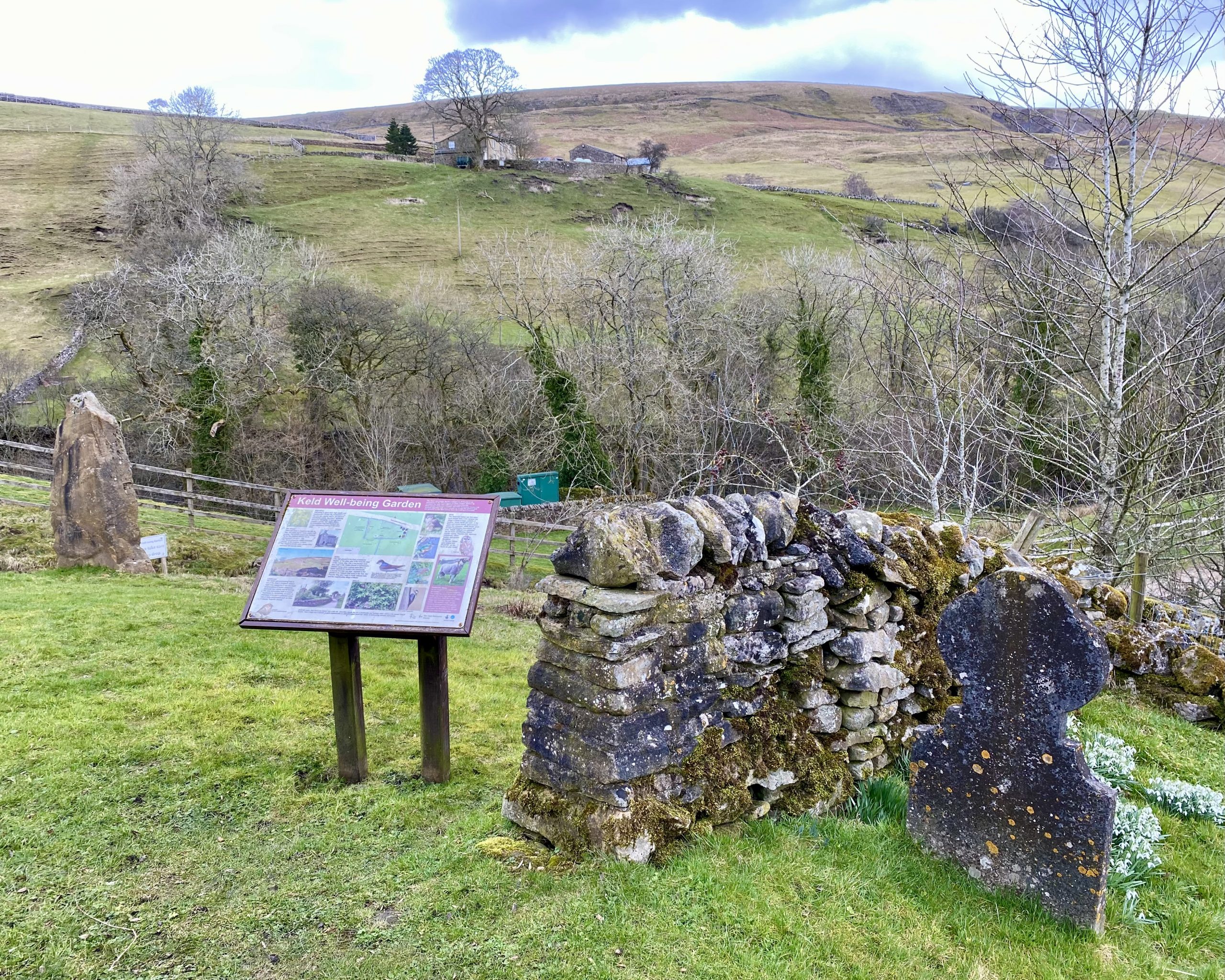
The Keld Well-being Garden
A sign in the garden provides some more information:
Well-being is about more than wealth and employment it is also the environment we live and take leisure time in, our physical and mental health, education, spirituality and social belonging. At Keld we have created a garden that allows visitors to contemplate their Well-being in the unique and special setting of the upper Dale.
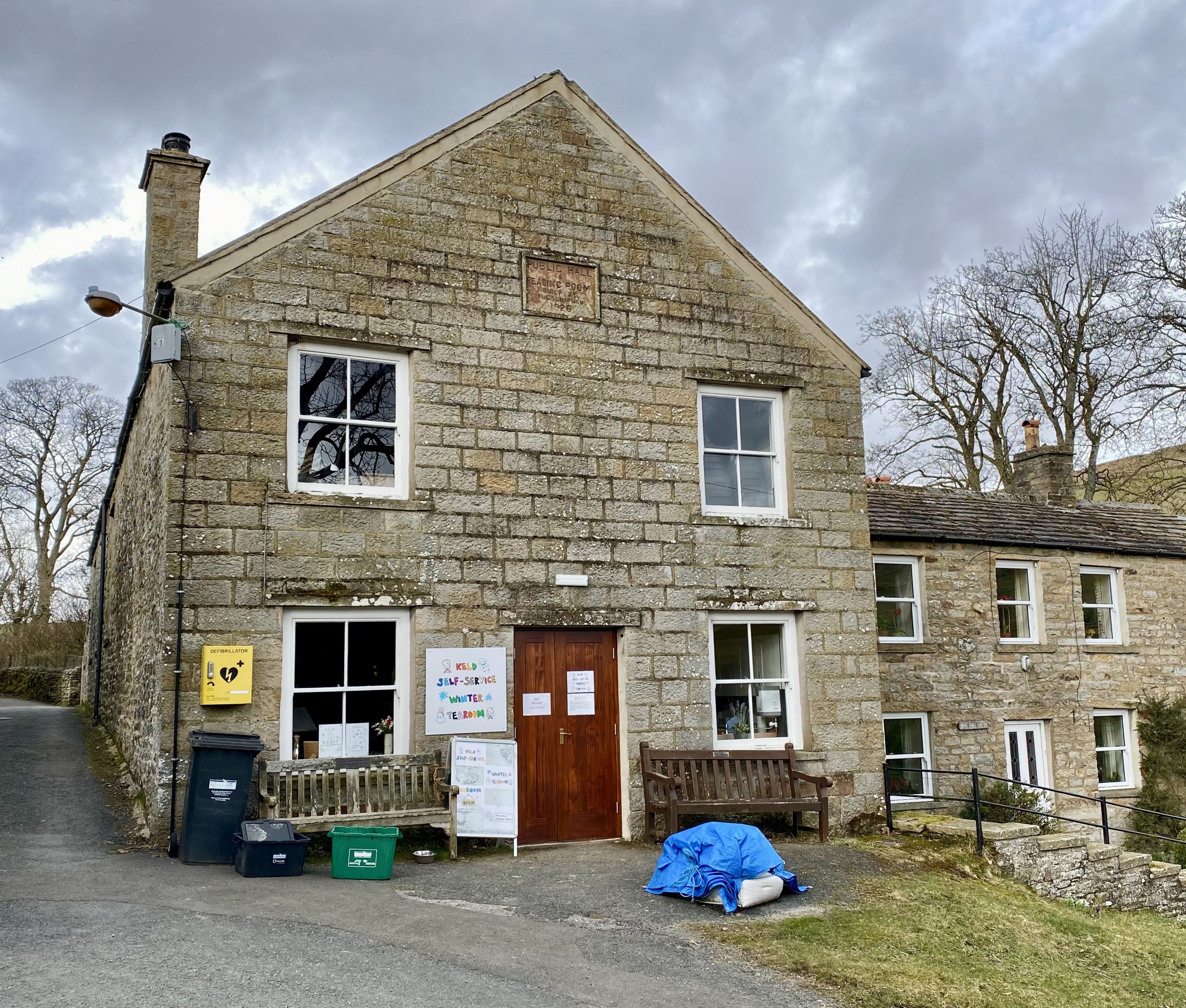
The Keld Resource Centre
Keld Public Hall & Reading Room, built in 1926.
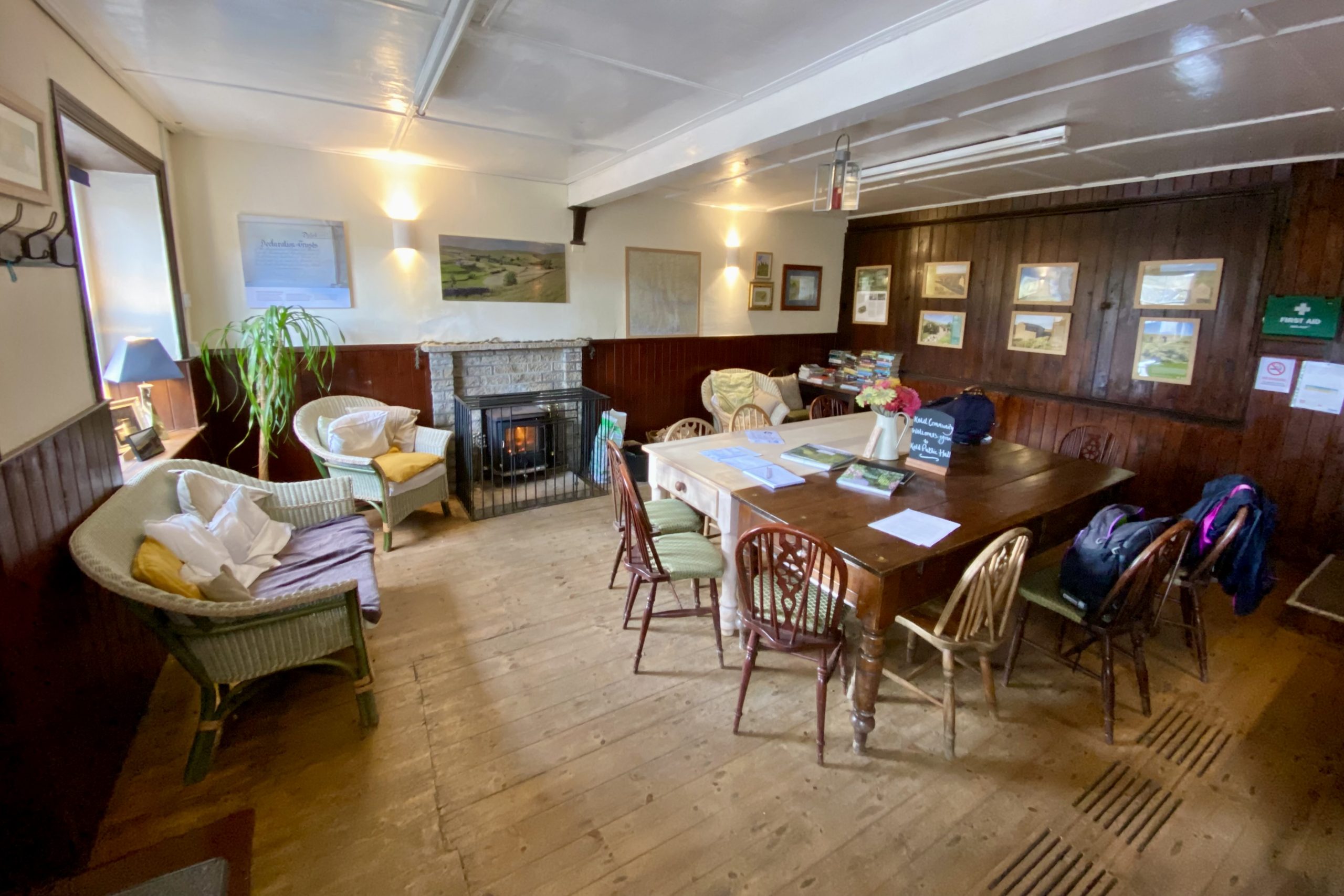
The self-service cafe inside Keld Public Hall. A warm and welcoming place.
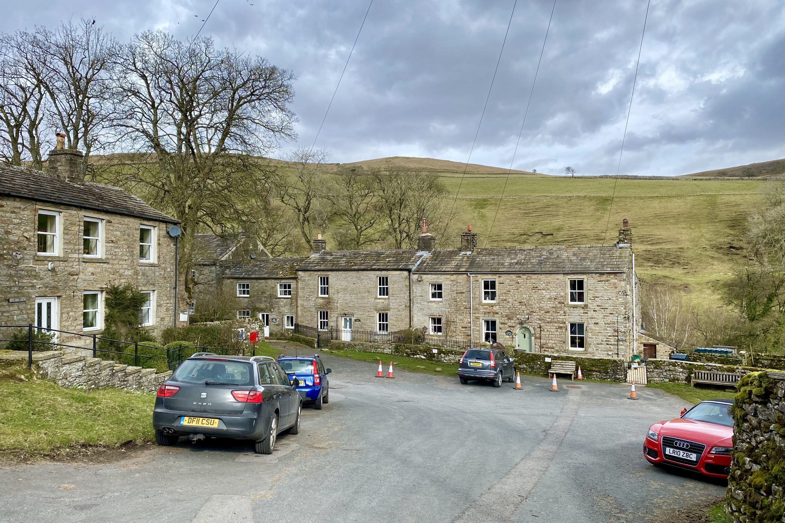
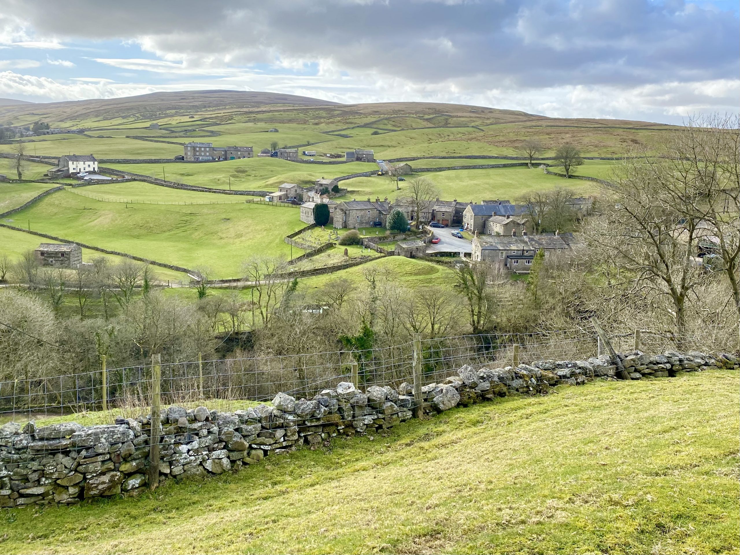
Keld
The name Keld derives from the Norse word Kelda meaning a spring. The village was once called Appletre Kelde (the spring near the apple trees), and apple trees were planted in the Well-being Garden in 2010 to celebrate this.
It is hill farming that has long been the economic underpinning of Keld, but the numbers working the land reduced dramatically during the 20th century, driven by mechanisation and the economic draw of the town. Over the last 30 years the visitor economy has grown enormously and local farmers have diversified by providing services such as B&B, tea shops and camping sites.
Thousands of Swaledale sheep graze the grassland and moors around Keld. Both the male sheep (tups) and the female sheep (ewes) have horns, black faces with white noses, and black legs with white down the front. The breed emerged from a genetic group of horned sheep of which other localised types exist.
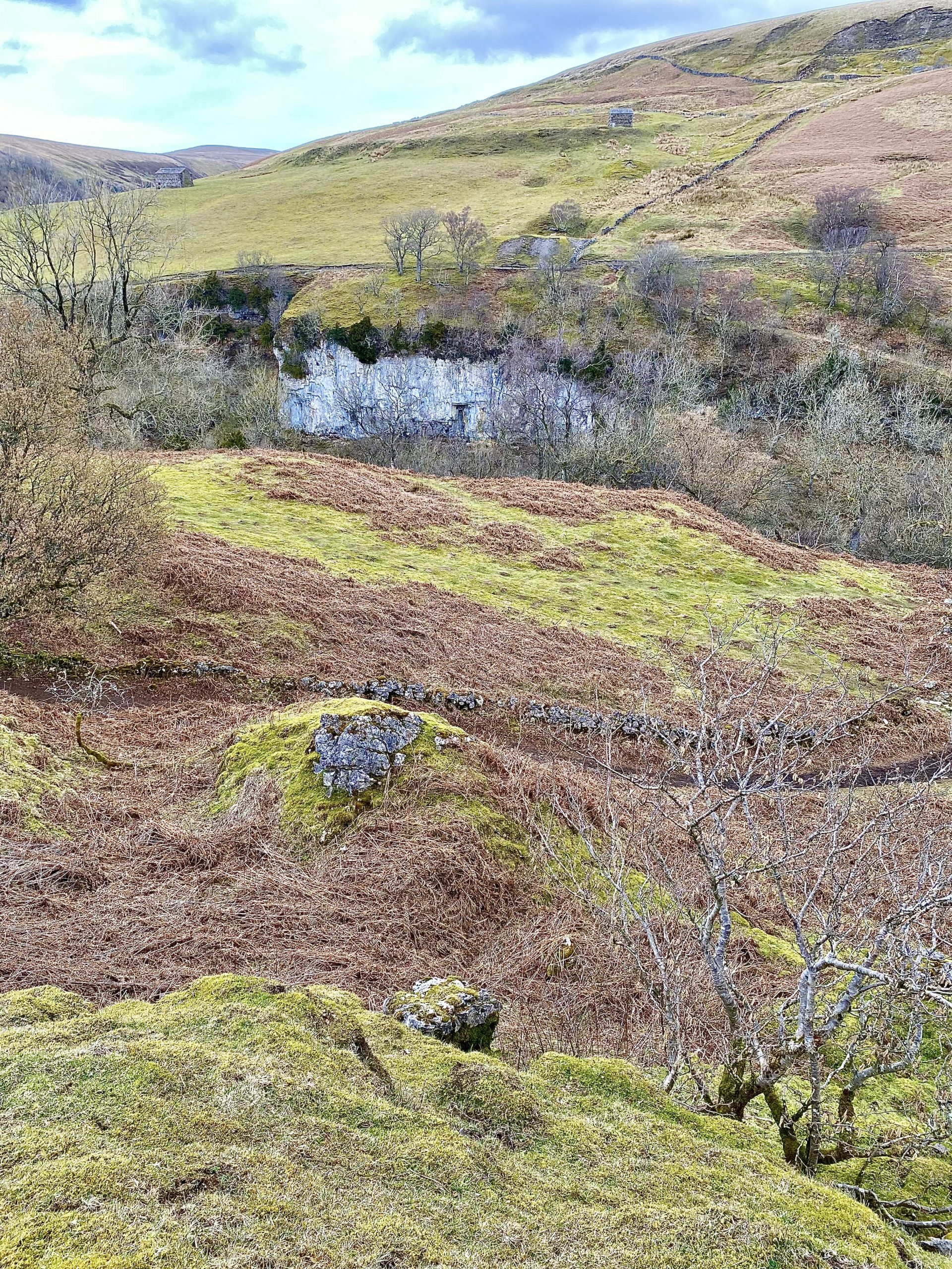
In the 18th and 19th century led mining was a major employer, but working conditions were very poor and life expectancy was short. The hills surrounding Keld contain lead ore (galena) and the eroded remains of lead mining ‘hushes’ can still be seen. A hush is a ravine in the hillside caused by miners releasing dammed-up water to scour away the topsoil and reveal the lead ore veins.
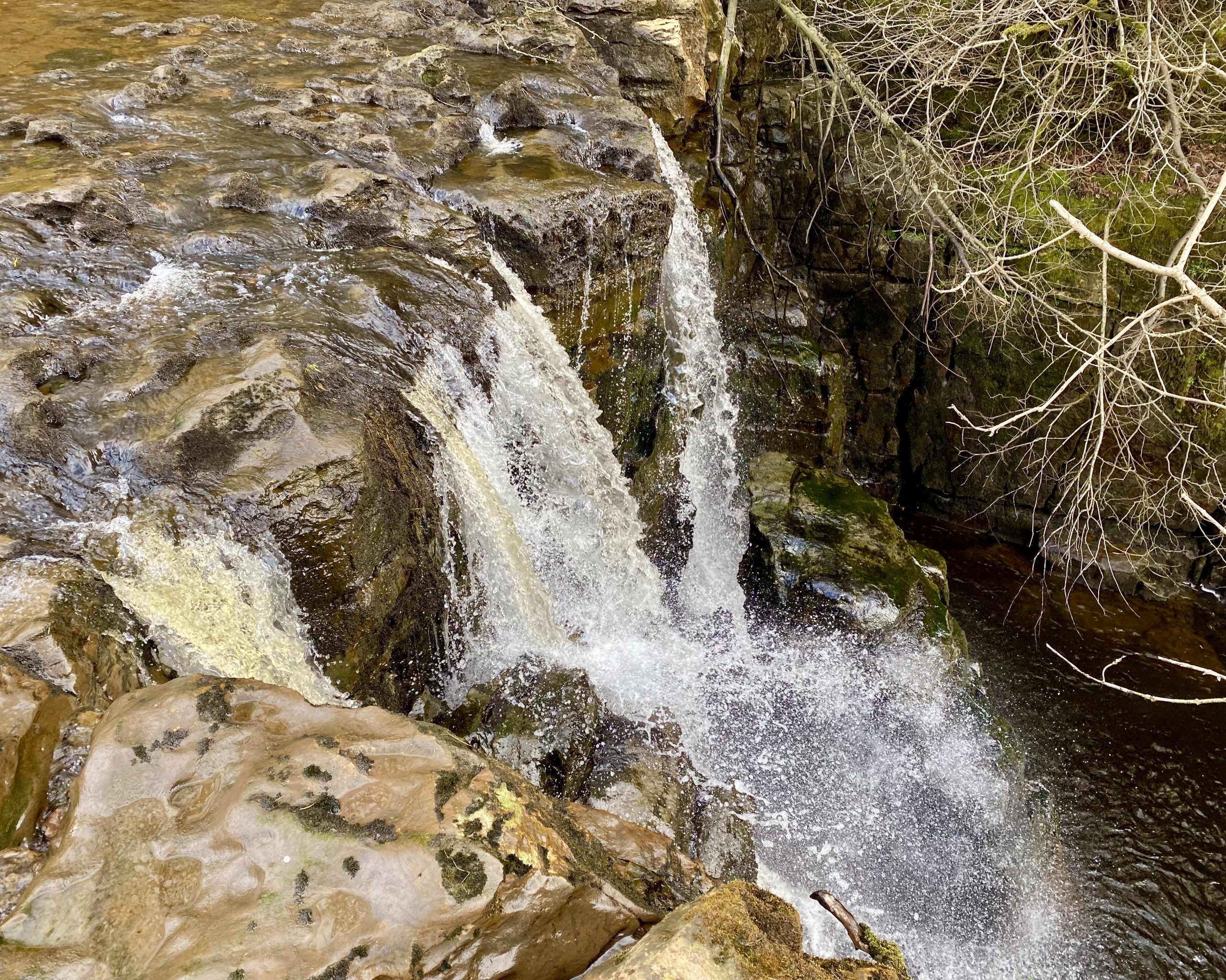
East Gill near its confluence with the River Swale just outside Keld. The waterfalls are often mistaken for the nearby Catrake Force.


Footbridge over the River Swale between Catrake Force and Kisdon Force.

Keld as seen from the bridleway on the north side of the River Swale as we make our way to Currack Force.
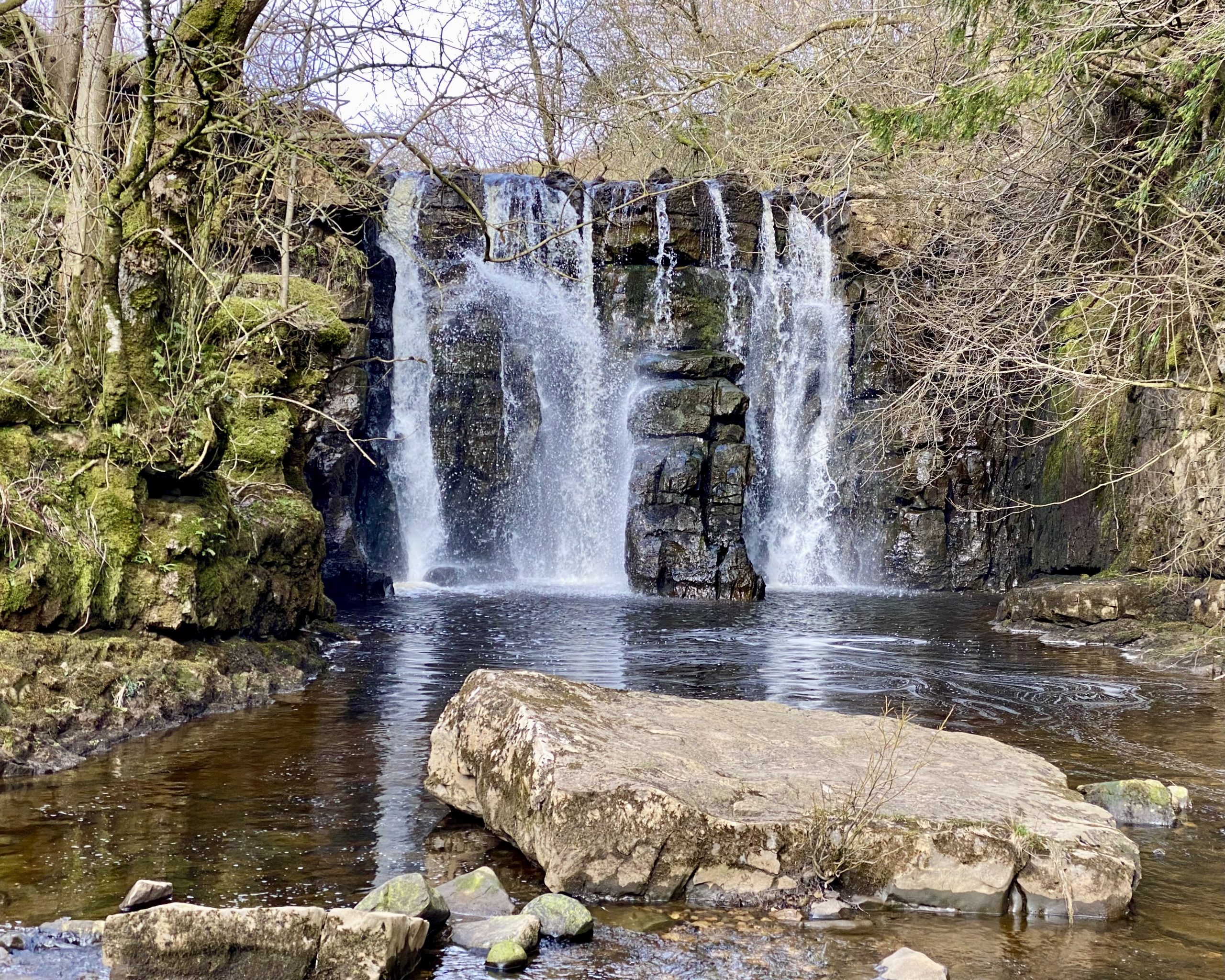
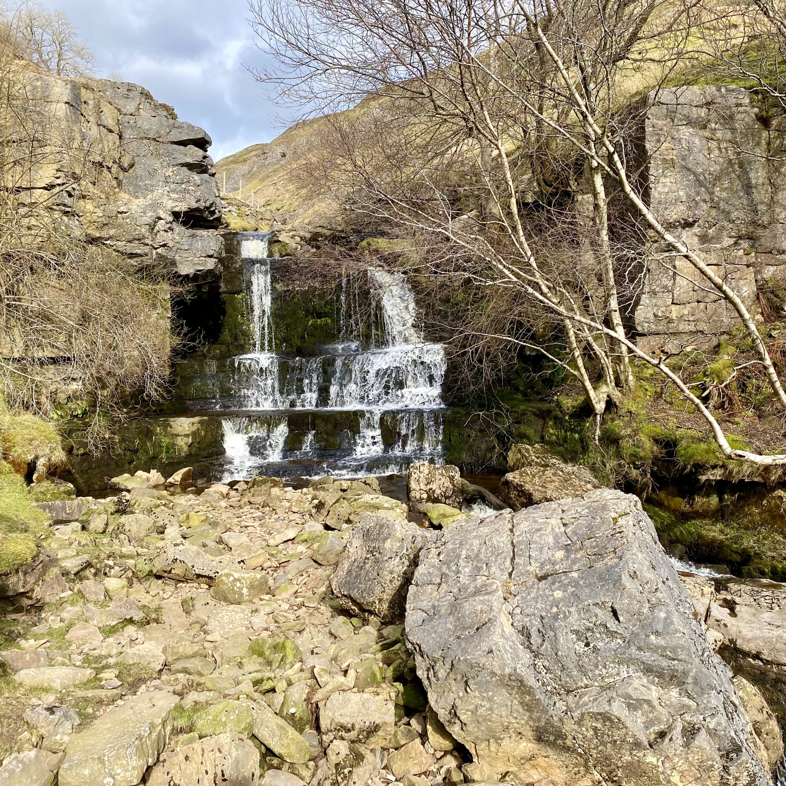
Currack Force, a waterfall on Stonesdale Beck which has its source about three miles to the north near the Tan Hill Inn, Britain’s highest public house at 528 metres (1732 feet) above sea level.

The River Swale flowing south-east through the valley at Kisdon Force.
Beldi Hill.

Water from the deeply cut valley Swinner Gill flows into the River Swale.
Swinner Gill.

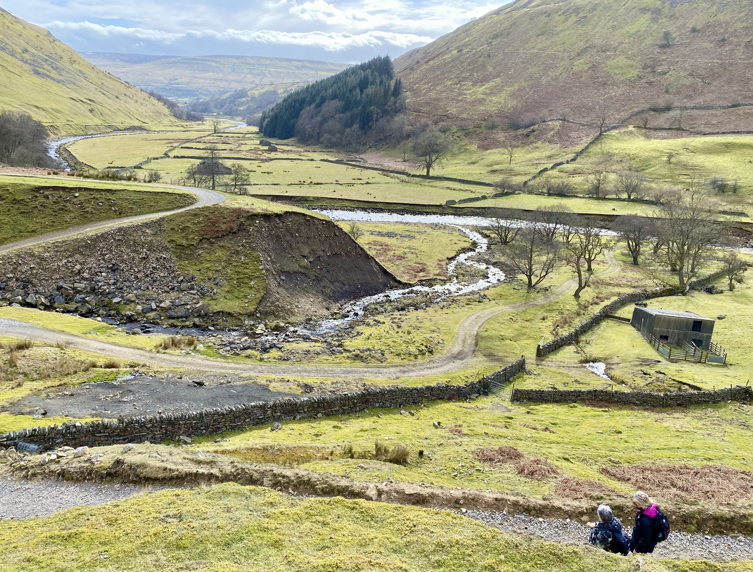
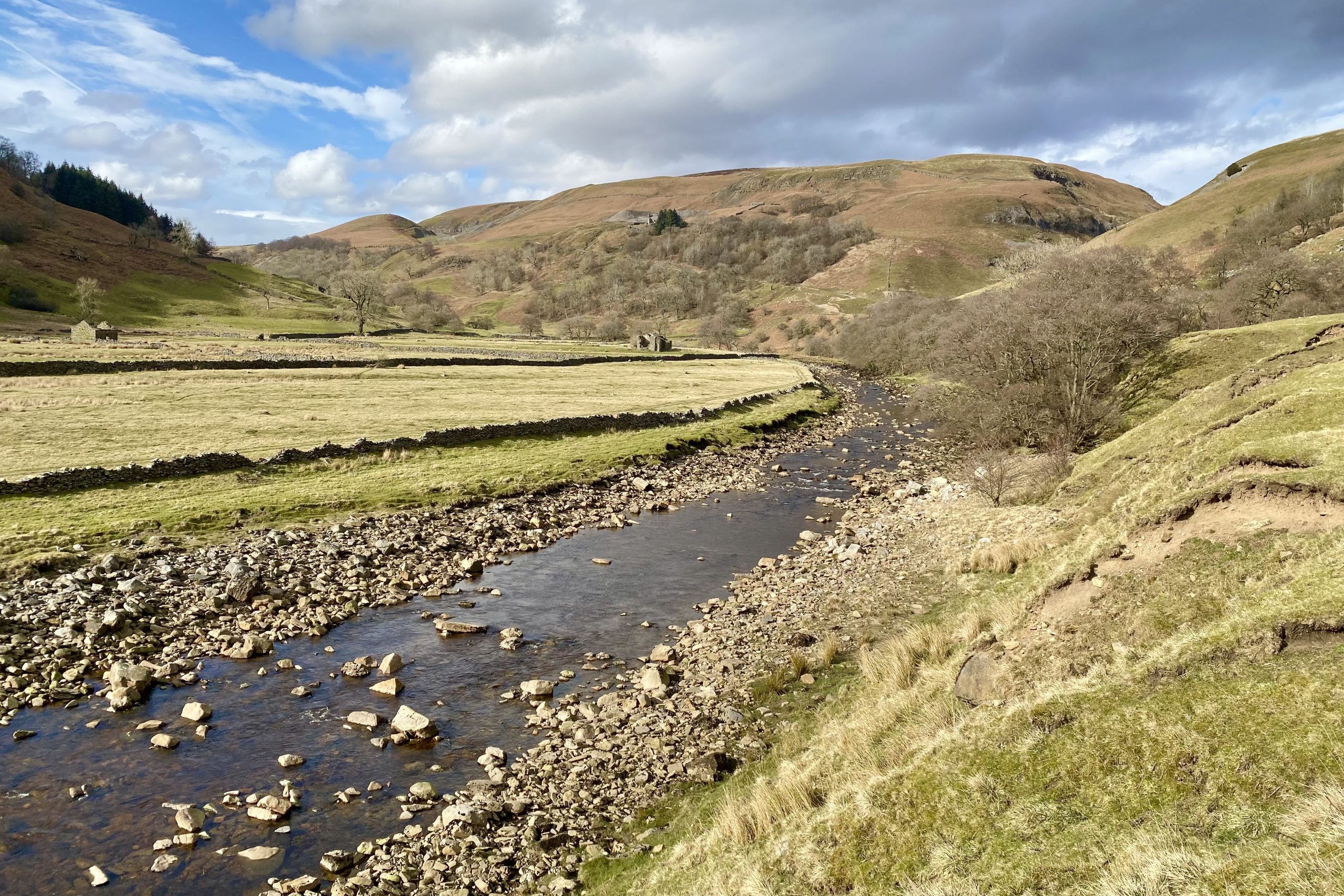
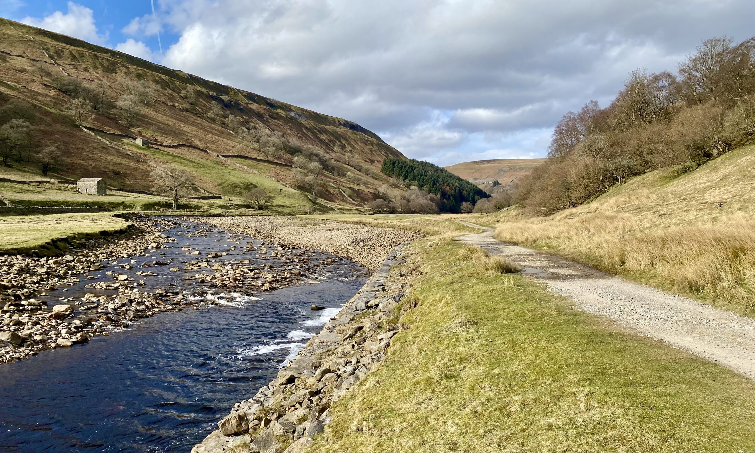
Between Kisdon Side and Swinner Gill the valley floor widens and the River Swale meanders its way through.

Looking back at the picturesque river floodplain.
Ramps Holme Bridge near Ivelet Wood.
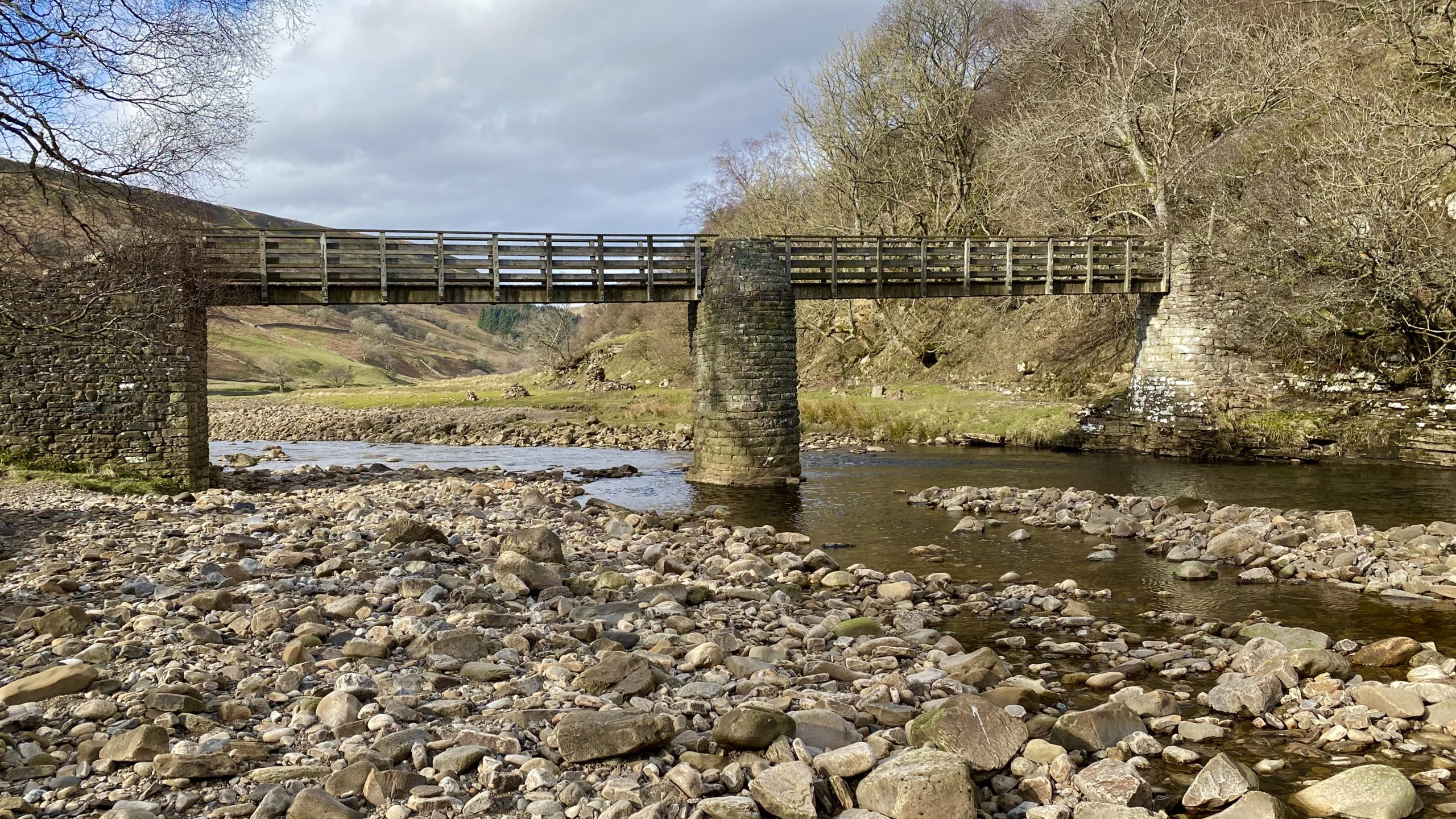
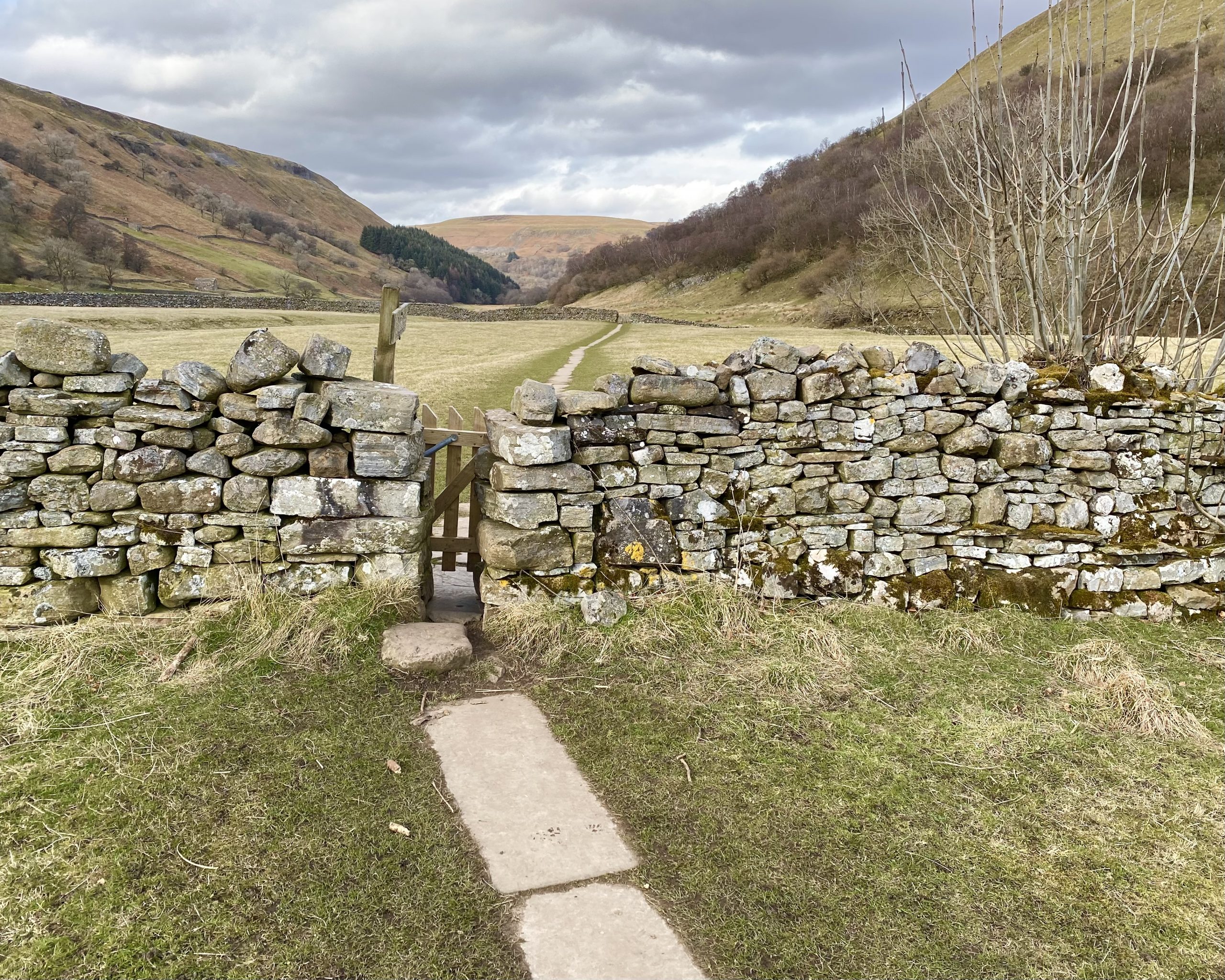
The scenic path between Ramps Holme Bridge and Muker, the subject of many Yorkshire Dales photographs.
St Mary’s Church, Muker, originally built in the 1580s.

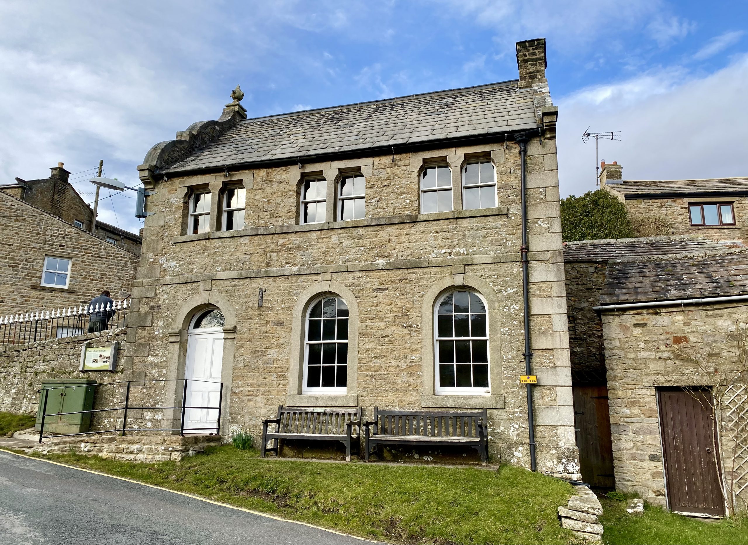
Muker Literary Institute
This unusual building was erected in the 1860s as a reading room for local people, which at the time would have been men only.
Its unusual decorative gable end makes it look quite Flemish in style but little is known about the architect who designed it or why this style was chosen. Reading rooms were built in many villages in the Yorkshire Dales to provide wholesome and educational places for young men to spend their time. It was built by public subscription for around £260 with specifications that the building be “Two Stories high of a neat and substantial character with freestone dressings”.

Working people prized self-education and the list of over 600 books kept in the specially built bookcases upstairs shows what a broad range of works was available, along with a daily newspaper and periodicals which brought the wider world to this remote community.
In later years the building’s function changed although it still remained a community building. From the 1920s to the present day, Muker Silver Band has used the building (currently the upper room) for rehearsals and the ground floor room is now used for meetings and exhibitions.