Reach New Heights with the Urra Moor Walk in North York Moors
Embark on your Urra Moor walk from the forestry car park on Greenhow Avenue, nestled near Ingleby Greenhow in the North York Moors. Greenhow Avenue branches off from the B1257 at Clay Bank, clearly signposted towards Ingleby Greenhow. After parking, wander northwards along the road for a few metres, then veer right onto a forest track.
Continue on this track, initially eastwards, then curving south through the verdant woodlands of Greenhow Plantation. This leisurely walk brings you to a bridleway near Clogger’s Hall. At this point, turn right and climb a grassy path through the forest to reach the summit of Jackson’s Bank. As you transition from woodland to moorland, you’ll encounter the Cleveland Way. Travel east along this route, passing by Round Hill, the loftiest peak of the North York Moors, en route to Bloworth Crossing.

Upon reaching Bloworth Crossing, follow the Cleveland Way northward across Greenhow Bank for roughly two miles until you arrive at a junction near Tidy Brown Hill. Opt for the left fork, which leads down towards the viewpoint atop Ingleby Bank. The path then descends steeply through the forest, culminating at Bank Foot. Here, turn left onto a wide stone track and proceed south under the shelter of Battersby Plantation for about a mile. Next, turn right and cross fields and farmland on a footpath, interspersed with a short stint on a minor road, as you head towards West Wood Farm.
Pass through the farm and reconnect with Greenhow Avenue, turning left to follow the road back to where you began. This Urra Moor walk, extending just over 10 miles, offers a splendid voyage through the North York Moors. Featuring stunning vistas from Urra Moor and along the Cleveland Way, it promises an unforgettable trekking adventure.
Urra Moor Walk: Maps and Tools
Visit either the OS Maps website or the Outdooractive website to view this walking route in greater detail. Both platforms offer a range of features, including the ability to print the route, download it to your device, and export the route as a GPX file. You can also watch a 3D fly-over and share the route on social media.
Urra Moor Walk: Distance, Duration, Statistics
Distance: 10¼ miles
Distance: 16½ kilometres
Duration: 4¾ hours
Ascent: 1363 feet
Ascent: 415 metres
Type: Circular walk
About Urra Moor
Urra Moor lies within the Hambleton District of North Yorkshire. It stands as the highest moor in the North York Moors National Park. The term ‘Urra Moor’ refers to the entire moor, whereas the peak is named Round Hill. This summit reaches an elevation of 454 metres (1490 feet), with a prominence of 409 metres (1342 feet). It is classified as a Marilyn, and the Ordnance Survey grid reference for Round Hill is NZ 594 015.
The name combines Old English and Old Norse – ‘horh’ and ‘haugr’ – meaning ‘The Dirty Hill.’ At the summit of Round Hill, there is a triangulation pillar. This pillar is situated approximately one quarter of the way into the Urra Moor walk I have described on this page. A favoured route to Urra Moor starts from the car park at Clay Bank on the B1257, just south of Great Broughton. From there, walkers ascend eastward up stone steps, following the Cleveland Way along Carr Ridge. The Cleveland Way comes within a few metres of the triangulation pillar at Round Hill.
Recommended Ordnance Survey Map
The best map to use on this walk is the Ordnance Survey map of the North York Moors Western Area, reference OS Explorer OL26, scale 1:25,000. It clearly displays footpaths, rights of way, open access land and vegetation on the ground, making it ideal for walking, running and hiking. The map can be purchased from Amazon in either a standard, paper version or a weatherproof, laminated version, as shown below.
Urra Moor Walk: My Photos
Looking back as we climb the grassy path through Greenhow Plantation to the top of Jackson’s Bank.

The view from Jackson’s Bank. Farmland around Ingleby Greenhow is enclosed by a U-shaped section of the Cleveland Hills.

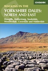
Walking in the Yorkshire Dales with 43 Circular Routes
AD This Cicerone guidebook includes 43 circular walks exploring valleys, hills, and moors between Kirkby Stephen and Pateley Bridge. With OS maps, local highlights, and routes ranging from 3–11 miles, it is a year-round companion for walkers of all abilities.
Lynn looks north and spots Roseberry Topping in the distance.

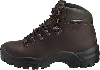
Grisport Unisex Adult Peaklander Hiking Boots
AD The Grisport Unisex Adult Peaklander Hiking Boots are crafted in Italy with a durable waxed leather upper, Spotex breathable lining, and a reliable Track-on rubber sole. Waterproof and weighing just 1120g, they offer comfort, resilience, and dependable performance on demanding trails.
The view north-west from the Cleveland Way towards another length of the Cleveland Hills which links Hasty Bank, Cold Moor, Cringle Moor and Carlton Moor. The walk along Hasty Bank is described in my Wainstones walk from Chop Gate.

Triangulation pillar on Round Hill, Urra Moor, height 454 metres (1490 feet). This is the highest point in the North York Moors National Park.

Grisport Unisex Adult Peaklander Hiking Boots
AD The Grisport Unisex Adult Peaklander Hiking Boots are crafted in Italy with a durable waxed leather upper, Spotex breathable lining, and a reliable Track-on rubber sole. Waterproof and weighing just 1120g, they offer comfort, resilience, and dependable performance on demanding trails.
The Round Hill triangulation pillar is about one-quarter of the way round this Urra Moor walk.

Bloworth Crossing.

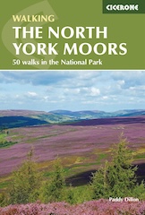
Fifty Walks Across the Beautiful North York Moors National Park
AD Discover 50 routes across the North York Moors, from short easy strolls to challenging high-level hikes. With OS maps, route descriptions, and local highlights, it also includes the legendary 40-mile Lyke Wake Walk, described in four accessible stages.
It’s August and the distinctive purple tones of the blossoming heather are lovely.

Heading along the moorland track to Ingleby Bank. Roseberry Topping is visible on the horizon in the centre of the picture.

Fifty Walks Across the Beautiful North York Moors National Park
AD Discover 50 routes across the North York Moors, from short easy strolls to challenging high-level hikes. With OS maps, route descriptions, and local highlights, it also includes the legendary 40-mile Lyke Wake Walk, described in four accessible stages.
Amazing views from Ingleby Bank across North Yorkshire and the North York Moors. At Ingleby Bank we’re about two-thirds of the way round our Urra Moor walk.


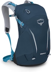
Osprey Hikelite Unisex Backpack for Comfortable and Lightweight Hiking
AD The Osprey Hikelite backpack combines lightweight design with practical features, including a breathable mesh back panel, soft webbing straps, and stretch mesh water bottle pockets. With zipped storage and an organiser compartment, it is ideal for day hikes and outdoor use.

There’s a footpath in there somewhere! But in the summer bracken often takes over. Not to worry, there’s an alternative route nearby.

Osprey Hikelite Unisex Backpack for Comfortable and Lightweight Hiking
AD The Osprey Hikelite backpack combines lightweight design with practical features, including a breathable mesh back panel, soft webbing straps, and stretch mesh water bottle pockets. With zipped storage and an organiser compartment, it is ideal for day hikes and outdoor use.
We encountered Bank Foot’s very own ‘Grim Sheeper’ three-quarters of the way into our Urra Moor walk.


