Discover Two Walks in Wharfedale with Scenic Hillside and River Views
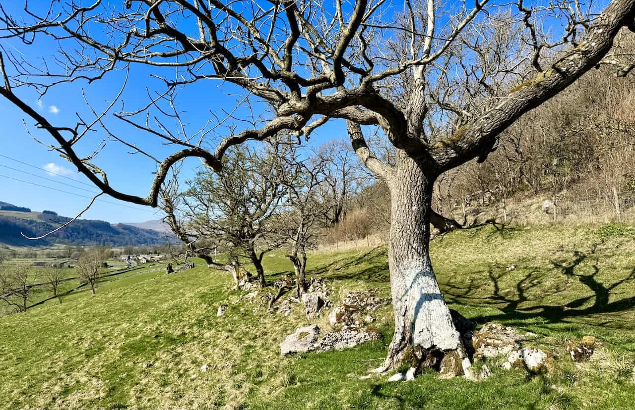
If you’re looking for scenic winter routes in the Yorkshire Dales, these two walks in Wharfedale are ideal. Both are a little over 4 miles long and usually take around a couple of hours, excluding stops. Each route follows a gentle hillside path on the eastern side of Upper Wharfedale before returning along the peaceful River Wharfe. They’re not especially high, but they’re high enough for superb views across the dale.
Both walks start in welcoming Dales villages, each with a good parking area, public toilets, and pubs or cafés for warming up afterwards. They’re two excellent short options for crisp winter days, offering wide, uplifting views without any major climbs. The route maps in this post show clearly where the hillside paths and riverside stretches run, making navigation straightforward. If you enjoy walks in Wharfedale, these two routes are well worth adding to your list.
Taken together, they make a fine introduction to gentle hillside and riverside walking in this part of the Dales, and are ideal for anyone looking to explore more walks in Wharfedale without tackling demanding terrain.

Walking in the Yorkshire Dales with 43 Circular Routes
AD This Cicerone guidebook includes 43 circular walks exploring valleys, hills, and moors between Kirkby Stephen and Pateley Bridge. With OS maps, local highlights, and routes ranging from 3–11 miles, it is a year-round companion for walkers of all abilities.
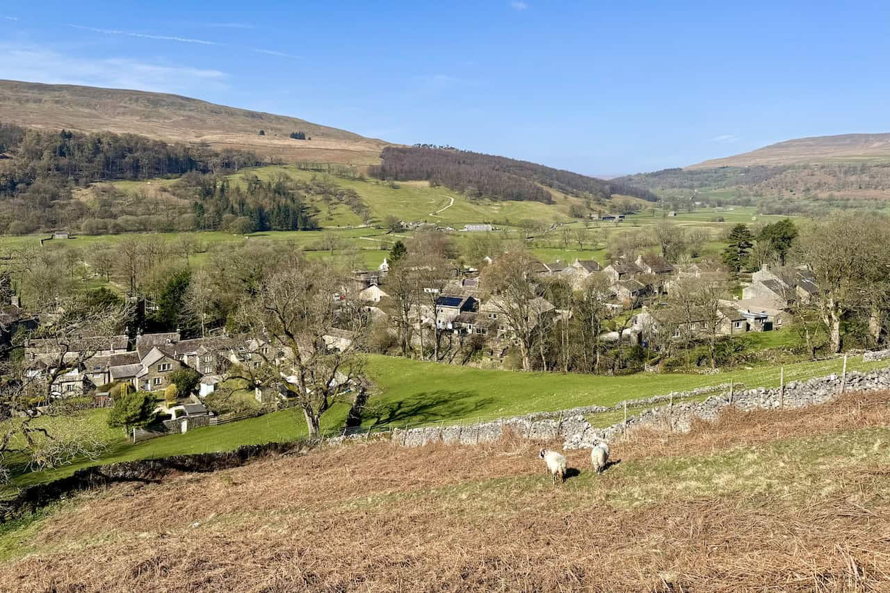
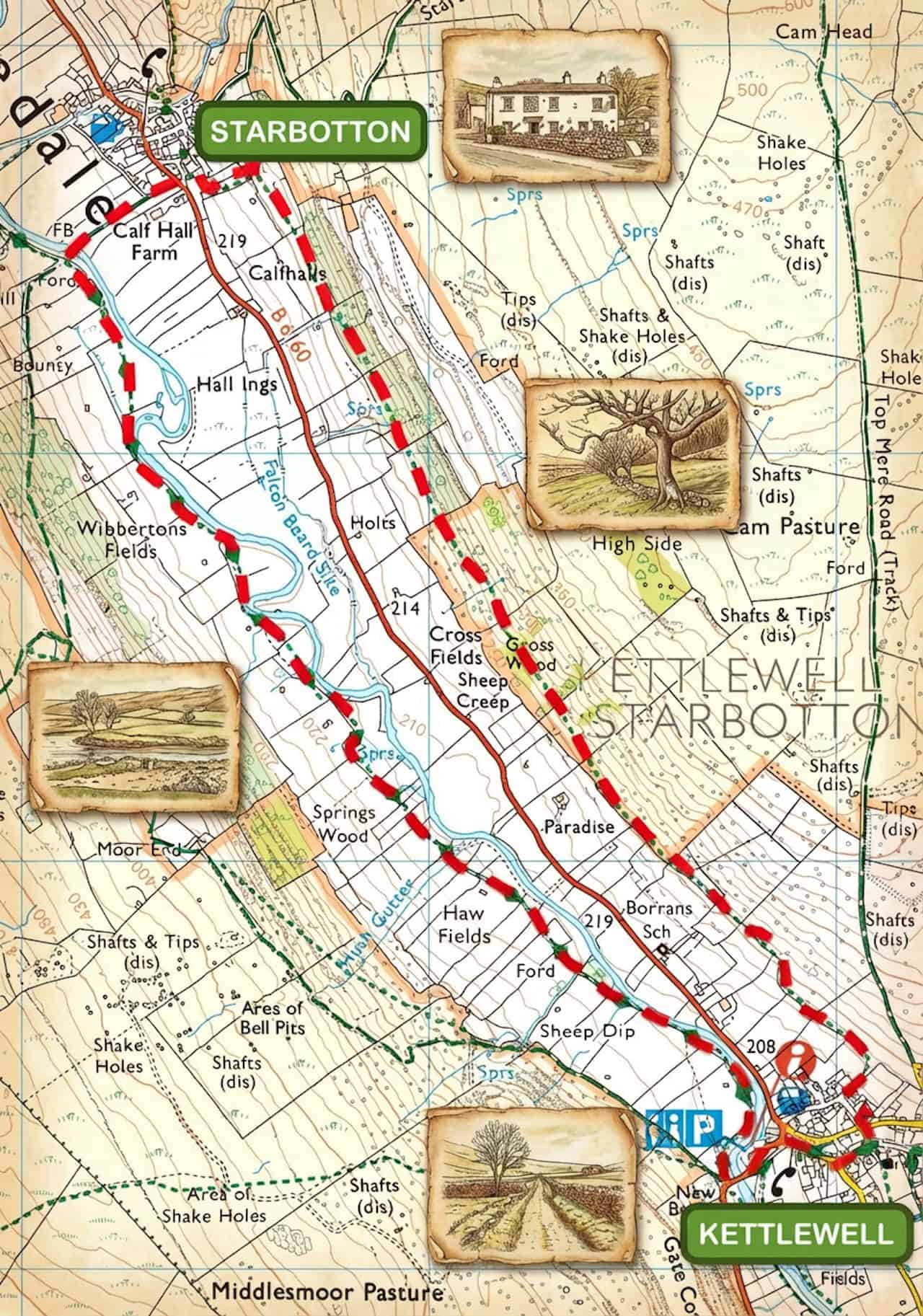
Buckden to Starbotton Walk
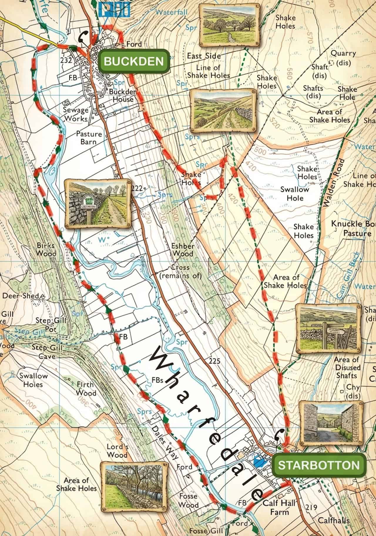
This Buckden to Starbotton walk begins in Buckden. Start from the Yorkshire Dales National Park car park at the northern end of the village. It’s a pay-and-display site behind the former St Michael’s School Room, with plenty of parking spaces and public toilets.

Grisport Unisex Adult Peaklander Hiking Boots
AD The Grisport Unisex Adult Peaklander Hiking Boots are crafted in Italy with a durable waxed leather upper, Spotex breathable lining, and a reliable Track-on rubber sole. Waterproof and weighing just 1120g, they offer comfort, resilience, and dependable performance on demanding trails.
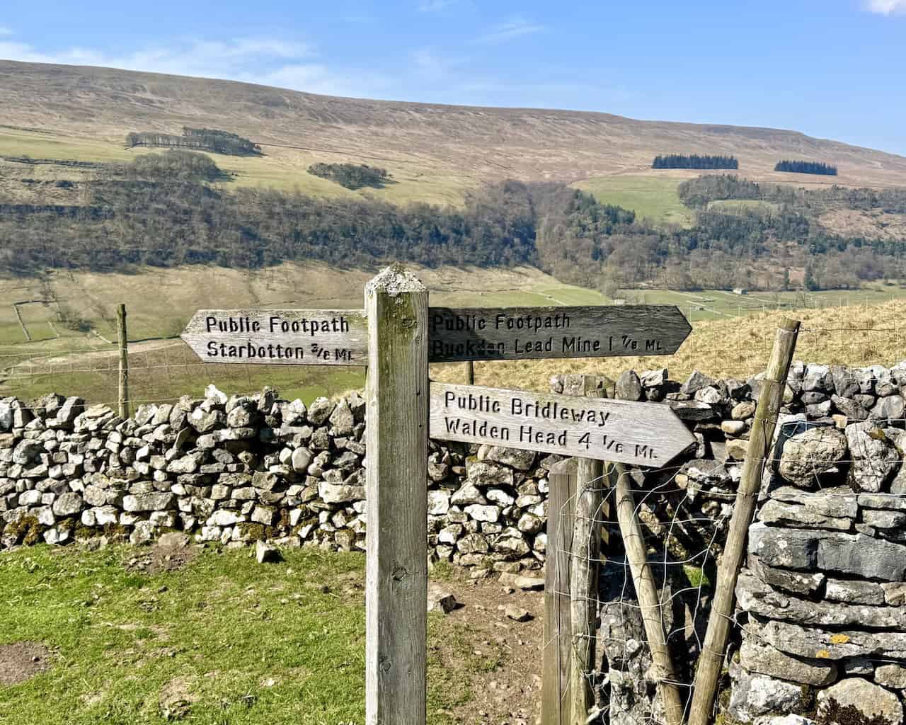
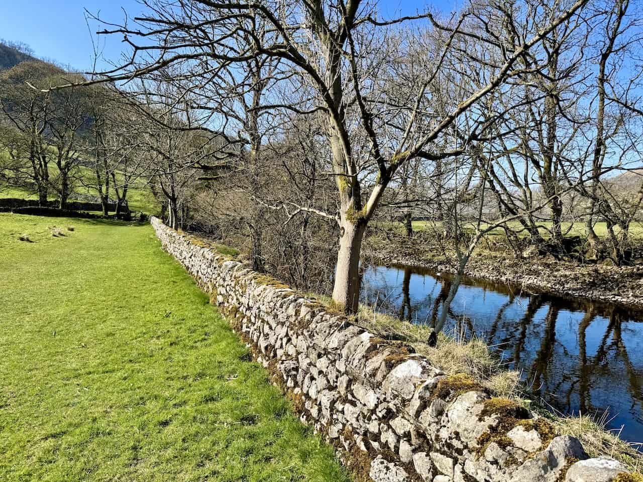
From the car park, make your way to the northern end, where you’ll spot a gate and a signpost pointing towards Cray High Bridge and Buckden Pike. Go through the gate and turn right, following the path signposted to Buckden Lead Mine and Starbotton. Keep to the path beside the dry-stone wall until you reach Buckden Beck. Cross the beck, head uphill, and turn right again, continuing on the signposted path towards Starbotton and the lead mine.
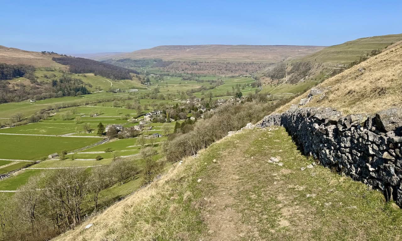
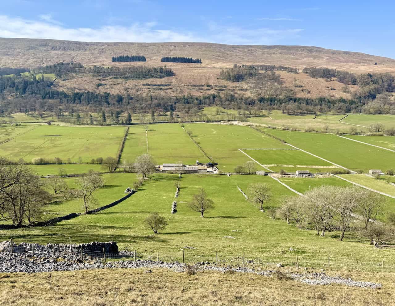
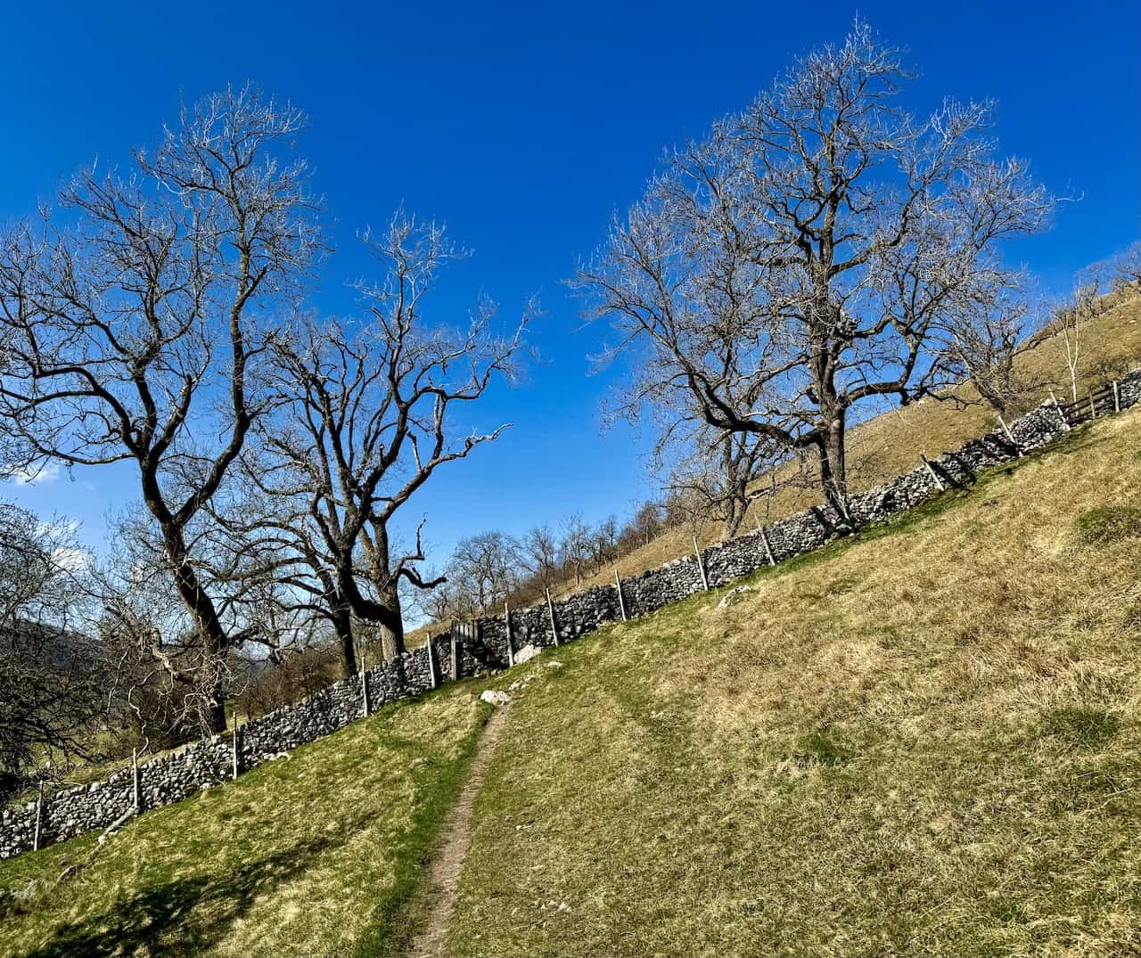
As you continue south, you’ll follow a grassy path high above the village, which remains visible in the valley to your right. The route becomes stonier and begins to climb more steeply. After roughly three-quarters of a mile, it eases back to grass and swings left in a broad U-bend. This section is typical of many walks in Wharfedale, offering wide views with steady, manageable gradients. Follow the signpost to the lead mine and stay beside the dry-stone wall until you reach a wooden post marked with yellow public footpath arrows.
Grisport Unisex Adult Peaklander Hiking Boots
AD The Grisport Unisex Adult Peaklander Hiking Boots are crafted in Italy with a durable waxed leather upper, Spotex breathable lining, and a reliable Track-on rubber sole. Waterproof and weighing just 1120g, they offer comfort, resilience, and dependable performance on demanding trails.
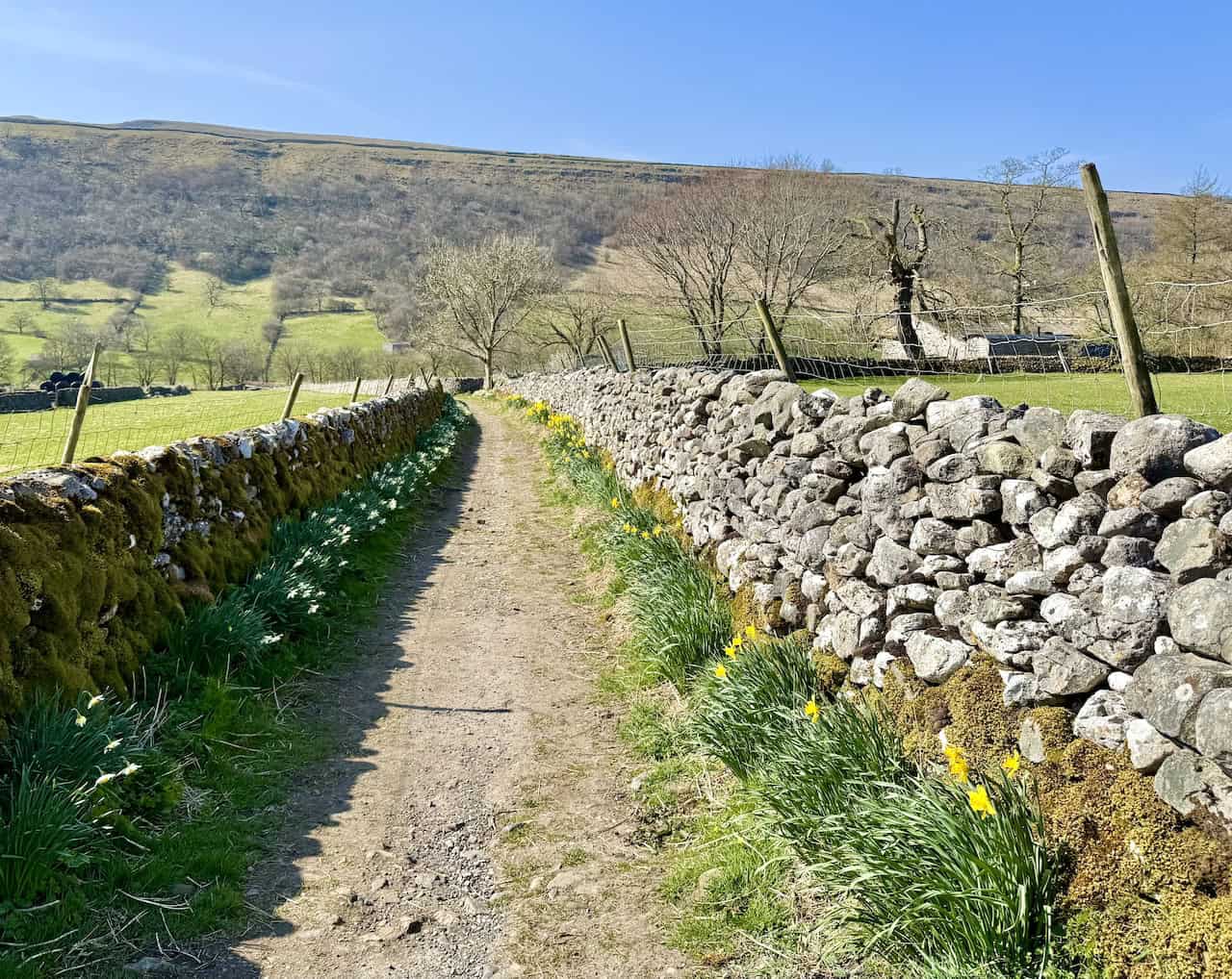
Turn right here and cross the hillside. Cross a stile, then continue south along a clear grassy footpath. This stretch lasts for about one and three-quarter miles, with regular waymarkers to guide you. The path then gradually descends towards the village of Starbotton.
When you reach a stone track, turn right and follow it downhill. The track becomes concrete and zigzags into the heart of Starbotton. Cross the stone bridge over Cam Gill Beck, then immediately turn right along the tarmac lane leading to the B6160. Turn left onto the road and continue through the village.

Fifty Walks Across the Beautiful North York Moors National Park
AD Discover 50 routes across the North York Moors, from short easy strolls to challenging high-level hikes. With OS maps, route descriptions, and local highlights, it also includes the legendary 40-mile Lyke Wake Walk, described in four accessible stages.
Once you’ve passed through Starbotton, turn right onto a bridleway signposted to Arncliffe, Kettlewell, and Buckden. Follow it to the footbridge over the River Wharfe. Cross the bridge and, on the far side, turn right to join the Dales Way back to Buckden.
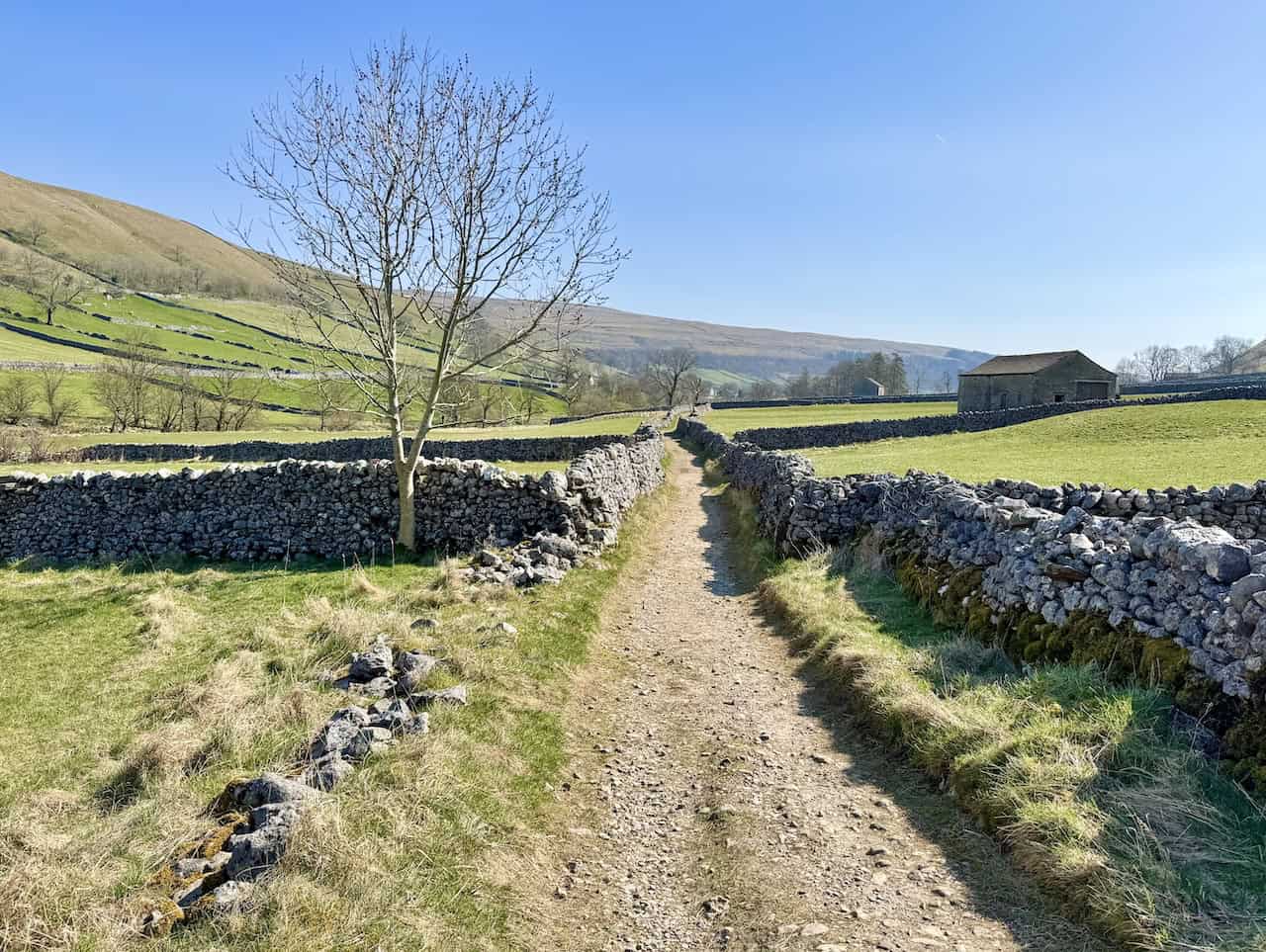
The final stretch takes you north through the valley for roughly one and three-quarter miles. The route eventually merges with a wider stone track. Stay on it, passing a large stone barn on your left. A short distance later, turn right onto a public footpath signposted as the Dales Way and head downhill towards the river. Continue along the edge of the field with the River Wharfe on your right. After about half a mile, the path brings you to a road called Dubb’s Lane. Turn right, cross the road bridge over the river, and return to Buckden to complete one of the most rewarding short walks in Wharfedale.
Fifty Walks Across the Beautiful North York Moors National Park
AD Discover 50 routes across the North York Moors, from short easy strolls to challenging high-level hikes. With OS maps, route descriptions, and local highlights, it also includes the legendary 40-mile Lyke Wake Walk, described in four accessible stages.
Kettlewell to Starbotton Walk
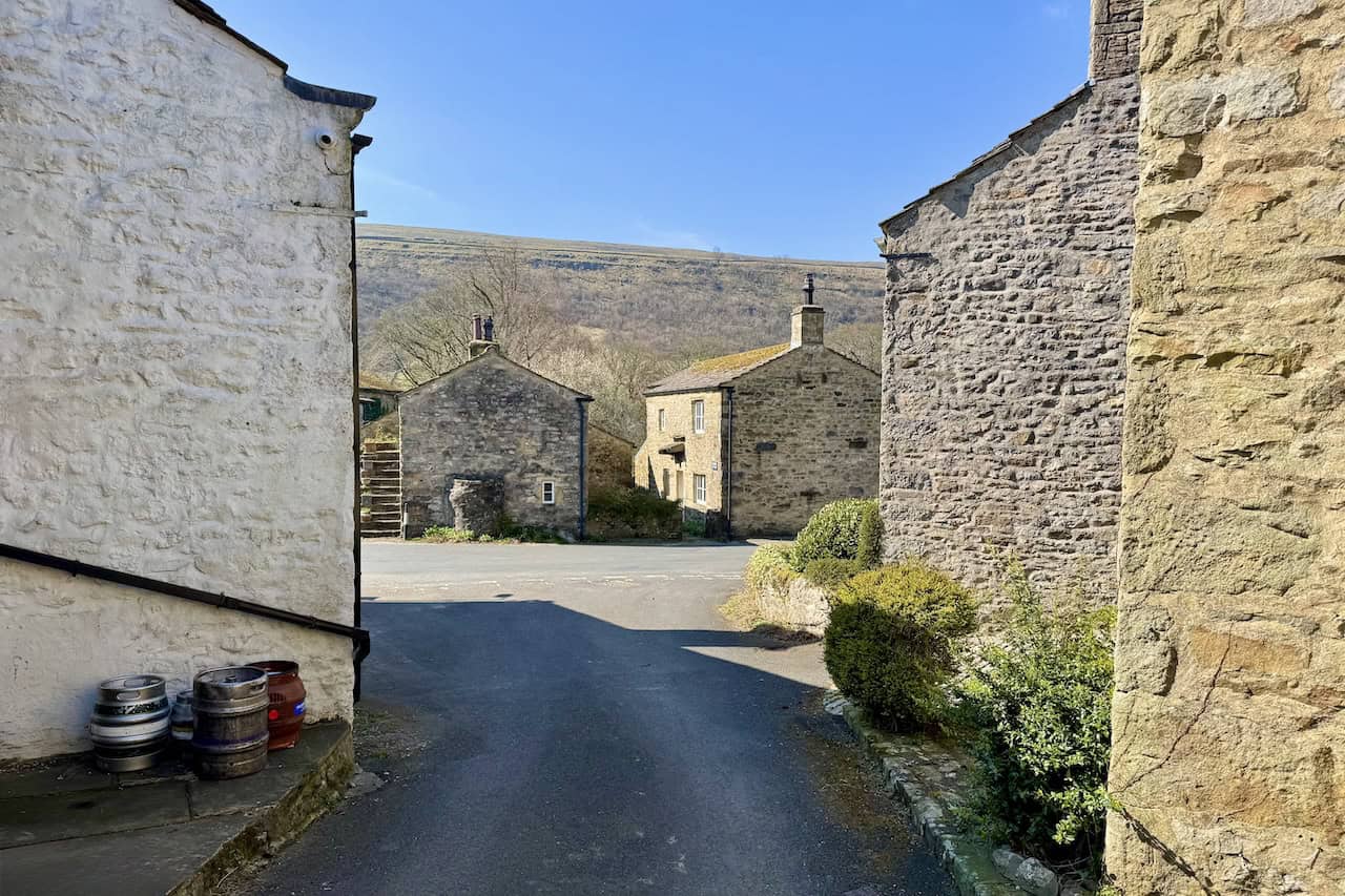
This Kettlewell to Starbotton walk begins in the village of Kettlewell. Start from the Yorkshire Dales National Park car park. It’s a pay-and-display site with plenty of parking spaces and public toilets.
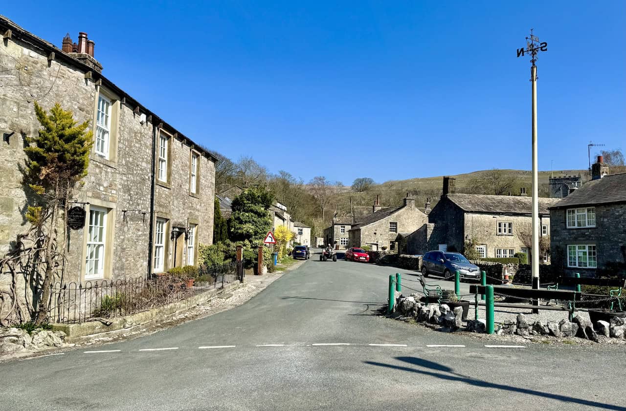
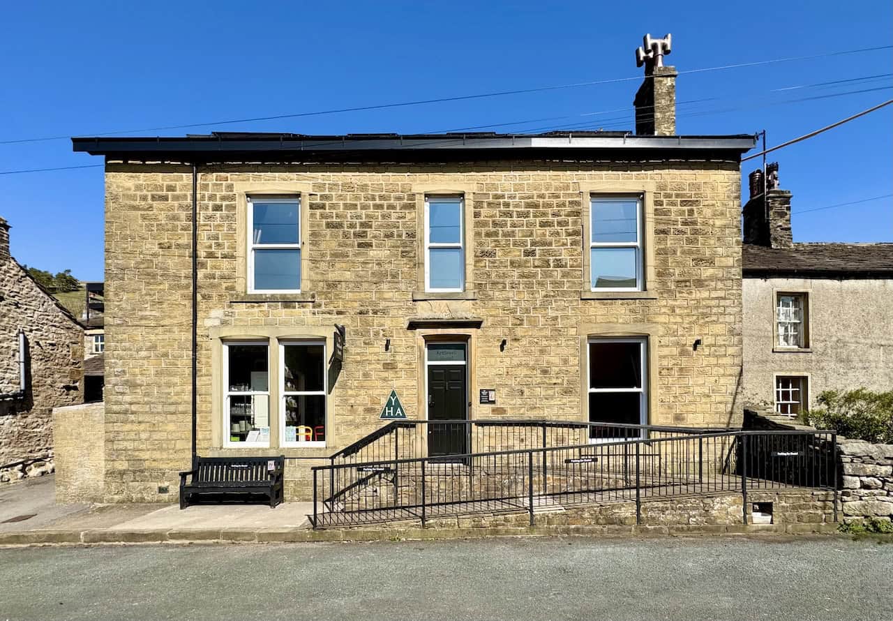
From the car park, turn left, then take the first road on your right just before the bridge, signposted to Kettlewell Camping. Follow the road past the Kettlewell War Memorial on your left. At the next junction, where there’s a small seating area, turn left towards the church, following the Dales Way. Just after the Kings Head pub, turn left again and cross the bridge. You’ll pass the Kettlewell Village Store on your left. Continue straight ahead, past the Kettlewell Youth Hostel on your right, until you reach the end of the road.

Osprey Hikelite Unisex Backpack for Comfortable and Lightweight Hiking
AD The Osprey Hikelite backpack combines lightweight design with practical features, including a breathable mesh back panel, soft webbing straps, and stretch mesh water bottle pockets. With zipped storage and an organiser compartment, it is ideal for day hikes and outdoor use.
Turn right in front of Cam Lodge and follow the stony track uphill. As you climb, you’ll pass the Kettlewell Weather Stone on your left. Keep to the public footpath signposted to Starbotton. The grassy path curves left, tracing the edge of a dry-stone wall. The next section is generally level, following the natural contours of the hillside for about one and three-quarter miles, with yellow footpath waymarkers along the way. This is another section that shows why walks in Wharfedale are so popular with walkers seeking open views and easy-going routes.
As you draw near to Starbotton, turn left and cross a stile. Follow the path downhill across two open fields to reach the B6160. From here, join the bridleway signposted to Arncliffe, Kettlewell, and Buckden. Follow the bridleway to the footbridge over the River Wharfe. Cross the bridge, then turn left to join the Dales Way back to Kettlewell.
Osprey Hikelite Unisex Backpack for Comfortable and Lightweight Hiking
AD The Osprey Hikelite backpack combines lightweight design with practical features, including a breathable mesh back panel, soft webbing straps, and stretch mesh water bottle pockets. With zipped storage and an organiser compartment, it is ideal for day hikes and outdoor use.
This riverside stretch takes you south through the valley towards Kettlewell for nearly two miles, with yellow directional waymarkers along the way. Eventually, the path brings you to the main road in Kettlewell. Turn left and follow the road across the bridge over the River Wharfe. Continue to the Yorkshire Dales National Park car park on your left, where you started, completing another of the most enjoyable short walks in Wharfedale.
Related Post: Grassington Hebden Circular Walk
From Linton Falls to Hebden on the Grassington Hebden circular walk