ADVERTISEMENT
Enjoy the Magic of the Lake District on Your Ullswater Walk from Patterdale
Begin your Ullswater walk in the Lake District at the quaint village of Patterdale, positioned on the A592 at the southern extremity of Ullswater. There is ample parking available opposite the Patterdale Hotel. Initiate your journey by walking south-east along the footpath adjacent to the road, leaving the village behind. After a short distance, turn left onto a minor road that crosses over Kirkstone Beck.
Continue your stroll through a picturesque small hamlet until you encounter a track signposted to Boredale Hause and Angle Tarn. Follow this track uphill towards the south-east, enjoying expansive views back towards Patterdale. Ascend further uphill around the western and southern sides of Angletarn Pikes to reach the northern tip of Angle Tarn, a perfect spot for a brief rest.
Change direction to head north, climbing further. Proceed along the fell ridge in a north-easterly direction, passing Bedafell Knott and traversing Beda Fell to reach the summit known as Beda Head. This part of the Ullswater walk offers breathtaking views of Ullswater and the surrounding Lake District fells.
ADVERTISEMENT
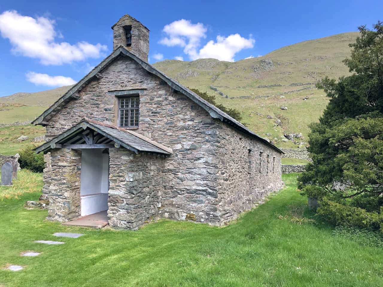
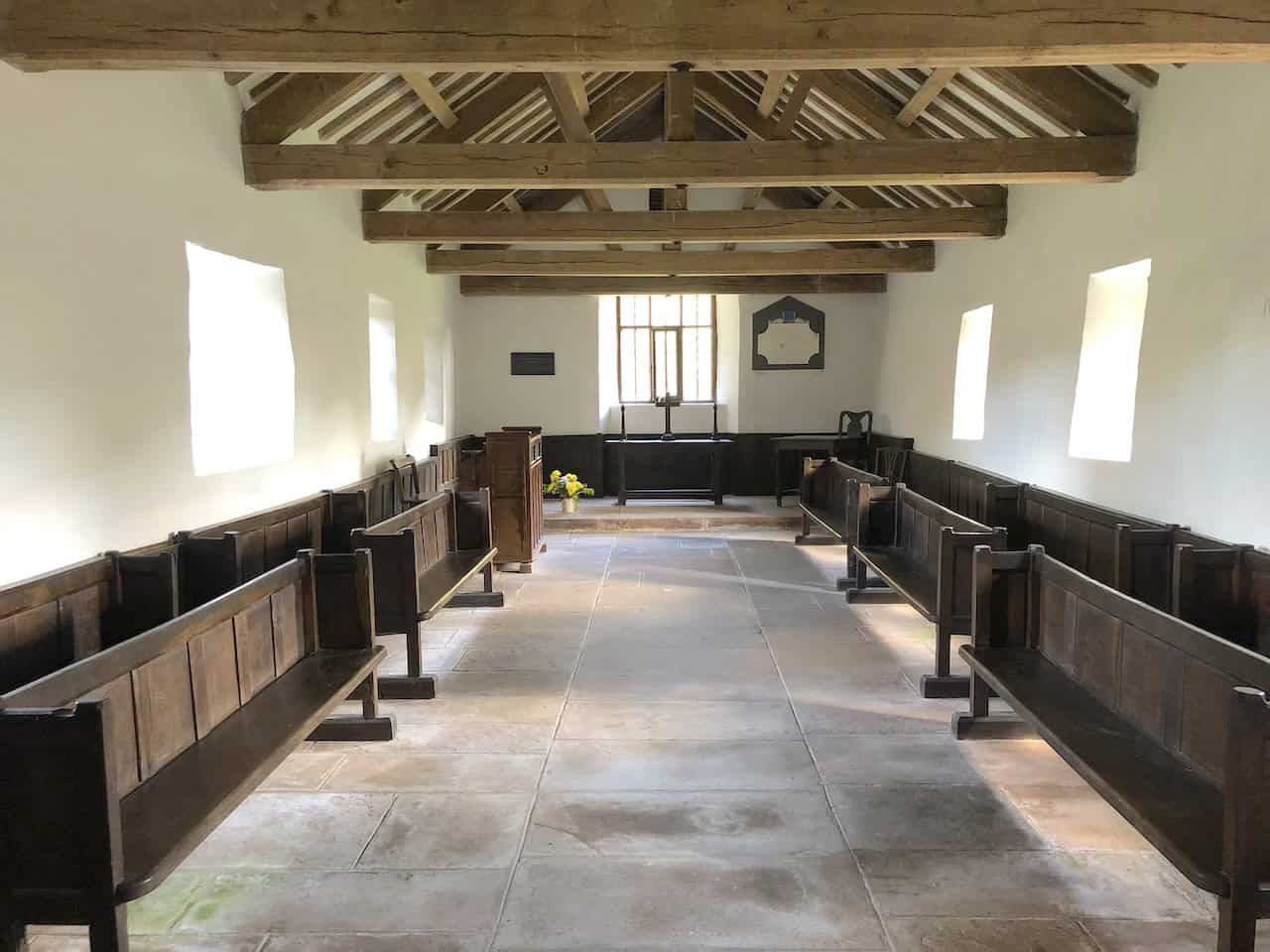
After leaving Beda Head, continue northwards across Allen Crag, then start your descent. Keep an eye to the right for a path leading steeply downhill towards the minor road in the Howe Grain valley. This path can be elusive, but as long as you keep going downhill until you reach the road, all will be fine. Follow this road north to the stunning St Martin’s Church in Martindale, which is an excellent place for lunch.
Resume your walk north along the quiet road, which sees little traffic. Upon reaching a junction, you have the option to shorten this Ullswater walk by approximately 1¼ miles by turning left and heading west towards Sandwick. Alternatively, continue north, then turn left off the road after St Peter’s Church, and follow the footpath that circumnavigates the base of Hallin Fell in an anti-clockwise direction. This section offers serene walking conditions along the shores of Ullswater.
You’ll reach Sandwick Bay, followed soon after by Sandwick. At Sandwick, get onto the Ullswater Way near Sandwick Beck. Conclude your journey by following this well-defined route along the southern shores of the lake for almost four miles back to Patterdale. This path offers splendid views, although it may become tiring as the day progresses. Upon your return to Patterdale, you will have completed a rewarding 12¼-mile walk, or an 11-mile journey if you opted for the shortcut.
Ullswater Walk: Maps and Tools
Visit either the OS Maps website or the Outdooractive website to view this walking route in greater detail. Both platforms offer a range of features, including the ability to print the route, download it to your device, and export the route as a GPX file. You can also watch a 3D fly-over and share the route on social media.
Ullswater Walk: Distance, Duration, Statistics
Distance: 12¼ miles
Distance: 19½ kilometres
Duration: 6½ hours
Ascent: 2961 feet
Ascent: 903 metres
Type: Circular walk
About Ullswater
Ullswater is a glacial lake located in Cumbria, within the Lake District National Park. It ranks as the second largest lake in the area by both size and volume, surpassed only by Windermere. The lake stretches approximately seven miles in length and ¾ mile in width and reaches a depth of 63 metres. Its waters flow out via the River Eamont, which joins the River Eden at Brougham Castle, then continues to the Solway Firth. Ullswater resides within the administrative boundaries of Westmorland and Furness and the ceremonial county of Cumbria.
Historical Significance
The lake was created after the last ice age, as a glacier carved the valley floor, which subsequently filled with meltwater. The surrounding hills mould it into an extended Z-shape with three distinct reaches. Historically, Ullswater marked the boundary between the counties of Cumberland and Westmorland.
Tourism began flourishing here by the mid-18th century. By the 1890s, it had become a popular retreat for the British aristocracy, drawn by excellent sailing conditions and nearby fell shooting estates. Notably, in 1912, German Emperor Wilhelm II visited Ullswater and toured the lake aboard the MY Raven, which was outfitted as a royal yacht. The local major landowner, Hugh Lowther, 5th Earl of Lonsdale, even constructed a shooting lodge at Martindale for the Kaiser.
Modern Attractions
Today, one of Ullswater’s key attractions is the Ullswater Steamers. These vessels, originally functional boats from the 1850s, now offer scenic trips around the lake with stops at Pooley Bridge, Glenridding, Howtown, and Aira Force. They operate throughout the year, previously serving to transport mail, workers, and goods to and from the Greenside Mine at Glenridding, which closed in 1962.
The Ullswater Way
The Ullswater Way, a 20-mile marked walking route around the lake, is another major attraction. Opened on 25 April 2016 by broadcaster Eric Robson, the path was a joint effort by the Lake District National Park Authority, the National Trust, Eden District Council, and Ullswater Steamers. It was finally realised after the devastating 2015 Cumbria floods provided the impetus to complete the project. The route, now recognised by the Long Distance Walkers Association, is marked by daffodil symbols, recalling the inspiration for William Wordsworth’s famous poem ‘I Wandered Lonely as a Cloud’.
Recreational Activities
Sailing is another popular activity on Ullswater, which hosts several marinas and the Ullswater Yacht Club. Each July, the lake becomes the venue for the Lord Birkett Memorial Trophy, attracting over 200 sailing boats. Ullswater also offers diving, rowing, and motor boating facilities. Another highlight is the Aira Force waterfall, situated midway along the lake’s western side. The area, partially managed by the National Trust, features Lyulph’s Tower near the falls. The eastern shore of Ullswater boasts the Sharrow Bay Country House.
Historical Record and Cultural Contributions
A notable historical event occurred on 23 July 1955, when Donald Campbell set the world water speed record on Ullswater, reaching 202 mph in the ‘Bluebird K7’ hydroplane.
In June 2017, the three Poetry Stones were unveiled along the Ullswater walk, inscribed with lines from poet Kathleen Raine, a former resident of Martindale. These stones were carved by Cumbrian artist Pip Hall, adding a cultural touch to the scenic Ullswater walk.
Recommended Ordnance Survey Map
The best map to use on this walk is the Ordnance Survey map of the Lake District North-Eastern Area, reference OS Explorer OL5, scale 1:25,000. It clearly displays footpaths, rights of way, open access land and vegetation on the ground, making it ideal for walking, running and hiking. The map can be purchased from Amazon in either a standard, paper version or a weatherproof, laminated version, as shown below.
Standard Version
Ullswater Walk: My Photos
The view north-west towards Glenridding and the southern tip of Ullswater.
ADVERTISEMENT
The view south towards Deepdale and Brothers Water.
ADVERTISEMENT
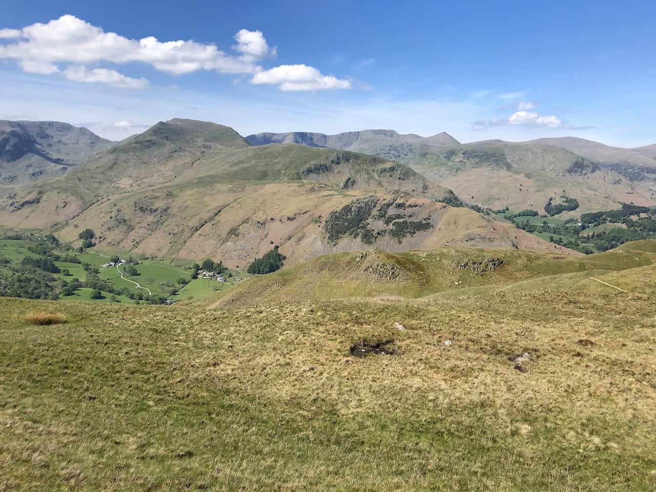
A quick break on the way up to Boredale Hause.
ADVERTISEMENT
The view west towards Helvellyn.
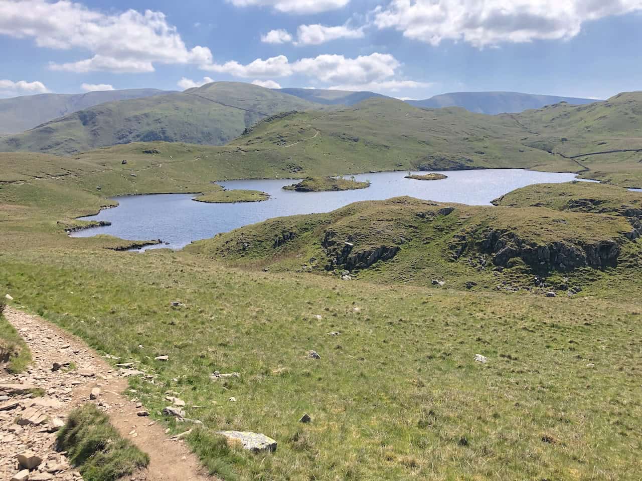
Angle Tarn.
ADVERTISEMENT
ADVERTISEMENT
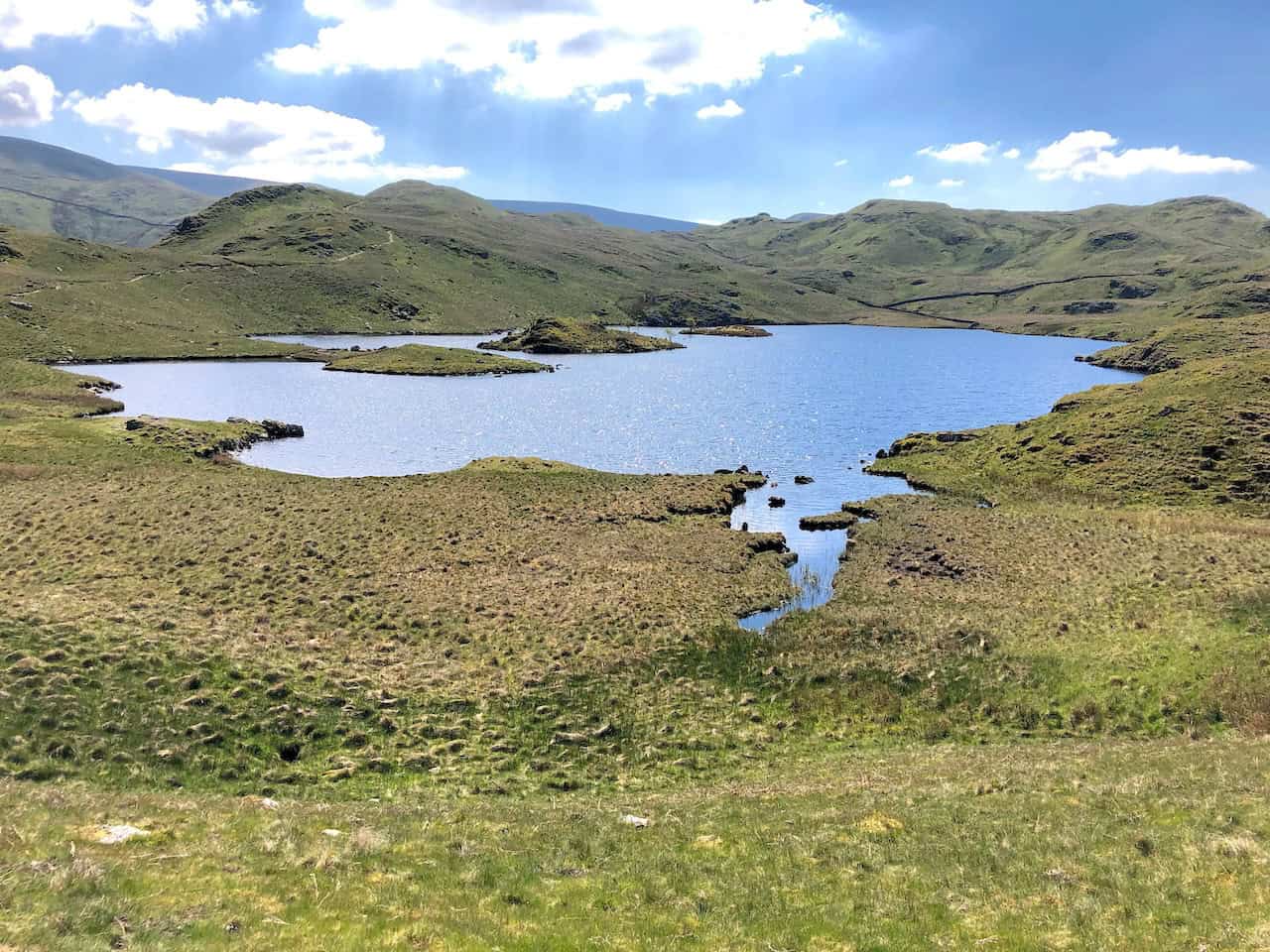
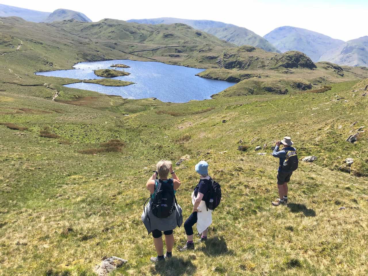
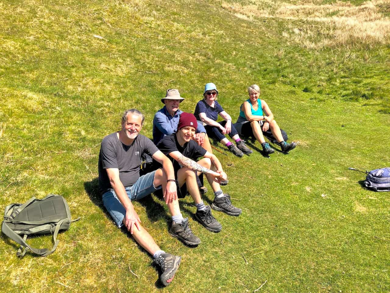
Enjoying the sunshine on the grassy banks of Angle Tarn.
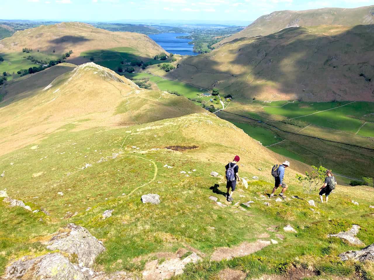
The path across Beda Fell, approximately one-third of the way round this Ullswater walk.
ADVERTISEMENT
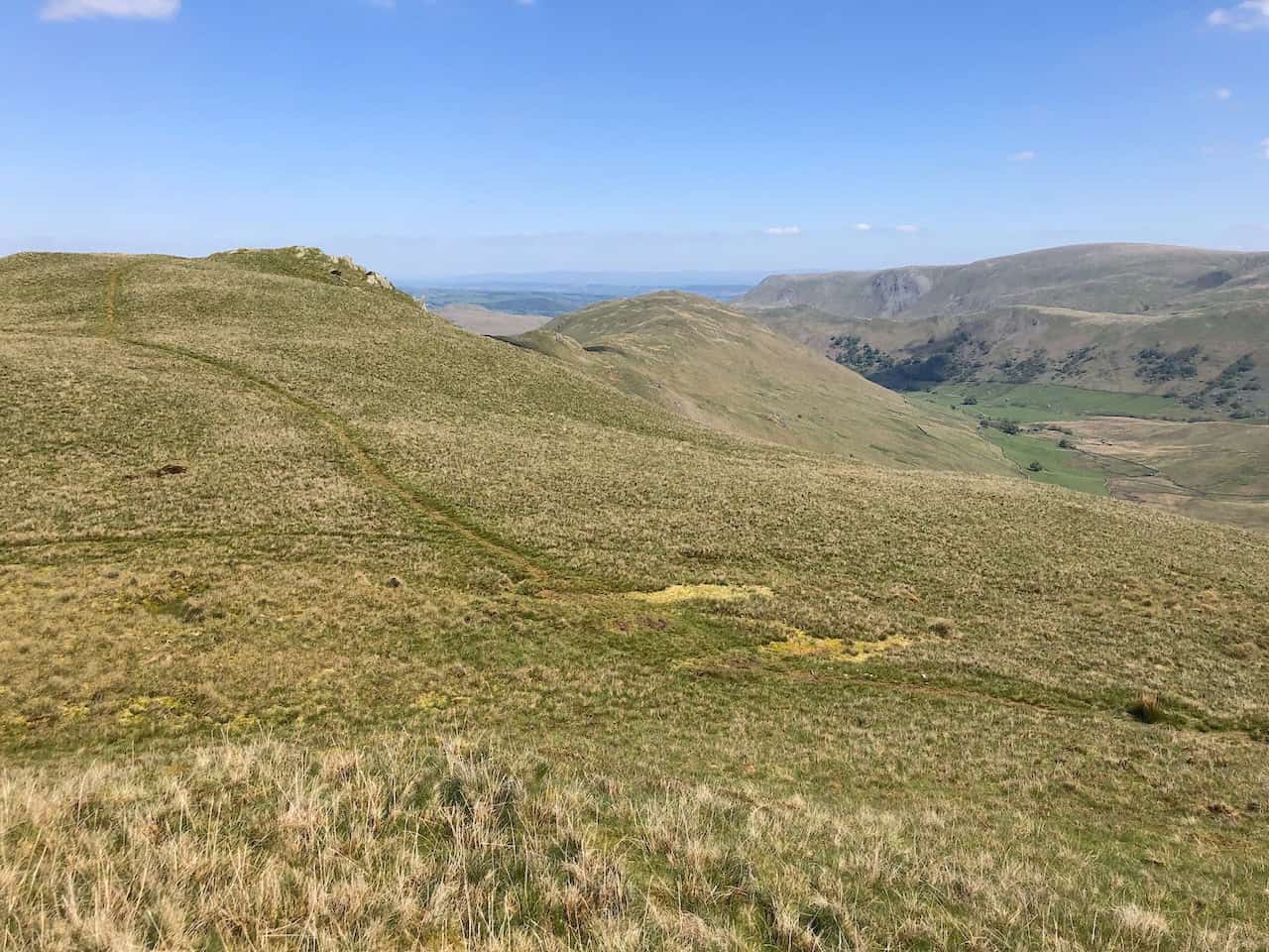
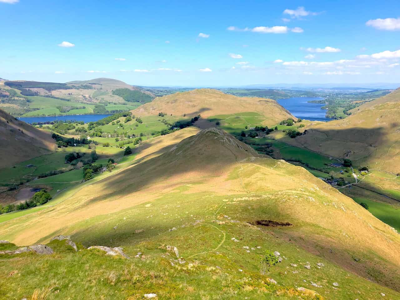
Crossing Beda Fell. The valley below is Boredale.
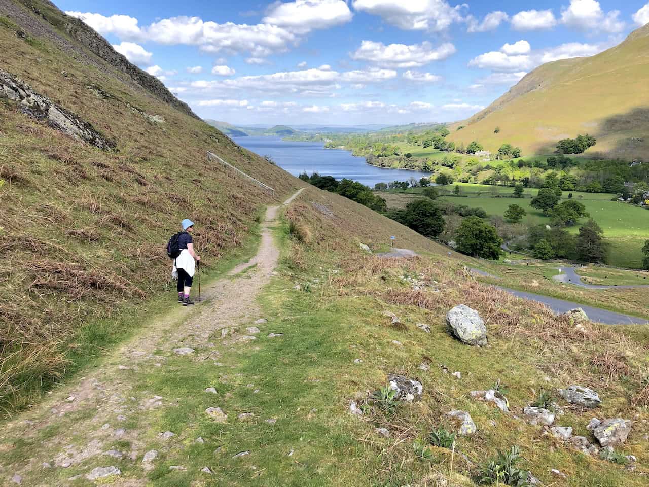
Crossing Beda Fell. Ullswater is visible behind Hallin Fell.
ADVERTISEMENT
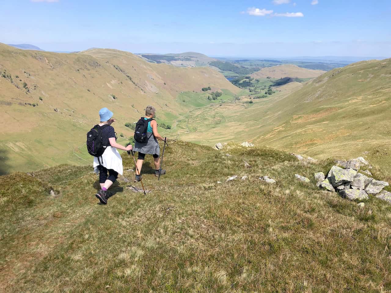
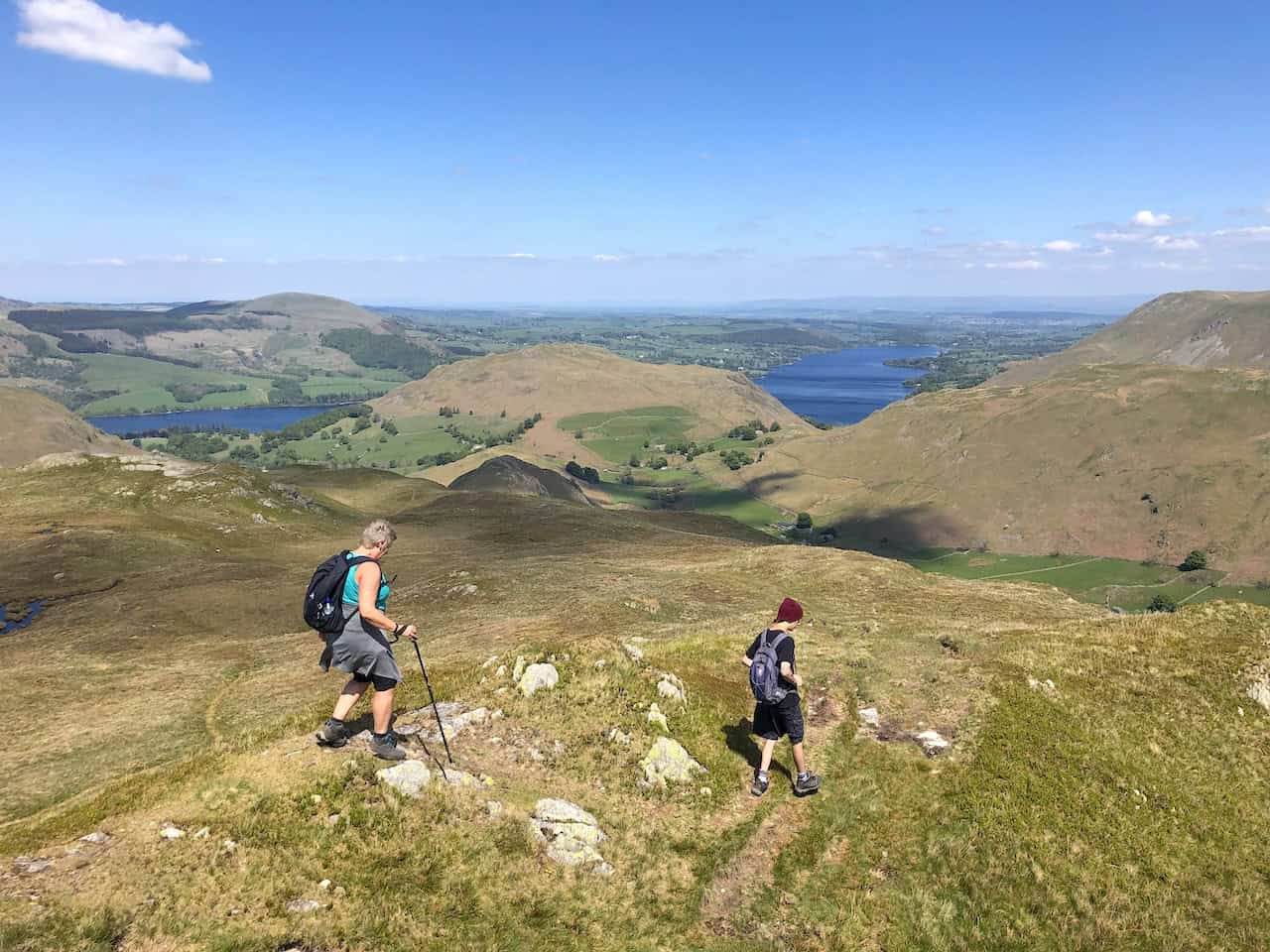
The view north from Beda Head towards Hallin Fell and Ullswater.
Climbing down from Beda Head to reach Martindale in the Howe Grain valley.
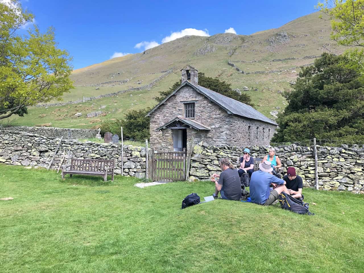
Lunch in Martindale.
ADVERTISEMENT
St Martin’s Church, Martindale, often referred to as the ‘Old Church’ to avoid confusion with the nearby St Peter‘s Church which is situated half a mile down the valley.
The path around the bottom of Hallin Fell, just over halfway round our Ullswater walk.
ADVERTISEMENT
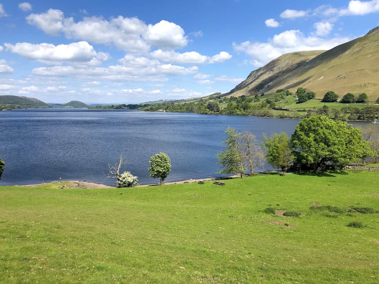
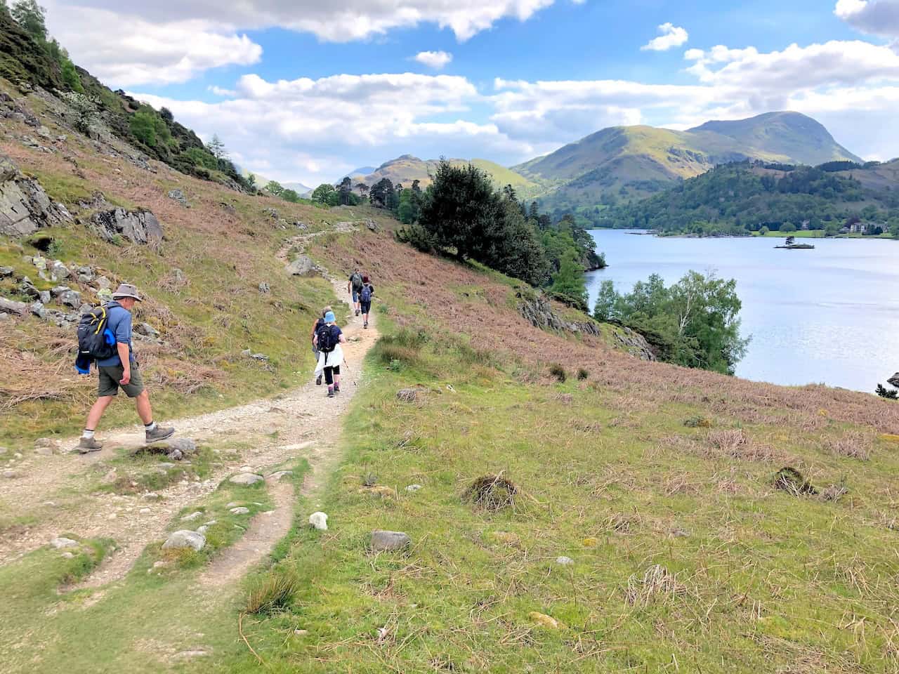
The view north-east over Ullswater towards Pooley Bridge, which is situated on the northern tip of the lake.
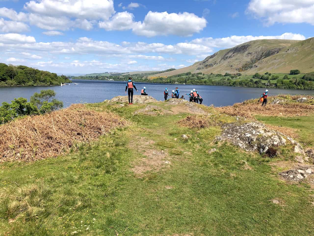
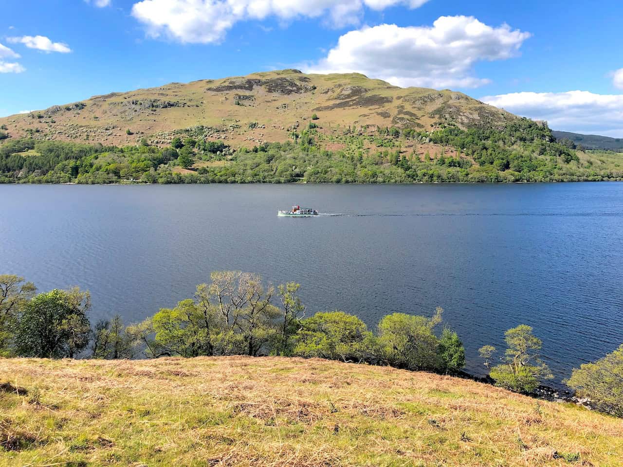
Outdoor activities on Ullswater.
ADVERTISEMENT
An Ullswater Steamer crosses the lake.
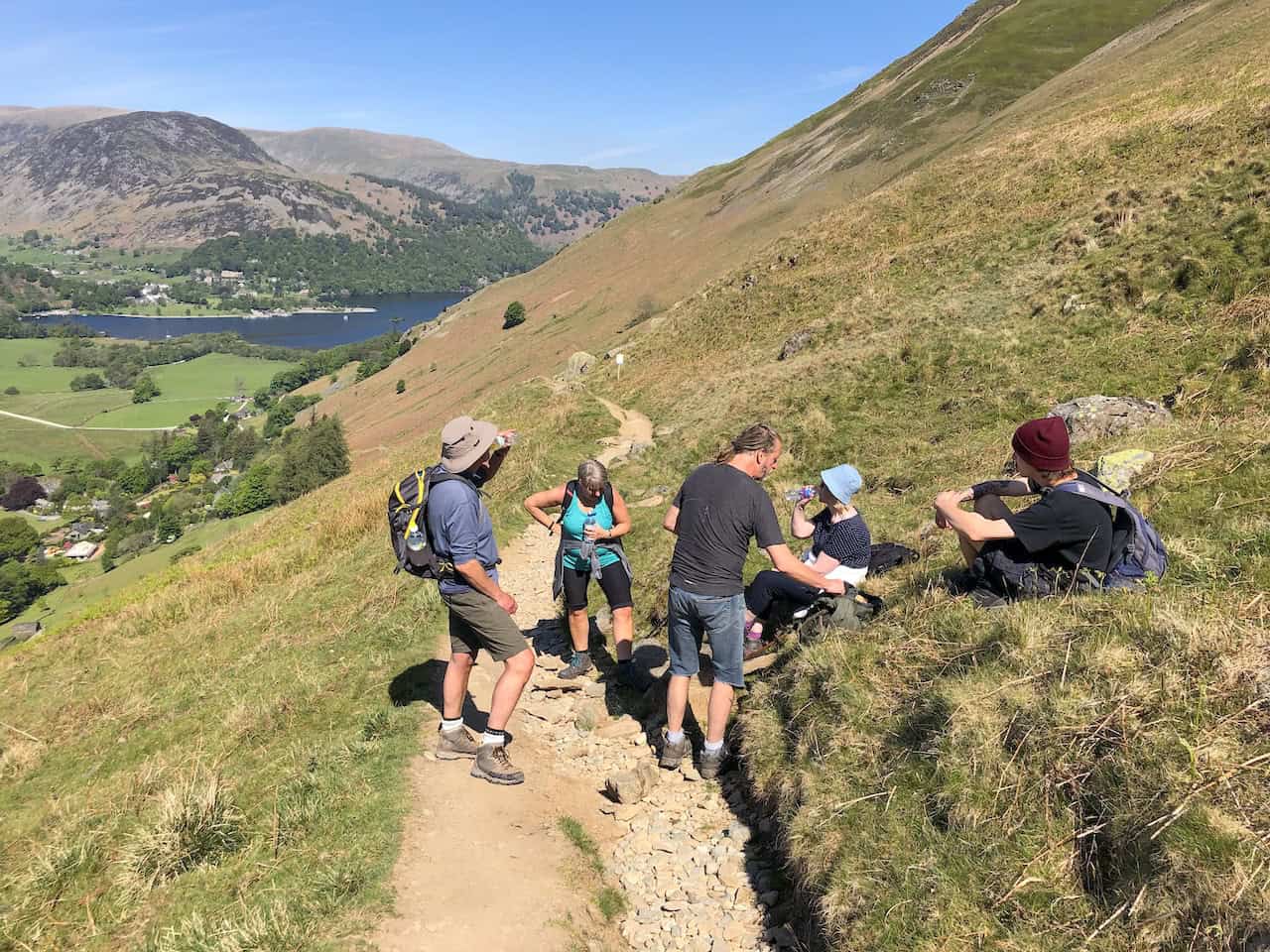
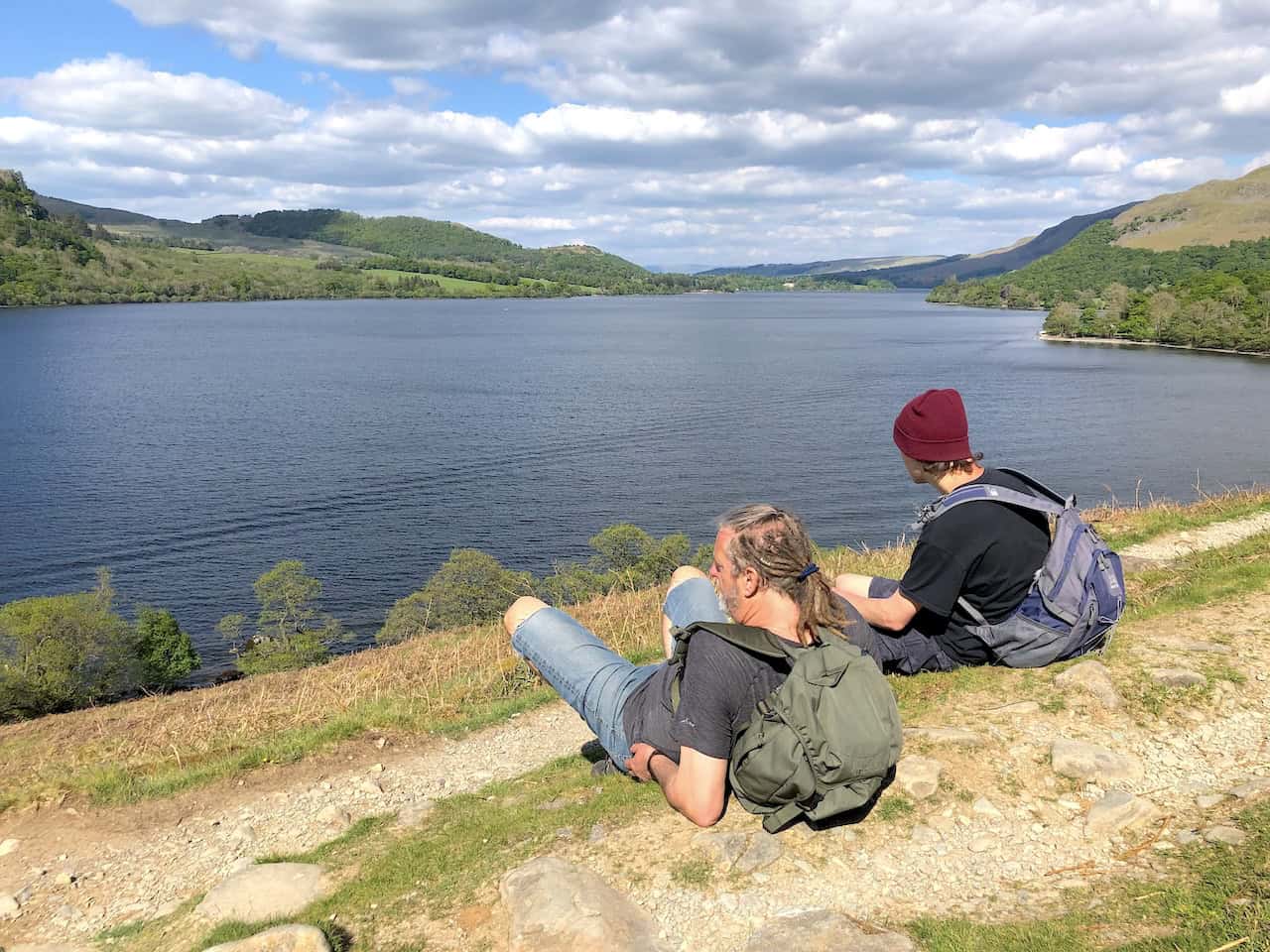
Relaxing and enjoying the views during our Ullswater walk.
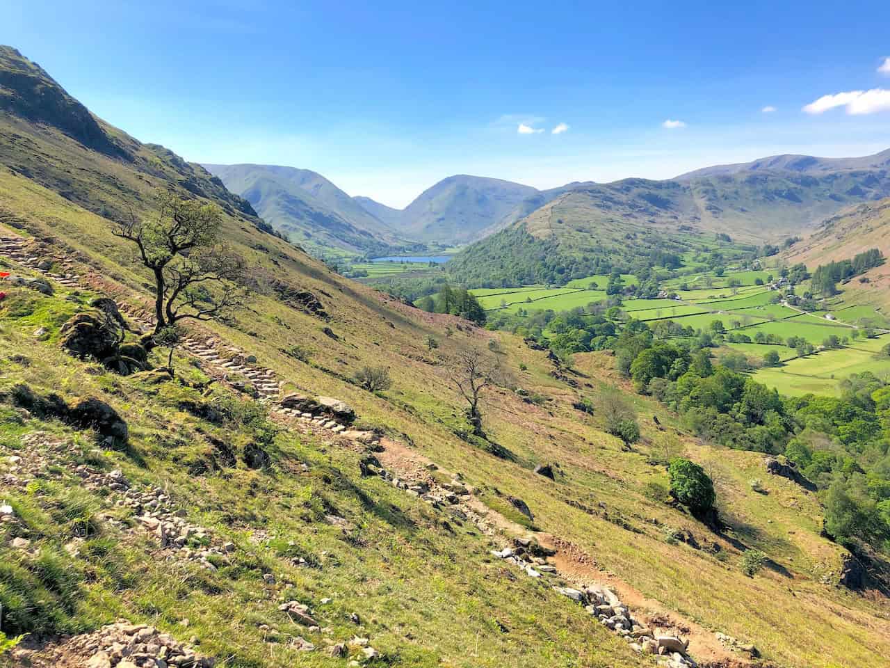
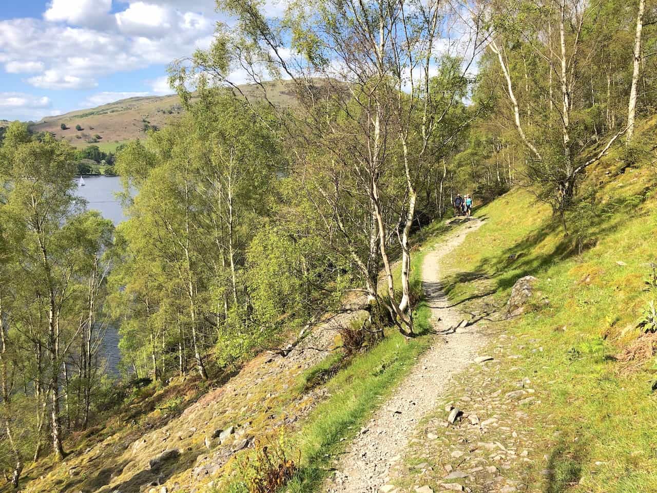
Footpath through woodland beneath Birk Fell. The path is part of the Ullswater Way, a 20-mile walking route around the entire lake.
ADVERTISEMENT
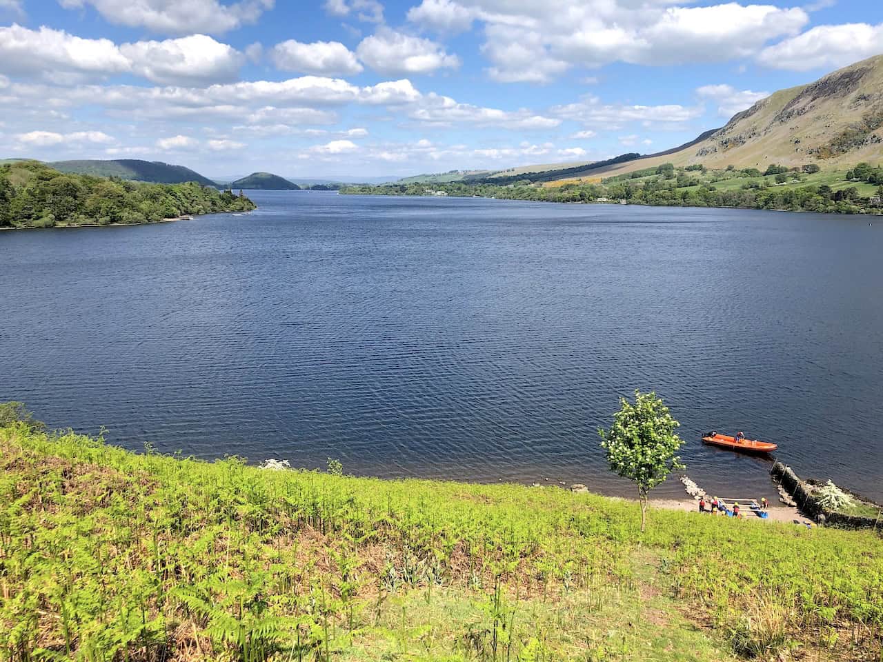
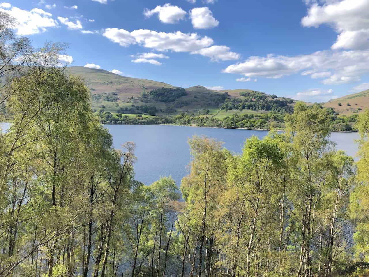
The view west over Ullswater from the woods below Birk Fell.
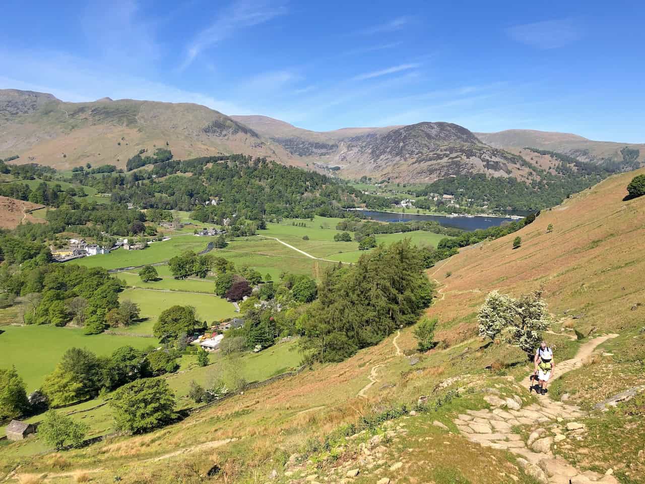
Heading south on the Ullswater Way.
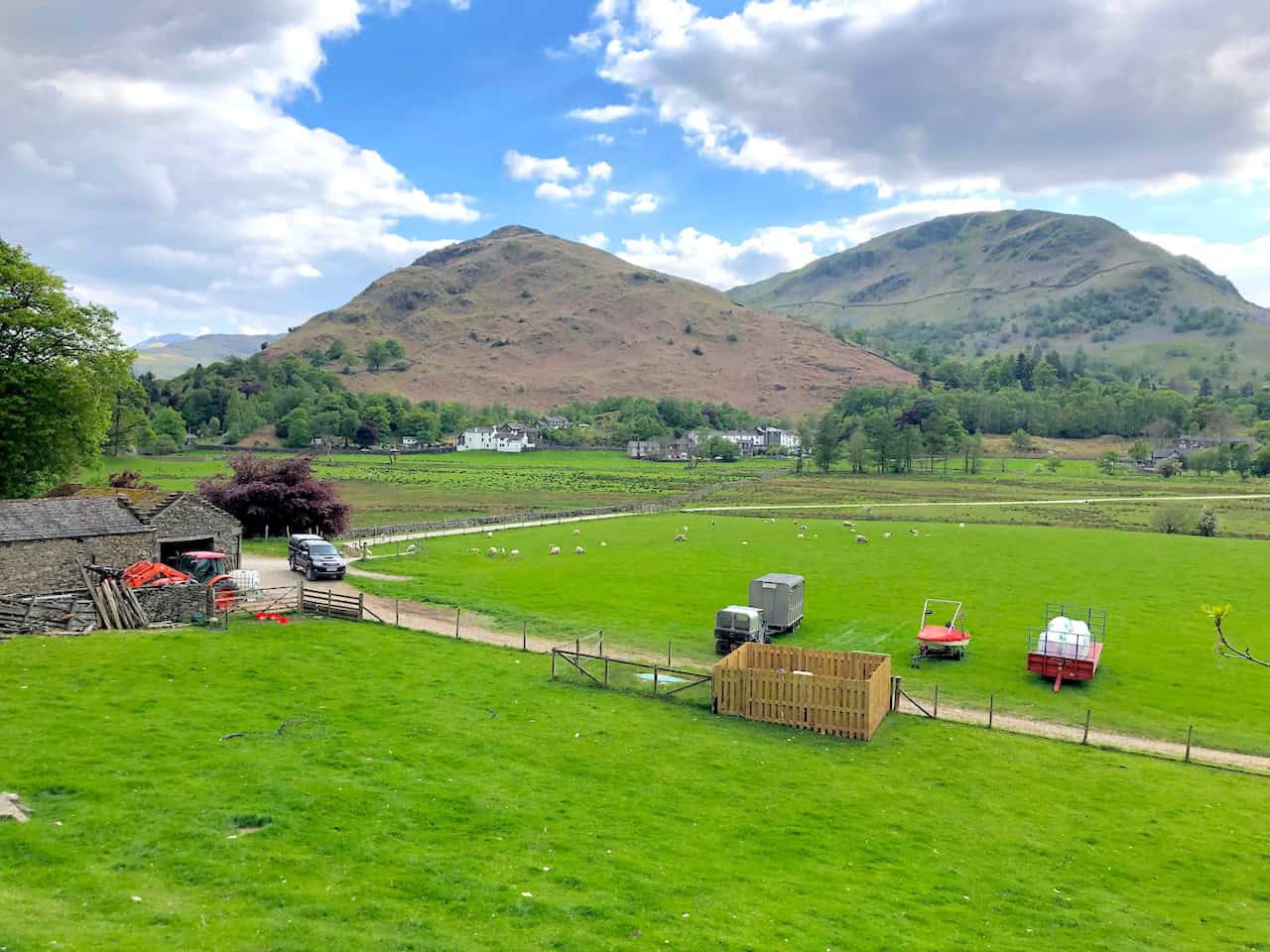
The view over Side Farm towards Patterdale.
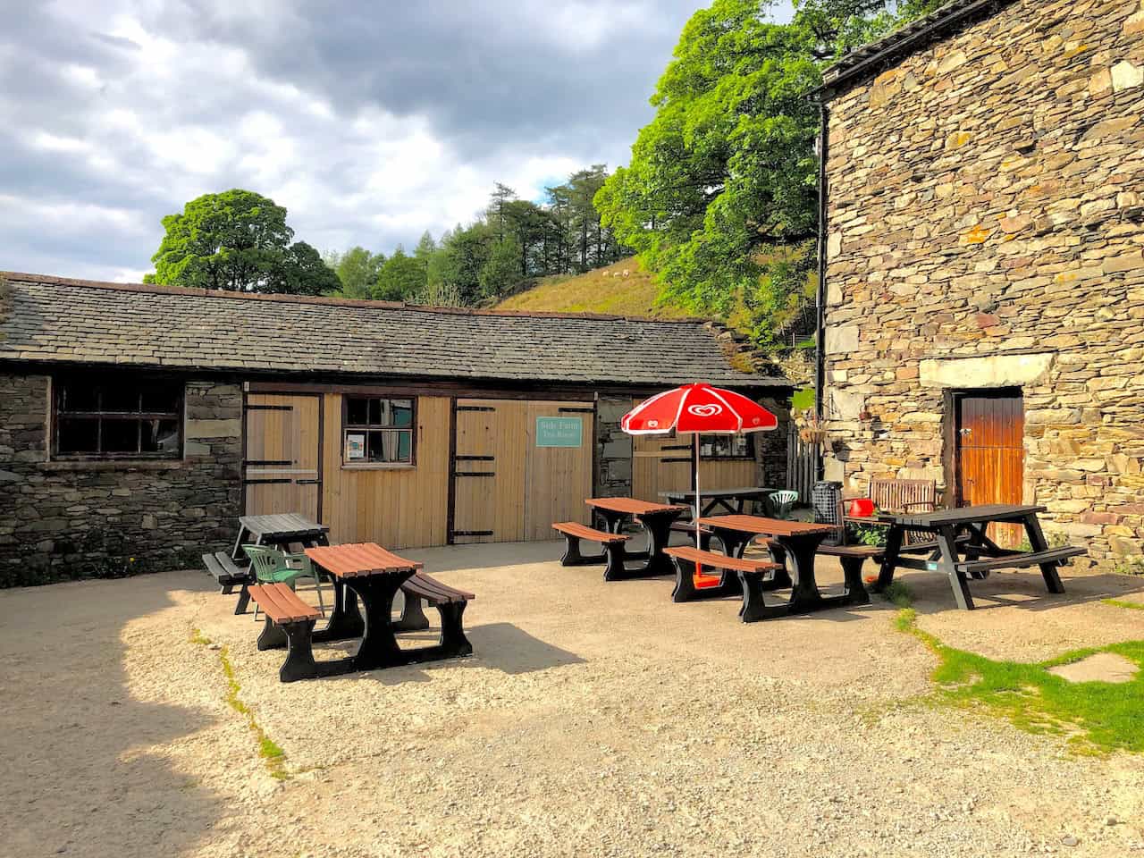
Side Farm Tea Room near the end of our Ullswater walk.
ADVERTISEMENT
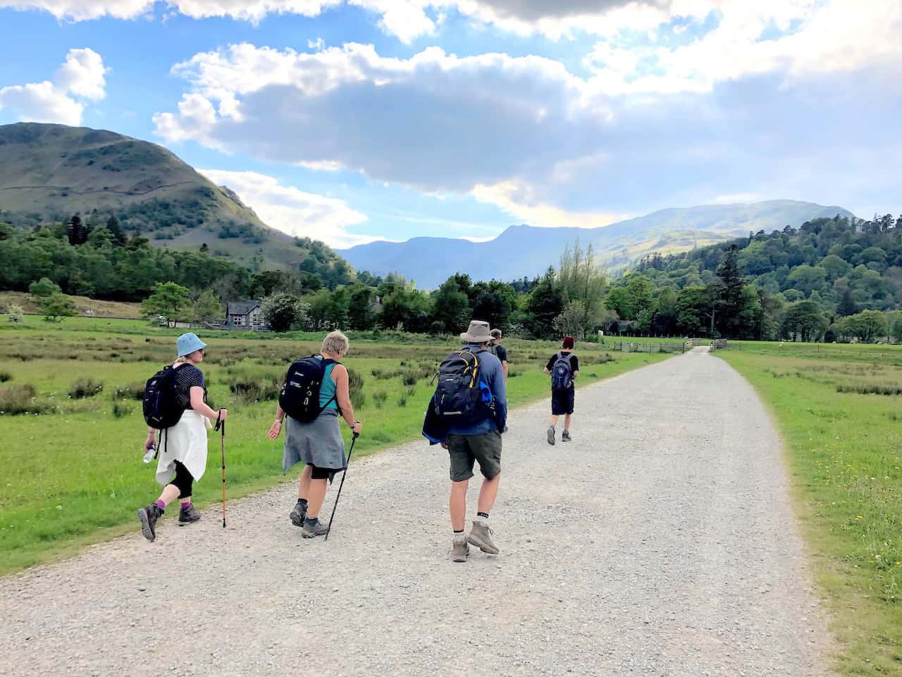
The track from Side Farm back to Patterdale.
ADVERTISEMENT