ADVERTISEMENT
A Guide to the Most Beautiful Lake District Walks
Discover breathtaking Lake District walks and trails in one of England’s most picturesque regions. The Lake District National Park is located entirely within the county of Cumbria, in the north-west of England, and covers an area of over 900 square miles. It was established as a national park in 1951, and in 2017 was designated a UNESCO World Heritage Site.
All of England’s land more than 3000 feet above sea level lies within the park, including Scafell Pike, the highest mountain. The Lake District also contains the deepest and largest natural lakes in England, Wast Water and Windermere respectively. Head over to the official website for more information.
Presented below are three outstanding Lake District walks, each showcasing different aspects of the area’s extraordinary natural scenery. Bear in mind, these examples only scratch the surface of the numerous trails available. Keep scrolling down for many more fantastic walks.
ADVERTISEMENT
Lake District Walks: My Three Favourites
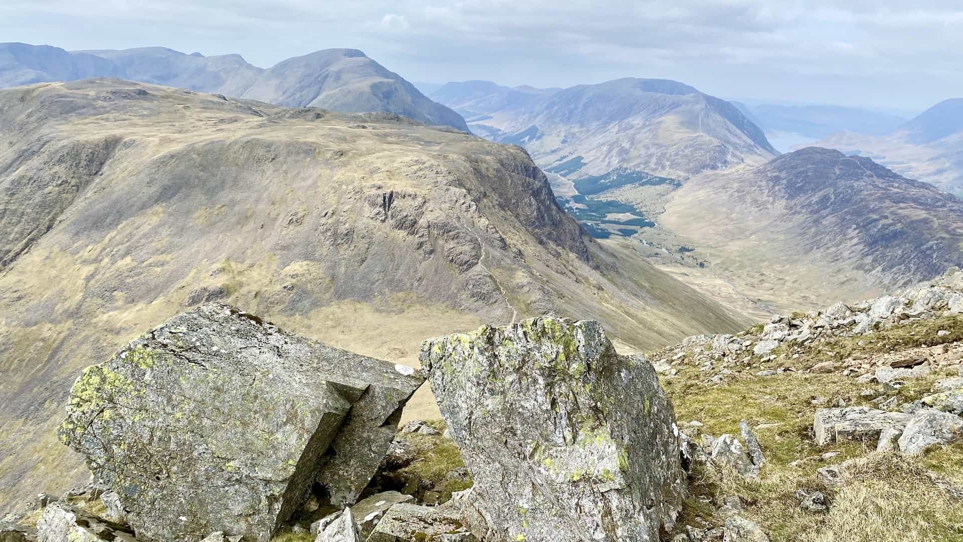
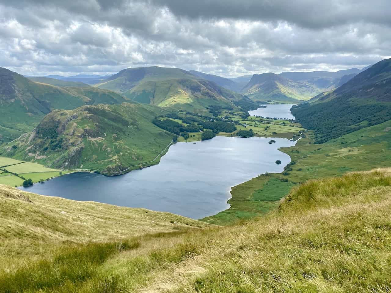
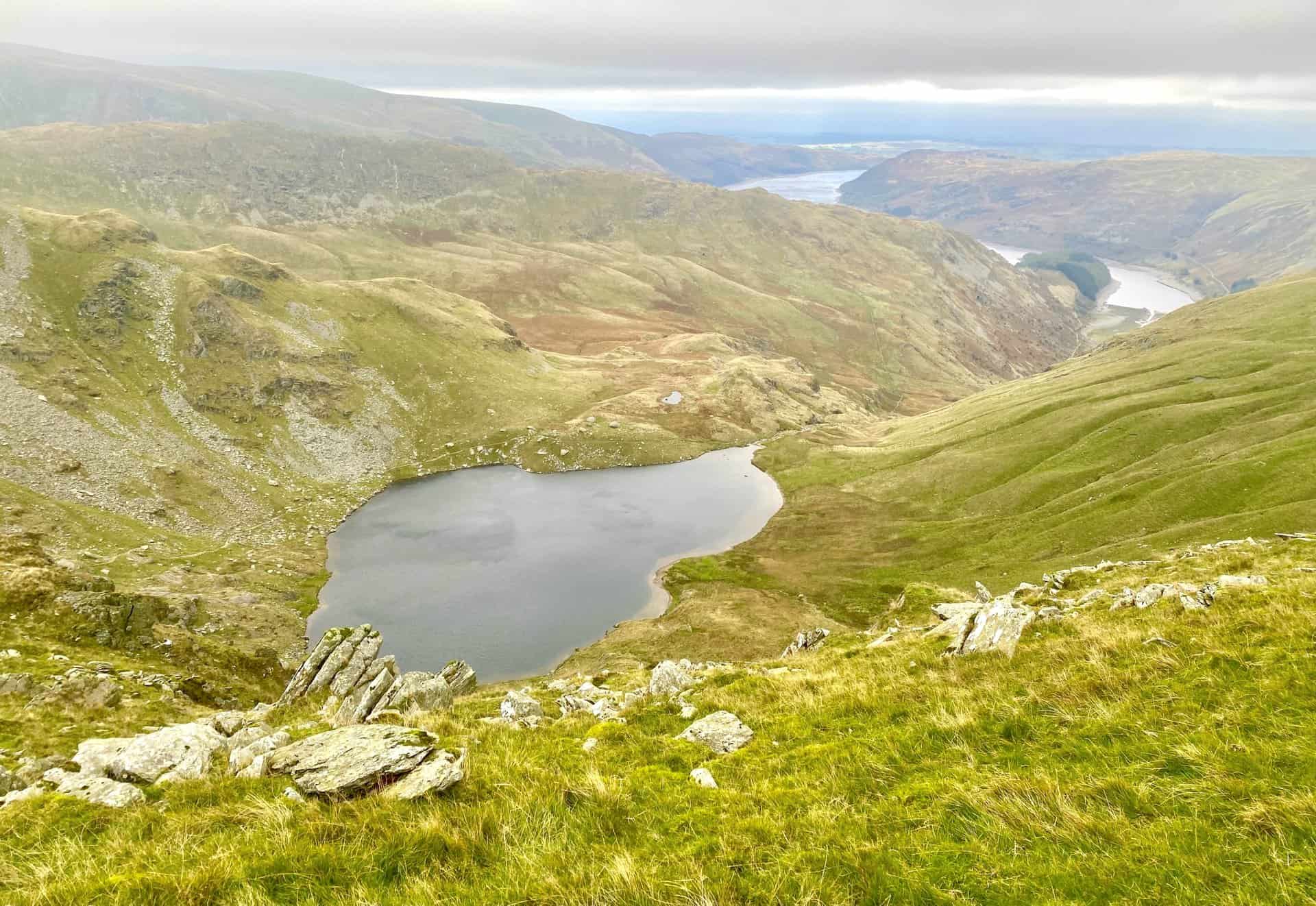
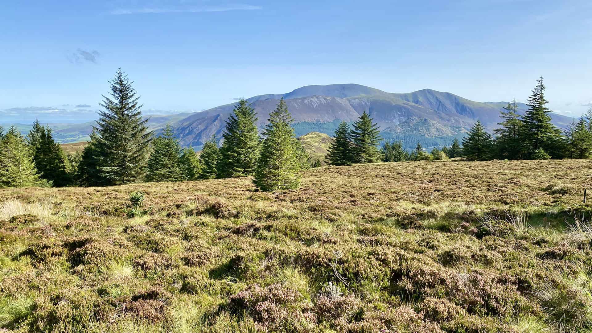
One of the most captivating hikes begins at Crummock Water. The Grasmoor walk starts near the lake’s eastern shore. As you set off, the imposing slopes of Grasmoor loom to your right, creating a dramatic backdrop. The trail takes you across Liza Beck into the picturesque Gasgale Gill. Ascending through a valley adorned with waterfalls, the path to Coledale Hause offers enchanting views that make every step worthwhile. The summit of Grasmoor provides some of the finest panoramas in the Lake District, making it an ideal spot for a restful lunch. The descent to Wandope Moss and Whiteless Pike completes the journey, leaving you with unforgettable memories of a superb day out.
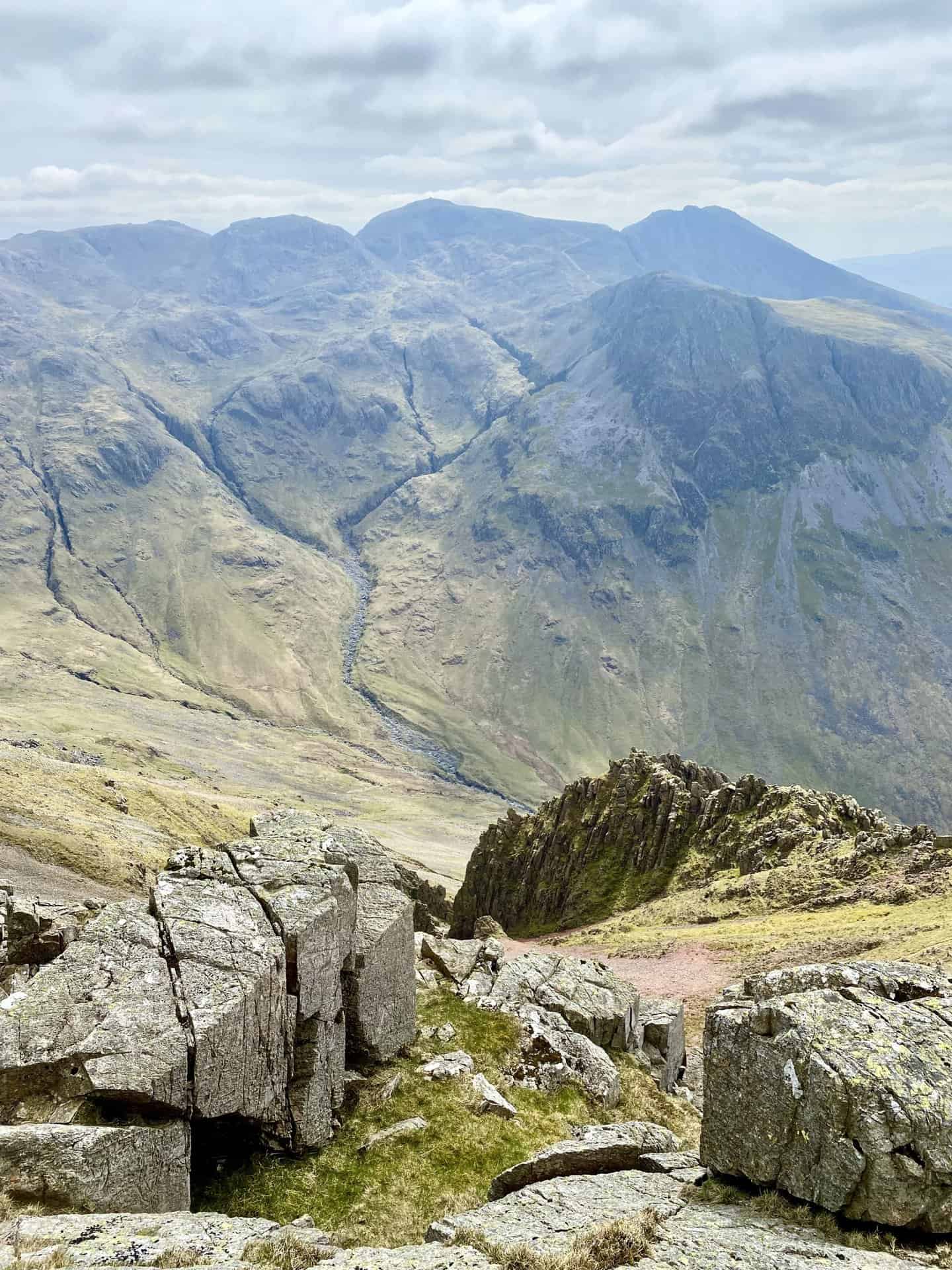
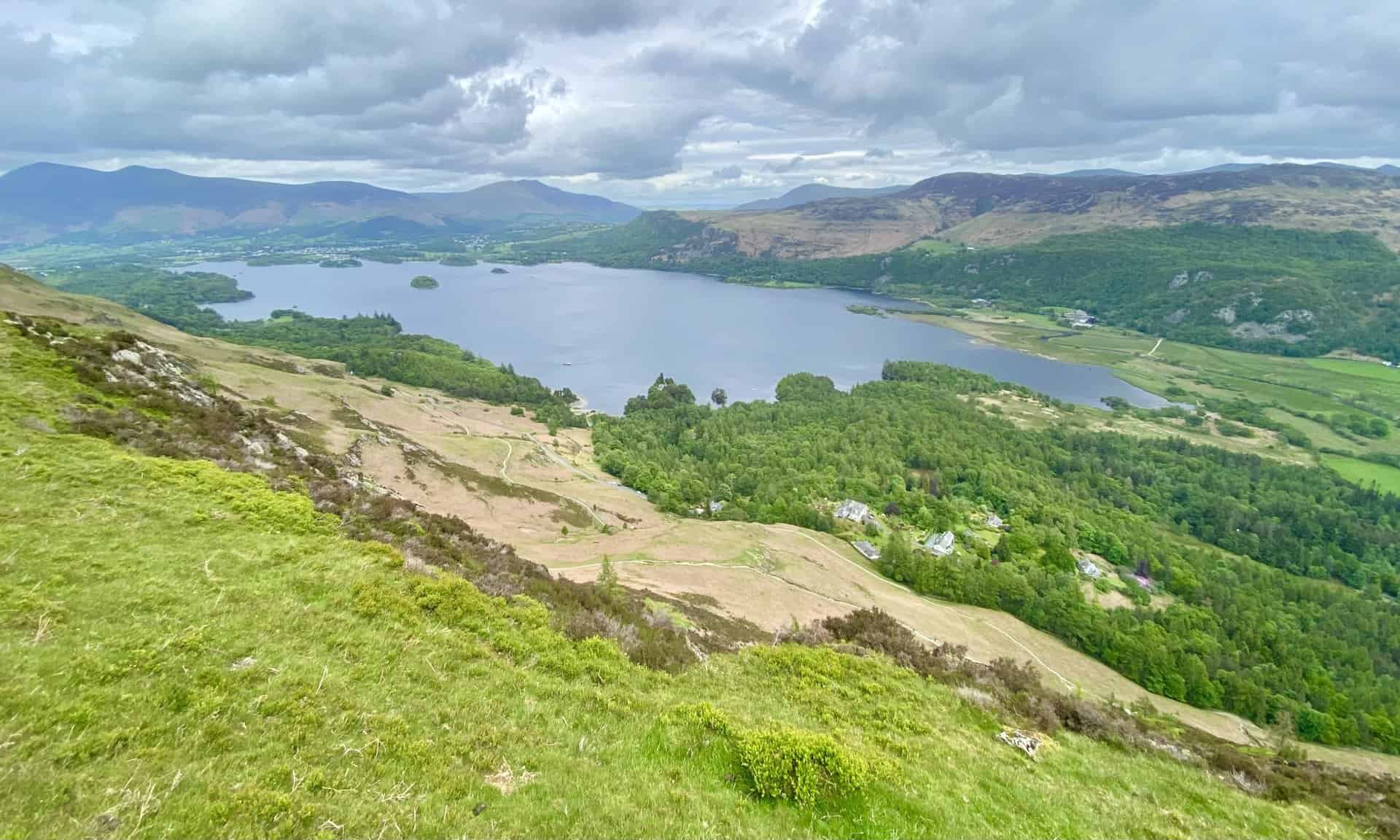
Another must-experience hike is the Helvellyn walk from Thirlmere. Starting at Swirls Car Park, this route offers a quieter ascent away from the popular Swirral and Striding Edges. The initial climb to Browncove Crags is steep but straightforward, rewarding hikers with a sense of accomplishment as they reach Lower Man. From the summit of Helvellyn, sweeping views of the Lake District unfold, offering a visual feast of rolling hills and distant lakes. The trail continues south towards Nethermost Pike, before descending into a lush woodland below Comb Crags.
A third exceptional hike starts in the charming village of Buttermere. The Red Pike walk takes you through the enchanting valley of Scale Beck. Ascending past the majestic Scale Force waterfall, the route to Red Pike is a sensory delight, with the sights and sounds of cascading water accompanying your journey. The trail continues to the summits of High Stile and High Crag, each offering breathtaking views of the Lake District. The descent via Gamlin End to Scarth Gap Pass and Buttermere Fell is equally rewarding, with the path winding through tranquil woodlands and along the serene shores of Buttermere.
The walks detailed above are just a glimpse into the multitude of trails that weave through the Lake District. Each path offers its own unique experience, showcasing the area’s stunning natural beauty and diverse landscapes. Whether you prefer gentle lakeside strolls or challenging mountain treks, there is a walk in the Lake District for everyone. To discover even more wonderful Lake District walks, be sure to check out the list below.
The Lake District’s Breathtaking Trails
Ard Crags Walk: Explore Robinson and Scenic Lake District Trails
8.2 miles | 13.2 kilometres | 5 hours
Bannerdale Crags: Walk from Mungrisdale and Ascend Blencathra
10.6 miles | 17.0 kilometres | 5¾ hours
Barf Walk: From Braithwaite to Lord’s Seat via Whinlatter Forest
10.2 miles | 16.4 kilometres | 6 hours
Bowscale Tarn Walk: A Trek Through the North of the Lake District
11.1 miles | 17.9 kilometres | 6 hours
Carrock Fell Walk: From Coomb Height to High Pike Panoramas
10.5 miles | 16.8 kilometres | 5¾ hours
Causey Pike Walk: From Braithwaite, Featuring Sail and Crag Hill
12.0 miles | 19.3 kilometres | 7½ hours
Coledale Horseshoe: Epic Ridge Walk from Braithwaite to Crag Hill
12.2 miles | 19.6 kilometres | 8¼ hours
Deepdale Horseshoe: Experience Lake District Hiking at Its Best
9.4 miles | 15.1 kilometres | 5½ hours
Derwent Water Circular Walk: A Lake District Trail From Keswick
9.9 miles | 15.9 kilometres | 4½ hours
Gowbarrow Fell Walk: A 7-Mile Adventure with a Visit to Aira Force
6.9 miles | 11.1 kilometres | 4½ hours
Grasmoor Walk: Explore Iconic Lake District Views and Landmarks
8.4 miles | 13.5 kilometres | 4¾ hours
Great Dodd Walk: Featuring Watson’s Dodd and Stybarrow Dodd
12.0 miles | 19.3 kilometres | 7 hours
Great Gable Walk: Four Wainwrights from Honister Slate Mine
6.0 miles | 9.7 kilometres | 4 hours
Grisedale Pike Walk: From Braithwaite to Hopegill Head Summit
8.5 miles | 13.6 kilometres | 5 hours
Hart Crag Walk: Scenic Tour of Hartsop above How and Dove Crag
8.1 miles | 13.0 kilometres | 5 hours
Helvellyn Circular Walk: A Day Hike with Superb Lake District Views
11.3 miles | 18.1 kilometres | 6½ hours
Helvellyn Via Striding Edge: Walk the Famous Lake District Ridge
10.5 miles | 16.9 kilometres | 5¾ hours
Helvellyn Walk from Glenridding: Avoid Swirral and Striding Edge
11.8 miles | 19.0 kilometres | 6½ hours
Helvellyn Walk from Thirlmere: A Guide to a Less Crowded Ascent
6.9 miles | 11.1 kilometres | 4¼ hours
High Stile Walk: Conquer the Red Pike, High Stile, High Crag Ridge
7.5 miles | 12.2 kilometres | 4¼ hours
Kentmere Horseshoe: The Ultimate 13-Mile Lake District Adventure
12.6 miles | 20.3 kilometres | 7 hours
Loughrigg Fell Walk: Rydal Cave and Loughrigg Tarn from Ambleside
7.7 miles | 12.4 kilometres | 4½ hours
Mellbreak Walk: From Lakeside Valleys to Majestic Mountain Tops
8.1 miles | 13.0 kilometres | 4¼ hours
Newlands Horseshoe Walk: A Lake District Exploit to Remember
10.5 miles | 16.6 kilometres | 6 hours
Newlands Horseshoe: Premier Walking Route in the Lake District
9.5 miles | 15.3 kilometres | 5½ hours
Place Fell Walk: Lake District Summit Views and Lakeside Paths
8.6 miles | 13.8 kilometres | 4¾ hours
Red Pike Walk: From Buttermere, Scaling High Stile and High Crag
8.6 miles | 13.8 kilometres | 5 hours
Stony Cove Pike: Walk the High Street Trail via Thornthwaite Crag
8.7 miles | 14.0 kilometres | 5½ hours
Stybarrow Dodd: Walk from Dockray to Glencoyne and Sticks Pass
10.0 miles | 16.1 kilometres | 5¾ hours
Ullswater Walk: Grand Beda Fell Views and Scenic Lakeside Paths
12.2 miles | 19.6 kilometres | 6½ hours
Walla Crag Walk: A Guide to Keswick’s Premier Lake District Hike
10.5 miles | 16.8 kilometres | 5 hours
About the Lake District
Introduction to the Region
The Lake District, also known as the Lakes or Lakeland, is a picturesque mountainous region and national park in Cumbria, in the north-west of England. This area is celebrated for its breathtaking landscapes, which encompass serene lakes, rugged coastlines, and towering mountains. Among the most famous natural features are Scafell Pike, the highest mountain in England, and Windermere, the largest lake in the country. The region’s beauty has inspired numerous writers and artists, including Beatrix Potter, John Ruskin, and the Lake Poets, cementing its status as a place of significant cultural heritage.
ADVERTISEMENT
The Lake District National Park
Establishment and Boundaries
The Lake District National Park was officially established on 9 May 1951, making it one of the first national parks in the United Kingdom, following the Peak District. Initially, the park’s boundaries encompassed the central area of the Lake District. However, in 2016, the park’s boundaries were extended by 3% to the east to include the Lune Valley and other areas of high landscape value, extending closer to the Yorkshire Dales National Park. Today, the park covers an area of approximately 2362 square kilometres (912 square miles), preserving the natural beauty and heritage of the region for future generations.
Visitor Statistics
In 2022, the Lake District National Park attracted a remarkable 18.14 million visitors, highlighting its popularity as a tourist destination. These visitors accounted for a total of 29.15 million tourist days, considering visits lasting longer than three hours. The high number of tourists underscores the park’s appeal, drawing people from all over the world to experience its unique landscapes and outdoor activities.
ADVERTISEMENT
Governance and Management
The Lake District National Park is managed by the Lake District National Park Authority (LDNPA). The authority’s headquarters are located in Kendal, with additional visitor centres situated at strategic locations such as Brockhole on Windermere and the Coniston Boating Centre. The park authority is composed of 20 members: six appointed by Westmorland and Furness Council, four by Cumberland Council, and ten by the Secretary of State for Environment, Food, and Rural Affairs. The LDNPA’s primary aim is to protect the park’s landscapes by regulating development and promoting sustainable tourism, ensuring that the natural beauty and cultural heritage of the Lake District are preserved for future generations.
Lake District Human Geography
General Extent
The precise boundaries of the Lake District are somewhat undefined, but the region is generally considered to be slightly larger than the area encompassed by the Lake District National Park. The national park itself spans approximately 2362 square kilometres (912 square miles) and extends just over 51 kilometres (32 miles) from east to west and nearly 64 kilometres (40 miles) from north to south. While the park includes the central Lake District, several areas of significant landscape value lie outside its boundaries, such as the Lake District Peninsulas to the south. These peninsulas and other adjacent regions contribute to the broader geographical and cultural landscape of the Lake District.
Major Settlements
Within the mountainous expanse of the Lake District, there are only a few major settlements. The towns of Keswick, Windermere, and Bowness-on-Windermere (which are contiguous), along with Ambleside, are the largest and most prominent. These towns are heavily dependent on tourism, with their economies significantly bolstered by the influx of visitors. Close to the boundary of the national park are several other important towns, including Carlisle, Barrow-in-Furness, Kendal, Ulverston, Dalton-in-Furness, Whitehaven, Workington, Cockermouth, Penrith, Millom, and Grange-over-Sands. Each of these towns maintains vital economic links with the Lake District. Additionally, numerous smaller villages such as Coniston, Threlkeld, Glenridding, Pooley Bridge, Broughton-in-Furness, Grasmere, Newby Bridge, Staveley, Lindale, Gosforth, and Hawkshead dot the landscape. These villages, along with scattered hamlets and isolated farmsteads, form the rural backdrop of the region. Many of these settlements, historically tied to agriculture, now also play a part in the vibrant tourist economy.
ADVERTISEMENT
Land Ownership
The land within the Lake District National Park is predominantly privately owned. About 55% of the land is registered as agricultural land, with more than half of this being farmed by individual farmers and other private landowners. The National Trust is a significant landowner, holding around 25% of the total area, including several lakes and areas of substantial landscape value. The Forestry Commission, along with other investors in forests and woodlands, also owns a considerable portion of the land. United Utilities owns approximately 8% of the land, while the Lake District National Park Authority itself owns about 3.9%. This distribution of land ownership plays a crucial role in the management and preservation of the park’s natural and cultural heritage.
Lake District Physical Geography
Landscape and Features
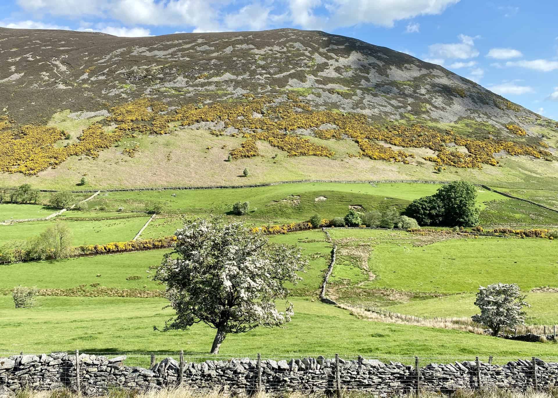
The Lake District is characterised by a roughly circular upland massif, deeply dissected by a radial pattern of major valleys. These valleys, largely shaped by repeated glaciations over the past two million years, create the distinctive U-shaped cross-sections typical of glacial landscapes. Many of these valleys contain long, narrow lakes nestled in bedrock hollows, such as Buttermere, Crummock Water, Derwent Water, and Bassenthwaite Lake. At higher elevations, smaller lakes known as tarns occupy glacial cirques. The abundance of these lakes and tarns contributes to the region’s name. The higher fells are predominantly rocky, while moorland dominates the lower elevations. Vegetation in the well-drained areas includes bracken and heather, though much of the land remains boggy due to high rainfall. Deciduous native woodlands, supplemented by extensive conifer plantations, cover many of the steeper slopes below the tree line. Notably, Grizedale Forest, located in the lower southern part of the area, is a significant expanse of woodland. The Lake District’s landscape extends to the sea on the west and south, adding to its diverse natural beauty.
Major Mountains
The mountains, or ‘fells’, of the Lake District are collectively known as the Cumbrian Mountains or Lakeland Fells. Among these are the four highest peaks in England, which exceed 3000 feet (914 metres). These peaks are:
- Scafell Pike: 978 metres (3209 feet), the highest peak in England.
- Scafell: 965 metres (3166 feet).
- Helvellyn: 951 metres (3120 feet).
- Skiddaw: 931 metres (3054 feet).
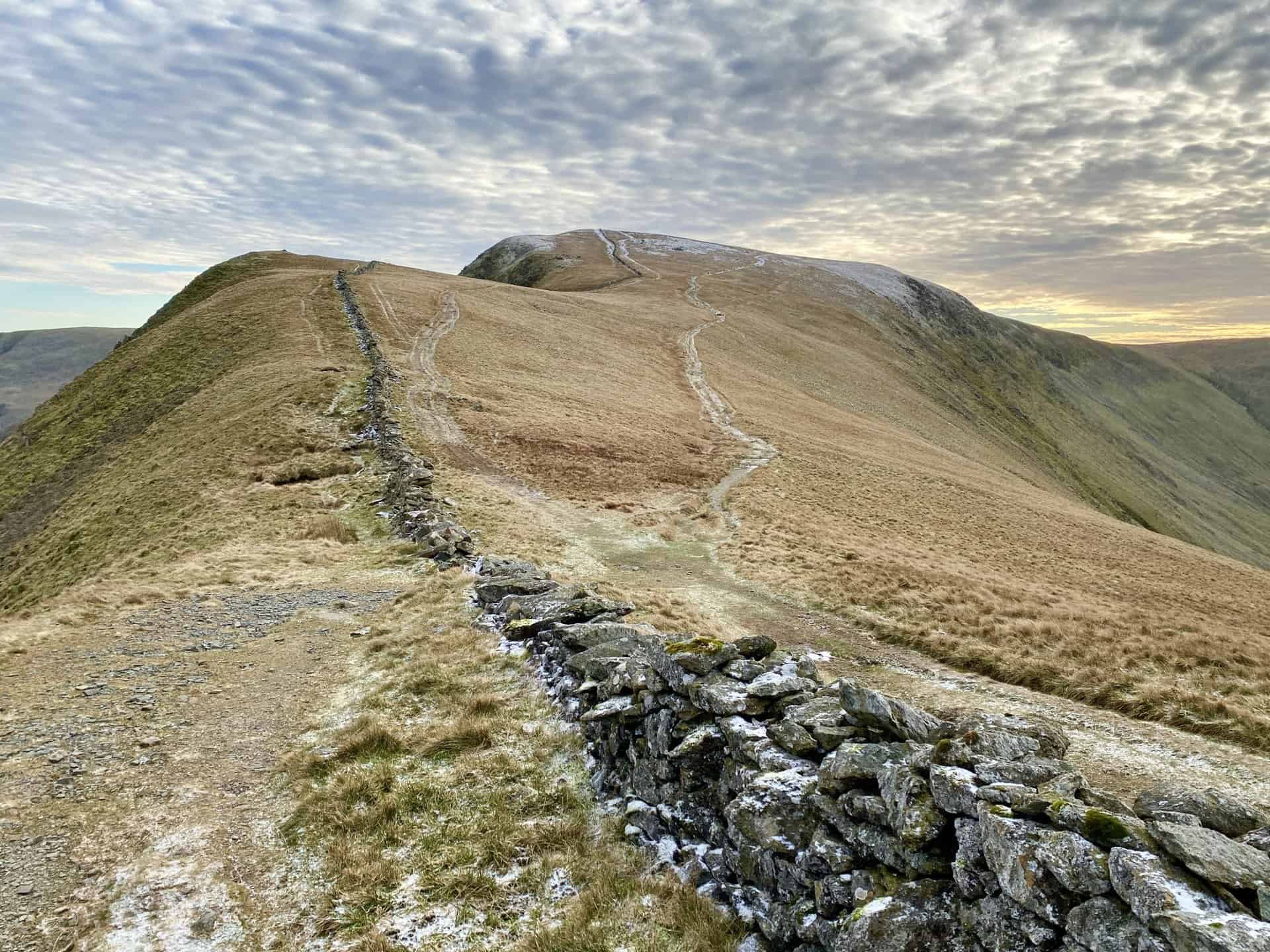
These fells are not only significant for their height but also for their dramatic landscapes and challenging Lake District walks. The northern fells, north-western fells, western fells, central fells, eastern fells, far eastern fells, southern fells, and south-eastern area each have unique characteristics and notable peaks, offering a variety of walking experiences for visitors. The combination of rugged mountains, serene lakes, and historical sites makes the Lake District a prime destination for walkers and outdoor enthusiasts.
Detailed Sections of the Lake District
Northern Fells
The northern fells are a clearly defined range of hills contained within a 13-kilometre (8-mile) diameter circle between Keswick in the south-west and Caldbeck in the north-east. This area is characterised by the prominent peak of Skiddaw, standing at 931 metres (3054 feet), which is the highest point in the northern fells. Other notable peaks include Blencathra, also known as Saddleback, at 868 metres (2848 feet), and Carrock Fell. Bassenthwaite Lake, one of the largest bodies of water in the region, occupies the valley between this massif and the north-western fells. The northern fells are known for their smooth, rounded hills and relatively sparse rock faces, making them popular among walkers seeking less rugged terrain.
North-Western Fells
The north-western fells lie between Borrowdale and Bassenthwaite Lake to the east and Buttermere and Lorton Vale to the west. Their southernmost point is at Honister Pass. This area includes the Derwent fells above the Newlands valley and the hills to the north, including Grasmoor, the highest peak in the range at 852 metres (2795 feet). Other significant peaks include Grisedale Pike and Dale Head. This region is characterised by rounded Skiddaw slate hills, with relatively few tarns and rock faces. The valleys and passes in this area offer spectacular views and are popular for walking and hiking.
Western Fells
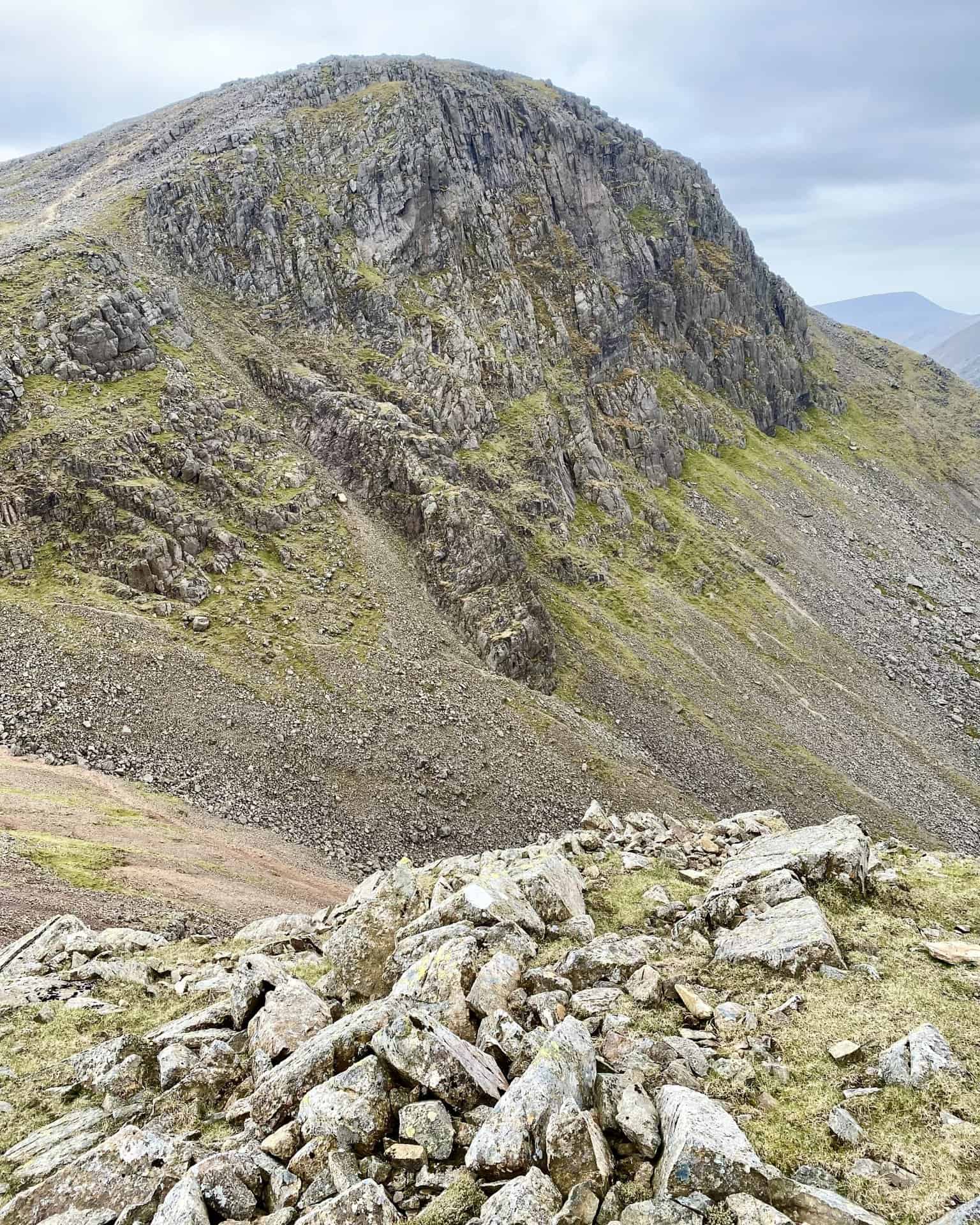
The western fells are bordered by Buttermere and Wasdale, with Sty Head forming the apex of a large triangle. The Ennerdale valley bisects this area, featuring the High Stile ridge north of Ennerdale and the Loweswater fells in the far north-west. The western fells are known for their rugged terrain, with craggy peaks and steep inclines. Significant summits include Great Gable, at 899 metres (2949 feet), and Pillar, which features the impressive Pillar Rock. Wast Water, England’s deepest lake, is located in this region, adding to the dramatic scenery.
ADVERTISEMENT
Central Fells
The central fells are generally lower in elevation compared to the surrounding areas, peaking at 762 metres (2500 feet) at High Raise. This region forms a ridge running between Derwent Water in the west and Thirlmere in the east, from Keswick in the north to the Langdale Pikes in the south. The central ridge running north over High Seat is particularly boggy, adding to the unique walking challenges in this area. The central fells are known for their scenic beauty and accessible Lake District walks, making them a favourite among less experienced hikers.
Eastern Fells
The eastern fells consist of a long north-to-south ridge known as the Helvellyn range. This range runs from Clough Head to Seat Sandal, with Helvellyn, standing at 950 metres (3118 feet), being the highest point. The western slopes of these summits tend to be grassy, while the eastern side features rocky corries and crags. The Fairfield group, located to the south, follows a similar pattern with towering rock faces and hidden valleys spilling into the Patterdale valley. Red Screes, overlooking the Kirkstone Pass, is another notable summit in this region. The eastern fells offer a variety of walking routes, from gentle slopes to more challenging ascents.
Far Eastern Fells
The far eastern fells encompass the Lakeland fells to the east of Ullswater and the A592 road running south to Windermere. The highest point in this region is High Street, at 828 metres (2717 feet), which sits on a complex ridge overlooking the hidden valley of Haweswater. The northern part of this region includes the lower fells of Martindale Common and Bampton Common, while the southern part features the fells overlooking the Kentmere valley. Further to the east, beyond Mardale and Longsleddale, lies Shap Fell, an extensive area of high moorland more reminiscent of the North Pennines. This diverse landscape offers varied walking experiences, from gentle valley strolls to strenuous fell climbs.
Southern Fells
The southern fells occupy the south-western quarter of the Lake District and are divided into three main groups. The northern group, located between Wasdale, Eskdale, and the Langdale valleys, includes England’s highest mountains: Scafell Pike, at 978 metres (3209 feet), and Scafell, slightly lower at 965 metres (3166 feet). This group also features the Wast Water Screes and the Glaramara ridge. The central area is drained by the infant River Esk, providing some of the region’s most rugged landscapes. The south-eastern group, known as the Furness fells or Coniston fells, is bounded by the Hardknott and Wrynose passes. The highest peaks here are the Old Man of Coniston and Swirl How, both slightly exceeding 800 metres (2600 feet). The south-western group includes Harter Fell and the ridge leading over Whitfell to Black Combe and the sea. The southern fells are renowned for their dramatic scenery and challenging Lake District walks.
South-Eastern Area
The south-eastern area of the Lake District lies between Coniston Water and Windermere, extending east towards Kendal and south to Lindale. This region is characterised by low hills, knolls, and limestone cuestas such as Gummer’s How and Whitbarrow. The highest point is Top o’ Selside, at 333 metres (1093 feet), located east of Coniston Water. Grizedale Forest, situated between Coniston Water and Windermere, is a significant feature of this area, offering numerous walking trails and outdoor activities. The south-eastern area’s landscape, though less rugged than other parts of the Lake District, provides a serene and picturesque environment ideal for leisurely walks and nature exploration.
Lake District Valleys
Major Valleys
The Lake District is renowned for its dramatic valleys, each offering unique landscapes and walking experiences. These major radial valleys, shaped by glaciation, extend outward from the central fells and create the region’s distinctive topography. Here is a list and description of the main valleys:
Dunnerdale
Located in the south, this valley is known for its rugged beauty and the River Duddon, which runs through it. It offers picturesque walks along its length.
Eskdale
Also in the south, Eskdale is famous for its scenic beauty and historic sites, such as the Ravenglass and Eskdale Railway. The River Esk flows through this valley, providing a tranquil setting for walkers.
Wasdale
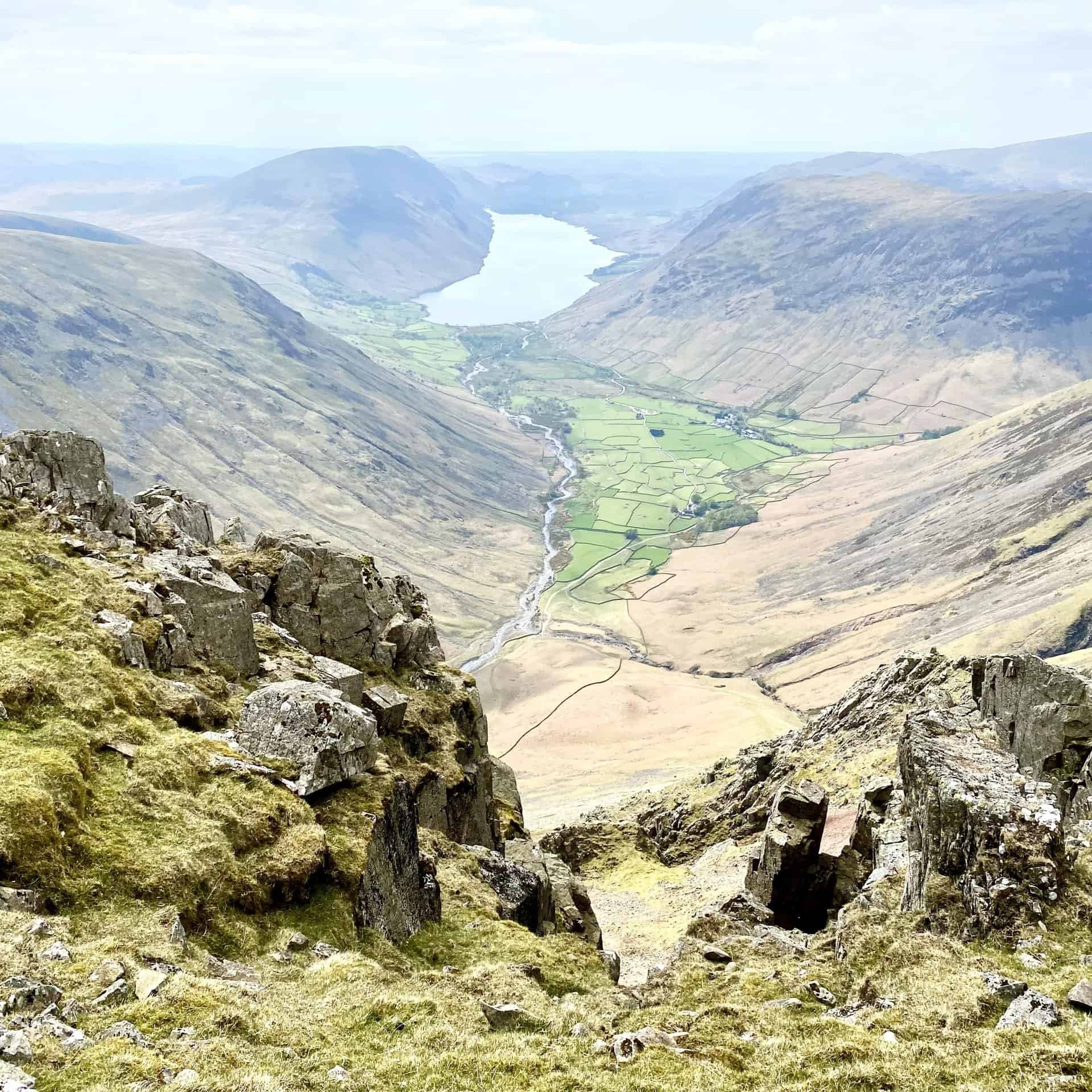
Home to England’s highest peak, Scafell Pike, Wasdale is a dramatic valley with stunning views of Wast Water, England’s deepest lake. It is a popular destination for serious hikers.
ADVERTISEMENT
Ennerdale
Bisecting the western fells, the Ennerdale valley is less visited but offers serene landscapes and Ennerdale Water. The valley is ideal for those seeking solitude and unspoiled nature.
Vale of Lorton
Situated to the north-west, this valley offers gentle walks and stunning views of the surrounding fells. It is known for its pastoral beauty and tranquil atmosphere.
Buttermere Valley
Known for the picturesque Buttermere lake, this valley is surrounded by high fells and offers a variety of walking trails, including the famous Haystacks.
Derwent Valley and Borrowdale
These valleys converge on the town of Keswick and feature some of the Lake District’s most iconic scenery, including Derwent Water and the surrounding fells.
Ullswater Valley
Stretching along Ullswater, this valley offers diverse walking routes and stunning lake views. It is also famous for the Ullswater ‘Steamers’ boats.
Haweswater Valley
This remote valley, home to Haweswater Reservoir, is known for its rugged beauty and the Golden Eagle, once the only one in England.
Longsleddale
A quiet and less frequented valley, Longsleddale offers peaceful walks and beautiful landscapes, ideal for those looking to escape the crowds.
Kentmere Valley
Known for the Kentmere Horseshoe, a popular walking route, this valley offers challenging hikes and rewarding views.
Grasmere, Great Langdale, and Little Langdale
These valleys converge at the head of Windermere and offer a range of walks, from gentle strolls around Grasmere Lake to more strenuous hikes in the Langdales.
Coniston Water Valley
Located in the southern part of the Lake District, this valley features the serene Coniston Water and the historic village of Coniston.
The valleys break the mountains into distinct blocks, providing a variety of walking experiences. Alfred Wainwright, in his renowned guides to the Lakeland fells, detailed numerous walks in these valleys, making them accessible to walkers of all levels.
Lake District Lakes
Major Lakes and Reservoirs
The Lake District is home to a number of significant lakes and reservoirs, each offering its own unique charm and recreational opportunities. Here is a list of the major lakes and reservoirs within the National Park:
Bassenthwaite Lake
One of the largest bodies of water in the Lake District, known for its diverse wildlife and scenic walks.
Brothers Water
A small, tranquil lake offering peaceful walks and stunning reflections of the surrounding fells.
Buttermere
Surrounded by high fells, Buttermere offers picturesque walks along its shores and stunning views.
Coniston Water
Known for its association with the writer Arthur Ransome and the record-breaking speed attempts by Donald Campbell, Coniston Water is a popular spot for boating and walking.
Crummock Water
Located between Buttermere and Loweswater, Crummock Water is known for its clear waters and scenic beauty.
Derwent Water
Situated near Keswick, Derwent Water is one of the most popular lakes in the region, offering a range of water sports and walking routes.
ADVERTISEMENT
Devoke Water
A remote and less visited lake, Devoke Water is ideal for those seeking solitude and natural beauty.
Elter Water
A small lake offering gentle walks and stunning views, particularly popular with photographers.
Ennerdale Water
The most westerly lake, Ennerdale Water is less visited but offers unspoiled landscapes and tranquil walks.
Esthwaite Water
A private waterbody known for fishing and its connections to Beatrix Potter.
Grasmere
Situated south of the village of Grasmere, this lake is famous for its association with the poet William Wordsworth and offers serene walks.
Haweswater Reservoir
Created by the damming of the the Mardale valley, Haweswater Reservoir is known for its rugged beauty and the once sighted Golden Eagle.
Hayeswater
A small, high-altitude lake offering a peaceful setting and great views of the surrounding fells.
Loweswater
One of the quieter lakes, Loweswater offers peaceful walks and stunning reflections of the surrounding landscape.
Rydal Water
Close to Grasmere, Rydal Water is known for its scenic beauty and literary connections to Wordsworth.
Thirlmere
A reservoir serving Manchester, Thirlmere offers beautiful walks and views of the surrounding fells.
ADVERTISEMENT
Ullswater
The second largest lake in the region, Ullswater is famous for its beauty and the Ullswater ‘Steamers’ boats that offer scenic cruises.
Wast Water
The deepest lake in England, Wast Water is surrounded by some of the highest peaks and offers dramatic scenery and challenging walks.
Windermere
The largest lake in England, Windermere is a popular tourist destination offering a variety of water sports, boat trips, and walks.
It is worth noting that only one of the lakes in the Lake District is officially named a ‘lake’—Bassenthwaite Lake. The others are referred to as meres, tarns, or waters. ‘Mere’ is the least common term, while ‘water’ is the most commonly used. These naming conventions add to the unique character and charm of the Lake District, making it a fascinating place to explore.
Lake District Geology
Geological Composition
The Lake District’s geology is exceptionally complex and diverse, reflecting its long and dynamic geological history. This region’s geological foundation is primarily a result of ancient volcanic activity, sedimentation, and subsequent glaciation. Broadly, the Lake District can be divided into three main geological bands, which run from the south-west to the north-east, with the rocks generally becoming younger from the north-west to the south-east.
North-Western Band
This band is composed of early to mid-Ordovician sedimentary rocks, predominantly mudstones and siltstones of marine origin. Known as the Skiddaw Group, these rocks include what are traditionally called the Skiddaw Slates. The friability of these rocks results in mountains with relatively smooth slopes, such as Skiddaw itself.
Central Band
The central part of the Lake District features a mix of volcanic and sedimentary rocks of mid-to-late Ordovician age. These include the lavas and tuffs of the Borrowdale Volcanic Group, which were formed as the Iapetus Ocean was subducted beneath what is now the Scottish border during the Caledonian orogeny. The northern central peaks, like Great Rigg, are the product of considerable lava flows. The subsequent pyroclastic eruptions created calderas, with Scafell Pike being a notable example. This region’s craggy landscapes are characteristic of these pyroclastic rocks.
South-Eastern Band
This area consists of the mudstones and wackes of the Windermere Supergroup, including the Dent, Stockdale, Tranearth, Coniston, and Kendal groups. These rocks are generally less resistant to erosion than those to the north, underlying much of the lower landscapes around Coniston and Windermere.
Notable Rock Formations
Significant rock formations in the Lake District include granite batholiths and various notable outcrops. These geological features are crucial in shaping the region’s unique landscape:
Granite Batholiths
The presence of granite batholiths beneath the Lake District is responsible for the uplifted massif, as the low-density granite causes the area to be buoyed up. These granite formations can be observed at the surface in places like Ennerdale, Skiddaw, Carrock Fell, Eskdale, and Shap.
Ordovician Rocks
The Borrowdale Volcanic Group, comprising lavas and tuffs, is particularly notable in the central Lake District. These volcanic rocks, formed from ancient lava flows and pyroclastic eruptions, are visible in the rugged terrains and craggy peaks of the region.
Silurian Rocks
The mudstones and wackes of the Windermere Supergroup belong to this period, contributing to the gentler landscapes found in the south-eastern part of the Lake District.
Carboniferous Limestone
Surrounding the Ordovician and Silurian rocks on the northern, eastern, and southern fringes of the Lake District is a semi-continuous outcrop of Carboniferous Limestone. This limestone is particularly spectacular at sites like Whitbarrow Scar and Scout Scar, where it forms dramatic cliffs and pavements.
Journey Through Time on Lake District Walks
The Lake District’s unique geological composition, stunning landscapes, and rich cultural heritage make it a remarkable destination for walkers and outdoor enthusiasts. The region’s diverse geology, from the ancient Skiddaw Slates to the dramatic Borrowdale Volcanic Group and the scenic Carboniferous Limestone outcrops, offers a fascinating exploration into the earth’s history. Walking through the Lake District allows visitors to fully appreciate its natural beauty and historical significance, making it an unparalleled experience. Whether you are drawn by the challenging peaks of the fells, the serene beauty of the lakes, or the intriguing geological formations, the Lake District promises an unforgettable journey through one of England’s most cherished landscapes.
ADVERTISEMENT