ADVERTISEMENT
Navigate the High Stile Walk for an Unforgettable Lake District Experience
Begin your High Stile walk from the quaint village of Buttermere. Proceed south, towards the fords of Sourmilk Gill, a picturesque location that prepares you for the terrain ahead. Next, commence a southern climb through the delightful Burtness Wood.
Upon emerging from the woodland, continue uphill towards Bleaberry Tarn. Exercise caution during the next phase, a steep ascent on potentially slippery scree, until you reach the summit of Red Pike. This climb offers the most direct route to Red Pike from Buttermere.
Now, move south-east along the ridge from Red Pike. Above the striking Chapel Crags, the ascent to High Stile awaits. This peak represents the highest point of your High Stile walk. Press on south-east, passing above both Eagle Crag and Comb Crags, to reach the High Crag summit.
ADVERTISEMENT
Start your descent from High Crag, taking the path down via Gamlin End. Traverse the summit of Seat to arrive at Scarth Gap Pass. Follow this path downwards, between High Wax Knott and Low Wax Knott. Continue across Buttermere Fell to the south-eastern corner of Buttermere.
From here, head north-west. The path runs along Buttermere’s southern shores and winds through Burtness Wood. Proceed back to the fords of Sourmilk Gill and then turn north to return to Buttermere. This 7½ mile High Stile walk in the Lake District combines a moderate challenge with stunning scenery. Enjoy the exploration!
High Stile Walk: Maps and Tools
Visit either the OS Maps website or the Outdooractive website to view this walking route in greater detail. Both platforms offer a range of features, including the ability to print the route, download it to your device, and export the route as a GPX file. You can also watch a 3D fly-over and share the route on social media.
High Stile Walk: Distance, Duration, Statistics
Distance: 7½ miles
Distance: 12 kilometres
Duration: 4½ hours
Ascent: 3012 feet
Ascent: 918 metres
Type: Circular walk
About High Stile
High Stile, the pinnacle of the range of fells stretching from Great Gable towards Loweswater, towers over the lake and village of Buttermere. Along with Red Pike and High Crag, it creates a picturesque trio of fells. These fells, sometimes referred to as the Buttermere Edge, form the watershed between Buttermere and Upper Ennerdale.
High Stile boasts high crags, wild combes, and a quaint tarn, Bleaberry Tarn. Its Ennerdale flanks are steep and rough with craggy areas, framed by a strip of conifers. The ridge-top to the north reveals deep corries and dark crag walls looming over the lake.
This fell is best ascended as part of a High Stile walk across the three fells (Red Pike, High Stile, and High Crag). The ridge continues south-east towards Haystacks and the Great Gable group. Red Pike sits to the west, followed by Starling Dodd, Great Borne, and the Loweswater Fells.
High Stile ranks 30th by height in the Wainwright Pictorial Guide to the Lakeland Fells list. Its height is an impressive 806 metres (2645 feet). The fell’s grid reference is NY 167 147, and it is shown on the OL4 Explorer and 89 Landranger maps.
Recommended Ordnance Survey Map
The best map to use on this walk is the Ordnance Survey map of the Lake District North-Western Area, reference OS Explorer OL4, scale 1:25,000. It clearly displays footpaths, rights of way, open access land and vegetation on the ground, making it ideal for walking, running and hiking. The map can be purchased from Amazon in either a standard, paper version or a weatherproof, laminated version, as shown below.
Standard Version
High Stile Walk: My Photos
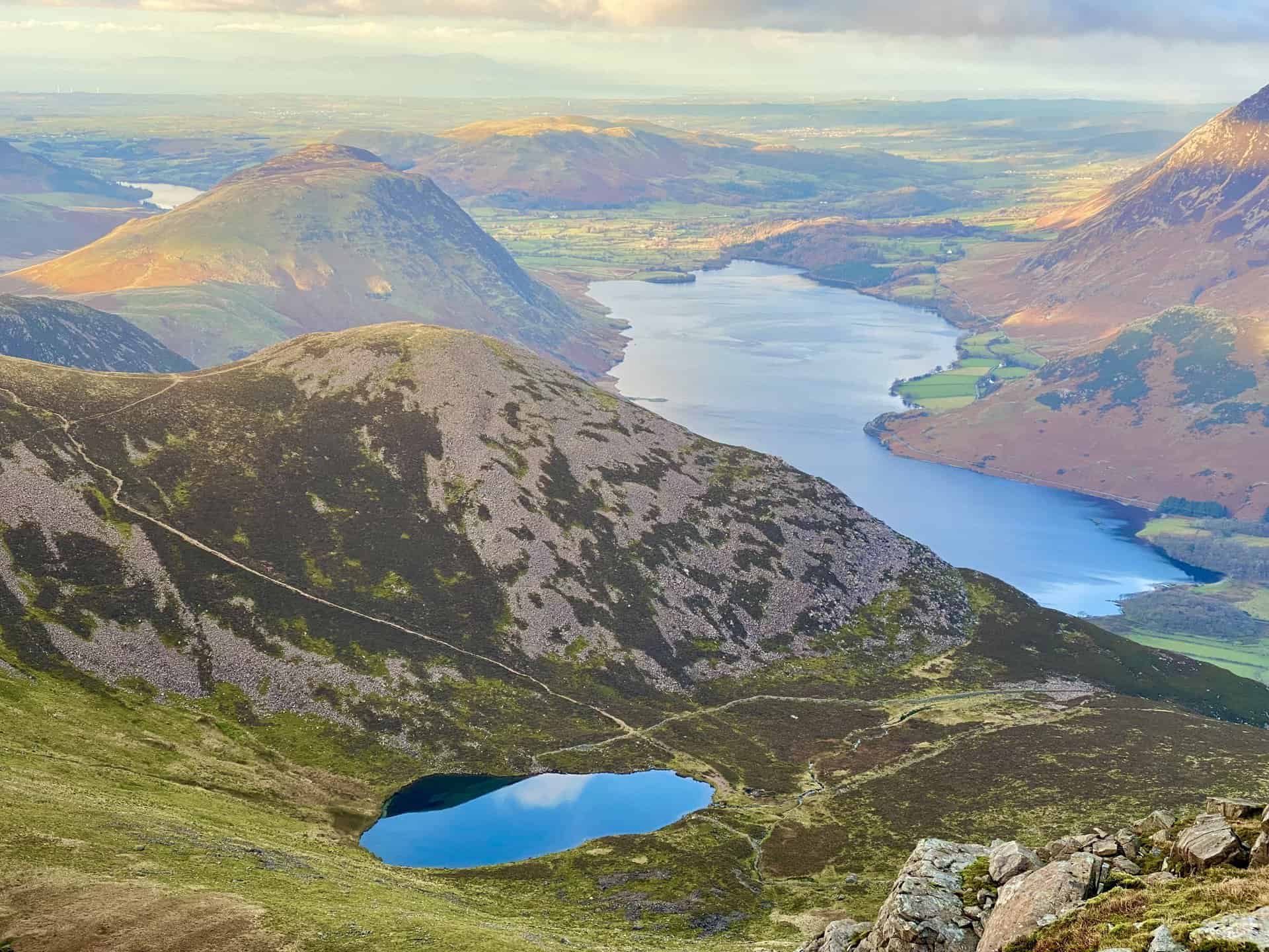
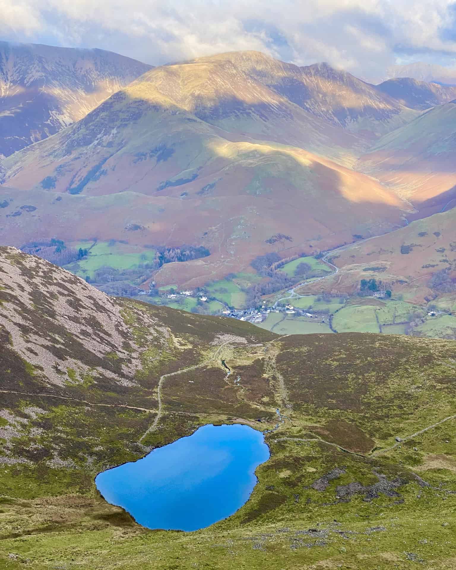
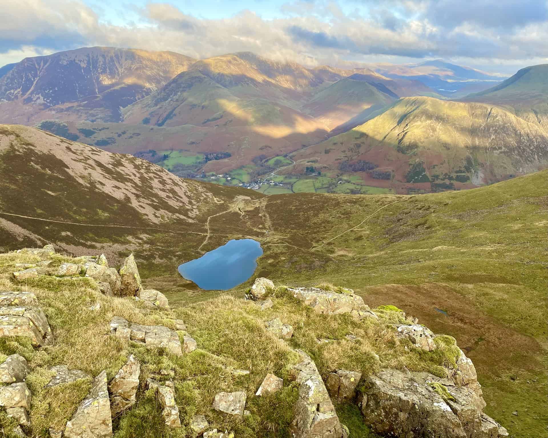
The view down to Bleaberry Tarn and Buttermere from the Red Pike summit, height 755 metres (2477 feet). Red Pike is the first of the three mountains encountered on this High Stile walk.
ADVERTISEMENT
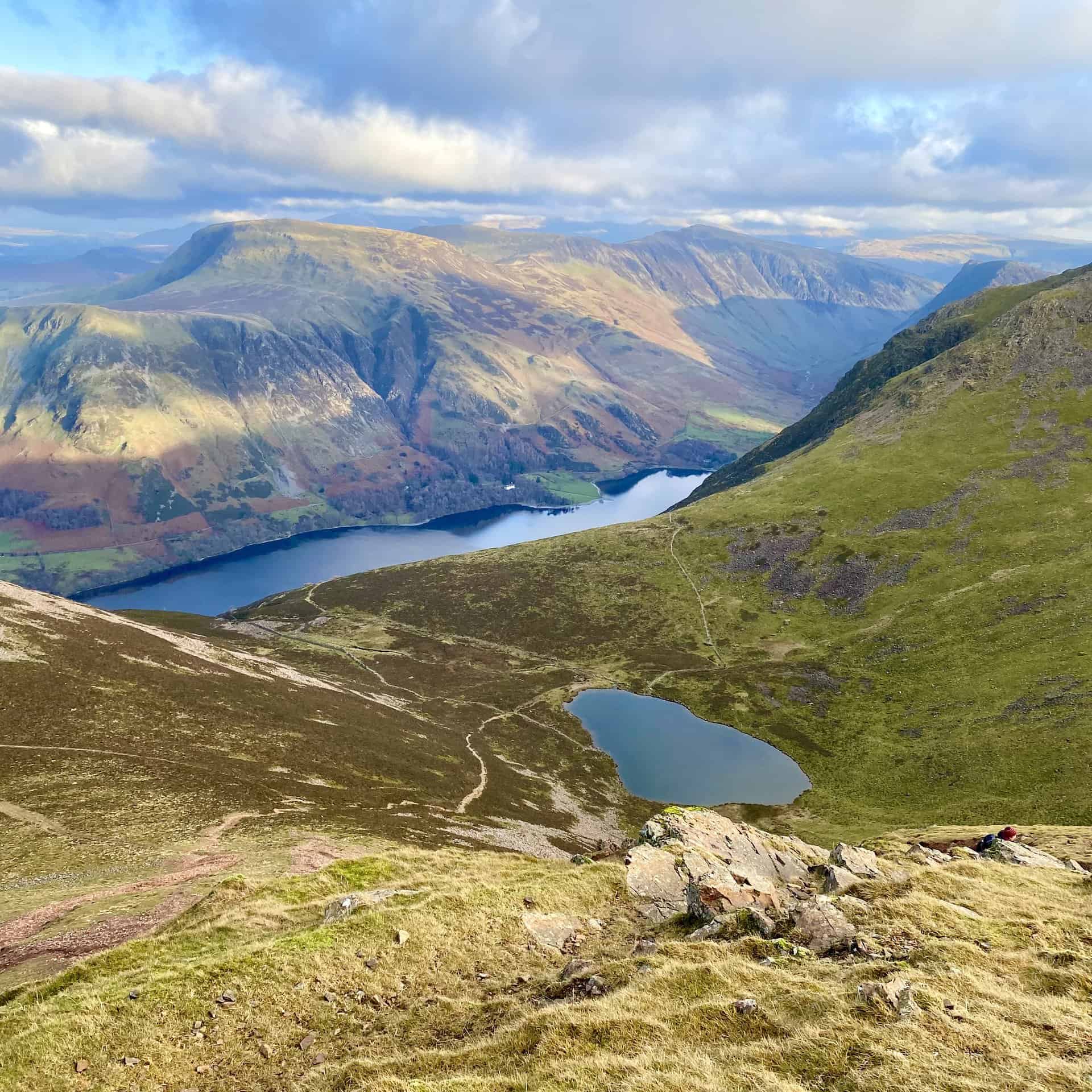
Magical scenes from Red Pike. The hill in the foreground is Dodd, with Crummock Water to the left.
ADVERTISEMENT
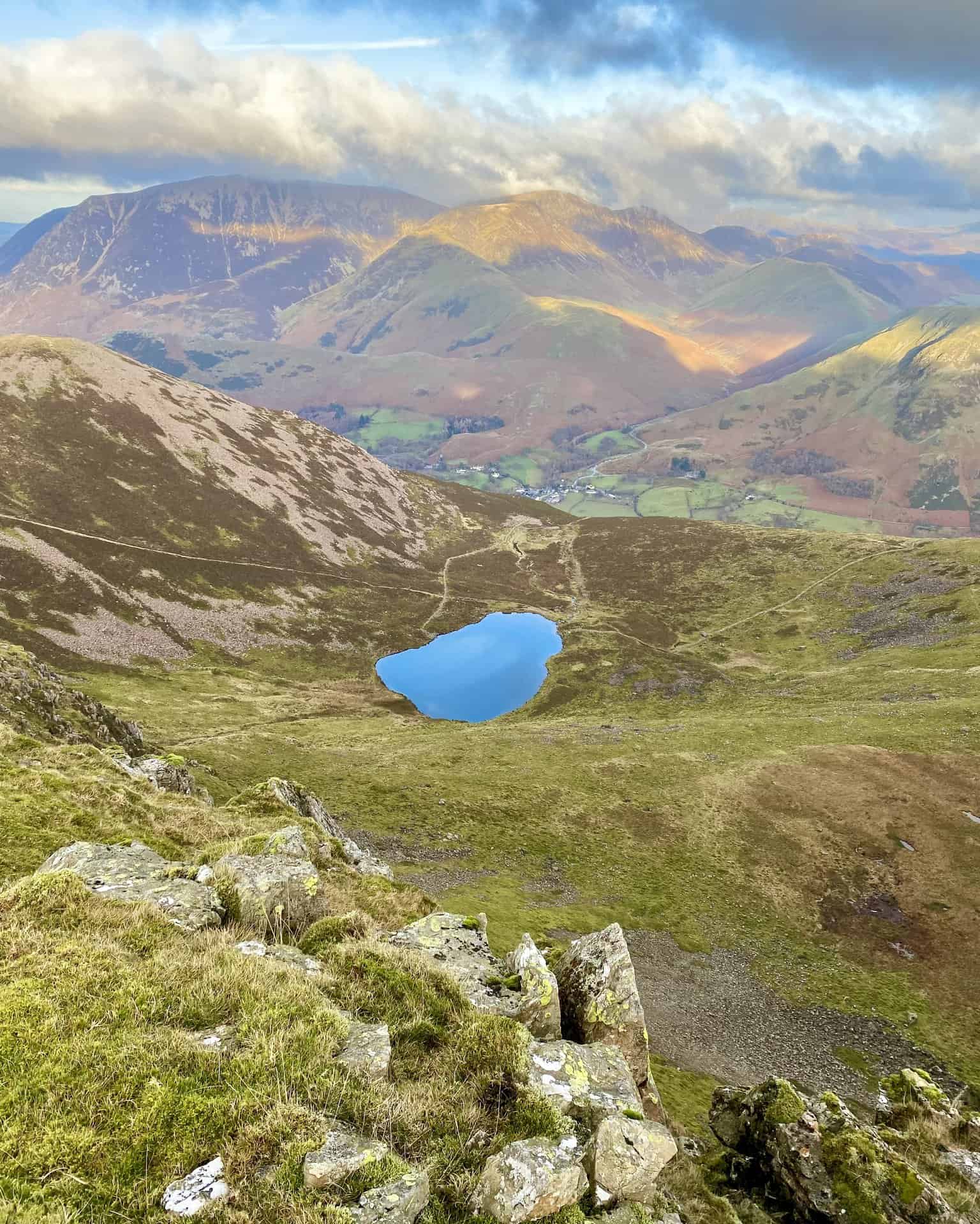
Spectacular vistas from above Chapel Crags. Bleaberry Tarn down below, and the village of Buttermere in the valley. Stretching out behind Buttermere is the mountain range comprising Whiteless Pike, Wandhope, Crag Hill and Sail. The largely brown-coloured mountain on the left-hand side is Grasmoor.
ADVERTISEMENT
ADVERTISEMENT
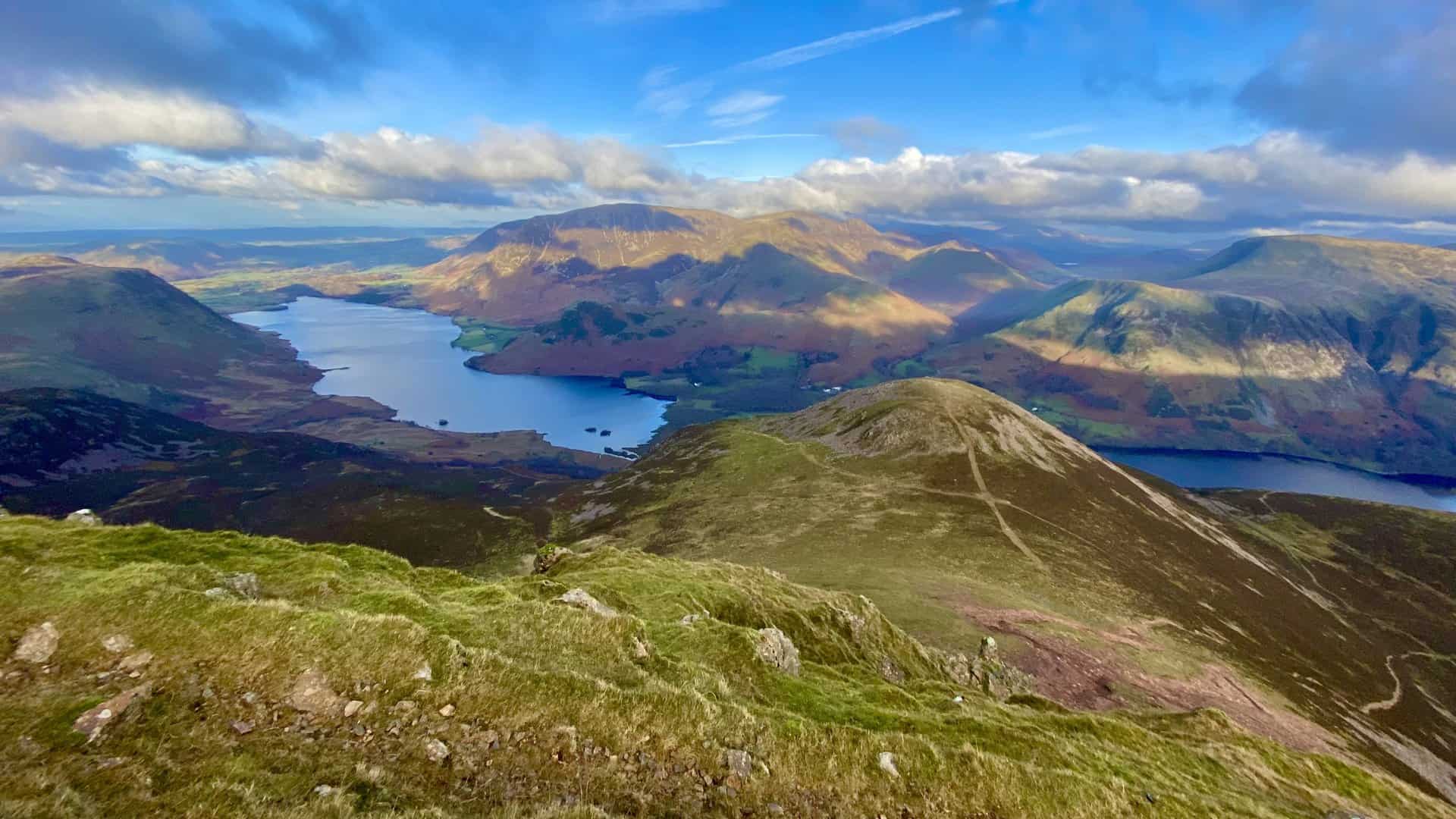
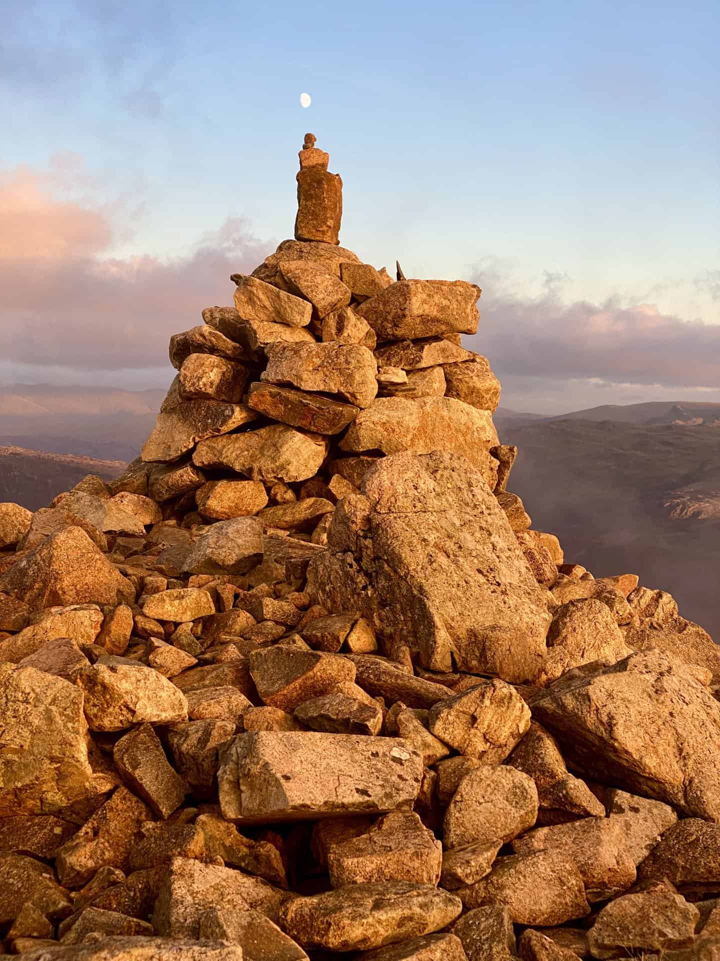
More magnificent panoramas from the top of High Stile, including the distant Loweswater, a smaller lake to the north-west of Crummock Water. As the highest point on the High Stile walk and the second mountain along the ridge, High Stile stands at 806 metres (2645 feet).
The summit of High Crag, height 744 metres (2441 feet). High Crag is the third and last mountain encountered on this High Stile walk.
ADVERTISEMENT
ADVERTISEMENT