ADVERTISEMENT
Experience the Beautiful Barf Walk and Unforgettable Bassenthwaite Lake Views
Begin your Lake District adventure in the picturesque village of Braithwaite. If you’re driving, you’ll find convenient parking along a minor road near the A66, directly opposite Braithwaite. This serves as an ideal starting point for your Barf walk.
Depart Braithwaite heading west along the B5292. Then, take the route north along a well-marked public footpath. Wander through serene woodland, following tranquil paths and tracks past the small settlement of Ladstock, leading all the way up to Thornthwaite.
ADVERTISEMENT
Once you reach Thornthwaite, steer your steps south-west. Here, you’ll encounter a climb through the enchanting Thornthwaite Forest. Keep Comb Beck as your companion, generally following its course up to the Whinlatter Forest Park visitor centre.
Upon reaching the visitor centre, commence your exploration with the Seat How Summit Trail. You’ll spot signs marked in green near the visitor centre, or refer to the leaflet from keswick.org (https://www.keswick.org/UserContent/doc/23250/whinlatter-walking-trails-map.pdf) for a map. This trail takes you north through the verdant forest towards Ullister Hill.
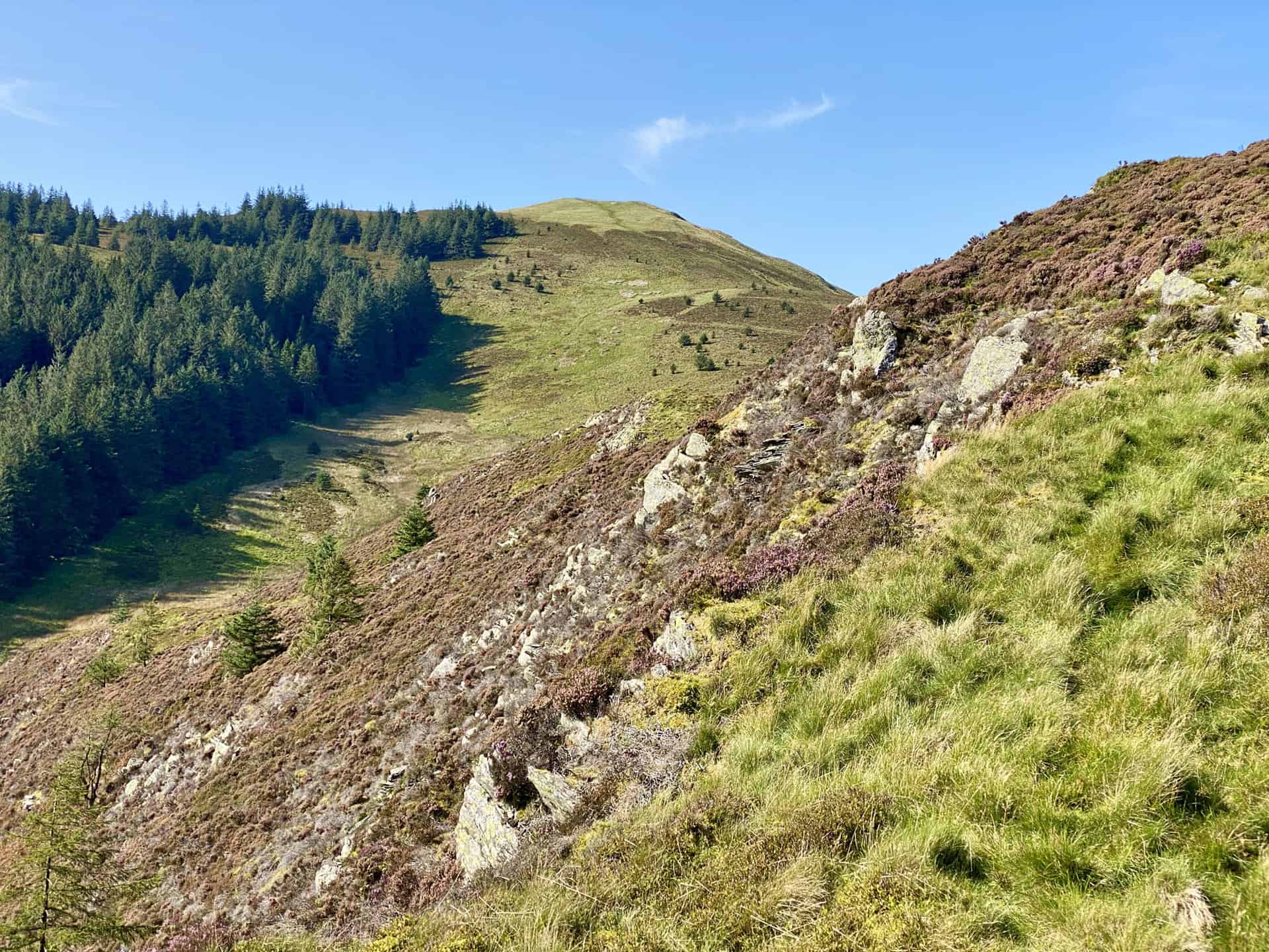
Just south of Ullister Hill, leave the Seat How Summit Trail. Now, challenge yourself to a summit climb up to Lord’s Seat. As you conquer this peak, gear up for the next leg of your Barf walk.
From Lord’s Seat, head east. This leads you to the top of Barf, where mesmerising views of Bassenthwaite Lake await. Take a moment to savour the vista – it’s the crowning jewel of this Barf walk.
Once you’re ready, head southwest back into the comforting shade of the forest. Navigate generally south through the woods, following the forest trails back to Comb Beck. This tranquil watercourse will guide you back to Thornthwaite.
Upon returning to Thornthwaite, your Barf walk takes you south along peaceful minor roads. Pass by Lanefoot Farm and Spring Bank, leading you back to your starting point, Braithwaite.
Congratulations, you’ve just completed a rewarding 10-mile Barf walk in the heart of the Lake District. Enjoy the sense of accomplishment and cherish the lasting memories of stunning natural beauty.
Barf Walk: Maps and Tools
Visit either the OS Maps website or the Outdooractive website to view this walking route in greater detail. Both platforms offer a range of features, including the ability to print the route, download it to your device, and export the route as a GPX file. You can also watch a 3D fly-over and share the route on social media.
Barf Walk: Distance, Duration, Statistics
Distance: 10¾ miles
Distance: 16½ kilometres
Duration: 5½ hours
Ascent: 2527 feet
Ascent: 770 metres
Type: Circular walk
About Barf
Barf, situated in the north-western region of the Lake District, is a noteworthy fell that sits on the south-western boundary of Bassenthwaite Lake. Recognised for a distinguishing whitewashed pillar of rock, the ‘Bishop of Barf’ or ‘Bishop’s Rock’, found on its lower inclines, Barf’s name is understood to originate from ‘burgh’.
Although essentially an eastern appendage of Lord’s Seat, Alfred Wainwright, in his influential Pictorial Guide to the Lakeland Fells, attributed to Barf the status of an independent fell. The eastern facade of Barf presents a daunting, steep wall of scree plummeting towards the Keswick to Cockermouth road and the lake’s edge.
A remarkable feature of Barf is the ‘Bishop of Barf’, a white painted stone stationed at 700 feet on a rocky site. This stone, visible from the A66 Cockermouth to Keswick road, denotes the location where, as per local folklore, the Bishop of Derry was killed in 1783. He was said to have fallen off his horse after a drunken bet that he could ascend the hill. Both the bishop and his horse are reputedly buried by a smaller stone, named the Clerk, at the hill’s base.
Nonetheless, the tale is likely to be fabricated, as records show the Bishop of Derry passed away in Italy 20 years later. Despite this, the colourful narrative of the Bishop’s life has been an inspiration for many stories that captivate the imagination. The Swan Hotel staff were responsible for the annual whitewashing of the stone until its conversion into apartments. Currently, this task is undertaken by the Keswick Mountain Rescue team.
Standing around 7 feet high on the shortest side, the Bishop contrasts with the much smaller conical stone, the Clerk. The summit of Barf is a small platform covered with a thin layer of grass, slightly withdrawn from the eastern slope. A Barf walk rewards hikers with a splendid eastward view to Skiddaw and Longside Edge, with Bassenthwaite Lake providing a stunning foreground.
Recommended Ordnance Survey Map
The best map to use on this walk is the Ordnance Survey map of the Lake District North-Western Area, reference OS Explorer OL4, scale 1:25,000. It clearly displays footpaths, rights of way, open access land and vegetation on the ground, making it ideal for walking, running and hiking. The map can be purchased from Amazon in either a standard, paper version or a weatherproof, laminated version, as shown below.
Standard Version
Barf Walk: My Photos
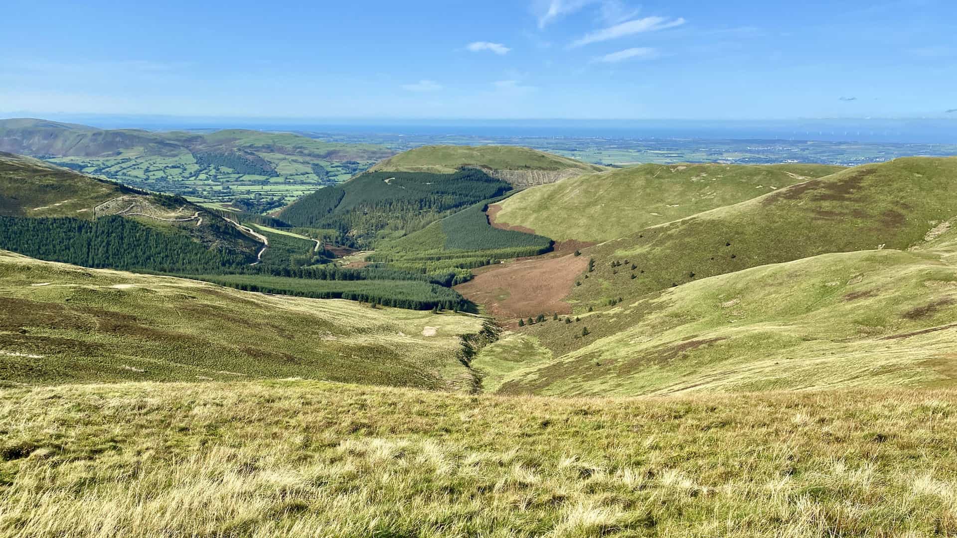
The view north-east from Ullister Hill towards the Skiddaw range of mountains.
ADVERTISEMENT
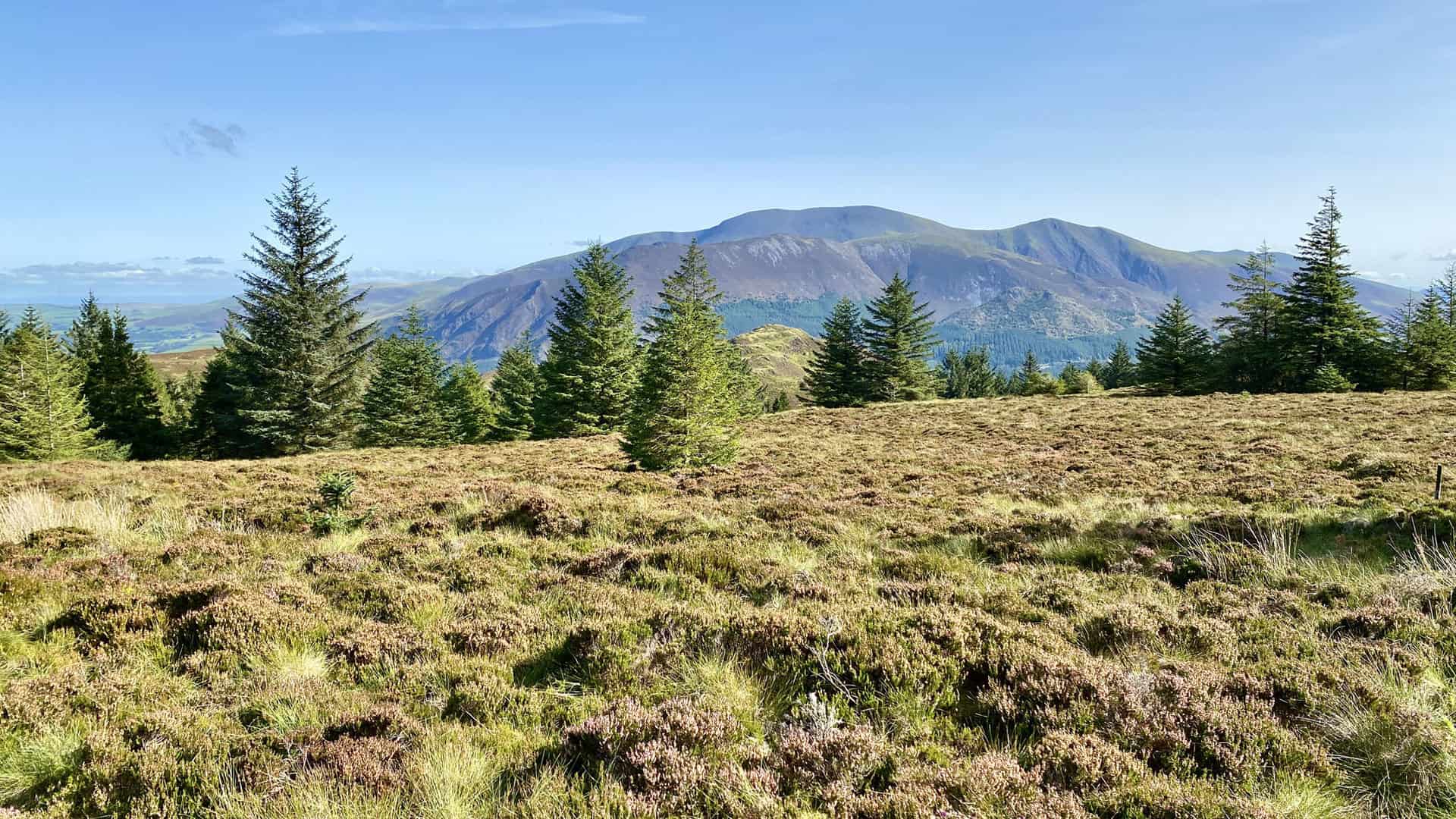
Looking south-west from Lord’s Seat towards some of the north-western fells including Grisedale Pike on the left. Lord’s Seat is about half way round this Barf walk.
ADVERTISEMENT
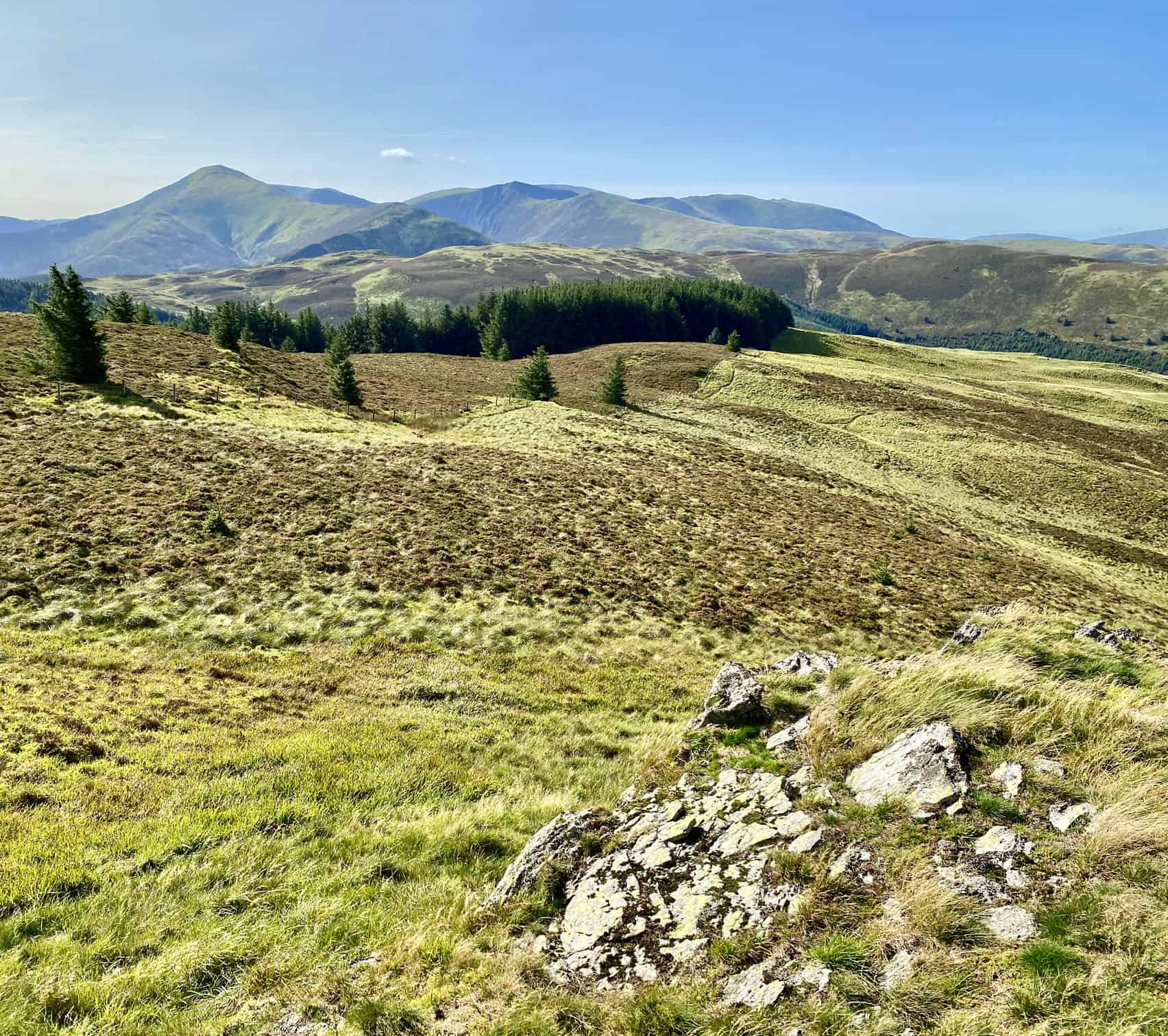
Darling How Plantation in the valley to the west of Lord’s Seat, with Graystones just visible behind the trees. In the far distance is the English coastline, roughly between Workington and Whitehaven.
ADVERTISEMENT
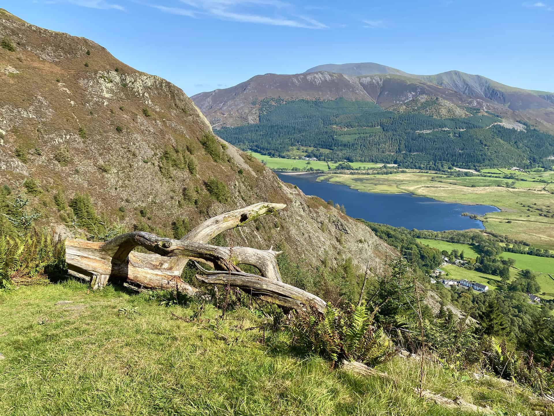
Looking down upon Bassenthwaite Lake from the northern slopes of Barf. An absolute highlight of this Barf walk.
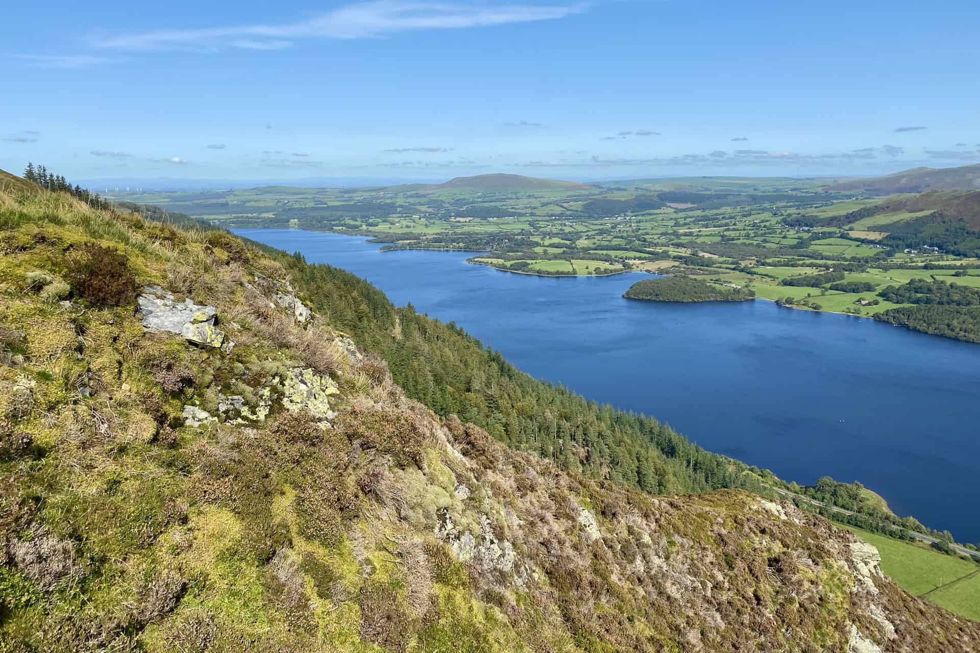
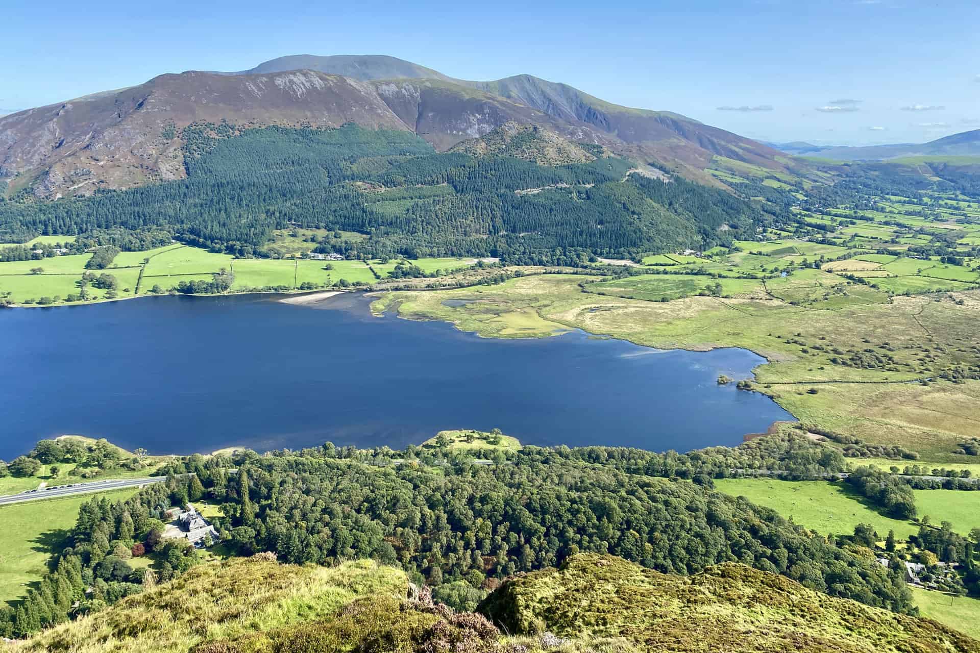
The southern extent of Bassenthwaite Lake and a few of the northern fells as seen from the summit of Barf. The smaller, tree-covered hill on the other side of the lake is Dodd. Behind Dodd are the peaks of Carl Side, Long Side and Ullock Pike. At the back are the summits of Little Man and Skiddaw.
ADVERTISEMENT
The full list of Alfred Wainwright’s Northern Fells by height is as follows:
- Skiddaw, 931 metres (3054 feet)
- Blencathra, 868 metres (2848 feet)
- Skiddaw Little Man, 865 metres (2838 feet)
- Carl Side, 746 metres (2448 feet)
- Long Side, 734 metres (2408 feet)
- Lonscale Fell, 715 metres (2346 feet)
- Knott, 710 metres (2329 feet)
- Bowscale Fell, 702 metres (2303 feet)
- Great Calva, 690 metres (2264 feet)
- Ullock Pike, 690 metres (2264 feet)
- Bannerdale Crags, 683 metres (2241 feet)
- Bakestall, 673 metres (2208 feet)
- Carrock Fell, 663 metres (2175 feet)
- High Pike, 658 metres (2159 feet)
- Great Sca Fell, 651 metres (2136 feet)
- Mungrisdale Common, 633 metres (2077 feet)
- Brae Fell, 586 metres (1923 feet)
- Meal Fell, 550 metres (1804 feet)
- Great Cockup, 526 metres (1726 feet)
- Souther Fell, 522 metres (1713 feet)
- Dodd, 502 metres (1647 feet)
- Longlands Fell, 483 metres (1585 feet)
- Binsey, 447 metres (1467 feet)
- Latrigg, 367 metres (1204 feet)
The complete list of all 214 Lake District Wainwrights is available here:
The view back to Lord’s Seat from Barf.
ADVERTISEMENT
The southern tip of Bassenthwaite Lake viewed from Birch Crag, just south of Barf.
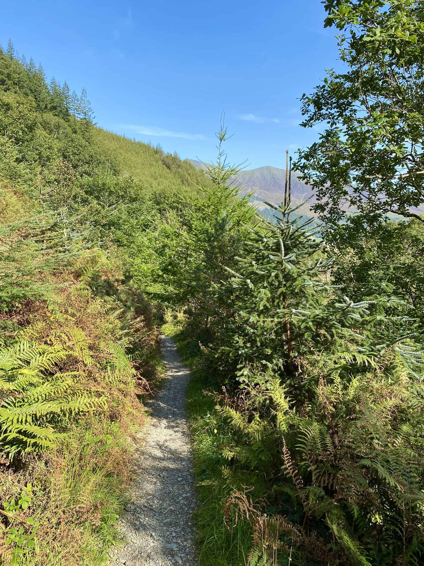
The forest path leading to Thornthwaite.
ADVERTISEMENT
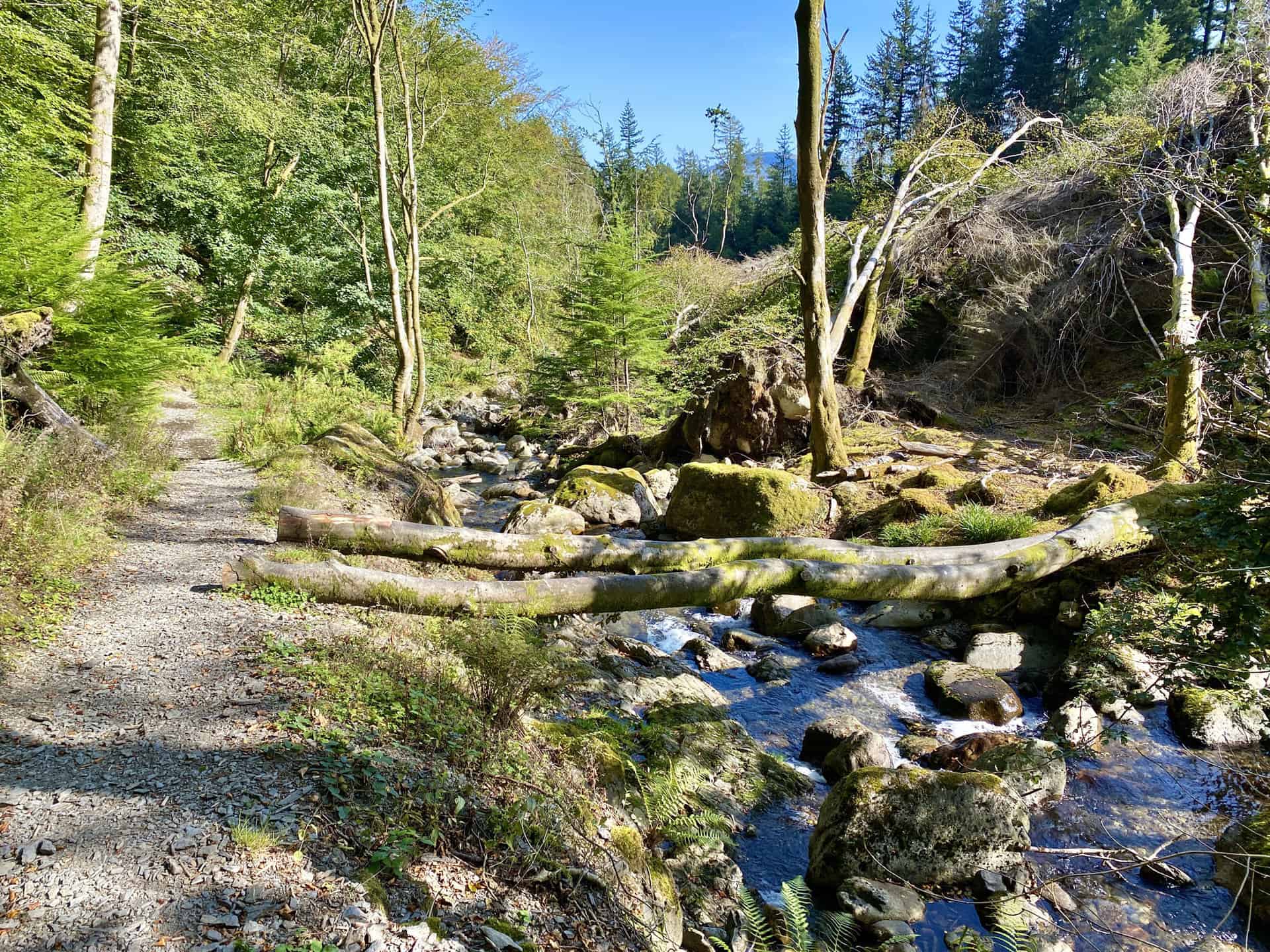
Comb Beck near Thornthwaite.
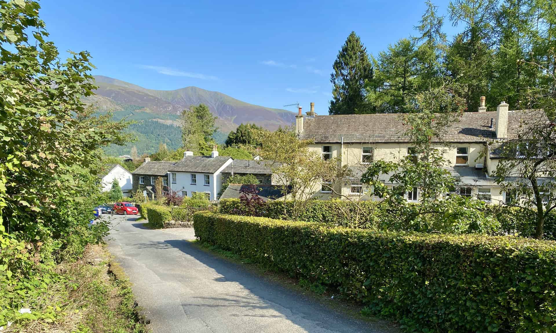
The village of Thornthwaite.
ADVERTISEMENT
ADVERTISEMENT