Reach Helvellyn Via Striding Edge and Visit Nethermost Pike and Dollywaggon Pike
Your walk to Helvellyn via Striding Edge begins in the charming village of Patterdale. This village is located at the southern end of Ullswater in the Lake District on the A592 road between Penrith and Windermere. Parking is available opposite the Patterdale Hotel in the village centre. From the hotel, head north along the road towards Ullswater, passing the church on your left. Shortly after, you’ll reach Grisedale Bridge, which carries the main road over Grisedale Beck. Just before the bridge, take the minor road on the left, following it uphill through the woodland until it becomes a track near Thornhow.
Near Thornhow, turn right and cross a bridge over Grisedale Beck, beginning your ascent to Helvellyn via Striding Edge. Enjoy the splendid views up the valley towards Dollywaggon Pike and across to your left, where you can see the impressive St Sunday Crag. Continue on the path as it winds uphill in a westward direction. This path takes you up the steep southern slopes of Birkhouse Moor for almost two miles until you reach a junction of paths at Hole-in-the-Wall.

From Hole-in-the-Wall, continue south-west across the ridge above Bleaberry Crag. Here, you’ll encounter one of the day’s highlights: crossing Striding Edge. Take your time and proceed with caution, soaking in the stunning views down to Red Tarn on your right and across to Swirral Edge and the cone-shaped Catstye Cam. After navigating Striding Edge, a final steep climb awaits, leading you to the peak of Helvellyn. Turn right across the plateau to reach the summit shelter and the triangulation pillar. From here, you can enjoy far-reaching views of the Lake District mountains. Also, bodies of water like Ullswater to the east, and Grasmere, Rydal Water, Windermere, Esthwaite Water, and Coniston Water to the south.
After enjoying the summit of Helvellyn, retrace your steps slightly and then head south downhill before ascending to the crest of Nethermost Pike. Stay close to the steep eastern slopes for breathtaking views down the Grisedale valley, from where you ascended earlier. Continue south from Nethermost Pike, descending slightly before climbing again to High Crag. Keep heading south to reach the pinnacle of Dollywaggon Pike, maintaining your position near the eastern slopes.

From Dollywaggon Pike, prepare for a steep descent along a well-defined stone path leading to Grisedale Tarn, with Fairfield towering high behind it. Grisedale Tarn offers a tranquil spot for a rest. From here, navigate north-east through the valley, following the path alongside Grisedale Beck back to Patterdale. This final stretch is approximately four miles and can be tiring after a long day, but it is straightforward.
Eventually, you’ll arrive back at the main A592 road at Grisedale Bridge. Turn right and follow the road back to where you started in Patterdale. This magnificent walk to Helvellyn via Striding Edge, almost 11 miles (18 kilometres) long, is both exhilarating and rewarding, offering spectacular views throughout. After this tiring yet fulfilling trek, you’ve certainly earned a refreshing drink at the Patterdale Hotel bar.
Helvellyn Via Striding Edge: Maps and Tools
Visit either the OS Maps website or the Outdooractive website to view this walking route in greater detail. Both platforms offer a range of features, including the ability to print the route, download it to your device, and export the route as a GPX file. You can also watch a 3D fly-over and share the route on social media.
Helvellyn Via Striding Edge: Distance, Duration, Statistics
Distance: 10½ miles
Distance: 17 kilometres
Duration: 5¾ hours
Ascent: 3128 feet
Ascent: 953 metres
Type: Circular walk


Walking in the Yorkshire Dales with 43 Circular Routes
AD This Cicerone guidebook includes 43 circular walks exploring valleys, hills, and moors between Kirkby Stephen and Pateley Bridge. With OS maps, local highlights, and routes ranging from 3–11 miles, it is a year-round companion for walkers of all abilities.
Recommended Ordnance Survey Map
The best map to use on this walk is the Ordnance Survey map of the Lake District North-Eastern Area, reference OS Explorer OL5, scale 1:25,000. It clearly displays footpaths, rights of way, open access land and vegetation on the ground, making it ideal for walking, running and hiking. The map can be purchased from Amazon in either a standard, paper version or a weatherproof, laminated version, as shown below.
Standard Version
About Striding Edge
Striding Edge is a popular route up to Helvellyn that involves some scrambling. Yes, it can be tricky, but if you take your time and are very careful, you will be absolutely fine. Thousands of people, not necessarily the most experienced hikers, cross this route every year. It is manageable for a wide range of people.
Striding Edge links the summit ridge of Birkhouse Moor to Helvellyn’s summit by a sharp arête. An arête is a narrow ridge of rock formed between two glaciers, often presenting a knife-edge appearance that requires careful navigation due to its sharp and exposed nature.
The route begins at Hole-in-the-Wall and stretches for over one mile to the Helvellyn summit plateau. This starting point is accessible from both Glenridding and Patterdale. Hole-in-the-Wall was once a prominent gap in the stone wall at the top of the ridge where a gate was missing. Today, the gap is filled in, and a ladder stile crosses the wall.
From Hole-in-the-Wall, the initial part of the ridge is relatively rounded with a solid path running along the right-hand side. This changes upon reaching High Spying How, the highest point on the ridge at 863 metres (2831 feet). At this point, a narrow path continues close to the top of the ridge, which becomes increasingly narrow. Scramblers often follow the very top of the arête.
The path below the top of the arête on the right-hand side continues until near the end of the ridge, where it switches to the left-hand side. Scramblers who stay on the top must descend an awkward short gully from the final rock tower to rejoin the path. At this point, the ridge connects with the main Helvellyn massif. Reaching the summit plateau involves a steep walk or scramble up about 80 metres (260 feet) of rough, rocky terrain. This section is known as The Abyss by W. A. Poucher, the author of a popular series of mountain guidebooks. From the top of this climb, the summit is only about 200 metres away.
The Helvellyn via Striding Edge walk is a notorious accident spot among hikers and scramblers. Accidents can happen, and deaths have occurred. However, with great care and in good, dry weather, the route is generally manageable for most people. Recently, efforts have increased to raise awareness about the dangers of this route, emphasising the importance of proper equipment and preparation.
Helvellyn Via Striding Edge: My Photos
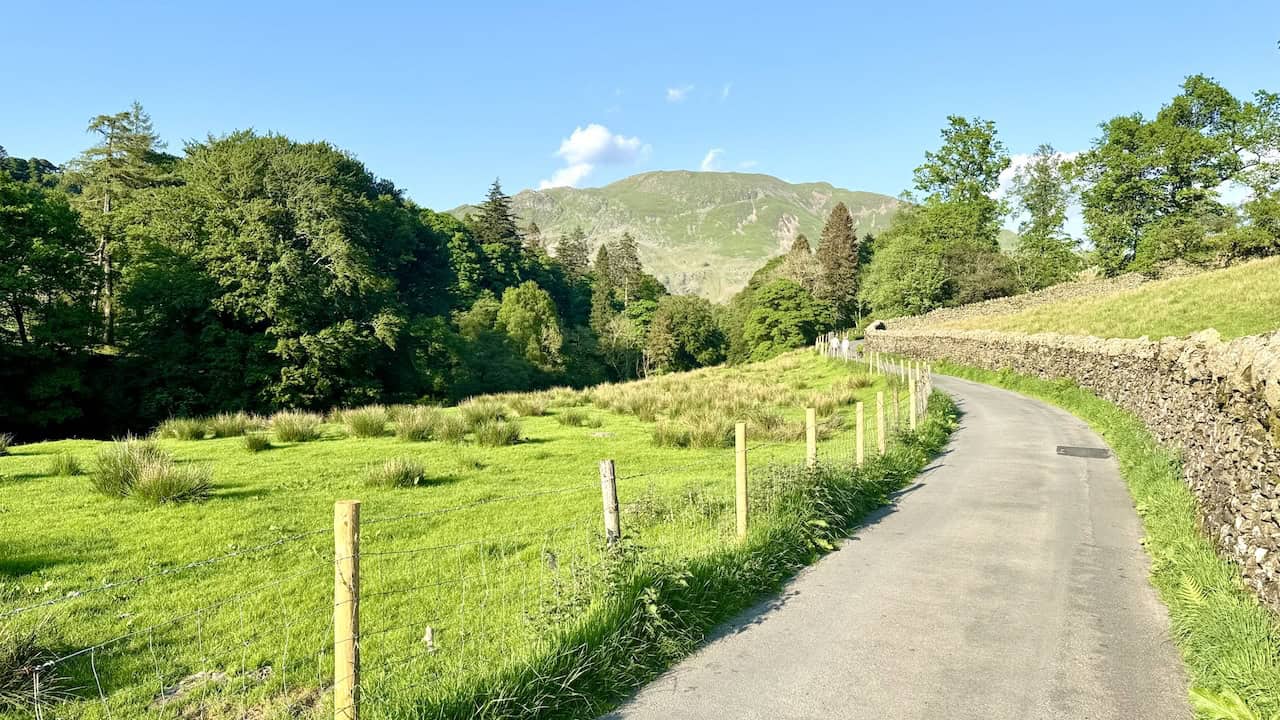
The view south-west from the bridge crossing Grisedale Beck near Thornhow reveals the scenic Grisedale valley, framed by the imposing Dollywaggon Pike and High Crag.


Grisport Unisex Adult Peaklander Hiking Boots
AD The Grisport Unisex Adult Peaklander Hiking Boots are crafted in Italy with a durable waxed leather upper, Spotex breathable lining, and a reliable Track-on rubber sole. Waterproof and weighing just 1120g, they offer comfort, resilience, and dependable performance on demanding trails.
As we ascend the southern slopes of Birkhouse Moor, a stunning panorama of the Grisedale valley unfolds. Dollywaggon Pike dominates the valley’s head, while St Sunday Crag stands majestically to the left.

Climbing higher, we see St Sunday Crag on the left and Fairfield emerging in the centre, nestled between St Sunday Crag and Dollywaggon Pike.

Grisport Unisex Adult Peaklander Hiking Boots
AD The Grisport Unisex Adult Peaklander Hiking Boots are crafted in Italy with a durable waxed leather upper, Spotex breathable lining, and a reliable Track-on rubber sole. Waterproof and weighing just 1120g, they offer comfort, resilience, and dependable performance on demanding trails.
The path up the southern slopes of Birkhouse Moor leads us to Hole-in-the-Wall, a crucial stop on our Helvellyn via Striding Edge adventure.

Looking back down into the Grisedale valley, we notice Birks on the right and Place Fell beyond Patterdale. The well-maintained path makes the ascent more manageable.


Fifty Walks Across the Beautiful North York Moors National Park
AD Discover 50 routes across the North York Moors, from short easy strolls to challenging high-level hikes. With OS maps, route descriptions, and local highlights, it also includes the legendary 40-mile Lyke Wake Walk, described in four accessible stages.
Upon reaching Hole-in-the-Wall, we are greeted by a captivating view of Catstye Cam on the right and Helvellyn on the left. Walkers gather to discuss their routes, with Striding Edge appearing to the left and the path to Swirral Edge also visible, though not our chosen path today.
A glance back from Hole-in-the-Wall reveals the expansive Grisedale valley, with Place Fell prominently at the valley’s base.

Fifty Walks Across the Beautiful North York Moors National Park
AD Discover 50 routes across the North York Moors, from short easy strolls to challenging high-level hikes. With OS maps, route descriptions, and local highlights, it also includes the legendary 40-mile Lyke Wake Walk, described in four accessible stages.
From Hole-in-the-Wall, the view north-east features a dry stone wall leading to the top of Birkhouse Moor. Many walkers approach from this direction, having climbed Birkhouse Moor from Glenridding via its eastern flanks to bag another Wainwright.

Another perspective of Birkhouse Moor from above Hole-in-the-Wall shows Ullswater in the distant right, adding to the picturesque landscape.


Osprey Hikelite Unisex Backpack for Comfortable and Lightweight Hiking
AD The Osprey Hikelite backpack combines lightweight design with practical features, including a breathable mesh back panel, soft webbing straps, and stretch mesh water bottle pockets. With zipped storage and an organiser compartment, it is ideal for day hikes and outdoor use.
The view of Grisedale from above Hole-in-the-Wall, with Birks prominently on the right, is breathtaking.

As we cross the ridge above Bleaberry Crag, Helvellyn looms directly ahead with Catstye Cam to the right. The path to Catstye Cam’s summit offers unparalleled views of Ullswater and is ideal for those aiming to reach Helvellyn via Swirral Edge.
Osprey Hikelite Unisex Backpack for Comfortable and Lightweight Hiking
AD The Osprey Hikelite backpack combines lightweight design with practical features, including a breathable mesh back panel, soft webbing straps, and stretch mesh water bottle pockets. With zipped storage and an organiser compartment, it is ideal for day hikes and outdoor use.
The view south from Bleaberry Crag highlights the massive St Sunday Crag and the magnificent Fairfield to the right.

Approaching Low Spying How, we catch our first glimpse of Red Tarn, nestled between Striding Edge and Swirral Edge below Helvellyn.


Peak Bagging Wainwrights with Routes to Complete All Fells
AD This comprehensive guide offers 45 circular routes linking all 214 Wainwright fells. With maps, GPX downloads, elevation profiles, and practical advice, it provides efficient yet inspiring ways to complete this classic Lake District challenge at your own pace.
Sandra and Jeff stroll along the path between Low Spying How and High Spying How, enjoying the journey and the surrounding beauty.

Jeff captures a photograph of the northern fells, including Sheffield Pike and Stybarrow Dodd.

Peak Bagging Wainwrights with Routes to Complete All Fells
AD This comprehensive guide offers 45 circular routes linking all 214 Wainwright fells. With maps, GPX downloads, elevation profiles, and practical advice, it provides efficient yet inspiring ways to complete this classic Lake District challenge at your own pace.
The view south from High Spying How showcases Fairfield on the left and Dollywaggon Pike on the right.

A memorial cross at High Spying How marks our traverse across Striding Edge and is a memorable part of the Helvellyn via Striding Edge walk.


Berghaus Hillmaster II GTX Men's High Rise Hiking Boots
AD The Berghaus Hillmaster II GTX men’s hiking boots feature a waterproof, breathable GORE-TEX membrane, a memory foam tongue and collar for a personalised fit, and a Vibram sole delivering exceptional grip, stability, and shock protection for confident performance on any terrain.
The cross commemorates Robert Dixon of Rookings, Patterdale, adding a poignant touch to our journey.

Another view towards Fairfield and Dollywaggon Pike from near the memorial cross enhances the scenic panorama.

Berghaus Hillmaster II GTX Men's High Rise Hiking Boots
AD The Berghaus Hillmaster II GTX men’s hiking boots feature a waterproof, breathable GORE-TEX membrane, a memory foam tongue and collar for a personalised fit, and a Vibram sole delivering exceptional grip, stability, and shock protection for confident performance on any terrain.
On Striding Edge, Jeff turns to photograph the ridge we’ve traversed so far, capturing our progress.

Another shot looking back along Striding Edge shows how far we’ve come. We’re pacing ourselves well and enjoying the experience.


Kendal Mint Co Energy Gel with Citrus and Mint Flavour
AD Kendal Mint Co energy gels deliver 27g of fast-absorbing carbohydrates plus electrolytes and B vitamins for improved performance. Vegan, gluten free, and Informed Sport certified, these caffeine-free gels are refreshing, easy to digest, and ideal for running, cycling, and endurance.
At the midpoint of Striding Edge, we see there is a convenient lower path for those who prefer not to cross the highest points.

Continuing across the ridge, we look west towards the summit, part of the exhilarating Helvellyn via Striding Edge trek.

Kendal Mint Co Energy Gel with Citrus and Mint Flavour
AD Kendal Mint Co energy gels deliver 27g of fast-absorbing carbohydrates plus electrolytes and B vitamins for improved performance. Vegan, gluten free, and Informed Sport certified, these caffeine-free gels are refreshing, easy to digest, and ideal for running, cycling, and endurance.
Looking back, we’ve just navigated a tricky section requiring careful descent. We’re nearing the end of Striding Edge.

The remarkable view from Striding Edge down to Red Tarn, with Catstye Cam on the left, is simply stunning.


Thermos Stainless King Flask for Travel and Daily Adventures
AD The Thermos Stainless King 470ml flask keeps drinks hot for 18 hours or cold for 24. With durable stainless steel, vacuum insulation, a serving cup, and a leakproof design, it is perfect for commutes, journeys, and outdoor adventures.
As we near the top, Jeff points out our route across Striding Edge. Easier paths below the ridge’s top offer an alternative for those seeking a less challenging route.

Looking back during the final steep ascent to the top, we see Birkhouse Moor beyond Red Tarn, with the distant Sheffield Pike to the left and Place Fell to the right.

Thermos Stainless King Flask for Travel and Daily Adventures
AD The Thermos Stainless King 470ml flask keeps drinks hot for 18 hours or cold for 24. With durable stainless steel, vacuum insulation, a serving cup, and a leakproof design, it is perfect for commutes, journeys, and outdoor adventures.
A wider view as we near the summit reveals the full extent of Striding Edge, Red Tarn below, and Catstye Cam to the left. Jeff and Sandra make their final scramble upwards.

The breathtaking view from Helvellyn’s summit north-east showcases Ullswater clearly, with Red Tarn shining brilliantly below.

Lake District High Level and Fell Walks with Thirty Routes
AD This pocket-sized guide presents 30 routes on the Lake District’s highest fells, including Scafell Pike, Helvellyn, and Blencathra. With OS maps, colour photographs, and practical notes, it offers circular walks from 4–15 miles graded by difficulty.
The triangulation pillar on Helvellyn stands at 949 metres (3114 feet), marking the summit and offering a sense of accomplishment.

Hikers relax and relish the expansive views from Helvellyn’s peak.

Lake District High Level and Fell Walks with Thirty Routes
AD This pocket-sized guide presents 30 routes on the Lake District’s highest fells, including Scafell Pike, Helvellyn, and Blencathra. With OS maps, colour photographs, and practical notes, it offers circular walks from 4–15 miles graded by difficulty.
Good weather and the weekend make Helvellyn a bustling destination, filled with enthusiastic hikers.

Another view from Helvellyn’s summit features the serene Red Tarn and the striking Catstye Cam.

Super Sparrow Stainless Steel Insulated Water Bottle with Two Lids
AD The Super Sparrow stainless steel water bottle keeps drinks cold for 12 hours or hot for several. With a straw lid, bamboo cap, BPA-free construction, and durable 18/8 steel, it is ideal for sport, travel, work, and outdoor use.
On the route between Helvellyn and Nethermost Pike, we look back at Striding Edge, which we crossed earlier on our Helvellyn via Striding Edge walk. Lad Crag appears on the left, adding to the rugged beauty.

Another shot of Striding Edge on the way to Nethermost Pike offers more views down into the captivating Grisedale valley.

Super Sparrow Stainless Steel Insulated Water Bottle with Two Lids
AD The Super Sparrow stainless steel water bottle keeps drinks cold for 12 hours or hot for several. With a straw lid, bamboo cap, BPA-free construction, and durable 18/8 steel, it is ideal for sport, travel, work, and outdoor use.
The view west from above Swallow Scarth between Helvellyn and Nethermost Pike reveals Thirlmere Reservoir, with Harrop Tarn and Ullscarf in the distance.

Heading towards Nethermost Pike, the views down into Grisedale are spectacular. We now see the track through the valley, which will lead us back to Patterdale.

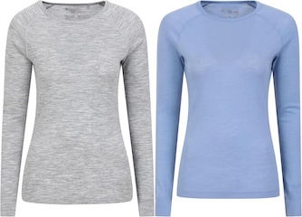
Mountain Warehouse Merino Womens Long Sleeve V Neck Top
AD This Mountain Warehouse Merino top combines warmth, comfort, and practicality. Made with high-quality wool, it is naturally antibacterial, lightweight, and easy to pack. Designed for outdoor activities, it keeps you fresh and warm, and comes with a two-year warranty.
Looking back, we see our route from Helvellyn. Striding Edge is visible, and Catstye Cam peaks out behind the ridge. The rocky outcrops of Swallow Scarth and Lad Crag create an impressive scene.

The summit of Nethermost Pike, at 891 metres (2923 feet), offers a sweeping view south-west towards the Scafell area, including Great Gable, Scafell Pike, and Bow Fell.

Mountain Warehouse Merino Womens Long Sleeve V Neck Top
AD This Mountain Warehouse Merino top combines warmth, comfort, and practicality. Made with high-quality wool, it is naturally antibacterial, lightweight, and easy to pack. Designed for outdoor activities, it keeps you fresh and warm, and comes with a two-year warranty.
The view south from Nethermost Pike towards High Crag on the right and Dollywaggon Pike on the left is captivating and expansive.

From High Crag, we observe the rocky slopes of Nethermost Crag on the left, with Hard Tarn below. Place Fell and Ullswater are visible in the distance.

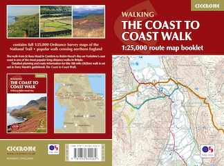
The Coast to Coast Walk Map Booklet with OS Mapping
AD This handy map booklet covers the full 188-mile Coast to Coast route from St Bees to Robin Hood’s Bay. Featuring 1:25,000 OS maps, it is pocket-sized, practical, and designed for use in either direction across England’s landscapes.
Looking to our left as we cross from High Crag to Dollywaggon Pike, we appreciate the rugged beauty of the landscape.

As we approach the top of Dollywaggon Pike, the views become even more breathtaking.

The Coast to Coast Walk Map Booklet with OS Mapping
AD This handy map booklet covers the full 188-mile Coast to Coast route from St Bees to Robin Hood’s Bay. Featuring 1:25,000 OS maps, it is pocket-sized, practical, and designed for use in either direction across England’s landscapes.
Sandra captures pictures of the Lake District from Dollywaggon Pike’s summit. From here, you can see Morecambe Bay in the distance, as well as Coniston Water and Esthwaite Water.

The view south-east from Dollywaggon Pike’s summit, standing at 858 metres (2815 feet), is awe-inspiring and expansive.

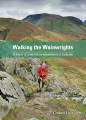
Walking the Wainwrights with Routes Covering Every Lake District Fell
AD This book includes 64 carefully designed routes that allow walkers to complete all 214 Wainwright fells. Intended to complement the original Pictorial Guides, it provides full-day circular walks that link multiple summits for a rewarding and practical challenge.
The view north-east from the cairns at the top of Dollywaggon Pike shows St Sunday Crag impressively on the right. Gullies running down the side of the mountain, named West Chockstone Gully, Y Gully, and East Chockstone Gully, are visible. Place Fell and Ullswater are easily seen, with Birkhouse Moor to the left.
Another view of St Sunday Crag from the cairns on Dollywaggon Pike enriches the visual feast, adding to the day’s memorable sights.

Walking the Wainwrights with Routes Covering Every Lake District Fell
AD This book includes 64 carefully designed routes that allow walkers to complete all 214 Wainwright fells. Intended to complement the original Pictorial Guides, it provides full-day circular walks that link multiple summits for a rewarding and practical challenge.
The view north back to Nethermost Pike and Helvellyn showcases fantastic scenery along the Helvellyn via Striding Edge route, capturing the essence of our adventure.

Another view north from Dollywaggon Pike features High Crag on the left and Nethermost Pike on the right, connected by visible paths. We preferred sticking close to the eastern edge for better views. This section from Helvellyn to Dollywaggon Pike offers lovely, comfortable walking.

Leaving Dollywaggon Pike, we take one last look at St Sunday Crag, appreciating its grandeur.

The stepped path down from Dollywaggon Pike to Grisedale Tarn reveals Fairfield to the left and Seat Sandal to the right, with Grisedale Hause between them. The ridge from Fairfield forms part of the popular Fairfield Horseshoe, including Great Rigg and Heron Pike.

The beautiful Grisedale Tarn backed by Seat Sandal is a serene sight, providing a peaceful interlude.

The start of the four-mile (6.4-kilometre) route from Grisedale Tarn through the valley to Patterdale is picturesque and inviting.

Ruthwaite Lodge in the Grisedale Beck valley is dedicated to Richard Read and Mike Evans, tutors at Outward Bound Ullswater, who were tragically killed on Mount Cook in New Zealand in 1988.

The view north-east through the Grisedale Beck valley is enchanting, offering a tranquil retreat.

Crossing a stream sourced high up on the east-facing slopes of High Crag is a refreshing experience, adding to the adventure.

Walking through the valley, we notice many large boulders, possibly fallen from the steep slopes or transported by glaciers. Some have been split by freeze-thaw erosion over thousands of years.

Jeff and Sandra cross the footbridge over Grisedale Beck, enjoying the picturesque scenery.

Halfway along our four-mile (6.4-kilometre) trek through the valley, it widens with small areas of picturesque woodland, adding variety to the landscape.

A charming stone barn by the track just before Elmhow. We’re growing tired and eagerly anticipating our return to Patterdale.
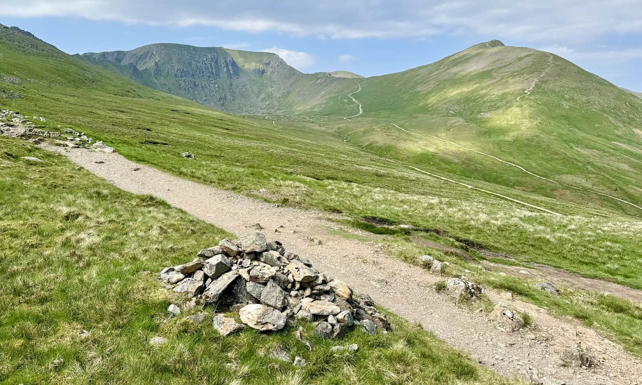
The lovely area between Elmhow and Thornhow leaves us with about one and a half miles (2.4 kilometres) to go, a manageable final stretch.

Just after Thornhow, the stone track turns into a tarmac minor road. With less than one mile (1.6 kilometres) to Patterdale, we eagerly anticipate a well-deserved drink after a superb day out, aided by glorious weather.