ADVERTISEMENT
Big Views Early as Thirlmere Opens Up on the Helvellyn from Swirls Ascent
Helvellyn from Swirls is a direct, steep route on the western side of the Helvellyn massif in the Eastern Fells of the Lake District National Park. The Helvellyn massif itself offers one of the most starkly contrasting topographic profiles in the British Isles. While the eastern side is known for the high-drama arêtes of Striding and Swirral Edges, the western flank, rising straight up from the shores of Thirlmere, is all about steep, steady effort.
ADVERTISEMENT
This route starts from the Swirls Car Park, climbing by Helvellyn Gill and Browncove Crags, crossing Lower Man and the Helvellyn summit plateau, and then descending via the western slopes of Nethermost Pike and Birk Side, before finishing with a return through the Thirlmere forestry tracks.
ADVERTISEMENT
Helvellyn from Swirls Key Figures, Distance, and Difficulty
Here are the key figures for this circular route, starting and finishing on this side of the range:
- Starting Point: Swirls Car Park (NY 316 169)
- Highest Point: 950 metres
- Total Elevation Gain: approximately 850 metres
- Total Distance: around 7 miles
- Typical Time: 4.5 to 5 hours excluding stops
- Technical Difficulty: Moderate to hard (non-scrambling)
- Primary Ascent Terrain: stone-pitched paths and rocky shoulders
- Primary Descent Terrain: rough stone steps, woodland, forestry tracks
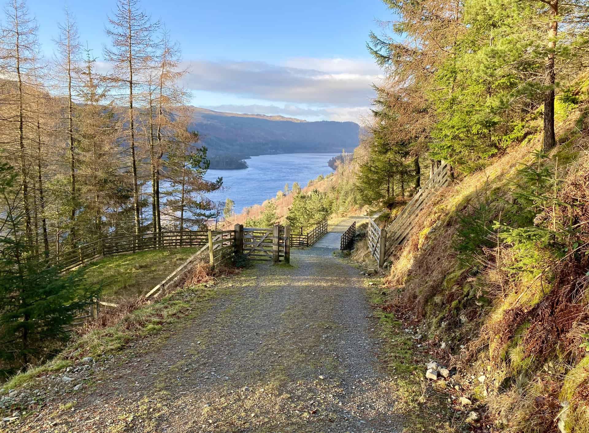
Swirls Car Park is the main starting point for the approach to Helvellyn from Thirlmere, and it works well for anyone planning a Helvellyn from Swirls walk. It sits on the A591, the main road running north to south through the Lake District. Parking at Swirls is pay-and-display, although hikers often use the large lay-by just north of the main car park as a free alternative.
Helvellyn from Swirls: Maps and Tools
Visit either the OS Maps website or the Outdooractive website to view this walking route in greater detail. Both platforms offer a range of features, including the ability to print the route, download it to your device, and export the route as a GPX file. You can also watch a 3D fly-over and share the route on social media.
Helvellyn from Swirls Ascent via Helvellyn Gill and Browncove Crags
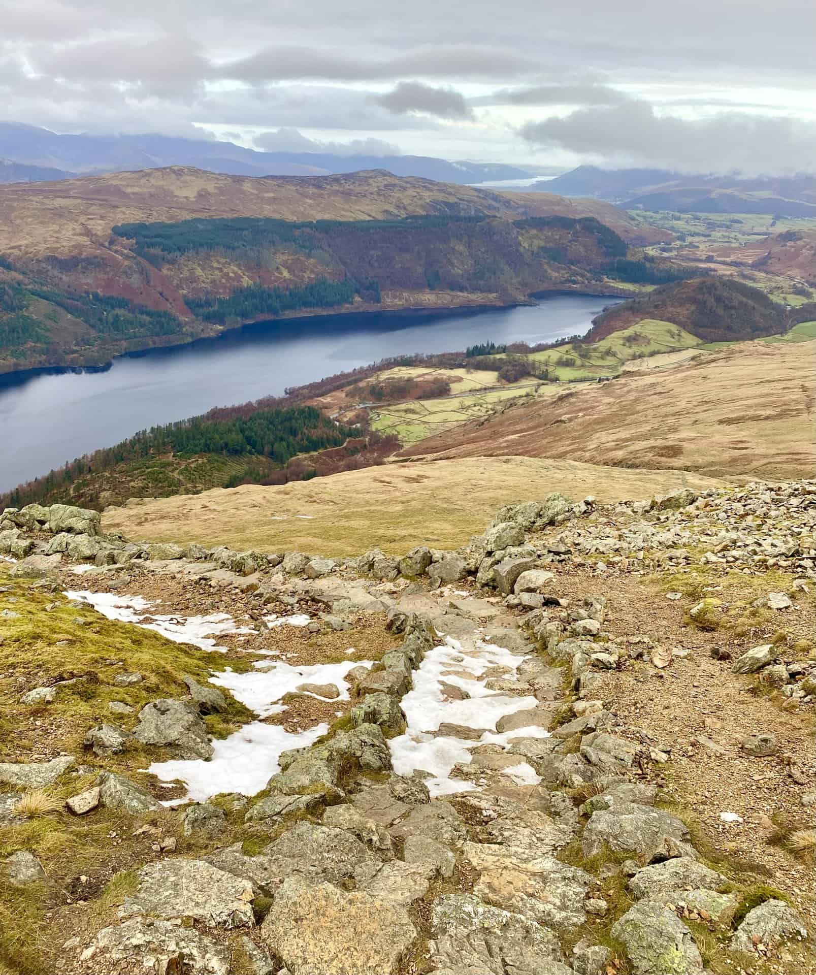
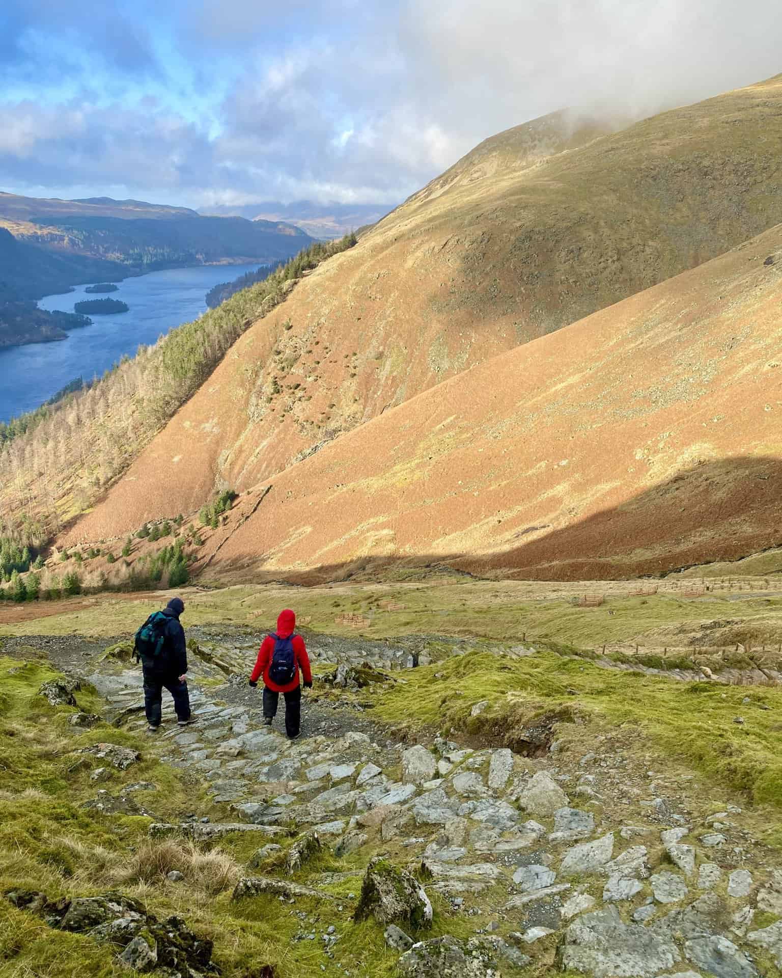
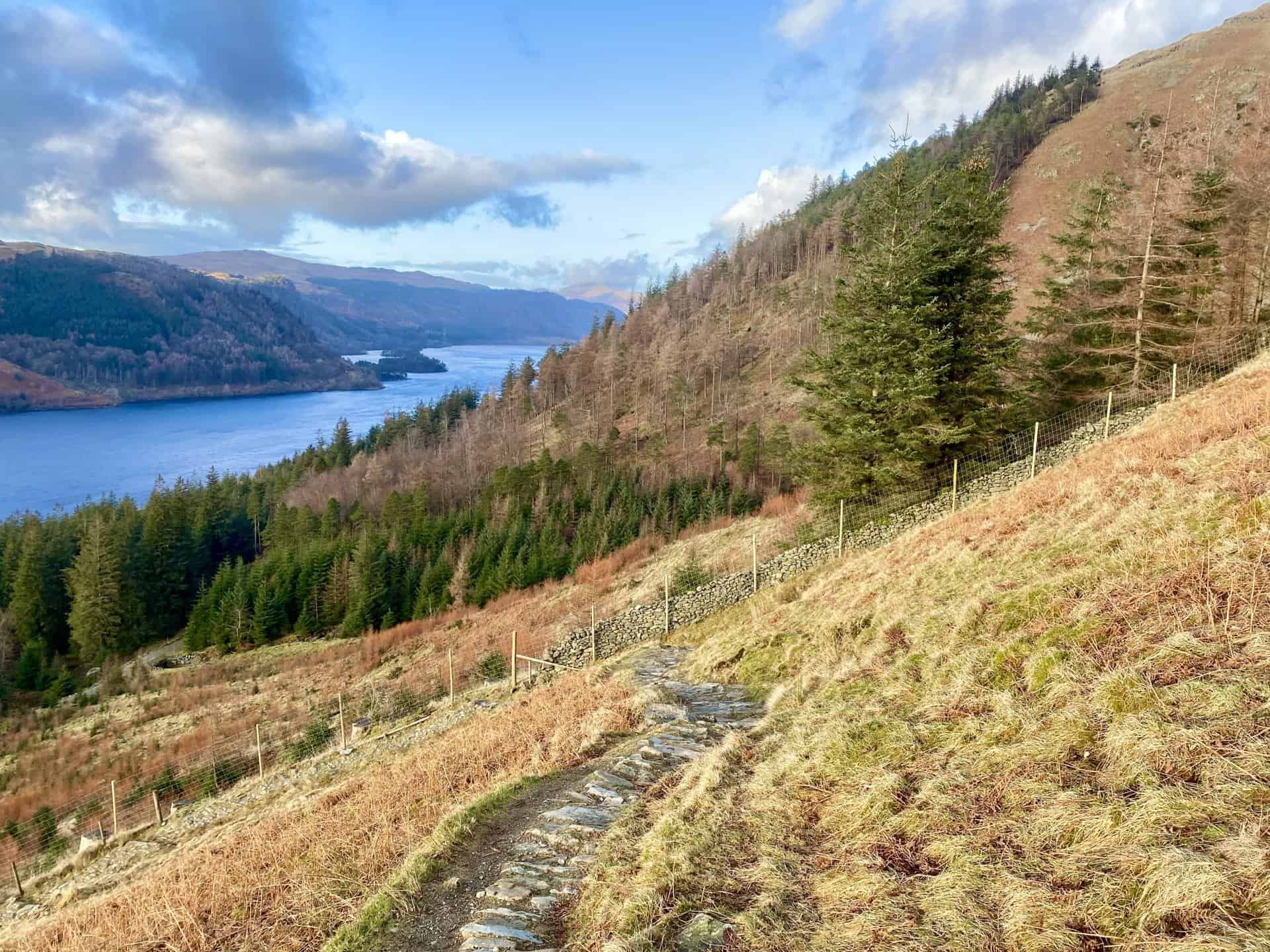
The climb from Swirls gets going straight away. Unlike some eastern routes that involve a long valley walk-in, this one starts gaining height almost as soon as you leave the car park. The path follows Helvellyn Gill, a mountain stream that acts as a main drainage channel for the slopes above Thirlmere.
The path itself shows how much work goes into looking after busy upland routes. To tackle the severe erosion caused by thousands of walkers on a steep line, extensive stone pitching has been laid. It creates a solid surface underfoot, but it is hard work on the calves, and that’s why this route has a reputation for being relentless. As you gain height, the views back over Thirlmere are a real boost. The islands of Hawes How and Deergarth How stand out as emerald markers in the water, while the northern horizon starts to open up to the Skiddaw and Blencathra massifs.
ADVERTISEMENT
Browncove Crags and Lower Man
At around 600 to 700 metres, the path reaches Browncove Crags and the feel of the ground changes. You move from grassy fellside onto more rugged, rocky terrain. The crags are a major feature here, forming a dark, broken wall of Borrowdale volcanic rock overlooking the Thirlmere valley.
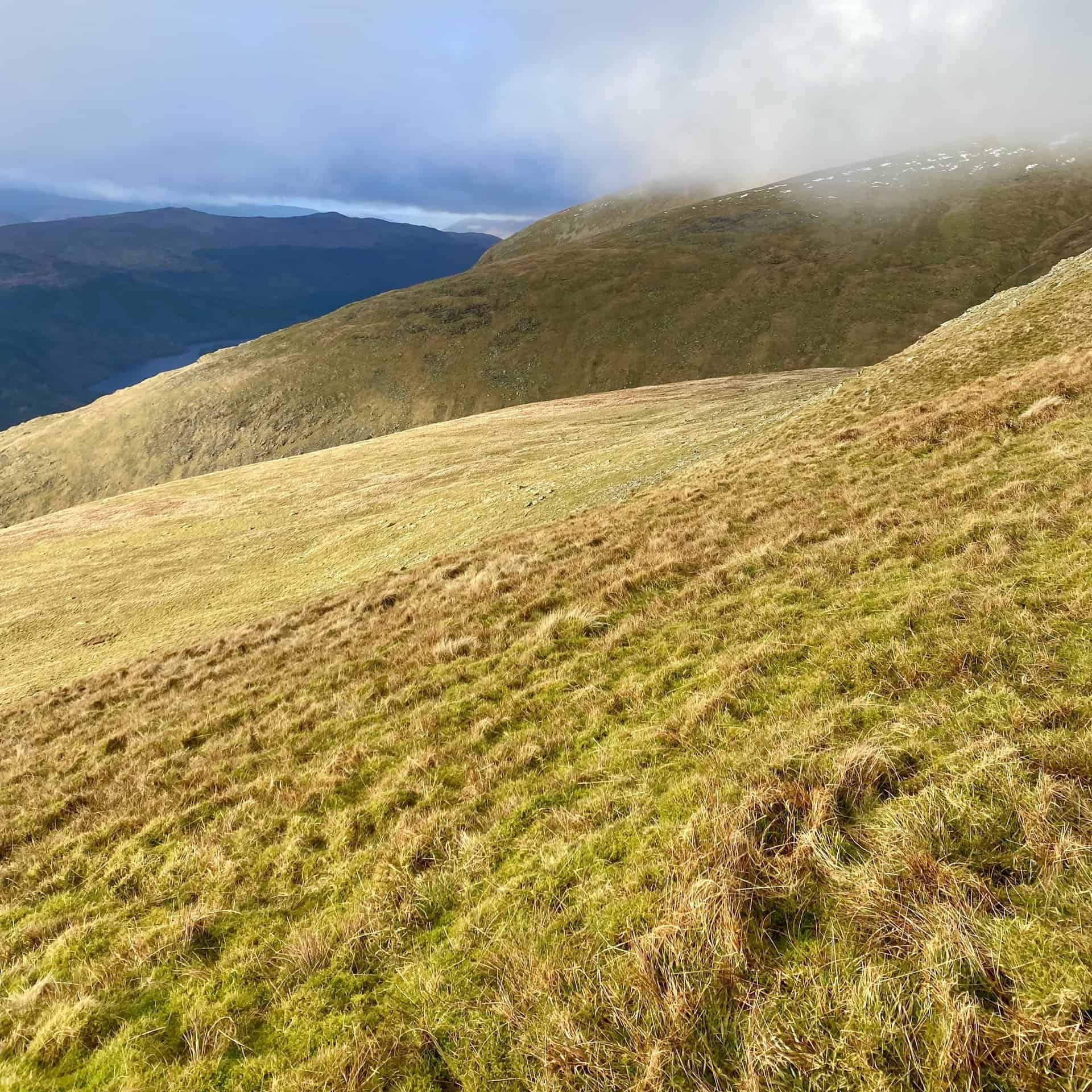
After passing the crags, the path eases onto a broad ridge leading to Helvellyn Lower Man (925 metres). From there, it’s a relatively easy climb up to the summit of Helvellyn, and the steep effort of the Helvellyn from Swirls hike starts to feel properly worthwhile.
ADVERTISEMENT
The summit of Helvellyn is a wide, fairly flat plateau of stony ground and short grass, and it can be surprisingly disorientating in low visibility. On a clear day, this Helvellyn from Swirls hike gives you time to take in the scale of the plateau before you move on.
Near the summit cairn there is a crosswind shelter that provides multi-directional wind protection. You might need it, as it can be very windy and bitterly cold up there.
Helvellyn from Swirls Descent via Birk Side and Comb Crags
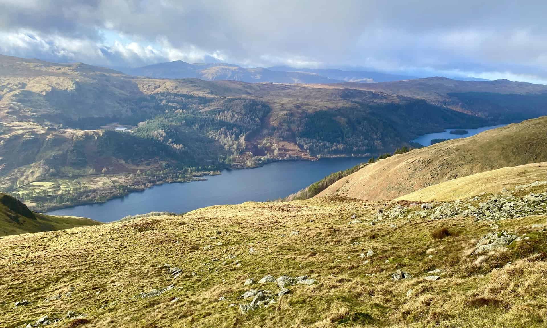
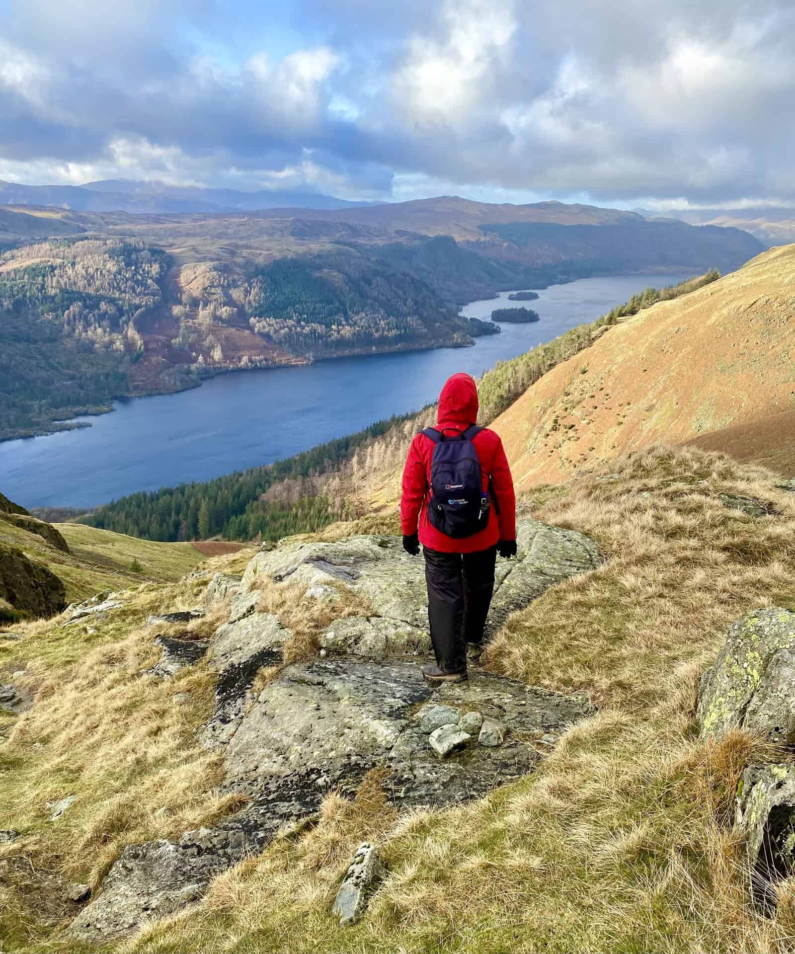
To complete the circular route, the descent usually follows the ridge south towards Nethermost Pike and Birk Side. This part of the walk feels different, moving away from the built stone staircase of the ascent and onto a more traditional stony mountain path.
The descent begins by heading south, where the path turns towards the slopes of Birk Side and takes you above High Crags. This is an important point, and it’s worth staying alert here. If you carry on too far south you can end up heading towards the summit of Nethermost Pike. From there it continues on to Dollywaggon Pike, which is fine if you want to extend the day, but not if you’re sticking to this circuit.
ADVERTISEMENT
The descent through Comb Crags is often said to be tougher on the knees than the ascent was on the lungs. The path is made up of steep, uneven stone steps that work their way down through rough ground.
A well-known problem spot comes at Comb Crags, where the path makes a sharp right-hand turn. In poor visibility it’s easy to miss this and drift onto faint grassy lines that lead into dangerous terrain, which is one of the reasons it pays to treat the descent on a Helvellyn from Swirls route with care.
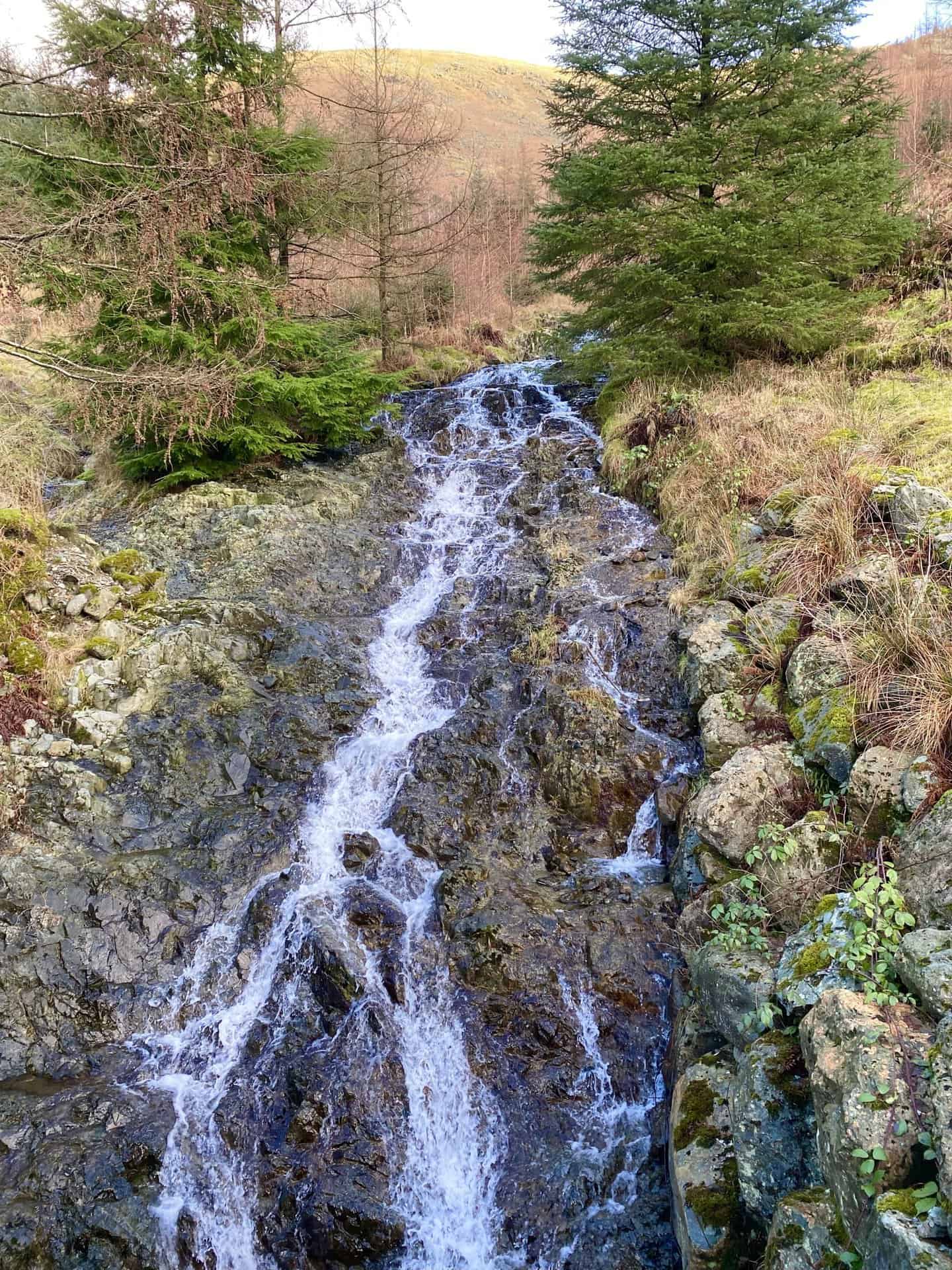
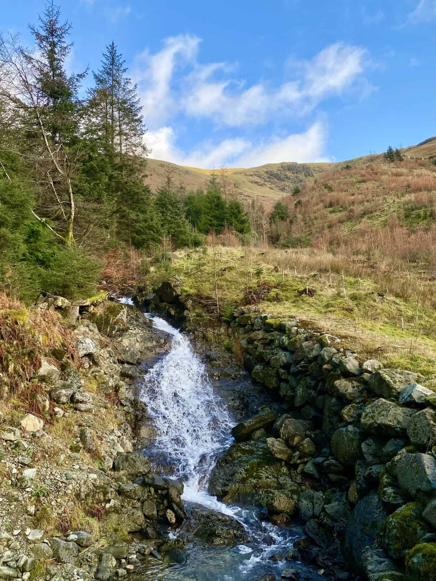
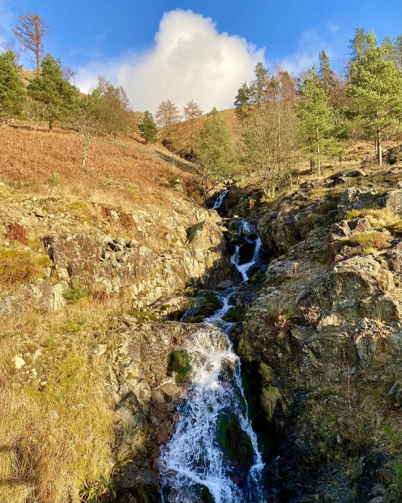
As you descend, you’ll hear Comb Gill and Whelpside Gill alongside you. These streams cut deep channels through the hillside before eventually emptying into Thirlmere.
The final leg uses forestry tracks and footpaths that contour the lower slopes of the Helvellyn range, at around 200 metres above the water. It’s a lower-level, fairly flat return to Swirls, and it gives you time to take in the managed woodland and the scale of the reservoir.
ADVERTISEMENT
Why the Helvellyn from Swirls Approach Suits Many Walkers
Many people choose the approach from Swirls because it feels safer and tends to be quieter. The eastern ridges of Striding and Swirral Edges are famous for their exposed scrambling on the way to Helvellyn from Patterdale or Glenridding, but plenty of walkers prefer not to cross them. You can still reach the summit by other routes from the eastern side, but coming in from Thirlmere and the western slopes makes a very good alternative.
In terms of technical difficulty, the Swirls route is one of the easiest and most direct ways to the summit, but it is more physically demanding than many people expect. If you don’t like heights, or if the weather is poor, this side is often the better choice as it avoids the knife-edge exposure of the arêtes.
The quieter feel here is something many experienced walkers mention. Even if the summit is busy with people arriving from Glenridding, the paths on the Thirlmere side, especially the southern descent via Birk Side, can feel much more peaceful and give a stronger sense of the mountain’s rugged, volcanic character.
A Classic Lake District Outing
The circuit from Swirls Car Park is a classic Lakeland outing, balancing the hard work of the climb with the geological and historical richness of the plateau. It takes a decent level of fitness to handle the ascent, and in winter it also calls for careful navigation and extra caution on the technical descent at Comb Crags.
For the modern explorer, the Thirlmere side offers a journey through 450 million years of volcanic history, tens of thousands of years of glacial sculpting, and around 150 years of industrial water management. The final walk out through the milder air of the forestry tracks, with the constant sound of cascading water, is a fitting end to a Helvellyn from Swirls circuit that shows off the raw, varied beauty of the Lake District’s third-highest peak.
ADVERTISEMENT
Related Post: Map of Wainwrights
Explore Alfred Wainwright’s enchanting Lake District with my map of Wainwrights
ADVERTISEMENT