ADVERTISEMENT
Ripon Cathedral to Fountains Abbey on a Scenic Ripon Walk Circular Route
Start your Ripon walk at the Cathedral Car Park in the city centre. This is a long stay pay and display car park, and at the time of writing the charges were very reasonable. From the car park, make your way across to the Sainsbury’s supermarket, then follow the path signposted to the cathedral, passing the Ripon Liberty Magistrates’ Court as you go.
When you reach the cobbled road in front of the cathedral, called Minster Road, turn right and head downhill. This road, Bedern Bank, leads down to a roundabout. Go straight across, taking the second exit onto King Street, and follow it down to Bondgate Bridge with its wrought iron parapets, crossing the River Skell.
Immediately after the bridge, turn right onto a footpath that drops down to the river in front of several apartment blocks. Follow the path beside the River Skell with the water on your right. When you reach the road, carry straight on onto Barefoot Street. Shortly afterwards, turn right through a gap in the wall and follow the footpath signposted to Fountains Abbey and Studley Royal, again keeping the river on your right.
Walk beneath the bridge and continue through the children’s play area, passing the paddling pool. Leave the play area and turn right onto Borrage Green Lane, following it past Ivy House. Soon afterwards, just before Borrage Farm, turn left through a wrought iron kissing gate onto a public footpath. Follow this across the fields and through woodland to reach Hell Wath Nature Reserve.
Now follow the Hell Wath Nature Trail across the fields. The route is marked by sturdy wooden signposts with green lettering and green arrows, and it’s easy enough to follow if you keep to the main path through the reserve and stay with the green arrows. When you reach the last of these signposts near the southern end of the reserve, you come to a T-junction. You could turn right here to double back along the circular reserve trail, but for this walk turn left to leave the reserve, walking south along the broad woodland path.
The path brings you to a tarmac lane at the edge of the reserve. Turn left and walk past Hell Wath Cottage, then follow the lane past the car parking area to a wider road and continue straight ahead. As the road bends round to the left, turn right onto the concrete public bridleway known as Whitcliffe Lane. Follow it south for about three-quarters of a mile to reach Whitcliffe Hall.
ADVERTISEMENT
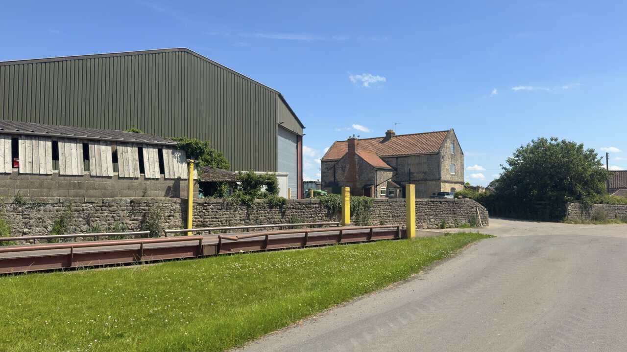
Whitcliffe Hall is a large farm. Walk straight past it, following the signpost for Bland Close Farm. After the final large wooden barn of Whitcliffe Hall, turn right onto a public bridleway signposted Ripon Rowel. You’re now about a quarter of the way round your Ripon walk.
Follow the bridleway for about a third of a mile across open fields, then go through a gate into woodland. Walk down the woodland trail for a minute or so, then take a sharp right and descend further through the trees. At the bottom, just before the River Skell, the path splits. Take the left-hand fork and cross the footbridge, then turn left into Chinese Wood.
Walk through the woods and pass through the iron gates into Studley Royal Deer Park. Cross the first of the stone single-arched packhorse bridges and follow the well-defined stone track through the valley. Cross a second bridge, then two more that sit close together, and finally one more after that.
Immediately before the weir at the northern end of The Lake, take a sharp left where a wooden signpost points to Mackershaw Park, and follow the stone track uphill. Before you make this turn, you might like to wander a little further to admire The Lake, or even take a stroll around it. A public footpath follows the western shore all the way to the entrance to Fountains Abbey, though do bear in mind that entry to the abbey is chargeable.
Keep following the wide stone track uphill and across Mackershaw Park, where it eventually becomes a grassy path across the fields. Leave the park through the historic arched stone gateway and turn right. Follow the woodland bridleway and then cross a grassy field to reach Hill House Farm. Walk through the farm, following the blue bridleway waymarker arrows, and after you leave keep on the bridleway as it bears round to the right.
Stay with the bridleway across the fields to enter the National Trust’s Fountains Abbey and Studley Royal estate. Well marked with blue arrows, it runs alongside the ancient Abbey Wall. Keep to the bridleway until you reach a road, where you leave the estate again. You’re now about halfway round your Ripon walk.
At the road, turn right onto Fountains Lane and follow it down to the junction, then bear right, signposted to Ripon and Fountains Abbey. The road crosses Fountains Bridge and bends to the left in front of the Fountains Abbey West Gate entrance and a row of large stone cottages, before turning sharply right and climbing uphill.
ADVERTISEMENT
At the top of the hill, turn right onto the signposted public bridleway and follow the stone track to reach a road. There’s no need to walk on the road itself, as the bridleway runs alongside it behind the hedgerow. Follow the track as it crosses the road near the entrance to Fountains Abbey and enters woodland. It’s a broad stone track with a hedgerow on each side, roughly following the line of the road, which stays on the far side of the woodland to your left.
Just before you reach the obelisk, turn right through the gates into Studley Royal Deer Park, signposted as the footpath to Saint Mary’s Church and Studley Royal Water Garden via the Deer Park. Walk straight ahead along the well-surfaced lane, passing Saint Mary’s Church on your left, and continue through Studley Park. A little further on, also on your left, you pass the National Trust holiday cottage called Choristers’ House.
Stay on the lane, which is remarkably straight and lines up neatly with Ripon Cathedral away in the distance. It gradually widens into more of a road as it runs through the park and leads directly to the ancient arched stone gateway on the eastern side. Pass through the arch and carry straight on to meet a minor road. Turn left here to walk into the village of Studley Roger. You’re now about three-quarters of the way round your Ripon walk.
As you walk through Studley Roger, look out for a signposted public footpath on the right. It appears about fifty metres after you pass the stone memorial to Harold William Baines, almost opposite a house called The Old Post House. Take this footpath, where a wooden signpost points the way to Ripon, and follow it for just under half a mile to reach a crossroads. Turn right here, signposted as a public bridleway to Hell Wath.
This leads you back for about another half a mile to Hell Wath Cottage, where you were earlier. Turn left to make your way back into Hell Wath Nature Reserve. Pause at the interpretation board as you enter the woodland, then follow the route marked by yellow circles down towards the River Skell. At the first of the Hell Wath Nature Trail signposts the path splits, so take the left-hand fork and keep following the nature trail signposts down to the river.
Walk along the riverside path, keeping the River Skell close on your left, and pass the 1820 Ripon Navigation Marker Stone. Descend the Fairy Steps and carry on beside the water. Leave Hell Wath Nature Reserve and continue along the riverside path, taking care not to cross the river by the footbridge.
The path soon becomes Borrage Green Lane, familiar ground from earlier in the day. Pass Ivy House on your left and turn left into the children’s play area. Walk through it, follow the path beneath the bridge and return through the gap in the wall onto Barefoot Street. Retrace your steps to the path alongside the River Skell in front of the apartment blocks, which brings you back to Bondgate Bridge.
Cross the bridge and head north along King Street, over the roundabout and up Bedern Bank to return to the cathedral and finally to the car park, completing your Ripon walk.
Ripon Walk: Maps and Tools
Visit either the OS Maps website or the Outdooractive website to view this walking route in greater detail. Both platforms offer a range of features, including the ability to print the route, download it to your device, and export the route as a GPX file. You can also watch a 3D fly-over and share the route on social media. Additionally, this page includes a printable version of the walk in PDF format.
Ripon Walk: Distance, Duration, Statistics
Distance: 10¼ miles
Distance: 16½ kilometres
Duration: 4½ hours
Ascent: 732 feet
Ascent: 223 metres
Type: Circular walk
ADVERTISEMENT
Recommended Ordnance Survey Map
The best map to use on this walk is the Ordnance Survey map of Nidderdale, reference OS Explorer 298, scale 1:25,000. It clearly displays footpaths, rights of way, open access land and vegetation on the ground, making it ideal for walking, running and hiking. The map can be purchased from Amazon in either a standard, paper version or a weatherproof, laminated version, as shown below.
Weatherproof Version
Ordnance Survey map of Nidderdale, reference OS Explorer 298, scale 1:25,000
About Ripon
Ripon sits in North Yorkshire, at the point where two small rivers, the Laver and the Skell, come together on their way to join the River Ure. It’s a cathedral city, and a famously small one, the smallest in Yorkshire and among the smallest in the whole of England, with a population of around 16,700. For all its modest size it carries a great deal of history, and it sits right on the doorstep of the Studley Royal and Fountains Abbey World Heritage Site, which is part of what draws so many walkers and visitors this way.
Centuries of History
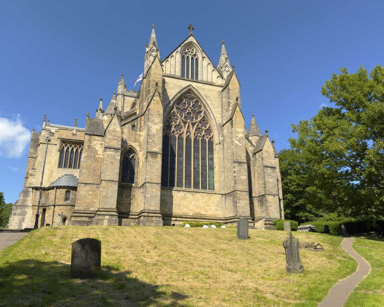
Ripon’s story goes back more than thirteen centuries, to a time when this was part of the Anglian kingdom of Northumbria. The settlement grew up around a church founded by Saint Wilfrid in the seventh century, and he brought stonemasons and craftsmen all the way from Lyon and Rome to build it. His Saxon crypt of 672 still survives beneath the cathedral, where this Ripon walk begins and ends, and it’s one of the oldest built spaces you can stand in anywhere in the country.
The centuries that followed were rarely quiet. Ripon spent time under Viking rule, was granted the right of sanctuary by King Athelstan in 937 and was burned a few years later on the orders of King Edred. It went on to build up a thriving wool and cloth trade, and by the sixteenth and seventeenth centuries it had become known for making spurs, so much so that fine steel was said to be “as true as Ripon rowels”. A short stretch of this Ripon walk runs along the Ripon Rowel route, so the name may already feel familiar.
Related Walk: Similar to the Ripon Walk
Explore lead mining heritage and Wath Mill on the Pateley Bridge walk
How Ripon Became a City
Ripon’s status as a city is tied up with its cathedral. In 1836 it became the first new Church of England diocese to be created after the Reformation, carved out of the older dioceses of Chester and York, and its church was raised to cathedral rank. The local council took that to mean Ripon was now a city and simply began calling it one. The title was only formally settled some years later, by the City of Ripon Act of 1865. It remains one of the smallest cities in England by population to this day, which is part of its quiet appeal.
Rivers and Landscape
Water has shaped Ripon as much as anything. The Laver and the Skell meet to the west of the city, and the Skell, which you follow for much of this Ripon walk, feeds the basin of the Ripon Canal before the whole flow joins the River Ure just to the east. Sitting where rivers come together has its drawbacks, and Ripon has seen its share of flooding over the years, which is why substantial flood defences have been built to protect it.
The ground underfoot is mostly magnesian limestone, part of a band of Permian rock that runs down through this part of the country. There’s gypsum beneath the surface too, and because water slowly dissolves it, the area around Ripon is known for the occasional sinkhole, particularly on the northern side of the city.
Ripon Walk: My Photos
I start my Ripon walk at the Cathedral Car Park, and just after I set off properly I take a little time to wander round the cathedral itself. The great traceried window, crowned by a rose window above, rises from the sloping churchyard. Ripon only became a cathedral in 1836, but the building goes back far further than that, and tucked beneath it is St Wilfrid’s Anglo-Saxon crypt of 672 AD, reckoned to be the oldest built structure in any English cathedral. Parts of this site have been in use for more than 1,350 years, and it still draws around 100,000 visitors a year.
ADVERTISEMENT
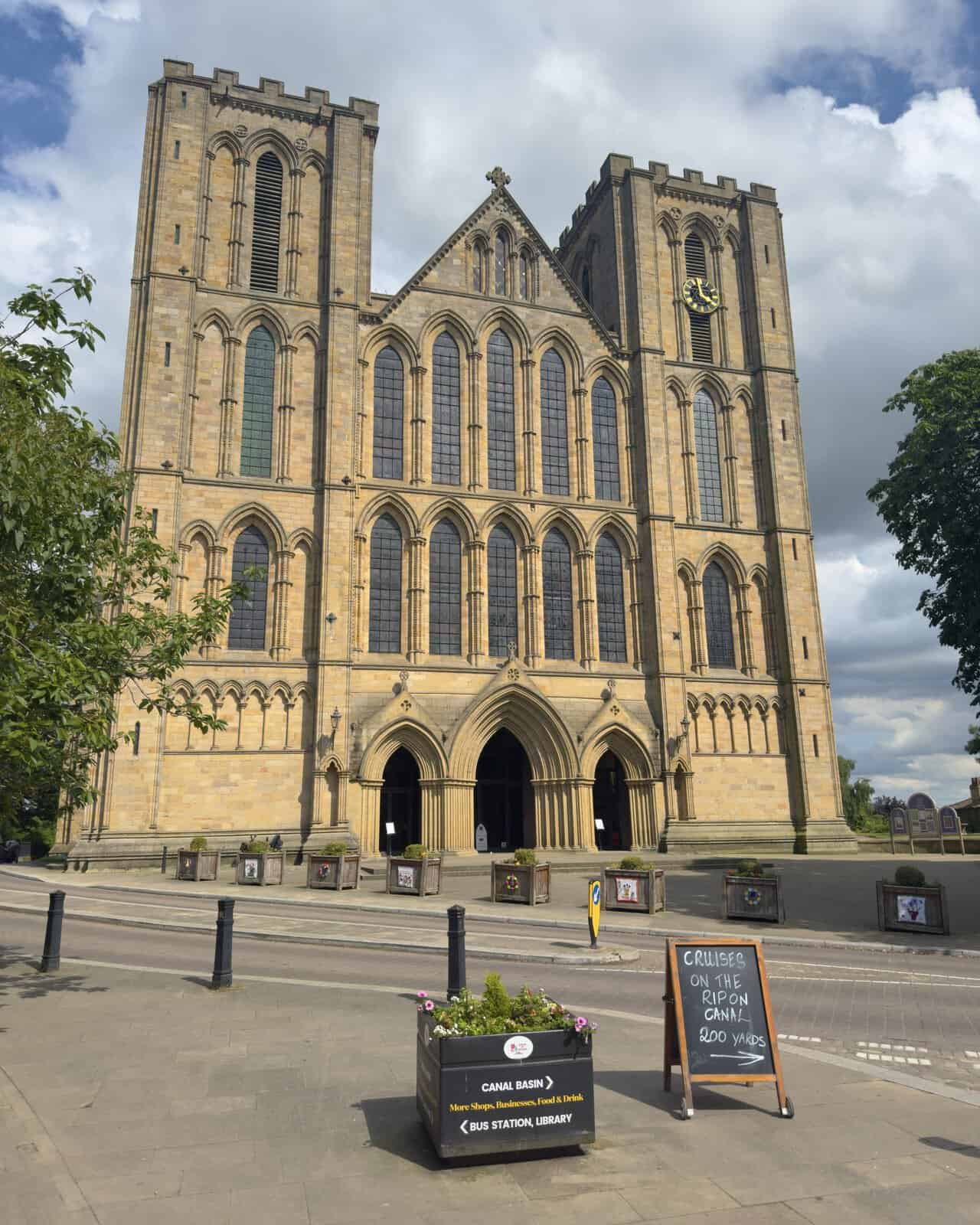
Carrying on round, I get a sense of just how long and imposing the place really is. The great frontage climbs in twin towers above a pair of arched doorways and tiers of lancet windows, with the St Wilfrid’s flag flying from the top. This was the work of Archbishop Walter de Gray in the early thirteenth century, an Early English Gothic design. It’s formally listed as Ripon Minster, the Cathedral Church of St Peter and Wilfrid, and has held Grade I protection since 1949.
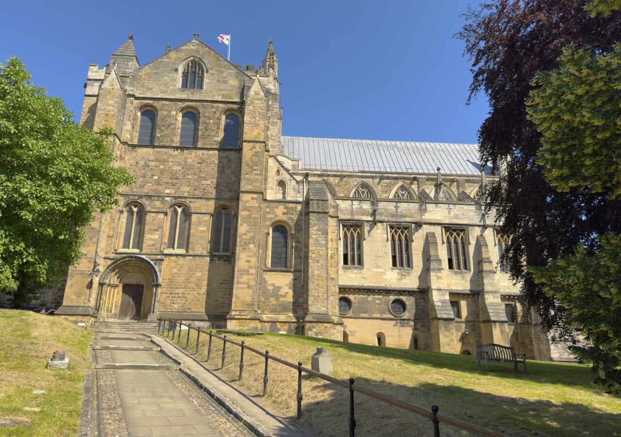
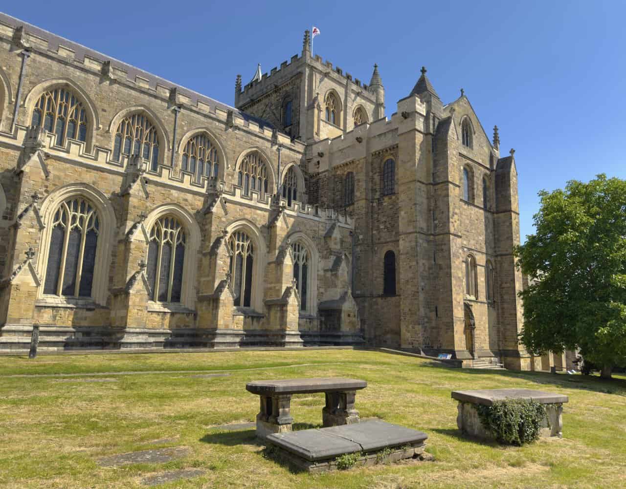
A little further round I come to another corner of the churchyard, where weathered chest tombs sit out on the grass. The long line of windows runs the length of the building, and above the roofline the squat central tower stands square against the sky. From here I make my way down through the city towards the River Skell.
ADVERTISEMENT
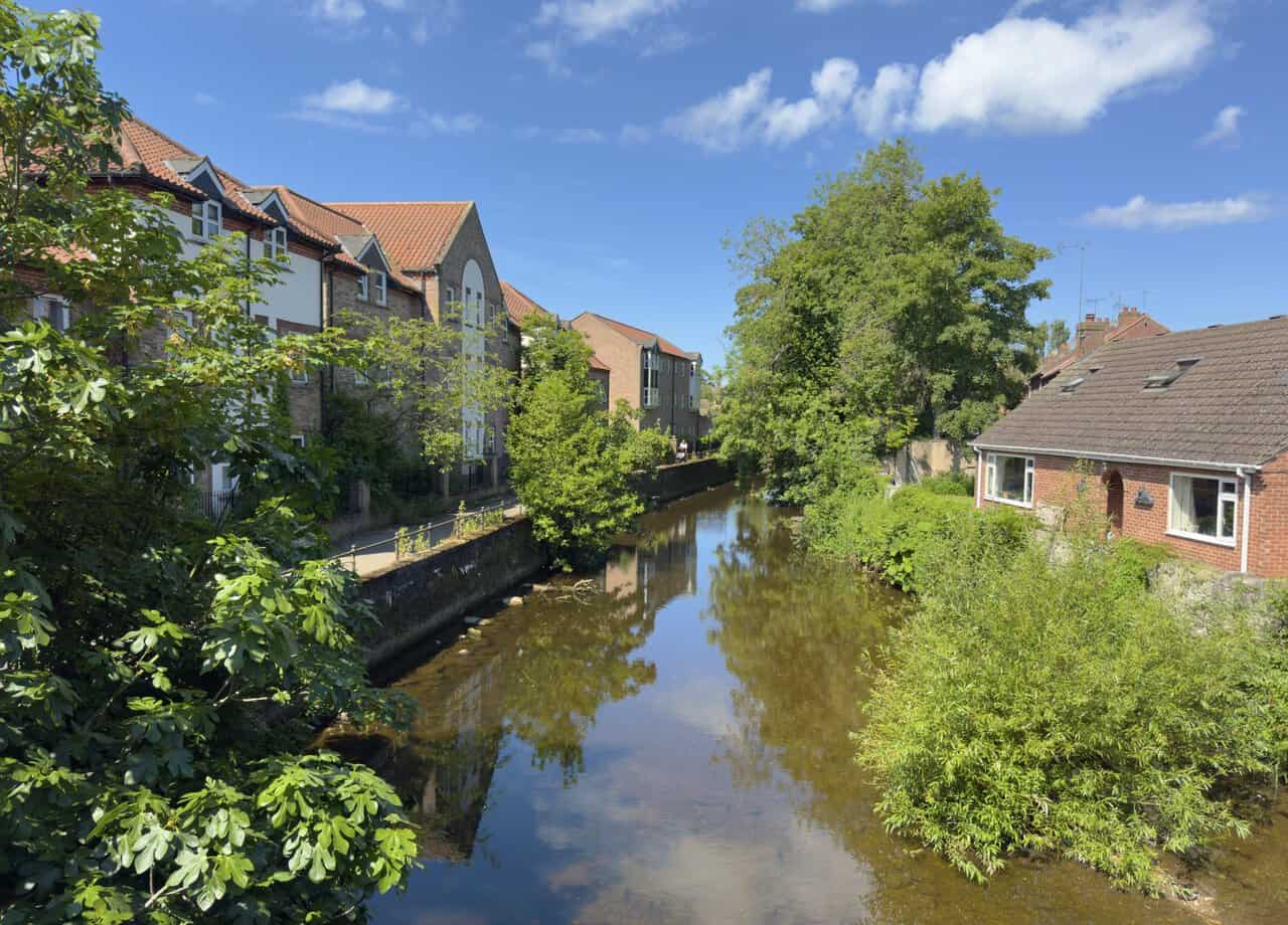
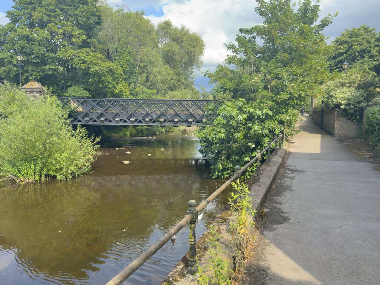
I come to Bondgate Bridge, where I get my first proper look at the River Skell. The water lies calm and still between its banks, mirroring the trees on either side. A row of apartment blocks lines one bank, with the riverside path running along below them. The Skell is the thread that ties this whole walk together, flowing down from the moors through Fountains Abbey and Studley Royal before it reaches Ripon, and I’ll be following it closely for much of the way ahead.
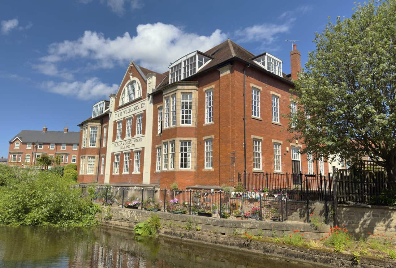
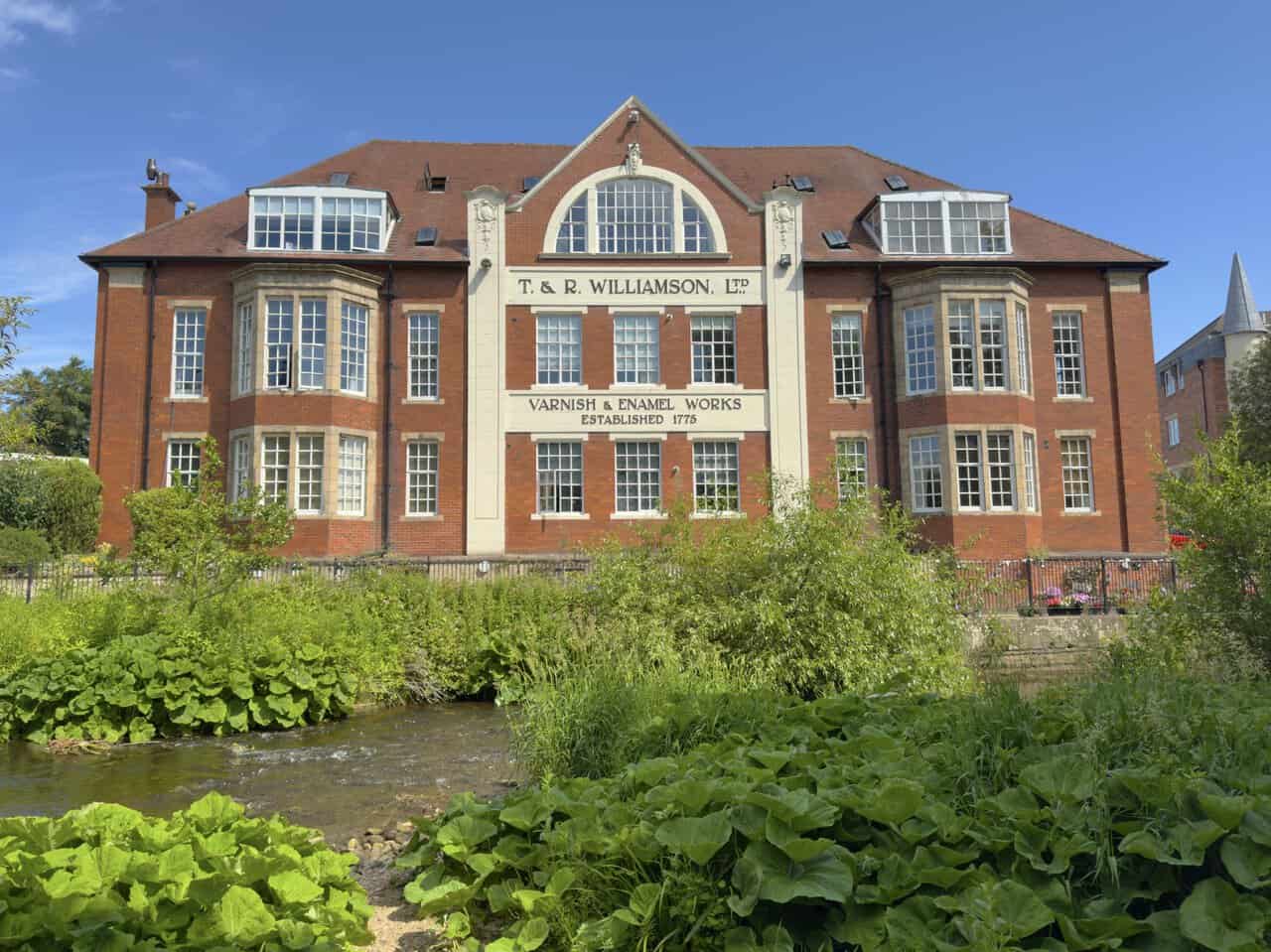
Following the River Skell, it isn’t long before I reach this building standing above the water. The lettering across the front spells it out, T. & R. Williamson Ltd, Varnish and Enamel Works, established 1775. It’s a red-brick frontage with pale stone detailing, generous bay windows and little flowerbeds with bunting strung along the railings at the riverside. The firm was founded by two brothers, Thomas and Robert Williamson, who were bankers at the time, and the story goes that they were given the secret recipe for a fine varnish by a grateful French refugee they’d taken in.
ADVERTISEMENT
Pausing on my Ripon walk, I take in the full sweep of the front, with its big arched window set into the gable and the works name picked out in stone. What makes this place notable is that it’s still going after a quarter of a millennium, recognised as the oldest established varnish house in the United Kingdom and thought to be the oldest privately owned, family-run paint maker anywhere in the world. The company has stayed in Ripon all this time, and there’s a fair chance the traditional finish on a heritage steam locomotive or vintage bus you’ve admired came from here. It was awarded a Royal Warrant in 2011.
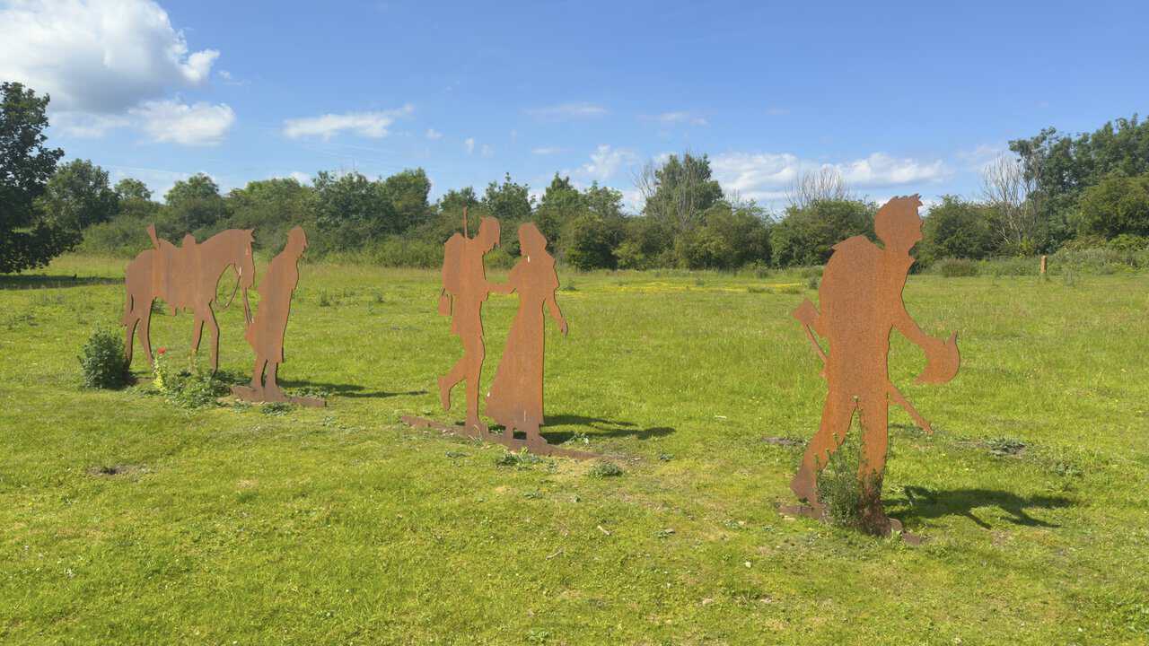
Reaching Hell Wath Nature Reserve, I come across these rusted metal sculptures standing in the meadow. They’re part of Ripon’s silhouette soldiers, a community project created to mark the centenary of the end of the First World War, with similar figures placed at meaningful spots across the city. The setting is fitting, because Hell Wath was once part of the largest army camp in the country, home to more than 30,000 soldiers at its peak, the war poet Wilfred Owen among them. Cut from weathered steel, the figures show a soldier with his horse and a couple saying their goodbyes.
ADVERTISEMENT
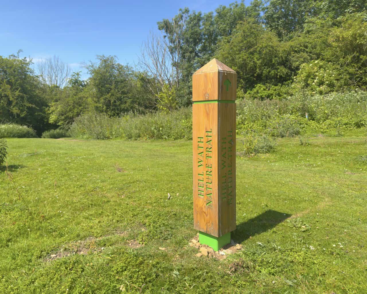
The Hell Wath Nature Trail is easy to follow, thanks to wooden posts like this one along the way. The trail name is cut into the timber in green lettering, with a matching green arrow and a green band at the top and base. I keep an eye out for the next post and follow the green arrows through the reserve, a stretch of open meadow and woodland on my Ripon walk.
Leaving the nature reserve behind, I make my way along Whitcliffe Lane until I reach Whitcliffe Hall, which is actually a large working farm. A big green-clad shed rises behind an older weatherboarded barn and a low stone wall, with a stone farmhouse off to the right under a red pantile roof and a tractor parked in the yard. I follow the signs straight past the farm, heading for Bland Close Farm, and just beyond the last big barn I turn off onto the bridleway signposted Ripon Rowel.
ADVERTISEMENT
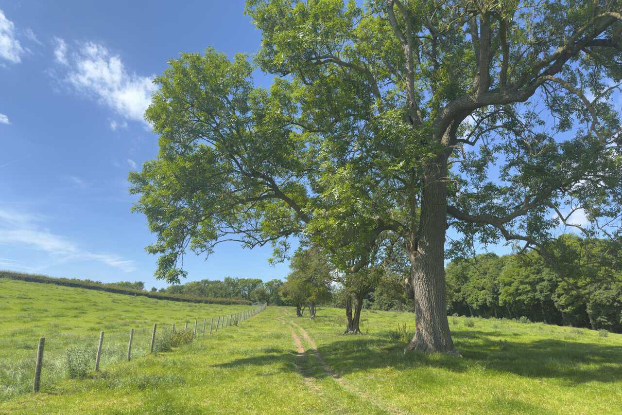
From the farm a grassy bridleway leads me across open countryside towards Mackershaw Trough. The path runs as a pair of worn tracks through the meadow, following a post-and-wire fence line, with a row of tall trees and a large old tree standing beside the track. This is about the quarter mark of my Ripon walk.
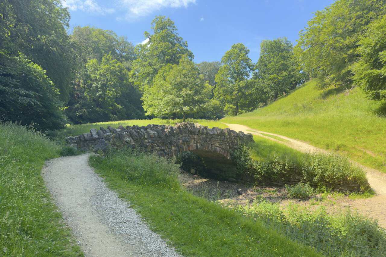
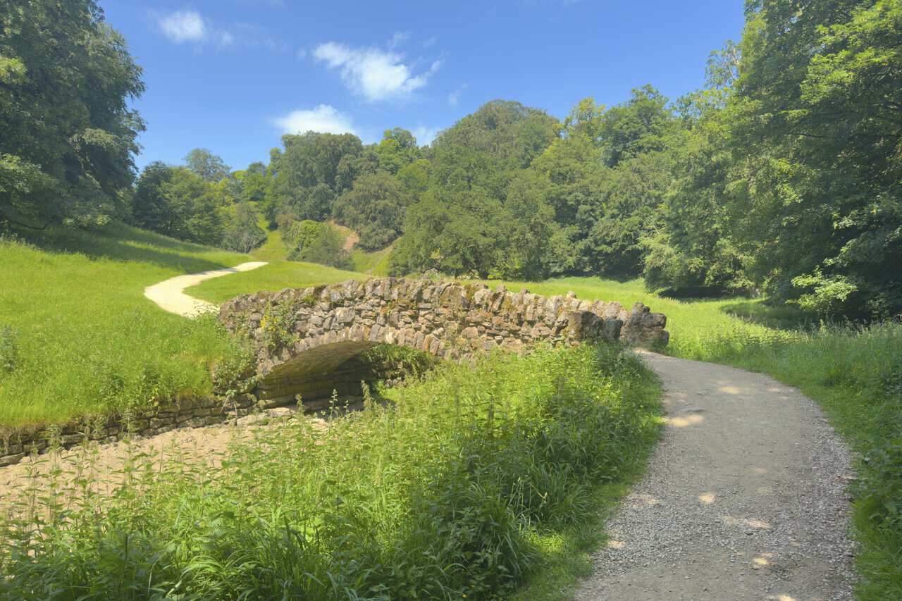
After descending through the woods I pass through the iron gates into Studley Royal Deer Park, where the River Skell winds through a steep-sided valley dotted with old stone bridges. The first carries the path over the water in a single low arch. This is part of what’s known as the Seven Bridges Valley, an extension of the eighteenth-century pleasure grounds, where five of the original seven crossings still stand. The first bridges here weren’t stone at all but timber, built in a Chinese lattice style, a nod to the lost Chinese garden that William Aislabie laid out nearby in the 1740s and from which Chinese Wood takes its name.
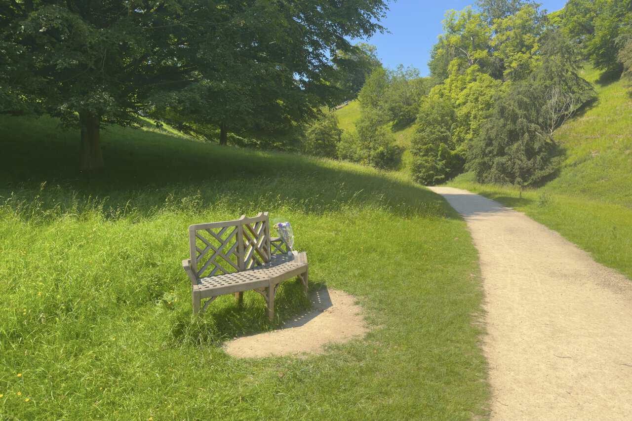
A little further along the valley I come to a wooden bench set just off the path, with a small bunch of flowers resting on it. The grassy valley sides rise on either hand and the pale track runs on ahead. This south-east corner of the estate, taking in Mackershaw and Chinese Wood, is privately owned rather than National Trust land. It’s a quiet spot to pause for a moment on my Ripon walk.
ADVERTISEMENT
Carrying on, I cross another of the valley’s old stone bridges, much like the first with its single rough-stone arch spanning the Skell. These crossings are often taken for packhorse bridges, but the stronger evidence points to rustic estate bridges of the eighteenth century, built to replace the earlier Chinese-style timber ones.
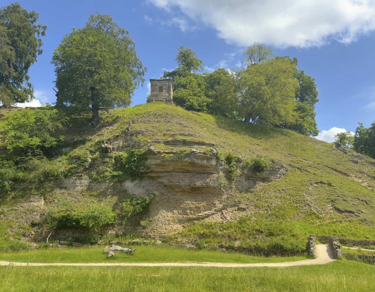
Looking up from the valley floor, I spot a stone tower perched high on a grassy mound above a band of exposed limestone cliff. This is the Roman Monument, also known as the Devil’s Chimney, thought to date from around 1740 as one of the designed features that ornament the valley. It’s believed to have once carried four pinnacles, going by the evidence of a painting from 1760, though the plain square tower is all that crowns the knoll today.
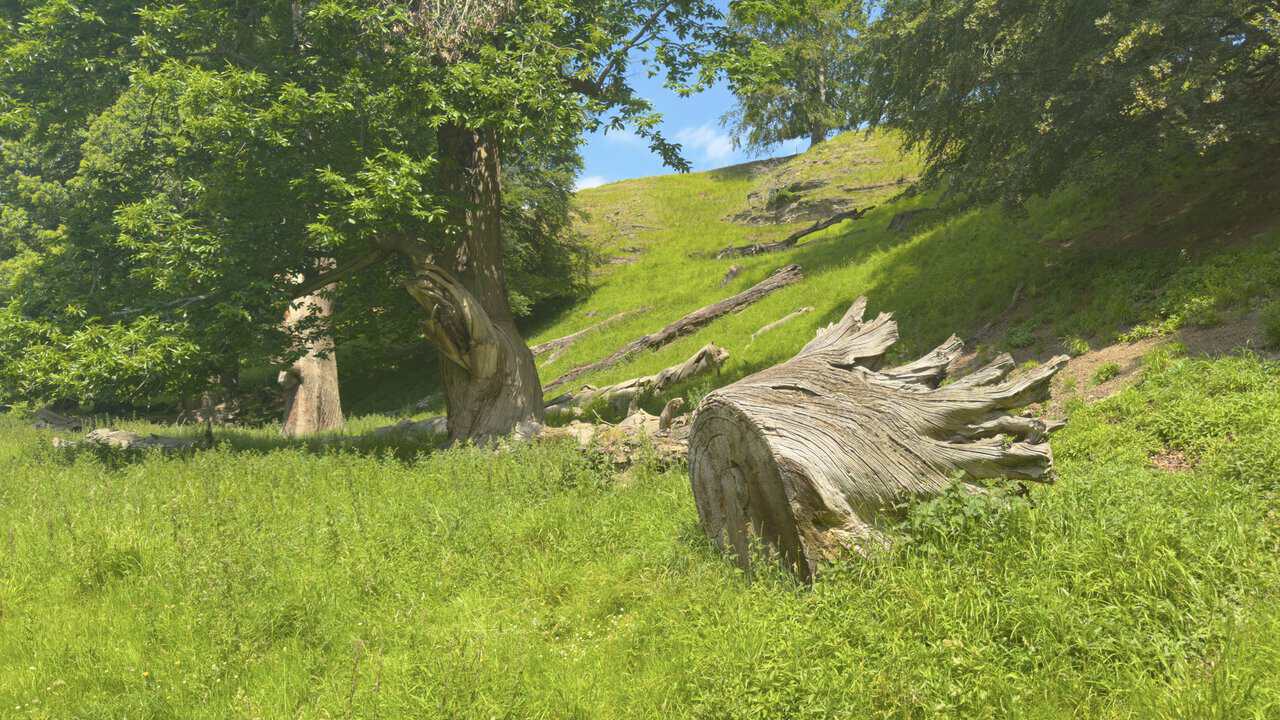
Down in the valley I pass some ancient trees, great gnarled trunks and fallen limbs lying among the long grass on the slope. One huge bleached log rests on its side, its grain twisted like driftwood, while a veteran tree still stands close by. The deer park is known for its old tree avenues, and this deadwood is left to lie for a reason, since rotting timber is a haven for insects, fungi and the wildlife that feeds on them.
ADVERTISEMENT
I reach one last bridge before the valley opens out, its low stone arch reflected in the still water of the Skell. Beyond it the meadow rolls away towards a low grassy ridge, and a bare old skeleton tree stands out among its leafier neighbours. From here the valley begins to broaden as I make my way towards the weir and The Lake.

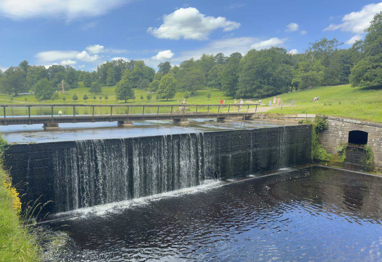
I reach the weir at the northern end of The Lake, where the Skell spills over a long stone sill. A low footbridge runs across just above it, with the open parkland of the deer park beyond. Looking carefully through the trees, I can pick out the spire of St Mary’s Church, William Burges’s High Victorian masterpiece, away on the rise. This is a turning point on my Ripon walk: just before the weir I take a sharp left, signposted to Mackershaw Park, and begin to climb away from the water.
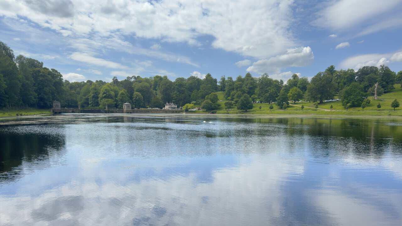
Before moving on, I look across The Lake, its surface mirroring the sky. A long dam wall closes off the far end, with a scatter of pale lakeside buildings set among the trees. A solitary swan glides across the water. The Lake was shaped as part of John Aislabie’s water garden design, where the natural valley and the River Skell were worked into mirrored pools and framed views rather than simply built over.
ADVERTISEMENT
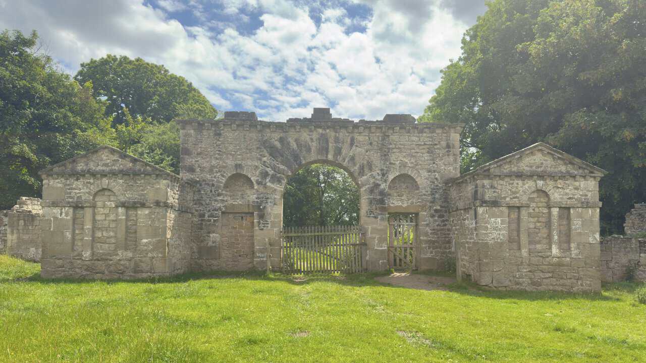
From the lake I climb away on the wide stone track and make my way across Mackershaw Park, the path turning to grass as it runs over the fields, and I leave the park through this arched stone gateway. A central carriage arch is flanked by a pair of pedimented lodges, built of limestone rubble and ashlar and now standing roofless and ruined. This is Mackershaw Lodge, dating from around 1740 and built for John Aislabie. Despite looking every inch an entrance, it was probably never a true gateway at all but a folly set on high ground, designed to be seen from a distance as a focal point in the wider park.
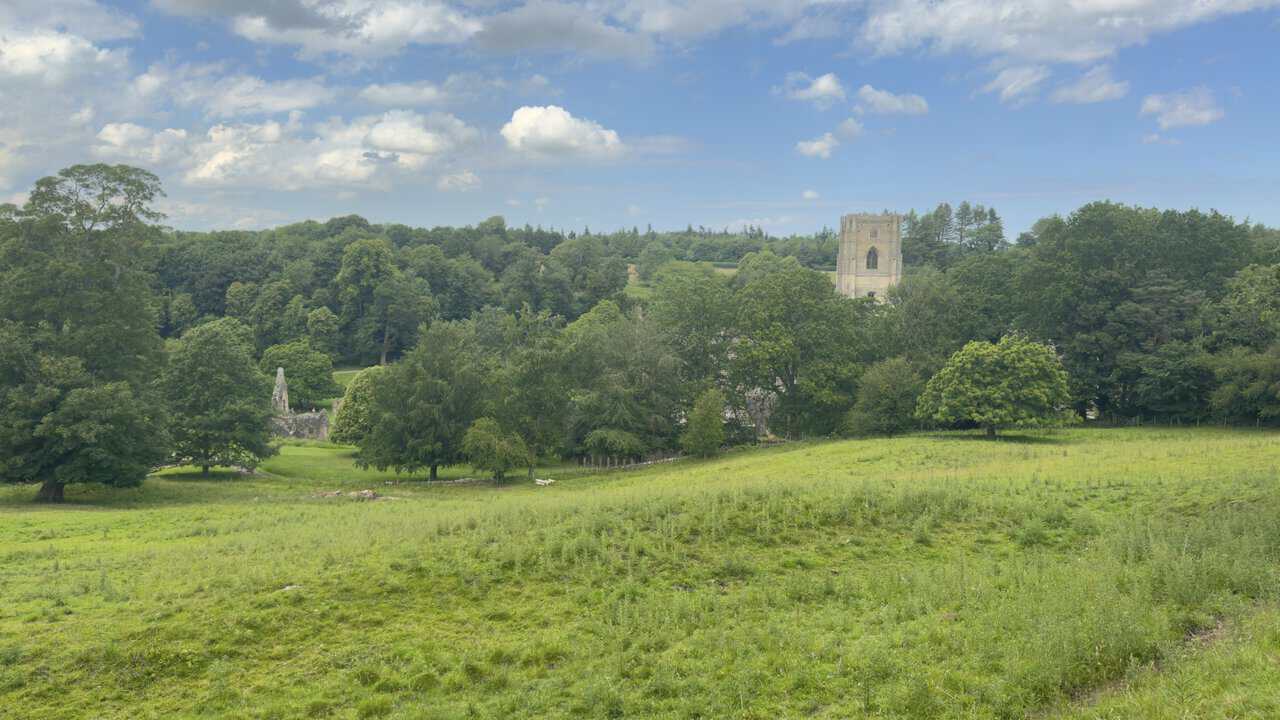
After passing through Hill House Farm I follow the bridleway as it runs alongside the ancient Abbey Wall, and looking downhill to my right I catch a glimpse of Fountains Abbey. The great tower rises above the treetops in the distance, with a fragment of ruined wall just visible lower down among the trees. Fountains was founded in 1132 and grew into the most powerful and prosperous monastic house in northern England, before its closure under Henry VIII in 1539. Even glimpsed from afar it’s a fine sight on my Ripon walk, and I carry on along the bridleway with the abbey wall keeping me company.
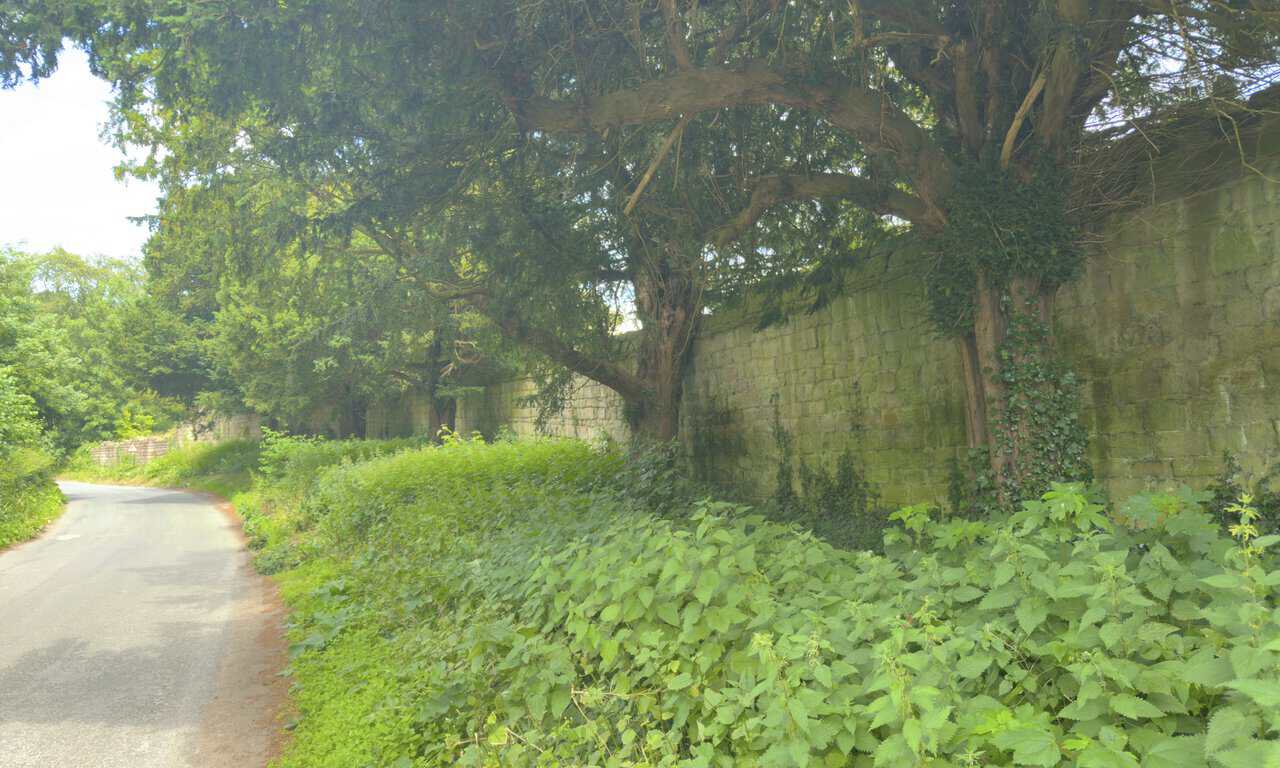
Walking on down Fountains Lane, the ancient abbey precinct wall runs along on my right, and what catches my eye is the line of great yew trees rising against it. Yews have a special place in the abbey’s story, because when the founding monks arrived in this valley in 1132 they’re said to have sheltered through their first hard winter beneath a cluster of ancient yews known as the Seven Sisters. Only two of those original trees are thought to survive today over near the ruins, but yews are extraordinarily long-lived.
ADVERTISEMENT
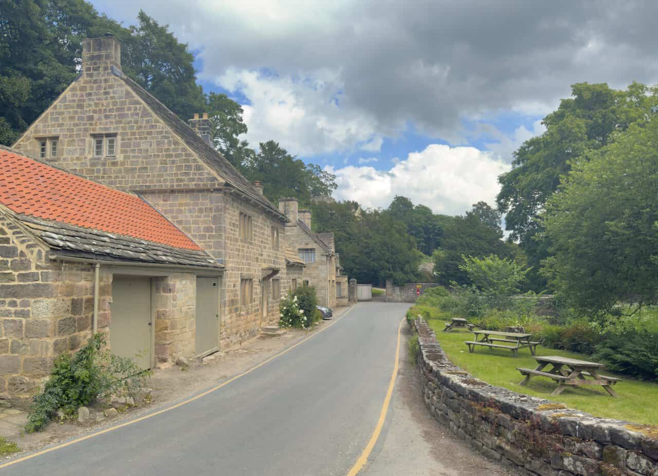
Reaching Fountains Bridge, I take a sharp left in front of the Fountains Abbey West Gate entrance and pass this row of old stone cottages. Built of honey-coloured stone under pantile and slate roofs, they sit among the trees, with gardens and a low drystone wall running along the lane. The West Gate has long marked the threshold into the abbey precinct, the point where, in monastic times, access to the estate was controlled through an outer gate to the west. One of these cottages, West Gate Lodge, is a Victorian building put up around 1859 by the Marquess of Ripon, using stone taken from the abbey ruins.
Pausing to look back at the cottages before I move on, the lane curves gently away between stone walls and gardens. A private picnic area sits across the road on a strip of green, not for passing walkers. These buildings are part of the historic estate setting that gathers around West Gate, and they mark roughly the halfway point of my Ripon walk. With the cottages behind me, I follow the road as it bends and begins to climb the hill ahead.
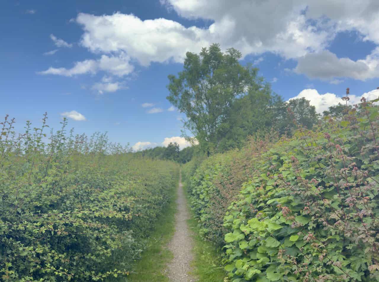
At the top of Fountains Lane I turn onto the public bridleway and follow the stone track up to a road. The road carries a fair bit of traffic, but there’s no need to walk along it, because this bridleway runs alongside behind the hedgerow. It’s a narrow path between tall banks of hedge and bramble, keeping me safely off the tarmac.
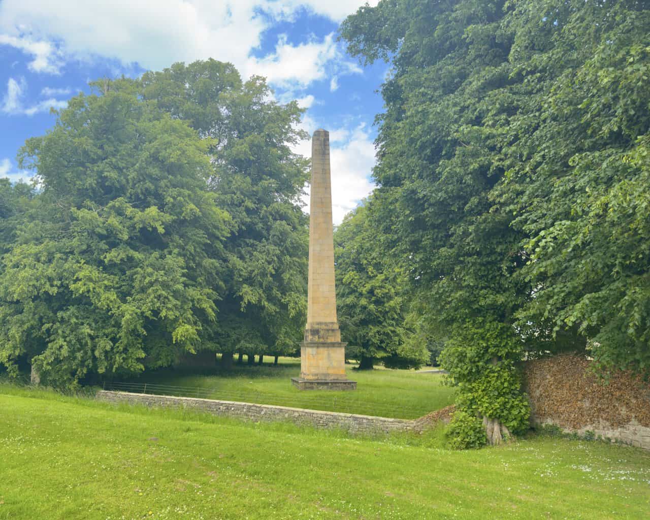
Near the deer park gates, I reach the obelisk, a tall tapering pillar of honey-coloured stone set diagonally on its pedestal. It was raised as a memorial to John Aislabie, who created the great water garden here in the early eighteenth century, and the stone obelisk dates from 1815, replacing an earlier wooden version and a stone pyramid before it. Standing some fifteen metres tall and Grade II listed, it once marked the end of a long straight drive leading all the way from Ripon. From here I turn right through the gates into Studley Royal Deer Park, onto the straight lane that lines up with the cathedral.
ADVERTISEMENT
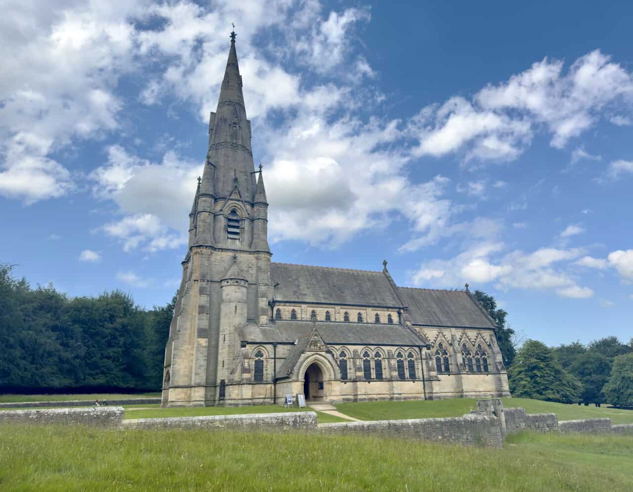
A little way into the deer park I pass St Mary’s Church, a soaring Gothic spire of pale stone rising above the open parkland. This is no ordinary estate church, but one of the finest examples of High Victorian Gothic Revival architecture in England, often called the ecclesiastical masterpiece of its architect, William Burges. It was completed in 1878, and its carved west front, rose window and tall lancets hint at the decoration within.
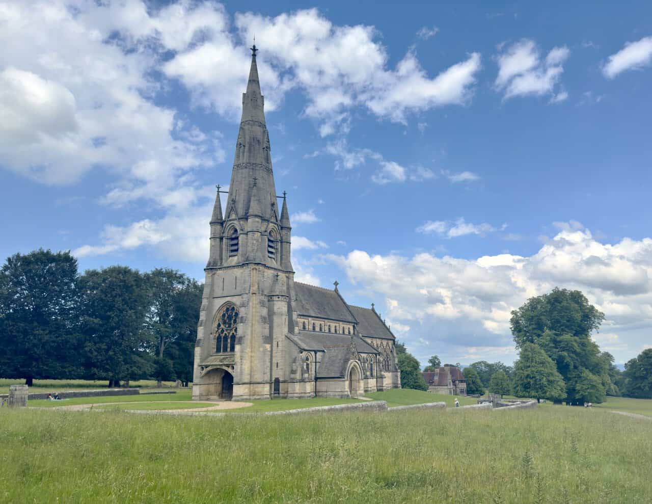
Drawing closer, I take in the full length of the church, the spire anchoring one end and the long nave and chancel stretching away beneath their steep roofs. St Mary’s was built following the death of Frederick Vyner, who was killed by brigands in Greece in 1870. His mother, Lady Mary Vyner, and his sister and her husband, Lord and Lady Ripon, used the ransom money that had been raised but never needed to build two churches in his memory, this one and its sister church at Skelton-on-Ure. Inside, Burges filled it with coloured marble, stained glass, gilded figures and an organ, drawing on a thirteenth-century Gothic influence.
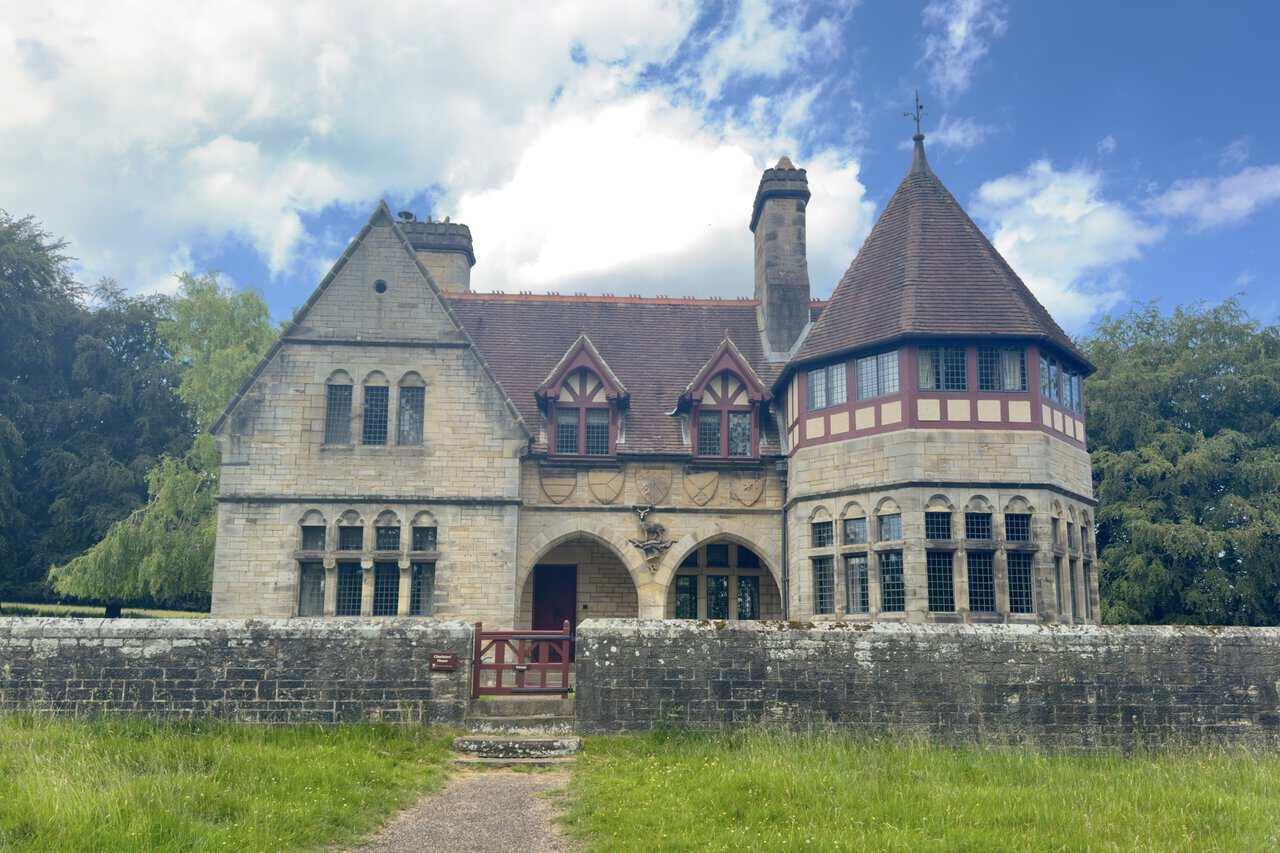
A little further on, the lane brings me to Choristers’ House, a National Trust holiday cottage standing back behind a low wall in the parkland. It has steep red-tiled roofs, half-timbered gables, tall chimneys and a conical-roofed turret, all in mellow gritstone. Like St Mary’s Church, it was the work of the Victorian architect William Burges, built in 1873 with funding from George Robinson, the first Marquess of Ripon, and it makes a notable landmark on my Ripon walk.
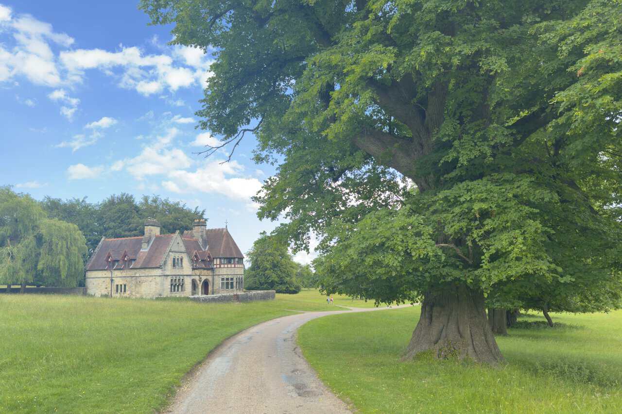
Drawing level with the front, I can see the detail Burges packed into it, the carved shields and the stag set above the twin-arched porch, a nod to the deer that still roam the park. The name Choristers’ House points to its original purpose, the Marquess intending it to house a music school or choir along with the church organist and music master. A small gate in the wall is marked private, since this is someone’s holiday retreat, so I admire it from the lane and walk on.
ADVERTISEMENT
Now I walk along the dead-straight lane through Studley Park, lined on both sides by tall, well-spaced trees. The lane stretches arrow-straight into the distance, and this is no accident, because it was laid out to line up directly with Ripon Cathedral, framed far away at the end of the avenue. It’s one of the great designed vistas of the estate, a deliberate borrowed view that ties the parkland to the city on the skyline.
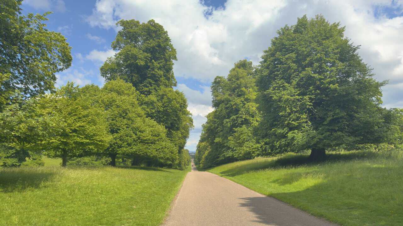
The avenue settles into a rhythm of trees on either side, the grass verges broad beneath them and the pale lane running straight down the middle. Near the far end I can make out the arched stone gateway that marks the eastern edge of the deer park, the exit I’m heading for. The trees here are part of the estate’s avenues, planted to lead the eye and shape the view. This is a calm, ordered stretch of my Ripon walk.
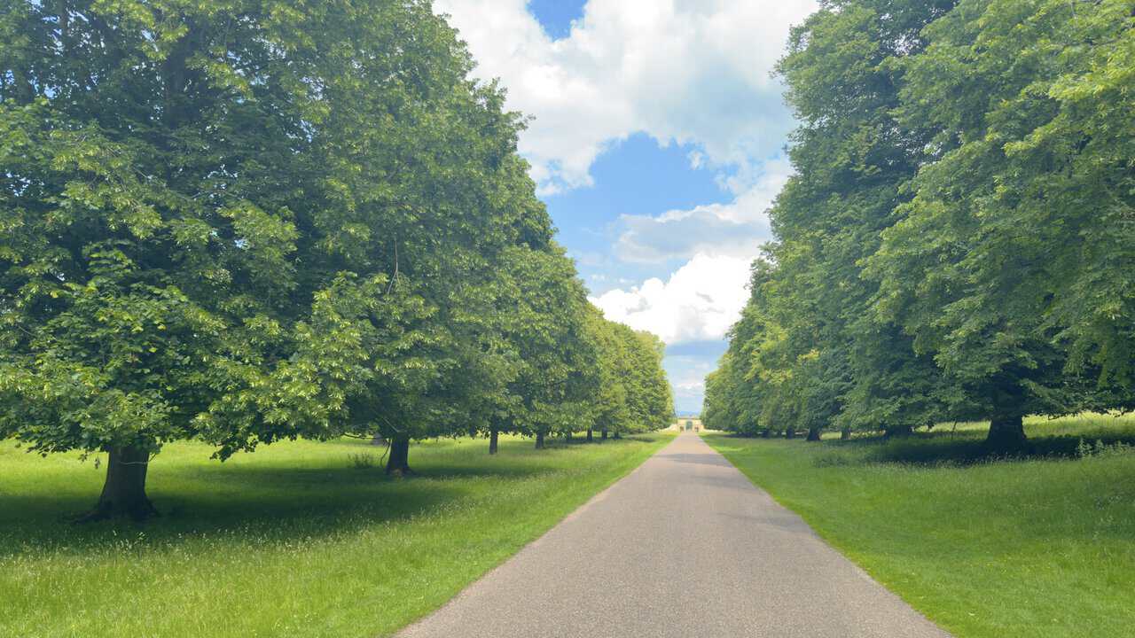
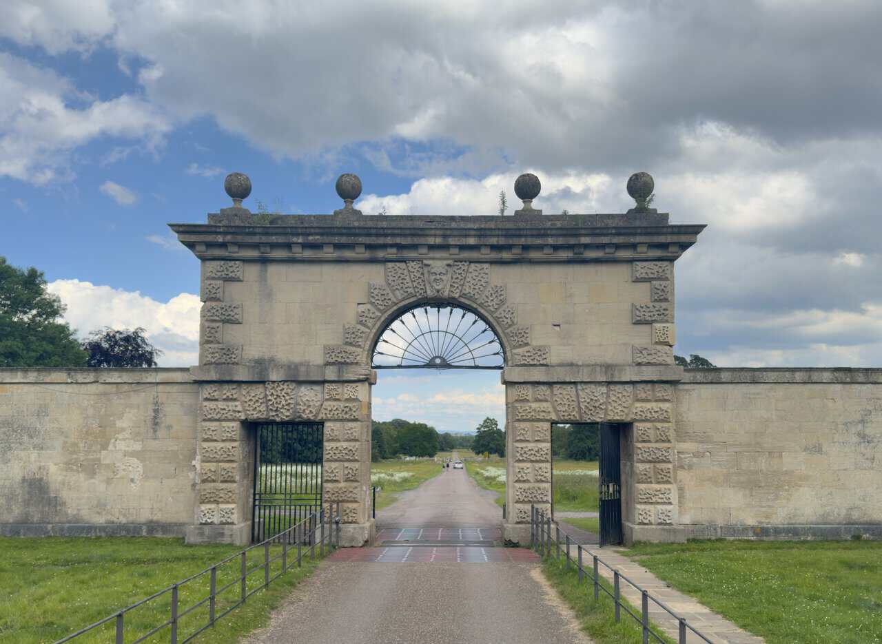
At the far end of the avenue I draw close to the gateway, a classical archway set in a long wall and flanked by a pair of matching stone lodges. This is the Studley Great Gate, the historic eastern entrance to the park, built to stand in line between the estate and Ripon Minster on the skyline. A central carriage arch is set between two smaller pedestrian openings, with iron railings funnelling the lane towards it.

Reaching the gateway, I can take in the stonework up close. The arch is built of boldly rusticated blocks with a pitted texture, crowned by a heavy cornice topped with four big stone balls, with a carved face as a keystone above the fanlight of ironwork. It’s thought to have been the work of Colen Campbell or his circle in the 1720s, though a gate may have stood on this alignment since the 1670s. Passing beneath the arch, I leave Studley Royal behind and carry straight on to meet the minor road, where I’ll turn for the village of Studley Roger.
ADVERTISEMENT
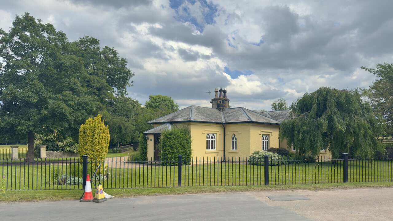
I reach Plumpton Lane on my Ripon walk and pause at Studley Lodge, a single-storey cottage painted in a warm buttery yellow, set behind iron railings on a lawn. It’s built in the Gothick style, with pointed arched windows under stepped hood-moulds and a hipped stone-slate roof topped by a central chimney stack. Dating from the late eighteenth or early nineteenth century and now a private house, it’s a Grade II listed building, one of a cluster of historic structures gathered around the eastern approach to Studley Royal.
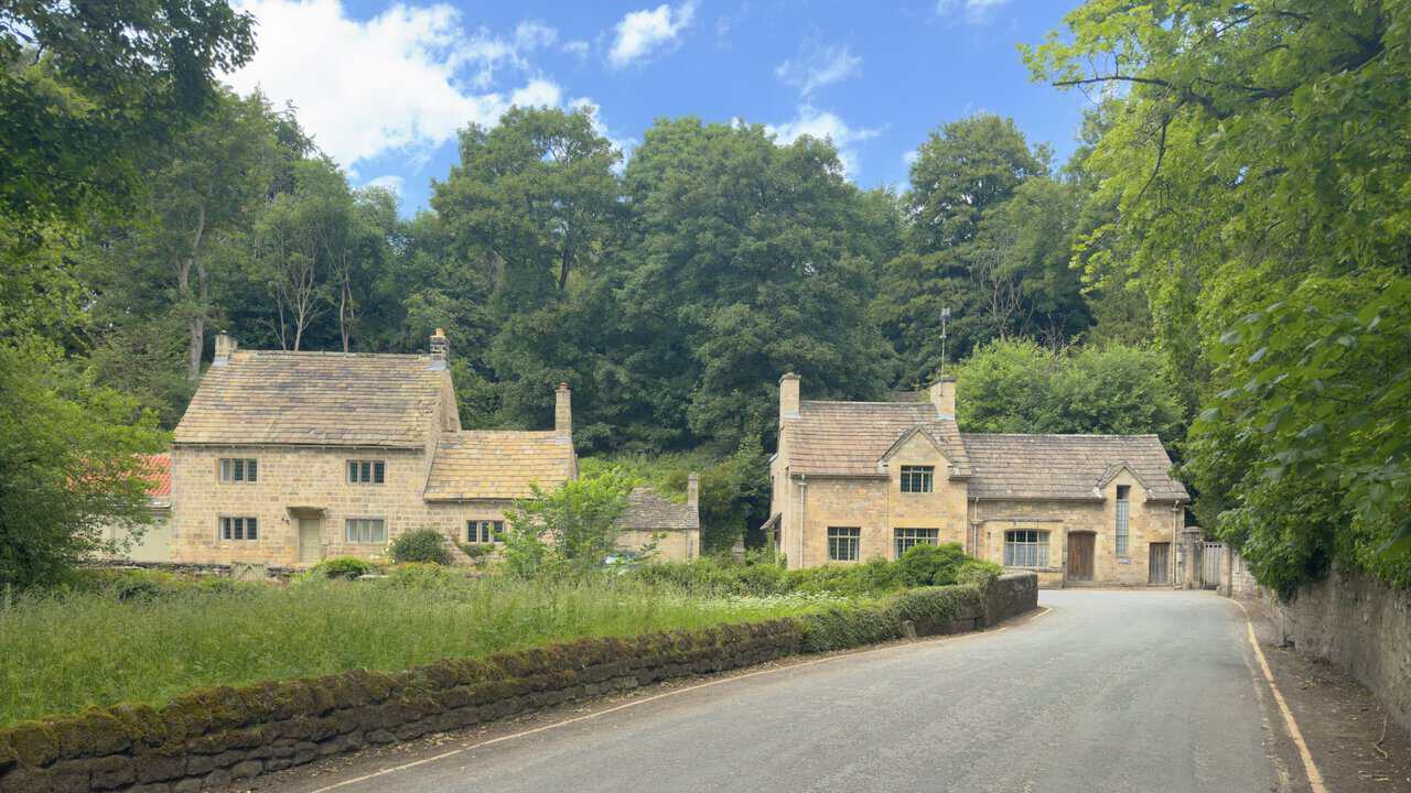
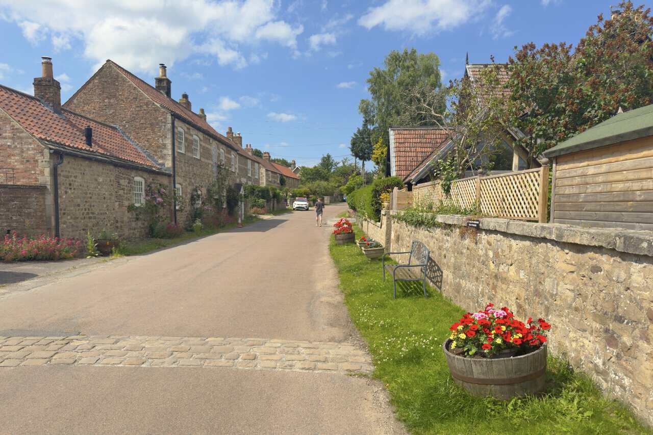
I walk through the village of Studley Roger, a quiet lane lined with stone cottages under red pantile roofs, their gardens spilling roses and flowers towards the road. Half-barrels of poppies and geraniums sit along the verge, and a bench is tucked against the old stone wall. Studley Roger sits on the edge of the World Heritage Site, and its lanes, cottages and long views towards Ripon Cathedral are part of the designed historic landscape. I keep an eye out for the signposted footpath that leads onward towards Hell Wath.
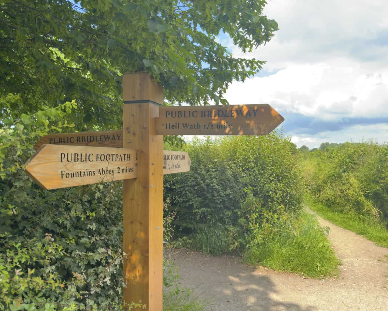
Leaving Studley Roger behind, I carry on for about half a mile until I reach a crossroads marked by this wooden fingerpost. Its arms point the various ways: a public footpath to Fountains Abbey two miles off, another towards Ripon, and the public bridleway to Hell Wath half a mile ahead, which is the way I need. I turn to follow the Hell Wath sign, the path running off between hedges and open countryside.
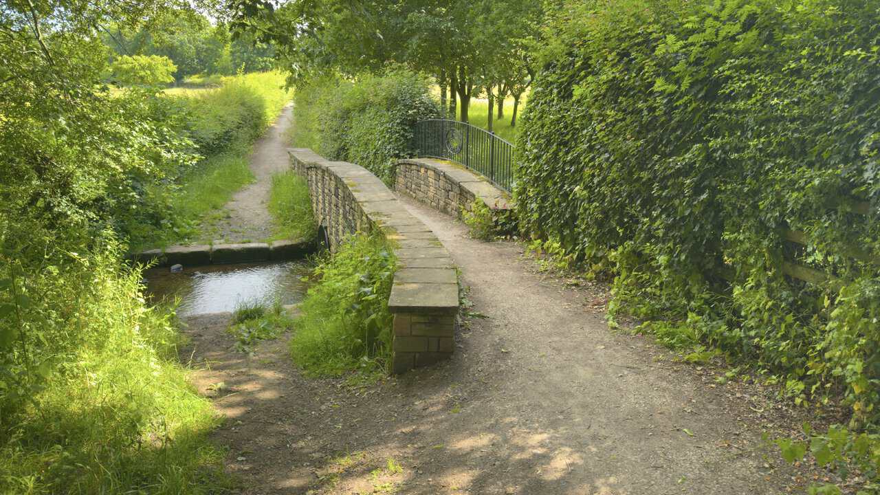
Just after the crossroads I carry on along the bridleway, over a small stone bridge with a curving iron railing, crossing a small stream below. The water lies clear in its channel between grassy banks, a modest beck that rises somewhere back near Studley Roger. The bridleway runs on into the shade of trees and hedgerows, and I press on towards Hell Wath Cottage, where I’ll turn back into the nature reserve and onto ground I walked earlier.
ADVERTISEMENT
Back alongside the River Skell, I descend the Fairy Steps, a short flight of broad, shallow steps dropping towards the water with a metal handrail to steady me. The river runs clear over its stony bed just beyond. The steps may carry a whimsical name, but their origin is not: they’re a First World War feature, built wide and shallow when Hell Wath was part of the largest army camp in the country. They’re thought to have helped haul gun carriages up the slope, the gentle treads suited to mules and horses, and they’re now one of the few visible reminders of those wartime years.
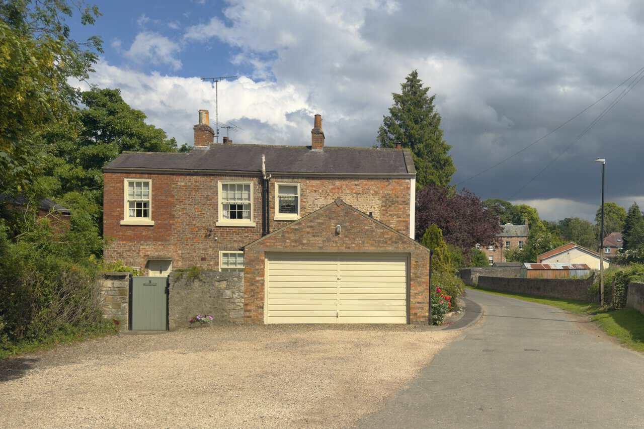
Leaving Hell Wath Nature Reserve behind, I continue along the riverside path beside the River Skell until it becomes Borrage Green Lane. Here the countryside gives way to the edge of the city again, and I pass a red-brick house with cream-painted windows, a garage, a low stone wall and a small gate. The lane runs on ahead towards Ripon. This is familiar ground from earlier in my Ripon walk, and I’m now on the home straight back towards the cathedral and the car park.
Following the riverside path along the Skell, I return to Bondgate Bridge, its black iron lattice-girder span reaching across the water as it did at the start of the day. This Grade II listed bridge dates from 1892, its traceried panelled sides carrying the coat of arms of Ripon, with matching cast-iron railings along the riverbank. I’m very nearly back where I began my Ripon walk, with just the climb up through the city left.
Climbing back up through the city, I arrive once more at Ripon Cathedral, almost at the end of my Ripon walk. The great west front rises before me, its twin towers framing the tall lancet windows and the three arched doorways below, the gilded clock catching the light on the tower to the side. Inside, Ripon is well known for its medieval misericords, the carved wooden seats in the quire whose intricate figures are thought to have helped inspire Lewis Carroll, whose father was a canon here. This is where I set out at the start of the day, and the walk has taken in the abbey ruins and the water garden, the wartime steps and the quiet riverside. All that remains is the short stroll back to the Cathedral Car Park, my circular Ripon walk complete.
ADVERTISEMENT