Following the Cloughton Wyke Walk Along the North Yorkshire Coast
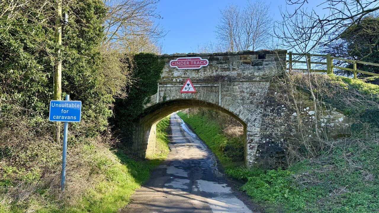
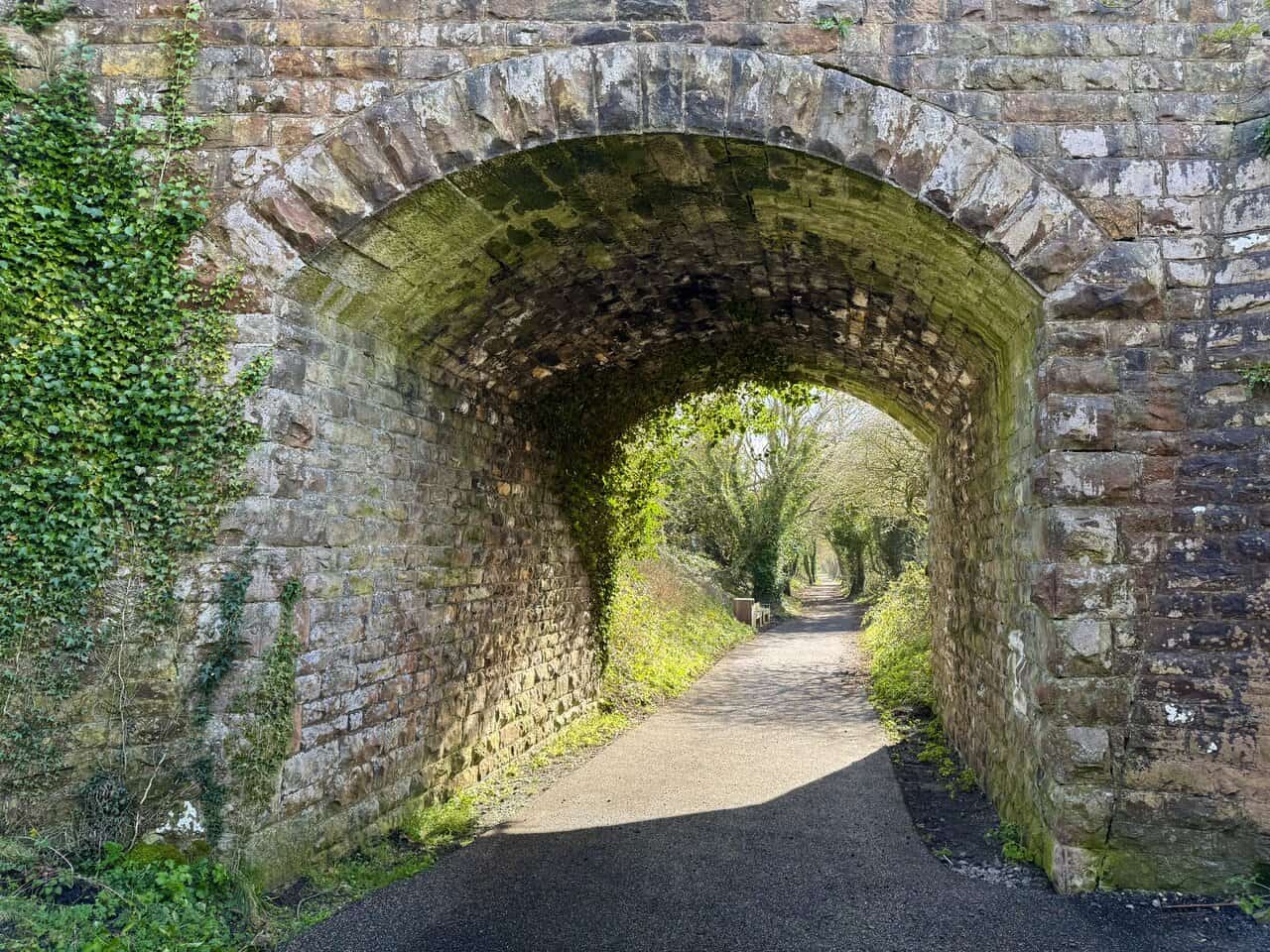
Begin your Cloughton Wyke walk in Burniston. There is a small parking area on Field Lane, near the Cinder Track bridge. Field Lane can be reached by turning off the A171 in Burniston and heading along Rocks Lane by the side of the Three Jolly Sailors. Rocks Lane then becomes Field Lane. The parking area is next to the single-arched stone bridge which carries the Cinder Track over Field Lane. The car park is quite small, but if you cannot get parked here, there is an additional car park at the very end of Field Lane.
From the parking area, walk beneath the single-arched stone Cinder Track bridge and make your way north-east along Field Lane on the tarmac lane. Walk for two thirds of a mile, heading towards the coast, to reach Cliff Top House. When you reach Cliff Top House, stick to the road as it bends around to the right. You will reach the end of the road and the small car park mentioned earlier.
At the end of the road, the path splits into two. Take the left-hand fork, which is a public footpath. When the path splits again almost immediately after that, take the left-hand path around the edge of the farmer’s field. You will be avoiding the descent into Crook Ness. The path will lead you to the Cleveland Way clifftop path, and you will begin making your way north. As well as the Cleveland Way, the path also forms part of the King Charles III England Coast Path. Just a few minutes later, you will pass Long Nab Coastguard Station and Mine Shelter.
Continue following the Cleveland Way clifftop path for one mile to reach Cloughton Wyke. There will be several ups and downs along the way, but just keep following the clifftop coastal path. It is fairly easy to navigate. While walking along the path around the top of Cloughton Wyke, avoid any left-hand paths leading inland and keep on the Cleveland Way heading in the direction of Ravenscar.
After Cloughton Wyke, you will ascend a steep set of steps through a wooded area near Sycarham House. Continue ahead and you will soon reach a bench and viewing area above Rodger Trod. From Rodger Trod, continue along the path for about three quarters of a mile, then start descending through the National Trust woodland at Hayburn Wyke.
Descend through the woodland to reach a wooden signpost at a crossroads and turn right, following the Cleveland Way signed for Ravenscar. Continue following the winding path downhill through the woodland. At the next signpost, turn right again, signed Cleveland Way Ravenscar, and make your way down to the stony and rocky beach at Hayburn Wyke.
Cross the footbridge over Hayburn Beck and head up the steps on the other side of the valley. At the top, do not descend the next set of steps to the next footbridge. Instead, turn left following the North York Moors National Park public footpath. The next section follows the beck upstream through the woodland. The key is to keep the beck on your left and resist any paths that take you across it or away uphill.
Continue following the path down through the woodland to reach the water’s edge, but do not take the left-hand turn across the footbridge. Instead, carry straight on along the public footpath with the beck on your left-hand side. When the path splits at a fork, take the left-hand fork down some steps, not the right-hand fork uphill. Keep close to the side of the beck on your left.
Eventually, the path ascends and moves away from the beck. When you reach a fork in the path, keep left following the North York Moors bridleway blue marker arrow. At the highest point on the bridleway, you will be on the edge of the woodland, with the woodland on your left and a farmer’s field on your right.
You will soon reach a tarmac lane. Keep going straight along it. When you reach the farm buildings at Whitehouse Farm in front of you, turn left and head downhill. Cross a single-arched stone bridge over Bloody Beck and then keep following the lane back uphill for about a quarter of a mile. After passing some large wooden lodges on your left, continue to the bridge, and just before the bridge descend the set of steps on your right-hand side down to the Cinder Track. Turn left and go through the tunnel archway of the bridge. You will now be heading south along the Cinder Track for the second half of your Cloughton Wyke walk.
After about a mile, you will reach the Hayburn Wyke Inn on your left-hand side. Call in for refreshments or just keep going straight ahead on the Cinder Track. After another mile, you will reach a bridge which crosses over a tarmac lane signposted to Newlands Lane, Cloughton. Ignore this and carry straight on along the Cinder Track. After a further half a mile, continue straight through the tunnel beneath Salt Pans Lane and carry on along the Cinder Track, signposted to Burniston and Scarborough.
After a further half a mile, you will reach Station Lane. Continue following the Cinder Track towards Burniston and Scarborough. The route passes by the front of the old station buildings and the Old Goods Shed. After about three quarters of a mile, you will reach the bridge over Field Lane. Descend the steps on your right to reach the car parking area and complete your Cloughton Wyke walk.
Cloughton Wyke Walk: Maps and Tools
Visit either the OS Maps website or the Outdooractive website to view this walking route in greater detail. Both platforms offer a range of features, including the ability to print the route, download it to your device, and export the route as a GPX file. You can also watch a 3D fly-over and share the route on social media.
Cloughton Wyke Walk: Distance, Duration, Statistics
Distance: 8¾ miles
Distance: 14 kilometres
Duration: 4¼ hours
Ascent: 1052 feet
Ascent: 321 metres
Type: Circular walk

Walking in the Yorkshire Dales with 43 Circular Routes
AD This Cicerone guidebook includes 43 circular walks exploring valleys, hills, and moors between Kirkby Stephen and Pateley Bridge. With OS maps, local highlights, and routes ranging from 3–11 miles, it is a year-round companion for walkers of all abilities.
Recommended Ordnance Survey Map
The best map to use on this walk is the Ordnance Survey map of the North York Moors Eastern Area, reference OS Explorer OL27, scale 1:25,000. It clearly displays footpaths, rights of way, open access land and vegetation on the ground, making it ideal for walking, running and hiking. The map can be purchased from Amazon in either a standard, paper version or a weatherproof, laminated version, as shown below.
About the Cloughton Wyke Walk
Cloughton is a small village on the edge of the North York Moors National Park, situated about five miles north of Scarborough along the A171 road to Whitby. The name appears in the Domesday Book of 1086 as “Cloctune” and translates from Old English as the town in the valley. The village has long been part of the Duchy of Lancaster estate, one of the oldest land holdings in the Duchy’s possession, with the connection dating back to 1267 when the manor was granted to Edmund Crouchback, the first Earl of Lancaster. That connection continues to this day, with the Duchy still owning properties along the village High Street.
Cloughton Wyke is the rocky coastal inlet that gives this walk its name. The word “wyke” comes from the Old Norse word for a sea inlet or creek, a reminder of the Viking influence on this stretch of the North Yorkshire coast. The exposed cliffs at Cloughton Wyke are of considerable geological interest, dating from the Middle Jurassic period around 170 million years ago. The rock formations here form part of what is known as the Cloughton Formation, and the site is popular with fossil hunters and geology enthusiasts. Shells, plant remains and trace fossils can all be found in the boulders and rock layers along the shore.
Related Walk: Similar to the Cloughton Wyke Walk
Robin Hood’s Bay views and coastal scenery on the Hayburn Wyke walk
The Cloughton Wyke walk follows the Cleveland Way along the clifftop for the outward leg. This long-distance national trail runs for 109 miles around the North York Moors, from Helmsley to Filey, and the coastal stretch between Cloughton and Hayburn Wyke is among its finest sections. The path also forms part of the King Charles III England Coast Path. Along the way, the route passes the Long Nab Coastguard Station and Mine Shelter, built in 1927 and later used to watch for enemy submarines during the Second World War.
Hayburn Wyke, at the northern turning point of the walk, is a secluded cove managed by the National Trust and the Yorkshire Wildlife Trust as a nature reserve. The name combines the Old English for a hunting enclosure by a stream with the Old Norse word for a sea inlet. The cove is best known for its double waterfall, where Hayburn Beck drops over a rocky ledge directly onto the beach. The surrounding woodland is a designated Site of Special Scientific Interest, home to roe deer, badgers and over thirty species of breeding birds.
The return leg of the Cloughton Wyke walk follows the Cinder Track, which runs along the old Scarborough to Whitby railway line. The railway operated for around eighty years before closing in 1965, and the trackbed has since been converted into a popular walking and cycling trail. The route passes the Hayburn Wyke Inn, an eighteenth-century coaching inn, and the beautifully converted former Cloughton Station, before returning to the starting point on Field Lane.
Cloughton Wyke Walk: My Photos
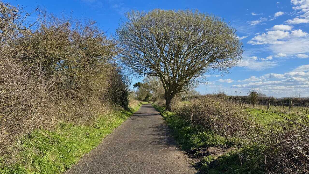
I begin my Cloughton Wyke walk on Field Lane, where I’ve parked near the single-arched stone bridge that carries the Cinder Track overhead. Passing through the bridge, I head north-east along the tarmac lane towards the coast, making for Cliff Top House.

Grisport Unisex Adult Peaklander Hiking Boots
AD The Grisport Unisex Adult Peaklander Hiking Boots are crafted in Italy with a durable waxed leather upper, Spotex breathable lining, and a reliable Track-on rubber sole. Waterproof and weighing just 1120g, they offer comfort, resilience, and dependable performance on demanding trails.
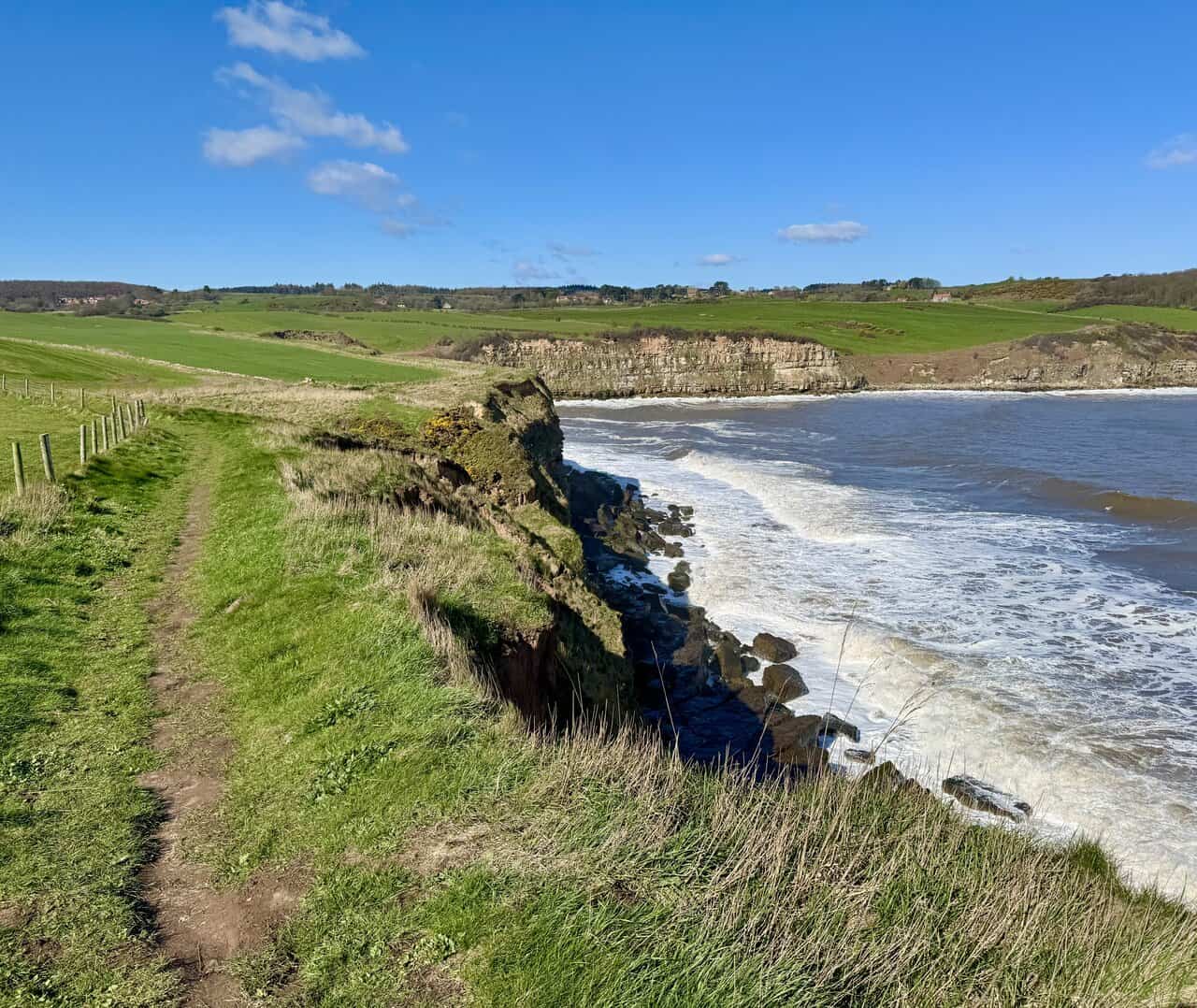
As soon as I reach the coast, I’m rewarded with a fantastic view south towards Scarborough. The castle is just visible, perched on top of the headland. The fortress dates back to the 1130s and has stood watch over the town and its two bays for nearly nine hundred years.

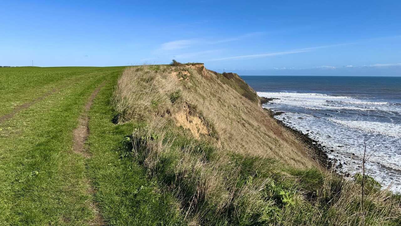
I turn north and head along the clifftop path, which here forms part of both the Cleveland Way and the King Charles III England Coast Path. The narrow track runs along the edge of open farmland, with exposed sandy clay cliffs dropping away to the rocky shore below.
Grisport Unisex Adult Peaklander Hiking Boots
AD The Grisport Unisex Adult Peaklander Hiking Boots are crafted in Italy with a durable waxed leather upper, Spotex breathable lining, and a reliable Track-on rubber sole. Waterproof and weighing just 1120g, they offer comfort, resilience, and dependable performance on demanding trails.
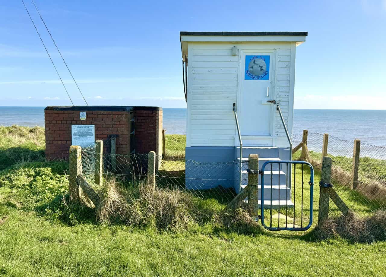
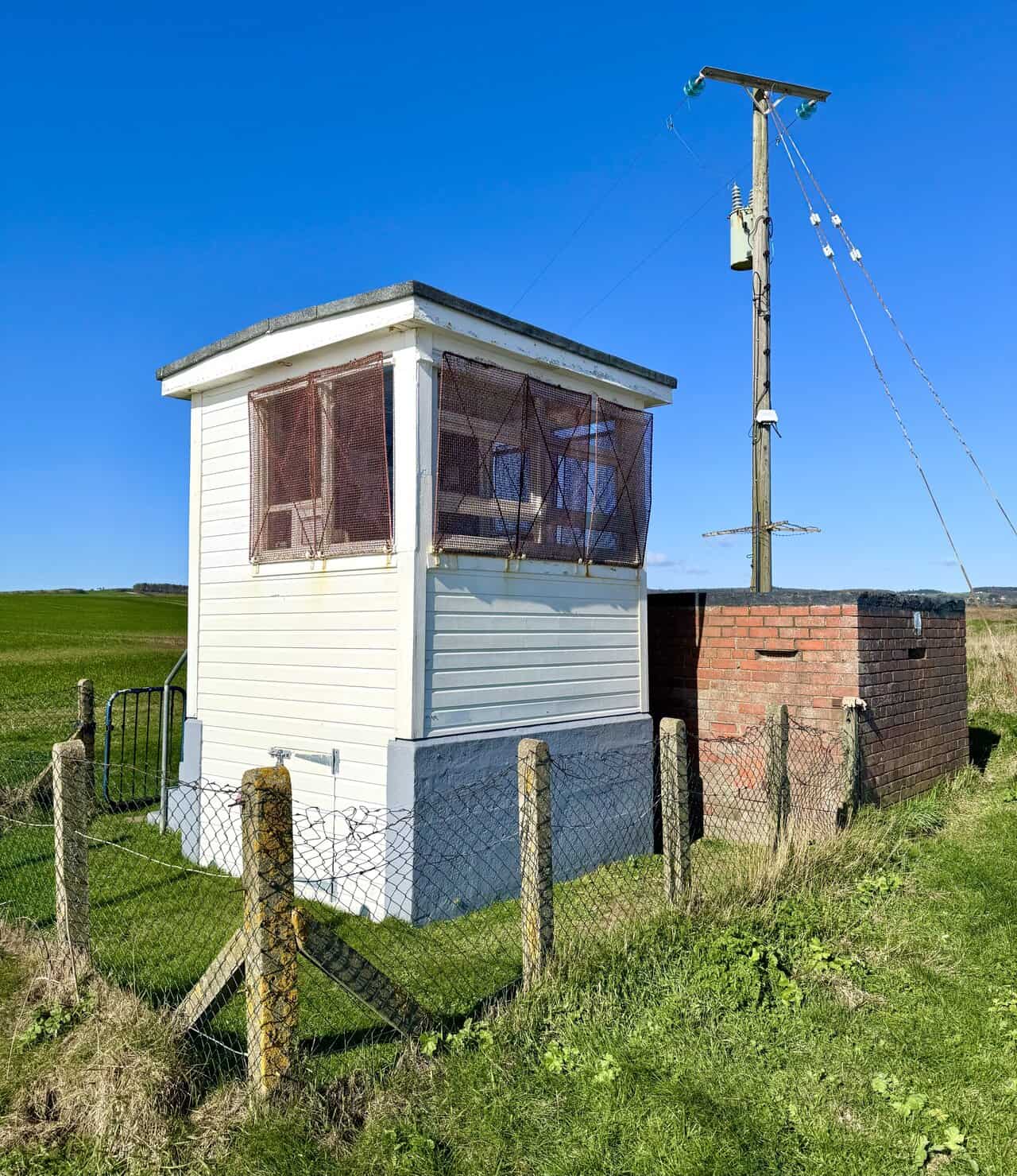
After not too long, I reach the Long Nab Coastguard Station and Mine Shelter, sitting on the clifftop with open views out to sea. The original coastguard station was built in 1927, with the brick mine shelter added in 1939 to protect the coastguards during the Second World War.
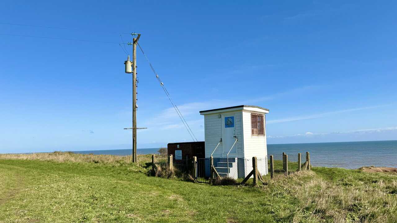
One of the station’s main functions was to watch for mines or torpedoes that would signal the presence of enemy submarines near the Scarborough Channel sea lane, a task of considerable importance to the safety of allied shipping. In 1945 the station reverted to its pre-war role, but with the onset of the Cold War it was linked to the Carrier Control Nuclear Warning System until the early 1960s.

Fifty Walks Across the Beautiful North York Moors National Park
AD Discover 50 routes across the North York Moors, from short easy strolls to challenging high-level hikes. With OS maps, route descriptions, and local highlights, it also includes the legendary 40-mile Lyke Wake Walk, described in four accessible stages.
The station closed in 1993 and was taken over by Scarborough Birders for birdwatching and the study of migration. The rear of the building still has its observation windows, now used for a rather more peaceful purpose. The site is maintained with the support of the Duchy of Lancaster, the North York Moors National Park Authority, and the North Yorkshire and Cleveland Defence Study Group.
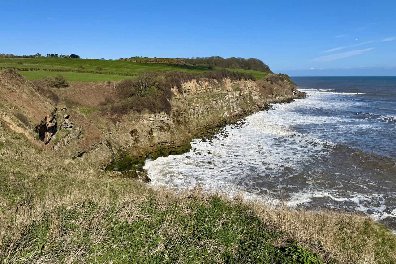
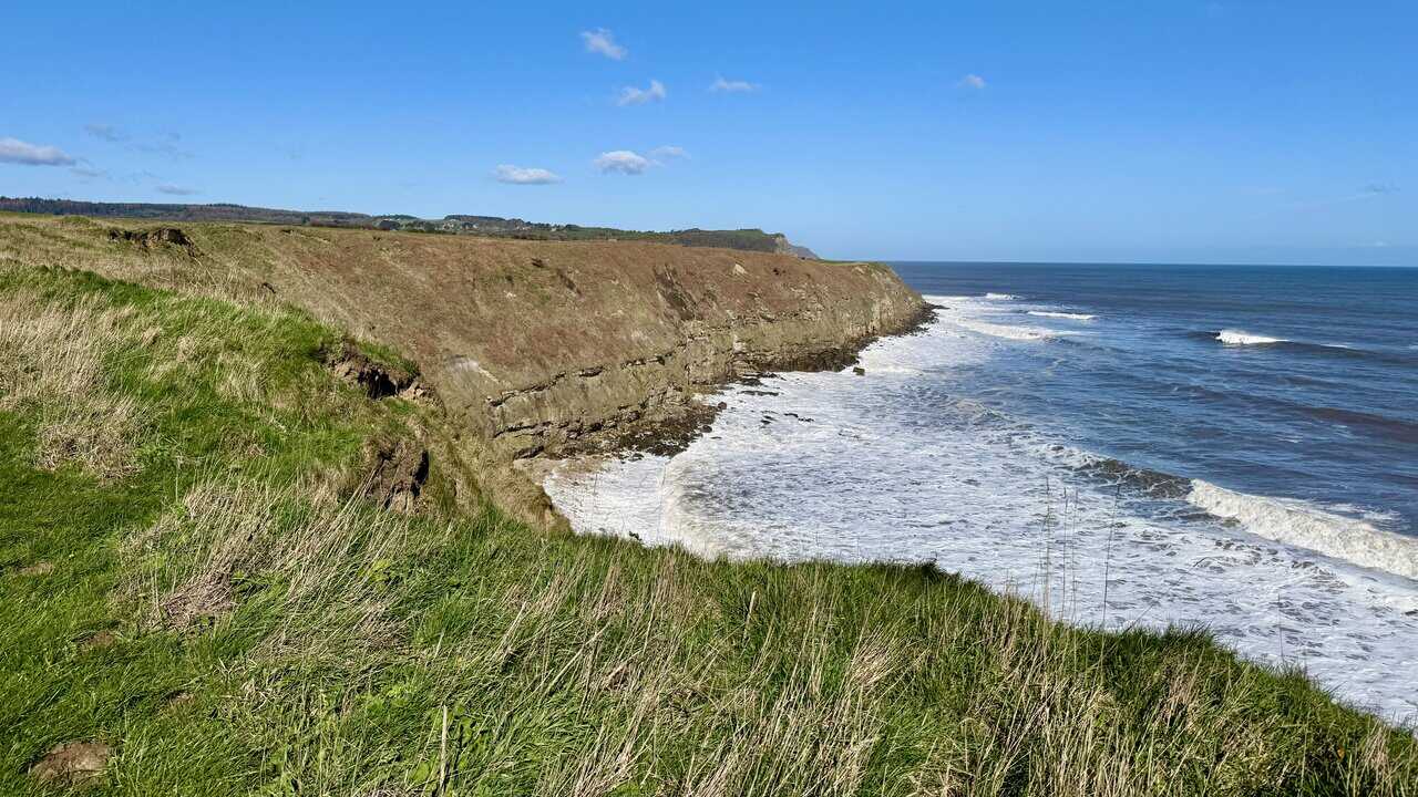
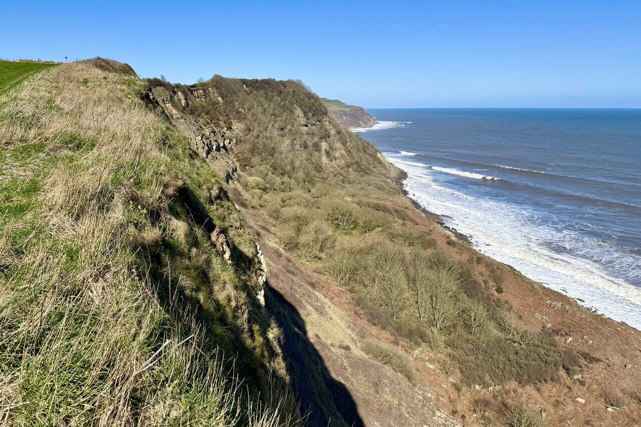
From the coastguard station, I have a magnificent view north along the coast towards The Hundales. I believe the name refers to the stretch of coastline around Hundale Point and Hundale Scar, with Hun Dale being the valley that runs down to the coast through the area. The tall cliffs stretch into the distance, their layered rock faces exposed above a churning white sea.
Fifty Walks Across the Beautiful North York Moors National Park
AD Discover 50 routes across the North York Moors, from short easy strolls to challenging high-level hikes. With OS maps, route descriptions, and local highlights, it also includes the legendary 40-mile Lyke Wake Walk, described in four accessible stages.
The path above Hundale Point dips and rises over a series of steps cut into the clifftop, and there are several such ups and downs along this stretch of the coast. The bright yellow gorse stands out against the green of the grass and the deep blue of the sea, making for a striking combination of colours.
The views along this stretch are superb, and I find myself moving ever closer to Cloughton Wyke. The layered cliffs and rocky shoreline curve away ahead, backed by green farmland rising to the higher ground inland. It’s moments like these that make the Cloughton Wyke walk so enjoyable.

Osprey Hikelite Unisex Backpack for Comfortable and Lightweight Hiking
AD The Osprey Hikelite backpack combines lightweight design with practical features, including a breathable mesh back panel, soft webbing straps, and stretch mesh water bottle pockets. With zipped storage and an organiser compartment, it is ideal for day hikes and outdoor use.
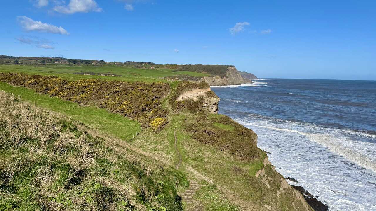
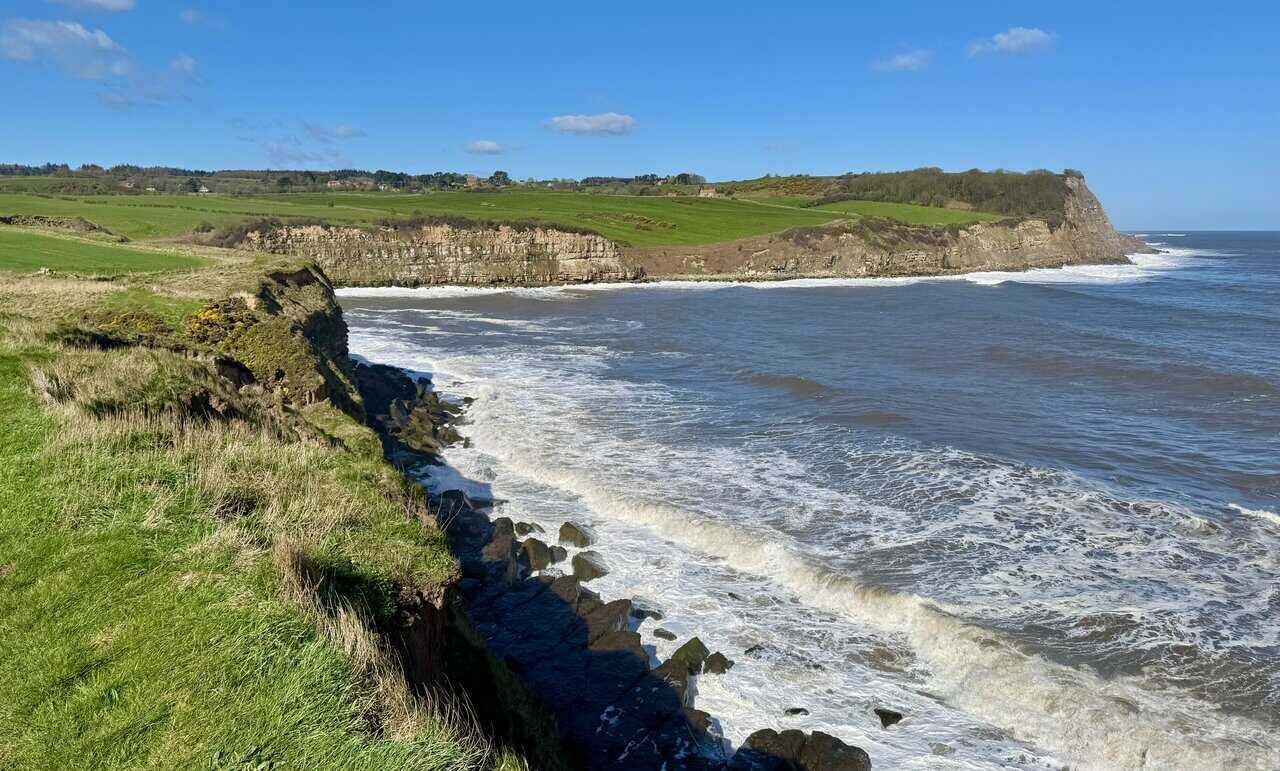
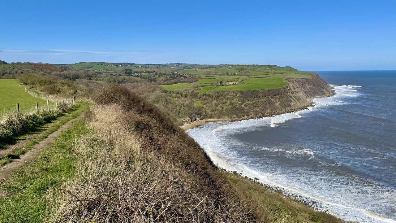
The Cleveland Way follows the cliff edge closely here as I approach Cloughton Wyke. This long-distance national trail runs for 109 miles around the North York Moors, from Helmsley to Filey, and this coastal stretch is among its finest sections. Across the bay, the banded rock faces of Cloughton Wyke draw steadily nearer.
As I continue towards Cloughton Wyke, the cliffs on the far side of the bay come into sharper focus, their horizontal bands of rock standing bold against the green fields above. Waves roll in across the bay, breaking white against the foot of the headland. This is a beautiful and unspoilt part of the coast, and I have it almost entirely to myself.
Osprey Hikelite Unisex Backpack for Comfortable and Lightweight Hiking
AD The Osprey Hikelite backpack combines lightweight design with practical features, including a breathable mesh back panel, soft webbing straps, and stretch mesh water bottle pockets. With zipped storage and an organiser compartment, it is ideal for day hikes and outdoor use.
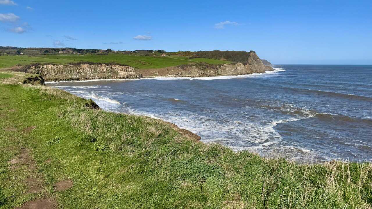
I reach the top of Cloughton Wyke and look down into the inlet below. A small stream tumbles down through a gully in the cliffs to meet the sea, which surges in among the boulders at the base. The exposed rock faces show distinct bands of sandstone and shale, a reminder that this coastline is prized by geologists.
The path circles around the head of Cloughton Wyke, dropping down a set of wooden steps into a dip before climbing back up the other side. The climbs and descents along this coast are nothing too troublesome, and the effort is more than repaid by the views. It’s a beautiful spot, with the open sea on one side and green farmland rolling away inland.

Peak Bagging Wainwrights with Routes to Complete All Fells
AD This comprehensive guide offers 45 circular routes linking all 214 Wainwright fells. With maps, GPX downloads, elevation profiles, and practical advice, it provides efficient yet inspiring ways to complete this classic Lake District challenge at your own pace.
Leaving Cloughton Wyke behind, I continue north along the clifftop path above an area marked on the map as Salt Pans. The name is a reminder that seawater was once collected and evaporated along this shoreline to produce salt, a valuable commodity in medieval times. The path winds through bracken and scrub, with the sea calm and flat below.
I descend another set of steps into a dip, then face the steepest climb so far as the path rises sharply through woodland. I think this is Sycarham Wood, taking its name from Sycarham House which sits just inland. On my way up, I pass volunteers from the North York Moors National Park Authority who are busy repairing the route.
Peak Bagging Wainwrights with Routes to Complete All Fells
AD This comprehensive guide offers 45 circular routes linking all 214 Wainwright fells. With maps, GPX downloads, elevation profiles, and practical advice, it provides efficient yet inspiring ways to complete this classic Lake District challenge at your own pace.
Continuing north on the Cleveland Way, I’m amazed by the sheer scale and beauty of the cliffs along this stretch. Rock faces jut out from beneath the green fields above, with trees and scrub clinging to the steep slopes that fall away to the shore. The coastline ahead curves gently into the distance, and there’s barely another soul in sight.
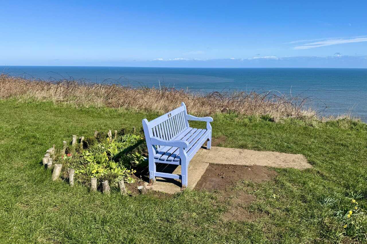
I reach Rodger Trod, which is marked on the Ordnance Survey map with one of those blue fan symbols indicating an exceptional viewpoint. It’s easy to see why, and it makes a superb spot to stop for a break. The views from here along the coast in both directions are outstanding.

Berghaus Hillmaster II GTX Men's High Rise Hiking Boots
AD The Berghaus Hillmaster II GTX men’s hiking boots feature a waterproof, breathable GORE-TEX membrane, a memory foam tongue and collar for a personalised fit, and a Vibram sole delivering exceptional grip, stability, and shock protection for confident performance on any terrain.
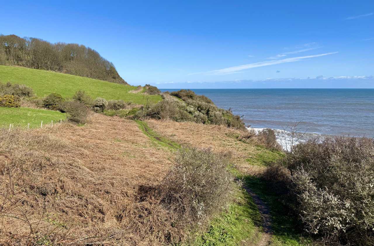
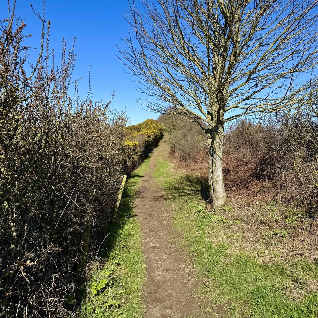
From Rodger Trod, the character of the path changes for a while as it becomes enclosed by hedgerows on both sides. It’s a lovely little path, narrow and sheltered, with a patch of bright yellow gorse catching the eye ahead. A welcome contrast to the open clifftop walking.
I follow the path above Little Cliff, and the anticipation starts to build. Hayburn Wyke is not too far away now, and it’s another of the highlights of this Cloughton Wyke walk.
Berghaus Hillmaster II GTX Men's High Rise Hiking Boots
AD The Berghaus Hillmaster II GTX men’s hiking boots feature a waterproof, breathable GORE-TEX membrane, a memory foam tongue and collar for a personalised fit, and a Vibram sole delivering exceptional grip, stability, and shock protection for confident performance on any terrain.
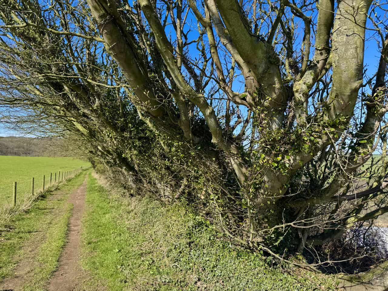
I pass through a section where the trees arch over the pathway, their trunks and branches bent inland by years of strong winds blowing in from the coast. Ivy clings to the gnarled limbs, and the narrow path runs between a fence line and the twisted hedgerow. It’s a reminder of just how exposed this coastline can be.
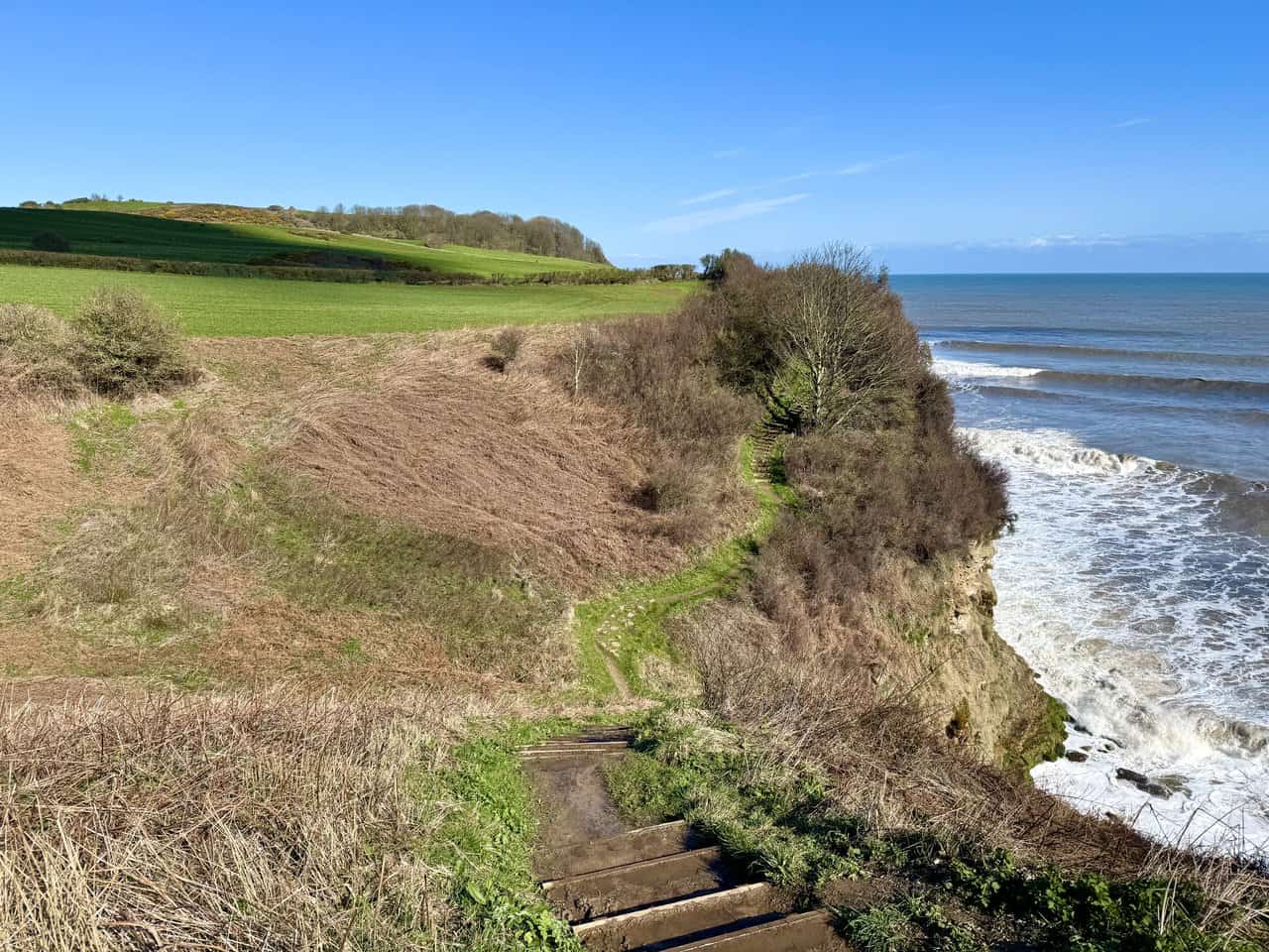
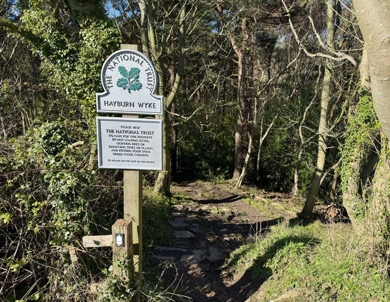
From Little Cliff, I follow the Cleveland Way into woodland and reach the National Trust sign for Hayburn Wyke. The path drops into the trees, and the feel of the walk changes as the open clifftop gives way to dappled shade. This marks the beginning of my descent down to Hayburn Wyke.

Kendal Mint Co Energy Gel with Citrus and Mint Flavour
AD Kendal Mint Co energy gels deliver 27g of fast-absorbing carbohydrates plus electrolytes and B vitamins for improved performance. Vegan, gluten free, and Informed Sport certified, these caffeine-free gels are refreshing, easy to digest, and ideal for running, cycling, and endurance.
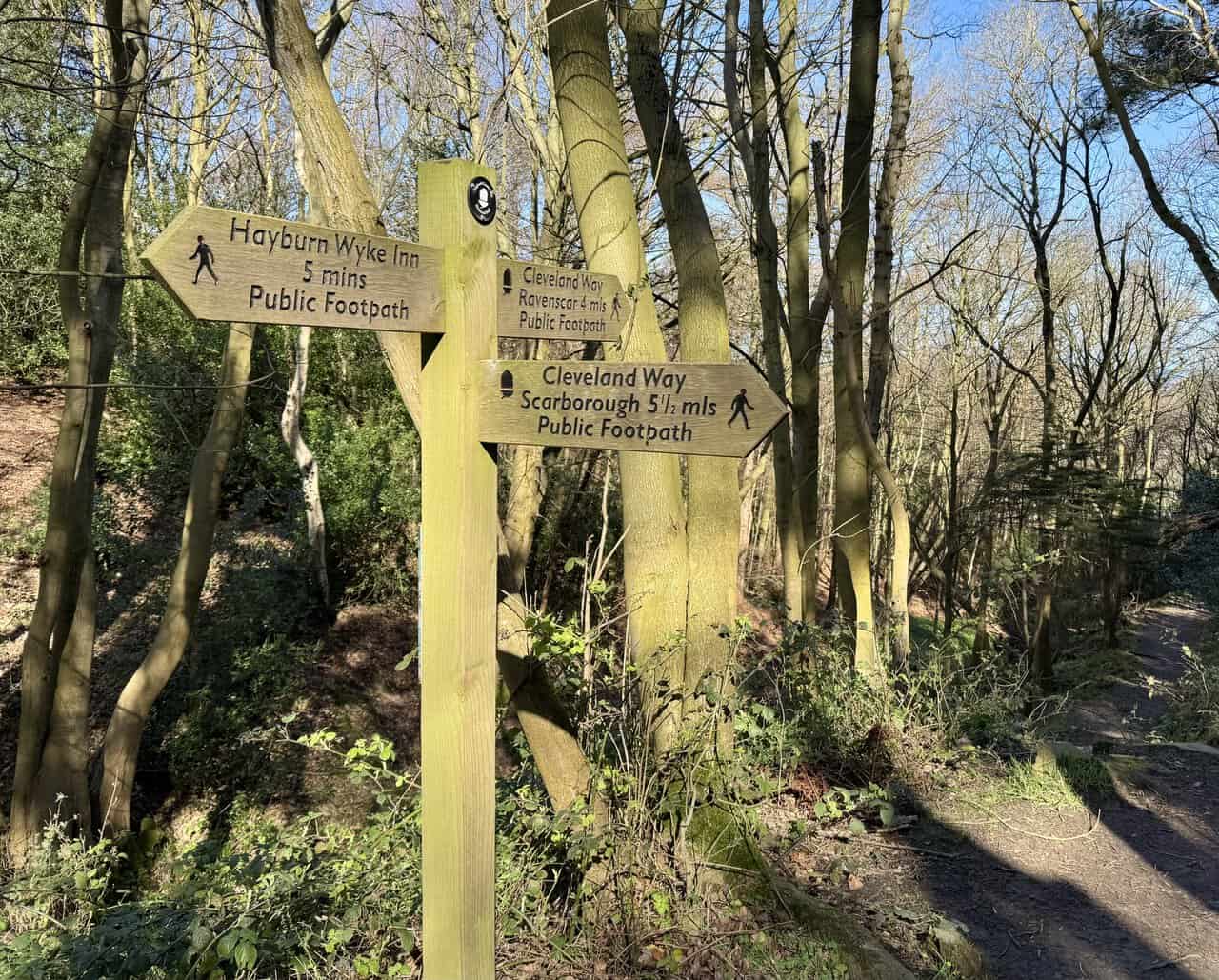
Halfway down through the woods, a fingerpost offers three choices. Left leads to the Hayburn Wyke Inn, and Scarborough is the way I’ve come from. I turn right, following the Cleveland Way signed for Ravenscar, and continue my descent towards the shore at Hayburn Wyke.
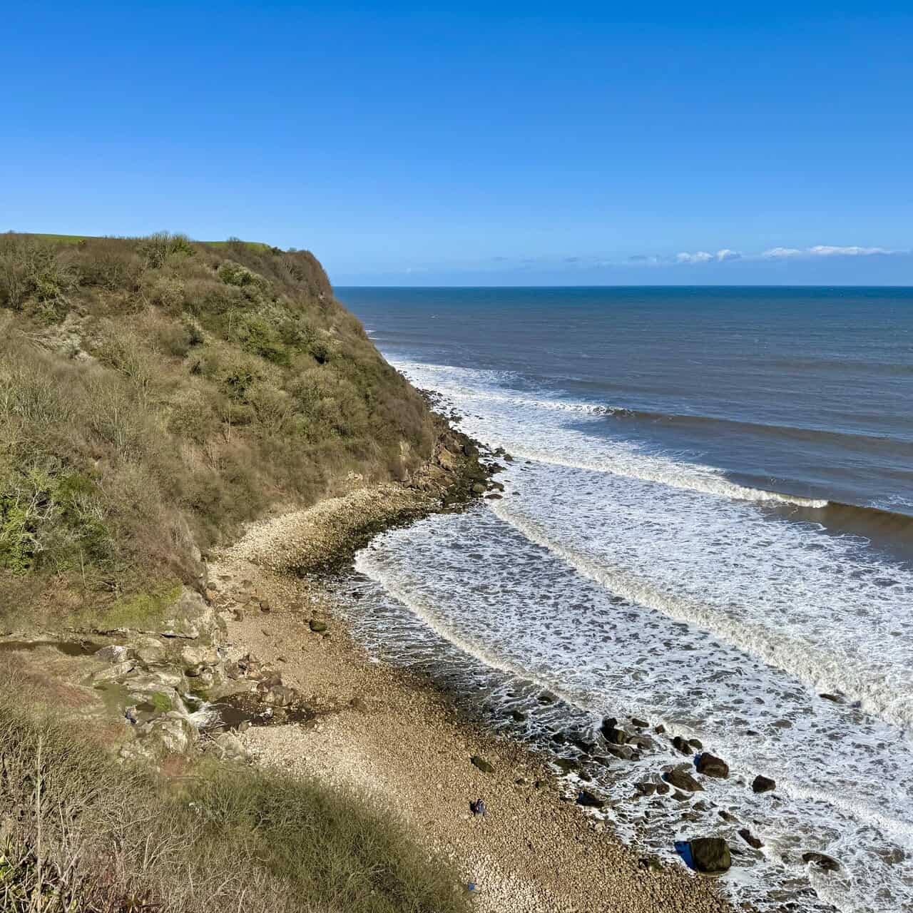
As I continue down through the woodland, I get my first full sighting of Hayburn Wyke and it’s magnificent. The rocky beach curves below, with waves rolling in across the shingle and boulders. The wooded cliffs rise steeply on the far side, topped by green fields above.
Kendal Mint Co Energy Gel with Citrus and Mint Flavour
AD Kendal Mint Co energy gels deliver 27g of fast-absorbing carbohydrates plus electrolytes and B vitamins for improved performance. Vegan, gluten free, and Informed Sport certified, these caffeine-free gels are refreshing, easy to digest, and ideal for running, cycling, and endurance.
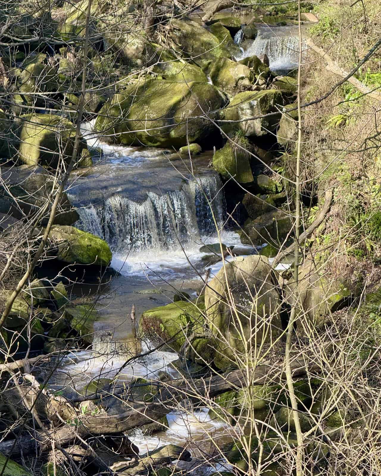
I take a short detour to visit the waterfall formed by Hayburn Beck as it tumbles over a series of mossy rocks through the woodland. The beck cascades in several small drops, the water catching the light as it rushes between banks of moss-covered stone. It’s a lovely spot, and well worth the brief diversion.
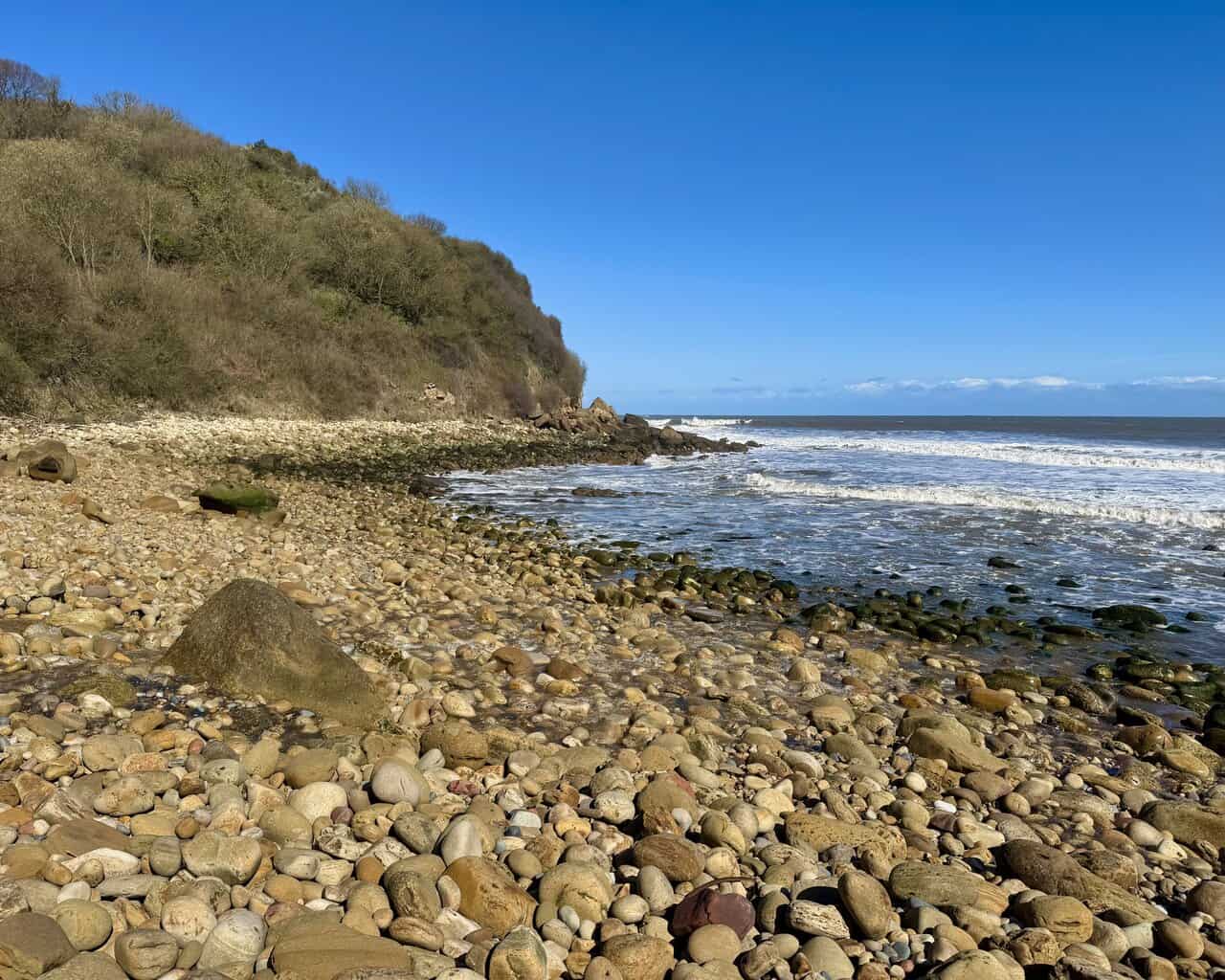
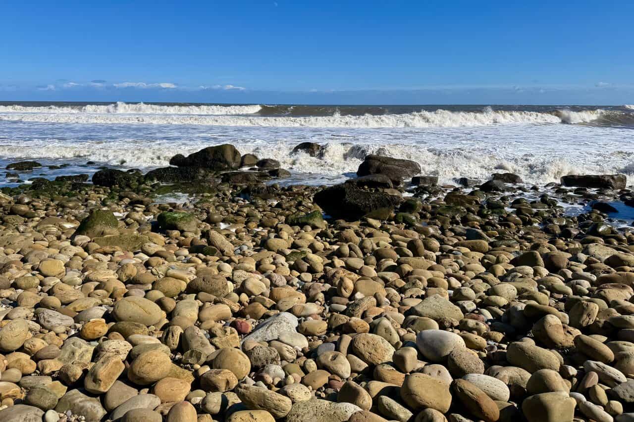
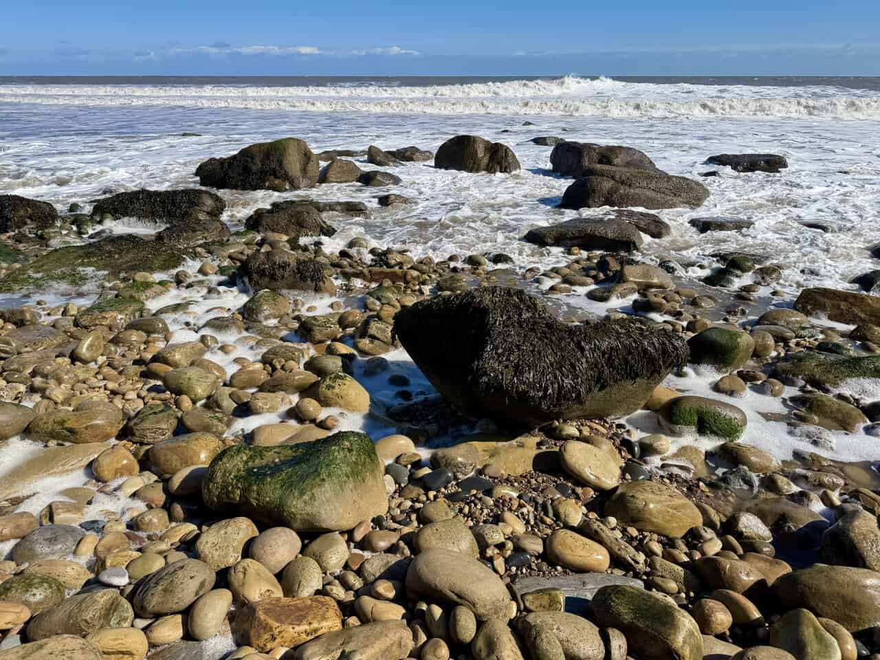
I make my way down to the beach at Hayburn Wyke and step out onto the pebbles and boulders that fill this secluded cove. The rounded stones stretch away along the shore, backed by steep wooded cliffs. Hayburn Wyke is a designated Site of Special Scientific Interest, and the name itself goes back centuries, combining the Old English for a hunting enclosure by a stream with the Old Norse word for a sea inlet.

Thermos Stainless King Flask for Travel and Daily Adventures
AD The Thermos Stainless King 470ml flask keeps drinks hot for 18 hours or cold for 24. With durable stainless steel, vacuum insulation, a serving cup, and a leakproof design, it is perfect for commutes, journeys, and outdoor adventures.
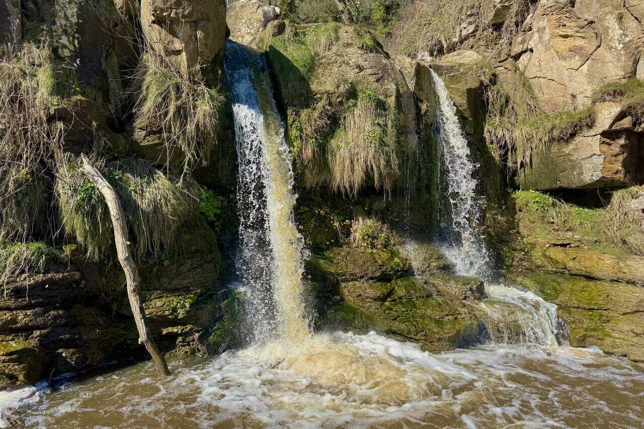
The highlight of the cove is the double waterfall where Hayburn Beck drops over a rocky ledge onto the beach. The water splits into two streams as it falls, tumbling down between mossy outcrops and weathered boulders. The cliffs here date from the Middle Jurassic period, and the beck has exposed fossil-rich rock layers that are of great interest to geologists.
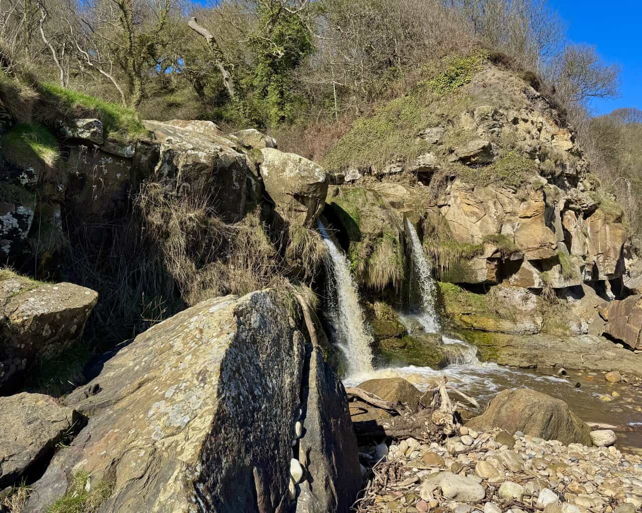
Up close, the waterfall is even more impressive. The water catches the light as it cascades down, splashing into a pool at the base before running across the rocks and out to sea. It’s one of those rare places where a waterfall meets a beach, and the sound of the falling water mixing with the breaking waves is something quite special.
Thermos Stainless King Flask for Travel and Daily Adventures
AD The Thermos Stainless King 470ml flask keeps drinks hot for 18 hours or cold for 24. With durable stainless steel, vacuum insulation, a serving cup, and a leakproof design, it is perfect for commutes, journeys, and outdoor adventures.
I spend some time exploring the beach itself, where the waves roll in over the pebbles and crash around the larger boulders. The woodland surrounding the cove is owned by the National Trust and managed alongside the Yorkshire Wildlife Trust as a nature reserve. It’s home to roe deer, badgers and over thirty species of breeding birds.
The rock pools and seaweed-covered boulders along the waterline are full of life. The receding tide leaves behind pools where blennies, limpets and crabs find shelter among the stones. It’s a wild and unspoilt spot, and I could happily spend much longer here, but it’s time to head inland and continue on my way.
Lake District High Level and Fell Walks with Thirty Routes
AD This pocket-sized guide presents 30 routes on the Lake District’s highest fells, including Scafell Pike, Helvellyn, and Blencathra. With OS maps, colour photographs, and practical notes, it offers circular walks from 4–15 miles graded by difficulty.
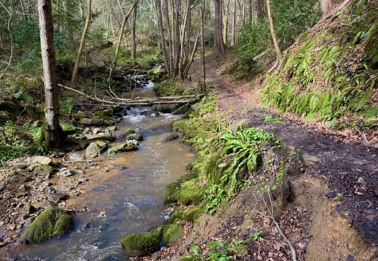
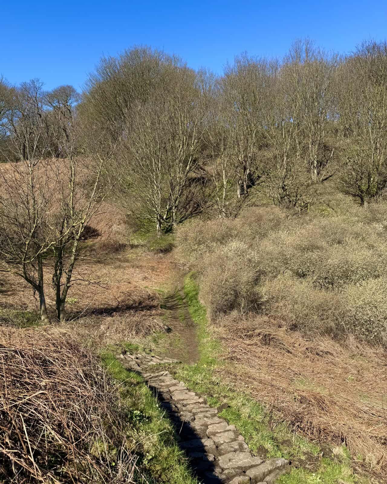
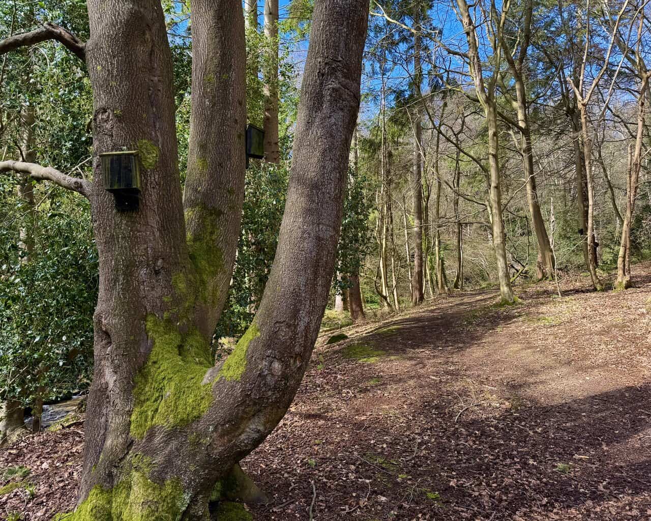
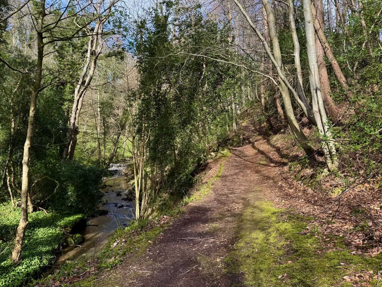
Leaving the beach behind, I head inland through the Hayburn Wyke woodland, following the course of Hayburn Beck upstream. Bird boxes have been fixed to the moss-covered trunks of the mature trees, a sign of the careful management of this nature reserve. The leaf-covered path is soft underfoot, and the sound of the sea gradually fades behind me.
The path follows the beck closely through the wooded valley, with the water bubbling along to my left. Wild garlic carpets the bank on the far side, and the light filters down through the canopy above. Exploring this woodland is one of the most peaceful parts of my Cloughton Wyke walk.
Lake District High Level and Fell Walks with Thirty Routes
AD This pocket-sized guide presents 30 routes on the Lake District’s highest fells, including Scafell Pike, Helvellyn, and Blencathra. With OS maps, colour photographs, and practical notes, it offers circular walks from 4–15 miles graded by difficulty.
Further upstream, the beck narrows and the valley closes in. Ferns sprout from the mossy banks, and fallen branches lie across the water as it tumbles over rocks and stones. The path is a little rougher here, but the setting is wonderful, a world away from the open clifftop walking earlier in the day.
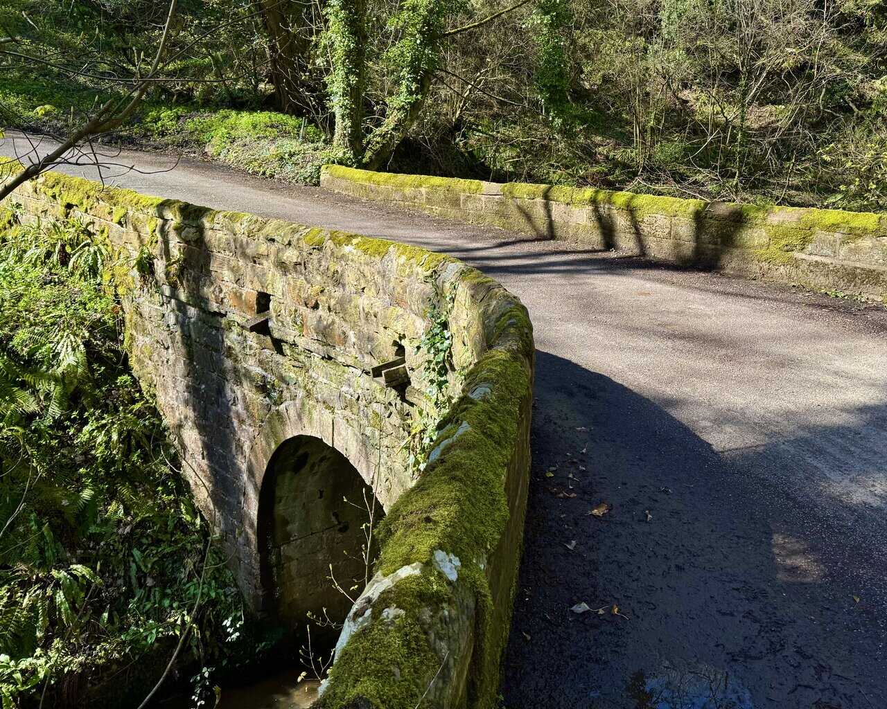
Leaving the woodland behind, I follow a narrow country lane from Whitehouse Farm and cross a stone bridge over Bloody Beck. The moss-covered parapets and single arch give it a timeless feel, tucked away in the trees. It’s a quiet corner that most people would drive straight past without a second glance.
Super Sparrow Stainless Steel Insulated Water Bottle with Two Lids
AD The Super Sparrow stainless steel water bottle keeps drinks cold for 12 hours or hot for several. With a straw lid, bamboo cap, BPA-free construction, and durable 18/8 steel, it is ideal for sport, travel, work, and outdoor use.
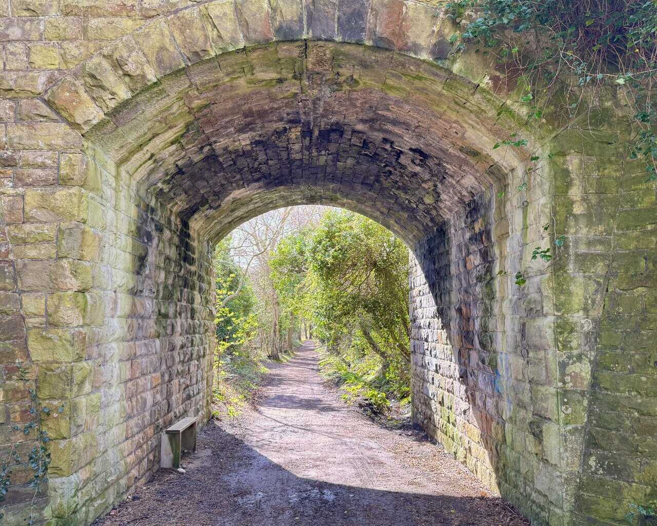
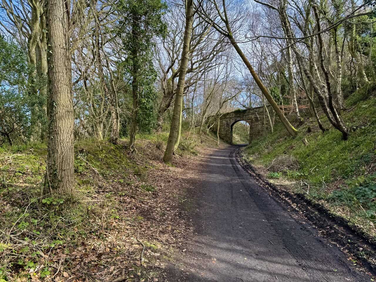
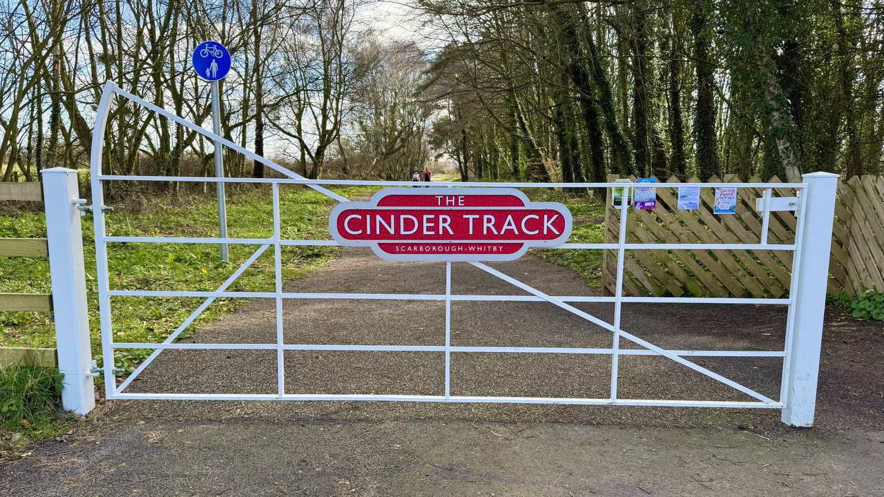
From the lane, I drop down onto the Cinder Track and pass through a stone tunnel beneath the road. The Cinder Track follows the old Scarborough to Whitby railway line, and I now begin my journey south along it, heading back in the direction I’ve come from but on a completely different route.
The Cinder Track is a pleasure to walk along, its wide, well-surfaced path winding gently through the trees. Another stone bridge arches over the route ahead, a reminder that this was once a working railway. It’s flat and easy going after the clifftop path, and a welcome change of pace.
Super Sparrow Stainless Steel Insulated Water Bottle with Two Lids
AD The Super Sparrow stainless steel water bottle keeps drinks cold for 12 hours or hot for several. With a straw lid, bamboo cap, BPA-free construction, and durable 18/8 steel, it is ideal for sport, travel, work, and outdoor use.
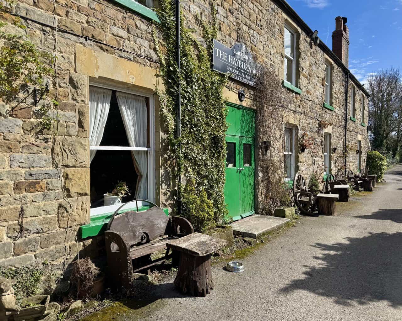
The Hayburn Wyke Inn appears on my left, an attractive stone-built building with distinctive green paintwork. This eighteenth-century coaching inn sits right beside the Cinder Track, and in the days of the Scarborough to Whitby railway there was a nearby station that would deliver visitors right to its door. It’s a popular stopping point for walkers and cyclists using the trail.
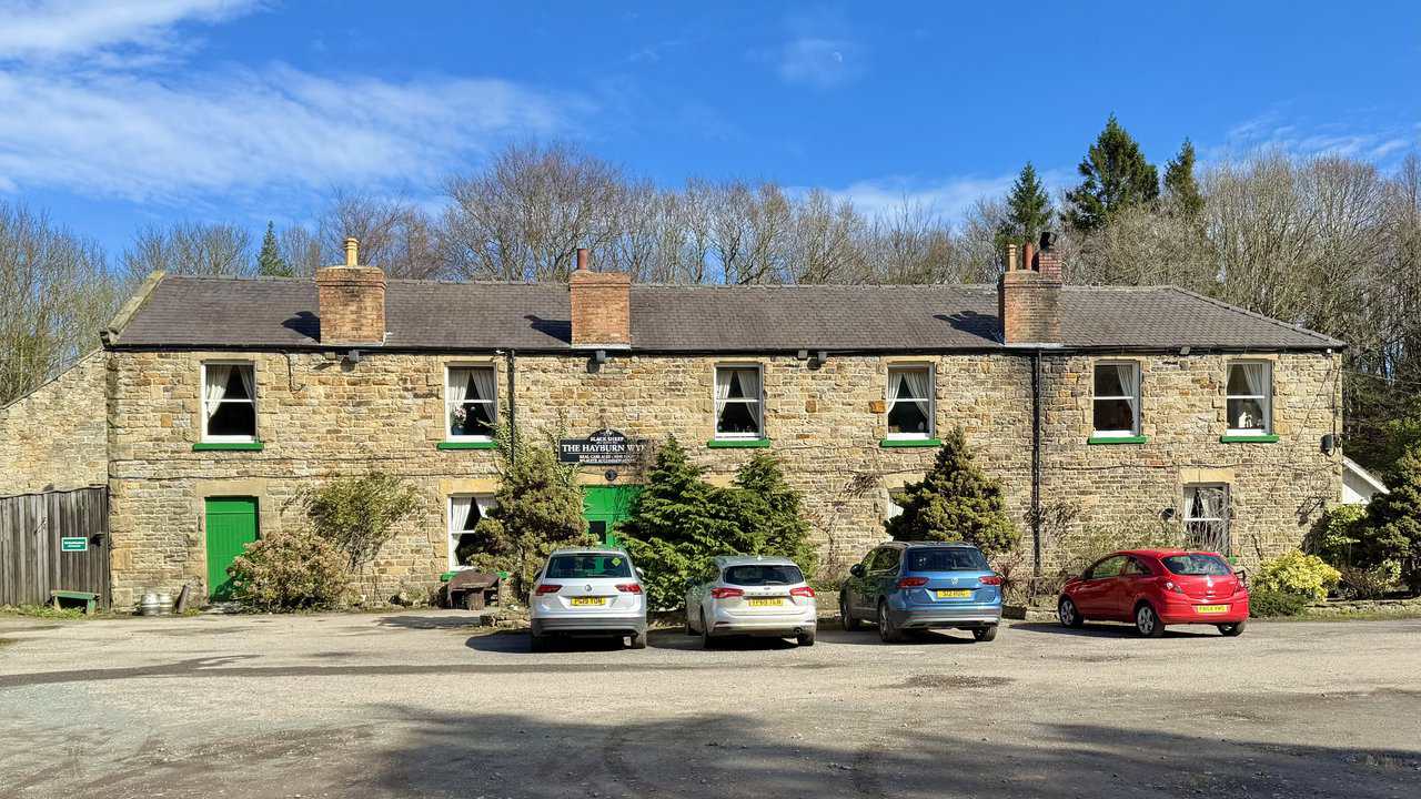
Up close, the inn has plenty of character, with ivy climbing the stonework and old cart wheels and rustic benches lining the front. It serves real cask ales and homemade food, and the Sunday carvery is a local favourite. I can’t resist calling in for a well-earned pint before continuing south along the Cinder Track.

Mountain Warehouse Merino Womens Long Sleeve V Neck Top
AD This Mountain Warehouse Merino top combines warmth, comfort, and practicality. Made with high-quality wool, it is naturally antibacterial, lightweight, and easy to pack. Designed for outdoor activities, it keeps you fresh and warm, and comes with a two-year warranty.
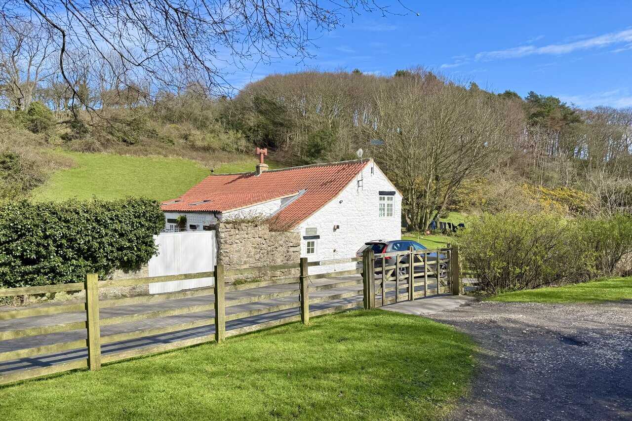
I pass a beautiful white-washed cottage with a red pantile roof, nestled in Newlands Dale. A quirky metal plaque on the fence catches my eye, warning that any person who fails to shut and fasten the gate is liable to a penalty not exceeding forty shillings. It’s a lovely reminder of a different era.
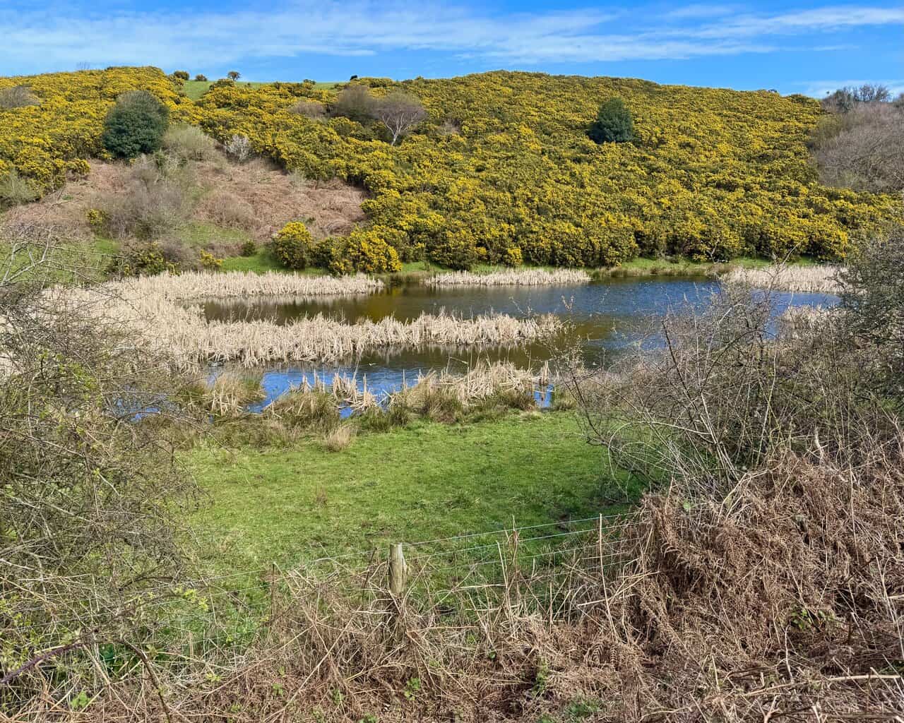
Progressing south along the Cinder Track through Newlands Dale, I spot a pond to my left, fringed with reeds and bulrushes. The hillside beyond is ablaze with gorse, its bright yellow covering the slope almost entirely. It’s another fine splash of colour on a walk that has been full of them.
Mountain Warehouse Merino Womens Long Sleeve V Neck Top
AD This Mountain Warehouse Merino top combines warmth, comfort, and practicality. Made with high-quality wool, it is naturally antibacterial, lightweight, and easy to pack. Designed for outdoor activities, it keeps you fresh and warm, and comes with a two-year warranty.
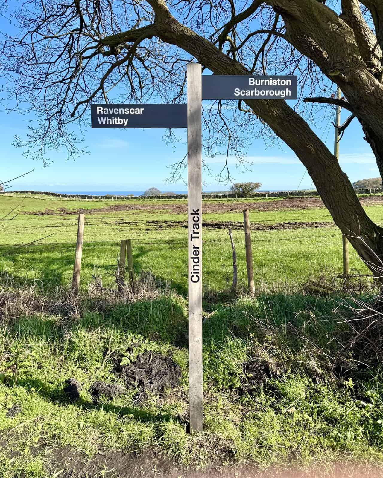
A Cinder Track signpost confirms my direction, pointing south towards Burniston and Scarborough. The track passes by the eastern side of the village of Cloughton here, with open farmland stretching away on both sides and a glimpse of the sea on the horizon.
I pass through another stone tunnel beneath Salt Pans Lane, its ivy-clad walls framing the tree-lined path ahead. These old railway bridges are a constant feature of the Cinder Track, each one a solid reminder of the line that once connected Scarborough and Whitby.
The Coast to Coast Walk Map Booklet with OS Mapping
AD This handy map booklet covers the full 188-mile Coast to Coast route from St Bees to Robin Hood’s Bay. Featuring 1:25,000 OS maps, it is pocket-sized, practical, and designed for use in either direction across England’s landscapes.
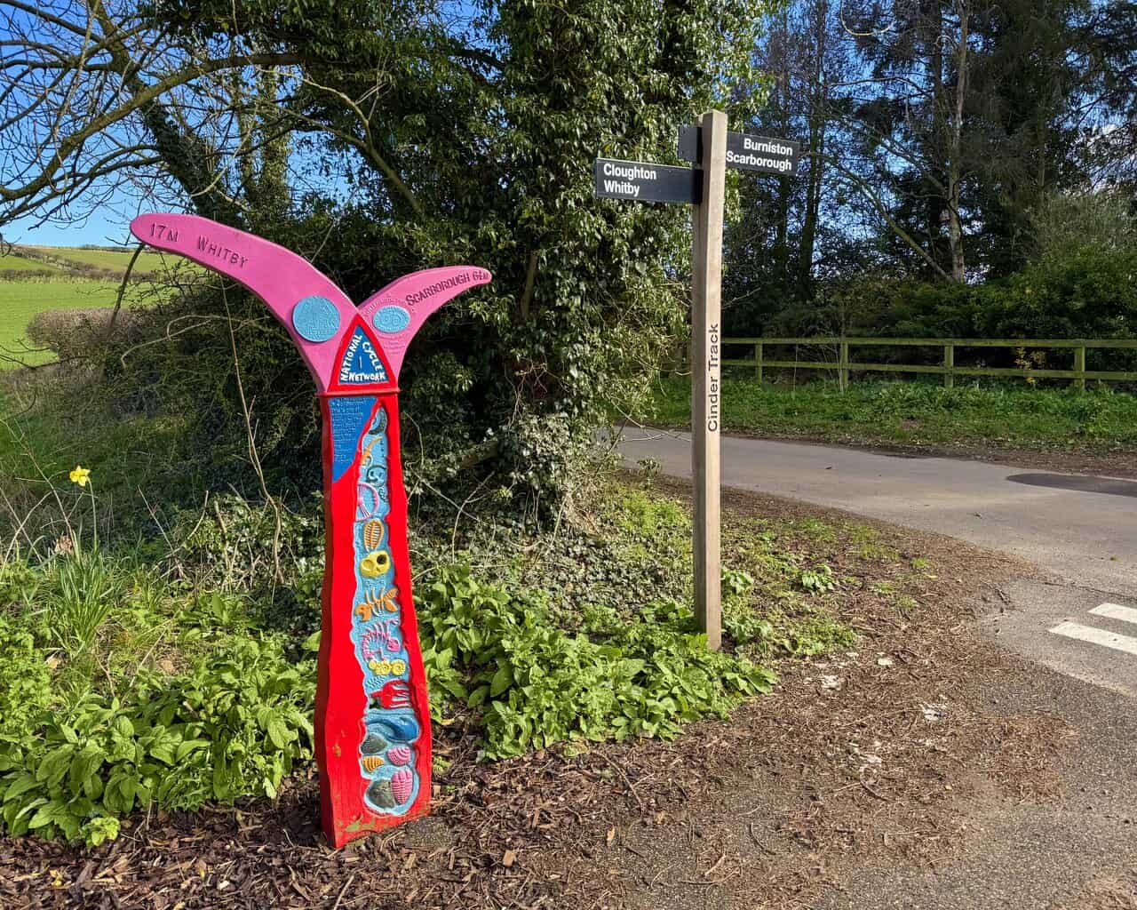
I reach the crossroads with Station Lane in Cloughton, where another Cinder Track signpost points me towards Burniston and Scarborough. Beside it stands one of the beautifully decorated National Cycle Network mileposts, painted in bright red and pink and adorned with coastal motifs. It marks seventeen miles to Whitby and six and a quarter to Scarborough.
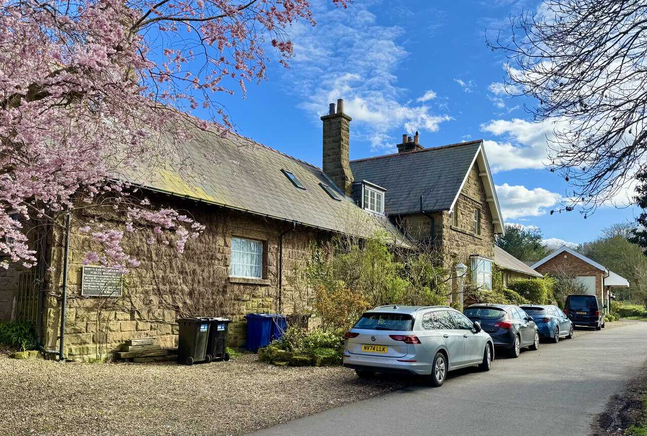
I pass in front of the former Cloughton Station, a handsome stone building that has been converted into bed and breakfast accommodation. The station once served the Scarborough to Whitby line before it closed in 1965, and an old North Eastern Railway notice board is still fixed to the wall. The rooms were originally the covered yard, ticket office and porter’s room, all carefully refurbished to give the old station a new purpose while keeping its railway character.
The Coast to Coast Walk Map Booklet with OS Mapping
AD This handy map booklet covers the full 188-mile Coast to Coast route from St Bees to Robin Hood’s Bay. Featuring 1:25,000 OS maps, it is pocket-sized, practical, and designed for use in either direction across England’s landscapes.
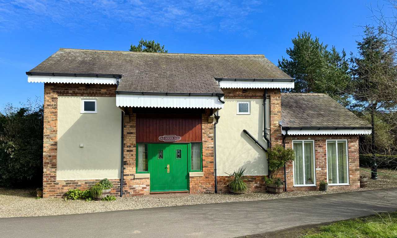
Next door stands the Old Goods Shed, now fully renovated and converted into self-catering accommodation sleeping up to six. With its brick detailing, green front door and corrugated canopy, it has kept much of its original character while being given a new lease of life. It sits right beside the Cinder Track, so guests can step straight out onto the trail.
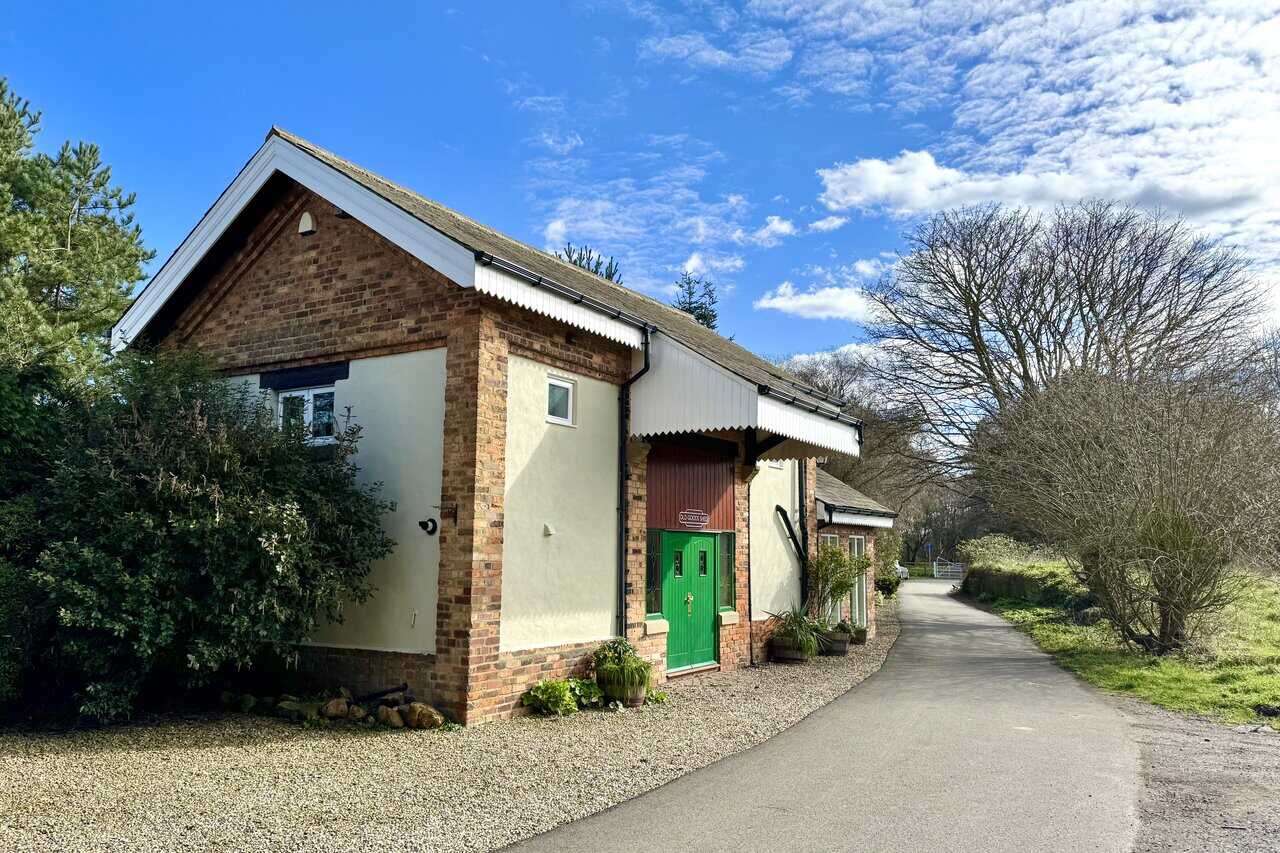
A sign above the door confirms its identity as the Old Goods Shed. The building is spread over two floors, with an open-plan lounge and fully fitted kitchen on the ground floor and three bedrooms above. There’s underfloor heating, a gas stove, and outside a patio with a barbecue and dining area. It’s a thoughtful conversion that makes the most of this former railway building.
Walking the Wainwrights with Routes Covering Every Lake District Fell
AD This book includes 64 carefully designed routes that allow walkers to complete all 214 Wainwright fells. Intended to complement the original Pictorial Guides, it provides full-day circular walks that link multiple summits for a rewarding and practical challenge.
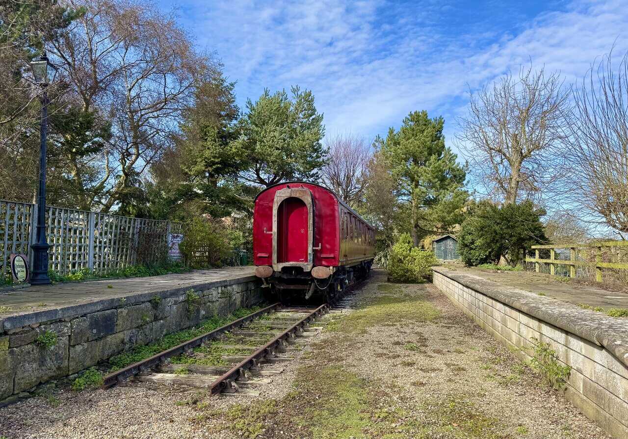
The real showpiece, though, is Oscar. This 1962 Derby-built Mark 1 railway carriage sits on the original track bed between the two platforms, complete with a section of track beneath it. Oscar has been fully refurbished into four-star self-catering accommodation for up to six, with a nineteen-foot lounge created from the first three original compartments, a fully equipped kitchen, three bedrooms and a shower room. With its deep red livery and period details, it’s a wonderful piece of railway history brought back to life.
I pass through the white gates at Cloughton Station, each one bearing a Cinder Track sign in the style of an old railway nameplate. This section of the track is exceptionally well surfaced, smooth and flat, making it suitable for prams, pushchairs and those with limited mobility. It makes for very easy walking on tired legs.
Walking the Wainwrights with Routes Covering Every Lake District Fell
AD This book includes 64 carefully designed routes that allow walkers to complete all 214 Wainwright fells. Intended to complement the original Pictorial Guides, it provides full-day circular walks that link multiple summits for a rewarding and practical challenge.
The Cinder Track stretches ahead of me, and it won’t be long now before I’m back at Field Lane to complete my Cloughton Wyke walk. What a beauty it has been. The contrast between the Cleveland Way coastal path, the peaceful woodland at Hayburn Wyke, and the easy going of the Cinder Track has made for a walk of real variety, and one I’ll be happy to do again.