Enjoy Stunning Moorland Views on the Malham Tarn Walk from Littondale
Your Malham Tarn walk starts in the charming village of Arncliffe, nestled in Littondale, one of the smaller valleys in the Yorkshire Dales. Roadside parking is available along the village road that leads to the local pub, the Falcon Inn. Begin your trek by taking the track to the right of the Falcon Inn. This track, known as Monk’s Road, starts as a stone path but soon narrows into a footpath that crosses fields and ascends the hillside.
As you follow the path in a south-westerly direction, you will gradually climb onto the moorland. The ascent offers spectacular views back towards Arncliffe and down into the valley where Cowside Beck flows. Continue hiking south-west across the hills for nearly three miles, passing landmarks such as Clowder, Dew Bottoms, and Middle House Hill, until you reach some derelict farm buildings near Back Pasture Hill. This picturesque spot is perfect for a coffee break.

From Back Pasture Hill, continue walking in a south-westerly direction for about another mile along Monk’s Road. You will soon arrive at the north-eastern shores of Malham Tarn, a highlight of the Malham Tarn walk and an excellent location for lunch. After your break, follow the track leading south-east beneath the slopes of Great Close Hill. When you meet another track, turn right and head south for about half a mile to reach a junction at Street Gate.
At Street Gate, take the route that leads north-east back onto the moorland. Be careful not to take the Mastiles Lane route, which heads east. Continue walking north-east across the hills for about four and a half miles. On this stretch, you will pass Lee Gate High Mark, the highest point of the Malham Tarn walk, before descending to the hamlet of Arncliffe Cote.

Upon reaching Arncliffe Cote, turn right onto the road and follow it around a bend. After a few minutes, turn left onto a smaller road called Out Gang Lane. Follow this lane, and after it bends to the right, take the path on the left to cross the River Skirfare via the footbridge. Once you have crossed the river, turn left onto the minor road and continue north-west for about one and three-quarters miles. This quiet road, with little to no traffic, leads you back to Arncliffe.
This Malham Tarn walk, just under 12 miles (19 kilometres), provides a fantastic alternative route to reach Malham Tarn, rather than the more popular approach from Malham. The varied landscapes and serene trails make it a memorable hike for all.
Malham Tarn Walk: Maps and Tools
Visit either the OS Maps website or the Outdooractive website to view this walking route in greater detail. Both platforms offer a range of features, including the ability to print the route, download it to your device, and export the route as a GPX file. You can also watch a 3D fly-over and share the route on social media.
Malham Tarn Walk: Distance, Duration, Statistics
Distance: 11¾ miles
Distance: 19 kilometres
Duration: 5¾ hours
Ascent: 1698 feet
Ascent: 518 metres
Type: Circular walk

Walking in the Yorkshire Dales with 43 Circular Routes
AD This Cicerone guidebook includes 43 circular walks exploring valleys, hills, and moors between Kirkby Stephen and Pateley Bridge. With OS maps, local highlights, and routes ranging from 3–11 miles, it is a year-round companion for walkers of all abilities.
Recommended Ordnance Survey Map
The best map to use on this walk is the Ordnance Survey map of the Yorkshire Dales Southern & Western Area, reference OS Explorer OL2, scale 1:25,000. It clearly displays footpaths, rights of way, open access land and vegetation on the ground, making it ideal for walking, running and hiking. The map can be purchased from Amazon in either a standard, paper version or a weatherproof, laminated version, as shown below.
Standard Version
About Malham Tarn
Malham Tarn is a glacial lake near the village of Malham in Yorkshire. It is one of only eight upland alkaline lakes in Europe. At an altitude of 377 metres (1237 feet) above sea level, it is the highest marl lake in the United Kingdom. A marl lake is an alkaline lake with bottom sediments containing large deposits of marl, a mixture of clay and carbonate minerals.
The lake’s unique geology, flora, and fauna have earned it multiple conservation designations. The National Trust currently owns the site, which previously leased part of it to the Field Studies Council. The Field Studies Council operated from Malham Tarn House in woodland close to where my Malham Tarn walk first encounters the lake. However, it ceased operations as a field centre in 2022. Malham Tarn inspired Charles Kingsley’s 1863 novel, ‘The Water-Babies, A Fairy Tale for a Land Baby’.
Malham Tarn is situated in the Yorkshire Dales National Park, approximately 25 miles (40 kilometres) north-west of Bradford and about 2½ miles (4 kilometres) north of the nearest settlement, Malham. Although sometimes mistakenly considered the highest lake in England, higher-altitude lakes such as Innominate Tarn in the Lake District do exist. However, Malham Tarn holds the distinction of being the highest marl lake.
The lake has a catchment area of 600 hectares (1483 acres), and its main inflow is a stream at the north-west corner. Malham Tarn reaches a depth of 4.4 metres (14 feet) at its deepest point, with an average depth of 2.4 metres (8 feet), and covers a surface area of 62 hectares (153 acres). It takes approximately 11 weeks for water to exit the lake after entering.
The primary outflow is a small stream at the southern end, near Watersinks Car Park, a popular spot for those embarking on shorter Malham Tarn walks. The stream goes underground then emerges downstream of Malham Cove as a source of the River Aire. My Malham Tarn walk offers an exceptional opportunity to explore this unique environment.
Malham Tarn Walk: My Photos
As I leave Arncliffe on Monk’s Road (Path) and start to climb, I see Cowside Beck meandering through the valley. It flows to Arncliffe and joins the River Skirfare, which courses through Littondale.

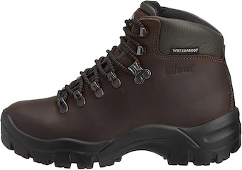
Grisport Unisex Adult Peaklander Hiking Boots
AD The Grisport Unisex Adult Peaklander Hiking Boots are crafted in Italy with a durable waxed leather upper, Spotex breathable lining, and a reliable Track-on rubber sole. Waterproof and weighing just 1120g, they offer comfort, resilience, and dependable performance on demanding trails.
A little further along Monk’s Road (Path), I look back and see Arncliffe nestled in the Littondale valley, with Old Cote Moor providing a picturesque backdrop.

Looking west from Monk’s Road (Path) as I pass Great Clowder, I see the majestic Fountains Fell.

Grisport Unisex Adult Peaklander Hiking Boots
AD The Grisport Unisex Adult Peaklander Hiking Boots are crafted in Italy with a durable waxed leather upper, Spotex breathable lining, and a reliable Track-on rubber sole. Waterproof and weighing just 1120g, they offer comfort, resilience, and dependable performance on demanding trails.
The old farmhouse and outbuildings near Back Pasture Hill along Monk’s Road offer a perfect spot to explore, rest, and enjoy a snack or drink.

Descending Monk’s Road on the north-western flanks of Great Close Hill, I catch my first glimpse of Malham Tarn, a highlight of my Malham Tarn walk.

Fifty Walks Across the Beautiful North York Moors National Park
AD Discover 50 routes across the North York Moors, from short easy strolls to challenging high-level hikes. With OS maps, route descriptions, and local highlights, it also includes the legendary 40-mile Lyke Wake Walk, described in four accessible stages.
Upon reaching the shores of Malham Tarn, I admire the view across the water to a boathouse on the northern shore.

Strong winds whip across Malham Tarn, making the water choppy and creating waves reminiscent of the seaside.

Fifty Walks Across the Beautiful North York Moors National Park
AD Discover 50 routes across the North York Moors, from short easy strolls to challenging high-level hikes. With OS maps, route descriptions, and local highlights, it also includes the legendary 40-mile Lyke Wake Walk, described in four accessible stages.
The impressive cliffs of Great Close Scar rise on the southern side of Great Close Hill.

In winter, the Arncliffe Cote bridleway at Great Close Mire can become flooded and tricky to cross, but there’s always a way through.

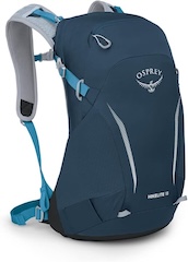
Osprey Hikelite Unisex Backpack for Comfortable and Lightweight Hiking
AD The Osprey Hikelite backpack combines lightweight design with practical features, including a breathable mesh back panel, soft webbing straps, and stretch mesh water bottle pockets. With zipped storage and an organiser compartment, it is ideal for day hikes and outdoor use.
I love the anvil-shaped rock on Lee Gate High Mark. Standing at 510 metres (1673 feet), Lee Gate High Mark is the highest point of this Malham Tarn walk.

A signpost on High Cote Moor points to Arncliffe Cote in the north-east and Street Gate near Malham Tarn in the south-west. I’m heading to Arncliffe Cote. This open countryside is exhilarating and breathtaking.

Osprey Hikelite Unisex Backpack for Comfortable and Lightweight Hiking
AD The Osprey Hikelite backpack combines lightweight design with practical features, including a breathable mesh back panel, soft webbing straps, and stretch mesh water bottle pockets. With zipped storage and an organiser compartment, it is ideal for day hikes and outdoor use.
I relish walking in this Yorkshire Dales landscape. Cote Gill, flowing north-east towards Arncliffe Cote, has carved a small V-shaped valley into the terrain.

I come across a disused pit on the hillside near the caravan park at Hawkswick Cote.

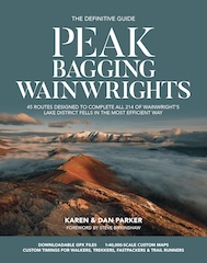
Peak Bagging Wainwrights with Routes to Complete All Fells
AD This comprehensive guide offers 45 circular routes linking all 214 Wainwright fells. With maps, GPX downloads, elevation profiles, and practical advice, it provides efficient yet inspiring ways to complete this classic Lake District challenge at your own pace.
Here, the River Skirfare flows through Littondale between Hawkswick and Arncliffe. The river starts at the confluence of Foxup Beck and Cosh Beck in the hamlet of Foxup. The name, of Old Norse origin, means ‘bright river-course’. It spans 9½ miles (15 kilometres) before joining the River Wharfe.

The Church of St Oswald in Arncliffe features a tower from the 15th century. The rest of the church was rebuilt in 1805, restored in 1841, and had its chancel rebuilt in 1843 by Anthony Salvin. It received Grade II listing in 1958.

Peak Bagging Wainwrights with Routes to Complete All Fells
AD This comprehensive guide offers 45 circular routes linking all 214 Wainwright fells. With maps, GPX downloads, elevation profiles, and practical advice, it provides efficient yet inspiring ways to complete this classic Lake District challenge at your own pace.
The River Skirfare is visible from the graveyard of the Church of St Oswald in Arncliffe.

Finally, I pass School House in Arncliffe, marking the end of my Malham Tarn walk.

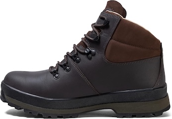
Berghaus Hillmaster II GTX Men's High Rise Hiking Boots
AD The Berghaus Hillmaster II GTX men’s hiking boots feature a waterproof, breathable GORE-TEX membrane, a memory foam tongue and collar for a personalised fit, and a Vibram sole delivering exceptional grip, stability, and shock protection for confident performance on any terrain.
